Sometimes recreation in Central Colorado can be just plain overwhelming. I remember when I was preparing to move to Colorado, and took a look at a Colorado DeLorme atlas I had just purchased. DeLorme makes an atlas for every state in the country. These atlases are great for those who love outdoor recreation. Not only are features such as campgrounds, hiking trails, waterfalls, and parks labeled on the maps themselves, but each map contains a dozen or so pages in which hot spots are listed. These include key places to camp, fish, hunt, hike, bike, and such, as well as a list of “unique natural features”. When I looked through my Colorado DeLorme atlas, I was suddenly overwhelmed by the amount of options available to me for many of the activities I enjoy. I kept wondering, though, how the heck I would go about something like picking a place to hike when there are so many options. I was actually worried that some days I would end up going nowhere due to analysis paralysis.
The most effective networks, whether they be all of the trail networks in parts of Colorado, or New York City’s network of subways, are overwhelming, and sometimes take awhile to learn. However, the same way any New Yorker can get by without owning a car, due to all of the train lines in the city, a Coloradan can find the right hike for many different situations and many different desired experiences.
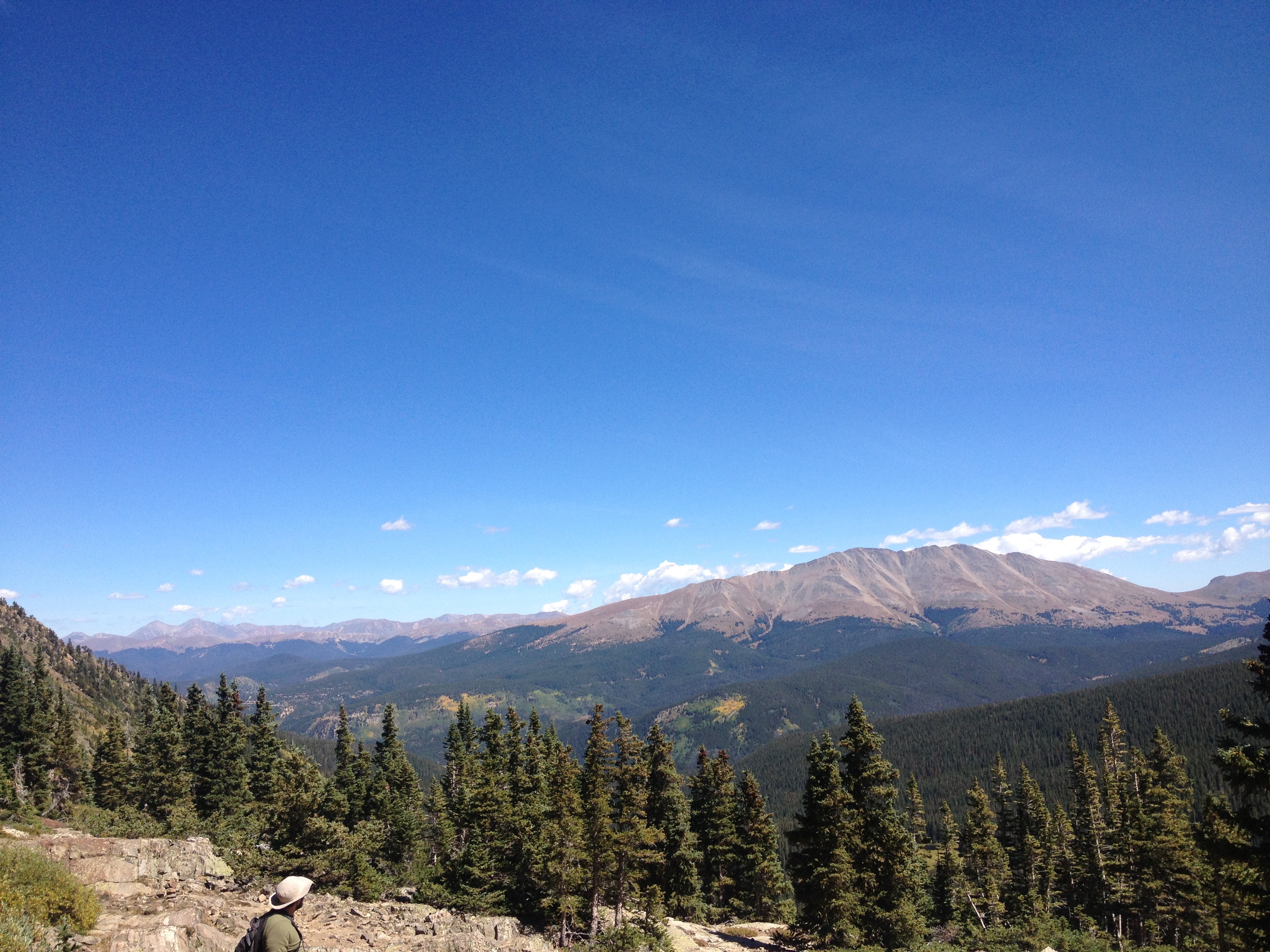
Last Friday I had a friend in town from Chicago who does not get to experience mountains on a regular basis. On previous trips I had taken him to Rocky Mountain National Park. This time, I wanted to take him somewhere different to see some different scenery in a different part of the state.
The most talked about hikes in this part of the State tend to be the “14ers” to the South. These hikes tend to be challenging, and, sometimes are just as much about accomplishing something (particularly to some people) as it is about the experience of hiking.
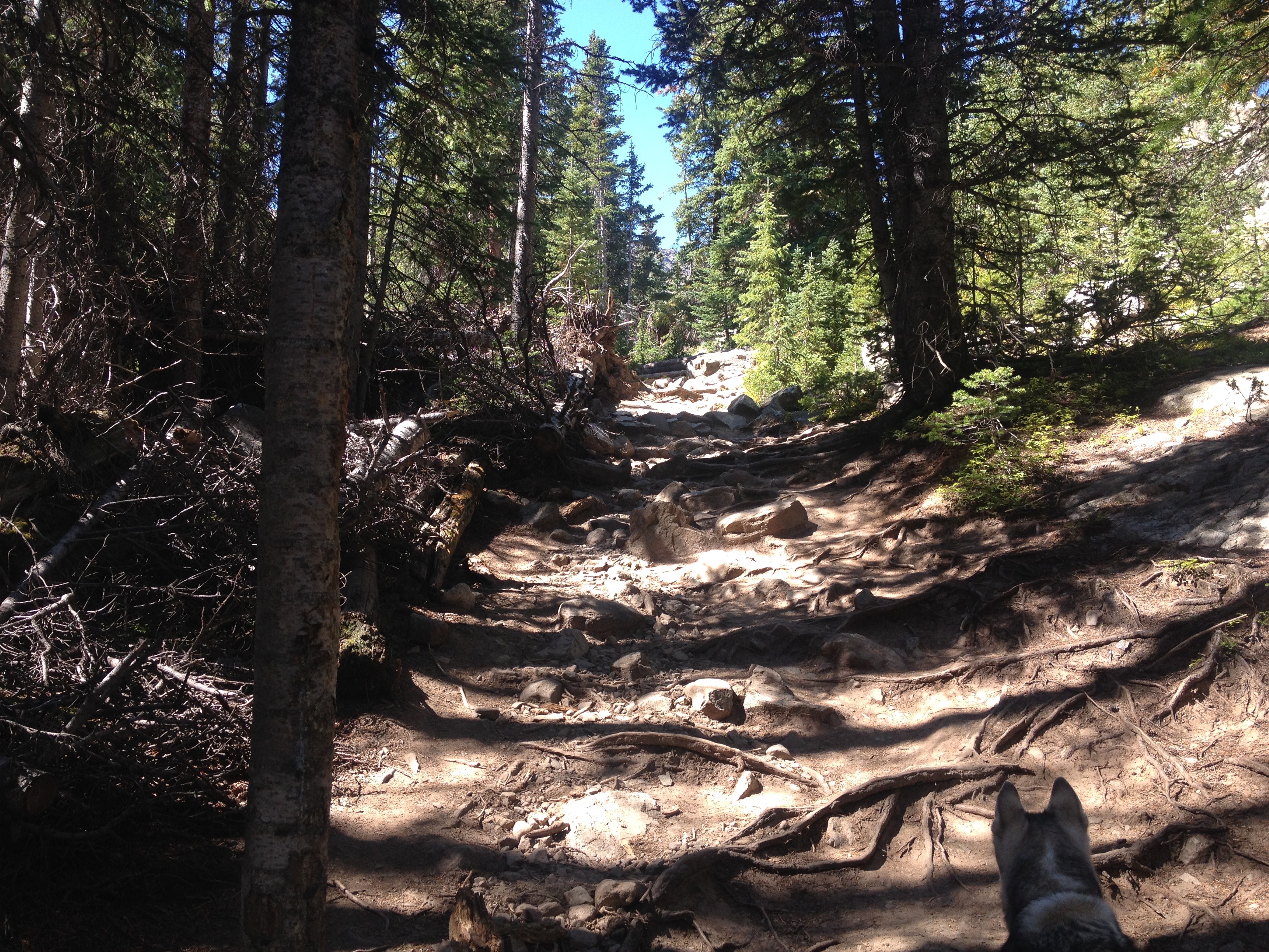

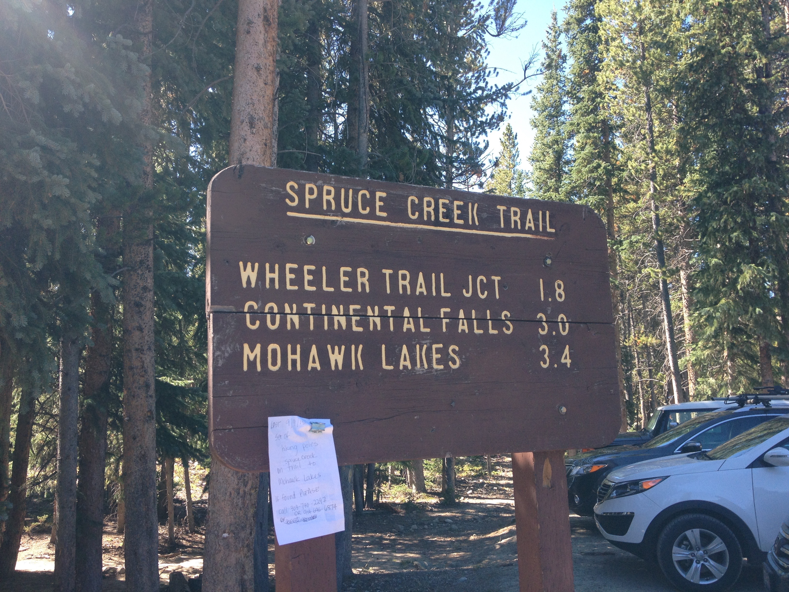
By contrast, the Spruce Creek Trail certainly fits into the “moderate” category for difficulty. The first part of the trail is kind of a mixture of flatter and steeper areas.


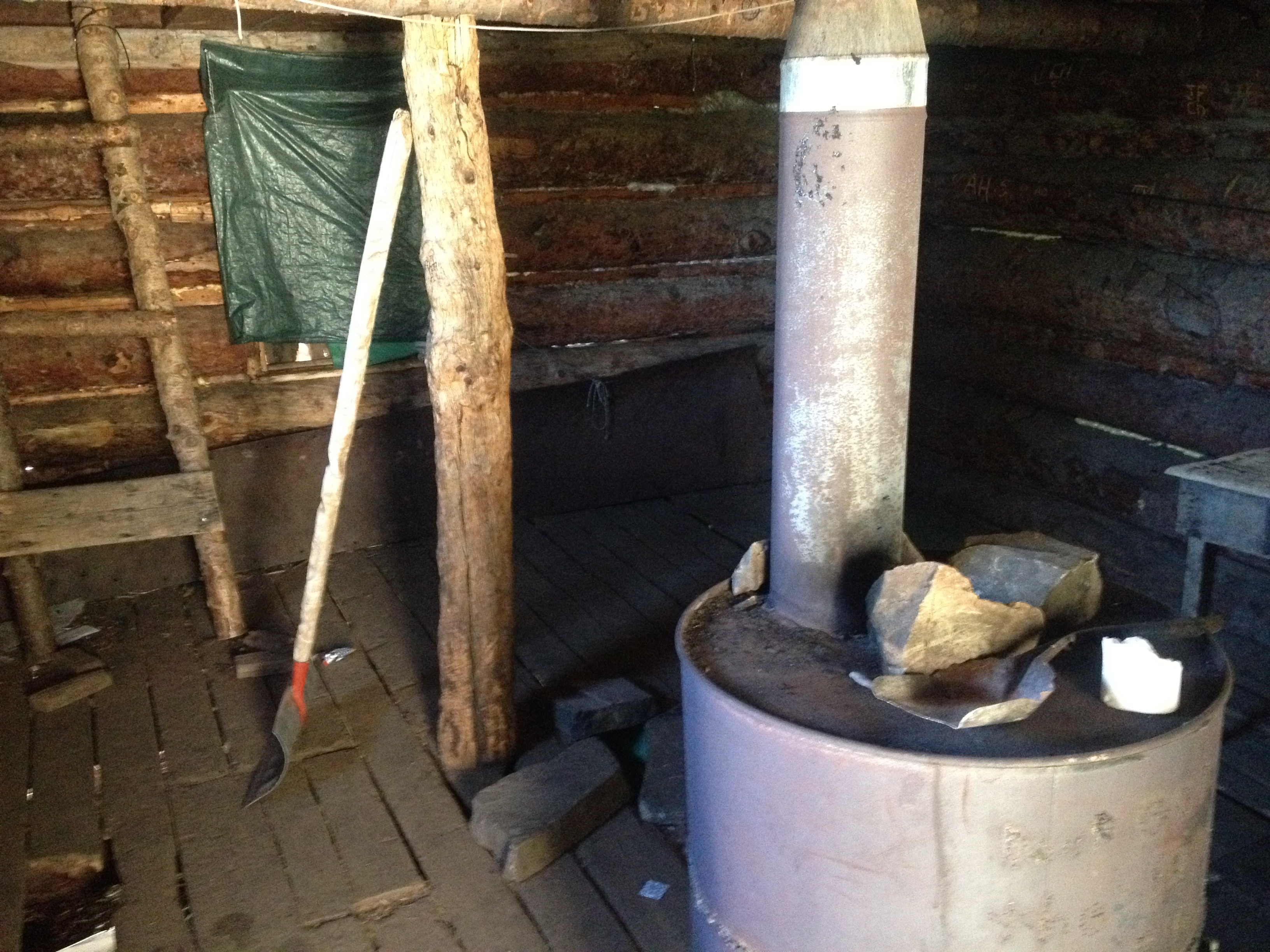
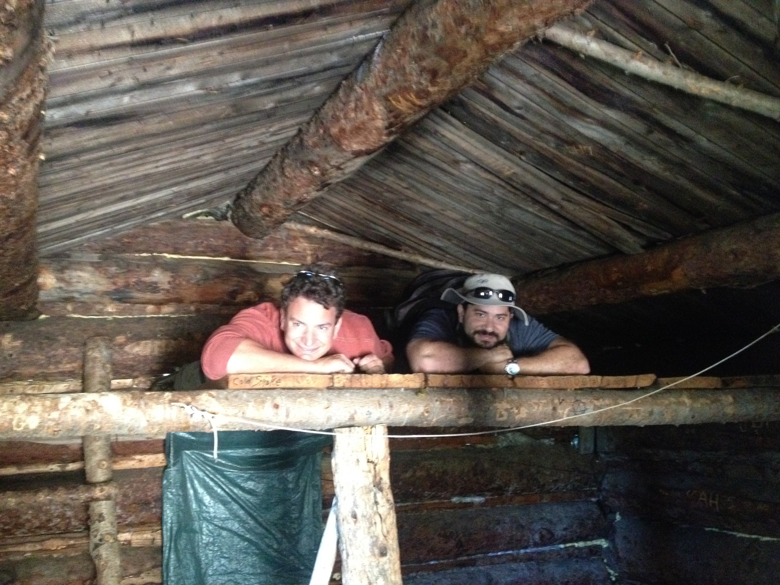
Roughly two miles into the hike we encountered this random cabin that still seemed partially functional. With a stove and a ladder that leads to an upstairs area it is reminiscent of the cabins that people purchase as second homes. However, it was kind of in disrepair and there were several holes in the floor. Still, I wonder what this cabin is used for. Do people actually stay here at night from time to time? Did people originally stay here when this place was built? Is it used for some other purpose, like filleting fish, or fleeing storms from time to time? After all, this cabin is fairly close to the first major lake one encounters on this hike- Mayflower Lake.

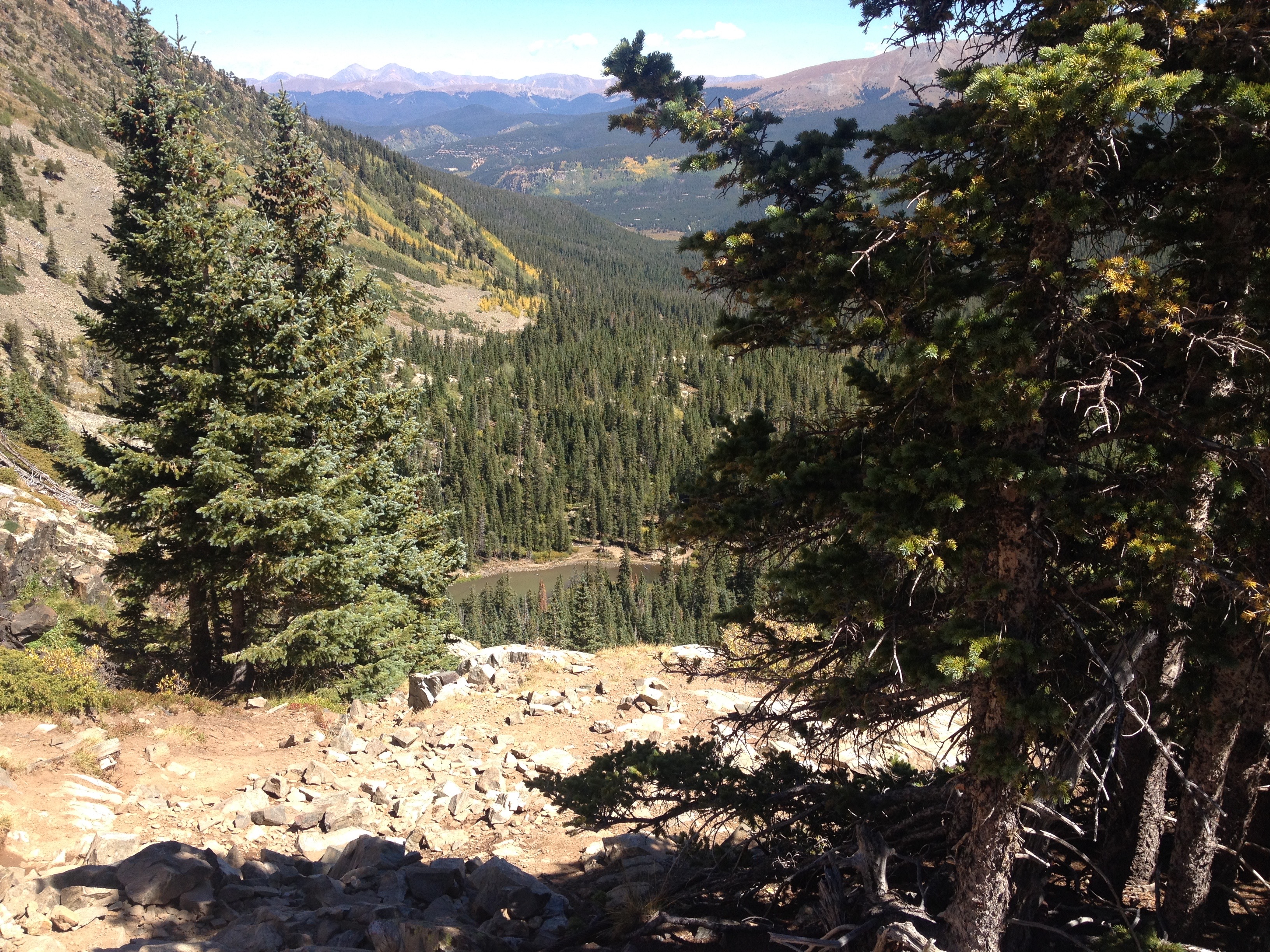
It is around here that the trail reaches somewhat of a point of inflection. Above this elevation, the trail becomes steeper. I honestly should have expected this type of experience. One thing I note every time I ski at Breckenridge ski resort is the fact that the steeper terrain tends to be on the higher parts of the mountain. If I ski on Peaks 7, 8, or 9, which is the part of the mountain closest to town and the lower part, I notice that any run I chose becomes progressively flatter as I descend. The Mohawk Lakes, and the Spruce Creek Trail are seriously no more than 3 or 4 miles from the boundary of the ski resort. Therefore, it makes perfect sense that one would experience the same kind of terrain.

The trail encounters Continental Falls several times as it switches back and forth across the mountain. The last several hundred feet of climbing up to Lower Mohawk Lake is somewhat of a scramble making it quite different from the smooth and well marked trails that we started out on.

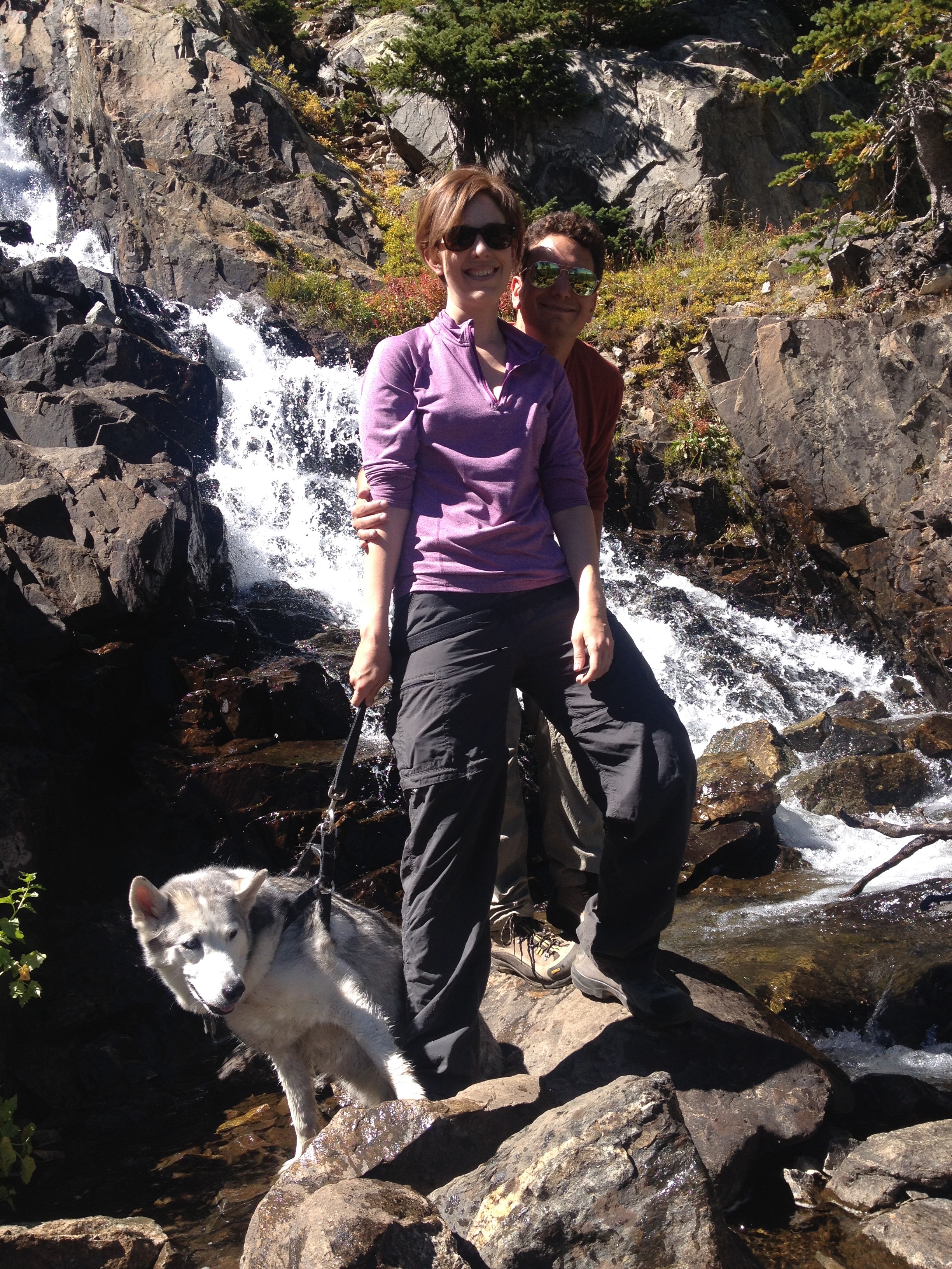
It was already nearly 1 P.M. when we arrived at Lower Mohawk Lake. We stopped to eat lunch and decided to forgo hiking all the way to Upper Mohawk Lake, a decision I eventually came to regret after learning that we would only have had to hike an additional 0.4 miles, and only climb another 250 feet or so.
I have really come to appreciate this time of year; September, early fall. There is a lot of pleasant weather, and many people have even told me this is the best time of year for hiking in Colorado. In the summertime, particularly in August, there is a daily thunderstorm threat associated with the North American Monsoon. This year that threat ended right after Labor Day when the prevailing weather patterns changed ushering in a drier period for Colorado. On Labor Day I got caught in a brief afternoon thunderstorm. There has not been one since. It is almost as if Mother Nature was aware of, and chose to abide by, our society’s labeling of Labor Day as the “end of summer”. In August mid-afternoon would typically bring at least some major cloud formations reminding hikers of the thunderstorm threat. Last Friday the sky remained clear throughout the day.

I actually think I could not have picked a more ideal time for this particular hike. One thing I hear about the Spruce Creek Trail is that it is prone to becoming muddy during periods of heavier precipitation. These types of trails can be problematic in early summer when there is heavier stream flow. The later part of this summer, and now September, has been much drier across Colorado.
The hike ended up being exactly what we had wanted; a moderately challenging hike that brought us to some unique scenery. There are many places, both geographic, and in life, where one cannot just go about finding a trail that matches the desired experience exactly. Whether it be picking a place to hike, chosing a neighborhood to purchase a home, or picking a place of employment, sometimes the option that matches exactly what we want simply is not available at the right time. So, we end up finding something that is pretty good, a decent match, but not exactly 100% the experience we had been looking for. It’s just a part of life. But, here outside of Breckenridge, I found the trail that matched exactly what we wanted, and am thankful for it.
