May 10th was kind of a strange storm chasing day for me. It was the kind of day that calls into questions a whole bunch of things for me. What assumptions I make. How I go about making decisions. Both with regards to where and when to chase, as well as about life in a broader sense.
There are so many things that end up factoring into when and where people chose to chase severe thunderstorms. I had chosen to go on this two-day chase (see day one) partially out of frustration I was experiencing back home. It was one of those situations where I felt like it would just be good for me to do something I had not done in a while, for a change of pace, and I had yet to chase in 2017.
So, I went to chase on a Tuesday and Wednesday with only a slight risk for both days, something many people with jobs tend not to do, particularly when the outlook shifts so far away from home on the second day.
In fact, I was not even sold on chasing again on Wednesday, as leftover storms from Tuesday would prevent the area that I had originally thought would have the best dynamic setup for storms from developing the instability needed to fuel them.
I decided to stay out partially because of the more optimistic outlook from the Storm Prediction Center, and partially because I got an email from a friend, telling me he was excited about the outlook… in Southeast Colorado.
Still, I decided originally to target Southwest Kansas. Given the outlook, the best place to be would have been well further south, at least into the Texas panhandle. But, you know, those life considerations. I did want to make it back to Denver that evening.

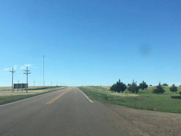
Whenever in Western Kansas, I always kind of think the same thing. This place is flat, but it is not as flat as Florida, or Northern Illinois. People often assume the place is flat. But, according to a study in National Geographic, Kansas is not even in the top 5 flattest states.
One aspect of storm chasing that is often missed by people watching storm videos, or the movie Twister, is the fact that storm chasing involves a lot of driving, and it also often involves a lot of waiting. On many days, chasers pick a “target” location, where they believe storms are likely to form, and sit there, sometimes for hours, waiting for them to form. Because it was unrealistic to get down to the Texas Panhandle and still get back to Denver in the evening, we chose to sit in a town called Ulysses, Kansas because my favorite weather website had analyzed another boundary near there.
Ulysses, by the way, was named after Ulysses S. Grant, Civil War general and 18th President of the United States. Why a place like this cares so much about this historical figure from Galena, Illinois confuses me a bit. But, at least the town had highways in all four cardinal directions, and an empty field with a cell tower, so we could look at weather information while we wait.
And, this requires patience, and continued belief that the right location had been chosen. But, May 10th was not a typical day. Storms started to form in this region, first just clouds, and then even some small thunderstorms. I was even proud to have seen a storm start to produce rain before the RADAR images even began to reflect it!

Now, that’s what I call “catching initiation”.
The problem is, we caught the wrong initiation. These storms would never amount to anything. In fact, they were so small that when I zoomed out on a RADAR image, they were barely visible!

It turned out that, despite the fact that some of the sites I typically look at for weather information indicated some potential, we were in “no man’s land”. The boundary I thought was situated near the CO/KS border was actually farther West, and storms were forming … in Southeast Colorado. So, we had to adjust, headed back into “Colorful Colorado” (although today it would be “Colorful” for different reasons).
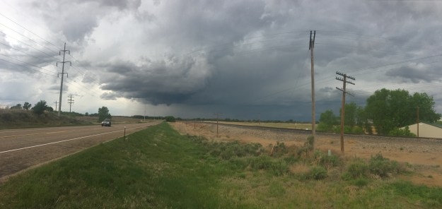
It was there we saw the main feature of the day, a funnel cloud near the town of Lamar, CO.

For a while it looked like it was rotating and trying to form a tornado, but from experience I know that in Eastern Colorado only 1 in 8 of these actually turn into tornadoes.
The entire day was kind of a head scratcher. What did my friend see that I didn’t? What did he see that SPC kind of didn’t? Why did so many storms form north and west of where the outlook was?
Why did my the information sources I typically point to lead me kind of to the wrong place?
I also wonder if I was chasing the right way, and for the right reasons. The weather bends to nobody’s schedule. The weather doesn’t care about personal preferences, conveniences, one’s life situation, or ego. We have tools that provide good guidance into what is going to occur. And, those tools pointed to a clear spot that they were correct about, as the biggest cluster of tornado producing storms of the day formed in Northwest Texas, near Childress, crossed into Southwest Oklahoma, and produced tornadoes. That just didn’t fit into my plan.
The chase ended up turning into somewhat of a metaphor, for life decisions in general. When we chose to take part in an activity, of any kind, we get the most out of it when we are willing to go “all in” per say. This is true of jobs, hobbies, relationships, you name it. We have to be willing to adjust, and consider a whole bunch of circumstances and other factors. But, sitting in the middle, waiting for two or more different opportunities to possibly manifest only works well for a little while. In the end, a choice needs to be made, and even if it is not the ideal choice, the fact that a choice was made produced a better outcome than having allowed the entire day to lapse without making one at all.


