Category Archives: social

Anne Arundel County and the DelMarVa Peninsula

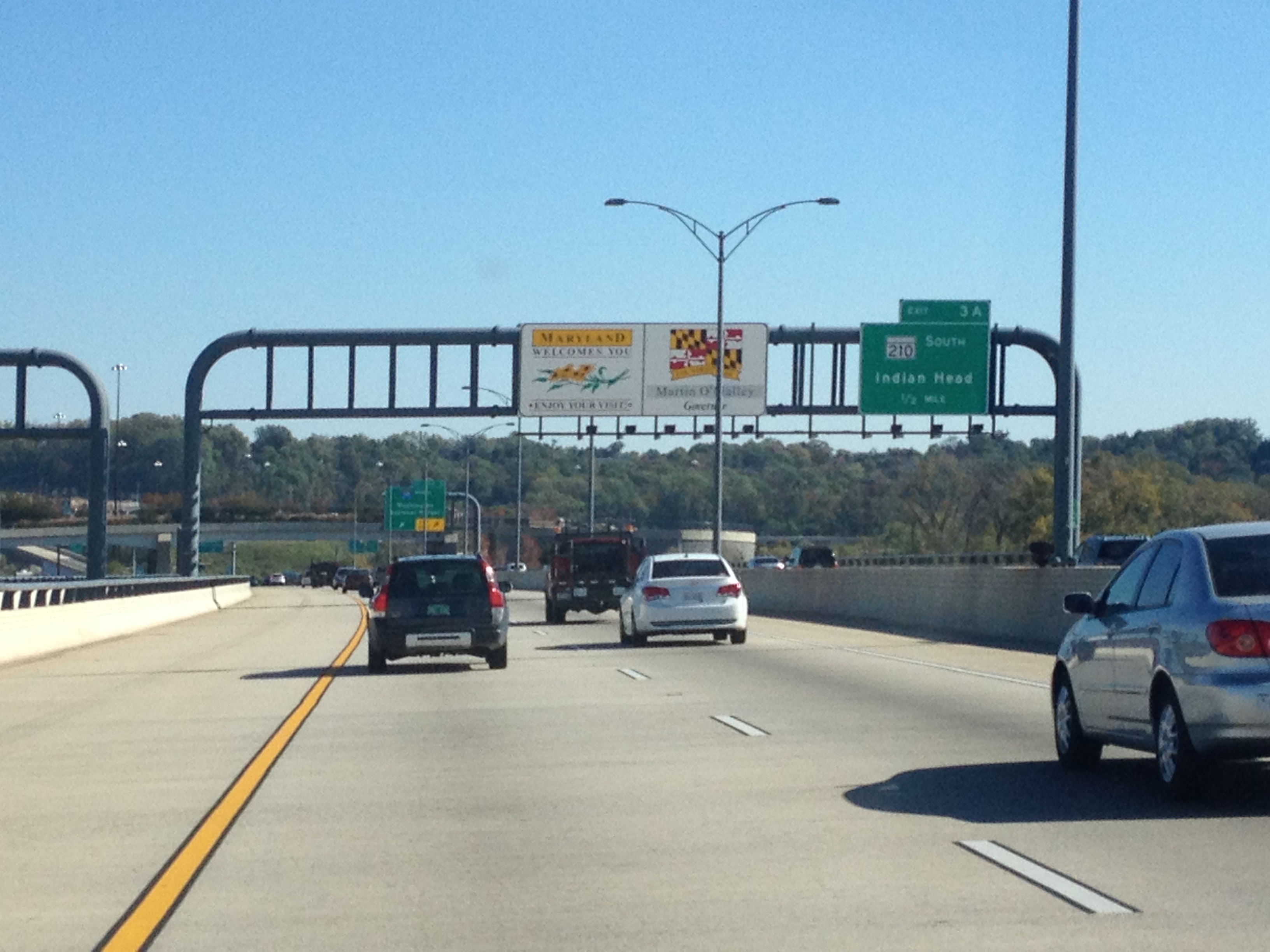
Anne Arundel County is my favorite county in Maryland.  It sits on the western shore of the Chesapeake Bay, south of Baltimore (and Baltimore County), and east of the counties in the D.C. area.  Many people are surprised that I have a favorite county in Maryland.  But, I feel like Anne Arundel County provides visitors with an experience that seems quintessentially Maryland to me.  It’s primary city, Annapolis, is characterized by the colonial development style that makes these early colonies on the eastern seaboard distinct from much of the rest of the nation.  However, much of the rest of the county is suburban in nature, which is really what much of the populated part of Maryland is like today.  With it containing a shoreline on the western banks of the Chesapeake, many of the boating activities synonymous with Maryland culture have a significant presence in this county.

In my experience here, which is quite extensive, as I have an Aunt and Uncle who used to live here, and good friends that still do (whom I am visiting this weekend), it seems as though this part of Maryland is not as politically charged as the counties to the west, adjacent to D.C.  Those areas actually feel more like an extension of D.C. than really Maryland, the same way Arlington and Alexandria seem more like a D.C. extension than Virginia.  Both of these areas are significantly different culturally from the rest of their respective states, and therefore a visit to Silver Spring is no more of a “Maryland experience” than a visit to Arlington is a “Virginia experience”.

IMG_1296 IMG_1293


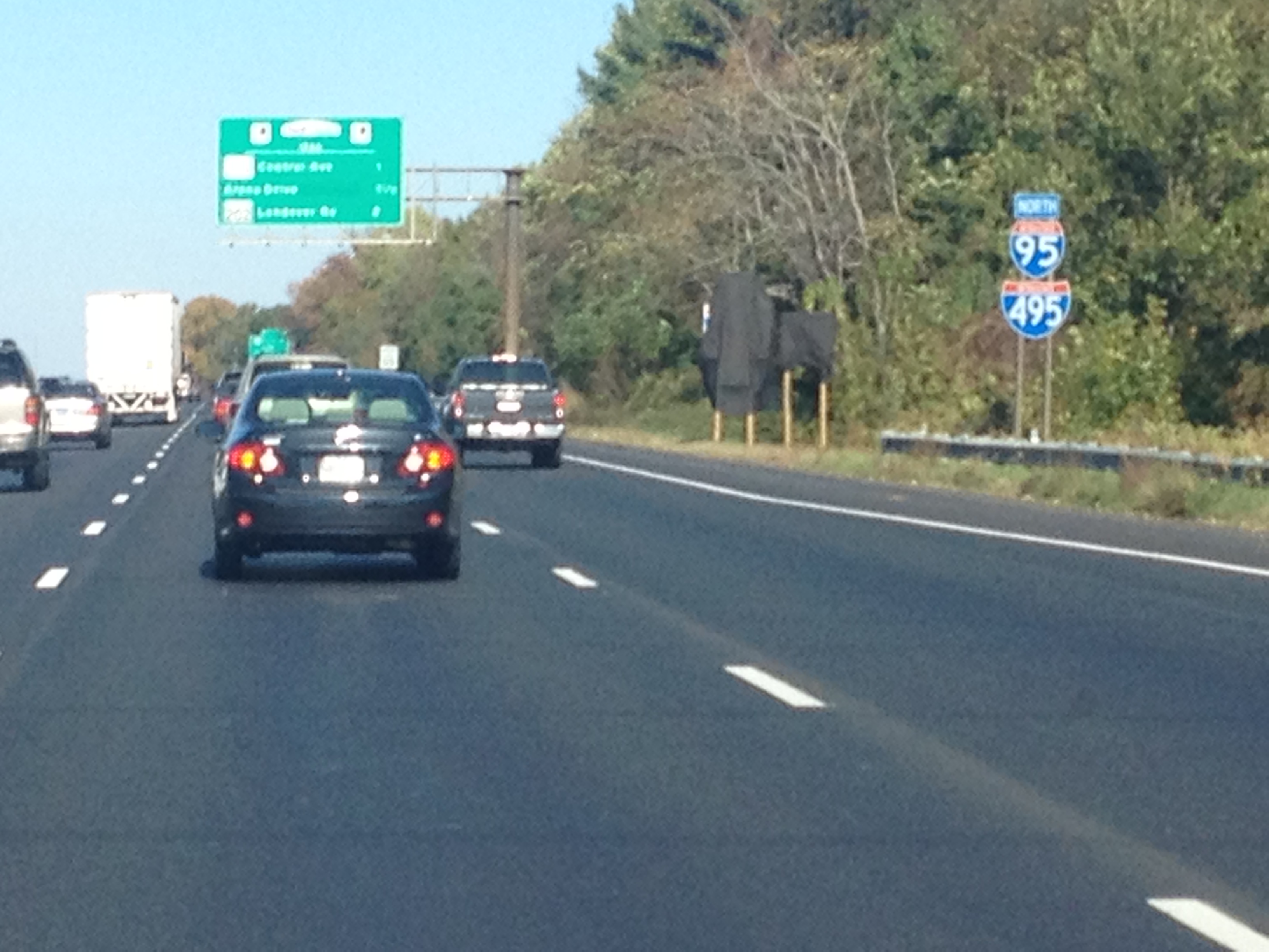
I have some amount of destain for politics and politicians at this time.  It is not that politics is not an interesting topic of conversation and not significant.  It is just that the way we practice and discuss politics in this nation at this time has this strange way of bringing out the worst in people.  Right now, I view Washington D.C. as a group of people who generally view themselves as way more important than they are/ should be, and therefore I had no desire to pass through this city at this time.  So, I went around on the “beltway” to get to Anne Arundel County.

IMG_1297 IMG_1303


My friends live in a row house in Millersville, MD.  The section of houses they live in is not too uncommon for this part of the country.  It is crowded and the houses actually connect to one another.  Saturday was a housewarming party, and my contribution was a bottle of Bourbon I had picked up on the Bourbon Trail in Kentucky on Wednesday.  It is Bourbon Cream from Buffalo Trace.  It tastes like Bailey’s, only better.  It went over well at the party, and I would recommend it!

IMG_1307 IMG_1305


On Sunday we took a drive over the Bay Bridge over the Chesapeake Bay to an area referred to as Maryland’s “Eastern Shore”.  The Bay Bridge is a really neat bridge.  It is a classic for those that love bridges.  The main marvel of engineering on this bridge is how long the bridge is, 4.3 miles.  It is a testament to the amazing engineers that we have in this country that I, along with millions of drivers each year, cross this bridge, over 150 feet above the water’s surface for this long of a span of time and distance without feeling nervous about the integrity of the bridge.  I think more people complain about the toll than anything.

IMG_1310


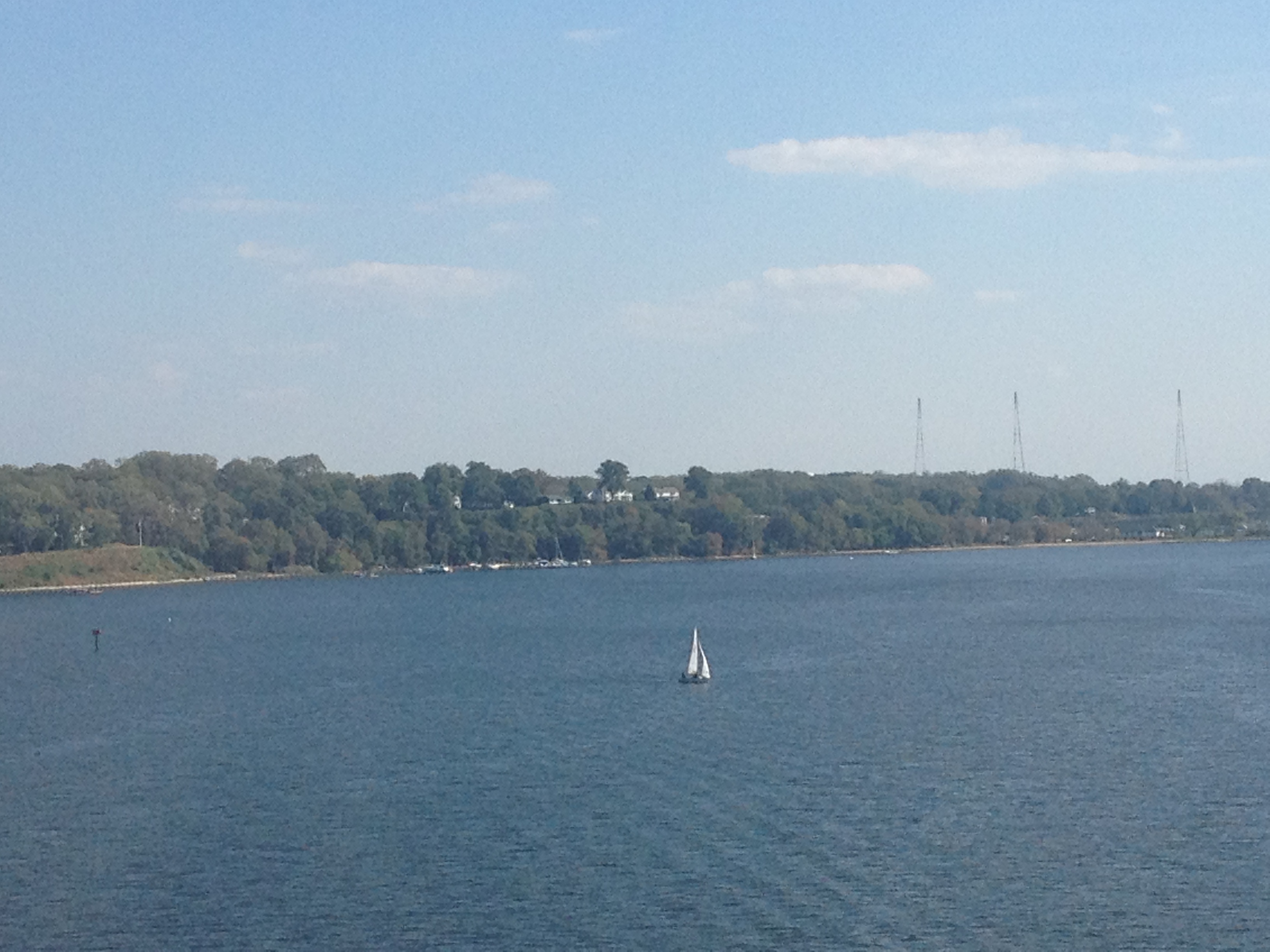
Traveling through Maryland’s eastern shore, first on U.S. 301, then on state route 300, I am quite surprised by the scenery I encounter.  After the first few miles off the bridge, where the same shoreline features that are common in Anne Arundel County seem prevalent, I actually encounter farmland that reminds me of the midwest a bit.  Not as many trees have been leveled here to make way for farmland as have been in northern and central Illinois, and the trees are a bit denser in the non leveled places.  But, many of the crops are the same.  And, I surprisingly encounter some irrigation devices too.

IMG_1313 IMG_1315


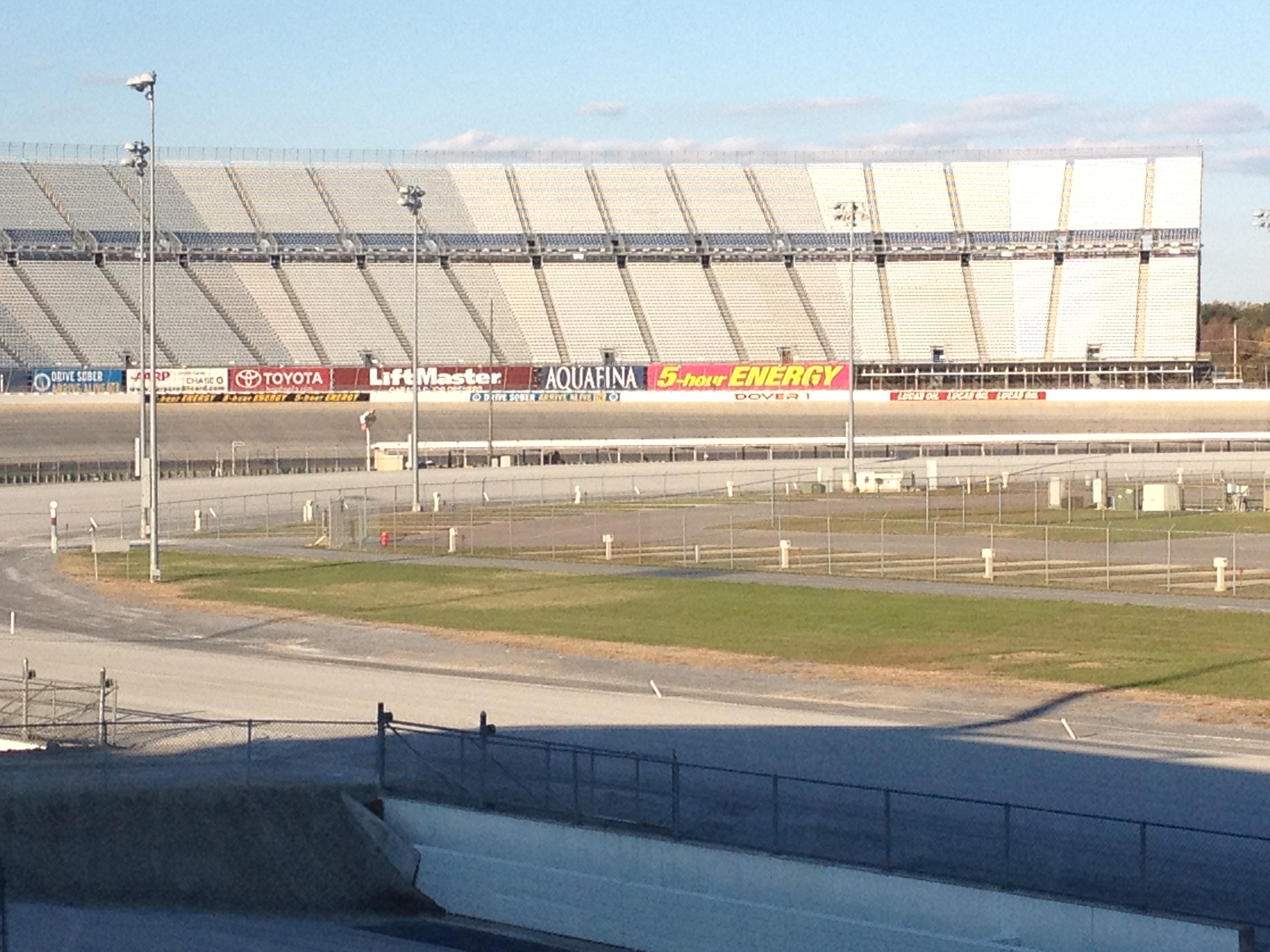
Our destination is Dover Downs, a “racino” (which refers to a racetrack that is also a casino).  Unlike many of the other racinos I have been to, this particular one has both a horse racing track and a NASCAR track.  NASCAR hosts a couple of races here each year.  I headed into the club box, where all of the rich people would sit during these races, as well as their horse races, which occur more frequently.  But, there were no races, for cars or horses, today.

The other thing that differentiates this place from other racinos I have been to is that the casino part of the facility is a full casino, and offers you a casino experience equivalent to visiting a standard casino.  By this I mean that every table game, from the common black jack and craps, to games like pai gow poker, can be found here.  Also, there are no alternate rules that change the experience, such as no alcohol sales or the requirement of a “rake” at the black jack tables.  At Canterbury Park in Minnesota, for example, every $10 black jack bet requires the player to chip in a 50 cent “rake” that the casino just takes.  This makes it nearly impossible to win, and not a great place to gamble.  No such restriction exists at Dover Downs, and I appreciate that.

IMG_1319


After the racino, we head back into Maryland, but not quite back over the Bay Bridge.  This was so that I could take part in an activity that I have always closely associated with Maryland; eating crab.  In fact, I can barely remember the last time I came to Maryland without going out for crab.  There is really nothing like eating seafood when it is fresh, and being that I currently live in land-locked Colorado, it was imperative that I have a seafood meal while in Maryland.  The restaurant I was taken to is called Harris Crab House, and it is right along the shore of the Chesapeake.  There is nothing better than eating crab while staring right at the body of water the crab was just caught from. It is beautiful in two ways.  The views here not only make me think of both the tranquility and adventure that can be achieved on water, but also reassure me of the freshness of my food while serving as a reminder of how connected the culture of this region is to the water.

IMG_1322

Not only did I get to see the sun set over the bay, something that is possible because we are east of the bay, but the stairs of the restaurant also had a marker marking the high point of the water during Hurricane Isabel.

IMG_1320


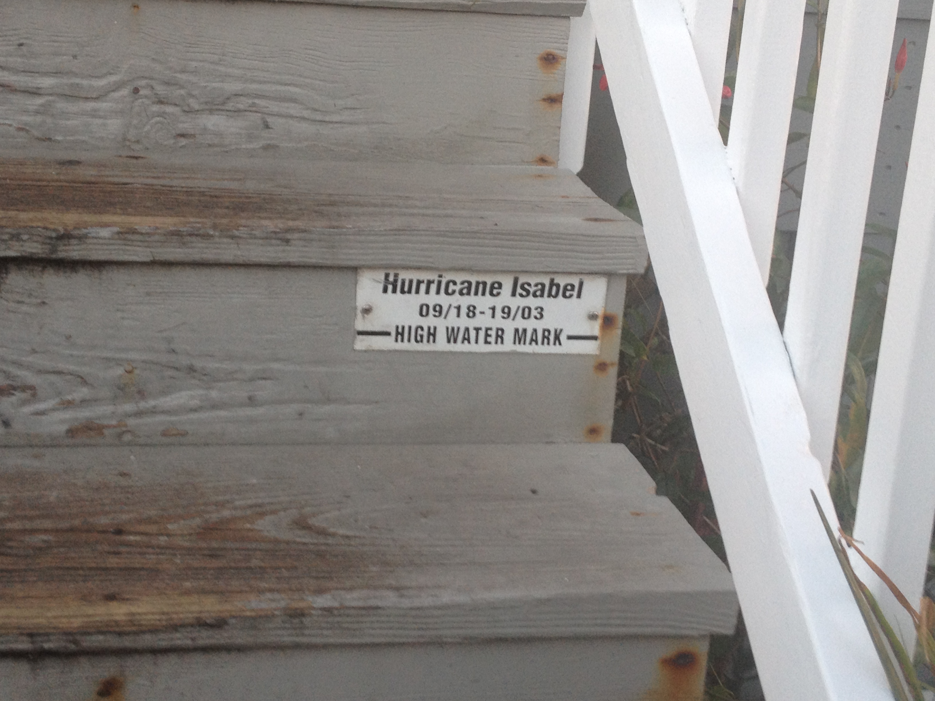
Apparently hurricanes Irene and Sandy did not bring water as high in the Chesapeake as Isabel, a 2003 North Carolina landfall.  The marking labeled here reminded me how much coastal storms are also a part of life here.  I saw plenty of boats on the water, both out in the open and docked.  Many of these boats would be submerged if this event were to repeat itself.  I also imagine these boats being battered by the wind, in this hurricane, the two more recent ones, as well as the dozen or so “Nor-Easters” that occur in these parts every winter.

Maryland has other parts, including Baltimore city, the D.C. influenced suburbs of Montgomery and Prince George Counties and western Maryland’s mountains.  However, for some reason, when I think of Maryland, and the things Maryland is most known for, I think primarily of the places and I activities I have seen here in this part of the state.  It may be a while before I have another crab meal like the one I had today.  In fact, I was too preoccupied with eating to take any pictures.  So, I am quite glad to have had a good Maryland experience this weekend.

My Fall Road Trip


One Hundred Years ago, it was common for people to live most or all of their lives in one place.  People’s ties would remain with one community throughout their lives.  For a typical American one hundred years ago, this all but guaranteed that certain people would remain in each other’s lives throughout its course.


All that changed as society became more mobile.  While there are still some people out there that remain in their community or metropolitan area of origin throughout their lives, it has also become quite common for people to move to different regions as their lives progress.  This makes each of life’s new chapters increasingly involve new places, new people, or both.  In early 21st century society, even those that are committed to one place for life will experience significant flux with regards to the people they encounter and interact with on a day-to-day basis.


As one’s life turns from one chapter to another, it is all too easy for anyone to lose touch with the people that had grown important to them in any of their lives’ previous chapters.  Life’s new chapter demands attention, and it is a bad idea to constantly live in the past.  It also suddenly requires significantly more effort to remain in touch with people, especially if the next chapter of your life involves a move to another city/region. However, I definitely believe it is worthwhile to keep in touch.  Many people have told me that I am good at keeping in touch with people.  I believe this only to be true for early 21st century standards.  Overall, I still think I could do a much better job of this.

One problem is that our society is still in a restructuring phase.  We are restructuring our communities around increasing mobility, new forms of communication, and our society’s changing needs.  We now have websites like Facebook that help us keep in touch.  But, while Facebook helps us track each other’s lives from remote locations, it is no true substitute for having actual experiences with one another.

RoadTrip_Oct2013

This is why I decided to take some spare time I have to go on a major fall road trip.  My itinerary is summarized above, but there will probably be more to it than what is presented on this map.  My idea behind this trip is to see some people that have been, and still are, important to me, but also develop some new experiences.

With a total of two weeks worth of time, I will not be able to make it to all of the places I would like to, and see all of the people I would like to.  But, I still think I came up with a plan that will allow me to reconnect with a significant number of people with whom I would like to remain connected with, without being too hurried to actually enjoy the experiences.  I have a plan, but I am ready to adjust, and there is some extra time built in.  It is a balanced road trip, a mix of the familiar and the new, a mix of the urban and the wilderness, and a blend of efficiency and flexibility.

Bent’s Old Fort

IMG_1112

The idea of racial unity, or more accurately the idea of two or more racial/national groups living side-by-side without conflict, and mutual respect for one another is not new.  It isn’t, as it feels like some people believe, something that mankind first came up with in the middle of the 20th century after finally sorting through the fallout from World War 2.  It is just an idea that has never really overcome other pressures.

In the early to mid 19th century, brothers William and Charles Bent, of Saint Louis Missouri, actually believed that it was possible.  Early in life, these brothers participated in a series of trade missions along the Santa Fe Trail.  As the Bent brothers encountered both Mexicans and Native Americans on these missions, over time they established good relations with both groups of people.  William Bent was even accepted into the Cheyenne tribe, and participated in negotiations on their behalf.  This included negotiations with other native tribes, as well as with the United States. The two brothers, along with Ceran St. Vrain established a trading fort in what is now Southeastern Colorado, along the Santa Fe trail.

For this reason, I decided to make the trip to Bent’s Old Fort, but I ran into one minor issue.  Apparently, I did not realize that Bent’s Old Fort is a National Historic Site, and therefore is closed due to the current government shutdown.

IMG_1111 photo

So, I did the only sane thing.  I pulled my car off to the side of the road (the parking lot was also closed), and I snuck around the gate.  Heck, I didn’t have to pay the entry fee!

IMG_1115 IMG_1116

The fort is reconstructed really well.  I should probably come here sometime when I could actually get inside the building.  And also when the bulls and horses that are kept there are contained rather than wondering around where I could have theoretically provoked them and wound up in trouble.  In fact, that is why I did not stay very long, and did not take any pictures of the animals and the trail.  I was, however, able to imagine what it was like for pioneers and traders to travel along this trail, and encounter this fort, the first building of any sort travelers along the trail would find for miles.  And, according to the information presented in the parking lot, which I did get to read, from 1833 (when it was built) through 1849, this place would have been bustling.  Surely, a welcome sight for travelers.

IMG_1113

One question that often comes to mind when learning about Bent’s Fort, is why it was placed where it was, near La Junta, Colorado.  Currently, most of Colorado’s largest cities are a lot closer to the mountains, within 20 miles or so.  From the perspective of modern day Colorado, it appears illogical for this major trading post to be located over 60 miles east of Pueblo, the mountains, and all of the good fur and pine.   However, at the time Bent’s fort was built, 1833, it was built right on the border with Mexico.  For someone traveling west on the Santa Fe Trail, this fort marked the end of the portion of the trail in the United States.  After this, travelers would have entered Mexico, or, after 1836,  the Republic of Texas.

Unfortunately, both Bent brothers ended up on the wrong side of history despite their good intentions.  Actually, it was perhaps because of their good intentions.  Charles Bent, the older brother, was appointed the first territorial governor of New Mexico following the Mexican-American war.  The reading material outside the fort suggested that he was appointed to this position due to his good relations with the people there.  However, he was killed by the Native Americans in the Taos Revolt in 1847.

The younger Bent brother, William, was persecuted by the other side.  During the Sand Creek Massacre, he was captured by General John Chivington after attempting to make peace between the U.S. and the Native tribes during the gold rush.  He was forced to lead Chivington and his troops to the Cheyenne campsite where he conducted the Sand Creek Massacre, killing hundreds of Native Americans.  William’s end was not nearly as dramatic as his brother’s, but his efforts failed to create peace between the U.S. and the Native Americans.

The story of the Bent family and their fort reminds us that it is important to judge everybody as an individual, and not paint every member of some group with one brush.  Throughout this time, there were definitely more white people like Chivington, who murdered natives despite their efforts to make peace, and also more white people like the Bents, who approached native tribes with deep respect for their culture, and attempted to share in the human experience with them.  There is more to who someone is than their racial identity.

Just in case the lines were not blurred enough in this whole story, John Chivington was a hard-core abolitionist.  He could not wait to free the black population and share our culture with them.  Yet, he viewed all Native Americans as savages that needed to be exterminated.  On the flip side, the Bent brothers owned slaves, and William would eventually support the cause of the confederacy.  So, there is a group of people out there who would potentially view Chivington in a more favorable light than Bent.

So, who is the good guy and who is the bad guy?  People like to simplify history, assign one side ad good the other as bad, and establish one or two themes.  This makes them feel like the have a good handle on the situation.  However, in reality, history is about as complicated as the human mind, and all of the many mechanisms that cause people to behave in the way that they do.  Some people may know more individual facts about history, but that does not necessarily mean they understand history better.  Some people view all facts through the lens of a preconditioned idea about the nature of the people involved, and cannot appreciate all of the facts.

IMG_1120 IMG_1123

One amazing thing about traveling is that travel has this way of causing people to build upon their thoughts.  Sometimes it almost feels as if the world has found a way to set itself up in such a pattern that it creates certain themes in everybody’s lives, or at least each person’s individual trips.  After pondering these thoughts on the drive from La Junta back to the interstate, the drive home took me through two towns that recently made waves in our current political climate; Pueblo and Colorado Springs.

Last month, these two towns made news across the state as they surprising recalled two of Colorado’s state senators.  One of them was actually the leader in the senate!  The recall election was at least partially about the gun control debate, but other factors may have contributed.  Advocates on each side of the debate appeared, at least to me, to be motivated by ideological differences rather than some form of tribalism.

But is it all just ideology?  Have we really replaced racial issues with actual issues about how we view our government and society (which would be a positive change)?  Unfortunately, last year’s election results, and specifically the large difference in voting patterns by race indicates differently.  Race also still finds it’s way into may of the political debates we have in this country today.  I am not going to assign blame to either side on this one.  This is not a partisan political blog.  But, pondering the racial component to our politics, the self-segregated neighborhoods in Chicago and other places, the Indian Reservations and the like, makes me think that we are not really living side-by-side the way the Bents had envisioned.  The middle of the 20th century saw a major push towards that end, with Matrin Luther King’s I Have a Dream speech articulating that goal in a manner that most can relate to.  But, there does still appear to be a disconnect.

Tribalism is an inevitable part of human nature.  But will our “tribes” always be dictated by our origins?  The internet now provides us access to nearly everybody around the world, and more and people are moving more frequently.  These factors may encourage our future “tribes” to be more determined on different grounds, such as worldview, or common interests.  But, would this be better?  Less disconnected?  Less violent?  Maybe the key is not how we determine our “tribes”, but having respect for other “tribes”, or at least letting them live the way they want to as long as they are not hurting you.  This is a tall task for the human race, but one that is theoretically possible.  All challenges can be met, like the one below, Pike’s Peak, which I got one last view of before it once again becomes snow packed tomorrow (which is fine, it looks better with the snow on it anyways).  A mountain whose peak was once unreachable, is not reached by People on foot, in their cars, and by the cog railway.

IMG_1125