Category Archives: trails

Winter Cycling in Colorado

IMG_9426

Colorado weather can be quite variant, especially in wintertime. This variance opens up opportunities and makes winters here far less unpleasant than winters in the Northeast and Midwest. Compared with Chicago, Denver’s winter temperatures…

  • Are 41% more variable
  • Change, on average, 9.3°F from one day to the next (In Chicago it’s 6.6°F)
  • Reach 50°F (10°C) or greater 34.6% of all days, compared with only 7.1% in Chicago
  • Despite this, Denver gets more snow (53.8 inches per year) than Chicago (37.1)

In particular, the greater frequency at which temperatures warm up provides some opportunities. I need not write off an entire season for outdoor cycling. There were six days in January 2020 in which the temperature reached 55°F (12°C).

Then, on Groundhog Day, as if to taunt everyone that buys into the folklore, temperatures across Colorado were exceptionally warm. Denver and the surrounding area reached well into the 70s while some areas in the East and Southeastern parts of the state reached 80!

That morning, Punxsutawney Phil, the most widely known groundhog, would predict an early spring. Later on, Flatiron Freddy, a groundhog local to Colorado, predicted six more weeks of winter. That evening, the weather in Colorado would turn sharply colder and snowier for the foreseeable future.

Groundhog Day 2020 ended up being a perfect demonstration of the opportunities and challenges associated with cycling in Colorado in wintertime. I learned a long time ago to keep to lower elevations in the wintertime due to both wind and residual ice on the roadways. Luckily, the region has a fantastic set of trails. This is actually an outdated map. The network has become even more robust since 2013!

DenverBikeTrails2013

It is all centered around Confluence Park, right in the heart of downtown. Confluence Park itself is a fantastic example of a place where people can get a little bit of time in nature right in the heart of a major city. There is also an REI flagship store!

On Groundhog Day, I decided to ride the South Platte River trail from Confluence Park to Chattfield Reservoir.

IMG_9419

The trail runs a total of 16 miles. The reservoir itself can be reached with only an additional 3 miles of pedaling. This place is tremendous, with the lake in the foreground and the mountains behind. In summer, there are often a lot of boaters.

IMG_9427

One of the challenges that day was the wind. Wild changes in temperature from day to day are often associated with strong winds and Groundhog Day was no exception. The wind came out of the South at 15-20 miles per hour, making the mostly Southbound ride to the reservoir far more challenging than usual. I recall going at about 15 miles per hour the entire way.

Having not done this specific ride for a few years, I forgot how beautiful the Southern half of the Platte River trail is. The trail snakes through downtown Littleton. After that, there are plenty of places where the the river in the foreground and the mountains in the background make one feel as if they are in the setting of a famous nature painting. Much of this land is being preserved as part of South Platte Park.

IMG_9423

The return trip went quite fast, with the wind at my back and the miles just flying by. While I refrain from hill climbs in the wintertime, this ride ended up having some similarities, with a headwind to get to the reservoir and a much easier and faster return trip. I was back at Confluence Park before I knew it!

In addition to the wind, another major challenge of winter cycling is the limited amount of time available. Winter days are short, and without exception start off cold. Even on Groundhog Day, the day cities across the front range would hit record highs in the 70s to near 80, morning temperatures were still in the 25-35°F (-3 to +1°C) range. If one is to wait until 9 or 10 for temperatures to warm up a little, and be limited by a 5 P.M. sunset, there is a pretty limited amount of time or riding. It was for this reason I picked the particular ride I did.

IMG_9431

It is also for this reason that despite Colorado’s frequent warmer days in the winter, I finally decided to supplement my training with some indoor spinning.

IMG_9347

The Highest Point in Colorado

IMG_7820

I hiked Mount Elbert last Friday for a few reasons…

I wanted to reach Colorado’s highest point.

Also, it has been a hot summer in the Denver area, with August’s daytime high temperatures running about 4ºF above average.

August2019_CO_Anomalies

At Denver International Airport, the average high temperature for the month of August (through the 23rd) was over 91ºF (33°C). Getting up in elevation, where temperatures would be far cooler sounded refreshing.

Despite the heat, I could feel summer’s end approaching, with sunset getting earlier and earlier.

IMG_7616.JPG

I was starting to feel as if I was allowing my Colorado summer to pass by without that many mountain adventures to show for it.

Finally, as recently as a six months ago, the idea of needing a day away from people would have seemed inconceivable to me. Things changed, and last week I was seriously feeling the desire to spend a day alone (well, with my dog). I guess it is true that even the most extreme introverts need human interaction and even the most extreme extroverts need some time alone.

So, I did the only logical thing. I left Denver at 3:45 A.M. so I could arrive at the Mount Elbert Trailhead at sunrise- in time to get the last parking spot in the lot.

It certainly was cooler. At the start of the day, the temperature had dropped into the mid 30s (≈2ºC).

IMG_7768.JPG

The Northeast Ridge is the most popular, and most easily navigable route up Mount Elbert. The first mile of this hike follows both the Colorado Trail and the Continental Divide trail.

IMG_7774.JPG

This first half of this mile is fairly steep, with switchbacks, followed by a flat section.

One of the greatest things about starting a hike this early is being there the moment the sun first hits the top of the trees.

IMG_7781.JPG

I reached the tree line an hour into the hike.

IMG_7784.JPG

The Arkansas Valley and the town of Leadville gradually disappeared from behind the trail, as if I was on an airplane taking off.

IMG_7785.JPG

IMG_7792.JPG

Due to the time of day, and sun exposure, it began to feel warmer. The trail also got even more intense.

IMG_7791.JPG

One of the reasons people hike 14ers is to get that feeling of being on top of the world! Because the Mount Elbert Trail is pretty steep right near the tree line, that feeling comes sooner on Mount Elbert than it does on other 14ers. I looked back only about 15 minutes after reaching the tree line, and already felt as if I was looking down on all else.

IMG_7793.JPG

The other common 14er experience that comes a bit earlier on Mount Elbert (compared to other 14ers) is the “scramble”. This is a really steep and rocky section where there is often not one specific route. On most 14ers, the “scramble” comes right at the top. However, on Mount Elbert it comes a bit earlier.

After a couple more miles of alternating steeper and flatter sections…

An intense “scramble” presents itself.

The top of the scramble, however, is not the summit.

IMG_7808.JPG

Exhausted from the scramble, the trail seems to drag on forever (although in reality it is about 30 minutes). It is the kind of hike that forces a lot of hikers to reach, deep inside themselves, and find the energy and stamina they did not think they had.

IMG_7810.JPG

I was able to summit right around 10 A.M., a safe time to summit given the thunderstorm threat is primarily in the afternoon.

IMG_7815.JPG

Shasta (pictured with me here) was far from the only dog to hike Mount Elbert that day. However, I was surprised to see a mountain bike at the top of the mountain.

IMG_7816.JPG

A hiker carried this bike up the mountain on his back, and then rode it down the East Ridge- WOW!

IMG_7821.JPG

The man who carried the mountain bike to the top of the mountain was far from the only person I talked to on this hike. I talked to dozens of people, many others with dogs and even one of the trail volunteers who was helping build an erosion preventing wall along the trail just above tree line. It was not nearly as solitary as I had thought.

I really didn’t mind. In fact, I enjoyed talking to all of the people I met on the trail and felt it made it a better experience. Maybe what I really needed was not a break from all people, just the ones I felt were being demanding.

IMG_7823.JPG

Downhill was also an adventure. The views are commonly different, as it is much closer to the middle of the day. Some places feel like they took on a somewhat different color.

IMG_7827

It also presented a challenge of its own, as parts of the trail were slippery.

IMG_7830

And, as was the case with the trip up the hill, it also felt like it dragged on longer than anticipated.

IMG_7831

IMG_7832

While I had grown tired of all things “demanding”, this hike made me realize that some of the best experiences in life are the demanding ones. The ones that force you to give more than what you were prepared to give. The ones that force you to reach deep inside yourself, both physically and mentally, and find what you did not know you had in you.

There are different kinds of demanding experiences. Some build something in us, such as hikes like these, the basketball coach that wants their players to reach their full potential, or a great boss or mentor that knows going soft on someone with real talent will shortchange them.

Then there are other ones, that do nothing but feed someone else’s ego, or squeeze every last hour of work or bit of energy out of you to line pocketbooks. Sometimes it is hard to tell the difference, especially when tired. I know there were sections of this hike where I was barely able to hold a thought. Somewhere deep inside, we all understand what is going on. All we need to do is trust our instincts and ask ourselves this simple question…

Am I Being Built or Harvested?

Be thankful for the experiences that build us, no matter how frustrating or exhausting they are. Run as fast as you can from those where we are being harvested.

Nebraska Out of the Way Attractions

Smith Falls

IMG_4526

Smith Falls is pretty well hidden from most travelers. It is located in a very sparsely populated section of North Central Nebraska, far away from any heavily traveled interstate highway. It is also in a section of the country where few would expect to see a magnificent waterfall like this one.

Unless you are one of Valentine, Nebraska’s 2,820 residents, getting there is a long drive on empty roads, that even requires four miles on a gravel road off of State Highway 12.

Being so far out of the way of where people live and travel, the Niobrara Canyon, where Smith Falls is located, is quite secluded. The river itself looks nothing like the surrounding areas. The dense tree coverage feels reminiscent of places further East. It feels like the perfect destination for a private group experience; a float trip, family reunion, or some other group bonding experience.

IMG_4521

There does tend to be a few more people at the Falls themselves, as it is the main attraction at the State Park.

IMG_4522

Unlike some trails, visitors can freely walk right into Smith Falls without breaking any kind of rule. Many visitors bring swimsuits, and wear water shoes, as the trail to get from the parking to the falls is not vigorous at all, although it is about half a mile.

IMG_4529

Carhenge

IMG_4542.jpg

Carhenge, just north of Alliance, Nebraska, several hours west of Smith Falls is also quite far from any metropolitan area or heavily traveled highway. This image of an open two-lane highway with nobody else on it, wide open skies and small subtle sand hills in the background sums up the entire three hour drive between Smith Falls and Carhenge.

IMG_4538

While both attractions are out of the way, a few miles outside a small town (Alliance has a population closer to 8,000), in a way they could not be any more different. Smith Falls and the Niobrara Canyon is all about natural beauty, an attraction carved out of a glaciation event that occurred about 17,000 years ago. Carhenge is a homage to all things manmade, a recreation of Stonehenge, a mysterious pre-historic manmade structure, using a more modern human invention, cars.

Whereas Smith Falls is serious, Carhenge is has a goofy vibe. There is also more to Carhenge than just rusty old cars arranged like Stonehenge. This one vehicle apparently has a time capsule in it. In the year 2053, someone will open up memories of 2003, the last year before social media. That should be an interesting experience, especially for someone not old enough to remember such a world.

IMG_4544

There is also a car where people can write on.

IMG_4545

A few of these random structures that are made out of car parts, whose relation to the rest of the exhibit is not aparent.

IMG_4547

And, a car hood with a vaguely political sounding message on it.

IMG_4548

Chimney Rock

IMG_4562.jpg

Not too far from Carhenge is an attraction of both natural beauty and historical significance: Chimney Rock.

IMG_4559

Although this structure served as a landmark for Native Americans and fur trappers, its significance was heightened when South Pass (in Western Wyoming) was discovered to be the easiest passage across the Rocky Mountains. This lead to most major trails, including the famed Oregon Trail, being routed along the North Platte River, passing by Chimney Rock.

IMG_4563.jpg

Chimney Rock is a National Historical Site with a museum containing artifacts, primarily about the pioneers who traveled this route, including journals and letters written by those who made the journey.

It is hard to appreciate in the current era, where anyone with means can get on a plane and fly to some of the most beautiful places on Earth, but when pioneers in the mid-19th Century came across Chimney Rock, they were often in awe of its beauty. Many accounts went to great lengths to describe the structure that is Chimney Rock.

It was also recognized by those making the journey at the time as the point where the flat portion of the journey ended and the uphill part began. The journey ahead would become more rigorous, but also more beautiful.

IMG_4567.jpg

Nebraska is not always known as a place with a lot of natural beauty. However, it is not without its places to be appreciated. The truth is that beauty can be found pretty much anywhere, because, it is often not a specific place or a specific person. It is often an experience. A major part of the travel experience is driving. Nebraska offers open roads that pass by subtle features like the sand hills or the rock features further west. The key is to go a little bit out of the way, and to notice, be looking for what is around you. Then, with the right music on in the right vehicle (I personally found both classic rock and EDM to match this situation, you may find something different), the experience becomes a thing of beauty itself.

Road Trip to Santa Fe

IMG_5623.jpg

I spent about half a decade working in the Insurance Industry, an industry with a significant presence in Bermuda.  At workshops, conferences, and in meetings, I would regularly interact with people who lived there.  The place certainly has its draw, and with the right opportunity, a person with experience in the industry could make a really good life there, despite the high cost of living.

I often imagine what it would be like to have a totally different life, in a totally different place, particularly when traveling, or when I meet someone from somewhere far away.  While working in the insurance industry, although I never seriously considered up and moving to Bermuda, I did imagine what it would be like a couple of dozen times.  Each time I imagined it, I would always end up dwelling on the lack of room to roam around there.  The island is only 20.6 square miles, and getting anywhere else requires a flight.  I pictured myself moving there, getting my swimming trunks out, snorkeling, attending a few parties and such, but then, eventually, just getting restless, and missing something I love to do here in mainland U.S.A.; taking a road trip.

There is something I really love about road trips.  When I refer to road trips, I am not talking about simply driving somewhere.  A lot of people drive to work every day, or to a relative’s house every other weekend, and those drives don’t feel like “road trips”.  I’m talking about driving somewhere a significant distance away that is not a routine trip; somewhere that is somewhat unknown.  On road trips, we have somewhat of an idea as to what to expect, based on what we have heard, read, or researched, but we do not know it intimately.  We have not experienced the towns we will pass along the way, which exits have the best deals on gas, and where the best restaurants are.  In other words, there are still some surprises, and we are still going to encounter something unexpected.

IMG_5619

Driving south along I-25, the first indication that one is reaching the Southernmost portion of Colorado is the Spanish Peaks.  While visible farther north, they take prominence south of Pueblo. The Spanish Peaks are nowhere near the tallest features in Southern Colorado.  In fact, within 30 miles or so, there are 5 mountains taller than 14,000 feet (14ers)!  But, since they are relatively isolated from other natural features, and can be seen quite some distance, they are a prominent landmark toady (an entire region is named Spanish Peaks country, as well as the names of countless business in the region), and were a prominent landmark on the old Santa Fe Trail.

Approaching Trinidad, CO, the last town before the New Mexico border, the Spanish Peaks disappear from the horizon as the highway enters a much hillier region approaching Raton Pass.  It is here that the path of Interstate 25 joins with the old Santa Fe Trail, which it will more or less follow for the remainder of the trip to Santa Fe.  This trail was first pioneered by the Spanish and later played a pivotal role in American history including westward expansion, and the eventual conquest of the Southwest from Mexico.

IMG_5622.jpg

I had mixed expectations of Raton Pass.  Many years back, I was on a ten-day storm chase. Our group was situated in Clovis, New Mexico, which is quite close to the Texas-New Mexico border.  We were discussing the possibility of chasing upslope storms roughly an hour northeast of Denver the following day.  Some of us brought up the possibility of driving west to Raton so we can take the Interstate to our target destination, but the group leader balked at the idea, instead suggesting driving up 385, as he felt it might be risky to take a large convoy of chase vehicles over Raton Pass.  We ended up deciding not to drive up to Northeastern Colorado, as, in the morning, the storm outlook had weakened, and we no longer felt it worth the drive.  By the way, this is common on storm chases, you really never know where you will end up going.  However, ever since then, I had kind of wondered what it was like to drive over this pass.

As the photos indicate, the road gets windy as motorists climb from Trinidad, at roughly 6000′ in elevation, over Raton Pass, which tops out at 7834′.  It’s definitely not nearly as rough as heading over the Rocky Mountains along I-70 or I-80, but definitely is a much more major incline than anything a group of people that drives largely in the Great Plains from Texas up to South Dakota would typically experience.

IMG_5626.jpg

Oh, and in one of the strangest of coincidences, the top of the pass is right at the border of Colorado and New Mexico.  This is odd as, first of all, the Colorado-New Mexico border is defined as the 37th parallel, and has nothing to do with where any mountain pass is located, and roads through mountain passes are built to take the safest and most effective route.  The fact that the place where this road crosses the 37th parallel most effectively happens to also be the high point seems to me as a pure coincidence.  Maybe someday I will read into this, the story behind the road and such, but I have yet to do so.

After a descent into Raton, the road reaches a segment that is long, flat, open, and rather empty.

I switched the music on the radio to classic rock, The Clash, Ozzy, Queensryche and such.  For some reason, there is something about the sound of guitar rock that makes more sense while driving through scenery like this than many other forms of music.  As the afternoon passed along this landscape, cloudy skies gave way to peaks from the sun only every once in a while.  A few periods of gentile, chilly rain fell from the skies.  In some ways it reminded me of a storm chase gone horribly wrong, the day slowly but surely slipping away with no prospects of favorable storm conditions developing.  However, in other ways, the drive was relaxing, allowing me to think without any distractions.

After passing through a town called Las Vegas, NM (which I assure you is nothing like the Las Vegas in Nevada), the highway turns West.  It kind of loops the last 60 or so miles into Santa Fe, even heading back northward for the last ten miles, following the route of the old Santa Fe trail.  However, unlike the previous 100 or so miles, this part of the trail, and the drive, is far from flat.

To the right, is the southernmost part of the Sangre de Cristo mountain range, and an area now part of the Santa Fe National Forest.  It is these mountains that the trail routed 19th century pioneers around.  To the left are a series of bluffs which, luckily, the trail did not have to also bypass, as it would have added many more miles to the journey.  The road itself slowly climbs over Glorietta Pass, descending only slightly into New Mexico’s Capitol City- Santa Fe.

Back on Top of the World

IMG_4128

Four in the morning is such as strange time of day.  It feels almost surreal.  Everything around you is so much quieter than we all have become accustomed to seeing it.  It is a time when the streets of your home town, even the blocks surrounding your home, feel strange and distant.  For many of us, it is the only time that our surroundings appear restful, as nearly every other time of day, the streets are full of people; people in motion, with agendas, and tasks to attend to.  It is almost as if you are experiencing a completely different place than the one you experience on a day-to-day basis during normal waking hours.

The few people you do see out and about at this hour have widely differing experiences.  There are some for which it is still last night.  The parties, after parties, drama, and other events that had been unfolding since the previous evening are still unfolding.  They have not transitioned to the next day yet.  For others, though, the new day has already begun.  They are starting some sort of project that has already carried them into the new day.  Basically, although the calendar says Sunday, some people are still on Saturday, while others had moved on to Sunday.  It very much reminds me of the International Date Line, which physically separates one day from the next day.  Only here, it is much murkier.  And having been on both sides of this line, it is definitely a challenge to make sense of everything I see around me.

I woke up at four in the morning in order to climb Quandary Peak, one of Colorado’s “14ers“, located in Summit County, just under two hours from Denver.  Climbing “14ers” is one of Colorado’s pastimes, and a rite of passage I first accomplished just over two years ago.  Unfortunately for anyone that hates early mornings, those climbing these peaks are generally advised to get an early start for safety reasons, as the weather here can be somewhat chaotic.  Sometimes unexpected weather here can lead to horrible results, even on days when inclement weather was not expected.  It is recommended that most hikers begin these climbs by 7 A.M. to minimize such risks.  So, I woke up at 4, to get ready, and get to the trailhead by 7.

IMG_4107

I have only climbed three other 14ers, so I have little experience to compare this particular hike to.  But, from the very beginning this hike seemed anomalous.  Most hikes, particularly Mount Bierstadt, begin relatively flat, with steeper grades coming farther into the hike, and closer to the top of the mountain.  This hike, however, had some fairly intense grades right at the start of the trail.

IMG_4110 IMG_4111

Still, it felt like we spent a considerable amount of time, 40 minutes or so, hiking before we got above the tree line.  There is some variance as to the elevation of the tree line in Colorado.  On this hike, it certainly felt like I climbed to nearly 12,000 feet in elevation before getting above the trees.

IMG_4118 IMG_4146

The other aspect of this particular trail that sets it apart from nearly every hike I have ever undertook is how much of this trail is covered by rocks.  The portion of the trail above the tree line, which is most of the trail, is more than half covered by rocks.  This is well more rock coverage than I remember from the other 14ers I have climbed.

IMG_4115 IMG_4116 IMG_4124 IMG_4145

And then there were the mountain goats.  I probably encountered roughly a dozen of them today.  Most of them hung out a little bit above the tree line, but there were a couple of them that were actually spotted closer to the summit. I was surprised to encounter the first mountain goat I came across today.  I was even more surprised to keep encountering them, sometimes in packs.

Unlike many other mountains, Quandary Peak’s “intimidation factor” actually slowly builds up as one approaches the summit.

IMG_4109

While the mountain does appear big from the start, it appears somewhat gentile in nature when compared to some of the other mountains I have hiked.  From this vantage point, still below the tree line, it almost feels as if there will be a slow, steady, and merciful climb to this peak.

IMG_4120 IMG_4117

Just above the tree line the mountain’s summit comes into clear view, appearing significantly less gentile than it did just 30 short minutes ago.

IMG_4122 IMG_4123

The closer I got to the summit, the more I realized that the last 1000 foot climb would not be gentile at all.  In fact, this final stretch resembles any other 14er I have experienced or seen posts about.  This final section, leading up to the summit, will be a place where I will trudge to the top, focusing one exhausting step at a time.  This is the way it always goes down.

IMG_4126 IMG_4131 IMG_4132

Despite the fact that I have already successfully hiked to the top of a mountain that is technically a few feet taller than this one, it was hard not to feel a sense of accomplishment when reaching this summit.  Looking down on the intense terrain I had just navigated, and the mountains that surround me, all of which are below me, I was once again on top of the world.  And, once again, I had earned it.

As the day progressed, I saw more and more of two types of people on the trail.  First, large groups of either high school or college aged people.  But, also, I began to see more people wearing headphones on their hikes.  And, unlike the trail runners in headphones I encountered on Bierstadt, the people wearing them were not all trail runners.  Or, well, they were not all running.  Some were climbing the mountain at a fairly leisurely (for an intense climb like this) pace.

It made me wonder what this experience was about for these particular individuals.  How does having music on change the experience of the scenery around you?  I can imagine it having a negative impact on the connection one can make with nature at a place like this.  I am for certain that it would have a negative impact on one’s ability to share experiences with others.

IMG_4136

As was the case with the other 14ers I had climbed a couple of years ago, I was fortunate to have good company with me for the journey.  The experience, like many of the others I write about, would not have been the same had I taken them on alone.  My friend and I were discussing a mutual acquaintance who was hiking one of these 14ers solo.  I know that I would have significantly more trouble motivating myself to get up at the hour of 4 A.M. for a solo excursion.  For me, connecting with others plays a significant role in a lot of what I do, and I would have a hard time finding myself wearing headphones at a place like this.

July 2015 Bicycle Journey Day 1: Bozeman to Chico Hot Springs

There is no feeling like actually beginning something you had set out to do.  Lots of people talk about what they would like to do, or think about what they will someday do.  And, sure, anticipation is fun.  But it certainly does not compare to that feeling you get when you actually start something major.  For years I had been thinking about traveling long distances by bicycle.  The idea of traveling a significant distance under my own power had always thrilled me.  So, I read stories of others who had traveled by bicycle.  I looked at bicycle travel routes, particularly from the Adventure Cycling Association.  I bought the necessary equipment.  I trained.  And, finally, I planned an actual trip.  Well, I decided to join my friend’s cross-country bike ride for a three day segment, from Bozeman, Montana to Jackson, Wyoming.

IMG_3685

When I met up with my friend in Bozeman along his journey, Thursday, July 2nd finally became “Day 1”.  They say that the journey of 1000 miles begins with one step.  In my case, it begins with one pedal stroke.  And, when I started to pedal, headed East out of town, I finally had a “Day 1” of my own.  I was finally doing it.  I was traveling by bike.  What was once just an idea, something on a bucket list, had matured, first into detailed plans, and than into action!

IMG_3686 IMG_3687

The fact that I was finally on a bicycle journey of my own felt ever more real when I left town.  After all, many people bike around town all the time.  I had biked around town quite a bit earlier in the day- roughly 10 miles total.  And, none of that really felt like I was actually on my way.  It was when i departed from town that I truly achieved that “Day 1” feeling.

IMG_3688

That feeling soon got complicated with another first, bicycling along an interstate highway.  At the REI, I found out that the route I had originally intended on taking was not paved, leaving no other choice but to basically follow I-90 from Bozeman to Livingston; roughly 25 miles.  Unfortunately, there is a five mile stretch where I-90 does not have a frontage road.  This actually occurs quite frequently in the West, particularly in canyons.  In many cases, there are no other roads in which to use to get from one town to another.  And, for this reason, many Western states, unlike their Eastern counterparts, permit bicycling on Interstates.

The fact that it was completely legal for me to cycle down I-90 did not make it any less scary.  In some sections, the shoulder width was not nearly as wide as they are on typical interstates.  It felt like a mere 6 feet of distance separated the edge of the right lane and the guard rails, all on a road with a speed limit of 75!  Needless to say, when we were able to exit the highway, I was relieved.

IMG_3690

A couple of miles later, I had reached the top of what is referred to as Bozeman Pass, and completed the first climb of my trip.  I did not take this climb too seriously.  I stayed in my big gear the entire way up.  For part of it, I was more concerned with 80 mile per hour traffic.  But, when I looked down at what I had just climbed, after reading one of the many Lewis and Clark related information boards along this route, I realized that I had actually climbed a significant amount.

On the other side of the pass, I rapidly descended into Livingston, a town we would not spend too much time in.

IMG_3692

We pretty much just took a bathroom break, filled up on water, and headed out, southbound, towards Yellowstone, or at least that is what pretty much all of the signs for Highway 89 south say as one heads out of town.

IMG_3695

This road follows the Yellowstone River into an area known as Paradise Valley.  This particular area was stunning to travel through.  Paradise Valley is a wide river valley surrounded by mountain ranges on both sides.  When one travels through this valley, particularly when they cross the Yellowstone and follow the less traveled MT-540/ East River Road, they cannot help but truly feel the solitude that this region offers.

IMG_3697 IMG_3698 IMG_3700 IMG_3703

One will often see a lone building, a lone animal, a lone boat on the river, and even a lone cyclist making the journey through the region.  It is almost as if every single person, and every single animal came here to experience the solitude that is oh so elusive in their daily lives.

There were a lot of small climbs on East River Road, as the road periodically climbs up to an overlook of the river, only to descend back down towards the level of the river.  It was also an overall gradual ascent, as we were headed upriver in the direction of Yellowstone National Park.  I felt somewhat exhausted on this part of the ride despite the fact that I would only ride 61 miles on the day (and I had fresh legs).  I wondered if I had burned myself out going over Bozeman Pass.  Should I have taken it slower up that hill?  I knew I had a really challenging day of riding ahead of me.  Was I not pacing myself properly?

As the journey continued, and I approached the end of the day, I realized that I was not properly fueled.  I had eaten a moderate lunch, as I had recently been trying to avoid unnecessary weight gain, which would have made this journey tougher.  I had also not taken my water needs too seriously, not stopping for water too terribly frequently, as I was energized, excited about finally starting my journey, and my mind was filled with anticipation.

IMG_3705

When I arrived at Chico Hot Springs resort, I grabbed some of the beef jerky I had with me, and drank a good amount of water.  I felt much better for it, and came to the realization that, on bike journeys, you need to take care of your body.  On a bike trip, your body is your engine, not your bike.  I’d always thought of the bike as being the vehicle that we use to get places when traveling by bike.  I went to great lengths to ensure that my bike was properly prepared for this journey.  On this day, I learned that our bodies, and particularly our need to be properly fueled and hydrated, probably need to be taken just as seriously.

IMG_3710

After some time in the pool, we ate dinner at the resort.  It was a bar/pub type of place.  Upon being seated, the smell of chicken wings overwhelmed me, as they were being served to someone.  I cannot even being to tell you how good that smelled to me after all that cycling today.  Still, I restrained myself.  This is a bicycle trip.  It is not about the food.

IMG_3711 IMG_3714

I was fortunate enough to spend the evening in a nice cabin, where I would get plenty of rest for the next day, a day when I would take precautions to make sure I am properly fueled and hydrated, but a day where I would also take on the challenge of cycling in Yellowstone National Park.

Testing Our Limits

IMG_3247

A good friend of mine once told me that nearly all people are capable of much more than what they believe they can do.  And that, in fact, when challenged, most would actually be surprised by what they are physically able to do once they have been pushed to their very limit.

When it comes to most activities, people generally tend to stop when tired.  After all, exhaustion is generally an unpleasant experience for most, and has the potential to make an activity no longer enjoyable.  However, from time to time, life issues some kind of challenge that forces us to give everything we have, way beyond what we had been wanting to give.  Most of us have experienced that unexpectedly challenging assignment in college that forced us to “pull an all nighter”, or had to tend to someone they truly care about at a time when completely exhausted.  It is at these moments, when we completely drain ourselves, that we figure out the true boundary of what we are capable of.  And, for physical activities, such as cycling, it is when our bodies actually physically begin to give out on us, that we truly understand what we are capable of doing.

Heading into a new season, I decided it was time to challenge myself.  Monday, I had an entire day available with no prior engagements, so I decided to take on a ride that would potentially test the limits of my endurance at its current state; A bike ride from Denver to Castle Rock, and back, in one day.

IMG_3241 IMG_3259

The first 30 miles of this trek is on the Cherry Creek trail, from Denver to the suburb of Parker.  Most of this trail is relatively flat.  A gradual upslope, combined with a few uphill segments, takes a rider from Denver’s 5280′ in elevation to Parker’s 5900′.  This part of the journey was not too terribly challenging.  In fact, in this segment, my biggest challenge was finding water to refill my water bottle.  I had assumed, for some reason, since it was already the end of March, and that there have already been 12 days with high temperatures of 70 or above, that the water fountains around the suburbs would be turned on for the spring.  I was wrong, and was quite thirsty and relieved to see this sign, indicating that although the water fountain was not operational, that the bathroom had available water.  You would be surprised how many suburban park bathrooms do not have running water.

IMG_3243

To get from Parker to Castle Rock, one must follow a road called Crawfoot Valley Road.  The road is quite luxurious for cyclists, with a shoulder wide enough for roughly two bikes.  In fact, it is labelled a bike lane for some parts of this eight mile stretch of road.  The first three miles, headed southwest from Parker, however, is a bit of a climb, and a deceptive one.  The climb is nowhere near as steep as one in the mountains, and one only climbs 500-600 feet.  But, it is one of those frustrating climbs where the road winds around a bit, and, with each turn, a cyclist will wonder whether or not they are approaching the apex only to see another uphill segment gradually appear as they approach.

IMG_3245 IMG_3246

Once this road levels off, facing southwest, the ride becomes almost surreal.  To the left of the road, one can see Pike’s Peak, standing there all by its lonesome.  To the right, the mountains of the Front Range, due west of Denver appear.  Riding sort of directly at these mountains, with the vantage point of being up at roughly 6500 feet in elevation, I cannot help but take a deep breath and marvel at how wondrous the world can be sometimes.

IMG_3248 IMG_3247

After just over 40 miles of cycling, I arrived at Castle Rock.  When I got to Castle Rock, I decided to add on a mini-hike to my day of activity.  After all, I spent almost three hours getting here, why wouldn’t I head up to this little rock structure- my destination!

IMG_3250 IMG_3253 IMG_3256 IMG_3257

This is a fairly short hike, with stair-step features that indicate that it was designed primarily for tourists, and not hard-core hikers.  So, I did not feel too bad about adding this hike to my already exhausting daily itinerary.

After all, the return trip to Denver would be much easier, after the initial climb out of town on Crawfoot Valley Road, the rest of the trip would be more or less downhill, descending, overall, from an elevation of 6200′ at Castle Rock back to 5280′ at Denver.

That turned out to be wrong.  As I approached Parker, a northerly wind developed, and, although the wind itself was not too terribly strong (10-12 mph range), the gusts began to pick up and become more frequent.  It was here, peddling into the wind, that an already challenging ride became one where I ended up testing the limits of what my body can do.

There are three levels of tired.  First, there is just general tiredness, where we just feel like stopping.  Many people do indeed stop at this point.  However, those who stop at this first level of tiredness generally do not develop any further endurance.  Level two tired is where we begin to ache, or feel some level of pain.  At this point, it is typically recommended that one stop.  This is the level of tiredness I had expected out of Monday’s ride.  However, the gusty winds on the return trip brought my level of tiredness to the third level, the level in which you simply cannot go anymore.

Working to each level of tiredness achieves a different goal.  An activity that stops at level 1 tiredness maximizes our enjoyment of an activity.  An activity that stops at level 2 tiredness is most beneficial to our fitness.  When we push to level 3 tiredness, we achieve personal accomplishments, the kind that make us feel as if we are achieving something with our activities.

The key is, for almost anyone involved in any kind of physical activity, to find a balance between working to each of the three levels, as they feed off of each other.  The original, and ultimate purpose of any activity should be to have fun, but, for most, an activity become even more enjoyable when we improve, take on new challenges, and accomplish new things.  Much like a skier that starts out on the green slopes, moves up to the blues, then blacks, and finally extreme terrain, I am looking to take my bike out longer distances, and to places that were previously unreachable.  However, in order to plan out how to test my own personal limits, I first have to know where those limits are.  So, as much as I can be pissed off that this ride ended up being more difficult than expected due to the wind, the wind allowed me to actually measure my personal limit, so I can start the process of improving.

A 50 Mile Bike Ride in the Dead of Winter

I am not sure where the phrase “The Dead of Winter” came from.  In fact, I am not even 100% sure people still use that phrase (in 2015).  But, I do recall hearing that phrase growing up in both New York and Illinois, referring to the period of time from roughly New Years through President’s Day.

My best guess is that the phrase comes from scenes like this one appearing in many major Northern Hemisphere cities.  Trees having long since lost all of their leaves, the grass taking on a lifeless brown-ish color, and overcast skies combine to create a cold, lifeless image that can persist for long periods of time.

IMG_2940

No month epitomizes the depths of winter more than the month of January.  By January, most northern cities have already experienced a significant amount of winter.  Residents of these cities have typically been through a dozen or so days they would consider “very cold” (which does vary by city).  Also, by January, most cities have experienced their version of lousy winter whether, whether that be lack of sunshine, heavy snow, ice storms, that cold drenching rain, or some kind of combination of the four.  With the holidays over, if winter is going to wear you down, it will most definitely do so in the month of January, as it runs its course.

For many, winter (and particularly January) is something of a metaphor for a rough period of time, or a low point.  In American history, the winter at Valley Forge is remembered as a low point for the American Revolution.  Winter is also used periodically to describe low points in people’s individual lives.  With the chill, darkness, and frequent inclement weather, there is not only commonly more hardships, but also more limitations.

This is true even when mother nature offers periodic breaks from cold and gloomy weather.  After a cold start to 2015, the middle part of January brought warmer conditions to Colorado, including several consecutive days with highs in the 50s or 60s here in Denver.  And, while today ended up being one of the best possible January days for a bike ride, the amount of riding I could do was still limited significantly by the sheer fact that it is January.

Even on a mild day, it is typically too cold to start riding at sunrise, the coldest part of the day.  As the day began with temperatures in the 30s, I waited until roughly 9:30 to begin my ride.  Even with this later departure, I still encountered significant amounts of water, and even ice on the trails.  In several sections, I needed to stop and dismount my bike for safety reasons.

IMG_3018

The mere possibility that ice like this will be present on the trail also makes it extremely unsafe to ride after dark.  With sunset occurring right around 5 P.M. at this time of year, the window of time for a bike ride is significantly shorter than it is in other season.

IMG_3025

Another major limitation to what places I can bike to in January is the wind.  In winter, wind can be quite unpredictable, and can lead to unexpected slow-downs.  Also, higher terrain can get quite windy, even on days where there is little to no wind in town and in the river valleys.

Therefore, I decided to ride up Cherry Creek trail, and make the 50-mile round trip ride from Denver to Parker, an exurb 25 miles to the Southeast.

IMG_3019 IMG_3020

Despite the slow-downs associated with random standing water and ice on the trail, I was still able to reach Cherry Creek Dam in roughly 45 minutes.  Here, the only “climbing” portion of the ride appears in the distance.  For those with little to no “climbing” experience, the uphill sections can actually be a bit exhausting.  However, for anyone that has previously ridden up a mountain, or a large hill, the climb up the hill is quite tame.  With the mountains still appearing in the distance, there is a clear reminder that even after a mild stretch of weather, climbing too high in elevation would also lead to slippery conditions.  In essence, this “climb”, although quite tame, is the most significant climb one can make safely in the month of January.

IMG_3023 IMG_3024

Behind the dam, the trail winds around Cherry Creek Reservior.  Only half covered with ice (and probably thin ice), I am relieved to see nobody trying to ice fish, or stand out on the lake at this time.

IMG_3028 IMG_3029

With some amount of wind, and having not ridden a significant amount of miles in one sitting in quite some time, I ended up taking it a bit slower on the trail today than I normally would have in mid-summer.  As a result, it ended up taking me nearly another hour to reach Parker, where the 470 trail, another major trail in the metro Denver trail system, terminates at the 40-mile long Cherry Creek Trail.

And, while it took me a bit longer than normal to ride 25 miles, not exhausting myself to achieve a better time had it’s reward.  Neither overly exerting myself, nor traveling too slowly, the return trip flew by!  Mile after mile passed, almost as if I was living out a montage of my own life.  I passed mile 25, 24, 23, winding around, smiling at nearly every person I passed by as the wind, and my direction shifted back and forth.

IMG_3030 IMG_3022

Before I knew it, it was mile 15, 14, 13.  On a typical ride, exhausted at the end of the day, I am anticipating each mile, and tracking how far I am from home.  Today, I achieved somewhat of a state of euphoria.  I almost feel as if I had achieved the “runners high” often discussed (albeit on a bicycle, as opposed to running).

In the end, despite my slower than usual pace, I thoroughly enjoyed the ride, and was actually only passed on the trail once!

For those wanting to take advantage of a mid-winter warm-up, and get on the trail (or roads), I offer the following tips

  • Plan extra time (maybe half an hour) for your ride.  There is a distinct possibility that mud, ice, or snow on the trail can slow you down, as well as unexpected winds.  It is not safe to ride at night, and it will get cold again.  You are better off taking on a goal that would be considered modest during the warm season than ending up in trouble.
  • Listen to your legs.  I know “shut up legs” is a popular poster to hold up at long distance rides, but often times a ride can be done more effectively if you allow yourself to downshift when the ride feels exhausting.  This may mean being on a specific segment of trail, or road, in a lower gear than what you would typically be in.  But, maybe that combination of the 5 pounds you gained over the holidays, and that 8 mph cross-wind is enough to warrant being one gear lower.  It is best not trying to exhaust yourself early just to be in your usual gear regime.  That being said, there also may be opportunities to shift up and go faster where there is an unexpected tail wind.
  • Don’t shy away from undertaking a major bike ride immediately after a hard day of skiing.  Cycling uses mostly different muscles than skiing, and I have been surprised by how little recent hard core skiing has impacted my cycling performance on rides like the one today.

Louisville Slugger and the Bourbon Trail

IMG_1203


How many people can name one company that manufactures baseball bats?

How about two?

There are probably a lot of people involved with the sport of baseball that can name two or more, but I would reckon to say that most people can name one bat manufacturer; Louisville Slugger.  The truth is, there are over 30 other bat companies, but unlike some other industries, like automobiles and soft drinks, there is a clear leader in this industry.  This is why the Louisville Slugger bat factory is a must see for any baseball fan.  My last time driving through this area, not seeing this bat factory was my one regret, so I have chosen to make this a top priority on this trip to Kentucky.

IMG_1201 IMG_1202


Getting into Louisville was a little bit of a struggle today, as I hit some major traffic and had to take an alternate route.  But, after this minor delay, I was still able to make it in time to get a spot on the 10:00 bat tour.  This is one major advantage of traveling on weekdays.  In fact, time-off considerations aside, I would definitely recommend to anyone to travel in the manner in which I have, designating weekends for parties and such, and leaving the “touristy” activities like this one to weekdays where there will be less tourists.  When being a tourist, you do not want crowds, when partying, you likely want at least some crowds, or are at least less impeded by them- something to definitely consider.

The bat factory tour was well worth the $11 fee, which also included souvenirs, and a museum with exhibits about both the history of Louisville Slugger bats and the history of Major League Baseball.  I am quite astonished by the number of bats this company produces every year, and how quickly they produce customized bats for major league baseball players.  As I watch the World Series tonight, I realize that I will never look at something as simple as a player knowing they have another bat available to them after breaking one the same way again.  A lot of work goes into producing these bats, starting with trees being cut down in the forests of Pennsylvania and New York, followed by the wood being shipped to Louisville to be sorted, cut, and customized to everyone’s individual use.  It is strange to me how easily a ballplayer will throw a bat away due to frustration, slumps, etc. when so much effort was needed to produce that bat.

IMG_1211


Louisville is the largest city in Kentucky, and it seems not too different from other cities of it’s size in the region, like St. Louis and Cincinnati.  For some reason they have this gold replica of the David Statue by Michelangelo.  I don’t know why this is here.  But, otherwise, it is just like any other downtown.  I see people in suits talking business.  I see science museums and performing arts centers.  Those sandwich shops where people go to lunch are there.  I even stopped at one.

IMG_1213 IMG_1214


Kentucky is an interesting place.  It is definitely prettier than Indiana, with more trees and rolling hills.  I am glad they finally raised their state speed limit to 70 (from 65).  However, it is a place that is tough to categorize.  It is not quite part of the Midwest region, as it’s neighbors to the north are.  But, it is not exactly a true southern state either.  During the Civil War, Kentucky largely did not take a stance, as it was a “border state” that allowed slavery but did not secede from the union.  For this reason, and many others related to culture, climate, and geography, I can never figure out how to classify the state of Kentucky when I am describing the different regions in the United States.

IMG_1217 IMG_1219

The state is also unique for several other reasons.  I head east to Frankfort, KY, the state capitol, to join up with the famed “bourbon trail”.  Here, I notice something I should have noticed before about the state; how old the buildings are.  Due to the fact that the easiest pass over the Appalachian Mountains was a place called the “cumberland gap”, near the borders of Virginia, North Carolina, Kentucky, and Tennessee, this state was settled earlier than states to it’s north and south.  Kentucky became a state in 1792.  Tennessee in 1796.  The states to the north and south would not become states until the 1810s.

In fact, given its’ size, the town Frankfort, KY most reminds me of is Annapolis, MD.  Throughout the center of town I see historic buildings, dating back to the later 1700s and earlier 1800s, and the buildings have that more colonial feel that is common on the east coast.  The road layout, and tree density all make me feel like I have reached the east, even though at one point in the early part of this country’s history, this was considered the west.

IMG_1215


My brief stint on the Kentucky Bourbon Trail first takes me to the Buffalo Trace distillery.  Here, I got to learn some strange facts that are second nature to bourbon enthusiasts, but facts I was unaware of, such as the requirement that a “bourbon” contain between 51 and 79 percent corn to be labeled as such.  From all of the spots on the tour out to the parking lot, the area has a distinct smell.  The smell is probably one that any employee of any distillery has become accustomed to, but it definitely smells strong and distinct.  All I can say is, I would not recommend anyone go to a bourbon distillery on a day in which they are nursing a rough hangover.

IMG_1222 IMG_1223


My day ends in Versailles KY (which I am told is pernounced ver-sail-es, and not like the French city), home of the Woodford Reserve Distillery. This distillery produces some more high end whisky.  I drink it “neat” (i.e. no ice), which is what I was told is proper.  I’d say I am drinking it like a “real man”, but I also ordered a water.  So, if I was in an old western of sorts, this would not be acceptable.  Either way, I did drink it the real Kentucky way.  And, to add to the experience, I grabbed a few bottles of Ale 8 (a beverage that is unique to Kentucky), and mixed it with some bourbon for the last drink of the evening.  This gave me to total Kentucky experience.  Earlier this year, rapper Eminem said “Life’s too short to not go all out”.  I have taken a basic equivalent of this message to heart in many of the places I have visited this year, hoping to get the full experience of life in that place.  Heck, I even ate something called “turnip greens” and poured vinegar on them (which I think is the right way to eat them).

There is no real quick way to summarize Kentucky and what Kentucky is all about.  I’d come up with something along the lines of saying that it is like Virginia and Texas had a baby, but that would ignore many of the other unique qualities of this state.  Kentucky produces 95% of the world’s bourbon.  Whisky produced in other states takes on different forms.  Princes and kings from other countries often come to Kentucky for horses.  These qualities are not shared by neighboring states the way one can say Illinois produces corn, like Indiana and Iowa.

Perhaps Kentucky is trying to teach me a lesson.  Maybe it is time for me to stop trying to categorize states, and just visit places and take them for what they are.  Driving across endless seemingly identical corn fields in Indiana it becomes easy to lose sight of the fact that places are worth visiting because every place is unique, with a unique history, a unique geography, and a unique combination of influences that produces an experience different from other places.  The combination of rolling hills, bats, bourbon, and horses makes Kentucky a place like none other.

Bent’s Old Fort

IMG_1112

The idea of racial unity, or more accurately the idea of two or more racial/national groups living side-by-side without conflict, and mutual respect for one another is not new.  It isn’t, as it feels like some people believe, something that mankind first came up with in the middle of the 20th century after finally sorting through the fallout from World War 2.  It is just an idea that has never really overcome other pressures.

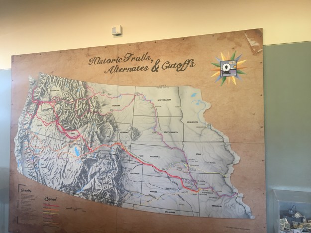
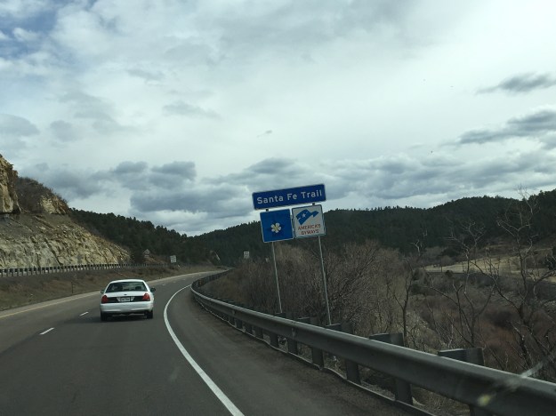
In the early to mid 19th century, brothers William and Charles Bent, of Saint Louis Missouri, actually believed that it was possible.  Early in life, these brothers participated in a series of trade missions along the Santa Fe Trail.  As the Bent brothers encountered both Mexicans and Native Americans on these missions, over time they established good relations with both groups of people.  William Bent was even accepted into the Cheyenne tribe, and participated in negotiations on their behalf.  This included negotiations with other native tribes, as well as with the United States. The two brothers, along with Ceran St. Vrain established a trading fort in what is now Southeastern Colorado, along the Santa Fe trail.

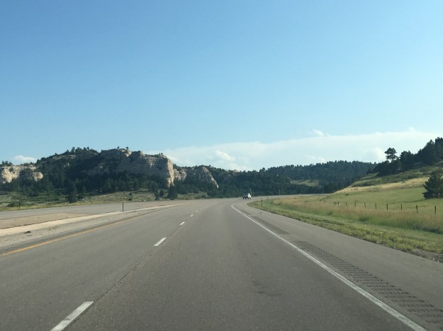
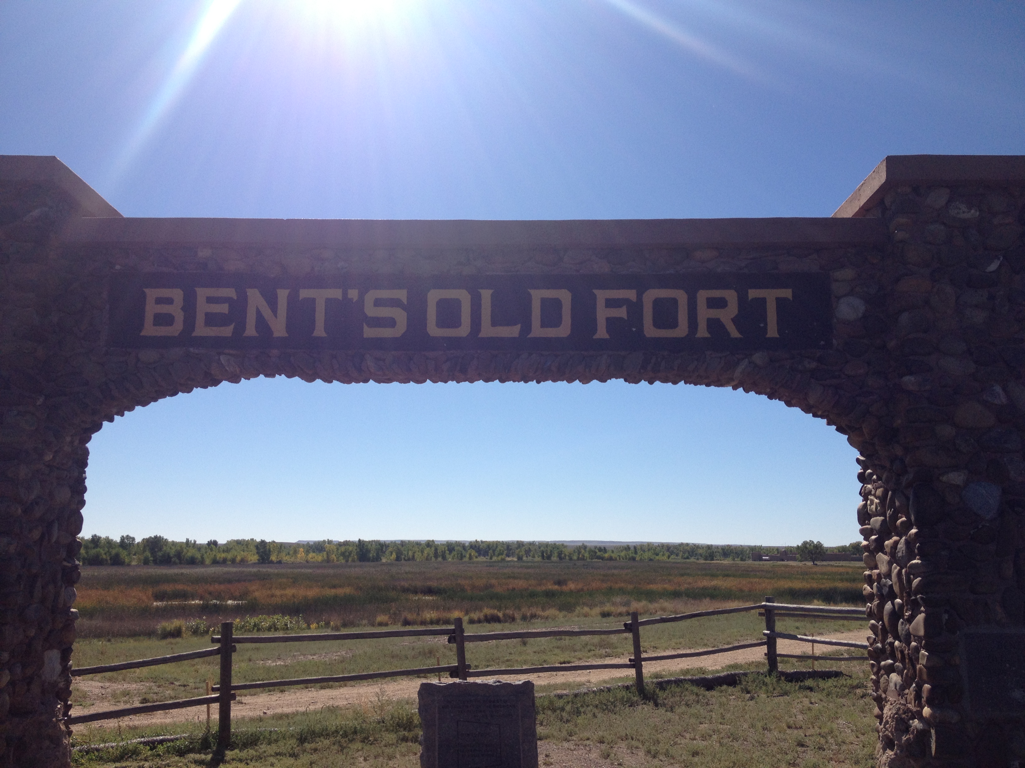
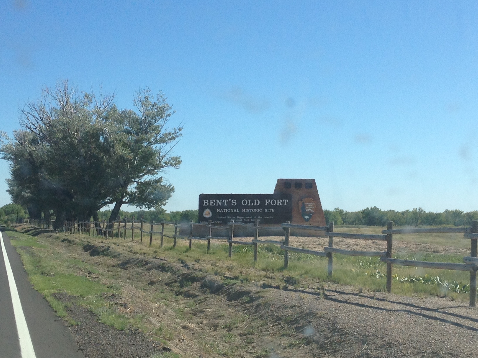
For this reason, I decided to make the trip to Bent’s Old Fort, but I ran into one minor issue.  Apparently, I did not realize that Bent’s Old Fort is a National Historic Site, and therefore is closed due to the current government shutdown.

IMG_1111 photo

So, I did the only sane thing.  I pulled my car off to the side of the road (the parking lot was also closed), and I snuck around the gate.  Heck, I didn’t have to pay the entry fee!

IMG_1115 IMG_1116

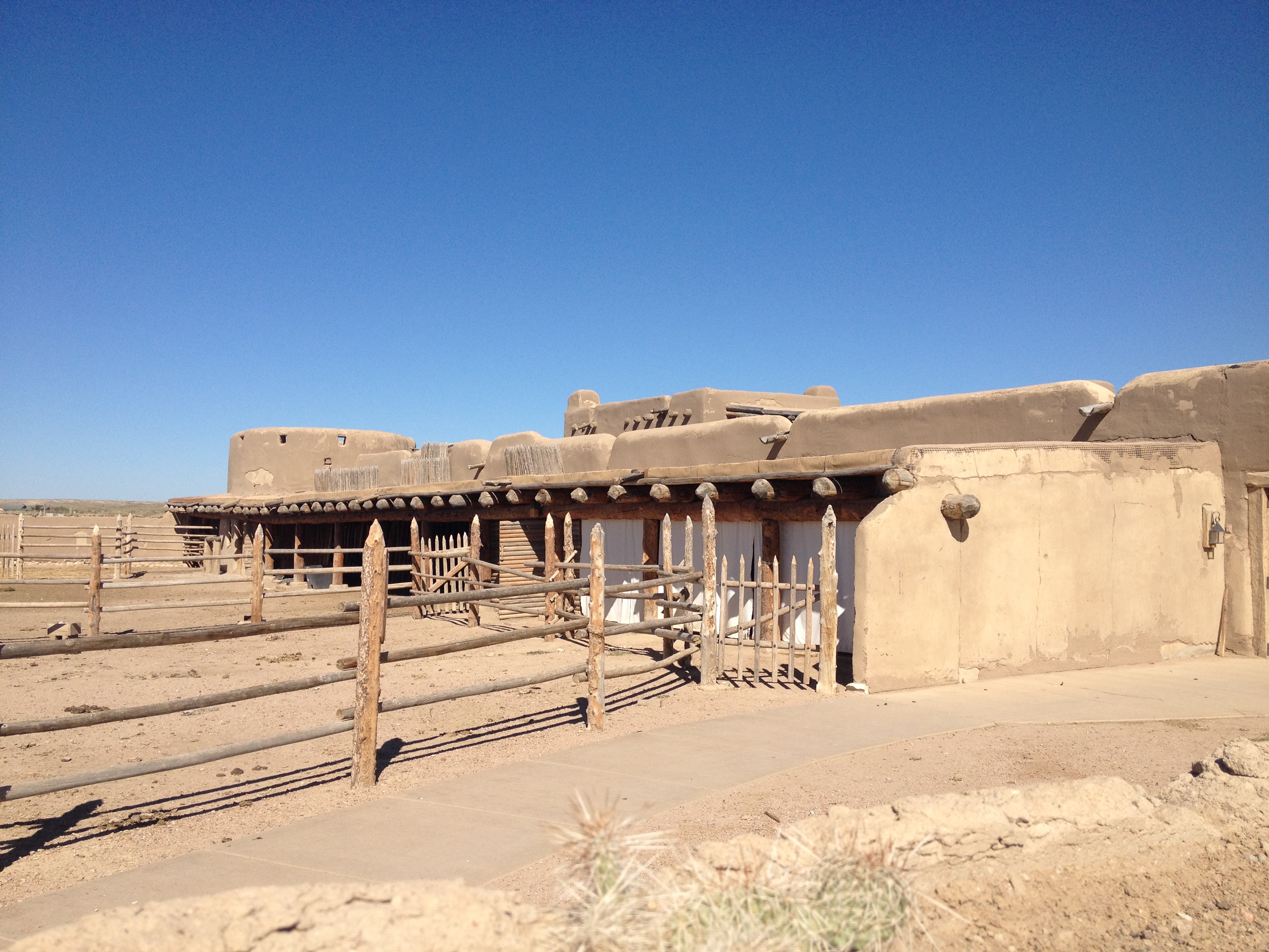
The fort is reconstructed really well.  I should probably come here sometime when I could actually get inside the building.  And also when the bulls and horses that are kept there are contained rather than wondering around where I could have theoretically provoked them and wound up in trouble.  In fact, that is why I did not stay very long, and did not take any pictures of the animals and the trail.  I was, however, able to imagine what it was like for pioneers and traders to travel along this trail, and encounter this fort, the first building of any sort travelers along the trail would find for miles.  And, according to the information presented in the parking lot, which I did get to read, from 1833 (when it was built) through 1849, this place would have been bustling.  Surely, a welcome sight for travelers.

IMG_1113

One question that often comes to mind when learning about Bent’s Fort, is why it was placed where it was, near La Junta, Colorado.  Currently, most of Colorado’s largest cities are a lot closer to the mountains, within 20 miles or so.  From the perspective of modern day Colorado, it appears illogical for this major trading post to be located over 60 miles east of Pueblo, the mountains, and all of the good fur and pine.   However, at the time Bent’s fort was built, 1833, it was built right on the border with Mexico.  For someone traveling west on the Santa Fe Trail, this fort marked the end of the portion of the trail in the United States.  After this, travelers would have entered Mexico, or, after 1836,  the Republic of Texas.

Unfortunately, both Bent brothers ended up on the wrong side of history despite their good intentions.  Actually, it was perhaps because of their good intentions.  Charles Bent, the older brother, was appointed the first territorial governor of New Mexico following the Mexican-American war.  The reading material outside the fort suggested that he was appointed to this position due to his good relations with the people there.  However, he was killed by the Native Americans in the Taos Revolt in 1847.

The younger Bent brother, William, was persecuted by the other side.  During the Sand Creek Massacre, he was captured by General John Chivington after attempting to make peace between the U.S. and the Native tribes during the gold rush.  He was forced to lead Chivington and his troops to the Cheyenne campsite where he conducted the Sand Creek Massacre, killing hundreds of Native Americans.  William’s end was not nearly as dramatic as his brother’s, but his efforts failed to create peace between the U.S. and the Native Americans.

The story of the Bent family and their fort reminds us that it is important to judge everybody as an individual, and not paint every member of some group with one brush.  Throughout this time, there were definitely more white people like Chivington, who murdered natives despite their efforts to make peace, and also more white people like the Bents, who approached native tribes with deep respect for their culture, and attempted to share in the human experience with them.  There is more to who someone is than their racial identity.

Just in case the lines were not blurred enough in this whole story, John Chivington was a hard-core abolitionist.  He could not wait to free the black population and share our culture with them.  Yet, he viewed all Native Americans as savages that needed to be exterminated.  On the flip side, the Bent brothers owned slaves, and William would eventually support the cause of the confederacy.  So, there is a group of people out there who would potentially view Chivington in a more favorable light than Bent.

So, who is the good guy and who is the bad guy?  People like to simplify history, assign one side ad good the other as bad, and establish one or two themes.  This makes them feel like the have a good handle on the situation.  However, in reality, history is about as complicated as the human mind, and all of the many mechanisms that cause people to behave in the way that they do.  Some people may know more individual facts about history, but that does not necessarily mean they understand history better.  Some people view all facts through the lens of a preconditioned idea about the nature of the people involved, and cannot appreciate all of the facts.

IMG_1120 IMG_1123

One amazing thing about traveling is that travel has this way of causing people to build upon their thoughts.  Sometimes it almost feels as if the world has found a way to set itself up in such a pattern that it creates certain themes in everybody’s lives, or at least each person’s individual trips.  After pondering these thoughts on the drive from La Junta back to the interstate, the drive home took me through two towns that recently made waves in our current political climate; Pueblo and Colorado Springs.

Last month, these two towns made news across the state as they surprising recalled two of Colorado’s state senators.  One of them was actually the leader in the senate!  The recall election was at least partially about the gun control debate, but other factors may have contributed.  Advocates on each side of the debate appeared, at least to me, to be motivated by ideological differences rather than some form of tribalism.

But is it all just ideology?  Have we really replaced racial issues with actual issues about how we view our government and society (which would be a positive change)?  Unfortunately, last year’s election results, and specifically the large difference in voting patterns by race indicates differently.  Race also still finds it’s way into may of the political debates we have in this country today.  I am not going to assign blame to either side on this one.  This is not a partisan political blog.  But, pondering the racial component to our politics, the self-segregated neighborhoods in Chicago and other places, the Indian Reservations and the like, makes me think that we are not really living side-by-side the way the Bents had envisioned.  The middle of the 20th century saw a major push towards that end, with Matrin Luther King’s I Have a Dream speech articulating that goal in a manner that most can relate to.  But, there does still appear to be a disconnect.

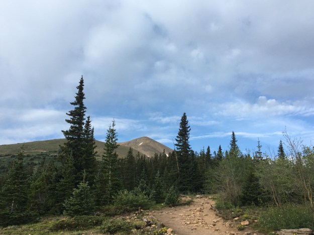
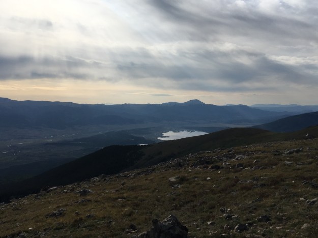
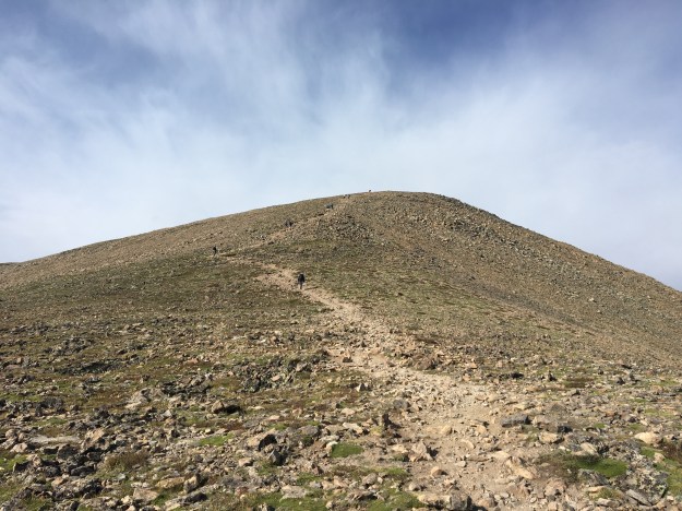
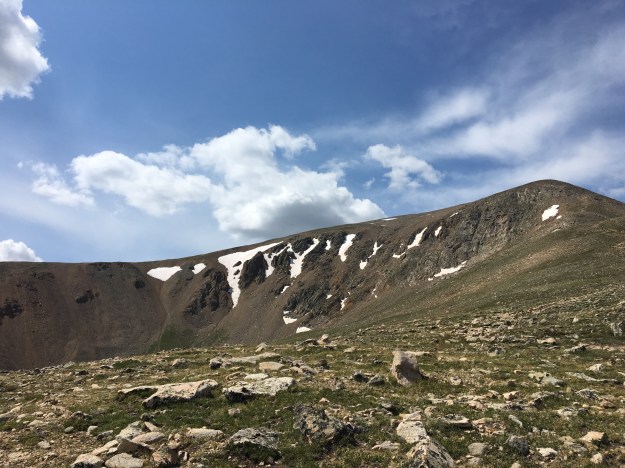
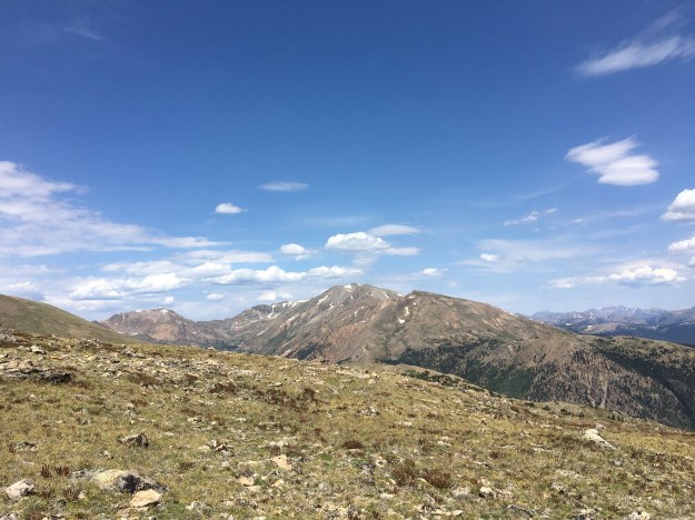
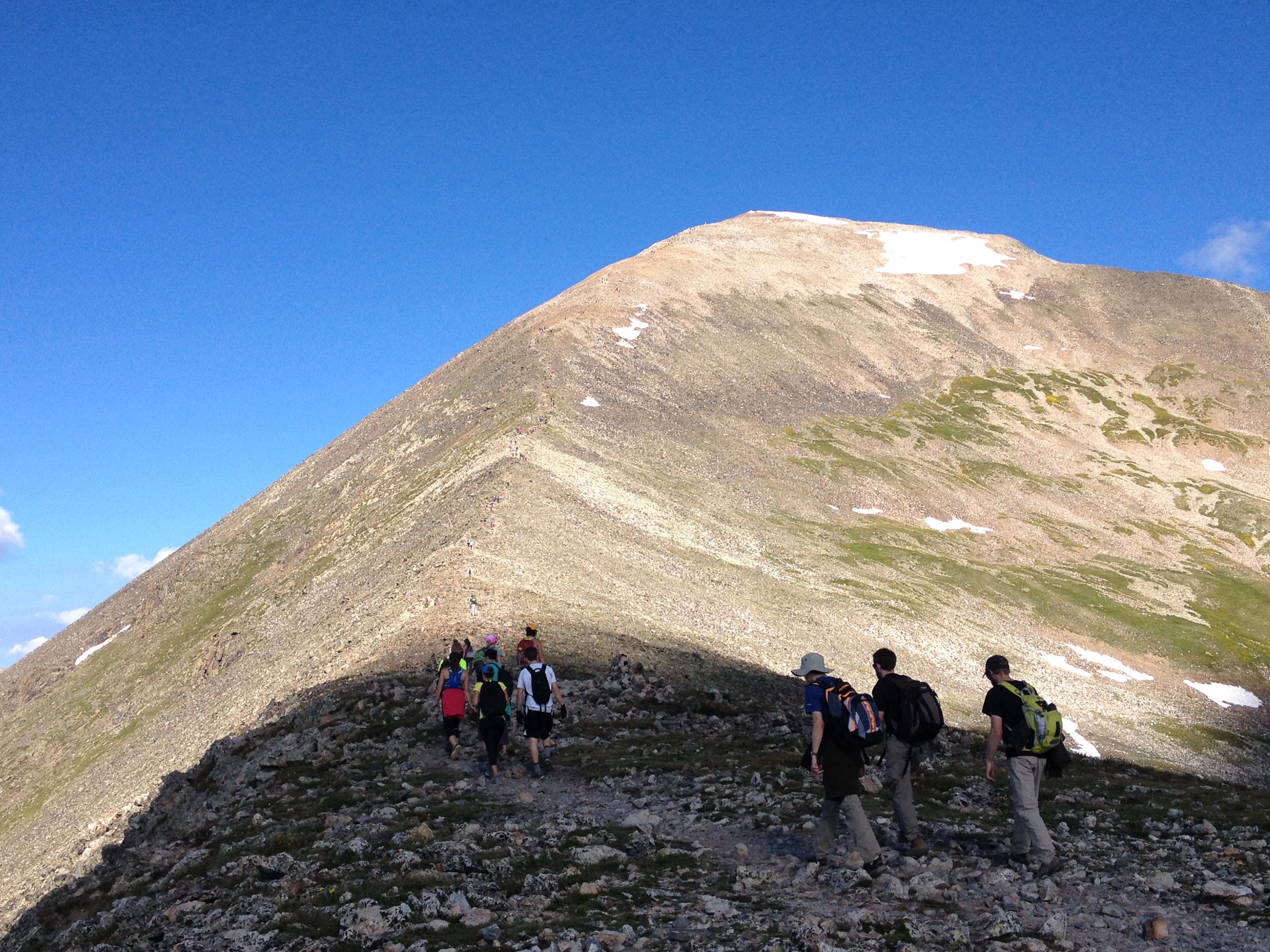
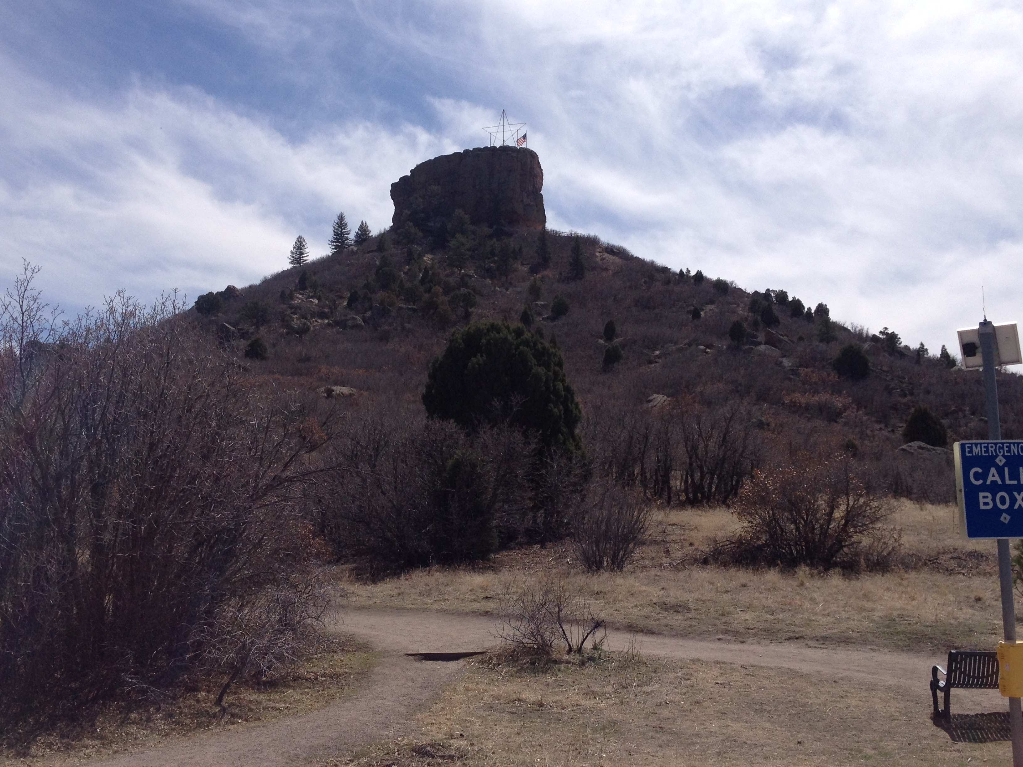
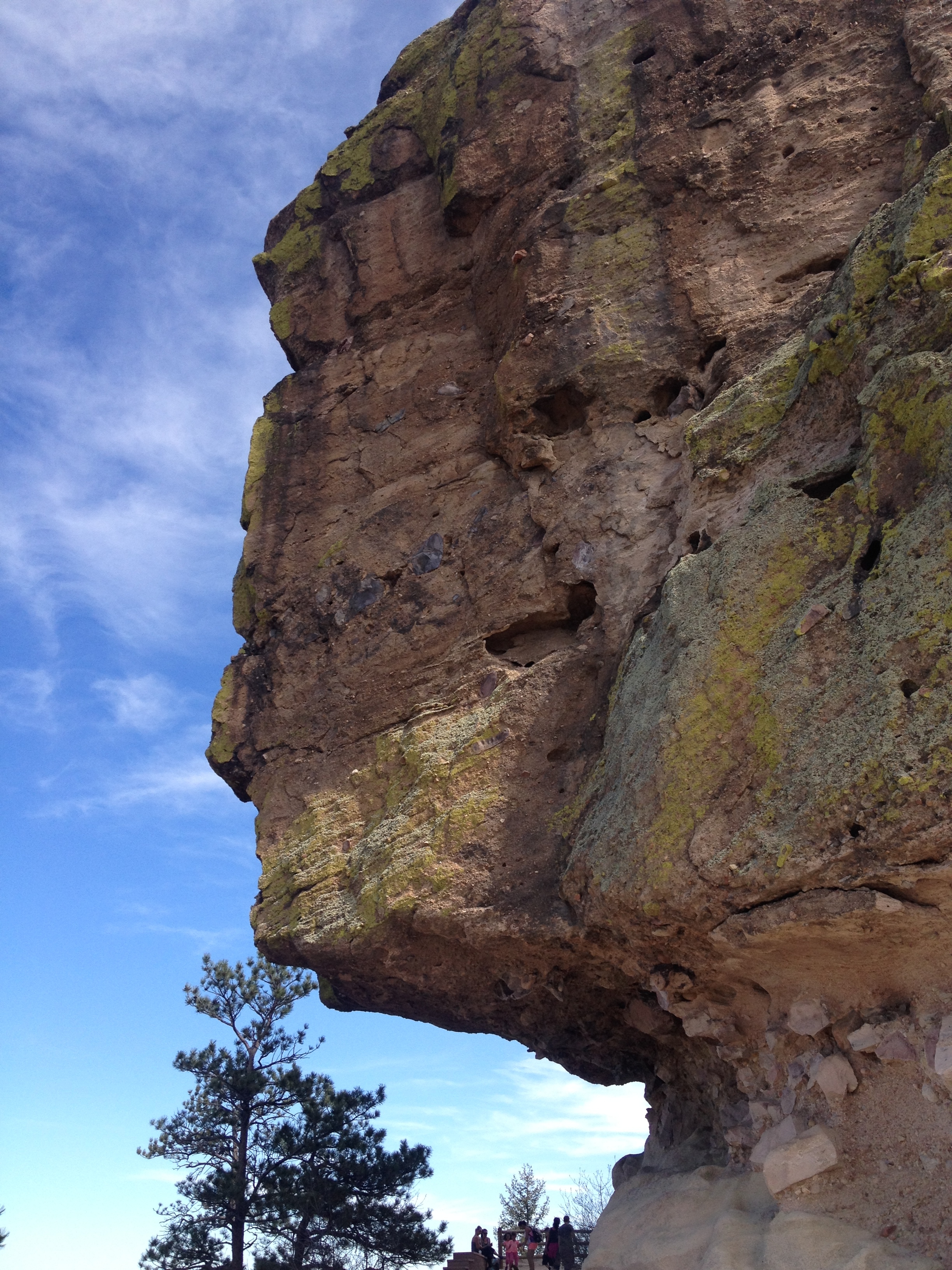
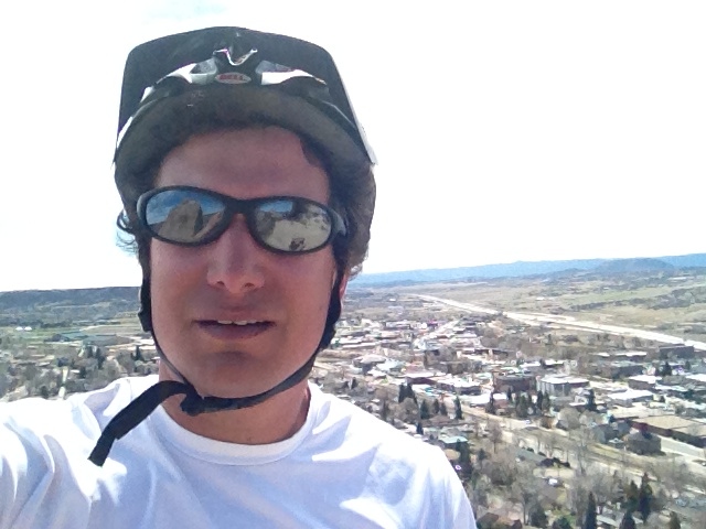
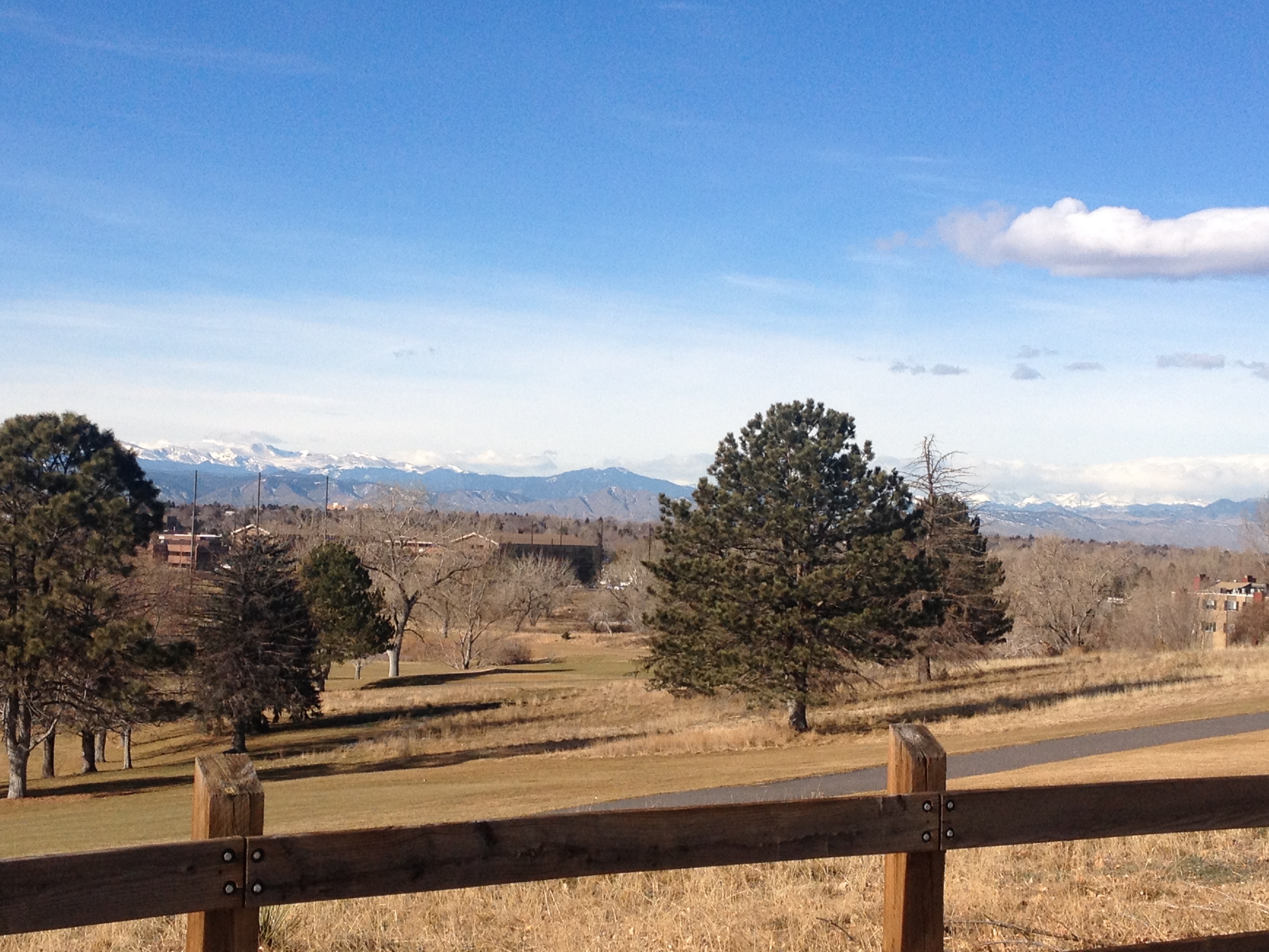
Tribalism is an inevitable part of human nature.  But will our “tribes” always be dictated by our origins?  The internet now provides us access to nearly everybody around the world, and more and people are moving more frequently.  These factors may encourage our future “tribes” to be more determined on different grounds, such as worldview, or common interests.  But, would this be better?  Less disconnected?  Less violent?  Maybe the key is not how we determine our “tribes”, but having respect for other “tribes”, or at least letting them live the way they want to as long as they are not hurting you.  This is a tall task for the human race, but one that is theoretically possible.  All challenges can be met, like the one below, Pike’s Peak, which I got one last view of before it once again becomes snow packed tomorrow (which is fine, it looks better with the snow on it anyways).  A mountain whose peak was once unreachable, is not reached by People on foot, in their cars, and by the cog railway.

IMG_1125