Category Archives: New Mexico

Cycling The Enchanted Circle

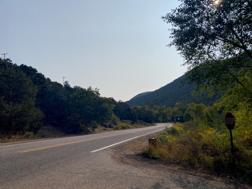
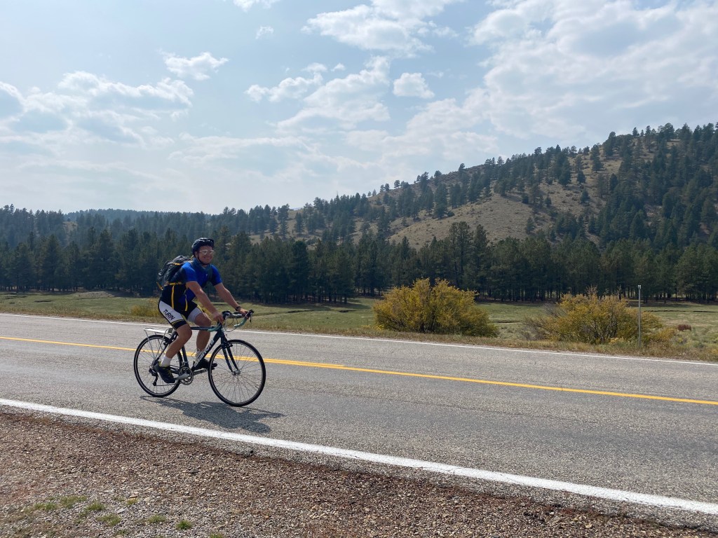
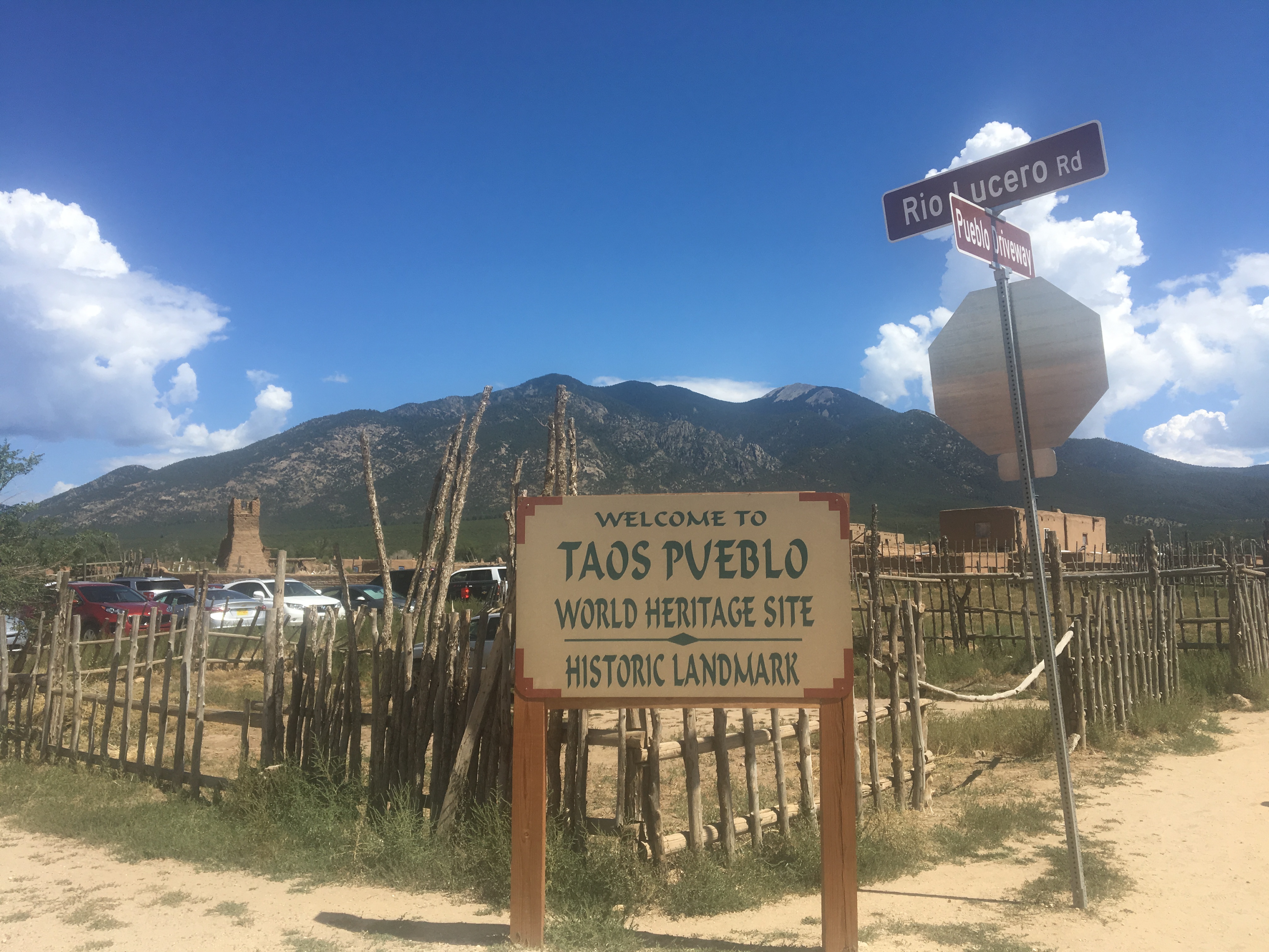
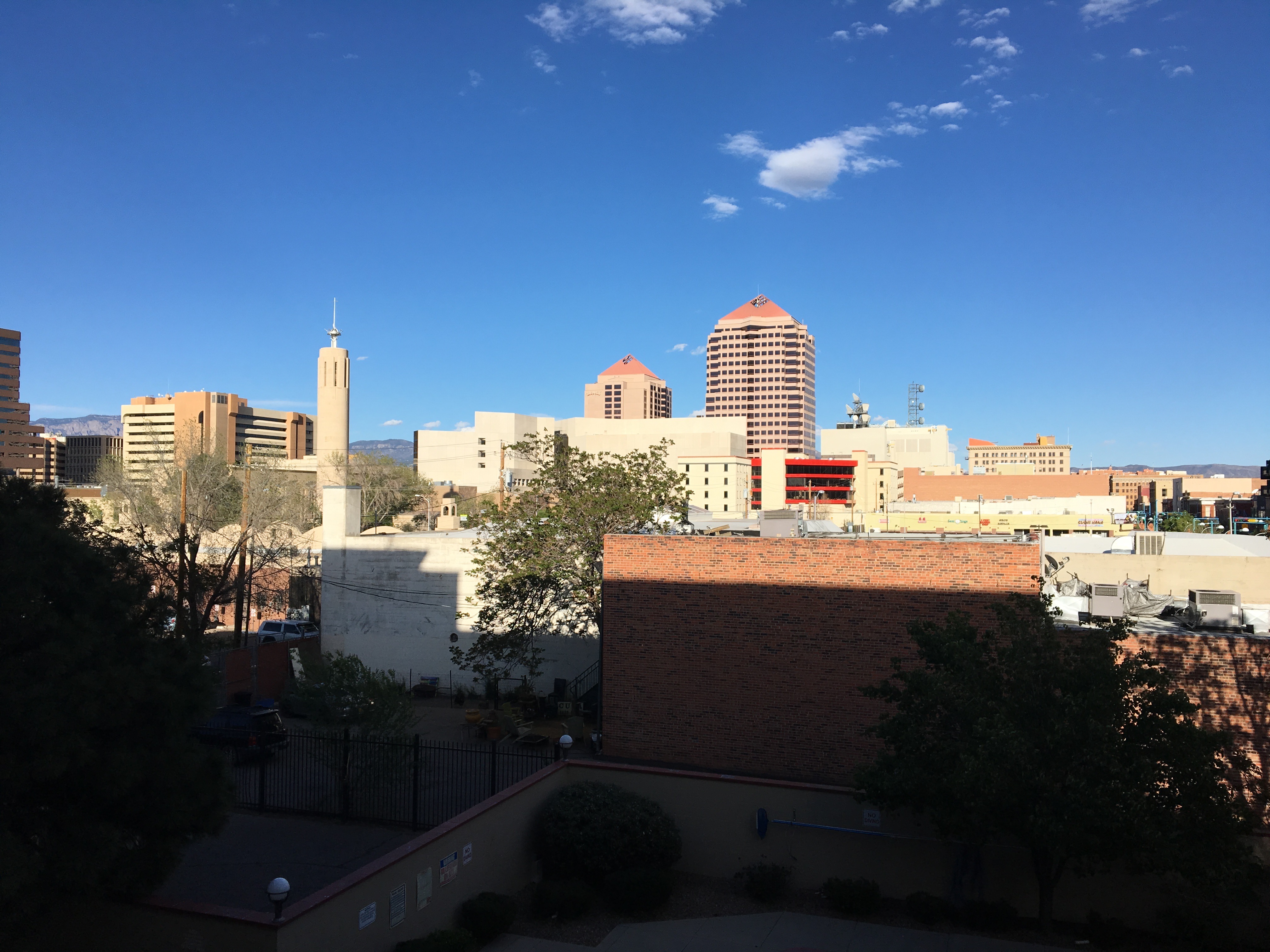
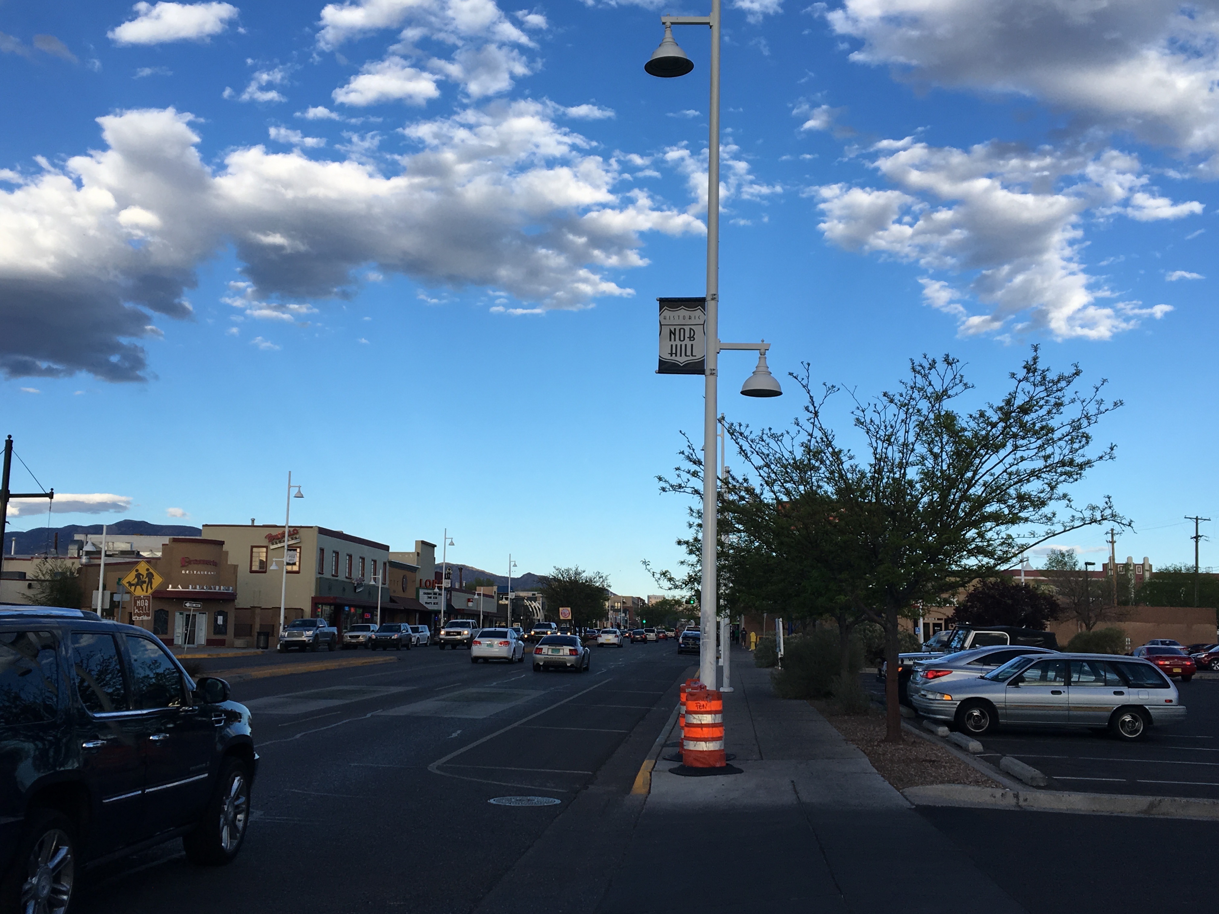
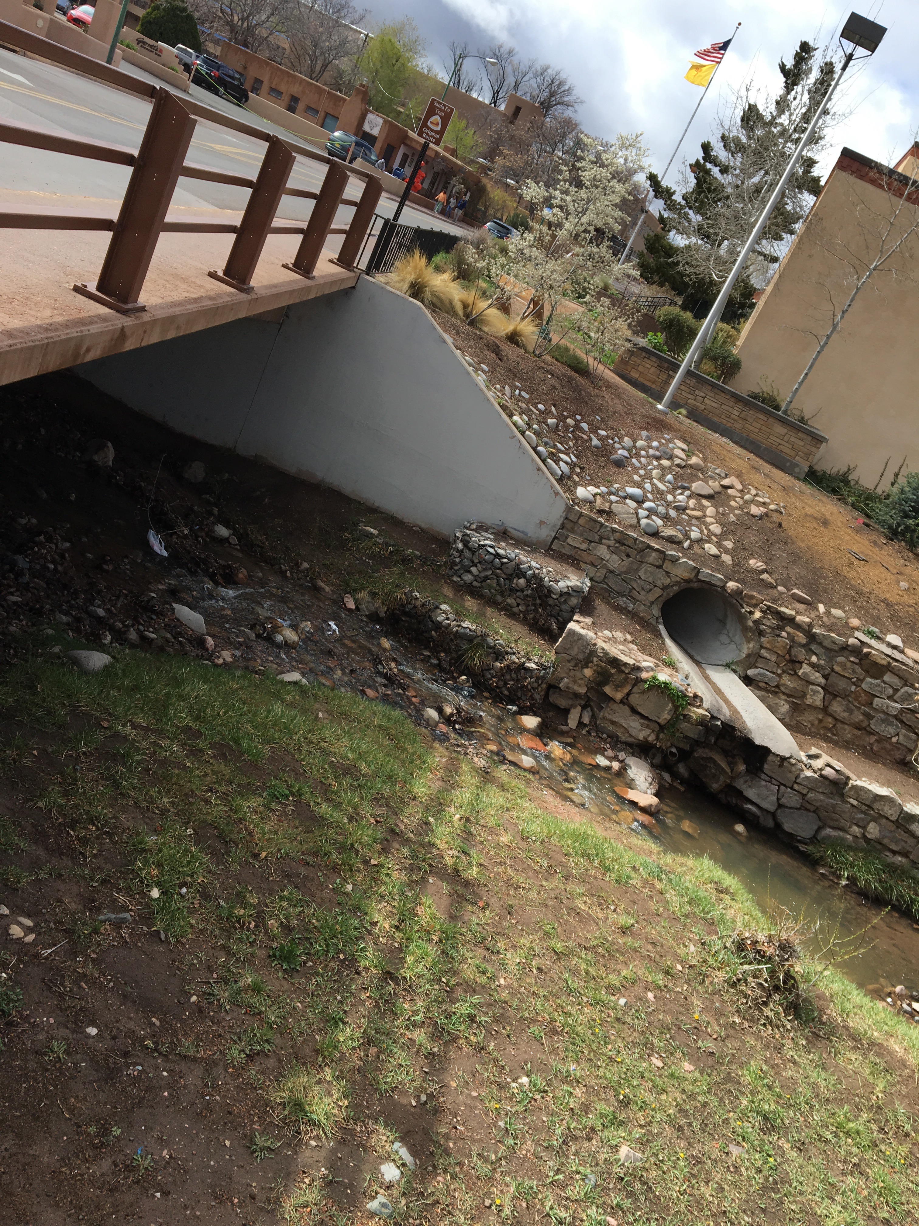
The enchanted circle can be an intimidating bike ride for two reasons. First, it is challenging. It’s an 84 mile ride with a total of over 5,700 feet (1.75 km) of climbing. There are also a lot of sections where the road has no shoulder. A road with significant traffic and no shoulder can feel quite dangerous on a bicycle. Maybe I’m spoiled by typically riding in Colorado, with roads that are typically more bike friendly. According to the League of American Cyclists, Colorado ranks as the 7th most bike friendly state in the country, while New Mexico ranks 44th.

Like this bike ride, life has tons of opportunities that are both risky and potentially rewarding. A lot of people lose out on so much that life has to offer because they avoid endeavors that cary significant risk. For me, the Enchanted Circle bike ride became a microcosm for how we are meant to approach these important opportunities. I would not let the apparent challenge and the apparent danger stop me from doing the ride. However, it is good to be mindful and smart about the risks we take. With any potentially risky endeavor, there are actions one can take to minimize the downside. For me on the Enchanted Circle, it meant trying to face as little traffic as possible on the most potentially dangerous part, U.S. highway 64. So, I started the ride early, around 9 A.M., and rode the circle in the counter-clockwise direction, starting east out of Taos on 64.

As I’d hoped, there was very little traffic. There were even times where I completely forgot I was on a U.S. highway. The highway kind of took on the feeling of an empty country road, which was fantastic.

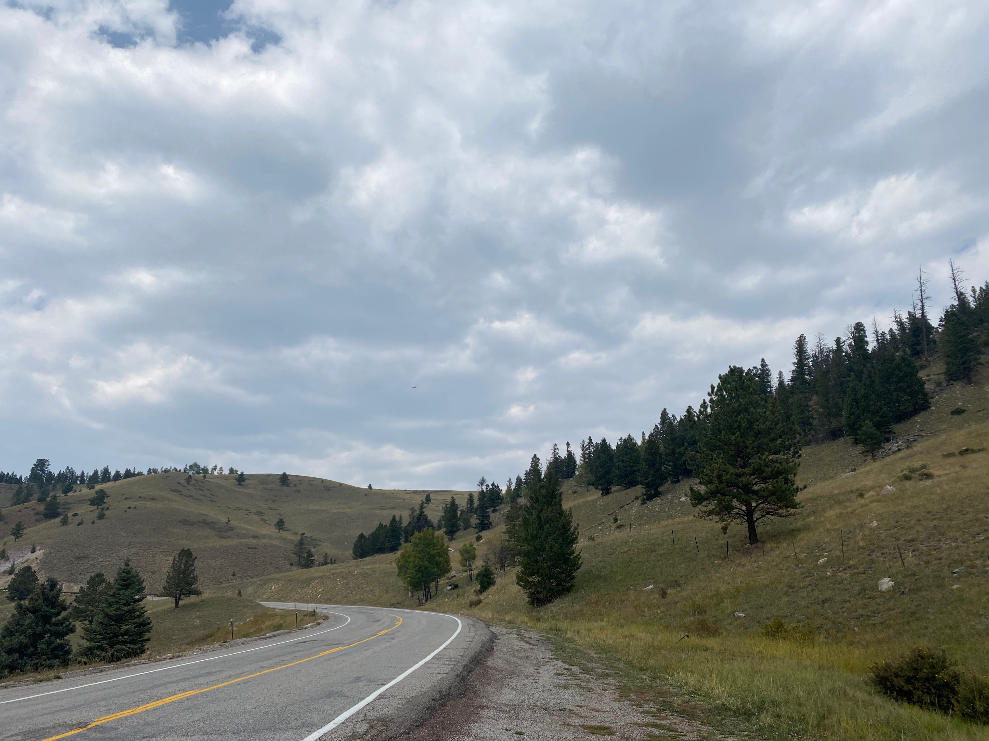
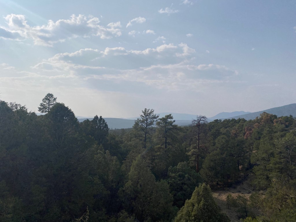
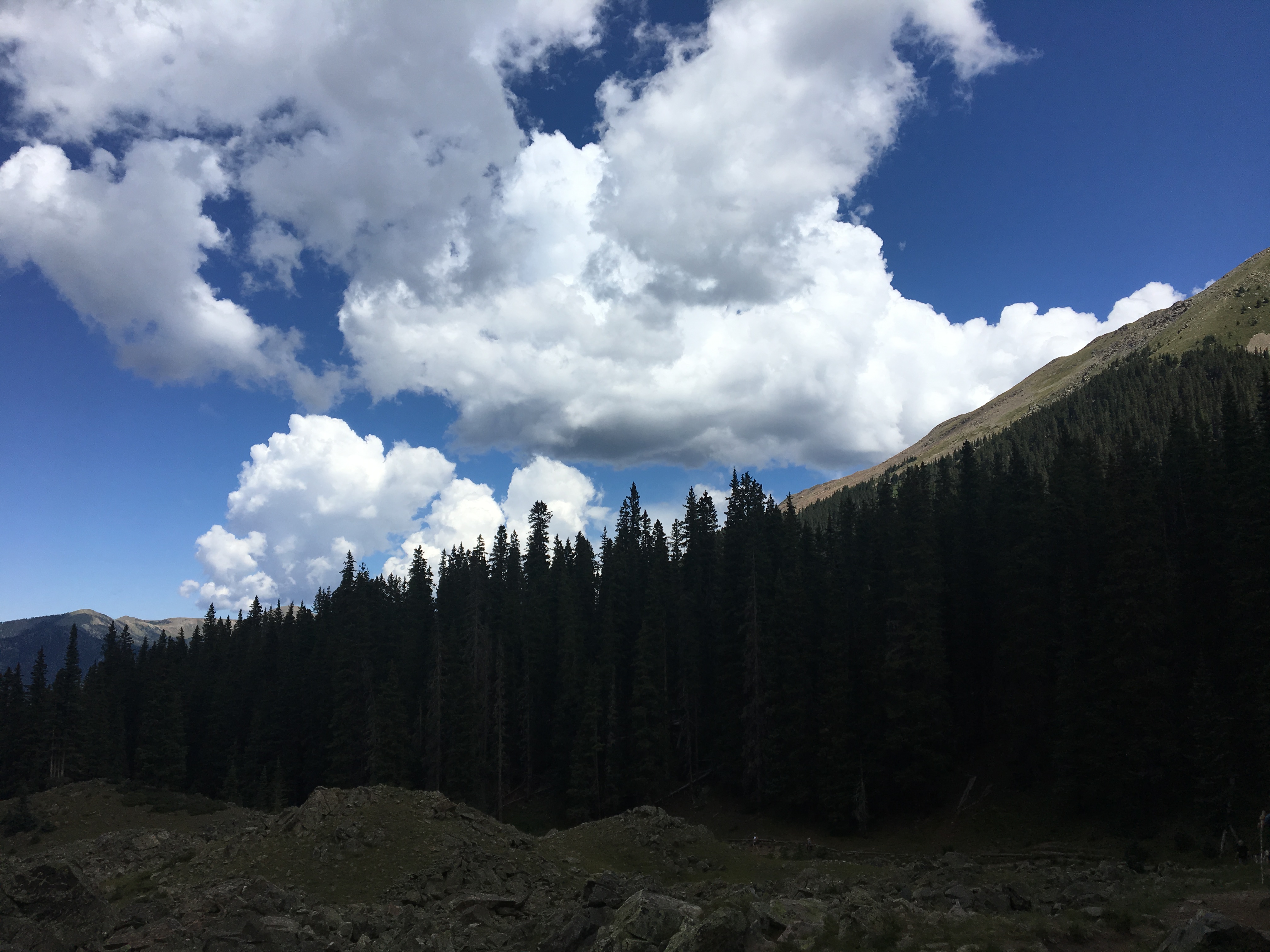
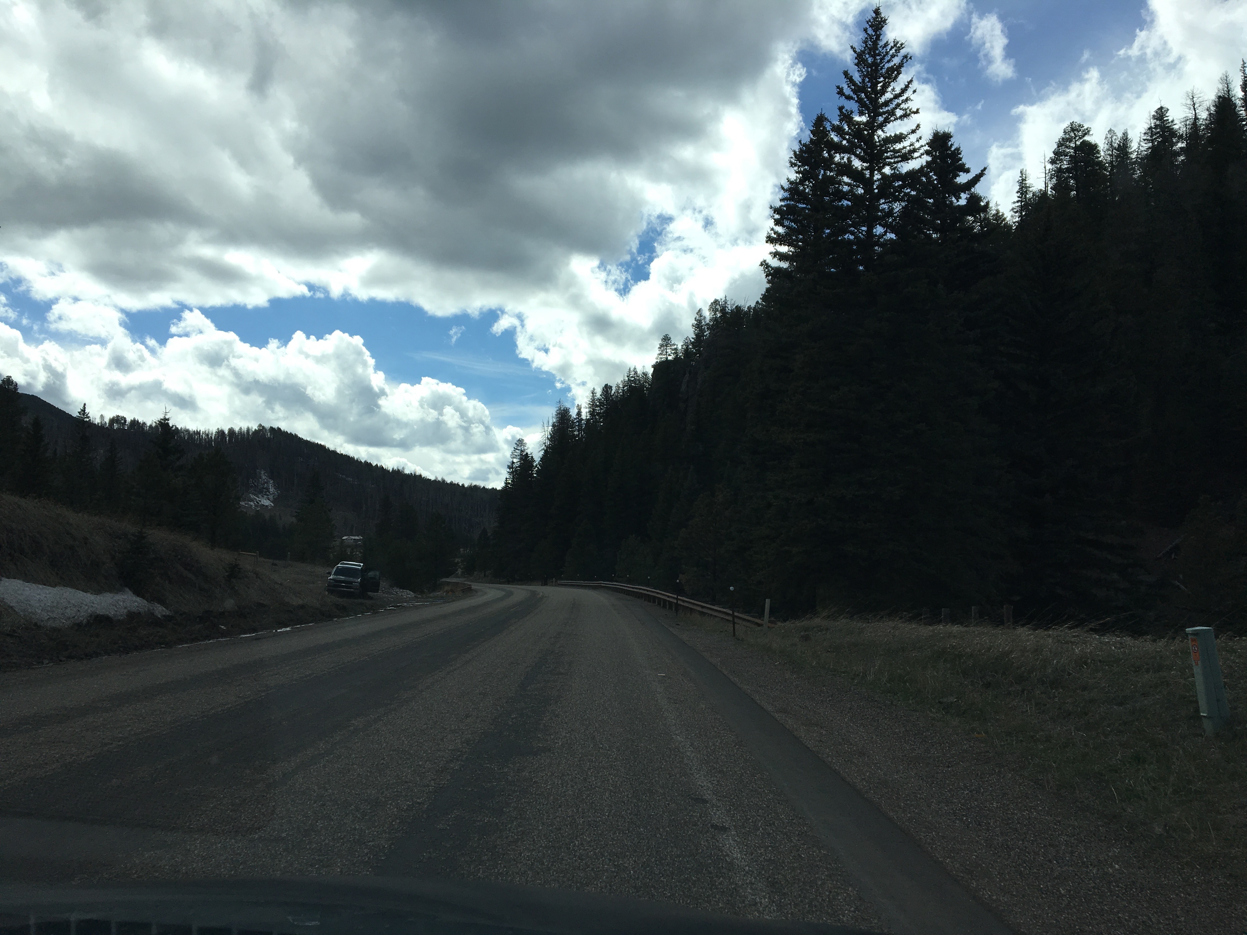
The 18 mile moderate climb from Taos to Palo Flechado Pass wound through the Carson National Forest. I truly felt enchanted, right from the start of the ride. Around each curve was a new sight to behold: Trees just starting to change colors for the upcoming fall. Birds flying through the air. Horses grazing on open land. New mountain peaks appearing on the horizon.

I could not help but smile for most of this segment. The climb is not even steep enough to cause too much exhaustion.

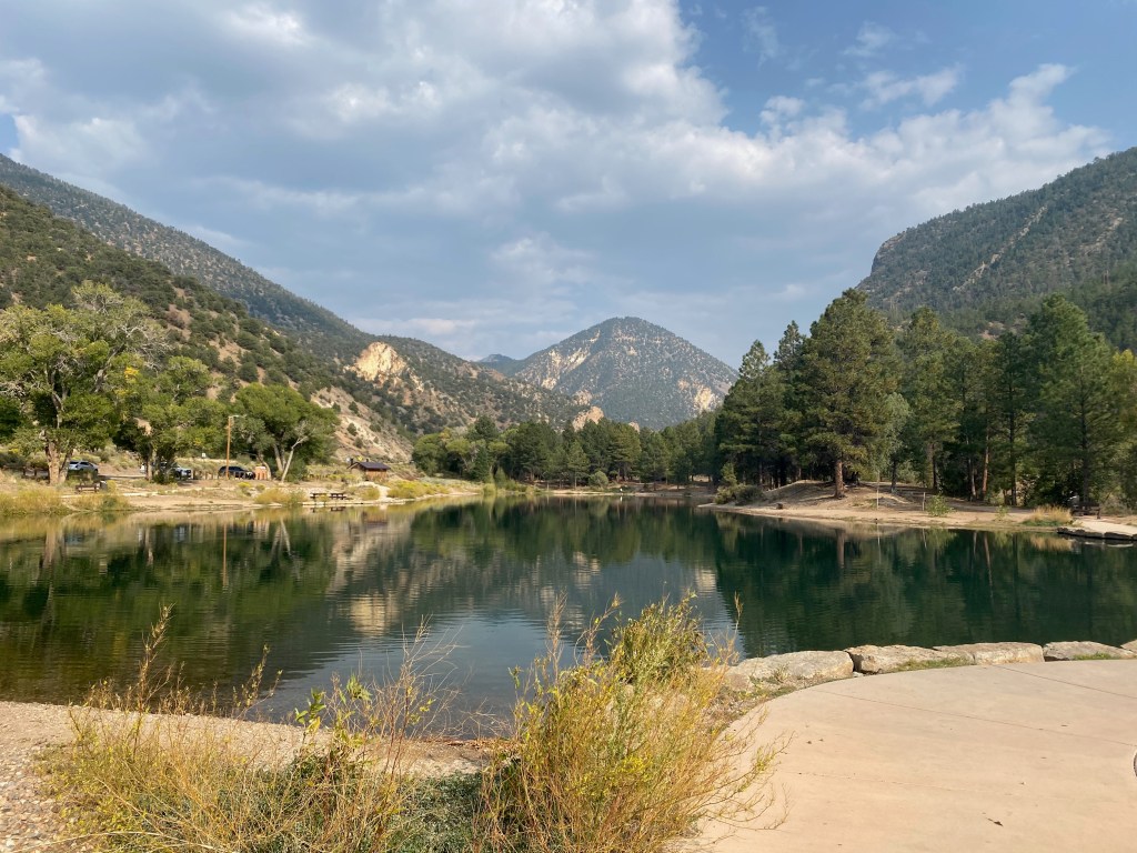
After this climb came a quick 700 foot (210m) descent into Angel Fire, home to one of several major New Mexico ski resorts along the Enchanted Circle.

Due to smoke from wildfires in California and Oregon, I was unable to see Angel Fire ski resort from the road. However, I would later get the gist, as one of the locals I would speak with in Eagles Nest would describe this resort as “a ski resort without apres”. It sounded like an interesting family oriented experience.

The next stretch of road, from Angel Fire to Eagles Nest, was perhaps the most comforting, being flat and having the widest shoulders of the entire loop.

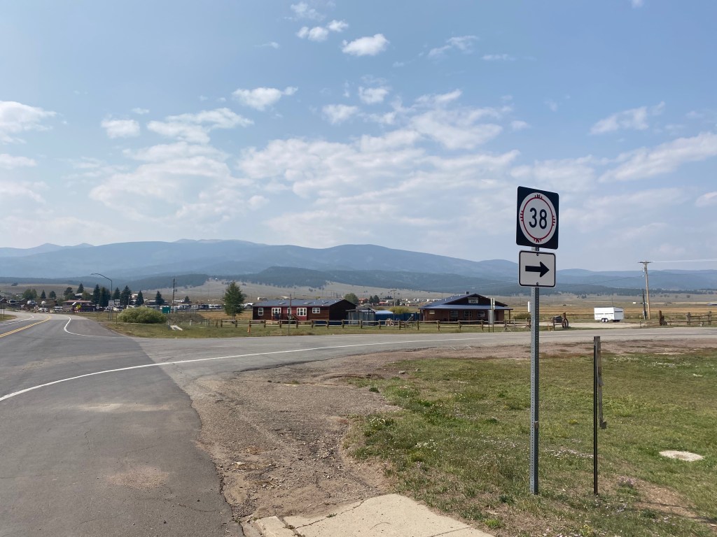
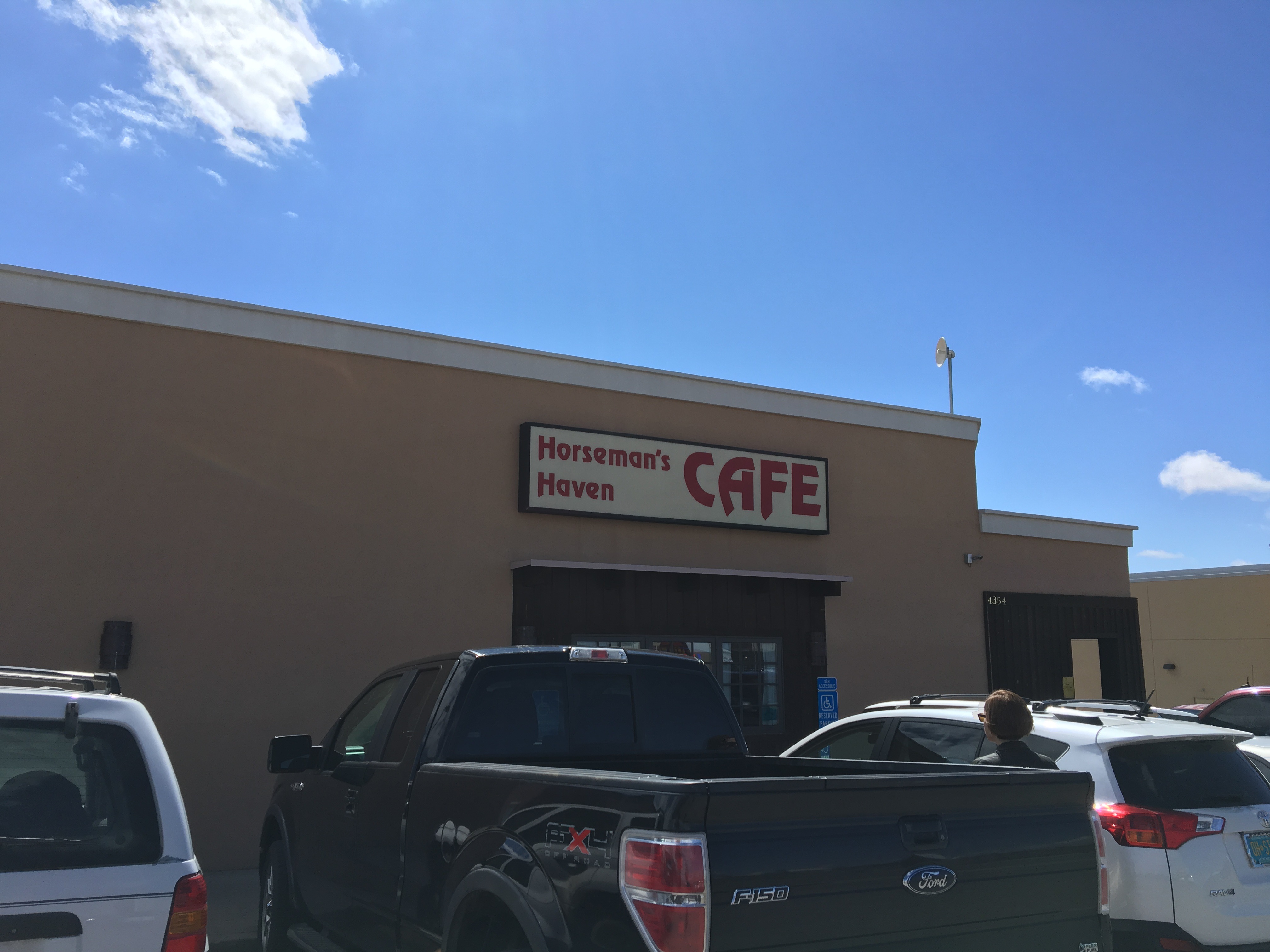
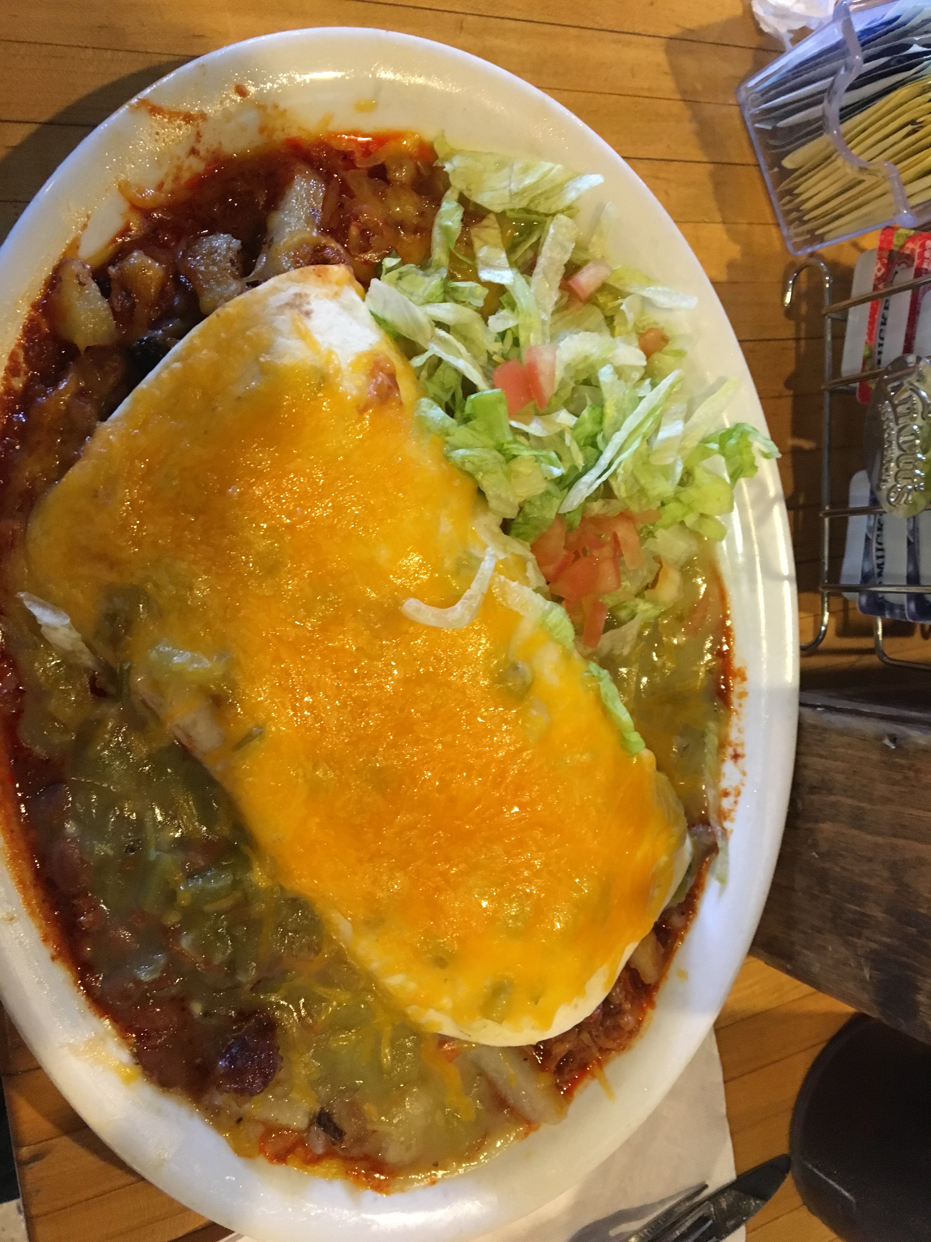
I grabbed some food in Eagles Nest, interacted with some of the locals and then turned onto highway 38 for the next segment.

Highway 38 is a mixed bag. There is no shoulder, but traffic is pretty light. Of the cars I did encounter, this is where I felt the most scared. On a few occasions, I was frightened by being passed at high speeds by vehicles that did not move too far over.

The climb starts gradually, passing by a ghost town called Elizabethtown. A woman I had talked to in Eagles Nest told me this town was so easy to miss I would “miss it if I blinked… while riding uphill”.

Then comes the most challenging ascent of the ride, to the top of Bobcat Pass, the ride’s highest point.

This part turned out to be quite steep. I had received some encouragement regarding this bike ride at the Eagles Nest Cafe. One patron even let me have one of her onion rings. However, when I told people I was doing this ride, I also did hear “I’m exhausted just thinking about you riding up Bobcat Pass”, as well as “If my son were to tell me he wants to do this ride, I’d urge him not to.”

I took the downhill at 35 miles per hour (56 km/hr).

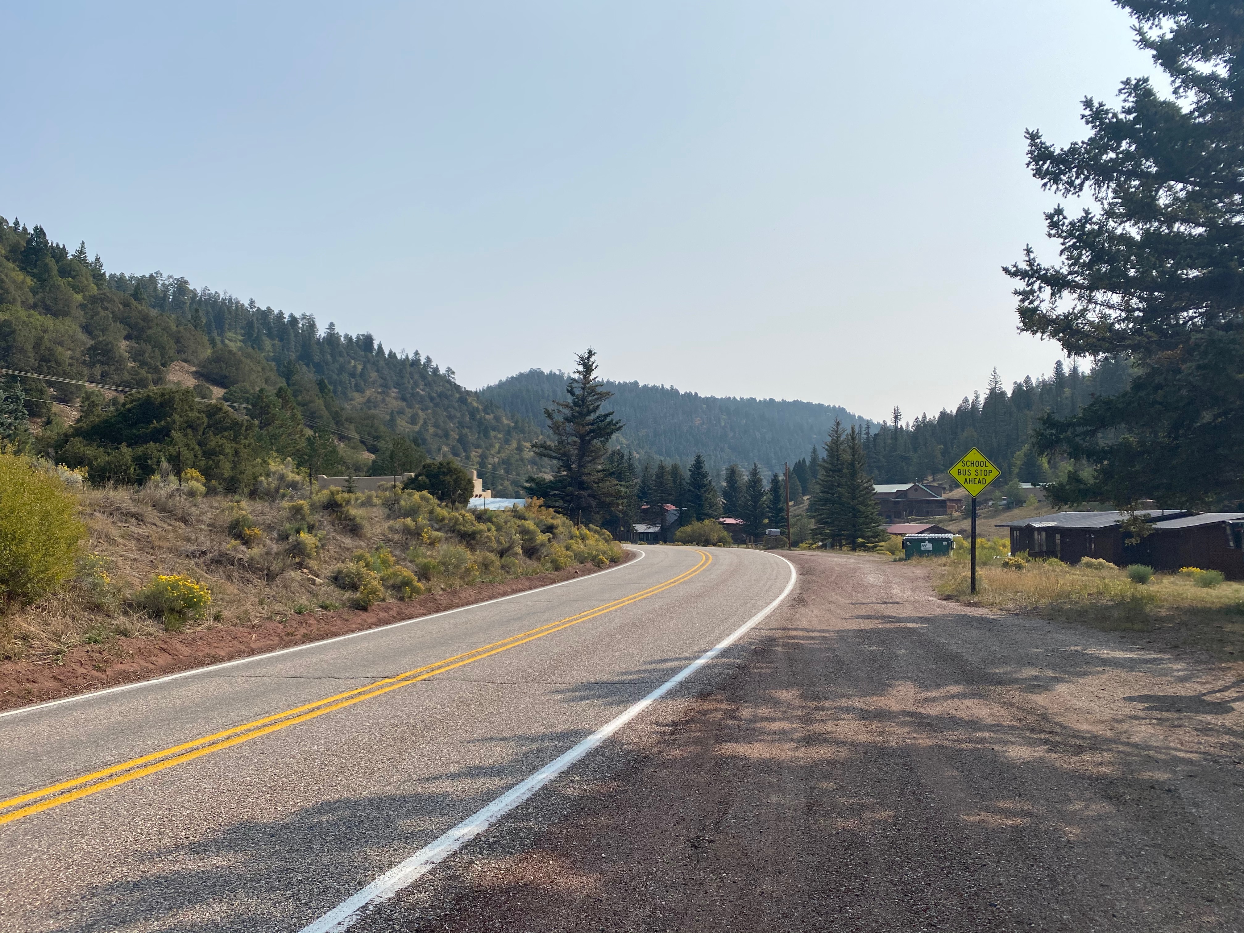
And quickly arrived in the town of Red River.

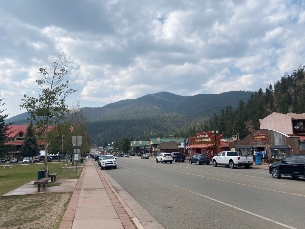
Red River, home to yet another ski resort, felt like your quintessential touristy mountain town. It felt reminiscent of Lincoln, New Hampshire, a town I rode through several years ago, also while on my bicycle tackling challenging mountain passes.

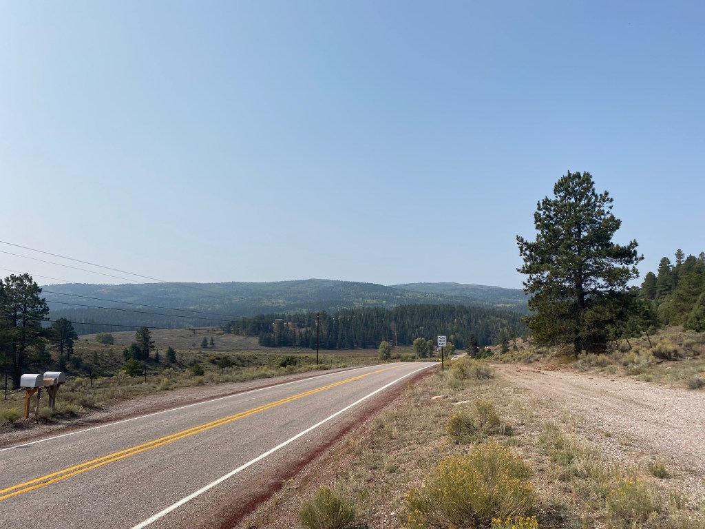
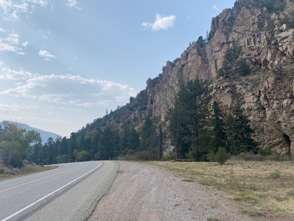
Continuing west on highway 38 was a beautiful descent from Red River into Questa.

Like the initial climb out of Taos, this descent was not quite as steep, winding through the forest, and by some other unique natural features over the course of 12 miles.

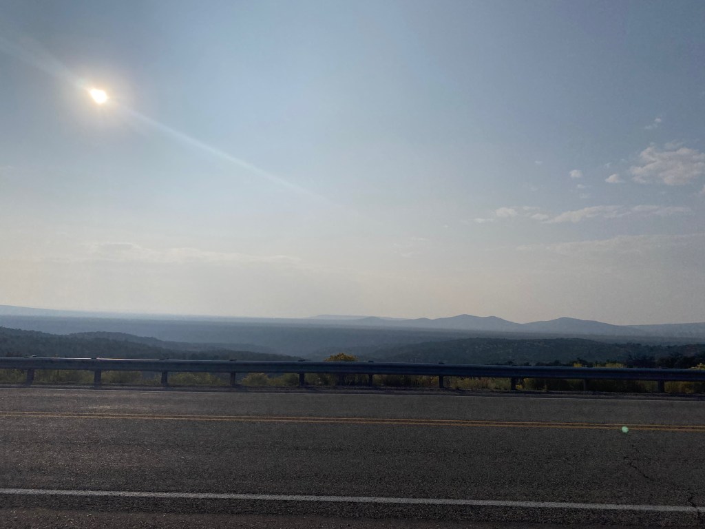
The final 20 miles of the ride follows highway 522 back towards Taos. While this section has some rolling hills, it stays in the valley to the west of the Southern Sangre de Cristo mountain range. On this part of the ride, I saw the mountains from a whole different, and more broad, vantage point.

The rolling hills on this last part of the ride are not nearly as big as the major passes I’d rode up earlier. However, having already rode 70 miles and pedaled up Bobcat Pass, they were enough to exhaust me.

Like many of my previous exhausting bike rides, I ended the day physically exhausted but spiritually rested. It also came with another form of spiritual satisfaction, having properly persevered despite some less than ideal conditions. The manner in which I approached this ride allowed me to enjoy the upside of the experience (the satisfaction of the ride, the scenery, the interactions with the locals, etc.), while being smart enough to minimize the downside (the risk of riding in high traffic with no shoulder).

Taos Pueblo: A Trip Back in Time

New Mexico is a fascinating place. In many ways, it feels both old and new at the same time. Santa Fe is one of the oldest cities in North America.

IMG_5647

From a U.S. perspective it is associated with the new. It is the 47th State, having only achieved Statehood in 1912. When the Eastern States had well established State identities and were lining up to take sides in the Civil War, New Mexico was part of a large open area thought of as the Wild West. It’s rugged terrain still suggests that to this day.

IMG_8036.JPG

Taos Pueblo is a part of New Mexico’s older heritage, having been around for over 1,000 years. It is here that Native American tribal people still practice the culture of their ancestors.

IMG_8040.JPG

Taos Pueblo is only several miles to the Northeast of the town of Taos. Admission is $16, and volunteers give free guided tours of the Pueblo (tips recommended). Visiting the Pueblo without taking the guided tour would not do justice to the experience. The tour guide on this particular day was a cheerful father of two who is currently getting an English degree from the University of New Mexico- Taos and was happy to talk about the Pueblo and answer any questions tourists might have.

IMG_8054.JPG

Life in the Pueblo sounds quite a bit like life in the Amish country. Within the Pueblo, there is no plumbing or electricity. Much like the Amish, they have a communal living situation that involves a lot of hard work that those outside the village have delegated to technology decades to centuries ago.

IMG_8046.JPG

The most significant difference between life in the Pueblo and the life of the Amish is that they do often engage with the outside world. The tour guide indicated that many of the Pueblo’s residents pursue higher education or careers in the military. Taos being a very artistic community, one of the residents became a famous artist and travels quite frequently to sell and talk about her artwork.

IMG_8043.JPG

While there is not plumbing or electricity within the Pueblo, cars can be seen all around, which the Taos use to travel outside the Pueblo. While the residents of Taos Pueblo practice ancient cultures, rituals and gender roles within the walls of the Pueblo, when they go forth into the outside world, they often behave quite a bit like everyone else does in the modern world.

The way of life is also distinctly Native American. The river that runs through the Pueblo is considered sacred, visitors are advised not to touch it.

IMG_8051.JPG

They also all use the traditional stove, called the Horno (pronounced like the Spanish word orno), to cook their food

IMG_8049.JPG

With everyone’s horno outside, it suggests a lifestyle that involves much more time outdoors.

Spiritually, they practice a hybrid faith between the ancient religion of the Taos people and the Catholicism that was forced on them by their Spanish conquistadors.

IMG_8041.JPG

As is the case with many Catholic communities, the church serves as a community center. However, rather than Jesus, they place the Virgin Mary at the altar. Their patron Saint is St. Geranimo, a man who refused to join the Catholic church until he was permitted a certain amount of individual autonomy behind his methods of worship and study. One of his oddest preferences; He preferred to pray and write naked.

The traditional indigenous religion is something the villagers do not talk about outside the tribe. The tour guide did indicate that it still played a major role in the lives of the Taos tribe, and that it was “nature based”.

Discussions of history naturally came up. Part of the tour is a visit to the remnants of the first church, which was destroyed in the 1840s by the U.S. military.

IMG_8053.JPG

When the United States defeated Mexico in the Mexican American war, there were a lot of people in Taos, both Mexican and Native American who did not want to be part of the U.S. U.S. officials tried handle this known resentment by appointing Charles Bent as the first territorial governor. It seemed like a logical choice. He was a successful businessman who was known for having good relations with people of Hispanic and Native origin. However, it did not end well for him. He was eventually murdered by the Taos, with support from Mexicans, both resentful of the prospect of being ruled by the United States.

The gripe that his assassins had with him was not about his personality or actions, it was about the sheer fact that they resented being conquered and ruled.

I personally struggle with this situation because I see a lot of myself in Governor Bent. Charles Bent was a very ambitious and successful person who was also cheerful and well liked. As was indicated by the account of his assassination by his five-year-old daughter at the Governor Bent Museum, he was willing to lend a helping hand and go out of his way to understand people from different cultures- even embrace them.

IMG_8063.JPG

Ironically had he been a stereotypical business tycoon with no regard for others, he would never had been appointed as Governor and never would have been assassinated. He also could have avoided his fate by turning down the position, which would have required putting concern for others over his own ambitions. Many suggest this course of action, but, like Charles Bent, I am not convinced it leads to true happiness.

IMG_8068.JPG

While many of the Pueblo residents pursue higher degrees and career opportunities elsewhere, all indication is that they “always come back” to the Pueblo. The Amish cite preserving their community as their primary reason for rejecting certain technology. The Taos similar rejection of technology seems to have produced a similar result. People here feel a much deeper tie to their community than most of us 21st century Americans. Many of us gladly leave our hometowns for whichever city provides us the best opportunity. Some of us never look back.

Maybe the Taos, in New Mexico, have the right balance, between the old and the new. There is a place for high-tech life and there is a place for low-tech life.

The Highest Point in New Mexico

IMG_8006.JPG

Not too many hikes begin at a ski resort. In fact, many ski resorts have begun to incorporate summer activities; mountain biking, festivals and other attractions. However, that is exactly where the journey to New Mexico’s highest point, Wheeler Peak, begins, at Taos Ski Resort.

IMG_7954.JPG

Wheeler Peak is not nearly as high as Mount Elbert, or many of Colorado’s other high points. It is a strange accident of geography that Colorado is home to 58 peaks that exceed 14,000 feet in elevation (referred to as “14ers”), while the highest point in neighboring New Mexico is only 13,167 ft.

As was the case with many State borers set at the time, a line of latitude (37ºN) was selected to form the border between Colorado and New Mexico. The same line is used for the borders between Arizona and Utah, and Kansas and Oklahoma.

Colorado_14ers_OutsideMag.jpg

All of Colorado’s peaks >14,000 feet in elevation

Yet, all the tallest peaks are contained within Colorado’s borders. Colorado’s Southernmost “14er”, Culbera Peak, is less than 10 miles north of the New Mexico border! Was it sheer luck, or did some sort of force will all the highest peaks be in Colorado?

Despite it not being a “14er”, the hike to the top of Wheeler Peak is actually quite similar. The vertical gain from the trailhead is just shy of 3,000 feet, and the threat of afternoon storms makes it advantageous to start the hike early in the morning.

IMG_7956.JPG

Much of the ascent felt like chasing the sun. We were hiking up the mountain, while the alpenglow would slide further and further down.

It’s a 2.2 mile hike to Williams Lake, the destination for most hiking the first part of this trail.

IMG_7972

This lake was not that crowded at 7:30 in the morning. Later in the day, it would become packed. Also, for those looking to hike to Wheeler Peak, the turn off is before the lake.

The marking for the Wheeler Peak turnoff at 7:30 A.M. and Noon

It is marked by a carving in a wooden stick, which is clearly labelled but easy to miss first thing in the morning.

For those who miss the turnoff, or decide to head to the lake, there is an alternate route. Good luck locating it.

I spent much of the second hour of the hike wondering both where the treeline is, and when I had reached it.

IMG_7986.JPG

The term “tree line” makes it seem like hikers will reach a certain elevation and suddenly leave a dense forest for wide open alpine tundra. However, there are elevations where the trees thin out a bit but do not completely disappear. So, the elevation of the “treeline” is more of a guideline, or an approximation. The Alpine Visitor’s Center at Rocky Mountain National Park indicates that the treeline there is about 11,500 feet in elevation. In Northern New Mexico, that elevation is likely closer to 12,000 feet.

Just above the treeline, we had multiple close encounters with wildlife. First, the marmots chirped at us, as if to say “get off my lawn”.

IMG_7987.JPG

Then, a surprisingly close encounter with bighorn sheep.

IMG_7990IMG_7992

At first I wondered whether these animals were staying away from the busiest trails. However, someone who hikes this trail quite a bit indicated that wildlife encounters this close is actually quite rare on this trail. On any of these trails, encountering wildlife is likely just a matter of luck; whether or not certain creatures happened to be roaming the area at a certain time. After all, last summer I saw mountain goats up close on a very busy “14er” near Denver.

After this, there was a section that is quite challenging. Steep rocky switchbacks quickly ascend the final 1000 feet of elevation gain.

This challenging section ends suddenly with a view over the ridge, overlooking the rugged terrain of the Carson National Forest. The exhaustion that had lead to this point made it even more breathtaking.

IMG_8001.JPG

A quick turn to the right, and the final ascent is made to the highest point in the State of New Mexico.

IMG_8003.JPG

A plaque at the top reveals that the mountain is named after the surveyor who identified this point as the highest in the State.

IMG_8004

I only imagined what it must have been like to be Major George Wheeler, charged with this task, especially at the very beginning. One look around the area, in most directions, revealed dozens of candidates for which peak could indeed be the tallest one in the State. He likely had to scale all of them to determine the true highest point. It reminded me of a situation we all find ourselves in at one point in our lives,. We agree to take on a project or endeavor. Getting started, me suddenly come to the realization that it is going to be significantly more work than anticipated.

IMG_8006

Having many other peaks in the area that are nearly as tall gives it a pretty unique feel at the top. The plethora of similar peaks may have also contributed to the pleasant conditions at the top. There was surprisingly little wind at the top of Wheeler Peak that day (August 31, 2019).

IMG_8010

The descent is also an interesting experience. Some of the steepest parts of the trail can be downright scary, and just as challenging as it was on the way up. It is also interesting to encounter the people that are still trying to reach the peak.

This aspect of the hike is a strange and somewhat depressing transition. At the start of the descent, still only a couple of hundred feet from the summit, it feels great to give hikers, often exhausted, encouragement and reassurance that they are “almost there”. Continuing downward, this transitions to having “a little bit to go”, to either no comment or vague encouragement.

If there is a depressing time of day on an amazing hike like this, it is 11:15 A.M. This is the time of when I start to realize that those that those still trying to get to the summit are probably not going to make it.

There is a safety concern behind this. Lightning is quite dangerous, even more so above treeline. Lightning is always looking for the fastest path to the ground. Regardless of where you are, if you’re outside, there is always a chance this can be you! Above treeline, without tall trees to theoretically provide that path, hikers are even more likely to be struck.

Surely enough, at 11:45, I heard thunder, and saw the convective clouds starting to build.

IMG_8019.JPG

I just hope that everyone in danger got off the mountain and stayed safe! While policies, attitudes and even the height of the peaks may be different on either side of the 37th parallel, some things are the same. This includes how mountainous topography creates thunderstorms, how lightning behaves and how our bodies react to being struck. Danger aside, it is refreshing to know that regardless of boundaries created by humankind, there are things we can always count on being true.


A Visit to Albuquerque

People like to break things up into neat little groups.  It is a technique people use in order to try to simplify a world that, in reality, is quite complicated.  In the United States, we take our cities, and break them out into various groupings.  We place cities in groups based on their region, their size, and sometimes even by culture.  I am as guilty as anyone of doing this.  But, every once in a while, we find ourselves in a place that reminds us that we need to respect two basic tenants of humanity, which apply both to the Cities we visit, as an entity, as well as to each and every one of us individually.

Each City, just like every one of us, has a distinct and unique individual identity.  In this identity, we see reflections of factors such as its geographic location, its history, and some of its specific influences, such as specific personalities and prominent industries.  We also see some specific quirks that cannot be easily explained just by looking at what we observe elsewhere.  It is the same way with each and every one of us.  When we are being true to ourselves, our behavior patterns manifest in a similar unique manner, a manner that can only be described as attributed to our unique person.  I feel it every time any one of my friends responds to anything I do or say by simply saying “That’s so Steve”.

Also embedded in the character of any City I have ever visited are reflections of natural law, or the universal truths that bind us all together.

IMG_5691

Albuquerque reminded me of both of these two basic facts.  Albuquerque has a unique heritage.  It has similar beginnings as Santa Fe, and even has an Old Town Square that reflects these beginnings.

IMG_5737.jpg

However, much of the city was built in a much more sun-belt style car-centric manner.  It is one of the most storied towns along historic U.S. route 66.  Route 66 embodies multiple eras of U.S. history, including the mass migration to California during the Great Depression, and later the first decade after the second World War, when the American road trip first became accessible to a large swath of the American people; the middle class.

IMG_5701.jpg

Route 66 connected Chicago to Los Angeles from the late 1920s through the end of the 1970s.  While the route covers a large distance, traversing many different parts of the country, it is the Southwest, New Mexico and Arizona, that is often most commonly pictured when people imagine that classic road trip on route 66.  While the exact location of the route 66 town in Disney’s Cars is not disclosed, the imagery in the movie clearly points to a southwestern location.

IMG_5728

Albuquerque celebrates its pivotal position along route 66 by both preserving some of the places that were legendary stops for travelers along this highway.

IMG_5729 (1)

As well as creating restorations that recreate the experience of being at a travel stop along the old highway, much the same way old west towns recreate the American West during the 1800s.

IMG_5694 (1).jpg

Route 66 is even the subject of a major controversy in town.  A proposed Bus Rapid Transit project, called Albuquerque Rapid Transit, would more or less follow the path of historic route 66 through town.  Residents of a hip area of town adjacent to the University of New Mexico called Nob Hill appear united in opposition to the project.  Some of the signs I saw opposing the Albuquerque Rapid Transit referenced protecting the heritage of route 66.  However, I wonder if this opposition is motivated by route 66 preservation, or the desire to avoid any changes to the neighborhood.

IMG_5693.jpg

Regardless of whether the people are motivated by the desire to preserve route 66 in its historic format, or preserve their neighborhood the way it currently is, on display here is one aspect of humanity that appears consistent across all cultures.  When people are enjoying their current situation, they generally do not desire change, and, in many cases, will fiercely oppose it.  This has been the case for me, personally, at various stages in my own life, and is also evident in a lot of the behaviors I observe in others when they react to changes in the workplace or their favorite social media outlet.

IMG_5708 (1)

It also appears to be basic human nature to seek out a broader view of the world from time to time.  It is the reason people go to the top of the world’s tallest building, hike Mount Rainier, or sit and gaze down at Los Angeles from the Hollywood sign.  Albuquerque’s answer to this is the Sandia Peak Tramway.

IMG_5718 (1).jpg

This tramway takes passengers on a 15-minute ride from a base elevation of 6559 feet (already significantly higher than the center of town), to a peak of 10,378 feet. Here, visitors to the area can see unique rock formations.


IMG_5707IMG_5723

Learn about the unique biomes that can be found in the mountainous terrain (Breckenridge has a similar exhibit, but uses an actual garden).

IMG_5712

And, can get a view overlooking this city that actually covers a much broader area than just the Albuquerque city limits.  In fact, Sandia Peak is so high that it is quite difficult to make out individual buildings or even neighborhoods in town!

IMG_5716 (1)

The culture is unique as well, seeming to combine so many aspects of the West and Southwest.

IMG_5739IMG_5742

Along the Rio Grande River, which cuts through the center of town, a bike trail, as well as numerous parks provide the urban outdoor space that Westerners seem to value so much.  Whereas, in many other cities I have visited and lived in, living in close proximity to a park is desirable, but kind of a bonus, it feels as if people here in the West view being near a park as a prerequisite, a necessity of life itself!

IMG_5734.jpg

On this particular Sunday afternoon, a parade of classic cars rolled through Old Town Square, showing off their classic appeal, and the hard work each and every car owner put into maintaining their vehicle’s shine.

IMG_5733

That evening, on the West side of downtown, another group of people are gathered, also showing off their vehicles, and, almost downright partying.

When I think of all the cars revving their engines up at night, all I can say is, “That’s so Albuquerque”.  One could speculate what mix of cultural influences, old Spanish, sunbelt, Western, Hispanic, etc. lead to Albuquerque being the way it is today.  But it is more than that.  The same can be said about any other place one would visit.  That is why we travel, not just when we need to go somewhere for business, or when we wish to visit people that live in another place, but also when we desire an experience we simply cannot have in our respective hometowns.

Exploring New Mexico

IMG_5660 (1).jpg
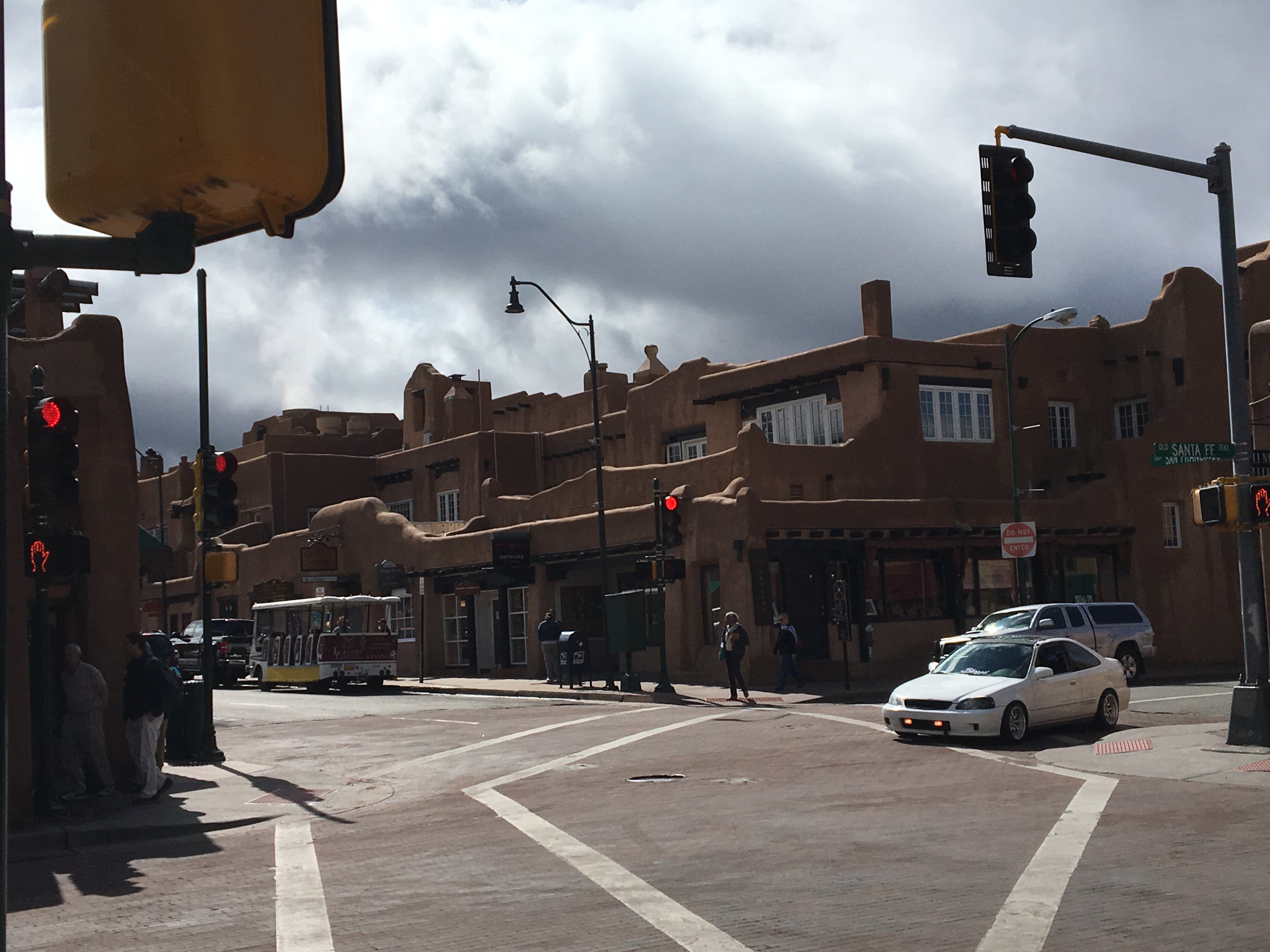
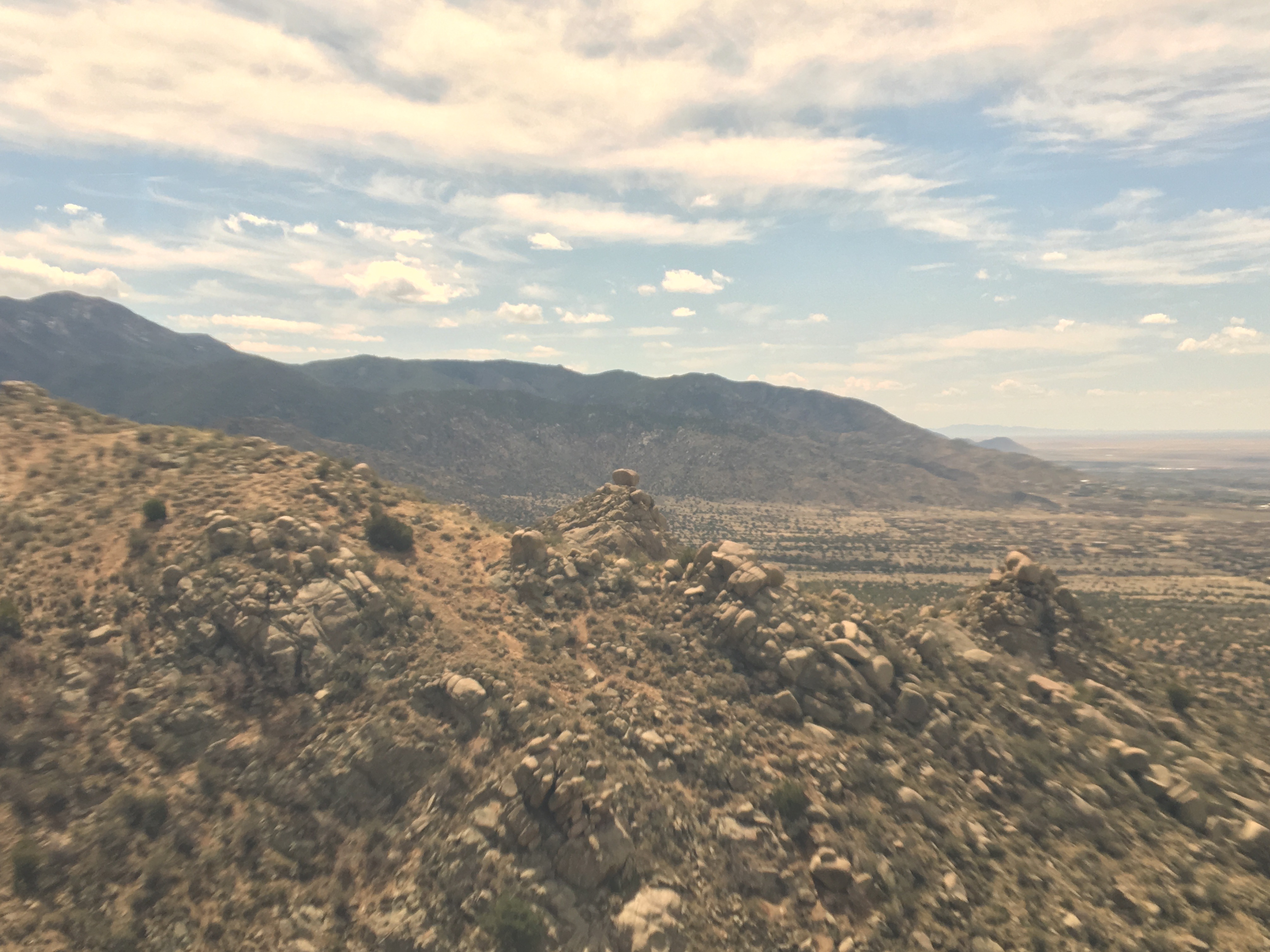
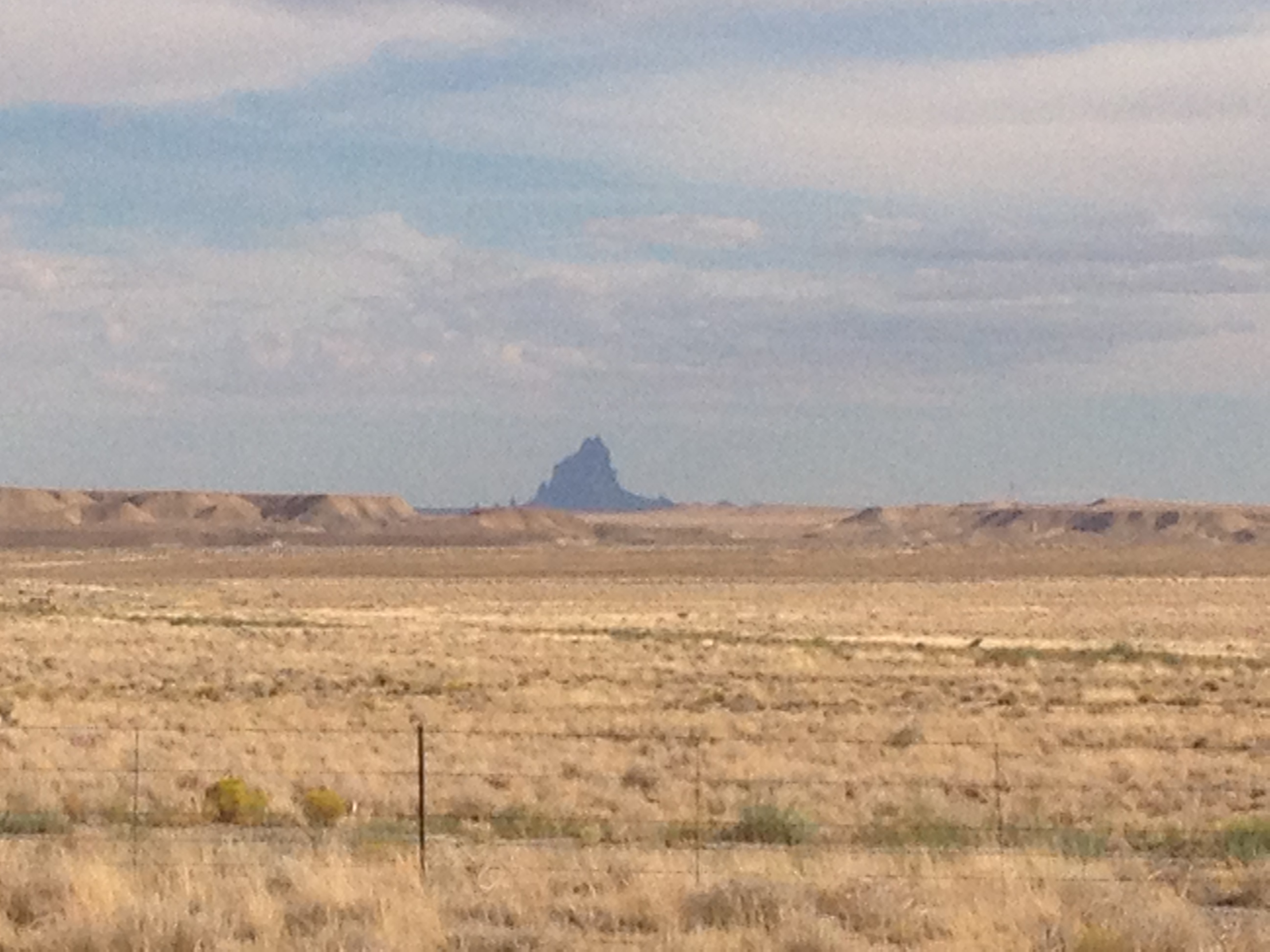
The northbound journey out of Santa Fe, along highway 84 towards Pojoaque, and Espanola could not possibly feel any more Southwestern.  Rolling hills are covered with bushes and sagebrush.  There are some trees here, but unlike in the East, their impact on the wide open landscape is minimal.  They are but mere dots, small points in a panoramic image that shows off the entirety of the landscape of the region, stretching for miles and miles.  As a consequence, mountain ranges can be seen in the distance in multiple directions.

IMG_5662 (1).jpg

Artwork depicting the culture of the American Southwest can be seen quite frequently along this entire stretch of highway, on roadside decorations, bridges, and even buildings in the distance.  There is something about sculptures and murals like these that invariantly make me think of the Southwest, even when I am in a completely different region.  The use of colors in particular are reminiscent of this region, warm and dry but still American.  The colors are warm, reds, oranges, browns.  Even when they use “cool” colors, like green and blue, these murals somehow find a way to make these colors feel warmer than they typically do in other drawings and signage.

I wonder, as much of the artwork of the region originated with the Native tribes that thrived in the area roughly a millennium ago, if the styles that came to be predominant in this region are a mere reflection of the manner in which the landscape, and climate, impact the human psyche.  And, is this an aspect of human nature that transcends culture?  Did the Spanish, and White and Hispanic people who would later inhabit the region adopt similar artistic styles because they were responding to the same conditions around them and reflecting them in a similar manner?

The reason I was headed in this direction out of Santa Fe, other than just merely to explore, which I do believe is a reasonable pursuit in of itself, was the desire to see one of the most significant, but also confusing places in the United States; Los Alamos.  Los Alamos is a place where some of the top scientists in the world came together during World War 2 in order to build the nuclear weapons that eventually ended the war.

Of course, at the time, it wasn’t the Japanese, but the Germans who were the main subject of concern. It was rumored that the Nazis were building this capability, which could have significantly altered the course of the war.  The Manhattan Project was both highly secretive (Americans were largely unaware this was going on at the time), and quite controversial, as it still is today.

IMG_5665.jpg

The entire area has a feel that continues to reflect how Los Alamos came about.  Headed towards town, on highway 502 West from Pojoaque, road signs indicate that the stretch of highway is a “safety corridor”.  What does that even mean?  I have never seen this before.  Anywhere else, this road would have a higher speed limit, less fines, and would likely not have three lanes in each direction.  Something must be going on here.  But, is it still going on?  If so, what?  And, how much of a secret is it?

IMG_5668.jpg

The truth is, Los Alamos is a place like no other place on earth, and like the rest of New Mexico, cannot be placed in a specific category.  It is, indeed, a place where discoveries are made.  But, unlike many other towns with major labs, and I am particularly thinking of Boulder, Colorado, which is near my home, it does not appear laid back at all.  After parking, I had an intense experience crossing the street to get to the Bradbury Science Museum.  This crosswalk had a walk/ don’t walk voice command that spoke words with a level of urgency that appeared to highlight the National Security and wartime origins of this town.  It felt as if 70 years later, the mindset had never really changed from its wartime heritage.  Or, in the very least, the town had kept its infrastructure, which was built specifically for time of extremely heightened security.

IMG_5669

The Bradbury Museum is quite well done, and for those traveling on a budget, is free.

I’d say slightly over half of the museums exhibits focus on the Manhattan Project, the A-Bomb and the original history of the laboratory.  However, the laboratory is operational, and has been involved in some high caliber research over the last 70 years, in areas such as cancer detection, energy conservation, and wildfire prevention.  It is amazing to think, the same place, the same people, the same lab, and the same knowledge base was used both to create the most destructive item on the face of the earth, nuclear weapons, but also to advance humanity and help countless people better their lives!

IMG_5667.jpg

One of the reasons Los Alamos was selected as the location for this top secret lab, was that it had to attract top scientists, many of the young at the time, to a project that likely meant years in seclusion.  While these young scientists would not have the benefits of urban nightlife, for Los Alamos, and the laboratory, they found an area with plenty of opportunity for outdoor activities.  The volume of hiking trails throughout Los Alamos County (a relatively small county) reflects this history.

IMG_5677 (1).jpg

Just West of town, and the lab, is a large area known as the Santa Fe National Forest.  This National Forest, in many ways resembles the National Forests that can be found throughout Colorado.  In fact, I can picture many of the same activities, backpacking, camping, and with the Jemez River, water activities such as fishing and boating.

IMG_5680 (1)IMG_5681

The main difference I felt, between here and many of the forested areas of Colorado I regularly frequent for hikes and such, is that this area seemed significantly less crowded- emptier.

Along highway 4, the main road through the forest, there is one area hot spot, a unique natural feature known as the Soda Dam, a waterfall the flows between a rock along the Jemez River.

IMG_5682 (1).jpg

Not only does this area feature a waterfall unlike any other place on earth, but there are geothermal features that make this river a popular pseudo hot spring.  I say pseudo- hot spring, as the water is not really hot, as it is in some areas where water temperatures resemble that of a hot tub.  It is just simply warmer than you would expect it to be given its high altitude origins.  It was warm enough that people were able to comfortably swim in it.

IMG_5685.jpg

It is an area that is just simply peaceful and panoramic, the kind of place where one can simply turn off the wheels that churn in their heads as a result of everyday life, and just sit, swim, float, or fish, gazing in the distance at the majesty of the region.  Two weeks later, I still gaze at this very photograph and feel as if I am entering a much more peaceful state of mind.  I almost need to place it in front of my desk, as a stress reliever.

IMG_5686 (1).jpg

The entire west is full of areas like this, where, due to unique geological history, the rocks take on a reddish color.  This is the color that many associated with the American Southwest.  Although most of Central New Mexico is much browner, especially in April, a section of bright red suddenly appears at the South end of Santa Fe National Forest, along highway 4, at the border of Jemez Pueblo, yet another Native American village.

The day ended with a final drive down highway 550 towards Albuquerque, where the Sandia Mountains, largely to the City’s Northeast, drew gradually closer as the drive progressed.

IMG_5688 (1).jpg

Thinking about all of the beautiful places I saw over the course of the day, my main regret is spending too much of the day in the car, and not being able to stop, hike, float, walk around, and just get immerced in area.  As a travel enthusiast who unfortunately has responsibilities at home, it is all too easy to get into the trap of planning too many activities for too short of a period of time.  This often makes travel feel rushed, like there is too little time to experience some of the places we see.  Luckily, I live in Colorado, and therefore can get similar experiences, National Forest recreation areas and such, closer to home.  But, there are some subtle differences, and things that make this area unique.  I would very much like to come back here at a much more relaxed pace, and experience another side of New Mexico life.


An Old World Town in a New World Region

In the U.S.A., we are quite accustomed to the seeing certain kinds of towns in certain parts of the country.  Since cities were built earlier on the East Coast, we expect to see towns laid out like Boston, Annapolis, or Charleston.  These cities tend to be a bit more challenging to navigate, as is particularly the case with Boston.

boston_street_map

By contrast, in the Western part of the country, we expect to see towns built more around automobile (or the automobile’s predecessor in the late 19th Century, the horse drawn carriage).  Cities like Phoenix, designed with driving in mind, have mostly straight-line roads, with suburban areas having windy subdivisions.

Phoenix_Street_map

This is what we have come to expect from towns in this part of the country.  So, when I first looked at Santa Fe’s road network, I was quite surprised to see a city full of windy roads that resembled something I would expect to see along the East Coast, or in Europe.

IMG_5647.jpg

Oddly enough, New Mexico is one of the oldest regions in the U.S., at least when it comes to architecture.  The historical lineage is just different.  New Mexico is home to over a hundred Native American Pueblos that date back to long before anyone associated with the United States of America would arrive.  Many of them are still inhabited, with some having been inhabited for over 1000 years!  This is quite a long time for this part of the world.

Santa Fe, New Mexico’s capitol city was founded originally as a Spanish colony in 1610, ten years before the Mayflower would come ashore in Massachusetts, and still retains much of its original Spanish style.  In some ways, driving into New Mexico feels like entering a whole different region, fairly instantaneously.  I first noticed this storm chasing in college. It was my first time in New Mexico, or Arizona.  I was previously unaware of the prevalence of adobe style buildings in these two states, and was somewhat surprised to see how abruptly the styles of the building around me changed once I crossed the border from Texas into New Mexico.

Santa Fe appears to have retained much of its cultural heritage.  Aware that New Mexico has a substantial Spanish history, I decided that it might be a good idea to check out a Spanish restaurant downtown.

IMG_5638.jpg

Taberna came highly recommended by the staff at the hotel, and certainly did not disappoint.  The food was excellent, and, on this particular evening, a performer named Jesus Bas performed for the customers.  I sincerely, if only for a moment while sipping a glass of wine, tasting enchiladas, and hearing Spanish music, felt like I was in Spain.  Well, at the very least, it made me want to go to Spain.

IMG_5642.jpg

I decided to somewhat follow in the footsteps of one of the people who inspired me to start writing about my travels, Anthony Bourdaine.  For those not familiar, he is a chef who eventually became the host of a series of food related travel shows.  I watched a lot of his previous Travel Channel show No Reservations, where he did not just simply describe the food he was eating, he would also reflect upon the experience, what certain places made him feel like, and what historical context they can be placed in and such.  His current show, which is actually a bit less food focused and more focused on the travel is called Parts Unknown.  So, I was actually quite excited to see a souvenir shop actually called Parts Unknown.  Additionally, the shop is located only a few doors down from one of the places Anthony Bourdaine visited on the Season 2 episode where he travels around New Mexico; the Five and Dime, a shop where he gets a Frito Chili Pie, a commonly served dish in New Mexico.

IMG_5643.jpg

I did not end up getting the Frito Chili Pie, as there were a limited number of meals I could have here in Santa Fe.  I mostly just looked around at the souvenirs available in this shop, which featured Santa Fe’s connection to one of my favorite aspects of American History, route 66 (although the route bypassed Santa Fe starting in 1937).

IMG_5646 (1).jpg

I ended up going to a place called Horesman’s Haven, a small restaurant on the edge of Santa Fe famous for authentic New Mexican style food where Anthony Bourdaine was caught off guard by the level of spice in their green chili.

IMG_5658.jpg

IMG_5659.jpg

My chili was not quite as spicy, but still packed quite a punch.  I am glad it did!  Many people try to avoid spicy food while on vacation, to avoid experiencing an upset stomach while far from home.  In this case, the level of spice was an important part of the experience.  Life is meant to be experienced.  Some people spend their entire lives trying to avoid bad outcomes.  In my view this is a sure fire way to miss out on countless rewarding experiences.  Bad outcomes are going to happen.  We just need to manage them in our own way.  Missing out on a whole bunch of experiences, and I am talking about things much more significant than one high quality meal, bears a much greater cost than the occasional unfavorable outcome.

I am guessing this is the attitude taken by the unexpectedly high number of people who make a living as an artist in this town.  In the downtown part of Santa Fe, it seemed like half of all buildings house art galleries.  Santa Fe is known for art galleries, but there seemed to be way more than is necessary to support a town of roughly 70,000 people, even if all of those people are wealthy and have dozens and dozens of pieces of artwork hanging from all of their walls.

Like New Mexico as a whole, Santa Fe appears to have an interesting set of values that does not fit neatly into one of the categories we have become familiar with.  It is western, but also European.  It is cowboy, but also quite diverse.

IMG_5654.jpg

It is a state capital, but has a state capital building that looks nothing like any of the other ones I have seen across the country.

IMG_5655 (1).jpg

It is the kind of place that erects historical markers dedicated to fiscal responsibility, an important, even if not flashy, achievement, and one that reflects the western values of personal responsibility.

IMG_5656 (1).jpg

It is also a place that erects building dedicated to the memory horrible death marches in Europe.

IMG_5652.jpg

It is both “old world”, and “new world”.  It does what we all need to do, both in our own cities, and more importantly, individually.  It combines old ideas with new ideas in a way that uniquely represents its individual identity.

Road Trip to Santa Fe

IMG_5623.jpg

I spent about half a decade working in the Insurance Industry, an industry with a significant presence in Bermuda.  At workshops, conferences, and in meetings, I would regularly interact with people who lived there.  The place certainly has its draw, and with the right opportunity, a person with experience in the industry could make a really good life there, despite the high cost of living.

I often imagine what it would be like to have a totally different life, in a totally different place, particularly when traveling, or when I meet someone from somewhere far away.  While working in the insurance industry, although I never seriously considered up and moving to Bermuda, I did imagine what it would be like a couple of dozen times.  Each time I imagined it, I would always end up dwelling on the lack of room to roam around there.  The island is only 20.6 square miles, and getting anywhere else requires a flight.  I pictured myself moving there, getting my swimming trunks out, snorkeling, attending a few parties and such, but then, eventually, just getting restless, and missing something I love to do here in mainland U.S.A.; taking a road trip.

There is something I really love about road trips.  When I refer to road trips, I am not talking about simply driving somewhere.  A lot of people drive to work every day, or to a relative’s house every other weekend, and those drives don’t feel like “road trips”.  I’m talking about driving somewhere a significant distance away that is not a routine trip; somewhere that is somewhat unknown.  On road trips, we have somewhat of an idea as to what to expect, based on what we have heard, read, or researched, but we do not know it intimately.  We have not experienced the towns we will pass along the way, which exits have the best deals on gas, and where the best restaurants are.  In other words, there are still some surprises, and we are still going to encounter something unexpected.

IMG_5619

Driving south along I-25, the first indication that one is reaching the Southernmost portion of Colorado is the Spanish Peaks.  While visible farther north, they take prominence south of Pueblo. The Spanish Peaks are nowhere near the tallest features in Southern Colorado.  In fact, within 30 miles or so, there are 5 mountains taller than 14,000 feet (14ers)!  But, since they are relatively isolated from other natural features, and can be seen quite some distance, they are a prominent landmark toady (an entire region is named Spanish Peaks country, as well as the names of countless business in the region), and were a prominent landmark on the old Santa Fe Trail.

Approaching Trinidad, CO, the last town before the New Mexico border, the Spanish Peaks disappear from the horizon as the highway enters a much hillier region approaching Raton Pass.  It is here that the path of Interstate 25 joins with the old Santa Fe Trail, which it will more or less follow for the remainder of the trip to Santa Fe.  This trail was first pioneered by the Spanish and later played a pivotal role in American history including westward expansion, and the eventual conquest of the Southwest from Mexico.

IMG_5622.jpg

I had mixed expectations of Raton Pass.  Many years back, I was on a ten-day storm chase. Our group was situated in Clovis, New Mexico, which is quite close to the Texas-New Mexico border.  We were discussing the possibility of chasing upslope storms roughly an hour northeast of Denver the following day.  Some of us brought up the possibility of driving west to Raton so we can take the Interstate to our target destination, but the group leader balked at the idea, instead suggesting driving up 385, as he felt it might be risky to take a large convoy of chase vehicles over Raton Pass.  We ended up deciding not to drive up to Northeastern Colorado, as, in the morning, the storm outlook had weakened, and we no longer felt it worth the drive.  By the way, this is common on storm chases, you really never know where you will end up going.  However, ever since then, I had kind of wondered what it was like to drive over this pass.

As the photos indicate, the road gets windy as motorists climb from Trinidad, at roughly 6000′ in elevation, over Raton Pass, which tops out at 7834′.  It’s definitely not nearly as rough as heading over the Rocky Mountains along I-70 or I-80, but definitely is a much more major incline than anything a group of people that drives largely in the Great Plains from Texas up to South Dakota would typically experience.

IMG_5626.jpg

Oh, and in one of the strangest of coincidences, the top of the pass is right at the border of Colorado and New Mexico.  This is odd as, first of all, the Colorado-New Mexico border is defined as the 37th parallel, and has nothing to do with where any mountain pass is located, and roads through mountain passes are built to take the safest and most effective route.  The fact that the place where this road crosses the 37th parallel most effectively happens to also be the high point seems to me as a pure coincidence.  Maybe someday I will read into this, the story behind the road and such, but I have yet to do so.

After a descent into Raton, the road reaches a segment that is long, flat, open, and rather empty.

I switched the music on the radio to classic rock, The Clash, Ozzy, Queensryche and such.  For some reason, there is something about the sound of guitar rock that makes more sense while driving through scenery like this than many other forms of music.  As the afternoon passed along this landscape, cloudy skies gave way to peaks from the sun only every once in a while.  A few periods of gentile, chilly rain fell from the skies.  In some ways it reminded me of a storm chase gone horribly wrong, the day slowly but surely slipping away with no prospects of favorable storm conditions developing.  However, in other ways, the drive was relaxing, allowing me to think without any distractions.

After passing through a town called Las Vegas, NM (which I assure you is nothing like the Las Vegas in Nevada), the highway turns West.  It kind of loops the last 60 or so miles into Santa Fe, even heading back northward for the last ten miles, following the route of the old Santa Fe trail.  However, unlike the previous 100 or so miles, this part of the trail, and the drive, is far from flat.

To the right, is the southernmost part of the Sangre de Cristo mountain range, and an area now part of the Santa Fe National Forest.  It is these mountains that the trail routed 19th century pioneers around.  To the left are a series of bluffs which, luckily, the trail did not have to also bypass, as it would have added many more miles to the journey.  The road itself slowly climbs over Glorietta Pass, descending only slightly into New Mexico’s Capitol City- Santa Fe.

Places of Questionable Significance

IMG_2460

In 1983, an incredibly drunk Ozzy Osborne made the mistake of deciding to relieve himself on the Alamo, a building of historical significance.  He was arrested (Isn’t public urination usually just a ticket?), and scorned by many, primarily due to the fact that the Alamo is an important symbol of pride amongst Texans.  However, to Ozzy, a British rock star, the building probably did not mean too terribly much.  While a sober Ozzy (if that existed in 1983) would probably have realized the building is significant due to the presence of tourists, he probably would not have felt the same affinity or pride when standing in front of the Alamo.

With the exception of a few wide eyed hippies that believe that every place is significant, and a few hard core cynics, that fail to see the significance in any place (or anything), the significance of most places is dependent on the person and the culture.  There is no better of an example of a place like this than Four Corners, U.S.A.

Four Corners is unique due to the fact that it is the only place in the United States where four states all border one another.  If one wanted to stand in five different states at one time, it would not be possible.  If one wanted to stand in four different states at once, there is only one place where it can be done; Four Corners Monument.

IMG_2455 IMG_2456

The primary reason people visit this particular monument is to take silly pictures like this one.  Assuming the location of the four-state border is correctly marked (some question that is in the right place), in this picture I am in four states at once.

IMG_2462 IMG_2468

However, in the absence of state borders, this particular spot would really actually be quite insignificant.  There is no natural demarcation point, or significant change in scenery.  Even on the Colorado side, the wide open landscape, periodic mesas, and sagebrush screams Arizona much more than Colorado.  This Arizona-like feel persists for over thirty miles into Colorado until the San Juan Mountains start to show up on the horizon somewhere east of Cortez.

IMG_2457

The significance of this place is further muddled by the fact that this point is not the border of four different jurisdictions.  The monument is actually on an Indian Reservation.  Thus, you do not even get the standard differences in policies and sales tax that usually accompany state borders.  An equal number of souvenir stands exists on all four sides of the monument.  I am not sure whether or not marijuana is legal on this particular reservation, but the policy is the same on all sides.  I did not observe all of the pot heads clustered in the Colorado quadrant of this monument.

In the absence of state borders (and people obsessed with exact points of latitude and longitude), the most significant site in this region is a rock formation a dozen or so miles away called Shiprock, which has cultural and religious significance to the Navajo people who have inhabited the region since well before the Spanish arrived.

IMG_2467

From a completely neutral standpoint, the rock formation definitely seems to stand out way more than any other feature in the area, which is mainly small mesas and creeks.  But that does not mean the wide open space where the monument should lack significance to all people.

For most likely a variety of neurological, sociological, and historical reasons, Western Culture associates wide open spaces like this one with freedom.  It’s the wild.  It’s the untamed.  It’s the place where you can yell as loud as you want, shoot any kind of weapon you want, and start a fight without anyone to break it up.  There is nobody to tell you where you can (and can’t) hike, climb, tie a rope to an arch or mesa to swing from it, or even try to catapult small rodents.  It’s the last refuge of people seeking to escape every single one of society’s restrictions and limitations.

But the one set of regulations that one can really never escape is the ones that exist only inside their own heads.  I often refer to these as the “invisible chain”.  And by this, I am referring to all of the anxiety, fear, and self-consciousness that often stop us from doing what we feel we should be doing.  It stops us from telling people what we really think.  It stops us from talking to that interesting and attractive stranger on the train.  It stops us from dancing when fun music comes on.  In some ways, it stops us from living.  And, millions of Americans are in the process of destroying their livers trying to reclaim it.  In these pictures of the free, wild, and untamed west, there are typically very few people, or buildings to indicate the presence of people.  There is nobody to judge you, and nobody to make you feel self-conscious about what you chose to wear, say, and do.  The fact that this is where we go to seek freedom indicates where we, as a people, believe most of our restrictions come from.

Therefore, if one could overcome this “invisible chain”, the restrictions placed upon us would be limited only to those officially legislated by some kind of governing body and effectively enforced by law enforcement personnel.  The few lucky individuals that manage this are able to find this greater level of freedom in places like London, Hong Kong, or New York City; places that provide the interaction with other human being that we all crave.

We often see the desire for community and human interaction as pulling us in one direction, while the desire for freedom and individuality pulling us in the opposite direction.  As an extrovert, I often struggle with the fear that asserting my individuality and refusing to conform, will cost me in the social realm.  Reflecting upon all of this in the wide open spaces of the desert southwest, I re-realized that being an individual and reducing that fear actually helps in the social realm.  Negative responses from those that fear non-conformity are more than outweighed by positive responses by those that appreciate authenticity and variety in nearly all circumstances.  The key is to understand that we all have freedom of choice, and not to allow any of the hate to translate into hatred towards others.  This applies even the people that have ridiculed me and caused me hurt.  They have the freedom say what they want.  The only way to truly overcome that ridicule is not to ridicule them back, or “defeat” them in an argument.  It is to not be affected by that ridicule and continue to be the way you are despite anything they say.

This is one of several lessons, I re-learned on this trip.  These re-realizations make this place significant to me, even if the official reason for the significance of any of these places is questionable.  Everyone has a different experience here, and it is completely understandable for someone to come to Four Corners, find out it is on a reservation, buy nothing at the souvenir stands, and leave seeing the place as pointless.  For me, however, this is where I got my mind off some of life’s frustrations, and got back on the path to becoming a better person.