Tag Archives: adventure

The Highest Point in New Mexico

IMG_8006.JPG

Not too many hikes begin at a ski resort. In fact, many ski resorts have begun to incorporate summer activities; mountain biking, festivals and other attractions. However, that is exactly where the journey to New Mexico’s highest point, Wheeler Peak, begins, at Taos Ski Resort.

IMG_7954.JPG

Wheeler Peak is not nearly as high as Mount Elbert, or many of Colorado’s other high points. It is a strange accident of geography that Colorado is home to 58 peaks that exceed 14,000 feet in elevation (referred to as “14ers”), while the highest point in neighboring New Mexico is only 13,167 ft.

As was the case with many State borers set at the time, a line of latitude (37ºN) was selected to form the border between Colorado and New Mexico. The same line is used for the borders between Arizona and Utah, and Kansas and Oklahoma.

Colorado_14ers_OutsideMag.jpg

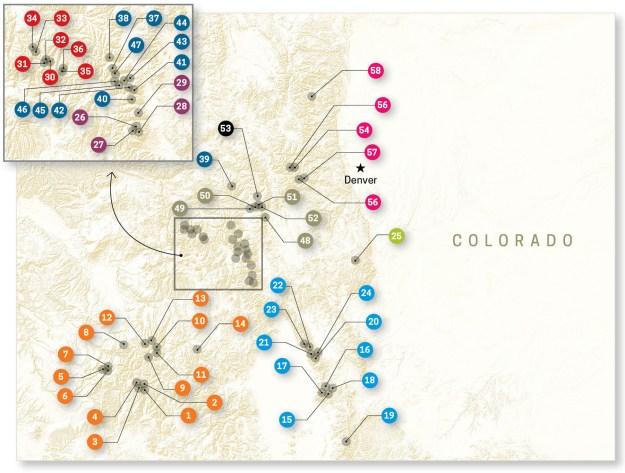
All of Colorado’s peaks >14,000 feet in elevation

Yet, all the tallest peaks are contained within Colorado’s borders. Colorado’s Southernmost “14er”, Culbera Peak, is less than 10 miles north of the New Mexico border! Was it sheer luck, or did some sort of force will all the highest peaks be in Colorado?

Despite it not being a “14er”, the hike to the top of Wheeler Peak is actually quite similar. The vertical gain from the trailhead is just shy of 3,000 feet, and the threat of afternoon storms makes it advantageous to start the hike early in the morning.

IMG_7956.JPG

Much of the ascent felt like chasing the sun. We were hiking up the mountain, while the alpenglow would slide further and further down.

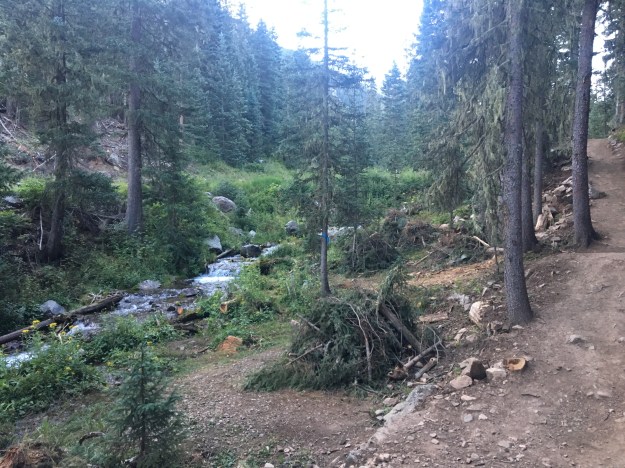
It’s a 2.2 mile hike to Williams Lake, the destination for most hiking the first part of this trail.

IMG_7972

This lake was not that crowded at 7:30 in the morning. Later in the day, it would become packed. Also, for those looking to hike to Wheeler Peak, the turn off is before the lake.

The marking for the Wheeler Peak turnoff at 7:30 A.M. and Noon

It is marked by a carving in a wooden stick, which is clearly labelled but easy to miss first thing in the morning.

For those who miss the turnoff, or decide to head to the lake, there is an alternate route. Good luck locating it.

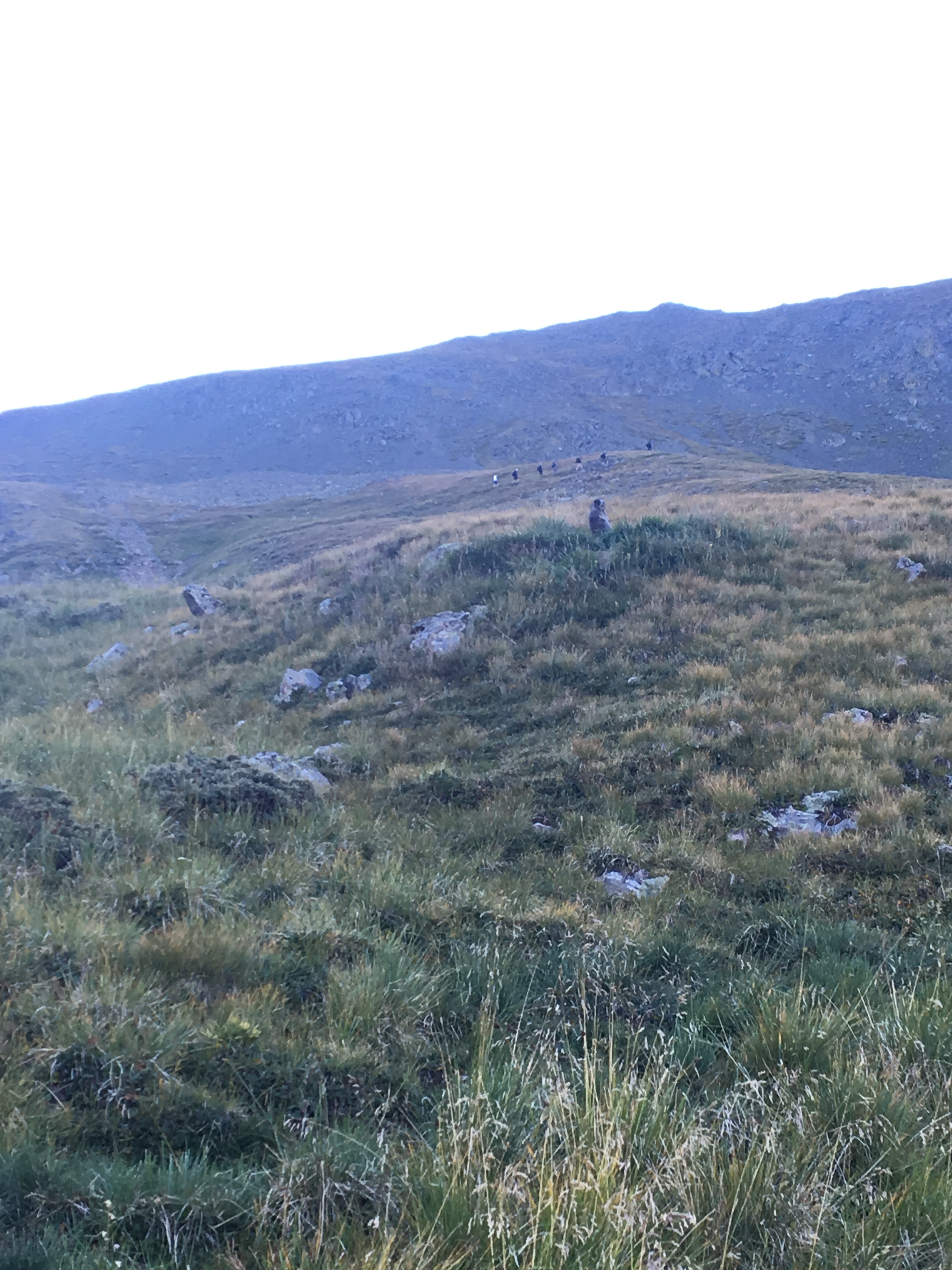
I spent much of the second hour of the hike wondering both where the treeline is, and when I had reached it.

IMG_7986.JPG

The term “tree line” makes it seem like hikers will reach a certain elevation and suddenly leave a dense forest for wide open alpine tundra. However, there are elevations where the trees thin out a bit but do not completely disappear. So, the elevation of the “treeline” is more of a guideline, or an approximation. The Alpine Visitor’s Center at Rocky Mountain National Park indicates that the treeline there is about 11,500 feet in elevation. In Northern New Mexico, that elevation is likely closer to 12,000 feet.

Just above the treeline, we had multiple close encounters with wildlife. First, the marmots chirped at us, as if to say “get off my lawn”.

IMG_7987.JPG

Then, a surprisingly close encounter with bighorn sheep.

IMG_7990IMG_7992

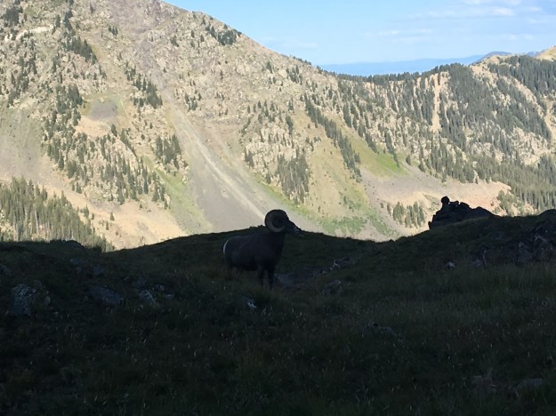
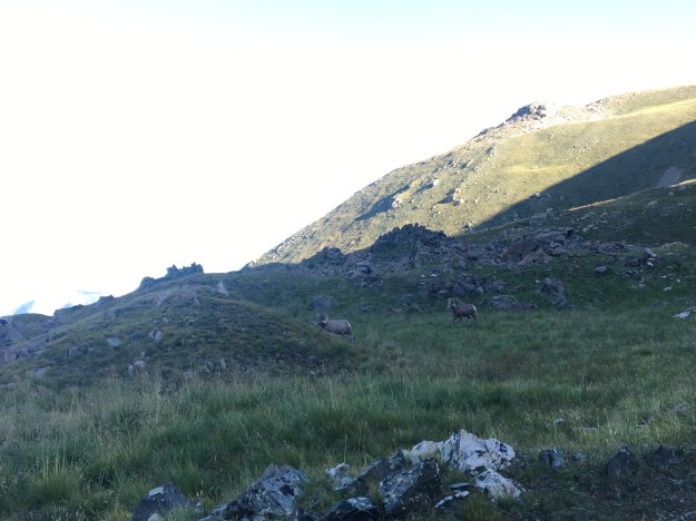
At first I wondered whether these animals were staying away from the busiest trails. However, someone who hikes this trail quite a bit indicated that wildlife encounters this close is actually quite rare on this trail. On any of these trails, encountering wildlife is likely just a matter of luck; whether or not certain creatures happened to be roaming the area at a certain time. After all, last summer I saw mountain goats up close on a very busy “14er” near Denver.

After this, there was a section that is quite challenging. Steep rocky switchbacks quickly ascend the final 1000 feet of elevation gain.

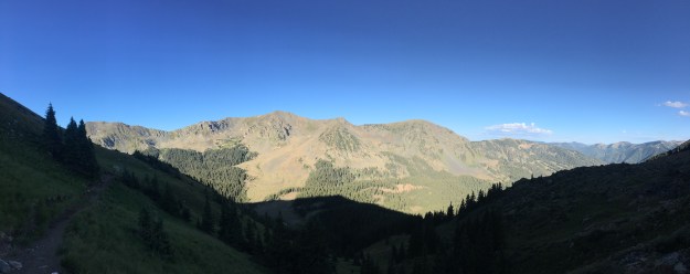
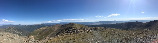
This challenging section ends suddenly with a view over the ridge, overlooking the rugged terrain of the Carson National Forest. The exhaustion that had lead to this point made it even more breathtaking.

IMG_8001.JPG

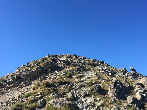
A quick turn to the right, and the final ascent is made to the highest point in the State of New Mexico.

IMG_8003.JPG

A plaque at the top reveals that the mountain is named after the surveyor who identified this point as the highest in the State.

IMG_8004

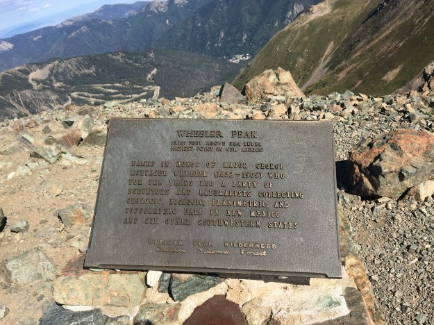
I only imagined what it must have been like to be Major George Wheeler, charged with this task, especially at the very beginning. One look around the area, in most directions, revealed dozens of candidates for which peak could indeed be the tallest one in the State. He likely had to scale all of them to determine the true highest point. It reminded me of a situation we all find ourselves in at one point in our lives,. We agree to take on a project or endeavor. Getting started, me suddenly come to the realization that it is going to be significantly more work than anticipated.

IMG_8006

Having many other peaks in the area that are nearly as tall gives it a pretty unique feel at the top. The plethora of similar peaks may have also contributed to the pleasant conditions at the top. There was surprisingly little wind at the top of Wheeler Peak that day (August 31, 2019).

IMG_8010

The descent is also an interesting experience. Some of the steepest parts of the trail can be downright scary, and just as challenging as it was on the way up. It is also interesting to encounter the people that are still trying to reach the peak.

This aspect of the hike is a strange and somewhat depressing transition. At the start of the descent, still only a couple of hundred feet from the summit, it feels great to give hikers, often exhausted, encouragement and reassurance that they are “almost there”. Continuing downward, this transitions to having “a little bit to go”, to either no comment or vague encouragement.

If there is a depressing time of day on an amazing hike like this, it is 11:15 A.M. This is the time of when I start to realize that those that those still trying to get to the summit are probably not going to make it.

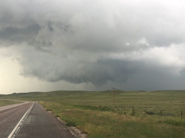
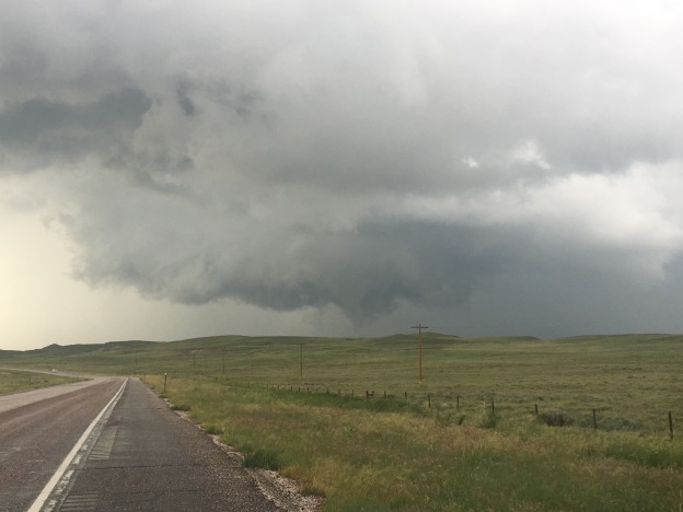
There is a safety concern behind this. Lightning is quite dangerous, even more so above treeline. Lightning is always looking for the fastest path to the ground. Regardless of where you are, if you’re outside, there is always a chance this can be you! Above treeline, without tall trees to theoretically provide that path, hikers are even more likely to be struck.

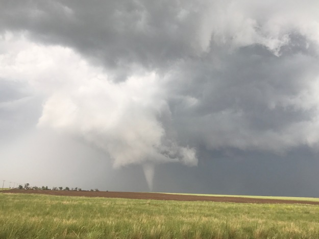
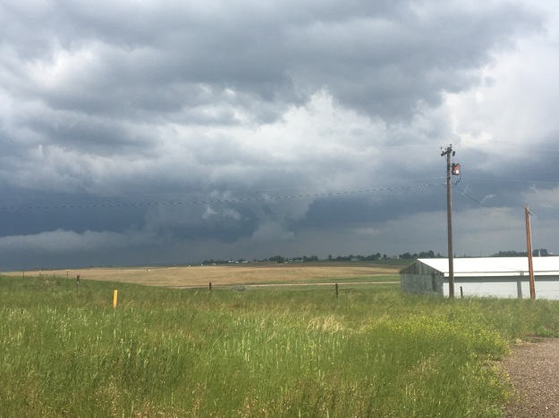
Surely enough, at 11:45, I heard thunder, and saw the convective clouds starting to build.

IMG_8019.JPG

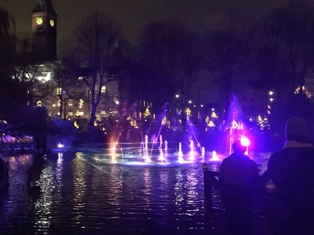
I just hope that everyone in danger got off the mountain and stayed safe! While policies, attitudes and even the height of the peaks may be different on either side of the 37th parallel, some things are the same. This includes how mountainous topography creates thunderstorms, how lightning behaves and how our bodies react to being struck. Danger aside, it is refreshing to know that regardless of boundaries created by humankind, there are things we can always count on being true.


Travel; The Balance Between Spontaneous and Planned

IMG_3251.jpgOn one end of the spectrum are the planners, the ones that assemble detailed itineraries, and, perhaps not so surprisingly, are typically able to stick to them.

BikeRoute_Sunmer2016

A well planned trip comes with several advantages. Flights, hotels, and many travel related big-ticket items are typically cheaper when booked several months ahead of time. Putting in the time and effort to plan ahead of time also reduces the chances that some unforeseen complication or circumstance will negatively impact the trip, causing travelers not to get the experience they were hoping for.

IMG_3929

On the other end of the spectrum are the spontaneous, the last minute, the drop everything and go type of experiences. This has its advantages too. Psychological studies have indicated that the satisfaction people have with their experiences is often dependent on how the experience compares with their expectations. The spontaneous trip, the one that comes together last minute can have a strong upside, as there were no expectations. Finding oneself unexpectedly in a new place, trying something new; experiences like these can make people truly feel alive!

IMG_0117

Missing out on this feeling is probably the main drawback to planning travel too intensely. When every activity is regimented, down to the hour (given the fact that there is traffic, weather, etc. regimenting to the minute is a fool’s errand), it is harder to make adjustments for what may occur, or take advantage of opportunities that present themselves. See an interesting billboard for a museum, theme park, or natural bridge? Sorry, there is no unplanned time. Run into an old friend, or make new friends? We can reconnect only if you’re going in this direction as me at this time.

img_7656

As is the case with most things in today’s world, there is an optimal “middle ground” that can be reached, and it is not necessarily a compromise between the two extremes. The best “middle ground” solutions often try to achieve the objectives of those on both sides of the issue. The planners want some kind of guarantee that the most important experiences, the original objective of the trip, are actually obtained. The spontaneous want flexibility and the element of surprise.

While I have taken part in experiences that were planned many months in advance and completely regimented.

IMG_2105.jpg

As well as ones that were super of the moment.

IMG_1658.jpg

My general tactic is in the middle.

IMG_3043

The trip I took to Death Valley six weeks ago was actually originally planned for Zion National Park. Unexpectedly cool and rainy weather prompted us to change the venue to Death Valley, where it would be more pleasant. In this case, it wasn’t necessarily the exact intended experience, but the overall experience of camping, hiking, and being outside in a group of people still came to pass.

20171122-014003-6003890.jpg

When visiting Copenhagen and Stockholm last fall, we set aside a few “must sees”…

20171126-171745-62265432.jpg

While leaving a lot of time open for other experiences

20171122-014742-6462249.jpg

There are a lot of other ways to achieve this optimal combination of guaranteeing experiences while also remaining spontaneous. They are not all as simple as the Southwest Airlines no change fee policy. Some things, like planning alternative activities if the weather is bad, having meals ready on fishing trips in case no fish are caught, or planning for a busted stove on a backpacking trip, take research.

IMG_4244

And, well, in our attention deprived world, doing research can often be a deterrent. It can be a deterrent to being well prepared, but also, perhaps most unfortunately, can be a deterrent to traveling at all. The phenomenon of “analysis paralysis”, where a combination of too many choices, too much information and too many factors to consider leads to no choice being made at all, has become quite the large scale issue this decade.

Luckily, in an age where the internet appears to do nothing but create “analysis paralysis” there are still resources designed to help people sort through the clutter of information available to them.

One option is to hire a travel agent, who knows the ins-and-outs of various destinations, and can help travelers find the best deals and the best experiences. There are some who believe that travel agents are no longer needed in the age of the internet. However, as the Travel Channel’s Samantha Brown has pointed out in many occasions (including the 2017 Travel and Adventure show which I was at), travel agents do help people sift through all of this information.

The other is to find resources online that actually help people consume information rather than find more of it. A great example of this is the side by side comparison of travel insurance options on reviews.com. More generally, reviews.com is one of the few sites that actually aims to reduce the amount of time people spend on the internet (as opposed to many other sites whose goal is to suck you in). The site has reviews that help people make decisions regarding plenty of other products, including others important to travelers and outdoor enthusiasts, like water bottles, vitamins and booking sites.

IMG_4743.jpg

There is certainly a time to be completely regimented.

IMG_3746

There is also a time it feels great to do something completely spontaneous.

IMG_6128

In most experiences, it is wonderful to try to find a way to make our travel plans both guarantee the experiences that prompted us to make the trip, while also being flexible enough to adjust for the conditions and take advantage of opportunities. This is, in my humble opinion, the proper balance between being planned and being spontaneous.

Why I Love Whitewater Rafting

IMG_0175.JPG

The raft meanders down the river, passing through sections that are both relatively calm, and sections that are quite rough.

In the calmer sections, the smell of the trees adjacent to the river bed activates memories in the brain, of other outdoor adventures. In these sections, the people in the boat laugh at ridiculous anecdotes, point out the unique natural features around them, and congratulate one another on navigating the raft through the most recent set of obstacles. The group camaraderie is alive, as we enjoy each other’s company.

In the rougher sections, the raft jolts, left and right, up and down, and spins around. It even occasionally spins in a full 360-degree circle due to water currents, eddies and rocks. Around every turn is a genuine feeling of adventure, the element of surprise, and even some level of danger. The water, the people, and the raft, are all in motion.

I love whitewater rafting because…

It is outdoors.

It is social.

It requires teamwork.

There is physical activity involved.

The canyons and valleys the rivers wind through are often breathtaking!

It is a fast-paced event. It is impossible to feel stagnant inside the raft.

It is one of the few activities left in this world that requires we separate from our phones and other portable devices.

It is wild, raw, and unpredictable. Yet, there is some degree of control, as we paddle, steer the boat, brace for impact of all kinds, and look out for one another in the roughest sections.

It feels like life when it is being operated correctly. Not over idealized, yet full of “life”. Surprises are expected, and responded to in a healthy manner with a smile. And, people are constantly improving in both skill and character.

A Tornado Outbreak in Wyoming

Wyoming is not exactly “tornado alley”. According to the National Oceanic and Atmospheric Association, the entire state averages only 12 tornadoes per year. Kansas, by comparison, receives eight times as many tornadoes each year despite being 15% smaller in area. Although a tornado in Southeastern Wyoming played a pivotal role in the VORTEX 2 project, Wyoming generally tends to be too dry for severe thunderstorms.

June 13th’s chase came up somewhat suddenly for me, based on a notification I had received about this outlook after being out of town, and not focused on the weather, the prior weekend. For some reason, before I even looked at anything else, weather models, discussions, etc., I had a feeling something major was going to happen.

SPC_day2_20170611

This day somehow felt different, right from the start.

IMG_0031 (3).jpg

By 2 P.M., storm chasers were all over the roads, and at places like this Love’s Truck Stop in Cheyenne, Wyoming, watching the storms begin to form and trying to determine the best course of action.

RADAR_20170612

The decision we all were faced with was which set of storms to follow. The storms forming to the North were in the area previously outlined by the Storm Prediction Center as having the highest risk for the day, and in an area with great low-level rotation. But the storms to the South looked more impressive on RADAR.

Often, we need to continue to re-realize that the best course of action is to follow our instincts, and to follow them without hesitation or self-doubt. That is what I did, opting for the storms to the North.

IMG_0035 (2)

It did’t feel like a typical day in Wyoming. Storm chasers everywhere. Highway signs were alerting motorists to the potential for tornadoes and large hail. Moisture could be smelled in the air. With a moderate breeze from the East South East, the atmosphere felt less like Wyoming and more like a typical chase day in “tornado alley”

IMG_0047 (1).jpg

When I  caught up with the storms in Wheatland, Wyoming, hail larger than I had ever seen had already fallen. One of the good things about following a storm from behind is the ability to see hail after it has already fallen, as opposed to trying to avoid hail out of concern for safety and vehicular damage.

I stayed in Wheatland as long as possible, knowing the storm would head Northeast and I would have to leave Interstate 25. One of the disadvantages to chasing in Wyoming, as opposed to “tornado alley”, is the sparseness of the road network.

IMG_0049 (1).jpg

So I sat there for roughly 20 minutes. Looking at the storm, it felt like something was going to happen. All the necessary conditions were there, and the appearance and movement of the storm felt reminiscent of other situations which had spawned tornadoes.

I took a chance, using roads I had never traveled before, hoping the roads I was following would remain paved so I could follow the storm North and East.

There was a half hour time period where I had become quite frightened. I could feel the adrenaline rush through my body as the clouds circled around in a threatening manner less than half a mile in front of me. I lacked the confidence that the road would remain paved, or that I would have a reliable “out plan” if a tornado were to form this close.


After lucking out with around 10 miles of pavement, I suddenly found myself driving over wet dirt, and, at 20-30 miles per hour, gradually falling behind.

Luckily, I once again found pavement, drove by some of the natural features that makes Wyoming a more interesting place to drive through than most of “tornado alley”, and once again encountered large hail that I felt the need to stop and pick up.

IMG_0070 (1).jpg

Almost an hour later, and significantly farther north along highway 85, I finally caught up to the storm, just as it had dropped it’s first, and brief, tornado. And, this time, I was a comfortable distance from the thing! Unfortunately, this tornado would lift off the ground in only a few minutes.

IMG_0075 (1)

Not too long after, I received notification that other chasers, following the storms that had formed farther South, had seen a much more impressive tornado, closer up, and had gotten better photos (the above is not my photo).

It was a strange day. Not only because Wyoming is not the typical place to see tornadoes. It also felt strange, as I had managed to do something impressive, yet still had reason to feel like a failure.

Most storm chasing is not like it is portrayed in the movies, with people getting close to storms all the time and getting in trouble. Most days, chasers do not see one. Seeing a tornado one day out of five is a very good track record for storm chasers.

Going out on a chase and seeing a tornado of any kind is impressive. Yet, to be truly happy with my accomplishment, I had to accept the fact that there was something better out there- something I did miss out on. This is a struggle we all face, in common life situations such as jobs, relationships, events, houses, etc. We often know we have done well, but always have this idea of something that is even better out there. Knowing this can make us indecisive, which will often leave us with nothing. In the age of text messaging and social media, evidence of such options has become extremely abundant, and quite hard to escape.

In a connected world, in order to be happy with ourselves, we need to find a way to both believe in ourselves, but also be accepting of the fact that someone else, somewhere out there, has done better. For that will always be the case, and we now have instant access to that knowledge. We cannot let knowledge of someone else’s more impressive accomplishments dampen our enthusiasm for our own. Otherwise, we will likely never be content.

Greyrock Mountain- An Ideal Hike for May

IMG_9765.jpg

For the majority of people who like to hike on weekends, or in their spare time, hiking anywhere in the American West in the month of May requires two additional considerations.

  1.  There is typically still a residual snowpack at higher elevations.  While this can vary quite a bit from year to year and even day to day, even on a warm, sunny day, those that don’t want to encounter slippery conditions or deep snow covering the trails should generally stick to lower elevations.  In Colorado, that generally means below 9500 feet in elevation.
  2. Although everyone’s body behaves differently, most people still respect the seasonality of the activities they take part in, hiking less frequently in winter than in summer.  Therefore, most people still need to, in some way, work up to the most challenging hikes they will take on later in the summer.

IMG_9733

Tucked away in the Poudre Canyon 15 miles West of Fort Collins, Colorado (which is an hour north of Denver), the Greyrock Trailhead starts at an elevation of roughly 5600 feet.

IMG_9734

The hike to the top of Greyrock Mountain, on the most direct path is 3.1 miles, with an elevation gain right around 2000 feet.  For those who spent their winters either sedentary or on unrelated activities, and maybe have done two or three hikes thus far in the spring, it is strenuous enough to help get the body back into summer mode.  And, topping out at 7600 feet, it remains well below the elevations where residual snowpack and large amounts of mud would still be present on a sunny day in May.

IMG_9731

Of course, many people are aware of these seasonal considerations.  Therefore, the area does get busier than usual, particularly if it is a nice day and/or on the weekend.

Still, there is plenty of quiet to be found on this appropriately named mountain, just not the level of solitude one would expect on, say, a remote backpacking trip.

On the 13th of May 2017, a dry day in which Fort Collins reached a high temperature of 85F (and was preceded by two dry days) nearly all of the trail was dry.  It was only in certain sections, close to streams, where mud would appear.  These sections got interesting, as groups of butterflies, both red and blue, would loop around the sky, periodically congregating in and around areas of standing water.

IMG_9745

The blue butterflies are actually extremely well camouflaged, only showing their color when the wings are flapped open.

IMG_9751

IMG_9755

A closer look at the muddy surface reveals dozens of these butterflies nearly completely blended into the muddy surface, something many hikers don’t even notice!

IMG_9761.jpg

Roughly 2/3 of the way up, the first real scenic overlook is reached.  This is the point just before the two trails merge back together, at an elevation of roughly 7000 feet.

The final 600 feet of ascent looks, well, far more daunting than a typical 600 foot climb.  And, well, it is.  After a short flat area, following the scenic overlook, the trail begins to climb up a series of rocky areas, often referred to as “scrambles” by hikers.

These parts require some strategizing, both on the way up and on the way down.

The final section of the trail is the one area where it is possible to get lost.

On top of rocks, the trail passes by several lakes, where the sound of frogs can be heard, and is marked only by periodic signs 2-3 feet tall and the occasional standard rock pile (referred to as a Cairn).

IMG_9783

The summit is also just kind of a series of rocks, that need to be climbed over to reach the best lookout point.  Being at the top of Greyrock Mountain is somewhat of an unique experience.  In some ways, it feels just like being on top of the world, as noting in the immediate vicinity is at a higher elevation.

IMG_9792.jpg

However, out on the horizon to the West and Southwest reveals mountains whose peaks dwarf this one by over 5,000 feet.

It feels like a metaphor for a certain life situation that nearly every human being will find themselves in at one point.  The mountain has been climbed, a goal has been achieved, and there is reason to celebrate… temporarily.  But, there is still a lot that must be done, and much higher aspirations.  It is finishing a degree and moving on to start a new job.  It is successfully navigating nine months of pregnancy now knowing that it is hard work to raise another human being.  It is knowing that one has achieved as much as is possible in a current endeavor, and that there is something more meaningful, a higher calling, awaiting that requires a pivot, a new strategy, and renewed effort.


The Denver Travel and Adventure Show

IMG_8957

It says something about our culture, in its current state, that we now have a series of exhibitions like this, throughout the country, dedicated to travel.  After all, it was only about a century ago that the idea of going on vacation, let alone regular travel as a way of life, became an option for those that would be considered “middle class”.  Now, we have a Travelers Century Club, with multiple chapters around the world, for people who have visited over 100 countries, and wanderlusters encouraging others to make travel a way of life.

Due to a variety of factors, I am in the midst of what I am referring to as a “low energy month”.  I am guessing this is more common than I realize.  I really cannot remember the last time I had one.  It’s likely that I needed a calmer, quieter period, although, I cannot say I welcomed it.  What I ended up with was a feeling eerily similar to how I would feel toward the later part of most winters when I lived in the Midwest.  I got kind of stir crazy (still am at the time of writing this).

The Travel and Adventure Show represents a whole new way for people to feed their stir-craziness.  This year, the Travel and Adventure Show came to Denver for the first time ever, at the Colorado Convention Center downtown .  The Colorado Convention Center features the Big Blue Bear sculpture, one of Denver’s architectural attractions.  I love it!  So creative.  So unique.  Whoever designed this was not thinking along conventional lines!

IMG_8958

At first glance, the idea of attending this show could seem absurd.  Pay $12 (or $20 to go both days) to have people advertise to me?  It reminded me of those catalogs people would get in the mail.  They would be thick, at least 150 pages, of nothing but ads.  And people would actually pay to have them delivered?  I never wrapped my mind around that (and now I don’t have to).  I’m used to getting something like free entertainment (TV), or free information (web content) in exchange for being subjected to advertisements.

But, the Travel and Adventure Show is actually about more than just the exhibits.  The show had a series of presentations, from various people in the travel industry, with topics ranging from advice about journeys to specific destinations, travel tips, food, and so much more.

IMG_8951

Maybe this is more about who I am and what I care about, but the talk I got the most out of was definitely The Travel Channel’s Samantha Brown.  Her presentation focused on why we travel, how to get the most out of travel, and why experiencing other places and cultures is beneficial to us.

What I really liked about her presentation is that she presented clear and positive cases for what she believes are the best practices while traveling.  From personal experiences, she described why she does certain things on trips, including visiting some of the less publicized destinations, interacting with the locals, going on walks without maps, and being open to life-changing experiences.  However, she avoided doing so in a manner that demeans those who do things differently.

People often make the distinction between travelers and tourists.  I find it to be you classic “my way is better than their way, and now I feel better about myself” type of distinction.  People who describe themselves as “travelers” depict tourists as those who visit common destinations, play it safe, overpack, over-plan, and do nearly everything else that annoys locals.  Samantha flat out dismissed this distinction, encouraging people, well, just to travel.

IMG_8952

I also did not feel pressured by any of the exhibitors, which was the very thing I was afraid of.  I largely haven’t figured out what places I will visit in 2017, which makes me both nervous and excited at the same time.  I went around from booth to booth, talking to a good number of the exhibitors.  Whenever I did not think of anything specific to say to anyone, I would simply tell the exhibitors “I’m wanderlusting”.  At the time I thought it was an easy way to say that I was just browsing, but later realized that this sentence could have given people more reason to be pushy.  But, it did not happen.  I felt less like I was being advertised to, and more like I was just meeting people and hearing about places.

This distribution of exhibits were about a third from places within a day’s drive of Denver.  This included Colorado hot-spots such as Breckenridge, as well as some places a bit farther, including Utah and Montana.  The Great Plains actually had a significant presence.  Another third came from more distant international destinations.  Every region of the world was represented.  I particularly noticed a signifiant presence from Nepal, Australia, and Denver International Airport’s newest direct flight: Belize.  The remaining exhibits were a combination of people representing other parts of North America, such as Louisiana, and California, some travel related products, and even some interesting types of companies.

One was a company that offered active travel, which is the only place in the entire show I saw bike travel represented.  This exhibit, along with the 1000 Places to See Before You Die presentation reignited my desire to one day cycle the Pacific Coast Highway.  Unfortunately, this will not be possible in 2017 due to the California Floods.

IMG_8956

The main surprise, I would say, are the number of exhibits that were actually staffed by some sort of combination of a county or regional tourism board and one or several private tourism company.  I did not expect this.  I actually wondered if there were some tourism companies, not part of the exhibit, that would be upset by seeing their county’s tourism office team up with a rival company at an exhibition.

In the end, I would say my only disappointments were not seeing a big presence from some places I find interesting (Norway, etc.), and not seeing too much about bike travel (just the one exhibit).  I was lucky in that this show ended up feeling nothing like those gigantic catalog books I never understood, and that nobody pushed me to sign up for anything.  It ended up being just a place to explore, and, well, feed my “wanderlust”.  I thought back to those winters in the Midwest, when I would go online and start looking at trail maps, start talking to people about Springtime adventures, and thought to myself: Did I just help myself get through this stir-crazy period, or did I just make it worse?