Tag Archives: Wyoming

Wyoming’s Wind River Mountain Range: A Quiet Place to View the Eclipse

IMG_0940 (1).jpg

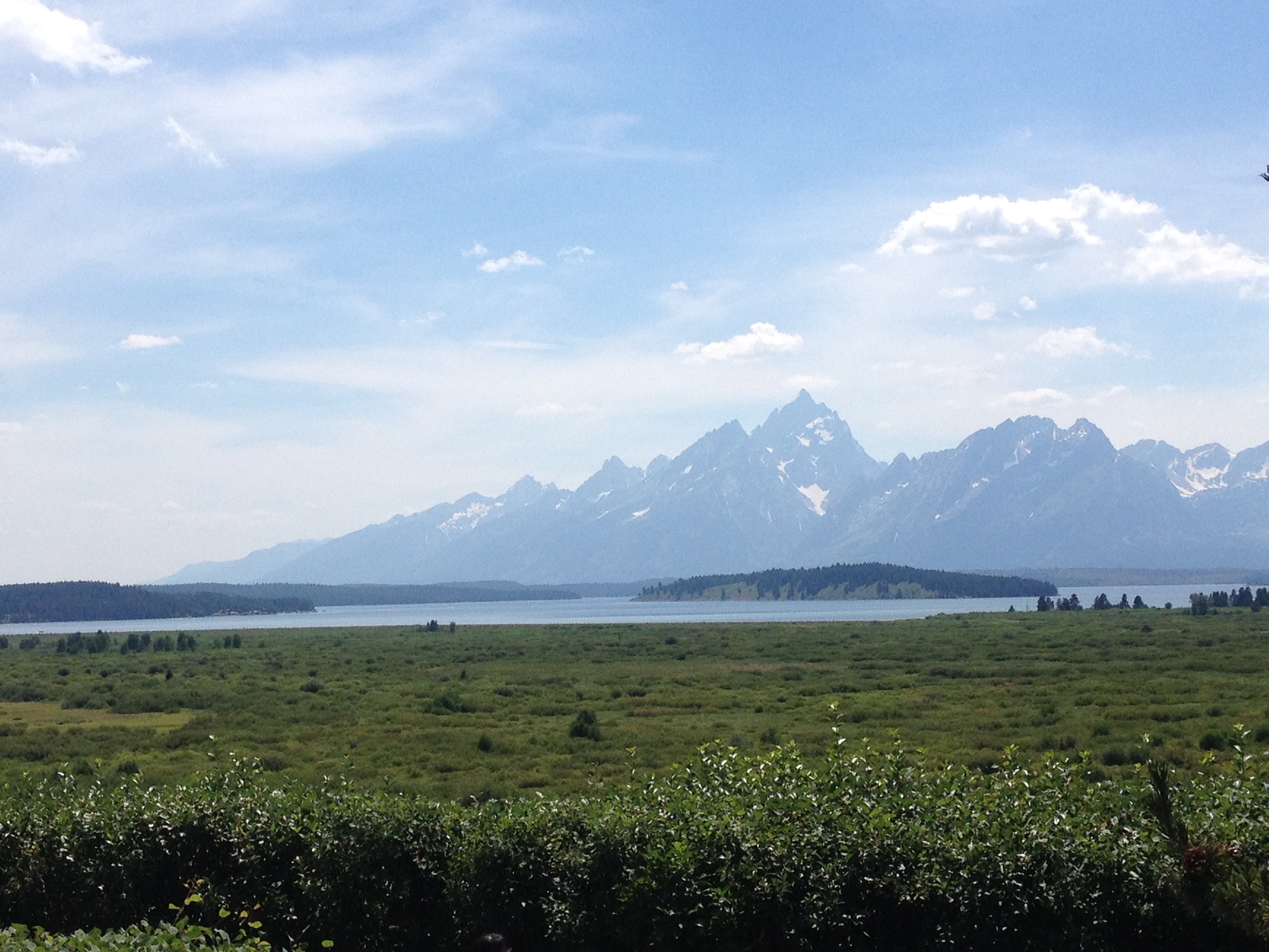
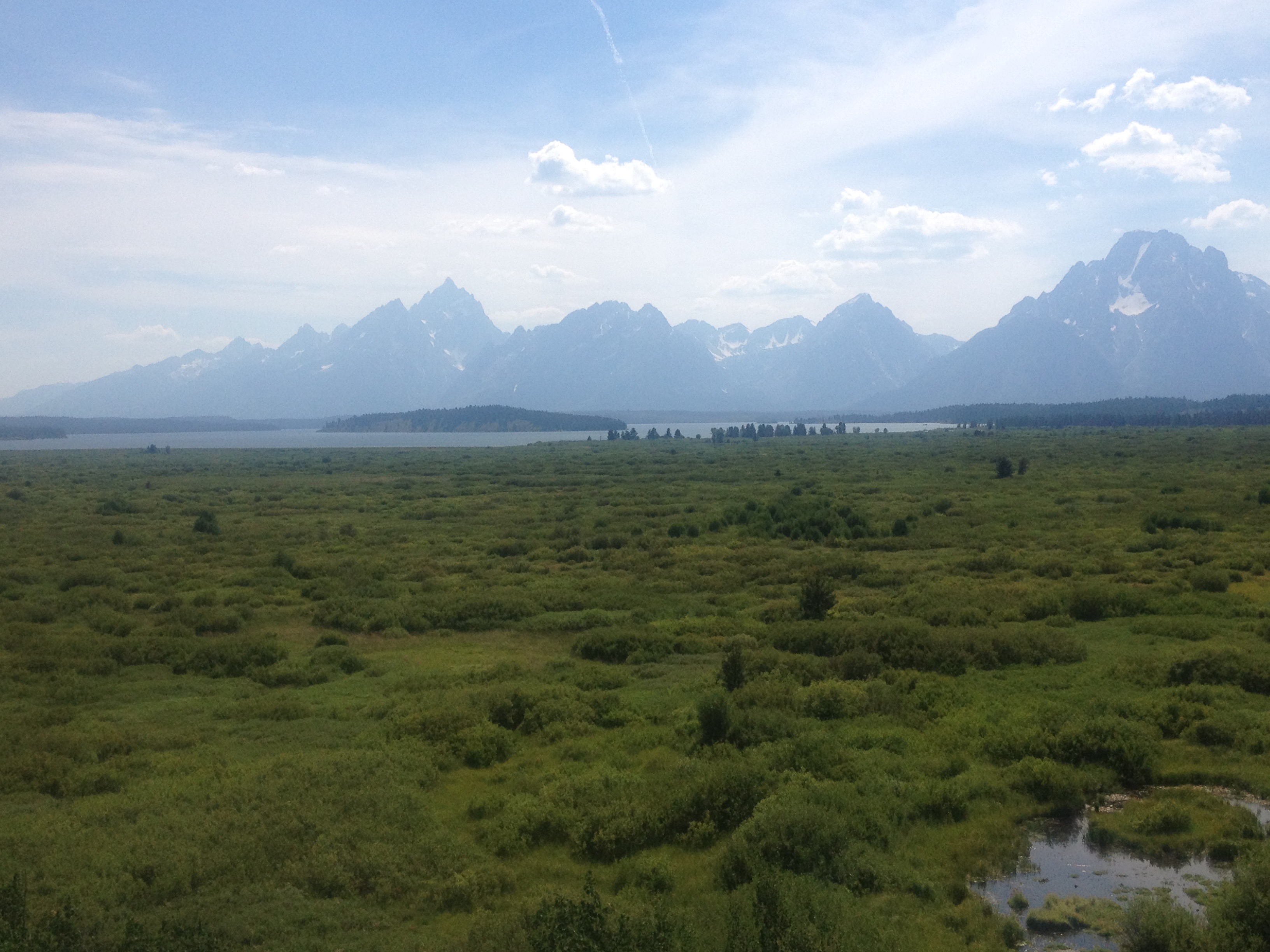
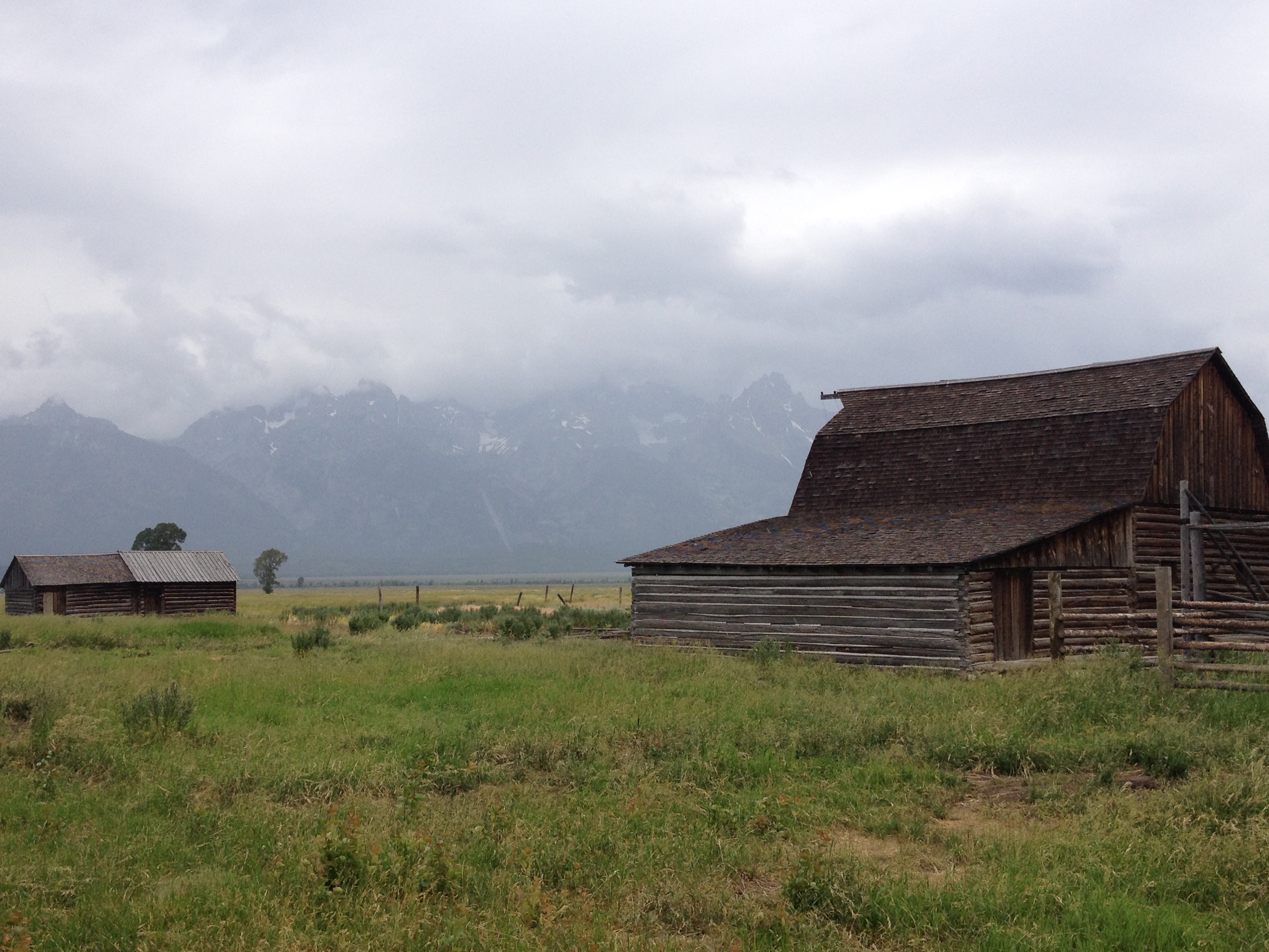
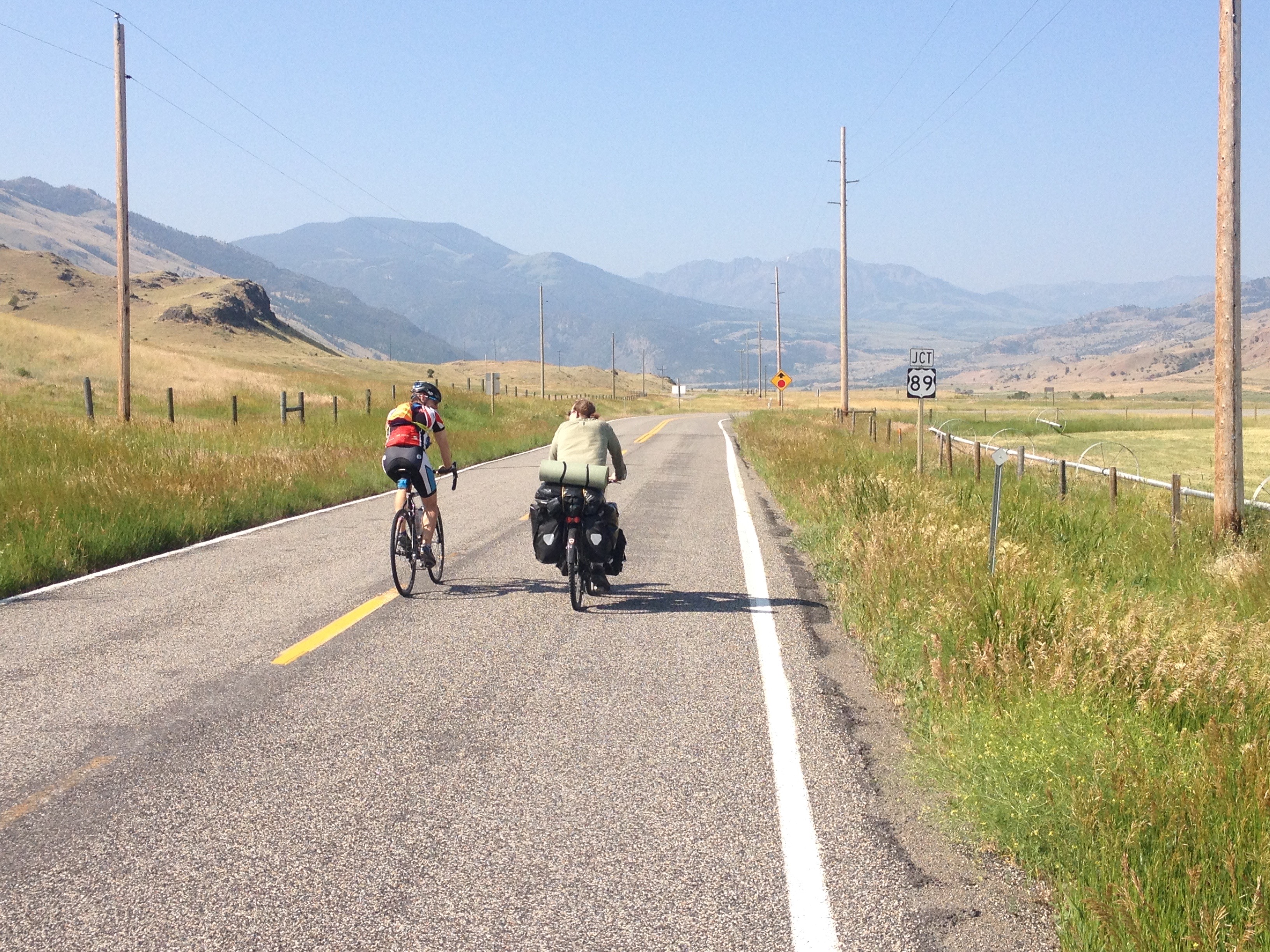
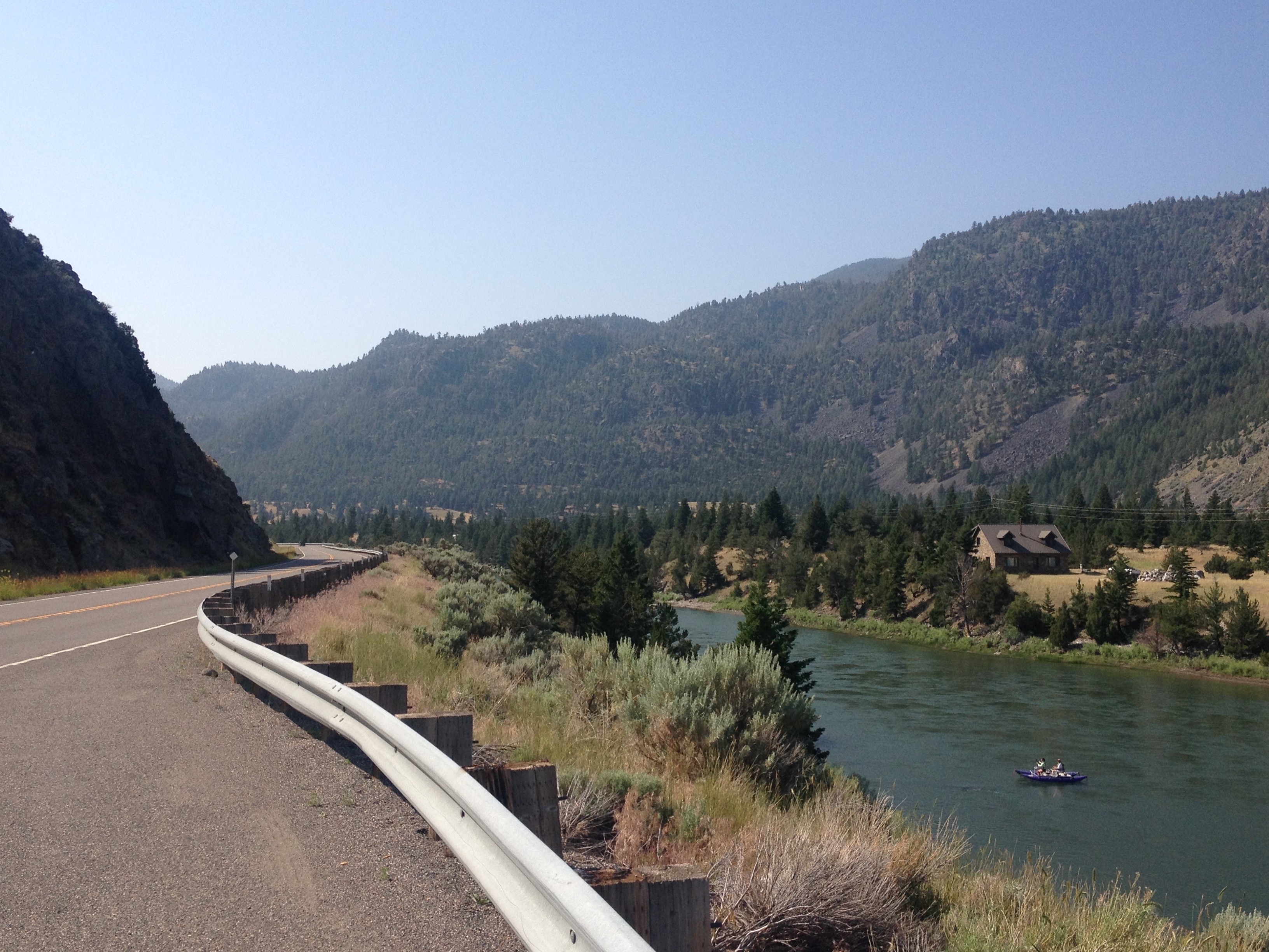
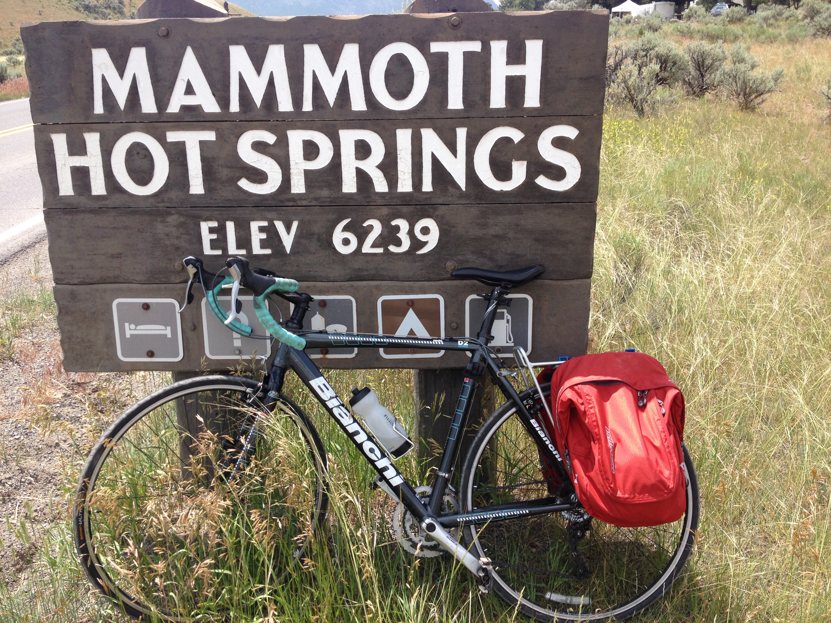
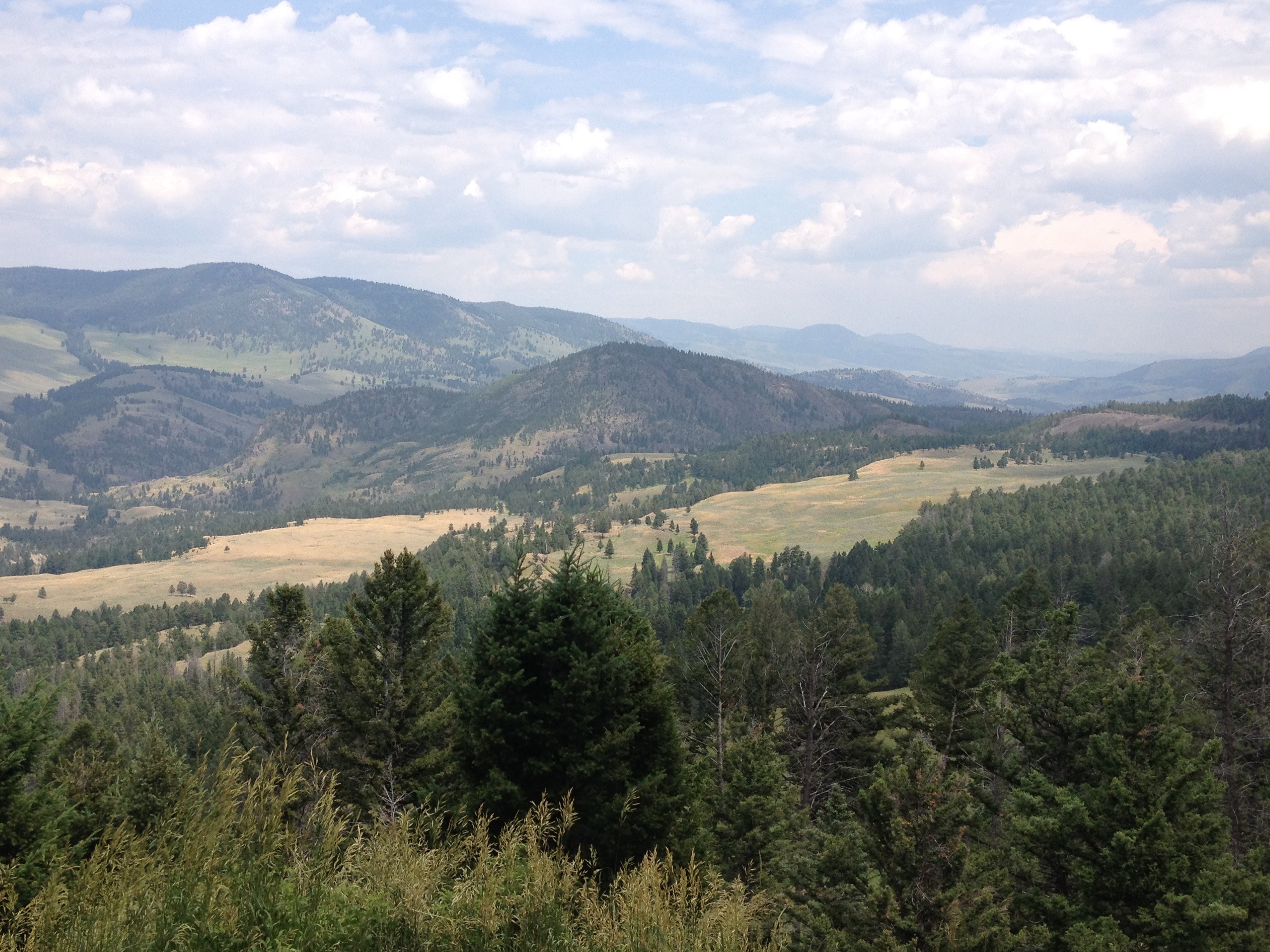
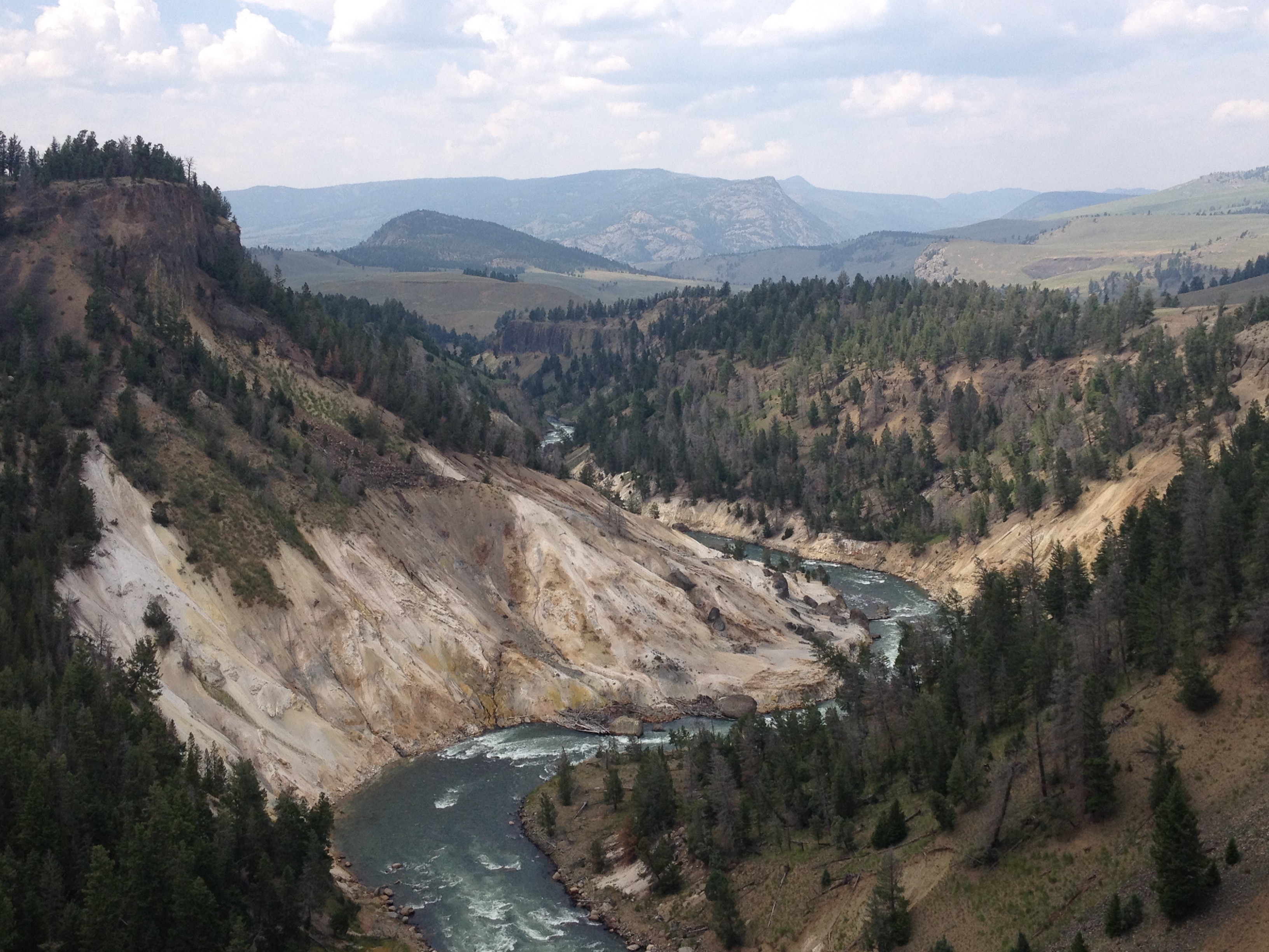
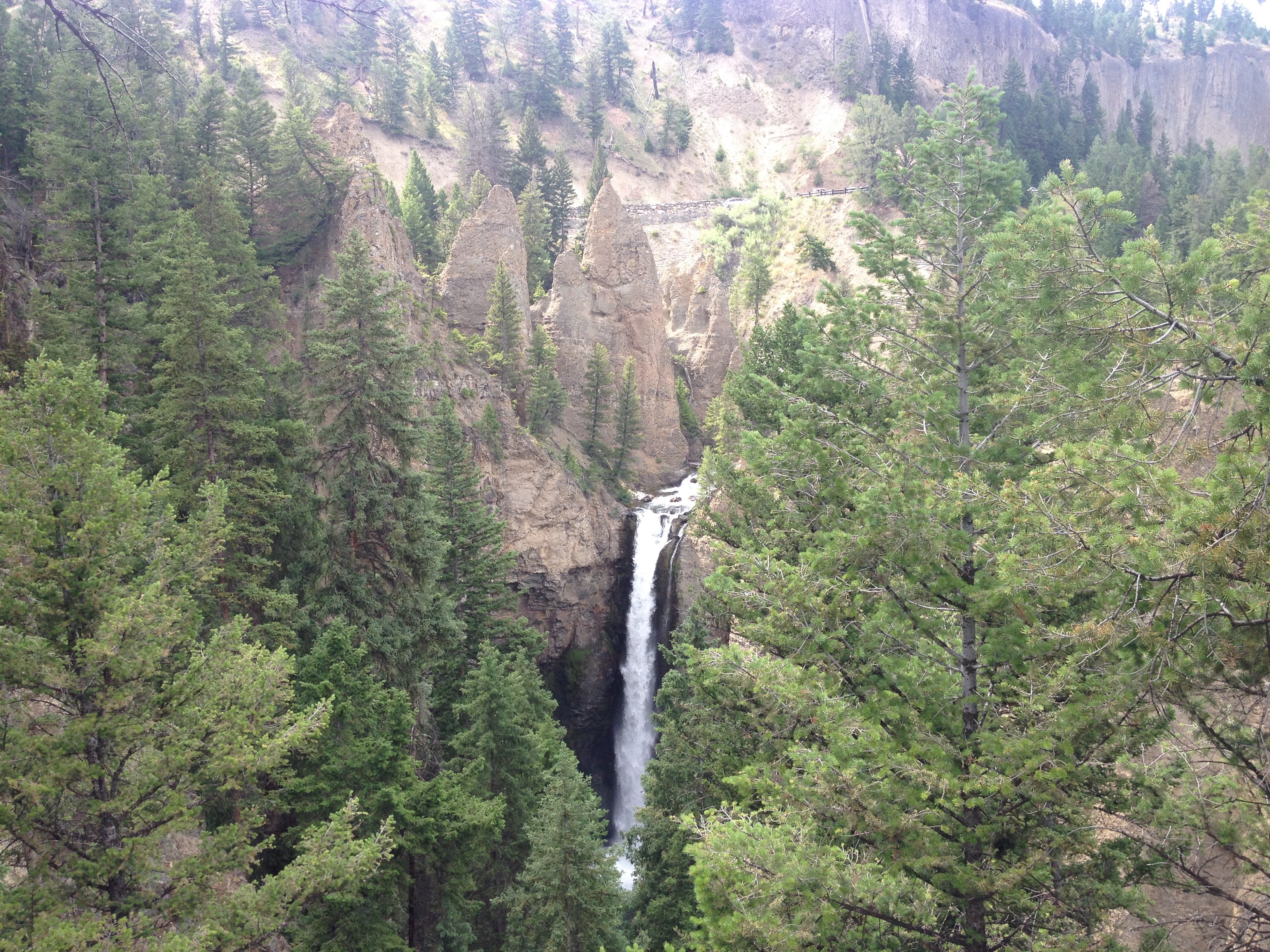
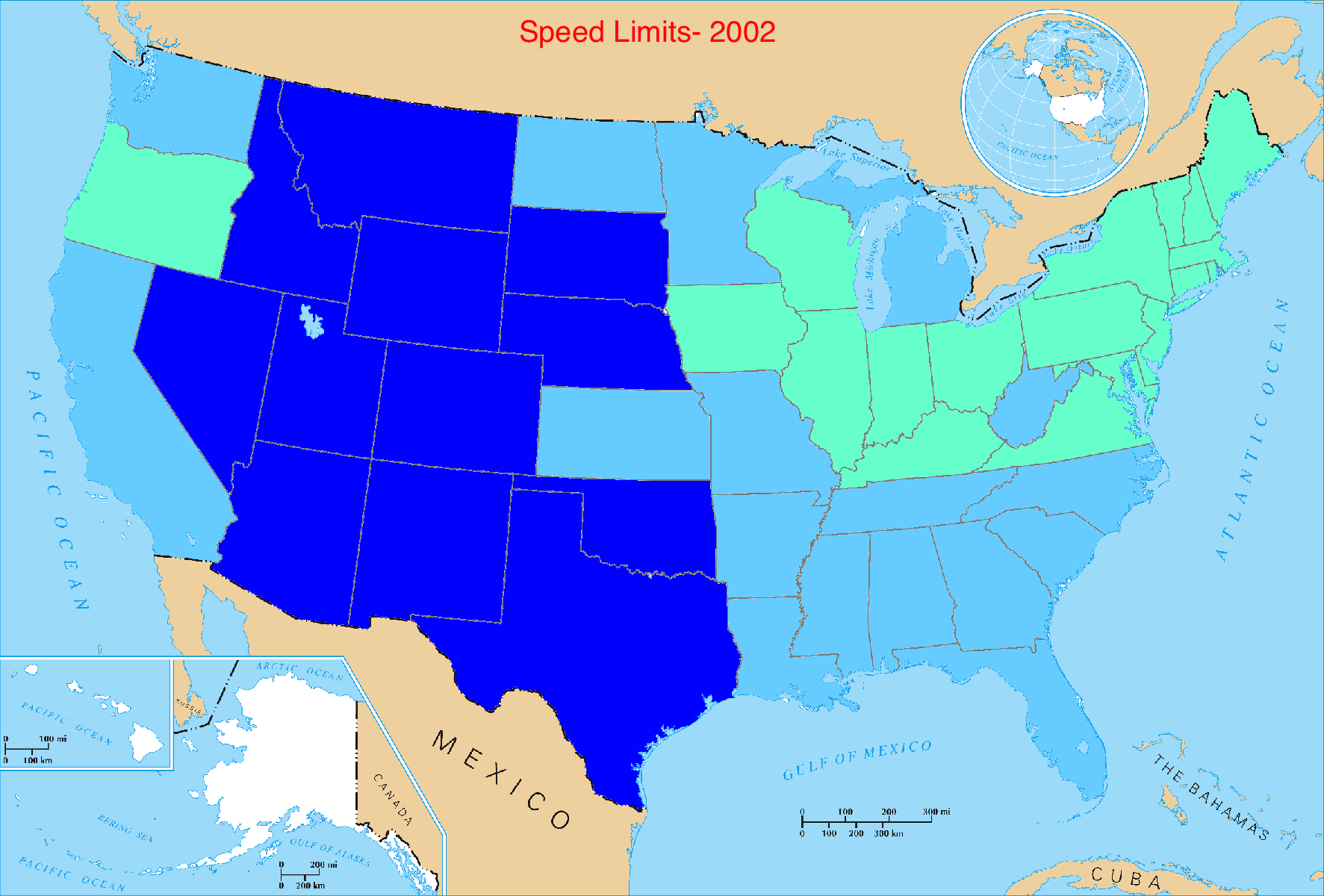
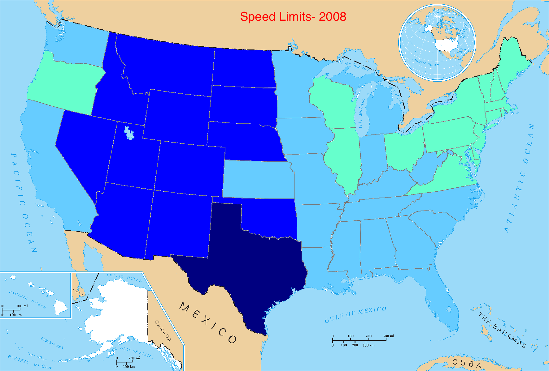
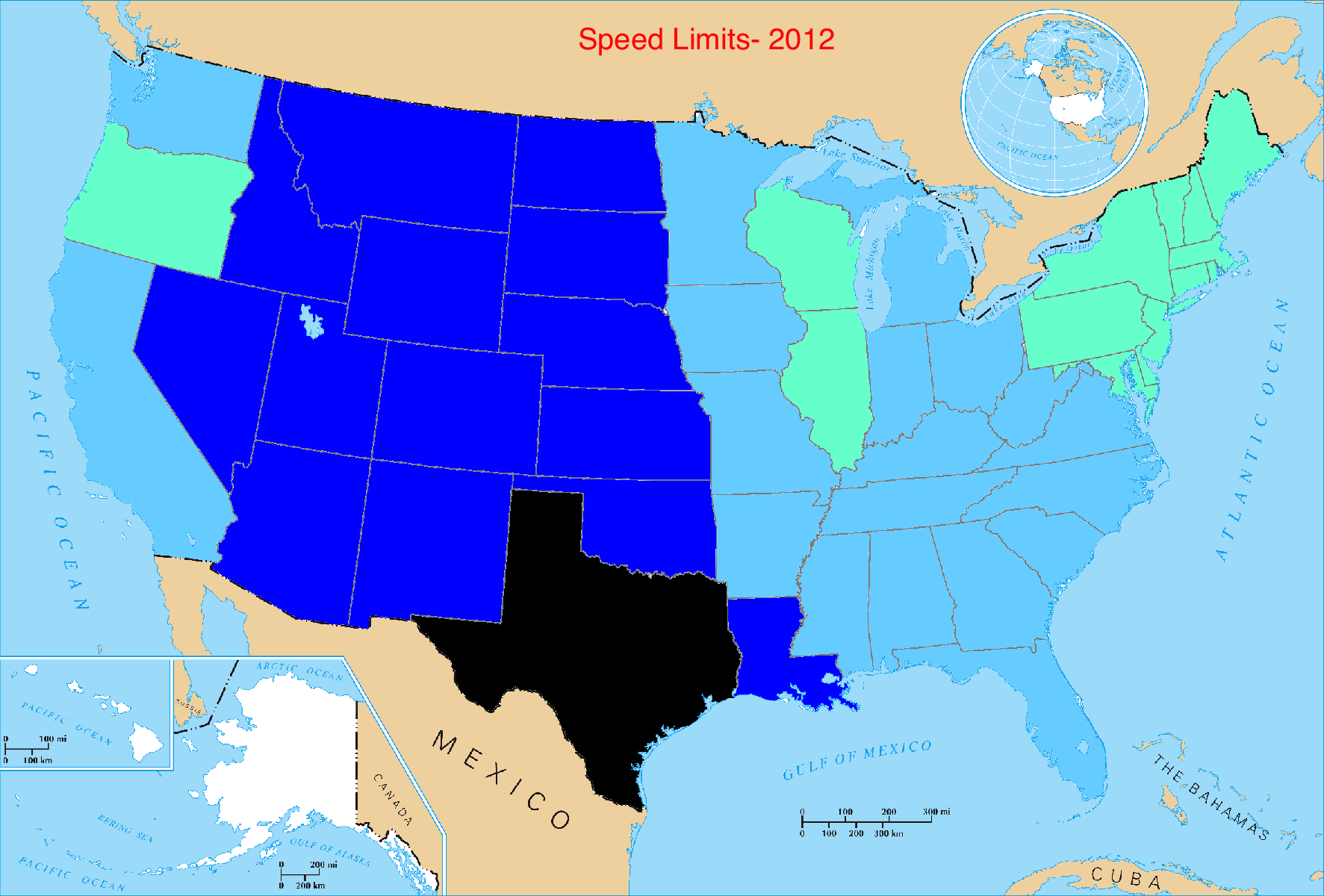
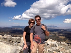
Every region has its high-profile destinations, as well as some lesser known, but often just as magnificent places. When people think of Wyoming, they often think of Yellowstone and the Grand Tetons, home of some of North America’s most unique and picturesque landscapes. The Wind River Mountains, roughly an hour east of Jackson Hole Ski Resort and the Grand Tetons is one of those places.

IMG_0693.jpg

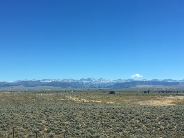
The jagged peaks of the Wind River Range are somewhat reminiscent of the Grand Tetons. They include Wyoming’s highest peak, and are considered an ideal setting for a true primitive outdoor experience. In fact, the National Outdoor Leadership School, where people of all ages learn about survival in the outdoors, has its headquarters in Lander, WY, and conducts many of its programs in the Wind River Mountains.

It also happened to be in the path of totality for the August 21, 2017 solar eclipse. For an event that brought hundreds of thousands of people to the state of Wyoming, the lesser known but still amazing Wind River Mountains represented the ideal place to view the solar eclipse without encountering large crowds.

IMG_0700 (1).jpg

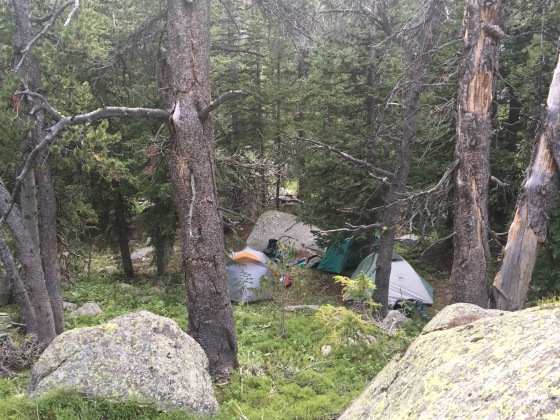
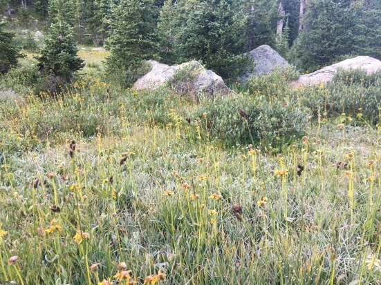
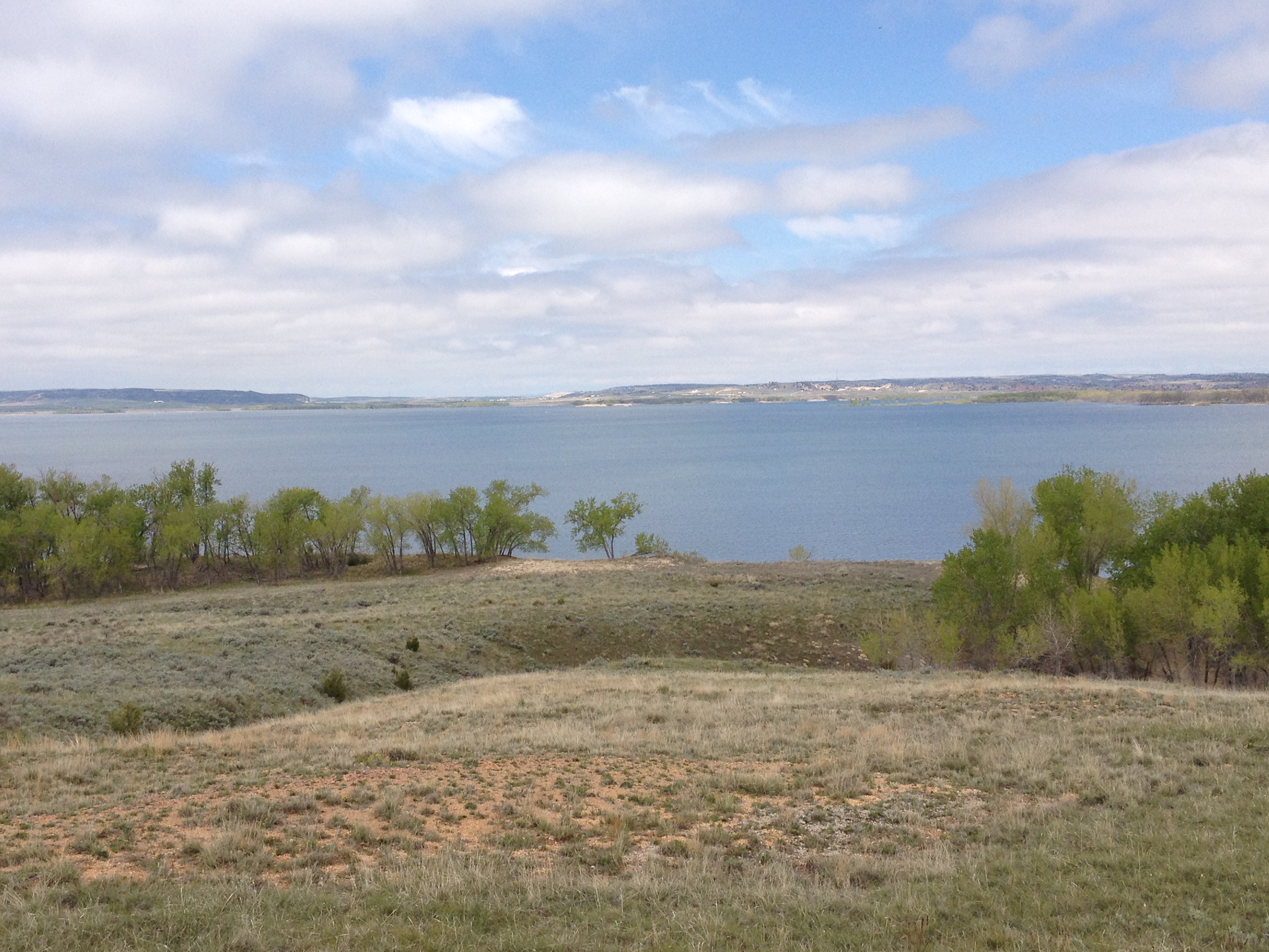
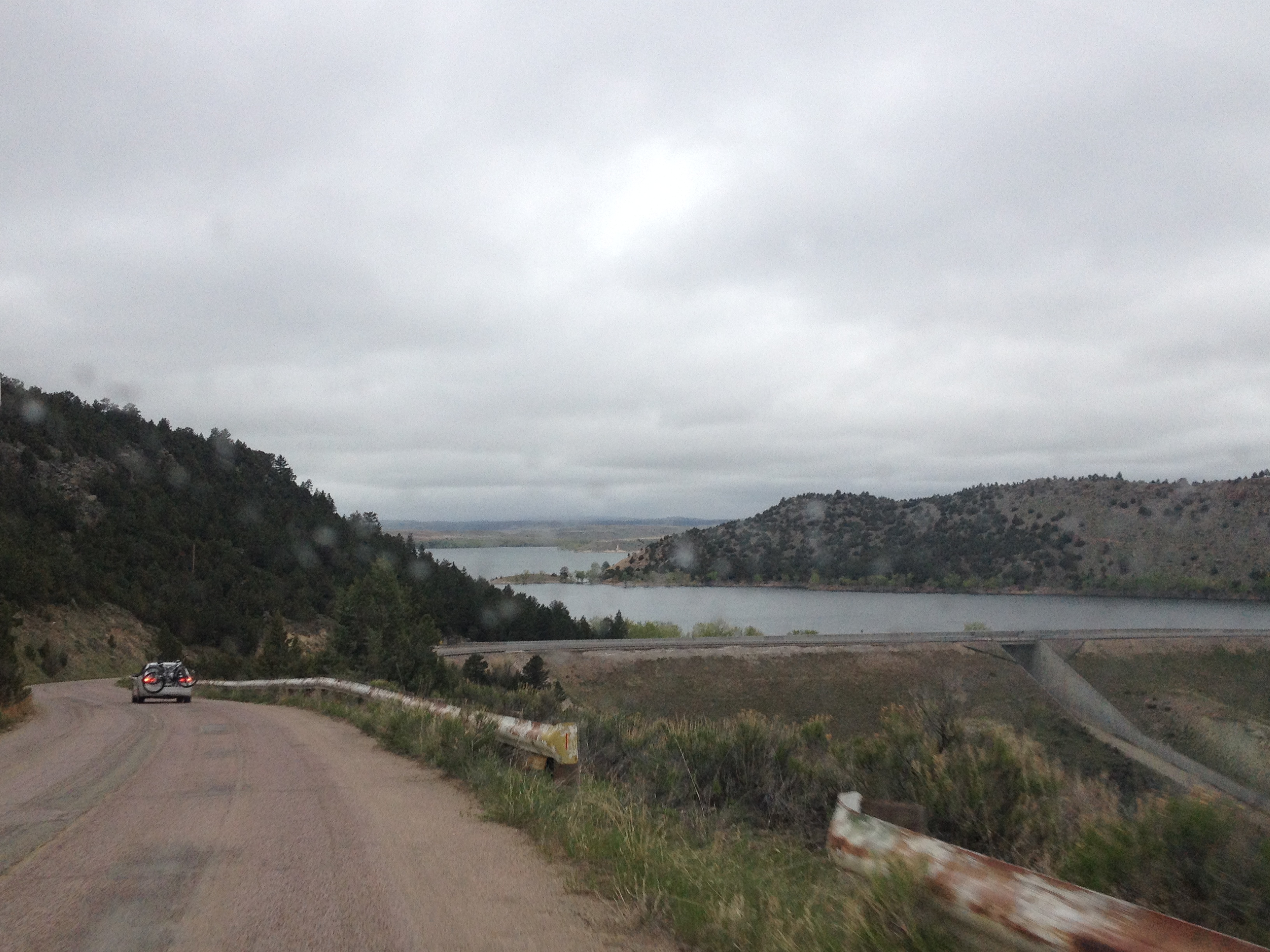
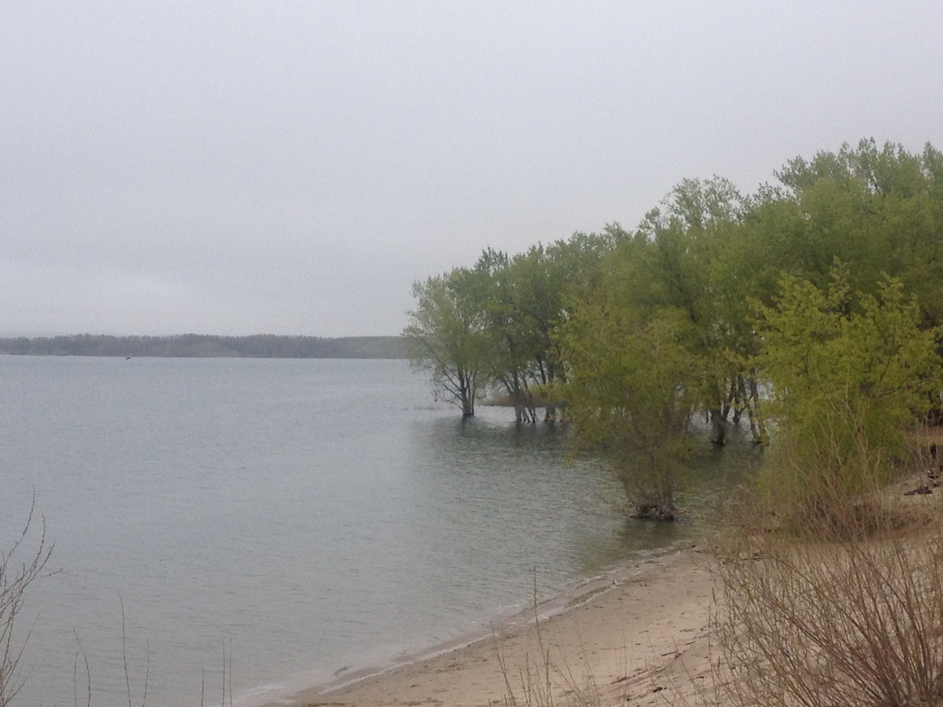
My group started our journey at the New Fork Lakes Campground roughly 48 hours prior to the eclipse. We spent most of Saturday afternoon climbing through a forest of mostly dead trees, wildflowers, and the occasional raspberry.

After stopping for the evening at one of the only quazi-flat areas we could find along the trail.

IMG_0731 (1).jpg

Hiking several hours Sunday morning.

IMG_0737 (1).jpg

Where we would periodically traverse alpine lakes of all sizes.

IMG_0756 (1).jpg

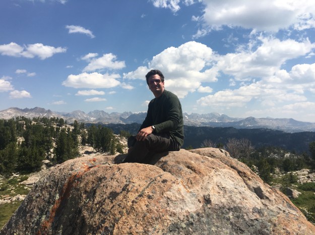
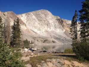
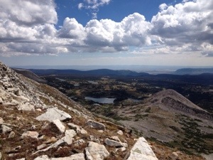
We finally got a glimpse of the higher peaks that make up the heart of the Wind River Range.

IMG_0768 (1).jpg

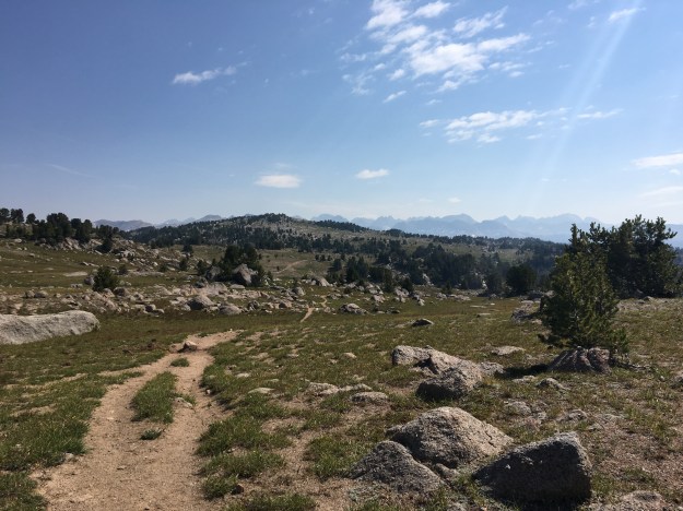
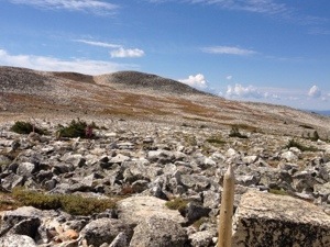
This was one of about a dozen “false summits” along the trail. By this, I mean places where the trail ahead appears to be reaching its apex, or a flat area, only to reveal significantly more climbing around the next corner.

IMG_0744 (1).jpg

Sometimes there is a lot more climbing.

Whether hiking, backpacking, or cycling, false summits can be frustrating. Some people find themselves quite discouraged when they believe that the challenging component of an experience is over, only to find out that far more challenge lay ahead, with no known ending.

IMG_0733 (1).jpg

It is also true of many of our personal challenges in life. A trail like this, with many false summits, can, in a way, be a metaphor for life. At times, it feels as if life is one false summit after another. Hopeful people in less than ideal situations will often see reason to believe better days are ahead only to have the struggle re-emerge, or the emergence of a new source of stress.

However, if hikes like this, sweat, frustration, and deceptive false summits and all, demonstrate anything, it is that climbing the mountain, both literally and metaphorically, is often worth it.

IMG_0780 (1).jpg

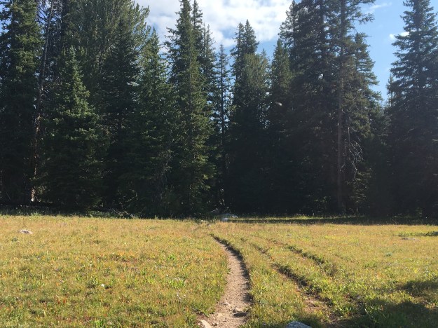
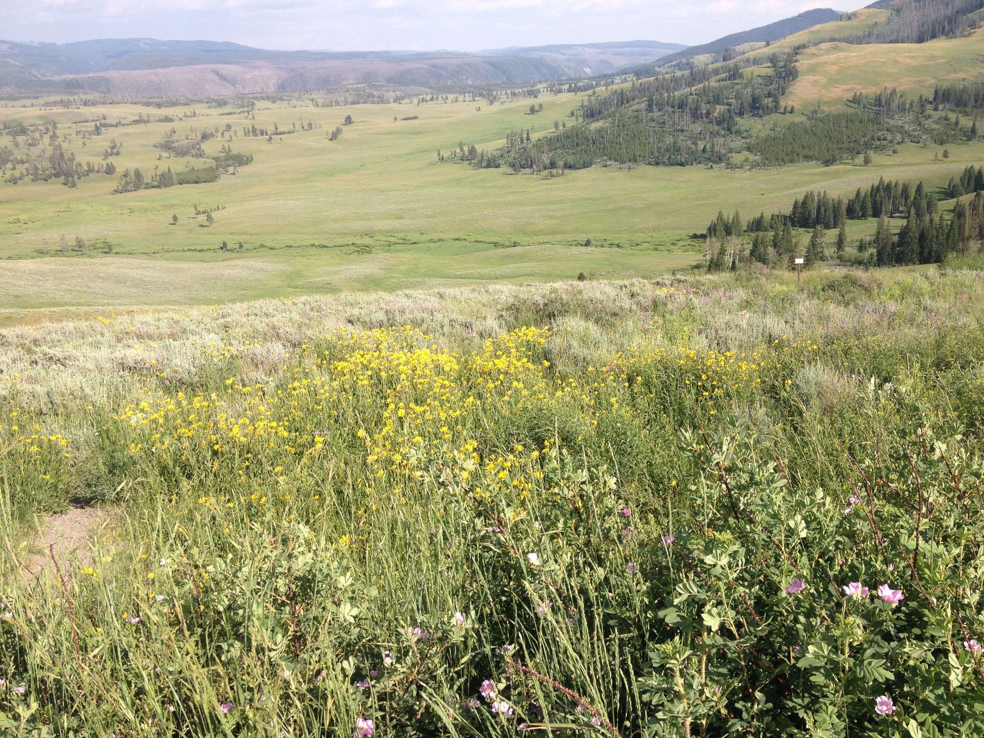
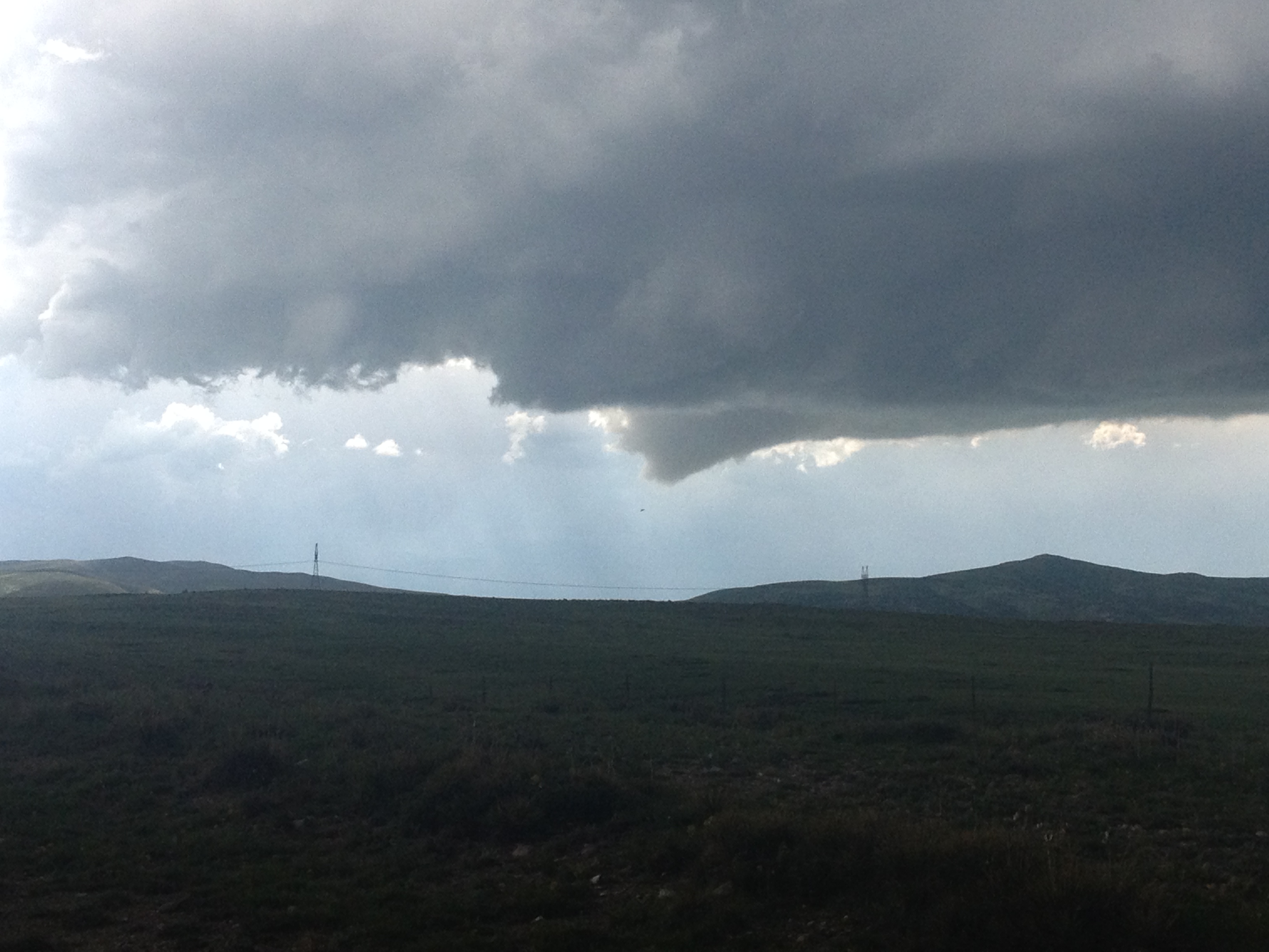
After the morning haze finally burned off, we spent the day Sunday in an area the was simply magnificent.

The manner in which the shadows of the clouds shifted along the panoramic horizon was often breathtaking to watch.

IMG_0823 (1).jpg

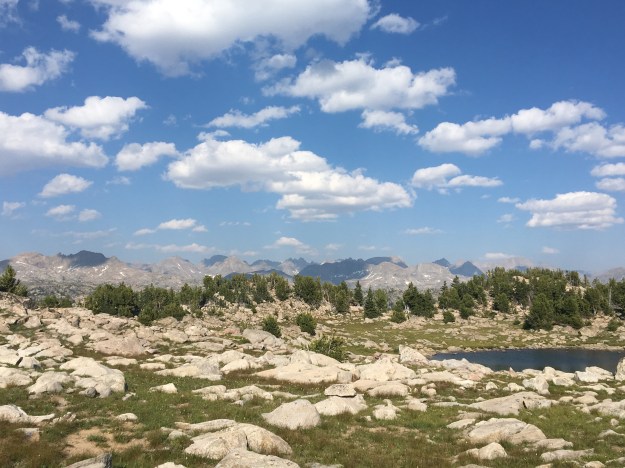
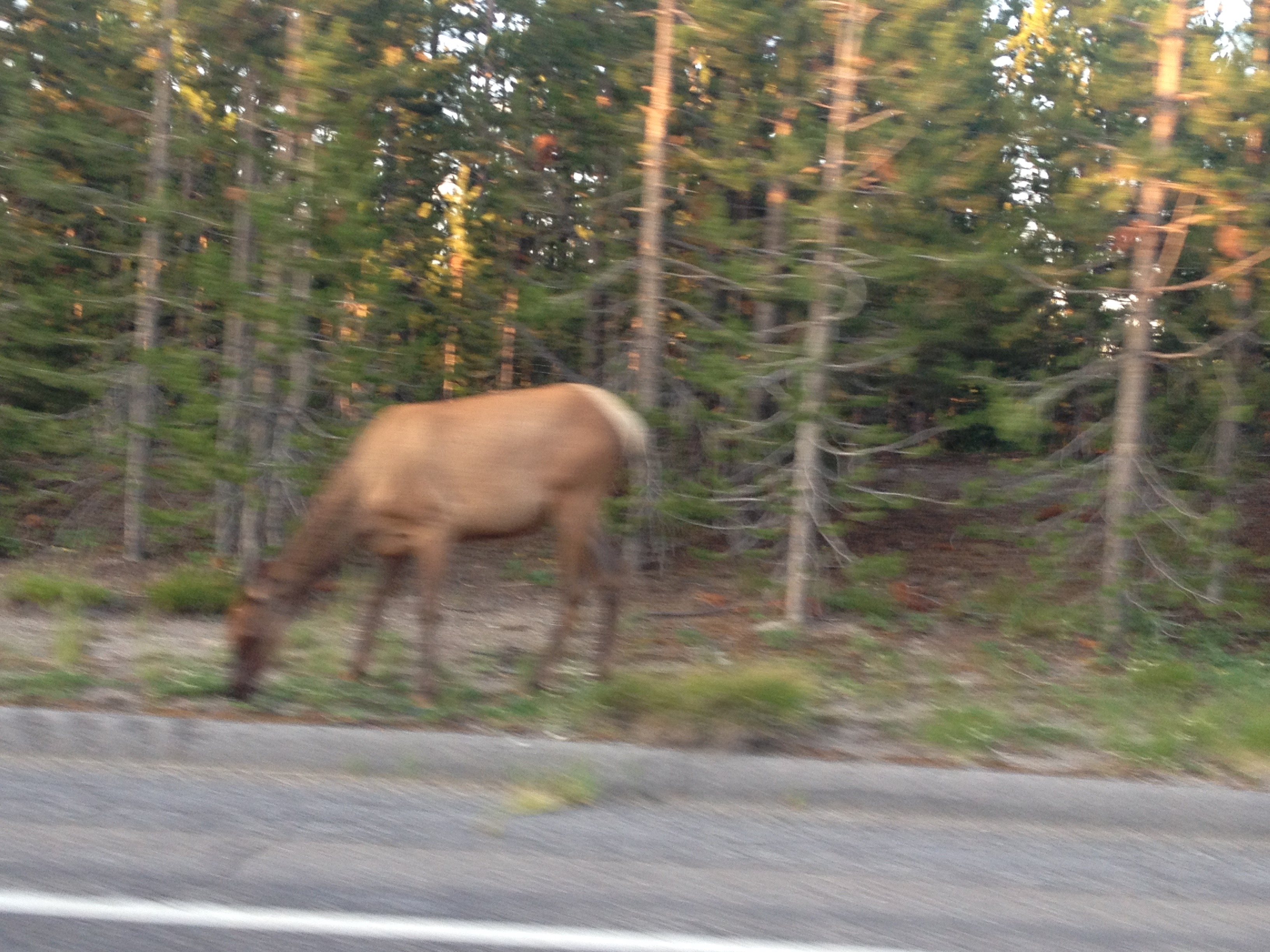
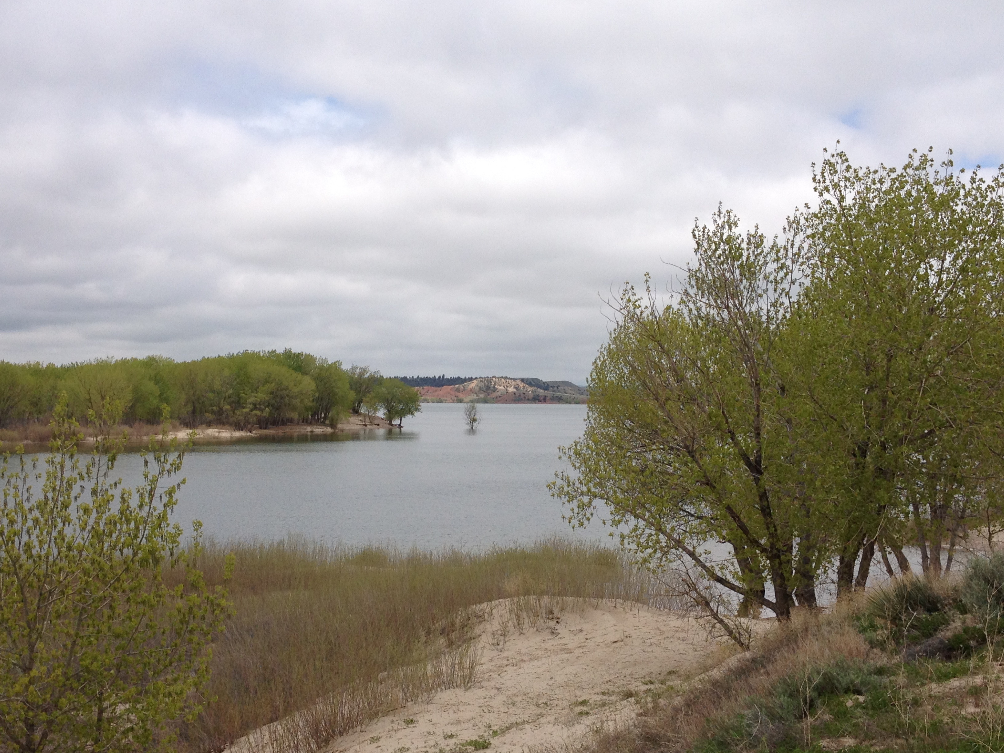
We got to enjoy ourselves in lakes that belong to nobody.

The campground we stayed at was great vantage point to watch, the sunset.

As well as the sunrise.

On a day when many were fighting crowds, and struggling with numerous hours of traffic to get a view of this eclipse, we were on top of Doubletop mountain, at roughly 11,000 feet in elevation, enjoying the eclipse with plenty of space.

IMG_0871 (1).jpg

The eclipse itself, like the breathtaking jagged peaks of the Wind River Range was beautiful beyond words.

P1000323

The event lasted a total of nearly three hours, most of it with the sun only partially blocked by the moon.

P1000211P1000258P1000283

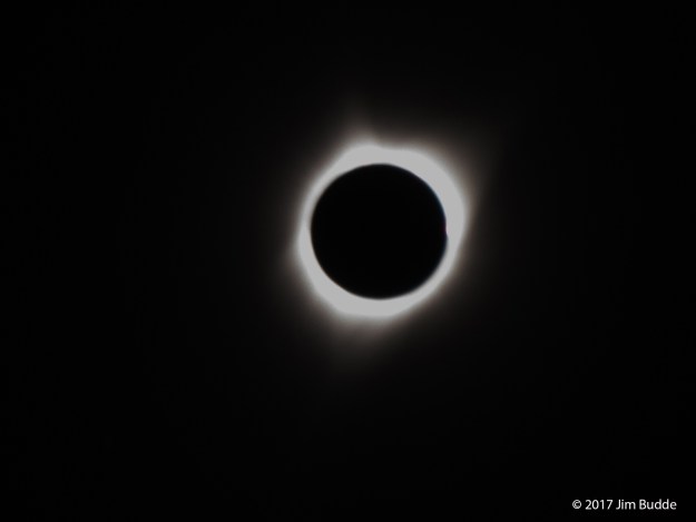
The previous four eclipse photos were taken by Jim Budde who got better photos of the event.

A little bit before “totality”, it began to noticeably feel cooler, even though it did not seem too much darker than usual.

IMG_0939 (1).jpg

Right before totality, the darkness becomes noticeable.

IMG_0950 (1).jpg

Totality is kind of like a two-minute-long strange dusk-like period. It does not feel like nighttime. In a way it feels like that time of the evening roughly twenty minutes after sunset, with the day that had just occurred gradually descending away to the west, enough residual light to make out surrounding objects, and the promise of the night ahead beginning to enter the collective consciousness.

IMG_0953 (1).jpg

Only, everything is, like, sideways, rotated or something.

IMG_0955 (1).jpg

While there was plenty of time to goof off, swim, watch the eclipse, it still was a physically challenging experience, as is any trip involving carrying heavy backpacks up steep hills.

IMG_0960 (1).jpg

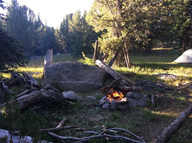
Backpacking is work too. There are chores to be done; setting up tents, starting fires, cooking, pumping water, etc.

IMG_0977 (1).jpg

That which is more challenging, requires more effort, or taking some kind of risk is almost always more rewarding than that which is easy. This backpacking trip, the beauty of the Wind River Mountains, the experience of viewing the eclipse, such a rare event, in all its glory, served as a reminder to me of something I have always known but can at time lose sight of. Human beings, by our nature, were meant to “work” in some capacity. Sitting around and playing all day, or having everything done for us will naturally lead to a life that is empty. Working hard and receiving a reward of some kind after that hard work is complete, whether that be backpacking to see something beautiful or starting a business that impacts the world positively, leads to fulfillment.

IMG_0980 (1).jpg

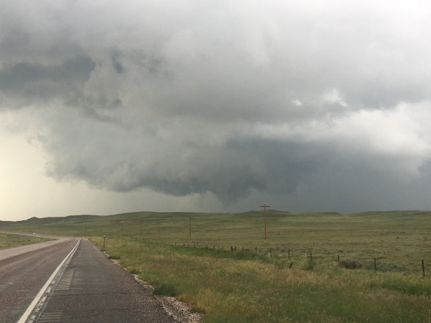
The final struggle of this trip is one that I can sometimes have a harder time dealing with than others- cold. Dry weather is convenient because it means no rain. However, it also commonly means large daily temperature swings. Each day, the temperature probably reached or exceeded 70F (21C), warm for physical exertion such as carrying a heavy pack uphill. Each morning was chilly, with Tuesday morning being the coldest – frost covered the ground.

The final day’s hike, and descent back to civilization went by surprisingly fast. With an early start, and few stops, we were back into civilization before noon, ready to return to “regular life”, and tackle the challenges that lay ahead, including whatever metaphorical “false summits” we would encounter next.

A Tornado Outbreak in Wyoming

Wyoming is not exactly “tornado alley”. According to the National Oceanic and Atmospheric Association, the entire state averages only 12 tornadoes per year. Kansas, by comparison, receives eight times as many tornadoes each year despite being 15% smaller in area. Although a tornado in Southeastern Wyoming played a pivotal role in the VORTEX 2 project, Wyoming generally tends to be too dry for severe thunderstorms.

June 13th’s chase came up somewhat suddenly for me, based on a notification I had received about this outlook after being out of town, and not focused on the weather, the prior weekend. For some reason, before I even looked at anything else, weather models, discussions, etc., I had a feeling something major was going to happen.

SPC_day2_20170611

This day somehow felt different, right from the start.

IMG_0031 (3).jpg

By 2 P.M., storm chasers were all over the roads, and at places like this Love’s Truck Stop in Cheyenne, Wyoming, watching the storms begin to form and trying to determine the best course of action.

RADAR_20170612

The decision we all were faced with was which set of storms to follow. The storms forming to the North were in the area previously outlined by the Storm Prediction Center as having the highest risk for the day, and in an area with great low-level rotation. But the storms to the South looked more impressive on RADAR.

Often, we need to continue to re-realize that the best course of action is to follow our instincts, and to follow them without hesitation or self-doubt. That is what I did, opting for the storms to the North.

IMG_0035 (2)

It did’t feel like a typical day in Wyoming. Storm chasers everywhere. Highway signs were alerting motorists to the potential for tornadoes and large hail. Moisture could be smelled in the air. With a moderate breeze from the East South East, the atmosphere felt less like Wyoming and more like a typical chase day in “tornado alley”

IMG_0047 (1).jpg

When I  caught up with the storms in Wheatland, Wyoming, hail larger than I had ever seen had already fallen. One of the good things about following a storm from behind is the ability to see hail after it has already fallen, as opposed to trying to avoid hail out of concern for safety and vehicular damage.

I stayed in Wheatland as long as possible, knowing the storm would head Northeast and I would have to leave Interstate 25. One of the disadvantages to chasing in Wyoming, as opposed to “tornado alley”, is the sparseness of the road network.

IMG_0049 (1).jpg

So I sat there for roughly 20 minutes. Looking at the storm, it felt like something was going to happen. All the necessary conditions were there, and the appearance and movement of the storm felt reminiscent of other situations which had spawned tornadoes.

I took a chance, using roads I had never traveled before, hoping the roads I was following would remain paved so I could follow the storm North and East.

There was a half hour time period where I had become quite frightened. I could feel the adrenaline rush through my body as the clouds circled around in a threatening manner less than half a mile in front of me. I lacked the confidence that the road would remain paved, or that I would have a reliable “out plan” if a tornado were to form this close.


After lucking out with around 10 miles of pavement, I suddenly found myself driving over wet dirt, and, at 20-30 miles per hour, gradually falling behind.

Luckily, I once again found pavement, drove by some of the natural features that makes Wyoming a more interesting place to drive through than most of “tornado alley”, and once again encountered large hail that I felt the need to stop and pick up.

IMG_0070 (1).jpg

Almost an hour later, and significantly farther north along highway 85, I finally caught up to the storm, just as it had dropped it’s first, and brief, tornado. And, this time, I was a comfortable distance from the thing! Unfortunately, this tornado would lift off the ground in only a few minutes.

IMG_0075 (1)

Not too long after, I received notification that other chasers, following the storms that had formed farther South, had seen a much more impressive tornado, closer up, and had gotten better photos (the above is not my photo).

It was a strange day. Not only because Wyoming is not the typical place to see tornadoes. It also felt strange, as I had managed to do something impressive, yet still had reason to feel like a failure.

Most storm chasing is not like it is portrayed in the movies, with people getting close to storms all the time and getting in trouble. Most days, chasers do not see one. Seeing a tornado one day out of five is a very good track record for storm chasers.

Going out on a chase and seeing a tornado of any kind is impressive. Yet, to be truly happy with my accomplishment, I had to accept the fact that there was something better out there- something I did miss out on. This is a struggle we all face, in common life situations such as jobs, relationships, events, houses, etc. We often know we have done well, but always have this idea of something that is even better out there. Knowing this can make us indecisive, which will often leave us with nothing. In the age of text messaging and social media, evidence of such options has become extremely abundant, and quite hard to escape.

In a connected world, in order to be happy with ourselves, we need to find a way to both believe in ourselves, but also be accepting of the fact that someone else, somewhere out there, has done better. For that will always be the case, and we now have instant access to that knowledge. We cannot let knowledge of someone else’s more impressive accomplishments dampen our enthusiasm for our own. Otherwise, we will likely never be content.

Cycling from Denver to Cheyenne

IMG_6854
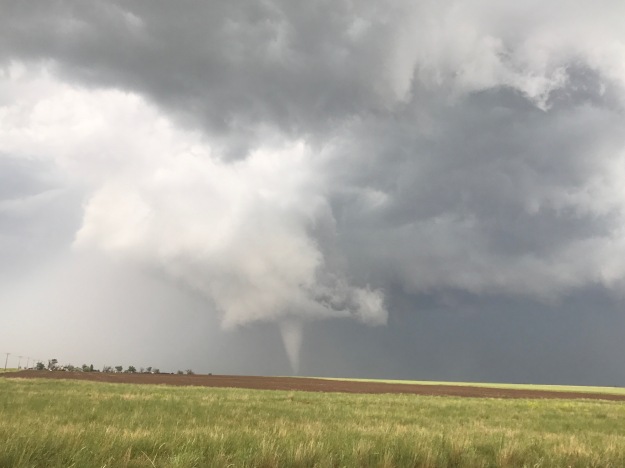
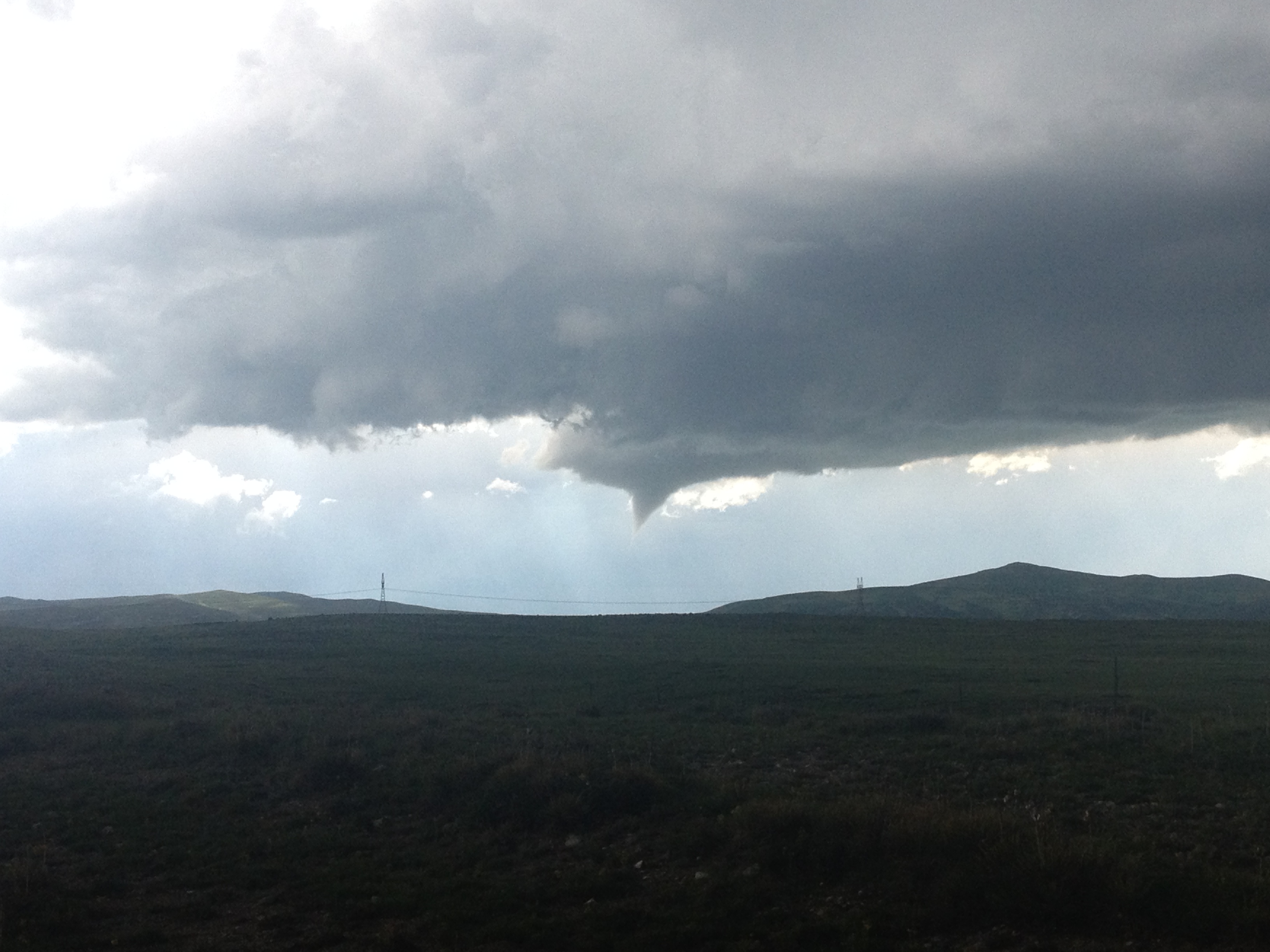
On the evening of July 3rd, having just finished an exhausting six-day bike ride, including four days of cycling over one hundred miles, my body felt a bit relieved.  I was actually ready to rest, ready to sit in front of a computer again!  Clay, however, told me that I was going to wake up the next morning, realize I was not biking 100+ miles and not know what to do with myself.

The truth ended up being somewhere in the middle.  I could not have pictured cycling at all the next day.  This was literally how I felt.

IMG_6644

The next day, I biked six miles, to and from Union Station from my home.  And, I was perfectly fine with that.

However, I did eventually get antsy, despite two other, closer to home adventures.  By Tuesday July 19th, I posted this picture on Instagram, stating I was bored and wishing to get on my bike and explore again!

IMG_6808

I ride the new RTD A-Line train, which connects downtown Denver with Denver International Airport, roughly three days a week for a gig I am currently working at the airport.  At Central Park Station, one of six intermediate stops between downtown and the airport, this curious piece of potentially symbolic artwork sits atop a pillar.

IMG_6809

Whenever I am on the train, and not trying to sleep for efficiency sake, I see it, and sincerely wonder what its purpose is.  It seems to depict a person running to catch the next train, but headless.  But why headless?  Could it actually be a satire on the futility of the rat race?  Could the artist who created the sculpture have had an alterior motive?  Could he or she have created this sculpture with the secret hope that a few commuters each day would look at this sculpture and be prompted to ask; what am I doing and why am I doing it?  Is this the life I wanted?  Is this the natural state of human condition?  Etc.?

I, however, had other plans, actually for the next Friday, and, they once again involved my 2012 Bianchi Cyclocross bicycle.  The Cheyenne Frontier Days Rodeo was starting, and, I was going to ride my bike there!

The prior evening, I spent the night in Broomfield, after a softball game in Boulder.  So, even before this next 100+ mile bike ride, I was already spending some significant time on my bike again.  Knowing it was going to be hot, we got an early start.  I actually wish we had gotten an earlier start.

BikeRoute_DenvertoCheyenne

A lot of people hear about my bike adventures and immediately sounds perplexed…

Is there a trail there?

Are there safe roads to bike on there?

There’s a lot of trucks on that road.

I would never ride my bike on those roads, you could get killed.

Etc.…

There is some risk, no denying it.  When I was a child, one of my favorite bands, the Offspring, told me “Back up your rules.  Back up your jive.  I’m sick of not living just to stay alive.”  More recently, Drake told me, “Everybody dies, but not everybody lives.”  The truth is that there is the possibility of death doing nearly everything.  People die on the slopes.  People die rafting.  But, people also die commuting to work.  And, due to the health risk factors such as cardiovascular disease and such, sitting around watching television can be deadly!

That being said, I still considered risk when choosing a route, and am still willing to go a few extra miles to reduce my risk.  I am just not willing to miss out on opportunities altogether out of fear.

IMG_6814

The first part of the ride was pleasant, 95th St. from Broomfield to Longmont is a road I knew had bicycle accommodations in the form of bike lanes or wide enough shoulders.

Longmont was a little bit tougher to navigate.  Like many towns, their bike route network was designed primarily with travel within the town in mind.  I stared at their bike map for a good half an hour to figure out the best route through town, but it ended up being a fun route.

IMG_6817

I particularly enjoyed all the sculptures along the Saint Vrain Greenway!

IMG_6818

One thing people miss when they drive along I-25 between Denver and Fort Collins is how many lakes there are in the area.  On the interstate, there are none.  On this route between Longmont and Fort Collins, through Berthoud and Loveland, we actually saw a lot of lakes.

I’d been pondering riding my bike from Denver to Cheyenne for years, even going as far as thinking about some of the details, such as what time of year to go and what route to take.  As soon as I started thinking about routing, there was one segment I knew I was going to do, the combination of Taft Avenue and Shields St. through Loveland and Fort Collins, roughly half a mile west of highway 287.  This straight shot through both towns has a bike lane the entire way, and made navigating through Loveland and Fort Collins was easier than navigating through Longmont.

IMG_6821

This is where I started to feel the heat, which was right around 10:30 or 11:00.  The temperature probably hit 90 sometime while we were in Fort Collins, making me regret having not left even earlier than we did (we departed at about quarter to 7 in the morning).

Also, the wind had a slight easterly component that day.  This made the next two segments of the ride, first from Fort Collins to Wellington, where we stopped for lunch around noon, and then from Wellington to Nunn to reach U.S. highway 85, quite possibly the most challenging segments of the ride.  I had this nagging feeling about entering Weld County.  I do not know why, I just felt as if something bicycle unfriendly would happen to me in this county specifically.  It was mainly just a premonition that bore out to be true, just not in the way I had anticipated.

IMG_6845

Upon entering Weld County, the road we were following switched to newly paved blacktop, while the temperatures had climbed probably into the mid-90s.  This lead to the closest thing to heat exhaustion we would experience during the ride.

IMG_6846

By the time we reached Nunn, we were desperate to get out of the heat for a few minutes and get some water.  Unfortunately, despite the fact that Nunn has a water tower that says “Watch Nunn grow”, I’m 100% sure that my calf muscles were growing faster than Nunn that day.  The only place we could find to fill up our water bottles was the police station/town hall, and the only reason that option was available to us is because we were riding on a weekday (Friday).

IMG_6847

We followed U.S. 85 for the last 30 miles of the ride.  We ended up having to wait out a mid-afternoon thunderstorm near the Colorado-Wyoming border, at the only building within a 10-mile radius.

IMG_6850

The storm was, however, neat, and I felt as if I were storm chasing on my bicycle (even though in real life that would have been a disaster).

We arrived in Cheyenne during rush hour, which was a little nerve racking as this is the only part of the ride where the shoulder on U.S highway 85 disappears, the last couple of miles before entering town.

After 109 miles of riding, we were there, Cheyenne Frontier Days, miraculously with enough energy left to party, parade, and rodeo!

July 2015 Bicycle Journey Day 3: Yellowstone’s Grant Village to Jackson, Wyoming

IMG_3840

What a difference a day makes!  After the most exhausting bicycling day of my life, day 3 seemed like a breeze.  Everything seemed different, even in subtle ways.  Whereas on day 2 I felt like I had to struggle, even on the flatter portions of the ride, certain segments of this day seemed to breeze by.  It was almost as if there was some kind of invisible force that had been holding me back on the previous day, but now was helping me along.

IMG_3819

We left the Grant Village campground having done none of the activities that are typically associated with camping (other than putting up and tearing down a tent).  We did not set up a fire.  We did not cook anything.  We did not even spend a significant amount of time at the campsite other than sleeping. The next morning, we got some breakfast, and headed South, towards Grand Teton National Park.

IMG_3820

The day started with a climb, albeit a very small one, and one that event felt easier than a similar sized climb would have felt the previous day.  Only four miles into the ride, we crossed the Continental Divide, and immediately started headed downhill.  The next eight miles flew by as we reached our last major stop in Yellowstone National Park; Lewis Falls.

IMG_3822 IMG_3823

I feel like I got a fairly exhaustive tour of Yellowstone’s waterfalls.  And, while I had seen several waterfalls while in Yellowstone, each one was different in characteristics.  Undine Falls, which I saw yesterday, was skinny and tall.  Lewis Falls is much wider, with a smaller drop.  It is shaped much more like Niagara.  At this point in my journey, 12 miles in, I was energized!  I felt almost as if I could have handled anything on that day.  In fact, I am 100% sure that I had more energy at that point in the day than I would have had I been resting over the last several days.  There is just something about getting through a really rough day of riding, and then riding downhill.

Until this trip, most of my riding had consisted of day trips.  Before moving to Colorado, those trips were pretty much about how many miles I traveled, as Illinois is flat.  Since then, I have begun to tackle some climbs.  In each of these rides, there is a similar theme, I go up, and then I go down.  There is a climb, and it is followed by a “reward”, a chance to go fast.  This almost felt like a way more stretched out version of this.  I spent an entire day pretty much climbing.  The previous day was my climb, and this day of primarily descending was my reward.  Therefore, the feeling of guilt that usually passes over me when I descend without having climbed first did not manifest.  The whole time I knew that I had earned this day of rapid riding through the exhaustion I had endured on the prior day.

IMG_3827 IMG_3829

By the time we left Yellowstone National Park, we had already descended a significant amount.  That descent was interrupted by the days only climb, in the 6 mile space that separates Yellowstone and Grand Teton National Parks.  This is a strange place.  Although you are technically in neither National Park, signs posted along the road remind motorists that National Park speed limits and enforcement are still in effect.  Also, there is no official entrance into Grand Teton National Park from the north, at least not along US-89.  It is pretty much assumed that all motorists (and I guess cyclists too) had already paid to get into Yellowstone and do not need to pay again.

After climbing for a little bit, there is a rapid descent towards Lake Jackson, and the heart of the Grand Tetons.

IMG_3830

This lake is gigantic, and one of the defining features of the National Park.  And, as one travels farther, into the heart of the Park, one can sometimes get some of the most stunning views of the Tetons from the other side of the lake.

IMG_3832 IMG_3833

The Grand Tetons are the most photographed location in Wyoming.  The primary reason they are so photogenic is that this particular mountain range not only has a prominence (how much higher in elevation the peaks are from the area around them) of over 7,000 feet, but there are no foothills to obstruct one’s view of the mountains.

IMG_3838 IMG_3840

There really is nothing like experiencing the Tetons, at a nice comfortable pace of 15-20 miles per hour, from the seat of a bicycle, up and down some gentile rolling hills, as the afternoon progresses. As was the case in Yellowstone, I decided not to push myself and hurry through the park.  Only this time, on a day that had been mostly downhill, it felt way more comfortable.  I wasn’t climbing up a major pass, putting my legs through all of that exhaustion.  I was just gliding kinda.

The final part of the trip into Jackson took me on a bike trail, where I encountered the last wildlife of my journey, a coyote.

IMG_3845 IMG_3847

In the end, I once again rode over 80 mies on the final day of my journey.  However, the last part of the ride felt quite a bit different for me on day 3 as it had on day 2.  At some point, I came to the realization that on my final day’s ride, it wasn’t the energy I had left in my legs that was limiting the number of miles I felt like I could do, it was other intangibles.  It was how my butt felt about getting back on the seat.  It was how many times my right fingers had been used to shift gears, as well as the amount of weight I had placed on my forearms in general over the course of many hours on the seat.  In this case, I wonder if the strategy of biking a bit faster, but taking more frequent stops to get up and off the seat may be a better strategy for handling these long distance rides.

The last five miles of my ride, on the trail, headed into Jackson were counted off by little markers in the trail; white lines labelled 5.0, 4.5, 4.0 and so on, counting off the distance from Jackson at the end of the trail.  These markers countered down, pretty much, the end of my trip.  So while I was excited to make it all the way into Jackson, and really anxious to take a shower and have a coca-cola, it still felt bittersweet to me, knowing that this bicycle trip that I had been anticipating for so long was quickly coming to an end.

IMG_3848 IMG_3851 IMG_3853

Two days earlier, at Chico Hot Springs, I had refrained from eating chicken wings, as I was unsure if the choice would negatively impact my bike ride the next day.  Now, with no more bike riding ahead of me, it was time to finally fulfill that craving.  So, after showering and changing, we went to a place called Local, right in downtown Jackson, and, yes, I had my wings.  Oh, and they were amazing.  One thing I learned the first time I attempted bike travel, ten years ago, was that wings always taste better on a bike journey.

IMG_3856 IMG_3859

That evening, we stayed at the Anvil Motel downtown, and watched the 4th of July firework show.  As I watched the fireworks light up the night sky, I thought to myself about how I had celebrated our Nation’s independence by traveling through some of the most beautiful places in the country.  I cannot think of a better way to honor The United States of America than that.

The only regret I really had was that the haziness of the day had seriously impacted the images I had taken of the Grand Tetons.  This regret was remedied, as we spent another day in Jackson before headed home, and got to see some more sights, including different images of the Tetons, under different weather conditions, both Sunday and Monday, as well as the iconic images that one encounters in the famous Mormon Row settlement to the east of the National Park.

IMG_3864 IMG_3867 IMG_3871 IMG_3894

By completing this journey, I feel like I have entered a whole new league when it comes to bike riding, and bike travel.  Before this trip, I could only speculate as to what rides I would one day love to take on.  I could only respond to people’s own bicycle travel stories with statements such as “wow, that seems incredible”, or “good job”.  I was not truly belonging to the group.  Now, with this trip behind me, I have finally earned the right to consider myself a bike traveler.  I have earned the right to actually chime in with my own anecdotes, about biking long distances, road conditions, places to go, pannier setup, and all sorts of other topics bicycle tourists typically discuss.  I have reached the pros- sort of.

And, because of this experience, Montana and Wyoming now have a special place in my heart, something that someone born on Long Island, New York would never have expected.  I almost feel like Teddy Roosevelt this weekend, New Yorker in attitude and mannerisms through and through, but lover of the West, lover of America’s beauty and lover of the National Parks.

IMG_3906 IMG_3907

As I rode home Monday, July 6th, it suddenly occurred to me how little I missed my regular life.  I think I missed some of the people and some of the socializing.  But I really didn’t miss the kind of stuff that many would assume.  I had yet to watch a single minute of television, and had yet to use the internet for anything other than looking up the weather and writing a blog entry on this site.  I certainly had not looked at the news or anything.  I definitely did not miss either TV or the internet at all.  As of the time of writing this blog, July 9th, my TV total for the month of July still does not exceed one single hour.  And, the odd thing is, I also knew that if I needed to get back on that bike again and ride more distance, I was more than capable of it.  Maybe that is the way I truly know I have reached a whole new level with regards to bicycling.

July 2015 Bicycle Journey Day 2: Chico Hot Springs to Yellowstone’s Grant Villiage

IMG_3776

I was 43 miles into a 100 mile bike ride.  I had already climbed over 1,000 feet from my starting location.  I knew I had over 2,000 more vertical feet to climb before I would reach the high point of my day.  The road mercilessly took a turn downhill.  This was vertical height I had already worked hard to climb.  I knew that somewhere down the road, I would once again have to climb this several hundred vertical feet that I was now descending.  I sped up and continued down the road, already exhausted, knowing that I still had more than half my day left to go, both in terms of milage as well as vertical climb.

IMG_3759

That was when I found myself going over a bridge, over the Gardner River.  The views in all four directions, including downward were spectacular.  Not only was I viewing all of the scenery in all directions, I was smelling it.  I was feeling the air around me.  It was at this moment that I realized that, despite how exhausted I already was, and despite how agonizing the steep hills I had in front of me were going to be, that all of this was worth it.  The effort of pedaling harder than I had ever pedaled before, and enduring hours of pure pain was worth it to experience what I was experiencing on that day.

Miles 44 and 45 would take forever, as I climbed up and out of the river valley and onto the Blacktail Deer Plateau in the Northern part of Yellowstone National Park.  Knowing that I still had so much painful climbing left to go, once again “This Summer’s Gonna Hurt” by Maroon 5, a song that I had heard many times this year, and, like most Maroon 5 songs, catches in one’s head quite easily, popped into my head as I pondered the pain that I was enduring, as well as the pain that would come.

IMG_3715 IMG_3718

That morning, I woke up in Paradise Valley with a strange feeling.  I was half worn out from my first day of cycling, but also felt ready to go.  It is a feeling that people who cycle long distances probably experience quite frequently, but it was a feeling that I had not truly experienced before.  Sure, I had undertaken multi-day tasks before, but never one like this, where in my head I knew I was about to tap into pretty much everything I have, physically, but I also knew that it would make for one of the most exciting days I’ve ever had.

IMG_3724

On the way out of Paradise Valley, we encountered the only other cyclist we would encounter that day, an Austrian gentleman headed for the Grand Canyon.  He was traveling fully self-contained, with all of his camping gear attached to his bike, and therefore taking it slower.

IMG_3726 IMG_3728

After turning back onto US-89 South towards Gardiner, we entered an area known as Yankee Jim Canyon. It is here where we started to see some rafters.  Over the next few miles, we would wonder who was this “Yankee Jim” that this canyon was named after.

IMG_3729 IMG_3731

Unfortunately, even the signage along the highway, the signage that eluded to both history and Yankee Jim, did not tell me anything about who Yankee Jim was.  After the trip, I did a full web search.  Nothing.  I still have no idea who was this man they call Yankee Jim. Maybe if I ever go to a Montana History Museum of some kind I’ll find out, but to this day, it remains a mystery.

IMG_3735 IMG_3733

Luckily, several miles up the road, as we approached Gardiner, there was a distraction.  We encountered a place called Devil’s Slide, a uniquely shaped exposed area of red sedimentary rock that appears to lend itself to stupid, and potentially dangerous adolescent ideas.  I am quite thankful that nobody turned it into a cheesy touristy site.  There are enough overpriced alpine slides elsewhere in the West.

IMG_3738 IMG_3743

We stopped for Ice Cream just before noon in Gardiner, Montana, and stepped out into much hotter air as we entered Yellowstone National Park.

IMG_3746

Back when I lived in Chicago, I never understood why advertisements for Montana tourism would feature images of Yellowstone National Park, which is primarily in Wyoming, with the phrase “Gateway to Yellowstone”.  But, apparently, this was the original entrance to the National Park, and, when the park first opened up, the only way to get in.  This structure right here, that I found myself riding under, was the first entrance ever created to the first National Park established.

IMG_3748 IMG_3749

And I knew the climb was coming, the first climb of the day, which would eventually take me past the 45th Parallel, into the State of Wyoming, and up to Mammoth Hot Springs, where I was now roughly 1000 feet higher than Gardiner.

IMG_3750 IMG_3751 IMG_3754

But, it wasn’t just the climbs that made the ride exhausting.  It was all of the other rolling hills I was not 100% expecting.

IMG_3762

There are very few flat parts of Yellowstone National Park, and even the area between Mammoth Hot Springs and Tower Falls, which starts and ends at a similar elevation had many hills of different sizes.  It was around there that I decided that I was in no hurry to get to the campsite.  After all, I was in Yellowstone National Park, and in a part of the park I did not get to see the last time I visited.  I was gonna see some stuff.

After having to climb back up out of the Gardiner River Valley, I took a look at the Undine Falls.

IMG_3763

Unfortunately, I did not feel I had the energy to add a mile of hiking (round trip) to my day, and see the Wraith Falls.

IMG_3766

But, I stopped several other times to enjoy the scenery along the Blacktail Deer Plateau, and even got a chance to see a blue-billed duck through some bincoulars.

IMG_3770 IMG_3775

In the middle of the afternoon, I reached one of Yellowstone’s more breathtaking, but underrated features, Tower Fall.

IMG_3777

It was here I took a more lengthy break, as I knew ahead of me I had a climb tougher than any climb I had ever undertaken in my life.  After that exhausting 30 mile stretch from Gardiner, up into the park and then over the plateau and all of the rolling hills, I would climb over 2000 feet, to the highest point of any road in Yellowstone; Dunraven Pass.  But, it was here that I also realized that not only was I more than halfway through my trip overall (63 miles into today with 61 miles behind me yesterday), but I was now at a higher elevation than where I would end the trip (Jackson, Wyoming is at 6200 feet).  In every sense of the phrase, I was more than halfway there.

The climb, 12 miles and almost 2600 feet in elevation gain, took me nearly two hours.  It was exhausting, and intense.  I pretty much had to stop every mile.  Somewhere roughly halfway up the pass, I started to see some beautiful alpine flowers; yellow and purple.

IMG_3781

But, signage told me that the presence of these wonderful flowers also signified that I was in Grizzly Bear territory.

IMG_3782

So, it should not have been too much of a surprise to me that when I finally got to the top of the pass,  after two long hours of huffing and puffing, I saw my first Grizzly Bear!

IMG_3786 IMG_3790

Just as I had realized 31 miles (and almost 3000 feet of net climbing) ago, when I was going over that breathtaking bridge over the Gardner River, all of the riding, all of the sweat, and all of the pain did have its reward.  To be honest, it would have been more than worth all of the physical exertion without even seeing the bear.  But, seriously, there was nothing like encountering this animal, so beautiful, so majestic, yet so dangerous and overwhelming, in the manner in which I did; from my bike, out in the open, yet at the top of a pass, knowing that if I needed to outrun it, I could by pedaling as hard as I could on the next downhill stretch.

IMG_3791

By then, after hanging out with the bear for a little while, it was nearly 7 P.M.  I had neither the energy, nor the remaining daylight to take the walk down to Yellowstone’s iconic Lower Falls.  Luckily I saw those last time I was here, so I was glad to have taken the time to see the other waterfalls in the park.

The last real feature I visited that evening was Yellowstone’s Mud Volcano area.

IMG_3798 IMG_3801

There I stood, with the water bottle I had filled up something like 6 times that day, and I came to the realization of just how geothermal Yellowstone Park is.  Like many of the geysers in the park, this “mud volcano” smelled like sulfur.  In fact, it smelled kind of yucky.  And, while I had spent most of the day looking at waterfalls, scenic river valleys, and finally those yellow and purple flowers, it is these types of features that make Yellowstone National Park unique.  We do have waterfalls, canyons, river valleys and the like all over the west, including within an hour or so of home.  All of these geothermal features … I cannot think of where else to see them!  It almost felt like this park was built on sulfur.

IMG_3802 IMG_3803

After seeing an elk on the side of the road, near Yellowstone Lake, I reached the campground at Grant Village.

It had been, without a doubt, the toughest day of riding I had ever undertaken.  Going into this trip, I knew it would be, so I was prepared.  But, I was still pretty much without any residual energy at the end of the day.  In fact, I was kind of acting like I was drunk.  I guess my body had gone through an experience that some would consider “traumatic”, given how far I pushed myself.  But, for me, it is how you grow as an individual, and it is how you gain confidence.  I know that soon I will have to return to “regular life”.  In “regular life”, there is competition, there is conflict, and there are things that are just plain hard.  But, they become easier for those of us that are confident in ourselves.  Accomplishments like these simply serve as a reminder to ourselves that we are awesome.  In fact, I would love to market a bumper sticker that simply says “Smile, you are you, and you are awesome.”  Or, something like that.  There is probably a better, and catchier way to phrase that.  But the point remains that experiences like these do remind us that we are often capable of more than we believe, and are told, that we are.

A Bizarre Memorial Day Weekend in Wyoming

IMG_3445It is hard for me to really describe a place like Glendo Reservoir in East Central Wyoming.  It feels like this place is a complete contradiction of itself.    It is in Wyoming, a mountainous State with the second highest mean elevation in the country, at 6700 feet.  Yet, this reservoir sits at a paltry 4635 feet, lower than many of the larger cities of the Rocky Mountain region.  Unlike many of the other popular destinations in Wyoming, no mountains can be seen from here.

In fact, like many lakes here in the West, this particular lake is a Reservoir, meaning it is manmade and does not naturally exist.  Glendo’s average annual precipitation is roughly 14 inches per year, which is about what one can expect anywhere on the high plains just East of the Rocky Mountains.  Lakes like this one, and the even higher profile Lake McConaughy in Western Nebraska, exist only because of hydrological dams created in the 20th Century.  To anyone not thinking about the creation of these dams and the reason for them, lakes like these appear completely out of place for a section of the country that is quite dry.  The pioneers who followed the famed Oregon Trail during the westward expansion period of the 19th Century followed this very river westward through what is now Nebraska and Eastern Wyoming.  They would have seen none of these manmade lakes that now serve as popular weekend destinations for boating and fishing enthusiasts with few other places in the region to go.

In a way, this place does not even feel like it is in Wyoming at all.  When most of us think of Wyoming, or any other Rocky Mountain State, we think of destinations that are either in the mountains, or within view of the mountains.  Most Americans understand that there is much flatter terrain in the Eastern portions of Colorado, Montana, New Mexico and Wyoming.  However, these places are dry grasslands with abundant cattle ranches and oil fields, not the kind of place one would think to bring a boat, jet skis, kayaks, and fishing poles.

IMG_3425 IMG_3427Camping at Glendo Reservoir is already a bizarre experience.  Making the experience even more bizarre was the bizarre weather.  May had already been quite wet, with rainfall totals prior to Memorial Day Weekend more than double the monthly average for nearly all of Colorado, as well as the Southern half of Wyoming.  As a result, Glendo Reservoir was roughly 94% full prior to the weekend.  All over the lake, images like these were common, with trees that typically stand on dry land temporarily underwater.  The air was far more humid, and the skies were far more cloudy than is typically the case in Eastern Wyoming.

IMG_3428 IMG_3438The cool, damp overcast weather reminded me of the Midwest as a whole, as the entire region is prone to be damp and cloudy at times.  The size of the lake, however, reminded me specifically of Wisconsin, where I would frequently spend weekends on lakes roughly this size.  Bringing boats up to the lake on summer weekends is a major part of the culture there.  And, the sand dunes and trails that surrounded the lake reminded me of some of the dunes I would typically encounter on the Lake Michigan shoreline in Indiana and Michigan.  At times, it felt impossible to even remember that I was actually in Wyoming, and not in the Midwest.

After a fairly cold night of camping, we were able to have some fun on Saturday.  After a damp, foggy start, the skies gradually cleared throughout the morning hours, and temperatures reached comfortable levels.  During this time period, we were able to do some hiking on the sandy trails around the lake, hang out at the beach (another concept that seems foreign to the state of Wyoming), and even do some kayaking.  The water was quite cold, as the Lake is fed from the North Platte River whose origins are pretty high in elevation.

The rain did not start up again until 4 P.M., which was later than some forecasts had indicated.  Unfortunately, however, once the rain started, it came down quite heavy.  In fact, it actually ended up cutting the trip short, as, well, camping in the rain can be a less than enjoyable experience at times.  However, it was not the rainfall that pounded us in the afternoon and early evening hours that made me decide to leave Glendo behind on Saturday.  It was the expectation that the rain would continue throughout most of the day on Sunday that pushed me to leave, as enduring the evening of cold, wet weather huddled inside a tent would not produce a reward.  Those who decided to press on with the trip and stay at the campground confirmed that the rain was still falling Sunday morning.

IMG_3423

I could be disappointed in only getting one day at the lake this weekend.  But, unfortunately, that is part of the reality of taking part in outdoor activities as a whole.  People can make all the plans they want, but, in the end, Mother Nature really does not give a shit about whatever plans have been made.  The Earth, the sun, the air, and wildlife move about in a manner that we cannot truly control.  The best thing we can do is be prepared for it, both in the sense of remaining safe in adverse conditions, and in a way that allows us to use our most precious resource of all, our time, in a more optimal manner.

Thus, I decided to head back to Denver (home), where prospects for Monday, the final day of Memorial Day weekend, appeared better.  The decision proved to be the right one, as Monday morning was pleasant, and it did not rain until after 4 P.M.  I was able to get a solid bike ride in well before the onset of rain.

IMG_3449 IMG_3452

Life is full of unexpected experiences.  Nobody expects it to rain nearly every day in this part of the country, creating lakes where they typically don’t exist.  I did not expect to encounter a lake in the middle of nowhere in Eastern Wyoming or Western Nebraska.  And, people are often surprised that some of the people they meet like certain food, or genres of music that do not match their upbringing.  But, these anomalous experiences do happen, and happen quite frequently.  When we make expectations in life, we need to account for, and prepare for, uncertainty.

The Future of Transportation

This weekend, I got a glimpse into the future in an unexpected place … Wyoming.  Not to say that I have any kind of preconceived notion that Wyoming is backwards in any sort of way.  It is just that in mainstream American culture, people tend to look elsewhere for glimpses of the future.  More frequently, people will look to the latest gadgets being developed in Silicon Valley, the newest fashion designs coming out of New York, or even a new dance craze coming out of a place like Miami before they look into anything going on in a more remote area of the country.

However, my experience in Wyoming this past weekend felt oddly futuristic, albeit in a more subtle way.  As a travel lover, I pay close attention to all issues related to transportation and how we get around.  We are a mobile country full of people (such as myself) who love to be in motion.  And, regardless of what changes, I sincerely hope we (as a nation) never lose that zest for life and exploration that draws us out of our homes, and out of our day to day lives, to new places, experiences, and adventures.

While many novels and films set in the future immediately focus on some kind of major technological breakthrough that ultimately changes the way we live, the changes we actually observe are typically more gradual.  And, while many people are anticipating electric, driver-less cars coming out of Silicon Valley, over the last fifteen years, we have achieved some less high-profile, but still significant changes, such as the proliferation of hybrid cars, incremental efficiency improvements, a general increase in interest in bicycle commuting, and a few new rail lines in some cities.  Once again, nothing monumental, but the results of these changes, and how they impact our lives is easy to spot.

IMG_3276

These gradual changes were on display this weekend when I, for the first time ever, got to drive on an 80 mile per hour road.  Prior to today, the highest speed limit I had ever observed had been 75.  In fact, it was just last year that speed limits on interstate highways in many parts of Wyoming increased to 80 miles per hour.  Higher speed limits can at least partially be attributed to vehicles becoming both safer and more fuel efficient, as historically these two concerns have prompted many to feel uncomfortable about high speed driving.

When I see the 80 mile per hour speed limit on Interstate 25, I see the future.  Growing up in the Midwest, I rarely got to drive on roads with speed limits in excess of 65 miles per hour.  I would commonly go 80, but doing so undoubtedly meant the risk of a speeding ticket.  The same speed here is not only legal, but almost necessary to keep up with the speed of traffic.  Over the years, a significant number of states have decided to allow higher speeds on their interstate highways.

Speed_Limits_2002Speed_Limits_2008Speed_Limits_2012Speed_Limits_2015

Speed_Limit_legend

This is not the only transportation trend I observed in Wyoming this weekend.  In Wyoming’s largest city, Cheyenne, it is hard not to notice a newly built Greenway system, designed to accommodate the increasing interest in cycling, and the increased use of cycling as a form of transportation.

IMG_3264

And, while there are many places (such as Denver, where I live) that have built trail systems like this many years ago, Cheyenne is still ahead of the game.  As more people bicycle to get places, I expect to see many more trail systems like this one pop up in smaller to mid sized cities across the country.

Cheyenne is also ahead of the game when it comes to new and innovative road design.  On the south side of town, a diverging diamond intersection has been built to handle the large volumes of traffic that occurs when a highway has multiple popular rest stops (truck stops) at one exit.

Diverging_Diamond_Cheyenne

This particular design is best suited for intersections like this one, where most of the traffic is either turning left or right (in this case entering or exiting the highway).  A majority of U.S. States have yet to successfully implement a diverging diamond interchange.  Yet, people who live in or travel through this area have seen a significant reduction in congestion at this interchange.

When I see the future of transpiration here in Wyoming, I see a bright one, and also a realistic one.  I am not waiting for some pie-in-the-sky innovation that should suddenly fix all of our problems.  But, I see incremental improvements, as there is one commonality in all of these developments, the desire to accommodate people.  While speed limits are increasing on highways across the country, they are not increasing everywhere.  In fact, last year New York City actually decreased its speed limits on surface streets.  At first these trends appear to contradict one another, but both are actually helping accommodate more people.  Maintaining slower speed limits on surface streets in town is seen as accommodating to pedestrians and cyclists.  We are moving towards a world where drivers can drive a fast but comfortable speed and arrive at their destination quicker using limited access highways, meanwhile pedestrians and cyclists feel increasingly comfortable choosing not to drive places as they travel on Greenway-ype trails, and/or surface streets where their safety is at only minimal risk.

Accommodation of different types of people, who live different types of lives, is important beyond just methods of transportation.  If we are going to live within a diverse nation like this one, let alone a global society, we must learn to live with those who chose to do things differently than us, and not let these differences lead to violent conflict.  Although some people would probably never look to a place like Wyoming for clues as to how the future will unfold, I am quite proud to be the kind of person who can see value anywhere.  And that, despite the current political situation in our country, I can go to a place like Wyoming, but also to a place like New York, and enjoy the local culture.  It is not that I do not have strong opinions opinions about anything, it is just that I refuse to view everything through the lens of the current red-state blue-state divide that so many people focus on.  Those who view all places, ideas, and even people through this lens place unnecessary limitations upon themselves.  Recently, at a bar, an acquaintance of mine actually suggested that political affiliations are a strong consideration for potential one night stands.  Needless to say my respect for this individual evaporated that evening.

If we can find ways to accommodate one another, such as maintaining both high-speed interstates and safe places to walk and bike, we no longer need to fight with those who do things differently than us.  The more we do so in all areas of our lives, the better we will be equipped to handle the diverse world that we have, and the more opportunities for meaningful experiences we will be able to take advantage of.

Funnel Clouds and UFOs

Chugwater, Wyoming is not known for tornadoes, nor is it known for UFOs.  When people think of major tornadoes, they typically think of places like Oklahoma and the rest of the Great Plains.  Most consider “tornado alley” to be to the east of Wyoming.  Likewise, when people think of UFOs, the town of Roswell, New Mexico comes to mind, as it is not only the location of a major event related to UFO conspiracy theories, but also in a region dense with UFO reports.

Chugwater is a town of barely more than 200 people roughly 40 miles north of Cheyenne.  The only thing it is really known for is chili.

IMG_2019 IMG_2020

I have never actually tasted Chugwater Chili, but others have told me that it is really good.  Enough people like it to support an annual chili cook-off in the town, which has been going on for twenty-nine years!

However, yesterday, the last day of May, a trip to Chugwater helped shed some light on both phenomenon.

It was a day where thunderstorms fired up across a wide area that stretched all the way from Saskatchewan to just southwest of Colorado Springs.  After an examination of weather conditions, we determined that the best possible conditions for seeing some good thunderstorms within a reasonable drive of Denver would be in Southeast Wyoming.

IMG_2021 IMG_2022

In the early part of the afternoon, a series of storms popped up in the region, but fizzled out and died fairly quickly.  It was not until mid-afternoon when we finally encountered a major storm brewing over the Laramie Mountains to the west of Chugwater.

IMG_2025

From a hill just to the west of town, we were able to observe this storm gradually move towards us as the afternoon progressed.  The entire day felt quite strange to me.  In every single way, it felt like a typical storm chase.  The procedure of heading towards an initial target location, then heading towards a storm as it forms, and observing it along a country road was exactly as I had done probably close to 100 times throughout my lifetime.  The air felt warm and moist, and the wind picked up as the storm approached, just as I had always remembered it.  Even the ground looked as green as it had looked in most of my chases in places like Iowa, Nebraska, Kansas, and even Illinois.

However, this was Wyoming.  What we were observing today is quite atypical for Wyoming.  The ground, typically quite brown here, had turned green due to a recent uncharacteristically rainy period.  Additionally, it was quite moist that day, also atypical for the region.  All the conditions had come together to produce a scene, and event, and a feeling, that felt way more like Kansas, or even Oklahoma, than Wyoming.

IMG_2028 IMG_2030

However, this region is still naturally dry, and as the storm developed, the somewhat random mixing of moist and dry air produced a somewhat chaotic storm structure.  For a period of time the storm structured itself in a manner that looked quite like a UFO.  Well, at least it looked like a UFO in the way it is typically portrayed in the movies; a gigantic circular object with a hole in the middle (the hole being where the aliens come down and abduct the humans in many scenarios).

The other major difference between this chase and a typical chase is the presence of mountains.  The mountains seen in the background of these pictures, which are facing West-North-West, are not nearly as tall as some of the region’s bigger mountains.  However, contemplating this UFO-like shape in the cloud feature did make me wonder if a similar phenomenon in Southern New Mexico, which also has a dry climate and more modest sized mountains, could explain some of the UFO sightings there.

Of course, there are many theories behind not only UFO spottings, but any observation that does not appear to be sufficiently explained.  The world often appears to operate in a manner that seems inconsistent with what we have been told by official sources, experts, and authority figures.  This is the primary driver of conspiracy theories.  While these theories largely have not been verified, I do sympathize with the intellectual curiosity that often leads people to explore these theories as a possible explanation for what they are observing in life.

IMG_2031 IMG_2032 IMG_2033 IMG_2034

Roughly half an hour after the storm’s “UFO” phase, it produced a funnel cloud.  A funnel cloud is the beginning phase of a tornado.  However, not all funnel clouds reach the ground and produce tornadoes.  The reasons as to why some storms with the same rotation produce active, life-threatening, tornadoes while others don’t has been the subject of scientific research for decades.  I’m not going to figure this out by staring at this storm west of Chugwater.  I just came here because I love storms.

IMG_2035

After about 10 minutes the funnel dissipated, without producing a tornado.  As the storm began to produce greater and greater amounts of rainfall, it got darker, making the storm features harder to see.  This prompted us to go home, as we were already quite satisfied to have seen a funnel cloud.  In fact, this was the first time I got a picture of a funnel with mountains in the background.

This trip to Chugwater reminded me that every location has a story.  Even if a place seems boring, quiet, and insignificant, there is still the potential for something quite amazing to happen there, and there is still the potential for answers to some of life’s important questions to be found there.  Prior to 1947, I doubt too many people knew where Roswell, New Mexico was, or ever really thought about the place.  Now, a lot of people think of it whenever they think about aliens and UFOs.  While Roswell did not answer anything there are plenty of events occurring in all sorts of places around the world that may offer us answers to all kind of questions from curing diseases to questions of sociological and genetic nature.  What other obscure location could have the answers to some of the most pressing question of our day?  And, how do we go about finding it?

Medicine Bow Peak

Labor Day Weekend represents somewhat of a rare occurrence in our modern world. For many with standard salary positions, Labor Day Weekend, along with Memorial Day Weekend and sometimes the 4th of July, are the three times of year in which a three-day weekend occurs automatically at a time of year with reliable weather. It is the rare opportunity to embark on certain adventures without having to dip into what is a precious commodity for many; vacation days. With how little chance many people have to go out and enjoy our natural world, see new places, and find new experiences, it is hard not to feel some kind of pressure to take advantage of weekends like these. Many even plan their excursions months in advance.

I come from this world. And, no matter how independent-minded I try to be, I find it hard not to feel this same pressure. There is some kind of pull on me, some strange aspect of my subconscious, my psyche reminding me of this scarcity. A voice in my head will actually tell me that not having some kind of an adventure on one of these “major weekends”, which includes Labor Day Weekend, is a waste of a resource more precious than anything monetary. It engulfs me, telling me that a mediocre Labor Day Weekend could possibly indicate that I am no longer an interesting person, regardless of what kind of activities I had been involved in the pervious weekends, or have planned for the coming weekends.

I bet this same pressure is felt by many. Therefore, I am told that on Labor Day Weekend nearly all of the popular recreation destinations in Colorado are “crowded”. But, I still really do not know what that means. Everybody has different thresholds for what constitutes crowded. And, part of me still suspects that to the average Coloradan, still not really that terribly used to the idea of Denver as a large city (or at least significantly larger than it used to be), the threshold for a place being considered “crowded” is much lower. Despite the fact that part of me reasons that being told something is “crowded” in Colorado is not something I need to concern myself with, I heed the advice given to me and head up to Wyoming, where I am told crowds are significantly less, even on a weekend like this one.

20130831-210404.jpg

20130831-210415.jpg

Today I headed up to Medicine Bow Peak, which is about 35 miles west of Laramie, Wyoming, basically in South Central Wyoming. And, well, the advice I was given actually turned out to be correct. The hiking trail, from Lake Marie to the top of Medicine Bow Peak, the highest peak in the region, is actually surprisingly not crowded. The crowd is probably less than half the crowd I encountered both times I climbed “14ers” earlier this summer, and probably comparable to what I would encounter on day hikes in Colorado on weekdays! Amazing for a holiday weekend like this one.

20130831-211950.jpg

Today’s hike began at Lake Marie, at about 10,500 feet in elevation, but started out climbing rapidly up the side of the mountain. This is actually something I was quite prepared for, as the mountain itself looked quite steep from approach. Today’s climb would only take me to slightly over 12,000 feet in elevation, a roughly 1500 foot climb, but the first half of the climb occurred quite quickly, and it did not take long for the lake, and the parking lot to appear significantly below us.

20130831-212334.jpg

20130831-212346.jpg

The next part of the hike, however, did take me by surprise. After climbing nearly 1,000 feet in the first mile, and feeling like I was actually on the verge of completing the hike, the trail flattened out. On the way to Medicine Bow Peak, there are several closer peaks that some would consider “false summits”, because they blocked the peaks behind them. We would hike around each peak in a semi-circle, the trail being either flat or having some minor rolling hills. This even included some downhill sections on the hike up the trail, which made the hike overall somewhat more challenging than other 1500 foot climbs.

I referred to this as “orbiting” these peaks. After each “orbit”, a new peak would appear, showing itself to be 100 feet or so higher than the pervious one. Each time, we would reason that the new peak was the one we needed to summit, only to be surprised to find the trail meandering on to the left of the peak once again, and another peak appearing in the distance.

20130831-213040.jpg

20130831-213048.jpg

After four of these peaks, we finally encountered the peak we were destined to summit. After another steeper section, summiting this peak involved 100 feet of “scrambling”, which basically means climbing up a fairly steep vertical on rocks, with no one intended path. However, before the “scramble”, I was able to look down and see kind of an overview of the land I had already traversed. WIth all of the smaller peaks we had “orbited” around, we actually made some significant progress in the horizontal direction, and were quite far away from Lake Marie. A series of lakes near the trailhead appeared on the horizon looking down. The true beauty of the area could be seen from above, but did appear significantly different from it’s view from below.

20130831-213757.jpg

20130831-213803.jpg

The trek up this mountain actually reminded me of climbing “14ers” earlier this summer in a few ways. First of all, most of the trail was above the tree line, and had a similar feel to it. Secondly, despite the fact that this peak barely rises over 12,000 feet in elevation, it is the tallest peak in the region. So, the top of the mountain had a similar “on top of the world” feel to it. And, of course, the rock and the scrambling.

I would say overall that this particular hike would be a great warm-up for those planning to hike “14ers”. It has a similar feel, is also in the arctic tundra at high altitudes, but is less challenging with less vertical climbing. The “14ers” I climbed earlier this year were similar in length (7-8 miles total), but were steeper climbs in general, without the flat-ish section. They also generally contained longer and steeper scrambles at the top. For the purpose of working up to the challenge, I would recommend this hike for anyone that is looking for a good warm-up for a “14er”.

Cheyenne Frontier Days

IMG_0883

Every July, the World’s Largest Outdoor Rodeo (The Calgary Stampede is larger, but indoors) comes to Cheyenne, Wyoming.  Cheyenne’s Frontier Days is not only a rodeo.  It is a major nine-day event, and the most exciting time of the year to visit Cheyenne, Wyoming.  At Frontier Park, not only does one of the most major pro rodeo events take place each afternoon, but live concerts take place each night, and a carnival is set up just outside the park.  It is the week where Wyoming shows in full display it’s western heritage.  And while the “old west” can be thought of as encompassing part or all of 16 states, I find it hard to think of a state that shows more pride in it’s “old west” heritage than Wyoming.

Consistent with the culture on display at Cheyenne Frontier Days, most of the concerts that take place over the course of the week are country/western.  I am not a fan of country/western music.  I am from New York and Chicago, it is just the culture I grew up in.  So, I went to the only non-country/western show on the Frontier Days lineup, which happened to feature two of my favorite classic rock/ arena rock acts; Journey and Styx.

IMG_0868 IMG_0869

Styx went on first, and they began on-time!  This was at 8:00 P.M., Friday night, the first night of Cheyenne Frontier Days.  They put on a phenomenal show!  Some bands just don’t sound the same as they get older, but this band was quite good.  In fact, it reminded me how much I liked this band.  As an added bonus, I took pride in the fact that they are from Chicago.

IMG_0873

Journey was the main act of the night, and they also sounded really phenomenal!  Their story is quite an interesting one.  They scored their biggest commercial success in the time period from 1977 through 1984 with lead singer Steve Perry, who has a very unique sounding voice.  After breaking up, periodically reuniting, having a falling out with Steve Perry, and a few years with a different lead signer, in 2007, they hired Arnel Pineda, from the Philippines, as their new lead singer.  The interesting thing about this hire is that they hired him based on hearing his Journey Tribute band perform on YouTube.  It is interesting how this technology has helped a California based band find the most ideal new lead signer on pretty much the other end of the world.  How’s that for the benefits of the internet and connectivity?

I also love watching this guy in concert.  His attitude is just so positive!  Whenever I see him on stage, it just feels like singing for Journey has been a dream come true for him and that he is loving every minute of it.  I can feel his energy, and it seems like the crowd can feel his energy as well, and responds positively to it.  I think people in general just love it when someone seems really happy and enthusiastic about what they are doing.

IMG_0882 IMG_0877

In addition to seeing a wonderful show, we got to attend the show in a special section called the “Party Zone”.  This section of the venue is in front of the stands, fairly close to the band, which is how I got those fairly close-up pictures.  There are no seats here, and beer is sold right in the section, just slightly off to the side of where the crowd congregates.  Essentially, this is the section for people that came to dance, jump up and down, etc., as opposed to those that just want to sit and watch.  This is where I feel I belong.  So, I was happy to have good company, have a few beers, and see an amazing show.

IMG_0879 IMG_0880

The next day, Saturday, we went to the parade, which occurs four times throughout the duration of this festival.  Saturday morning’s was the first one, but there will be another one on Tuesday, Thursday, and the following Saturday.  For this day, I decided to find the most western looking attire I own, which includes a cowboy hat that I actually bought at last year’s Frontier Days.  I have no boots, no fancy belt buckle, or anything that would make me completely legit.  But, it was nice to somewhat look the part, and somewhat look like I fit in in a place that could not be more opposite from where I am from.

I am not a conformist.  I believe that everybody should feel free to be themselves.  However, sometimes I enjoy just fitting in.  It makes me feel like a versatile individual, like somebody that can find a way to feel comfortable in many different situations and scenarios.  Wearing jeans and a cowboy hat for one day did not in any way make me feel like I am compromising my values or losing my ability to be who I am.  I will return to my quite urban lifestyle when this is over.  So, why not fully embrace the experience while it is happening?

IMG_0886 IMG_0888

One thing I try not to do while attending major events is loose track of the actual purpose of the event.  The best example of this is the Mifflin Street Block Party in Madison, Wisconsin.  Originally a Vietnam War protest, this event quickly evolved into large early May block party with little purpose other than drinking heavily.  The major event at Cheyenne Frontier Days is the rodeo.  It is actually one of the most significant rodeo events on the pro rodeo circuit and attracts some of the best the sport has to offer.

Rodeos feature a variety of events, including your standard bull riding, and bucking broncos, but also the events pictured above; calf roping and barrel racing.  Calf roping is quite a crazy event.  A cowboy will first lasso a cattle.  Then, they jump off of their horse in order to tie it up, using a rope.  The best of the best can do this in a matter of 12 seconds.  Steer wrestling also features cowboys jumping off of their horse, but in order to wrestle a steer to the ground by the horns.  I saw someone do this in a matter of 7.6 seconds!

Of course, from the standpoint of an animal right activist, this is probably the worst sport in existence.  In order to get the bulls, as well as the broncos, to buck, they literally tie up their balls.  Maybe greyhound racing is worse, I don’t know, I am not PETA.

This particular rodeo ended with a unique and quite exciting event; a wild horse race.  For a lack of a better way of putting it, the wild horse race is literally a shit show.  Teams of three attempt to saddle up and ride an untamed horse, straight from the wild, one time around a track, in a fashion similar to a more proper horse race like the Kentucky Dirby.  However, because these horses are wild, anything can happen.  Before getting started, many of these horses started pulling their “handlers” in all sorts of directions, and some even “sat down”, if that is something a horse can do.  While running around the track, two of these horses jumped over the gate, throwing their riders off, and one of them completely changed directions out of nowhere.

All of this was quite amusing, but I actually kept thinking about this entire scene from the point of view of the horse.  Specifically, the people who were dragging the wild horse around in a vein attempt to get them to act like Man-O-War were, in some cases, riding trained horses.  These wild horses, being dragged into the arena must be wondering why these other horses are betraying their own species and helping the humans do this to them.  It’s got to be on their minds.

IMG_0889 IMG_0890

We also got quite lucky with regards to the weather.  Towards the end of the rodeo, around 3 P.M., storms started to form to our West, Northeast, and South.  But, luckily, the storms formed and tracked elsewhere, and very little rain fell on the rodeo itself.  The storms did, however, help cool things off.  In both Colorado and Wyoming, in summertime, storms are like power plants; you want them close to you but not close enough to mess things up.