Category Archives: Personal Accomplishments

My 2018 End of the Year Note

FB05BCFB-A54C-4F3C-A40B-09A0CB16702E.jpg

It feels strange to be writing another entry that is not about travel. I did travel this holiday season, back to Chicago, but the primary purpose of the trip was to visit family, not to explore new places.

I have also already written about both visiting places I have previously lived and about New Years as a time of reflection. Now that I feel more grown-up, I want to provide what other serious individuals provide, a year-end summary.

2018 in Review

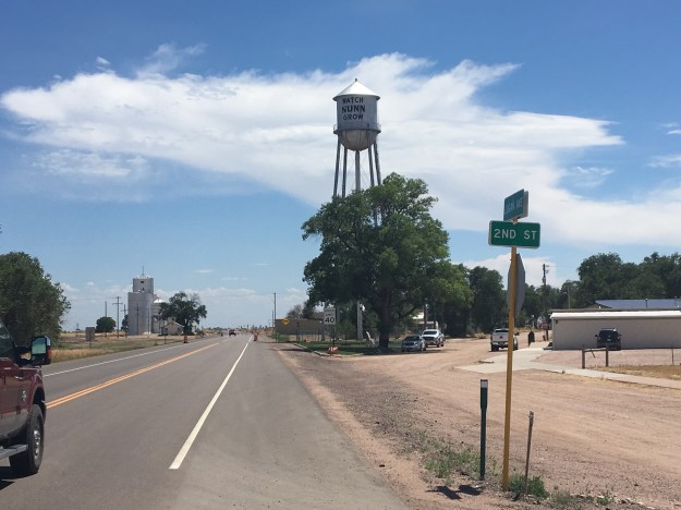
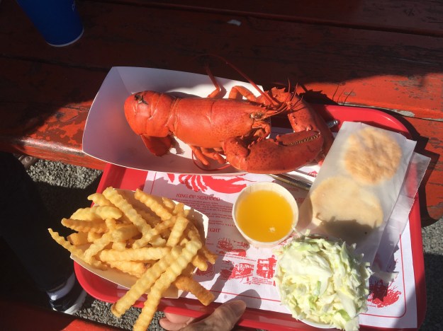
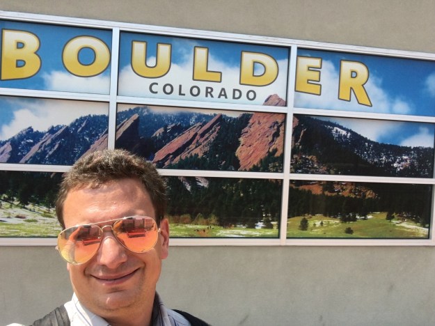
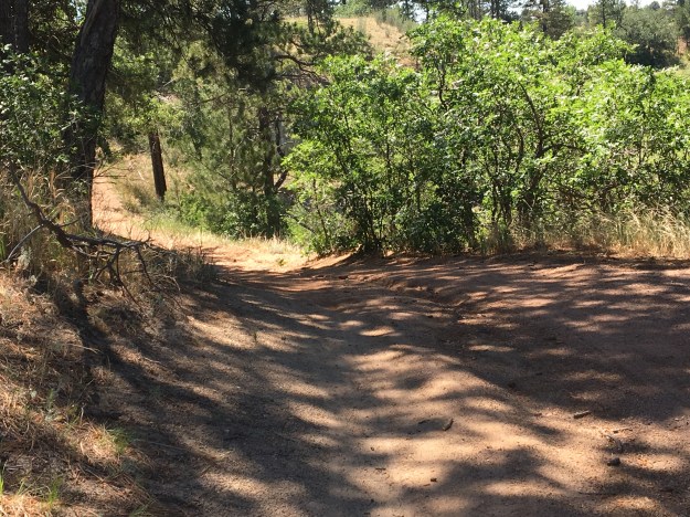
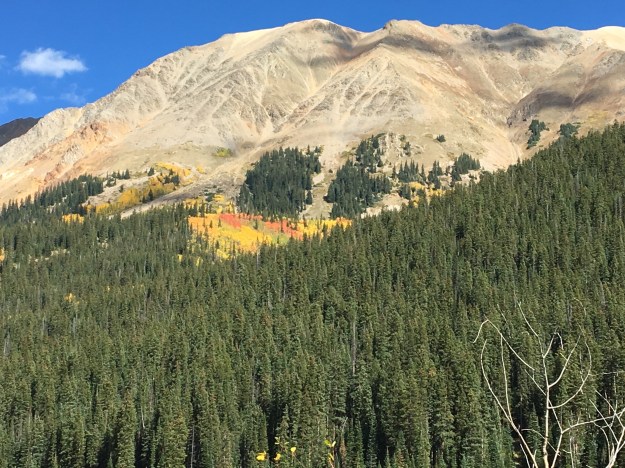
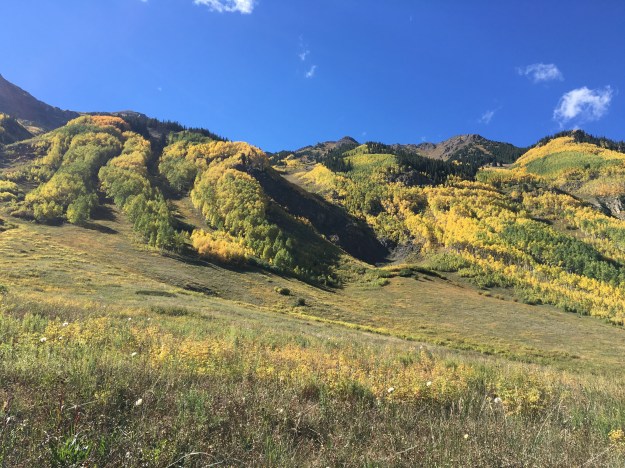
I will always yearn for travel and adventure. However, 2018 took my attention in other directions. The year started with some major trips, including Vegas, Whistler, and Death Valley.

After those trips, I really needed to get my career back on track. The five years prior to this one had seen tons of great adventures, which I catalog on this blog. However, they had not been too great for my career. We all have to earn a living, and it can be hard having to do so in places that are not the right fit.

At first I was going about it in the manner that most do in 2018, looking for opportunities online. By springtime, I decided that getting out there, networking, and meeting people would be a better way to try to create something new in my life.

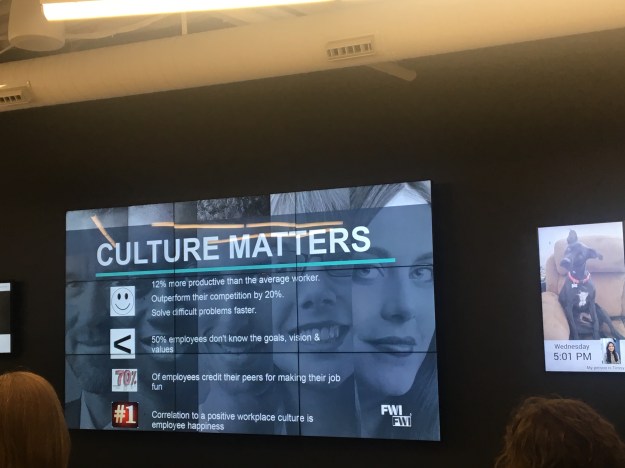
I ended up catching a break. In August, I started a new job which is both in the field I had originally studied, meteorology, and provides a working environment that is both flexible and collaborative. Not too many people can travel for a living, and not too many people actually want that lifestyle. Having a job where the work itself is fulfilling, and is also flexible enough that I can pursue significant travel and adventure, is probably the best scenario I could have hoped for. Therefore, I can say 2018 was a hard year but also a great one!

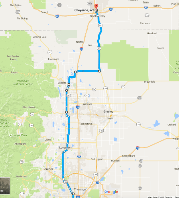
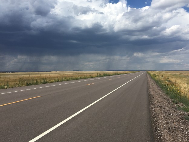
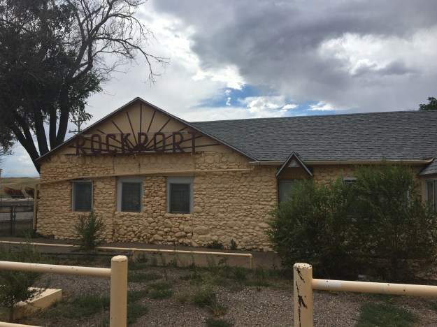
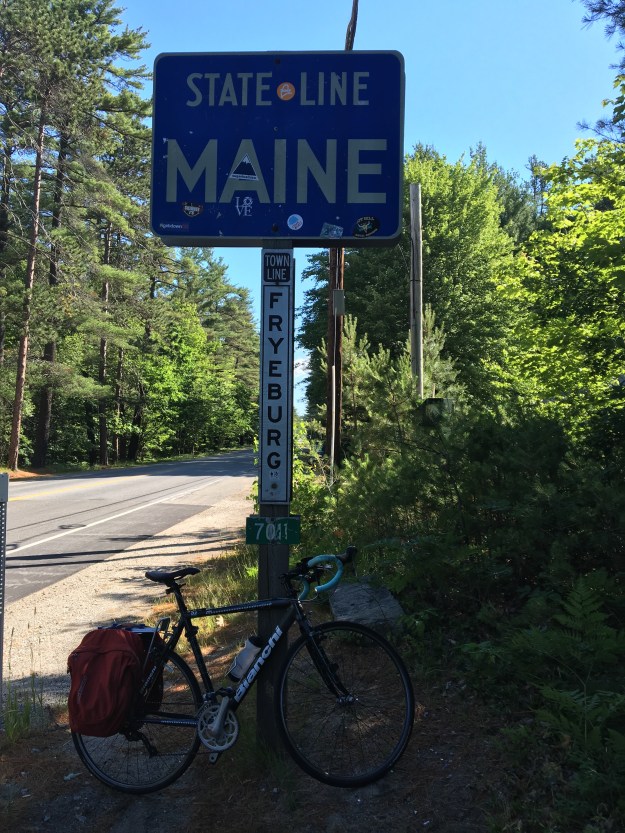
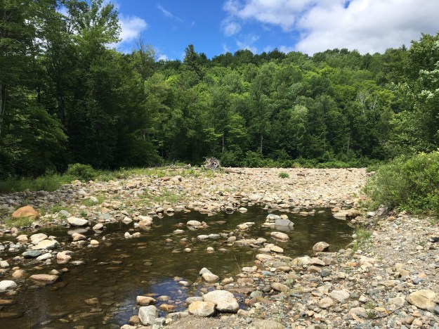
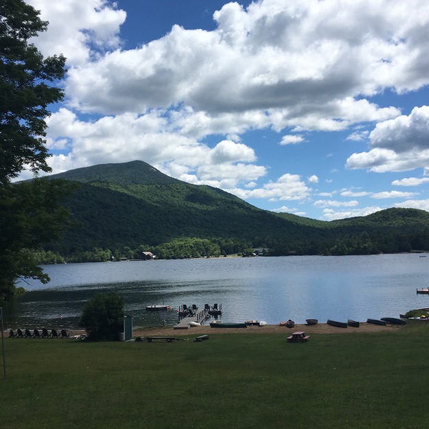
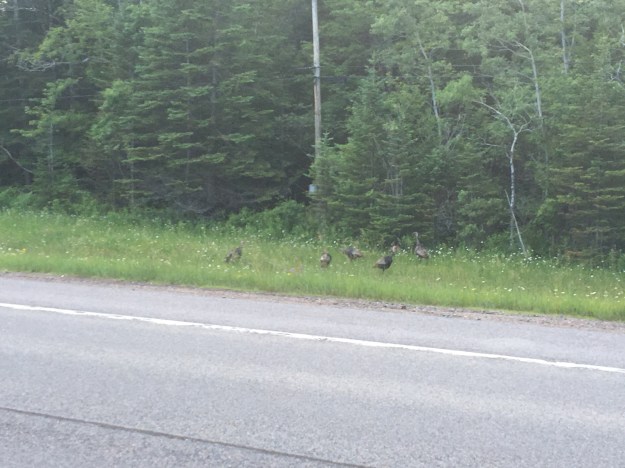
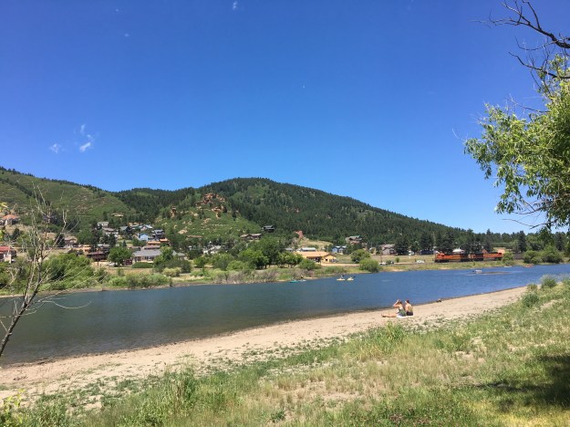
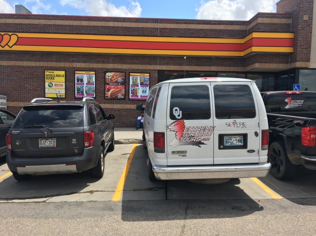
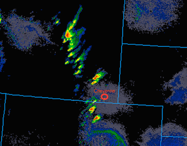
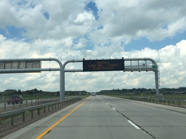
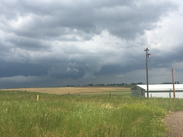
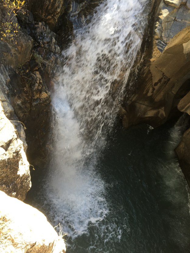
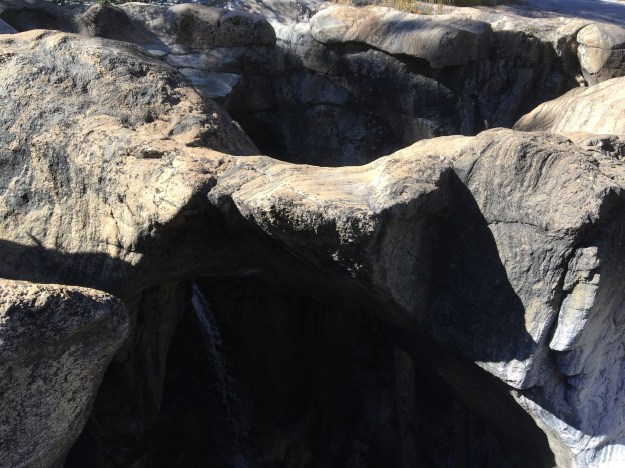
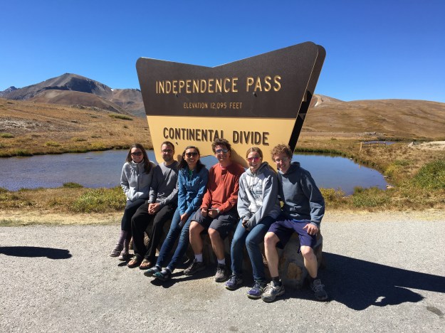
Before starting that job, I did go on one more major road trip, in Early August.

Since then, my life has actually been quite busy. In addition to starting a new job with a significant commute…

IMG_4595

I continued some of the freelance work I had been doing prior to starting the job, as well as some of my involvements in professional organizations. There were some weeks, particularly in September and October, where there was very little spare time. I came into the holiday season quite exhausted!

IMG_5236

2019 and a New Sense of Self

In addition to getting my career back on track, I feel that I am coming out of this exhausting but fruitful year with a better sense of who I am than I have had for years. A lot of people talk about “discovering themselves”. I feel this is an appropriate, yet sad, way of putting it. What I “discovered” about myself is stuff that I had known all along. I had just lost sight of them because of some of the disappointments and negative feedback I had received at various points in my life.

I determined I loved weather and science by the time I was five years old. It didn’t take much longer for me to figure out what else makes me who I am.

I often do not match what people expect from me. A lot of people think they understand the world, and the people in it, based on rudimentary aspects of who someone is; race, age, gender, economic status, and partisan politics. It saddens me to see people placing more, not less, emphasis on theses things in the past few years. This is one component of today’s world I refuse to be a part of or encourage, as who someone is is more about what they value and how they treat people.

IMG_5329.jpg

For the first time in my life, I actually feel like I am in a position to help people, as opposed to being the one that needs help. With this spirit, as well as my new job and other engagements, I want to encourage the following in the world around me:

  • Bridging the worlds of science and enterprise. I believe this is the best manner in which we can bring the benefits of scientific research and scientific knowledge to the general public, in a manner that is fair and equitable.
  • Encouraging people to spend less time alone, indoors, and seated. There are a lot of mental and physical health problems in my country that are only getting worse thanks to things like people spending more time in front of screens and less time conversing with one another.
  • Creating a more flexible world, particularly in the workplace. This means removing outdated rules and assumptions which are costing many people the opportunity to be who they really are.

IMG_3429.jpg

This may not be what some people desire of me, but it is my life. These pursuits were determined by matching my interests, values, and expertise with a desire to improve the condition of humanity.

I personally learned a lot more about life the year, which I will cover in my next entry. In addition to traveling and exploring less towards the end of 2018, a few other areas of my life also ended up getting neglected, particularly my physical health and social life. While going to an event with a professional organization can be enjoyable and productive, I have realized that it is no substitute for taking part in activities with friends. As I start 2019, I plan to place a higher priority on…

  • Physical health and particularly getting active and moving
  • Creating and nurturing some kind of a community
  • Expressing myself, and my unique-ness at all times
  • Finding new activities, new restaurants, new ideas, and exploring new places

Thank you for reading- hope you all have great plans for 2019!

Cycling from Colorado Springs to Denver

COSprings_to_Denver.png

It started with a two hour bus ride, from Denver to Colorado Springs, on something called the Bustang. Bustang is a pretty good service for cyclists in Colorado, as each bus has bike racks on the front. It would be a great service with more schedule options. For anyone thinking of making this journey, the only real option is the 7:35 A.M. departure from Denver, which arrived in downtown Colorado Springs just after 9:30.

IMG_3821.jpg

Colorado Springs is an interesting town. People who think about Colorado Springs often think about one of two things; its affiliation with Christian conservative causes, as it is where Focus on the Family is headquartered, and Pike’s Peak, the mountain that towers over the city to the west.

IMG_3824.jpg

Pike’s Peak is actually only the 20th tallest peak in the State. Yet, it is often amongst the most visited and talked about because, compared to many of Colorado’s other mountains, it is relatively isolated.

14ers_PikesPeak

Perhaps most importantly, Colorado Springs is among the most active and fittest cities in America.

This was apparent as I began to pedal north from downtown Colorado Springs. The Pike’s Peak Greenway, was quite crowded for much of the journey, with joggers, packs of runners, and other cyclists.

At the northern border of Colorado Springs, the Pike’s Peak Greenway connects to the New Santa Fe Trail. Both of these trails are part of a long term plan to create what is being called the Front Range Trail, a network of trails that will eventually cross the entire state from the Wyoming border to the New Mexico border, through many of Colorado’s most populated cities. Sings for the Front Range Trail have already been put in place here.

For some riders, the New Santa Fe Trail has the potential to be the roughest part of the ride. Much of it is both uphill, and unpaved. It also runs right through the property of the United States Air Force Academy.

IMG_3835.jpg

Many sections of it are quite rough, probably more suitable for mountain bikes than road or touring bikes. Along this stretch, there were about half a dozen instances where I had to dismount and walk my bike for a short distance.

IMG_3837.jpg

It was still a beautiful place to bike. The trail cuts through fields of Piñon Pines, and Monument Creek creates some picturesque mini-cliffs in front of the mountains.

However, although the journey up the hill is actually quite subtle, with no switchbacks or steep climbs, it did take more time and energy than anticipated to get to Palmer Lake, the high point of the trip, at an elevation of about 7,300 feet (2225 m).

IMG_3840.jpg

The next part of the ride was my favorite, north along Perry Park Road. This section is mostly downhill, but with some rolling hills. It was a wonderful 25 mile per hour ride on a smooth road, with bright blue skies, wide open spaces, rock formations popping out on both sides around every turn, and a light cooling breeze.

IMG_3843

There are a few route options at this point, and following Perry Park Road as long as I did, a little over 10 miles to Tomah Road, does bypass the town of Larkspur. I found it worthwhile, as I was enjoying the ride, but it does mean a total of about 20 miles between towns.

IMG_3846

Turning East, Tomah Road was actually the most challenging climb on the entire ride. The total climb is pretty small, from about 6200 feet to just over 6800. However, that climb occurred in less than two miles, and can be unexpected, as Castle Rock is at 6200 feet and this climb came from one of the subtle terrain features east of the Rocky Mountains.

After climbing and descending Tomah Road, the route was follows the Frontage Road along I-25 for about four miles into Castle Rock. Despite it being right next to the interstate, the road was quite crowded, and with no shoulder. It was probably the least enjoyable part of the ride.

IMG_3848

This was also where I struggled the most. It was the hottest part of the day, and after the unanticipated challenges, I began to doubt whether or not I could complete the ride. In these situations, it is usually good to stop and take a rest. The additional time it took on the unpaved trail up Monument Hill had set me back at least half an hour, but I definitely needed a rest, a snack, and, most importantly, I had a coke.

Maybe it was the caffeine, maybe it was the sugar, but the coke re-energized me, and I was back on my way.

Crawfoot Valley Road, the road that connects Castle Rock and Parker was surprisingly crowded. It is a good thing there is a wide enough shoulder for bikes. This area is growing quite rapidly, and seems to get busier every time I ride this segment.

My next burst of energy was actually mental, which is usually the battle we are actually facing when we decide to undertake physical challenges like this. In Parker, the route connects to the Cherry Creek Trail, an amazing trail that is fun, well kept, and mostly flat.

IMG_3853.jpg

From here, it is 30 miles to downtown Denver. This sign (the Cherry Creek Trail has one every 1/2 a mile, but this is the first one I saw when I joined the trail) felt like a welcoming of sorts, to the home stretch. The final 30 miles of the trip would feel like a victory lap.

I knew there was only one real climb remaining, the part where the trail goes around the Cherry Creek Reservoir.

IMG_3855.jpg

It reminded me of this weird place we often find ourselves in life, where we know some sort of “victory” is coming. We can sense it on the horizon. We are anticipating it. However, it is not there yet. There is still some amount of work that needs to be done, and there is still some things that can go wrong.

Is it too soon to start feeling good about ourselves? Can we start celebrating something that is “about” to happen? Or, do we remain cautious and diligent, understanding that although we feel we deserve this victory, it has not yet happened, and it is still not yet time to celebrate?

That was how the final 30 miles felt for me. The first half went by fast. However, as I got closer and closer, anticipation increased, and this “homestretch” seemed to drag on.

IMG_3857.jpg

At that point, there really is no choice but to pound out that final ten miles, with those mixed emotions. I knew I had persevered, ended up having to take on more than expected, and would arrive at home triumphant that I had ridden my bike from Colorado Springs to Denver. However, I would have to keep pedaling those last few miles before I could check that box off my internally kept bucket list.

A Tornado Outbreak in Wyoming

Wyoming is not exactly “tornado alley”. According to the National Oceanic and Atmospheric Association, the entire state averages only 12 tornadoes per year. Kansas, by comparison, receives eight times as many tornadoes each year despite being 15% smaller in area. Although a tornado in Southeastern Wyoming played a pivotal role in the VORTEX 2 project, Wyoming generally tends to be too dry for severe thunderstorms.

June 13th’s chase came up somewhat suddenly for me, based on a notification I had received about this outlook after being out of town, and not focused on the weather, the prior weekend. For some reason, before I even looked at anything else, weather models, discussions, etc., I had a feeling something major was going to happen.

SPC_day2_20170611

This day somehow felt different, right from the start.

IMG_0031 (3).jpg

By 2 P.M., storm chasers were all over the roads, and at places like this Love’s Truck Stop in Cheyenne, Wyoming, watching the storms begin to form and trying to determine the best course of action.

RADAR_20170612

The decision we all were faced with was which set of storms to follow. The storms forming to the North were in the area previously outlined by the Storm Prediction Center as having the highest risk for the day, and in an area with great low-level rotation. But the storms to the South looked more impressive on RADAR.

Often, we need to continue to re-realize that the best course of action is to follow our instincts, and to follow them without hesitation or self-doubt. That is what I did, opting for the storms to the North.

IMG_0035 (2)

It did’t feel like a typical day in Wyoming. Storm chasers everywhere. Highway signs were alerting motorists to the potential for tornadoes and large hail. Moisture could be smelled in the air. With a moderate breeze from the East South East, the atmosphere felt less like Wyoming and more like a typical chase day in “tornado alley”

IMG_0047 (1).jpg

When I  caught up with the storms in Wheatland, Wyoming, hail larger than I had ever seen had already fallen. One of the good things about following a storm from behind is the ability to see hail after it has already fallen, as opposed to trying to avoid hail out of concern for safety and vehicular damage.

I stayed in Wheatland as long as possible, knowing the storm would head Northeast and I would have to leave Interstate 25. One of the disadvantages to chasing in Wyoming, as opposed to “tornado alley”, is the sparseness of the road network.

IMG_0049 (1).jpg

So I sat there for roughly 20 minutes. Looking at the storm, it felt like something was going to happen. All the necessary conditions were there, and the appearance and movement of the storm felt reminiscent of other situations which had spawned tornadoes.

I took a chance, using roads I had never traveled before, hoping the roads I was following would remain paved so I could follow the storm North and East.

There was a half hour time period where I had become quite frightened. I could feel the adrenaline rush through my body as the clouds circled around in a threatening manner less than half a mile in front of me. I lacked the confidence that the road would remain paved, or that I would have a reliable “out plan” if a tornado were to form this close.


After lucking out with around 10 miles of pavement, I suddenly found myself driving over wet dirt, and, at 20-30 miles per hour, gradually falling behind.

Luckily, I once again found pavement, drove by some of the natural features that makes Wyoming a more interesting place to drive through than most of “tornado alley”, and once again encountered large hail that I felt the need to stop and pick up.

IMG_0070 (1).jpg

Almost an hour later, and significantly farther north along highway 85, I finally caught up to the storm, just as it had dropped it’s first, and brief, tornado. And, this time, I was a comfortable distance from the thing! Unfortunately, this tornado would lift off the ground in only a few minutes.

IMG_0075 (1)

Not too long after, I received notification that other chasers, following the storms that had formed farther South, had seen a much more impressive tornado, closer up, and had gotten better photos (the above is not my photo).

It was a strange day. Not only because Wyoming is not the typical place to see tornadoes. It also felt strange, as I had managed to do something impressive, yet still had reason to feel like a failure.

Most storm chasing is not like it is portrayed in the movies, with people getting close to storms all the time and getting in trouble. Most days, chasers do not see one. Seeing a tornado one day out of five is a very good track record for storm chasers.

Going out on a chase and seeing a tornado of any kind is impressive. Yet, to be truly happy with my accomplishment, I had to accept the fact that there was something better out there- something I did miss out on. This is a struggle we all face, in common life situations such as jobs, relationships, events, houses, etc. We often know we have done well, but always have this idea of something that is even better out there. Knowing this can make us indecisive, which will often leave us with nothing. In the age of text messaging and social media, evidence of such options has become extremely abundant, and quite hard to escape.

In a connected world, in order to be happy with ourselves, we need to find a way to both believe in ourselves, but also be accepting of the fact that someone else, somewhere out there, has done better. For that will always be the case, and we now have instant access to that knowledge. We cannot let knowledge of someone else’s more impressive accomplishments dampen our enthusiasm for our own. Otherwise, we will likely never be content.

Celebrating Our Accomplishments

IMG_8015.jpg

Life is full of events, both events in which we have control over and events which we do not.  This is true for everybody, from the most successful and confident people to the most disillusioned.  It’s also true that all people will experience both positive and negative events.

There are a lot of cheesy sayings out there that get to the same general point.  The one that sticks out in my mind is…

url.png

Every time I’ve ever read this statement, I imagine the author primarily referring to those “negative” events- the kind of events that can cause anxiety, and, when not properly handled, have long lasting negative consequences, including a reduction in confidence and self-worth.

However, I feel as if this statement can apply both ways.  The same way the impact negative events can have on our lives can be minimized through the proper response, the positive impact of certain events can be truly realized, both with regards to life circumstance as well as confidence and self-worth, with the right response to a good event.

That is why it is important to celebrate accomplishments whether major or minor.  When celebrated properly, a person’s accomplishments can reinforce positive perceptions they have about themselves- without doing so at the expense of others, the way so many mistakenly do.

IMG_5453.jpg

I wanted to reach the 2,000-mile mark, celebrating the biggest cycling year of my life, at a location that is iconic as well as meaningful.  I might have selected a place right in the middle of the Central Rocky Mountains, had it not been for the basic fact that it is November.  While the weather has been warm, to the point that it doesn’t feel like summer actually ended, the month of November still comes with constraints.  70 degree temperatures will not change the fact that by 5:00 it will be getting dark.  And, in the mountains, there is more risk for trouble, in the form of precipitation, wind, and chilly mornings.

Luckily, there was a reasonable place to host this event; Davidson Mesa, a moderate sized hill, that sits about 600 feet above town, roughly six miles East of Boulder.

IMG_5456.jpg

The view of the Flatiorns to the West on a clear day is magnificent enough to warrant the Colorado Department of Transportation putting in a scenic overlook, which is particularly popular among tourists to the area driving from Denver to Boulder.

As is the case at the top of Vail Pass, the rest area is shared between motor vehicles and bicycles, as there is now a bike trail that follows highway 36 between Denver and Boulder.  As a regular visitor to Boulder, I have ridden on this trail about a dozen and a half times over the course of 2016.  So, it felt both scenic and meaningful to celebrate reaching this mile marker at the most scenic location along the trail between Denver and Boulder.

What makes events like this truly special is sharing them with others.  For me, this meant even sharing the event with someone who had a more significant accomplishment, mileage-wise, than I did.  In fact, I know that there are a lot of cycling enthusiasts who ride far more miles than I do, some even topping out at over 10,000 miles in one year!

2016 was a memorable cycling year for me, and the fact that I hit this milestone, 2,000 miles is only a small part of it.  When I look back upon the year, that is now almost over, and think of the cycling I have done, it is about way more than numbers.  It is pedaling around Niagara Falls

20160703-231425-83665101.jpg

The Adirondacks

IMG_6462

Over the mountain passes of New Hampshire

IMG_6598

And reaching the ocean, after six days, to have a fresh lobster.

IMG_6648

It is treks to places like Cheyenne and Castle Rock.

It is countless rides long the Platte River, Cherry Creek, and Route 36 bike trails.  It is even commuting for work.  This celebration for me, was about all those experiences way more than it was about reaching a milestone.  In a way, I was celebrating a year’s worth of positive and healthy experiences on my bicycle.

And I got to share the event with others, some of whom joined me for the 25-mile ride from downtown Denver, and some of whom joined me along the way.

img_8017


img_8020

I even shared the event with a friend who was celebrating a more significant accomplishment than mine, 3,000 miles.  The true way to celebrate our accomplishments, both big and small is to do so in a way that does not take away from the accomplishments of others.  Knowing there are people out there who accomplish more, ride 3,000, 5,000, even 10,000 miles, and have gone to more destinations, some even riding across countries or continents, does not take away from what I have done.

I know I am not a super hero, or someone saving the world because I do some interesting bike rides that add up to 2,000 miles a year.  And, I know my life will have some more significant accomplishments.  But, I also know how to properly harness an event like that.  And, it is certainly not by using it as a means in which to compare myself favorably with some people for an artificial self-esteem boost.  Nor is it by dwelling on how much more others have done.  It’s by simply being joyous, celebrating, being happy for others, but most importantly, allowing myself to be happy for myself.

The Longest Day Hike of My Life

DCIM160GOPRO

Conundrum Hot Springs

The hike from the Conundrum Trailhead to Conundrum Hot Springs is roughly 8.5 miles.  Round trip is at least 17 miles of hiking.  I say AT LEAST as I have been on plenty of hikes where side excursions, both planned and unplanned, lead to covering a total distance that exceeded the official distance of the hike.

Due to the distance, and the destination, nearly all the people we encountered on this hike were backpacking.  This is an attractive option, as the trail is pretty long but not terribly challenging, and the hot springs are the kind of destination one would want to spend a significant amount of time at.  However, Conundrum Hot Springs is a popular destination, and there are limited camping sites in the immediate vicinity of the springs.

Conundrum Hot Spring is close to Aspen, which is three and a half hours from Denver.  Some of the people in our group, myself included, were not able to leave early enough on Friday for us to be confident that we could secure a camping spot.  We ended up deciding to find a campground somewhat close to the trailhead, and hike to and from the springs as a day hike.  As an added bonus, we would not have to bring, or carry nearly as much equipment, as we would be “car camping”.  The hike would be both easier and harder.  We would not be carrying nearly as much weight, but we would be cramming 17 miles of hiking into one day.

Up in the mountains of Central Colorado, trees change color earlier in the Fall than they do in many other parts of the Country.  In general, the second half of September, and maybe the first few days of October, is the best time to see the Aspen trees here change colors.  I was partially surprised by how vibrant the colors were, by September 16th.  For the first two hours or so of the drive, before sunset, we saw a preview of the kind of colors we’d be seeing during the hike, certainly early season, but vibrantly colorful, with sections of bright yellows and oranges periodically appearing in front of us.

To be sure we would have enough time, we had to wake up, eat breakfast and leave the campground at Lincoln Creek (dispersed camping roughly 40 minutes from the trailhead) all before sunrise.  We arrived at the trailhead and started hiking at roughly 15 minutes after 7 A.M.

The morning chill was both an obstacle and a boost.  Overnight temperatures dropped to roughly 30F (-1C) at the campground.  For the first 90 minutes of the hike, the ground was covered in frost.  In fact, the frost even made our first river crossing a bit slippery.

This morning cold made me cary several layers, adding a little bit to the weight of my backpack (although it was still way, way, lighter than it would have been had we been backpacking).  However, the cold weather motivated us to begin our hike at a rapid pace.

We would cover over four miles before we even reached the sun!

IMG_7577.jpg

I would describe at least the first five miles of the hike as “easy” from the standpoint of evolution gain.

img_7579img_7580img_7581

Many sections of the trail are actually close to perfectly flat, giving me plenty of time to take in the natural beauty that is around me, and also connect with my friends who I was hiking with.  When hiking, it is challenging to have a conversation when hiking up steep terrain, but fairly easy to do so in largely flat sections.

IMG_7582.jpg

The appearance of small lakes precludes the transition to the more challenging part of the trail.

This occurs somewhere around six and a half miles into the hike.  First of all, there are sections that are more technically challenging, including a couple of tricky creek crossings, and a section where one must scramble over rocks.

IMG_7589.jpg

There last two miles of the trail also includes some fairly steep sections.  I wouldn’t say they are overly challenging, but in the context of a 17 mile day that included hiking at a rapid pace towards the beginning, they ended up being fairly exhausting.

We ended up spending roughly two hours at the hot springs (including changing and eating lunch).  There were a lot of people in the hot springs, but it was not as crowded as some of us had feared.

img_7601img_7603

For a variety of reasons, the fall colors appeared even more magnificent on the way back down!  The most significant reason had to be the manner in which the trees appeared in the mid-afternoon sun.

img_7604

I was also pleasantly surprised to see a significant amount of deep orange shades.  In prior experience with fall in the Rockies, I had almost exclusively seen the yellow shade that seems to be the most common fall color for Aspen trees.  While “autumn gold” is pretty, I had, in some ways, missed wide variety of shades that leaves on maple trees take on during fall.

img_7606

I would definitely describe the color we enountered as “early season”.  There were still many Aspen trees primarily shaded green, particularly at lower elevations.  This indicates that the next two weekends could be just, or perhaps even more, colorful!  The colorful trees, the yellows and the oranges, tended to be those higher up.  The several patches of deep shaded orange I saw were nearly exclusively up closer to the tree line.

Conudnrum_FallCOlors_Sept2016.JPG

Both the hike up to the hot springs and the return trip took roughly four hours.

IMG_7607.jpg

We got back to the trailhead sometime just after 5 P.M., and, after the 40 minute drive back to Lincoln Creek, I finally got to see what the campground looked like.  And I got to do something I had not previously done.  I got to park my car with the rear left tire on top of a rock, showing off just how rugged my vehicle is.  Well, at least in an auto show pamphlet sort of way.

Capping off an exhausting day was a side excursion, to a waterfall, well, multiple waterfalls, that those of us in our group lucky enough to be able to leave early Friday had located roughly a quarter of a mile from the campground.  In fact, they hyped this place up over the course of the hike.  So, we had to go.  Additionally, this side excursion was enough for me to achieve something meaningless, but also something I am likely never again to achieve.  I recorded 50,000 steps on that step counter thing that comes with every iPhone6.  Yay me!

We would explore this likely unnamed waterfall area again Sunday morning before departing for Denver.

img_7631img_7636img_7641img_7642

If you count all the places where water squirts out of random places in the rock, there are probably close to a dozen “waterfalls” in this area.  What a great unexpected treat!

The return trip on Sunday was eventful as well, with some great stops at Independence Pass and Twin Lakes, both places I had driven by on Friday, but after the sun had already set.

img_7656img_7660

I titled this blog “The Longest Day Hike of My Life”, as, well, I can not picture a day where I hike more than 17 miles on a day trip.  However, I probably would have never imagined hiking 17 miles in one day a few years back, so there is no way to definitively say never.  I am prepared, though, for this to be my longest hike, and understand the significance of it. Like many of the adventures I had over the course of this summer, and in previous years, it was both exhausting and amazing.  But, most worthwhile experiences, from relationships to starting successful businesses and such, are.  Being exhausted after this experience should be a reminder to all of us that what is easiest is often the least rewarding, and that which is most challenging often comes with the greatest reward.


Cycling from Denver to Cheyenne

IMG_6854
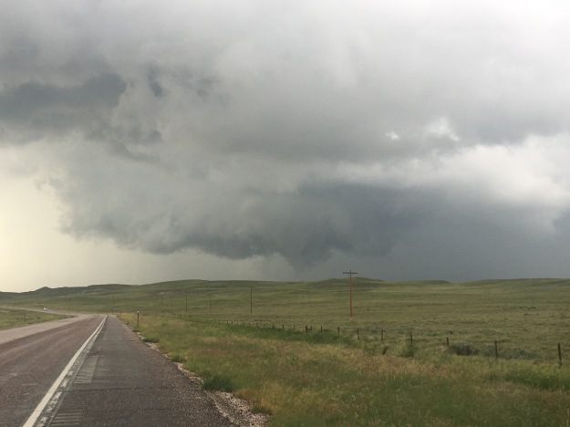
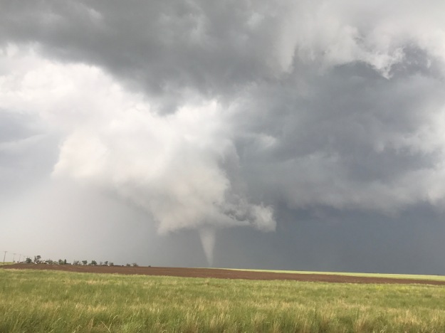
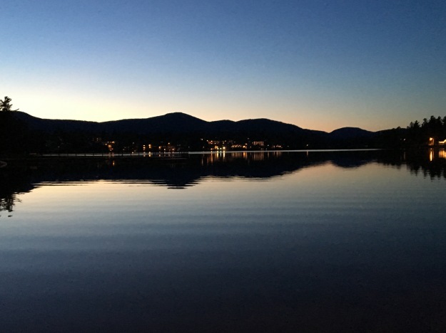
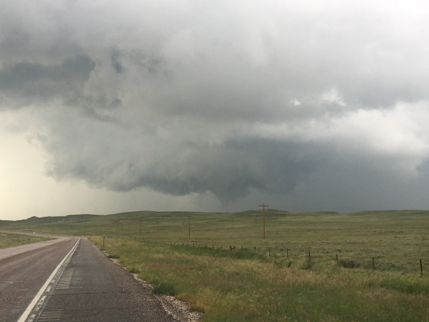
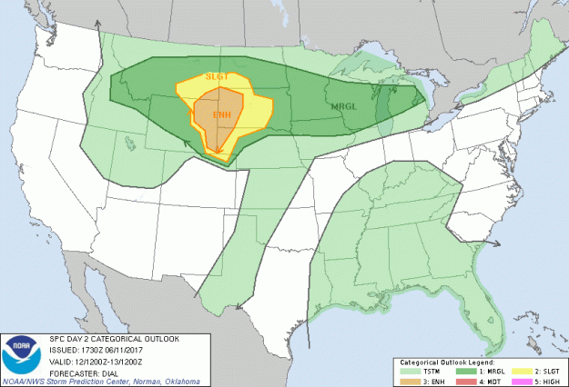
On the evening of July 3rd, having just finished an exhausting six-day bike ride, including four days of cycling over one hundred miles, my body felt a bit relieved.  I was actually ready to rest, ready to sit in front of a computer again!  Clay, however, told me that I was going to wake up the next morning, realize I was not biking 100+ miles and not know what to do with myself.

The truth ended up being somewhere in the middle.  I could not have pictured cycling at all the next day.  This was literally how I felt.

IMG_6644

The next day, I biked six miles, to and from Union Station from my home.  And, I was perfectly fine with that.

However, I did eventually get antsy, despite two other, closer to home adventures.  By Tuesday July 19th, I posted this picture on Instagram, stating I was bored and wishing to get on my bike and explore again!

IMG_6808

I ride the new RTD A-Line train, which connects downtown Denver with Denver International Airport, roughly three days a week for a gig I am currently working at the airport.  At Central Park Station, one of six intermediate stops between downtown and the airport, this curious piece of potentially symbolic artwork sits atop a pillar.

IMG_6809

Whenever I am on the train, and not trying to sleep for efficiency sake, I see it, and sincerely wonder what its purpose is.  It seems to depict a person running to catch the next train, but headless.  But why headless?  Could it actually be a satire on the futility of the rat race?  Could the artist who created the sculpture have had an alterior motive?  Could he or she have created this sculpture with the secret hope that a few commuters each day would look at this sculpture and be prompted to ask; what am I doing and why am I doing it?  Is this the life I wanted?  Is this the natural state of human condition?  Etc.?

I, however, had other plans, actually for the next Friday, and, they once again involved my 2012 Bianchi Cyclocross bicycle.  The Cheyenne Frontier Days Rodeo was starting, and, I was going to ride my bike there!

The prior evening, I spent the night in Broomfield, after a softball game in Boulder.  So, even before this next 100+ mile bike ride, I was already spending some significant time on my bike again.  Knowing it was going to be hot, we got an early start.  I actually wish we had gotten an earlier start.

BikeRoute_DenvertoCheyenne

A lot of people hear about my bike adventures and immediately sounds perplexed…

Is there a trail there?

Are there safe roads to bike on there?

There’s a lot of trucks on that road.

I would never ride my bike on those roads, you could get killed.

Etc.…

There is some risk, no denying it.  When I was a child, one of my favorite bands, the Offspring, told me “Back up your rules.  Back up your jive.  I’m sick of not living just to stay alive.”  More recently, Drake told me, “Everybody dies, but not everybody lives.”  The truth is that there is the possibility of death doing nearly everything.  People die on the slopes.  People die rafting.  But, people also die commuting to work.  And, due to the health risk factors such as cardiovascular disease and such, sitting around watching television can be deadly!

That being said, I still considered risk when choosing a route, and am still willing to go a few extra miles to reduce my risk.  I am just not willing to miss out on opportunities altogether out of fear.

IMG_6814

The first part of the ride was pleasant, 95th St. from Broomfield to Longmont is a road I knew had bicycle accommodations in the form of bike lanes or wide enough shoulders.

Longmont was a little bit tougher to navigate.  Like many towns, their bike route network was designed primarily with travel within the town in mind.  I stared at their bike map for a good half an hour to figure out the best route through town, but it ended up being a fun route.

IMG_6817

I particularly enjoyed all the sculptures along the Saint Vrain Greenway!

IMG_6818

One thing people miss when they drive along I-25 between Denver and Fort Collins is how many lakes there are in the area.  On the interstate, there are none.  On this route between Longmont and Fort Collins, through Berthoud and Loveland, we actually saw a lot of lakes.

I’d been pondering riding my bike from Denver to Cheyenne for years, even going as far as thinking about some of the details, such as what time of year to go and what route to take.  As soon as I started thinking about routing, there was one segment I knew I was going to do, the combination of Taft Avenue and Shields St. through Loveland and Fort Collins, roughly half a mile west of highway 287.  This straight shot through both towns has a bike lane the entire way, and made navigating through Loveland and Fort Collins was easier than navigating through Longmont.

IMG_6821

This is where I started to feel the heat, which was right around 10:30 or 11:00.  The temperature probably hit 90 sometime while we were in Fort Collins, making me regret having not left even earlier than we did (we departed at about quarter to 7 in the morning).

Also, the wind had a slight easterly component that day.  This made the next two segments of the ride, first from Fort Collins to Wellington, where we stopped for lunch around noon, and then from Wellington to Nunn to reach U.S. highway 85, quite possibly the most challenging segments of the ride.  I had this nagging feeling about entering Weld County.  I do not know why, I just felt as if something bicycle unfriendly would happen to me in this county specifically.  It was mainly just a premonition that bore out to be true, just not in the way I had anticipated.

IMG_6845

Upon entering Weld County, the road we were following switched to newly paved blacktop, while the temperatures had climbed probably into the mid-90s.  This lead to the closest thing to heat exhaustion we would experience during the ride.

IMG_6846

By the time we reached Nunn, we were desperate to get out of the heat for a few minutes and get some water.  Unfortunately, despite the fact that Nunn has a water tower that says “Watch Nunn grow”, I’m 100% sure that my calf muscles were growing faster than Nunn that day.  The only place we could find to fill up our water bottles was the police station/town hall, and the only reason that option was available to us is because we were riding on a weekday (Friday).

IMG_6847

We followed U.S. 85 for the last 30 miles of the ride.  We ended up having to wait out a mid-afternoon thunderstorm near the Colorado-Wyoming border, at the only building within a 10-mile radius.

IMG_6850

The storm was, however, neat, and I felt as if I were storm chasing on my bicycle (even though in real life that would have been a disaster).

We arrived in Cheyenne during rush hour, which was a little nerve racking as this is the only part of the ride where the shoulder on U.S highway 85 disappears, the last couple of miles before entering town.

After 109 miles of riding, we were there, Cheyenne Frontier Days, miraculously with enough energy left to party, parade, and rodeo!

Day 6: The Finale

The last day of a long bike ride is always a strange day.  Not that any of the previous five days were similar to the others, but this day was especially different.  As is the case with many journeys, on the last day two things happen.

First, the specifics, the details such as route decisions, stop locations, timing, daily milage and the like all sort of gradually drift out of my mind.  In its place come grander thoughts about the trip as a whole, the accomplishments, the disappointments, the lessons learned, and everything else that has been going through my mind.

The second thing that happens is reality starts to set in.  For six days, July 5th, the day I would go back to work, and return to my “normal life”, may as well not have existed.  It did not cross my mind once.  It’s like my mind suddenly re-realized that this day was coming and that, in less than 24 hours I’d be on a plane heading home, and within 48 hours I’d be back to regular old work.

IMG_6618

Another thing that made this day different than the first five days is that we had two additional riders join us.  Riding with a group, and riding significantly less miles (67 today as opposed to over 100 most other days) made the ride take on a significantly different feel.

IMG_6620

We entered Maine only about seven miles into the ride.  I guess the previous day I pretty much rode across the entire state of New Hampshire.  And, I got my sign!  The one I had been hoping for the last two times (last two days) I crossed a state line.

The first part of the ride was nice, with a wide shoulder along state highway 113, following the Saco River.  After riding on a few back roads, and a little bit of time on a trail that was half paved and half rocky, we found ourselves headed into the Portland area.  The roads got significantly busier.  In fact, these were the busiest roads I had ridden on for the entire trip.  In some parts of the route, the shoulders all but disappeared, making these the kinds of roads I would not normally chose to ride on.

IMG_6637

We rode through the surprisingly hilly downtown area of Portland, and after the final seven miles along state highway 77, arrived, in the early afternoon, at our final destination for the trip, Cape Elizabeth.

IMG_6638

When we arrived at the Atlantic Coast, at Two Lights State Park, the day started to get emotional.

IMG_6642

This was, by far, the biggest bike trip I had ever been on, and may still prove to be my life’s longest bicycle journey.  But, for Clay, it was the culmination of a three year long effort to bike across the country.  In 2014, he biked from Denver to Chicago.  Last summer, from the Oregon Coast to Denver.  This year, from Chicago to Maine.  In three segments, he biked across the country.  Many members of his family made the journey to Maine to see him triumphantly enter the Atlantic Ocean, having biked across the continent, and, as a side note, also basically proven that you do not have to be some incredibly rich or extremely lucky person to do so.  He did it all while holding the same steady job!

IMG_6644

Of course, it is easier to be emotional when exhausted, and this picture sums up exactly how I felt the first fifteen minutes after completing the ride.  It was an odd combination of emotions that came over me.  Most of them were good, and most importantly, I felt gratitude for being able to play a small part in this whole mission by joining Clay, for three days last year in Montana and Wyoming, and for six this year.

IMG_6648

In the afternoon I got the meal I knew I had wanted upon completion of my ride; Lobster.  I love lobster, but I live in Denver.  When in Maine, well, really there was no other logical choice.  In fact, when biking over the last hill of the day, despite being tired, I actually increased my speed and simply yelled, “this is the last hill in the way between me and lobster”!

We ate at a place called the Lobster Shack Restaurant, which, on that day, had a 40 minute wait for service, as it is a popular destination where patrons can eat while overlooking the Ocean!

It got even more emotional after that.  That evening my main goal was to hang out with my friends, Clay and Liz, as much as possible.  They are in fact, leaving for a year long adventure, to go out and see many other parts of the world!  These adventures will be catalogued on their WordPress site.  I knew I would likely not see them for a while.

I also could not help but think about all of the things this bike journey taught me, whether it be specifically from the experience, or things that ran through my mind over the course of the long hours I spent on my bike.

Over the course of the week, I saw kindness everywhere I went.  Clay was raising money for charity.  His family volunteered to help with the ride.  Many of the people we met along the way were friendly.  I realized that, despite the amount of physical pain I put myself through, I felt happy the entire time, significantly happier than under normal circumstances.  Maybe the whole world would be happier if we all acted this way towards one another.  The most I can do, going forward, is strive to be the kind of person that gives more than I take, and do my part.

Having experienced being on mile 27 of a 100+ mile day multiple times reminded me not to become too obsessed with the destination.  This ride was about more than me laying on a beach in Maine and then eating lobster.  It was all of the places I saw while traveling from Niagara Falls across Upstate New York, through the Adirondacks and then Northern New England.  The rest of my life is not exactly where I hope it will end up at this point in time, but I can be much better off if I learn to obsess less over the destination and enjoy the journey, as I did this week.

The social media era has turned us all into avatars.  By that I mean we all have some kind of image of ourselves that we present to others, based on who we think they want us to be.  This week, I simply couldn’t continue to be my avatar.  On trips like this, our concerns shift, from the concerns of urban 21st century American life, such as getting a promotion or getting likes on social media, to more basic concerns, for food, water, and shelter.  I couldn’t put on a show for others, but I got by, and even thrived.  The others on the trip seemed to enjoy having me around.  So, I need to stop trying to be the person I think others want me to be.

Also, on the flight to Buffalo-Niagara, I was reading a book called The Happiness Project, about a woman who undertakes various initiatives aimed at improving life satisfaction and reports on the results.  She introduced me to the concept of “fog happiness”.  This is when the happiness related to an activity is not necessarily concentrated at the time of the activity itself, but spread out over a longer time period, both before and after the actual activitiy.  Once I determined I was going to make this bike trip, for the first time in my life, I thought of myself as a legitimate bike tourist.  For the first time, I felt the right to interject in a conversation about bike touring, and have legitimate opinions.  Essentially, I had added something to my list of activities and enriched my life.  We all should be more thoughtful when choosing activities, and, specifically avoid missing out on opportunities to create more of this “fog happiness”.

Obviously, anytime anyone completes an activity that requires a great amount of physical exertion, it is a reminder of how rewarding it can be to overcome fatigue.  This lesson applies to other areas of life too, but a journey like this can often be the best reminder that some of the most challenging tasks are the ones with the greatest reward.

Personally speaking, the most important lesson I have taken from this ride relates to something I have struggled with for nearly my entire life.  I seek significance in life.  I want to do things that matter and feel like I matter to others.  While with most of it my intensions are good, there is a dark side.  At times, when I feel insignificant and powerless, I succumb to anger, depression and other negative emotions.

This week, while a significant ride, and a series of significant experiences and accomplishments for myself, I was not the center of it all.  As previously mentioned, it was Clay’s ride.  He rode longer, harder, and raised money for charity.  Yet, I did not feel insignificant, as I have a tendency to feel in many day-to-day activities.  I realized, and this is important, that: You Don’t Have to be the Center of Attention to Matter.  I cannot stress this, to others but most importantly to myself, enough!

As I flew home, I drifted off to sleep, as Bon Jovi’s inspirational 2000 song Save The World played on my headphones.  Flying through moderate turbulence, I felt the plane gently shift, both upwards and downwards.  Running through my head, was an image of myself, from above, pedaling over hills, through the woods.  Nothing else was happening, I was just pedaling.

Cycling Northern New England

Selecting the best possible route can be a challenge on bike trips.  In an ideal situation, there would be a direct route, a road or a trail, safe for cycling, pleasant, providing a direct path from point A to point B, and conveniently jaunting by all of the point Cs that are of interest along the way.  In the sparsely populated West, there rarely is an ideal route, but there often is only one option.  I could not picture taking any route other than the standard cycling route when traveling from Portland, Oregon to Missoula, Montana.  When following one of the Adventure Cycling’s bike routes, the job of selecting the best possible route is already done, by experts with tons of experience bike touring.

Being in neither situation, we spent the better part of an hour looking over maps before settling on the ideal route from Greensboro, Vermont to Conway, New Hampshire.  Choosing a route in places like this can often be a matter of factoring in various considerations and determining how to manage priorities.  I’d predict that six different cycling groups would select at least four different routes for this particular ride.  Some people want to avoid adding extra miles to an already lengthy ride.  Others wish to avoid obstacles such as wind, hills, and towns with numerous stoplights.  Others still may prioritize seeing as many sights as possible, while there are probably some that just want to find the safest route.

We had imperfect information, as in we couldn’t find information such as whether or not certain small roads are paved, or whether roads like U.S. Highway 5 have a wide enough shoulder for cycling.  Still, we took kind of a balanced approach, and I believe the route we selected served us well.

The first 45 miles of the ride were in Vermont.  On this first segment, I got what felt like the full Vermont experience, in a way I never could have had traveling by other means.

IMG_6540

I stopped in one of those off the wall small town convenience shops that is sort of a grocery store and also sort of a cultural center.

IMG_6541

I rode by lakes.

IMG_6546.jpg

Over some rolling hills.

Got to stop in one of those cheese and maple syrup shops with the arts and crafts and all.

We went by a couple of houses with interesting designs in their front yard that made me simply say, “That’s so Vermont”.  They screamed some sort of combination of people having a lot of time on their hands, and also looking for ways to express their individuality.

IMG_6556

We even rode through a forest, along an unpaved road, where trees were being tapped for maple syrup.

IMG_6557

And finally, stopped in a quintessential small Vermont town, Peacham, settled in 1776, and even talked to some people in the cafe.

IMG_6559.jpg

We took a little bridge over the Connecticut River, and, once again, I was disappointed not to see the gigantic Welcome to New Hampshire sign.

For the second day in a row, I crossed a major river, entered a new state, and found myself feeling like I was in a completely different place, with different types of people with different attitudes.  Before taking on the major climbs I knew lied ahead of me, I stopped at the Walmart in Woodsville to get water and a quick snack.  I immediately heard different accents.  A stick of beef jerky and a candy bar cost me $1.79, with no sales tax!

The first climb began right away.  In fact, it began before even leaving town!  We saw a couple of covered bridges (Clay thought we’d see them in Vermont, but at least we finally saw one here in New Hampshire), and a home with a pet pig in the yard, and finally, entered the White Mountain National Forest.

IMG_6570.jpg

The climb was not particularly steep.  I’ve been in plenty of situations where I’ve had to climb steeper hills, achieving more elevation gain over a shorter distance.  But, it was long, lasting nearly 17 miles!  This made the climb quite exhausting.

IMG_6574IMG_6580

It felt like I was following a river called the “Lost River” the entire duration of the climb, on both the uphill and downhill sides.

IMG_6569.jpg

At this point, I may not have been as mentally sharp as I typically am, due to physical exhaustion.  But, this river, with its tan-ish hue felt like it was with me for the entire ride between Woodsville and Lincoln.

At Lincoln, I took another break.  Even though I had descended a bit, probably around 1000 feet from the summit of my last climb, I was still feeling delirious.  I first confused the tiny town of Woodstock on the other side of Interstate 93 for Lincoln itself, then it took me a while to find the place where the rest of my party had already stopped for lunch.  Exhausted and delirious, I entered the room and immediately exclaimed, “that ride was like a college affair gone wrong, beautiful, exhausting, and now I am just confused”.

Lincoln is a super touristy town, which I did not expect.  There is the typical arrangement of hotels, pizza shops, ice cream stands, souvenir shops, and outdoor outfitters I’ve come to expect from any town like this.  Unlike other tourist hot spots I’ve been to, everywhere I looked I saw outfitters offering Moose tours. Some of them even offered something like a 97% guarantee of a Moose spotting!  This sounds incredible given that I have always known Moose to be elusive and hard to find.

IMG_6585.jpg

In fact, as soon as I left town, to take on another climb, back in the National Forest, and to even higher heights, I saw a sign I’ve never seen before, urging motorists to be on the lookout for Moose.  So, well, I get the point, there are a lot of Moose here.

I geared myself up for this climb more than the last one.  So, while it was likely more challenging than the first climb, I felt more comfortable, as I had set my expectations for something even crazier than this.  I still took a couple of stops to take in the scenery, as I personally prefer stopping on climbs rather than descents.

It was the exhausting final mile of climbing up Kancamagus Pass.  I needed something, anything, to divert my attention from the fatigue that had come over me.  In my head, the phrase, “Live Free or Die”, New Hampshire’s State motto, played inside my head, over and over again, to the exact rhythm of my pedal strokes.  I did not do this on purpose.  It’s what just popped in my head, as I was just in New Hampshire, and the activity I was doing, climbing on one of New England’s most iconic roads, made me think of both living free and dying, at the same time.  But, I have been told that repeating a phrase in your head is an effective way to manage challenges like this.

IMG_6599.jpg

The descent scared me.  It scared me before I even made it to the top of the pass!

IMG_6603

I had looked it up prior to leaving Lincoln.  I knew that Kancamagus Pass was at 2855 feet in elevation, and Conway, our destination for the evening was at 465 feet.  The descent was  almost 2400 feet!  But, I also made a slight miscalculation when determining both how long my ride for the day and how frightening the descent would be.  While delirious, in Lincoln, my bike computer registered at 73 miles for the day.  I was told that the ride to Conway was 37 miles.  Normally, I am good at math, but for some reason I spent most of the ride thinking that my total ride would be 100 miles, even though 73 + 37 is 110.  So, when I reached the top, I thought I had only 11 miles to go (instead of 21), but also thought I would be descending a lot faster.

IMG_6606

The last part of the ride, a slow descent into Conway dragged on forever. I repeatedly saw signs indicating what highway I was on, New Hampshire route 112, one of New England’s most challenging and iconic cycling roads.  It started to feel like a victory lap.  Unlike at the Adirondacks, where I looked back upon what I had just “conquered”, at the end of my White Mountains ride, I looked forward, seeing the signs as a reminder of what I had just achieved.

The end of the ride was slowed down by one final annoyance, periodic poor road conditions, causing me not to get into Conway until nearly sundown.  Bumpy sections of roads like this are another piece of information that cannot be obtained while looking at maps and selecting routes.  Over 100 miles into a ride, these bumps became most unwelcome.  They offer the poor choice of either putting more pain onto my butt in the sitting position or relying on my exhausted legs to pull me out of the saddle.

Even had I known this, I still would have selected more or less the same route.  Today was a success.  It was among the most physically challenging rides I have ever done.  I also felt that we had successfully solved the riddle of route selection for optimal cycling experience.

Cycling the Adirondacks

IMG_6454.jpg

I woke up in Old Forge not knowing exactly what to expect for the day.  I knew the generalities.  The Adirondacks are mountains.  There will definitely be some terrain, some climbs, and some fantastic scenery.  This would be my first day of riding through a truly mountainous area.  The first day of my bike trip had been flat, mostly following the Erie Canal through Western New York.  There were rolling hills on the second day, through Central New York, but no significant climbs.  A ride through the Adirondack Mountains from Old Forge to Lake Placid would definitely be more of a challenge than the previous two days.

I started the day wondering how challenging the ride would be.  I knew that the mountains here, or anywhere in the East, are not as tall as the mountains in Colorado.  But, I also knew that I had covered quite a bit of distance the past two days, over 100 miles each day, so I could be a bit exhausted.  I had read blogs and such about cycling through the Adirondacks, but it’s hard for anyone to deduce how their body will respond to a bike ride based on a blog entry.  The same more or less holds true for other activities like hiking and skiing.

IMG_6452.jpg

It barely took a mile or so of riding, northeast on highway 28 out of Old Forge before I began to encounter the splendid lakes surrounded by forests and hills that make the Adirondacks so appealing to so many people.

IMG_6462.jpg

It was about 30 miles into the ride, at a place called Blue Mountain Lake, where the terrain started to become more challenging.  The mountains were becoming taller, as I had entered the heart of the Adirondack Mountain Range.

IMG_6464.jpg

Leaving Blue Mountain Lake, heading north on highway 28-N, I encountered the first of a series of challenging climbs.  This one was likely the steepest, but throughout the entire ride, each time I passed through a town, I would have a climb after leaving town.

I was already a little tired from the first exhausting climb when I stopped in Long Lake, at a farmer’s market I randomly encountered.  One of the beautiful things about bike traveling is that, while traveling at slower speeds, it is harder to miss these kinds of random events.  Six years ago, while cycling the I & M Canal trail along the Illinois river, I randomly encountered the Grundy County Corn Festival in the town of Morris, IL.

At this farmer’s market I talked to the people manning the booth while eating an ice cream sandwich.  One thing I notice while bike traveling in general, is that people tend to be interested when they encounter people traveling long distances by bicycle.  One of the vendors even told me she had a friend that had graduated from the same high school, on Long Island, as my father (7 years earlier, so no mutual acquaintances or anything like that).

IMG_6469

The next part of my ride, along state highway 30 from Long Lake to Tupper Lake, was the most challenging for me.  Turning towards the Northwest, for the first time on this bike tour, I was facing a significant head wind.  And, there were a few segments with significant climbing, including the climb to get out of Long Lake.

This was also the part of the ride when negative thoughts started to creep into my head.  Anyone that has taken on a large scale physical challenge understands this phase.  The body starts to get overwhelmed.  It starts to resist.  That resistance creeps into the mind through some kind of combination of messages to oneself such as, “you should quit”, “you’re not gonna make it”, “it was a crazy idea anyways”.

How to respond to this is always a challenge.  From my experience, this occurs anytime anyone truly tries to stretch themselves, and do something that amounts to a serious challenge.  There are some that never overcome this phase, repeatedly giving in to that voice telling them to quit.  Overcoming this internal pressure, born out of fatigue, builds character.  It teaches us all how to endure fatigue and negative pressure in other areas of our lives.

I also learned a valuable lesson about understanding what my body needs.  I was cycling through this challenging segment at roughly 1:30 P.M., and had yet to eat lunch.  The previous day, I had also made a relatively late official lunch stop (around 2 P.M.), but I had eaten a hot dog at 11, something that kept me going.  The ice cream sandwich I had at Long Lake was far less substantial.  It is likely that by 1:30, my body did not have the nutrition it needed.  It’s important to keep in mind that, when traveling by bike your body is your engine, and that engine needs fuel to keep running!

After stopping for a full meal, at a place called the Skyline Drive in, which was recommended to me by the woman at the farmer’s market back in Long Lake, I felt refreshed, and realized I had just over 30 miles to go to my final destination for the day, Lake Placid.  My mindset did a complete 180!  I went from questioning myself at every pedal stroke, to knowing I was going to make it, and finish this beautiful ride.

IMG_6477

I knew I was getting closer to my destination, Lake Placid, where the Olympic Winter Games were held, twice, when my route diverged from the Adirondack Trail and started following the Olympic Trail.

IMG_6481

IMG_6482

After a brief stop in Saranac Lake, and eight miles along state highway 86, which featured a surprisingly high traffic volume (but also a wide enough shoulder to accommodate bicycles), I arrived in Lake Placid, and gazed upon the mountain that had hosted some of the greatest athletes from around the world on two occations.

What a gorgeous town, and what a gorgeous ride, all the way through!  It was an exhausting ride, once again clocking in at 100 miles, but this ride through the Adirondacks is a ride I would recommend to anyone.

IMG_6489.jpg

After a nice meal at Lake Placid Pub and Brewery, across from the Hampton Inn where I would spend the night, I spent the rest of the evening soaking in the sunset over Mirror Lake, gazing at the reflection of the mountains in the water below them.

I thought about life.  I thought about how to live better.  How to be better to people around me.  How to overcome challenges.  I also thought about what I had experienced over the past three days.  The New York portion of this ride was nearly complete.  Through this ride, from Niagara Falls to Lake Placid, I saw a good portion of the state, much of it which I had never seen before.  Having been born on Long Island, and spent much of my childhood going into New York City for various events, museums, shows, etc., I am familiar with the phrase “I love New York”.  Having now seen the roaring falls of Niagara, the majestic lakes of the Adirondacks, and many points in between, I can now say “I love New York”, and know I mean ALL of New York.

100 Miles of Rolling Hills Through Central New York

It’s the quintessential bike tour stop.  A small town diner.  A picture of the bicycle in front of it, the more panniers the better.  Highly decorated walls, with an old fashion sort of flare to it.  And, of course, the existential, thought filled, photo.  It feels like I am having that experience every long distance cyclist needs to have.  Of the many stories of bike travel I have read, particularly in the Adventure Cycling Association’s monthly newsletter, it always seems like there is some sort of experience at a small town diner like this.

I am not even sure, at this point in time, whether or not I am indeed following the Adventure Cycling Association’s Northern Tier route. I know it is somewhere close to here, in Wolcott, NY, a town I would pronounce incorrectly for the entire duration of the trip. But, I am still unsure of just how odd I look at this point in time.

IMG_6408

We rolled out of town on some quiet roads that were significantly hillier than the prior day’s ride.  The entire days’ ride would in some ways resemble this, up and down these types of rolling hills that dominate the landscape of Central New York.  Over the course of the next twenty or so miles (sometimes the brain works slower when the body is consistently physically engaged like this), I processed the interactions I had with the locals, both at the diner this morning and over the course of the day yesterday.   It suddenly occurred to me that my Long Island accent, which I had originally thought would be an asset while interacting with people in this area, is actually a liability.

It’s a familiar story that plays out in so many other states with large metropolitan areas, but also large rural/small town swaths.  People from “downstate”, which mainly means New York City, Long Island, and Westchester County, dominate state politics, and call anything north of Poughkeepsie “upstate” despite its position well south of the center of the state.  This can sometimes lead to resentment from those in other parts of the state that feel neglected or even abused.

IMG_6413

The people at the hot dog stand in Fulton, NY, our next stop, were quite friendly.  They gave us the water we needed to refill our water bottles, and even gave us a couple of hot dogs to help us on our journey.  They also largely confirmed my speculation about my Long Island accent, and how they feel about the region I grew up in.  The discussion focused on state politics.  By far the most common political sign I encountered throughout my time in the state of New York were yard signs advocating the repeal of something called the NY Safe Act.  A rough map of which counties have resolved to oppose this act highlights a clear divide between the New York metropolitan area and the rest of the state!

Green-Star-Map-05-Feb-14

My friend Clay is originally from Texas.  Out of curiosity, I asked the two ladies at the hot dog stand which location, Long Island or Texas, would have a generally more positive reputation in this town.  They quietly giggled at me and told me “Texas wins”.

I’ve always had a strong interest in road networks.  I’ve actually memorized the routes of many interstate and U.S. highways.  People will often open up a map, name two roads, and see if I can guess where those two roads intersect.  I don’t have perfect memory, like that zip code guy that used to hang out in downtown Boulder.  But, knowing my road network, I knew getting to Interstate 81, in Central Square, NY, directly north of Syracuse, felt like a milestone to me. It meant that I was roughly halfway across the state.

IMG_6414

When I was 12 years old, about a year after my family moved from New York to Chicago, I made this mental connection between people talking about “going upstate” back in New York, and people from the Chicago area heading to Wisconsin.  While there are plenty of parallels, the analogy was undoubtedly an oversimplification.  After crossing I-81, I recalled that I was now within a several hour drive of New York City.  Before even hitting the Adirondacks, I saw tons of amazing places in this part of New York.

I was also fortunate to get to ride on some quieter roads. We took Moose River Road northeast out of Booneville to connect to state highway 28, which would lead to our evening’s destination: Old Forge.

IMG_6434

This was one of my favorite parts of today’s ride; 17 quiet miles through dense forests, going over periodic hills and passing by groups of vacation homes tucked away in the woods.  It feels like the kind of place where a lot of happy things happen.  It made me think of people having their weekend away from the crowds.  It made me think of sixth graders at their family vacation home having their first kiss down by the lake.  It made me think of people actually talking to one another as opposed to staring at phones, tablets, and other devices.

IMG_6437

The final ten miles of my ride were along highway 28.  This was kind of the opposite experience.  It was not quiet at all.  But, like many of the roads I had been biking on throughout the state of New York, it had a wide shoulder for biking.  Additionally, it had periodic signs labeling the road as a bike route.  I also saw some wild turkey- not too exotic, but something I do not see on a day-to-day basis.

IMG_6440

I arrived in Old Forge just before sundown.  We stayed at a hotel called Water’s Edge Inn, which, as its name suggests is next to a lake.

We sat by the lake, watching nightfall gradually creep up on us, reflecting on the experiences of the day.  I had now ridden my bike over 100 miles two days in row for the first time ever.  We were covering quite a lot of ground, but I had started wishing I could spend a little more time in some of these places, particularly Old Forge, a town with a lot of activities and natural scenery, and a town I would barely be in for 12 hours, 7 of which would be sleeping.  Still, I was enjoying myself, and finally broadening my view of what this entity known as New York really is; beyond the City and Long Island where I spent my childhood.