Tag Archives: adventure cycling

Mingus Mountain: A 3500 foot climb in Arizona

A view of Mingus Mountain from the edge of Clarkdale, Arizona

My day did not start out well. It may have been poorly planned. To train for Ride The Rockies 2021, a very challenging organized bike ride in mid-June, I decided to travel to Arizona in April where the weather would be more hospitable for mountainous bike rides. I looked at lists of Arizona’s top bike rides and determined that Mingus Mountain should be on my itinerary. However, upon looking at the specifics of the Mingus Mountain loop, I decided to shy away from a ride that would involve cycling on the interstate.

Instead, I came up with a plan that turned out to be unrealistic. I would park in Prescott and bike from Prescott to Sedona (and then back). I figured I wanted to push myself, and this long ride would enable me to see all of Central Arizona’s top spots in one day! I would start the day at beautiful Watson Lake.

Almost immediately I encountered problems. Highway 89-A is busy, and in parts of Prescott it is a limited access road much like an interstate highway. The alternate road I planned to bike on turned out to be closed.

Determined to find a way to continue with my original plan, I spent about an hour pedaling through neighborhoods under construction only to continuously be re-routed by dead ends and roads that were either closed or still in the process of being built. I ended up in a spot where the only reasonable course of action would be to follow an unpaved trail back to my vehicle.

First, i figured I would just drive around 15 miles down the highway, find a place to park and continue on my path. However, the road continued to be heavily trafficked without a shoulder to accommodate bicycles.

Also, this parking spot that I had just imagined to exist never actually materialized. Before I knew it, I was driving over Mingus Mountain.

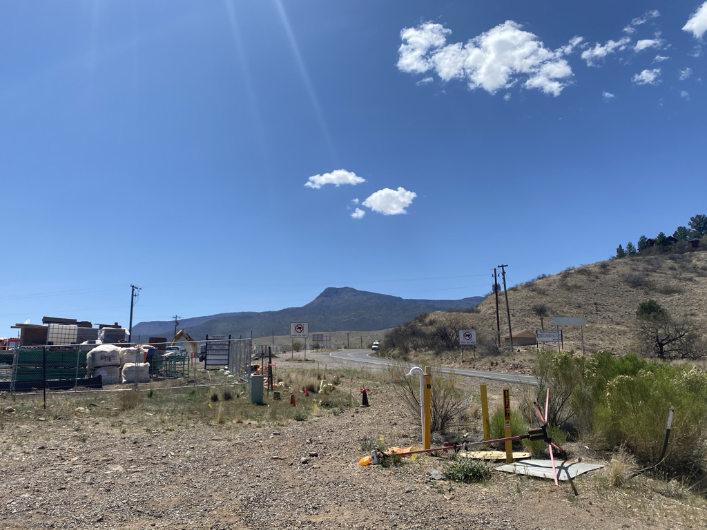
So, I figured I would drive to Sedona and pedal up the mountain from the East side. Then, I encountered Clarkdale and Cottonwood. Riding through these towns, would have involved five or six miles, both ways, of riding on suburban feeling sidewalks.

My “plan” was never a good one. It involved too many assumptions about things I failed to fully research, including parking, bicycle accommodations, etc. Doing this due diligence is a lesson I had learned but somehow forgotten during the pandemic. How frequently lessons have to be re-learned can be one of the most frustrating occurrences in life. A “re-lapse” is not just a drug addict that starts using again. Unfortunately, it’s all too common for people who had improved things like their habits and mindset to slip back into their old patterns that were not serving them well.

I was fortunate enough to find a tourist information center.

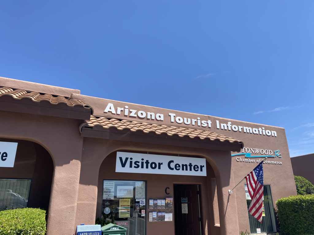
Where I was told I could park at the gas station on the far West end of town to ride my bike up Mingus Mountain.

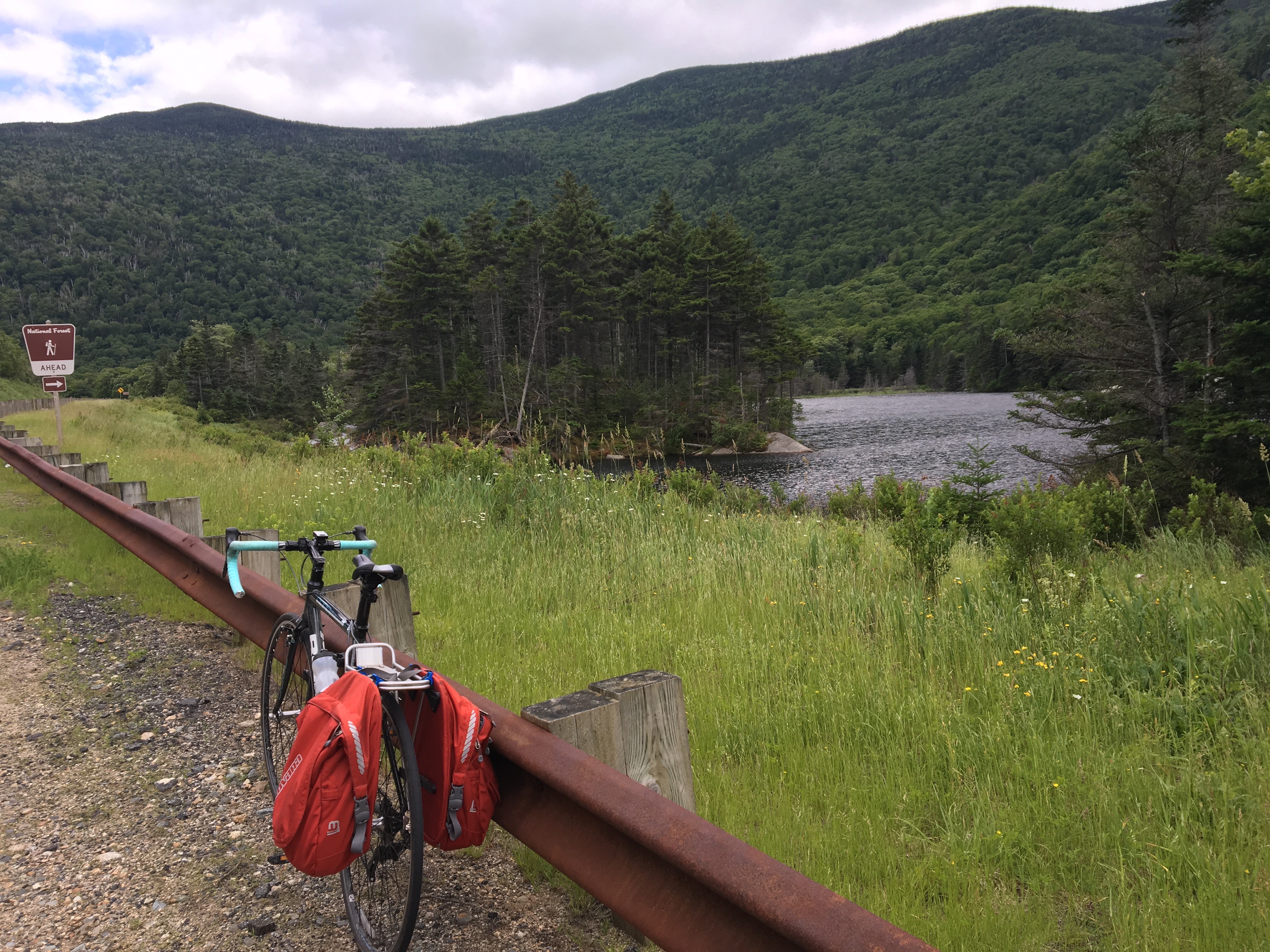
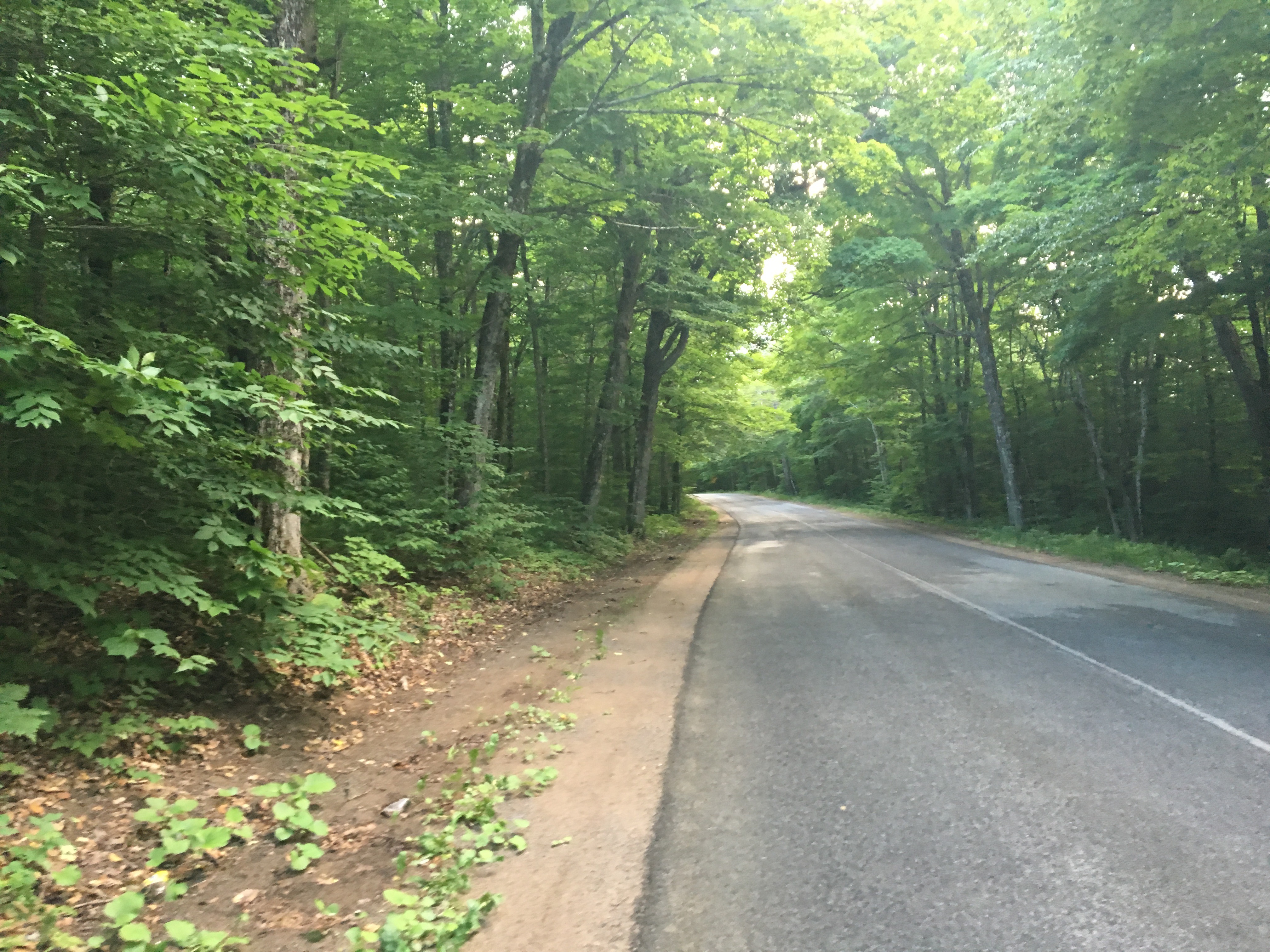
The ride itself is beautiful right from the start, and, although I had a delay I was doing exactly what I had come to Arizona to do, ride my bike up big hills in nice weather.

Clarkdale sits at only 3545 feet (1080 m) in elevation. So, it is already a significant climb just to get to the ghost town of Jerome.

Jerome is a unique spot! Like many ghost towns of the West, it boomed in the late 19th Century due to mining (copper) and then went bust.

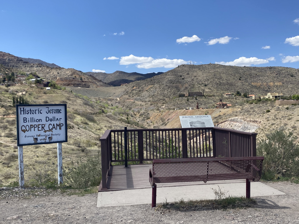
However, unlike other ghost towns, it is now a popular tourist destination with a lot of visitors.

Evidence of its past, as a lawless “old west” town can be seen everywhere.

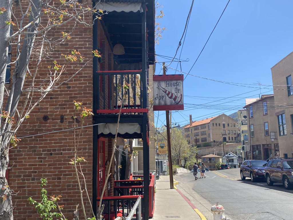
Sitting on the side of a cliff, it also takes on the feel of a Mediterranean town.

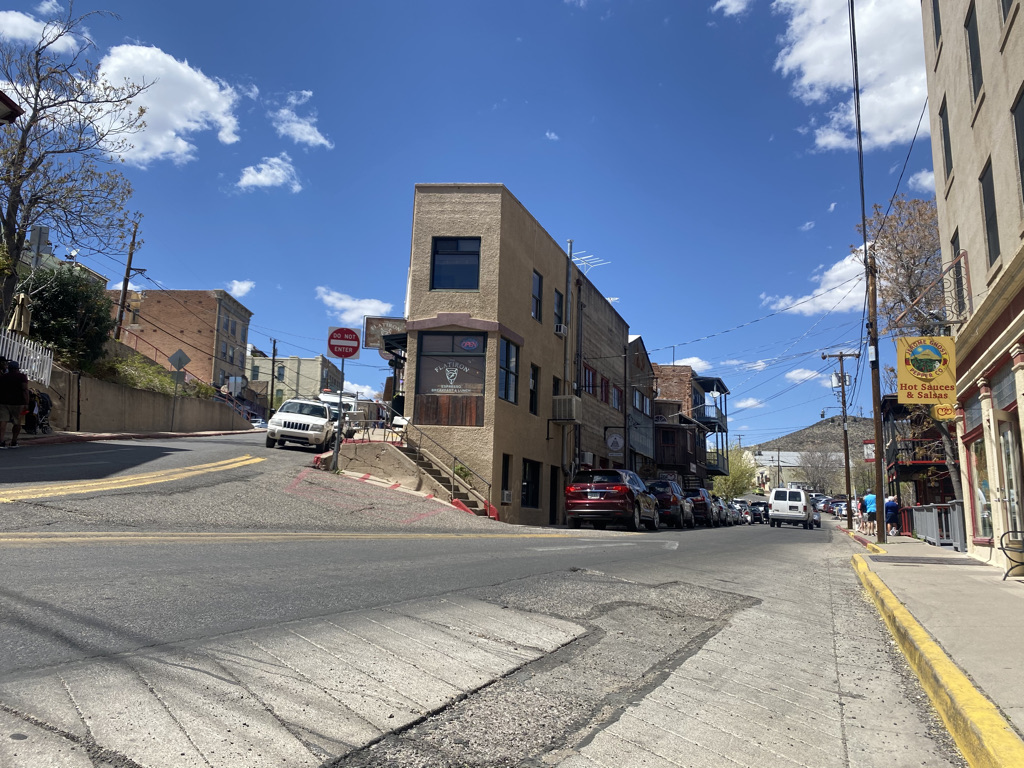
Pedaling uphill through Jerome ended up being one of the hardest parts of the entire climb!

A scenic overlook a half a mile up the road from Jerome

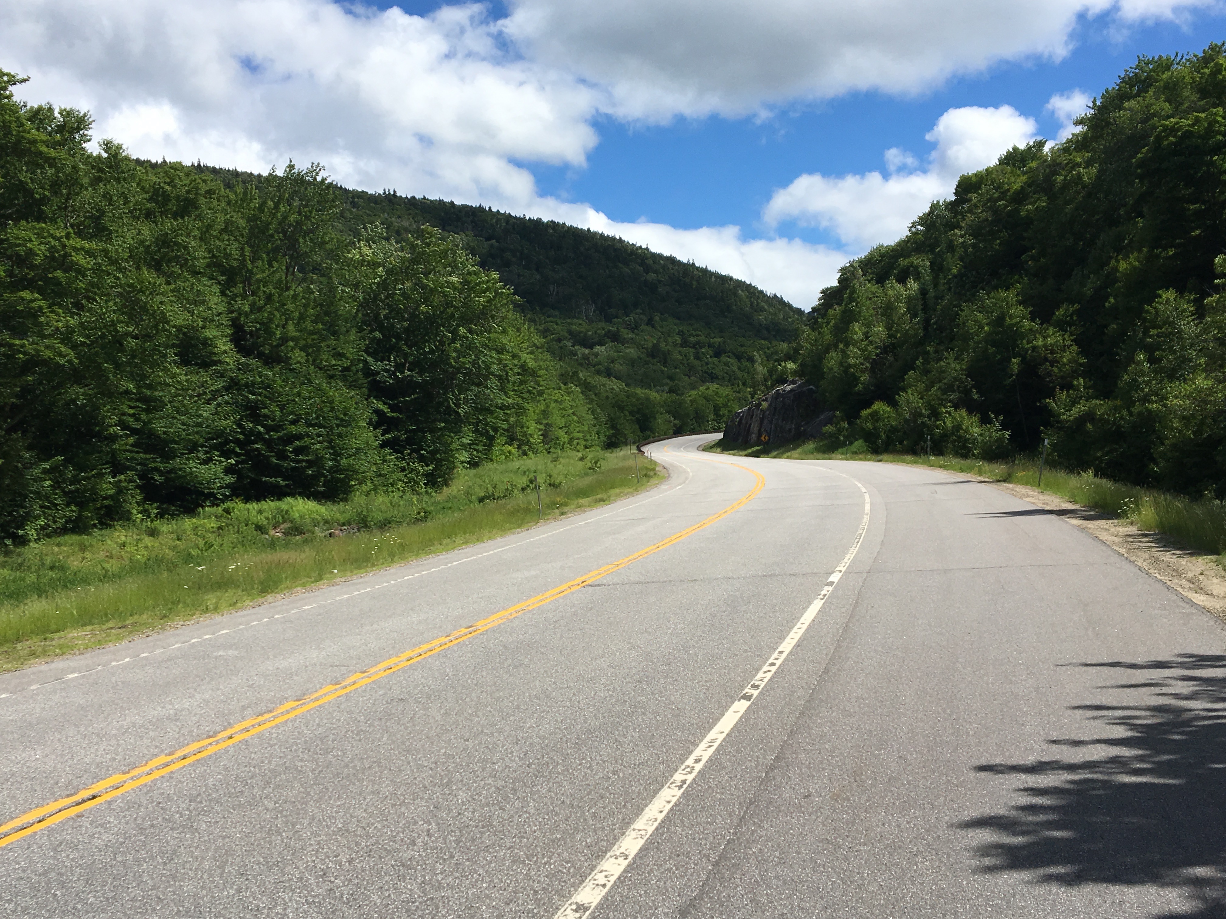
Above Jerome the climb continued to be intense, but the amount of cars drops off significantly making for a quieter ride.

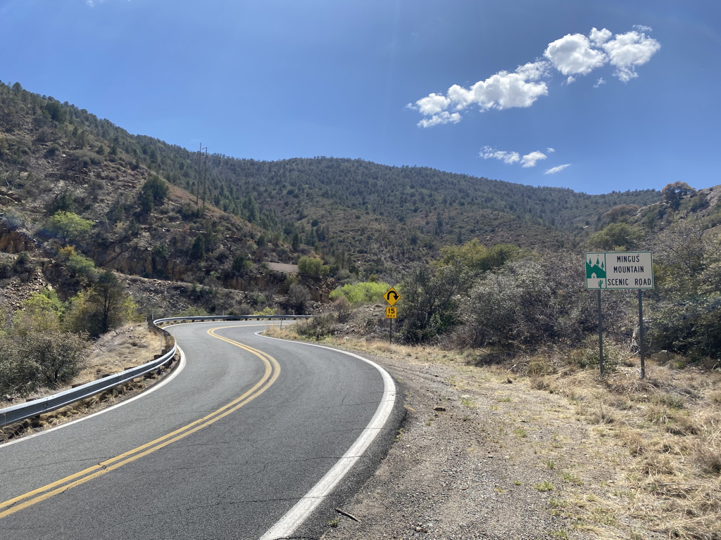
One thing I would grow to love about Arizona’s highway system throughout the week was their elevation signs. Their highways commonly have signs denoting the 1000 foot increments in elevation, providing a fantastic reference point!

The highest 1000 feet (300 m) of the climb was stunning. The panoramic views provided an almost instant reward for level of muscle exhaustion I was experiencing.

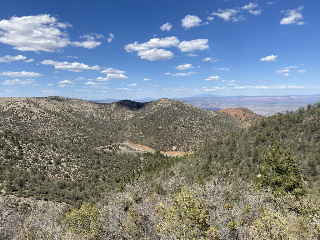
This is perhaps why I love cycling so much. When it comes to physical exercise, it is quite rare to be so immersed in the core motivating factor for the hard work, exhaustion and pain. Typically during workouts people remind themselves they are building endurance, improving their health, losing weight, etc. to keep their motivation. Here in the mountains on my bicycle, all I needed to do was continue to look all around me, feel and smell the fresh air and I knew exactly why I was willing to endure so much.

It is always exciting to reach the top of a climb. Seeing the signs and the road turn downwards for the first time in over an hour is a sweet feeling that one must experience to truly understand.

It is a great place to rest and enjoy the beauty of the place I had worked so hard to get to.

As is the case with all other components of our lives, it is crucial to savor moments like these, enjoy them while they are happening. It would have been a huge disservice to myself, as well as the natural environment around me to dwell on my prior setbacks. After all, the world is in a constant state of flux. We never know what experiences will no longer be available to return to.

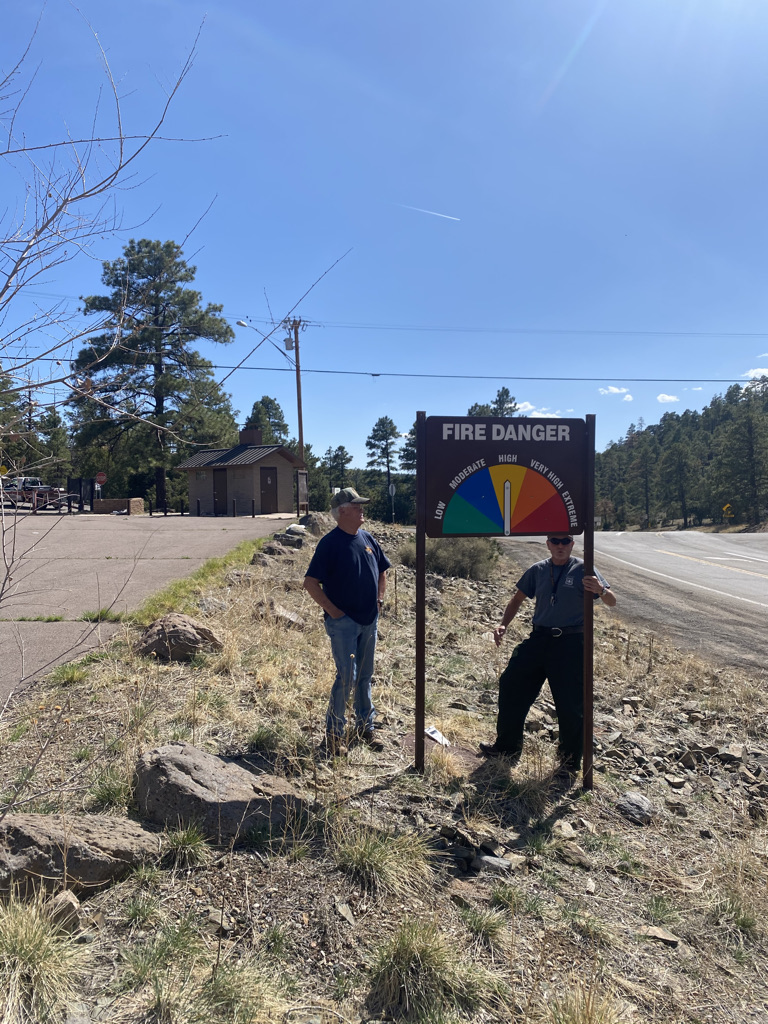
Yes, that day I actually saw the forest rangers update the fire risk to high on the grounds that the humidity was 8%.

Day 6: The Finale

The last day of a long bike ride is always a strange day.  Not that any of the previous five days were similar to the others, but this day was especially different.  As is the case with many journeys, on the last day two things happen.

First, the specifics, the details such as route decisions, stop locations, timing, daily milage and the like all sort of gradually drift out of my mind.  In its place come grander thoughts about the trip as a whole, the accomplishments, the disappointments, the lessons learned, and everything else that has been going through my mind.

The second thing that happens is reality starts to set in.  For six days, July 5th, the day I would go back to work, and return to my “normal life”, may as well not have existed.  It did not cross my mind once.  It’s like my mind suddenly re-realized that this day was coming and that, in less than 24 hours I’d be on a plane heading home, and within 48 hours I’d be back to regular old work.

IMG_6618

Another thing that made this day different than the first five days is that we had two additional riders join us.  Riding with a group, and riding significantly less miles (67 today as opposed to over 100 most other days) made the ride take on a significantly different feel.

IMG_6620

We entered Maine only about seven miles into the ride.  I guess the previous day I pretty much rode across the entire state of New Hampshire.  And, I got my sign!  The one I had been hoping for the last two times (last two days) I crossed a state line.

The first part of the ride was nice, with a wide shoulder along state highway 113, following the Saco River.  After riding on a few back roads, and a little bit of time on a trail that was half paved and half rocky, we found ourselves headed into the Portland area.  The roads got significantly busier.  In fact, these were the busiest roads I had ridden on for the entire trip.  In some parts of the route, the shoulders all but disappeared, making these the kinds of roads I would not normally chose to ride on.

IMG_6637

We rode through the surprisingly hilly downtown area of Portland, and after the final seven miles along state highway 77, arrived, in the early afternoon, at our final destination for the trip, Cape Elizabeth.

IMG_6638

When we arrived at the Atlantic Coast, at Two Lights State Park, the day started to get emotional.

IMG_6642

This was, by far, the biggest bike trip I had ever been on, and may still prove to be my life’s longest bicycle journey.  But, for Clay, it was the culmination of a three year long effort to bike across the country.  In 2014, he biked from Denver to Chicago.  Last summer, from the Oregon Coast to Denver.  This year, from Chicago to Maine.  In three segments, he biked across the country.  Many members of his family made the journey to Maine to see him triumphantly enter the Atlantic Ocean, having biked across the continent, and, as a side note, also basically proven that you do not have to be some incredibly rich or extremely lucky person to do so.  He did it all while holding the same steady job!

IMG_6644

Of course, it is easier to be emotional when exhausted, and this picture sums up exactly how I felt the first fifteen minutes after completing the ride.  It was an odd combination of emotions that came over me.  Most of them were good, and most importantly, I felt gratitude for being able to play a small part in this whole mission by joining Clay, for three days last year in Montana and Wyoming, and for six this year.

IMG_6648

In the afternoon I got the meal I knew I had wanted upon completion of my ride; Lobster.  I love lobster, but I live in Denver.  When in Maine, well, really there was no other logical choice.  In fact, when biking over the last hill of the day, despite being tired, I actually increased my speed and simply yelled, “this is the last hill in the way between me and lobster”!

We ate at a place called the Lobster Shack Restaurant, which, on that day, had a 40 minute wait for service, as it is a popular destination where patrons can eat while overlooking the Ocean!

It got even more emotional after that.  That evening my main goal was to hang out with my friends, Clay and Liz, as much as possible.  They are in fact, leaving for a year long adventure, to go out and see many other parts of the world!  These adventures will be catalogued on their WordPress site.  I knew I would likely not see them for a while.

I also could not help but think about all of the things this bike journey taught me, whether it be specifically from the experience, or things that ran through my mind over the course of the long hours I spent on my bike.

Over the course of the week, I saw kindness everywhere I went.  Clay was raising money for charity.  His family volunteered to help with the ride.  Many of the people we met along the way were friendly.  I realized that, despite the amount of physical pain I put myself through, I felt happy the entire time, significantly happier than under normal circumstances.  Maybe the whole world would be happier if we all acted this way towards one another.  The most I can do, going forward, is strive to be the kind of person that gives more than I take, and do my part.

Having experienced being on mile 27 of a 100+ mile day multiple times reminded me not to become too obsessed with the destination.  This ride was about more than me laying on a beach in Maine and then eating lobster.  It was all of the places I saw while traveling from Niagara Falls across Upstate New York, through the Adirondacks and then Northern New England.  The rest of my life is not exactly where I hope it will end up at this point in time, but I can be much better off if I learn to obsess less over the destination and enjoy the journey, as I did this week.

The social media era has turned us all into avatars.  By that I mean we all have some kind of image of ourselves that we present to others, based on who we think they want us to be.  This week, I simply couldn’t continue to be my avatar.  On trips like this, our concerns shift, from the concerns of urban 21st century American life, such as getting a promotion or getting likes on social media, to more basic concerns, for food, water, and shelter.  I couldn’t put on a show for others, but I got by, and even thrived.  The others on the trip seemed to enjoy having me around.  So, I need to stop trying to be the person I think others want me to be.

Also, on the flight to Buffalo-Niagara, I was reading a book called The Happiness Project, about a woman who undertakes various initiatives aimed at improving life satisfaction and reports on the results.  She introduced me to the concept of “fog happiness”.  This is when the happiness related to an activity is not necessarily concentrated at the time of the activity itself, but spread out over a longer time period, both before and after the actual activitiy.  Once I determined I was going to make this bike trip, for the first time in my life, I thought of myself as a legitimate bike tourist.  For the first time, I felt the right to interject in a conversation about bike touring, and have legitimate opinions.  Essentially, I had added something to my list of activities and enriched my life.  We all should be more thoughtful when choosing activities, and, specifically avoid missing out on opportunities to create more of this “fog happiness”.

Obviously, anytime anyone completes an activity that requires a great amount of physical exertion, it is a reminder of how rewarding it can be to overcome fatigue.  This lesson applies to other areas of life too, but a journey like this can often be the best reminder that some of the most challenging tasks are the ones with the greatest reward.

Personally speaking, the most important lesson I have taken from this ride relates to something I have struggled with for nearly my entire life.  I seek significance in life.  I want to do things that matter and feel like I matter to others.  While with most of it my intensions are good, there is a dark side.  At times, when I feel insignificant and powerless, I succumb to anger, depression and other negative emotions.

This week, while a significant ride, and a series of significant experiences and accomplishments for myself, I was not the center of it all.  As previously mentioned, it was Clay’s ride.  He rode longer, harder, and raised money for charity.  Yet, I did not feel insignificant, as I have a tendency to feel in many day-to-day activities.  I realized, and this is important, that: You Don’t Have to be the Center of Attention to Matter.  I cannot stress this, to others but most importantly to myself, enough!

As I flew home, I drifted off to sleep, as Bon Jovi’s inspirational 2000 song Save The World played on my headphones.  Flying through moderate turbulence, I felt the plane gently shift, both upwards and downwards.  Running through my head, was an image of myself, from above, pedaling over hills, through the woods.  Nothing else was happening, I was just pedaling.

Cycling Northern New England

Selecting the best possible route can be a challenge on bike trips.  In an ideal situation, there would be a direct route, a road or a trail, safe for cycling, pleasant, providing a direct path from point A to point B, and conveniently jaunting by all of the point Cs that are of interest along the way.  In the sparsely populated West, there rarely is an ideal route, but there often is only one option.  I could not picture taking any route other than the standard cycling route when traveling from Portland, Oregon to Missoula, Montana.  When following one of the Adventure Cycling’s bike routes, the job of selecting the best possible route is already done, by experts with tons of experience bike touring.

Being in neither situation, we spent the better part of an hour looking over maps before settling on the ideal route from Greensboro, Vermont to Conway, New Hampshire.  Choosing a route in places like this can often be a matter of factoring in various considerations and determining how to manage priorities.  I’d predict that six different cycling groups would select at least four different routes for this particular ride.  Some people want to avoid adding extra miles to an already lengthy ride.  Others wish to avoid obstacles such as wind, hills, and towns with numerous stoplights.  Others still may prioritize seeing as many sights as possible, while there are probably some that just want to find the safest route.

We had imperfect information, as in we couldn’t find information such as whether or not certain small roads are paved, or whether roads like U.S. Highway 5 have a wide enough shoulder for cycling.  Still, we took kind of a balanced approach, and I believe the route we selected served us well.

The first 45 miles of the ride were in Vermont.  On this first segment, I got what felt like the full Vermont experience, in a way I never could have had traveling by other means.

IMG_6540

I stopped in one of those off the wall small town convenience shops that is sort of a grocery store and also sort of a cultural center.

IMG_6541

I rode by lakes.

IMG_6546.jpg

Over some rolling hills.

Got to stop in one of those cheese and maple syrup shops with the arts and crafts and all.

We went by a couple of houses with interesting designs in their front yard that made me simply say, “That’s so Vermont”.  They screamed some sort of combination of people having a lot of time on their hands, and also looking for ways to express their individuality.

IMG_6556

We even rode through a forest, along an unpaved road, where trees were being tapped for maple syrup.

IMG_6557

And finally, stopped in a quintessential small Vermont town, Peacham, settled in 1776, and even talked to some people in the cafe.

IMG_6559.jpg

We took a little bridge over the Connecticut River, and, once again, I was disappointed not to see the gigantic Welcome to New Hampshire sign.

For the second day in a row, I crossed a major river, entered a new state, and found myself feeling like I was in a completely different place, with different types of people with different attitudes.  Before taking on the major climbs I knew lied ahead of me, I stopped at the Walmart in Woodsville to get water and a quick snack.  I immediately heard different accents.  A stick of beef jerky and a candy bar cost me $1.79, with no sales tax!

The first climb began right away.  In fact, it began before even leaving town!  We saw a couple of covered bridges (Clay thought we’d see them in Vermont, but at least we finally saw one here in New Hampshire), and a home with a pet pig in the yard, and finally, entered the White Mountain National Forest.

IMG_6570.jpg

The climb was not particularly steep.  I’ve been in plenty of situations where I’ve had to climb steeper hills, achieving more elevation gain over a shorter distance.  But, it was long, lasting nearly 17 miles!  This made the climb quite exhausting.

IMG_6574IMG_6580

It felt like I was following a river called the “Lost River” the entire duration of the climb, on both the uphill and downhill sides.

IMG_6569.jpg

At this point, I may not have been as mentally sharp as I typically am, due to physical exhaustion.  But, this river, with its tan-ish hue felt like it was with me for the entire ride between Woodsville and Lincoln.

At Lincoln, I took another break.  Even though I had descended a bit, probably around 1000 feet from the summit of my last climb, I was still feeling delirious.  I first confused the tiny town of Woodstock on the other side of Interstate 93 for Lincoln itself, then it took me a while to find the place where the rest of my party had already stopped for lunch.  Exhausted and delirious, I entered the room and immediately exclaimed, “that ride was like a college affair gone wrong, beautiful, exhausting, and now I am just confused”.

Lincoln is a super touristy town, which I did not expect.  There is the typical arrangement of hotels, pizza shops, ice cream stands, souvenir shops, and outdoor outfitters I’ve come to expect from any town like this.  Unlike other tourist hot spots I’ve been to, everywhere I looked I saw outfitters offering Moose tours. Some of them even offered something like a 97% guarantee of a Moose spotting!  This sounds incredible given that I have always known Moose to be elusive and hard to find.

IMG_6585.jpg

In fact, as soon as I left town, to take on another climb, back in the National Forest, and to even higher heights, I saw a sign I’ve never seen before, urging motorists to be on the lookout for Moose.  So, well, I get the point, there are a lot of Moose here.

I geared myself up for this climb more than the last one.  So, while it was likely more challenging than the first climb, I felt more comfortable, as I had set my expectations for something even crazier than this.  I still took a couple of stops to take in the scenery, as I personally prefer stopping on climbs rather than descents.

It was the exhausting final mile of climbing up Kancamagus Pass.  I needed something, anything, to divert my attention from the fatigue that had come over me.  In my head, the phrase, “Live Free or Die”, New Hampshire’s State motto, played inside my head, over and over again, to the exact rhythm of my pedal strokes.  I did not do this on purpose.  It’s what just popped in my head, as I was just in New Hampshire, and the activity I was doing, climbing on one of New England’s most iconic roads, made me think of both living free and dying, at the same time.  But, I have been told that repeating a phrase in your head is an effective way to manage challenges like this.

IMG_6599.jpg

The descent scared me.  It scared me before I even made it to the top of the pass!

IMG_6603

I had looked it up prior to leaving Lincoln.  I knew that Kancamagus Pass was at 2855 feet in elevation, and Conway, our destination for the evening was at 465 feet.  The descent was  almost 2400 feet!  But, I also made a slight miscalculation when determining both how long my ride for the day and how frightening the descent would be.  While delirious, in Lincoln, my bike computer registered at 73 miles for the day.  I was told that the ride to Conway was 37 miles.  Normally, I am good at math, but for some reason I spent most of the ride thinking that my total ride would be 100 miles, even though 73 + 37 is 110.  So, when I reached the top, I thought I had only 11 miles to go (instead of 21), but also thought I would be descending a lot faster.

IMG_6606

The last part of the ride, a slow descent into Conway dragged on forever. I repeatedly saw signs indicating what highway I was on, New Hampshire route 112, one of New England’s most challenging and iconic cycling roads.  It started to feel like a victory lap.  Unlike at the Adirondacks, where I looked back upon what I had just “conquered”, at the end of my White Mountains ride, I looked forward, seeing the signs as a reminder of what I had just achieved.

The end of the ride was slowed down by one final annoyance, periodic poor road conditions, causing me not to get into Conway until nearly sundown.  Bumpy sections of roads like this are another piece of information that cannot be obtained while looking at maps and selecting routes.  Over 100 miles into a ride, these bumps became most unwelcome.  They offer the poor choice of either putting more pain onto my butt in the sitting position or relying on my exhausted legs to pull me out of the saddle.

Even had I known this, I still would have selected more or less the same route.  Today was a success.  It was among the most physically challenging rides I have ever done.  I also felt that we had successfully solved the riddle of route selection for optimal cycling experience.

Cycling Day #4: Out of Gas

A decade and a half ago, popstar Christina Agulera, recalling a situation that most of us have faced at some point in our lives, sang “My body’s saying let’s go, but my heart is saying no.”  This morning’s situation was the exact opposite!  My heart wanted to continue riding, and soak in every experience that I could out of this trip.  But, my body, soar after three straight days of 100+ miles of riding (including yesterday’s climbs through the Adirondacks), did not feel like going any farther.

Had I decided not to ride today, I would have cheated myself out of an experience, that being day 4.  I have two previous experiences bike touring.  One, in graduate school, was a three day ride across the State of Wisconsin.  The other, last summer’s ride from Bozeman, Montana to Jackson, Wyoming, was also a three-day ride.  This day would be my first day 4, and regardless of what amount of pain I felt, I had to have this experience.

The ride started northeastward out of Lake Placid, with a little bit of a climb.  This was followed by a descent, which follows the Ausible River by Whiteface Mountain Ski Resort, and several waterfalls.

A strange thing happens when the human body is this worn out, but is forced to start going anyways.  The first few miles, or first 15 minutes or so, are kind of rough.  In particular, my legs did not feel as if they had anything left in them.  After 15 minutes, the resistance abated.  It felt like my body finally, and begrudgingly, agreed to tap some kind of alternate energy source.  For my own sake, I hope this energy source is fat reserves rather than muscle tissue.

The pain did not abate.  Sometimes the worst pain one experiences when cycling long distances is not muscle strain in the quadriceps, calves, or hamstrings.  Due to the long periods of time spent in riding position, other ares, particularly the neck and shoulders, often feel the worst.  In these situations, a little bit of Advil can help.  I usually do not advocate turning to pain medication, or any other kind of medication just to avoid a tough situation.  I even lament how many of us are dependent on caffeine to get through the average Thursday.  But, at least for me, eight hours a day hunched over a bicycle counts as that extreme situation where one can partake in pain medication without it becoming a regular occurrence.

IMG_6496.jpg

The first stop of the day, early on, was in a town called Wilmington.  This was an important stop for me, as it kind of represents the end of the Adirondacks.  On trips like this, I tend to spend well over 90% of my time looking forward, to the next destination, to the next activity, and to the next challenge.  In Wilmington, though, I found myself gazing backwards, back at the mountain range I had just “conquered”.  I have now already accomplished something.  Despite having significantly more distance in front of me, and some more amazing places to go, I’ve already had an amazing experience, one where I biked far greater distance than I have ever had before, and seen some amazing places I’ve never been to before.

The next segment of the ride followed back roads farther northeastwards towards Plattsburgh, a town along Lake Champlain.  Forests gave way to farmland, and finally town.

It ended up being a bit harder than I had anticipated to get across Lake Champlain.  First, I hit a wall.  It was as I got into town, just over fifty miles, and only about three hours, into my ride.  I was probably still quite exhausted from the previous three days.

IMG_6503.jpg

Then, the last several miles to get to the ferry ended up being more challenging than expected.  To get to the ferry from town, one must follow a trail along the Cumberland Head Peninsula that starts out heading East, but turns towards the South.  In this case, that was straight into the wind, the only strong headwind I had faced.  Although the trail was flat, the combination of wind and fatigue meant I could barely maintain a speed of ten miles per hour for the very last few miles of my ride in New York State.  I had literally run out of gas.

IMG_6505.jpg

Perhaps my biggest disappointment of the day was that when I arrived on the other side of the lake, from the ferry, there was no sign welcoming me to Vermont.  There was only this Fish and Wildlife Department sign, which I used as a proxy.

IMG_6506.jpg

The other side of Lake Champlain, Vermont, is a very different place.  The attitudes of the people could not be any more different.  In Upstate New York, I was told that Texas has a better image than Long Island.  When I first got into Vermont, I stopped at a local bagel shop and grabbed a sandwich.  I overheard a conversation where one of the locals mentioned “extreme political differences” with Texas.

IMG_6507

I doubt that these difference with Texas corespond to any kind of affinity for the New York metropolitan area.

The family that hosted us that night in Greensboro told us that the town, and probably most of the area, was quite homogenous- politically.  They recommended that anyone who had a differing opinion “bite their tongue”.

IMG_6508

To me, though, Vermont felt like the reciprocal of Texas.  Current political considerations put the two places at odds with each other.  However, as soon as I got into Vermont, I saw signs and heard rhetoric that stressed individuality, and Vermont’s “Independence”, both current and historical.  This felt to me, honestly, reminiscent of Texas.

I decided to take the afternoon “off”, which meant returning to my backup plan; riding in the van that was following Clay’s route.  I came into this ride knowing that I would not be able to keep up with Clay’s pace, often well over 100 miles per day, for the entire ride.  Before booking my flights and such to join on this trip, I made sure that I would have a backup plan when this moment of utter fatigue would eventually set in.  I figured this would be the best time to rest, as the weather turned a bit questionable (that afternoon, it became windier, and it would eventually rain in the evening).

Riding in the van also allowed me to see a couple of additional sites, most notably the Ben and Jerry’s Ice Cream factory, which is not along the bike route, but not too far out of the way.

One thing I was told to expect from Northern Vermont, was to see a lot of red barns.  After all, the quintessential Vermont image is of rolling hills, possibly cheese or ice cream, and a red barn.

IMG_6513.jpg

During my time in Vermont, which included both the time in the van today, and the time I would spend on my bicycle the next day (before reaching New Hampshire), I would see a total of 80 barns!  During my entire time in New York State, a much longer distance from Niagara to Plattsburgh, I saw only 54.

IMG_6533.jpg

Clay arrived at our destination literally minutes before the sky opened up, and started to pour.  Had I continued cycling that day, not only would I have hit a large amount of rain, I likely would have slowed Clay down, causing him to unnecessarily get wet.  This was the last time I had to invoke my back-up plan, but, based on weather considerations, the opportunity to take the Ben and Jerry’s factory tour, and this dirt road, I think I made the right choice.

Cycling the Adirondacks

IMG_6454.jpg

I woke up in Old Forge not knowing exactly what to expect for the day.  I knew the generalities.  The Adirondacks are mountains.  There will definitely be some terrain, some climbs, and some fantastic scenery.  This would be my first day of riding through a truly mountainous area.  The first day of my bike trip had been flat, mostly following the Erie Canal through Western New York.  There were rolling hills on the second day, through Central New York, but no significant climbs.  A ride through the Adirondack Mountains from Old Forge to Lake Placid would definitely be more of a challenge than the previous two days.

I started the day wondering how challenging the ride would be.  I knew that the mountains here, or anywhere in the East, are not as tall as the mountains in Colorado.  But, I also knew that I had covered quite a bit of distance the past two days, over 100 miles each day, so I could be a bit exhausted.  I had read blogs and such about cycling through the Adirondacks, but it’s hard for anyone to deduce how their body will respond to a bike ride based on a blog entry.  The same more or less holds true for other activities like hiking and skiing.

IMG_6452.jpg

It barely took a mile or so of riding, northeast on highway 28 out of Old Forge before I began to encounter the splendid lakes surrounded by forests and hills that make the Adirondacks so appealing to so many people.

IMG_6462.jpg

It was about 30 miles into the ride, at a place called Blue Mountain Lake, where the terrain started to become more challenging.  The mountains were becoming taller, as I had entered the heart of the Adirondack Mountain Range.

IMG_6464.jpg

Leaving Blue Mountain Lake, heading north on highway 28-N, I encountered the first of a series of challenging climbs.  This one was likely the steepest, but throughout the entire ride, each time I passed through a town, I would have a climb after leaving town.

I was already a little tired from the first exhausting climb when I stopped in Long Lake, at a farmer’s market I randomly encountered.  One of the beautiful things about bike traveling is that, while traveling at slower speeds, it is harder to miss these kinds of random events.  Six years ago, while cycling the I & M Canal trail along the Illinois river, I randomly encountered the Grundy County Corn Festival in the town of Morris, IL.

At this farmer’s market I talked to the people manning the booth while eating an ice cream sandwich.  One thing I notice while bike traveling in general, is that people tend to be interested when they encounter people traveling long distances by bicycle.  One of the vendors even told me she had a friend that had graduated from the same high school, on Long Island, as my father (7 years earlier, so no mutual acquaintances or anything like that).

IMG_6469

The next part of my ride, along state highway 30 from Long Lake to Tupper Lake, was the most challenging for me.  Turning towards the Northwest, for the first time on this bike tour, I was facing a significant head wind.  And, there were a few segments with significant climbing, including the climb to get out of Long Lake.

This was also the part of the ride when negative thoughts started to creep into my head.  Anyone that has taken on a large scale physical challenge understands this phase.  The body starts to get overwhelmed.  It starts to resist.  That resistance creeps into the mind through some kind of combination of messages to oneself such as, “you should quit”, “you’re not gonna make it”, “it was a crazy idea anyways”.

How to respond to this is always a challenge.  From my experience, this occurs anytime anyone truly tries to stretch themselves, and do something that amounts to a serious challenge.  There are some that never overcome this phase, repeatedly giving in to that voice telling them to quit.  Overcoming this internal pressure, born out of fatigue, builds character.  It teaches us all how to endure fatigue and negative pressure in other areas of our lives.

I also learned a valuable lesson about understanding what my body needs.  I was cycling through this challenging segment at roughly 1:30 P.M., and had yet to eat lunch.  The previous day, I had also made a relatively late official lunch stop (around 2 P.M.), but I had eaten a hot dog at 11, something that kept me going.  The ice cream sandwich I had at Long Lake was far less substantial.  It is likely that by 1:30, my body did not have the nutrition it needed.  It’s important to keep in mind that, when traveling by bike your body is your engine, and that engine needs fuel to keep running!

After stopping for a full meal, at a place called the Skyline Drive in, which was recommended to me by the woman at the farmer’s market back in Long Lake, I felt refreshed, and realized I had just over 30 miles to go to my final destination for the day, Lake Placid.  My mindset did a complete 180!  I went from questioning myself at every pedal stroke, to knowing I was going to make it, and finish this beautiful ride.

IMG_6477

I knew I was getting closer to my destination, Lake Placid, where the Olympic Winter Games were held, twice, when my route diverged from the Adirondack Trail and started following the Olympic Trail.

IMG_6481

IMG_6482

After a brief stop in Saranac Lake, and eight miles along state highway 86, which featured a surprisingly high traffic volume (but also a wide enough shoulder to accommodate bicycles), I arrived in Lake Placid, and gazed upon the mountain that had hosted some of the greatest athletes from around the world on two occations.

What a gorgeous town, and what a gorgeous ride, all the way through!  It was an exhausting ride, once again clocking in at 100 miles, but this ride through the Adirondacks is a ride I would recommend to anyone.

IMG_6489.jpg

After a nice meal at Lake Placid Pub and Brewery, across from the Hampton Inn where I would spend the night, I spent the rest of the evening soaking in the sunset over Mirror Lake, gazing at the reflection of the mountains in the water below them.

I thought about life.  I thought about how to live better.  How to be better to people around me.  How to overcome challenges.  I also thought about what I had experienced over the past three days.  The New York portion of this ride was nearly complete.  Through this ride, from Niagara Falls to Lake Placid, I saw a good portion of the state, much of it which I had never seen before.  Having been born on Long Island, and spent much of my childhood going into New York City for various events, museums, shows, etc., I am familiar with the phrase “I love New York”.  Having now seen the roaring falls of Niagara, the majestic lakes of the Adirondacks, and many points in between, I can now say “I love New York”, and know I mean ALL of New York.

100 Miles of Rolling Hills Through Central New York

It’s the quintessential bike tour stop.  A small town diner.  A picture of the bicycle in front of it, the more panniers the better.  Highly decorated walls, with an old fashion sort of flare to it.  And, of course, the existential, thought filled, photo.  It feels like I am having that experience every long distance cyclist needs to have.  Of the many stories of bike travel I have read, particularly in the Adventure Cycling Association’s monthly newsletter, it always seems like there is some sort of experience at a small town diner like this.

I am not even sure, at this point in time, whether or not I am indeed following the Adventure Cycling Association’s Northern Tier route. I know it is somewhere close to here, in Wolcott, NY, a town I would pronounce incorrectly for the entire duration of the trip. But, I am still unsure of just how odd I look at this point in time.

IMG_6408

We rolled out of town on some quiet roads that were significantly hillier than the prior day’s ride.  The entire days’ ride would in some ways resemble this, up and down these types of rolling hills that dominate the landscape of Central New York.  Over the course of the next twenty or so miles (sometimes the brain works slower when the body is consistently physically engaged like this), I processed the interactions I had with the locals, both at the diner this morning and over the course of the day yesterday.   It suddenly occurred to me that my Long Island accent, which I had originally thought would be an asset while interacting with people in this area, is actually a liability.

It’s a familiar story that plays out in so many other states with large metropolitan areas, but also large rural/small town swaths.  People from “downstate”, which mainly means New York City, Long Island, and Westchester County, dominate state politics, and call anything north of Poughkeepsie “upstate” despite its position well south of the center of the state.  This can sometimes lead to resentment from those in other parts of the state that feel neglected or even abused.

IMG_6413

The people at the hot dog stand in Fulton, NY, our next stop, were quite friendly.  They gave us the water we needed to refill our water bottles, and even gave us a couple of hot dogs to help us on our journey.  They also largely confirmed my speculation about my Long Island accent, and how they feel about the region I grew up in.  The discussion focused on state politics.  By far the most common political sign I encountered throughout my time in the state of New York were yard signs advocating the repeal of something called the NY Safe Act.  A rough map of which counties have resolved to oppose this act highlights a clear divide between the New York metropolitan area and the rest of the state!

Green-Star-Map-05-Feb-14

My friend Clay is originally from Texas.  Out of curiosity, I asked the two ladies at the hot dog stand which location, Long Island or Texas, would have a generally more positive reputation in this town.  They quietly giggled at me and told me “Texas wins”.

I’ve always had a strong interest in road networks.  I’ve actually memorized the routes of many interstate and U.S. highways.  People will often open up a map, name two roads, and see if I can guess where those two roads intersect.  I don’t have perfect memory, like that zip code guy that used to hang out in downtown Boulder.  But, knowing my road network, I knew getting to Interstate 81, in Central Square, NY, directly north of Syracuse, felt like a milestone to me. It meant that I was roughly halfway across the state.

IMG_6414

When I was 12 years old, about a year after my family moved from New York to Chicago, I made this mental connection between people talking about “going upstate” back in New York, and people from the Chicago area heading to Wisconsin.  While there are plenty of parallels, the analogy was undoubtedly an oversimplification.  After crossing I-81, I recalled that I was now within a several hour drive of New York City.  Before even hitting the Adirondacks, I saw tons of amazing places in this part of New York.

I was also fortunate to get to ride on some quieter roads. We took Moose River Road northeast out of Booneville to connect to state highway 28, which would lead to our evening’s destination: Old Forge.

IMG_6434

This was one of my favorite parts of today’s ride; 17 quiet miles through dense forests, going over periodic hills and passing by groups of vacation homes tucked away in the woods.  It feels like the kind of place where a lot of happy things happen.  It made me think of people having their weekend away from the crowds.  It made me think of sixth graders at their family vacation home having their first kiss down by the lake.  It made me think of people actually talking to one another as opposed to staring at phones, tablets, and other devices.

IMG_6437

The final ten miles of my ride were along highway 28.  This was kind of the opposite experience.  It was not quiet at all.  But, like many of the roads I had been biking on throughout the state of New York, it had a wide shoulder for biking.  Additionally, it had periodic signs labeling the road as a bike route.  I also saw some wild turkey- not too exotic, but something I do not see on a day-to-day basis.

IMG_6440

I arrived in Old Forge just before sundown.  We stayed at a hotel called Water’s Edge Inn, which, as its name suggests is next to a lake.

We sat by the lake, watching nightfall gradually creep up on us, reflecting on the experiences of the day.  I had now ridden my bike over 100 miles two days in row for the first time ever.  We were covering quite a lot of ground, but I had started wishing I could spend a little more time in some of these places, particularly Old Forge, a town with a lot of activities and natural scenery, and a town I would barely be in for 12 hours, 7 of which would be sleeping.  Still, I was enjoying myself, and finally broadening my view of what this entity known as New York really is; beyond the City and Long Island where I spent my childhood.

My First Long Day of Cycling

IMG_6357

I woke up in the morning with a good feeling.  It wasn’t a premonition regarding something specific, like when people set out to run a triathlon or take a key exam and get this feeling of confidence that they are going to achieve what they set out to do.  After all, this is a bike journey.  Accomplishment does not come at the end of this day.  It comes at the end of the last day, five days later, when I reach the coast of Maine after six days of riding.

The feeling I started the day with was just a general positive vibe, that I knew I was going to have a good day.  It is a Tuesday, a day where many people will simply be grinding out their daily lives.  For tragically many people, this means stressing out at jobs that do not fulfill them.  I get to ride my bicycle, spend the day outside, and see places I have never seen before.  I must be thankful for that.

On bike journeys there are plenty of things that can go wrong.  There’s always the possibility of unpleasant weather, unexpected storms, or an unexpected unfavorable shift in wind direction.  There are also the many possible mechanical issues that can occur to a bicycle, particularly one that was recently shipped across the country.  The feeling I got was that none of those things would happen, and that I would simply have an enjoyable day on my bicycle.

IMG_6356.jpg

Most Canadians will recognize my way of starting my day off right, with a nice breakfast at Tim Hortons.  Food is crucial on a bike trip.  It is so crucial that when I took the Adventure Cycling Association’s Leadership Training Course three years ago, it was the very first thing they talked about, before bike mechanics, camping/lodging, or even the basics of bike touring.  How to pack trailers, roof racks, panniers, etc. would not be covered until the next day!  I know one bad meal can really strain a bike trip, particularly if it’s breakfast, so I made it a good one before crossing the border back into the United States.

IMG_6360.jpg

Before leaving the Niagara area, I took one last view of the falls from a place called Goat Island.  Goat Island is between the two falls, and on the American side.  It offers a pretty good alternate view of Horseshoe Falls, which is directly across from a place called Terrapin Point.  It might be the best view on the American side of the falls, but, as I mentioned in my prior post, the Canadian side still offers better views overall.

I would spend most of my day cycling on one of the Nation’s longest bike paths, the Erie Canal trail.

IMG_6367.jpg

I knew that this was going to be a flat ride.  The Erie Canal is a waterway that was built in 1824 to provide a shipping route between the Great Lakes and the Atlantic Ocean.  In order for the very concept to work, they had to find a route with very minimal elevation change.  When the canal was built, a series of locks were built to regulate the water flow.  The first town we encountered after picking up the trail was Lockport, New York, a small town with one of these locks at the center of town.


East of Lockport, the trail surface becomes crushed limestone.

IMG_6377.jpg

Staying right next to the Erie Canal, the scenery I encountered was quite constant.  Much of my day looked exactly like this.  This trail is flat, and largely straight, which is good for covering a large number of miles in one day.  I spent most of my time on this trail just thinking about the Erie Canal itself, the amount of work it must have taken to build it, and its role in transporting goods across the Union in the Civil War, which some consider to be a major factor in the eventual Union victory.

IMG_6383

On a day like today, covering a lot of miles on a trail with consistent scenery, it is easy to lose track of each individual town.  This is why one of my favorite features of the Erie Canal Trail, at least in Western New York, is these bridges.  Each of them have the name of the town labelled on top of the bridge, so as cyclists approach, they know which town they are, in fact, approaching.

IMG_6375

I generally liked Western New York for bicycling, and bicycle accommodations.  Obviously, there is the trail, but also many of the roads include wide enough shoulders to accommodate bicycling.  Additionally, New York is one of the states that has labelled state-wide bike routes, which add some level of legitimacy to cycling as a form of transportation.

The exception, at least for me and the route we followed, was Rochester.  We split off the Erie Canal trail in order to ride, and eventually camp, along Lake Ontario.  This involved getting off the trail and following State Highway 104 into town.  Like other Western New York roads, this road had a shoulder.  However, this shoulder had frequent obstacles, mainly sewers, that we needed to cut into traffic to avoid.  After that, we cut over to the lake in a suburb called Sea Breeze only to find out that the bridge we were hoping to take, over Irondequoit Bay, was closed for the summer.

IMG_6388.jpg

We were told that the bridge would re-open in November.  I am accustomed to roads being closed in wintertime, but not in summertime.  I never would have thought to even check to see if any bridge that I was hoping to take would be closed.  What was so frustrating about this was that the bridge itself, seen in the distance, and also on this map, is so short.

Screen Shot 2016-07-06 at 6.49.28 AM.png

It couldn’t cover more than fifty feet, and, as a result of that bridge being closed, we had to back track all the way around Irondequoit Bay, adding a significant number of miles to the trip.

I ended up having to invoke my backup plan.  I had already ridden more miles in one day, 112, than I had ever before in my life, smashing my previous record of 104.  Without the detour, I would already be close to my destination for the day.  But, I knew I needed to save some energy for five more days of riding.

So, I got a ride for the remainder of the day’s trip, which ended at Sodus Point, at a campground where I could watch a beautiful sunset along Lake Ontario.

IMG_6397.jpg

The obstacle I faced was not one of the ones I had anticipated.  Usually when I think of what can go wrong on a bike trip, wind, rain, and flat tires are the first things that come to mind.  A bridge closed for the summer is the last thing that would occur to me.  In fact, it took nearly three days for me to eventually realize the likely reason for a summer bridge closure; so boats can pass through from the bay into the lake.  Still, I consider this sunset along one of America’s Great Lakes a great end to a great day on my bicycle.


Taking it to Another Level

IMG_5807

I must be insane!  The same thoughts have kept popping up into my head about my upcoming trip ever since I planned it roughly six weeks ago.  I am so conflicted.  On one hand, what I am doing is significantly outside the realm of what “normal people do”.  On the other hand, compared to most long-distance cyclists, my plan is actually rather tame.

My upcoming trip involves cycling (or attempting to, we’ll see how it goes) 600 miles over the course of six days, starting at Niagara Falls, New York, and ending on the East Coast at Portland, Maine.  I am actually joining my friend Clay for half of his 1250 mile journey, which he started in Chicago.  So, while I am taking this cycling thing to a whole new level, I can’t help but think about the fact that there are plenty who do trips that are way more elaborate than mine.

BikeRoute_Sunmer2016.png

This map represents an approximation of the route that I will be taking.  There are a few things that are still up in the air, and we may improvise a bit.  But we are certainly planning to head northeast through the Adirondack Mountains as opposed to taking the most direct route through Saratoga Springs.  It will add a few miles to the trip, but we will get to see places like Old Forge, Saranac Lake, and Lake Placid.

Last year, I joined my friend for one of his journeys, but chose a much shorter segment, from Bozeman, MT to Jackson, WY.  This 230 mile bike ride took me through Yellowstone and Grand Teton National Park, and at this point is still the longest and most exhausting bike ride I have ever done.

This year, I took on a much longer ride for reasons that are somewhat personal.  I grew up on Long Island, just outside of New York City.  However, I moved away when I was only eleven years old.  Still, at face value, it always seems odd to people when they hear that I am from New York and have never been to Niagra Falls, as well as countless other places in the region.  In fact, there are nine states I have never been to, and Vermont is one of them.  In about a week’s time, my number of remaining states to visit will be down to eight!

I can’t fault myself for having not been to these places.  After all, it takes many people until nearly the age of eleven to start developing an individual identity, and for many it takes even longer to develop an appreciation for travel to places of natural beauty.  I remember taking the ferry from Orient Point on Long Island to New London, Connecticut several times as a child.  While I remember the smell of the salt water, I do not remember appreciating the scenic coastal town in front of me.

After months of what still doesn’t feel like enough training, I am ready to take on the longest bike ride of my life, and see many of the places I “should have” seen as a “New Yorker”.

I feel anxious.  Will I make it?  Did I train enough?  Will it rain?  Will it get windy?  Will some other hazard emerge?  Or, will the lower elevation and relatively easier terrain (for the first half of the ride along the Erie Canal) make it feel easier than my normal cycling around Colorado’s Front Range?

Whenever I plan to do something major like this, there is also always this tug of war that goes on inside my head.  Maybe this is normal.  I don’t know.  On the surface, I understand what it means to go outside of one’s comfort zone, and do something unique.  There is a greater risk and a greater reward than sticking to activities that are easy and familiar.

Sometimes, particularly when doing something major, a part of me gets this nagging feeling of guilt inside my head, like I am skipping out on some kind of responsibility.  It’s strange, and I don’t know why it occurs.  In a way, it bums me out that this feeling occurs at all.  I know that life was meant to be lived, and the world was meant to be explored.  Yet,  in the back of my mind this feeling just occurs, making me feel like I should be doing something boring, like work, or house cleaning.

I wonder if others get that feeling too.  I wonder if we’ve been conditioned in some way to feel guilty about taking extended periods of time to do something for ourselves.  I’m glad I’ve learned to work through this feeling, preventing it from costing me countless opportunities over the years.  Still it would be nice to silence it altogether.

Sometimes we need to push ourselves, or be pushed, to truly figure out who we are.  Perhaps this requires the right level of insanity.  Last weekend, I attended two weddings, one in Breckenridge, CO, and one in Chicago, IL.  They were on back-to-back days.  This is, in some ways insane.  Yet, I did not do anything out of control, that could land me in jail or on a hospital bed.  Perhaps I have already found this proper level of insane!