Category Archives: Recreation Trails

The Cycling Trails of Metro Phoenix

People tend to think of Phoenix as a sun-belt car centric city, and for the most part they are correct. While Arizona ranks fairly low in terms of miles driven per capita, biking and public transit are not widely used in the Phoenix area. As is the case in other sun belt places like Southern California and Texas, driving is the default way to get from point A to point B. However, this does not mean that the region has no bike trails, nor does it mean that the area cannot be explored by bicycle.

Maricopa County Bike Map

The bike trails are quite nice and not crowded at all. My visit to Phoenix came at probably the best time of year to bike around the city, in the middle of April, and I was commonly the only one on the trail.

There are also a good number of trails, all connecting most parts of Phoenix and the nearby suburbs.

The crown jewel of the trail system is the Arizona Canal Path, a trail nearly 70 miles in length connecting places as far apart as Glendale and Scottsdale.

The trail has a very unique feel. The canal is obviously not natural. Nothing about it feels free flowing like the rivers and creeks I am accustomed to seeing elsewhere. It was constructed in the late 19th century kind of as the towns around Phoenix were being settled and incorporated. They needed the water and the means to transport goods, which was then far more dependent on water then. Later, they built Arizona Falls to harness some power from the canal.

Still, none of this is what I typically envision when I think of riding a bicycle along a river and seeing a waterfall.

However, the ride is not without natural beauty. Mountains, cactus and palm tress emerge around every curve.

It’s such an interesting feeling. Little mini-mountains in the middle of a city with over 1.5 Million People. Natural beauty around every curve, but every curve was planned carefully by engineers. Some of us are so accustomed to thinking of natural experiences as being separate from human development. This is especially the case in places like New York and Chicago where our homes are surrounded by development but we travel a few hours to be away from that development in nature. However, here on all of the Phoenix area bike trails, there is both, right there in front of my eyes.

Along these trails, it is possible to visit a lot of the area attractions. From the kinds of places you’ll see in almost every major city.

To spring training facilities for baseball and softball alike.

To the college and professional sports stadiums.

While exploring, you also never know what kind of random attractions you’ll encounter. Right in the middle of town there is a castle, and just east of town there is this hole in a rock people like to hike into.

I even got to see Central Station under construction and the one light rail line downtown.

I also learned one other important lesson, the difference between cycling long distances in a semi-arid area like Denver and a full-blown desert like Phoenix.

Usa Map Of Köppen Climate Classification - 2018 Iecc Climate Zone Map -  Free Transparent PNG Download - PNGkey

In this part of Arizona, it was hard to drink enough water without even doing anything that involves physical exertion. Spending the whole day riding my bicycle felt like a constant search for water. I guess I now understand why the bike trails are empty and why they follow a series of waterways built to bring water into the area. It even facilitates some agriculture surprisingly close to the city center.

Still, there is nothing like the feeling of visiting so many tourist attractions traveling by bicycle on a day with sunshine and temperatures in the 80s (26-32° C).

When Cycling Was What I Needed

January 31, 2021 on the Platte River Trail in suburban Denver…

I ceased pedaling for a few seconds, allowing myself to slow down. This helped me successfully navigate around several groups of people, while anticipating the unpredictable motion of dogs, children and even a few less attentive adults. There were so many people walking side by side with their dogs, or even in large groups, likely families. This made navigating the trail, in sections, particularly challenging. On this section of the trail, pedestrians outnumbered cyclists by about 3-to-1.

After navigating the congested area, my mind began to wander onto some of the more pressing issues of our time.

I thought about those on the left, who were concerned with people not getting paid what they are worth and the amount of power employers seem to have over their employees. I thought about those on the right, concerned with inconsistency and the possible abandonment of our core culture. I even thought about my own concern about preserving our basic freedoms, and a political culture that has become both more divisive and intrusive into more areas of our lives.

I thought about the commonly heard proposed solutions and why I find them narrow, short-sighted and potentially dangerous. Most people support solutions that address the issues that matter to them, but could make other problems worse, or create new problems altogether. I began to ponder an innovative solution that addresses multiple concerns at once. Then, I began to wonder if the solutions I would come up with would be just as narrow and short-sighted as the ones that terrify me.

Before I knew it, I was once again rapidly approaching a large group of people, this one larger than the last group. I decided not to be aggressive. It is a Sunday. I’m not in a hurry. After all, we are still supposed to be “social distancing” and trying to avoid using hospital resources, which are needed for COVID patients, for avoidable accidents. I slowly navigate around the group. First, I pass the parents walking and talking, while avoiding the couple walking in the other direction. Then, I maneuver around several children in front of them using scooters. However, this time before fully clearing the group, I suddenly noticed another cyclist behind me.

“On Your Left!” he shouted before I had fully moved over to the right side of the trail. I guess every person on this trail has a different agenda for the day.

The same cycle repeated for about 12 miles. The experience of suddenly realizing a more aggressive cyclist was behind me even repeated several more times. Regardless, my mind was alternating, almost in a rhythm, between navigation mode and pondering mode. The more I pondered these grand issues, and processed my thoughts about human nature, the more pessimistic I became.

Then, suddenly, I entered a section of the trail I had never fully appreciated until now. It is in the Southern part of Cherry Creek State Park.

Cherry Creek State Park is known for a fairly large (for Colorado standards) reservoir where people swim, boat, and apparently also walk on the ice in winter.

Seriously, I don’t know if this is safe. Winters here are not consistently cold, and the temperature was around 53°F (11°C) at this time.

However, at the southern end of this park the trail winds through a large open field.

Maybe this is what happens when you finally start to feel the physical strain of a long bike ride and don’t have the energy to think about mentally taxing subjects. Or, maybe it was the inspiration of the bright sunshine and the contrast between the mountains in the distance and wide open, mostly brown, field in front of me. I just gazed at the scene. I realized that, unlike in many other situations, nobody was trying to make me think about those topics that were making me feel pessimistic. All I had to do was appreciate that on this, the last day of January, the dead of winter, I was enjoying a sunny day on my bicycle.

I felt youthful, untamed and uninhibited, which was exactly what I needed after a year that has been filled with fear, restrictions and divisiveness. There was no better place to be than on my bike, on this trail.

I rode my bike nearly 60 miles that day, finding a great stopping point with some hidden treasures.

We are facing a lot of challenges and it would be foolish to ignore them. However, it would also be foolish to allow them to consume us. No matter what anyone is going through or becomes concerned with, sometimes it is necessary to just enjoy the experience in the here and now.

My First Long Day of Cycling

IMG_6357

I woke up in the morning with a good feeling.  It wasn’t a premonition regarding something specific, like when people set out to run a triathlon or take a key exam and get this feeling of confidence that they are going to achieve what they set out to do.  After all, this is a bike journey.  Accomplishment does not come at the end of this day.  It comes at the end of the last day, five days later, when I reach the coast of Maine after six days of riding.

The feeling I started the day with was just a general positive vibe, that I knew I was going to have a good day.  It is a Tuesday, a day where many people will simply be grinding out their daily lives.  For tragically many people, this means stressing out at jobs that do not fulfill them.  I get to ride my bicycle, spend the day outside, and see places I have never seen before.  I must be thankful for that.

On bike journeys there are plenty of things that can go wrong.  There’s always the possibility of unpleasant weather, unexpected storms, or an unexpected unfavorable shift in wind direction.  There are also the many possible mechanical issues that can occur to a bicycle, particularly one that was recently shipped across the country.  The feeling I got was that none of those things would happen, and that I would simply have an enjoyable day on my bicycle.

IMG_6356.jpg

Most Canadians will recognize my way of starting my day off right, with a nice breakfast at Tim Hortons.  Food is crucial on a bike trip.  It is so crucial that when I took the Adventure Cycling Association’s Leadership Training Course three years ago, it was the very first thing they talked about, before bike mechanics, camping/lodging, or even the basics of bike touring.  How to pack trailers, roof racks, panniers, etc. would not be covered until the next day!  I know one bad meal can really strain a bike trip, particularly if it’s breakfast, so I made it a good one before crossing the border back into the United States.

IMG_6360.jpg

Before leaving the Niagara area, I took one last view of the falls from a place called Goat Island.  Goat Island is between the two falls, and on the American side.  It offers a pretty good alternate view of Horseshoe Falls, which is directly across from a place called Terrapin Point.  It might be the best view on the American side of the falls, but, as I mentioned in my prior post, the Canadian side still offers better views overall.

I would spend most of my day cycling on one of the Nation’s longest bike paths, the Erie Canal trail.

IMG_6367.jpg

I knew that this was going to be a flat ride.  The Erie Canal is a waterway that was built in 1824 to provide a shipping route between the Great Lakes and the Atlantic Ocean.  In order for the very concept to work, they had to find a route with very minimal elevation change.  When the canal was built, a series of locks were built to regulate the water flow.  The first town we encountered after picking up the trail was Lockport, New York, a small town with one of these locks at the center of town.


East of Lockport, the trail surface becomes crushed limestone.

IMG_6377.jpg

Staying right next to the Erie Canal, the scenery I encountered was quite constant.  Much of my day looked exactly like this.  This trail is flat, and largely straight, which is good for covering a large number of miles in one day.  I spent most of my time on this trail just thinking about the Erie Canal itself, the amount of work it must have taken to build it, and its role in transporting goods across the Union in the Civil War, which some consider to be a major factor in the eventual Union victory.

IMG_6383

On a day like today, covering a lot of miles on a trail with consistent scenery, it is easy to lose track of each individual town.  This is why one of my favorite features of the Erie Canal Trail, at least in Western New York, is these bridges.  Each of them have the name of the town labelled on top of the bridge, so as cyclists approach, they know which town they are, in fact, approaching.

IMG_6375

I generally liked Western New York for bicycling, and bicycle accommodations.  Obviously, there is the trail, but also many of the roads include wide enough shoulders to accommodate bicycling.  Additionally, New York is one of the states that has labelled state-wide bike routes, which add some level of legitimacy to cycling as a form of transportation.

The exception, at least for me and the route we followed, was Rochester.  We split off the Erie Canal trail in order to ride, and eventually camp, along Lake Ontario.  This involved getting off the trail and following State Highway 104 into town.  Like other Western New York roads, this road had a shoulder.  However, this shoulder had frequent obstacles, mainly sewers, that we needed to cut into traffic to avoid.  After that, we cut over to the lake in a suburb called Sea Breeze only to find out that the bridge we were hoping to take, over Irondequoit Bay, was closed for the summer.

IMG_6388.jpg

We were told that the bridge would re-open in November.  I am accustomed to roads being closed in wintertime, but not in summertime.  I never would have thought to even check to see if any bridge that I was hoping to take would be closed.  What was so frustrating about this was that the bridge itself, seen in the distance, and also on this map, is so short.

Screen Shot 2016-07-06 at 6.49.28 AM.png

It couldn’t cover more than fifty feet, and, as a result of that bridge being closed, we had to back track all the way around Irondequoit Bay, adding a significant number of miles to the trip.

I ended up having to invoke my backup plan.  I had already ridden more miles in one day, 112, than I had ever before in my life, smashing my previous record of 104.  Without the detour, I would already be close to my destination for the day.  But, I knew I needed to save some energy for five more days of riding.

So, I got a ride for the remainder of the day’s trip, which ended at Sodus Point, at a campground where I could watch a beautiful sunset along Lake Ontario.

IMG_6397.jpg

The obstacle I faced was not one of the ones I had anticipated.  Usually when I think of what can go wrong on a bike trip, wind, rain, and flat tires are the first things that come to mind.  A bridge closed for the summer is the last thing that would occur to me.  In fact, it took nearly three days for me to eventually realize the likely reason for a summer bridge closure; so boats can pass through from the bay into the lake.  Still, I consider this sunset along one of America’s Great Lakes a great end to a great day on my bicycle.


Great Smoky Mountains National Park

America’s most visited National Park is Great Smoky Mountains National Park.  Situated  in the Southern Appalachian Mountain Range, along the border of North Carolina and Tennessee, it is not the easiest place to get to.  When I think of National Parks, places like Yellowstone and the Grand Canyon first come to mind.  This is why I am somewhat surprised that this National Park takes the prize as most visited, with something like 10 million visitors annually.

IMG_1228 IMG_1229


The drive down to the Smoky Mountains was quite scenic.  It was mostly along Interstate 75, which I joined just north of Richmond, Kentucky.  Mountains began to appear as I approached the border of Tennessee.  And, with it being a cold morning, fog appeared along the sides of the mountains near the border.  I have only driven this road once before, but I actually recall it being prone to fog.  I even remember fog related caution lights the last time I was here, which I did not see this time.

IMG_1232 IMG_1233

As I approached the National Park, I began to think that there may be places besides the National Park itself that are just as scenic.  I knew the park would be crowded, which it was, with slight backups on the way both in and out of the park.  I still wonder if I could have gotten the same experience at a slightly different location.  Most mountain ranges are larger than the parks that are built to celebrate them.

IMG_1234


As I entered the park I notice that the trees in this area have largely not turned yet.  This, of course, is at lower elevations, and as I traveled up the mountains, the scenery would change.  This is one of the things that made this trip quite interesting.

IMG_1235


My Thursday hike would take me up the Alum Cave Trail to the top of Mount LeConte.  This trail is right in the middle of the park, and one of the most popular trails here.  It is kind of describes as your “quintessential Smoky Mountain hike”, and since this is my first time here, I figured I might as well start with this one.

IMG_1237

The hike starts off somewhat easy.  The first mile or so treks along the valley of a creek, gradually gaining elevation from a start of something like 3500 feet to just over 4000 feet.  It is in this part of the park, the middle elevations (as it has places lower than 2000, but also peaks above 6000) where the fall foliage was at it’s peak this week.  Knowing this, I would still recommend late October as an ideal time of year to visit the Smoky Mountains.

IMG_1238


Arch Rock is the first defining feature on this trail, 1.4 miles in.  It is at this point that the trail becomes more difficult.  In fact, I think there are a lot of people that end their hike here.

IMG_1240 IMG_1241 IMG_1242


As I continue up the trail, I notice more great views of the mountains and the foliage.  The hike overall is somewhat difficult, but I would say I have done harder hikes in Colorado, especially due to the elevation.  However, I did get a chance to feel really awesome, as I was the fastest person on the trail that day.  I would spend most of the day passing people up, and only get passed up once, at the very end of my descent, right before reaching the car again.  This, of course, is the opposite of the experience that I typically have in Colorado, where I am the one usually getting passed up.  I should really not compare myself to others, especially regarding something like hiking, but it still felt kind of good, almost like I know what it feels like to be one of those guys with their headphones on running up Mt. Bierstadt.

IMG_1244 IMG_1245


The trail’s main defining feature is Alum Cave, which is not a cave, but more of a series of bluffs.  This point is also a common stopping point for hikers.  It was a cold day, especially for Tennessee standards.  Highs would only get into the lower-middle 50s at the base of the mountain, and most of my hike would be in temperatures in the 30s and 40s.  A little nervous about the cold, I thought about stopping here, but decided to keep going anyways, up Mt. LeConte, which would take me over 6500 feet in elevation.

IMG_1247 IMG_1248


I had perviously noticed a white looking feature to the top part of the mountains.  One could mistake this feature for snow, but one of the hikers informed me that it was a really heavy frost.  This, of course, is something that would never happen in Colorado due to the lack of moisture, and is one of many features that make the Appalachian Mountains different from the Rocky Mountains.  When I finally got to this level, I was relieved to find that this frost was not present on the ground, which would have made the hike slippery.

IMG_1250 IMG_1251


There were some really neat icicle formations near the side of the trail, but there were really only one or two parts I would consider slippery.  The top of the mountain did have some dense pine forests.  With their heavy coating of frost, walking in and out of these areas was somewhat creepy feeling- appropriate for Halloween.  There was some wind at the top of the mountain.  It was no faster than 10 mph, but was enough to blow some of this frost off the trees.  The frost flying through the air felt kind of like it was snowing, but being the scientist I am, I knew that it was not actually snowing.

IMG_1253 IMG_1254


0.2 miles before the top of the mountain, there were a bunch of cabins.  I actually saw some people with full backpacks headed there to stay the night.  The top of the mountain was foggy, which dampened my view.  WIth it being cold and windy, I only stayed up there for about 10 minutes; long enough to take this picture and eat a 6″ sub from Subway, which I brought with me in my backpack.

IMG_1257

The hike took me about 5 hours overall, 3 to get up and 2 to get down.  Other hikers told me that it was an impressive time, but I was kind of in a hurry, as it was cold and I did not want to take long breaks.  The additional time gave me a chance to see some of the park’s other features.

IMG_1259 IMG_1260


The first of such features was the Newfoundland Gap, which was apparently discovered in the early 19th century as an alternate route to the Cumberland Gap.  Looking out at the natural features, I struggle to figure out where this gap is, and what makes it an easy route for settlers to get across the Appalachians.  I am guessing it is the valley between this hills, but it seems as though they would still have to climb to the elevation I am sitting at, 5048 ft.

IMG_1261

I also got to see a small section of the famed “Appalachian Trail”, which follows the high points along the NC/TN state-line through most of the park.

IMG_1263


I drove up the road to Clingman’s Dome, the highest point in the park.  But, the cold, windy weather, and fog at the observation deck stopped me from actually going up there.

Overall, I enjoyed my experience at the Great Smoky Mountains National Park, and I think the area offers something for everyone.  Just outside the park are the towns of Gatlinberg and Pigeon Forge.

IMG_1264


Both towns are quite touristy, with tons of restaurants, hotels, and other attractions like roller coasters and family fun centers.  However, Gatlinberg was more dense, the kind of place where one would largely walk to most of the places they desire to go to.

IMG_1230


Pigeon Forge, on the other hand, is a driving place.  I saw few people walking around here (as I saw a lot in Gatlinberg), but there were still tons of attractions, probably even more than in Gatlinberg as Pigeon Forge is home to Dollywood.

For those that want a more rustic experience, there is plenty of that too.  In fact, just off the Smoky Mountain Parkway (the highway that connects these two towns to Interstate 40), it gets a lot more rustic quite quickly, with lots of cabin sites, but also areas with tubing and other outdoor activities.  I can imagine nearly everyone getting something out of their Smoky Mountain experience, and I can imagine spending a significant amount of time here.  Between this, my experience in Nashville last year, and what I hear about Memphis, Tennessee seems to me like a state that really knows how to party!

One other thing I noticed while in Tennessee is that there are parts of the country where Krispy Kreme donuts are still popular.  In fact, my hotel offered free Krispy Kreme donuts to their guests, as a manner in which to draw people (as competition is quite stiff in this area).  In this part of the country, Krispy Kreme donuts were popular long before the Krispy Kreme fad up north around a decade ago, and remain a cultural institution.  When I ate my donuts, I realized once again that these are good donuts.

We urban, cosmopolitan, northerners (or however you describe pop-culture influenced mainstream America) seem to do a good job of taking cultural mainstays from other regions and turning them into short-lived fads.  Shortly after the Krispy Kreme fad (which was roughly 2001-2004), we created a fad out of Caribbean reggaton music, culminating with Daddy Yankee’s widely successful BarrioFino album.  For those that don’t know, Daddy Yankee is still producing albums that are widely successful in the Caribbean, and even moderated a gubernatorial debate in Puerto Rico.  We are now doing the same thing with twerking, which has been part of African American culture for two decades.  Actually, that fad may already be over!

After my breakfast, I head back to the park to visit one last destination; Cades Cove.  This part of the park is mainly for wildlife viewing.  I have limited luck, as much of the area is pretty empty.  There are a lot of horses here, but that is kind of what I expect.  I was amazed, though, at how people went right up to the wildlife, even if it was deer, something I see all the time.  At the other National Parks I have visited this year, mainly Yellowstone and Rocky Mountain National Park, anywhere I’d seen wildlife, there were park rangers making sure people don’t get too close.  Here, it appeared as if people were walking up to the animals, just daring them for a fight.

IMG_1266 IMG_1267

I would very much like to come back here.  There is so much more to see and do in Great Smoky Mountains National Park, as well a in Gatlinberg and Pigeon Forge.  However, I am also curious to go somewhere else in this mountain range where it may be less crowded.  Perhaps I could go somewhere like Mount Mitchell, or to an area north or south along the range, just to see if the foliage and hiking experience would be just a good without the traffic and crowds.  However, I do think it is interesting to see these mountain ranges in the east, as they are quite different from the Rocky Mountains, near where I live.  They have much more of a densely forested feel to them than the wide open Rockies.  The colors are different, and the mountains feel somewhat different in orientation.


Interstate 65: The Raceway

IMG_1176 IMG_1177

I designed a road trop that would mix the familiar with the new.  The first day of my road trip focused on the familiar, and few roads are more familiar to me than interstate 65 between Chicago and Indianapolis.  During my time living in the State of Indiana, people would often refer to Interstate 65 as “the raceway”.  This, of course, referred to how fast traffic would move on this highway.   Traffic most likely moves this fast on this particular road because the two cities it connects both contain a lot of fast drivers.  At the time when I was living in Indiana, the highway speed limit was 65 and traffic tended to move at a speed of about 80 mph.  Since then, the speed limit has increased to 70, meanwhile gas prices have risen substantially.  Still, with the exception of when trucks are slowing down the highway by passing one another, traffic moves at about the same pace.

IMG_1179 IMG_1178

Most of this route would be considered quite dull by most.  It pretty much looks like this, open fields of corn and soy stretching endlessly into the distance.  And, there is little variance.  Nearly every highway I crossed would contain the same features, a few gas stations, and signs pointing motorists to both Chicago and Indianapolis.  For many, this is a dreadfully dull ride, but for me it is slightly differnt.  As I had spent a significant amount of time in the area, and gained a lot of interesting experiences here, the highway actually brought back a plethora of memories for me.  Many of the exits I encountered on this trip reminded me of interesting experiences I had years back.  It was almost like a trip through a period of my life, and almost like I was reliving many of these memories.

IMG_1180

I felt it appropriate to stop at Arbys, a staple of this region.  In fact, whenever I think of central Illinois and Indiana, I think of Arbys, as they are plentiful here.  One time, while driving interstate 55 from Saint Louis to Chicago, I decided to count the number of Arbys- there were 13, and that was only the number I could see signed from the highway.

IMG_1183

There is one place where the endless fields of corn and soy give way to a very different scenery; in the vicinity of the Wabash River near Lafayette, Indiana.  WIth dense trees, and even a little bit of terrain, this region is always a welcome break from the monotony of this trip, even when I am reliving memories from my past.  In fact, I recollect this area being one of the few areas I explored beyond the local fast food joints and truck stops on this trip.  I was hoping for more color, given that it is well into October, but I heard that the weather had just cooled down recently.  So, the colors will have to wait.

IMG_1189

Indianapolis is not a glamorous city.  In fact, it is mostly known for being quite affordable compared to most cities its’ size and larger.  I recall seeing lists that compare median income to median home costs, and seeing that Indianapolis is one of the easiest places for someone with the average paying job to afford a home.

IMG_1190

However, it is not without its’ interesting places.  The bike trails here are pretty unique, albeit they do not seem like they would be efficient.  In town, I got the chance to check out the Indianapolis City Market, which seems like the kind of place people go to eat lunch during an average workday downtown.  By the time we arrive there, around 4:15 P.M., most of the businesses seem closed.  However, there is one open establishment, called the Tomlinson Tap Room that serves beer from different microbreweries throughout the state.  They even serve “flights” on boards shaped like the State of Indiana, which I found to be a unique idea.

IMG_1191 IMG_1192 IMG_1193

Looking at the clientelle at this establishment, it appears to be one of those after work type of places that tends to die down around 8 or 9 P.M.  Plenty of these types of places can be found in central business districts of many large cities, as other districts are more sought after with regards to nightlife.

Although I can never think of a defining feature about Indianapolis, I always enjoy my trips here.  My last time here was in 2010, when I was Wisconsin defeat Michigan State in the inaugural Big 10 Championship game.  I remember getting pitchers of Long Island Iced Tea for only $7 at a place called Tiki Bob’s.  And this was on a Saturday night, and the night of a major sporting event.  There is something to be said about affordable cities, and even affordable neighborhoods of our own cities.  People here seem to be enjoying the same experiences for a fraction of the cost.  Sometimes I even wonder if the joke is one me, and others that chose cities and neighborhoods that are trendy or well known.  They are probably sitting back, enjoying their $3 drinks and $550/ month apartments wondering why we pay so much to be where we are and do what we do.


A Rite of Passage

IMG_2367 IMG_2376

Birth to roughly age 22 is an endless barrage of rites of passages.  There is birth itself, first steps, first words, first day of school, learning to ride a bike, first kiss, then high school and college are one eight year long rite of passage into adulthood which includes learning to drive, and then all of the other things you can legally do at age 17, then 18, then 21.  Due to the ridiculous drinking age in this country, many of us end up going a little bit overboard somewhere in there.  On top of that, there are a bunch of rites of passages in there that are specific to each individual, like first baseball games, or learning musical instruments.

The final rite of passage in all of this is graduating and getting a job (or, for some people graduate school).  At this point in time, most of us are quite sick of rites of passages.  This is especially true for some of us that went to graduate school.  The time has just come for us to stop preparing for our lives and live our lives.  However, the transition is quite abrupt.  We go from being in a near constant state of flux and trying to figure out where are lives are going, to a quasi-steady state, where day in, day out, week in, week out, year in, year out, has the potential to follow some routine that never changes, and never progresses.  After a few years of this, it is natural to get a bit restless.  Before long, we see American Pie, or Superbad, or Clueless, or whatever movie reminds us of that time in our lives, and almost become nostalgic for the time in our lives when the future, heck, the next week, was an open book, as opposed to a likely mirror of the last.

IMG_2347 IMG_2349

In Colorado, it is considered somewhat of a rite of passage to climb to the top of a “14er” for the first time.  A “14er” is a mountain whose peak is more than 14,000 feet in elevation.  The selection of the number 14,000 seemed a bit arbitrary to me at first.  It seemed like it just happened to be the nearest round number, and that it would be different if the U.S. were on the metric system.  But, this demarcation of peaks exceeding 14,000 feet seems useful to Coloradans for two reasons:

1.  With a total of 54 “14ers”, it gives Colorado hikers a large enough variety of places to go and hike these peaks, but not so many that climbing all of them is out of reach.

2.  With a total of 54 “14ers”, Colorado has significantly more of these peaks than all other states, including Alaska (14) and California (12).  So, despite the fact that those states have the tallest peaks in North America and the lower 48 respectively, Colorado has a basis to claim the top position in the country with regards to mountains and mountaineering.

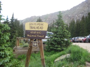
This is why yesterday I woke up before sunrise and made the trek to Gray’s Peak in order to accomplish the feat of climbing my first “14er”, and becoming a true Coloradan (in the eyes of some).

IMG_2393

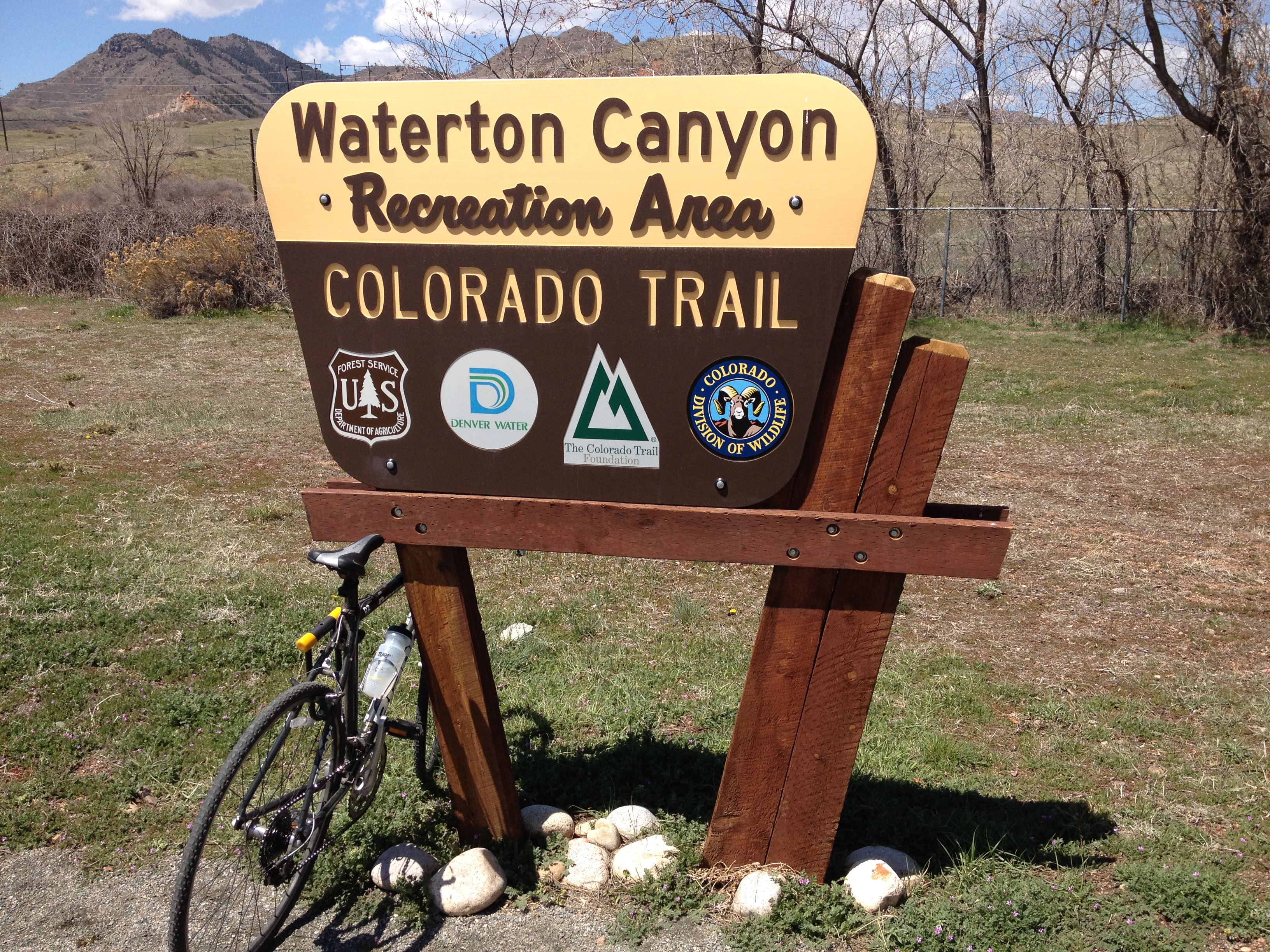
Gray’s peak is actually the highest point on the Continental Divide, and the trail up to the top of this peak (as well as Torrey’s Peak) is part of a national scenic trail that follows the continental divide.  This trail is only about 70% complete.  If someone wanted to traverse the entire trail, they would have to do some road-walking.  This is most likely why we don’t hear about this trail as much as the Appalachian and the Pacific Crest trails.

IMG_2354

I was lucky enough to go with a group of people that included three first timers (including myself), and a mixture of people who had varying levels of experience climbing “14ers”.  A couple of people had been up over ten of these peaks, some others had done only a couple.  It is also just fun for me to do activities in groups like this, and I am glad I got to share this accomplishment with them.

IMG_2355

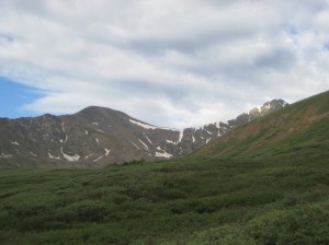
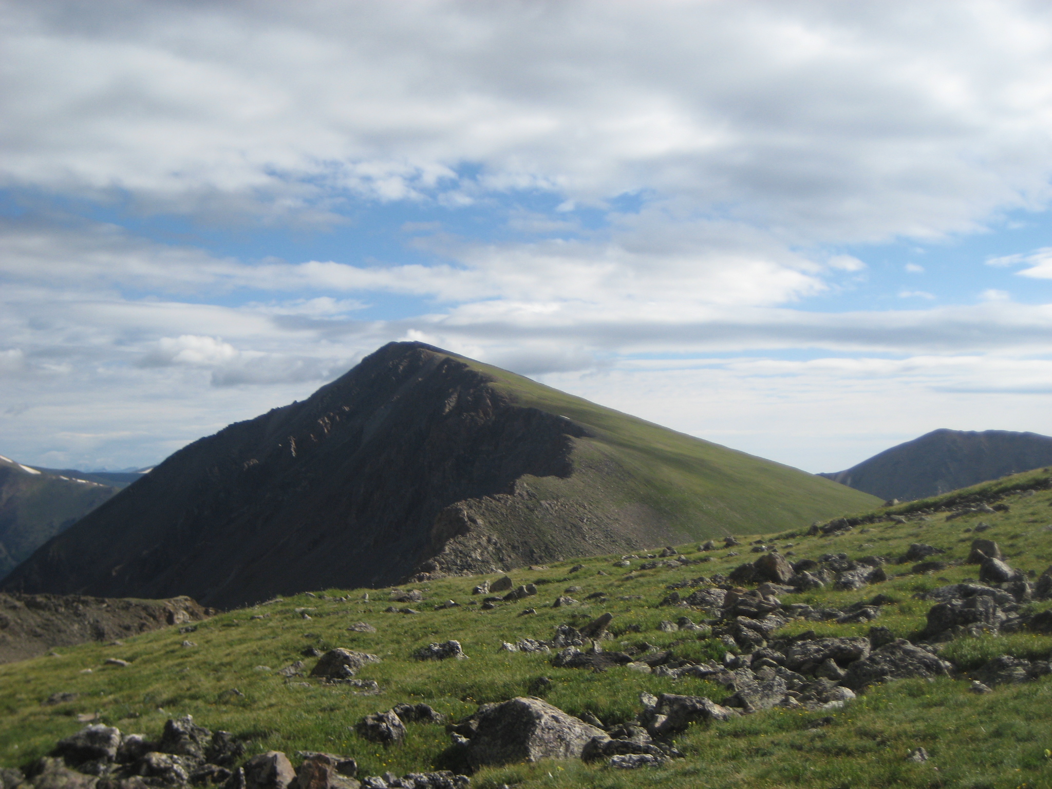
Whenever attempting something that requires physical strength or endurance, part of the battle is always mental.  Seeing Gray’s Peak (left), and Torrey’s Peak (right, partially hidden behind the hill), toward the beginning of the climb definitely created an intimidation factor that somewhat reminded me of the first time I went skiing in the Rocky Mountains, at Steamboat Springs, and looked at the ski mountain, after having only seen ski mountains in the Midwest.

IMG_2358

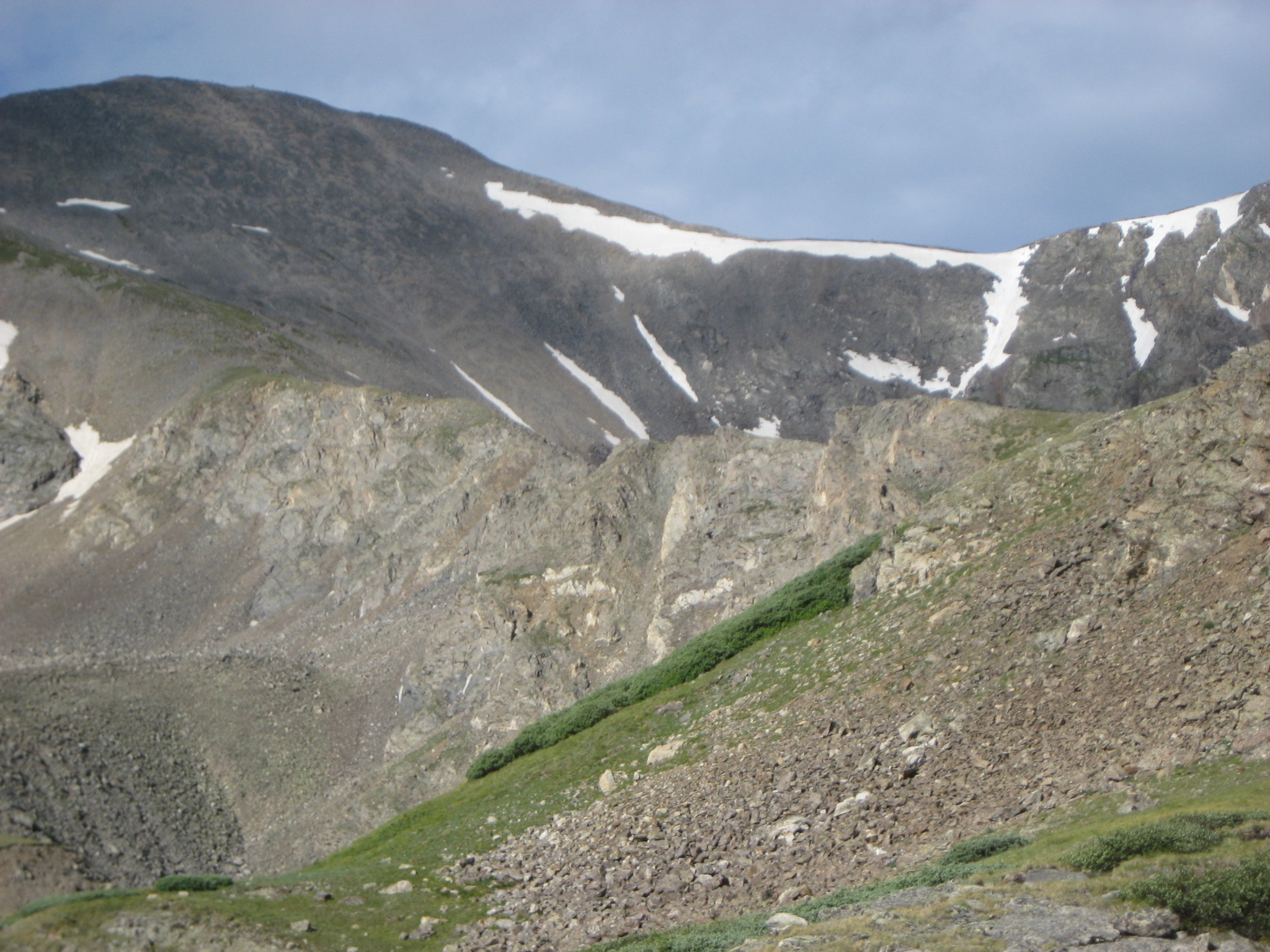
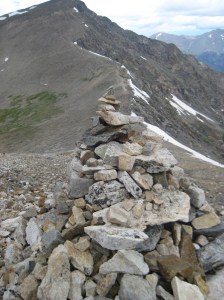
The trail up the mountain follows a path that has been mapped out for some time, and has been improved and preserved by the Colorado Fourteeners Initiative.  It is likely the safest way to hike up the mountain, but it follows a ridge that looks a bit scary, as the thought of being on a small linear feature like the one seen in this picture can be somewhat frightening.  Luckily, when we got there, it was actually less scary up close than it was looking at it from afar.

IMG_2361 IMG_2362

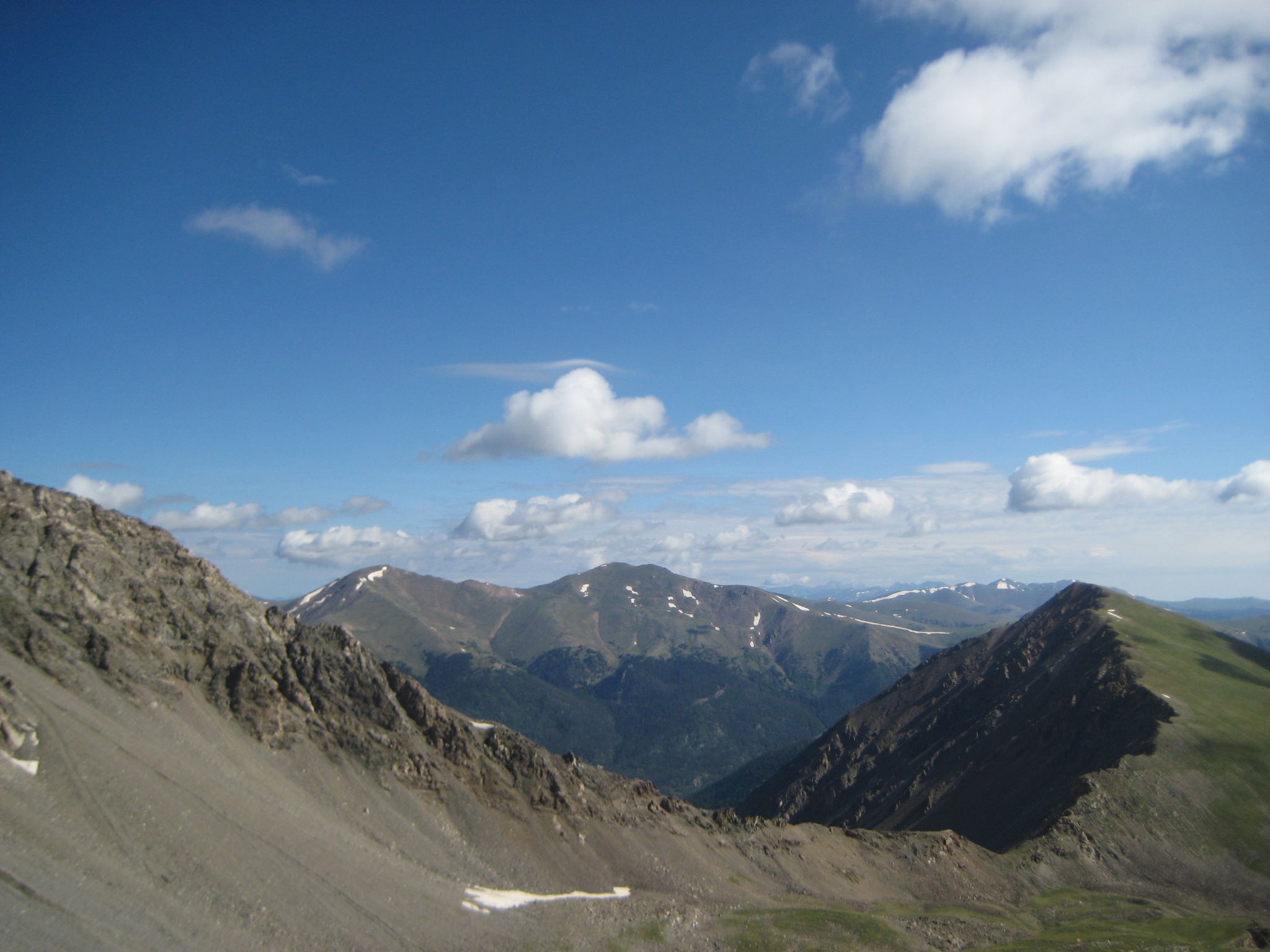
With pretty much the entire hike being above the tree line, I began to get some pretty scenic views only halfway up the mountain, which is already above 12,000 feet in elevation.  It was quite interesting to see some of the other peaks looking away from the top of the mountain, to the north.  As a scientist, it is hard not to be intrigued by seeing a mountain where one side is getting a significant amount of sun and the other is not.  It appears as if grass grows on one side but not the other, which indicates a different ecosystem and a different climate, all within the arctic tundra, dependent on local topography.

IMG_2363 IMG_2365

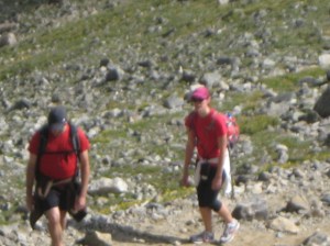
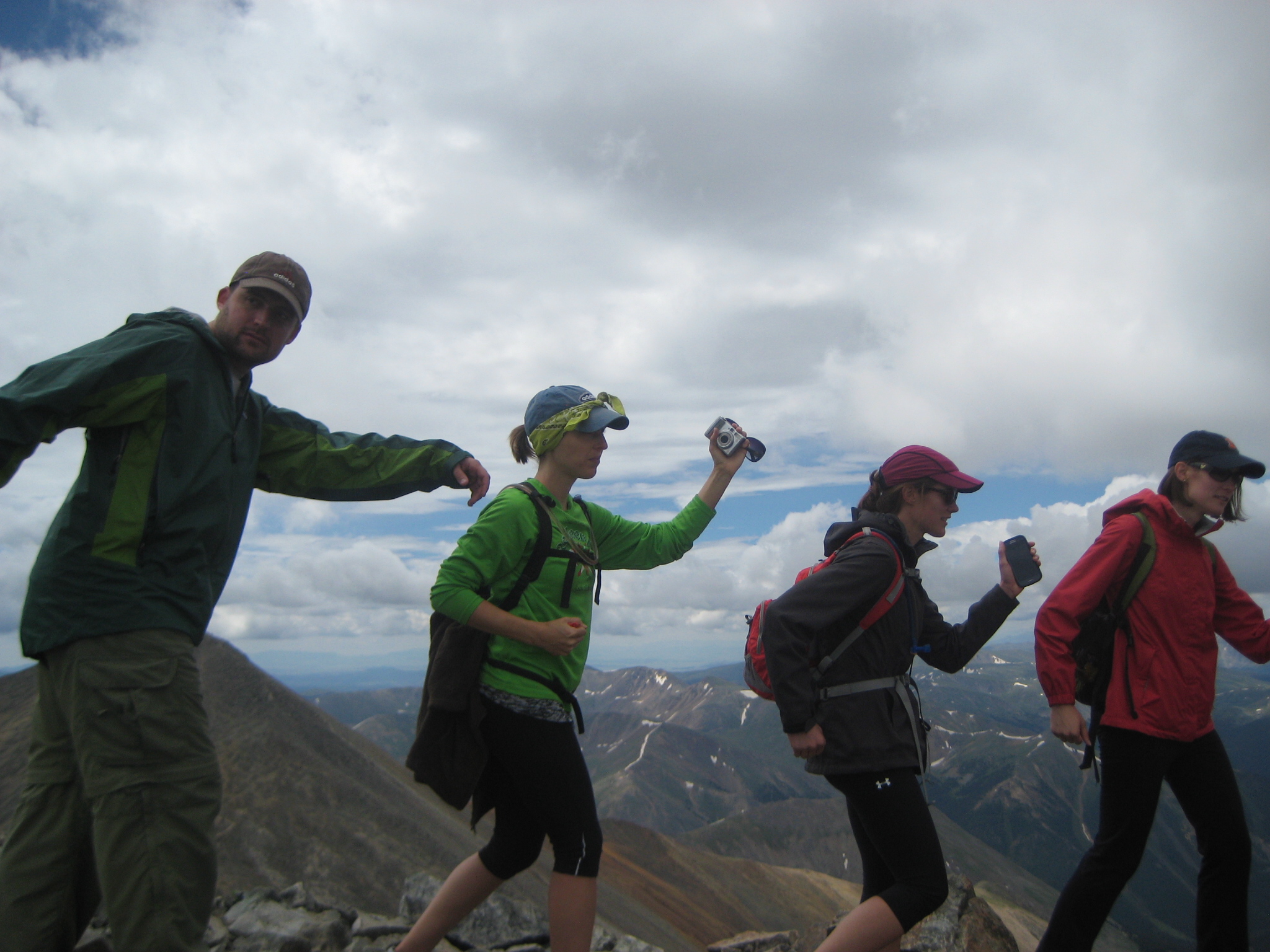
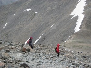
For roughly the first two thirds of the way up the first peak, I was actually able to keep up with the fastest people among the group.  However, having less experience climbing at these altitudes, it was inevitable that I would eventually drop back.  I took this opportunity to get some image of the others in the group hiking, as there was a switchback zone after the ridge we had previously followed.  Hiking trails like these definitely involves a significant amount of looking at the ground, as there are a lot of small rocks, which need to be approached somewhat carefully.  Even after I let everyone know I was taking pictures, some people still did not look up.

It took me about three hours to get to the top, and I summited just after 10 A.M.  The feeling of getting to the top is hard to describe, especially for a first timer like myself.  It is definitely a feeling of accomplishment, and a really good confidence builder.  It is also mixed with this feeling of being on top of the world.  All of the mountains, the ones that I typically view from Denver as towering over the city from the west were all below me.  I had climbed to the top, conquered it in a way.  I may never look upon these mountains the same way again.  The very scenery that I can see on all non-cloudy days from the back window of my apartment has been suddenly transformed from symbolizing what is challenging, wild, and untamed to symbolizing that all things are possible, and that challenges can be met with determination and proper planning.

IMG_2370 IMG_2369 IMG_2368

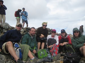
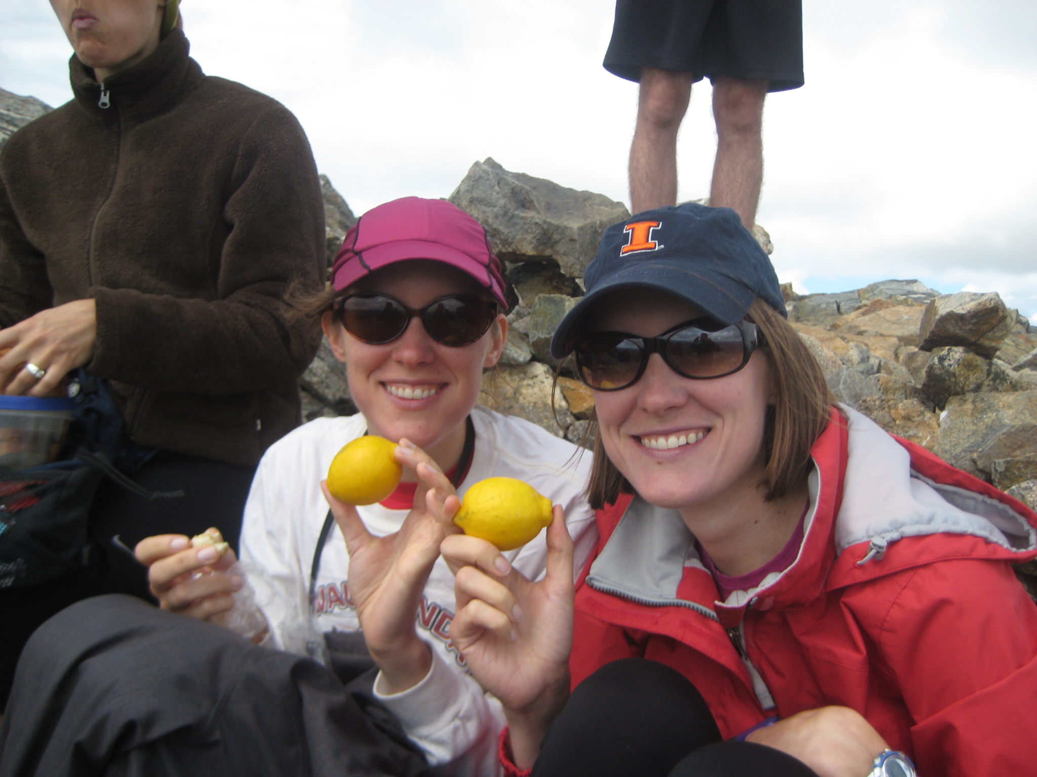
At the top of Gray’s Peak, we actually found a pretty nice place to sit, where the rocks somewhat shielded us from the wind.  For some reason, it is always significantly windier at the top of a mountain peak than it is just a mere 100 feet lower.  I have noticed this before, but wondered if it would feel different on this hike, which was pretty much all above the tree line.  It wasn’t, it felt more than twice as windy at the top of Gray’s peak.  I also learned something very surprising about hiking yesterday.  On the way up to the mountain, I was told that all hikers should bring a lemon with them on their hike.  This made absolutely no sense to me, as I was under the impression that I should stick with sandwiches and power bars to avoid carrying excess weight.  Liz and Laura (pictured above) followed by this advice, brought the lemons, and actually let us have some.  I had one lemon wedge, so I probably did not receive too much impact from it, but it did seem refreshing and energizing.  Who would have thought.IMG_2372

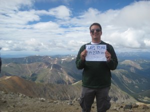
I also brought Bigfooting to new heights, doing my pose at 14,270 feet above sea level, and on the Continental Divide!  The scenery behind me is looking in the other direction (South), where I could see more gigantic mountains from above- exhilarating!

IMG_2375 IMG_2379

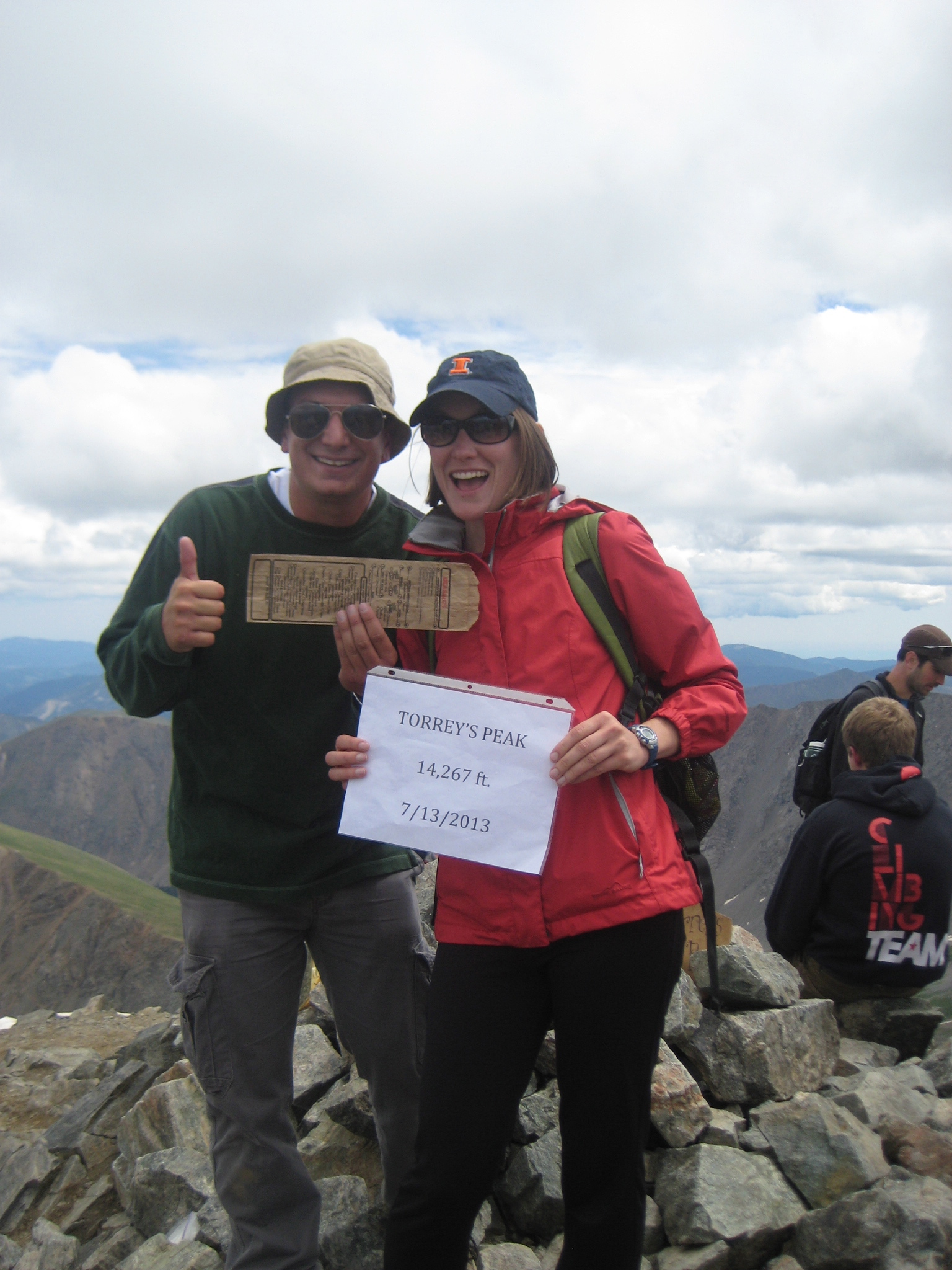
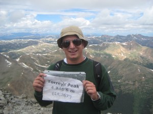
From Gray’s Peak, it is possible to “saddle” over to Torrey’s Peak.  To do this, I had to descend 575 feet along a ridge between the two peaks, which actually follows along the Continental Divide, and then climb up the second peak.  Apparently, this picture taken at the top of Torrey’s Peak, with a Which Which bag in the photo, entitles me to a free sandwich at Which Which.  I wonder if I can upgrade to a large size sandwich for posting this picture here.

Climbing up Torrey’s Peak was harder than climbing up Gray’s.  The trail up was steeper, and, possibly because I was already tired from climbing the first peak, I had to stop and catch my breath several times.

IMG_2382

When I reached the top of my second “14er”, I was quite worn out.  This is how I knew that I had given it my everything, and truly pushed my limit.  I could have stopped after peak #1 already having accomplished my rite of passage.  But, I decided I wanted to leave with absolutely no doubt that I had pushed my body as hard as it was willing to go.  I even had to leave the Bigfooting up to others on this peak.

IMG_2381

Going down was scary, especially this second peak, which was steeper than the first.  I don’t know how I feel about it.  I had become accustomed to having trees to hold onto in a pinch, but this hike was all above the tree line.  I actually went pretty slow at first, but then started resorting to descending the mountain using some of my skiing techniques, primarily facing my feet sideways and turning back and forth.

IMG_2384 IMG_2385

To get down from Torrey’s Peak, one must return to the saddle area between the two peaks, and then follow another trail down towards the parking area.  This lead us down the mountain on a slightly different path.

IMG_2390 IMG_2391

We actually had to trudge through an area with residual snowpack.  While I do find it interesting to ponder why part of this mountainside still has snow and other parts, facing the same direction do not, this was my least favorite part of the hike.  It was real slippery and we were descending.  I consider hiking and skiing (or snowshoeing) to be two different activities, and usually plan to avoid hiking on too much snow.  This snow is still melting obviously, and some small streams of water from this snowmelt were observed further down the trail.

After another area of switchbacks, the descent got less steep, and the rest of the hike was somewhat uneventful.  We got back to the parking lot around 2:30 P.M., about an hour before thunderstorms erupted in the area, but apparently there were already storms elsewhere in the area.  What was amazing for me to see, were people starting their ascent up the mountain after noon.  We wanted to tell them to turn back and wait for another day, but I am never sure what to do about that.  As someone who is typically not a fan of unsolicited advice, I am hesitant about giving it to people, even in the case where their idiocy is blatantly obvious.  A general rule about climbing “14ers” is to get there as early as possibly, preferably before 7 A.M. (which we did not quite make).  If arrival before 9 A.M. is not possible, it is probably not worth it to go.  I learned this within a month of moving to Colorado, without even seeking this knowledge.  So I find it hard to believe that someone would try to scale this mountain starting at 1 P.M. on a day with greater than normal monsoonal thunderstorm likelihoods.

IMG_2387 IMG_2388 IMG_2389

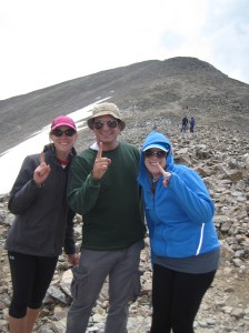
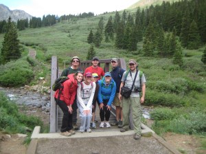
It was wonderful to have completed this, my first “14er”, and traversed this rite of passage.  Having done this will give me something akin to the Colorado version of street-cred.  With two other first timers amongst us, we took some “graduation photos”, with the mountains we had climbed in the background.  I actually billed this the “14er Class of 2013”, but I was possibly a bit warn out and light-headed when I came up with that one.  At this level (still over 13,500 feet), there is 35-40% less oxygen available than at sea level.

Does this make me a true Coloradan now?  No.  It actually makes me something more akin to a true Colorado transplant.  One of the things I have learned over the past year is that it is the transplants that are the ones obsessed with skiing, hiking, and all of the mountain activities in general.  The only people I have met over the past year here that do not ski have been Colorado natives.  But, what makes someone a true Coloradan?  One could argue that those of us that are going out and experiencing what Colorado has to offer are the truest Coloradans there are.  It is in the same vein that some argue that some immigrants can be counted amongst the truest Americans there are.  Of course, there are valid arguments on the other side, but as I have viewed tons of Colorado Native bumper stickers over the past year, I do find it hard to accept that being born in a certain location is a prerequisite for belonging there.

Denver to the Colorado Trail by bike

In this entry, I introduce another form of travel, bicycle travel. Bicycle travel is simply traveling by bicycle, but there are probably many people in the United States that have never even thought of the idea of traveling somewhere by bicycle.  It is definitely more common in Europe, but there are a significant number of people that do bicycle tours in the United States.  Groups like the Adventure Cycling Association run tours that vary from just a few days to several months.  The several month tours go across the entire country.  I don’t know who has the time and money to do this, but I sure wish I did!

My one day ride that clocked at just under fifty miles can hardly be considered a bike tour, given that these groups typically ride sixty or more miles a day.  However, today’s bike ride was with a specific exploratory mission, so I count it as “traveling” by bike (as opposed to just riding a trail or running errands).  I had desired to find out where the Colorado Trail began, which is twenty or so miles to the Southwest of Denver.  This trail, which conjures up images (at least in my mind) of the more well-known Appalachian Trail, runs about 485 miles, stretching from just Southwest of Denver all the way to Durango!  You can’t bike all of the trail, and most of the biking parts are primarily for mountain biking, but I did have in my mind the idea of being able to bike straight from home to Durango based on routes provided by the Adventure Cycling Association.

My ride today started as many of my rides do, down the Platte River trail.  Luckily for me, the Denver Metro area has a bunch of great bike trails, most of which follow rivers and creeks.  The Platte River trail runs along the river, passing right through the heart of the city.  It is one of the main trails of the Denver metro area, and I can take this trail South, for a good part of the way, all the way to C-470.

IMG_0325

On the way I took this photo of the South Platte River to demonstrate that water levels along the river are looking healthy.  Last year, as well as earlier this year, severe drought conditions lead to much lower river flows.  Hopefully this return to near normal will mean less wildfires than last year.

IMG_0336IMG_0337

As I pass through the Denver City limits into Arapahoe County, the trail changes name to the Mary Carter Greenway.  In Arapahoe County I also notice two peculiar things.  There is a posted speed limit of 15 miles per hour.  In fact, this speed limit is posted quite frequently, a few times per mile.  I blatantly disobey.  I have become quite accustomed to exceeding posted speed limits while traveling by car, I did live in Chicago for a long time.  However, the 15 mph speed limit on this bike trail gave me the opportunity to disobey speed limits in a completely different venue- on my bike.  I felt great!  There are also round-abouts (also known as traffic circles) on this trail.  A lot of smaller trails branch off of this trail.  For some reason Arapahoe County decided that bicycle traffic circles are the best way to control the flow of traffic at these particular junctions.

After getting across highway 470, I must pass through the Chattfield Reservoir.  This is State Park, and where some climbing enters the picture.  Trails the follow rivers are generally quite flat, with only gradual rises and falls in elevation.   At this reservoir, I climb what feels like 300 feet in elevation over a fairly short distance.  Bicycling uphill is significantly harder than bicycling on flat ground.  Having spent several years in flat Illinois, I am not accustomed to bicycling uphill, so I need to practice, and I welcome the challenge.  The great thing about climbing these little hills in the Denver metro area is the view of the mountains you get at the top.  You are still a significant distance away from the mountains, but see them from a higher vantage point.  The photograph below is from the top of the hill, looking out over the resevour towards the foothills of the Rocky Mountains, quite a splendid view.  I took a little bit of time off here to soak this in.

IMG_0327

Sometimes after a triumphant hill climb, when I go back down the hill, I feel sad.  I feel almost as if I am just giving up what I had worked so hard to achieve- elevation.  It was especially hard to go downhill knowing that on the return trip I was going to have to re-climb up that very same hill.  However, I definitely need to work on my climbing.

To get to the starting point of the Colorado trail, I must exit the park and take Wadsworth Rd. south for about three miles.  Cycling along Wadsworth Rd. in this segment is the closest thing to cycling on an interstate highway I have ever experienced.  In this segment (south of C-470), the road is 55 miles per hour with a wide shoulder.  The shoulder is wide enough that I am not at all scared of being side-swiped by a fast moving car, but it still is kind of a different experience for me, given that I usually bike in cities or on trails.  The road abruptly ends at a Lockheed Martin facility.  This I find even more odd, as my DeLorme High Resolution Colorado atlas had clearly pointed to this location as the start of the Colorado trail.  After stopping to look at the map on my phone and stopping at a sign, I finally find it, the beginning of the Colorado trail.

IMG_0329IMG_0331

As I gazed out at the Colorado trail, I obviously thought about the 485 mile path leading all the way to Durango.  If I were to bike the amount I biked today, it would take me ten days to complete the trail, and the conditions on the trail are much tougher than the paved roads I biked on all day.  Despite this, I still get some kind of a kick out of the idea that I am looking at a trail that leads all the way to the opposite end of the State.  But, I also cannot help but think about how this trail starts at a Lockheed Martin facility.  I mean, it’s a non-motorized trail, mostly geared towards hiking.  Regardless of how anyone feels about issues of war and national defense, defense contractors should be one of the last things that comes to anyone’s mind while thinking about trails like the Colorado Trail or the Appalachian Trail.  They even sponsor this Discovery Pavilion, which is at the end of the Waterton Canyon trail, which makes up segment 1 of 28 of the Colorado trail.

The return trip was not too eventful, except that the wind shifted out of the Northeast to ensure that I had to bike into the wind both ways.  Although, with sustained wind speeds not exceeding 10 mph, there really isn’t too much to complain about.  It made it that much harder, but, if I want to ever do bike tours like the ones at the Adventure Cycling Association, I do need to be prepared to handle wind and hills, so I am glad I am getting that experience even if my 46.5 mile ride today was harder than a 60 mile ride in Illinois would be.