Category Archives: Canada

Whistler Blackcomb: Chasing the Snow

IMG_2676 (1).jpg

Changes in weather patterns can bring risks, or even hardship, but can also bring opportunities. 2017-2018, in some ways, can be thought of as a peculiar winter in Western North America. Storms kept impacting the same region over and over again. Some areas received over twice their normal precipitation, while others received less than half.

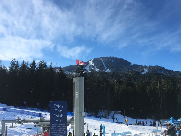
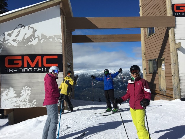
Weather cannot be controlled, and, probably shouldn’t be. It is possible, however, to make adjustments to make the most of the weather. While this was not a stellar snow year (compared to average) in places like California, Colorado, and Utah, conditions made this season a perfect time to visit North America’s largest ski resort: Whistler-Blackcomb. Located 120 km (75 miles) north of Vancouver, Whistler-Blackcomb is the 11th largest ski resort in the world.

IMG_2707 (1)

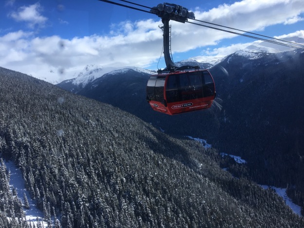
As is the case with many of the other largest ski resorts in the world, Whistler-Blackcomb is the result of a merger between two mountains. Once competitors, the two mountains merged 20 years ago. To connect the two adjacent resorts, they built the Peak to Peak Gondola. This 11 minute ride brings skiers/boarders between the midpoint (and fairly high on the mountain) of one mountain and the other. It covers a distance of 2.73 miles (4.4 km) over a deep valley that separates the resorts. At its midpoint, it is 1430 feet (436 m) off the ground!

IMG_2737.jpg

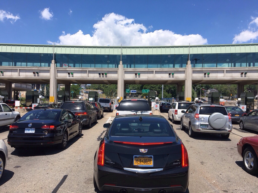
Just getting to Whistler-Blackcomb, before even reaching the mountain, is an amazing experience! The drive from Vancouver International Airport takes about two hours along highway 99 through the heart of Vancover.

There is no limited access highway that connects Vancouver International Airport to downtown. This adds time to the journey, making what should take little more than 90 minutes take closer to two hours. However, it is interesting for visitors to actually see the city. Vancouver is quite dense, with a very urban feel (as opposed to some sunbelt cities that feel more suburban in nature). The two things that stand out the most about the city are..

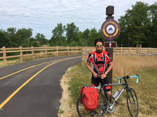
  1. Despite the fact that rains, on average, 161 days out of the year (notice the rain in these photos), cycling appears to be extremely popular, with bike lanes and bike shops everywhere!
  2. Literally, every nationality of food can be found in downtown Vancouver: Portuguese, Peruvian, Malaysian, you name it, it’s there!

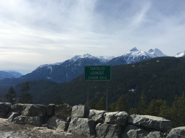
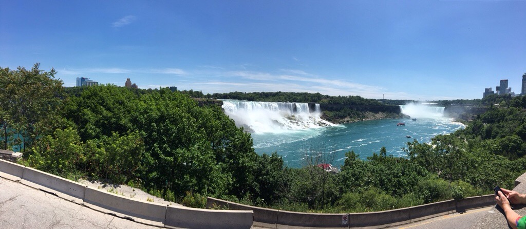
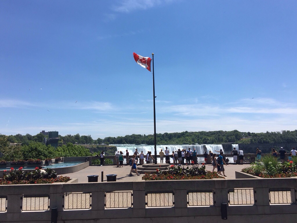
This is followed by a drive along highway 99, also known as the “Sea to Sky” highway.

IMG_2655IMG_2790IMG_2663

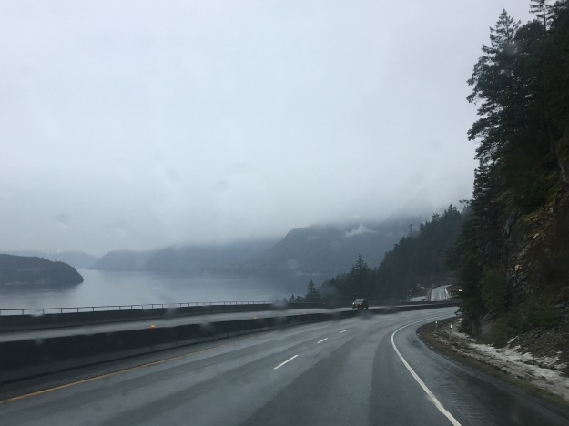
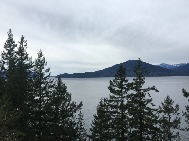
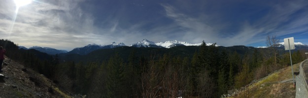
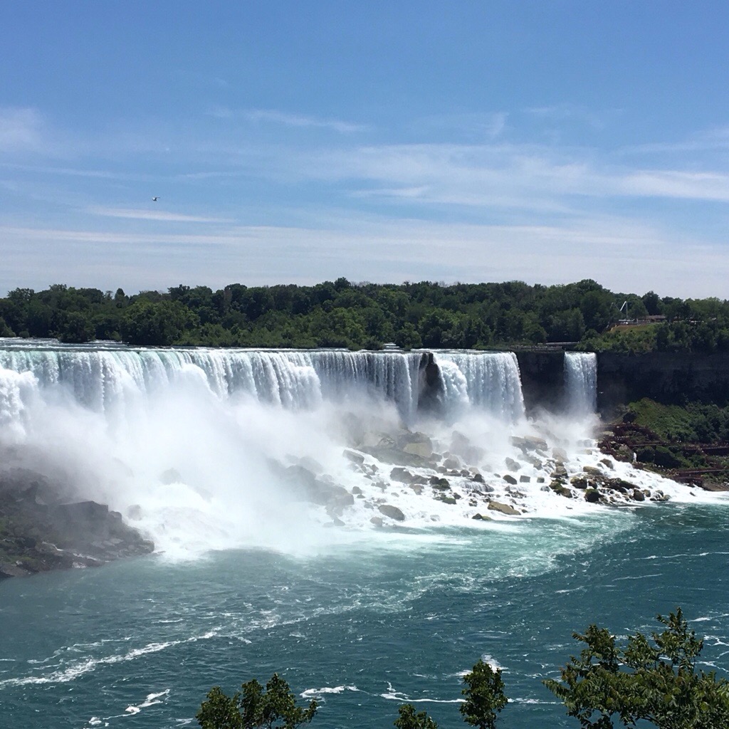
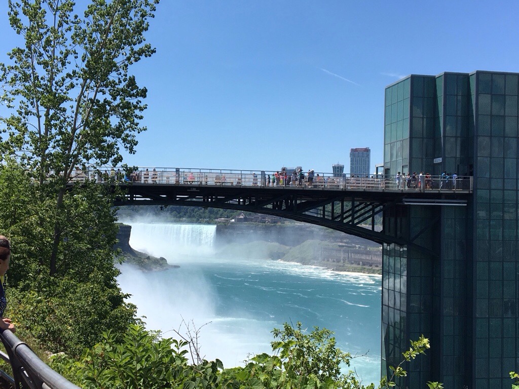
The drive itself is quite exquisite and unique. The road winds northward, adjacent to a bay, from which tree covered islands pop out periodically on the left. On the right, the coastal cliffs are quite dramatic, and periodically rocky.

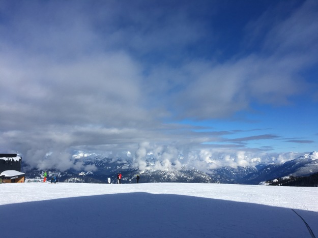
If caught while the sun is shinning, which is common in the summer but quite rare in winter, the views of the mountains can be quite amazing!

IMG_2780.jpg

IMG_2782

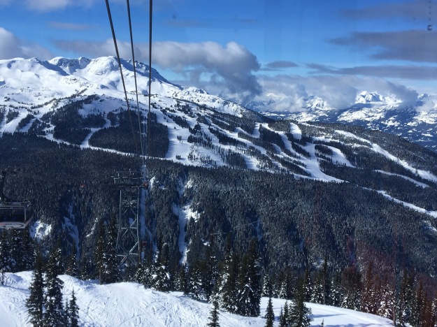
The mountain itself is spectacular, and steep! With a 5,280 foot vertical drop, it is surpassed, in North America, only by Revelstoke Mountain, a significantly smaller resort. For comparison, Vail has a vertical drop of 3,450 feet, and there are plenty of ski resorts whose vertical drops are only a little over 2,000 feet that are talked about quite positively (Grand Targhee, Alta, Stowe, etc.).

IMG_2681.jpg

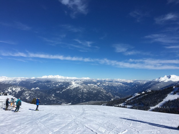
Ski trails at Whistler Blackcomb can be steep and long. However, there are trails of all kinds here, as to be expected.

IMG_2697


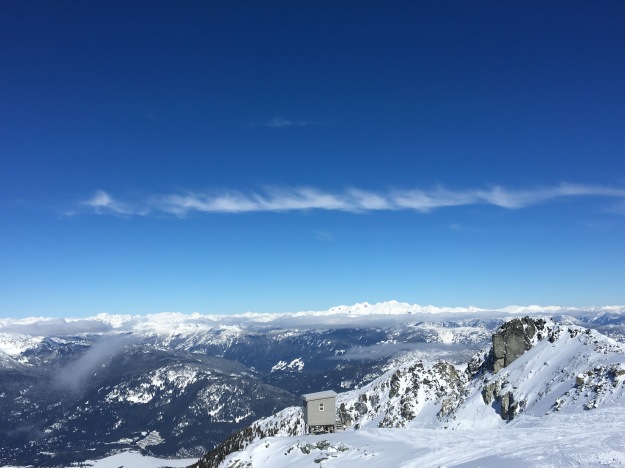
Highlights include the top of Whistler Peak.

IMG_2754

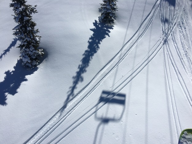
Finding a place to make fresh tracks in the snow.

IMG_2761.jpg

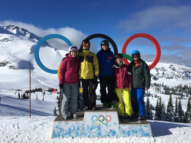
And, of course, the Dave Murray Downhill, where the downhill competition took place for the 2010 Olympic games.

IMG_2751.jpg

IMG_2765.jpg

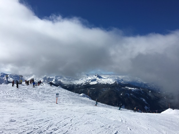
These experiences can commonly be hampered, however, by the weather. In particular, on a typical day, layers of clouds often form somewhere about 1/3 to 1/2 of the way up the mountain.

IMG_2718

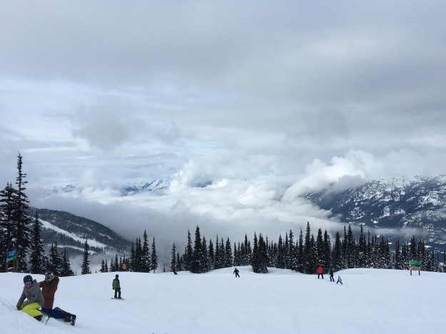
Many skiers and boarders chose to stay either above or below this layer of clouds. Traversing through this layer of clouds is a unique, albeit stressful, experience.

IMG_2724.jpg

As is the case when driving through dense fog, it requires moving slowly, and it is very easy for groups of people to lose each other in this thick set of clouds. Let’s just say, there is a reason this picture was taken on the lift ride up and not while skiing down the hill.


Whistler Blackcomb is in bear country, and they appear proud of it! On the Peak-to-Peak gondola, the information signs, in addition to pointing out its the length, speed, and height, of the gondola ride, mentions the fact that the forest it traverses over is home to over 60 bears.

IMG_2668.jpg

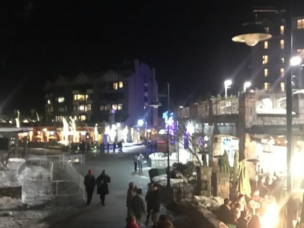
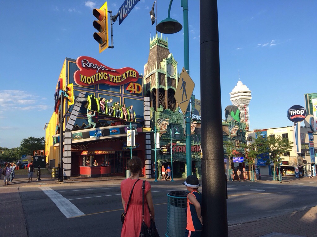
A major part of any ski trip experience is the town, where travelers go for food, amenities, shops, and other forms of entertainment. Not all ski towns are equal, as some provide a more active and others a quieter ski experience. Whistler’s experience is definitely middle of the road with respect to the quiet and cosy vs. active and loud experience. However, there is some variance here too.

There are two parts to Whistler village, an upper village and a lower village. Both connect to the mountain via gondolas. The main village is a bit larger and more active than the upper village, with a variety of food options and even several clubs.

Outside the village, there are plenty of ski-in/ski-out resorts, which is quite convinent. As is typical of any ski town, lodging can be expensive, and finding a place to stay at the price range most people are looking for can be a challenge.

IMG_2735.jpg

There are some out there that wish to never have the weather, or some other kind of external event change their plans. Its an unwelcome inconvenience to have to research something new, make a different plan, spend money, and have to travel when not expected. However, sometimes these changes in plans, whether forced by weather or a different external factor, are the driver for creating new, different, and sometimes life-changing experiences.

Some would say this has been a peculiar winter, but, on a larger scale, there has always been variance in weather patterns. The average temperature is not the temperature experienced every day and the average precipitation is not the amount of precipitation experienced every year. It is normal to differ from the average, from year to year. These variations may be getting close to causing danger in some places in the West this year, but that is also fairly typical.

Whether people traveled north to experience better snow to ski on, or traveled south to get some sun, the variation in weather patterns this year, while inconveniencing many, also created its fair share of memories.

My First Long Day of Cycling

IMG_6357

I woke up in the morning with a good feeling.  It wasn’t a premonition regarding something specific, like when people set out to run a triathlon or take a key exam and get this feeling of confidence that they are going to achieve what they set out to do.  After all, this is a bike journey.  Accomplishment does not come at the end of this day.  It comes at the end of the last day, five days later, when I reach the coast of Maine after six days of riding.

The feeling I started the day with was just a general positive vibe, that I knew I was going to have a good day.  It is a Tuesday, a day where many people will simply be grinding out their daily lives.  For tragically many people, this means stressing out at jobs that do not fulfill them.  I get to ride my bicycle, spend the day outside, and see places I have never seen before.  I must be thankful for that.

On bike journeys there are plenty of things that can go wrong.  There’s always the possibility of unpleasant weather, unexpected storms, or an unexpected unfavorable shift in wind direction.  There are also the many possible mechanical issues that can occur to a bicycle, particularly one that was recently shipped across the country.  The feeling I got was that none of those things would happen, and that I would simply have an enjoyable day on my bicycle.

IMG_6356.jpg

Most Canadians will recognize my way of starting my day off right, with a nice breakfast at Tim Hortons.  Food is crucial on a bike trip.  It is so crucial that when I took the Adventure Cycling Association’s Leadership Training Course three years ago, it was the very first thing they talked about, before bike mechanics, camping/lodging, or even the basics of bike touring.  How to pack trailers, roof racks, panniers, etc. would not be covered until the next day!  I know one bad meal can really strain a bike trip, particularly if it’s breakfast, so I made it a good one before crossing the border back into the United States.

IMG_6360.jpg

Before leaving the Niagara area, I took one last view of the falls from a place called Goat Island.  Goat Island is between the two falls, and on the American side.  It offers a pretty good alternate view of Horseshoe Falls, which is directly across from a place called Terrapin Point.  It might be the best view on the American side of the falls, but, as I mentioned in my prior post, the Canadian side still offers better views overall.

I would spend most of my day cycling on one of the Nation’s longest bike paths, the Erie Canal trail.

IMG_6367.jpg

I knew that this was going to be a flat ride.  The Erie Canal is a waterway that was built in 1824 to provide a shipping route between the Great Lakes and the Atlantic Ocean.  In order for the very concept to work, they had to find a route with very minimal elevation change.  When the canal was built, a series of locks were built to regulate the water flow.  The first town we encountered after picking up the trail was Lockport, New York, a small town with one of these locks at the center of town.


East of Lockport, the trail surface becomes crushed limestone.

IMG_6377.jpg

Staying right next to the Erie Canal, the scenery I encountered was quite constant.  Much of my day looked exactly like this.  This trail is flat, and largely straight, which is good for covering a large number of miles in one day.  I spent most of my time on this trail just thinking about the Erie Canal itself, the amount of work it must have taken to build it, and its role in transporting goods across the Union in the Civil War, which some consider to be a major factor in the eventual Union victory.

IMG_6383

On a day like today, covering a lot of miles on a trail with consistent scenery, it is easy to lose track of each individual town.  This is why one of my favorite features of the Erie Canal Trail, at least in Western New York, is these bridges.  Each of them have the name of the town labelled on top of the bridge, so as cyclists approach, they know which town they are, in fact, approaching.

IMG_6375

I generally liked Western New York for bicycling, and bicycle accommodations.  Obviously, there is the trail, but also many of the roads include wide enough shoulders to accommodate bicycling.  Additionally, New York is one of the states that has labelled state-wide bike routes, which add some level of legitimacy to cycling as a form of transportation.

The exception, at least for me and the route we followed, was Rochester.  We split off the Erie Canal trail in order to ride, and eventually camp, along Lake Ontario.  This involved getting off the trail and following State Highway 104 into town.  Like other Western New York roads, this road had a shoulder.  However, this shoulder had frequent obstacles, mainly sewers, that we needed to cut into traffic to avoid.  After that, we cut over to the lake in a suburb called Sea Breeze only to find out that the bridge we were hoping to take, over Irondequoit Bay, was closed for the summer.

IMG_6388.jpg

We were told that the bridge would re-open in November.  I am accustomed to roads being closed in wintertime, but not in summertime.  I never would have thought to even check to see if any bridge that I was hoping to take would be closed.  What was so frustrating about this was that the bridge itself, seen in the distance, and also on this map, is so short.

Screen Shot 2016-07-06 at 6.49.28 AM.png

It couldn’t cover more than fifty feet, and, as a result of that bridge being closed, we had to back track all the way around Irondequoit Bay, adding a significant number of miles to the trip.

I ended up having to invoke my backup plan.  I had already ridden more miles in one day, 112, than I had ever before in my life, smashing my previous record of 104.  Without the detour, I would already be close to my destination for the day.  But, I knew I needed to save some energy for five more days of riding.

So, I got a ride for the remainder of the day’s trip, which ended at Sodus Point, at a campground where I could watch a beautiful sunset along Lake Ontario.

IMG_6397.jpg

The obstacle I faced was not one of the ones I had anticipated.  Usually when I think of what can go wrong on a bike trip, wind, rain, and flat tires are the first things that come to mind.  A bridge closed for the summer is the last thing that would occur to me.  In fact, it took nearly three days for me to eventually realize the likely reason for a summer bridge closure; so boats can pass through from the bay into the lake.  Still, I consider this sunset along one of America’s Great Lakes a great end to a great day on my bicycle.


Niagara Falls: Where My Journey Begins

20160703-224931-82171740.jpg

For most visitors to this iconic location, Niagara Falls is the ultimate destination.  It is the place one travels to, spends some time at, and then subsequently travels home from.  When I think of Niagara’s typical visitors, I think of a family from a place like New York, that made the grueling six hour drive to get there, and will make the grueling six hour drive home.

I guess my sometimes fanatical quest to not be like “normal people”, whatever that means, is working.  I certainly do not feel normal.  My day, which began with an 1:15 A.M. flight out of Denver, involved traveling from airport to airport carrying not luggage or a back pack of sorts, but two panniers, one in each hand.

In a way my journey actually began at a tiny bike shop in Niagara, NY called Beeton’s Cyclery.

20160703-225445-82485961.jpg

I need to give this place a serious shout out.  I shipped my bike here.  It arrived on Friday, June 24th.  I told them I needed it by Monday, and they were able to get the bike assembled (to package a bike for shipping, the pedals, handlebars, seat, and front tire must be removed) and apply new handlebar stripping in time for me to arrive late morning Monday and start my voyage.

I brought my passport, knowing that I wanted to visit the Canadian side of the falls.  Anyone who has been to Niagara told me that the Canadian side was “better”.  I wasn’t sure what that meant.  The contrast between the two sides is quite stark.  Niagara, NY is sort of depressing.  I had trouble finding a place to grab a snack, while I gazed ahead at tall buildings and casinos on the other side.

20160703-230305-82985654.jpg

Still, I wanted to see the falls from the U.S. side first.  The plan was to meet up with my friends on the other side and spend the evening there.

On the American side, the view of the falls is somewhat awkward.

20160703-230550-83150230.jpg

Well, it is from he riverfront. There is this overlook, where theoretically the view is spectacular, but it costs like $18 to go on it, so I didn’t.

20160703-230749-83269193.jpg

Getting to the falls on the Canadian side involved going over the same bridge that cars travel over.  The toll for bikes is only $.50 (I believe cars is $3.50), but I still had to wait in the same traffic cars wait in to cross into Canada.

20160703-230948-83388452.jpg

Once I crossed the border, I realized why most of the tourist attractions, hotels, and buildings and such were on he Canadian side of the border.  By happenstance of geography, the views from this side of the river are better.

20160703-231424-83664213.jpg

20160703-231424-83664658.jpg

20160703-231425-83665101.jpg

This includes both falls that make up what is called “Niagara Falls”, the American Falls, which are on the U.S. side of the river, which splits around an island, and Horseshoe Falls, which are on the Canadian side.  Both falls are magnificent.  Horseshoe Falls is more powerful, but I actually prefer American Falls, particularly the way the water hits he rocks and sort of foams up.  Both falls are best viewed from Canada.

20160703-232006-84006386.jpg

I’ve always loved waterfalls for some reason.  Much like one’s taste in music or art, it is not something that can be explained.  Waterfalls just feel natural to me, they feel peaceful and even sometimes graceful.

In the world of waterfalls though, Niagara Falls is pretty much the opposite of any of the waterfalls I typically view out West.  Waterfalls in the west, such as the Lower Falls of the Yellowstone, tend to be tall and skinny, falling a much greater vertical distance, but carrying much less water.  Niagara is high volume but the vertical drop is actually less than 200 feet.

I also could never imagine waterfalls in the west being as commercialized as these.  In addition to the $18 charge for getting on the overlook in the New York side, the town of Niagara Falls, Ontario is filled with every establishment one would expect to find in a tourist trap packed together at a density I have only seen in one place before; Gatlinburg, Tennessee.

20160703-233302-84782966.jpg

20160703-233303-84783451.jpg

20160703-233304-84784380.jpg

20160703-233303-84783901.jpg

Gatlinburg, like Estes Park, is outside a popular National Park.  The hotels, mini golf, and Ripley’s Believe it or Not, are miles away from the iconic natural beauty that made those places worth preserving through the National Park system.  All of these places in Niagara Falls are within a mile or so of the falls.  In fact, one can get another perspective of the falls by riding a ferris wheel next to the mini golf course across from the laser tag.

20160703-234209-85329566.jpg

Tomorrow a long journey by bicycle begins.  Tonight, I get to continue to savor these falls, as they are lit up at dusk as part of a nightly illumination. This, like the rest of town, adds a man made touch to a natural phenomenon.  Some love it, some hate it, most find a way to enjoy it regardless of the opinion they expose.  As for me, my focus turns to the days ahead, for unlike most of the others watching the illumination, my journey is only beginning.