Category Archives: National Parks

A Very Special Day for a Friend in Akron, Ohio

What we seek out, what we invest in, and what we are willing to spend our time and money on has undergone an uneven and somewhat nebulous transformation thus far this century. Perhaps this is because I grew up in the suburbs, but at the turn of the century, life seemed to revolve around shopping malls and the pursuit of material possessions. Since then, my focus has undergone two major shifts, one at the start of the century and one quite recently.

I now have nearly a decade’s worth of entries in this blog, primarily about travel and experiences. The transition from focusing on the material to focusing on the experiences, society-wide, can be seen on Instagram. The Instagram era, and what many people see in their feeds, is the embodiment of people switching from seeking out bigger homes and more stuff to put into them to seeking out experiences in general, many of which have been shared on Instagram over the past decade.

As I pointed out in two earlier blogs [1][2], this year, after all that recently happened, I suddenly found myself most interested in connecting with people. There are a lot of people who have and/or continue to play an important role in my life. At this point in time, this feels like the most important use of my time and energy.

We’re also seeing this shift society-wide. More people are talking about the importance of connecting with locals and local culture while traveling. People are now sharing tips and even building apps to facilitate this pursuit.

To end the Summer of 2021, I went to Akron, Ohio.

To go to a Minor League Baseball Game.

Traveling 1300 miles (2100 km) to go to Minor League Baseball game is not something that is going to appear on anyone’s bucket list. As was the case with my earlier trips this summer, the purpose of this trip was connection.

That being said due to its location in the “rust belt”, Akron often gets a bad rap. However, there is more to the place than industrial decline. It’s probably not the most desirable place to live but it is certainly underrated.

It has a fairly lively downtown.

There are other interesting neighborhoods with some interesting places to go.

And, there a lot of outdoor places to explore.

The Summit Metro Parks are right next to the city.

In this park there a series of trails with dense deciduous forests and a little bit of terrain!

The Buckeye Trail runs right through the park.

There are also some other hidden gems.

This particular railroad crossing reminded me of another time and place where people would commonly run or dismount a horse and jump into the open car of a moving freight train.

The other gem close to Akron is Cuyahoga Valley National Park.

Hiking in Cuyahoga Valley National Park is fairly similar the Metro Parks hikes. There are the trees and rolling hills.

Cuyahoga Valley is one of the free National Parks. It also does not appear to be as crowded as some other National Parks can be.

Akron is also right in the middle of an 87 mile trail that connects it with Cleveland, as well as Canton and New Philadelphia. Following the Cuyahoga River, runners and cyclists encounter some scenic spots.

As society shifts it focus from the material to experiences and connection, as we shift our priorities, expectations, habits, and how we perceive work, value and power, our patterns of travel will shift. The conciseness on the post pandemic world where we use virtual meetings more, is that there will be less travel for work and more travel for pleasure. It also feels like more combination trips are in our future. This is because, it is possible to meet people and coordinate work virtually, without having to spend time, money and energy traveling. However, to CONNECT, whether it be with other people, with places, cultures or ourselves, will still require significant amounts of travel. What will likely shift is where we go, when we go there and how we get there.

North Dakota’s Role in the History of the West

IMG_4296

In my childhood, I never knew what to think of North Dakota. Like most people living in metropolitan areas, I never gave the place much thought. I do recall hearing, at some point in the late 1990s, that North Dakota was the least visited state in the country. However, a more recently published list indicates that the state sees far more visitors now due to the recent oil boom. Apparently, Alaska, the hardest state to get to, is now the least visited state in the country, which makes sense.

My ideas about North Dakota were just kind of hazy. I’d wonder if the culture was just like that South Dakota and Nebraska. Or, if the proximity to Minnesota or Canada made it kind of different.

IMG_4316.jpg

A drive across North Dakota along Interstate 94 will confirm what most people think. It is a Great Plains State with a Great Plains feel. If anything, there are even less trees and fewer towns than the rest of the Great Plains.

However, there are some surprising encounters, with both natural beauty and history to be found, without going more than a mile off the Interstate.

IMG_4305

One of the most amazing parts of Theodore Roosevelt National Park, the Painted Canyon,  can be viewed just by going to a rest stop right off the highway.

IMG_4309

This is pretty amazing, considering that adjacent to the park in all directions is nothing but endless wide open prairie.

Theodore Roosevelt National Park’s significance to the history of the west is, as expected, related to the president the park was named after. Theodore Roosevelt first encountered this land on a train trip to Montana. He fell in love with the wide open spaces, colorful valley, and quiet seclusion the area offered. He would later buy a ranch here, and it is said that experiences like these influenced the conservationist policies he would pursue as president, including a major expansion of the National Park System.

Halfway across the State, I encountered another scenic area, or, at least the sign indicated it as such.

In both North and South Dakota, the Missouri River Valley, and the surrounding bluffs provide some variance in what is otherwise a fairly homogenous drive.

IMG_4326

This river crossing is also where explorers Lewis and Clark met Sakakawea, a 17-year-old Native American who would play an important role in helping the explorers complete their journey. The Shoshone were the predominant tribe in areas of what is now Idaho and Montana, where Lewis and Clark were headed to cross the Rockies. Sakakawea, a Shoshone who was captured by the Hidasta tribe and brought to present-day North Dakota, had the language experience Lewis and Clark needed for much of the remainder of the journey. She was even reunited with her brother, who turned out to be one of the tribe chiefs Lewis and Clark needed to trade with.

It was here in Bismarck I encountered a sizable North Dakota town, as well as a State Capitol building with a very unique shape.

IMG_4334.jpg

I was not sure how to feel. As I prepared to interact with people, my mind wandered to every pre-concieved notion I had about North Dakota. I wondered what people here do on a day-to-day basis. I wondered if, despite the fact that it was only the second day of August, people who live here are already dreading the winter to come.

I overheard some conversations from people who sounded like they were locals. What I heard was not complaints about excessive boredom, fear about a sub-zero temperatures four months in the future, or some foreign sounding discussion about fracking I cannot follow. I heard people with a lot of the same concerns I often have: How to help that one friend or family member going through some hard times. People’s concerns over changes being made at their workplace. Health concerns and other day-to-day topics that are common amongst almost all the people of all the world.

I thought to myself “Have I become this disconnected from really?” Do I now struggle to relate to people when they aren’t discussing some major global issue, an invention at a setting like start-up week or some grand adventure?

IMG_3395.jpg

Even in the most innovative cities in the world, more people would prefer to discuss their day than a diagram like this one.

It would be easy for anyone to say that, right now, North Dakota’s only really significance is in the world of energy production. However, that would be ignorant to history. For, if it weren’t for Lewis and Clark meeting a friendly tribe to camp with for the winter (Fort Mandan), and get the help they needed from Sakakawea, it may have taken several more decades for the West to be opened up. And, if it weren’t for a young future president finding picturesque Badlands he desperately wanted to preserve, the National Park system, which has a much larger presence in the West than the East, could look significantly different than it does right now.

usa-national-park-map

What occurred to me as I continued Eastward from Bismarck was that, whether the number of annual visitors is closer to 2 or 20 Million, most North Dakotans probably do not care about the relatively small number of annual visitors. It reminds me of some of the people I interact with in Colorado that were born there decades ago. Many of them actually did not want this gigantic influx of people and visitors that fundamentally transformed the state. Many of them just wanted to enjoy their state the way it was, and that is what North Dakotans get to do.

Moose at Rocky Mountain National Park

IMG_3806.jpg

We humans seem to have some kind of fascination with moose. There must be something about that animal. Several years ago I was on a weekend ski trip in Breckenridge. The condo our group stayed in had a moose theme. Every decoration .. moose. The pictures hung on the wall. The design on the pillows. Even the back of the couches. It was impossible to rotate my head more than 15 degrees without seeing six new images of moose, in one form or another.

IMG_0172.JPG

It is nearly impossible to drive around Colorado, or anywhere in the West, without eventually seeing cars with decals like this one.

Moose_Decal

Two years ago, when I rode my bike through the White Mountains of Central New Hampshire, I saw advertisements for numerous “Moose Tours”, in the town of Lincoln, NH. These tours involve a bunch of people crowding in a van of some sorts and heading out into the wilderness to look for moose. A subsequent Google search revealed page after page of companies offering moose tours. There are a lot in New Hampshire, some in Maine, a bunch in Canada. There are even “Moose Safaris” in Norway and Sweden!

Added altogether, there has to be at least hundreds, possibly thousands, of people who earn a livelihood helping tourists see moose!

I woke up on a mid-summer Saturday morning without a real plan. I wanted to go by instinct, as I’ve been trying to avoid overtaking things lately. That instinct told me to head to Grand Lake, a place I had actually not been to before.

IMG_3788.jpg

Grand Lake is perhaps best known for having Colorado’s largest naturally occurring lake, however, the town itself is pretty interesting too.

Just West of Rocky Mountain National Park, it attracts a lot of visitors and tourists, not unlike Estes Park, the more well known town east of the park. Compared with Estes, it is a little bit quieter, and the buildings also have somewhat of a more western feel.

It is also apparently near the part of Rocky Mountain National Park where visitors are most likely to find moose. I had no idea when I decided to hit up the Green Mountain Trail, the first major trailhead one encounters after entering the National Park from the West.

I just knew I wanted to be out in nature, and have a break from my pursuits back in Denver. I knew there was some sort of healing power in being immersed in a place like this.

IMG_3813.jpg

I wasn’t even tracking my progress along the trail. I wasn’t thinking about where I was, where I was headed, or what I was hoping to see. I was just there, in the moment, in the deep evergreen forests of the Upper Colorado River valley, apparently headed for a meadow, when a woman walked up to me and told me that there was a family of moose 200 feet past the next trail junction, in the meadow, where moose are typically expected to be spotted.

I must admit, that although I do not count myself as one of those moose obsessed people, when I heard this, I got extremely excited- almost giddy. It was a feeling that is hard to explain. It felt almost like the excitement that comes over someone’s entire body when they suddenly hear their favorite song, or that their secret crush asked about them, or that their best friend got them tickets to see their favorite performer. It’s that suddenly bubbly feeling that often comes more frequently from anticipation than an actual event.

They first appeared in the distance, walking up toward big meadow. Two other families were watching them, in awe.

IMG_3806.jpg

It is never a good idea to get too close to moose. They are dangerous and powerful. This was about as close as I wanted to get.

IMG_3807

Even from somewhat of a protected distance, it was still an amazing experience. We watched them gradually walk downstream along the Tonahutu Creek in this wide open meadow. I am really not sure if they saw us at all. I imagine they did, but serious did not care. It is as if the moose are the ones that have perfected the art of not caring about the judgements of those around them.

I am actually nearly 100% certain that had there not been a bunch of humans taking pictures of them and watching them slowly walk by, they would not be acting any differently. Maybe I deeply respect that about them. If only more of us humans can learn to stop relying on the approval and attention of others.

IMG_3812

What is it about these creatures that capture so many of our imaginations? There are, after all, plenty of large mammals to be spotted on this planet. What makes the moose worthy of hundreds of tour companies in Eastern North America, decals on countless SUVs, and an entire section of nearly every Western themed home decoration store.

It is probably that the quest to spot a moose has all of the ingredients that any other worthwhile life quest could have. As is the case with learning a new skill like car repair, finding the right date for a school dance, or finding a rare collectable, it is a challenge, a deep one, but an obtainable one. This is important because if a challenge seems impossible, it would not be taken on by too many people. People who do not believe in the existence of BigFoot are not going to go searching for it.

There is also something amazing about the end result. This is important because there has to be some sort of reward that makes the challenge worth pursuing. I do not see a market for a 1,000 piece puzzle that is pure white, with no color, picture, or design. The end result would be nothing. Moose are something.

They are also unique, at least in the realm of the experiences the average human being has throughout their lives, but unique in a non-threatening way. Finding a moose in an open meadow is the right kind of unique. It is a unique people can relate to based on their own experiences, having likely seen something somewhat similar, like a horse, or some of the animals at the zoo. It is not too far out there for one to relate to.

So, in a way, seeing a moose after trying and failing a bunch of times, is a metaphor for obtaining the things we most cherish in this life. We have to work for it. There is some amount of reliance on luck. The reward is something amazing and unique, but also tangible, obtainable, and relatable. Now I understand why so many people love these creatures.

Death Valley: The Largest National Park

IMG_2899.jpg

It is hard to truly describe what makes Death Valley such a wonderful and unique place. It is probably best known as the location of the lowest point in North America, Badwater Basin, located 282 feet below sea level.

IMG_2932.jpg

Land below sea level generally only exists in places with hot, dry climates, as otherwise, the low lying terrain would fill up with water. Death Valley certainly is dry! It receives less than 2 inches of rainfall per year. By contrast, Minneapolis, a city that would be considered neither dry nor wet, averages around 30 inches per year (including winter snowfall).

Badwater Basin, like much of Death Valley National Park, is a large scale version of everything one would imagine dryness to be.

IMG_2934

The entire basin, which stretches out longer than expected, is covered with salt, deposited in a honeycomb-like structure, creating a scene that appears to be out of some kind of documentary about deforestation or climate change.

Of course, not the entire park is below sea level.

IMG_2908.jpg

In fact, its highest point, Telescope Peak, is over 11,000 feet above sea level, and despite the dry and hot climate of the valley below it, is covered in snow, and impassible without ice gear towards the end of March. Interestingly enough, while March may be an ideal time of year to visit Badwater Basin, Furnace Creek and some of the low elevations of the park, the higher terrain makes the park actually worth visiting in the summer too (with the right hydration precautions taken of course).

At the park’s lower elevations, near and even a little bit below sea level, the hikes are a bit milder, and significantly different from a typical hike in the mountains. Shorter hikes (1 to 3 miles each way) to places like Sidewinder Canyon…

and Mosaic Canyon…

have trails that cut through the rocks, through little “slots”, and along wide flat trails that appear to have been carved out by runoff from the flash floods that occasionally occur in the park.

IMG_20180317_133410373_HDR.jpg

Death Valley is certainly a place with some unique weather patterns, and some unique weather hazards. When most outdoor activities are planning, the weather hazards most likely to be considered are related to temperature and precipitation. Extremely hot weather is Death Valley’s most obvious weather hazard. Visiting in March, or at some other point during the cooler part of the year, definitely helps visitors avoid these extremes.

IMG_2901.jpg

With wide open spaces, no trees, and complicated terrain, some crazy winds can occur in Death Valley, whipping up and and dust from the dry ground below it, covering any and all things!

IMG_2894.jpg

Storms will pass through the complicated terrain, often first producing some interesting looking clouds.

IMG_2981

Then, often times, while producing decent amounts of precipitation in the higher mountains terrain, in the valley below they will mostly just manifest as strong and gusty winds.

IMG_3027 (1)

These winds can even be hazardous to campers, breaking tents, bending poles, and complicating campfires.

IMG_3040.jpg

Other than the extremes, in elevation, temperature and dryness, the rest of the park feels kind of a bit like a National Park sampler pack.

There are hikes that take visitors to amazing views of the park, but the park is not all about hiking (like Rocky Mountain National Park).

IMG_2948.jpg

The natural bridge is most certainly an “arch”, but Death Valley does not have the concentration of arches found at Arches National Park.

IMG_2984.jpg

There are a few fantastic sand dunes here, but not as many as there are at Great Sand Dunes National Park.

IMG_2994DSC_0390

The park has some other unique natural features, such as the “Devil’s Golf Course”, but isn’t the constant barrage of unique features that is Yellowstone.

IMG_2992.jpg

One can even spot the occasional desert wildlife here.

IMG_20180316_134933474_HDR.jpg

Those that are into numbers already know what makes Death Valley unique; elevation, temperature, dryness. Those who are more into experiences find themselves also loving the park, but in a manner that becomes harder to articulate. Often, it is just said that the place is “beautiful”, or “amazing”.

IMG_3043

Maybe nothing more needs to be said. After all, sometimes these commonly used descriptor words, although light on specifics, along with photographs, really do tell the story. Nature, like artwork, is open to interpretation, at the behest of the beholder.

However, when covering mile after endless mile across the park, it is hard not to observe how expansive and wide open the park feels, as a result of how dry the air is.

IMG_2999

Maybe that is the reason Death Valley is also the largest U.S. national park in outside of Alaska.

Moab- An Active Destination

IMG_9301

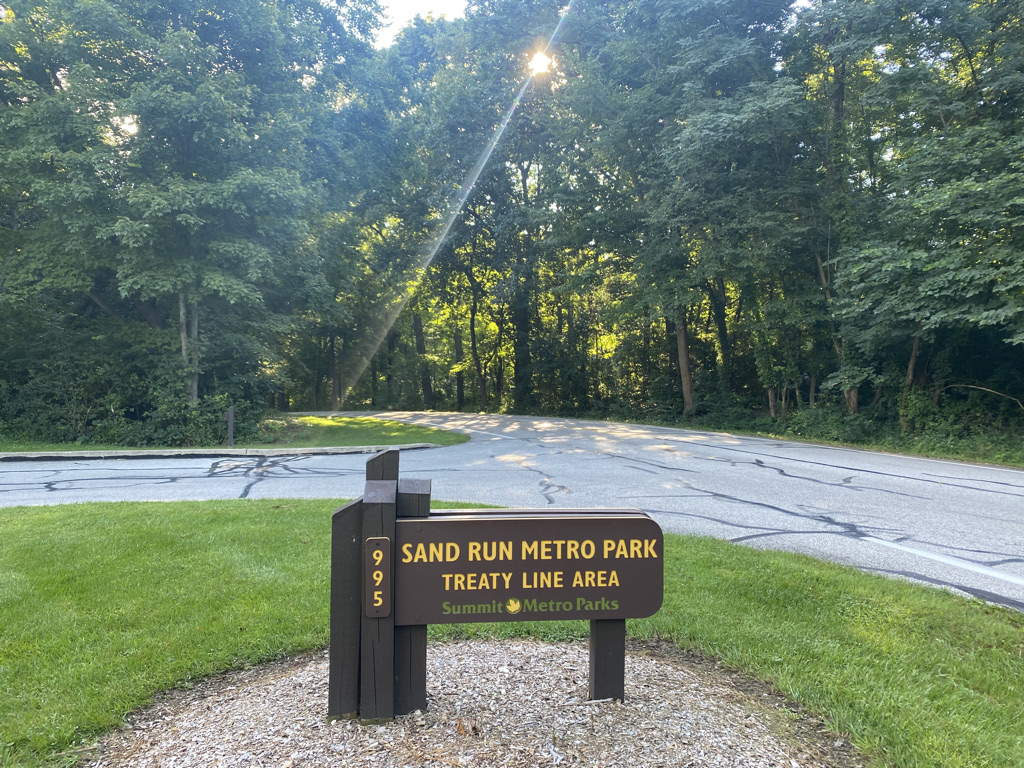
Some trips are restful, while others are more active.  There are some destinations that lend themselves to more restful trips; cottages in the woods near quaint towns, tropical beaches, and resorts.  Moab, is a place where it is nearly impossible to imagine anything other than an active itinerary, with a variety of activities, and a lot of places to see.  Situated in East Central Utah, several hours from the nearest major city, this popular tourist destination is surrounded by too much natural beauty to picture anyone coming here and spending large amounts of time sitting in one place.

First of all, Moab is surrounded by two National Parks, Arches and Canyonlands.

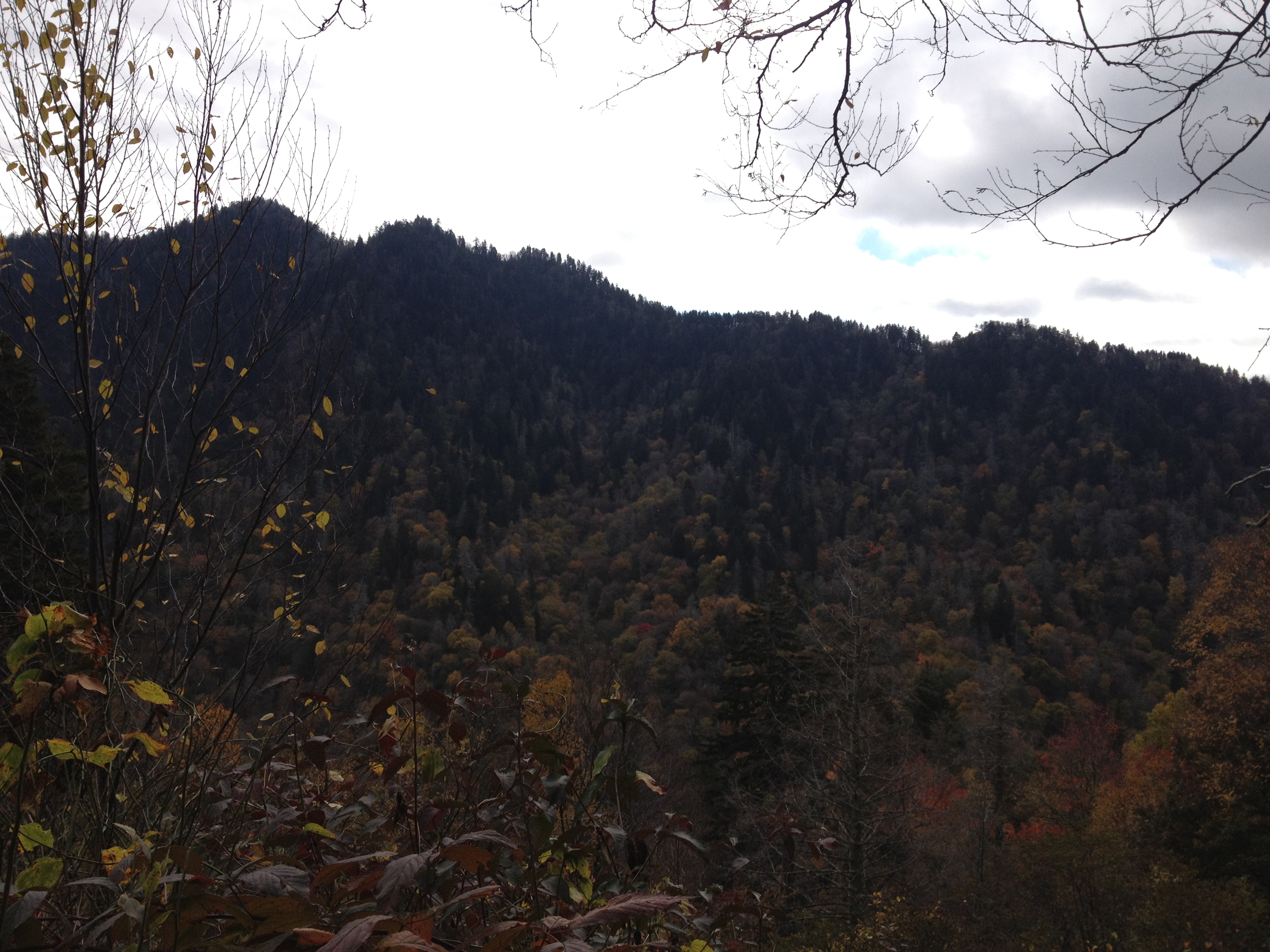
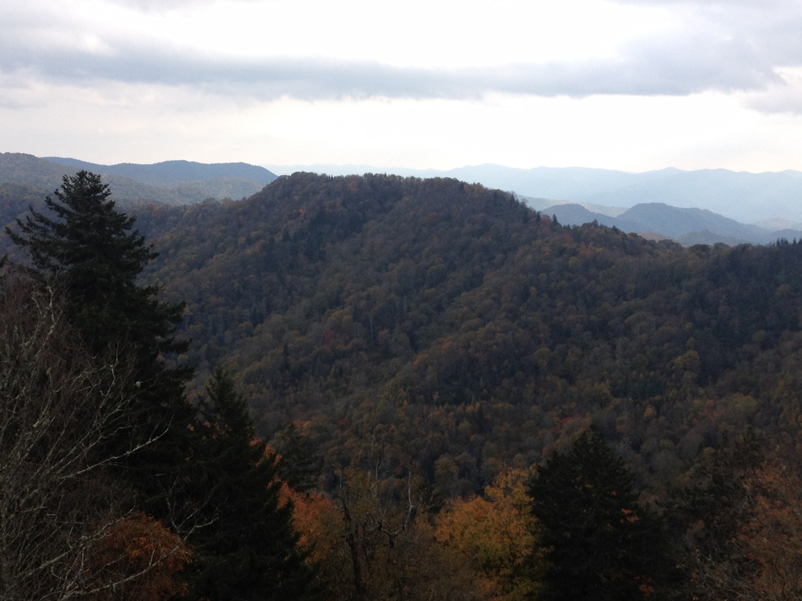
Both National Parks are, as National Parks tend to be, filled with tons of natural beauty and unique places.  At both National Parks, while it is possible to see a lot of interesting natural features without straying too far from the road, the best features at both parks require hiking.

FullSizeRender (1)

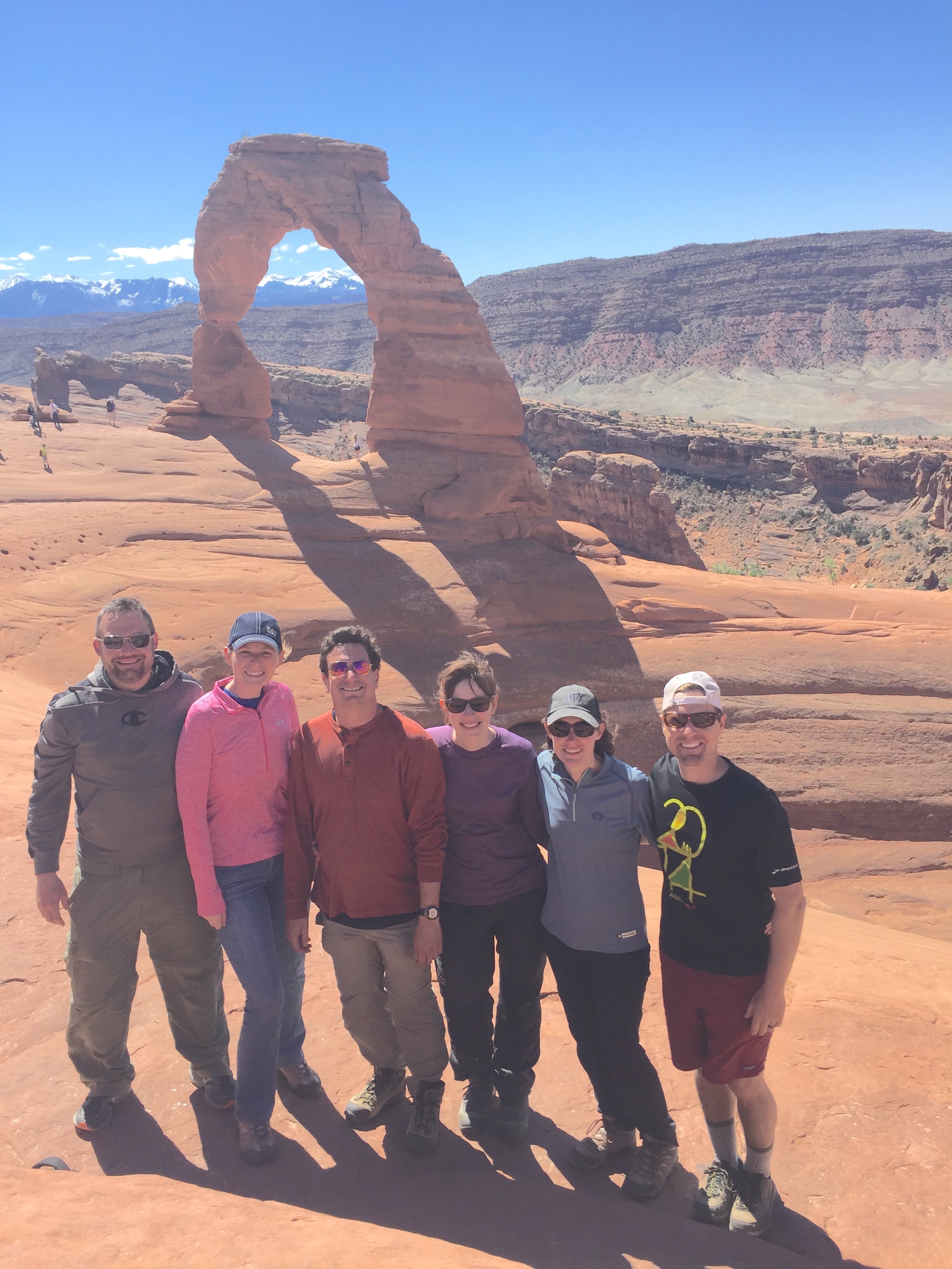
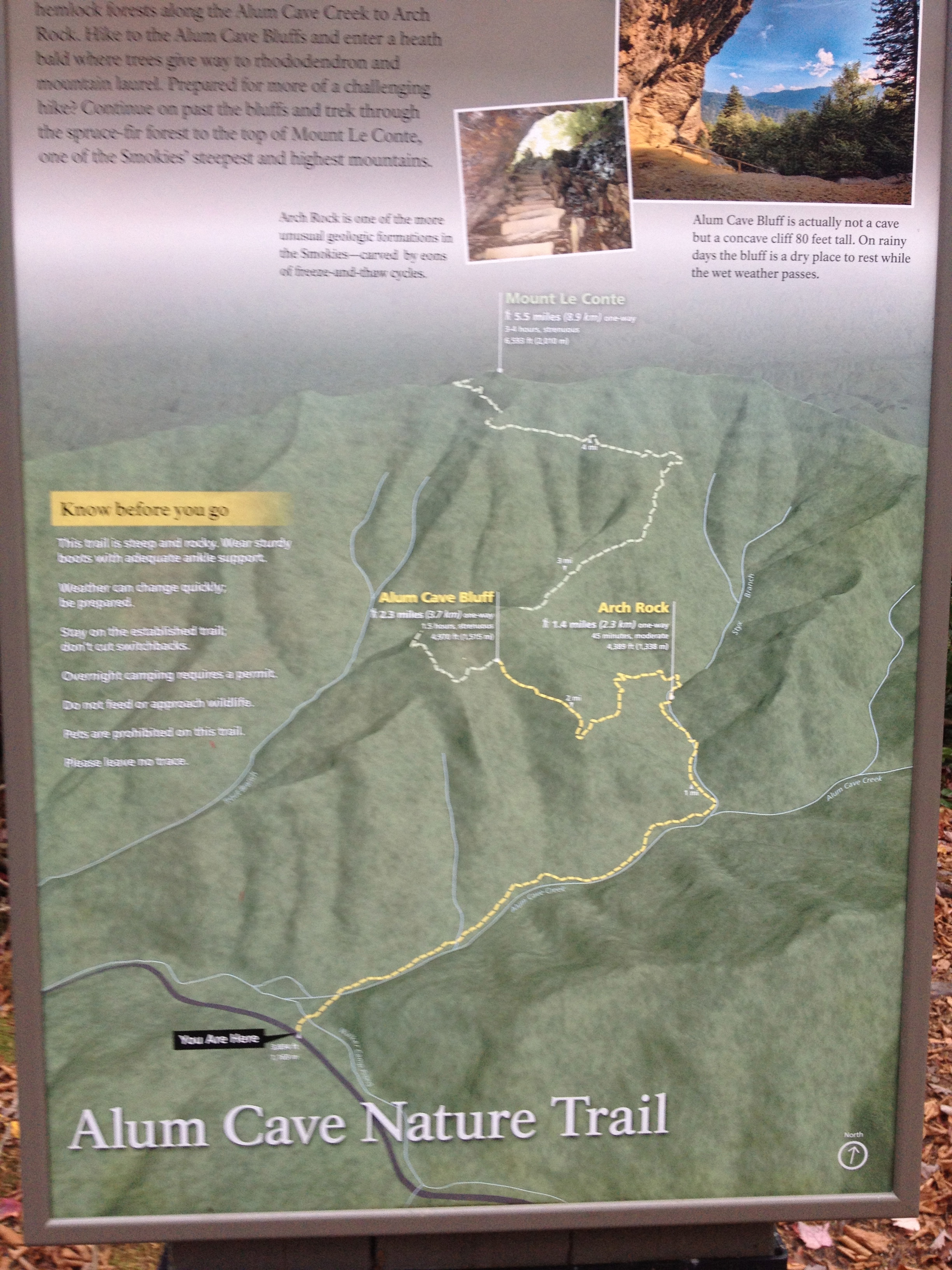
Getting to the signature feature of Arches National Park, Delicate Arch, requires a 1.5 mile hike from the Delicate Arch Trailhead.  Interestingly enough, this trail starts near the historic Wolfe Ranch, and traverses by some other unique features including some Ute Indian Rock art.

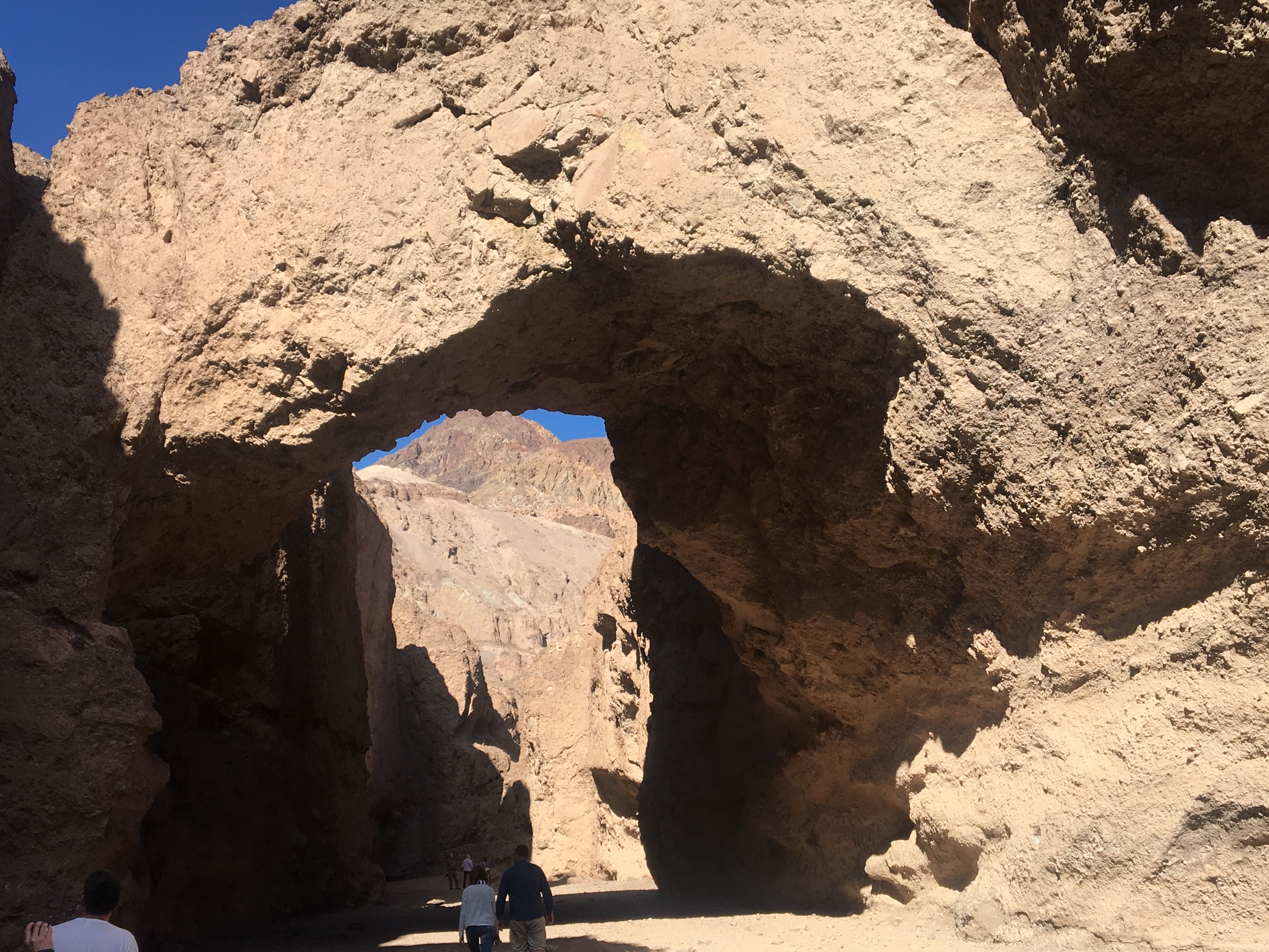
It is also quite difficult to imagine making a trip to Arches National Park and not viewing some of the other arches (Yes, it’s Arches National Park, not Arch National Park).  There is a section of the park known as Devil’s Garden, with somewhat of a network of trails taking visitors to all kinds of other arches.

The most famous of these arches is Landscape Arch, a long and wide arch whose name provides a clear recommendation as to how to orient any photograph of this particular feature (for those familiar with landscape vs. portrait  ).

IMG_9345

To get to most of the remaining arches requires a bit of a steep climb, which starts pretty much right after Landscape Arch.

IMG_9346

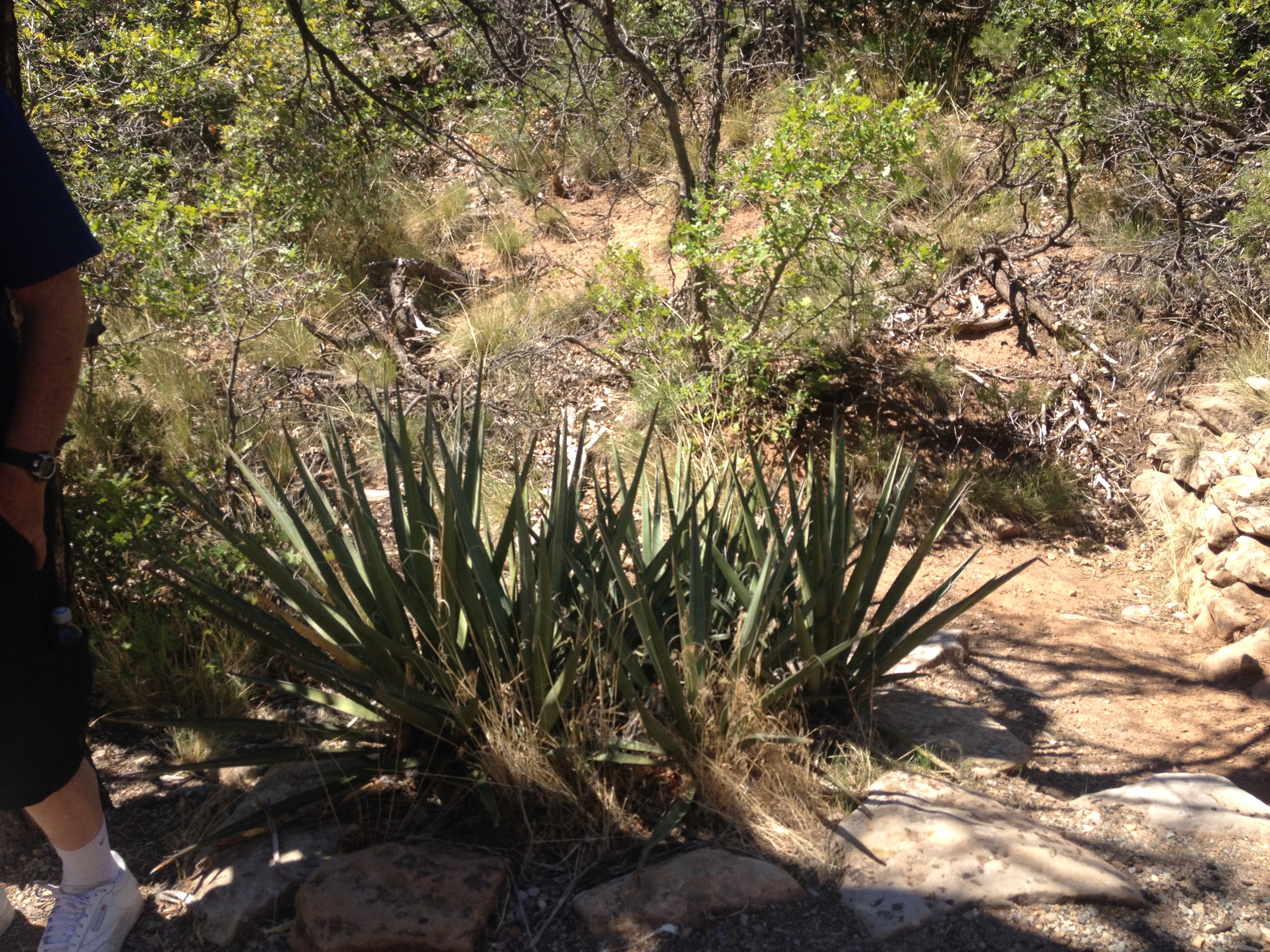
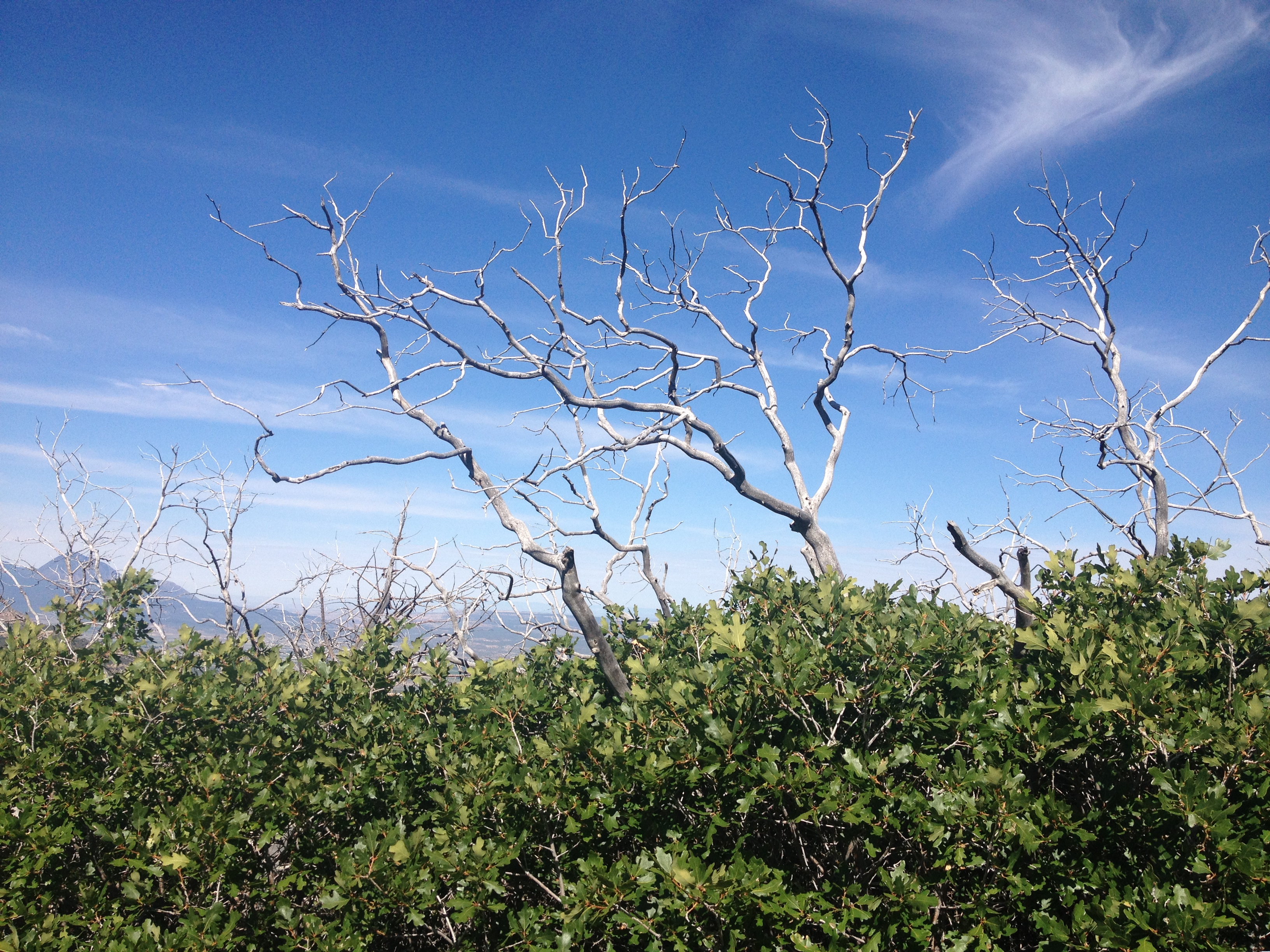
The hiking in the entire Moab area, not just at Arches National Park, is considerably different from the typical hiking experience.  Much of the hiking I’ve experienced, is on trails covered in dirt, gravel, and sometimes small to medium sized rocks at places such as the top of Quandry Peak.  All around Moab, I found myself on surfaces such as this one, on top of solid rock, sometimes for nearly the entire duration of the trail.  Traversing these trails required me to use my upper body more, and even do a little bit of jumping, from one rock to another.

At the top of this Mesa, there are arches with multiple partitions, arches people can hike under, and even one arch with an opening that lends itself to laying inside it to soak up the sun, the surroundings, and the experience!

The entire loop, including all the side trips in the trail network, is a total of 7.2 miles.  So, if a visitor desires to see all of these features, as well as Delicate Arch, a total of 10.2 miles of hiking is required.

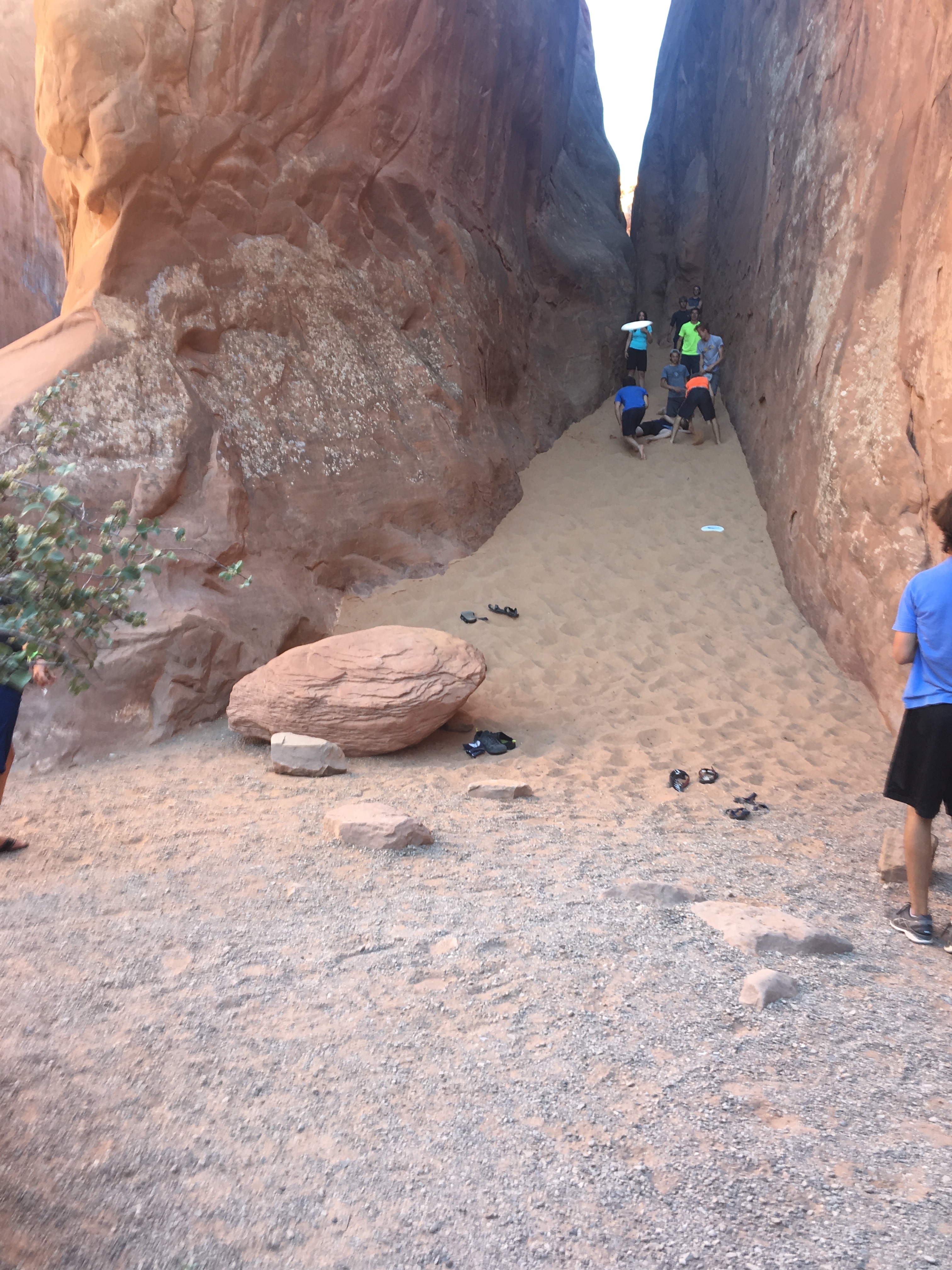
And some people decide to add even more activities to their day.  In a shaded off-shoot of the Devil’s Garden Trail, I witnessed a sizable group of people playing a game of Frisbee, using the walls of this tiny canyon to make trick shots.

IMG_9391

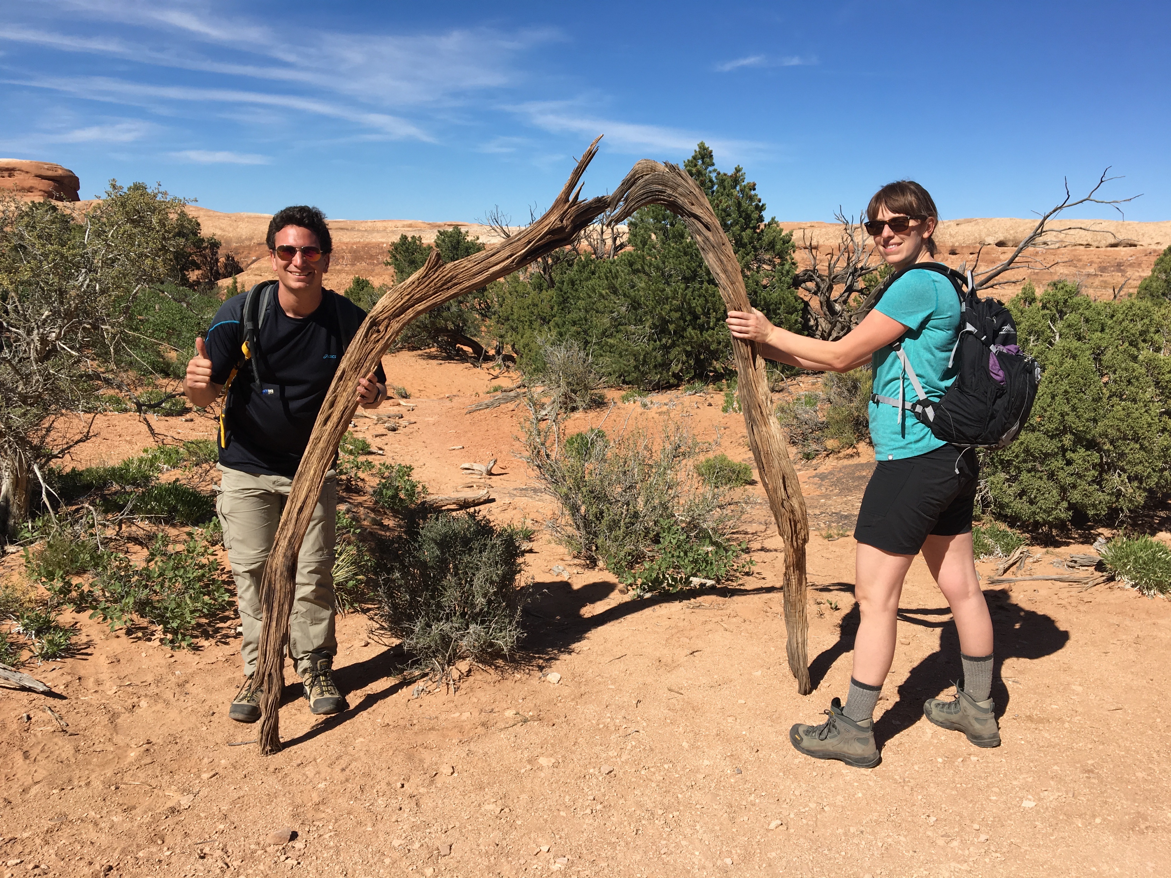
Since immersing oneself in the here and now, and contributing to the local culture of a place creates a more enriching travel experience, I decided to play my part.

First, I decided to bring my own arches into the park..

IMG_9332

Disclaimer: I did properly dispose of that cup

Then, when the opportunity presented itself, I decided it was time that we started making our own arches, contributing to the park’s plethora of natural beauty.

IMG_9374

IMG_9444

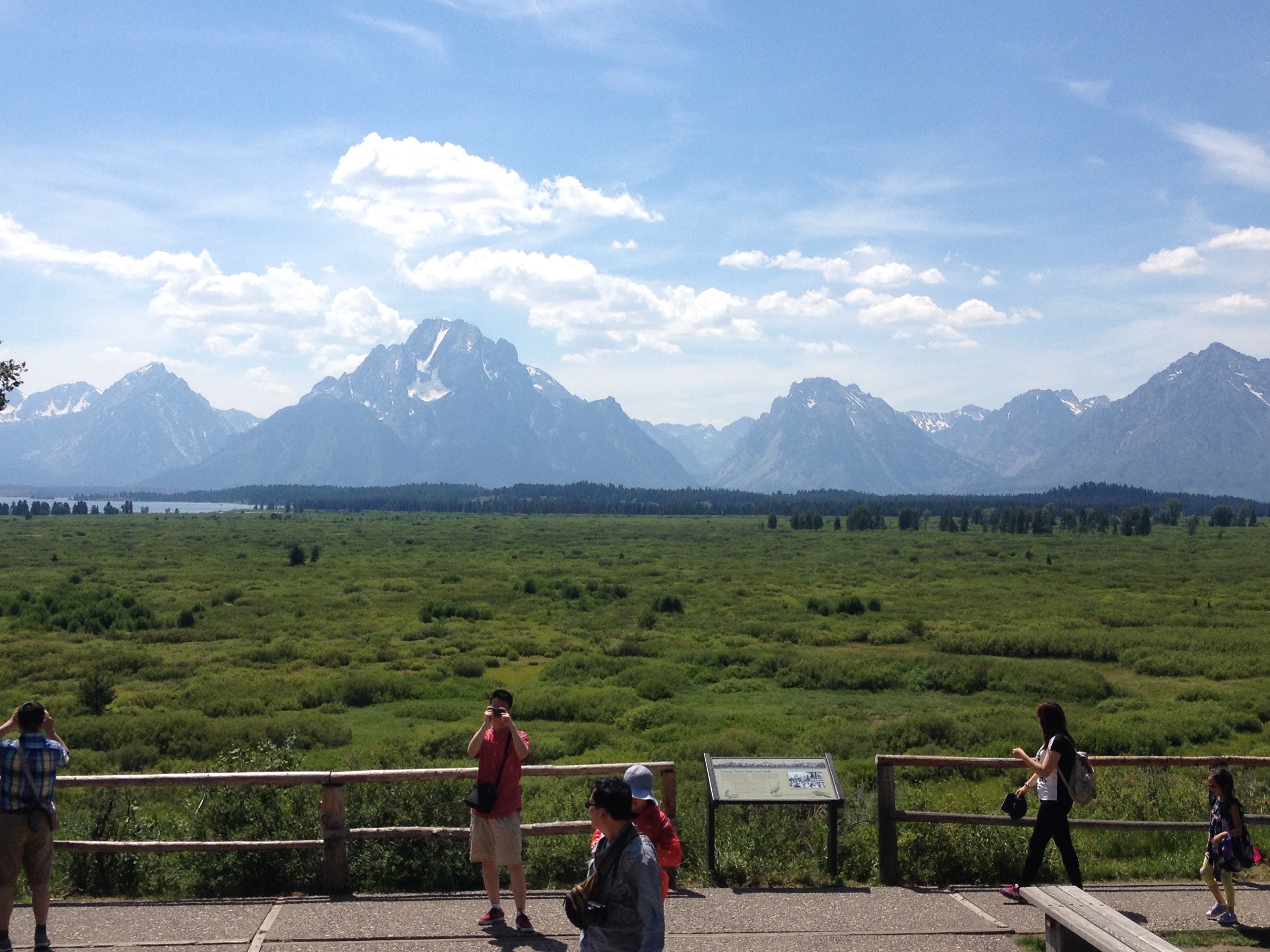
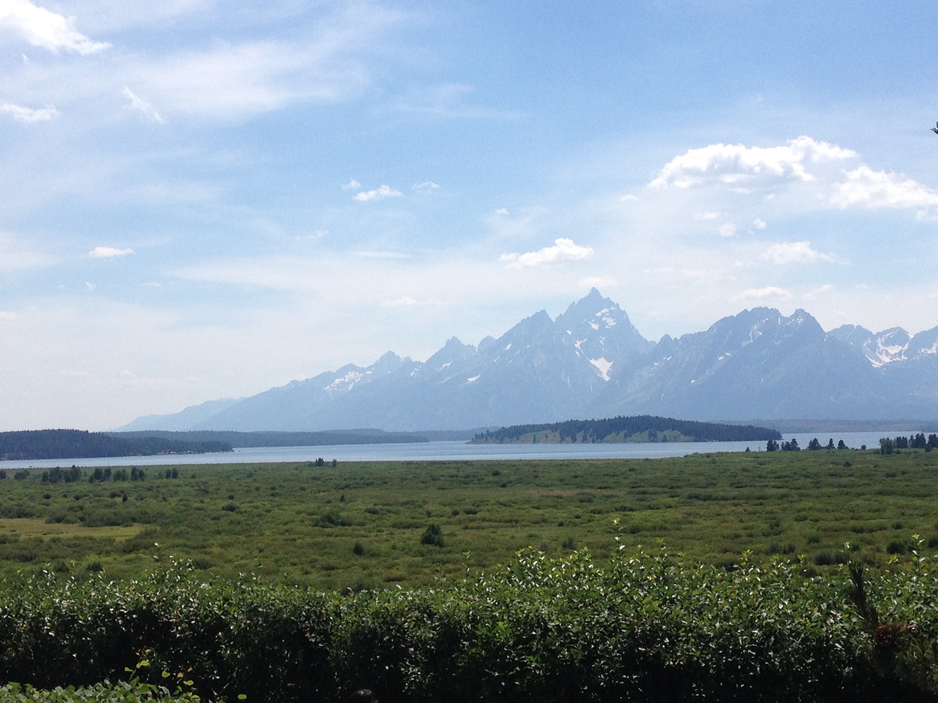
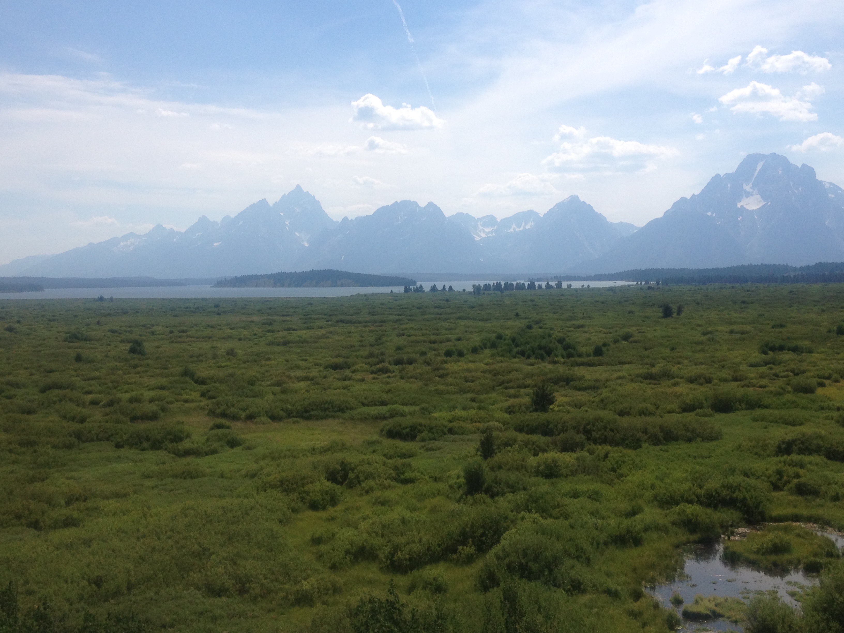
Canyonlands National Park is even bigger than Arches, broken up into three sections by the Colorado and Green rivers, whose confluence is right in the center of the park.  Without any bridges connecting over either river, and with the entrances to each section over an hour apart, it is all but impossible to visit more than one section in a day.

IMG_9461.jpg

The most common image of Canyonlands National Park is an almost Grand Canyon-like overlook into a deep river valley, sometimes with one of the two isolated mountain ranges in the background.  However, at the scenic overlooks in the parks’ Island In The Sky region, it is actually quite difficult to see the rivers themselves.  The canyons that make up Canyonlands National Park are quite expansive, with multiple tiers.  To see these canyons from the best vantage points requires a bit of hiking.  The hike to the Confluence Overlook (an overlook of the confluence between the Green and Colorado Rivers) is 10 miles round trip, something that could require the better part of a day!

Canyons are not the only interesting feature to Canyonlands National Park.  Being only roughly 20 miles away from Arches (as the crow flies), Canyonlands has some arches of its’ own.  The most interesting one is an arch called Mesa Arch, where one can see both the peaks of the nearby La Sal Mountain range, and actually another arch by looking through the arch at the right angle!

IMG_9471IMG_9468

And some features are random, like Upheaval Dome.

IMG_9427

Scientists still do not know whether or not this particular salt deposit is a remanat of a meteorite that would have theoretically collided with the earth roughly 20 million years ago.

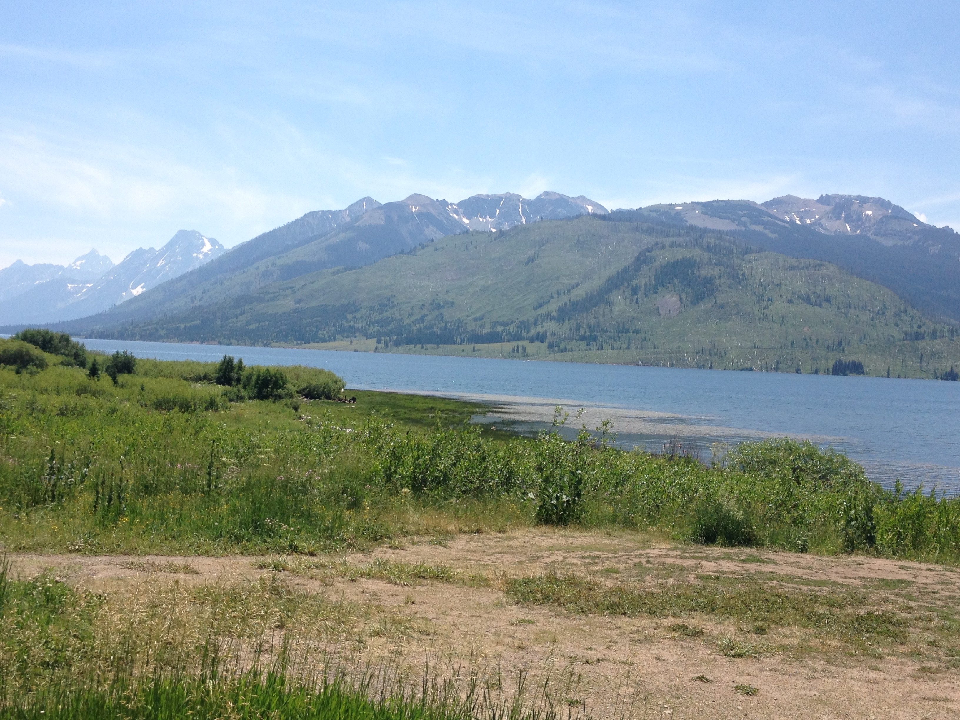
The two National Parks are not even close to all that Moab has to offer, all of which is “active” in one way or another.  Dead Horse Point State Park, located between the two National Parks, is a place where one can hike to one of Moab’s most picturesque locations: Goose Neck.

IMG_9494

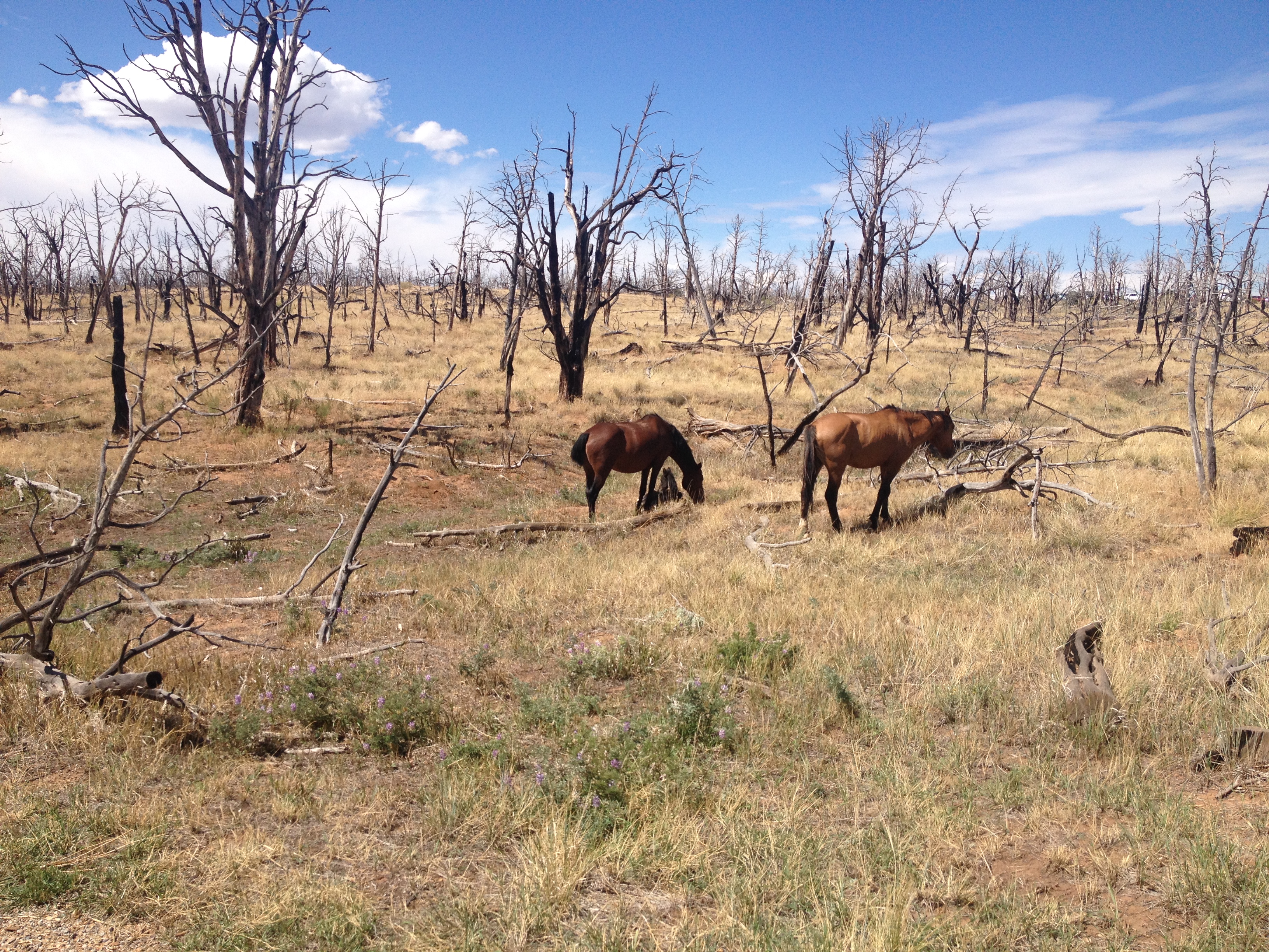
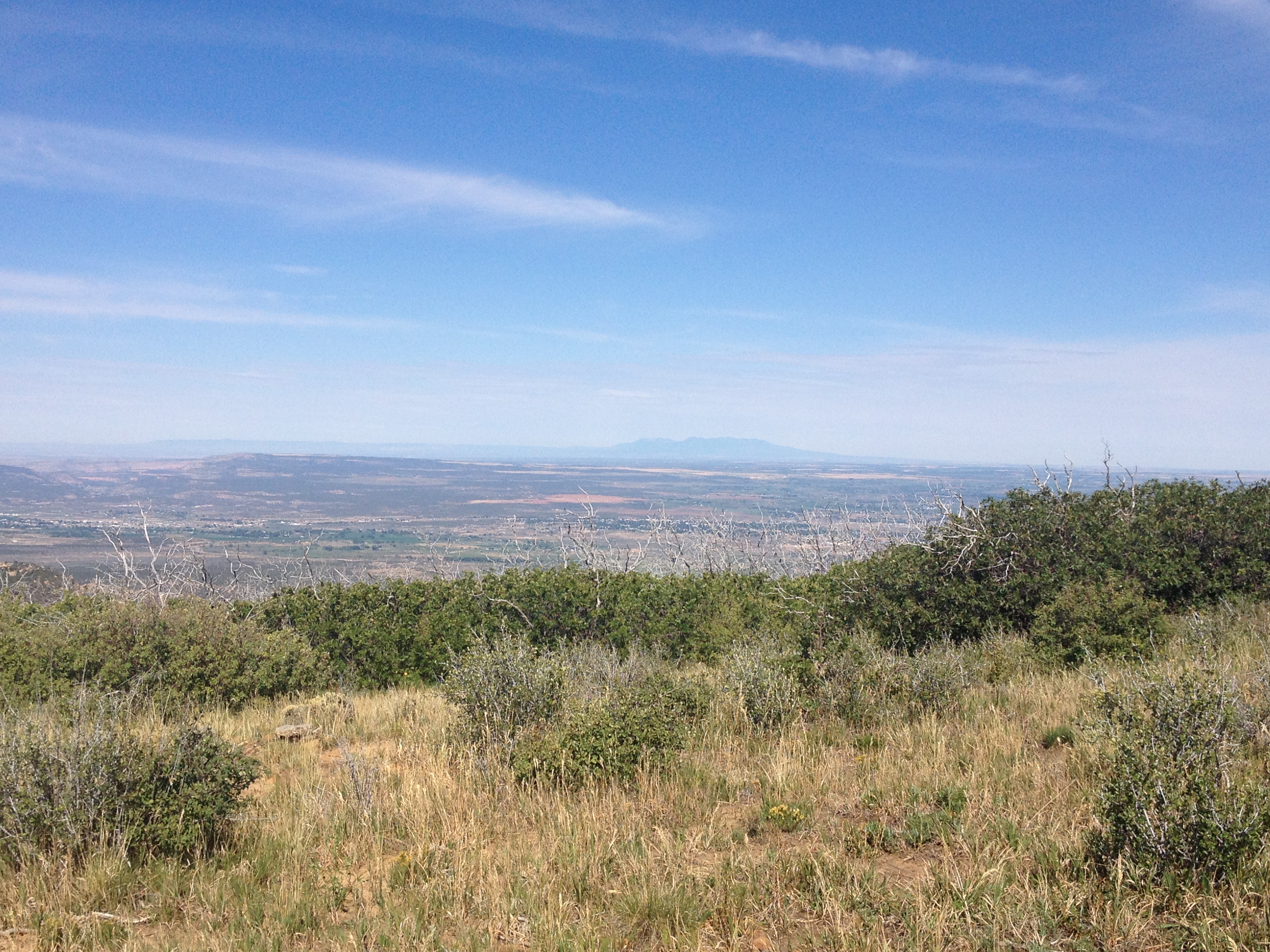
The entire region, regardless of what any spot is named, or whether it contains a state or federal distinction, is rich with abundant natural beauty, and places to hike, bike, jeep, climb, or even just explore.

Anyone driving into Moab from the East (from Colorado), would be well advised to take the additional time it takes to follow the windy State Highway 128 through Professor Valley, essentially following the Colorado River into town.

IMG_9209

We set up camp at a place called Hunter Canyon.

Twenty minutes from town, Hunter Canyon is a place where each part of the day, from sunrise to sunset, lights up a different rock formation.  It felt almost as if nature was putting on a show, with lighting, stage props, and characters coming on and off the stage for different scenes.

I also saw bike trails nearly everywhere I went.  Moab is known as a mecca for mountain biking, an activity we did not get around to (is is… really… impossible to do EVERYTHING in Moab without something like two weeks).  But, with trails like these, Moab is also a phenomenal place for road biking.

IMG_9401.jpg

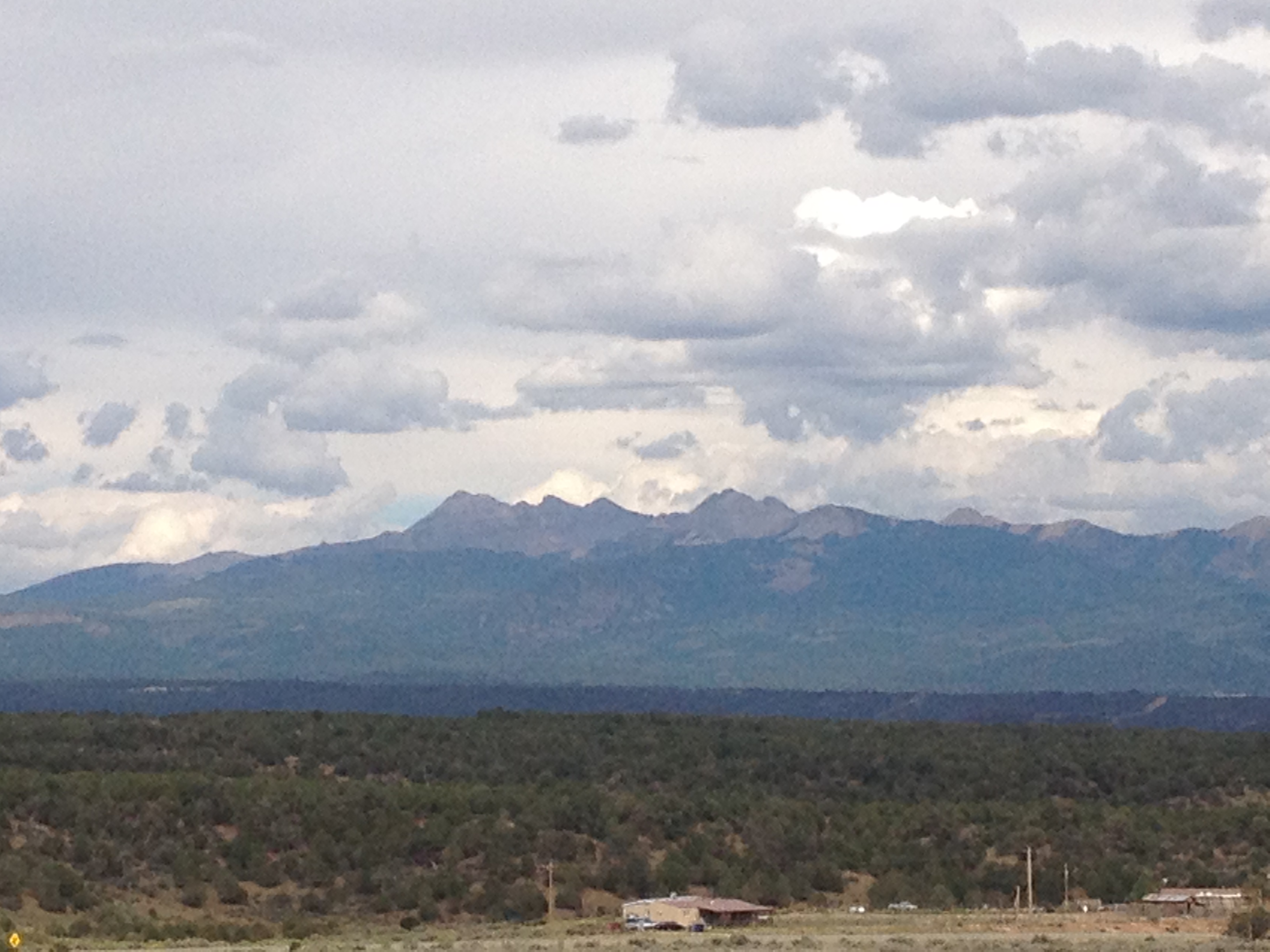
And, everywhere I went red rock formations, each one distinct from the next, would pop up, in and out of view.

It was next to impossible not to imagine these rock formations as something else.  While driving around, I would often point out to the rest of the group what each individual rock formation looked like, or what I perceived it to look like.  Some, I said looked like specific animals, some looked like people, others, still, looked like various specific objects, such as hammers, cooking utensils, or even a turkey wishbone (by the way, the following image is an arch, residing in neither National Park, they really are everywhere)!

IMG_9237.jpg

And, what amazed me was how often others in my group would actually see the exact same thing when they look at a rock formation and say, yes, I also saw an octopus.  This means that either my imagination is quite accurate, or, I have managed to surround myself only with similar minded people.  Both are very much a possibility!

IMG_9241

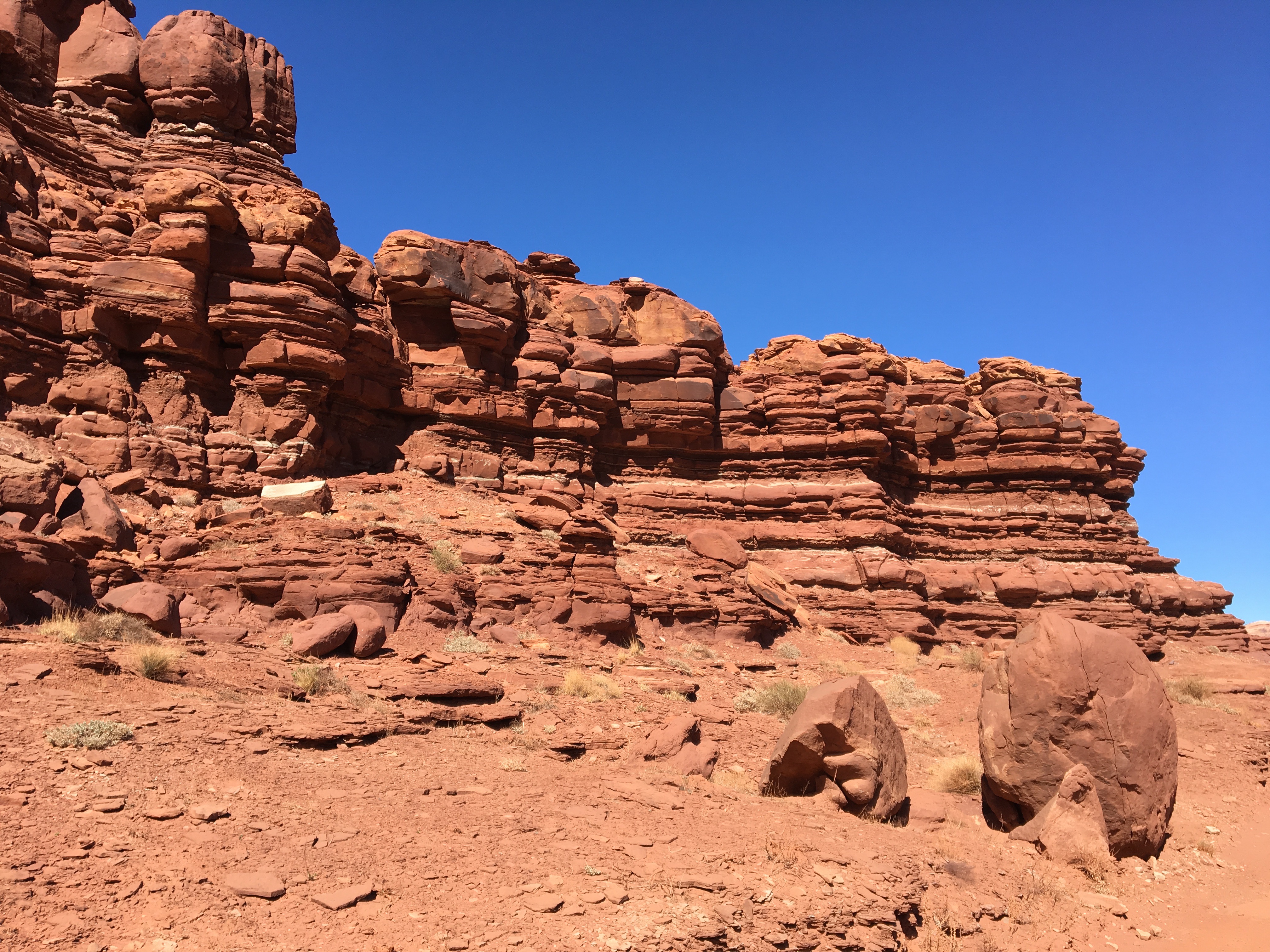
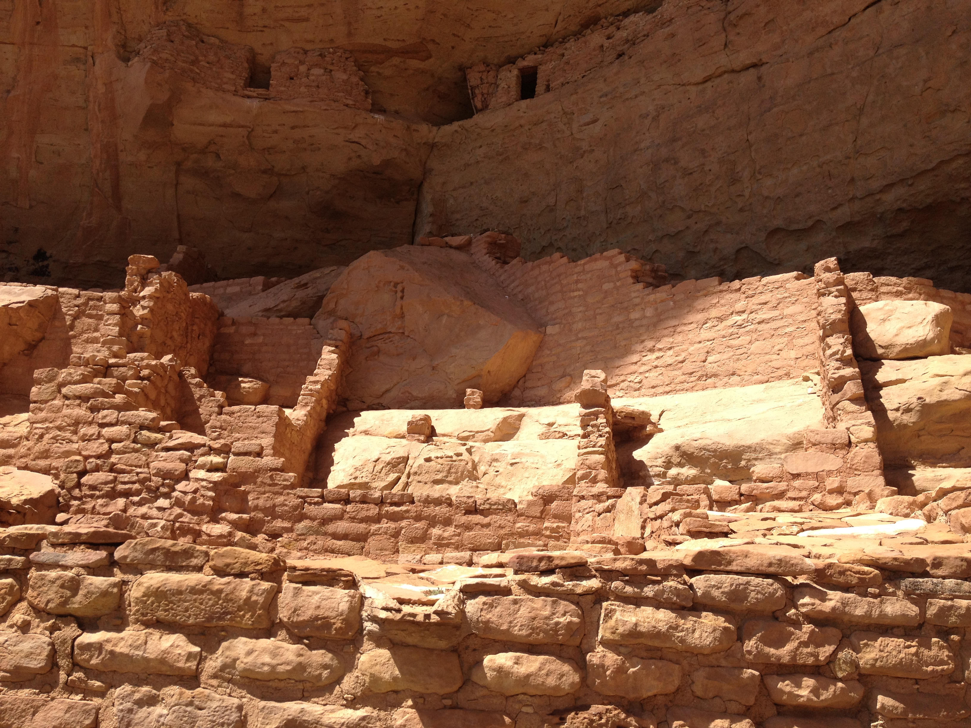
But, the analogy I came to in my head most frequently, throughout the trip, is between the rock formations and the ruins of an ancient city.  Every time I saw a structure such as this one, I would imagine what is would be like if, for some unknown reason, there actually was a civilization here, many thousands of years ago.  And each one of these rock formation was actually the remnant of an ancient skyscraper, or even a larger building like Chicago’s Merchandise Mart, weathered down by thousands of years of natural erosion.  I imagined what this ancient city would have been like, in an Atlantis-like scene that would play through my mind.

Since Samantha Brown’s presentation at last month’s Travel and Adventure Show, I had been trying to live in the here and now, and experience the current culture of a place, as she had advised.

For me, this included another new activity (for me)- Jeeping!

IMG_9521

And, I got to experience some crazy roads and some crazy places.

But, as I find in many of my travels, there is no way to truly avoid thinking about the past, and imagining another setting.  A video at the Canyonlands Visitors Center explained the actual process in which these rocks came to be formed, which took place over the course of 200 million years, back to a time when much of Utah and Colorado were near sea level, with some sections underwater and others above.  In fact, that is part of the reason why there is so much small scale variance in the color of the rocks throughout this region.

Everywhere I went, everywhere I looked, there were echoes of the past, both real and imaginary, and both ancient and more recent.

IMG_9507.jpg

The experience of visiting Moab for a long weekend is as jam-packed as I have made this aritcle.  Around every corner, something new, something exciting, and something unique.  While there are some travel destinations, like Miami, one can make as active or as restful as they would desire, Moab is one destination that requires one to be active, at least in some way, to truly experience.  To come to Moab, and not wander, not explore, not do a little bit of hiking, biking, or jeeping, one would miss out on so much of what is around every corner in this region.


July 2015 Bicycle Journey Day 3: Yellowstone’s Grant Village to Jackson, Wyoming

IMG_3840

What a difference a day makes!  After the most exhausting bicycling day of my life, day 3 seemed like a breeze.  Everything seemed different, even in subtle ways.  Whereas on day 2 I felt like I had to struggle, even on the flatter portions of the ride, certain segments of this day seemed to breeze by.  It was almost as if there was some kind of invisible force that had been holding me back on the previous day, but now was helping me along.

IMG_3819

We left the Grant Village campground having done none of the activities that are typically associated with camping (other than putting up and tearing down a tent).  We did not set up a fire.  We did not cook anything.  We did not even spend a significant amount of time at the campsite other than sleeping. The next morning, we got some breakfast, and headed South, towards Grand Teton National Park.

IMG_3820

The day started with a climb, albeit a very small one, and one that event felt easier than a similar sized climb would have felt the previous day.  Only four miles into the ride, we crossed the Continental Divide, and immediately started headed downhill.  The next eight miles flew by as we reached our last major stop in Yellowstone National Park; Lewis Falls.

IMG_3822 IMG_3823

I feel like I got a fairly exhaustive tour of Yellowstone’s waterfalls.  And, while I had seen several waterfalls while in Yellowstone, each one was different in characteristics.  Undine Falls, which I saw yesterday, was skinny and tall.  Lewis Falls is much wider, with a smaller drop.  It is shaped much more like Niagara.  At this point in my journey, 12 miles in, I was energized!  I felt almost as if I could have handled anything on that day.  In fact, I am 100% sure that I had more energy at that point in the day than I would have had I been resting over the last several days.  There is just something about getting through a really rough day of riding, and then riding downhill.

Until this trip, most of my riding had consisted of day trips.  Before moving to Colorado, those trips were pretty much about how many miles I traveled, as Illinois is flat.  Since then, I have begun to tackle some climbs.  In each of these rides, there is a similar theme, I go up, and then I go down.  There is a climb, and it is followed by a “reward”, a chance to go fast.  This almost felt like a way more stretched out version of this.  I spent an entire day pretty much climbing.  The previous day was my climb, and this day of primarily descending was my reward.  Therefore, the feeling of guilt that usually passes over me when I descend without having climbed first did not manifest.  The whole time I knew that I had earned this day of rapid riding through the exhaustion I had endured on the prior day.

IMG_3827 IMG_3829

By the time we left Yellowstone National Park, we had already descended a significant amount.  That descent was interrupted by the days only climb, in the 6 mile space that separates Yellowstone and Grand Teton National Parks.  This is a strange place.  Although you are technically in neither National Park, signs posted along the road remind motorists that National Park speed limits and enforcement are still in effect.  Also, there is no official entrance into Grand Teton National Park from the north, at least not along US-89.  It is pretty much assumed that all motorists (and I guess cyclists too) had already paid to get into Yellowstone and do not need to pay again.

After climbing for a little bit, there is a rapid descent towards Lake Jackson, and the heart of the Grand Tetons.

IMG_3830

This lake is gigantic, and one of the defining features of the National Park.  And, as one travels farther, into the heart of the Park, one can sometimes get some of the most stunning views of the Tetons from the other side of the lake.

IMG_3832 IMG_3833

The Grand Tetons are the most photographed location in Wyoming.  The primary reason they are so photogenic is that this particular mountain range not only has a prominence (how much higher in elevation the peaks are from the area around them) of over 7,000 feet, but there are no foothills to obstruct one’s view of the mountains.

IMG_3838 IMG_3840

There really is nothing like experiencing the Tetons, at a nice comfortable pace of 15-20 miles per hour, from the seat of a bicycle, up and down some gentile rolling hills, as the afternoon progresses. As was the case in Yellowstone, I decided not to push myself and hurry through the park.  Only this time, on a day that had been mostly downhill, it felt way more comfortable.  I wasn’t climbing up a major pass, putting my legs through all of that exhaustion.  I was just gliding kinda.

The final part of the trip into Jackson took me on a bike trail, where I encountered the last wildlife of my journey, a coyote.

IMG_3845 IMG_3847

In the end, I once again rode over 80 mies on the final day of my journey.  However, the last part of the ride felt quite a bit different for me on day 3 as it had on day 2.  At some point, I came to the realization that on my final day’s ride, it wasn’t the energy I had left in my legs that was limiting the number of miles I felt like I could do, it was other intangibles.  It was how my butt felt about getting back on the seat.  It was how many times my right fingers had been used to shift gears, as well as the amount of weight I had placed on my forearms in general over the course of many hours on the seat.  In this case, I wonder if the strategy of biking a bit faster, but taking more frequent stops to get up and off the seat may be a better strategy for handling these long distance rides.

The last five miles of my ride, on the trail, headed into Jackson were counted off by little markers in the trail; white lines labelled 5.0, 4.5, 4.0 and so on, counting off the distance from Jackson at the end of the trail.  These markers countered down, pretty much, the end of my trip.  So while I was excited to make it all the way into Jackson, and really anxious to take a shower and have a coca-cola, it still felt bittersweet to me, knowing that this bicycle trip that I had been anticipating for so long was quickly coming to an end.

IMG_3848 IMG_3851 IMG_3853

Two days earlier, at Chico Hot Springs, I had refrained from eating chicken wings, as I was unsure if the choice would negatively impact my bike ride the next day.  Now, with no more bike riding ahead of me, it was time to finally fulfill that craving.  So, after showering and changing, we went to a place called Local, right in downtown Jackson, and, yes, I had my wings.  Oh, and they were amazing.  One thing I learned the first time I attempted bike travel, ten years ago, was that wings always taste better on a bike journey.

IMG_3856 IMG_3859

That evening, we stayed at the Anvil Motel downtown, and watched the 4th of July firework show.  As I watched the fireworks light up the night sky, I thought to myself about how I had celebrated our Nation’s independence by traveling through some of the most beautiful places in the country.  I cannot think of a better way to honor The United States of America than that.

The only regret I really had was that the haziness of the day had seriously impacted the images I had taken of the Grand Tetons.  This regret was remedied, as we spent another day in Jackson before headed home, and got to see some more sights, including different images of the Tetons, under different weather conditions, both Sunday and Monday, as well as the iconic images that one encounters in the famous Mormon Row settlement to the east of the National Park.

IMG_3864 IMG_3867 IMG_3871 IMG_3894

By completing this journey, I feel like I have entered a whole new league when it comes to bike riding, and bike travel.  Before this trip, I could only speculate as to what rides I would one day love to take on.  I could only respond to people’s own bicycle travel stories with statements such as “wow, that seems incredible”, or “good job”.  I was not truly belonging to the group.  Now, with this trip behind me, I have finally earned the right to consider myself a bike traveler.  I have earned the right to actually chime in with my own anecdotes, about biking long distances, road conditions, places to go, pannier setup, and all sorts of other topics bicycle tourists typically discuss.  I have reached the pros- sort of.

And, because of this experience, Montana and Wyoming now have a special place in my heart, something that someone born on Long Island, New York would never have expected.  I almost feel like Teddy Roosevelt this weekend, New Yorker in attitude and mannerisms through and through, but lover of the West, lover of America’s beauty and lover of the National Parks.

IMG_3906 IMG_3907

As I rode home Monday, July 6th, it suddenly occurred to me how little I missed my regular life.  I think I missed some of the people and some of the socializing.  But I really didn’t miss the kind of stuff that many would assume.  I had yet to watch a single minute of television, and had yet to use the internet for anything other than looking up the weather and writing a blog entry on this site.  I certainly had not looked at the news or anything.  I definitely did not miss either TV or the internet at all.  As of the time of writing this blog, July 9th, my TV total for the month of July still does not exceed one single hour.  And, the odd thing is, I also knew that if I needed to get back on that bike again and ride more distance, I was more than capable of it.  Maybe that is the way I truly know I have reached a whole new level with regards to bicycling.

Sort of Leaving the Country

IMG_2818

I never had any specific plans to visit the U.S. Virgin Islands.  I had always been aware of their existence, and their Puerto Rico like murky status as part of the United States.  And, every time I saw images like this one, showing the magnificently clear water of the Caribbean, the plethora of activities that are available, and the obviously phenomenal weather, it had always seemed like a magnificent place to go.  However, for some reason, I just never made any specific plans to make a trip here.  Maybe it was the knowledge that it would be a fairly expensive trip that kept me away.  But, more likely, it was the plethora of other pursuits, other destinations, and other activities that are constantly circulating around my head.

This is why, when it comes to travel as well as general life activities, it is sometimes best to follow the lead of others.  If I were to only take part in the activities that I had personally selected to be a part of, and only gone to the places I had decided on my own I wished to go, I would have missed out on hundreds of great experiences over the past couple of decades.  I would never have learned activities like water skiing, or camping.  I would have never discovered some of my favorite foods, like chicken wings, or Thai food.  And, I would have never attended some interesting events, like rodeos, plays, and some interesting comedy shows.  I would essentially be a completely different person than who I am today.

Following the lead of others, I was brought to the Virgin Islands to attend a destination wedding.  After nearly an entire day of travel, I arrived at a destination that is not quite American, yet not quite foreign.

IMG_2815 IMG_2826

The U.S. Virgin Islands is considered a part of the United States.  All of the signs read in English.  There is no talk of any foreign currency.  And, more than half of St. John Island is a part of a U.S. National Park.  Yet, there are some major differences between how things work and operate in the U.S. Virgin Islands vs. the mainland.  The first, most glaring difference that greets any tourist when they arrive on either of the Islands is the fact that cars drive on the left side of the road.  For some reason, I figured this would be the case in the British Virgin Islands, but not the U.S. islands, as we drive on the right in our country.

IMG_2803 IMG_2823

Other major differences that become obvious right away include the taxis, which are sized and shaped quite differently than anywhere in the U.S., even tropical places like California or Florida.  As opposed to basically being cars for hire, taxis here are high profile vans with several rows of seating, built to accommodate roughly a dozen people if need be.  Their fare structure is also different.  Most rides are a flat, destination dependent, per person fee, regardless of the size of the party.  In the mainland, fees are mostly destination dependent, with the cost difference between transporting a single passenger, and several passengers differing by only a couple of dollars.

Also, a large majority of the streets here lack sidewalks, or any other type of pedestrian accommodation.  Walking around Saint John Island, I mainly had to figure out a way to maneuver around structures, both natural and man-made, and live with the traffic being so close to me.

Walking in close proximity to vehicles driving on the opposite side of the road that one is accustomed to, along with significantly different mannerisms, and the extremely thick accents of the natives, would be enough to make an extremely sheltered person freaked out.  For me, I felt only partially outside of my comfort zone.  It was really unclassifiable.  It was as if I was walking some kind of fine line, or living on the “edge”, as people used to say.  I was neither completely out of my element, nor reverting to the familiar.  I was neither “outside the box”, nor “inside the box”.  Maybe I was on the top of the box?

IMG_2808 IMG_2809

Fittingly, my new activity for the weekend was snorkeling in the Caribbean.  Like my experience in the U.S. Virgin Islands as a whole, this activity took me part of the way out of my comfort zone, but not completely.  I have swam, water skied, and jet skied before.  I have plenty of experience with water activities.  The main challenge snorkeling presented to me, as a first timer, was mastering the breathing.  I’d say it was also mastering the use of the flippers, but I most certainly did not master those.  I still moved around quite inefficiently.  However, once I was able to overcome my high elevation instincts to try to breath through my nose, and open my mouth wider to take in more oxygen while engaging in physical activity, I was able to breathe properly, and truly enjoy the activity.

It is said that the Caribbean is one of the best places to snorkel due to it’s clarity.  I was able to see some coral reefs, and moving fish.  Those the dove deeper down, either by scuba diving, or holding their breath, were able to see some turtles, a lobster, and view the coral much more closely.  Although I chose not to go too far down, I still saw underneath the Ocean for the first time ever, and was glad that I went part of the way outside my comfort zone, in both visiting the Virgin Islands, and snorkeling in the Caribbean.

Welcome to Fall

IMG_2656

Although the weather in many places in the country is still quite warm, the fall season is upon us.  Along with it comes all of the things associated with fall; shorter days, football games, all sorts of stuff made out of pumpkin, and, of course the fall colors.

For many, fall’s best feature is the colors that arrive as some species of trees make the necessary preparations for the coming winter season.  The Aspen trees at higher elevations in the Rocky Mountains are amongst the first to change colors.  In fact, at elevations near 10,000′, fall colors can even arrive towards the beginning of September.  In the Eastern States, colors will only begin to appear at the end of September in places like Northern Minnesota and the higher terrain in New England.  Most places will see their peak colors in October or Early November.

To view some of these Aspen trees, I headed to Rocky Mountain National Park, which actually has more of these trees than I had previously remembered seeing.  Of course, I had never been there during the fall before today, and probably did not pay enough attention to the tree types on my summer trips.  Like most places in Colorado, there are still more pine trees (and other “evergreen” varieties) than Aspens.  But, there are enough to make large patches of yellow and orange stand out while viewing the park.

IMG_2660 IMG_2664

Also, the colors themselves appeared more vivid here than they did in the places I had previously gone to view fall colors in Colorado.  I found out that this is one of the most popular places in Colorado for viewing fall colors.  This weekend, Estes Park is holding their annual Autumn Gold Festival, indicating that this is indeed the best time of year to search for fall colors in Rocky Mountain National Park.

IMG_2661 IMG_2665

The arrival of these fall colors, of course, indicates the changing of the seasons.  They remind us (just in case the football and pumpkin flavored everything is not enough) of the transition that is currently occurring, and, of course, of the winter that lies ahead.  They also remind us of the cyclical nature of most things on this planet.  And, they also remind us that all things on this planet, whether they be as periodic and predictable as an ocean tide, or as complicated as the global economy, undergo periodic transformations.

Those among us currently experiencing a rough period can look to the colors on the trees, and take solace in the fact that nothing is permanent, including situation they are currently in.  Just as the season must change, and just as periods of war and peace are inevitable, one’s current situation will eventually transform too, for better or worse.  And, at some point, regardless of how any particular person feels about their life’s situation, it will come time to move on to the next phase, or the next “chapter” of their life.  We did not chose to enter fall- fall just started.  I am sure there are some that would gladly stay in summer for a few more months.

Alongside, each individual’s periodic transformations, society as a whole also undergoes periodic transformations, which often end up intertwined with each person’s individual story.  Here in the United States, the 1950s-1970s was a time of great transition in which our society became more inclusive and individualistic.  More recently, the proliferation of the internet and later social media transformed the way we communicate.

Of course, with every transition, there is some level of predictability, but also some level of uncertainty with regards to the eventual outcome.  Will the coming winter be bitterly cold, or mild?  How much snow will we get?  Will it be a good ski season?

What can I expect from my new job?  Will my marriage work?  Will I like the city I chose to move to?

And, of course, the European philosophers that ignited the Age of Enlightenment had no clue that these ideas would lead to a series of revolutions amongst their colonized land in the “New World”.  Nor did the global political and economic community know what was to come of these newly established countries until several decades into their existence.

I believe our society is currently undergoing a transition, partly in response to the recent economic collapse, but also partly in response to some of the shortcomings of our current societal structure.  Maybe the internet and social media transformation has yet to be completed, and we are still working out how our society is going to incorporate all of these new innovations.  In-person interaction was somewhat degraded by the proliferation of social media and smart phones, and there is much talk about periodically “unplugging” from technology.  The cause of, and lessons to be taken from, the financial collapse is still very much under debate.  But, with the increased competition for both jobs and business, many are taking aim at one of the most destructive aspects of early 21st Century culture; the demand for instant gratification.  As is the case with any other transition, there is a lot of uncertainty, and what our society will look like in 10 years is anyone’s guess.  But, I am cautiously optimistic about these developments.

IMG_2658

For those unable to get up to their favorite fall color viewing spot this weekend, there is still time.  While many trees have already changed colors, there are some that have yet to “turn”.  Those who make it up to Rocky Mountain National Park over the next couple of weeks will still be able to enjoy some fall colors.

Mesa Verde: A Window to the Past

IMG_2396

For some reason, the history classes I took in Jr. High School and High School left me with the impression that the North American continent prior to the arrival of Europeans was one populated by nomadic hunter-gatherer tribes that never really established a civilization.  The popular characterization of Native America is a series of quasi-nomadic tribes following herds of Bison and other big game animals around vast open areas.  Thus, it is hard not to think of our continent as lacking the ruins of ancient civilizations that are quite prevalent in places like Egypt and Rome.

However, there are places in North America where one can view the ruins of ancient civilizations that existed long before the Spanish established the first European settlement at Saint Augustine, Florida.  The most high-profile pre-European (pre-Hispanic) civilization in the area is that of the Mayans, who archeologists discovered to have been quite advanced in writing, math, and the sciences, at a time when Europe was wallowing in the “dark ages”.   Those ruins can be found in Belize, Guatemala, Honduras, and Mexico.

Closer to home (for me), there are a handful of places, mostly in the Southwestern United States, where ruins of ancient civilizations can be viewed.  Preserving this history was significant enough for the United States to establish (in 1906) Mesa Verde National Park, as the only archeology themed National Park in the system.

IMG_2452 IMG_2451

Mesa Verde National Park is located in Southwestern Colorado, in a part of the state where mountains are less numerous than they are in the popular tourist destinations in central Colorado.  The drive from Denver is roughly seven hours, making it a somewhat difficult destination for many to reach.  In fact, the nearest interstate highway is over 100 miles away, and so are all airports that normal people can afford to fly into (I am assuming flying into Telluride is pricey even in summer).  As a result, even on a popular weekend like Labor Day Weekend, the place is significantly less crowded than many other National Parks.

IMG_2433 IMG_2434

The history of “civilization” in this park begins sometime in the 6th Century with the construction of “pit houses”.  Archeologists believe that this was the first time any kind of permanent residence was established here.  The tribes that would eventually inhabit this area were believed to have been semi-nomadic prior to the 6th century A.D.  Over time, these civilizations gradually got more complicated, and houses (referred to as Kivas) were grouped together into little villages.

IMG_2443 IMG_2415

Although the period of Ancestral Puebloan civilization at this site lasted over 600 years, it is the very end period, mainly from the middle 1100s through the middle 1200s that receive the most attention at this park.  This, of course, is the period in which most of the Cliff Dwellings were inhabited.  The Cliff Dwelling we visited is referred to as Long House.  For $4 per person (in addition to the entrance fee), the Long House tour provides the most in-depth explanation of the civilization that existed in the region.  This 90-minute tour is only available from Memorial Day to Labor Day.  The road to access Long House (on the far west end of the park) is also only open Memorial Day to Labor Day.  Visitors who come to the park later in the fall, or earlier in the spring, can visit other Cliff Dwellings, and take other tours.

IMG_2409 IMG_2410

The inhabitants of this region were a very resourceful people.  In addition to the corn, beans, and squash that they grew in the region, they took advantage of most other plants in the area, including Cactus, and the fruit-bearing Yucca plant.  They even resorted to ever awful-tasting plants like Juniper berries in meager years.

IMG_2413 IMG_2432

They even invented the first diaper from Juniper bark.

IMG_2424 IMG_2425

Of course, in a dry climate like this one, one of the scarcest resources is water.  For this, the Ancestral Puebloans devised a system to capture what little water precipitates through a system of little streams and holes designed to capture water when it comes.  Even with this resourcefulness, water was still always in short supply, and a long-term drought is often cited as a potential reason as to why these villages were abandoned sometime in the 13th century.

IMG_2426 IMG_2427Their homes, or “Kivas”, were significantly smaller than our homes today, even in large cities like New York.  The standard “Kivas” appear smaller than most people’s garages today.  Even the “Grand Kivas” would pale in comparison to the size of most present-day one bedroom apartments.
This is most likely because this civilization did not view the concept of the “home” in a way we are accustomed to.  A recent commercial (for some kind of real estate agency) describes home as “a place for your life to happen”.  The commercial reflects the prominent views of mainstream America today.  The Ancestral Puebloans who inhabited Mesa Verde from the 6th through the 13th centuries, used these “kivas” as places to sleep, gather, and sometimes have ceremonies.  However, it was not where their “life happened”.  The remainder of their lives was still primarily outside.

IMG_2420 IMG_2417Archeological analysis has also revealed that these homes were actually built in a rather hurried manner, with little attention to details.  It was hinted that there was always this view that any residence would be considered temporary.  According to the exhibits at the Visitor Center, while many scientists and archeologists concur that the reason this site was abandoned in the 13th century was scarcity of resources (water and animals), the descendents of the inhabitants of this region indicate that it was simply time for their people to move on, to another chapter of their story, in a different place.   Coming from this point of view, the concept of homeowner’s insurance, something practically considered a necessity in our present culture, would have been rejected as an absurd idea in 12th century Mesa Verde.  Fire?  Move on.  Earthquake?  Just put up a new building.  Not the big deal that it has become for us today.
IMG_2448 IMG_2406 IMG_2439 IMG_2403 Mesa Verde’s more recent history appears to be driven by wildfires, always a concern in regions like this.  While traveling about the park, the landscape of any given area can vary significantly depending on how recently it has been burned by fire.  A major fire in the year 2000 engulfed nearly half of the park, causing significant portions of the park to appear as this picture above, with a creepy combination of larger, older, dead trees, and the newer vegetation that has developed over the past decade and a half.For those on a tighter budget, I would certainly recommend staying in the town of Mancos.  It is the nearest town to the entry of the park (only 6 miles away).  It is a town of only 1300 residents, and does not boast too many amenities.  However, it offers, by far, the best deals on hotel rooms in the area.  Our hotel room was the Country West Motel, and I would recommend it to anyone.  A classic looking, modest roadside motel, it had it’s own courtyard, sizable enough rooms, and even a poster that I really enjoyed having in my room.
IMG_2389 IMG_2391 IMG_2387 IMG_2474

Great Smoky Mountains National Park

America’s most visited National Park is Great Smoky Mountains National Park.  Situated  in the Southern Appalachian Mountain Range, along the border of North Carolina and Tennessee, it is not the easiest place to get to.  When I think of National Parks, places like Yellowstone and the Grand Canyon first come to mind.  This is why I am somewhat surprised that this National Park takes the prize as most visited, with something like 10 million visitors annually.

IMG_1228 IMG_1229


The drive down to the Smoky Mountains was quite scenic.  It was mostly along Interstate 75, which I joined just north of Richmond, Kentucky.  Mountains began to appear as I approached the border of Tennessee.  And, with it being a cold morning, fog appeared along the sides of the mountains near the border.  I have only driven this road once before, but I actually recall it being prone to fog.  I even remember fog related caution lights the last time I was here, which I did not see this time.

IMG_1232 IMG_1233

As I approached the National Park, I began to think that there may be places besides the National Park itself that are just as scenic.  I knew the park would be crowded, which it was, with slight backups on the way both in and out of the park.  I still wonder if I could have gotten the same experience at a slightly different location.  Most mountain ranges are larger than the parks that are built to celebrate them.

IMG_1234


As I entered the park I notice that the trees in this area have largely not turned yet.  This, of course, is at lower elevations, and as I traveled up the mountains, the scenery would change.  This is one of the things that made this trip quite interesting.

IMG_1235


My Thursday hike would take me up the Alum Cave Trail to the top of Mount LeConte.  This trail is right in the middle of the park, and one of the most popular trails here.  It is kind of describes as your “quintessential Smoky Mountain hike”, and since this is my first time here, I figured I might as well start with this one.

IMG_1237

The hike starts off somewhat easy.  The first mile or so treks along the valley of a creek, gradually gaining elevation from a start of something like 3500 feet to just over 4000 feet.  It is in this part of the park, the middle elevations (as it has places lower than 2000, but also peaks above 6000) where the fall foliage was at it’s peak this week.  Knowing this, I would still recommend late October as an ideal time of year to visit the Smoky Mountains.

IMG_1238


Arch Rock is the first defining feature on this trail, 1.4 miles in.  It is at this point that the trail becomes more difficult.  In fact, I think there are a lot of people that end their hike here.

IMG_1240 IMG_1241 IMG_1242


As I continue up the trail, I notice more great views of the mountains and the foliage.  The hike overall is somewhat difficult, but I would say I have done harder hikes in Colorado, especially due to the elevation.  However, I did get a chance to feel really awesome, as I was the fastest person on the trail that day.  I would spend most of the day passing people up, and only get passed up once, at the very end of my descent, right before reaching the car again.  This, of course, is the opposite of the experience that I typically have in Colorado, where I am the one usually getting passed up.  I should really not compare myself to others, especially regarding something like hiking, but it still felt kind of good, almost like I know what it feels like to be one of those guys with their headphones on running up Mt. Bierstadt.

IMG_1244 IMG_1245


The trail’s main defining feature is Alum Cave, which is not a cave, but more of a series of bluffs.  This point is also a common stopping point for hikers.  It was a cold day, especially for Tennessee standards.  Highs would only get into the lower-middle 50s at the base of the mountain, and most of my hike would be in temperatures in the 30s and 40s.  A little nervous about the cold, I thought about stopping here, but decided to keep going anyways, up Mt. LeConte, which would take me over 6500 feet in elevation.

IMG_1247 IMG_1248


I had perviously noticed a white looking feature to the top part of the mountains.  One could mistake this feature for snow, but one of the hikers informed me that it was a really heavy frost.  This, of course, is something that would never happen in Colorado due to the lack of moisture, and is one of many features that make the Appalachian Mountains different from the Rocky Mountains.  When I finally got to this level, I was relieved to find that this frost was not present on the ground, which would have made the hike slippery.

IMG_1250 IMG_1251


There were some really neat icicle formations near the side of the trail, but there were really only one or two parts I would consider slippery.  The top of the mountain did have some dense pine forests.  With their heavy coating of frost, walking in and out of these areas was somewhat creepy feeling- appropriate for Halloween.  There was some wind at the top of the mountain.  It was no faster than 10 mph, but was enough to blow some of this frost off the trees.  The frost flying through the air felt kind of like it was snowing, but being the scientist I am, I knew that it was not actually snowing.

IMG_1253 IMG_1254


0.2 miles before the top of the mountain, there were a bunch of cabins.  I actually saw some people with full backpacks headed there to stay the night.  The top of the mountain was foggy, which dampened my view.  WIth it being cold and windy, I only stayed up there for about 10 minutes; long enough to take this picture and eat a 6″ sub from Subway, which I brought with me in my backpack.

IMG_1257

The hike took me about 5 hours overall, 3 to get up and 2 to get down.  Other hikers told me that it was an impressive time, but I was kind of in a hurry, as it was cold and I did not want to take long breaks.  The additional time gave me a chance to see some of the park’s other features.

IMG_1259 IMG_1260


The first of such features was the Newfoundland Gap, which was apparently discovered in the early 19th century as an alternate route to the Cumberland Gap.  Looking out at the natural features, I struggle to figure out where this gap is, and what makes it an easy route for settlers to get across the Appalachians.  I am guessing it is the valley between this hills, but it seems as though they would still have to climb to the elevation I am sitting at, 5048 ft.

IMG_1261

I also got to see a small section of the famed “Appalachian Trail”, which follows the high points along the NC/TN state-line through most of the park.

IMG_1263


I drove up the road to Clingman’s Dome, the highest point in the park.  But, the cold, windy weather, and fog at the observation deck stopped me from actually going up there.

Overall, I enjoyed my experience at the Great Smoky Mountains National Park, and I think the area offers something for everyone.  Just outside the park are the towns of Gatlinberg and Pigeon Forge.

IMG_1264


Both towns are quite touristy, with tons of restaurants, hotels, and other attractions like roller coasters and family fun centers.  However, Gatlinberg was more dense, the kind of place where one would largely walk to most of the places they desire to go to.

IMG_1230


Pigeon Forge, on the other hand, is a driving place.  I saw few people walking around here (as I saw a lot in Gatlinberg), but there were still tons of attractions, probably even more than in Gatlinberg as Pigeon Forge is home to Dollywood.

For those that want a more rustic experience, there is plenty of that too.  In fact, just off the Smoky Mountain Parkway (the highway that connects these two towns to Interstate 40), it gets a lot more rustic quite quickly, with lots of cabin sites, but also areas with tubing and other outdoor activities.  I can imagine nearly everyone getting something out of their Smoky Mountain experience, and I can imagine spending a significant amount of time here.  Between this, my experience in Nashville last year, and what I hear about Memphis, Tennessee seems to me like a state that really knows how to party!

One other thing I noticed while in Tennessee is that there are parts of the country where Krispy Kreme donuts are still popular.  In fact, my hotel offered free Krispy Kreme donuts to their guests, as a manner in which to draw people (as competition is quite stiff in this area).  In this part of the country, Krispy Kreme donuts were popular long before the Krispy Kreme fad up north around a decade ago, and remain a cultural institution.  When I ate my donuts, I realized once again that these are good donuts.

We urban, cosmopolitan, northerners (or however you describe pop-culture influenced mainstream America) seem to do a good job of taking cultural mainstays from other regions and turning them into short-lived fads.  Shortly after the Krispy Kreme fad (which was roughly 2001-2004), we created a fad out of Caribbean reggaton music, culminating with Daddy Yankee’s widely successful BarrioFino album.  For those that don’t know, Daddy Yankee is still producing albums that are widely successful in the Caribbean, and even moderated a gubernatorial debate in Puerto Rico.  We are now doing the same thing with twerking, which has been part of African American culture for two decades.  Actually, that fad may already be over!

After my breakfast, I head back to the park to visit one last destination; Cades Cove.  This part of the park is mainly for wildlife viewing.  I have limited luck, as much of the area is pretty empty.  There are a lot of horses here, but that is kind of what I expect.  I was amazed, though, at how people went right up to the wildlife, even if it was deer, something I see all the time.  At the other National Parks I have visited this year, mainly Yellowstone and Rocky Mountain National Park, anywhere I’d seen wildlife, there were park rangers making sure people don’t get too close.  Here, it appeared as if people were walking up to the animals, just daring them for a fight.

IMG_1266 IMG_1267

I would very much like to come back here.  There is so much more to see and do in Great Smoky Mountains National Park, as well a in Gatlinberg and Pigeon Forge.  However, I am also curious to go somewhere else in this mountain range where it may be less crowded.  Perhaps I could go somewhere like Mount Mitchell, or to an area north or south along the range, just to see if the foliage and hiking experience would be just a good without the traffic and crowds.  However, I do think it is interesting to see these mountain ranges in the east, as they are quite different from the Rocky Mountains, near where I live.  They have much more of a densely forested feel to them than the wide open Rockies.  The colors are different, and the mountains feel somewhat different in orientation.