Category Archives: jeeping

Mount Antero with my Siberian Husky

The top of Mount Antero- 14,276 ft (4351.4 m)

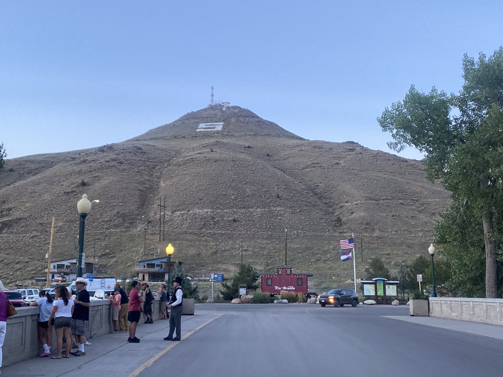
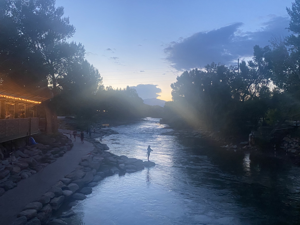
To tackle Mount Antero, I spent the night in a hotel in Salida, a small town along the Arkansas River in Central Colorado known for summer fun. It’s within a short drive of the trailhead to several “14ers” (peaks 14,000 feet above sea level or higher). Salida’s probably best known for its water sports, with this stretch of the Arkansas River being one of the most common destinations for whitewater rafting.

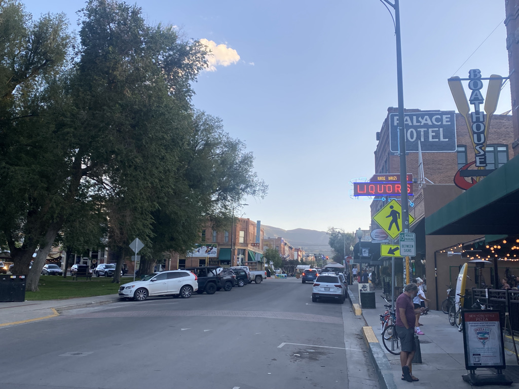
Despite it being a Wednesday evening, the town was quite lively. Salida also has some affordable pet friendly hotels and plenty of restaurants where you can eat on the patio with your dog.

While most people who climb 14ers camp near the trailhead, I decided to pay for a hotel, primarily because I chose to take only one day off for the trip. My energy was needed for the exhausting hike and the three hour drive back to Denver.

The morning temperatures in Salida were in the low to mid 50s, slightly warmer than the long term averages for August (47°F, 8°C) and also the warmest start to a 14er I’ve ever had.

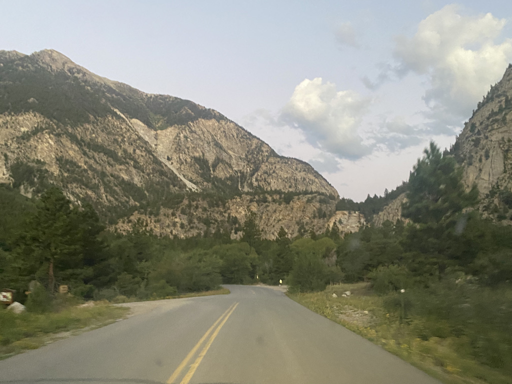
Getting to Mount Antero involves following a road called Chalk Creek Drive. It’s accessed off highway 24 halfway between Buena VIsta and Salida. The road passes by the Princeton Hot Springs and the Chalk Cliffs, and provides access to both Mount Antero and Mount Princeton.

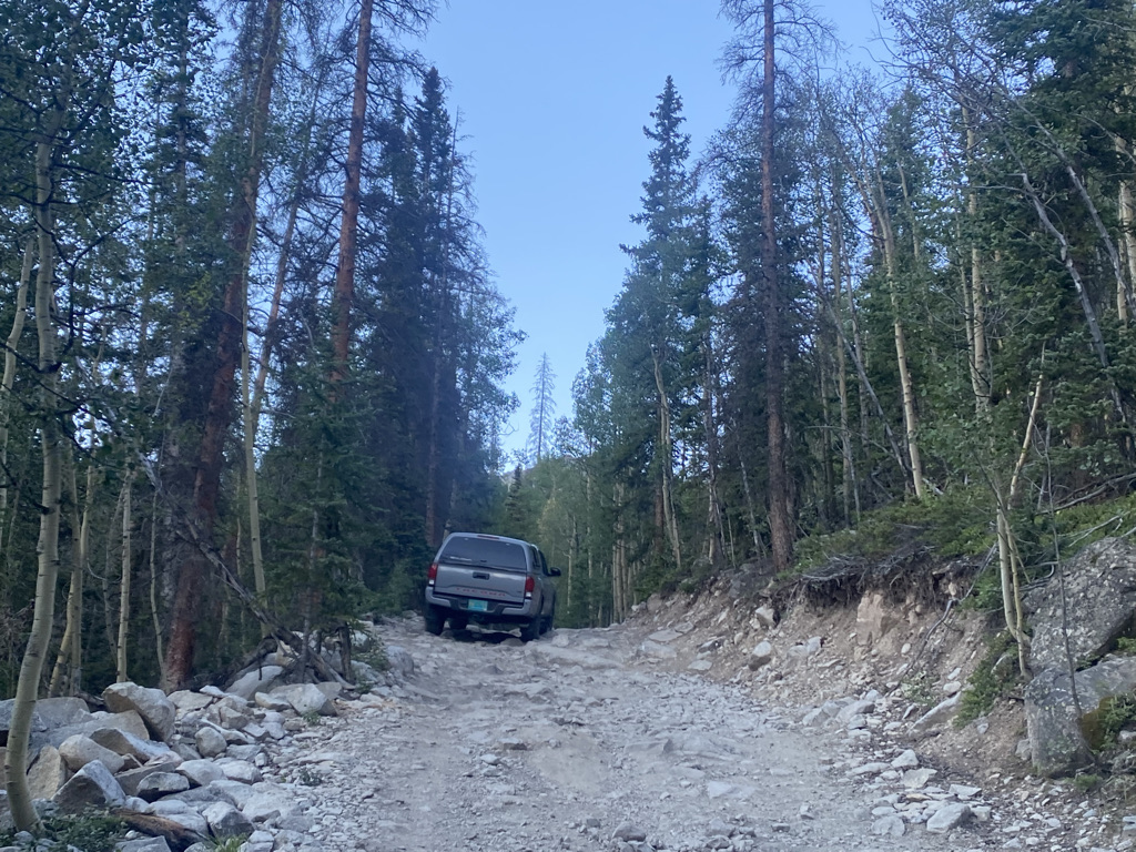
The most unique thing about this hike is that most of it follows a “Jeep Road”. In fact, some people were able to drive most of the way to the top

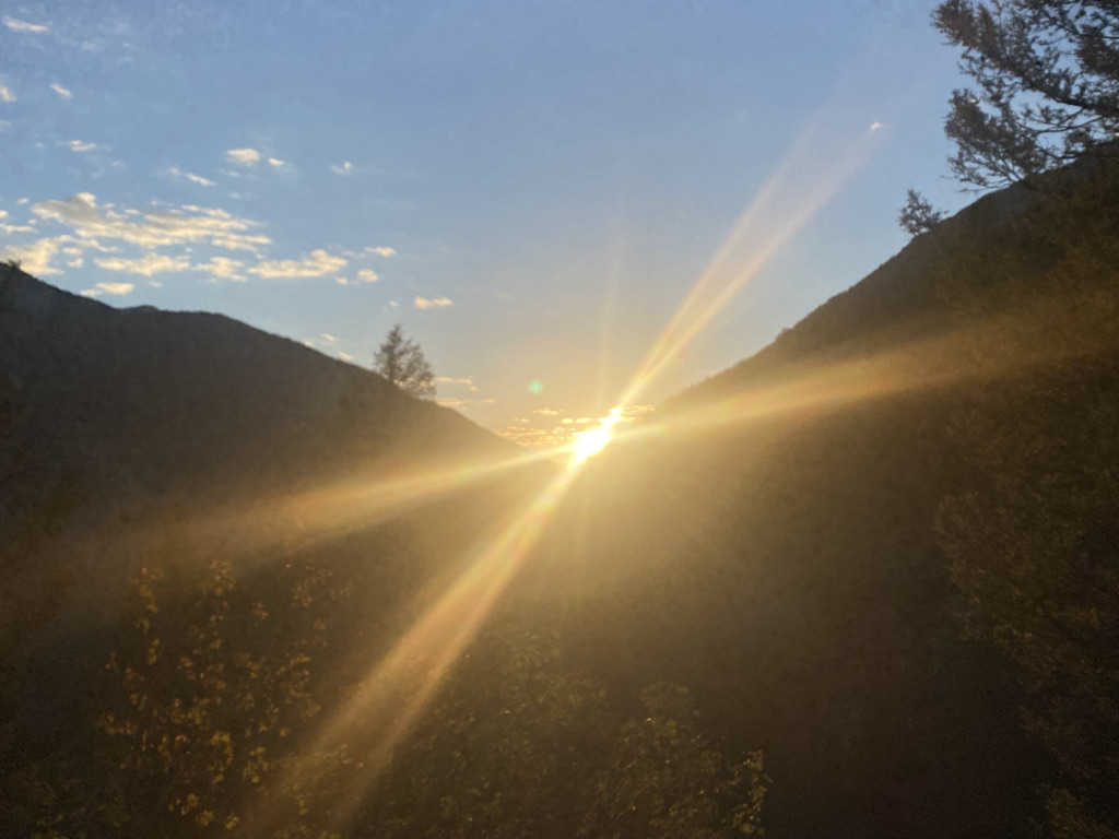
When done right, it is best to start a 14er quite early in the day, before sunrise, which makes the appearance of the sun one of the first exciting exhibitions of the hike.

14ers are challenging climbs. This one is no exception. The total vertical climb was about 4,500 feet (1350 m), and it starts getting challenging pretty much right away.

After about a mile, there is a flatter part. Then, around the 2.5 mile mark, we encountered the first area of major concern for anyone bringing a dog on the hike, an area completely covered by rocks.

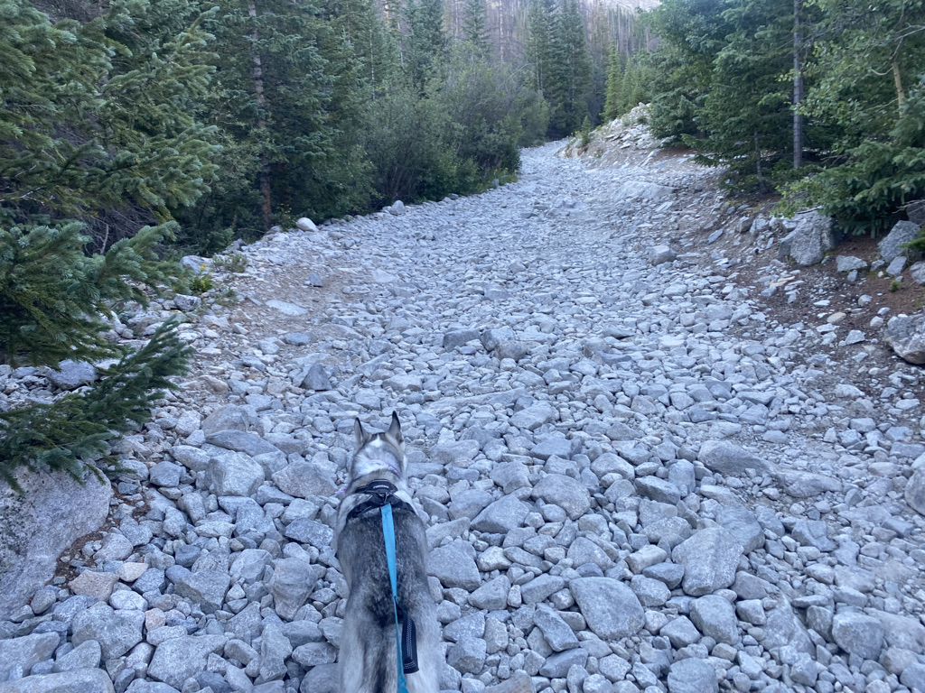
This is something anyone hiking with their dog needs to keep an eye on. Dogs paws blister over time but dogs do not always prepare for this possibility. They need to be either given booties to protect their feet or guidance on how to minimize their exposure to rocks starting pretty early on in the hike.

The trail up Mount Antero approaches the peak from the West side, meaning it takes longer for hikers to experience the sun in the morning.

We would get to tree line by 8:30 and enter the sun only shortly thereafter. Once tree line is reached, this hike becomes nothing short of absolutely breathtaking.

When hiking with dogs, especially challenging hikes like this one in dry climates, it is essential to keep them hydrated. For this, I not only bring water for my dog, but also allow my dog to drink from flowing creeks.

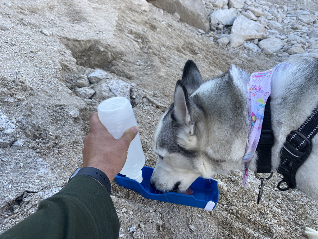
The key here is to only allow your dogs to drink from creeks that are flowing. Standing water could lead to Giardia.

Like every other 14er I’ve done, Mount Antero has two features that will drive most people to exhaustion.

First, a steep ascent to the top of some kind of ridge.

Then, a scramble to the top, over rocks.

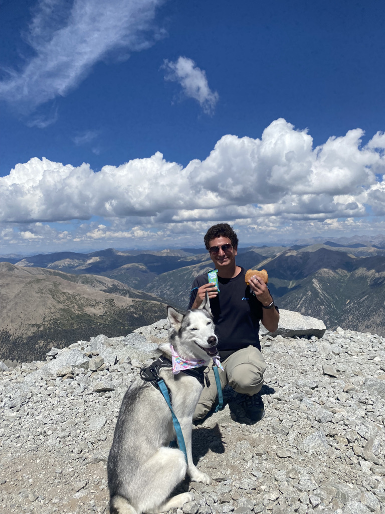
I had hiked over seven miles before getting to the final scramble. With the exhaustion, challenging scramble and high elevation, I needed to take quite a few breaks on this final ascent to the top. This is perfectly normal.

The top of this mountain feels like being on top of the world. Countless other peaks were below me.

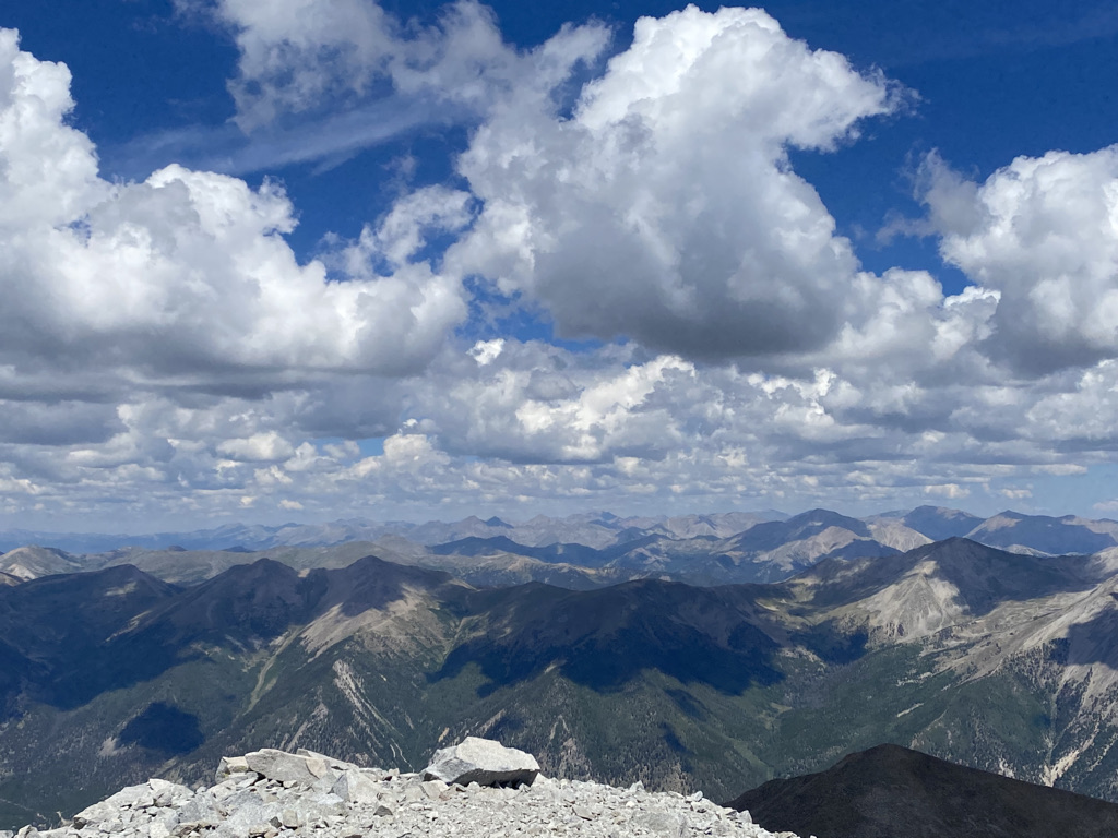
So was the Arkansas River Valley, where Buena Vista and Salida are.

We spent about half an hour at the top, enjoying the views, a little bit of food and some conversations with other hikers.

And, the descent was also quite beautiful.

Overall, it was an amazing day, but like most things that are truly amazing, it had to be earned. It had to be earned through the lengthy drive, proper preparation and physical exhaustion involved in climbing this much.

By the time I reached the end of the journey I realized that what was earned goes far beyond what could be captured in these photos. Sure, the areas below tree line were peaceful and the areas above tree line had spectacular views. But, the experience was also about a state of mind.

Since it was a Thursday, the trail was relatively empty. The few people I encountered kind of represented humanity at its best. Nobody was arguing over whatever topics people seem to be angry and divided over at the time. Even though some people were on the mountain to hike, others to ride their Jeeps and ATVs and others to mine gold or aquamarine. A couple of the people I encountered even helped me out by giving me and my dog a ride down the final few miles of the mountain when I was concerned about blisters on her paws. They stopped and talked to people they encountered, picked up litter from the road and had nothing but the most positive conversations about nature, camping, travel and music. The experience made me wonder if this is a reality we can create in our day to day lives, so long as we focus on the right things and earn it.

Moab- An Active Destination

IMG_9301

Some trips are restful, while others are more active.  There are some destinations that lend themselves to more restful trips; cottages in the woods near quaint towns, tropical beaches, and resorts.  Moab, is a place where it is nearly impossible to imagine anything other than an active itinerary, with a variety of activities, and a lot of places to see.  Situated in East Central Utah, several hours from the nearest major city, this popular tourist destination is surrounded by too much natural beauty to picture anyone coming here and spending large amounts of time sitting in one place.

First of all, Moab is surrounded by two National Parks, Arches and Canyonlands.

Both National Parks are, as National Parks tend to be, filled with tons of natural beauty and unique places.  At both National Parks, while it is possible to see a lot of interesting natural features without straying too far from the road, the best features at both parks require hiking.

FullSizeRender (1)

Getting to the signature feature of Arches National Park, Delicate Arch, requires a 1.5 mile hike from the Delicate Arch Trailhead.  Interestingly enough, this trail starts near the historic Wolfe Ranch, and traverses by some other unique features including some Ute Indian Rock art.

It is also quite difficult to imagine making a trip to Arches National Park and not viewing some of the other arches (Yes, it’s Arches National Park, not Arch National Park).  There is a section of the park known as Devil’s Garden, with somewhat of a network of trails taking visitors to all kinds of other arches.

The most famous of these arches is Landscape Arch, a long and wide arch whose name provides a clear recommendation as to how to orient any photograph of this particular feature (for those familiar with landscape vs. portrait  ).

IMG_9345

To get to most of the remaining arches requires a bit of a steep climb, which starts pretty much right after Landscape Arch.

IMG_9346

The hiking in the entire Moab area, not just at Arches National Park, is considerably different from the typical hiking experience.  Much of the hiking I’ve experienced, is on trails covered in dirt, gravel, and sometimes small to medium sized rocks at places such as the top of Quandry Peak.  All around Moab, I found myself on surfaces such as this one, on top of solid rock, sometimes for nearly the entire duration of the trail.  Traversing these trails required me to use my upper body more, and even do a little bit of jumping, from one rock to another.

At the top of this Mesa, there are arches with multiple partitions, arches people can hike under, and even one arch with an opening that lends itself to laying inside it to soak up the sun, the surroundings, and the experience!

The entire loop, including all the side trips in the trail network, is a total of 7.2 miles.  So, if a visitor desires to see all of these features, as well as Delicate Arch, a total of 10.2 miles of hiking is required.

And some people decide to add even more activities to their day.  In a shaded off-shoot of the Devil’s Garden Trail, I witnessed a sizable group of people playing a game of Frisbee, using the walls of this tiny canyon to make trick shots.

IMG_9391

Since immersing oneself in the here and now, and contributing to the local culture of a place creates a more enriching travel experience, I decided to play my part.

First, I decided to bring my own arches into the park..

IMG_9332

Disclaimer: I did properly dispose of that cup

Then, when the opportunity presented itself, I decided it was time that we started making our own arches, contributing to the park’s plethora of natural beauty.

IMG_9374

IMG_9444

Canyonlands National Park is even bigger than Arches, broken up into three sections by the Colorado and Green rivers, whose confluence is right in the center of the park.  Without any bridges connecting over either river, and with the entrances to each section over an hour apart, it is all but impossible to visit more than one section in a day.

IMG_9461.jpg

The most common image of Canyonlands National Park is an almost Grand Canyon-like overlook into a deep river valley, sometimes with one of the two isolated mountain ranges in the background.  However, at the scenic overlooks in the parks’ Island In The Sky region, it is actually quite difficult to see the rivers themselves.  The canyons that make up Canyonlands National Park are quite expansive, with multiple tiers.  To see these canyons from the best vantage points requires a bit of hiking.  The hike to the Confluence Overlook (an overlook of the confluence between the Green and Colorado Rivers) is 10 miles round trip, something that could require the better part of a day!

Canyons are not the only interesting feature to Canyonlands National Park.  Being only roughly 20 miles away from Arches (as the crow flies), Canyonlands has some arches of its’ own.  The most interesting one is an arch called Mesa Arch, where one can see both the peaks of the nearby La Sal Mountain range, and actually another arch by looking through the arch at the right angle!

IMG_9471IMG_9468

And some features are random, like Upheaval Dome.

IMG_9427

Scientists still do not know whether or not this particular salt deposit is a remanat of a meteorite that would have theoretically collided with the earth roughly 20 million years ago.

The two National Parks are not even close to all that Moab has to offer, all of which is “active” in one way or another.  Dead Horse Point State Park, located between the two National Parks, is a place where one can hike to one of Moab’s most picturesque locations: Goose Neck.

IMG_9494

The entire region, regardless of what any spot is named, or whether it contains a state or federal distinction, is rich with abundant natural beauty, and places to hike, bike, jeep, climb, or even just explore.

Anyone driving into Moab from the East (from Colorado), would be well advised to take the additional time it takes to follow the windy State Highway 128 through Professor Valley, essentially following the Colorado River into town.

IMG_9209

We set up camp at a place called Hunter Canyon.

Twenty minutes from town, Hunter Canyon is a place where each part of the day, from sunrise to sunset, lights up a different rock formation.  It felt almost as if nature was putting on a show, with lighting, stage props, and characters coming on and off the stage for different scenes.

I also saw bike trails nearly everywhere I went.  Moab is known as a mecca for mountain biking, an activity we did not get around to (is is… really… impossible to do EVERYTHING in Moab without something like two weeks).  But, with trails like these, Moab is also a phenomenal place for road biking.

IMG_9401.jpg

And, everywhere I went red rock formations, each one distinct from the next, would pop up, in and out of view.

It was next to impossible not to imagine these rock formations as something else.  While driving around, I would often point out to the rest of the group what each individual rock formation looked like, or what I perceived it to look like.  Some, I said looked like specific animals, some looked like people, others, still, looked like various specific objects, such as hammers, cooking utensils, or even a turkey wishbone (by the way, the following image is an arch, residing in neither National Park, they really are everywhere)!

IMG_9237.jpg

And, what amazed me was how often others in my group would actually see the exact same thing when they look at a rock formation and say, yes, I also saw an octopus.  This means that either my imagination is quite accurate, or, I have managed to surround myself only with similar minded people.  Both are very much a possibility!

IMG_9241

But, the analogy I came to in my head most frequently, throughout the trip, is between the rock formations and the ruins of an ancient city.  Every time I saw a structure such as this one, I would imagine what is would be like if, for some unknown reason, there actually was a civilization here, many thousands of years ago.  And each one of these rock formation was actually the remnant of an ancient skyscraper, or even a larger building like Chicago’s Merchandise Mart, weathered down by thousands of years of natural erosion.  I imagined what this ancient city would have been like, in an Atlantis-like scene that would play through my mind.

Since Samantha Brown’s presentation at last month’s Travel and Adventure Show, I had been trying to live in the here and now, and experience the current culture of a place, as she had advised.

For me, this included another new activity (for me)- Jeeping!

IMG_9521

And, I got to experience some crazy roads and some crazy places.

But, as I find in many of my travels, there is no way to truly avoid thinking about the past, and imagining another setting.  A video at the Canyonlands Visitors Center explained the actual process in which these rocks came to be formed, which took place over the course of 200 million years, back to a time when much of Utah and Colorado were near sea level, with some sections underwater and others above.  In fact, that is part of the reason why there is so much small scale variance in the color of the rocks throughout this region.

Everywhere I went, everywhere I looked, there were echoes of the past, both real and imaginary, and both ancient and more recent.

IMG_9507.jpg

The experience of visiting Moab for a long weekend is as jam-packed as I have made this aritcle.  Around every corner, something new, something exciting, and something unique.  While there are some travel destinations, like Miami, one can make as active or as restful as they would desire, Moab is one destination that requires one to be active, at least in some way, to truly experience.  To come to Moab, and not wander, not explore, not do a little bit of hiking, biking, or jeeping, one would miss out on so much of what is around every corner in this region.