Category Archives: Scenic Drives

Peak to Peak Highway: The Perfect June Colorado Bike Ride

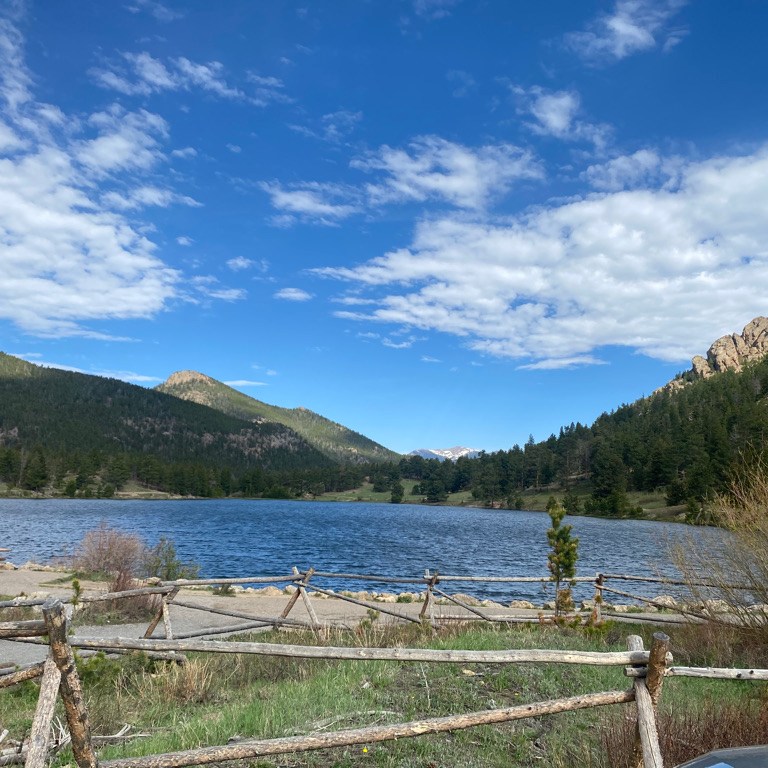
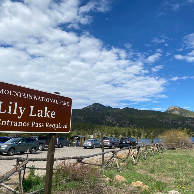
I started this ride just after 8 A.M. in Estes Park, Colorado, a town that has become so overrun with tourists due to Rocky Mountain National Park that they are now having visitors park at the visitor center and take a shuttle bus into town.

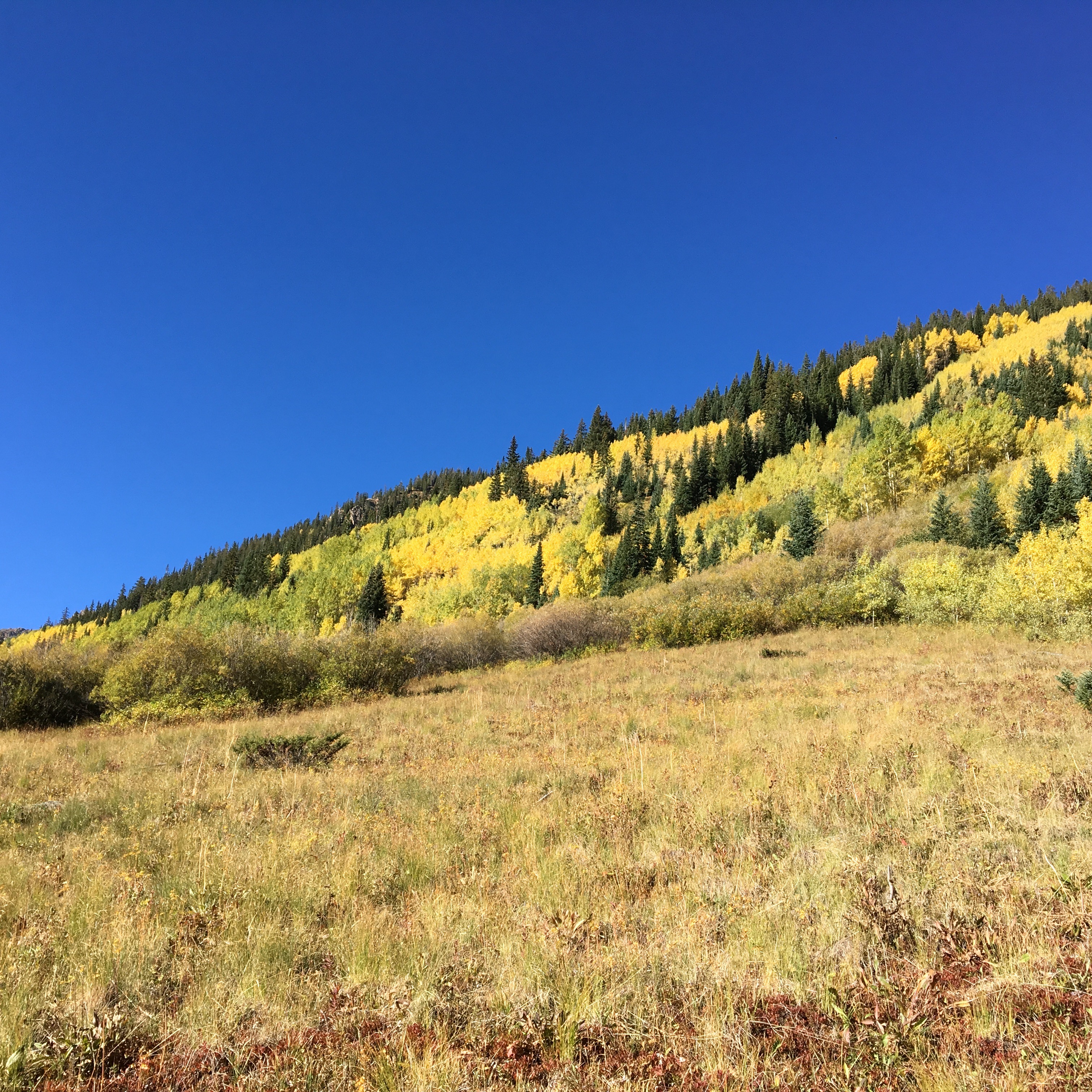
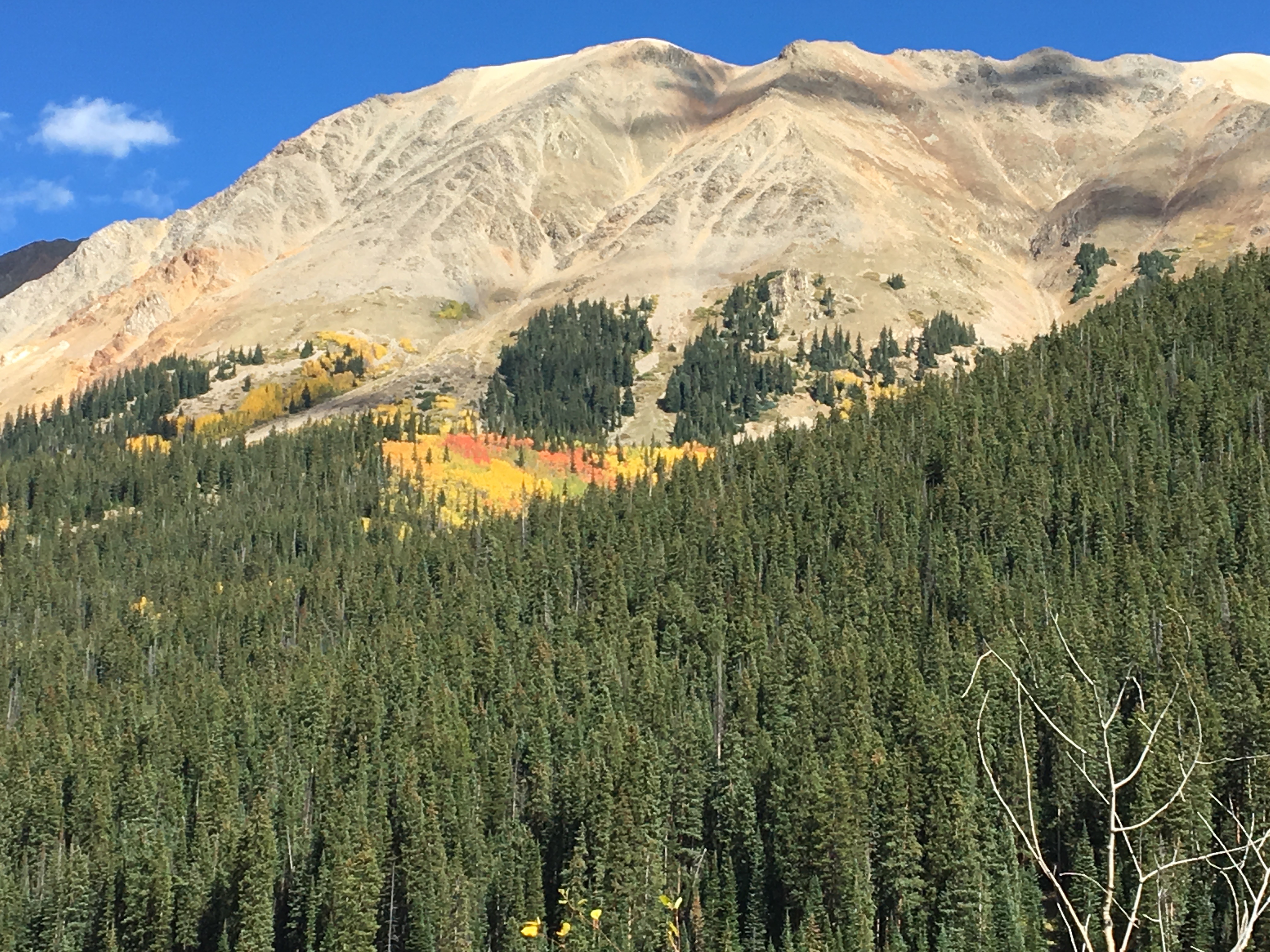
The town itself is surrounded by mountains still snow packed in the early part of June. Perhaps this residual snow at the highest peaks in the area is the reason this entire area would be less crowded than I had feared, and less crowded than it gets in July and August.

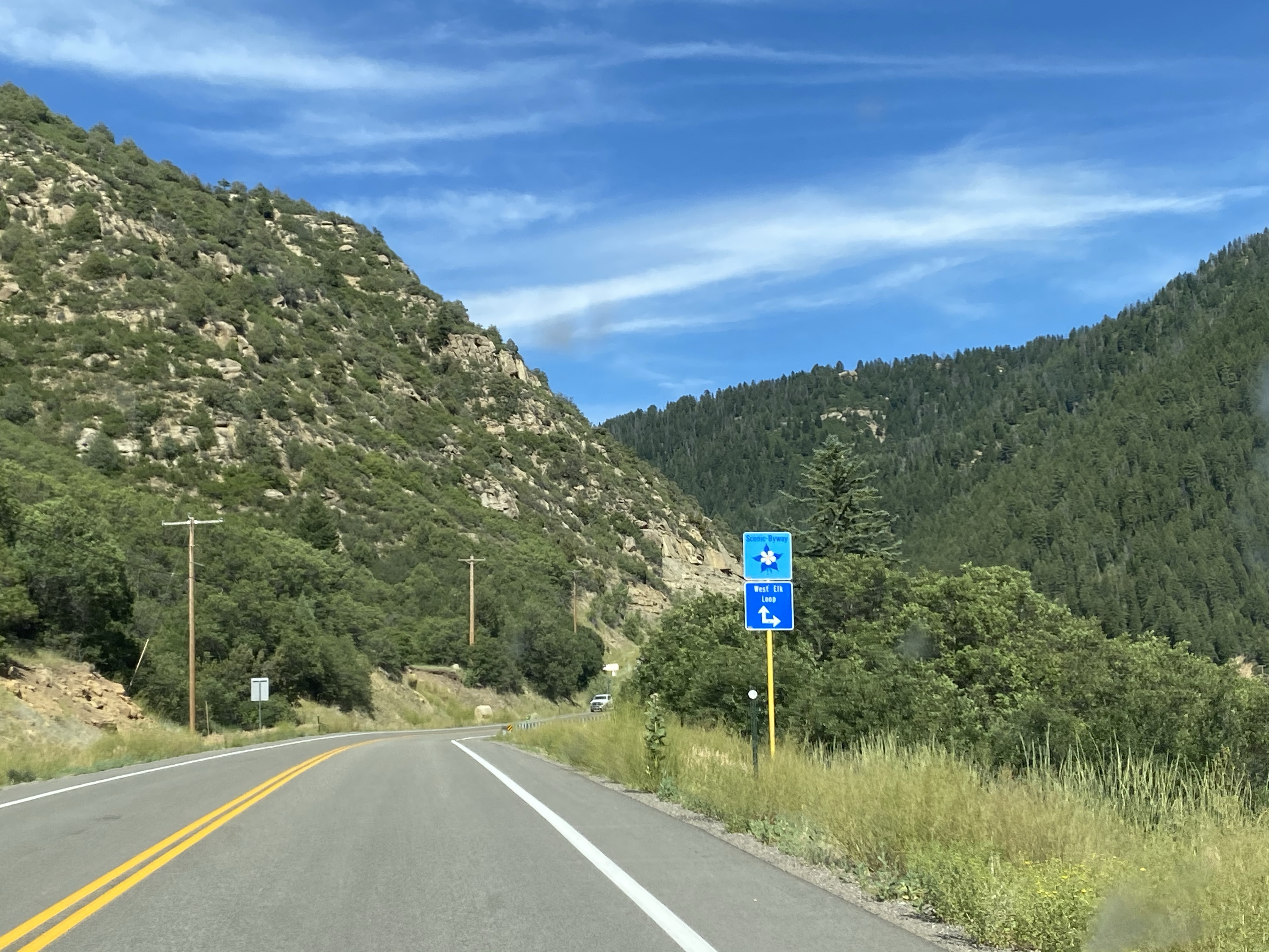
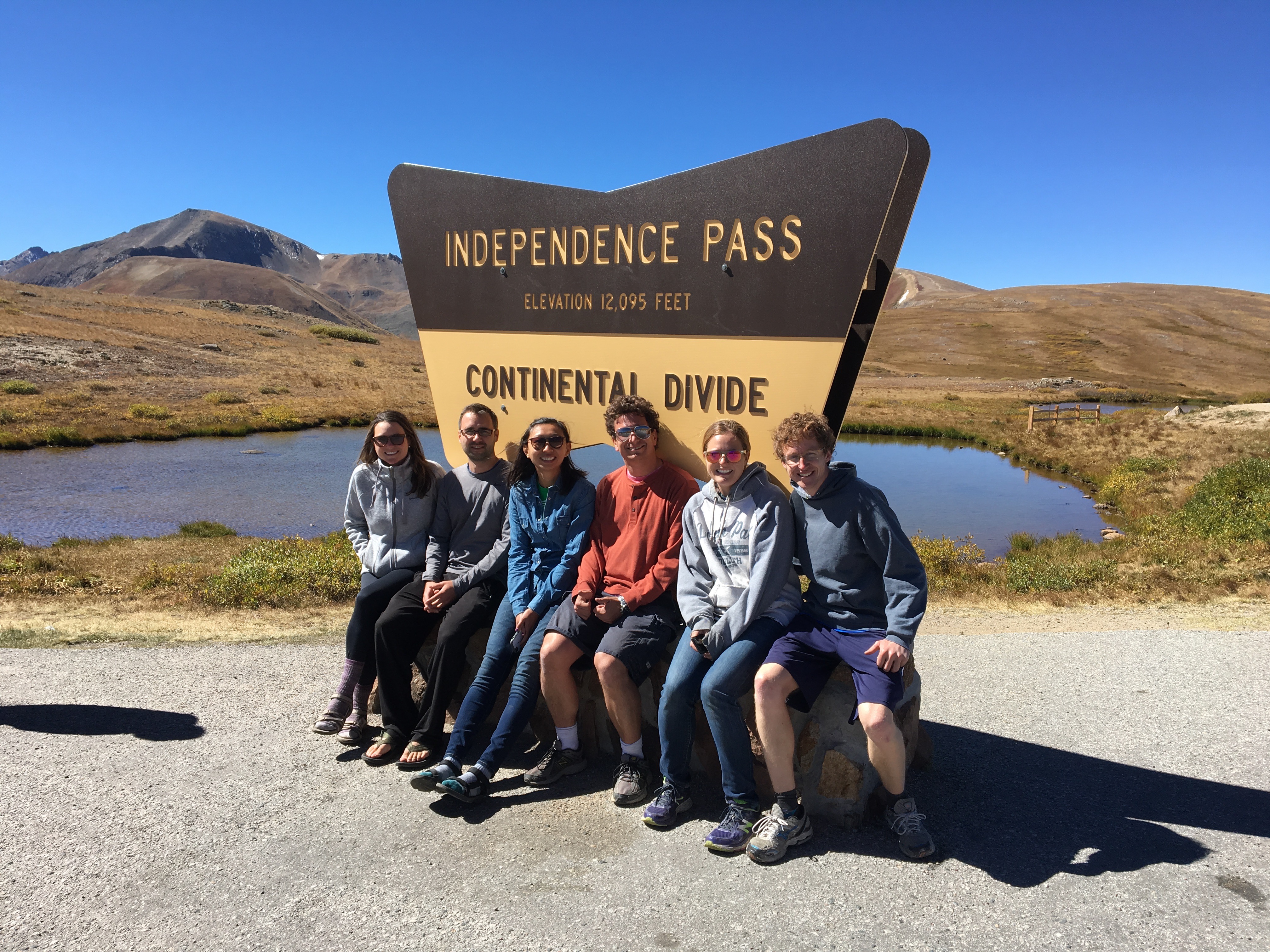
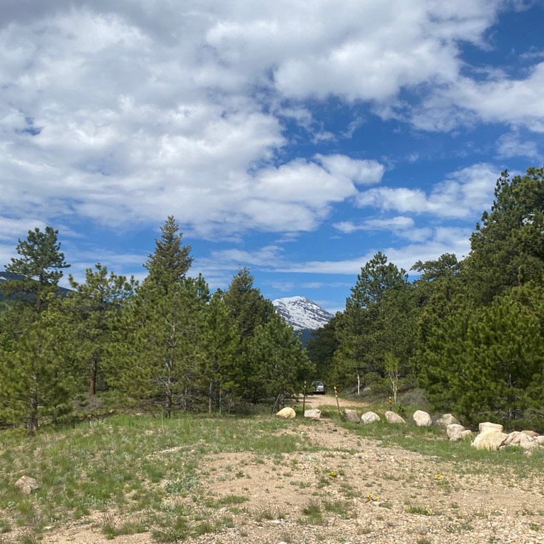
The first 8 miles of this 60 mile ride climb about 1700 feet (520 m), skirting by the Eastern and Southeastern edges of Rocky Mountain National Park.

There are even a couple entrance points to the park along the highway!

I liked the initial climb as a way to acclimate myself to the challenging ride and pace myself properly.

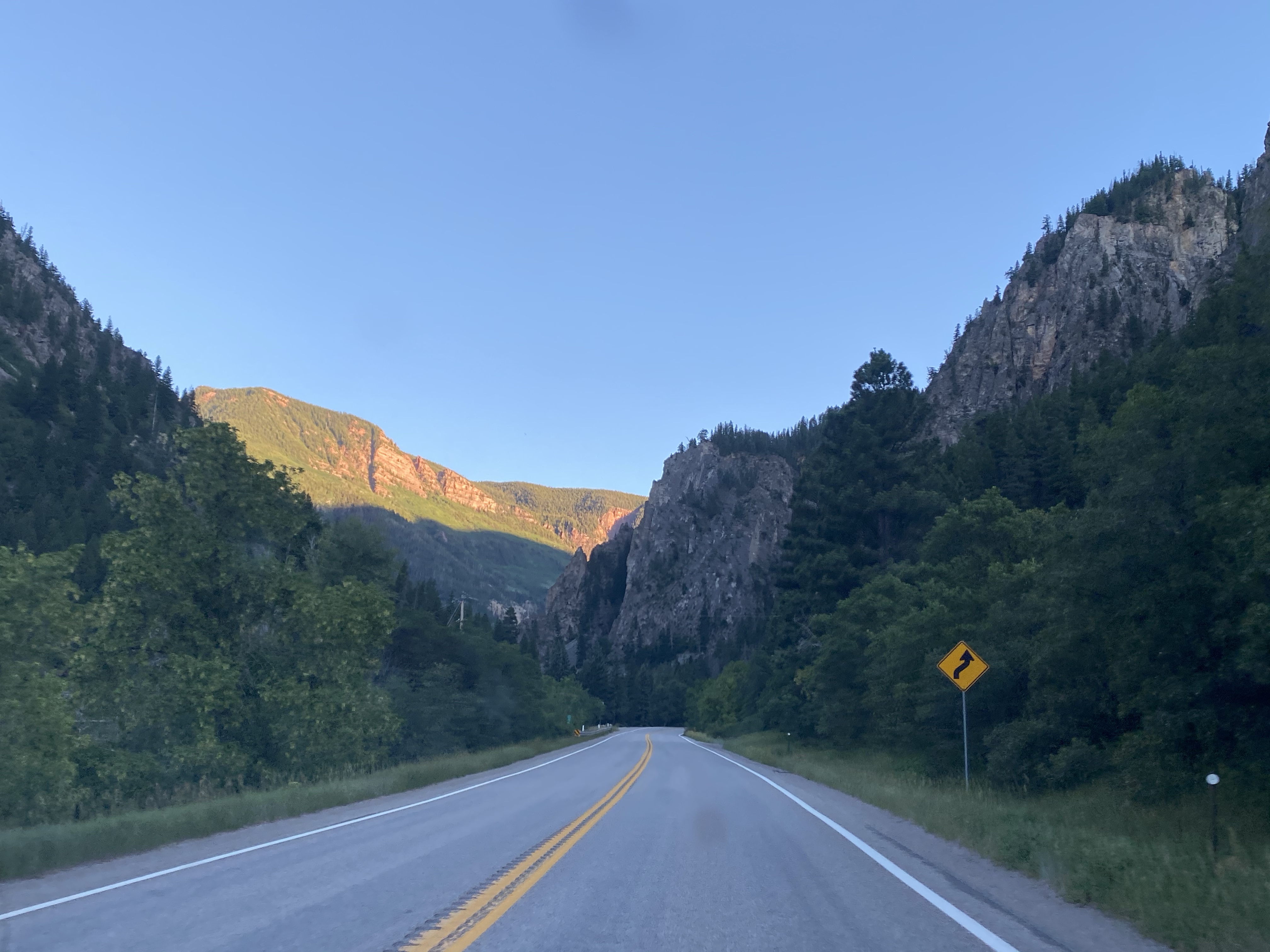
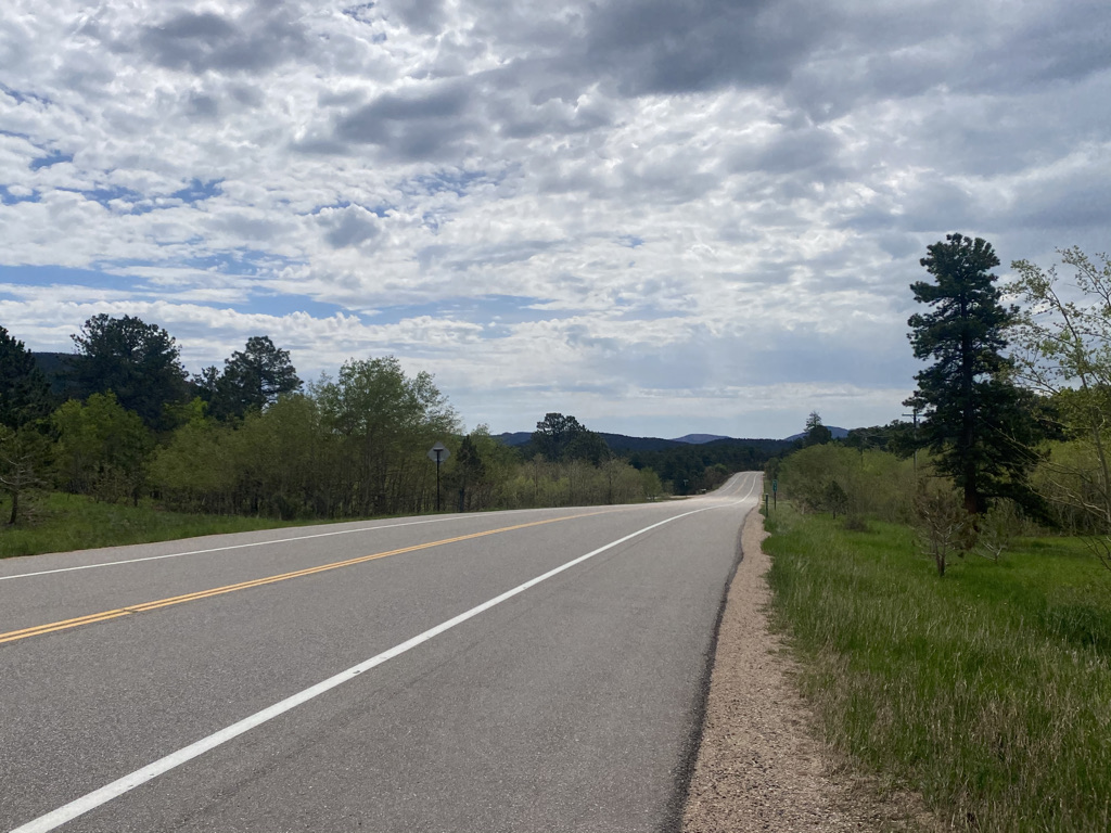
The ride as a whole does not have any flat sections. Some climbs and descents are long and others are short, but it’s always either up or down hill. The next part was mostly downhill, rolling through Allenspark and by one of the fastest sections of the highway (where I’d hit my top speed).

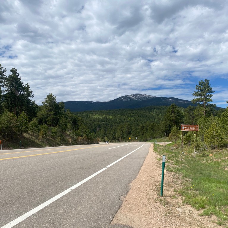
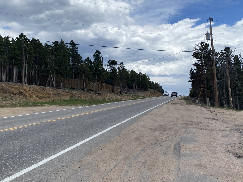
One of the things that makes this ride so close to perfect is the bicycle accommodations. With the exception of the first 8 mile climb out of Estes Park and another section of about 5 miles after Nederland, most of the highway has a shoulder so wide cyclists do not need to worry too much about interacting with traffic.

It is almost impossible to overstate how much this added to my enjoyment of this ride.

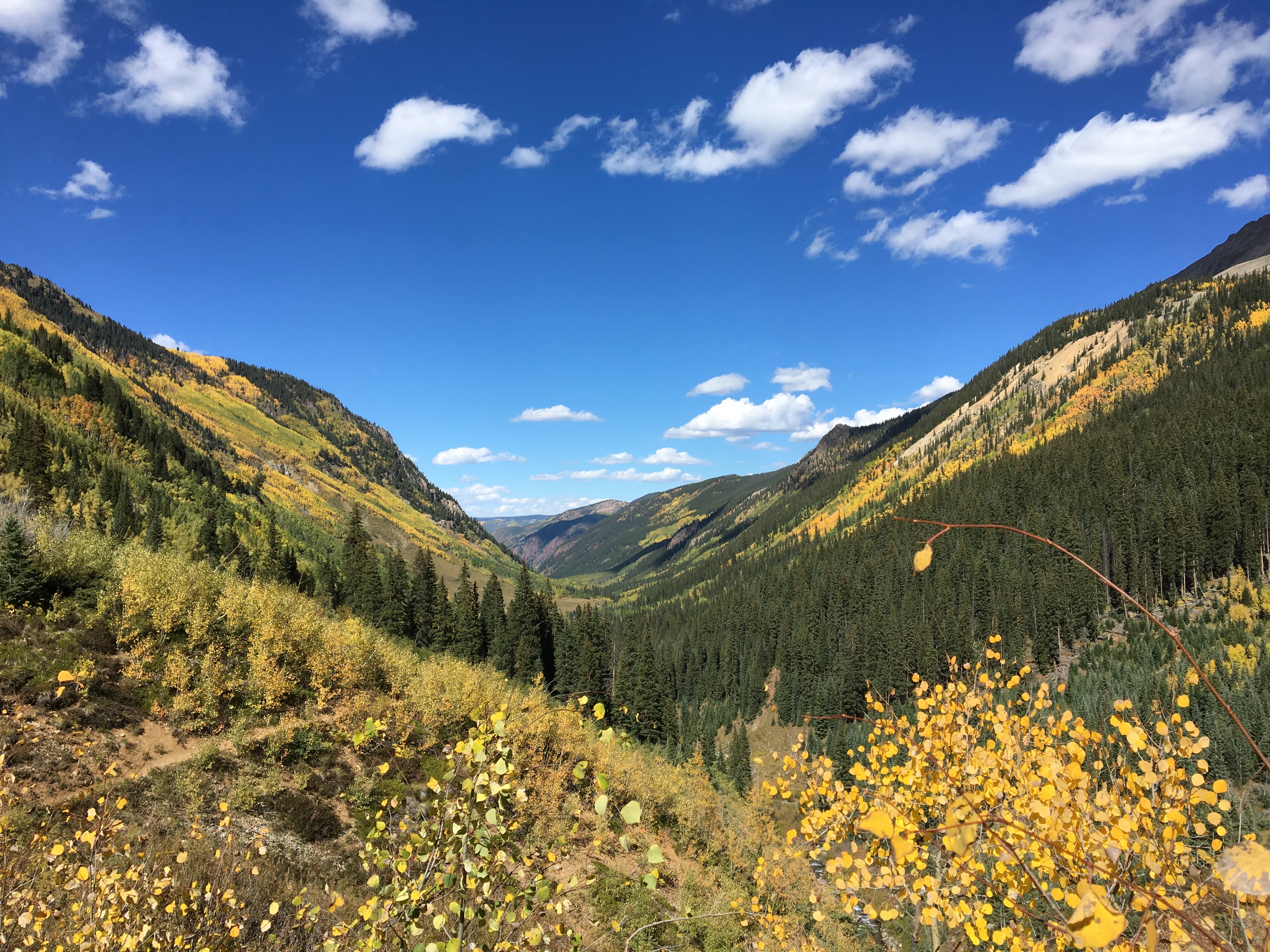
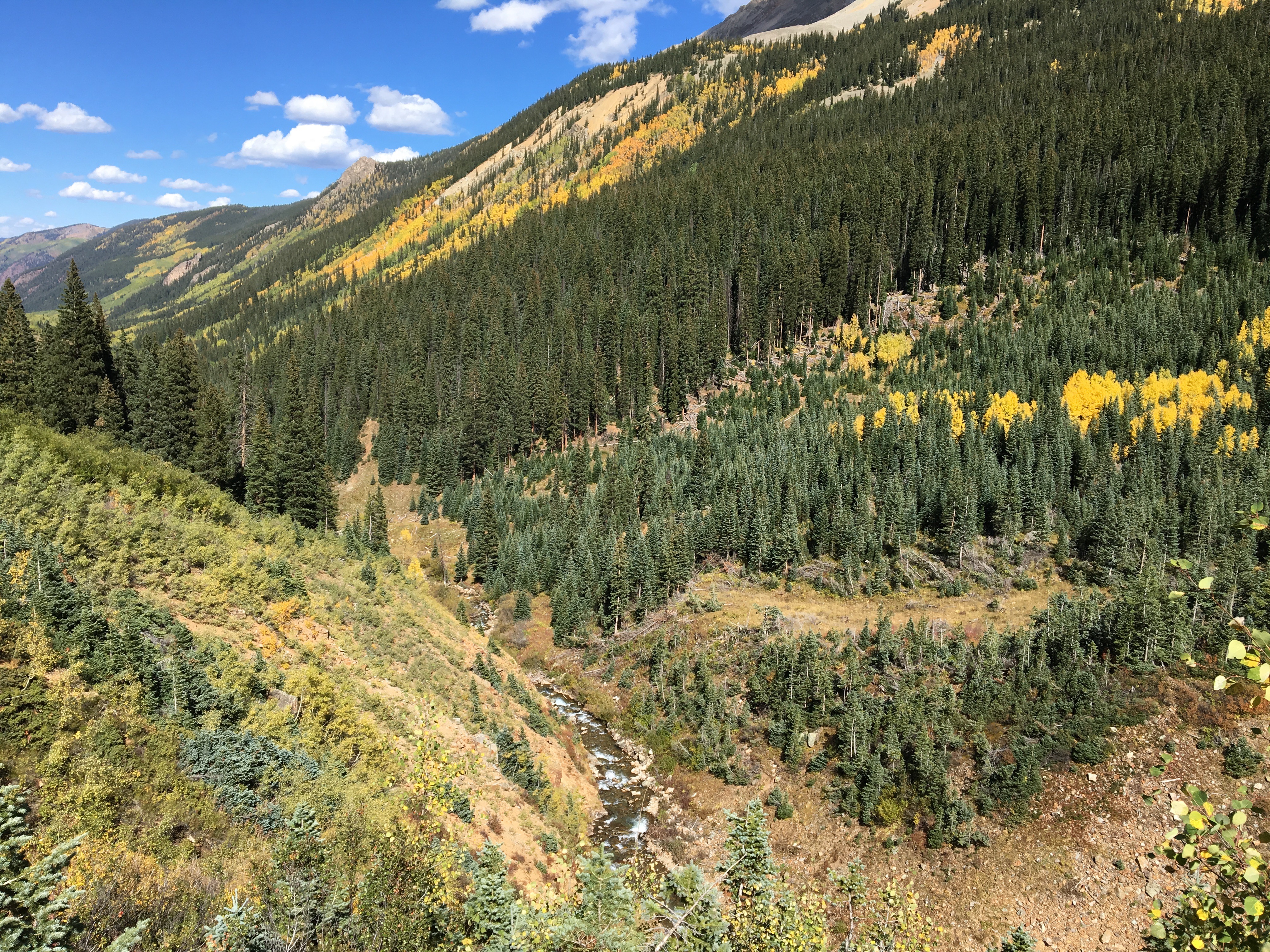
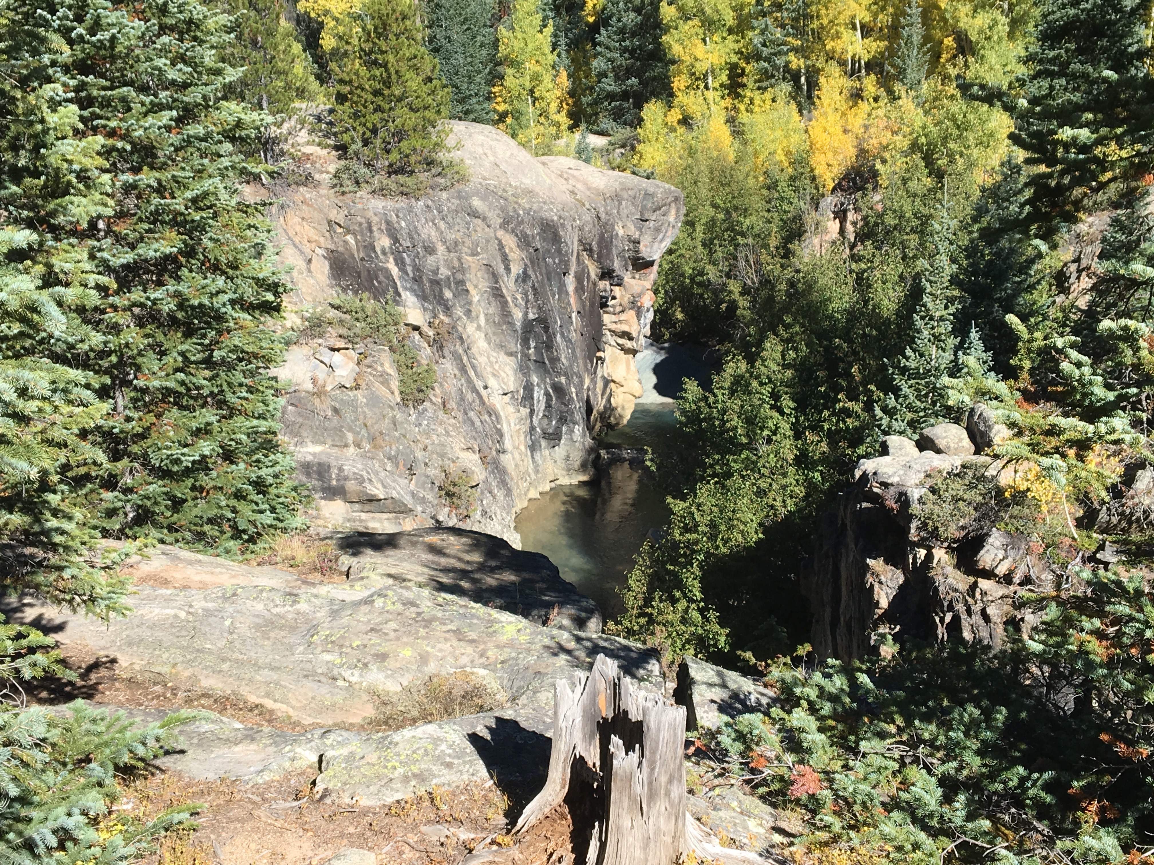
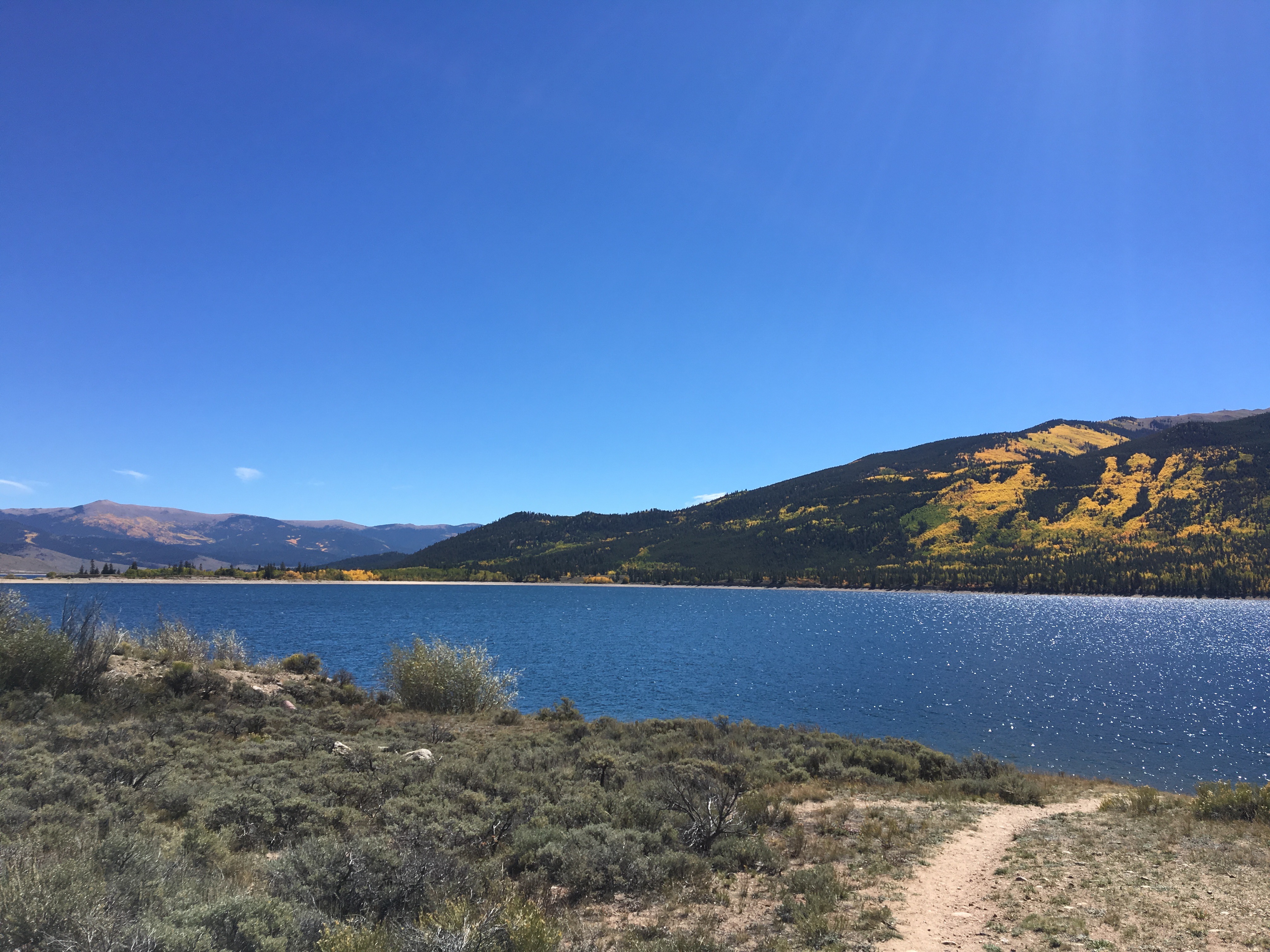
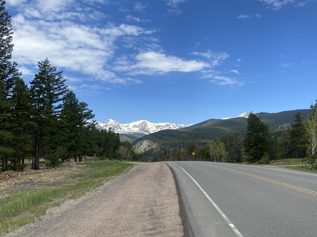
The entire ride is scenic in all directions. However, there are times when it is important to take a look back. The ride can be completed in either direction, from Estes to Blackhawk as I did or from Blackhawk to Estes. I decided to ride southbound, from Estes Park to Blackhawk to avoid afternoon crowds in Estes.

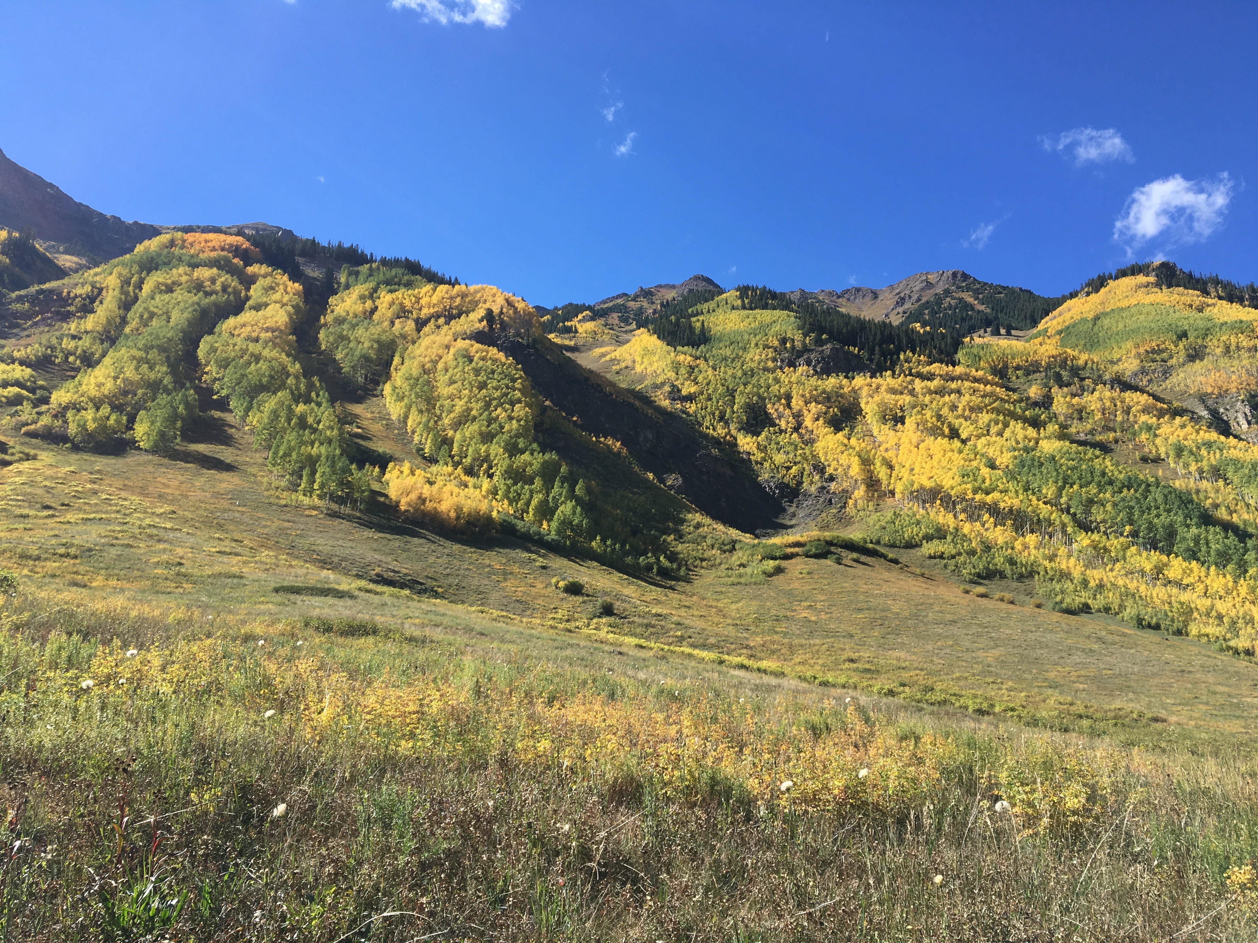
However, taking the ride in this direction did cause me to almost miss out on what turned out to be the best scenic overlook of the ride. Luckily, I stopped at the top of one of the many hills on the ride, this one about 20 miles in.

And decided to look back in the other direction, where those traveling in the northbound direction would be starting their approach towards Estes Park.

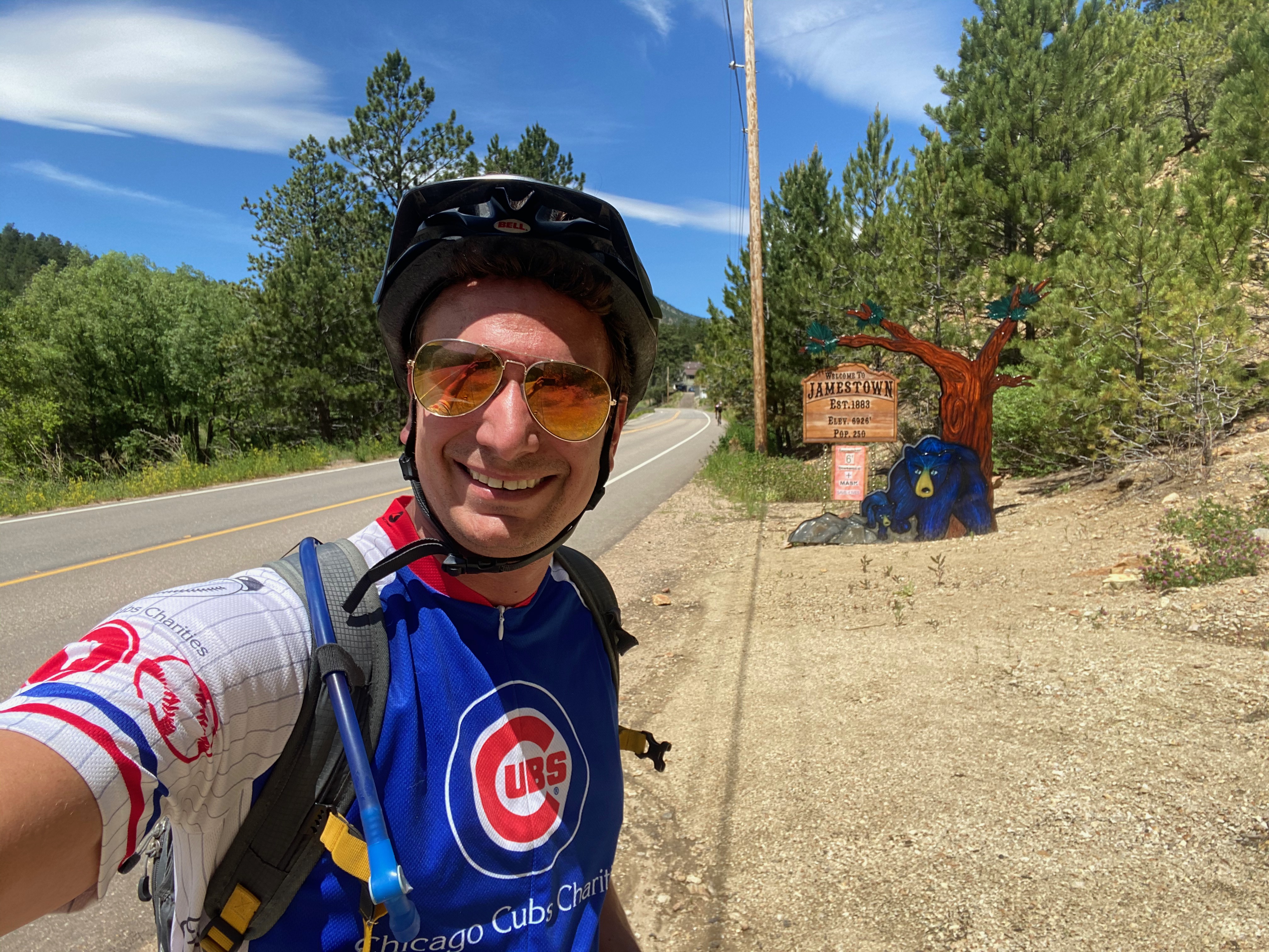
About 10 miles later and after another big hill climb, I would arrive at a tiny town called Ward.

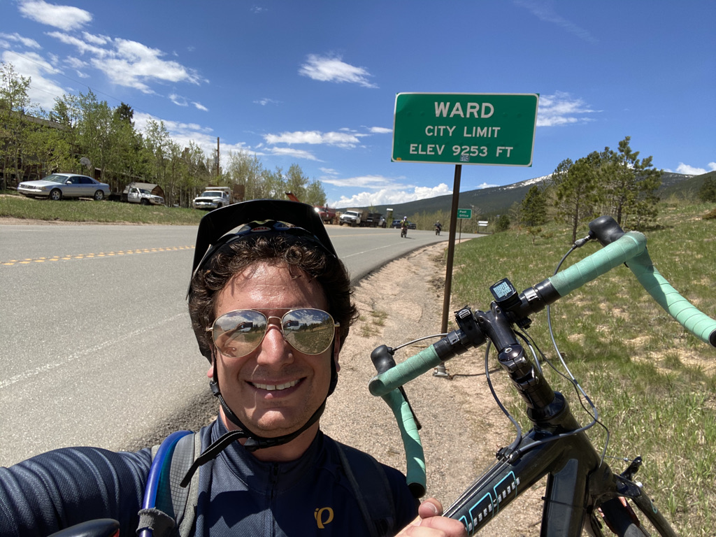
It reminded me of a phrase I used to hear about smaller towns on road trips growing up, “You blink and you’ll miss it.” I remember sometimes being intrigued enough by such towns that I would follow along on the map and anticipate looking out the window at towns like these to avoid missing out on the momentary opportunity to see them. When traveling by bicycle, there is no danger of missing towns because I was reading, looking at my phone, or drifting off in thought.

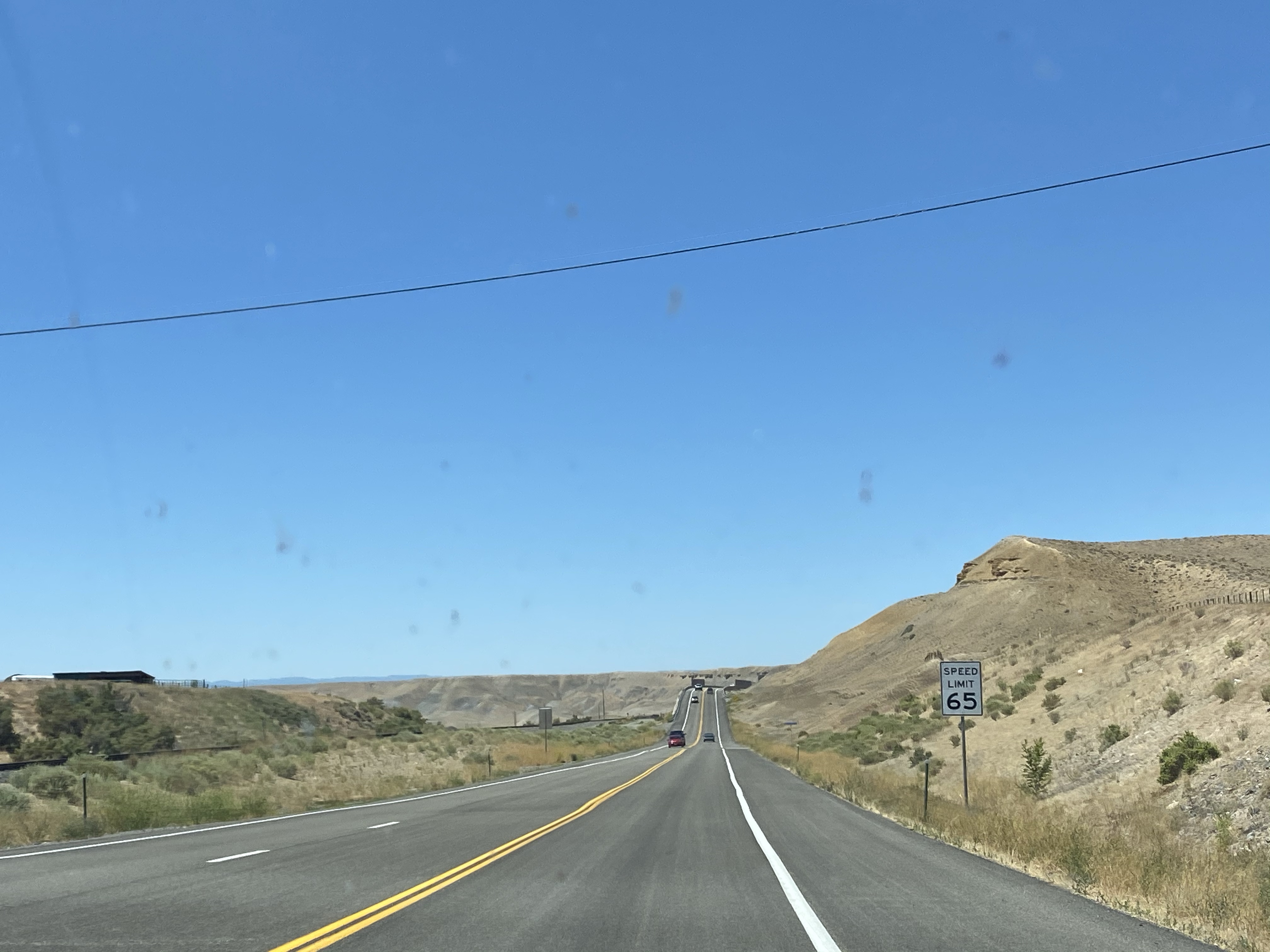
The next ten miles would be a series of rapid descents into the town of Nederland.

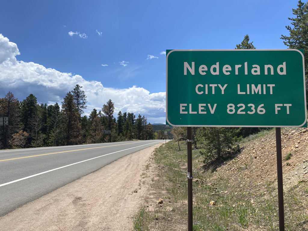
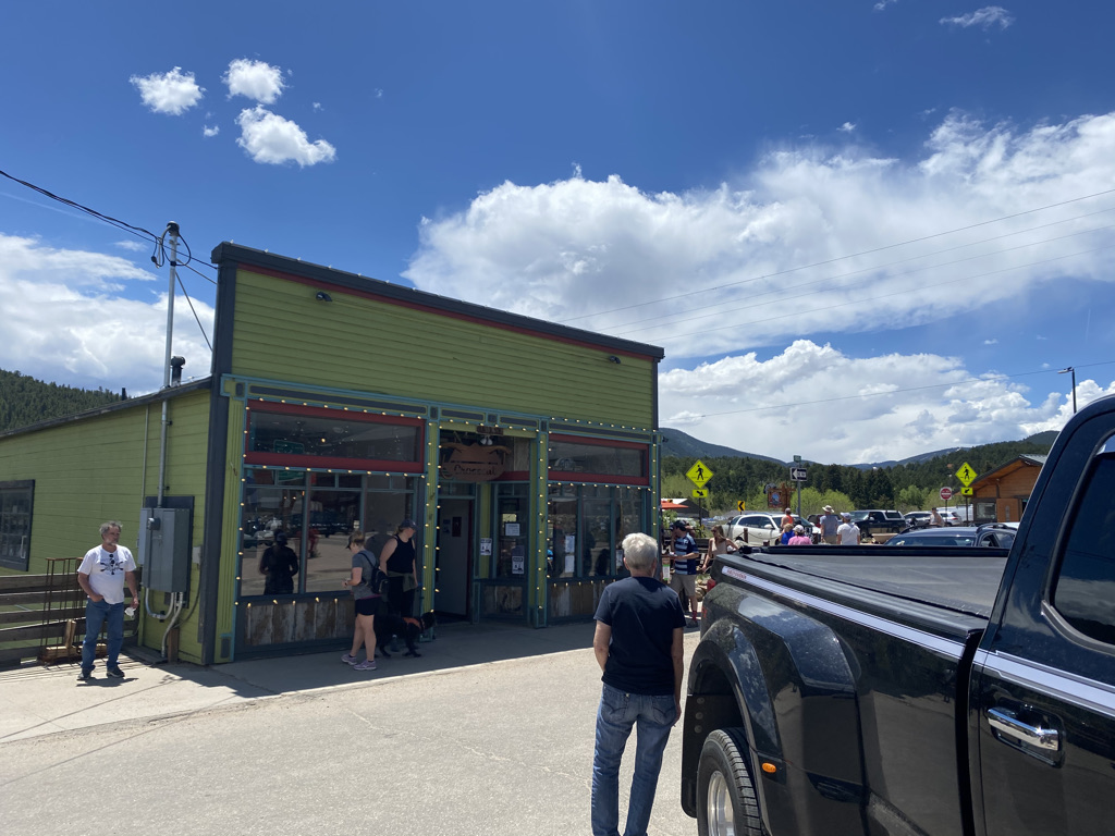
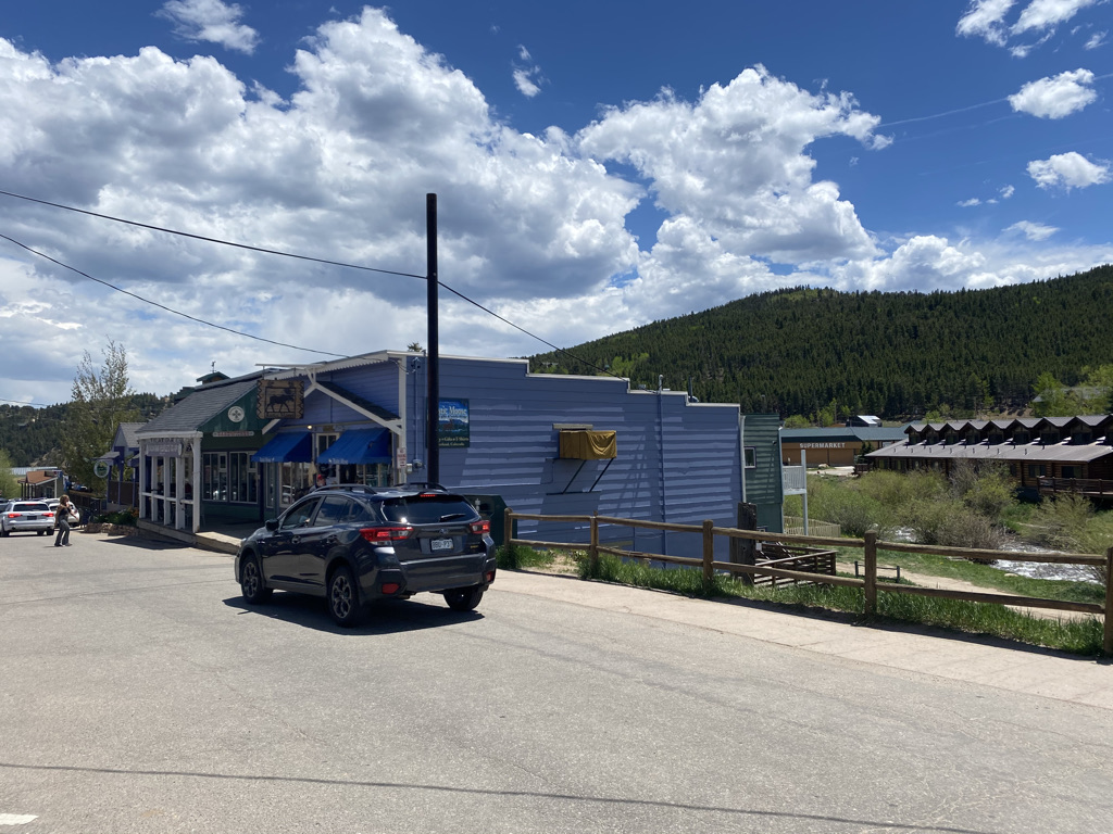
Having been to Nederland before, I expected to find crowds. There were people out and about, but perhaps because some of the trails were not yet opened up due to snowpack, it was significantly less crowded than I had expected. One other advantage to riding this highway from North to South is that I arrived in Nederland, the best place to take a break for lunch, a little bit after noon with 2/3 of the ride behind me.

Then would come the next most challenging climb (after the first 8 miles) and the only other section of road without a shoulder.

The open road returned alongside a series of hill climbs interrupted by short descents.

Throughout the ride I was hardly thinking of anything else besides what was in front of me. It reminded me of the state of flow so many people have been talking about during these somewhat psychologically challenging times. Most people enter this state of flow when they understand the task at hand, are sufficiently challenged, have sufficient autonomy and avoid distractions. Flow is said to accelerate both progress and satisfaction and the quest to reach the state of flow is an important component in many coaching services.

There I was, rolling up more hills until I finally reached the top of my final ascent.

Before I knew it I was flying down the final five miles into Blackhawk completing the ride.

After everything annoying about the past year or so, I have been working hard to clear as much negativity from my mind as possible. Apparently, I am not alone, as studies show 80 percent of all thought are negative. Even on a couple of my more recent bike rides, I struggled to avoid negative thoughts. I found my mind drifting towards conflicts with people, frustrations with recent events and the state of the world and such. It amazed me that on this day none of these thoughts entered my mind. I was present. I did not even come out of this ride with some sort of lesson. Those realizations would come days later. Maybe this turned into some kind of five hour long meditation session in nature. Either way I wish to have more experiences like this one.

Northern Arizona 1000 Years Ago

When we think about remnants of ancient civilizations, we often think of places like Egypt, Greece or Italy. Athens, Cairo and Rome are certainly places people visit for the primary purpose of observing and learning about history. However, one thing I learned about travel, generally speaking, is that history is all around us. Evidence of historical events, both the human and natural kind, can be found almost everywhere, and sometimes in some unexpected places.

Wupatki National Monument sits about 30 miles north of Flagstaff and is easily accessible via U.S. highway 89. Those traveling through the area can visit the remnants of several abandoned pueblos, as well as sunset crater, the site of a volcanic eruption, on a convenient 36 mile scenic drive.

In the 11th, 12th and early 13th centuries, the region around the present day four corners was home to one of the most advanced civilizations in North America north of the Aztec Empire.

They had houses large and small.

They even had buildings that would serve the equivalent function to the larger buildings we have in urban areas today.

Recent evidence indicates that the population of the continent before Columbus’s arrival was likely much higher than we had originally thought. Before the pueblos were abandoned and subject to 700 years of weathering, these building were certainly more densely packed together than they appear today. Archeologists and historians are still debating why the settlements here and in other nearby places were just abandoned. It is likely that a combination of drought and over-hunting made the region no longer ideal for civilization at the time. Looking out upon them and imagining this past, it becomes possible to speculate about people’s lives at the time.

Some things were certainly different from our lives today. For example, they did not have the means to travel long distances, as horses would be introduced by the Spanish centuries later. So, there were few journeys or adventures. However, based on human nature, there was certainly the friendships, conflicts, drama, power struggles, rivalries, parties, shared experiences and accomplishments that go along with life in towns and cities.

There were definitely events, one of which is evidenced by Sunset Crater Volcano National Monument on the same scenic drive

Evidence points to this volcano erupting in the later half of the 11th century. The eruption was seen by Anasazi and Sinagua inhabitants of the region. They probably talked about it for years, possibly even the entire two-ish centuries between the eruption and their mysterious departure from the region.

The volcanic eruptions changed the landscape of the area in ways that can still be seen today. Slopes in the area still appear black from the ash that followed the eruption.

Scientists can identify the minerals deposited on the rocks in the area.

These minerals likely altered the manner in which the Anasazi and Sinagua people farmed the area when they lived in these pueblos.

I began to wonder what other records, knowledge and traditions were lost when these civilizations collapsed. Could they have had scientific knowledge that we will never benefit from? Did they have philosophical ideas worthy of our consideration? Is there a history we could be learning from?

Sometimes it feels like we fail to consider the history of a place before “our” involvement- before we arrived. What event constitutes “our” arrival is open to debate. Regardless, “our” involvement in the North American continent spans between 150 and just over 500 years out of a history that goes back at least 13,000. What happened on this continent before Columbus arrived certainly impacts our lives today.

Even if we talk about the course of events on the scale of our individual lives, the same bias often surfaces. We’ll move to a city and learn what highways jam up at what hours of the day, what restaurants to go to, etc. But, what about the city a few decades ago? There is often a reason, based on the migration of people, why the best Italian restaurants are in one neighborhood and the best Chinese ones are in another.

As I took a deep breath and gazed out into the open sky I thought about a phenomenon I had first thought of nearly 20 years ago. Right now, there is something happening, in another town, involving people I do not know yet, that will have a significant impact on my life. The same can be said for anyone else, including anyone reading this entry.

The Best of Southeast Utah

Monument Valley from 2 miles south

Monument Valley is the quintessential image associated with The American West. Perhaps because of how frequently it has appeared in films, particularly westerns, it is quite difficult to look at this grouping of red rock formations without imagining cowboys riding horses across the landscape.

Despite the fact that the natural processes associated with its formation are culturally agnostic, and the fact that the monument sits on the Navajo Indian Reservation, these rocks have become forever associated with the culture of the American West. The fact that the first music video that pops into my head when I think of Monument Valley is by a German Band, the Scorpions, does not even seem to temper that association. Every American hard rock song feels like it fits in perfectly with this landscape.

Speaking of the landscape, Monument Valley is one of those places with a command of the landscape for miles away. Particularly approaching from the north (or northeast as that is where the highways are), it can be seen from some 50 miles away.

The interesting thing about Monument Valley is how different it can appear on either side of the monument. In the afternoon, the north (northeast) side has a much different appearance than the view from the south, which represents the standard iconic view of the feature, with the sun shining on it.

How this specific iconic set of rocks became associate with 19th century American pioneers on horseback, and the enduring culture and ethos of the Interior American West is probably a challenging question to answer. Yet, it is most certainly the repetition of this association throughout culture and media that makes people living some half a century or more after all of these films were produced continue to feel a certain feeling when they gaze upon this monument. It is hard to imagine a better example of how repetition creates and perpetuates and association than this one. I am truly curious about what the Navajo Nation thinks of it.

The strange thing is that this association has lead me to think of gold prospectors, cowboys on horseback, shootouts and such at other places with a similar feel. Like most naturally occurring features, Monument Valley is not the only place where the natural processes that created these features occured.

The rock formations about 160 miles to the Northeast, outside of Moab, Utah, take on a very similar feel. It almost feels as if any movie or music video filmed at Monument Valley could have just as easily been filmed here to the same effect.

It would be a huge missed opportunity to visit Monument Valley without also visiting Goosenecks State Park, only about 30 miles away.

This is another spot that is photographed quite frequently. Unlike Monument Valley, it seems to have a stronger association with that which is current about the American West; tourism, outdoor adventures, and, of course, the search for the perfect instagram photo.

Visitors to the park can also see Monument Valley from a distance.

I had previously visited Arches National Park, traveling to the most iconic of the arches.

On that trip, I had failed to realize that just a half an hour south on highway 191, it is possible to see one of these arches without ever leaving the highway.

Like any other place in the West, Southeast Utah has places that are underrated, not trying to be noticed.

And places trying to get people to stop that don’t make much sense.

It’s unique natural features connect the past to the present, activate the imagination and provide experiences that are indicative of Western North America as a whole, yet unique to the specific location.

Lessons Relearned on The West Elk Loop

It is quite easy to drive around the State of Colorado without even noticing the numerous scenic byways throughout the State. The signs are kind of easy to ignore. How certain roads get labelled scenic byways is somewhat of a mystery. There are plenty of extremely scenic places that are not designated a “scenic byway”, while there are some ares on the Plains, like highway 50 from Lamar to La Junta which are frankly not that scenic.

CO_Scenic_Byways

I’ve never made a point to follow one of these routes. However, the weekend I camped in the Gunnison National Forest, I just happened to mostly follow the West Elk Loop.

The West Elk Loop is kind of a loop around the Gunnison National Forest, but there is also spur north along the Crystal River. This happens to be where my journey began.

We were not too far from Black Canyon of the Gunnison National Park. I had never gone too deep into the park, nor have I visited the North Rim. I wanted to go and hike the North Vista Trail to overlook the canyon. Unfortunately, like most National Parks, Black Canyon of the Gunnison is not very dog friendly.

But that wasn’t enough to deter me. I thought it would be possible to hike up to an overlook of the canyon from outside the park. The drive was two hours, through an area that would eventually become a hot desert.

I figured there would be someone in the tiny town of Paonia that could help me figure out a way to overlook the canyon with a dog.


All I heard was a story about a dog that was left at the bottom of the canyon four years ago, who, luckily was able to eventually find a home.

The road I had identified to hopefully find an overlook of the canyon was hot and way too bumpy for my car.

We eventually got to a place where we could overlook part of the canyon.

But it hardly felt worth it. The round about drive took up nearly the entire day, and defeated one of the key purposes of this trip- to escape the heat.

IMG_0996

The next day, we’d visit a much less well known part of the West Elk Loop, along a county road that connects Paonia State Park to Crested Butte, that happens to be closed in the winter.

The drive was beautiful from the very beginning. It was quiet and the road was nowhere near as bumpy I had feared based on the previous day’s drive and that little dashed line on the map.

Instead, it lead us to one of the most beautiful hikes we had ever been on, in the Lost Lake area.

The first place we encountered along the hike was Lost Lake, a picture perfect lake with mountains in the backdrop.

When I see this place, it feels like where I would want to have a little cabin in the woods. Having just driven down into 100 degree heat on a wild goose chase the day before, I was suddenly thinking a lot about weather and climate. Although I was escaping the heat this particular mid-July weekend, I still wondered how often people get to really enjoy the lakes that are this high in elevation (closer to 10000 ft.). How often is it really warm enough? Maybe, if I were to get a lake house, I’d actually want to be a little bit lower, at an elevation more like 7000 ft., where there are more warm days to enjoy it.

We continued on to Beckwith Pass, which was actually not too much of a climb. However, even at this elevation, it felt hot! The scene got more amazing as we followed the trail.

We could see the West Elk Mountains.

The Maroon Bells.

And, Mount Crested Butte.

The least well known part of the West Elk Loop turned out to be the most magnificent!

I could not believe I had wasted an entire day looking for this elusive trail to overlook the Black Canyon. I could not believe that I had fallen for the trap that so many fall for, being relentless about going to the most high profile destination despite all the other obstacle, including the National Park’s dog policy, and the relatively low elevations in the middle of a heat wave!

The strange thing is that this is a lesson I had already learned. Despite living in Denver, I rarely go to Rocky Mountain National Park, instead opting for the less busy areas around it that are often just as scenic. This Beckwith Pass hike was probably even better than the North Vista Trail would have been.

The lessons I (re)learned, on this hot July weekend in the mountains are

  • Don’t get too hung up on the most obvious, high profile things in life
  • Be curious, open minded and keep exploring
  • Work with what is in front of me

Imagine

IMG_0767

Imagine a place where empty beautiful highways wind through the mountains populated by more bicycles than cars. A place where the world moves at a pace that allows for the soaking in of the full experience of all of nature’s sights, sounds and smells. The highway curves over rolling hills and through canyons revealing something new around each bend.

IMG_0769

Never pressured, never stressed, filled with nothing but awe, inspiration and true intrinsic motivation, content individuals power their way up manageable slopes. They travel in a manner that is both true to themselves, each as unique individuals, as well as in coordination with the communities, both human and animal, surrounding them.

There is a destination, but the destination does not overshadow the journey.

IMG_0771

It is not a place so big, overshadowing and boastful that it leads to unrelenting anticipation among those who are in the process of getting there. It does not produce anxiety and shame among those whose progress does not meet some arbitrarily set standard. Rather, it is humble, blending in with the journey, one among many surprises that pop out around each and every curve along the highway.

IMG_0773

It is a place where everyone is exactly where they are supposed to be at that moment in time. Nobody has been made to feel insecure or fearful. It is a place that exists in real life but it is so much more than that.

For as much as this is a real place, it is also a place that exists within each of our minds.

IMG_0774

Most of what restricts us exists only within our own minds based on what we have seen, heard or been told. Within each and every one of us is a place where life is very much like this journey. We are all free to move at our own pace, without judgement. Life’s twists and turns reveal nothing but beautiful surprises. Authenticity and community can be found in everyone we encounter. The sky shines bright and we all shine bright as well. The source of life, embodied by flowing water, but actually originating from all the positive thoughts in our heads is never too far away.

The world has been twisted and rearranged in some crazy ways both by recent events and longer-term trends.

IMG_0756

Out of the wreckage something beautiful can be built, if nowhere else but in our imaginations. The time has come for all of us to create our own narratives. Mine is on a bicycle in the fullness of the wide open outdoors.

The Great Ocean Road Day 3: Final Day

IMG_7118

The iconic 12 apostles is not the only intriguing coastal rock structure in the Port Campbell area. Continuing westward along the Great Ocean Road for the next several kilometers, spectacular oceanic limestone rock structures continue to appear.

First there’s The Arch, the only place I have ever seen a mini waterfall in an ocean.

IMG_7101

Then there is London Bridge. The name London Bridge was given to this structure back when it was attached to the mainland. In 2005, London Bridge literally fell down, due to waves and erosion.

IMG_7110

The South Ocean is quite turbulent. Everywhere along the Great Ocean Road, particularly in winter, there is a steady barrage of strong waves. There is a reason so many shipwrecks occurred here. As a result, this section of the coast is in a constant state of change. Watching the waves come onshore inundating the limestone rock, gradually eroding it and paving the way for the next structural change, is like watching science in action.

At the grotto, visitors can walk down to an arch-like structure where waves periodically crash in.

IMG_7115

Some of the larger waves can lead to mist on the other side of the arch.

After these structures, the Great Ocean Road once again ventures inland, transitioning to farmland.

IMG_7121.jpg

It would make sense that the Allansford Cheese World is in an area surrounded by farms, right near the end point of The Great Ocean Road.

IMG_7123.jpg

The Allansford Cheese World produces far more varieties of cheddar than I ever would have thought to be possible. I had always thought of cheddar as one of many types of cheese, which would include Swiss, Pepperjack, Havarti, etc. Visitors to the Allansford Cheese World can sample a dozen different types of cheddar, some of which are really innovative.

It was here I noticed myself slipping back into an American-like stand-offishness when it comes to dealing with people. For the entire trip, I felt Australians to be generally more friendly than Americans. In conversations with Australians, I did not experience the need for the conversation to provide some kind of value, or the assumption that everyone was in a rush to get to their next activity that is characteristic of many conversations I have with Americans. On my final day on the Great Ocean Road, as if trained by years of cultural experience I found myself starting to engage in conversation without being fully engaged, with the time and my next activity on my mind. I could not believe I was doing this.

Although the Great Ocean Road ends here, but most tourists continue on, at least to the town of Warrnambool, where visitors can supposedly see whales. A 30 minute visit to the pier, where one sign promised us “A Whale of a Time”, turned out to be a bust.

I guess there is a danger in trying to fit an activity like this, dependent on complicated natural forces and animal behavior, into any kind of schedule. However, I wanted to continue west, to the Tower Hill Nature preserve, a set of volcanic lakes where koalas often hang out. It would be a shame to visit Australia and not see at least one of those, and at this time of year daylight in Australia is limited.

IMG_7138.jpg

I made a major mistake here as well. Based on our life experiences, we often internalize assumptions and operate based on them without thinking. Being from Colorado, I have a base assumption that all “hikes” involve a climb, to some sort of peak or cool looking overlook.

After two such hikes, in hopes of seeing koalas, an employee at the visitor information center informed us that koalas need trees with moisture and would likely be found down by the lakes. This walk needed to be flat, not up a big hill.

For some reason, despite their actual demeanor, koalas feel like a picture of innocence. A small, furry, cuddly creature constantly hanging onto a tree and sleeping 20 hours per day. I actually wanted to pet them.

Port Fairy would be our final destination.

IMG_7165.jpg

We’d have one last adventure here, a short walk onto Griffiths Island.

IMG_7160

Where we would have one final wildlife encounter, fairly up close with the wallabies!

IMG_7164

A trip that many would consider “once in a lifetime” was coming to an end. I sat on a rock gazing out at the Ocean as the sun gradually faded behind me. It felt like a real life version of the fade outs often used at the end of movies and videos. Looking straight outward, I was amazed at how vast the Ocean is. I began to imagine what is on the other side, pondering more adventures. Uncertain as to the exact direction I was facing, I imagined multiple possibilities of what laid straight in front of me.

I imagined the jungles of Madagascar, with monkeys and other forms of wildlife roaming around in the trees and a lone explorer with a knife trying to trudge through the trees and mud.

I imagined the vast expansive ice sheets of Antarctica.

I imagined the far more nearby mountains of Tasmania, quiet for the winter season, but coming to life with young adult hikers and adventurers in the Springtime.

Despite the fact that my adventure would slowly be ending, the reflection of the orange light on the ocean surface felt like an invitation and promise of more to come.

IMG_7168.jpg

The Great Ocean Road Day 2: The Twelve Apostles

IMG_7049

Just like that the weather turned. A couple of hours after the sun went down After our first day on the Great Ocean Road, the wind started howling and the rain started falling. It was weird to be on top of a van while a storm was coming through. At first I was scared that the van would tip over, but I reminded myself of the amount of wind needed to actually do that, at least 85 miles per hour (135 km/hour). As much as I lament the amount of places in the world, particularly at work, where emotions are expected to ignored, it is still great to overcome an irrational fear with knowledge and logic.

I was surprised to awaken and find that I had slept in, until about 8:30 A.M. Given how early I had gone to sleep, due to the sun setting at 5:10 P.M., this meant that I had slept nearly 11 hours! While I had hoped to get an earlier start that day, I could not believe how refreshed I felt. Lately it feels like there are multiple competing theories about sleep, in particular related to whether or not lost sleep can be made up for. Based on my experiences, it feels like it can. The experience reminded me of coming home from college and immediately sleeping 12 hours at my parents house after stressing out about finals and final projects for weeks (as well as living in the dorms). After sleeping 11 hours, for the first time in what feels like years, I did not feel any sleepiness or need for caffeine!

No matter how much people plan, changes in weather create the need for some adjustments. The wind and rain made it feel not exactly pleasant outside. The beaches, as well as some of the walking trails, were empty that day. The town of Apollo Bay is bigger than Torquay and Lorne, and where the Great Ocean Walk, a 104 km trail that leads to the Twelve Apostles, begins.

IMG_7053

About 3 km West of Apollo Bay, is the first place along the Great Ocean Road, nearly halfway through the drive, deviates from the coastline.

Map of Great Ocean Road

Even here, the ocean is still always kind of in sight, but the inland traverse into the hills provides some variety in the scenery.

IMG_7055.jpg

It is this section of the coast, near Cape Otway, conditions felt at their windiest. Sort of like a peninsula jutting out into the Southern Ocean, the area is often referred to as “shipwreck coast”. 19th Century historical events here include a number of documented shipwrecks, but also the construction of the Cape Otway Lighthouse, Australia’s oldest. This lighthouse established the first connection between mainland Australia and the island of Tasmania, via both shipping routes and telegraph messages.

In the afternoon the rain stopped, but the wind continued to howl. The sun even gradually started to return. However, the cold wind straight off the coast would still make it a less than pleasant day for any kind of long walks or hikes. It ended up, however, becoming the perfect conditions for a once in a lifetime experience. A helicopter ride over one of Australia’s most iconic destinations; The Twelve Apostles.

IMG_7071

At AUS $145 ($110 US) per person, the cost of this epic journey is quite reasonable! The ride itself lasts about 15 minutes, and quickly soars over some iconic images, including The Great Ocean Road.

IMG_7072

Of course, the Twelve Apostles.

IMG_7082

And, many of the similar limestone structures further West.

While the helicopter ride provided an arial view of these beautiful oceanside structures, the Gibson Steps, located just a couple of kilometers to the East of the Twelve Apostles, provides a view at beach level.

IMG_7087.jpg

The Gibson Steps are exactly what one would expect, a staircase that leads down from the overlooking cliffs to the beach. Walking down and up the steps requires being outside for only about 10 minutes, so the less than pleasant weather was not too much of a factor.

IMG_7089.jpg

We camped that evening in Port Campbell, a town of barely 600 permanent full time residents with a beautiful beachfront. In the summer, this place is a lot more crowded. In the winter, it was quite empty.

This was the evening that having traveled to the Southern Hemisphere in June messed with my mind the most. Port Campbell in winter has a clasic quiet small town feel. The Main Street bar with a faded neon light outside it. The three block stretch of lit roads surrounded by darkness in all directions. The quiet street with a few people walking around but most inside the restaurants or their own homes.

We are accustomed to the relatively gradual changes in daylight patterns as the seasons progress. Even in periods like April and October, the amount of daylight, at most changes by a couple of minutes each day. Having experienced the daylight expansion in the Northern Hemisphere from April to June, I’d inured to sunset being sometime around 8 P.M. and complete darkness onsetting closer to 9. Being in complete darkness in a quiet small town made 6:30 P.M. feel almost like 10. Without seeing too many people out and about, it is easy to feel like we had arrived at everyone’s bad time.


The Great Ocean Road Day 1: Great Otway National Park

IMG_7011

The Great Ocean Road is an iconic drive along the south coast of Australia. Accessing the road is relatively easy. It starts about an hour west of Melbourne. For travelers, especially international ones, I’d recommend a stop at the travel information center along highway 1 just outside of Geelong. The people there were quite friendly. They provided plenty of maps and other information about attractions, which ended up being quite useful. They told me that many visitors try to do the entire drive all in one day, particularly in summer. However, with so much to do here, I am glad we chose a three day excursion in a camper van.

Our first spotting of the ocean shore in the distance, occurred less than 2km after we passed a sign welcoming us to the Great Ocean Road. A lot of travel involves a destination that is one specific location; a museum, campground, event or city. In these cases, it is easy to know when you have “arrived” at your destination. On trips like this one, the lines can be blurred. Seeing the ocean after passing this sign gave us a clearer indication that we were now at our intended destination- The Great Ocean Road.

IMG_7010.jpg

A bit further West, after having already hugged the coastline for about 20 km, an even fancier welcome awaits motorists just before entering one of the larger towns along the road, Lorne.

IMG_7017.jpg

Passing under this arch felt reminiscent of cycling under the original gateway into Yellowstone National Park, several summers ago.

The eastern half of this scenic drive passes in and out of coastal towns like Lorne and Torquay, which are primarily known for their surfing.

It also jets in and out of Great Otway National Park, a pretty dense feeling forest with plethora of utterly amazing waterfalls. Visiting all the waterfalls in this park would likely take several days, so it’s probably good to just pick a few specific ones to visit.

IMG_7022.jpg

As is the case with most of the other waterfalls in the park, getting to Erskine Falls required venturing a bit off the Great Ocean Road. The trailhead is about 10 km off the road in Lorne, and the walk was about 1.5 km round trip.

Despite the raw power of a this waterfall, the place felt quite tranquil. The trees calm the air while also creating a feeling of seclusion. Below the falls, the water seemed oddly calm despite having just descended 38 m (125 ft.). There is nothing like a gentile flowing creek when it comes to feeling balanced, happy, and connected to nature. The water cycle ties our planet together, and the manner in which it retains its tranquil feeling after going over the falls is uniquely reassuring.

IMG_7037IMG_7036

Each of the waterfalls in Great Otway National Park has a pattern that is unique from one another. Yet, they are uniform in their ability to create a feeling of seclusion from the outside world which made me feel refreshingly carefree and mindful.

IMG_7034.jpg

We saw the sun gradually begin to descend upon the Great Ocean Road, as we approached our campsite for the first evening, in a smaller town called Wye River where it appeared as if most people live on a hill.

IMG_7041.jpg

We set up a table and chairs along another tranquil creek, and opened up the top, or “penthouse” of our Jucy camper van.

It was my first time traveling in a camper van, but the experience felt quite similar to the kinds of camping trips I take part in back home in Colorado (with the exception of the sunset at 5:15 creating a long night).

Trips like this, away from much of our most recent technology always make me wonder whether or not it is worth it. Sure, when we ditch some of this technology, at places like this, there are more chores to be done, and some entertainment options are not available. However, making a comparison between an evening camping and an evening in the city, it feels like much of what our newest technologies have created are only minor conveniences, like a computer algorithm to help us select music to listen to, or a way to not have to physically buy a ticket to an event in person.

In exchange, we have created hundreds of new procedures to remember, hundreds of additional hours annually in front of screens, hundreds more things to keep track of and maintain and hundreds of log-ins and passwords to various sites and apps. Maybe it all is worth it, as I am comparing a holiday to normal days where we often have to work, do some form of home maintenance or run errands. Regardless, I am glad to have had some time away from these countless complications we have recently added to our lives.

Moab- An Active Destination

IMG_9301

Some trips are restful, while others are more active.  There are some destinations that lend themselves to more restful trips; cottages in the woods near quaint towns, tropical beaches, and resorts.  Moab, is a place where it is nearly impossible to imagine anything other than an active itinerary, with a variety of activities, and a lot of places to see.  Situated in East Central Utah, several hours from the nearest major city, this popular tourist destination is surrounded by too much natural beauty to picture anyone coming here and spending large amounts of time sitting in one place.

First of all, Moab is surrounded by two National Parks, Arches and Canyonlands.

Both National Parks are, as National Parks tend to be, filled with tons of natural beauty and unique places.  At both National Parks, while it is possible to see a lot of interesting natural features without straying too far from the road, the best features at both parks require hiking.

FullSizeRender (1)

Getting to the signature feature of Arches National Park, Delicate Arch, requires a 1.5 mile hike from the Delicate Arch Trailhead.  Interestingly enough, this trail starts near the historic Wolfe Ranch, and traverses by some other unique features including some Ute Indian Rock art.

It is also quite difficult to imagine making a trip to Arches National Park and not viewing some of the other arches (Yes, it’s Arches National Park, not Arch National Park).  There is a section of the park known as Devil’s Garden, with somewhat of a network of trails taking visitors to all kinds of other arches.

The most famous of these arches is Landscape Arch, a long and wide arch whose name provides a clear recommendation as to how to orient any photograph of this particular feature (for those familiar with landscape vs. portrait  ).

IMG_9345

To get to most of the remaining arches requires a bit of a steep climb, which starts pretty much right after Landscape Arch.

IMG_9346

The hiking in the entire Moab area, not just at Arches National Park, is considerably different from the typical hiking experience.  Much of the hiking I’ve experienced, is on trails covered in dirt, gravel, and sometimes small to medium sized rocks at places such as the top of Quandry Peak.  All around Moab, I found myself on surfaces such as this one, on top of solid rock, sometimes for nearly the entire duration of the trail.  Traversing these trails required me to use my upper body more, and even do a little bit of jumping, from one rock to another.

At the top of this Mesa, there are arches with multiple partitions, arches people can hike under, and even one arch with an opening that lends itself to laying inside it to soak up the sun, the surroundings, and the experience!

The entire loop, including all the side trips in the trail network, is a total of 7.2 miles.  So, if a visitor desires to see all of these features, as well as Delicate Arch, a total of 10.2 miles of hiking is required.

And some people decide to add even more activities to their day.  In a shaded off-shoot of the Devil’s Garden Trail, I witnessed a sizable group of people playing a game of Frisbee, using the walls of this tiny canyon to make trick shots.

IMG_9391

Since immersing oneself in the here and now, and contributing to the local culture of a place creates a more enriching travel experience, I decided to play my part.

First, I decided to bring my own arches into the park..

IMG_9332

Disclaimer: I did properly dispose of that cup

Then, when the opportunity presented itself, I decided it was time that we started making our own arches, contributing to the park’s plethora of natural beauty.

IMG_9374

IMG_9444

Canyonlands National Park is even bigger than Arches, broken up into three sections by the Colorado and Green rivers, whose confluence is right in the center of the park.  Without any bridges connecting over either river, and with the entrances to each section over an hour apart, it is all but impossible to visit more than one section in a day.

IMG_9461.jpg

The most common image of Canyonlands National Park is an almost Grand Canyon-like overlook into a deep river valley, sometimes with one of the two isolated mountain ranges in the background.  However, at the scenic overlooks in the parks’ Island In The Sky region, it is actually quite difficult to see the rivers themselves.  The canyons that make up Canyonlands National Park are quite expansive, with multiple tiers.  To see these canyons from the best vantage points requires a bit of hiking.  The hike to the Confluence Overlook (an overlook of the confluence between the Green and Colorado Rivers) is 10 miles round trip, something that could require the better part of a day!

Canyons are not the only interesting feature to Canyonlands National Park.  Being only roughly 20 miles away from Arches (as the crow flies), Canyonlands has some arches of its’ own.  The most interesting one is an arch called Mesa Arch, where one can see both the peaks of the nearby La Sal Mountain range, and actually another arch by looking through the arch at the right angle!

IMG_9471IMG_9468

And some features are random, like Upheaval Dome.

IMG_9427

Scientists still do not know whether or not this particular salt deposit is a remanat of a meteorite that would have theoretically collided with the earth roughly 20 million years ago.

The two National Parks are not even close to all that Moab has to offer, all of which is “active” in one way or another.  Dead Horse Point State Park, located between the two National Parks, is a place where one can hike to one of Moab’s most picturesque locations: Goose Neck.

IMG_9494

The entire region, regardless of what any spot is named, or whether it contains a state or federal distinction, is rich with abundant natural beauty, and places to hike, bike, jeep, climb, or even just explore.

Anyone driving into Moab from the East (from Colorado), would be well advised to take the additional time it takes to follow the windy State Highway 128 through Professor Valley, essentially following the Colorado River into town.

IMG_9209

We set up camp at a place called Hunter Canyon.

Twenty minutes from town, Hunter Canyon is a place where each part of the day, from sunrise to sunset, lights up a different rock formation.  It felt almost as if nature was putting on a show, with lighting, stage props, and characters coming on and off the stage for different scenes.

I also saw bike trails nearly everywhere I went.  Moab is known as a mecca for mountain biking, an activity we did not get around to (is is… really… impossible to do EVERYTHING in Moab without something like two weeks).  But, with trails like these, Moab is also a phenomenal place for road biking.

IMG_9401.jpg

And, everywhere I went red rock formations, each one distinct from the next, would pop up, in and out of view.

It was next to impossible not to imagine these rock formations as something else.  While driving around, I would often point out to the rest of the group what each individual rock formation looked like, or what I perceived it to look like.  Some, I said looked like specific animals, some looked like people, others, still, looked like various specific objects, such as hammers, cooking utensils, or even a turkey wishbone (by the way, the following image is an arch, residing in neither National Park, they really are everywhere)!

IMG_9237.jpg

And, what amazed me was how often others in my group would actually see the exact same thing when they look at a rock formation and say, yes, I also saw an octopus.  This means that either my imagination is quite accurate, or, I have managed to surround myself only with similar minded people.  Both are very much a possibility!

IMG_9241

But, the analogy I came to in my head most frequently, throughout the trip, is between the rock formations and the ruins of an ancient city.  Every time I saw a structure such as this one, I would imagine what is would be like if, for some unknown reason, there actually was a civilization here, many thousands of years ago.  And each one of these rock formation was actually the remnant of an ancient skyscraper, or even a larger building like Chicago’s Merchandise Mart, weathered down by thousands of years of natural erosion.  I imagined what this ancient city would have been like, in an Atlantis-like scene that would play through my mind.

Since Samantha Brown’s presentation at last month’s Travel and Adventure Show, I had been trying to live in the here and now, and experience the current culture of a place, as she had advised.

For me, this included another new activity (for me)- Jeeping!

IMG_9521

And, I got to experience some crazy roads and some crazy places.

But, as I find in many of my travels, there is no way to truly avoid thinking about the past, and imagining another setting.  A video at the Canyonlands Visitors Center explained the actual process in which these rocks came to be formed, which took place over the course of 200 million years, back to a time when much of Utah and Colorado were near sea level, with some sections underwater and others above.  In fact, that is part of the reason why there is so much small scale variance in the color of the rocks throughout this region.

Everywhere I went, everywhere I looked, there were echoes of the past, both real and imaginary, and both ancient and more recent.

IMG_9507.jpg

The experience of visiting Moab for a long weekend is as jam-packed as I have made this aritcle.  Around every corner, something new, something exciting, and something unique.  While there are some travel destinations, like Miami, one can make as active or as restful as they would desire, Moab is one destination that requires one to be active, at least in some way, to truly experience.  To come to Moab, and not wander, not explore, not do a little bit of hiking, biking, or jeeping, one would miss out on so much of what is around every corner in this region.


The Longest Day Hike of My Life

DCIM160GOPRO

Conundrum Hot Springs

The hike from the Conundrum Trailhead to Conundrum Hot Springs is roughly 8.5 miles.  Round trip is at least 17 miles of hiking.  I say AT LEAST as I have been on plenty of hikes where side excursions, both planned and unplanned, lead to covering a total distance that exceeded the official distance of the hike.

Due to the distance, and the destination, nearly all the people we encountered on this hike were backpacking.  This is an attractive option, as the trail is pretty long but not terribly challenging, and the hot springs are the kind of destination one would want to spend a significant amount of time at.  However, Conundrum Hot Springs is a popular destination, and there are limited camping sites in the immediate vicinity of the springs.

Conundrum Hot Spring is close to Aspen, which is three and a half hours from Denver.  Some of the people in our group, myself included, were not able to leave early enough on Friday for us to be confident that we could secure a camping spot.  We ended up deciding to find a campground somewhat close to the trailhead, and hike to and from the springs as a day hike.  As an added bonus, we would not have to bring, or carry nearly as much equipment, as we would be “car camping”.  The hike would be both easier and harder.  We would not be carrying nearly as much weight, but we would be cramming 17 miles of hiking into one day.

Up in the mountains of Central Colorado, trees change color earlier in the Fall than they do in many other parts of the Country.  In general, the second half of September, and maybe the first few days of October, is the best time to see the Aspen trees here change colors.  I was partially surprised by how vibrant the colors were, by September 16th.  For the first two hours or so of the drive, before sunset, we saw a preview of the kind of colors we’d be seeing during the hike, certainly early season, but vibrantly colorful, with sections of bright yellows and oranges periodically appearing in front of us.

To be sure we would have enough time, we had to wake up, eat breakfast and leave the campground at Lincoln Creek (dispersed camping roughly 40 minutes from the trailhead) all before sunrise.  We arrived at the trailhead and started hiking at roughly 15 minutes after 7 A.M.

The morning chill was both an obstacle and a boost.  Overnight temperatures dropped to roughly 30F (-1C) at the campground.  For the first 90 minutes of the hike, the ground was covered in frost.  In fact, the frost even made our first river crossing a bit slippery.

This morning cold made me cary several layers, adding a little bit to the weight of my backpack (although it was still way, way, lighter than it would have been had we been backpacking).  However, the cold weather motivated us to begin our hike at a rapid pace.

We would cover over four miles before we even reached the sun!

IMG_7577.jpg

I would describe at least the first five miles of the hike as “easy” from the standpoint of evolution gain.

img_7579img_7580img_7581

Many sections of the trail are actually close to perfectly flat, giving me plenty of time to take in the natural beauty that is around me, and also connect with my friends who I was hiking with.  When hiking, it is challenging to have a conversation when hiking up steep terrain, but fairly easy to do so in largely flat sections.

IMG_7582.jpg

The appearance of small lakes precludes the transition to the more challenging part of the trail.

This occurs somewhere around six and a half miles into the hike.  First of all, there are sections that are more technically challenging, including a couple of tricky creek crossings, and a section where one must scramble over rocks.

IMG_7589.jpg

There last two miles of the trail also includes some fairly steep sections.  I wouldn’t say they are overly challenging, but in the context of a 17 mile day that included hiking at a rapid pace towards the beginning, they ended up being fairly exhausting.

We ended up spending roughly two hours at the hot springs (including changing and eating lunch).  There were a lot of people in the hot springs, but it was not as crowded as some of us had feared.

img_7601img_7603

For a variety of reasons, the fall colors appeared even more magnificent on the way back down!  The most significant reason had to be the manner in which the trees appeared in the mid-afternoon sun.

img_7604

I was also pleasantly surprised to see a significant amount of deep orange shades.  In prior experience with fall in the Rockies, I had almost exclusively seen the yellow shade that seems to be the most common fall color for Aspen trees.  While “autumn gold” is pretty, I had, in some ways, missed wide variety of shades that leaves on maple trees take on during fall.

img_7606

I would definitely describe the color we enountered as “early season”.  There were still many Aspen trees primarily shaded green, particularly at lower elevations.  This indicates that the next two weekends could be just, or perhaps even more, colorful!  The colorful trees, the yellows and the oranges, tended to be those higher up.  The several patches of deep shaded orange I saw were nearly exclusively up closer to the tree line.

Conudnrum_FallCOlors_Sept2016.JPG

Both the hike up to the hot springs and the return trip took roughly four hours.

IMG_7607.jpg

We got back to the trailhead sometime just after 5 P.M., and, after the 40 minute drive back to Lincoln Creek, I finally got to see what the campground looked like.  And I got to do something I had not previously done.  I got to park my car with the rear left tire on top of a rock, showing off just how rugged my vehicle is.  Well, at least in an auto show pamphlet sort of way.

Capping off an exhausting day was a side excursion, to a waterfall, well, multiple waterfalls, that those of us in our group lucky enough to be able to leave early Friday had located roughly a quarter of a mile from the campground.  In fact, they hyped this place up over the course of the hike.  So, we had to go.  Additionally, this side excursion was enough for me to achieve something meaningless, but also something I am likely never again to achieve.  I recorded 50,000 steps on that step counter thing that comes with every iPhone6.  Yay me!

We would explore this likely unnamed waterfall area again Sunday morning before departing for Denver.

img_7631img_7636img_7641img_7642

If you count all the places where water squirts out of random places in the rock, there are probably close to a dozen “waterfalls” in this area.  What a great unexpected treat!

The return trip on Sunday was eventful as well, with some great stops at Independence Pass and Twin Lakes, both places I had driven by on Friday, but after the sun had already set.

img_7656img_7660

I titled this blog “The Longest Day Hike of My Life”, as, well, I can not picture a day where I hike more than 17 miles on a day trip.  However, I probably would have never imagined hiking 17 miles in one day a few years back, so there is no way to definitively say never.  I am prepared, though, for this to be my longest hike, and understand the significance of it. Like many of the adventures I had over the course of this summer, and in previous years, it was both exhausting and amazing.  But, most worthwhile experiences, from relationships to starting successful businesses and such, are.  Being exhausted after this experience should be a reminder to all of us that what is easiest is often the least rewarding, and that which is most challenging often comes with the greatest reward.