Tag Archives: Pennsylvania

Pittsburgh- a City That Feels Everywhere at Once

For people who love putting things into categories, Pittsburgh has to represent an absolute nightmare! Known as the “Steel City”, no regional map would not place it firmly in the rust belt. Like other rust belt cities, it fell on some hard times when many key industries collapsed in the final 30 years of the 20th century.

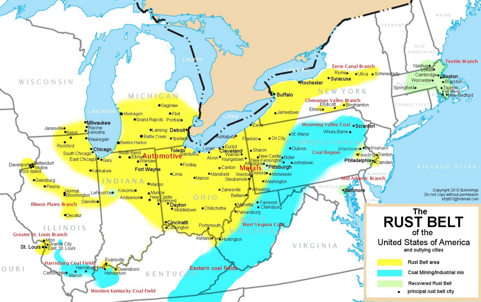
However, Pittsburgh is also known for having made a comeback. It’s considered a blueprint for other cities looking for a revival after suffering from the decline of their primary industries.

Pittsburgh’s revival is commonly attributed to versatility in embracing new industries like health care and technology. The education infrastructure and leadership with a more long-term focus is credited with creating the conditions needed for the city to once again thrive.

The story is reminiscent of countless personal stories of people who suffer major setbacks in life and later make a comeback. These stories often involve people who become complacent and stagnant. Typically their livelihoods get disrupted by external events they are unprepared for. Their personal revival stories typically revolve around a combination of adapting a new way of looking at things and tapping into core strengths they possessed all along.

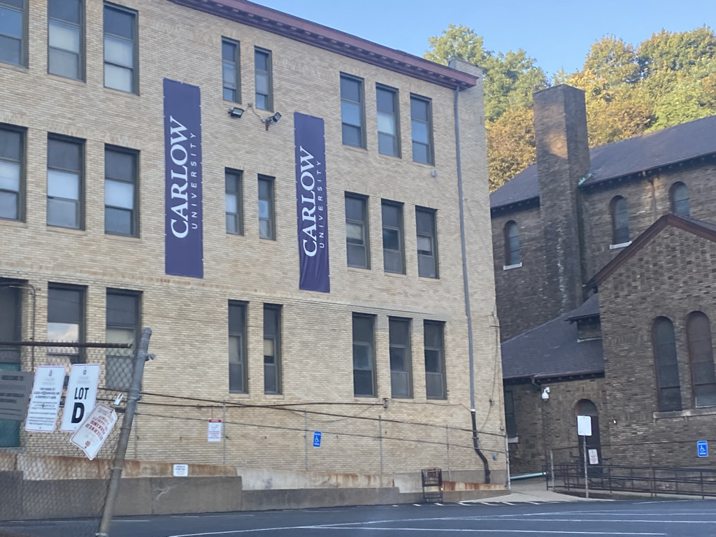
For a long time, Pittsburgh was a place that valued science and education. It is home to several major universities.

Benefiting from it’s hilly terrain, it is also home to the Allegheny Observatory, an observatory over 150 years old where countless star distance calculations have been made.

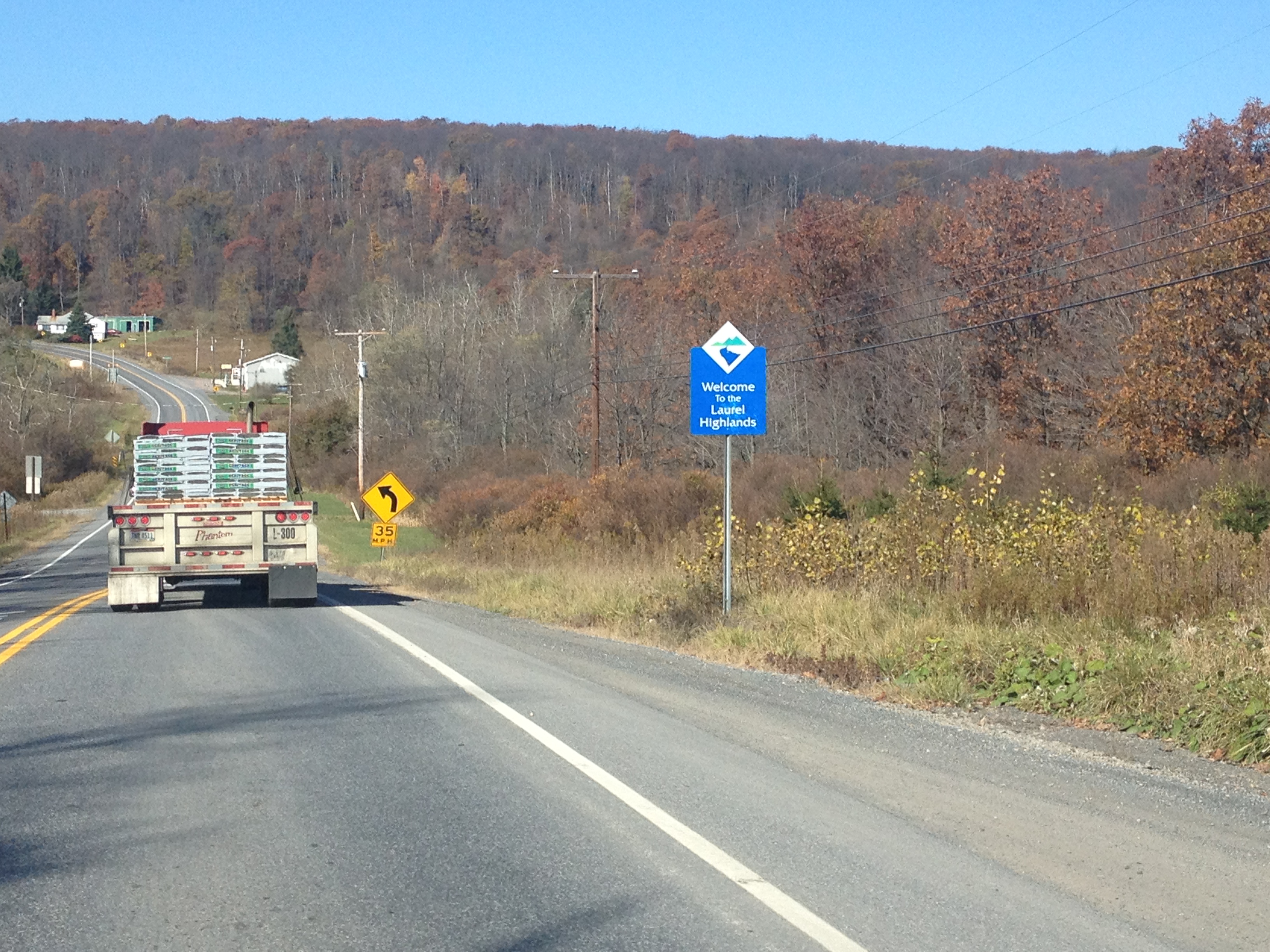
The hilly terrain makes Pittsburgh unique in other ways.

One of the city’s top attractions in the Duqeuesne Incline, a reasonably priced and dog friendly tram one can ride to overlook the city.

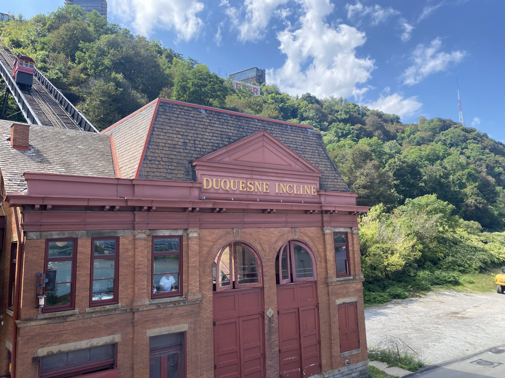
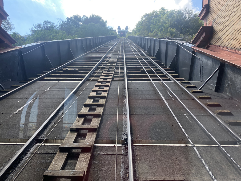
It’s also a historic commuter train as walking up the side of a bluff is often treacherous.

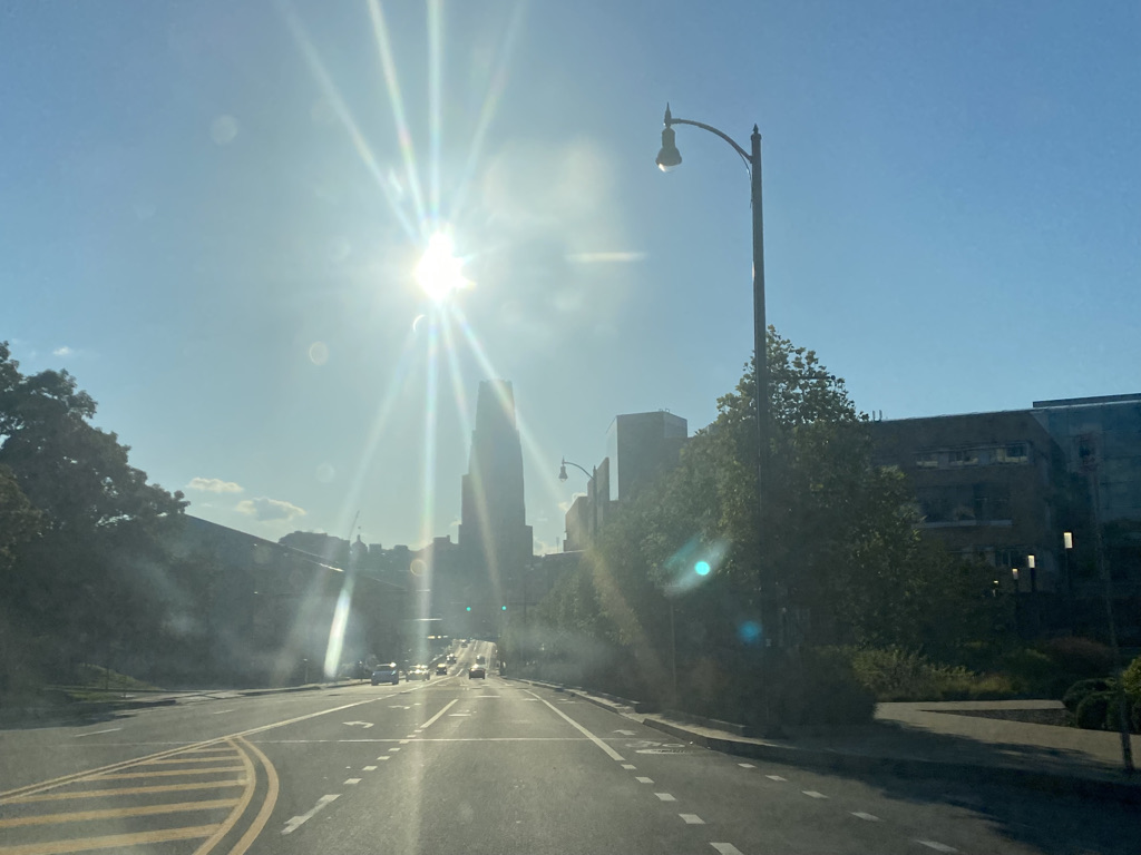
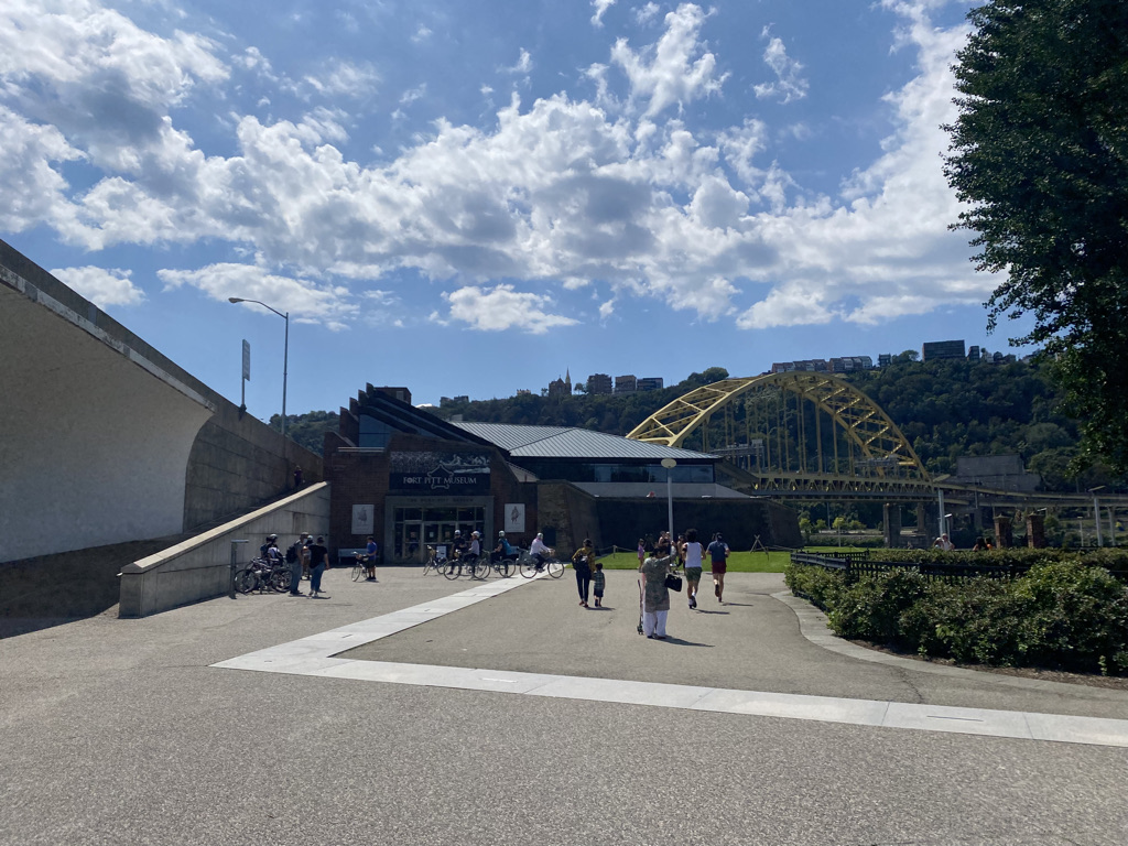
In fact, the entire layout of the city is forced by these geographical features. The city’s downtown is situated where the Allegheny and Monongahela Rivers converge into the Ohio River.

Both the football and baseball stadiums are right downtown.

Along with your typical big office buildings and a square which surprisingly seems to attract a lot of loud cars and motorcycles.

To the east of downtown, sandwiched between the Allegheny River and a densely forested bluff is the strip district, which seems like a standard tourist destination.

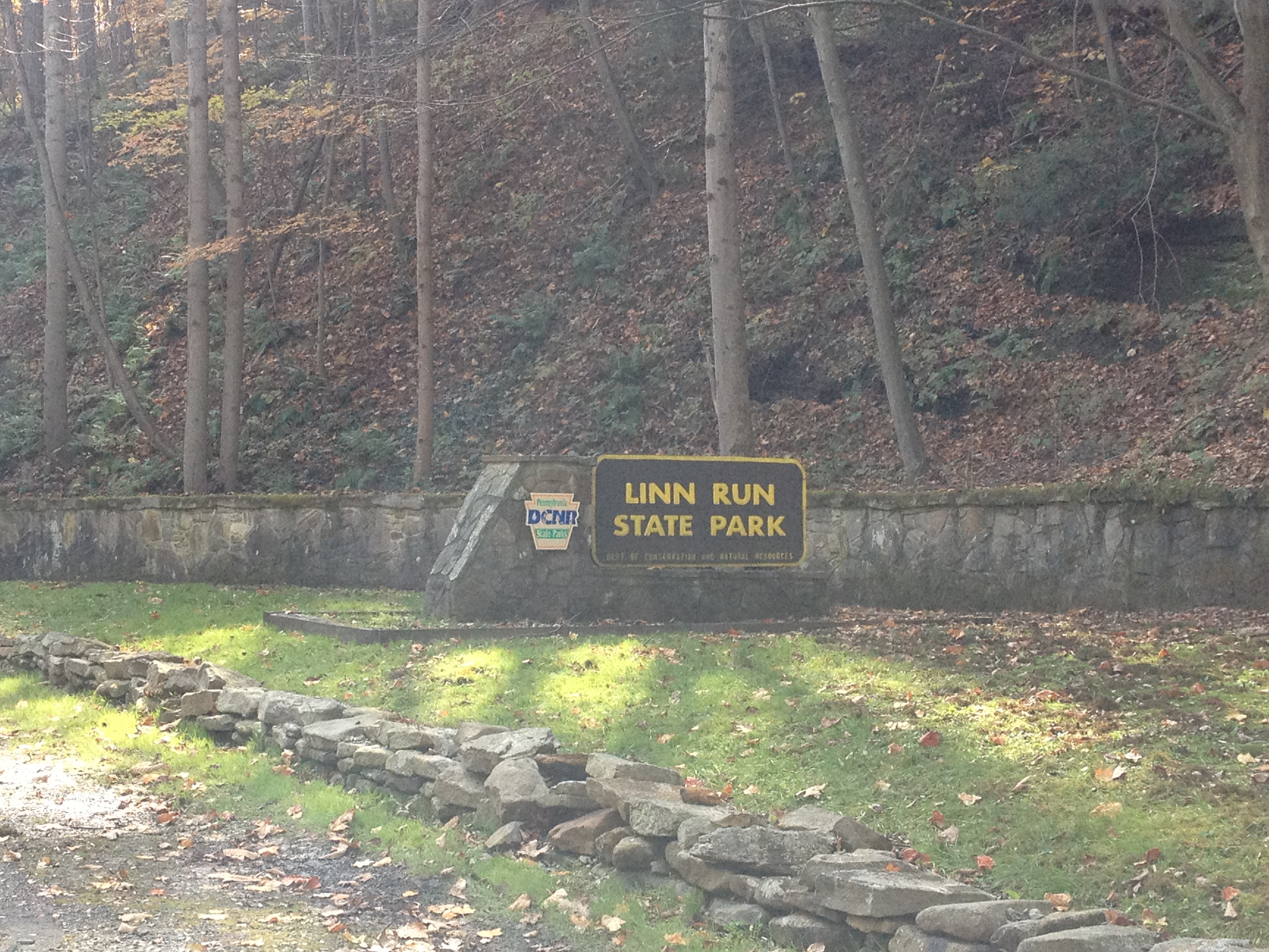
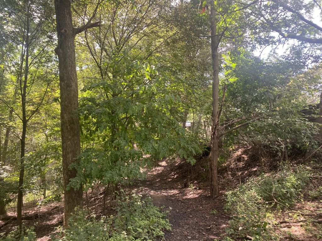
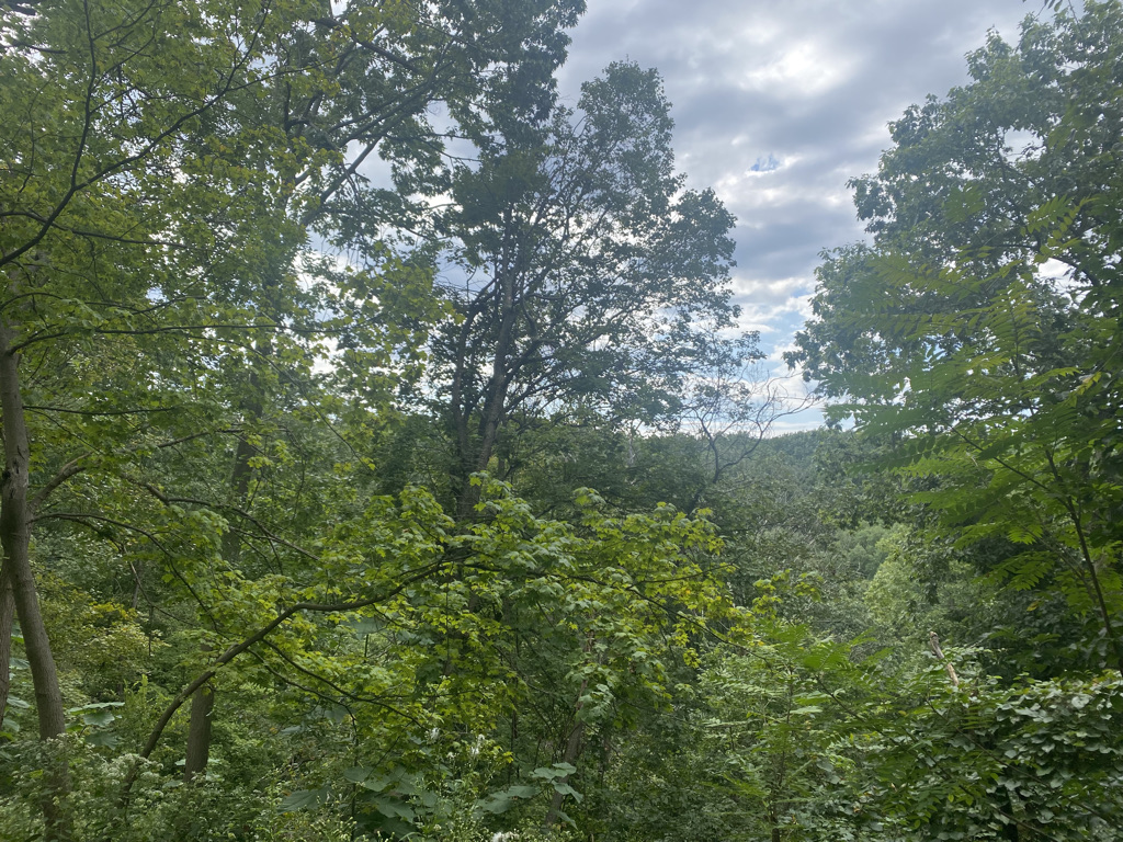
Pittsburgh’s most unique quality has to be legitimate hiking within the city limits. Riverview Park, on the north end, is one of several places with a system of trails that have significant terrain and fairly dense forests.

It is also a place with plenty of other parks.

When many think of Pittsburgh, they may still think of it as a rust belt city with a rough exterior.

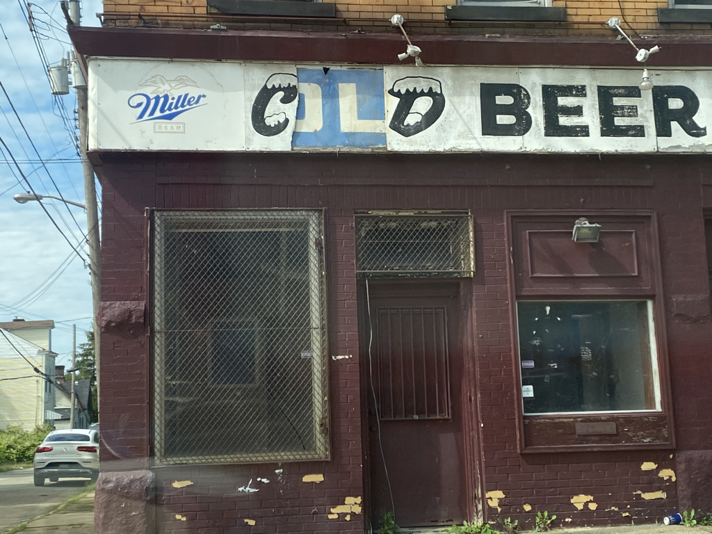
That, of course is only part of the truth, one aspect of the city’s culture. Many of the things Pittsburgh was about before the decline and subsequent revival are still there. There is still all the ketchup.

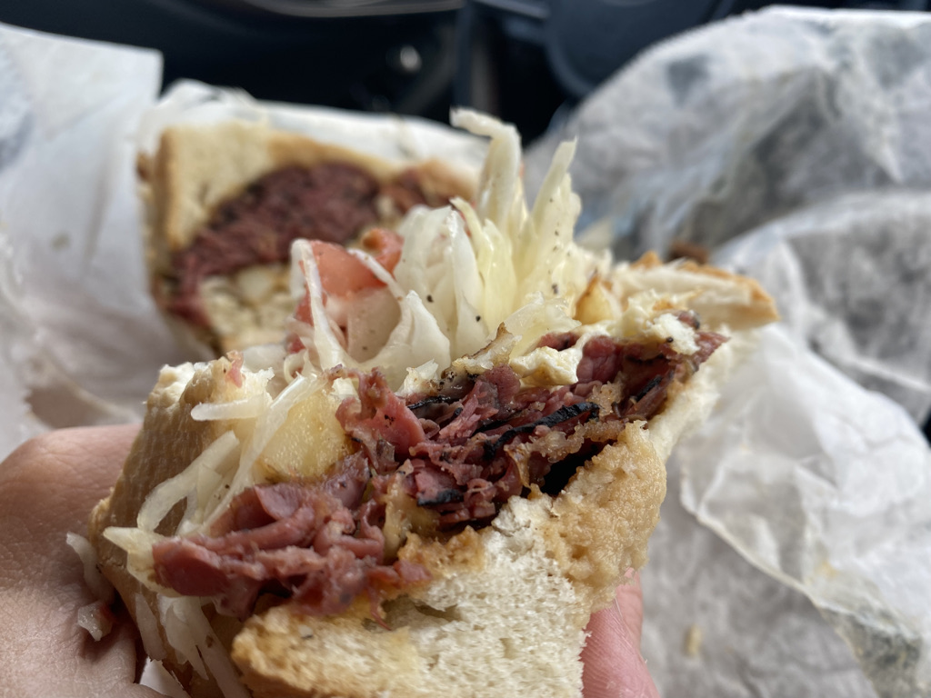
Pittsburgh’s history also involves a lot of food and traditions based on Eastern European culture.

However, the city has managed to incorporate the amenities demanded by talented urban professionals in the 2020s.

We all are, in a way, every chapter of our lives. A tour through Pittsburgh shows the city before the steel industry declined, during its dark days and in the current era. It’s a reminder of all of our personal stories and how even during the more prosperous times in our lives, the bumps we experienced along the road, as well as who we were before experiencing these setbacks are still a significant part of who we are. Battle scars don’t go away, they are just put into context.

Despite my sincere desire to avoid categorization or labelling, I could not help but want some kind of quick description of what Pittsburgh is. Do people think of it as on the up-and-up or in decline? Do people know how Pittsburgh is viewed by others? What region do they consider themselves to be in?

Pennsylvania has recently emerged as quite possibly the most important state in presidential politics. Walking around town, I could not help but wonder if people here were already starting to dread the inevitable onslaught of political ads that will be absolutely impossible to avoid in the run up to an election that is still over three years away.

When people try to make sense of this state, they will often say the state has a genuine east coast city in Philadelphia, aspects of rust belt and Appalachia and a midwestern city in Pittsburgh. But, some aspects of Pittsburgh felt downright eastern to me. There are the tunnels.
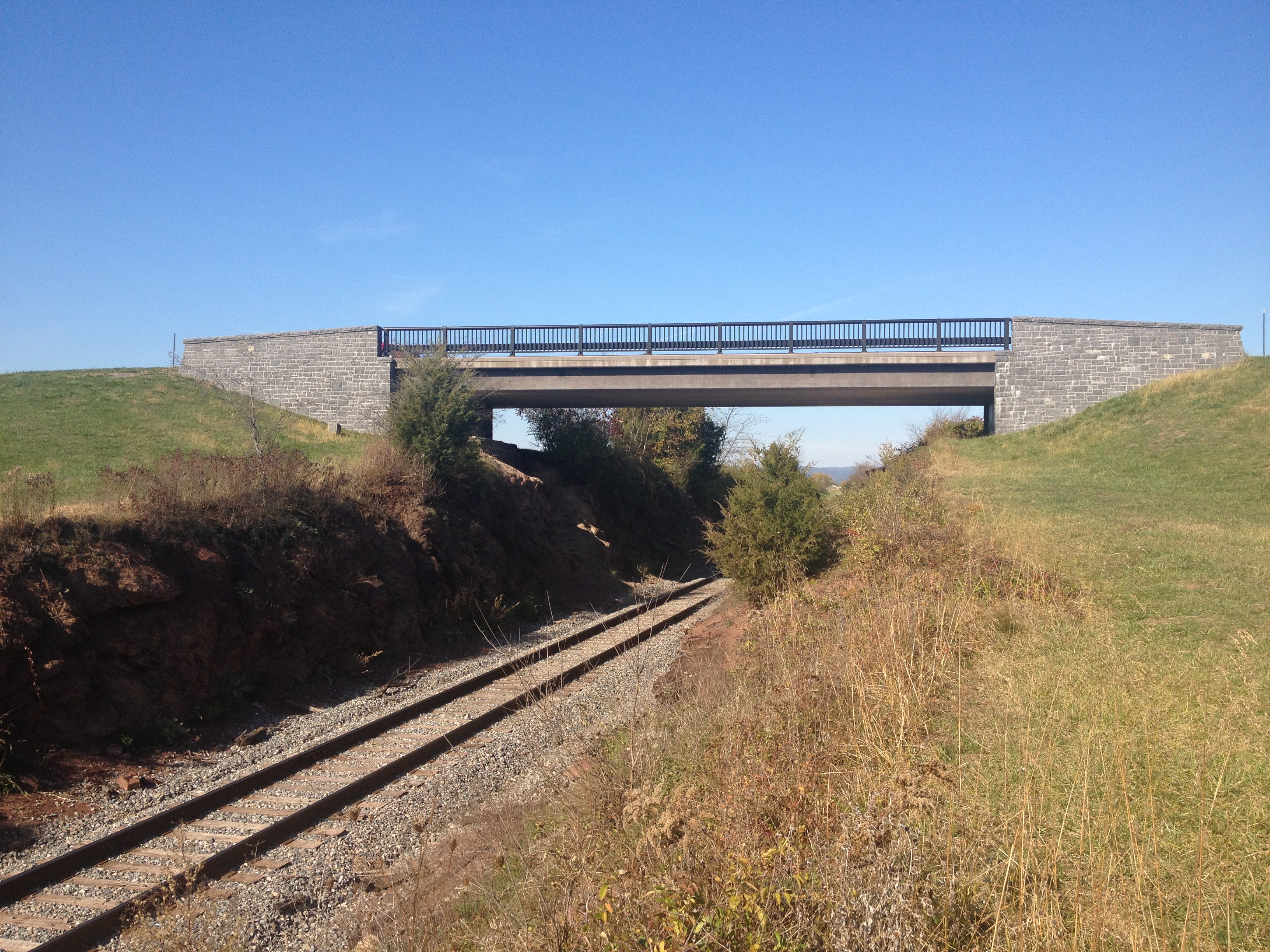
The bridges.

Some neighborhood have really tight roads, reminiscent of the Northeast.

As it is on the East Coast, the roads are often not in straight lines and the intersections are often not 90 degree angles.

In just over 24 hours, my long dormant east coast instincts regarding driving, walking pace, how to act and how to time things kicked back in.

What does the future hold for Pittsburgh? Based on what I have read and seen, it seems like the ability to adjust, long-term focus and unique spirit has not gone anywhere. So, most likely it will be a good one.

As long as people don’t get sick of cloudy days.

Pennsylvania’s Lincolnway

IMG_1365 IMG_1377IMG_1371

Nearly a decade before the much celebrated route 66 was commissioned, the first cross country automobile route, “The Lincolnway”, was developed.  This cross country route from New York to San Francisco, first labelled in 1913, roughly follows what would later become U.S. highway 30 through much of the country.  Although less songs and movies have been written about “The Lincolnway”, it is just as historic.

IMG_1368 IMG_1369

Accessing the Lincolnway in Pennsylvania is quite easy.  In fact, from the Southeast, it can be accessed without even exiting the highway.  In a town called Breezewood, PA, all Interstate 70 traffic comes to a grinding halt.  In order to continue on I-70 westbound, one must make a right hand turn, followed by a left hand turn, and enter the Pennsylvania Turnpike, where I-70 shares with I-76 for about 86 miles.  This is the only place I know where interstate highway traffic must actually come to a stop at a traffic light.  In many other places, following an interstate highway requires exiting and merging onto different roads, but I don’t know anywhere else where traffic lights are actually part of the main interstate highway route.  As a result of every I-70 traveler having to stop here, Breezewood is mainly just a bunch of gas stations (truck stops) and hotels.

The road that motorists encounter when I-70 comes to a halt is actually the Lincolnway, U.S. highway 30.  Since I have some extra time on my journey, and some level of disdain for the Pennsylvania Turnpike, I decide to follow the Lincolnway through much of Pennsylvania and check out some of the sights along the way.

IMG_1372 IMG_1373

After bypassing the larger towns of Everett and Bedford, I make my first stop at a place called Shawnee State Park, roughly 5 miles west of Bedford.  I have always been kind of impressed with Pennsylvania’s State Park System.  I do not ever recall being asked to pay to enter a state park here, which is quite common in other states, and most of these state parks are well kept, even having recycling bins at some places.  The parking area here, less than mile off the Lincolnway, looks like the kind of place where one can relax, do a little hiking, and have a nice picnic.  After less than ten minutes of walking I discovered something truly amazing!

IMG_1374 IMG_1375

Lake Shawnee actually reminded me of what I would consider one of my dream vacations.  One of the things I would love to do most is get somewhere between 8-14 fun, energetic people and go to a cabin or campground near a lake just like this one.  It would involve boating, swimming, beach volleyball, a little bit or partying, and some hiking, all of which seem readily available at this place.  In addition, this state park is well out of the way of most major cities, and the lake area is also out of the way of any parking lots, which would make for a true escape from day-to-day life.

It was already closed for the season by the time I arrived, but I could imagine this place in summer, with people swimming, boating, and just relaxing.  Well, not relaxing the way many of us think of it.  I will refer to it as “relaxation for the active”.  For those of us that would not necessarily enjoy a full day of just sitting around and watching T.V., this would be our version of relaxing and getting away from it all.  For people with very fast paced lives and/or high intensity goals like training for a marathon, it would still represent a slow-down of sorts, and I would still consider it a way of recharging.

IMG_1379

A few miles farther west, the Lincolnway enters a section of Pennsylvania referred to as the “Laurel Highlands”.  I am not sure if this is an official region, or some kind of a tourism marketing strategy.  There was a section of brochures dedicated to this part of the state at the Pennsylvania Welcome Center.  Upon entering the Laurel Highlands, the highway actually ascends up a fairly steep slope, going from basically sea level to periodic summits between 2600 and 2900 feet in elevation.

IMG_1380 IMG_1381 IMG_1382 IMG_1383

One of the main points of interest in this region is the United Flight 93 memorial near Stoystown, PA.  On September 11, 2001, terrorists hijacked this plane as part of a four plane attack on the United States.  Two of the planes were flown into the World Trade Center, and one was flown into the Pentagon.  This flight was headed for the Capitol Building (most likely) when the passengers and crew on this flight mounted a plan to retake the plane.  Their plan caused enough confusion to prevent a fourth strike that day, and the plane instead crashed in an empty field in Southwestern Pennsylvania.  All of these passengers, as well as the flight crew, lost their lives that day.  All 40 of them are buried and memorialized on this site.  I don’t know the names of these people, nor will I ever.  But they are people who truly embodied the word courage, and made an unexpected sacrifice for their country.  In a strange way I felt their presence here as people who have earned, and deserve all of our respect.  I would never had thought of this had I not traveled through this area, but I am really glad that someone decided to put up a memorial to these 40 heroes of recent American history.

IMG_1386

For almost all of this stretch of the Lincolnway, the towns I go through are really quite small.  In fact, they are smaller than I expected.  Finding even your basic road trip mainstays like McDonalds and Subway was quite difficult.  One could also see some remnants of the pre-interstate days on this road much the same way they could see these remnants traveling route 66.  Some of these motel signs even contained some outdated advertisements, such as “Color TV”.  I have a DvD series at home about route 66, which discusses all of the famous stop-off places along that route.  I wonder if anything similar has been done for the Lincolnway.

IMG_1387 IMG_1388

On the other side of the main summits in the Laurel Highlands, I stop at one of the State Parks, a place called Linn Run State Park.  This one, several miles off the Lincolnway, is quite different.  It is far more of a rustic fishing and hiking state park, with some really beautiful fall colors at this time.  The main odd thing I saw here were little homes, most likely people’s second homes, inside the park.  I did not know State Parks allowed people to build homes in them, but apparently this one does.

IMG_1391 IMG_1392

Continuing west on U.S 30 the drive got a little bit frustrating.  Just past the town of Ligonier, the road opens up into a multi-lane highway, but it does not take long for the road to become suburban in nature, with lots of traffic lights, shopping malls, etc.  Traveling roads like this does take significantly more time than traveling on an interstate.  This is why nearly everybody that travels long distances across the country takes almost exclusively interstate highways.  However, I have noticed today, traveling along the interstate does often mean missing some great places along the way, and I truly enjoyed having the time to take this route.  On the interstate, travel is quite monotonous.  Every exit seems to largely have the same places, the same gas stations, the same fast food, etc.  This is especially true of roads like the Pennsylvania Turnpike, where exits can be over 20 miles apart in places, and most of the eating/fueling is done at rest stops, which are designed to all look the same.  Travel on state and U.S. highways, and one can see what makes each town unique, and see spots that they cannot see anywhere else.  This is why I enjoy traveling on roads like this when not in a hurry.

IMG_1394

My final stop-off was somewhat of a disappointment.  In the travel guide I picked up at the Pennsylvania Welcome Center, I saw an advertisement for a Big Mac Museum.  I immediately thought it was a neat concept.  I wondered how much material there would be about one single sandwich, but was intrigued by the idea of a museum dedicated to one sandwich.  However, this museum was not really a museum.  It was just a McDonalds with a giant plastic Big Mac and Big Mac related newspaper clippings behind some glass thrown periodically throughout the restaurant as decorations.  It is really no more special than the “Rock N Roll McDonalds”, and if this can be considered a “museum”, than every single Five Guys can be thought of as a museum to their burgers.

IMG_1396 IMG_1397

Knowing that the Lincolway was about to go through even more suburbia and then downtown Pittsburgh, I decided to finally hop on the Pennsylvania Turnpike.  I got on at exit 76 and followed it the final 76 miles to the Ohio border.  This cost me $4.80 in tolls, which reminded me of another reason I dislike traveling on this road.  However, more important than the price of toll roads is the opportunities provided by other roads.  By traveling the Lincolnway across part of Pennsylvania, I got to see some magnificent state parks, some interesting towns where I could picture the day to day lives of people much different from me, and part of our nation’s history.

Gettysburg 150 Years Later

IMG_1326


When any American thinks about the key places in the American Civil War, Gettysburg is without a doubt one of the first to come to mind.  It was here that the war reached some kind of turning point.  As I had learned in history class, prior to the Battle of Gettysburg the momentum in the war was clearly with the Confederates.  The Union victory at this battle turned the tide of the war, which eventually resulted in a Union victory.  I sometimes speculate that the history is actually more complicated than this narrative.  But, this narrative does seem like it makes a good high-level summary, and the Gettysburg Battlefield is an important battle regardless of what other factors and events contributed to the Civil War’s outcome.

IMG_1339 IMG_1330


The town of Gettysburg is a fairly small town in South Central Pennsylvania close to the foothills of the Appalachian Mountains.  After a string of victories, Robert E. Lee determined that if he could wind a few decisive victories in “northern” towns, he could demand some form of surrender in Washington.  I am guessing that meant the United States recognizing their independence.  Effectively, the invasion of Gettysburg was part of a plan for the South to complete their victory.

IMG_1336 IMG_1337

Most of the Battle occurred just outside of town.  The first shot was fired in a field a little bit west of town, as the confederates invaded from the west.  It was tough to get a good picture of this monument due to the sun angle, but this marker indicates where the first shot actually took place.

Due to the chaotic nature of battles, it is hard to follow all of the events in Gettysburg in chronological order without criss-crossing paths and recovering ground.  The Gettysburg Military Park offers a driving route that covers many of the battle’s key locations and events, but it does not cover them in chronological order,

IMG_1338

One of the first places I visited after the location of the first shot is this cut in the railroad tracks that many soldiers used strategically to hide from bullet shots.  What I find amazing was that this land had already been cut out and these railroad tracks had already been built.  From what I remember about railroad history, 1863 was still kind of early in the development of the railroads.  So, I conclude that Gettysburg was somewhat ahead of the game with regards to getting railroads through their town.

IMG_1340IMG_1343


The entire battlefield area, which is quite large in area (a couple of dozen square miles) has plenty of monuments to specific people involved in the battle.  And, in order to attract visitors from all places, the monuments represent both the Union and Confederate sides.  This monument to Robert E. Lee is placed near a giant field where the Confederates made the final blunder of this battle.  Essentially, both the Union and Confederacy had “lines” where they had set up, and faced each other from roughly a mile away.  On the final day of the battle, General Pickett marched a whole bunch of Confederate soldiers right into the center of the “Union” line as part of a three-prong strategy that did not work.  There were massive casualties, and some soldiers even aborted the mission.  General Lee admitted his mistake to the remaining troops.

IMG_1342


The battlefield also contained a lot of replicas of cannons from the civil war era.  I could not really figure out the rhyme or reason as to why they were placed where they were placed.  But, there were a lot of them.

IMG_1344 IMG_1345IMG_1355


Gettysburg is somewhat of a strange place as the area seems to have a mixture of open fields and more wooded areas.  I was told that some of these areas were not as wooded in 1863 as they are today, but given how long trees live, some of these trees had to have been here in 1863.  In fact, there is one section of the auto tour where the trees appeared to be a nice fall color, an added bonus of the trip.  It was here, in a wooded place called “Little Round Top”, at the southern flank of the battle lines, that one of the key turning points in the battle occurred when Union troops fought back a Confederate advance on the second day of battle.  It was a turning point event of a turning point battle.  This one spot can almost be thought of as a place that changed history.  It is amazing how what was once just a pile of rocks on a gentle slope now becomes one of the places that shaped our country and who we are.

IMG_1347


There are also several places on site where the war turned uglier.  By this I refer to areas where casualties mount, but little to no land actually changes hands.  This is how I imagine the “trench warfare” during WW1 to have been.  This one wheat field apparently changed hands over six times during the three day period of the battle.  Hundreds upon hundreds continued to die with neither side advancing too much.


IMG_1349 IMG_1351 IMG_1352

I kind of ended up on information overload a bit.  There is a lot to understand about this battle, and prior to today I had really only thought of it as the battle, and the Gettysburg Address.  We decided to stop for lunch at a place called the Appalachian Brewing Company, which has a whole bunch of locally brewed beers, and burgers with their label on them.  I have never really seen any company burn a label into a burger bun.  Last week I saw how the Louisville Slugger bat company burns their label into their bats, but a burned label into a burger bun seems quite unique and different to me. Either way, it was an interesting experience, and I left the place actually feeling a little bit tipsy after this beer “flight”.

IMG_1354 IMG_1356


After lunch, back on the battlefield tour, I did do a couple of things one could consider a bit goofy.  I saw a spot on Little Round Top where they had created an iconic image of the Civil War, a photograph of a dead Confederate soldier.  I hope I did not offend anyone when I decided to reenact this photo.  Sometimes I like to feel history come to life when I visit these places.  This is why I was excited to see a Civil War reenactor standing at the top of the hill.  I actually wonder how often Civil War reenactments occur in Gettysburg.  I imagine a lot, and I picture the 8,000 people that live in Gettysburg to run into, and even be delayed by Civil War reenactments all of the time.

IMG_1360


The battlefield also contains memorials to all of the infantry units that fought in this battle.  Each one of these memorial stones contains statistics about the number of soldiers lost in battle.  Reading just some of these stones I conclude that nearly half the people who came to this battle did not leave.  This, of course, is what makes war so sad.  Military history can be interesting, and it sounds like fun to take part in one of those reenactments.  But it is important to remember how many people do lose their lives whenever there is war.

IMG_1328 IMG_1333


From the statues commemorating Abraham Lincoln, and the naming of one of our oldest cross country routes the Lincolnway, the impact that the outcome of this battle has had is quite evident all around us.  After hearing all of these details about the battle, strategies, events and such, my main takeaway from all of it is that General Robert E. Lee lost this battle due in part to an over aggressive strategy following a series of decisive victories.  When I process this through my head it actually makes a great deal of sense to me.

I think we have all been in situations where we get arrogant, aggressive, and sloppy after a series of ego boosts.  I can relate this to sports teams that blow giant halftime leads, and executives that push through major new product lines without the full vetting of the product.  It is easy to get caught up in a “winning streak”, and lose sight of the need to make careful decisions.  I do not know if the war’s outcome would have been different had Robert E. Lee exercised a bit more patience and due diligence at this point in time.  The war had other fronts and many battles elsewhere.  It is still strange to think about that possibility though, the possibility that the world could be completely different if only a few events at a key point in history had unfolded differently.  Alternate history writing often makes that speculation, and also speculates about how today’s world would be had the outcome been different.

Would the Southern and Northern States have ever reconciled their differences and reunited?

When would the Confederate States have outlawed slavery?

Could this have changed the outcome of the 20th century conflicts in Europe?

These questions and many more are discussed by many writings and videos often with wildly different answers.  There is no real way of knowing what would have happened had this war turned out differently.  This is part of what makes it fun to speculate.  However, Gettysburg is not about alternate history.  It is about real history, and history we can learn from.  This is why I find it important to not just learn the fact, but also the lessons.  One can memorize the sequence of events in this battle, and every battle of the Civil War but still fail to take away the lessons from it.  One such lesion from this battle is to make sure we all continue to make smart decisions even when our egos have been boosted and our confidence peaked by a series of victories, in any situation in life.