Category Archives: National Parks

The Lifeblood of the West

IMG_0920

The Colorado River is often referred to as the “Lifeblood of the West“.  Recent estimates place the number of people dependent on water from the Colorado River at close to 30 million.  This is a number that is likely expanding, and expanding fairly rapidly, given that water diverted from the Colorado River supplies water to some rapidly growing metropolitan areas, including Denver, Las Vegas, Phoenix, and Salt Lake City.  Most of the areas dependent on the Colorado River for water supply are deserts that receive precipitation irregularly.  These cities would not have been able to grow into the large cities they are today without this water source.  Without it, our country, and it’s population distribution would be quite different.  It made an entire region the powerhouse it is becoming today.  The importance of this particular river to the United States would be hard to over-estimate.

It is also one of the most iconic rivers in the United States.  Along it’s course, it carved out some of the most scenic canyons in the world.  This includes the Grand Canyon, a location iconic enough to make it into Arizona’s state motto and attract five million tourists a year.  The Colorado River not only conjures up images of all of these iconic canyons, but also images of rafters, kayakers, and other water sports enthusiasts.  And, of course, one of the most iconic images of the Colorado River is the Hoover Dam, over 700 feet tall, one of many dams that supplies both water and power to the Southwestern United States.

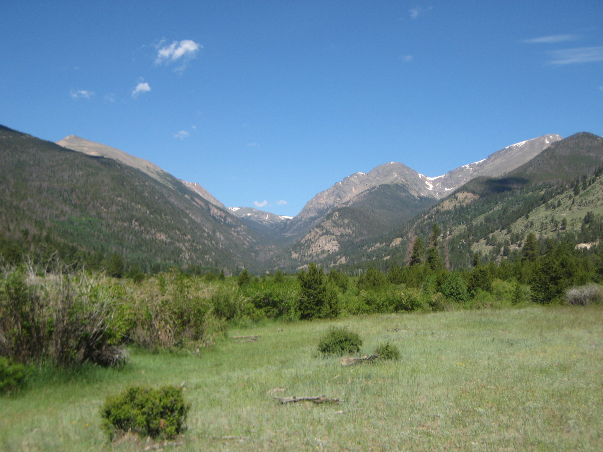
This gigantic cascading of water has it’s origins in Rocky Mountain National Park, near the Continental Divide.  The headwaters are not accessible by road.  A several mile hike is required in order to reach the headwaters of this iconic river.

This particular hike was not especially physically challenging.  Nearly every hiking guide rates this hike as “easy”, as opposed to “moderate”, “strenuous”, or Long’s Peak, which needs a category of it’s own.  Being a trail that follows a river valley, it is not surprising that the hike is easy, as steep grades are not common along river valleys.  This is why many trails follow rivers.  In the pre-automobile days following a river was often the safest and most direct route for fur traders, settlers, etc.  The automobile came along and made travel quite a bit easier, but many of today’s roads still follow these trails.

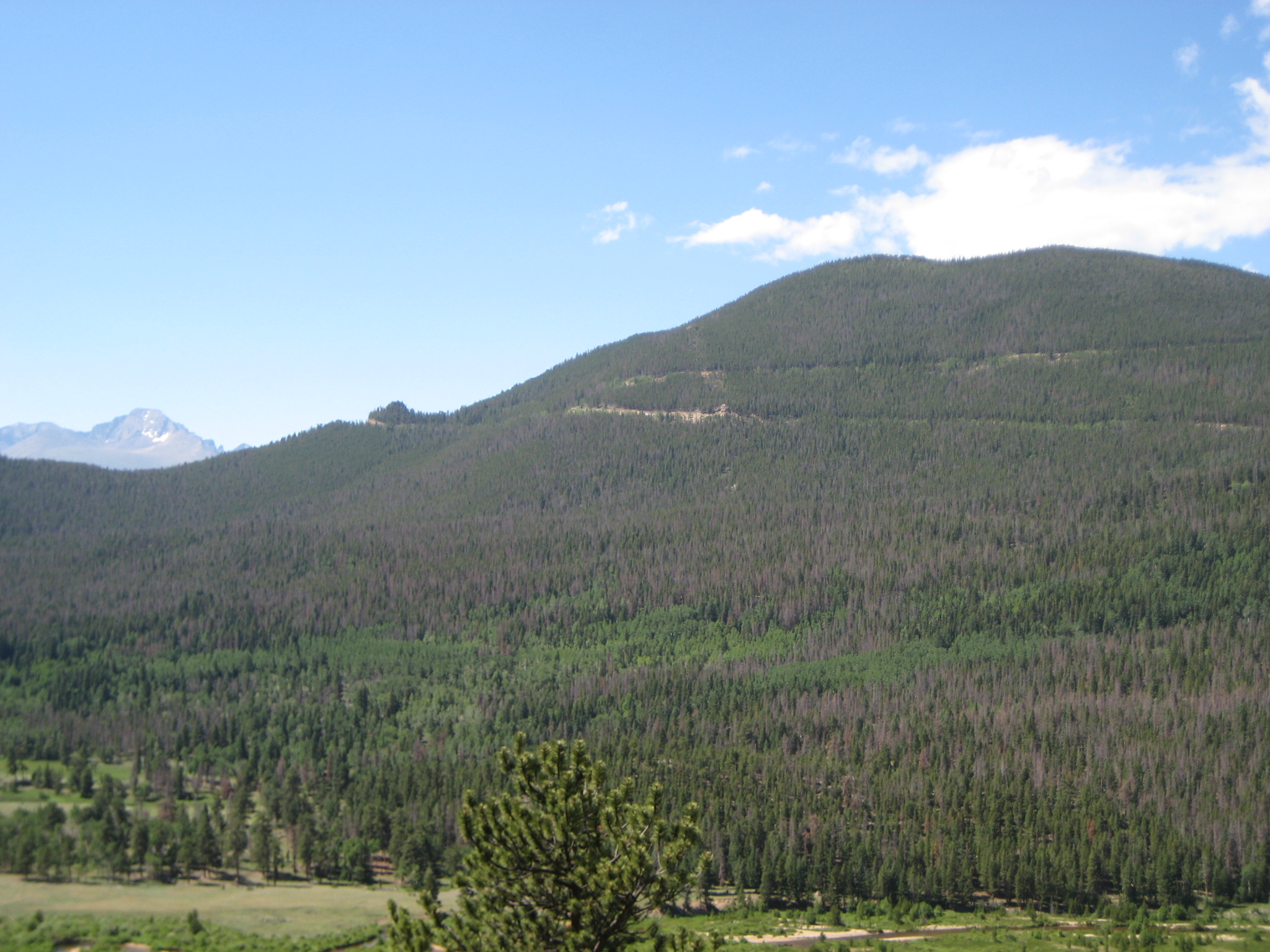
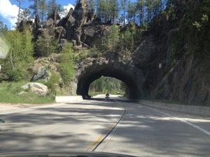
One interesting exception is Trail Ridge Road, the road I took to get to the Colorado River Trail.  This road traverses Rocky Mountain National Park, but it climbs to a peak elevation of over 12,000 ft. along a ridge in the north central part of the park, as opposed to following one of the river valleys like many other roads do.  It is also the route of U.S. highway 34, a route that proceeds eastward through Estes Park, and then towards Loveland, CO via the Big Thompson canyon.  The road follows a trail through a river valley east of Estes Park, but not west of town.  I wonder if that has anything to do with the fact that Rocky Mountain National Park was established in 1915, after the automobile had already been invented.  So, the people who planned the park could plan around visitors with cars.  Had it been established earlier, like Yellowstone, would the road follow one of the river valleys to the north or to the south, as opposed to it’s route up Trail Ridge?  Historical what-ifs are always fun to ponder, but never verifiable.  At least we know that as things actually are, visitors to the park can enjoy a scenic drive up Trail Ridge Road from mid-late May through the end of September.

IMG_0922 IMG_0924

Whenever a trail follows a river, there is an enhanced risk that the particular trail will be muddy.  The last couple of weeks have been rainier in North Central Colorado, and therefore, it was no real surprise to me that there were many places along this trail where the entire trail was covered with standing water, requiring hikers to either wade through it, or walk around it.  Anytime hiking, or bicycling along a dirt trail next to a river, one should prepare for such conditions after rainy days or rainy periods.

IMG_0925

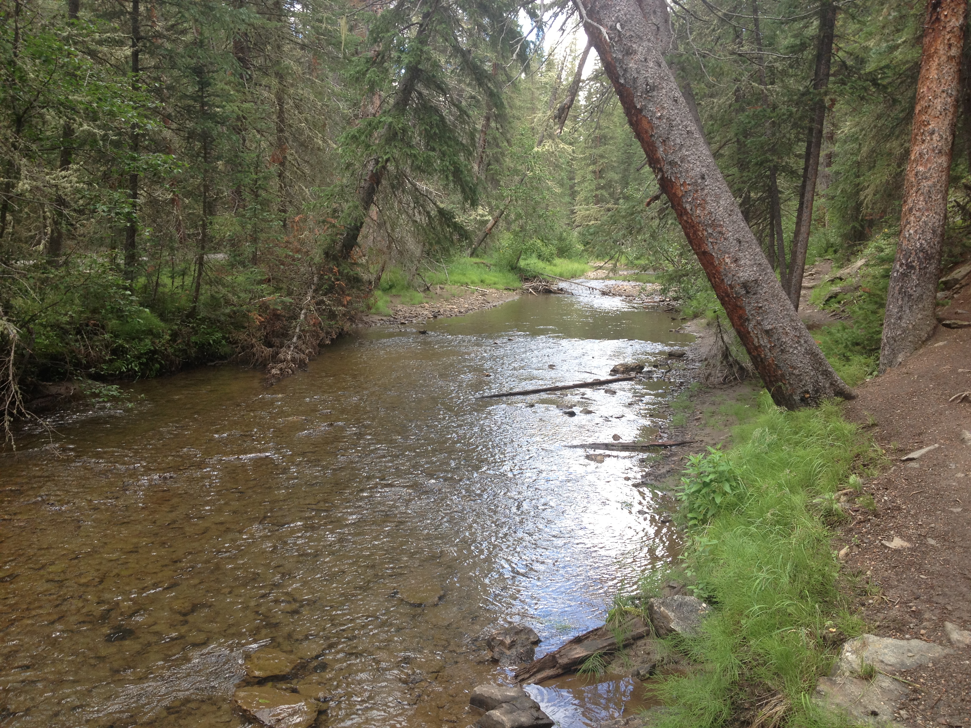
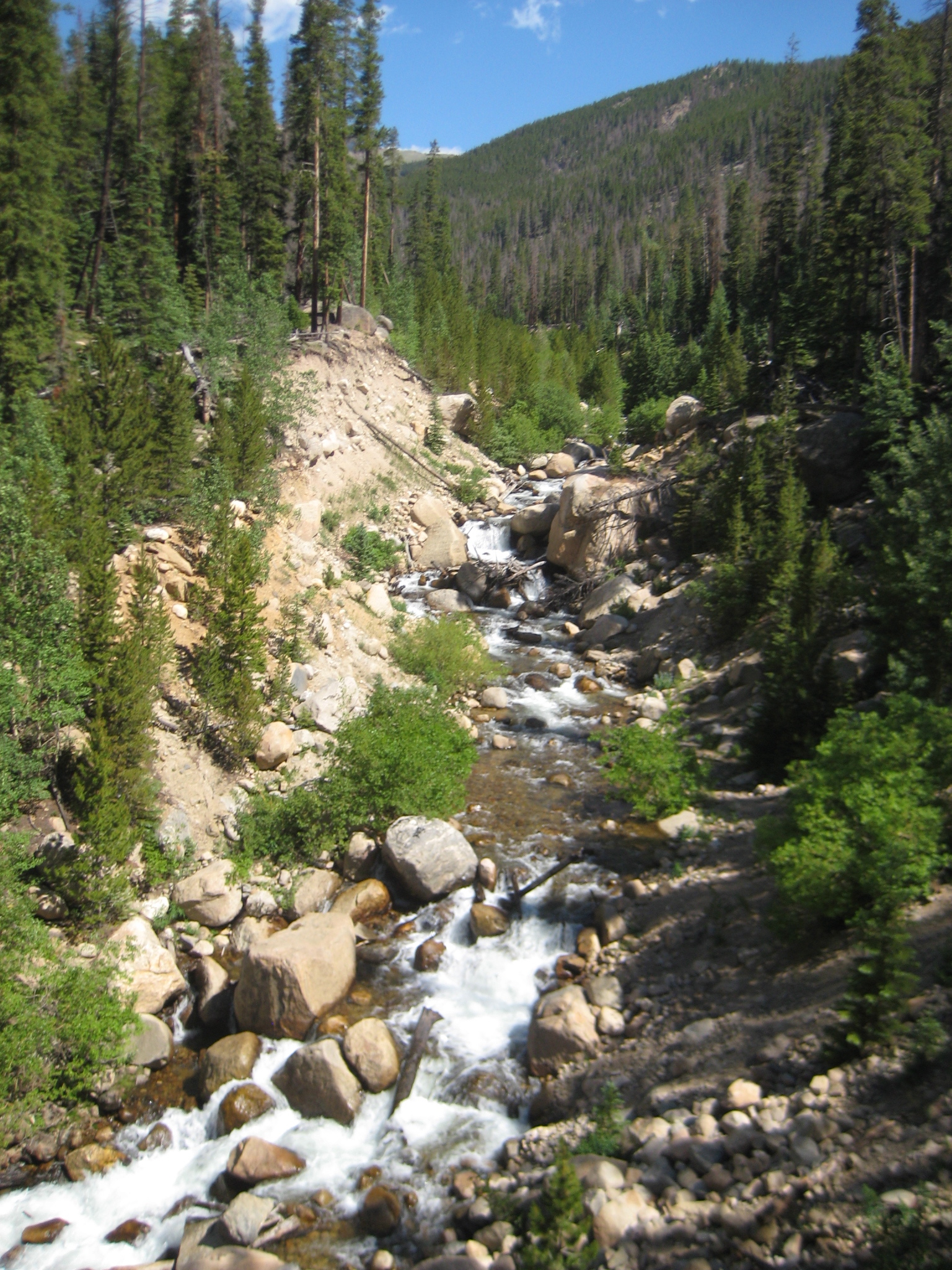
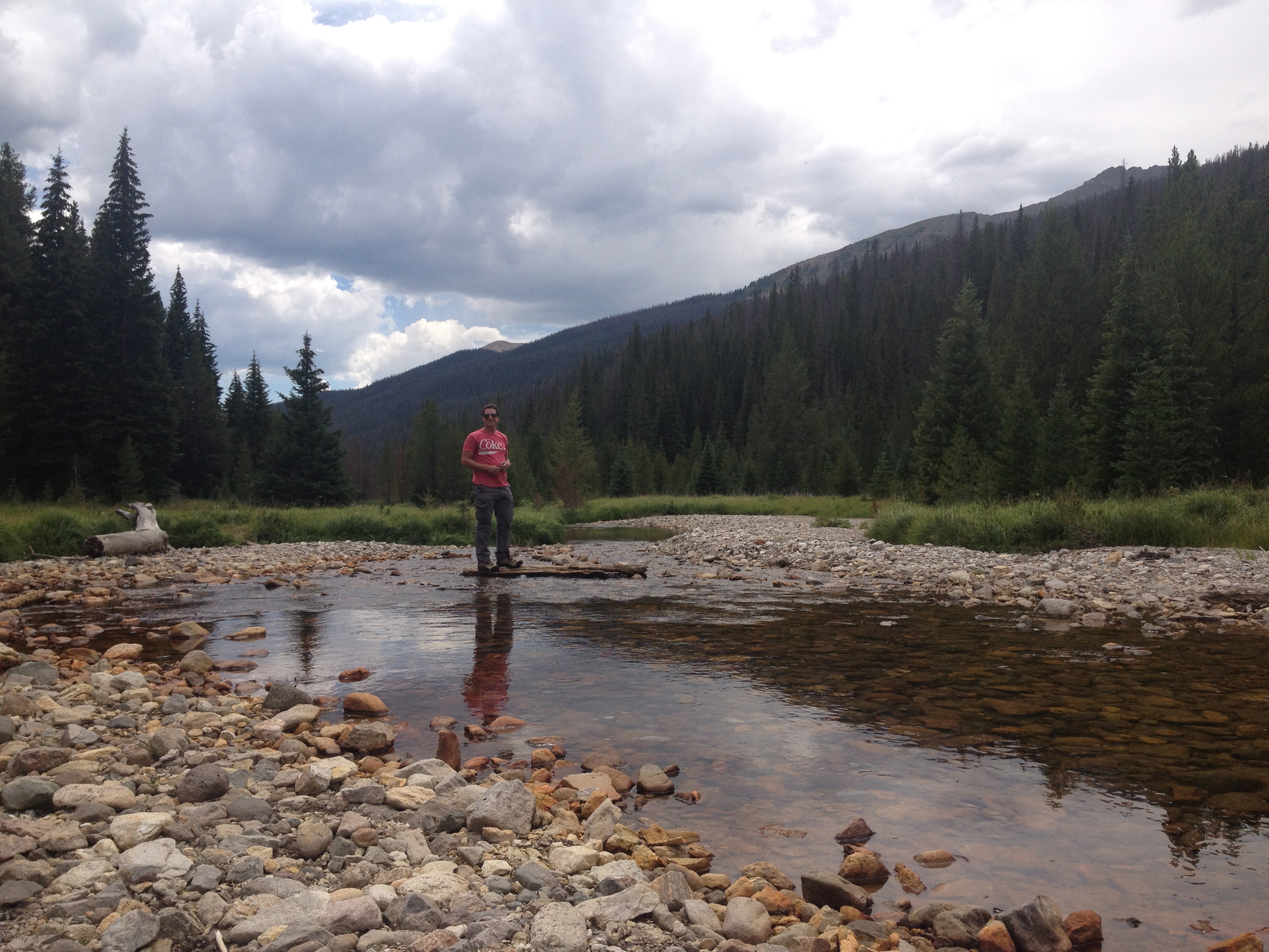
I was expecting humble beginnings, and even considering titling this blog entry as such, but that is simply not true.  A mile or two into the trail, which is only a couple of miles from the source of the river, it already looks quite a bit wider than many rivers in this region.  Although the Colorado River gets a lot of additional force, and water flow, farther downstream, when it is joined by large tributaries, particularly the Gunnison, Green, and San Juan Rivers, seeing the river here it almost seems like this particular river stands out against every other river, creek or stream that flows off of the continental divide in this region.  Like that one child in grade school already reading at high school levels with a curious mind and appetite for learning, it seems destined for greatness at this early stage.

IMG_0927

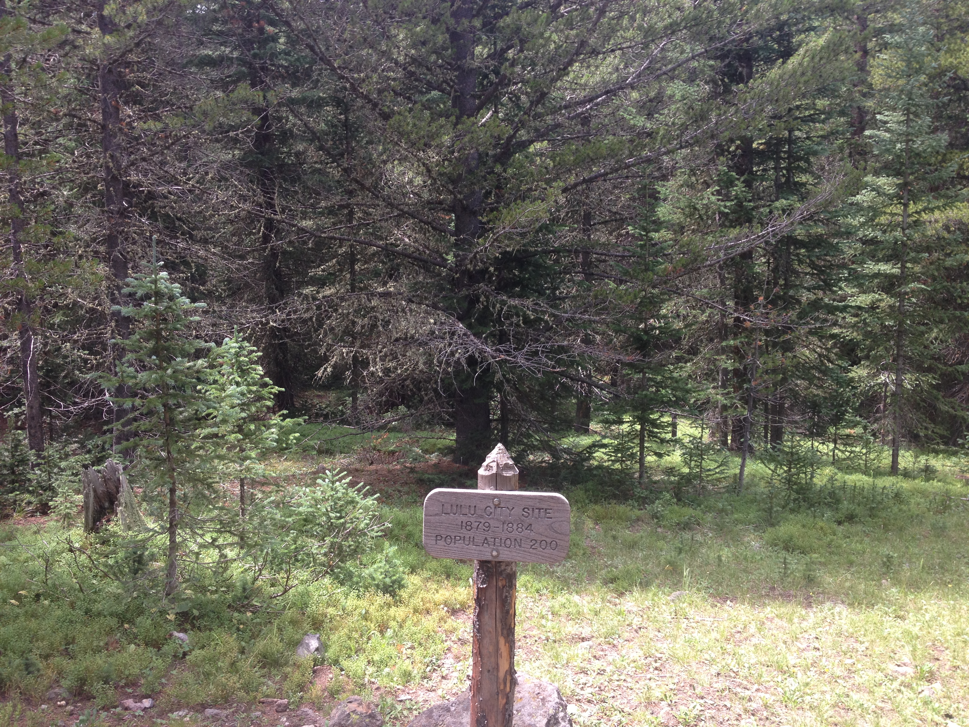
One interesting thing about this particular trail is that it passes through a ghost town.  3.5 miles from the trailhead, is a place called Lulu City.  In my DeLorme Colorado Atlas, it receives some fairly large lettering, so I was expecting the ruins of a town of sorts, similar to what you see on the Plains, or in the Rust Belt when you drive through a town that has been abandoned.  However, it was nothing like that.  All that is there is this sign, stating that a town of 200 people existed here for a total of five years.  Only five years!  I wonder what the story of this place is, and why it even warranted this major mention both in my atlas and on the Rocky Mountain National Park trail maps and signs.

IMG_0929 IMG_0931 IMG_0933 IMG_0934

After another mile or so of not too strenuous hiking, I arrived at the headwaters of the Colorado River.  The hike took less than two hours, and that was after going out last night and getting about three hours of sleep, so I was not exactly in top condition today.  Anyone wanting to view the Colorado River’s headwaters should actually stress the drive there more than the hike.  From Estes Park it is at least a half hour drive as the road traverses the park up and down a windy road.  Usually, it will take longer, as travel through the park slows down at nearly every scenic overlook, as well as anytime wildlife is seen and people stop to take pictures.

And of course, I can now forever say that I have walked across the Colorado River.  And I really walked across it, as opposed to when I walked across it on the bridge at the top of the Hoover Dam seven years ago.  That does not count.  But, when I get to the Grand Canyon, Moab, or any other place where the Colorado River has carved out an iconic scene, I will know that I have actually traversed across this very river with the assistance of nothing other than two logs, probably placed in the river earlier this year by someone with the same wacky idea and reasoning that I had today.

IMG_0935 IMG_0937

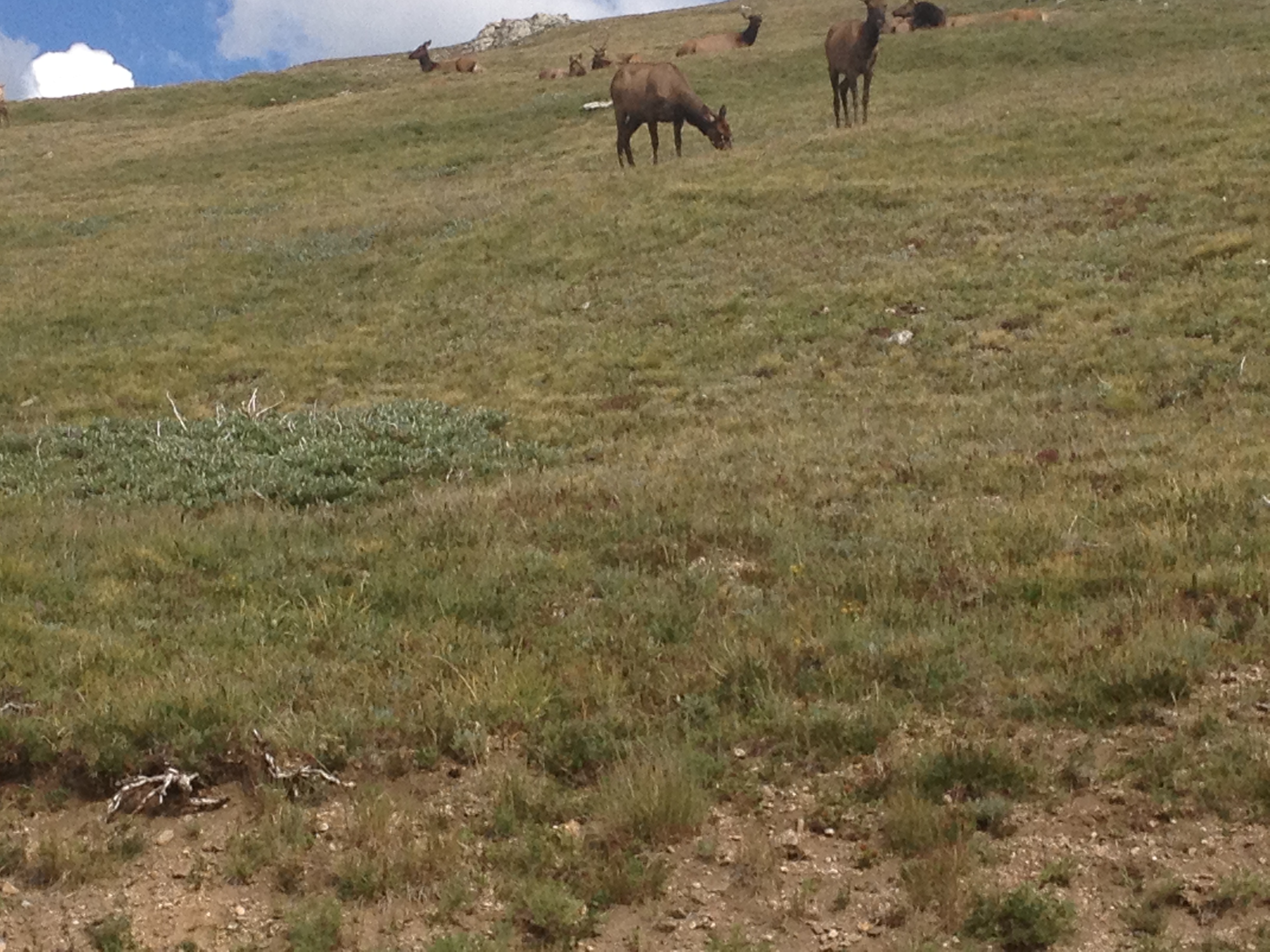
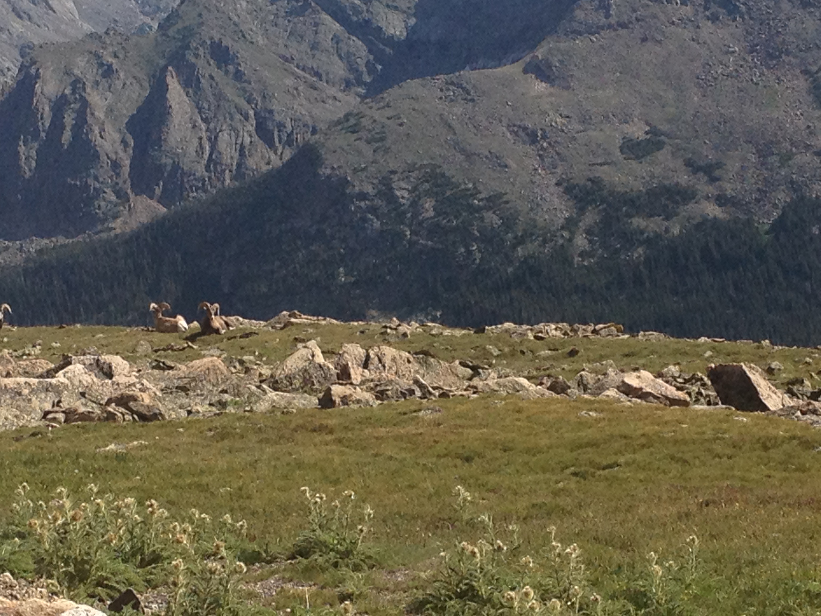
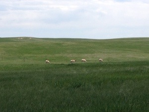
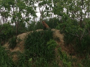
Oh yeah, and I cannot claim the higher ground with regards to everyone stopping to take pictures of wildlife and causing delays getting across the park.  This was only the second time I have ever seen moose, and this bighorn picture could not be passed up.  Five and a half hours of driving, and three and a half hours of hiking later, I can at least take solace that I rode my bike 39 miles yesterday and therefore did not really need a lot of exercise today.

Regional Familiarity

IMG_2317

Within only a month or so of moving to Colorado, one of the things I missed quite a bit about the Midwest was the familiarity I had with the region.  After 19 years in the Midwest, I had grown quite familiar with the area.  I knew the traffic patterns of Chicago, as well as all of the good alternate routes.   I knew what areas were popular in which situations, and therefore knew where to expect crowds.  I knew how much time to allocate for driving between any area in the Midwest, allowing me to allocate my life quite efficiently.  I also knew about restaurants, bar specials, people’s typical behavior patterns, and, well a host of other little intangibles that help an individual operate their lives smoothly.

I suspect many people begin to feel this way when moving to a new place.  Although it is important to embrace a new experience, in order to get the best result possible, it is hard not to long for that familiarity.  Different things are important to different people.  But, after living in a place for a few years, most people will have gradually obtained the knowledge that is important to them.  However, that first year or two always involves a scramble.

Yesterday, I learned a lesson about Colorado.  I had decided I wanted to go to Rocky Mountain National Park for two reasons:

1.  I decided that it was a good time to do a hike that contained a vertical climb somewhere in the neighborhood of 2,000 feet at a fairly high elevation.  This, of course, is mostly me wanting to fit in here, with the activities that a lot of people in my age group like to do.  At the University of Wisconsin-Madison, fitting in involved developing an alcohol tolerance.  Here it means being able to physically handle terrain, by hiking, biking, climbing, skiing, etc.

2.  Last month at Badlands National Park, I bought an annual pass to the National Parks for $80, with the specific intention on using the National Parks here in Colorado.

What I found out was, leaving at 7:30 A.M. was not early enough.  Well, not to do what I wanted to do, which was hike the Lawn Lake Trail, a 6.2 mile trail with a 2,450 foot accent to Lawn Lake, in the Mummy Mountain Range, and return to the car safely before thunderstorm chances increase in the afternoon.  My problem was that I departed right around the height of the morning rush hour, and, decided to take U.S. highway 36 through Boulder.  Not only did I encounter traffic before even getting out of Denver, but I encountered the usual Denver to Boulder traffic, and the usual delays in Boulder, where traffic is quite lousy for a city it’s size.  After all of this, I did not arrive at the entrance to the park until just after 10 A.M.  Luckily, I had learned from all of my recent travels that traveling within a National Park can be slow going, and therefore had selected a trail not too far from Estes Park, where I had planned to enter the park.

IMG_2318

By that time, all of the parking spaces at the Lawn Lake Trailhead parking lot had been taken, so I had to park across the street.  This was somewhat fortunate, as one of the best pictures I got from the area actually came walking across the street to get to the trailhead.

IMG_2319

On some hiking trails, it is surprisingly easy to take a wrong turn.  But, not on this one, as the trail was well marked by rocks the entire way, and even had periodic signs pointing the way.

IMG_2320 IMG_2321

As was advertised, the trail was quite steep.  In fact, it began with several switchbacks, and it was less than half a mile into the trail that some meaningful uphill progress began to appear.  That was when I saw another reminder that I am still a Colorado novice.  On one of the trail markers, I saw someone had actually left a hoodie on the post.  My first instinct was that having just worked up a sweat climbing the initial few switchbacks, the person had overheated a bit and decided to take their sweatshirt off.  But then, I thought to myself, why would anyone want to dump off a layer of clothing when going uphill, where it will only get cooler with elevation.  I also wondered if this was any kind of a signal that Coloradans know about that I do not.  Could it be similar to someone tying a tie around the door knob of a college dorm room to signal to their roommates that they have company and need to not be disturbed?  Only walking in on your roommate, as scary as that sounds, sounds less scary than being suddenly attacked by a bear, or giant falling rock because I did not understand this signal.

IMG_2322

I also seem to always happen upon waterfalls at Rocky Mountain National Park.  And, happening upon a waterfall I was not expecting kind of also made me reflect on some major differences between living here and in the Midwest.  I happened upon a waterfall when my destination was a lake.  This feels like the opposite of the way it would occur in the Midwest.  In the Midwest, waterfalls are hard to come by, and it is not uncommon to travel hours to encounter a good waterfall.

IMG_2324 IMG_2325

Knowing the thunderstorm threat at this time of year, and the amount of time I had, I had to change courses and chose to hike the shorter trail, Ypsilon Lake.  This trail, however, is also rated as “strenuous”, and at Rocky Mountain National Park, when they describe a trail as strenuous, they mean it!

IMG_2326 IMG_2328

I knew I had made some significant uphill progress because the density of the trees had begun to thin out.  From viewing the area around me, I concluded that I was roughly 1,000 feet below the “tree line”.  Later, after consulting my fabulous Colorado DeLorme Atlas, I determined that I turned around only about a mile and a half from the end of the trail, but that I had done pretty much all of the climbing.  From a base elevation of 8,540 feet, I had reached somewhere in the vicinity of 10,500 feet, leaving something in the neighborhood of 200 or 250 feet of climbing remaining.  I still wonder if I should have continued the rest of the way to the lake so that I could have completed the trail, but I guess I need to chalk the whole experience up to just not quite having the feel for how Colorado works yet.

IMG_2332 IMG_2333

Additionally, despite the fact that clouds seemed to be building on my decent, the thunderstorms actually held off.  So, I ended up deciding to do a little bit of driving along the famed Trail Ridge Road, which actually ascends up to nearly 12,000 feet.  On this road, one actually ascends above the tree line.  According to the Alpine Visitors Center, the tree line in Northern Colorado is at 11,400 feet of elevation.  Above this elevation, few trees are found, and pockets of residual snow can actually be found.

IMG_2335 IMG_2342

Overall, I guess I still had a productive day at Rocky Mountain National Park, but I still wish I could have traversed the entire trail to Lawn Lake.  I pictured myself getting there significantly earlier than I did.  I learned that Rocky Mountain National Park is farther away than I think of it in my head.  For some reason I always think of this place as being right in Denver’s backyard, because, from the point of view of 1,000 miles away, it kind of is.  But, it does take nearly two hours to get there from Denver.  Perhaps it would be faster to follow I-25 to Longmont, cutting over to Lyons on route 66?  I’ll probably try this next time, as Boulder does not do a good job of accommodating traffic.

I also learned not to expect this place to be much less crowded on a Tuesday than a Saturday.  This is because most of the people here are actually not from Colorado.  I actually saw a ton of Illinois plates here.  People come here on vacation, and, with the kids out of school for the summer, they are likely to be vacationing for a whole week.  If I really want to find a less crowded place to hike on a Tuesday, it would probably be best that I look somewhere completely different.  These are all things that people who have lived in Colorado for several or more years probably know and understand well.  And, over time, I will gradually get the feel for.  For now, I must learn all of this, either through experiences like this one, or through solicitations of advice from others.

Yellowstone and the Grand Tetons

IMG_0678

Yellowstone National Park was the first National Park in the United States, created in 1872, which seems to be before anyone really cared about preservation or anything like that.  It also appears to be the best known National Park, the first thing people think of when they think of National Parks.  Oddly enough, though, it is one of the toughest to get to.  It is two hours away from the nearest interstate highways, both I-90 and I-15.  And, those highways are not frequently traveled.  Denver is something like ten hours away by car, and with the possible exception of Boise, I do not even want to imagine what it would cost to fly into a closer airport.  So, I would not want to pass up the opportunity to visit this park, even if it is for just one day on my way back from Missoula.

IMG_0682 IMG_0683

Approaching from the West, via West Yellowstone, it is natural to enter the geyser part of the park first.  Old Faithful is the famous geyser that you see in all of the postcards about Yellowstone.  It is the biggest geyser, but not the only one.  In fact there are hundreds of them, maybe thousands, I don’t really know because I did not go everywhere.  All of these geysers, including Old Faithful, steadily emit steam whenever they are not “erupting”.  I am not sure if erupting is the right term for it, but as you know these geysers spew out water.  Apparently, it used to occur on a regular pattern, once every 50 minutes, but then something changed, likely the earthquake in 1959, and now the eruptions of this geyser are irregular.

IMG_0685 IMG_0686

Having time before Old Faithful “erupts”, we checked out the Old Faithful Inn, which is a famous hotel built right next to the geyser about 100 years ago.  I think pretty much every article I have ever read about Yellowstone, as well as every special on the Travel channel or whatever, has mentioned this place.  It would be quite neat to stay at a hotel right next to one of Yellowstone’s defining features.  In fact, there is even a balcony on the second floor on this hotel where you can actually see the geyser from.  If I ever did stay at this hotel (which probably won’t happen as I am assuming it is hella-pricey), I would definitely make a point of watching at least one “eruption” of Old Faithful from the second floor balcony.  With a really good breakfast, and pleasant conditions as they were yesterday, the only thing that could possibly make the experience better would be a 711 slurpee!  For my first ever viewing of the eruption of Old Faithful, which was predicted to be at 9:04 A.M., and occurred roughly three minutes later, I viewed it from the ground along with everybody else who was there.

IMG_0690

If a picture is worth 1,000 words, than seeing this in person would be worth at least a million.  Really, sorry to disappoint you, but it would be futile to even attempt to describe this.  I think all of the billboards in Chicago describe it as “three Buckinghams tall”.  That is a good start for anyone that knows about that place.  I’d say visit the park.

The geyser erupted for a few minutes, and after watching the eruption, we decided to walk towards some of the other features in that area of the park.  Still amazed by the experience of Old Faithful, headed toward this boardwalk with some other geysers, pools, and hot springs, we encountered a woman with her legs straddled across the ground, and a fancy camera shaking her head.  She made several comments to us about how disappointed she was in this Old Faithful eruption.  She eluded to previous viewings of this geyser being much better.  From what she was saying, it sounded like she was referring to something 15-20 years ago, in the 1990s, but I am not 100% sure because as soon as she started talking my mind began to wander out of sheer shock that someone could find something negative to say about this event.

To be honest, I do try to give people the benefit of the doubt.  Maybe the eruptions of Old Faithful in the 1990s were larger- who knows.  But, I can’t help but think of the possibility that she represents a certain type of people that we all have encountered at some point in time in our lives.  These are the people some refer to as “critics”.  No matter what happens, what goes on, they are always focused on the negative aspects of it.  They could be on vacation on a world class boat cruise in perfect weather around their favorite people ever, have a great time dancing by the pool, and get a call from their boss informing them of a raise and a promotion, and they would still focus on the fact that their hot dog came with yellow mustard instead of spicy brown, and embellish on that point.  More significantly, people like this can be a drain to be around sometimes.  Not only because of experiences like this, but anytime making plans with people like this, they are focused on what could go wrong instead of what could go right.  When you tell them about your ideas for what you want to do with your day, you week, your life, what they say to you undoubtedly plants the seeds of doubt and failure in your mind, rather than the seeds of confidence and success.  Maybe all of this is why this woman was alone.  But, once again, I do not want to make a judgement on someone who I met for only two minutes.  There are plenty of good reasons for people to take trips all by themselves, and I have known people to do this and come away with amazing experiences.  So, I am in no way going to make assumptions about this particular person.  I will only use this as a reminder of what kind of people tend to bring others down.  There is a book out this year that seems pretty popular called “Friendfluence” that actually addresses the issue of how the people you chose to associate with effects your personality and success in life.  I am lucky to have a lot of great positive friends that clearly do not fit into the category described above; some of whom I saw last weekend, some of whom I will get to see later in the week, some of whom I will see upon returning to Denver, and some of whom I hope to see again soon.

IMG_0692 IMG_0695

The other interesting features in the vicinity of Old Faithful are hot springs and smaller geysers.  I put my fingers in one of the hot spring’s resultant rivers, and verified- they are hot!  Many of these smaller geysers are constantly erupting in a way.  I hate to gloss over these features, as they are really neat.  But, this is a blog about Yellowstone, and I do not want to make it 10 pages long.  I guess people do write whole books about this place.

Yellowstone is big!  I guess I should have realized that when I saw that it did not fit onto one page of my Wyoming DeLorme Atlas, but I guess I was still not thinking of it as being as big as it is.  I think the park is almost 100 miles long and 100 miles wide.  Either way, it is quite possible, especially with the number of people that stop to take pictures of bison, elk, moose, and such, for it to take over an hour to get from one feature to the other.  So, we had to have a clear plan to get to the most important features in one day, which involved seeing Old Faithful early, and then headed toward Yellowstone Falls via Yellowstone Lake.

IMG_0698 IMG_0699

Yellowstone Lake is quite large, and surrounded by mountain ranges in all directions.  Overall, very picturesque.  It is also a good reference point when looking up weather information for the park.  At roughly 7700 feet in elevation, is is close to the mid-point.  There are plenty of hills that reach higher elevations, especially along the continental divide.  There are also some features, like the gorge of the Grand Canyon of the Yellowstone, and even Old Faithful, that are at lower elevations.

IMG_0704  IMG_0706IMG_0703IMG_0705

Okay, I know a lot of pictures, but Yellowstone Falls and the Grand Canyon of the Yellowstone also blew me away!  I later read (also in my DeLorme Atlas, they are really great) that these falls are actually much higher than Niagara!  Over 300 feet.  When the falls hit, they actually consistently cause rainbows to form, as water particles are projected upward significantly from the impact of the waterfall.  I do not think I even saw the bottom of the waterfall, as there was too much splash for me to actually see the bottom.  I bet Niagara is also like that.

In the same day, we also visit Grand Teton National Park, which is directly south of Yellowstone, with a gap of only a few miles.  I bet most people that visit one park visit the other one.  However, I bet the people that visit both parks do so over the course of several days to a week, not in one day.  This was definitely a hurried trip, but this leaves plenty more to be seen on a subsequent trip, which, now that I live in Denver, is not out of the range of possibilities.

IMG_0709

IMG_0712 IMG_0713

The main feature of the Tetons that stand out are the mountains themselves.  Grand Teton, the highest peak in this mountain range, has a height of 13,770′, making it only 34 feet shorter than the highest peak in Wyoming.  These mountains are actually visible from parts of Yellowstone park, and began to really appear as we approached the Tetons.  There is also a lake here, called Jackson Lake.  Jackson Lake is slightly smaller than Yellowstone Lake, and at a lower elevation.  In fact, it began to feel hot when we arrived here, well into the 80s.  It may have hit 90 somewhere nearby.

This whirlwind of a trip also took us to Jackson, which is quite a happening town.  It is probably best known for Jackson Hole ski resort, one of the premier ski resorts in the country, but is also less than 20 miles from the Tetons.  This provides the town with somewhat year round activity, and was quite lively in activity despite the ski resorts clearly being closed.

IMG_0715 IMG_0716

It was kind of odd visiting an area known to be cold on a hot day.  On a day when Denver hit 99, it is nice to be up in the mountains where highs were in the mid 80s.  However, I did get an experience that is probably significantly different than a typical experience of someone that lives in this area.  The average high at Yellowstone Lake at this time of year is about 65.  It’s a few degrees warmer in Jackson.  Oh well, this warmer weather makes up for the 34 degree morning in Custer on Wednesday.

IMG_0719 IMG_0720 IMG_0723 IMG_0725

The return trip also involves some more interesting features, all near a mountain range called the Wind River Mountains.  This mountain range contains Wyoming’s tallest mountain, Gannett Peak, and is home to the National Outdoor Leadership School.  And, with the town of Dubois (pronounced in a non- French manner, as I was repeatedly told) has a place called the National Bighorn Sheep Interpretive Center.  It would be interesting to see what really goes on there, but as of right now, I imagine a dog whisperer type character trying to figure out what Bighorn Sheep are saying.

Okay, well that was a lot to explore in one day, and I am 100% sure I missed some things, so hopefully I get to come back here.

Experiencing Western South Dakota

June 3, 2013

Today’s first activity was a hike at Badlands National Park. Yesterday evening, at the visitors center, I had chosen a hike for our group that was mostly considered “moderate”. Only the initial 1/4 of a mile, which started from the parking lot and took us up the side of the structures towards a plateau was considered “strenuous”. This initial part was pretty strenuous, and, had it gone on for over a mile, would have made a difficult hike. But, after the initial climb, most of the trail system we traversed on this morning, would be pretty flat, with only minor inclines and declines. This, of course, was the part of the trail that was labelled “moderate” in difficulty. I guess, the “moderate” difficulty rating was a let down because, the badlands, while a beautiful natural place, is not a place with a lot of terrain. There simply isn’t 1,000 ft. worth of incline to find.

20130605-211914.jpg

20130605-211920.jpg

Difficulty ratings for hikes have no set standard. How any place labels it’s hikes is completely to the discretion of the park. It reminds me of the differences we observe between ski trails labeled green vs. blue vs. black at different ski resorts. Some of the easiest black diamond ski trails I have skied in Wisconsin may even be considered green if they were to be in Colorado; certainly, they would at least be blue, not black. So, I guess it is important to understand the relative context of activities while planning them. While occasionally you will run into an activity with a standardization of sorts, like whitewater rafting, it seems like when it comes to most activities, descriptions of difficulty levels are subjective as well as relative.

The biggest waste of time today was driving about five miles out of our way to search for Bison at the Badlands. The reason being that our ultimate destination today was Custer. In Custer we saw so many Bison, and so many up close, that the search for Bison anywhere else today, well, the idea of looking for Bison anywhere else today seems utterly silly at this point in time.

20130605-212020.jpg

20130605-212029.jpg

We gave in to the nearly 200 (well, possibly even more) billboards we saw yesterday, and we went to Wall Drug. This place does a really good job of marketing itself, given that the main goal of marketing is to make people aware of your product. The signs, bumper stickers, and such make sure everyone is aware of the existence of Wall Drug. I had heard from others that the place was a gigantic tourist trap and not really worth it, but it is so close that it is worth going and finding out for myself.

20130605-212113.jpg

20130605-212119.jpg

The place was actually alright. It was a little bit cheesy. In the front , there is an actual drug store, true to its name. Behind that is a restaurant and ice cream parlor, which is pretty neat. The rest is mainly souvenir shops. Behind the store, there is this kind of old west town that many tourist traps in the high plains have. The only oddity is that they also have a really poor replica of a dinosaur there too. This was advertised on many billboards, so I am glad the delivered on this. But this does not belong right next to a replica of a village from 1880. Time periods should be consistent.

I made one key mistake there. I ate both ice cream and a donut. That is just simply too much sugar, simple sugar. A little over half an hour down the road, I got that sugar crash, and, for about half an hour could barely keep myself awake. This sucked, because the scenery was starting to become really interesting as we approached Rapid City and then drove Southwest on U.S. 16, and the 16-A.

20130605-212203.jpg

20130605-212213.jpg

The mountains here (I guess they are referred to as hills), are legit. I mean, the way the look, both from a distance, and up close when you drive into them, are actually not too different from the mountains of Colorado. This, I find somewhat surprising. When people make lists of states with really cool mountains, and I mean really big ones, it does not seem like South Dakota is ever really on that list. At least the association is never really made in my mind. I had always kind of known South Dakota to be kind of more interesting than the other plains states, and known that this area existed. But, it was not until now that I fully realized that the terrain in this area is significant when compared to other places in the country. It’s not as mountainous as Colorado, but it is not insignificant.

20130605-212245.jpg

20130605-212250.jpg

20130605-212301.jpg

20130605-212310.jpg

Today the sun rose at 5:30, and set at 8:30, for a total of 15 hours of daylight. I kept thinking about how much is possible with all these hours of daylight. It takes generally an hour or so to set up camp, start a fire, and cook. Today, we were able to take showers because we had extra time after cooking. This was after not arriving until nearly 6:00. In most other months, this would not have been possible. All this week, it seems like we had been less stressed, or had gotten more done than we would have in the fall, or some other time of year with less sunlight.

The problem is, June is the best time of year for a lot of things. Storm chasing is good, rafting is good, and with the most daylight possible, camping, touring, and such are all easier. So, how do we take advantage of our Junes. Should we work our asses off at other times of the year so we could get June off? That might cause too much stress at the other end of the year. How do we decide what activities are most deserving of these days? At the very least, the NBA and NHL can stop extending their playoffs into June so people don’t use up this time watching sports.

Oh, and we also saw Mount Rushmore. It was a bit smaller than I expected.

Camping in the Badlands

Today, June 2nd, started with a bang. Following our friends Jason and Allison, after only about 5 minutes of driving, suddenly a large black structure came flying off their vehicle. At first glance, the structure looked like a tire, and I became concerned that they had lost a tire. But, they continued, seemingly unaffected, so I assumed they had just run over an old tire, or old piece of rubber of some kind that was on the road. Either way, they wanted to stop to check things, which turned out to be unexpectedly beneficial. We stopped, still on some county road nowhere near the interstate, and concluded nothing was wrong with their vehicle.

After returning to the car, I suddenly see Allison running back to us with the kind of look on her face that made me think that something could have been wrong. It turns out that I had confused the sad look with the amazed look. Outside their car, sitting on some county road in South-Central (Minnesota that is), they had spotted a baby fox. This baby fox was quite cute. It actually made me think of dogs. It seemed in no way alarmed by our presence- and just presented itself to us, the same way a pet dog would. Had the fox of 60,000 years ago done the same to our forefathers, could the fox have become the pet of choice for humans rather than the evolved wolf (dog)?

20130605-210640.jpg

The remainder of the drive across Minnesota on I-90 was uneventful. A lot of windmills, that is it. Our first stop off on our journey to the Badlands was in Sioux Falls, SD. I’ve been to this town before. In fact, whenever I see this town, I think to myself that if I were to ever run a city, this is what it would look like, mainly on the count of how many signs that say “CASINO” one encounters here. Of course, they are mainly for places that throw in a slot machine or two, not full-fledged casinos with table games and all, but you still see them. And it makes you think this town is a gambling haven. We encounter a couple of other peculiarities in Sioux Falls. First, the gas station we filled up at had the following “Free Dandelion” sign. I not sure if that was supposed to be a joke or for real. Then, we saw something peculiar from a civil engineering standpoint, an interstate highway, 229, that actually turns into a dirt road (after its’ junction with I-90). From the point of view of someone who did not even know dirt roads still existed until college, but then became all too familiar with them on storm chases. I still think of dirt roads as not belonging in areas near “civilization”.

20130605-210740.jpg

20130605-210758.jpg

To break up the drive, we stop at the Mitchell Corn Palace, in Mitchell, which is just over an hour farther down I-90. For over 100 years, they have been building a succession of buildings that are actually made out of corn. Since corn does not last too long, roughly once a year they reconstruct the building with a different theme. The whole practice is rather ridiculous if you think about it. It becomes even more ridiculous when you see that the town’s city hall is actually attached to this building! Imagine being able to say you get to go to a castle every day because you are the mayor of the seventh largest town in South Dakota. Talk about the life.

20130605-210841.jpg

20130605-210847.jpg

My party thankfully avoids making all of the corn related puns one could make when visiting a ridiculous exhibit like this. I won’t repeat any of them, but I am sure you have thought of at least four by now. I did enjoy getting my picture taken with “Cornelious”, and buying a corn dog at the concession stand.

20130605-210942.jpg

South Dakota is pretty dull to drive across until you reach the Missouri River Valley, at the town of Chamberlin. At that point it becomes sort of interesting, but it does not become exciting all at once, the way it happens in Colorado where you suddenly see the mountains in the distance and one of the dullest most barren areas suddenly becomes a playground of infinite adventure possibilities. This transition starts with the Missouri River Valley, and then with some other river valleys that carve out of the land, as is typical in the high plains. Either way, it feels like we are in the West again.

20130605-211026.jpg

The other gradual transition across the state of South Dakota today was in the weather. Upon entering the state, the weather was similar to the weather we left behind in Iowa/Minnesota. It was chilly for this time of year last night, and we woke up to temperatures near 50 degrees and a thick deck of strato-cumulus clouds. As we transitioned across the state, the strato-cumulus clouds gradually waned, until there were suddenly quite few clouds in the sky. It also significantly warmed across the state, and by the time we arrived at Badlands National Park, it was a comfortable 70-72 degrees with good sun.

Indeed we were in the west. The distance we can see, the dryness, the scenery, everything felt a lot more west than Midwest. I switched I to what I am referring to as “Western mode”, which basically means being more prepared for dehydration and drinking more water. As soon as we arrived at Badlands National Park, we found a couple of really neat scenic overlooks, and then an area with some minor hiking trails. Today’s hike only lasted some thirty minutes and was more of a goofy/exploratory hike. By this, I mean there was no serious burn, no real workout. But we did some goofy things, climb a few rock structures, and went off trail. I even threw a few rocks around to see if I could throw them over some of the gorges. Hikes like this can be fun, even if they don’t build anything.

20130605-211135.jpg

20130605-211142.jpg

After hiking we went to our campsite, which was actually within the grounds of the park. This is my first time camping at a National Park! As a result of this, we have the minor inconvenience of not being allowed to have a campfire. But, the bigger inconvenience on this day is the wind. The high plains is known to be a windy place. Sometime in the afternoon, a Southeast wind of around 15 miles per hour, with major gusts, developed. I think for a while sustained winds may have reached 20. The main issue with this has been that it keeps blowing into my tent, and knocking the rods that hold it up out of place. I wonder if I have a sturdy enough tent. They have to make sturdier ones, but, are they tougher to carry? What is truly the best tent to have for hiking, or bicycle touring? Maybe, having the tent be less effective when camping in the wind is just a fact of life. This, of course is somewhat disturbing to me, as Colorado can get windy at higher elevation.

20130605-211453.jpg

Isn’t it strange how experience often leads us to more questions? I have some camping experience for sure, but to too much. I had never really thought of the odds and ins of these types of situations. I just know that I want the tent to be big enough and comfortable, that is all. Now, I am suddenly in a quandary of thought about a number of factors such as a tent’s weight, it’s reliability, durability, and, of course, how many people it can hold. It’s been said before that for every new question answered, two more are created. I really hope this is not right numerically, as we will never create a closed system of equations if this is the case. But, I do se the reality in answers leading to new questions. So do experiences. In a way, this is the rhythm of life. We meet people, try things, and create experiences. This leads to new inquiry, new ideas, and new methods. Which, leads to new experiences, activities, and people. The cycle goes on and on. The same is true of work, leisure, pretty much any area of life. Getting into this rhythm will create a life that will continue to perform, be motivated, and advance.

20130605-211527.jpg

After a visit to the visitors center where we determine a good hike for tomorrow, and a brief incident that involves me actually breaking our pants, our day ends with an evening presentation at the amphitheater about the black footed ferret, and then some star gazing with some heavy duty telescopes available at the park. This activity was an unexpected possibility at Badlands National Park. I learned about why this area is called the “Badlands”, and a lot about the history of the black footed ferret as well as the prairie dog. Then, we got to look at Saturn in this telescope, which was really quite awesome. Their telescope was so advanced that you could see the ring formations around Saturn, as well as some of its moons.

Overall, it was a very productive day. It is hard to believe that so much of it was spent on a fairly boring road. Tomorrow will involve less driving and more activities, which I look forward to. But, today’s activities were so diverse and the day was so full that I hope I can absorb them all, as well as the frenzy of thought they all put me in, in time to enjoy tomorrow’s to their fullest.