Tag Archives: South Dakota

The Akta Lakota Museum and Cultural Center

IMG_4497

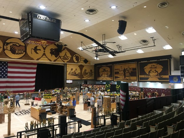
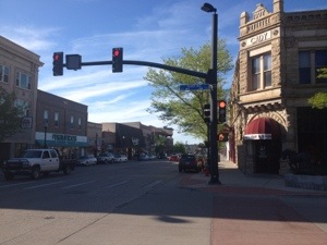
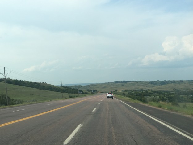
If you are anything like me, on a lengthy road trip, you are always looking for interesting places to stop. Stopping, for an hour or two, or for a night, breaks up the monotony of being in a car,  often on the highway, for many hours in a row. It also helps me take advantage of being where I am, and seeing interesting things I would not have been able to see had I flown. Depending on timing, the Akta Lakota Museum and Cultural Center, in Chamberlin, South Dakota is quite possibly one of the most interesting places to stop and check out on a drive across the state.

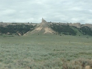
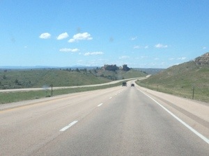
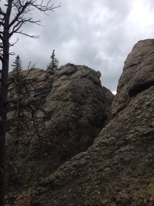
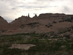
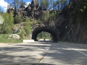
Chamberlin is already a welcome break to what can be a monotonous drive. Where I-90 crosses the Missouri river, and interestingly enough close to where explorers Lewis and Clark had one of their more confrontational encounters, the bluffs of the Missouri River contrast with the flat open grassland that stretches about 200 miles in either direction.

IMG_4489.jpg

The museum itself is unique as it tells the story of the Western United States from the point of view of the Native Americans, specifically the Sioux Nation.

IMG_4491

Most other museums about Western history, mention the Native Americans. However, in nearly all cases, the story is told primary from our point of view.

A lot of these museums cover the fir trade and the Lewis and Clark expedition. Some even talk of the Native Americans quite fondly and empathetically, like this statue, named Dignity, also in Chamberlin. It is accompanied by a museum that focuses on the South Dakota portion of Lewis and Clark’s mission.

The Akta Lakota Museum and Cultural Center, by contrast, tells the story of the region from the point of view of the Native Americans. It starts with life before European settlement. One of the first exhibits is an artistic depiction of what life was like across South Dakota before Lewis and Clark, and many of the fir traders had arrived.

IMG_4492.jpg

This depiction of life in South Dakota is quite easy to get immersed in. For a few minutes, I felt the way they felt, like I was living the life they lived. It is felt almost like the feeling people get when they truly feel a immersed in a movie or T.V. show and become emotionally attached to one or more of the characters. The people in this mural felt like my friends and family.

It made wish that I cared more, in the grand scheme of things, about the fact that the land they once occupied had been taken from them. Sure, change is inevitable, and given technological progress throughout the world, it is hard to imagine a scenario where South Dakota still looks exactly like this artist rendition today. However, there was a lot of misfortune brought upon these tribes.

This first part of the museum covers the culture of the Sioux. One thing I realized is that, the Sioux, being the group we interacted with most frequently in more recent years, likely created the caricature of Native Americans most of us live with today. The caricature of Native Americans are people who were at one with nature, in a way today’s hard core environmentalists can only dream of. They capture buffalo and use every last piece of it, giving the earth thanks for their bounty.

While this seems to be true of the Sioux Nations that Lewis and Clark encountered, and were among the last holdouts in the “Indian Wars” of the late 19th Century, it was not necessarily true of all Native Americans across the continent. Some tribes even exhausted their natural resources to the point of having to relocate.

What is astounding is how a culture can be so similar yet so different at the same time.

IMG_4494.jpg

Unlike in our culture, the Sioux place little emphasis on negative reinforcement or heavy-handed parenting. It seems as though positive reinforcement, likely mixed with a bit of peer pressure, generally brought children towards the right path. The general culture is interesting in the context of today’s current cultural divide. They saw children as a common tribal/communal responsibility, but also placed boys and girls on separate paths from a very young age; something both sides can agree with.

The museum then goes on to tell the story of the Sioux after European settlement. This story, oddly, starts out hopeful, which can be inferred from the diaries of Lewis and Clark. First, Spanish settlers brought with them horses, making travel faster. Later, British, French and Americans brought trade and all sorts of new supplies that made their lives easier. They became wealthier too.

IMG_4495.jpg

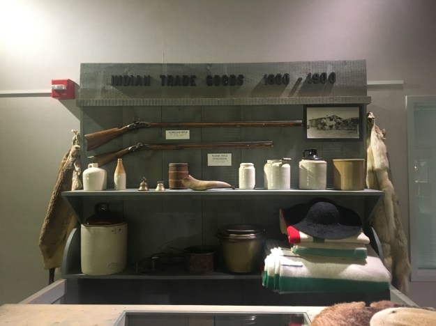
Unfortunately, they also brought disease. One aspect of the story of “How the West Was Won” that is rarely talked about extensively is how much of a role disease played in changing the North American continent for good. With the horses, guns, and new medicines, Europeans also brought diseases that Native Americans had no immunity to. These diseases would unleash plague after plague upon tribes throughout the 19th century, reducing their numbers. By the time the “Indian Wars” would occur, their numbers were reduced to the point that the outcome, victory for the United States, was all but inevitable.

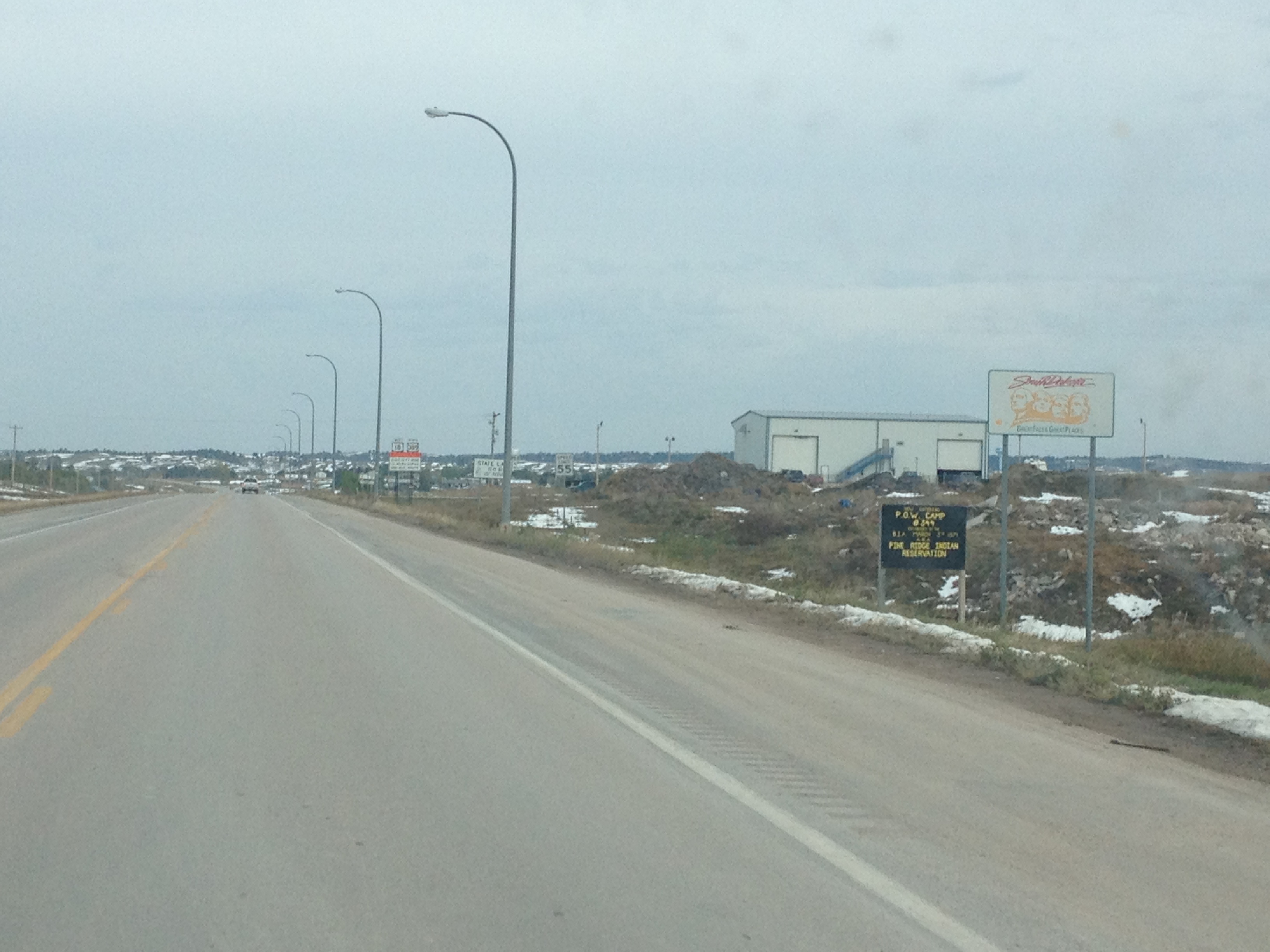
What had started out as an interesting new development with opportunities had turned into a nightmare. The final part of the museum covers the next, equally depressing chapter in the story of the Sioux. For most of the later 19th and early 20th Centuries, the U.S. government would sign treaties, establishing bounders with Native American tribes, only to break them anytime gold, or anything else of value was found on their land. The end result was today’s geographical distribution of Reservations, which covers only about 3% of the land area in the United States.

At this point, I am not sure what I can do about this terrible turn of events. It is hard for me to accept too much guilt for it, as I was born in 1980s New York, a time and a place where all this had already occurred. “My people”, if I can call it that, had happened to already successfully assimilate into the Nation that is responsible for much of the devastation brought upon the Native Americans. I was born into this country, and that is all I really know. Going somewhere else would be foreign to me.

I imagine a scenario where all this never happened, an alternate history, where Native Americans still control the North American continent. Rather than being born in the United States, I would have been born in Italy, spoken Italian and lived Italian culture. Still, in this case, there would likely be some story about how the Romans conquered the Etruscans.

At some point, it becomes necessary, in my opinion, to say that all I can really do is be mindful of history, live the life I know how to live in the place I was born into, for my own happiness, and try to look for a solution going forwards. Unfortunately, I do not have that solution, otherwise, I would probably be doing something else at this moment in time.


The World’s Only Corn Palace

IMG_4474.jpg

It’s one of those tourist attractions that makes most people just ask why. Corn is certainly Eastern South Dakota’s primary feature. However, it is impossible to drive by this place, see billboards advertising it, or hear about it from friends and not wonder what sequence of events lead to this idea actually being pursued and funded.

In the 21st Century, it sounds like the result of some combination of boredom, drugs, alcohol and/or sleep deprivation. But, when it was first constructed, in 1892, the idea was actually quite commonplace. Despite being the “World’s Only” Corn Palace, the Corn Palace in Mitchell, SD was not the world’s first. The idea was actually originally pursued in Sioux City, IA. Meanwhile, nearby Plankinton, SD was pursuing something called a “Grain Palace”.

So, what was behind all of these efforts to produce what is today seems like a pretty oddball attraction? To understand it requires actually visiting the place and taking a closer look at it, both inside and out.

IMG_4473

While the palace is reconstructed every year with a different theme, one aspect remains the same. The images, carefully created using corn, depict life on the Great Plains. The 2018 theme, South Dakota Weather, showcased an important aspect of life on the Great Plains, dealing with variant, and sometime wild weather patterns.

IMG_4480.jpg

The more the artistic displays at the Corn Palace are observed, taken in, and absorbed, the more the attraction makes sense. Rappers often use their lyrics to brag about the place in which they came from. Countless young adults showcase their lives on social media, showing primarily what they are proud of. This is just another version of this. South Dakotans showcasing what they are proud of…

Their resilience in the face of wild weather.

The pioneer spirit that drove them to the West, and the dedication and hard work it took to make life work in a rugged place.

IMG_4477

Cooperation, the community spirit, and the feeling of connection with the natural world.

IMG_4476

And, most importantly, the unique manner in which they show it.

IMG_4475.jpg

While the idea is not new, and it comes across as odd, the Mitchell Corn Palace is actually quite refreshing. In a world where bragging is everywhere, the form it has taken here is both unique and does not require insults be thrown at anyone else. It should serve as a challenge to all of us, as we attempt to find our place in a crowded world. Is there a way that each one of us can show the world why we love ourselves and why we feel valuable? But, do so in a way that is actually interesting to those around us, unique to each and every one of us as an individual, and does not require anyone else to be diminished in the process?


Sioux Falls: Not What its Supposed to Be

IMG_4471

I could stare at this for hours, looking at every detail about how the water pours over the rocks, creating a continuous splash, swirls in a pattern that is both chaotic and controlled at the same time, and a fine mist that sprays outward from the surface it lands on.

IMG_4468

No matter how many times I see waterfalls like these, it always fascinates me that some of the water that cascades downward takes on the appearance of foam, as if it was not water at all, but had taken on another form. Watching the water rapidly descend and subsequently take on this different form feels reminiscent of a human being that undergoes an experience that is both traumatic and transformative. The water, traumatized by unexpectedly falling rapidly, suddenly exudes a sudsy and bubbly appearance.

IMG_4472

The amount of raw power that is created when large amount of water steadily pour over a rock. The variance in colors that appear as a result of every small scale detail about how the rocks are arranged. The changes in the manner in which the atmosphere feels in proximity to this phenomenon.

All of this creates a level of curiosity and fascination in me reminiscent of an 8-year-old at a science museum, in awe by dinosaur bones and that electricity ball that makes people’s hair stand up any time they put their hands on it. How did the rocks come to be formed in this manner? Why did the water chose this path on its way to the ocean to complete the water cycle? And, in this case in particular, how did this happen in a place so unexpected?

Falls Park is not only in a section of the country that is quite flat (Eastern South Dakota), but it is also right in the middle of a city (Sioux Falls). Everything about its location is contrary to what most people think of when they imagine encountering waterfalls. Yet, it is there, powerful and beautiful.

IMG_4467.jpg

It is also not just one waterfall, but a series of waterfalls that cover a surprisingly long section of the Big Sioux River. The park itself spans 123 acres, includes a restaurant, permanent sculptures, and gets lit up for the holidays in December. It does for Sioux Falls what Central Park does for New York, and Golden Gate does for San Francisco. It is the place in the heart of town that is natural and scenic, providing a kind of convenient short-term escape from day-to-day urban concerns.

However, given its location, surrounded in all directions by flat lightly forested grassland and corn fields, a waterfall like this feels like it is not supposed to be here. Sioux Falls is a city in the Great Plains. The other cities in the region are bisected by rivers that gently flow towards the Mississippi in some capacity, not cascading waterfalls that are typically found in mountainous terrain.

Sioux Falls captures the imagination much in the same way light switches captivate a 9 month old, or magnets a 4 year old. It is not what is expected. It is not what it is supposed to be. Places like this, people like this, and ideas like this are what makes life interesting. Sure, we are all comforted when what is around us, including the people we interact with, follow some sort of pattern, behaving as expected. However, without the mavericks out there, the teacher with a strange method of reaching students, those that quit stable jobs to start a business, and that one person in your social circle who always has a story from last weekend about something the rest of us could never even imagine doing, things can get quite stale. Therefore, for the same reason I salute the first person to decide to travel the world by bicycle, I salute Sioux Falls for not being what it is supposed to be!

Chasing Records- Spearfish, SD

IMG_4286

At 7:30 A.M. on January 22, 1943, the temperature in Spearfish, South Dakota was -4ºF. A mere two minutes later, the temperature had suddenly jumped to +45ºF, a swing of nearly 50 degrees in a manner of two minutes. The Great Plains is known to be a region with extremely volatile weather. However, with respect to volatility on this short of a time scale, this one event is still in the record books.

75 years later, locals, as well as those interested in weather, still talk about the event. In fact, the event is mentioned in the Wikipedia entry on Spearfish.

But, why so much volatility? Why here? The answer to that question lays in the geography of the region.

Spearfish_Topography

Spearfish sits just north of the region known as the Black Hills. The Black Hills, although detached from the Rocky Mountains, are actually quite mountainous, with peaks rising several thousand feet above the river valleys. The manner in which peaks rise up in either direction while rock formations are carved out by small creeks is quite reminiscent of the Rockies.

Just over the border, in Northeastern Wyoming, Buttes of varying colors pop out of the more open, but still hilly landscape.

Only ten miles south of Spearfish is one of what feels like 500 different waterfalls that goes by the name “Bridal Veil Falls“.

IMG_4285.jpg

It is, nonetheless, breathtaking, but, what is it about this name? Did the wedding industry  somehow collaborate with the outdoor industry to try to convince tourists looking at waterfalls to be thinking about fancy weddings through this common nomenclature? Was there an early 20th Century conversation that went something like this…

“Okay, we’ll name every other waterfall ‘Bridal Veil Falls’. In exchange, you will encourage every newlywed couple to take something referred to as a ‘honeymoon’.”
“A honeymoon.. what is that?”
“A vacation that everyone is expected to take right after getting married. Think about it, both of our industries can make a ton of money off of this. We’ll get people thinking about getting married and specifically doing so with a fancy dress, likely to cost a lot of money, and then you make sure that when they wed, they are spending money on another vacation.”
“Sounds like a win-win.”

Okay, maybe it was not exactly like that, but it does seem pecular.

As far as Spearfish is concerned, traveling in the other direction, North, from town, could not be a more opposite experience.

IMG_4287.jpg

It is the Great Plains, and specifically the Dakotas, the way most people picture it.

It is this contrast, and specifically the North-South orientation of this contrast, in Spearfish that created this record breaking temperature change. When air travels from high elevation to low elevation, it warms. It is this exact reason that Denver, Colorado, just east of the Rocky Mountains, has frequent warm spells in the middle of the winter. In fact, January 16th is the only calendar date in which Denver’s record high is lower than 65ºF (it’s 64).

With the flat, wide-open, treeless land to the North, it could not be easier for bitter cold air straight from the North Pole to reach Spearfish. However, when warmer air does come from the South, it is further warmed by its trip over the Black Hills.

IMG_6101

But, why all the fuss about setting records? Specifically, why do people care so much about bizarre records? In 1943, the news about the wild temperature swings in Spearfish provided a war-weary American public with some lighter news. And while the impact was only a bunch of broken windows, people can learn from these records.

The wild temperature ride in Spearfish demonstrates how the atmosphere works. Is there something similar to be learned by the man who broke 46 toilet seats with his head in one minute? Do people who have watched that video avoid breaking their own toilet seat at home?

Or, is there something other than intellectual curiosity at work? Records like this one are interesting to people regardless of whether or not they care about the ins-and-outs of how the atmosphere works. They are just entertaining. They also provide people with one of the main things we are all searching for in the modern world; significance.

The people of Spearfish can always bring up this wild temperature swing as something that makes their town stand out among all of the towns of roughly 10,000 people out there. It is the same for the man who bloodied his head breaking toilet seats, or that one person in everyone’s social circle that did something bizarre, like stop at every Arby’s between Chicago and Saint Louis (there are 13). They have this way of making the world just a bit more interesting.


Back on the Reservation

A few weeks ago, I had the opportunity to visit an Indian Reservation for the first time in my life.  I learned quite a bit from that visit.  I learned that these reservations do not look like many of us imagine them to.  I also concluded that our history is complicated.  I do not have a good understanding regarding why relations between us and the Native Americans progressed the way they did, and it would be disingenuous for me to take a position on these issues.  However, I did see people in need due to their circumstances.

There are some things universal about helping out those in need.  Contrary to some people’s belief, helping out those in need is not dependent on ideology, wealth, or status.  It is only loosely dependent on what someone believes about the person (or people) they are helping.  Caring parents will often bail out their children with financial or housing support even if they believe their child had been lazy, stupid, or malicious in the behavior that led them into trouble.

In my belief, in order to be genuine in helping someone out, there are two necessary conditions.

  1. There must not be coercion.  This one is obvious, being forced to help someone out, or forcing somebody else to help someone out is not genuine charity.
  2. There must be no expectation of a reward.  This includes not only a monetary reward, but also the guy who does charity work and then starts telling girls at the bar about it to help him get lucky.  Or, likewise, anyone that hopes for any praise or increase in status from their charity work.  To be fair, rewards can come.  But they have to not be the reason for it.

For this reason, I was hesitant about writing about this in my blog.  It could come across that I am trying to show off that I did charity work.  I am really just trying to explain the reason I went back to the Pine Ridge Indian Reservation, as it is one of the poorest places in the country.  But, you have no real way of knowing that for sure.  Maybe I could have left this whole part out.

IMG_1135

The Pine Ridge Indian Reservation is in Southwestern South Dakota, with it’s southern border being the Nebraska/South Dakota border.  So, as soon as we entered South Dakota, we were on the reservation.  Last week, this area got an unexpected early season blizzard.   In the Black Hills, to the north, some places got over 40″ of snow.  This is something that rarely ever occurs in mid-winter in this part of the country, let alone in early October.  Pine Ridge, more on the southern flank of this storm, got about 12″, still a lot, and the evidence of this snowstorm could still be seen.

IMG_1140 IMG_1139

The task yesterday was tiling, and we put up tiling like the one pictured above at a couple of houses in this neighborhood in Pine Ridge.  So, just like the day before,  I learned a new activity.  In fact, I continued on the theme of expanding my comfort zone, as over the course of the day I became comfortable using machinery that initially intimidated me.

Spending an entire day on the reservation, I made a couple of observations I hadn’t last time (when I was only there for the morning).  Last time I felt that the reservation may have just as poor as some of the dispirited urban neighborhoods I had previously observed, but not as dangerous.  However, I was only there for the morning, which tends to be the least dangerous time of day.  I noticed this hole in the window of one of the homes I helped work on.

IMG_1143

This hole in the window may just be more evidence that the area is poor and do not have the resources to repair such a thing.  Still, I wonder who it got there.  Stray bullets from gang related activity tends to be one of the biggest fears one has about visiting poor neighborhoods in the United States.  Either way, I am not about to go ask the homeowner how this happened- that would be rude.

IMG_1145 IMG_1144

I was also quite astonished by the number of stray dogs in the neighborhood.  All day long, I encountered stray dogs just wandering up and down the street.  I recall one of my former co-workers in Chicago telling me that stray dogs were common on the south side, but I have no idea what that meant.  Occasionally I would see a stray dog in my neighborhood, but usually there was someone there to call animal control, or try to find them a shelter.  Here they were everywhere, wandering in and out of people’s yards, sometimes getting into people’s trash, and even pooping in the yard (which I was lucky to avoid).  I guess I just wonder why there is a different attitude towards dogs here than what I am used to.

The return trip also gave me an unexpected surprise; the quintessential Nebraska experience.  For me, this means thunderstorms and steak.  On the return trip southbound across the Nebraska Panhandle, we encountered a series of really fun storms, with lots of lightning.

RADAR_20131010 IMG_1146

Thunderstorms are my favorite type of weather, at least from an observers point of view.  There really is nothing like the raw, natural power of these storms.  I also love the differentiation within the storms, and how abruptly things change inside a thunderstorm.  With the heavy rain, frequent lightning, hail, and abrupt wind changes, there is so much to see.  There is so much going on I feel like I can make a diagram like those Xs and Os the football commentators make.  It is the weather phenomenon for people who love to see all things energetic.

It is also the weather phenomenon for people who love efficiency.  Seattle and Kansas City average about the same amount of annual precipitation (37-38″).  However, in Seattle, precipitation occurs 155 days per year, while in Kansas City, precipitation only occurs 104 days per year.  Kansas City achieves the same result with 41 more rain-free days.  In addition, many days with thunderstorms are mostly sunny for large sections of the day, with the exception of the hour or two when the storms are rolling through.  Overall, many more productive hours.  For me, it is the long, humid day, followed by the abrupt thunderstorm that makes the Great Plains what it is.

We stopped at a steakhouse called Cantu’s in the town of Bridgeport, NE right after we finished rolling through the storms.  The place is right on highway 385, the main street through the center of town.  I have many times stopped at random places I encounter on the main streets of towns while driving through.  I really like doing this because it gives me a sense of what makes that town unique to every other town I have ever been to, something I won’t get by eating at a chain restaurant.

Of course, I have had a variety of experiences, ranging from great to horrible at restaurants like this.  However, when on the Great Plains, particularly in areas near a lot of ranches, I’ve have mostly good experiences with steakhouses.  The trend definitely continued today.  I really enjoyed my sirloin steak at Cantu’s.

A Journey to Another Nation

In some of my travels earlier this year, I was exposed to more of the history of the American West; particularly our series of battles and treaties with the Native American population. Earlier this week, as I gazed towards the east, towards the Great Plains, I pondered people that society often overlooks. Quite possibly the most overlooked people in our society today are the Native Americans. In that vein, I took advantage of an opportunity I got to visit the Pine Ridge Indian Reservation in Southwestern South Dakota. This is one of the poorest places anyone can find within the United States, and a place where a lot of people in the West go to do charity work.

20130921-094233.jpg20130921-094246.jpg

The drive up to the Pine Ridge Indian Reservation is primarily through the Nebraska panhandle, through an area I am mainly familiar with through storm chasing. With a little bit of extra time, we got a chance to visit a couple of roadside attractions near Alliance, NE. The primary attraction there is a place called Carhenge. Carhenge is a replication of Stonehenge with old cars that was built by some rancher a couple of decades ago. Apparently, ranchers have nothing to do in the winter, and often end up bored. So, from time to time, they come up with something creative, which explains why we also saw this roadside attraction, only a couple of miles further up the road.

20130921-094643.jpg

As we travel north and approach the border of South Dakota, the empty and largely flat land typically associated with Western Nebraska gives way to some rolling hills and pine trees. This first begins to appear near the Niobrara River Valley, a river that actually produces some of Nebraska’s most interesting scenery. In fact, farther down this river, just east of Valentine, NE, is a place called Smith Falls, a waterfall with a 75 foot drop, which is really not to shabby at all.

20130921-095355.jpg

On the road we came in on, Nebraska highway 78, we enter the Indian Reservation as soon as we cross the border into South Dakota. On the border, there is a town called Whiteclay, NE, where Native Americans largely go to buy liquor, as for some strange reason it can’t be sold on the reservation. The town of Pine Ridge, the main town on the reservation is a mere couple of miles into the reservation. There, I met the people who assist with coordinating the volunteer efforts of those looking to help. They have an office, which looks like a small house from the outside. Inside, I see a map showing the poorest counties in the United States, a good amount of Native American artwork, and a calendar, with plenty of appointments for people to visit and help written on it.

20130921-103239.jpg

20130921-103248.jpg

Out of respect, I took a limited amount of pictures on the Reservation. However, I did take a couple of pictures, one of one of the houses we were working on, and one of the neighborhood. At some point, I was under the impression that Indian Reservations are places where people still live in tepees and chase buffalo off of cliffs. But, in reality, they live in towns much like how the rest of us do. We always kind of romanticize the idea of Native Americans as nomads who hunt and gather their food, but history does show that is not always the reality. Particularly in the Southwest, ruins of villages from long before any European Explorer arrived can be found in places like Taos Pueblo and Mesa Verde National Park.

The town did look obviously poor. Many of the yards had broken cars and many of the homes were in disrepair. In that sense, it kind of reminded me of some of the poorer parts of Chicago that I had seen, on the West and South sides. I did definitely feel a lot less danger in being there than I had when I had ventured to those parts of Chicago. I guess I did not feel as if I was liable to get jumped, or be hit by a stray drive-by. However, the level of poverty did not feel any less.

20130921-104819.jpg

After working on a few homes, we got to go to lunch with a couple of the people who coordinate the volunteer effort, at a place called the Lakota Cafe. I got a chance to have a small discussion with a couple of the people who coordinate the volunteer efforts, and also have some involvement with Indian affairs (with the U.S. Government). I have a ton of questions I would have liked to ask them. I really do not understand everything about our relations with the Native American tribes, as it is a topic that is not commonly discussed in depth. These reservations are sort-of another nation, but also sort of not. Apparently there are a lot of legal controversies in situations where our federal law is different than the laws enacted by the tribes. There are also controversies over water rights, particularly for water from the Missouri River. The water rights controversies in some ways remind me of the ones along other rivers, with those downstream accusing those upstream of taking too much. However, there is definitely a component of it that relates to the treaties we had formed with the tribes (some of which we blatantly violated). Apparently, one of the treaties permits some of the tribes to take the water from the Missouri River in South Dakota.

The biggest mystery to me about our affairs with the Native Americans is why we cannot simply just live together like we do, more or less with other racial groups. I mean, we do self-segregate, but we live under the same governmental and societal structure. And this is with different groups of people with differing histories, including some that did not come here willingly. Of course, the history with the Native Americans is also unique, as they were here long before Columbus introduced the continent to the Europeans. Seeing that the reservation has houses, cars, roads, stores, etc. just like us makes it even more of a mystery to me, as the idea of a place where people still chase the buffalo would definitely not vibe with our modern day American culture, but they seemed to have opted to live in towns now.

As much as I would really like to know their perspective on this, I decided it was not my place to ask them these questions. It could have been taken the wrong way, as there are a lot of people who feel like the Native American tribes should not have their reservations, and have become a drain on society. They don’t know me, and do not know my intentions, or how I feel about anything. Nor do I really know how I feel about all of this stuff. The more I hear them describe how the law operates within the confines of the reservation, how they coordinate with Badlands National Park and such, the more confused I get.

It is the point of view of the Native Americans that their land was taken away from them, little by little, and that in a large part their culture was taken away from them. However, nearly all of the world was once nomadic hunter-gatherers. One by one, different places took to living in cities, agriculture and the like. So, can the Native American tribes be expected to do so as well? It seems like there are towns in the reservations, so I get the impression that the issue is not even necessarily about the idea of nomadically chasing the buffalo. From my visits to places like Crazyhorse, and Fort Larmaie, it does seem like we made a lot of treaties, and broke them. But I don’t know the reason why. Nor do I have anything near a good understanding of that history.

I was born nearly a whole century after the last “Indian War” happened. I did not chose to come to a new continent, nor did I chose how we relate with the Native Americans. The only other time in my life I even encountered Native Americans was in Wisconsin in 2004, when we were protesting a professor by the name of Ward Churchill for making outlandish claims about the victims of 9/11. The Natives stood alongside us, as they felt Professor Churchill, only something like 1/16 Native American was stealing their identity to make a political point. So, while it is natural for me to feel that we did historically treat these Native Americans well, I also wonder how much I can personally be expected to feel responsible for something that was done by people who only really have one thing in common with me; their race?

In the end, the conclusion I came to today is that I am in no place to take a position on any of these issues, as I simply don’t understand them. I have become tired of people taking strong, decisive political opinions, often deriding those who disagree with them, based on incomplete understandings of facts and history. I believe that people should at least understand the uncertainty around their points of view before they start saying things that could potentially upset others. At this point in time, I am applying the same standard to myself with regards to this particular issue. To take either side, even if I were to take the side of the Native Americans due to what appears to be a failure on our part to honor the treaties, at this point in time would be disingenuous. And, I believe that the Native Americans would think this to be so even if I did take their side with what little knowledge I have of the true history, and the true reasons why thins are the way they are at this present point in time. All I can do is listen, to all points of views, learn more, and be willing to help out those in need.

America’s Emptiest Highways

June 5, 2013

Today’s entry is going to really make me seem crazy. You see, I not only had planned to go to the Black Hills with my friends from Chicago, but I also enrolled in a Leadership Training Course with the Adventure Cycling Association in Missoula, MT. This course goes from Thursday through Sunday (June 6-9). After a lot of figuring, my plan for today ended up being to ride with my friend back from the Black Hills to Cheyenne, WY, where I met up with my father-in-law, who ended up deciding to accompany me on the trip to Missoula. We would get as far along on this journey as possible today, and get an early start for Missoula tomorrow. I need to be in Missoula by 4 PM tomorrow.

So, I ended up spending most of today in a car. We started early on, just after 7:00, getting from Custer, SD to Cheyenne, WY by around 11:30. Then, after some lunch, and some additional prep, we took off from Cheyenne at 1:30 P.M. In the end, we made it as far as Hardin, MT, which is the first real town you encounter after the border.

My main activity today really was seeing some new places, that I have never seen before, and experiencing some of the quietest places in the country. I am talking about places where very few people live. You will go over 30 miles between town on some stretches, with the towns you do experience being barely a couple of thousand people. These are places that over 95% of Americans will never experience. And, the solitude of some of these places is something that many of us will also never experience. A good portion of the U.S. population live in or around large cities, and vacation to places where many others also vacation, like Disney World, or the Wisconsin Dells. Really, it is strange got think about how many people really never get away from the crowd.

The highlights of my drive are as follows.

In Eastern Wyoming, most of the area was desolate, as previously mentioned. The main feature the stuck out at me was a rock formation just South of Torrington that literally looked like it was giving me the middle finger! Wow!

20130606-211250.jpg

In the area around Casper it was easy to see the northern parts of the Laramie Mountain Range, however, it is important to note that none of these peaks are above the tree line.

20130606-211327.jpg

After Casper, there was a break in the action with respect to mountain ranges.

20130606-211407.jpg

I got to the end of Interstate 25, and returned to the road that had dominated not of my week already, interstate 90.

20130606-211433.jpg

Sheridan and the Bighorn Mountains. This place is legit. Sheridan has a surprisingly full downtown for its size. It has a fairly long stretch of road that feels like a legitimate downtown, along a Main Street. I have to say I was way more impressed than I expected. And the views of the Bighorn Mountains, both from within town and outside of town were quite breathtaking. Overall, it was a pretty nice experience.

20130606-211510.jpg

20130606-211516.jpg

Hitting the Montana border (New State)! And then, I actually drove through an Indian Reservation. It seemed odd to me that an interstate highway would actually run right through a reservation, but I-90 runs through the Crowe Indian Reservation. The town of Harden is where the road exits the reservation, and probably why the Montana Welcoe center is 50 miles into the state.

Hiking in the Black Hills

June 4, 2013

Mount Harney is the tallest peak in South Dakota. In fact, it is the tallest peak anywhere east of the Rocky Mountains. The guy at the Custer State Park visitors center actually said it was the “Tallest peak between the Rockies and the Alps”. While that is technically true, it is a bit of a stretch. At 7242 ft., it is taller than anything in Appalachia, including the tallest peaks in the Smoky Mountains, but not really by too much. The difference is less than 1000 ft., and is probably made up for by the fact that the bases of those mountains are at lower levels.

However, it was still a really good hike. In fact, it kind of reminded me of hiking near Boulder a bit. It is at similar elevations, a similar total climb, and there are some major rock formations here too. Our loop from Sylvan Lake up to Harney Peak and around by two other major features; Little Devil’s Tower, and the Cathedral Spires, took us a bit over 8 miles today. With what is probably close to 2000 ft. of vertical climbing, between the main climb and a couple of side climbs, it was a very satisfying hike. With this morning’s drive taking us by the ” Needles Eye”, we have actually seen nearly half of the unique natural features of South Dakota. Not bad considering that we only arrived in South Dakota on Sunday.

20130606-152731.jpg

20130606-152744.jpg

At the top of Harney Peak there was a strange lookout point. It was actually the remnants of an old building. We think people actually hid out here, but I am not sure who. It was still interesting to see the place, and imagine the life of someone living on top of the tallest peak in the area. From this vantage point, you can see all of the peaks. We could look out on all of the peaks of the Black Hills, including the ones we had driven up and down yesterday and today, and they all showed up significantly below us. This may be the first time I have experienced this exact feeling, climbing my own way up to the top of the highest peak in the area. In 2005, I biked up Blue Mounds (Wisconsin), but the terrain there is nothing compared to what it is here. In 1998, my family and I drove up Pike’s Peak, but, we drove.

20130606-152544.jpg

20130606-152552.jpg

The alternate trail we took on the return trip to the car took us real close to the Cathedral Spires. These rock formations remind me of the Dolomites in Northern Italy, with their mostly vertical, but imperfect, gray colored rock structures of varying heights. In fact, for the entirety of the hike, as well as in many cases before and after, I have been referring to this feature as “The Dolomites”. And, no, I am not trying to show off that I am Italian, or that I have been to Italy. It is just kind of natural for people to make the association in their head based on the visual. I am reminded of an instance when someone I knew kept referring to the green sauce that they provide with samosa at an Indian restaurant as guacamole. He was not trying to show off his Mexican-ness, it was just that his previous experiences with green sauces in restaurants had mainly been guacamole, and the natural association was made. In the same vein, the other time. I had seen rock formations like that, it was the Dolomites. Some of the other rock formations did look like the Flatirons in Boulder, with a major exception being that they are lighter in color.

20130606-152834.jpg

20130606-152849.jpg

On this hike, in several places, both on and off the trails we were traversing, we passed through some tight areas inside rock formations. This was a good deal of fun, although somewhat scary. Oddly enough, I enjoy doing things like this, and I have not even completely figured out why. I guess there is a slight element of danger in it, and it does provide the hike with some variety. But, hiking is already an interesting enough activity that it does not need variety. And, I am not really pushing my limits anymore with this nonsense, as I have done it plenty of times over the past several years. Maybe it is just curiosity, the entrance into the unknown, the feeling you get when anything can happen. In this sense, it would be the same feeling that drives people to take a new route home, enter into new activities and new social circles, or even drink or do drugs. The flirtation with the unknown seems to come out in me a lot; skiing, hiking, parties, etc.

One final note about the hike. Boy have these pine beetles done a number on the forrest here. Scenes like this one are seen everywhere, and when viewed at a distance, parts of the “Black Hills” look quite red! I knew this was a big problem in Colorado, but it actually seems like the beetles have done even worse to the forests here. It is sad to think that the very nature of these places are bound to change forever, but in life, change is inevitable. It cannot be avoided at any costs.

20130606-152926.jpg

Our other activity today was visiting Crazy Horse. Crazy Horse is a statue of a famous Native American hero that sits on the other side of the black hills from Mount Rushmore. But, it is incomplete. It has actually been under construction since 1948, and is still nowhere near close to done. According to the hosts at our campground last night, the Crazy Horse statue will “not be completed in your grandchildren’s lifetime”. This slow progress is due to the desire to make this statue quite enormous, as well as their commitment to use only private funds. Turning down money shows a significant amount of pride, and/ or adherence to principles. Maybe both, they are actually probably quite related.

20130606-152949.jpg

20130606-153001.jpg

At Crazy Horse is also a museum of the Native American. We did not intend to spend all day there, so I pick a few excerpts to read, some about famous Native Americans. I don’t even remember the stories themselves, but reading these stories makes me more curious about Native American culture in general. History is written by the winners, and in the battle for North America, we, the white man, are the winners. But, it is hard to ignore the fact that we kept making and then Subsequently breaking treaty after treaty with these Native tribes. I would love to know the full story behind this, from both perspectives, and how the modern day Native Americans feel about all this, as well as the situation they are in now. Are they happy to have all the modern conveniences associated with the U.S.A.? Do they feel that we are the ones protecting the freedom of all? Or do they feel they cannot live the lifestyle of their choosing, and their continent has been usurped? I bet you get some real mixed emotions.

On the campground tonight, we got a bit goofy. In fact, we spent probably about half an hour, sometime around sunset, trying to throw pine cones into the campfire from various places. Most of them were from the top of a rock. It was some unexpected (and free) fun. I think our society could use a bit more of that if you ask me. One of my favorite things about trips like this are actually simple things like this that bring joy out of nowhere, unexpectedly.

20130606-153140.jpg

Experiencing Western South Dakota

June 3, 2013

Today’s first activity was a hike at Badlands National Park. Yesterday evening, at the visitors center, I had chosen a hike for our group that was mostly considered “moderate”. Only the initial 1/4 of a mile, which started from the parking lot and took us up the side of the structures towards a plateau was considered “strenuous”. This initial part was pretty strenuous, and, had it gone on for over a mile, would have made a difficult hike. But, after the initial climb, most of the trail system we traversed on this morning, would be pretty flat, with only minor inclines and declines. This, of course, was the part of the trail that was labelled “moderate” in difficulty. I guess, the “moderate” difficulty rating was a let down because, the badlands, while a beautiful natural place, is not a place with a lot of terrain. There simply isn’t 1,000 ft. worth of incline to find.

20130605-211914.jpg

20130605-211920.jpg

Difficulty ratings for hikes have no set standard. How any place labels it’s hikes is completely to the discretion of the park. It reminds me of the differences we observe between ski trails labeled green vs. blue vs. black at different ski resorts. Some of the easiest black diamond ski trails I have skied in Wisconsin may even be considered green if they were to be in Colorado; certainly, they would at least be blue, not black. So, I guess it is important to understand the relative context of activities while planning them. While occasionally you will run into an activity with a standardization of sorts, like whitewater rafting, it seems like when it comes to most activities, descriptions of difficulty levels are subjective as well as relative.

The biggest waste of time today was driving about five miles out of our way to search for Bison at the Badlands. The reason being that our ultimate destination today was Custer. In Custer we saw so many Bison, and so many up close, that the search for Bison anywhere else today, well, the idea of looking for Bison anywhere else today seems utterly silly at this point in time.

20130605-212020.jpg

20130605-212029.jpg

We gave in to the nearly 200 (well, possibly even more) billboards we saw yesterday, and we went to Wall Drug. This place does a really good job of marketing itself, given that the main goal of marketing is to make people aware of your product. The signs, bumper stickers, and such make sure everyone is aware of the existence of Wall Drug. I had heard from others that the place was a gigantic tourist trap and not really worth it, but it is so close that it is worth going and finding out for myself.

20130605-212113.jpg

20130605-212119.jpg

The place was actually alright. It was a little bit cheesy. In the front , there is an actual drug store, true to its name. Behind that is a restaurant and ice cream parlor, which is pretty neat. The rest is mainly souvenir shops. Behind the store, there is this kind of old west town that many tourist traps in the high plains have. The only oddity is that they also have a really poor replica of a dinosaur there too. This was advertised on many billboards, so I am glad the delivered on this. But this does not belong right next to a replica of a village from 1880. Time periods should be consistent.

I made one key mistake there. I ate both ice cream and a donut. That is just simply too much sugar, simple sugar. A little over half an hour down the road, I got that sugar crash, and, for about half an hour could barely keep myself awake. This sucked, because the scenery was starting to become really interesting as we approached Rapid City and then drove Southwest on U.S. 16, and the 16-A.

20130605-212203.jpg

20130605-212213.jpg

The mountains here (I guess they are referred to as hills), are legit. I mean, the way the look, both from a distance, and up close when you drive into them, are actually not too different from the mountains of Colorado. This, I find somewhat surprising. When people make lists of states with really cool mountains, and I mean really big ones, it does not seem like South Dakota is ever really on that list. At least the association is never really made in my mind. I had always kind of known South Dakota to be kind of more interesting than the other plains states, and known that this area existed. But, it was not until now that I fully realized that the terrain in this area is significant when compared to other places in the country. It’s not as mountainous as Colorado, but it is not insignificant.

20130605-212245.jpg

20130605-212250.jpg

20130605-212301.jpg

20130605-212310.jpg

Today the sun rose at 5:30, and set at 8:30, for a total of 15 hours of daylight. I kept thinking about how much is possible with all these hours of daylight. It takes generally an hour or so to set up camp, start a fire, and cook. Today, we were able to take showers because we had extra time after cooking. This was after not arriving until nearly 6:00. In most other months, this would not have been possible. All this week, it seems like we had been less stressed, or had gotten more done than we would have in the fall, or some other time of year with less sunlight.

The problem is, June is the best time of year for a lot of things. Storm chasing is good, rafting is good, and with the most daylight possible, camping, touring, and such are all easier. So, how do we take advantage of our Junes. Should we work our asses off at other times of the year so we could get June off? That might cause too much stress at the other end of the year. How do we decide what activities are most deserving of these days? At the very least, the NBA and NHL can stop extending their playoffs into June so people don’t use up this time watching sports.

Oh, and we also saw Mount Rushmore. It was a bit smaller than I expected.