Tag Archives: Colroado

Hiking in the Front Range in Mid-April

IMG_9073

April can sometimes be a tough month.  It’s a hard month to plan too far ahead of time, as there is such a wide variety of weather conditions that one can experience in many parts of North America.  There have been instances, in April, where places like Nebraska have experienced both a tornado threat and snowfall within the same day!

This is especially true in Colorado.  Over the past five Aprils (2012-2016), Denver has received snowfall of an inch or more 11 times!  At higher elevations, April snowfall can be almost twice as frequent.  Yet, over the same five Aprils, Denver reached temperatures of 80F (26C) or above 6 times, and highs exceeded 70F (21C), on average, 9 days out of 30, or about 30% of the time.

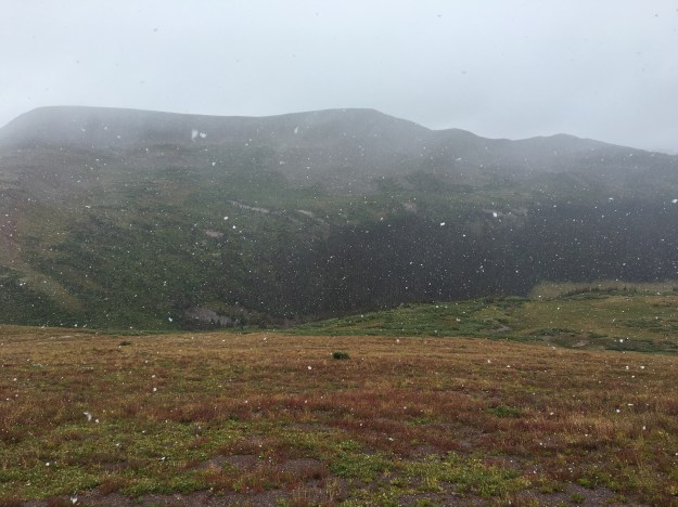
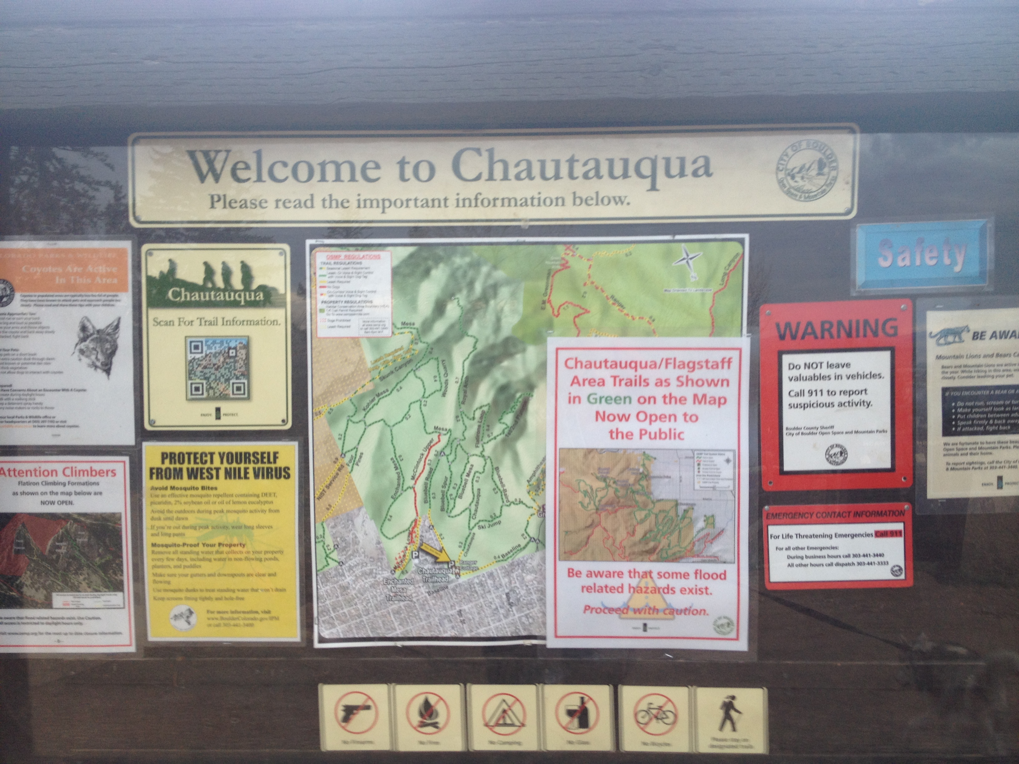
A typical challenge in April is to find hikes at lower elevations as there is often still a significant snowpack higher up.  April 8th’s snowpack exceeded 40 inches at most places above 8000′ in elevation, despite the period of warmer weather April 5-7.

CO_Snowpack_20170408

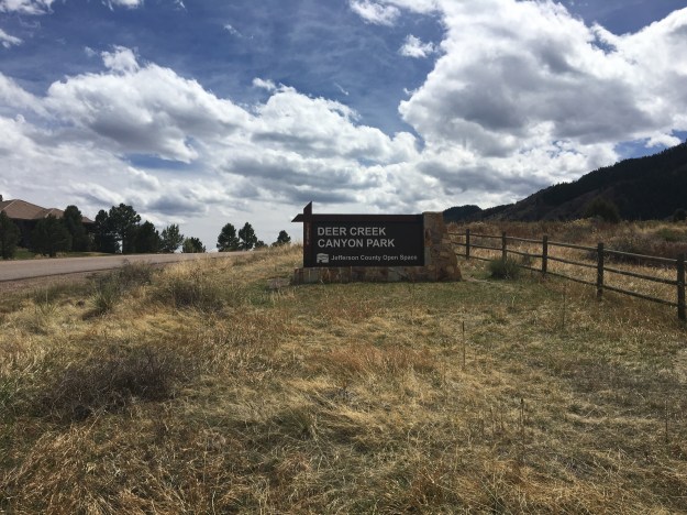
Looking primarily at start and end elevation, and for a place I have yet to hike, I selected Deer Creek Canyon, a place, oddly enough I can ride my bicycle to in just under 90 minutes.

IMG_9087.jpg

And, much to my surprise the trailhead is actually located at Colorado’s Center of Population (according to the 2000 census).

IMG_9065 (1)

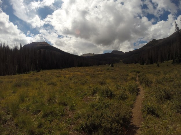
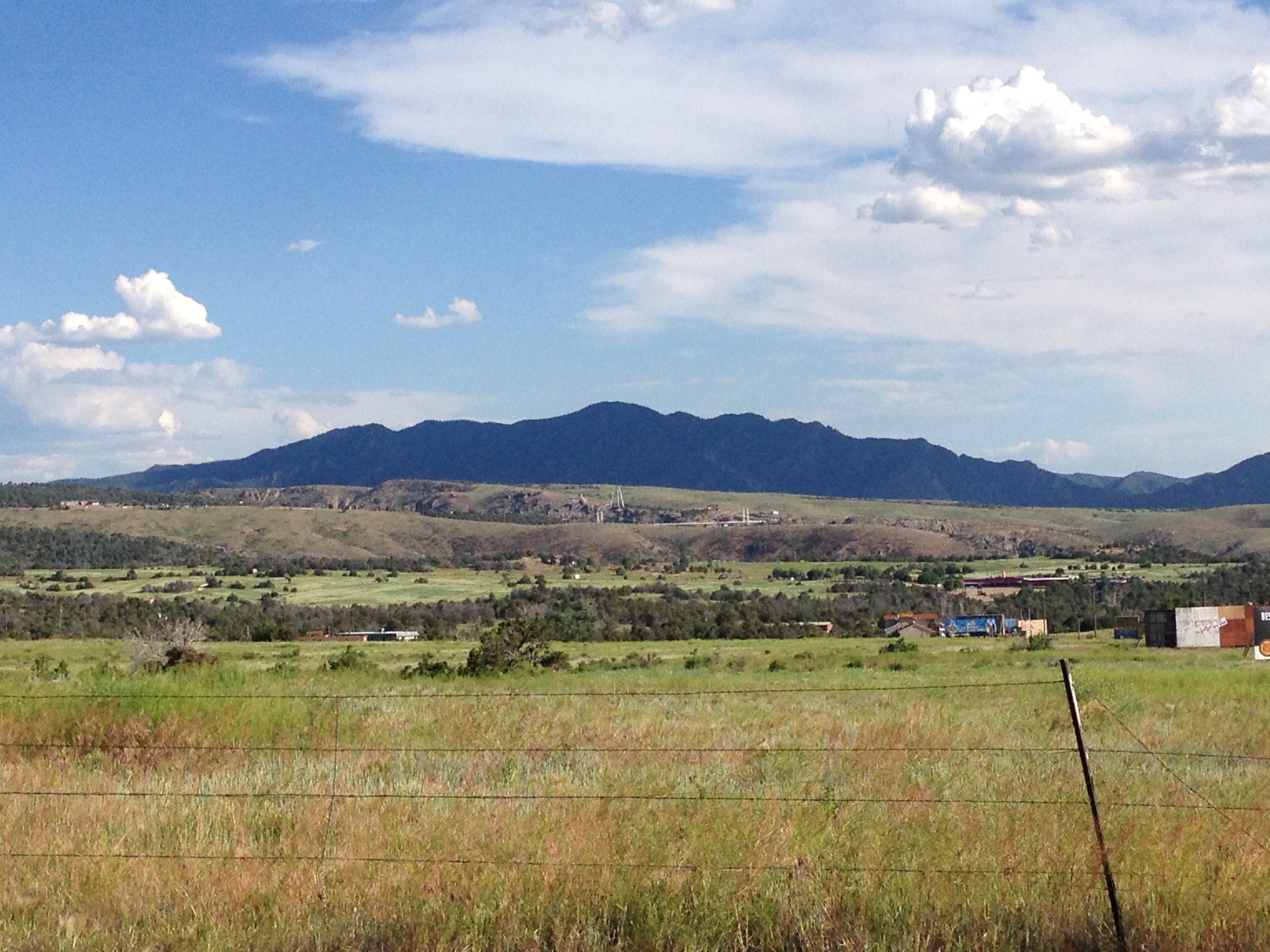
The quickest route from the trailhead to the top of Mount Plymouth is roughly 2.4 miles.  With an elevation gain of about 1200 feet, this particular hike would definitely fall into the “moderate” category for difficulty.

The other surprise was encountering not just a random structure, but an entire subdivision, roughly half a mile into the hike (taking the shortest route).

IMG_9067IMG_9066

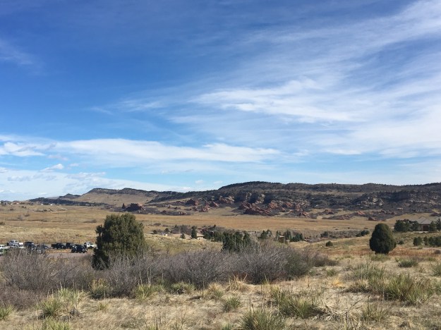
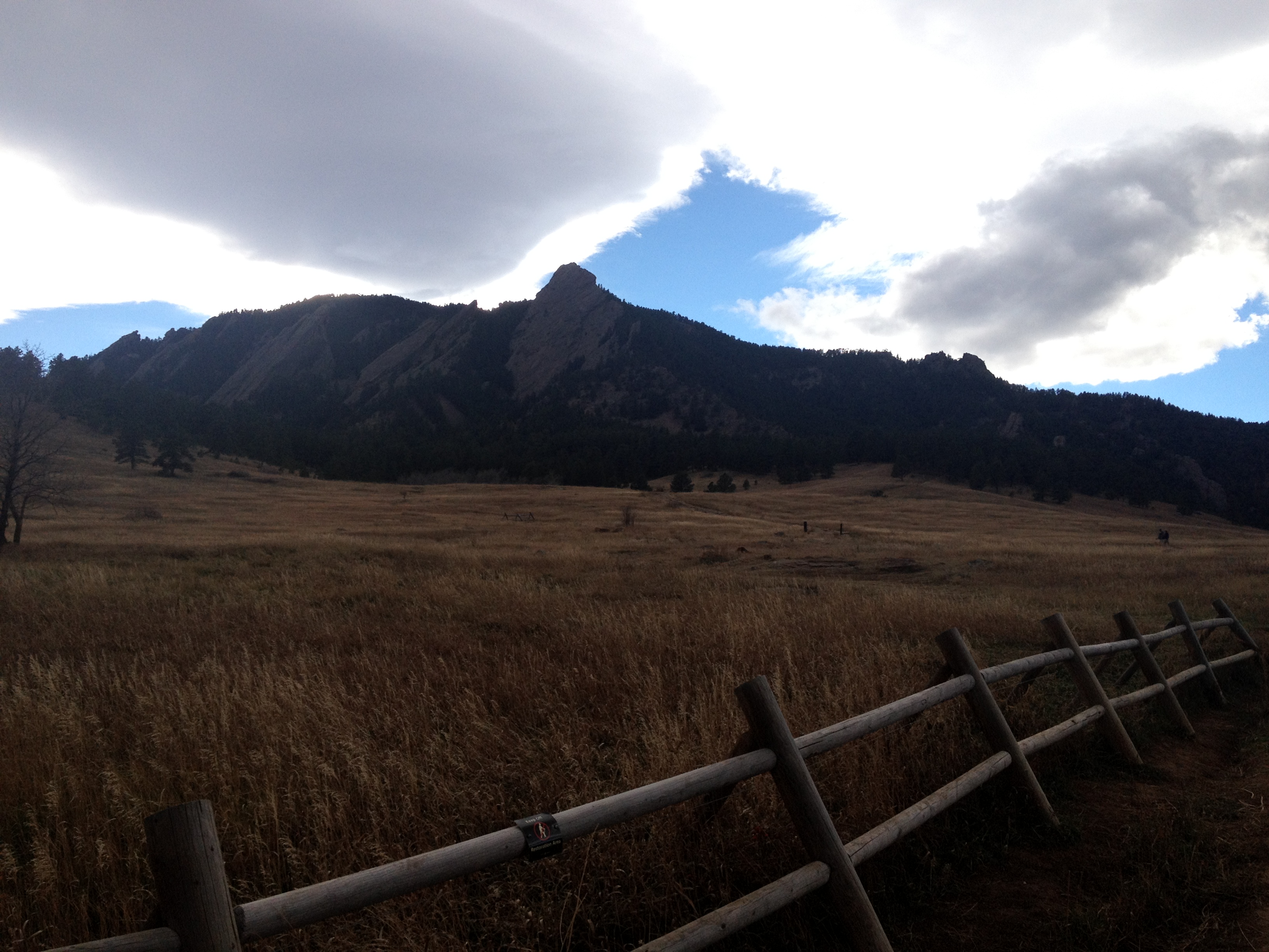
The people who live here seem to have the life!  The houses are quite large, they have a spectacular view of some pretty interesting looking red rocks and rolling hills, and easy access to hiking trails.  Oh, and they live pretty much at Colorado’s center of population.  For a while, we discussed what it would be like to live in a place like this, and whether or not we would enjoy it.  Being fairly close to Denver, I bet these homes are quite expensive.  Yet, moving to a place like this would still entail giving up some urban conveniences.


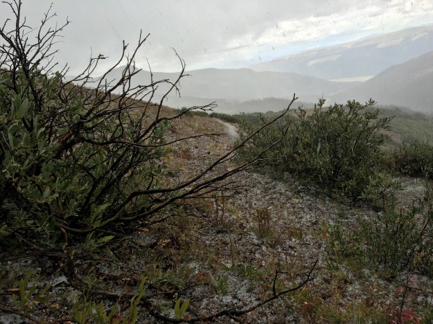
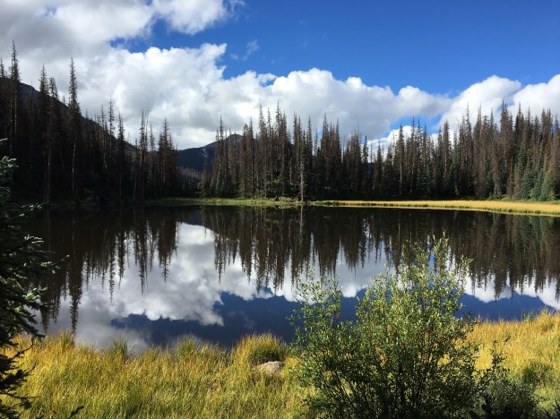
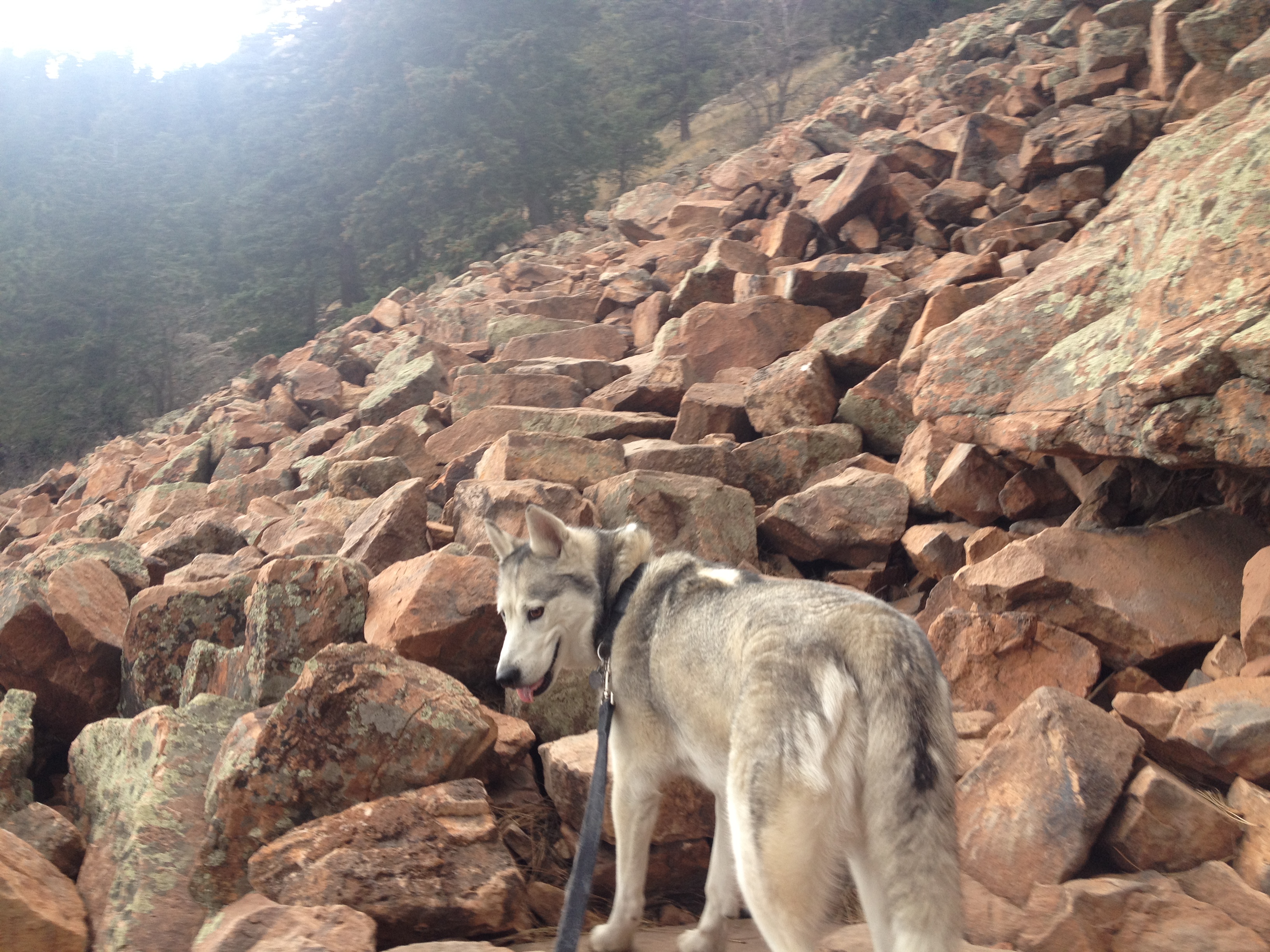
I had hoped to avoid snowpack and mud, and for the most part we did.  Starting the hike at about 9:45 A.M., at least 2/3 of the hike was in the sun, and those parts of the trail were dry.  Toward the top, some ares with a little bit of mud, and even a bit of slush could be found in shaded areas.  Parts of the area had received close to a foot of snow several days prior, which, despite warmth thereafter, had not completely melted in areas above roughly 6800′ that are shaded from the sun most of the day.

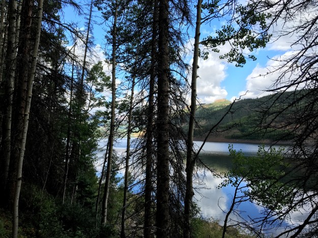
Whether it be on the way up to the top of Plymouth Mountain, or on the return trip to the trailhead, I would certainly recommend following the remaining part of the loop on the Plymouth Trail.

IMG_9078IMG_9096

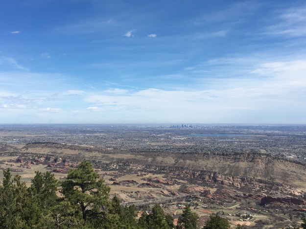
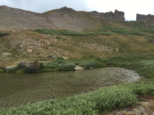
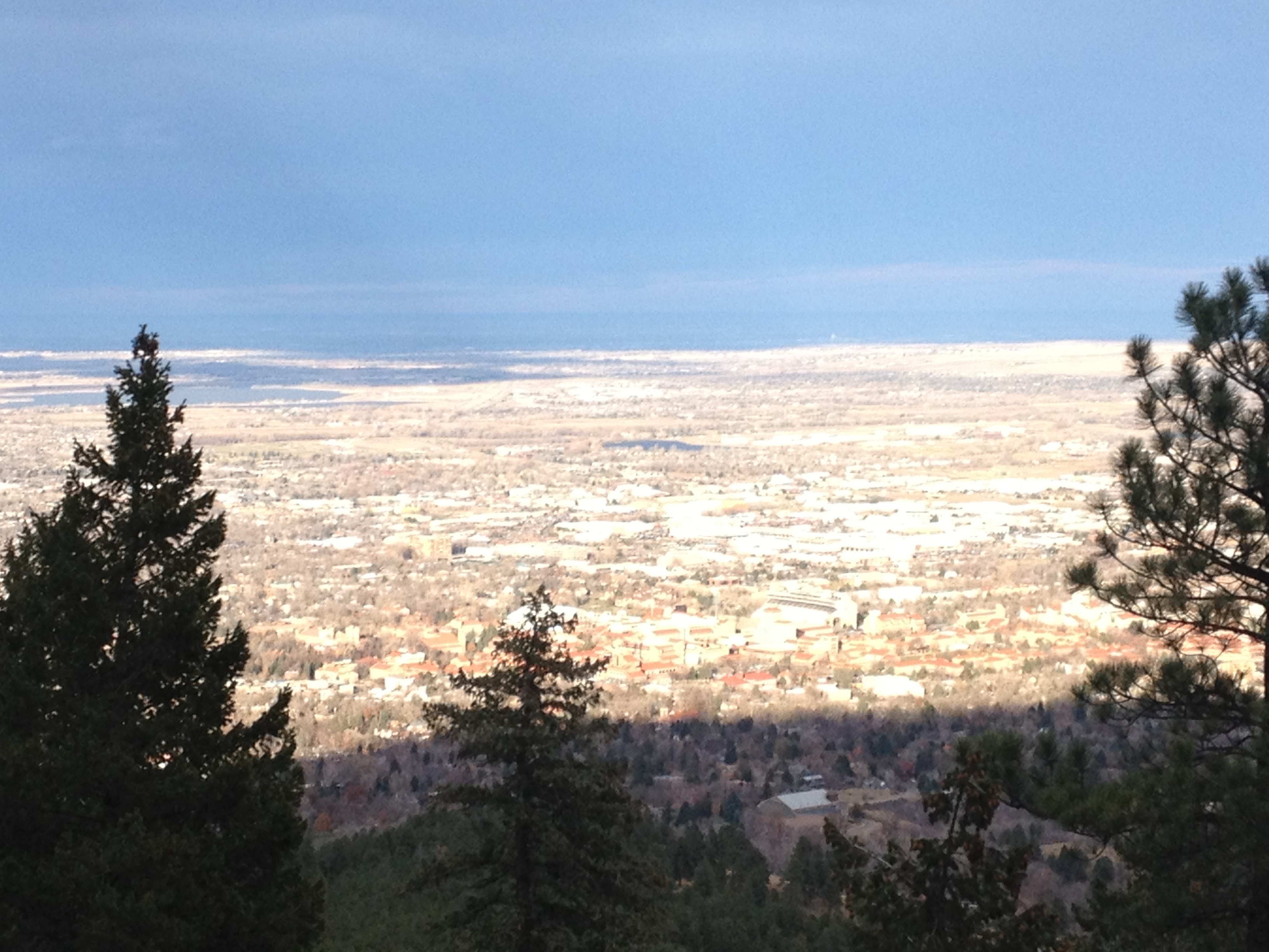
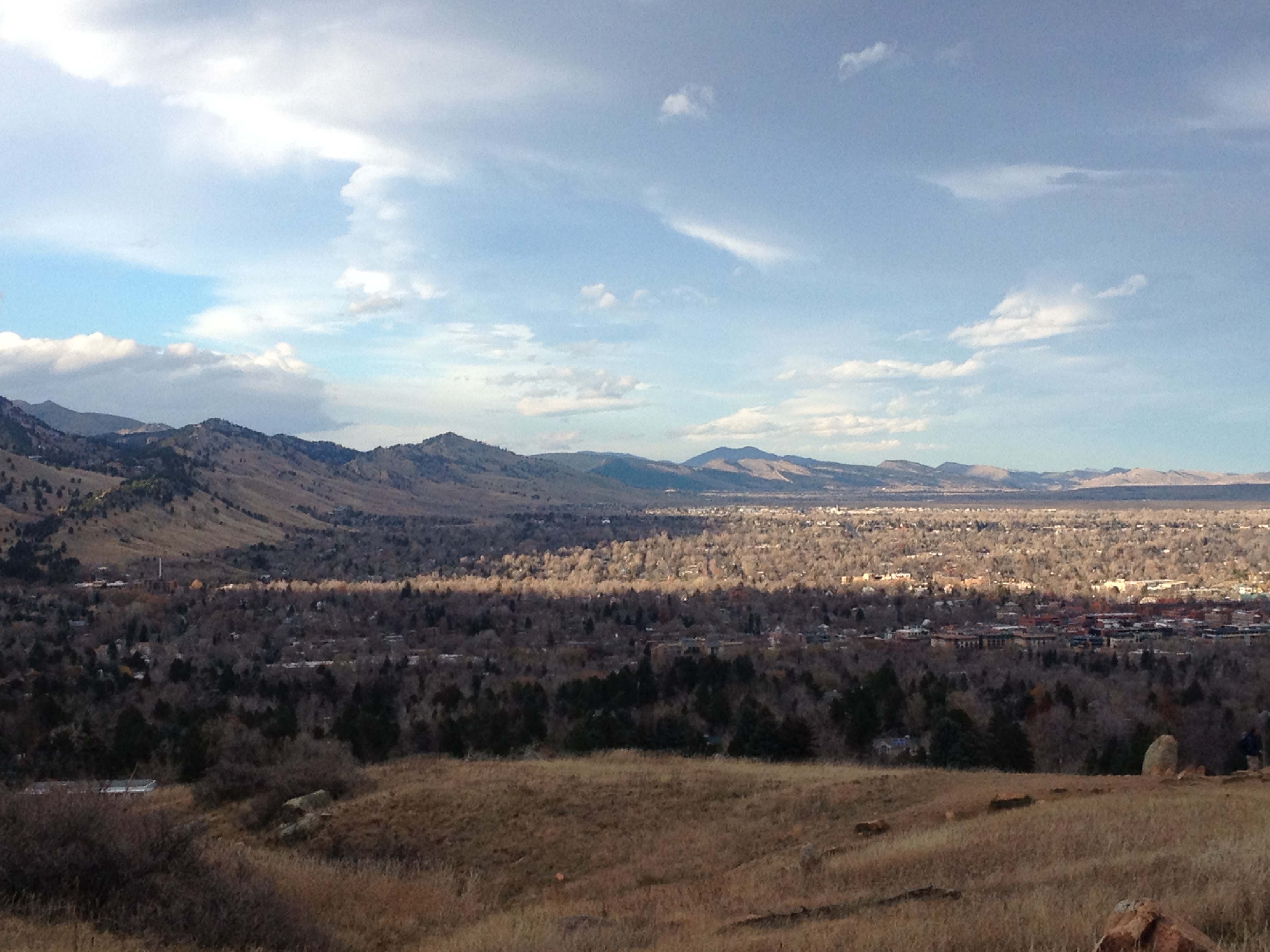
It was in this section of the loop where we found the best views of Denver’s skyline, and found some more interesting rocks to climb on.

We also veered off the main Plymouth Trail to follow The Meadowlark trail for the final 1.5 miles down to the trailhead.  This trail traverses through forests of short trees with minimal foliage.  I have encountered these trees before, always at roughly this elevation near the foothills of the Rocky Mountains.  It is a unique experience, to be surrounded by trees in all directions, but to still be nearly completely exposed to the sun.  I wonder what conditions make these particular trees grow here.

IMG_9082

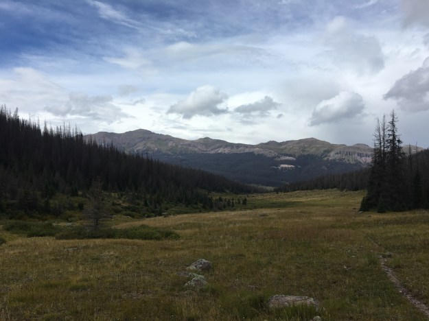
And, rather than going by the subdivision again, this trail cuts a bit farther north.  In several places, the trail overlooks the canyon that was carved out by Deer Creek.  I have previously ridden this road on a bicycle.  From the vantage point of the road, it’s hard to to truly appreciate the extent to which the rugged terrain had been carved out by a relatively small creek.

IMG_9084


After a period of inactivity, it felt really good just to be outdoors and active, feeling the sun for hours on end, and smelling the rocks, trees, and dirt.  As a culture, we likely spend way too much time indoors and sedentary.  Something about it just feels a bit unnatural to me- always has.  The entire duration of the hike, I just felt grateful for Colorado, the opportunities and access to so many amazing places like this.

I often tell people who are looking to visit Colorado not to come in April, as well other parts of the year are more exciting.  But, one thing I realized is that, this particular hike, mostly in the sun, with a maximum elevation of 7274′, would likely be very hot in the middle of the summer.  I can only imagine what it would be like with temperatures exceeding 90F (32C).

Many of us reserve the summer months, particularly June through September, for activities that require more travel, more planning, and more certainty.  In April, it is less worthwhile to plan more major activities, as conditions are so variable.  Thus, April is the ideal time for activities that are closer to home and more moderate in nature.  It is a time to embrace some amount of uncertainty, and think on the fly.

In pervious years, I became frustrated with Colorado in April, contemplating leaving for this period of time that is uncertain and commonly fails to deliver.  But, with uncertainty comes the excitement of the unknown, and the possibilities for new opportunities.  In life, we need a balance, between the planned and the unplanned, between familiar and the unfamiliar, and between the distant and the local.  April, and the changing of the seasons in general, ensures that we continue to calibrate this balance.

Backpacking in the Weminuche Wilderness: Day 2

IMG_7153

Before moving to Colorado, I experienced seasons in a completely different way.  While there would be some anomalies, for the most part, winter was winter and summer was summer.  Snow was something I experienced starting in November, through the winter, probably one last time in early April, and then not again for 6-9 months.  Likewise, heat would be primarily confined to the summer months.  In other words, I experienced being cold and being warm in two separate parts of the year.  The experience would generally only mix during the in between seasons; mid-spring and mid-fall.

In Colorado it’s all different.  In Denver I’ve seen temperatures reach the lower 70s (23 C) in the middle of February.  At higher elevations snow can fall nearly year round, and there are places where snowpack persists well into the summer.

IMG_7154.jpg

Saturday morning, the start of my second day in the Weminuche Wilderness, was a cold one.  The chill had awoken me at 3:00 in the morning, when I reached for my warm hat and for the zipper to zip my sleeping bag all the way shut.  At roughly 6:30 I woke up for good, and crawled out of the tent to find ice on the fly!  Frost was found on many of the items we left outside, including this bear cannister.

It warmed up fairly quickly at the campsite making me wonder why I did not simply stay inside the tent for another hour.  All the weather forecasts we had looked at prior to this backpacking trip had indicated that a wet period was coming to a slow end, and that each day would get progressively drier (lower probability of rain).  Yet, in the morning I saw something that would indicate differently; alto-cumulus clouds.  These are puffy clouds with a base somewhat higher up in the sky than the clouds we typically see.  On some storm chases, the presence of alto-cumulus clouds indicated the presence of moisture at higher levels of the atmosphere.  This was seen as a good sign on a storm chase, but, on a backpacking trip, is a bad sign.

The first few miles of the day took us by a lake we are glad we did not chose to camp at the prior evening, and then back into the woods, where once again the trail was muddy kind of on-and-off.

Headed farther up in elevation, towards the summit of the day, we approached the tree line, encountering several waterfalls.  This one, by far, was the most pictureqsue.

IMG_7175.jpg

I did not even know the name of any of these waterfalls.  In fact, I did not even verify that they even have a name.  It didn’t even seem important at the time.  We just liked what we saw.  At that time, most of the conversation within our group revolved around whether we would see marmots in the nearby rocks, and speculation as to what elevation the tree line was at at this latitude.

We followed the Rincon La Vaca (Cow Canyon) trail, which is also considered a section of the Continental Divide Scenic trail, above the tree line, and approached a rock formation we had been looking at since early the prior afternoon, “The Window”.

IMG_7183

This is where we decided to stop for lunch, at a lake where we could safely refill our water bottles.

IMG_7188

It was noon when we finished eating lunch and, four of us (out of a group of six) decided, despite the potentially ominous weather, to make a side excursion.  We dropped our packs and hiked the 500-ish feet (and half a mile) up to “The Window”

We got back to the lake, where our backpacks were, around 1:00.  As soon as we prepared to move, and catch up with the rest of the group, it started to rain.  A few minutes later, ice pellets began to fall from the sky.

IMG_7200

We briefly took shelter from the inclement weather, but eventually soldiered on through the not quite rain not quite ice, which would eventually change over to snow!

IMG_7203.jpg

I experienced a lot of this living in Chicago.  I called it “precipitation jambalaya”.  But, I never thought I would hike through it, and, well, am used to experiencing this in December, not late August!  Once again, that thing about the seasons!

IMG_7205

The precipitation stopped right before we turned off the Continental Divide/ Rincon la Vaca trail, and started looking for the trail we would take back towards the reservoir, the East Ute Creek Trail.

IMG_7207

The scene looked familiar.  The shape of the Ute Creek Valley where we were headed, with an open meadow surrounded by mostly dead forests on either side looked quite similar to the Weminuche Creek Valley we had hiked through the prior day.  The trail, though, was hard to find.

For the first mile we kept losing the trail, or we just saw it show up only as a barely visible line in the grass.  We actually speculated as to whether or not this trail was so infrequently used and/or maintained that mother nature was basically starting to take it back!

IMG_7213IMG_7214

We hiked until roughly 5:00 P.M., and by the time the day was over we hike a total of 10.2 miles (11.2 for those of us that took the side excursion to “the window”).  The last hour featured two crazy river crossings where we actually removed our socks and shoes.

We found a campground near a small lake called Black Lake, where, once again, the weather took a turn for the worse.

IMG_2867.JPG

The rain started shortly after 6 P.M., and did not let up until after sundown.  I rushed back into my tent!  With all of the experiences of the day, the mixed precipitation at over 12,000 feet elevation, wading through water, and now, once again, more icy rain, I was cold!  I was way colder than I wanted to be, and way colder than I ever imagined being in the month of August.  For the first 20-30 minutes, I had to lie sitting still inside my sleeping bag, otherwise I would start to shiver.

All I could think of were things that were HOT and DRY.  I wasn’t even thinking of warm, pleasant experiences, like drinking rum on a beach in Puerto Rico at sunset.  I was thinking about things that would immediately heat me up and dry me off; sheets that were pulled directly out of the drier, a sauna, Death Valley!

IMG_7237

With the hard hiking parts over with, I had originally hoped to have kind of a party with the group on Saturday night.  We had even brought flasks, filled with whiskey for such an occasion.  But, the weather changed my plans, as the rain continued and I continued to periodically hear thunder through the 7:00 and 8:00 hours.

I also did something I never do on group trips; read.  I joke I often bring a magazine or even a book, places, but never touch it.  This time I actually read.  It was the July edition of Adventure Cyclist.  Fitting for the mood, thinking about warm places while trying to stay warm, I read full stories about cycling journeys through Morocco and Hawaii, both warm places!

I guess regardless of whether you are in an urban setting or in the wilderness, life has a way of changing plans.  In the city, it is some merger, or a random change in commodities prices.  In nature, it is the weather.  But, when it comes to rain, and anytime rain changes my plans, I always do my best not to complain.  Even while I was bummed that I was not partying with my friends and hating how cold I was in my tent, I was mindful to remember that rain is necessary for the food we eat, the water we drink, as well as everything that made this trip possible in the first place.  I do not want to be one of those people that fails to realize this, and cannot put up with a little bit of rain.


Backpacking in the Weminuche Wilderness: Day 1

G0141034.JPG

During the month of August I had fallen back into some bad habits.  In particular, I’d fallen into the very habit I often criticize my own generation for: scrolling.  I know the costs outweigh the benefits.  By gazing at the predictable content of our news feeds and customized social media echo chambers on our phones, we miss out on countless opportunities out there in the real world, all to avoid the discomfort of boredom, or a potentially awkward interaction with another human being.

It’s not just about scrolling.  Scrolling is what we all see.  It’s the same routine day in and day out.  It’s going to the same bars and restaurants over and over.  It’s watching movies and TV shows we have already seen multiple times instead of calling people up and organizing a social gathering.  It is all the things that we do because the alternative requires a greater amount of effort.  It’s low risk, low effort, and low reward.  Unfortunately, for me, it lacks stimulation, it lacks enthusiasm, and over time can even lead to depression.

I haven’t thought of a better word for it than “defaulting”.  I often feel as if there is some sort of invisible force always dragging us toward this kind of life, this “defaulting”.  There seems to be a constant struggle, to mix things up, to avoid the mundane, to avoid losing contact with people.  And, while I think my personal record is pretty good (i.e. all the things I write about in this blog), there are times when I get tired of the struggle, and times when I do feel as if this invisible force is indeed advancing on me.  At these times, it is good to have some sort of activity, or some sort of trip that helps us hit the “reset” button.

IMG_7091.jpg

For this purpose, there truly is nothing like going into the woods, away from it all, out of cell service, completely out of my comfort zone, and in a place where “defaulting” is not only no longer easier, but not an option at all!

Our three day backpacking trip began at ThirtyMile Campground, just a mile or so east of the Rio Grande Reservoir.

After passing by a weather station, that is near and dear to me, as it is one of the stations that helped me calibrate the mean impact cold air funneling, in valleys throughout Colorado, has on nighttime lows, we encountered the Rio Grande Reservoir within the first mile of our trip.

IMG_7098.jpg

Going into this trip, which had been planned for several weeks ahead of time, we knew there would be muddy trails, and a heightened chance of rain.  Not only is Southwestern Colorado the most active part of the state during the late summer monsoon season, but this past weekend featured an active pattern in the region.

Friday was supposed to be the most active day, with regards to chances for precipitation.  Yet, we lucked out.  Leaving at 10 AM, after enjoying a nice relaxing morning at the campground, we hiked 7.5 miles, up the Weminuche Trail, dealing with very little rain, only with muddy trails.  Mindful of the storm threat, we stopped shortly after 3:00 P.M., having found a good spot to set up camp, near a stream and some trees.  Despite the periodically ominous looking skies, the storms held off until after sundown, giving us plenty of time to set up camp, cook a nice meal, and take in the wilderness, now being officially away from civilization.

I felt exhausted at the end of the day, as I had not gotten a good night sleep the prior evening at the campground.  So, I ended up going to sleep shortly after sundown.  With two backpacking trips behind me, I am starting to think that sleeping even more than the normal 7.5 hours per night is pretty normal on trips like this.

I spent the last waking hour of the evening inside the tent, listening to the sound of gentile rain tapping on the fly.  Under normal circumstances, many of us drown out these sounds, with TV, music, or some other sound.   Hearing this sound, for nearly an hour before falling asleep made me imagine a completely different life.

I imagined myself, as I often do, as a completely different person, with a completely different personality, upbringing, circumstance, and desires.  I imagined myself living in the woods, in a cabin of sorts, not too unlike the kind many people in Michigan, Minnesota, or Wisconsin have today.  It would be a modest sized cabin, with one main room, a bunch of bedrooms, a kitchen, and a closet, to keep things like cross-country skis, wet suits, and all of the other necessary equipment.  But, I would not have too many high tech or expensive toys.  It would be a life in a small community of sorts, where people know one another, spend a lot of time over at each other’s houses for dinner and games.  It would be a life way closer to, and way more connected with nature.  It would be a life that would never satisfy the real me, as restless as I get for one adventure after the next, one major social interaction after another, and testing limits.  But, for this alternate person I imagine myself being, as I drift off to sleep on a rainy August evening high in the San Juan Mountains of Southwest Colorado, it is perfect, cozy, and quaint.


Full Service Camping

IMG_3562

Camping is not just camping.  In fact, there is an entire spectrum of different types of camping one can take part in.  On one end of the spectrum is the type of bare bones camping that can be found in National Forests and other wilderness areas.  I took part in this type of camping for the first time last year at Gunnella Pass.  These are places where you just put down your tent, and pretty much are on your own.  Maybe there’s a fire pit leftover from the last set of people who plopped their tents there.

On the other end of the spectrum are places like Starlite Classic Campground.  These campgrounds have their own office, where one can usually buy the ice, firewood, and other standard camping supplies, specific camping sites reserved in advance for various group sizes, and often have plenty of other amenities.

On this campground, we had a pool, which we ended up spending a significant amount of time in, as temperatures soared well in to the 90s Friday, Saturday, and Sunday.

IMG_3588

Next to the pool is a children’s play area, which I probably spent way more time than any adult should at, but, hey, I am also a grown-up throwing myself a half birthday party, so, it kinda fits.

IMG_3571 IMG_3580

And, not to mention, a whole bunch of other games, including horseshoes, volleyball, and even a mini-golf course.

IMG_3559 IMG_3564 IMG_3566

All this made for a completely different kind of experience than your standard camping trip.  When most people think of camping, they ponder up images of a campfire, roasting marshmallows, and a fairly quiet experience, which can often involve some reflection, star gazing, and deep conversations in the wilderness.  With the hot temperatures, mid-June daylight lasting until nearly 9 P.M., all the amenities at Starlite, and a total of 17 people participating in the weekend (including both camping and rafting), very little of your standard camping experience happened.  In fact, the weekend kind of felt like some kind of hybrid experience between being at a campsite and a party!

Starlite Classic Campground is located just across the street from Performance Tours, the outfitter we used for our rafting trip.  We had a mere two minute walk to get where we needed to go in the morning.  In fact, the evening before the trip, we could see the very bus we would be getting on the following morning to start our raft trip.

IMG_3567

With the purchase of the group site at Starlite, we received a significant discount on the rafting trip, as they have some sort of deal.

IMG_3565 IMG_3570

In addition to all of the fun, the scenery was amazing.  Just four miles south of the campground is the Royal Gorge Bridge, which can be seen by gazing across the open plane of the Arkansas River Valley.  A quick turn to the right, and one can see the Sangre de Cristo Mountain Range, which contains numerous peaks over 14,000 feet, and extends all the way into Northern New Mexico.

IMG_3582 IMG_3586

As I walked across the open field that evening, staring across a the Sangres, and the bridge, and some of the other terrain features that look so breathtaking when the setting sun hits them at just the right angle, I came to the realization that I had entered the sweet spot that I am always looking for in life.  By this I mean being the best version of me, the version of me I wish I could be all the time, but somehow can’t.

Without the help of any substance, drugs, alcohol, or even caffeine for that matter, all the anxiety had just vanished.  I was just content.  It’s hard to explain.  But, it was like I had just simply left the competitive world that we live in behind for a few days.  I did not feel I was competing with people, needing to prove anything, or potentially being judged for anything.  Maybe what I felt was acceptance, something we all long for in life, and something I sincerely appreciate those who joined me on this trip for.

IMG_3583

Out here, organizational structures, hierarchies, deadlines, and all of the things that make life stressful simply don’t exist.  It is just you, whoever you chose to make the trip with, and the scenery.  And, once you get to that place where you can let go of everything in your head, you find that best version of you, the one you know you are capable of.  It is the you that is confident, eager to take on a new activity, and in no way hiding any aspect of who you are out of fear of judgement.  It is the you that the people who you value are drawn to, and it is the you that should be celebrated, even if that means throwing yourself parties like this one.

IMG_3607 IMG_3611 IMG_3615

For me, when I am being true to myself, it means being goofy, and, well this area offers plenty of opportunities for that.  This section of U.S. highway 50, near Royal Gorge, has more than just one campsite and one whitewater outfitter.  There are more campsites, more whitewater outfitters, other activities (such as helicopter rides), and shops and restaurants that serve the needs of the tourists in the area.  Not to say that this area is a full-fledged tourist trap similar to Estes Park.  But, there are some places to wander around to at night if one is so inclined.

IMG_3623

The return trip home involved one mildly disappointing stop; the World’s Largest Rocking Chair.  The chair was large, but we could not get in, as the shop that houses it has been closed for a year.

As I faced the return trip to the city, the return to work, and normal life, I could not help but think about the feeling I had this weekend, and how to be the best version of myself, the me that I was all weekend, every day.  What I struggle with is that “normal life” offers pretty much two typical paths.  First, one could work hard and “move up” in their organization, get promoted, become the boss, and maybe even reach leadership positions.  However, I have frequently observed that in many organizations, reaching higher levels requires some level of conformity, and one often must make some compromises on who they are and what they value to get in the good graces of those higher up- particularly in larger organizations.

Then, of course, there is always the option to be content to simply stay at the bottom of the totem pole.  This is a better path for those that prefer to keep their work load at reasonable levels, and seriously value work-life balance.  But, unfortunately, those that chose this route will always be answering to somebody, a boss, and sometimes for somewhat arbitrary reasons.  Being at the mercy of one person (and that person can suddenly change), who may be having a bad day, a bad month, or just simply be a bad person, has lead to countless terrible outcomes, all of which result in people not being the best version of themselves.

This is not to say that all is lost.  There are plenty of people that find a path outside the typical two options laid out above.  Many even write about their experiences here on WordPress.  There are also plenty of people that find a good environment using one of the two standard paths outlined above.  But, we all have a struggle.  And, this weekend, I realized that in order to make this struggle easier for both myself and the people around me, I need to celebrate the attributes in others that draw me to them, and also celebrate my own attributes that draw others to me.  Regardless of our paths, this authenticity needs to be encouraged.

Hiking Boulder’s Flatirons in late November

IMG_1472

One of the things a lot of people don’t realize about Colorado is that it is actually possible to hike here year round.  For sure, winters in Colorado are characterized by a lot of snow, but at lower elevations, warm-ups are also quite frequent.  Earlier this year I made some calculations with some data from the National Climatic Data Center, and concluded that even in the coldest part of winter high temperatures can be expected to exceed 50F in Denver more than one in three days.

At higher elevations it is more consistently cold and snowpacked.  This is why Colorado has great skiing, but also why hiking at higher elevations beyond the month of October generally unrealistic.  However, it is great knowing that there is a place where both skiing and hiking could be available on the same calender day.  Sunday I went skiing, Monday I rode my bicycle, and yesterday I hiked.  What an interesting place!

IMG_1471

With that in mind, this is a great time of year to check out many of the hikes available at lower elevations.  This includes the Flatirons in Boulder, Colorado.  Many of the trails up this mountain feature can be accessed from Chautauqua Park on Boulder’s Southwest side.  With the park being in town, and downtown Boulder being only about a mile and a half away, and this park can easily be reached by bike or bus, making this one of the few places in the country where one can frequently hike and even rock climb without access to a car.  So, I can kind of see why it is an expensive place to live, but I really did not mind driving, so I’ll spare myself the extra $400 a month in rent.

IMG_1473 IMG_1474

Hiking in the Boulder Flatirons is quite different than climbing a trail up a mountain.  Rather than one trail up and one trail down, there is a network of trails that need to be navigated for one to reach their destination.  From the parking lot, the Chautauqua Trail can be followed up to the Flatiron Loop Trail.  The Chautauqua Trail is a fairly consistent moderate uphill grade.  The Flatiron Loop Trail, however, gets both steeper and rockier.  Climbing this trail reminded me how high in elevation the Flatiron features really are.  With the features known as the Flatirons being so close to town, it is easy for one to think of these features as extending down almost to the elevation of town, roughly 5400 ft.  But, the reality is that these features are largely between 7000 and 8000 ft. in elevation.

Some of the rockier areas of the trail scared my dog a little bit.  Despite this, I did see a significant amount of dogs on the trail.  However, in Boulder, I would consider the Mount Sanitas Trail more dog-friendly, as it does not contain segments like this one.

What I did not realize until yesterday’s hike was that the Flatirons are numbered.  The Flatiron Loop Trail traverses Flatirons #1 though #3.  For each of these peaks, a spur off the trail provides climbing access.  The first Flatiron, pictured above, looks somewhat different up close.  Small scale features, particularly indentations in the rock, do not show up when viewing these features at a distance.  Like some famous paintings, they look nicer from afar than they do from close up.  The trail reaches it’s peak elevation between Flatiron #2 and Flatiron #3, and beyond Flatiron #3 is the trail I intended to do, the Royal Arch trail.

IMG_1478 IMG_1479

Unfortunately, this trail was closed, most likely due to the flooding.  As an alternate, I decided to hike the Flatiron #3 climbing access trail, as I still wanted to get to the top of these features.  This trail was even steeper than the Flatiron Loop Trail, and also a lot narrower and rockier.  It is one of those trails where one follows the rocks as an indicator of the trail’s path.

IMG_1481 IMG_1480

Flatirons #2 and 3 appeared somewhat more as I imagined them; rock formations poking out of the trees, with a near steady slant of around 45 degrees.  As I viewed each of these features up close, I could not help but be reminded of the rock features near Red Rocks.  Of course, these features are not nearly as red in color, but their shapes looked quite similar, making me believe that some of the same geological processes must have been at work in the creation of both of these features.

IMG_1484

On the return trip, back to the parking lot, I actually came to the conclusion that Flatiron #1 just looks somewhat different than the other two.  A later Google image search would confirm this for me.  I guess this one is not quite a “flat” as the other ones.

IMG_1486

It was actually nearly 3/4 of the way back down to Chautauqua Park that I encountered what I consider the best view of the day.  The time was around 3:30 P.M., which in late November means that the sun was already starting to descend in the western sky behind the mountains.  However, the sun was still an hour or so from setting.  As a result, the shadow created by the mountains can be seen quite clearly in contrast with the bright sunshine, making for a breathtaking image that is unique to that particular time of day.  Half an hour earlier, it would have looked like your standard daytime image of the foothills of the Rocky Mountains, and half an hour later this entire area would be shadowed and the entire region would be significantly darker.

I did not specifically plan to be here at this exact time, in this exact place.  In fact, if I were to try to calculate what time of day I would need to be here to see this exact view, I likely would have calculated it incorrectly.  Sometimes in life the best results come not from careful planning, but from simply going to new places, trying new things, and being ready to absorb and enjoy what comes your way.  This is what comes to mind when I look at this particular photograph.