Category Archives: Wyoming

Funnel Clouds and UFOs

Chugwater, Wyoming is not known for tornadoes, nor is it known for UFOs.  When people think of major tornadoes, they typically think of places like Oklahoma and the rest of the Great Plains.  Most consider “tornado alley” to be to the east of Wyoming.  Likewise, when people think of UFOs, the town of Roswell, New Mexico comes to mind, as it is not only the location of a major event related to UFO conspiracy theories, but also in a region dense with UFO reports.

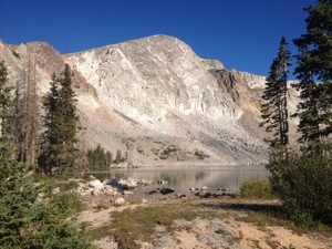
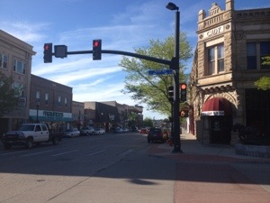
Chugwater is a town of barely more than 200 people roughly 40 miles north of Cheyenne.  The only thing it is really known for is chili.

IMG_2019 IMG_2020

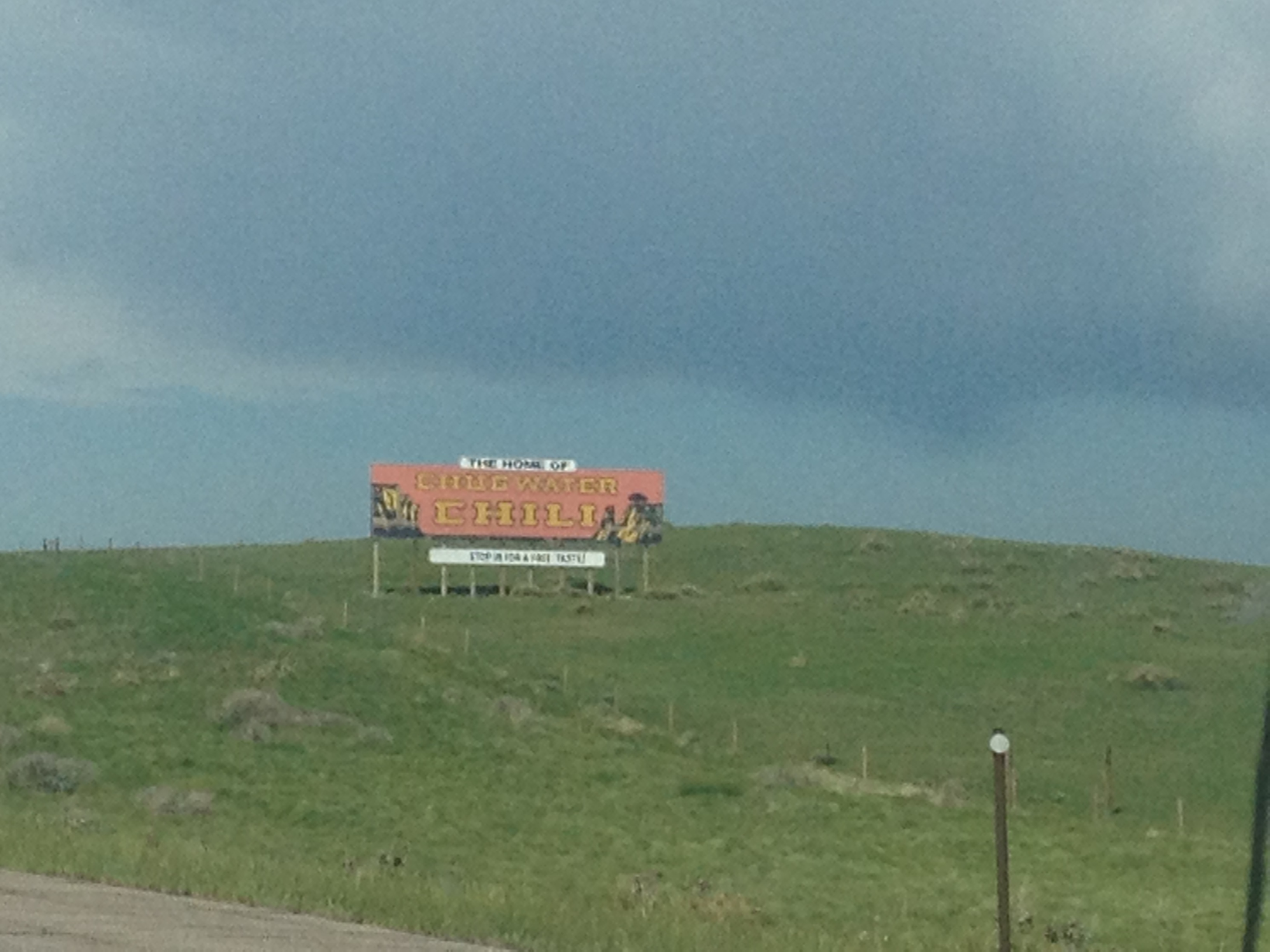
I have never actually tasted Chugwater Chili, but others have told me that it is really good.  Enough people like it to support an annual chili cook-off in the town, which has been going on for twenty-nine years!

However, yesterday, the last day of May, a trip to Chugwater helped shed some light on both phenomenon.

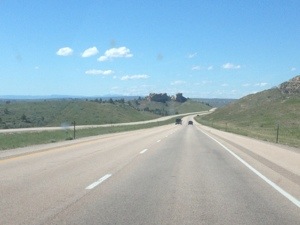
It was a day where thunderstorms fired up across a wide area that stretched all the way from Saskatchewan to just southwest of Colorado Springs.  After an examination of weather conditions, we determined that the best possible conditions for seeing some good thunderstorms within a reasonable drive of Denver would be in Southeast Wyoming.

IMG_2021 IMG_2022

In the early part of the afternoon, a series of storms popped up in the region, but fizzled out and died fairly quickly.  It was not until mid-afternoon when we finally encountered a major storm brewing over the Laramie Mountains to the west of Chugwater.

IMG_2025

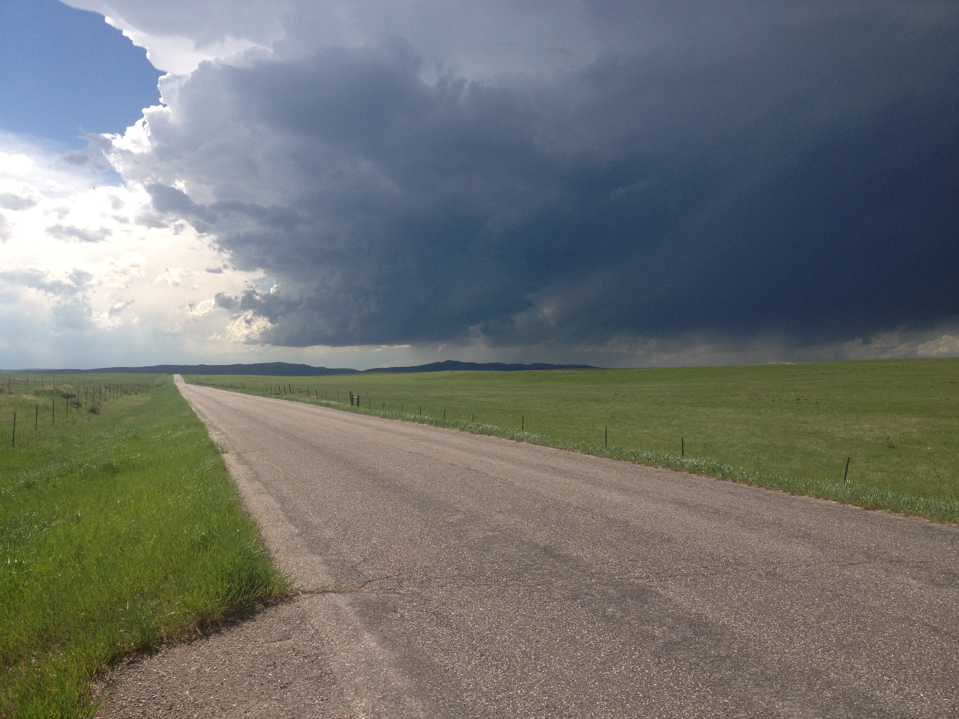
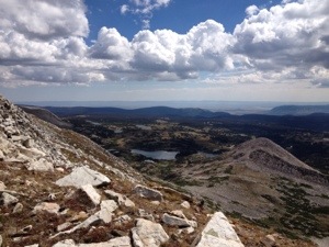
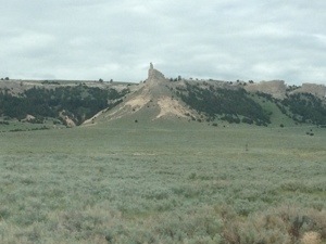
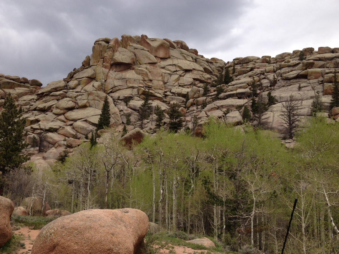
From a hill just to the west of town, we were able to observe this storm gradually move towards us as the afternoon progressed.  The entire day felt quite strange to me.  In every single way, it felt like a typical storm chase.  The procedure of heading towards an initial target location, then heading towards a storm as it forms, and observing it along a country road was exactly as I had done probably close to 100 times throughout my lifetime.  The air felt warm and moist, and the wind picked up as the storm approached, just as I had always remembered it.  Even the ground looked as green as it had looked in most of my chases in places like Iowa, Nebraska, Kansas, and even Illinois.

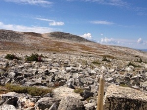
However, this was Wyoming.  What we were observing today is quite atypical for Wyoming.  The ground, typically quite brown here, had turned green due to a recent uncharacteristically rainy period.  Additionally, it was quite moist that day, also atypical for the region.  All the conditions had come together to produce a scene, and event, and a feeling, that felt way more like Kansas, or even Oklahoma, than Wyoming.

IMG_2028 IMG_2030

However, this region is still naturally dry, and as the storm developed, the somewhat random mixing of moist and dry air produced a somewhat chaotic storm structure.  For a period of time the storm structured itself in a manner that looked quite like a UFO.  Well, at least it looked like a UFO in the way it is typically portrayed in the movies; a gigantic circular object with a hole in the middle (the hole being where the aliens come down and abduct the humans in many scenarios).

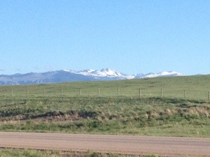
The other major difference between this chase and a typical chase is the presence of mountains.  The mountains seen in the background of these pictures, which are facing West-North-West, are not nearly as tall as some of the region’s bigger mountains.  However, contemplating this UFO-like shape in the cloud feature did make me wonder if a similar phenomenon in Southern New Mexico, which also has a dry climate and more modest sized mountains, could explain some of the UFO sightings there.

Of course, there are many theories behind not only UFO spottings, but any observation that does not appear to be sufficiently explained.  The world often appears to operate in a manner that seems inconsistent with what we have been told by official sources, experts, and authority figures.  This is the primary driver of conspiracy theories.  While these theories largely have not been verified, I do sympathize with the intellectual curiosity that often leads people to explore these theories as a possible explanation for what they are observing in life.

IMG_2031 IMG_2032 IMG_2033 IMG_2034

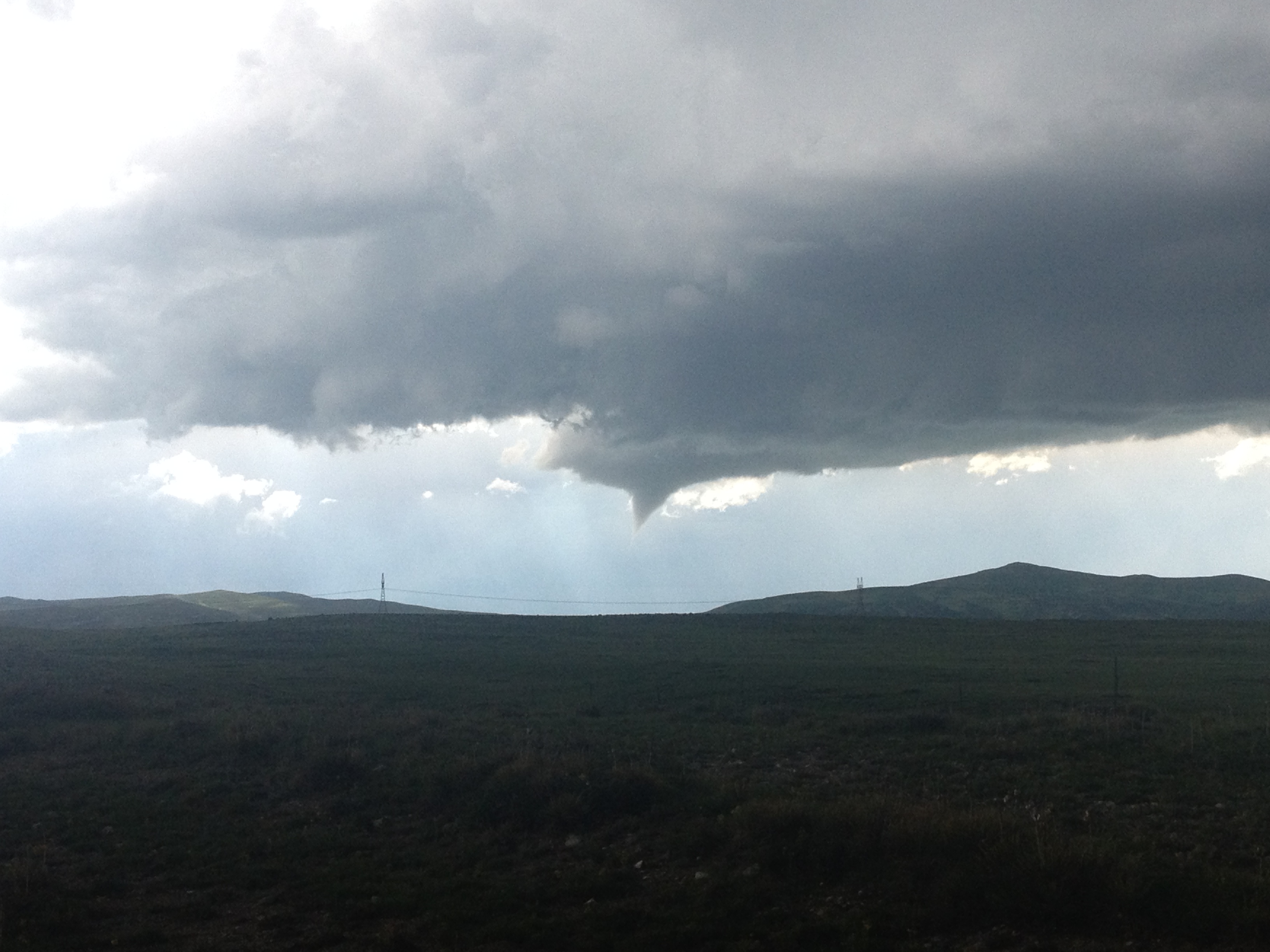
Roughly half an hour after the storm’s “UFO” phase, it produced a funnel cloud.  A funnel cloud is the beginning phase of a tornado.  However, not all funnel clouds reach the ground and produce tornadoes.  The reasons as to why some storms with the same rotation produce active, life-threatening, tornadoes while others don’t has been the subject of scientific research for decades.  I’m not going to figure this out by staring at this storm west of Chugwater.  I just came here because I love storms.

IMG_2035

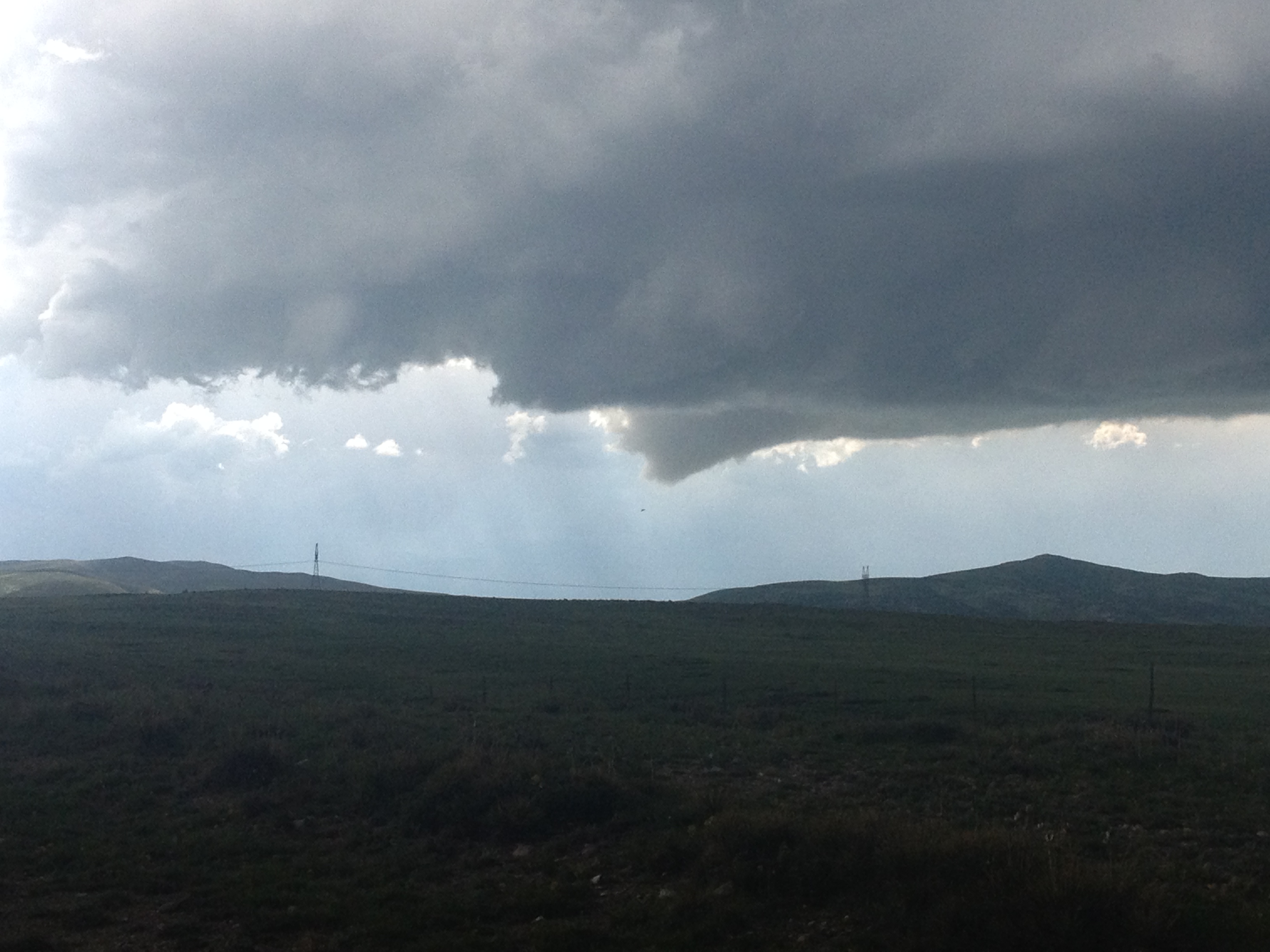
After about 10 minutes the funnel dissipated, without producing a tornado.  As the storm began to produce greater and greater amounts of rainfall, it got darker, making the storm features harder to see.  This prompted us to go home, as we were already quite satisfied to have seen a funnel cloud.  In fact, this was the first time I got a picture of a funnel with mountains in the background.

This trip to Chugwater reminded me that every location has a story.  Even if a place seems boring, quiet, and insignificant, there is still the potential for something quite amazing to happen there, and there is still the potential for answers to some of life’s important questions to be found there.  Prior to 1947, I doubt too many people knew where Roswell, New Mexico was, or ever really thought about the place.  Now, a lot of people think of it whenever they think about aliens and UFOs.  While Roswell did not answer anything there are plenty of events occurring in all sorts of places around the world that may offer us answers to all kind of questions from curing diseases to questions of sociological and genetic nature.  What other obscure location could have the answers to some of the most pressing question of our day?  And, how do we go about finding it?

Medicine Bow Peak

Labor Day Weekend represents somewhat of a rare occurrence in our modern world. For many with standard salary positions, Labor Day Weekend, along with Memorial Day Weekend and sometimes the 4th of July, are the three times of year in which a three-day weekend occurs automatically at a time of year with reliable weather. It is the rare opportunity to embark on certain adventures without having to dip into what is a precious commodity for many; vacation days. With how little chance many people have to go out and enjoy our natural world, see new places, and find new experiences, it is hard not to feel some kind of pressure to take advantage of weekends like these. Many even plan their excursions months in advance.

I come from this world. And, no matter how independent-minded I try to be, I find it hard not to feel this same pressure. There is some kind of pull on me, some strange aspect of my subconscious, my psyche reminding me of this scarcity. A voice in my head will actually tell me that not having some kind of an adventure on one of these “major weekends”, which includes Labor Day Weekend, is a waste of a resource more precious than anything monetary. It engulfs me, telling me that a mediocre Labor Day Weekend could possibly indicate that I am no longer an interesting person, regardless of what kind of activities I had been involved in the pervious weekends, or have planned for the coming weekends.

I bet this same pressure is felt by many. Therefore, I am told that on Labor Day Weekend nearly all of the popular recreation destinations in Colorado are “crowded”. But, I still really do not know what that means. Everybody has different thresholds for what constitutes crowded. And, part of me still suspects that to the average Coloradan, still not really that terribly used to the idea of Denver as a large city (or at least significantly larger than it used to be), the threshold for a place being considered “crowded” is much lower. Despite the fact that part of me reasons that being told something is “crowded” in Colorado is not something I need to concern myself with, I heed the advice given to me and head up to Wyoming, where I am told crowds are significantly less, even on a weekend like this one.

20130831-210404.jpg

20130831-210415.jpg

Today I headed up to Medicine Bow Peak, which is about 35 miles west of Laramie, Wyoming, basically in South Central Wyoming. And, well, the advice I was given actually turned out to be correct. The hiking trail, from Lake Marie to the top of Medicine Bow Peak, the highest peak in the region, is actually surprisingly not crowded. The crowd is probably less than half the crowd I encountered both times I climbed “14ers” earlier this summer, and probably comparable to what I would encounter on day hikes in Colorado on weekdays! Amazing for a holiday weekend like this one.

20130831-211950.jpg

Today’s hike began at Lake Marie, at about 10,500 feet in elevation, but started out climbing rapidly up the side of the mountain. This is actually something I was quite prepared for, as the mountain itself looked quite steep from approach. Today’s climb would only take me to slightly over 12,000 feet in elevation, a roughly 1500 foot climb, but the first half of the climb occurred quite quickly, and it did not take long for the lake, and the parking lot to appear significantly below us.

20130831-212334.jpg

20130831-212346.jpg

The next part of the hike, however, did take me by surprise. After climbing nearly 1,000 feet in the first mile, and feeling like I was actually on the verge of completing the hike, the trail flattened out. On the way to Medicine Bow Peak, there are several closer peaks that some would consider “false summits”, because they blocked the peaks behind them. We would hike around each peak in a semi-circle, the trail being either flat or having some minor rolling hills. This even included some downhill sections on the hike up the trail, which made the hike overall somewhat more challenging than other 1500 foot climbs.

I referred to this as “orbiting” these peaks. After each “orbit”, a new peak would appear, showing itself to be 100 feet or so higher than the pervious one. Each time, we would reason that the new peak was the one we needed to summit, only to be surprised to find the trail meandering on to the left of the peak once again, and another peak appearing in the distance.

20130831-213040.jpg

20130831-213048.jpg

After four of these peaks, we finally encountered the peak we were destined to summit. After another steeper section, summiting this peak involved 100 feet of “scrambling”, which basically means climbing up a fairly steep vertical on rocks, with no one intended path. However, before the “scramble”, I was able to look down and see kind of an overview of the land I had already traversed. WIth all of the smaller peaks we had “orbited” around, we actually made some significant progress in the horizontal direction, and were quite far away from Lake Marie. A series of lakes near the trailhead appeared on the horizon looking down. The true beauty of the area could be seen from above, but did appear significantly different from it’s view from below.

20130831-213757.jpg

20130831-213803.jpg

The trek up this mountain actually reminded me of climbing “14ers” earlier this summer in a few ways. First of all, most of the trail was above the tree line, and had a similar feel to it. Secondly, despite the fact that this peak barely rises over 12,000 feet in elevation, it is the tallest peak in the region. So, the top of the mountain had a similar “on top of the world” feel to it. And, of course, the rock and the scrambling.

I would say overall that this particular hike would be a great warm-up for those planning to hike “14ers”. It has a similar feel, is also in the arctic tundra at high altitudes, but is less challenging with less vertical climbing. The “14ers” I climbed earlier this year were similar in length (7-8 miles total), but were steeper climbs in general, without the flat-ish section. They also generally contained longer and steeper scrambles at the top. For the purpose of working up to the challenge, I would recommend this hike for anyone that is looking for a good warm-up for a “14er”.

Cheyenne Frontier Days

IMG_0883

Every July, the World’s Largest Outdoor Rodeo (The Calgary Stampede is larger, but indoors) comes to Cheyenne, Wyoming.  Cheyenne’s Frontier Days is not only a rodeo.  It is a major nine-day event, and the most exciting time of the year to visit Cheyenne, Wyoming.  At Frontier Park, not only does one of the most major pro rodeo events take place each afternoon, but live concerts take place each night, and a carnival is set up just outside the park.  It is the week where Wyoming shows in full display it’s western heritage.  And while the “old west” can be thought of as encompassing part or all of 16 states, I find it hard to think of a state that shows more pride in it’s “old west” heritage than Wyoming.

Consistent with the culture on display at Cheyenne Frontier Days, most of the concerts that take place over the course of the week are country/western.  I am not a fan of country/western music.  I am from New York and Chicago, it is just the culture I grew up in.  So, I went to the only non-country/western show on the Frontier Days lineup, which happened to feature two of my favorite classic rock/ arena rock acts; Journey and Styx.

IMG_0868 IMG_0869

Styx went on first, and they began on-time!  This was at 8:00 P.M., Friday night, the first night of Cheyenne Frontier Days.  They put on a phenomenal show!  Some bands just don’t sound the same as they get older, but this band was quite good.  In fact, it reminded me how much I liked this band.  As an added bonus, I took pride in the fact that they are from Chicago.

IMG_0873

Journey was the main act of the night, and they also sounded really phenomenal!  Their story is quite an interesting one.  They scored their biggest commercial success in the time period from 1977 through 1984 with lead singer Steve Perry, who has a very unique sounding voice.  After breaking up, periodically reuniting, having a falling out with Steve Perry, and a few years with a different lead signer, in 2007, they hired Arnel Pineda, from the Philippines, as their new lead singer.  The interesting thing about this hire is that they hired him based on hearing his Journey Tribute band perform on YouTube.  It is interesting how this technology has helped a California based band find the most ideal new lead signer on pretty much the other end of the world.  How’s that for the benefits of the internet and connectivity?

I also love watching this guy in concert.  His attitude is just so positive!  Whenever I see him on stage, it just feels like singing for Journey has been a dream come true for him and that he is loving every minute of it.  I can feel his energy, and it seems like the crowd can feel his energy as well, and responds positively to it.  I think people in general just love it when someone seems really happy and enthusiastic about what they are doing.

IMG_0882 IMG_0877

In addition to seeing a wonderful show, we got to attend the show in a special section called the “Party Zone”.  This section of the venue is in front of the stands, fairly close to the band, which is how I got those fairly close-up pictures.  There are no seats here, and beer is sold right in the section, just slightly off to the side of where the crowd congregates.  Essentially, this is the section for people that came to dance, jump up and down, etc., as opposed to those that just want to sit and watch.  This is where I feel I belong.  So, I was happy to have good company, have a few beers, and see an amazing show.

IMG_0879 IMG_0880

The next day, Saturday, we went to the parade, which occurs four times throughout the duration of this festival.  Saturday morning’s was the first one, but there will be another one on Tuesday, Thursday, and the following Saturday.  For this day, I decided to find the most western looking attire I own, which includes a cowboy hat that I actually bought at last year’s Frontier Days.  I have no boots, no fancy belt buckle, or anything that would make me completely legit.  But, it was nice to somewhat look the part, and somewhat look like I fit in in a place that could not be more opposite from where I am from.

I am not a conformist.  I believe that everybody should feel free to be themselves.  However, sometimes I enjoy just fitting in.  It makes me feel like a versatile individual, like somebody that can find a way to feel comfortable in many different situations and scenarios.  Wearing jeans and a cowboy hat for one day did not in any way make me feel like I am compromising my values or losing my ability to be who I am.  I will return to my quite urban lifestyle when this is over.  So, why not fully embrace the experience while it is happening?

IMG_0886 IMG_0888

One thing I try not to do while attending major events is loose track of the actual purpose of the event.  The best example of this is the Mifflin Street Block Party in Madison, Wisconsin.  Originally a Vietnam War protest, this event quickly evolved into large early May block party with little purpose other than drinking heavily.  The major event at Cheyenne Frontier Days is the rodeo.  It is actually one of the most significant rodeo events on the pro rodeo circuit and attracts some of the best the sport has to offer.

Rodeos feature a variety of events, including your standard bull riding, and bucking broncos, but also the events pictured above; calf roping and barrel racing.  Calf roping is quite a crazy event.  A cowboy will first lasso a cattle.  Then, they jump off of their horse in order to tie it up, using a rope.  The best of the best can do this in a matter of 12 seconds.  Steer wrestling also features cowboys jumping off of their horse, but in order to wrestle a steer to the ground by the horns.  I saw someone do this in a matter of 7.6 seconds!

Of course, from the standpoint of an animal right activist, this is probably the worst sport in existence.  In order to get the bulls, as well as the broncos, to buck, they literally tie up their balls.  Maybe greyhound racing is worse, I don’t know, I am not PETA.

This particular rodeo ended with a unique and quite exciting event; a wild horse race.  For a lack of a better way of putting it, the wild horse race is literally a shit show.  Teams of three attempt to saddle up and ride an untamed horse, straight from the wild, one time around a track, in a fashion similar to a more proper horse race like the Kentucky Dirby.  However, because these horses are wild, anything can happen.  Before getting started, many of these horses started pulling their “handlers” in all sorts of directions, and some even “sat down”, if that is something a horse can do.  While running around the track, two of these horses jumped over the gate, throwing their riders off, and one of them completely changed directions out of nowhere.

All of this was quite amusing, but I actually kept thinking about this entire scene from the point of view of the horse.  Specifically, the people who were dragging the wild horse around in a vein attempt to get them to act like Man-O-War were, in some cases, riding trained horses.  These wild horses, being dragged into the arena must be wondering why these other horses are betraying their own species and helping the humans do this to them.  It’s got to be on their minds.

IMG_0889 IMG_0890

We also got quite lucky with regards to the weather.  Towards the end of the rodeo, around 3 P.M., storms started to form to our West, Northeast, and South.  But, luckily, the storms formed and tracked elsewhere, and very little rain fell on the rodeo itself.  The storms did, however, help cool things off.  In both Colorado and Wyoming, in summertime, storms are like power plants; you want them close to you but not close enough to mess things up.

Yellowstone and the Grand Tetons

IMG_0678

Yellowstone National Park was the first National Park in the United States, created in 1872, which seems to be before anyone really cared about preservation or anything like that.  It also appears to be the best known National Park, the first thing people think of when they think of National Parks.  Oddly enough, though, it is one of the toughest to get to.  It is two hours away from the nearest interstate highways, both I-90 and I-15.  And, those highways are not frequently traveled.  Denver is something like ten hours away by car, and with the possible exception of Boise, I do not even want to imagine what it would cost to fly into a closer airport.  So, I would not want to pass up the opportunity to visit this park, even if it is for just one day on my way back from Missoula.

IMG_0682 IMG_0683

Approaching from the West, via West Yellowstone, it is natural to enter the geyser part of the park first.  Old Faithful is the famous geyser that you see in all of the postcards about Yellowstone.  It is the biggest geyser, but not the only one.  In fact there are hundreds of them, maybe thousands, I don’t really know because I did not go everywhere.  All of these geysers, including Old Faithful, steadily emit steam whenever they are not “erupting”.  I am not sure if erupting is the right term for it, but as you know these geysers spew out water.  Apparently, it used to occur on a regular pattern, once every 50 minutes, but then something changed, likely the earthquake in 1959, and now the eruptions of this geyser are irregular.

IMG_0685 IMG_0686

Having time before Old Faithful “erupts”, we checked out the Old Faithful Inn, which is a famous hotel built right next to the geyser about 100 years ago.  I think pretty much every article I have ever read about Yellowstone, as well as every special on the Travel channel or whatever, has mentioned this place.  It would be quite neat to stay at a hotel right next to one of Yellowstone’s defining features.  In fact, there is even a balcony on the second floor on this hotel where you can actually see the geyser from.  If I ever did stay at this hotel (which probably won’t happen as I am assuming it is hella-pricey), I would definitely make a point of watching at least one “eruption” of Old Faithful from the second floor balcony.  With a really good breakfast, and pleasant conditions as they were yesterday, the only thing that could possibly make the experience better would be a 711 slurpee!  For my first ever viewing of the eruption of Old Faithful, which was predicted to be at 9:04 A.M., and occurred roughly three minutes later, I viewed it from the ground along with everybody else who was there.

IMG_0690

If a picture is worth 1,000 words, than seeing this in person would be worth at least a million.  Really, sorry to disappoint you, but it would be futile to even attempt to describe this.  I think all of the billboards in Chicago describe it as “three Buckinghams tall”.  That is a good start for anyone that knows about that place.  I’d say visit the park.

The geyser erupted for a few minutes, and after watching the eruption, we decided to walk towards some of the other features in that area of the park.  Still amazed by the experience of Old Faithful, headed toward this boardwalk with some other geysers, pools, and hot springs, we encountered a woman with her legs straddled across the ground, and a fancy camera shaking her head.  She made several comments to us about how disappointed she was in this Old Faithful eruption.  She eluded to previous viewings of this geyser being much better.  From what she was saying, it sounded like she was referring to something 15-20 years ago, in the 1990s, but I am not 100% sure because as soon as she started talking my mind began to wander out of sheer shock that someone could find something negative to say about this event.

To be honest, I do try to give people the benefit of the doubt.  Maybe the eruptions of Old Faithful in the 1990s were larger- who knows.  But, I can’t help but think of the possibility that she represents a certain type of people that we all have encountered at some point in time in our lives.  These are the people some refer to as “critics”.  No matter what happens, what goes on, they are always focused on the negative aspects of it.  They could be on vacation on a world class boat cruise in perfect weather around their favorite people ever, have a great time dancing by the pool, and get a call from their boss informing them of a raise and a promotion, and they would still focus on the fact that their hot dog came with yellow mustard instead of spicy brown, and embellish on that point.  More significantly, people like this can be a drain to be around sometimes.  Not only because of experiences like this, but anytime making plans with people like this, they are focused on what could go wrong instead of what could go right.  When you tell them about your ideas for what you want to do with your day, you week, your life, what they say to you undoubtedly plants the seeds of doubt and failure in your mind, rather than the seeds of confidence and success.  Maybe all of this is why this woman was alone.  But, once again, I do not want to make a judgement on someone who I met for only two minutes.  There are plenty of good reasons for people to take trips all by themselves, and I have known people to do this and come away with amazing experiences.  So, I am in no way going to make assumptions about this particular person.  I will only use this as a reminder of what kind of people tend to bring others down.  There is a book out this year that seems pretty popular called “Friendfluence” that actually addresses the issue of how the people you chose to associate with effects your personality and success in life.  I am lucky to have a lot of great positive friends that clearly do not fit into the category described above; some of whom I saw last weekend, some of whom I will get to see later in the week, some of whom I will see upon returning to Denver, and some of whom I hope to see again soon.

IMG_0692 IMG_0695

The other interesting features in the vicinity of Old Faithful are hot springs and smaller geysers.  I put my fingers in one of the hot spring’s resultant rivers, and verified- they are hot!  Many of these smaller geysers are constantly erupting in a way.  I hate to gloss over these features, as they are really neat.  But, this is a blog about Yellowstone, and I do not want to make it 10 pages long.  I guess people do write whole books about this place.

Yellowstone is big!  I guess I should have realized that when I saw that it did not fit onto one page of my Wyoming DeLorme Atlas, but I guess I was still not thinking of it as being as big as it is.  I think the park is almost 100 miles long and 100 miles wide.  Either way, it is quite possible, especially with the number of people that stop to take pictures of bison, elk, moose, and such, for it to take over an hour to get from one feature to the other.  So, we had to have a clear plan to get to the most important features in one day, which involved seeing Old Faithful early, and then headed toward Yellowstone Falls via Yellowstone Lake.

IMG_0698 IMG_0699

Yellowstone Lake is quite large, and surrounded by mountain ranges in all directions.  Overall, very picturesque.  It is also a good reference point when looking up weather information for the park.  At roughly 7700 feet in elevation, is is close to the mid-point.  There are plenty of hills that reach higher elevations, especially along the continental divide.  There are also some features, like the gorge of the Grand Canyon of the Yellowstone, and even Old Faithful, that are at lower elevations.

IMG_0704  IMG_0706IMG_0703IMG_0705

Okay, I know a lot of pictures, but Yellowstone Falls and the Grand Canyon of the Yellowstone also blew me away!  I later read (also in my DeLorme Atlas, they are really great) that these falls are actually much higher than Niagara!  Over 300 feet.  When the falls hit, they actually consistently cause rainbows to form, as water particles are projected upward significantly from the impact of the waterfall.  I do not think I even saw the bottom of the waterfall, as there was too much splash for me to actually see the bottom.  I bet Niagara is also like that.

In the same day, we also visit Grand Teton National Park, which is directly south of Yellowstone, with a gap of only a few miles.  I bet most people that visit one park visit the other one.  However, I bet the people that visit both parks do so over the course of several days to a week, not in one day.  This was definitely a hurried trip, but this leaves plenty more to be seen on a subsequent trip, which, now that I live in Denver, is not out of the range of possibilities.

IMG_0709

IMG_0712 IMG_0713

The main feature of the Tetons that stand out are the mountains themselves.  Grand Teton, the highest peak in this mountain range, has a height of 13,770′, making it only 34 feet shorter than the highest peak in Wyoming.  These mountains are actually visible from parts of Yellowstone park, and began to really appear as we approached the Tetons.  There is also a lake here, called Jackson Lake.  Jackson Lake is slightly smaller than Yellowstone Lake, and at a lower elevation.  In fact, it began to feel hot when we arrived here, well into the 80s.  It may have hit 90 somewhere nearby.

This whirlwind of a trip also took us to Jackson, which is quite a happening town.  It is probably best known for Jackson Hole ski resort, one of the premier ski resorts in the country, but is also less than 20 miles from the Tetons.  This provides the town with somewhat year round activity, and was quite lively in activity despite the ski resorts clearly being closed.

IMG_0715 IMG_0716

It was kind of odd visiting an area known to be cold on a hot day.  On a day when Denver hit 99, it is nice to be up in the mountains where highs were in the mid 80s.  However, I did get an experience that is probably significantly different than a typical experience of someone that lives in this area.  The average high at Yellowstone Lake at this time of year is about 65.  It’s a few degrees warmer in Jackson.  Oh well, this warmer weather makes up for the 34 degree morning in Custer on Wednesday.

IMG_0719 IMG_0720 IMG_0723 IMG_0725

The return trip also involves some more interesting features, all near a mountain range called the Wind River Mountains.  This mountain range contains Wyoming’s tallest mountain, Gannett Peak, and is home to the National Outdoor Leadership School.  And, with the town of Dubois (pronounced in a non- French manner, as I was repeatedly told) has a place called the National Bighorn Sheep Interpretive Center.  It would be interesting to see what really goes on there, but as of right now, I imagine a dog whisperer type character trying to figure out what Bighorn Sheep are saying.

Okay, well that was a lot to explore in one day, and I am 100% sure I missed some things, so hopefully I get to come back here.

America’s Emptiest Highways

June 5, 2013

Today’s entry is going to really make me seem crazy. You see, I not only had planned to go to the Black Hills with my friends from Chicago, but I also enrolled in a Leadership Training Course with the Adventure Cycling Association in Missoula, MT. This course goes from Thursday through Sunday (June 6-9). After a lot of figuring, my plan for today ended up being to ride with my friend back from the Black Hills to Cheyenne, WY, where I met up with my father-in-law, who ended up deciding to accompany me on the trip to Missoula. We would get as far along on this journey as possible today, and get an early start for Missoula tomorrow. I need to be in Missoula by 4 PM tomorrow.

So, I ended up spending most of today in a car. We started early on, just after 7:00, getting from Custer, SD to Cheyenne, WY by around 11:30. Then, after some lunch, and some additional prep, we took off from Cheyenne at 1:30 P.M. In the end, we made it as far as Hardin, MT, which is the first real town you encounter after the border.

My main activity today really was seeing some new places, that I have never seen before, and experiencing some of the quietest places in the country. I am talking about places where very few people live. You will go over 30 miles between town on some stretches, with the towns you do experience being barely a couple of thousand people. These are places that over 95% of Americans will never experience. And, the solitude of some of these places is something that many of us will also never experience. A good portion of the U.S. population live in or around large cities, and vacation to places where many others also vacation, like Disney World, or the Wisconsin Dells. Really, it is strange got think about how many people really never get away from the crowd.

The highlights of my drive are as follows.

In Eastern Wyoming, most of the area was desolate, as previously mentioned. The main feature the stuck out at me was a rock formation just South of Torrington that literally looked like it was giving me the middle finger! Wow!

20130606-211250.jpg

In the area around Casper it was easy to see the northern parts of the Laramie Mountain Range, however, it is important to note that none of these peaks are above the tree line.

20130606-211327.jpg

After Casper, there was a break in the action with respect to mountain ranges.

20130606-211407.jpg

I got to the end of Interstate 25, and returned to the road that had dominated not of my week already, interstate 90.

20130606-211433.jpg

Sheridan and the Bighorn Mountains. This place is legit. Sheridan has a surprisingly full downtown for its size. It has a fairly long stretch of road that feels like a legitimate downtown, along a Main Street. I have to say I was way more impressed than I expected. And the views of the Bighorn Mountains, both from within town and outside of town were quite breathtaking. Overall, it was a pretty nice experience.

20130606-211510.jpg

20130606-211516.jpg

Hitting the Montana border (New State)! And then, I actually drove through an Indian Reservation. It seemed odd to me that an interstate highway would actually run right through a reservation, but I-90 runs through the Crowe Indian Reservation. The town of Harden is where the road exits the reservation, and probably why the Montana Welcoe center is 50 miles into the state.

Hiking With Dogs at Vedauwoo

My Memorial Day weekend has been pretty standard up until today. I got to spend some time out by the pool, went to the park for some games and grilling, and rode my bike a bit. You know, the standard kind of stuff someone is expected to do on Memorial Day Weekend. I stayed in town. Everything in town was more crowded than normal. But, the roads to get in and out of town were also more crowded than normal. What gives? More people going out of town, but also more people doing stuff in town. Where are all these people coming from? And, most significantly, where are all these people on an average summer weekend? Could they be doing nothing? That sounds weird to me.

Anyways, on Monday we decided to make a trip up to Wyoming to go to Vedauwoo. For those not familiar, Vedauwoo is a place between Cheyenne and Laramie with some unique rock formations. It is popular for Wyoming standards for both hiking and climbing.  Both the hiking and the climbing here are kind of moderate, as in, if you are looking for a really challenging hike or a really challenging climb, this is not the place to go.

20130527-172834.jpg20130527-172845.jpg

I like to bring my dog on some hikes.  To be honest, I do feel somewhat bad that a large majority of the activities I love do not involve the dog, and she usually ends up sitting at home alone all day.  Specifically, there are some places that fit a dog profile better than a human profile and visa versa.

IMG_0026

Vedauwoo is the kind of place where although the hikes are not physically challenging, there are some off-trail places you can go where the technical aspect of the hike gets kind of rough, specifically because of the rock formations.  While hiking up these rock formations, there were definitely some paths that we did not follow because they would be too hard for the dogs.  Three were also some places the dogs went that were tougher for humans.  Let’s just say that whatever limbo skills I do have definitely came in handy.

IMG_0030 IMG_0031

The apex of the trails reach elevations of only about 8500 feet.  However, this was definitely more than enough to wear out the dogs, who are pictured here completely worn out.  Dogs simply do not have the stamina that humans have, and most people who are very serious about their activities tend to prefer to leave their dogs at home.  However, today was not about accomplishing the greatest hike of all time, or even doing any hard core training.  It was much more of a fun hike.  I mean, we did not leave Denver until 9 A.M., which in the hard core hiking world is a no-no.  But, the amazing thing about this place is how good of a view I got from relatively little effort.  Only 600-700 feet of vertical, and I was able to kind of feel on top of the world.  It actually reminds me of a place in Wisconsin I used to go to in my graduate school days called Devil’s Lake.  The hiking there is actually the best hiking I have ever done in the Midwest, but then again, there are no mountains there.   But the climbing distance and rockiness is somewhat similar.

IMG_0032

Overall, I think the amazing thing about this particular hike was that I was able to do this hike in an hour or so, even after I drank last night.  I am not an alcoholic, or someone that needs to drink, but I do enjoy going out and letting loose from time to time.  And, I would never do so if I was hoping to climb a 14er or something serious the next day, it is really nice to know that there are places out there where I can get in a satisfying hiking experience without having to give up the previous night, not bring the dog, etc.  While I plan to hike some more major places this summer, I think there is room for the challenging hikes as well as the lighter and more recreational activities.  In fact, the same can be said for any activity.  Sometimes we want to push ourselves to the limits and come away worn out, but sometimes we just want to have some fun, laugh a little, and enjoy our surroundings.

That kind of sums up the entire Memorial Day Weekend for me.  I went for a bike ride, but it was only 31 miles.  I spent some time at the pool, chilling with friends, dancing, etc.  I drank a little, but did not go out of control.  I spent some time at a park playing some games, and enjoying some good company as well.  And, well, also this hike.  I could have used this weekend to do a challenging 3-day ride, or go out of town somewhere that is hard to get to on a standard 2-day weekend.  In fact, I will probably use some subsequent weekends for the purpose of pushing myself to the limit on one particular activity I enjoy.  But, sometimes in life, you want the sampler platter.

Oregon Trail Historical Sites in Wyoming

Image

I am not on vacation, nor am I on any kind of a long trip.  I have a couple of more major trips planned in the near future, and I intend to write about them.  Today, I took a day trip up to Fort Laramie and Guernsey, Wyoming to see some historical sites related to the Oregon Trail.  For those who don’t know of the Oregon trail, and have not played the popular 1990s computer game, the Oregon trail is one of several trails commonly taken during the 1800s era of Westward expansion.  As the name suggests, this trail was the route to Oregon.  It originated in Saint Louis, Missouri, which was a common starting point for many westward voyages.  Thus, the Gateway Arch and museum was built in Saint Louis to commemorate the city’s role in Westward expansion.

Several historic trails actually followed the North Platte River from it’s split in North Platte, NE to just west of Casper, WY.  Not only did the Oregon trail follow this route, but so did the California trail (which, as the name suggests went to California rather than Oregon), and the Mormon-Pioneer trail, which was used to establish Utah as the base area for the Mormon population.  These trails break off in different directions farther West, but in order to take advantage of the most efficient pass through the Mountains, they all followed this route, passing through Fort Laramie and Guernsey in Eastern Wyoming along the way.

The main attraction to this particular site is the ability to see the wagon ruts quite clearly, as shown in the picture above.  The wagon ruts are so clear to this day because in this section of the trail, the wagons passed through rock as opposed to dirt.  So, the process of weathering over the past 100+ years did not remove the evidence of heavy wagon traffic here, the way it did in many other points along the trail.

Fort Laramie also had major historic significance.  It was a major stopping point for pioneers making the Westward voyage, providing them with a place to rest, and a trading post for them to obtain supplies for their journey, which was about to enter a more treacherous phase, going through the mountains.  It is, in fact, at this point along the journey, where those traveling West first start to see the Mountains in front of them.  Up until this point, the trek from Saint Louis, along the Missouri, Platte, an North Platte rivers mainly through Missouri and Nebraska is relatively easy compared to what lies ahead.  I can even picture some people making this journey to have put the upcoming challenge that these Mountains pose out of their mind, after a month or so of mostly flat terrain.  While looking Westward from the Fort, I tried to imagine what would be going through the mind of someone traveling the trail in the mid to late 1800s, suddenly being reminded that their voyage was about to get much trickier, and much more dangerous.

It is always interesting how history seems to come alive in places like this.  I know not everyone does this, but whenever I visit historic places like this, I always kind of imagine the actual historic scene that is being commemorated.  In this case, it is Westward expansion, the movement of people from the East across a relatively unknown vast expanse of land, to a whole new life in the West.  I imagine the people at the Fort, discussing their voyage up to this point, and what lied ahead.  Maybe even some of them had a few drinks and had long talks about what they expect from their new lives, in Oregon, California, Utah, or wherever else they may be going.

The first time I ever remember imagining history was on a family trip to Plymouth Rock when I was eight years old.  On this trip, not only did we visit the rock where the Mayflower landed (I was disappointed, I thought it would be bigger), but we also went to Boston Harbor, where the Boston Tea Party had actually taken place.  They even had a ship with mock boxes of tea, so tourists could actually lift these boxes and act as if they were dumping the tea into the sea, the way the colonists did in 1773.

It is when I thought of this experience, and how it taught me to visualize history that I suddenly made the connection between these two places.  The Mayflower is basically where history began (from our perspective) for the state of Massachusetts.  The story of everything in that part of the world begins with the Mayflower’s arrival, then to Thanksgiving, and onward to the revolution, etc.  Where I live now, in the West, history begins much later,  pretty much with this very trail.

The first people to use this trail were actually fur traders, as early as the 1790s.  They made no permanent settlement in the area, but they did “blaze the trail”.  They were the ones that figured out what path was best to take through the Mountains, followed the rivers trapping beaver and such.  In essence, they mapped the route for the settlers that would begin making that voyage several decades later.  Along this trail would be the first white settlement in the region the same way the Mayflower was for the Northeast.  It is truly amazing what kind of connections we can make when we let our thoughts flow like this.

The other major historical significance was Fort Laramie’s military presence.  This is an aspect of our history that is significantly less triumphant and more questionable than the voyages across the country.  When I think of the pioneers, I think of them with pride, as they risked their lives to settle new areas and open up new opportunities to us all.  However, the military presence has a much more morally questionable history.  The military base at Fort Laramie played a role in a ridiculous shoot out with a group of natives over the theft of a cow, as well as some of the “Indian wars”, which, it appears from the way the history was presented there, came about when us, the European settlers, violated a treaty with the native tribes that we had previously made.  The previous treaty had given the native tribes the black hills, but once gold was discovered there, we decided we wanted it.

History is never as clear as we would like it to be.  Everyone loves to study World War 2 and the battle against the Nazis because it presents us as the “good guys” in a manner that is about as clear as any historical event would ever be.  Almost every other event has many shades of gray, and much more complexity to consider.  It is often presented through a biased lenz, but I have found out through further investigation that there is quite frequently more to the picture that what is commonly presented in history class, the media, or any other common discussion.

This bias, of course, is no more evident than my own thoughts earlier in this blog about how Massachusetts “history” started in 1620, while Wyoming “history” started with the first fur traders in the 1790s.  Both those places had been occupied by native tribes prior to those dates, which represents the first time European settlers entered the picture.  They may have a rich history as well, with stories of conflict, adversity, triumph, courage, and even some questionable actions, much like our own story of these places over the past few centuries.  But, I don’t know the story.  Maybe it’s been forgotten, maybe someone still knows it, but the rest of us Americans of European descent just don’t care.  Heck, I find that many people don’t even care about the history our direct descendants were directly involved with, let alone a history of our land that has basically been erased over the past few centuries.

I’ll probably never know that story, and there are probably many aspect of the story of the settlers of the 1800s that I am not aware of.  But, going to places like this does give some perspective, and encourages many of us to think about our history; the good, the bad, and the questionable.  History is not something that can be changed, but learning it gives us all a little bit of perspective.  As Bob Marley put it “if you know your history, then you’ll know where you’re coming from”.