Category Archives: Western US

Cheyenne Frontier Days

IMG_0883

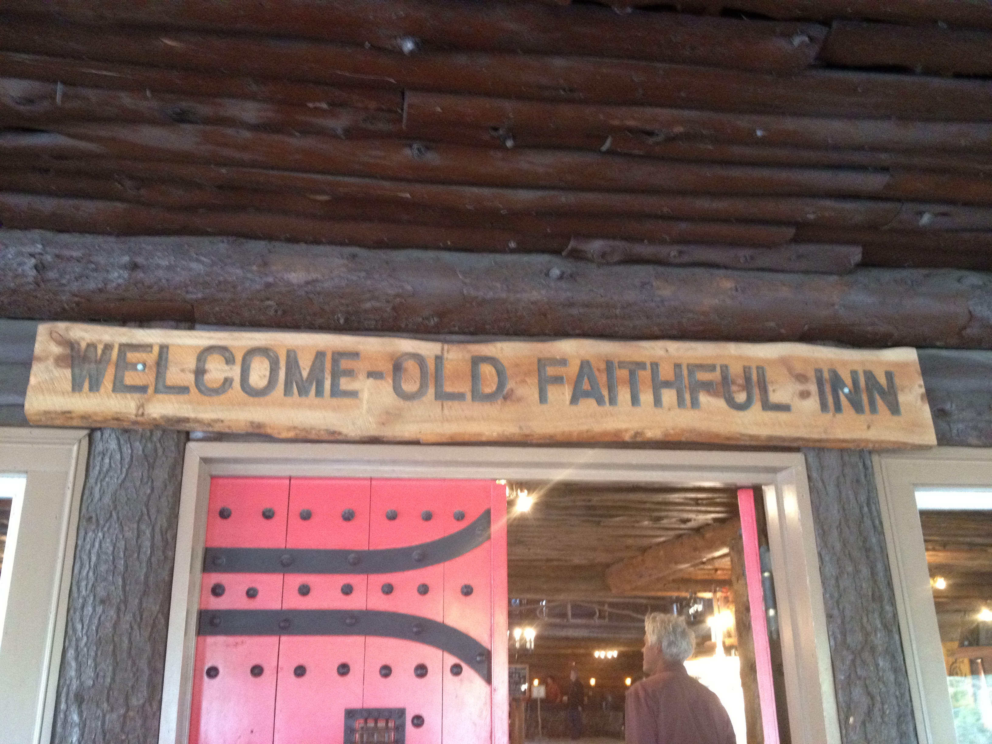
Every July, the World’s Largest Outdoor Rodeo (The Calgary Stampede is larger, but indoors) comes to Cheyenne, Wyoming.  Cheyenne’s Frontier Days is not only a rodeo.  It is a major nine-day event, and the most exciting time of the year to visit Cheyenne, Wyoming.  At Frontier Park, not only does one of the most major pro rodeo events take place each afternoon, but live concerts take place each night, and a carnival is set up just outside the park.  It is the week where Wyoming shows in full display it’s western heritage.  And while the “old west” can be thought of as encompassing part or all of 16 states, I find it hard to think of a state that shows more pride in it’s “old west” heritage than Wyoming.

Consistent with the culture on display at Cheyenne Frontier Days, most of the concerts that take place over the course of the week are country/western.  I am not a fan of country/western music.  I am from New York and Chicago, it is just the culture I grew up in.  So, I went to the only non-country/western show on the Frontier Days lineup, which happened to feature two of my favorite classic rock/ arena rock acts; Journey and Styx.

IMG_0868 IMG_0869

Styx went on first, and they began on-time!  This was at 8:00 P.M., Friday night, the first night of Cheyenne Frontier Days.  They put on a phenomenal show!  Some bands just don’t sound the same as they get older, but this band was quite good.  In fact, it reminded me how much I liked this band.  As an added bonus, I took pride in the fact that they are from Chicago.

IMG_0873

Journey was the main act of the night, and they also sounded really phenomenal!  Their story is quite an interesting one.  They scored their biggest commercial success in the time period from 1977 through 1984 with lead singer Steve Perry, who has a very unique sounding voice.  After breaking up, periodically reuniting, having a falling out with Steve Perry, and a few years with a different lead signer, in 2007, they hired Arnel Pineda, from the Philippines, as their new lead singer.  The interesting thing about this hire is that they hired him based on hearing his Journey Tribute band perform on YouTube.  It is interesting how this technology has helped a California based band find the most ideal new lead signer on pretty much the other end of the world.  How’s that for the benefits of the internet and connectivity?

I also love watching this guy in concert.  His attitude is just so positive!  Whenever I see him on stage, it just feels like singing for Journey has been a dream come true for him and that he is loving every minute of it.  I can feel his energy, and it seems like the crowd can feel his energy as well, and responds positively to it.  I think people in general just love it when someone seems really happy and enthusiastic about what they are doing.

IMG_0882 IMG_0877

In addition to seeing a wonderful show, we got to attend the show in a special section called the “Party Zone”.  This section of the venue is in front of the stands, fairly close to the band, which is how I got those fairly close-up pictures.  There are no seats here, and beer is sold right in the section, just slightly off to the side of where the crowd congregates.  Essentially, this is the section for people that came to dance, jump up and down, etc., as opposed to those that just want to sit and watch.  This is where I feel I belong.  So, I was happy to have good company, have a few beers, and see an amazing show.

IMG_0879 IMG_0880

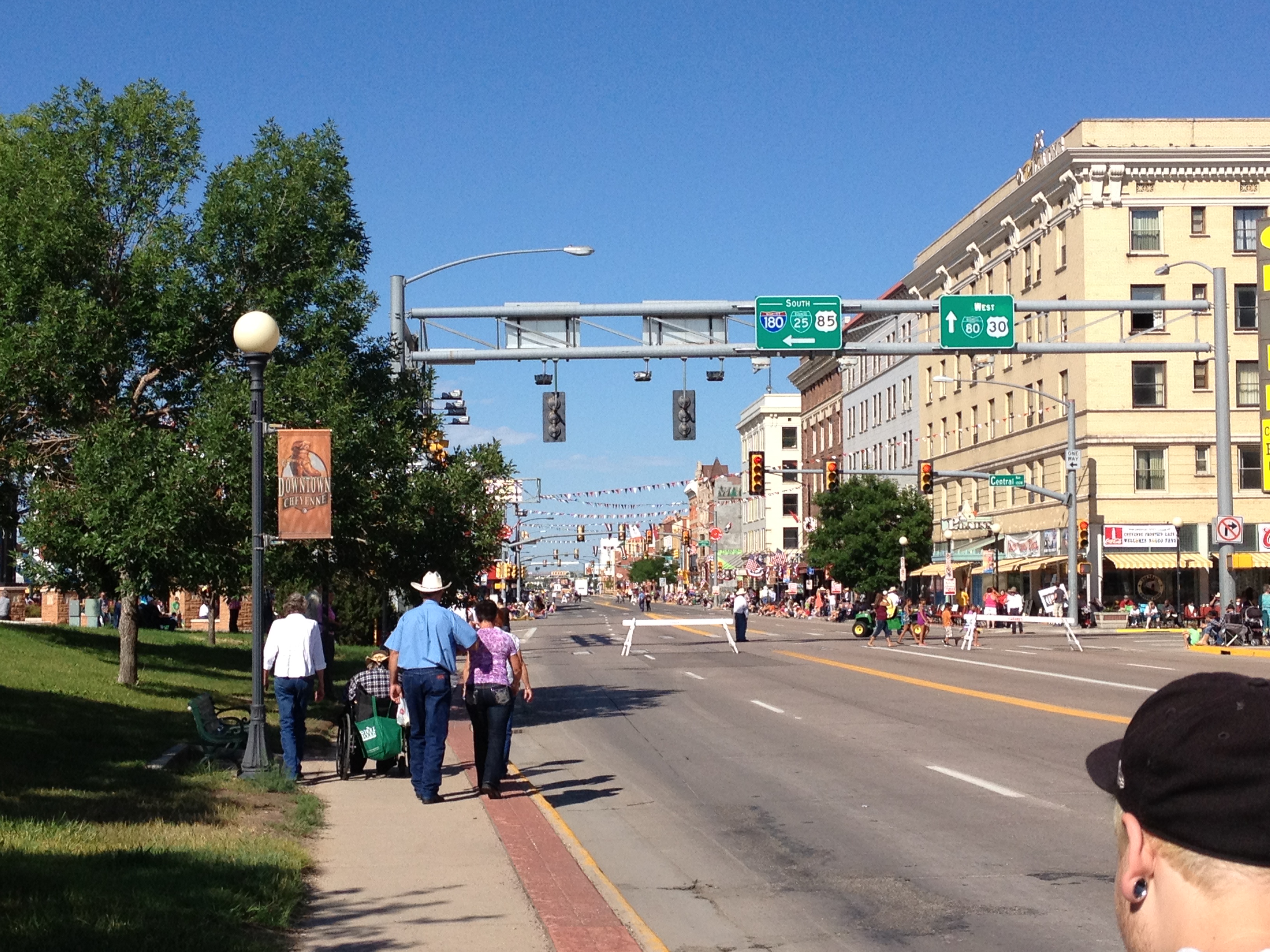
The next day, Saturday, we went to the parade, which occurs four times throughout the duration of this festival.  Saturday morning’s was the first one, but there will be another one on Tuesday, Thursday, and the following Saturday.  For this day, I decided to find the most western looking attire I own, which includes a cowboy hat that I actually bought at last year’s Frontier Days.  I have no boots, no fancy belt buckle, or anything that would make me completely legit.  But, it was nice to somewhat look the part, and somewhat look like I fit in in a place that could not be more opposite from where I am from.

I am not a conformist.  I believe that everybody should feel free to be themselves.  However, sometimes I enjoy just fitting in.  It makes me feel like a versatile individual, like somebody that can find a way to feel comfortable in many different situations and scenarios.  Wearing jeans and a cowboy hat for one day did not in any way make me feel like I am compromising my values or losing my ability to be who I am.  I will return to my quite urban lifestyle when this is over.  So, why not fully embrace the experience while it is happening?

IMG_0886 IMG_0888

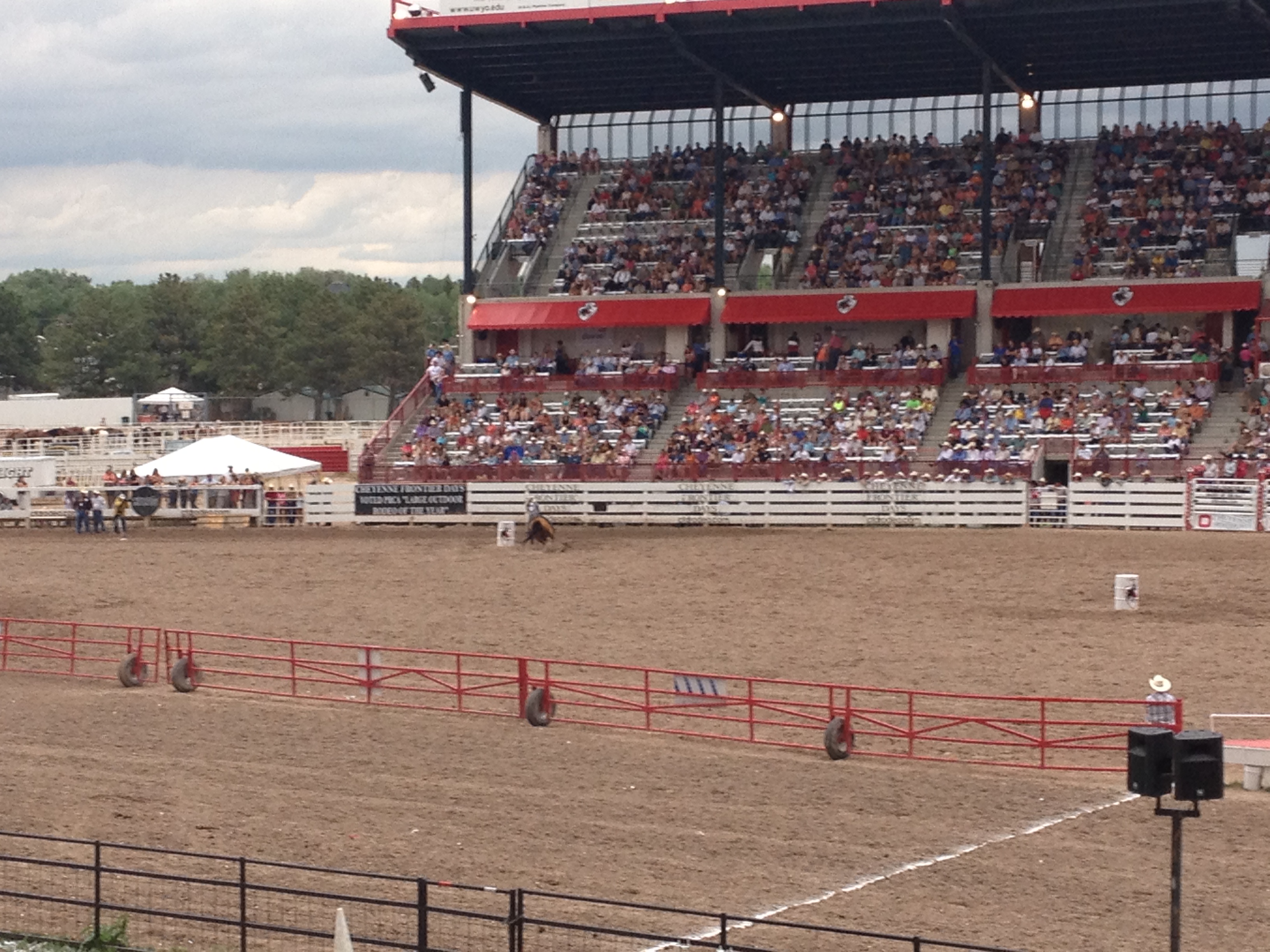
One thing I try not to do while attending major events is loose track of the actual purpose of the event.  The best example of this is the Mifflin Street Block Party in Madison, Wisconsin.  Originally a Vietnam War protest, this event quickly evolved into large early May block party with little purpose other than drinking heavily.  The major event at Cheyenne Frontier Days is the rodeo.  It is actually one of the most significant rodeo events on the pro rodeo circuit and attracts some of the best the sport has to offer.

Rodeos feature a variety of events, including your standard bull riding, and bucking broncos, but also the events pictured above; calf roping and barrel racing.  Calf roping is quite a crazy event.  A cowboy will first lasso a cattle.  Then, they jump off of their horse in order to tie it up, using a rope.  The best of the best can do this in a matter of 12 seconds.  Steer wrestling also features cowboys jumping off of their horse, but in order to wrestle a steer to the ground by the horns.  I saw someone do this in a matter of 7.6 seconds!

Of course, from the standpoint of an animal right activist, this is probably the worst sport in existence.  In order to get the bulls, as well as the broncos, to buck, they literally tie up their balls.  Maybe greyhound racing is worse, I don’t know, I am not PETA.

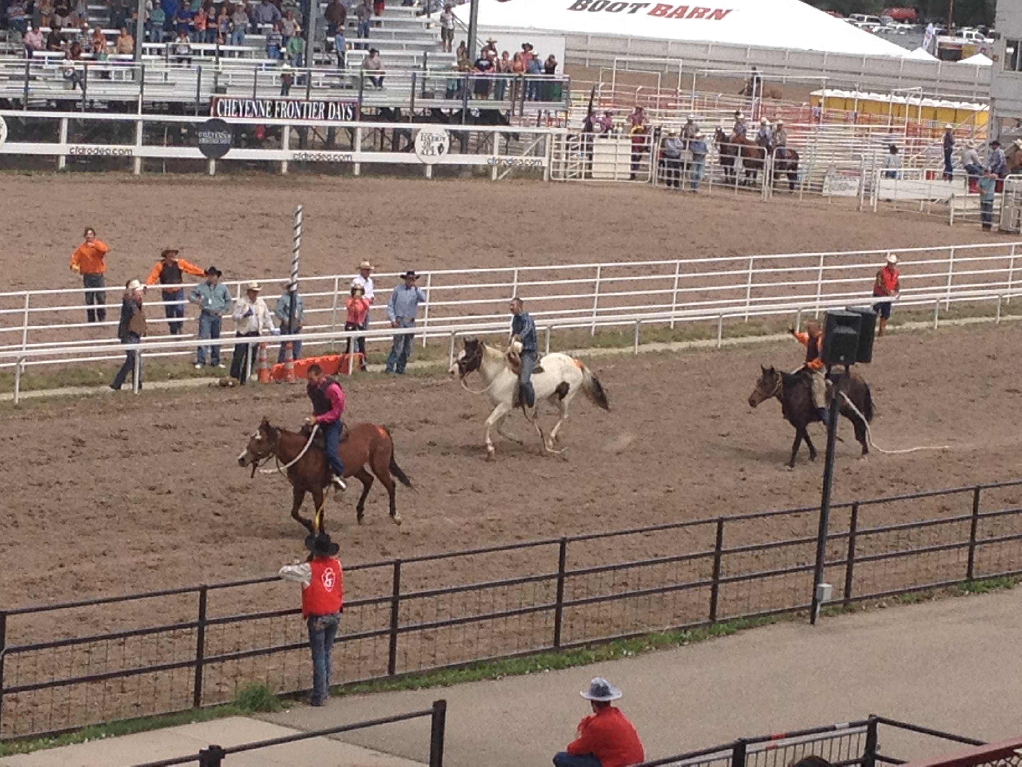
This particular rodeo ended with a unique and quite exciting event; a wild horse race.  For a lack of a better way of putting it, the wild horse race is literally a shit show.  Teams of three attempt to saddle up and ride an untamed horse, straight from the wild, one time around a track, in a fashion similar to a more proper horse race like the Kentucky Dirby.  However, because these horses are wild, anything can happen.  Before getting started, many of these horses started pulling their “handlers” in all sorts of directions, and some even “sat down”, if that is something a horse can do.  While running around the track, two of these horses jumped over the gate, throwing their riders off, and one of them completely changed directions out of nowhere.

All of this was quite amusing, but I actually kept thinking about this entire scene from the point of view of the horse.  Specifically, the people who were dragging the wild horse around in a vein attempt to get them to act like Man-O-War were, in some cases, riding trained horses.  These wild horses, being dragged into the arena must be wondering why these other horses are betraying their own species and helping the humans do this to them.  It’s got to be on their minds.

IMG_0889 IMG_0890

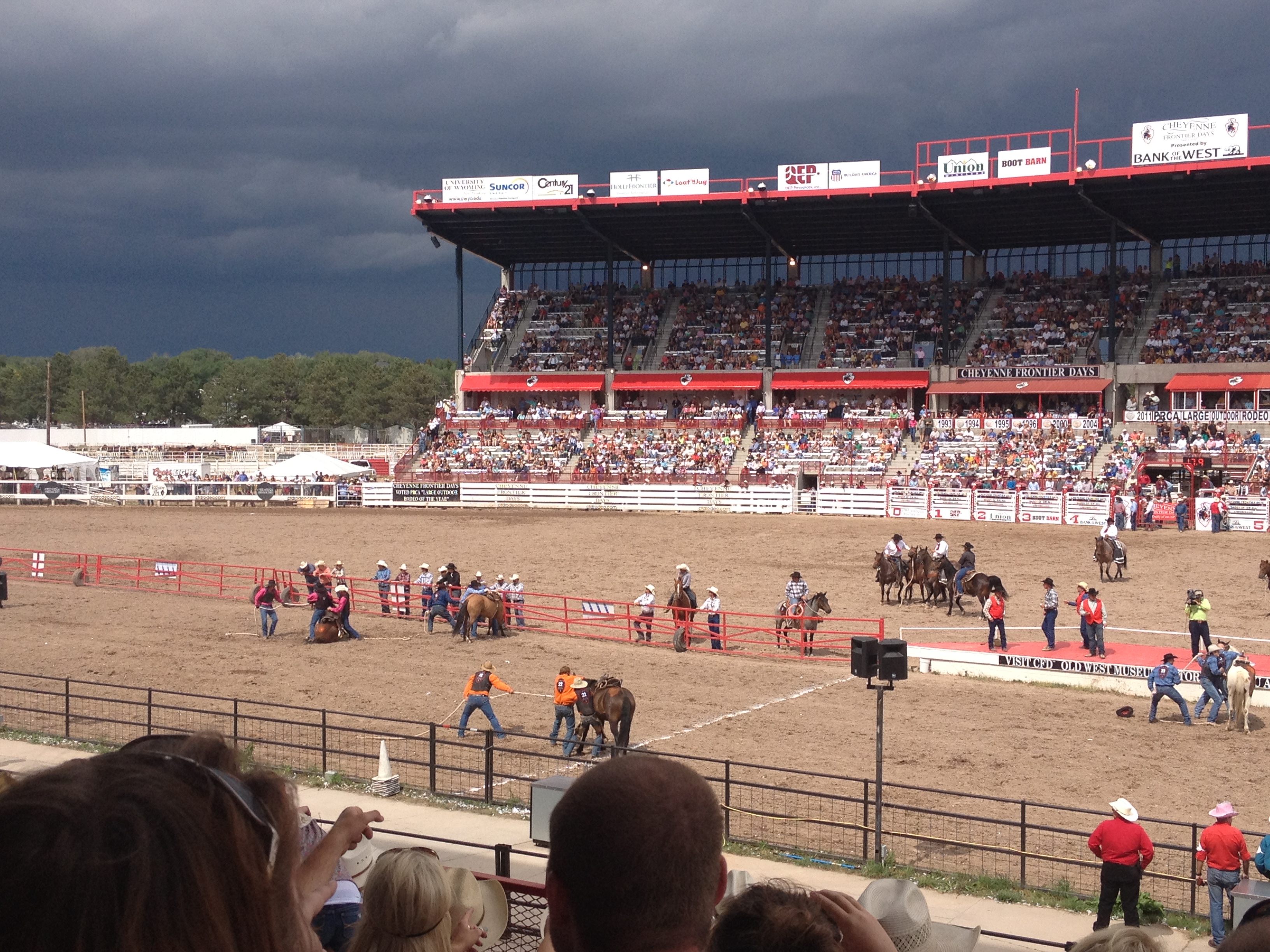
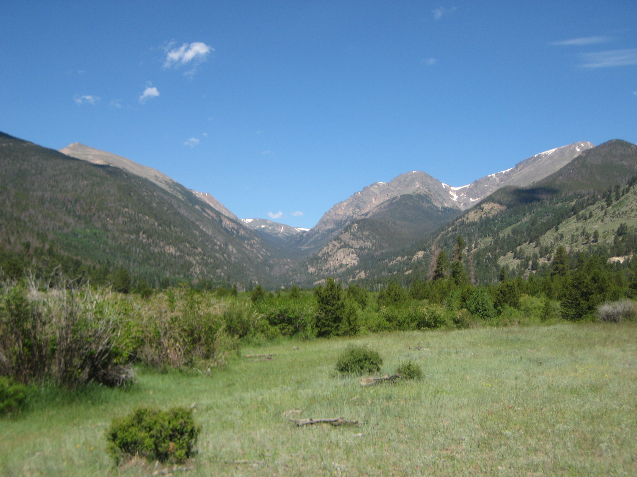
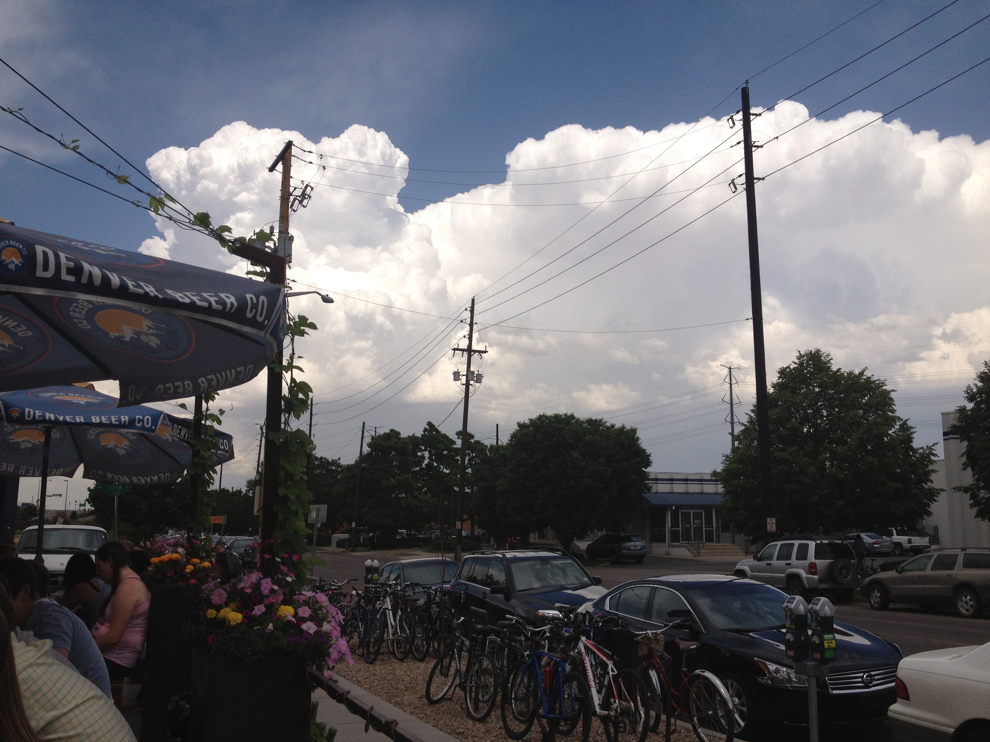
We also got quite lucky with regards to the weather.  Towards the end of the rodeo, around 3 P.M., storms started to form to our West, Northeast, and South.  But, luckily, the storms formed and tracked elsewhere, and very little rain fell on the rodeo itself.  The storms did, however, help cool things off.  In both Colorado and Wyoming, in summertime, storms are like power plants; you want them close to you but not close enough to mess things up.

Horsetooth Reservoir; A Great Place for Water Sports, and Your Dog

IMG_0857 IMG_0858

About ten minutes west of the town of Fort Collins, Colorado sits the Horsetooth Reservoir, a six and a half mile long, but fairly narrow lake at the edge of the foothills.  It was created in 1949 when the Bureau of Reclamation put up four dams in the area, as part of a larger project called the Colorado-Big Thompson project.  The intention of the project is to stabilize the supply of drinking water for the cities along the Front Range from Fort Collins down to Pueblo.  They do this by diverting water from the Western Slope (on the other side of the Continental Divide) to the Eastern Slope.  Thus, they effectively take water that would have flowed down the Colorado River to the Pacific Ocean via the Gulf of California.  It is interesting that some people here complain that the Hoover Dam takes significant amounts of water out of the Colorado River when we here on the Front Range in Colorado are also benefiting from water taken from the very same river.

Similar to places like Lake Mead and Lake Powell, the creation of a lake, originally intended as a reservoir to stabilize the supply of drinking water, ended up serving a secondary purpose; providing a spot for water recreation.  In the West, and especially in the Southwest, naturally occurring lakes are fairly rare.  They tend to be smaller and at higher altitudes than their Midwest counterparts.  The naturally occurring lakes I can remember seeing in Colorado are lakes like Fern Lake and Lawn Lake up over 10,000 feet in Rocky Mountain National Park.  With these lakes tougher to get to and smaller, these reservoirs have become a focal point for boating and other water related recreation areas in the region.

Yesterday was a perfect day along Colorado’s Front Range.  Temperatures topped out in the upper 80s to near 90 in most places from Fort Collins to Denver, and no thunderstorms occurred, not even in the foothills.  Afternoon thunderstorms typically occur in the region at this time of year, but yesterday all of the storms occurred West of the Continental Divide.  I guess that is good news for recreation enthusiasts in the populated part of the state of Colorado, but days like yesterday probably illustrate why it was necessary to divert water resources from Colorado’s Western slope to Colorado’s Eastern slope.

Yesterday I got the rare opportunity to join with a few people for some jet skiing on the Horsetooth Reservoir.  I do not own my own jet ski, and I haven’t ridden one for over five years.  But, I remember it being quite fun, and I knew there was no chance of storms in the forecast.  So, it ended up being a nearly perfect activity for a day like yesterday.  Also, since we traveled a significant distance away from Denver, and went on a Wednesday, there was significantly more open space then there would have had we gone to a place near town like Cherry Creek Reservoir on a weekend day.

IMG_0859 IMG_0860

Naturally, I got too carried away with the activity to think to get any pictures of myself on the jet skis.  I only got pictures of others.  This should be a testament to just how enjoyable the activity is.

As an added bonus, I got to bring my Siberian Husky; Juno.  Being a cold weather dog, she naturally wanted to get into the water as quickly as possible.  However, being a non-water dog, she spent a large part of the day just on shore, in the shade, periodically going into the water.  She still seemed to have a lot of fun here, in fact, enough to get her completely worn out.  If my husky enjoyed the experience this much, I can only imagine how enjoyable it would be for a retriever to come here for the day.

IMG_0856 IMG_0863

The water temperature here yesterday was perfect!  It was in that range where the water is cool enough to feel refreshing, but warm enough that it was comfortable to get in from the very beginning.  This contrasts with some pools I have gone in earlier this summer where the water felt quite cold at the beginning, before gradually getting used to it.  I was concerned that the water here would be even colder than that, but it wasn’t!

Overall, Horsetooth Reservoir was worth the $7 entry fee.  I am not sure how much more crowded it is on the weekends.  However, given the fact that this year’s weather in Colorado appears to have been fairly typical, I would expect most years to feature water temperatures in the same general range as yesterday’s, making Horsetooth Reservoir a wonderful place to go for both water sports, and dogs.

A Rite of Passage

IMG_2367 IMG_2376

Birth to roughly age 22 is an endless barrage of rites of passages.  There is birth itself, first steps, first words, first day of school, learning to ride a bike, first kiss, then high school and college are one eight year long rite of passage into adulthood which includes learning to drive, and then all of the other things you can legally do at age 17, then 18, then 21.  Due to the ridiculous drinking age in this country, many of us end up going a little bit overboard somewhere in there.  On top of that, there are a bunch of rites of passages in there that are specific to each individual, like first baseball games, or learning musical instruments.

The final rite of passage in all of this is graduating and getting a job (or, for some people graduate school).  At this point in time, most of us are quite sick of rites of passages.  This is especially true for some of us that went to graduate school.  The time has just come for us to stop preparing for our lives and live our lives.  However, the transition is quite abrupt.  We go from being in a near constant state of flux and trying to figure out where are lives are going, to a quasi-steady state, where day in, day out, week in, week out, year in, year out, has the potential to follow some routine that never changes, and never progresses.  After a few years of this, it is natural to get a bit restless.  Before long, we see American Pie, or Superbad, or Clueless, or whatever movie reminds us of that time in our lives, and almost become nostalgic for the time in our lives when the future, heck, the next week, was an open book, as opposed to a likely mirror of the last.

IMG_2347 IMG_2349

In Colorado, it is considered somewhat of a rite of passage to climb to the top of a “14er” for the first time.  A “14er” is a mountain whose peak is more than 14,000 feet in elevation.  The selection of the number 14,000 seemed a bit arbitrary to me at first.  It seemed like it just happened to be the nearest round number, and that it would be different if the U.S. were on the metric system.  But, this demarcation of peaks exceeding 14,000 feet seems useful to Coloradans for two reasons:

1.  With a total of 54 “14ers”, it gives Colorado hikers a large enough variety of places to go and hike these peaks, but not so many that climbing all of them is out of reach.

2.  With a total of 54 “14ers”, Colorado has significantly more of these peaks than all other states, including Alaska (14) and California (12).  So, despite the fact that those states have the tallest peaks in North America and the lower 48 respectively, Colorado has a basis to claim the top position in the country with regards to mountains and mountaineering.

This is why yesterday I woke up before sunrise and made the trek to Gray’s Peak in order to accomplish the feat of climbing my first “14er”, and becoming a true Coloradan (in the eyes of some).

IMG_2393

Gray’s peak is actually the highest point on the Continental Divide, and the trail up to the top of this peak (as well as Torrey’s Peak) is part of a national scenic trail that follows the continental divide.  This trail is only about 70% complete.  If someone wanted to traverse the entire trail, they would have to do some road-walking.  This is most likely why we don’t hear about this trail as much as the Appalachian and the Pacific Crest trails.

IMG_2354

I was lucky enough to go with a group of people that included three first timers (including myself), and a mixture of people who had varying levels of experience climbing “14ers”.  A couple of people had been up over ten of these peaks, some others had done only a couple.  It is also just fun for me to do activities in groups like this, and I am glad I got to share this accomplishment with them.

IMG_2355

Whenever attempting something that requires physical strength or endurance, part of the battle is always mental.  Seeing Gray’s Peak (left), and Torrey’s Peak (right, partially hidden behind the hill), toward the beginning of the climb definitely created an intimidation factor that somewhat reminded me of the first time I went skiing in the Rocky Mountains, at Steamboat Springs, and looked at the ski mountain, after having only seen ski mountains in the Midwest.

IMG_2358

The trail up the mountain follows a path that has been mapped out for some time, and has been improved and preserved by the Colorado Fourteeners Initiative.  It is likely the safest way to hike up the mountain, but it follows a ridge that looks a bit scary, as the thought of being on a small linear feature like the one seen in this picture can be somewhat frightening.  Luckily, when we got there, it was actually less scary up close than it was looking at it from afar.

IMG_2361 IMG_2362

With pretty much the entire hike being above the tree line, I began to get some pretty scenic views only halfway up the mountain, which is already above 12,000 feet in elevation.  It was quite interesting to see some of the other peaks looking away from the top of the mountain, to the north.  As a scientist, it is hard not to be intrigued by seeing a mountain where one side is getting a significant amount of sun and the other is not.  It appears as if grass grows on one side but not the other, which indicates a different ecosystem and a different climate, all within the arctic tundra, dependent on local topography.

IMG_2363 IMG_2365

For roughly the first two thirds of the way up the first peak, I was actually able to keep up with the fastest people among the group.  However, having less experience climbing at these altitudes, it was inevitable that I would eventually drop back.  I took this opportunity to get some image of the others in the group hiking, as there was a switchback zone after the ridge we had previously followed.  Hiking trails like these definitely involves a significant amount of looking at the ground, as there are a lot of small rocks, which need to be approached somewhat carefully.  Even after I let everyone know I was taking pictures, some people still did not look up.

It took me about three hours to get to the top, and I summited just after 10 A.M.  The feeling of getting to the top is hard to describe, especially for a first timer like myself.  It is definitely a feeling of accomplishment, and a really good confidence builder.  It is also mixed with this feeling of being on top of the world.  All of the mountains, the ones that I typically view from Denver as towering over the city from the west were all below me.  I had climbed to the top, conquered it in a way.  I may never look upon these mountains the same way again.  The very scenery that I can see on all non-cloudy days from the back window of my apartment has been suddenly transformed from symbolizing what is challenging, wild, and untamed to symbolizing that all things are possible, and that challenges can be met with determination and proper planning.

IMG_2370 IMG_2369 IMG_2368

At the top of Gray’s Peak, we actually found a pretty nice place to sit, where the rocks somewhat shielded us from the wind.  For some reason, it is always significantly windier at the top of a mountain peak than it is just a mere 100 feet lower.  I have noticed this before, but wondered if it would feel different on this hike, which was pretty much all above the tree line.  It wasn’t, it felt more than twice as windy at the top of Gray’s peak.  I also learned something very surprising about hiking yesterday.  On the way up to the mountain, I was told that all hikers should bring a lemon with them on their hike.  This made absolutely no sense to me, as I was under the impression that I should stick with sandwiches and power bars to avoid carrying excess weight.  Liz and Laura (pictured above) followed by this advice, brought the lemons, and actually let us have some.  I had one lemon wedge, so I probably did not receive too much impact from it, but it did seem refreshing and energizing.  Who would have thought.IMG_2372

I also brought Bigfooting to new heights, doing my pose at 14,270 feet above sea level, and on the Continental Divide!  The scenery behind me is looking in the other direction (South), where I could see more gigantic mountains from above- exhilarating!

IMG_2375 IMG_2379

From Gray’s Peak, it is possible to “saddle” over to Torrey’s Peak.  To do this, I had to descend 575 feet along a ridge between the two peaks, which actually follows along the Continental Divide, and then climb up the second peak.  Apparently, this picture taken at the top of Torrey’s Peak, with a Which Which bag in the photo, entitles me to a free sandwich at Which Which.  I wonder if I can upgrade to a large size sandwich for posting this picture here.

Climbing up Torrey’s Peak was harder than climbing up Gray’s.  The trail up was steeper, and, possibly because I was already tired from climbing the first peak, I had to stop and catch my breath several times.

IMG_2382

When I reached the top of my second “14er”, I was quite worn out.  This is how I knew that I had given it my everything, and truly pushed my limit.  I could have stopped after peak #1 already having accomplished my rite of passage.  But, I decided I wanted to leave with absolutely no doubt that I had pushed my body as hard as it was willing to go.  I even had to leave the Bigfooting up to others on this peak.

IMG_2381

Going down was scary, especially this second peak, which was steeper than the first.  I don’t know how I feel about it.  I had become accustomed to having trees to hold onto in a pinch, but this hike was all above the tree line.  I actually went pretty slow at first, but then started resorting to descending the mountain using some of my skiing techniques, primarily facing my feet sideways and turning back and forth.

IMG_2384 IMG_2385

To get down from Torrey’s Peak, one must return to the saddle area between the two peaks, and then follow another trail down towards the parking area.  This lead us down the mountain on a slightly different path.

IMG_2390 IMG_2391

We actually had to trudge through an area with residual snowpack.  While I do find it interesting to ponder why part of this mountainside still has snow and other parts, facing the same direction do not, this was my least favorite part of the hike.  It was real slippery and we were descending.  I consider hiking and skiing (or snowshoeing) to be two different activities, and usually plan to avoid hiking on too much snow.  This snow is still melting obviously, and some small streams of water from this snowmelt were observed further down the trail.

After another area of switchbacks, the descent got less steep, and the rest of the hike was somewhat uneventful.  We got back to the parking lot around 2:30 P.M., about an hour before thunderstorms erupted in the area, but apparently there were already storms elsewhere in the area.  What was amazing for me to see, were people starting their ascent up the mountain after noon.  We wanted to tell them to turn back and wait for another day, but I am never sure what to do about that.  As someone who is typically not a fan of unsolicited advice, I am hesitant about giving it to people, even in the case where their idiocy is blatantly obvious.  A general rule about climbing “14ers” is to get there as early as possibly, preferably before 7 A.M. (which we did not quite make).  If arrival before 9 A.M. is not possible, it is probably not worth it to go.  I learned this within a month of moving to Colorado, without even seeking this knowledge.  So I find it hard to believe that someone would try to scale this mountain starting at 1 P.M. on a day with greater than normal monsoonal thunderstorm likelihoods.

IMG_2387 IMG_2388 IMG_2389

It was wonderful to have completed this, my first “14er”, and traversed this rite of passage.  Having done this will give me something akin to the Colorado version of street-cred.  With two other first timers amongst us, we took some “graduation photos”, with the mountains we had climbed in the background.  I actually billed this the “14er Class of 2013”, but I was possibly a bit warn out and light-headed when I came up with that one.  At this level (still over 13,500 feet), there is 35-40% less oxygen available than at sea level.

Does this make me a true Coloradan now?  No.  It actually makes me something more akin to a true Colorado transplant.  One of the things I have learned over the past year is that it is the transplants that are the ones obsessed with skiing, hiking, and all of the mountain activities in general.  The only people I have met over the past year here that do not ski have been Colorado natives.  But, what makes someone a true Coloradan?  One could argue that those of us that are going out and experiencing what Colorado has to offer are the truest Coloradans there are.  It is in the same vein that some argue that some immigrants can be counted amongst the truest Americans there are.  Of course, there are valid arguments on the other side, but as I have viewed tons of Colorado Native bumper stickers over the past year, I do find it hard to accept that being born in a certain location is a prerequisite for belonging there.

Regional Familiarity

IMG_2317

Within only a month or so of moving to Colorado, one of the things I missed quite a bit about the Midwest was the familiarity I had with the region.  After 19 years in the Midwest, I had grown quite familiar with the area.  I knew the traffic patterns of Chicago, as well as all of the good alternate routes.   I knew what areas were popular in which situations, and therefore knew where to expect crowds.  I knew how much time to allocate for driving between any area in the Midwest, allowing me to allocate my life quite efficiently.  I also knew about restaurants, bar specials, people’s typical behavior patterns, and, well a host of other little intangibles that help an individual operate their lives smoothly.

I suspect many people begin to feel this way when moving to a new place.  Although it is important to embrace a new experience, in order to get the best result possible, it is hard not to long for that familiarity.  Different things are important to different people.  But, after living in a place for a few years, most people will have gradually obtained the knowledge that is important to them.  However, that first year or two always involves a scramble.

Yesterday, I learned a lesson about Colorado.  I had decided I wanted to go to Rocky Mountain National Park for two reasons:

1.  I decided that it was a good time to do a hike that contained a vertical climb somewhere in the neighborhood of 2,000 feet at a fairly high elevation.  This, of course, is mostly me wanting to fit in here, with the activities that a lot of people in my age group like to do.  At the University of Wisconsin-Madison, fitting in involved developing an alcohol tolerance.  Here it means being able to physically handle terrain, by hiking, biking, climbing, skiing, etc.

2.  Last month at Badlands National Park, I bought an annual pass to the National Parks for $80, with the specific intention on using the National Parks here in Colorado.

What I found out was, leaving at 7:30 A.M. was not early enough.  Well, not to do what I wanted to do, which was hike the Lawn Lake Trail, a 6.2 mile trail with a 2,450 foot accent to Lawn Lake, in the Mummy Mountain Range, and return to the car safely before thunderstorm chances increase in the afternoon.  My problem was that I departed right around the height of the morning rush hour, and, decided to take U.S. highway 36 through Boulder.  Not only did I encounter traffic before even getting out of Denver, but I encountered the usual Denver to Boulder traffic, and the usual delays in Boulder, where traffic is quite lousy for a city it’s size.  After all of this, I did not arrive at the entrance to the park until just after 10 A.M.  Luckily, I had learned from all of my recent travels that traveling within a National Park can be slow going, and therefore had selected a trail not too far from Estes Park, where I had planned to enter the park.

IMG_2318

By that time, all of the parking spaces at the Lawn Lake Trailhead parking lot had been taken, so I had to park across the street.  This was somewhat fortunate, as one of the best pictures I got from the area actually came walking across the street to get to the trailhead.

IMG_2319

On some hiking trails, it is surprisingly easy to take a wrong turn.  But, not on this one, as the trail was well marked by rocks the entire way, and even had periodic signs pointing the way.

IMG_2320 IMG_2321

As was advertised, the trail was quite steep.  In fact, it began with several switchbacks, and it was less than half a mile into the trail that some meaningful uphill progress began to appear.  That was when I saw another reminder that I am still a Colorado novice.  On one of the trail markers, I saw someone had actually left a hoodie on the post.  My first instinct was that having just worked up a sweat climbing the initial few switchbacks, the person had overheated a bit and decided to take their sweatshirt off.  But then, I thought to myself, why would anyone want to dump off a layer of clothing when going uphill, where it will only get cooler with elevation.  I also wondered if this was any kind of a signal that Coloradans know about that I do not.  Could it be similar to someone tying a tie around the door knob of a college dorm room to signal to their roommates that they have company and need to not be disturbed?  Only walking in on your roommate, as scary as that sounds, sounds less scary than being suddenly attacked by a bear, or giant falling rock because I did not understand this signal.

IMG_2322

I also seem to always happen upon waterfalls at Rocky Mountain National Park.  And, happening upon a waterfall I was not expecting kind of also made me reflect on some major differences between living here and in the Midwest.  I happened upon a waterfall when my destination was a lake.  This feels like the opposite of the way it would occur in the Midwest.  In the Midwest, waterfalls are hard to come by, and it is not uncommon to travel hours to encounter a good waterfall.

IMG_2324 IMG_2325

Knowing the thunderstorm threat at this time of year, and the amount of time I had, I had to change courses and chose to hike the shorter trail, Ypsilon Lake.  This trail, however, is also rated as “strenuous”, and at Rocky Mountain National Park, when they describe a trail as strenuous, they mean it!

IMG_2326 IMG_2328

I knew I had made some significant uphill progress because the density of the trees had begun to thin out.  From viewing the area around me, I concluded that I was roughly 1,000 feet below the “tree line”.  Later, after consulting my fabulous Colorado DeLorme Atlas, I determined that I turned around only about a mile and a half from the end of the trail, but that I had done pretty much all of the climbing.  From a base elevation of 8,540 feet, I had reached somewhere in the vicinity of 10,500 feet, leaving something in the neighborhood of 200 or 250 feet of climbing remaining.  I still wonder if I should have continued the rest of the way to the lake so that I could have completed the trail, but I guess I need to chalk the whole experience up to just not quite having the feel for how Colorado works yet.

IMG_2332 IMG_2333

Additionally, despite the fact that clouds seemed to be building on my decent, the thunderstorms actually held off.  So, I ended up deciding to do a little bit of driving along the famed Trail Ridge Road, which actually ascends up to nearly 12,000 feet.  On this road, one actually ascends above the tree line.  According to the Alpine Visitors Center, the tree line in Northern Colorado is at 11,400 feet of elevation.  Above this elevation, few trees are found, and pockets of residual snow can actually be found.

IMG_2335 IMG_2342

Overall, I guess I still had a productive day at Rocky Mountain National Park, but I still wish I could have traversed the entire trail to Lawn Lake.  I pictured myself getting there significantly earlier than I did.  I learned that Rocky Mountain National Park is farther away than I think of it in my head.  For some reason I always think of this place as being right in Denver’s backyard, because, from the point of view of 1,000 miles away, it kind of is.  But, it does take nearly two hours to get there from Denver.  Perhaps it would be faster to follow I-25 to Longmont, cutting over to Lyons on route 66?  I’ll probably try this next time, as Boulder does not do a good job of accommodating traffic.

I also learned not to expect this place to be much less crowded on a Tuesday than a Saturday.  This is because most of the people here are actually not from Colorado.  I actually saw a ton of Illinois plates here.  People come here on vacation, and, with the kids out of school for the summer, they are likely to be vacationing for a whole week.  If I really want to find a less crowded place to hike on a Tuesday, it would probably be best that I look somewhere completely different.  These are all things that people who have lived in Colorado for several or more years probably know and understand well.  And, over time, I will gradually get the feel for.  For now, I must learn all of this, either through experiences like this one, or through solicitations of advice from others.

Red Rock Canyon Open Space

Two miles south of Garden of the Gods, a place called Red Rock Canyon Open Space offers some of the same natural features.  Red Rock Canyon Open Space is a city park, belonging  to the city of Colorado Springs, but it is actually kind of halfway between Colorado Springs and Manitou Springs.

IMG_0830

There are two main differences between the Red Rock Canyon Open Space and the Garden of the Gods.  The most important difference is the density of the rock features.  The rock features at Red Rock Canyon do look similar to those at Garden of the Gods, but, these features are much farther apart than the features at Garden of the Gods.  This is most likely the reason that Garden of the Gods is more popular than Red Rock Canyon.

The other main difference is the hiking (and mountain biking).  Although Red Rock Canyon Open Space does not offer hard core hiking, there is more terrain here to climb than there is at Garden of the Gods.  Garden of the Gods can be thought of as more of a scenic walk than a hike, Red Rock Canyon does offer “strenuous” trails, that do have a little bit of grade.

IMG_0827 IMG_0825

Based on a previous understanding that the ratings assigned to hiking trails were relative, we decided to find the most strenuous set of trails possible in the park.  This actually took us on a mix of trails that were open to mountain bikers and trails that were labelled hiking only.  The trails we took wandered through some of the rock formations in the park, which, up close looked a lot like they did from up close at Garden of the Gods.  Oddly enough, one of the trails we ended up on was actually labelled the “Contemplative Trail”, which is odd because my previous post about Garden of the Gods was actually titled “Garden of the Gods, A Place to Collect Thoughts”.

IMG_0826 IMG_0829

We actually hiked far enough to leave the technical boundaries of the park, which took us a bit higher in elevation than those who remained within the park’s boundaries.  This is something I would definitely recommend to anyone else that is planning on hiking at Red Rock Canyon, as it provided us with some of the best views of the day.  From here, we could once again see the effects of last year’s major wildfires, which charred up all of the trees over a large segment of the mountainside.

IMG_0831 IMG_0833

At this location, the trail actually meets up with something called the “Section 16 Trail”, which appears to be a hike through the forest/ foothills with more elevation gain.  I still wonder what it is section 16 of, but my initial research, which primarily involves searching on Google, has not provided me with an answer as of yet.

The second half of this day will eventually feature thunderstorms over the higher terrain, west of both Denver and Colorado Springs.  This is actually a common occurrence, as air is compressed by the mountains.  On days like these, thunderstorms form in the mountainous part of the state, but not in the plains.  Occasionally, the thunderstorms do track eastward, affecting places like Denver and Colorado Springs, but not always, and it always takes quite a bit of time.  Although these storms did not form until afternoon, we could sense these storms were going to form because the wind was blowing up the mountain and already starting to form cumulus clouds.  Pictured below are the cloud formations at 10:30 this morning, and the RADAR image from 3:30 P.M.  Notice how the storms are only present in the mountainous part of the state.

IMG_0832 Screen Shot 2013-07-04 at 3.43.05 PM

Pike’s Peak, the defining feature of the region, was only visible for part of the hike.  In other parts of the hike, it was hidden behind other terrain features near Red Rock Canyon itself.  Of course, almost anywhere within Colorado Springs, Pike’s Peak can be seen towering over the city.  However, Pike’s Peak had a significantly different look this time up than last time.  Last time, in mid-May, Pike’s Peak was snow covered above basically the tree line.  Since then, all that snow has melted and the mountain is pretty much bare, making for a completely different look.

IMG_0377 IMG_0824

My May 16th photograph of Pike’s Peak, compared to the one taken today, July 4th.

Finally, as we finished up our hike, we encountered an unexpected feature.  It was one of those terrain park areas for mountain bikes.  I had never really seen any of those before, and I actually saw a few people riding their bikes around, up and down the railway and sea-saw features.  It seems like a neat thing to do, albeit somewhat scary.  I think I am personally going to stick to long-distance road biking.

IMG_0834

Today’s hike had a surprisingly southwestern feel to it.  And, the whole time it made me wonder, where does the southwest really begin?  The south-westernmost part of Colorado, Durango and the Four Corners region, I can imagine, definitely is part of the southwest the way we know it.  Northeastern Colorado is definitely the plains, but North Central, like Fort Collins and even Denver do not particularly feel southwestern.  They feel basically central Rockies.  Maybe all red-ish features just make me think of all things southwestern, and I am getting it all wrong.  But, still, I wonder if I am entering an entirely new region every time I drive south on I-25 over Monument Pass.

Denver: The Good, the Bad, and the Surprising

IMG_0784

Tomorrow, July 1st, marks the one year anniversary of my move from Chicago to Denver.  And, well, since I have not really been traveling ever since returning home from my back-to-back-to-back trips on the 16th, I figured I would write up a little something about Denver itself.  Or, at least my impression of it after a year of living here.

Keep in mind the background that I come from.  I was born in New York, on Long Island, but fairly close to Queens Borough, and New York City.   Most recently, I lived in Chicago, more accurately Logan Square.  So, I come into Denver from a pretty urban point of view.  A lot of my impressions of the city of Denver, and living here, may be quite different than someone who may have moved here from a more rural environment.  Still, I came into this without unrealistic expectations.  I knew Denver would not be another Chicago or another New York.  So, I am not about to chide downtown Denver for not having the energy level of Midtown Manhattan or Chicago’s north side.

I titled this blog “The Good, the Bad, and the Surprising”.  It is traditional to title something of the nature “The Good, the Bad, and the Ugly”, but that title would imply that the writing would be 2/3 negative, as ugly is pretty universally a negative word.  I want to make this blog entry a roughly even mix of positive and negative.  So, I decided to label it as such, as there are things I find good, bad, and surprising about Denver and living here.  The surprising stuff in this blog could be good, bad, or neutral, but on the balance this entry should be an even balance of what I have liked and not liked about living in Denver so far.

Activities:

The Good:

All of the outdoor activities nearby

IMG_0216 IMG_0034

In both summer and winter there is plenty to do in the vicinity of Denver.  This is one area where Chicago is pretty lacking.  The mountains to the West in particular provide anyone living in Denver, or anywhere in Colorado (except maybe some of the areas in the far east discussed in some of the storm chase entries in this blog), with a plethora of fun outdoor activities to enjoy, from skiing/boarding, snowshoeing, and sledding in winter to hiking, biking, rafting, climbing, and other river activities in summer.  In fact, I am overwhelmed by the amount of possibilities in the great outdoors here in Colorado.

The Bad:

The traffic on I-70

IMG_0067

It is surprisingly bad.  Worse than anything I could imagine happening in Colorado.  Denver is 1/5 the size of Chicago.  So, where are all of these cars coming from?  Every Sunday afternoon, regardless of season, traffic coming back into town from the mountains on I-70 will delay you roughly an hour, possibly more.  During ski season, Saturday and Sunday mornings will delay you unless you leave prior to 6:30 A.M.

The Surprising:

The frequency I have needed to wake up before 7 A.M. on weekends.

Okay, maybe I should not have been too surprised by this one.  But, in Chicago, it was quite rare to ever really need to be up early on weekends.  This is probably why 4 A.M. nights were so common.  Here in Colorado, I have woken up earlier than 7 A.M. for a variety of reasons, including beating the aforementioned I-70 traffic to the ski resorts, but also to get in bike rides and hike in the morning before the wind, and thunderstorm chances pick up.  Getting on the mountain as early as possible is like an unwritten law of hiking 14ers (peaks >14,000 ft.)

Going Out:

The Good:

Happy Hours!

Holy shit!  I mean, the amount of bars that have happy hours, and the amount of happy hours they have has made drinking a heck of a lot cheaper in Denver than in so many other places.  I have seen places have happy hour from 3-6 and then again from 10-1.  And, on a Friday.  Having become used to nights out that involve consistently paying $6-8 (or more) per drink and being out nearly $100 by the night’s end, this has been a pleasant surprise.

The Bad:

1:30 Last call!

Sorry Coloradans, but that is not baller.  That is all I will say about that.

The Surprising:

The energy!

IMG_0282 IMG_0392

And, I mean this in a good way.  Denver is 1/5 the size of Chicago, but it has three areas where the energy on a Friday or Saturday night will consistently be there; Downtown, East Colfax, and South Broadway (my neighborhood).  This includes some great bars and clubs, rooftop patios, and unique events like the Denver Cruisers (right picture).

Cityscape:

The Good:

Bicycle Trails

IMG_0337IMG_0331

Denver and the surrounding areas have a lot of great bike trails, including the Platte River Trail, the Cherry Creek Trail, Clear Creek Trail, and Bear Creek Trail that provide a fairly easy bike route between places around the area.  These trails generally bypass all traffic lights, which has been phenomenal!

The Bad:

Uninteresting suburbs and highway traffic

The traffic is not as bad as it is in Chicago, but I expected it to be much better.  I-25 in particular gets pretty jammed up from downtown to the tech center at every single rush hour.  Likewise, highway 36 to Boulder has it’s share of problems that are not bad when compared to New York and Chicago, but seem bad when compared to similar sized cities I know better; namely Milwaukee, Minneapolis, and Indianapolis.

Also, some of the suburbs are just plain uninteresting.  Englewood is fine, and I like saying I am in Englewood to people who are not familiar with Colorado, as, given the nature of every other Englewood in the country, I can get free street cred that way.  And, Littleton is alright.  But they do pale in comparison with places like Arlington Heights, IL which has it’s own comedy club and racetrack and a hopping downtown.

The Surprising:

The airport

It’s too far away.  Remember that line from the classic film “Dumb and Dumber”?  After five hours of driving in the wrong direction, Harry wakes up thinking he is in Central Colorado as opposed to Central Nebraska, and states “I expected the Rockies to be a bit rockier than this”.  And Lloyd, still unaware of his own mistake despite being awake and driving the whole time says, “Yeah, I was thinking, that John Denver is full of shit!”  Well, every time I go to that airport, I think of that line, as it is quite a ways East of downtown.  The one time I had to take a taxi home from the airport it ran me about $90.

Weather:

The Good:

Milder Winters:

IMG_0188

There I am, last December mimicking the standard Bigfoot pose.  A practice I like to call “Bigfooting”, which I started doing two years ago when everyone and their dog was making up a new internet photo pose in response to planking.  I think I came up with a good one, but that is all said and done.  Anyways, this was Christmastime, and I was out in a light jacket- at night!  And, the great thing about it was that this happened quite frequently.  Days where the temperatures would reach the 50s and even 60s occurred way more frequently in Denver than it would in Chicago or even New York.  I very much enjoyed this.  What I found depressing about Chicago’s winters was the consistent cold, the  times where it would be mid-January and you would look at the long-range forecast and see nothing above 30 in sight.  Oh, and I despise sub-0.  In Denver, we do have winter, and it does get cold, but there is a steady stream of periodic breaks, which helped me tremendously get through the winter.

The Bad:

Snow in April

IMG_0251

Seriously.. by about March 15th I am over this.  But, in Denver, it happened like five times this year.  I think the last one was actually technically on May 1st.  All I can say is that I should try to spend next April traveling elsewhere.  It ended up being the dullest month to be in Colorado.

The Surprising:

Slow storm movement

IMG_0794

This storm never even got into town.  The day I took this photo, no rain occurred in Denver!  In the Midwest, seeing a storm pop up in the sky, if it is to the West or Southwest, means get inside.  This storm will come to your location, probably within an hour or two (or even less in some circumstance).  In Denver, this has been significantly different.  On many days, a storm will form that never makes it into town, but can be seen from the horizon for the entire day.  It has taken some adjustment to see a storm in the horizon and not be instantly alarmed by it the way I would need to be in the Midwest in general.

Social:

The Good:

Friendly with a lot of other “transplants”

Unlike in New York or Chicago, people here will say hi to you walking down the street or passing by.  Usually, if you smile at a stranger they will return the gesture.  Particularly women and particularly while I am walking my amazing Siberian Husky, but I have had a lot of great friendly interchanges with people just walking around town.  This also applies to people who help you at restaurants, people who cut your hair, and other random things you typically do around town.

There are also a lot of transplants here.  Colorado has become a common place for people to move to in search of many of the aforementioned outdoor activities and a new life.  I have met a ton of people from elsewhere, particularly the Midwest.  In fact, I rarely go an entire week (that I am in town) without meeting someone that is also from the Midwest.  I can watch all Cubs and Bears games at a bar called Hayters downtown with other Chicago fans.  And, being a Badger, I can chose from Swankys downtown, and Badgers in my neighborhood for their games.

The Bad:

Slower pace of living and less reliable plans

The flip-side of this, at least from my point of view is that the pace of life here is definitely slower than what I am used to.  People here tend to have what New Yorkers like me stereotype as a California type influence, where everything is more relaxed and chill.  Like many New Yorkers (and Chciagoans), I like to always be in a rush.  In fact, at the wedding I recently attended in Northern Wisconsin, I had a conversation with one of the other attendees, who happened to also be from New York, about the desire to basically run on all cylinders and not slow down unless it is time to sleep.  Spending a significant amount of time around people who don’t enjoy packing plans together tightly, and make a lot more plans loosely or tentatively has definitely been a test of my desire to always be moving at something akin to my top speed from one interesting activity to another.

The Surprising:

Slow speed relationships

This has perhaps been my biggest challenge since moving to Denver.  And, this is possibly because I was not necessarily expecting it.  But, it feels that although people here are quite friendly in general, and will gladly be inclusive with people they barely know, they seem generally on guard about establishing good friendships, and establishing tight circles the way we all did in the Midwest.  I will go out and meet people and such, but haven’t gotten to the point I was at in Chicago where I was constantly getting invited to take part in social engagements.  This may be partially cultural, as many of the outdoor activities people like to do in Colorado are best done in groups of roughly four people.  It may also be partially due to my circumstance, and what people expect from someone like me vs. what they get.

City Living:

The Good:

The Mountain Scenery

IMG_0356

This picture was taken along the Peak-to-Peak highway, but from the city of Denver you can see a lot of great mountain scenery.  It looks particularly good in the morning, as the sun rises, before any clouds and dust have developed.  In Colorado, you can see frequently see much farther than you can in the Midwest.

IMG_0364

The views of the foothills are really nice from the higher points around town, such as the Chattfield Reseviour, Cherry Creek Reseviour, and near McCaslin Blvd. on the way to Boulder.

The Bad: 

Apartment availability

The rental market is crazy right now, but particularly so in Colorado.  You see, a lot of younger people desire a more urban lifestyle and setting than their parents did.  And, a lot of people are moving to Colorado.  But, Colorado does not offer too much urban residential property.  Other than the central parts of Denver, and maybe central Boulder and Fort Collins, most other places in Colorado are quite suburban in nature.  They range from places like Littleton and Lakewood, that look more like traditional suburbs, to the hyper-sprawled Highlands Ranch/Lone Tree, to places like Lafayette and Brighton that look like suburbs that are interrupted by large segments of cow fields.  So, those that want urban living in Colorado have little to choose from, creating a run on places like Capital Hill, Cheeseman Park, and Highland.

The Surprising:

The amount of park space

IMG_0796

I am simply blown away by how many city parks Denver has!  City Park, of course, is the largest, but without trying to name them all, there are a lot, and a lot of large ones.  As an added bonus, many of them have events like the one pictured above, and people do commonly have picnics and play games like drop-in volleyball in these parks.  Washington Park in particular is one of my favorites.

Food:

The Good:

Local Chains

Food is less important to Denverites than it is to Chicagoans and New Yorkers, and with good reason, as there are a plethora of great non food related activities.  However, there are several local area chains that I have really enjoyed.  This includes Tokyo Joe’s, Garbanzo, Swing Thai, and Wahoo’s Tacos.  Okay, Wahoo’s is actually from Southern California, but outside SoCal and Denver they are very rare to non-existant.  I have never heard of them until moving here.  Also, with the number of ex-Chicagoans here in Denver, I have really enjoyed going to the Mile High Vienna Beef Stand, which makes a lot of the traditional Chicago food here in Denver pretty much exactly how I remember it.

The Bad:

Some food is harder to find

This was kind of expected.  But, I do love New York style pizza, and some of the places here that advertize New York style pizza are really no good (sorry).  I did find a place in Broomfield I like.  Some other specialty food types are also harder to find.  In particular, as expected, it is tough to find good seafood.  We are not near the ocean.  Denver is a middle American city that seems kind of pre-occupied with burgers and beer.   I do like that stuff, but sometimes I want scallops and rum-and-coke too.

The Surprising:

Numerous 711s

IMG_0428

Woo Hoo!  Is all I can say!  I love slurpees.  There is nothing like the slurpee to pick me up.  For a few years I lived in Wisconsin, where 711s don’t exist.  I do not know if I could ever do that again.  That weekend (Memorial Day weekend when slurpees were 49 cents), I had six.

Back in Town

IMG_0784

It is one of the strangest days any of us will experience.  It is also the day that makes a vacation a vacation.  It is the first day back.  It is the inevitable end of some temporary state of being known as vacation, or holiday, and the return to what is often referred to as “real life”, or “normalcy”.

But it is not a true return to normalcy, whatever that may be.  If a vacation is successful, as mine has been, the first day back usually involves being, to some degree, more physically exhausted but more mentally/ emotionally energized or stimulated than is typical.  Around the office, someone on their first day back from an enjoyable vacation is usually seen walking around the office with a slightly “springier” step, with interesting anecdotes, sharing photos to coworkers.  People fresh from vacation do not seem to develop those mid-afternoon doldrums that come from an entire day of staring at a computer screen.

There is also the transition to normalcy, which often takes several days.  This usually involves laundry, responding to mail, buying groceries, and all of the other tasks that one normally performs on a regular basis, but are almost never done while on vacation.  Under normal circumstance, having to do all of these tasks in one particular day would be something to be dreaded, but today, that is not so much the case.  Maybe it is the fact that I had gotten a break from these routine and mundane activities.  This is kind of the same reason that many have come to recognize Tuesday, and not Monday, as the worst day of the week.

I have been traveling and out of the house since Friday, May 31st, two and a half weeks ago.  It was not just one trip, but three trips, whose schedules happened to coincide in a manner that has made the first part of June somewhat of a wild goose chase around the country for me.  I have always been one to plan things tightly packed together, but that usually meant meeting someone for dinner at 7:30, than meeting a group of friends at the bowling alley at 9:30 on the other end of town, and then going to a party afterwards.  This trip, first to Chicago to road trip to South Dakota, than to Missoula. Montana, and back to Denver very briefly to fly to Minneapolis to attend a wedding on Wisconsin’s Lake Superior shore, took that concept to a whole new level.

I knew I would be exhausted from this trip, but I am not nearly as exhausted as I thought I would be.  It is quite easy to under-estimate the power of adrenaline.  But, it was my friend Jacob who basically said that most people would be surprised at how much they are able to do if they just keep going.  It is usually a manner of motivation, which seems like where the adrenaline kicks in.

I notice this all the time in Colorado, when waking up at 5:30 to go skiing is ten times easier than waking up at 6:45 to go to work.  It may be easy to say “I don’t get tired, I get bored”, but that is not truly the case either.  There are limits.  A marathoner does not just find mile marker 25 boring.  Well, maybe they do, I wouldn’t know because I have never run one.  Either way, whenever we push ourselves hard, it is exhausting.   The exhaustion we experience usually becomes evident as soon as the adrenaline from the activity wares off.  The question is, how far can adrenaline take you?  I guess that is partially dependent on the person.  But, I am sitting here, now, still unsure whether or not I truly pushed my limit with this month’s series of adventures.

Regardless, it made for a period of time significantly more interesting than most.  It hopefully made for some good entries on this very blog, and experiences that I will remember for the rest of my life.  Now, for a little time off from constantly being on the move.

Yellowstone and the Grand Tetons

IMG_0678

Yellowstone National Park was the first National Park in the United States, created in 1872, which seems to be before anyone really cared about preservation or anything like that.  It also appears to be the best known National Park, the first thing people think of when they think of National Parks.  Oddly enough, though, it is one of the toughest to get to.  It is two hours away from the nearest interstate highways, both I-90 and I-15.  And, those highways are not frequently traveled.  Denver is something like ten hours away by car, and with the possible exception of Boise, I do not even want to imagine what it would cost to fly into a closer airport.  So, I would not want to pass up the opportunity to visit this park, even if it is for just one day on my way back from Missoula.

IMG_0682 IMG_0683

Approaching from the West, via West Yellowstone, it is natural to enter the geyser part of the park first.  Old Faithful is the famous geyser that you see in all of the postcards about Yellowstone.  It is the biggest geyser, but not the only one.  In fact there are hundreds of them, maybe thousands, I don’t really know because I did not go everywhere.  All of these geysers, including Old Faithful, steadily emit steam whenever they are not “erupting”.  I am not sure if erupting is the right term for it, but as you know these geysers spew out water.  Apparently, it used to occur on a regular pattern, once every 50 minutes, but then something changed, likely the earthquake in 1959, and now the eruptions of this geyser are irregular.

IMG_0685 IMG_0686

Having time before Old Faithful “erupts”, we checked out the Old Faithful Inn, which is a famous hotel built right next to the geyser about 100 years ago.  I think pretty much every article I have ever read about Yellowstone, as well as every special on the Travel channel or whatever, has mentioned this place.  It would be quite neat to stay at a hotel right next to one of Yellowstone’s defining features.  In fact, there is even a balcony on the second floor on this hotel where you can actually see the geyser from.  If I ever did stay at this hotel (which probably won’t happen as I am assuming it is hella-pricey), I would definitely make a point of watching at least one “eruption” of Old Faithful from the second floor balcony.  With a really good breakfast, and pleasant conditions as they were yesterday, the only thing that could possibly make the experience better would be a 711 slurpee!  For my first ever viewing of the eruption of Old Faithful, which was predicted to be at 9:04 A.M., and occurred roughly three minutes later, I viewed it from the ground along with everybody else who was there.

IMG_0690

If a picture is worth 1,000 words, than seeing this in person would be worth at least a million.  Really, sorry to disappoint you, but it would be futile to even attempt to describe this.  I think all of the billboards in Chicago describe it as “three Buckinghams tall”.  That is a good start for anyone that knows about that place.  I’d say visit the park.

The geyser erupted for a few minutes, and after watching the eruption, we decided to walk towards some of the other features in that area of the park.  Still amazed by the experience of Old Faithful, headed toward this boardwalk with some other geysers, pools, and hot springs, we encountered a woman with her legs straddled across the ground, and a fancy camera shaking her head.  She made several comments to us about how disappointed she was in this Old Faithful eruption.  She eluded to previous viewings of this geyser being much better.  From what she was saying, it sounded like she was referring to something 15-20 years ago, in the 1990s, but I am not 100% sure because as soon as she started talking my mind began to wander out of sheer shock that someone could find something negative to say about this event.

To be honest, I do try to give people the benefit of the doubt.  Maybe the eruptions of Old Faithful in the 1990s were larger- who knows.  But, I can’t help but think of the possibility that she represents a certain type of people that we all have encountered at some point in time in our lives.  These are the people some refer to as “critics”.  No matter what happens, what goes on, they are always focused on the negative aspects of it.  They could be on vacation on a world class boat cruise in perfect weather around their favorite people ever, have a great time dancing by the pool, and get a call from their boss informing them of a raise and a promotion, and they would still focus on the fact that their hot dog came with yellow mustard instead of spicy brown, and embellish on that point.  More significantly, people like this can be a drain to be around sometimes.  Not only because of experiences like this, but anytime making plans with people like this, they are focused on what could go wrong instead of what could go right.  When you tell them about your ideas for what you want to do with your day, you week, your life, what they say to you undoubtedly plants the seeds of doubt and failure in your mind, rather than the seeds of confidence and success.  Maybe all of this is why this woman was alone.  But, once again, I do not want to make a judgement on someone who I met for only two minutes.  There are plenty of good reasons for people to take trips all by themselves, and I have known people to do this and come away with amazing experiences.  So, I am in no way going to make assumptions about this particular person.  I will only use this as a reminder of what kind of people tend to bring others down.  There is a book out this year that seems pretty popular called “Friendfluence” that actually addresses the issue of how the people you chose to associate with effects your personality and success in life.  I am lucky to have a lot of great positive friends that clearly do not fit into the category described above; some of whom I saw last weekend, some of whom I will get to see later in the week, some of whom I will see upon returning to Denver, and some of whom I hope to see again soon.

IMG_0692 IMG_0695

The other interesting features in the vicinity of Old Faithful are hot springs and smaller geysers.  I put my fingers in one of the hot spring’s resultant rivers, and verified- they are hot!  Many of these smaller geysers are constantly erupting in a way.  I hate to gloss over these features, as they are really neat.  But, this is a blog about Yellowstone, and I do not want to make it 10 pages long.  I guess people do write whole books about this place.

Yellowstone is big!  I guess I should have realized that when I saw that it did not fit onto one page of my Wyoming DeLorme Atlas, but I guess I was still not thinking of it as being as big as it is.  I think the park is almost 100 miles long and 100 miles wide.  Either way, it is quite possible, especially with the number of people that stop to take pictures of bison, elk, moose, and such, for it to take over an hour to get from one feature to the other.  So, we had to have a clear plan to get to the most important features in one day, which involved seeing Old Faithful early, and then headed toward Yellowstone Falls via Yellowstone Lake.

IMG_0698 IMG_0699

Yellowstone Lake is quite large, and surrounded by mountain ranges in all directions.  Overall, very picturesque.  It is also a good reference point when looking up weather information for the park.  At roughly 7700 feet in elevation, is is close to the mid-point.  There are plenty of hills that reach higher elevations, especially along the continental divide.  There are also some features, like the gorge of the Grand Canyon of the Yellowstone, and even Old Faithful, that are at lower elevations.

IMG_0704  IMG_0706IMG_0703IMG_0705

Okay, I know a lot of pictures, but Yellowstone Falls and the Grand Canyon of the Yellowstone also blew me away!  I later read (also in my DeLorme Atlas, they are really great) that these falls are actually much higher than Niagara!  Over 300 feet.  When the falls hit, they actually consistently cause rainbows to form, as water particles are projected upward significantly from the impact of the waterfall.  I do not think I even saw the bottom of the waterfall, as there was too much splash for me to actually see the bottom.  I bet Niagara is also like that.

In the same day, we also visit Grand Teton National Park, which is directly south of Yellowstone, with a gap of only a few miles.  I bet most people that visit one park visit the other one.  However, I bet the people that visit both parks do so over the course of several days to a week, not in one day.  This was definitely a hurried trip, but this leaves plenty more to be seen on a subsequent trip, which, now that I live in Denver, is not out of the range of possibilities.

IMG_0709

IMG_0712 IMG_0713

The main feature of the Tetons that stand out are the mountains themselves.  Grand Teton, the highest peak in this mountain range, has a height of 13,770′, making it only 34 feet shorter than the highest peak in Wyoming.  These mountains are actually visible from parts of Yellowstone park, and began to really appear as we approached the Tetons.  There is also a lake here, called Jackson Lake.  Jackson Lake is slightly smaller than Yellowstone Lake, and at a lower elevation.  In fact, it began to feel hot when we arrived here, well into the 80s.  It may have hit 90 somewhere nearby.

This whirlwind of a trip also took us to Jackson, which is quite a happening town.  It is probably best known for Jackson Hole ski resort, one of the premier ski resorts in the country, but is also less than 20 miles from the Tetons.  This provides the town with somewhat year round activity, and was quite lively in activity despite the ski resorts clearly being closed.

IMG_0715 IMG_0716

It was kind of odd visiting an area known to be cold on a hot day.  On a day when Denver hit 99, it is nice to be up in the mountains where highs were in the mid 80s.  However, I did get an experience that is probably significantly different than a typical experience of someone that lives in this area.  The average high at Yellowstone Lake at this time of year is about 65.  It’s a few degrees warmer in Jackson.  Oh well, this warmer weather makes up for the 34 degree morning in Custer on Wednesday.

IMG_0719 IMG_0720 IMG_0723 IMG_0725

The return trip also involves some more interesting features, all near a mountain range called the Wind River Mountains.  This mountain range contains Wyoming’s tallest mountain, Gannett Peak, and is home to the National Outdoor Leadership School.  And, with the town of Dubois (pronounced in a non- French manner, as I was repeatedly told) has a place called the National Bighorn Sheep Interpretive Center.  It would be interesting to see what really goes on there, but as of right now, I imagine a dog whisperer type character trying to figure out what Bighorn Sheep are saying.

Okay, well that was a lot to explore in one day, and I am 100% sure I missed some things, so hopefully I get to come back here.

Reflections on Missoula and the Adventure Cycling Association

For the past four days, from Thursday June 6th, through Sunday, June 9th, I attended a Leadership Training Course for the Adventure Cycling Association (ACA) in Missoula, Montana. This course is designed to teach people how to be leaders of long-distance bicycle tours. These tours can be as short as a week-long tour of about 300 miles, which is short by ACA standards, but long by the standards of the average person. They can also be cross-country, which could last three months! The course is designed to help the ACA develop leaders for their own tours, as well as teach leadership skills to people who wish to conduct bicycle tours in some other kind of capacity.

The course was quite rigorous. One of the leaders said that it was a week-long course condensed into four days. However, I think the main reason it was rigorous was that the course was designed to stick to a schedule akin to the schedules kept on these long distance bicycle tours, where each day stats before 7 A.M. with breakfast and campsite cleanup, and ends at another campsite with dinner at 6 P.M., and sometimes other activities. The in between time would be biking and exploring on an actual bicycling tour, but in this course, it was leadership exercises and some bicycling.

Despite this rigorous program at the Adventure Cycling Headquarters, I was still able to get out and experience Missoula a bit. There were definitely some surprises. Missoula had a nice downtown with a neat looking river valley and mountains in the backdrop, which did not really surprise me at all. Missoula’s population is about 66,000, more than any town in Wyoming, and I thought Sheridan had all of these features with roughly half the population. What did surprise me was the surfing! Yeah, surfing! When people think of surfing, the typically think of California, or Hawaii. Maybe Florida, or Massachusetts surfing would not be a major surprise, but Montana, I would never have guessed. But apparently there is this one rapid, created in the Cark Fork River, where people commonly surf.

20130611-065524.jpg

20130611-065617.jpg

The other surprise was how lively the town was, especially when it comes to night life. Missoula is a college town, home to the University of Montana, but those students have left for the summer. However, the town was quite lively on Friday night. There were several areas where there were bands playing and people dancing, and in one place there were people drinking beer out in a parking lot and taking turns jump roping. In addition to that, Saturday morning featured more farmer’s markets than I thought it would be humanly possible for a town of 66,000 to support. One of the other participants in the Leadership Training Course referred to Missoula as a “mini Portland”.

At the Leadership Training Course, I couldn’t help but feel a bit conflicted. The main thing as learned here was that there was a lot more to putting together a long distance bike tour than I had really thought about. Most long distance bike tours involve primarily camping each night, and cooking food on a campfire. Both of which require a lot of gear, which needs to be carried by the bicycle riders. So, just like in backpacking trips, gear parking must be planned carefully and unnecessary items need not be taken along on the trip. Also, the route and campground accommodations must be carefully planned in advance. In these areas, the Adventure Cycling AssocIation does a really good job. Their maps are second to none, as well as their notes on services in each town on the route. If anyone plans to go on a bike trip across the country, I’d seriously recommend using their maps, or signing up for a guided tour.

Learning about all of their tour preparations and such, as well as meeting people who have the system of packed pannier bags and such down, made me realize just how inexperienced I really am at this stuff. The bicycle trips I organized with my friends were not nearly as far, and not nearly as well planned. I also have not had too much experience with cooking and camping. In essence, I learned that bing good at biking and having some good leadership personality traits is not all I need to be a good leader of bike tours. If I ever were to actually bike across the country, let alone lead a ride across the country, or bike the Lewis and Clark trail, as I love talking to people about, I would have to either learn more about this stuff, or be prepared to spend nearly $5,000 on hotels and restaurants. Or I can become good at convincing people to let me stay at my house, but being neither a drug dealer or a prostitute, well, that is not going to happen.

I also began to think about how much I may miss some of the other activities I love doing. Mostly, I am referring to social activities, and, well, partying. I may love to party too much to ever be able to give that up for 60 days. Well, it isn’t just partying. I don’t want to come across as someone out of that movie “Old School” that wants to join a frat well after college is over. But, I do like food variety, large social setting, etc. I guess in a nutshell, I am thinking of my urban nature. I mean, I am from New York and Chicago, and there is some kind of an adjustment to make to suddenly live a culture that represents the opposite, out in the woods in places like Montana.

I love bicycling though, and I do love being outside. I was tired of my desk job for a reason. It almost feels like there are two different version of me in conflict with each other. There is the me that just absolutely loves being on my bicycle, and cannot stand to watch a wonderful day with tons of opportunities to experience the outdoors go to waste inside the walls of an office sitting in front of a computer. This me stares at maps relentlessly and has been conjuring up ridiculous ideas for quite some time now.

20130611-065704.jpg

There is also the me that prides himself in being out until 5 A.M., being the craziest guy at the party, and squeezing as much activity into a weekend as possible. This is the me that lives and dies by schedules, social arrangements, and wants to find out whose Friday night activities will be the craziest. In essence, it is an urban me vs. a wilderness me, a nightlife me vs. a daytime me, an indoor me vs. an outdoor me.

After the Leadership Training course ended at 2:30, we headed South and East, towards Yellowstone, and I reentered the camping world, finding a campground roughly 15 miles northwest of Yellowstone along highway 287. As I set up camp and everything, and continued to ponder the possibilities regarding long bicycle tours in the wilderness, I begin to think of my friend Allison, who I had just seen in South Dakota (and wrote about on this blog). She lives in Chicago still, but has recently taken some outdoors classes, and gone on some trips. She seems to really enjoy it, but still lives on the north side of Chicago, well, maybe northwest, but you get the point. Maybe she has the same conflicts as I have, between enjoying urban areas and all the amenities, and loving all of these outdoor activities. Maybe this is something that a lot of American wrestle with. Do we need to pick one direction or the other? Or do we find a balance? Hopefully I find these answers soon.

20130611-065828.jpg

The Fourth Largest State

Earlier this week, when I was camping in some remote areas (as in, no WiFi), I fell behind on my blog posts. This is the main reason why today, for the second day in a row, three new entries are posted up on this blog. At the end of every day, I had been writing down my thoughts, but had not been able to upload the pictures into this site. Last night, I had a hotel room, and was able to load up my pictures. This weekend, I will be in the hotel world as well. So, with this entry, I will officially be caught up on my entires. On the return trip to Denver, I will most likely re-enter the camping world.

One way I have been amazing myself on this entire trip has been how consistently I have been waking up without provocation. Starting with Saturday morning, every morning I have been waking up at more or less 6 A.M., and not really having any problems. This is a far cry from when I was waking up to a desk job I did not enjoy every morning, and having to force myself out of bed every day, and struggling to be up at 7:00, or even 7:30. I thought this may have been an artifact of being outside camping, but, this morning, at the fabulous Super 8 in Hardin, I awoke at 5:45 with no problems.

Today’s journey was a nearly 400 mile journey across the state of Montana to get to Missoula for my Leadership Training. To be honest, I was somewhat concerned that I would get bored on this drive due to the large spacing between towns, and how traveling on only interstate highways get. But, this was not the case at all. In fact, I ended up finding a lot of Montana to be a pleasant place to drive across, with scenery that gave me serene and pleasant thoughts. It was quite a nice drive.

My first stop was in Billings for gas. Normally this is not really anything worth writing about, except that I was a little taken aback by the 85.5 octane ratings here in Montana. I had always been accustomed to 87 octane being the lowest grade fuel. Then, I moved to Denver where it is 85. I did not even know decimals existed for octane ratings in fuel until today.

20130606-221010.jpg

Another notable thing about Montana’s gas stations is that they have casinos! I took a look inside one of them, and all it was were slot machines and a poker table, but it was still an interesting and unique sight to see. The truck stops here also sold plenty of liquor and such. Montana’s attitude seems kind of like anything goes. It is almost like the people here have found a way to live free of everything uptight about the rest of the country, and avoided the unnecessary behavior restrictions that go along with it. In the grander scheme of things, thinking about this actually makes me feel like Denver may indeed be the place for me. I don’t think I could actually live in Montana, as I am kind of hooked on city life in a way. But, Chicago and New York come out with a bunch of unnecessary silly laws. Denver could be a really good compromise between the two.

Although it was pretty flat (albeit, nowhere near as flat as Nebraska), mountains quickly began to appear. To be honest, I don’t really remember the names of all the Mountain ranges here in Montana. I’ve just gotten to the point where I know most of them in Colorado. But, let’s just say scenes like this one were common throughout the drive. It was common to see mountains, but not have to drive through them like I-70 in Colorado.

20130606-221712.jpg

Bozeman was a nice town. It looked pretty well to do, and had some good Western qualities to it.

20130606-221833.jpg

With a couple of hours to spare, it was time for me to get my Lewis and Clark on. Those that know me know that I love to hear about the journey of Lewis and Clark and actually wish to recreate the adventure on my bicycle someday. In fact, that is the reason I know about the Adventure Cycling Association, as they are the organization that outlined a route in which to follow this historic mission on my bicycle.

So. We took a stop at the Missouri River headwaters, an important point on the Lewis and Clark journey, as well as a very significant place in our nation’s water system. The Missouri River is formed near Three Forks, MT, where the Madison, Jefferson, and Gallatin rivers meet. The Missouri River is actually the longest river in the U.S.A., running from this point all the way to Saint Louis. But, could it be even longer? Who was the one who decided that these three rivers, by three separate names, came together to form the Missouri? Why isn’t it two rivers flowing into the Missouri? This are the questions we pondered while throwing sticks into the river, knowing that sometime next month they would show up in Saint Louis, an amazing feeling.

20130606-222421.jpg

20130606-222432.jpg

20130606-222440.jpg

After this, we passed over the continental divide, which was only at 6300 or so feet. Significantly lower than in Colorado, where the divide is consistently over 10,000 ft. I notice a few cool rock formation, and also a lack of pine beetle damage to the trees. Last year’s drought did not extend this far north, and therefore Montana’s forests, unlike those of Colorado and South Dakota, actually look pretty much in tact.

20130606-222824.jpg

After a little bit of construction, I finally arrived at my destination, Missoula, MT, and the organization I had been reading about on the Internet for a decade.

20130606-222942.jpg