A Long Drive Down a Familiar Road

There is no road that I know better than Interstate 90. Before moving to Denver last year, I lived in the Midwest for 19 years. In that time, I attended High School, College, Graduate School, and started my first job. I lived in Illinois, Indiana, and Wisconsin. But, I never lived more than 10 miles from I-90. I drove back and forth on that road so much that I once claimed that I could tell at least one story about every exit on that road from South Bend to the Dells.

Today’s journey began on that all to familiar road. It was surreal to be driving past the same places, looking at the same exits, and reminiscing about the same stories, the same people, but keeping in mind that I no longer live here. It was almost like a journey into another life, but one that I am still living.

20130605-203944.jpg

We got an early start on June 1, and raced across Wisconsin. Well, raced is a relative term. Wisconsin remains, along with Illinois, the only states in the Midwest to still have a statewide speed limit of 65. In addition, unlike in Illinois, they are looking to pull you over.

20130605-204426.jpg

Regardless, we still go to LaCrosse in 4 hours, with our first stop being in Sparta, WI. Sparta is known as the “bicycle capital of Wisconsin”, which, as a bike enthusiast, makes it near and dear to me. In fact, I had ridden through Sparta in 2006, on a ride across the state. It is where the LaCross River Trail ends and the Elroy-Sparta trail begins. Both are bicycle trails created from abandoned rail beds, and quite fun to ride. Sparta hosts a bicycle museum, and has even placed bicycle images on their road signs!

In LaCrosse, we did something I am not accustomed to on road trips. We actually stopped at a microbrewery to sample some beer. The Pearl Street Brewery would not open for tasting until noon. With a little bit of extra time, we went downtown and checked out some sights, including the grounds of Oktoberst. LaCrosse is said to have one of the best Oktoberfests this side of the Atlantic. I regret never having gone there, but I did live in Madison, and living in Madison is almost like a non-stop Oktoberfest!

20130605-204601.jpg

20130605-204612.jpg

After sampling some good beer, it was time to tackle a new state, Minnesota. When it comes to states to drive across, Minnesota is the ultimate tease. The first ten miles are utterly spectacular! The road follows the bluffs of the Mississippi River, which are almost at their best here. In fact, this is my favorite Mississippi River crossing (with St. Louis being a close second).

20130605-204713.jpg

Unfortunately, after those ten miles, the surrounding scenery suddenly goes dull. I mean suddenly! At mile marker 267, you suddenly enter a mainly flat terrain full of corn fields. It stays that way for pretty much the entire rest of the state. So, essentially, Minnesota presents itself to the westbound I-90 traveler as quite exciting, but ends up manifesting as dull and frustrating. It reminds me of our own government, but that is another issue.

20130605-204756.jpg

Today’s destination is Spirit Lake, Iowa, for some camping. Spirit Lake, despite being in Iowa is only about 20 minutes off of I-90. The drive is quite easy, and, to be honest, I do not notice the difference in scenery between Iowa and Minnesota. I would say that the part of Minnesota I had been traveling through today is like more like Iowa than the rest of Minnesota.

However, ironically, the part of Iowa I end up camping in may be more like Minnesota than the rest of Iowa. Specifically, I am referring to the size of the lake. Minnesota, of course, is known for its lakes. Every time I visit the state, it feels like half the population owns a boat. In fact, the state motto is the “land of 10,000 lakes”. Iowa may not be lacking in lakes the way many states out west are, but it isn’t known for it’s lakes. But, Spirit Lake is a place where life pretty much revolves around the lake, much the way it does for many places in Minnesota.

20130605-204854.jpg

20130605-204912.jpg

I am very proud of myself on this day. I put up the tent all by myself! Yeah, this is something that many people know how to do, but it is a skill I never developed, and really need to have. Especially, if I really want to dive into the experience of living in Colorado, and, what is the point of moving to a new place if you don’t plan to experience it with all you’ve got.

The evening was all about spending some quality time with good friends, the kind of people you truly feel comfortable around. We goofed off, we grilled, and played frisbee in the park. We had a few drinks, and got a bit loopy. My friend Jason found a way to break a rock trying to break a gigantic tree branch to make more firewood. It was quite hilarious.

More importantly, we talked about some real stuff. The kind of stuff that people don’t seem to talk about anymore. People, society, who we are, where we are going, what we need in life. I have no idea why people don’t talk about all this anymore. Maybe it is the constant distractions. It seems like we are more connected than ever, but also more isolated. I really don’t know what I personally can do about this, but be there for people when they need me, which I plan to do. If I can reduce the amount of loneliness in this world, I could truly be of service to humanity. Maybe this is the kind of realization people tend to have on a quiet (somewhat, as it has been windy) night in a lake in North Central Iowa.

A Storm Chase Without Feedlots

IMG_0445

Just when I was concerned that the entire Northeastern section of Colorado had turned into one giant feedlot, yesterday I was able to go on a storm chase, completely (albeit barely) confined to the Northeastern Plains of Colorado, without encountering a single feedlot.  This is phenomenal news!  There actually is room for more!  If someone were to get elected Governor on a platform of wanting to reduce the price of beef to a dollar a pound and literally stop caring about the quality of the food we are consuming- it could be done!

After seeing the hail shaft pictured above, one of the first major events of our chase was getting tumbleweed stuck in the grill of the car.

IMG_0446

Tumbleweeds are often found in this part of the country.  In modern society, they have become synonymous with isolation, desolation, and decay, often portrayed as showing up in the wake of an economic decline or some kind of abandonment.  However, in this situation, the presence of tumbleweeds blowing across the highway was actually a positive sign for our mission, which is to see really cool storms.  The tumbleweeds were actually blowing across the road at this time of day because powerful inflow currents had developed, which fuels storms.  If I ever needed more reassurance that I had blazed my own path in life, and not followed the track that everyone else does, this is it.  I am in Northeastern Colorado and on a mission where seeing tumbleweeds blow across the road and get stuck in the car is a major positive sign.  Because it led to this.

IMG_0448 IMG_0449

These funnel clouds did not quite reach the ground, but were still really cool to see.  These storms were seen near Sterling, Colorado.  Apparently, there is something about the location of this town that makes it especially susceptible to tornadoes.  I wonder if that is why their roads are in bad shape, and their light cycles are timed in such a way that it seems like they try to virtually guarantee that you will stopped at over 50% of all traffic lights in town.

We tracked the storms north out of Sterling (after we eventually got out of Sterling), towards the Nebraska border, where we saw a couple of other cool features.  First, some downdrafts, which are what leads to strong wind events, and then another funnel formed on the storm.  This funnel was rather small.  All this indicated that the atmosphere yesterday was marginally fit for tornado development, but not anything like the atmosphere that lead to the gigantic tornadoes in Oklahoma last week.

IMG_0454 IMG_0456

Unfortunately, when you get out into this part of the country, good paved roads can be quite far apart from one another, in some cases over 20 miles.  Storms don’t really care where the roads are.  So, in this case, to continue to follow the storm circulation northeast of Sterling, we ended up having to take dirt roads.  The chase kind of ended on a dirt road that was literally less than half a mile from the Nebraska border.  At this point, we had kind of decided that we had already seen some really nice storms and it would be good to get home at a reasonable hour.  The storms we were looking at had kind of become one big cluster, which makes them hard to see anyways.

IMG_0458

For people hoping to get to as many states as possible, something like this would be frustrating.  It actually reminds me of a chase I had in 2003 where we spent a good deal of time in Nebraska, and on something like three occasions (on different days too) came within a mile of the border with South Dakota, but never entered the State.  I guess that would piss off people wanting to get to as many states as possible, but I have been in Nebraska a whole bunch of times, even been bored on a drive between Denver and Chicago where Nebraska, along I-80 feels like it goes on endlessly.  A couple of decades ago someone wrote a comedy song called “Interstate 80 Iowa”, basically mocking that 90% of what you encounter on that drive is corn.  But, when it comes to boredom, Interstate 80 Nebraska kind of blows Iowa out of the water!

Our final destination was Fort Morgan, where we went to a local pub to get some food.  This was around dark, so kind of late.  While there, another storm rolled through, producing some pretty major winds.  When looking outside at the wind, some of the locals at the restaurant looked at me and replied “Welcome to Morgan”.  This seemed to indicate to me that they knew we were not from the area and that those from the area do not even blink at stuff like this anymore.  We were something like 75 minutes East of Denver, but in a whole different world.  Upon reflection on this, I guess this Fort Morgan town can kind of be thought of as where “tornado alley” begins, with it stretching eastward from there to Missouri.  Pretty neat for a not all that exciting town.

Hiking With Dogs at Vedauwoo

My Memorial Day weekend has been pretty standard up until today. I got to spend some time out by the pool, went to the park for some games and grilling, and rode my bike a bit. You know, the standard kind of stuff someone is expected to do on Memorial Day Weekend. I stayed in town. Everything in town was more crowded than normal. But, the roads to get in and out of town were also more crowded than normal. What gives? More people going out of town, but also more people doing stuff in town. Where are all these people coming from? And, most significantly, where are all these people on an average summer weekend? Could they be doing nothing? That sounds weird to me.

Anyways, on Monday we decided to make a trip up to Wyoming to go to Vedauwoo. For those not familiar, Vedauwoo is a place between Cheyenne and Laramie with some unique rock formations. It is popular for Wyoming standards for both hiking and climbing.  Both the hiking and the climbing here are kind of moderate, as in, if you are looking for a really challenging hike or a really challenging climb, this is not the place to go.

20130527-172834.jpg20130527-172845.jpg

I like to bring my dog on some hikes.  To be honest, I do feel somewhat bad that a large majority of the activities I love do not involve the dog, and she usually ends up sitting at home alone all day.  Specifically, there are some places that fit a dog profile better than a human profile and visa versa.

IMG_0026

Vedauwoo is the kind of place where although the hikes are not physically challenging, there are some off-trail places you can go where the technical aspect of the hike gets kind of rough, specifically because of the rock formations.  While hiking up these rock formations, there were definitely some paths that we did not follow because they would be too hard for the dogs.  Three were also some places the dogs went that were tougher for humans.  Let’s just say that whatever limbo skills I do have definitely came in handy.

IMG_0030 IMG_0031

The apex of the trails reach elevations of only about 8500 feet.  However, this was definitely more than enough to wear out the dogs, who are pictured here completely worn out.  Dogs simply do not have the stamina that humans have, and most people who are very serious about their activities tend to prefer to leave their dogs at home.  However, today was not about accomplishing the greatest hike of all time, or even doing any hard core training.  It was much more of a fun hike.  I mean, we did not leave Denver until 9 A.M., which in the hard core hiking world is a no-no.  But, the amazing thing about this place is how good of a view I got from relatively little effort.  Only 600-700 feet of vertical, and I was able to kind of feel on top of the world.  It actually reminds me of a place in Wisconsin I used to go to in my graduate school days called Devil’s Lake.  The hiking there is actually the best hiking I have ever done in the Midwest, but then again, there are no mountains there.   But the climbing distance and rockiness is somewhat similar.

IMG_0032

Overall, I think the amazing thing about this particular hike was that I was able to do this hike in an hour or so, even after I drank last night.  I am not an alcoholic, or someone that needs to drink, but I do enjoy going out and letting loose from time to time.  And, I would never do so if I was hoping to climb a 14er or something serious the next day, it is really nice to know that there are places out there where I can get in a satisfying hiking experience without having to give up the previous night, not bring the dog, etc.  While I plan to hike some more major places this summer, I think there is room for the challenging hikes as well as the lighter and more recreational activities.  In fact, the same can be said for any activity.  Sometimes we want to push ourselves to the limits and come away worn out, but sometimes we just want to have some fun, laugh a little, and enjoy our surroundings.

That kind of sums up the entire Memorial Day Weekend for me.  I went for a bike ride, but it was only 31 miles.  I spent some time at the pool, chilling with friends, dancing, etc.  I drank a little, but did not go out of control.  I spent some time at a park playing some games, and enjoying some good company as well.  And, well, also this hike.  I could have used this weekend to do a challenging 3-day ride, or go out of town somewhere that is hard to get to on a standard 2-day weekend.  In fact, I will probably use some subsequent weekends for the purpose of pushing myself to the limit on one particular activity I enjoy.  But, sometimes in life, you want the sampler platter.

A More Successful Storm Chase

I promise anyone that is reading this that this blog is going to have a good deal of variety.  I have a good deal of travel plans starting next week, in which I will be traveling almost non-stop the first half of June.  But, for now, I guess there are going to be two consecutive blogs about storm chasing.  It is May, the peak month for tornadoes, and I plan to blog about the interesting places that I go.  It just so happened to be that two back to back entries ended up being storm chases.  I mean, I am not going to blog about things that are not too interesting, like my dog chewing up my underwear yesterday.  I guess I could write about partying, but for now I am keeping this a travel blog.

This is my first season of chasing out of Denver, so I am still getting used to certain things about chasing from here rather than Chicago.  Storm chasing from Denver means that you will always be going east to try to catch the storms, and trying to catch them from behind.  This is the opposite of chasing from Chicago which almost always entailed going west.  Strong thunderstorms often form on a weather feature known as a dry line.  Dry lines are boundaries between dry and moist air, with moist air to the east and dry air to the west.  It took us a couple of hours to get to the moist side of the dry line (which is more favorable for storms), but when we first started to see storms form, we were still in a very dry air mass near Akron, Colorado.

IMG_0400 IMG_0401

From now on, I am going to refer to U.S. highway 34 from Greeley to the Nebraska state line as “feed lot highway”.  I didn’t take another picture of the feedlots because one picture is enough, but I am still amazed by how may cows you encounter along this road in eastern Colorado.  I noticed that there is a gigantic feedlot about four miles west of the town of Wray, Colorado.  If there is a west wind, that town must smell horrible, and all 100 or so people must be pissed off.  There was a part of the drive when we were unable to get the smell of 1000s of cows all jammed up into something like 5 acres of land out of the car.  I remember the first time I drove by a feedlot (also on a storm chase).  I remember thinking that I had finally encountered a worse smelling road than the New Jersey Turnpike, and it only took me 19 years!

We chased four storms today.  The first two we caught up to near Holyoke, CO, about 35 miles north of Wray.  The first storm we caught actually showed some rotation, and produced some major hail.  I looked it up later, and the reports we saw indicated hail sizes of up to 2.75″.  Luckily for our chasing vehicle, we did not end up in that section of the storm, but we did see some smaller hail, as seen on the road in the below picture.

IMG_0402 IMG_0406

We followed the first storm for a while, and then started following the storm just to the east of it.  Tracking this storm took us across the stateline into Nebraska.

IMG_0408

This is the best picture I could get of the welcome to Nebraska sign on state route 23.  One of the strange things that makes me happy is when a state highway crosses into another state and maintains the same number in the adjacent state.  This is actually somewhat rare.  For example, Indiana state highway 2 becomes Illinois state highway 17 when you cross the border.  If you look at state highways on a map, you will see that it is way more common for them to take on a different number when crossing a border.  But, this crossing was an exception, Colorado state highway 23 became Nebraska state highway 23!

By the way, when it comes to state welcome signs, Nebraska is without a doubt blown away by all of it’s neighbors.  South Dakota’s welcome sign has an image of Mount Rushmore.  Kansas’s has a sunflower.  Colorado’s is the classic wooden sign saying “Welcome to Colorful Colorado”.  Wyoming’s forever west ones are a neat depiction of the state’s cowboy heritage.  Iowa’s say “Fields of Opportunities”.  Okay, that is kind of a stupid slogan, but at least it is memorable.  Home of Arbor Day?  Really, Nebraska?  Of all the facts about your state that you could present to me every time I enter Nebraska, you chose Arbor Day?  I’d rather see a picture of Warren Buffet every time I enter the state.

Anyways, that storm kind of crapped out, so we went after a few storms a bit farther north, near Ogallala.  Here we actually saw a funnel cloud.  It did not reach the ground and therefore was not a tornado.  In fact, there were no tornadoes reported today, only large hail and strong winds.  So, seeing this, we did feel like bad-asses for being on the best storm of the day even if it was not a tornado.

IMG_0409 IMG_0410

These pictures came north of Ogallala, near Lake Mcconaughy.  Basically, somewhere along the line someone decided to dam up the North Platter River just northeast of Ogallala, NE.  Behind it, as is typically the case with dams, a lake was created and suddenly Nebraskans had a place to bring their boats.  This is not too interesting of a story, but I am sure it is more interesting than Arbor Day.

The other problem we ran into was lack of a good road network in the area north and east of Ogallala.  Therefore, we had to let this particular storm, which was the most interesting one we saw today, go.  Luckily, there was one other storm behind it, tracking northeast from the west edge of Lake Mcconaghy.  So, we decided to watch this storm go by- well until sunset.

IMG_0417

At this ranch, where there were hundreds of cows out on the range, making plenty of noise (it was really funny actually), this spectacular sunset took place.  There was something kind of awe inspiring about the way the sun set gradually just to the left of a major thunderstorm that was producing frequent lightning.  It’s the kind of event that you really have to be there to truly appreciate, but let’s just say it was one of those things that really got me thinking.

IMG_0423

I tried to get a picture of lightning, but it is hard to do so with a cell phone camera.  But, I really liked the feeling of being on an empty two lane undivided road looking straight into a thunderstorm around sunset.  I think it just had a specific feeling to it.  It’s kind of like stepping into the unknown, and taking a path less traveled, but still knowing you are not going anywhere too terribly dangerous.  It is stepping far enough outside your comfort zone to generate an excitement in you, but not so far that you get truly scared, kind of like trying a new restaurant or taking a new class.

This scene also reminded me of a time in my life when roughly half of my weekends would start out this way; traveling on the open road on a Friday evening.  This was in college and graduate school when I would frequently be headed elsewhere in the general Midwest area; Chicago, Madison, Minneapolis, Indianapolis, Ann Arbor, Saint Louis, Bloomington, Champaign, etc.  I remember months where I would literally have spent 24 total hours traveling, but realize that I had not even left the corn belt.  Most of those weekends actually ended up being somewhat similar.  They would involve parties (or bars, etc.) with a couple of people I knew, and a bunch of people I did not know.  It was exactly that mix of the familiar and the unknown that is captured by driving down a desolate road into a thunderstorm.  In a way, it is the balance we are all seeking.  Very few people are satisfied continuing to do the same thing over and over again for their entire lifespan.  So, we all must learn new things, meet new people, and develop new experiences.  But, we must all do so at our own pace.

As I watched the sun slowly descend the horizon I continued to ponder what it meant.  I thought to the feelings I had on those countless Friday and Saturday evenings on the road last decade.  It is usually about what lies ahead.  Sometimes life can get frustrating.  When life does get frustrating, it is the promise of some kind of new experience that can help alleviate the feeling of melancholy that attempts to infect your mind.

It is impossible to know what kind of storms you are going to see when storm chasing.  Anyone that says they only want to go storm chasing if they know they will see a tornado simply does not understand storm chasing and should not be invited on future chases.  The unknown needs to be embraced.  It is the same with traveling to a place you have never been to before, trying something you have never done before, or meeting someone new.  The place may be a disappointment, like when I was 8 years old and I thought Plymouth Rock would be bigger.  You could always try a new activity or a new type of food and discover you don’t like it.  And, we have all met assholes.  But, the uncertainty is part of what makes it exciting.  Any task where a certain outcome is guaranteed quickly becomes just another task, indistinguishable from work, chores, etc.

This is why I gamble.  This is why I go to parties and dance with complete strangers.  This is why I am always looking to go somewhere I have never been to before.  And, in a way, this is why I chase storms and study the weather.  There is always a chance for a surprise, which makes these experiences the exact opposite of watching a movie you have already seen.  I for one, cannot wait for my next journey into the unknown, regardless of what type of unknown it is.

Storm Chasing in Kansas and Nebraska

Yesterday, for the first time since moving to Denver, I went storm chasing.  Thanks to the movie Twister, the discovery channel’s TV series on storm chasers, and other media, most people are familiar with the practice of storm chasing.  Basically, it is groups of people driving around looking for severe thunderstorms.  Seeing a tornado would typically be the biggest prize of all, but I have seen some really amazing non-tornadic storms in the past, including one that where we measured 71 mph winds from our vehicle.  I used to chase storm a lot more back in college and graduate school, but the combination of a more regular work schedule (essentially the real world), being around less meteorologists, and higher gas prices have made this a less common occurrence for me.

One of the things I find the most interesting about storm chasing is that it commonly takes you to places you would not otherwise visit.  Tornadoes and severe thunderstorms are most common on the Great Plains, an area a lot of people just fly over.  As a result of storm chasing, I have actually spent considerable time in the Great Plains from Texas north to South Dakota.  Yesterday’s chase was no different, as our initial target was near the borders of Colorado, Kansas, and Nebraska.  We head out East from Denver on I-76, exit at Fort Morgan to take U.S. 34 East to Wray, CO.  On the way there, one thing I keep seeing is cows.  These gigantic lots of cattle seem to show up everywhere in Eastern Colorado.  I remember seeing a few on previous storm chases, and a couple of big ones when I went to Greeley last year, but I must have come across something like ten of these between Fort Morgan and Wray.  These cows are kept in close quarters, and are most likely injected with some kind of hormones to maximize their growth.  They are probably not the best for you, and Chipotle and other restaurants take pride in not using beef from lots like this.  But, I guess it puts food on the table for some people who cannot afford to pay more for grass-fed or free range beef.

IMG_0384

We spent a little bit of time in Wray, CO waiting for the storms to fire up.  Wray, CO is also quite an interesting place.  It is in the Easternmost part of Colorado, less than ten miles from the Nebraska border.  In the Republican River valley (North Fork), it’s elevation is only 3500 feet.  It would take about three hours for someone to drive from Wray, CO to the mountains.  In fact, within the state of Colorado, it would be nearly impossible to find a settlement farther away from the mountains than Wray.  In essence, it is the most un-Colorado like place in Colorado.  This must be especially difficult for people from Wray, or Julesburg, or Lamar, or any other small town in the easternmost part of the state.  I can imagine that anytime anyone tells people they are from Colorado, they will would be immediately asked about skiing, snowboarding, hiking, or any of the other activities that are associated with mountains, and therefore associated with Colorado in the heads of almost all Americans.  People from there must get tired of having to explain to them that while they are technically from Colorado, they may as well be from Kansas given the nature of the area.

Most of yesterday’s chase was spent in the northwestern part of Kansas, kind of along U.S. highway 36.  After initially going East from Wray (into southwest Nebraska) to find atmospheres with more moisture and greater favorability for severe storms, we went South to chase a few storms that had popped up in northwest Kansas.

IMG_0385IMG_0386

The storms we found were quite large, but did not produce tornadoes.  The tornado producing storms actually ended up being in two places.  One farther Southeast from where we were, along I-70 between WaKenney and Hays, and another up in the Nebraska panhandle.  Although we did not see any tornadoes, we did see some major storms.  Additionally, we learned something about storm chasing.  Being from the midwest, I am use to chasing faster moving storms.  Storm motions in Illinois, Indiana, Iowa, and Wisconsin, storms tend to move 30-40 mph quite frequently, and sometimes even faster.  When storms move that fast, it is important to stay ahead of the storm if you want to keep following it, and I’ve lost storms by falling behind before.  The storms we chased yesterday were moving quite slow, 10-15 mph.  We ran into trouble by trying to hard to stay ahead of the storm instead of going straight towards it.  It is kind of like the difference between playing fast-pitch baseball and slow-pitch softball, a major adjustment.

Hopefully, I’ll get another chance to chase this year, but I have a lot of other travel plans for June, much of which will be to places I have never been to before.  I’m still glad to have had a learning experience if nothing else.

The Garden of the Gods: A Place to Collect Thoughts

IMG_0378

I was not expecting to make any posts this week, as I have kind of been focusing on some other projects that do not involve traveling.  But, for reasons I do not need to get into, I felt the need to take a drive today.  There are several places I have wanted to see ever since moving to Colorado (that I have not seen before), and this place, the Garden of the Gods, is the one that was certainly not going involve me encountering snow (unlike the source of the Colorado River and Mount Evans).  I guess I really would prefer not to encounter snow at this point in time.  There will be a great time for me to encounter a ton of snow, in November, and during ski season.  At that point- bring it on.

The Garden of the Gods is neither a National, nor a State park.  It is technically a city park, in the city of Colorado Springs.  Colorado Springs is about an hour south of Denver, and is the second largest city in the State of Colorado.  The most common reason people visit Colorado Springs is to go to Pike’s Peak.  Pike’s Peak is dubbed “America’s Mountain”, and attracts tens of thousands of visitors a year.  However, ever since moving to Colorado, I’ve kind of wondered why.  Pike’s Peak is only like the 31st or 32nd (or something like that) highest peak in the state, and it is not even the tallest mountain that one can drive to the top of.  Mount Evans is taller, and seemingly just as close to Denver International Airport.

However, as I approach Castle Rock, it somewhat dawns on me what makes Pike’s Peak unique.  And, well, it is actually something I should have figured out a long time ago, as I do frequently stare at maps.

IMG_0374

You see, when it comes to proximity to other tall mountains, Pike’s Peak is actually quite isolated.  Most other mountains in Colorado, including Mount Evans and Mount Elbert, the state’s tallest peak, are a part of a mountain range and are pretty close to other peaks.  People in Colorado talk about climbing to the top of two or three 14ers in succession quite frequently.  Most peaks are at least near others exceeding 12,000 feet, but not Pike’s Peak.  Pike’s Peak’s isolation makes it easy to spot as far away as Castle Rock (40 miles away).  This had to have contributed to it’s popularity.

IMG_0376IMG_0377

Upon entering Colorado Springs, it is actually quite easy to notice the remnants of last year’s wildfires.  In the foothills outside of town, all the trees are still charred up.  It is also easy to spot Pike’s Peak, especially from the Garden of the Gods.  Pike’s Peak towers over the town much the same way the Empire State Building towers over New York city.

However, there is a major difference between the two.  The structures that tower over cities in Colorado, the mountains, are all natural features.  Whereas, in both New York and Chicago, the structures that tower over the town are man-made buildings.  I seriously start to ponder what kind of sociological effect this has on each city’s inhabitants.  Can this difference actually explain some of the attitude differences we observe between people from Colorado and New York?  Is there some kind of subtle subconscious message being sent into everyone’s mind every time they see the most obvious feature in their area and they know whether or not mankind was responsible?  I mean, Coloradans see nature predominating over man when they look at their skylines, but New Yorkers and Chicagoans see the opposite in theirs.  Maybe my thoughts are just running away with me, but, heck, that is why I came, to collect some thoughts.

IMG_0379 IMG_0381

It turns out that the Garden of the Gods is not a major place for outdoor activity, at least not for Colorado standards.  There is some hiking, mountain biking, and climbing, but they are all quite basic.  Mostly in the park, there are sidewalks that people walk on and observe the structures in the Garden.  These structures are fairly unique rock formations and they vary in color as they vary in age.

In one of the few places where I am able to do some off sidewalk hiking, I hike up some rock and get a unique view of the garden, as well as of Pike’s Peak.  I found this small little area carved out of the edge of one of the rocks.  Being in the shade I found it a great place to gather thoughts.  I started to gather thoughts of Pike’s Peak being some kind of watchman, watching over the city, and the garden’s rock structures being it’s associates.  However, before I could get to a productive thought, my thought gathering was interrupted by a teenage girl who saw where I was sitting and was intrigued.  She climbed over to me and started talking to me about what she was doing, and how she loved to climb the rocks and all.  When she asked me if this one guy standing about 150 feet away from me was my brother, it suddenly occurred to me that she was most likely under the impression that I was a lot closer to her age than I really am.  The guy she asked about was a teenager on a trip with his parents (as was she).

On the way back I began to wonder if I look young, act immaturely, or if there is anything about me that would make someone believe I could be barely 21.  But, then I realized that this most likely had more to do with where I was than anything else- Colorado Springs.  In Colorado Springs it is far more common to have already married and had kids by the age of 30 (or even 25).  This is quite different than the places I have inhabited over almost my entire life.  In Denver, as in Chicago, it is quite common to see people in their 30s that are still single, and not single for obvious reasons (essentially a repulsive personality).  I have read this is not the case everywhere, and it is possible that in Colorado Springs this is the case, and that as much as I would like to be flattered by this exchange, she probably just assumed I had to be under 25 because I was there without kids.

On the way home, I decide to get Culvers, as I had seen a Culvers sign on the way there and realized I had not been there in about a year.  Getting there, though, was a challenge.  I have not spent too much time in Colorado Springs, and do not know the road system too well.  Unfortunately, the road system is not to intuitive.

Screen Shot 2013-05-16 at 2.02.01 PM

What is all this about!  Every road I was on was constantly curving one way or another.  There is only one possible explanation about how this road network came to be.  One hundred years ago or so, some city official was charged with developing a road system.  He did not know what to do, so he had his five year old daughter throw spaghetti noodles at their wall.  He then used the layout of these noodles to make a road system for the city.  Really, I can’t think of any other reason for this.

The Peak to Peak Highway

The weather has not gotten quite good enough for a hike in the mountains.  Well, maybe for some people who don’t mind chilly temperatures and trudging through a significant amount of residual snow, it’s time to get out there.  But, that is not me.  I love the outdoors and outdoor recreation, but I am not a fan of enduring the cold.  So, with this weekend being somewhat nice (highs near 60 in Denver, which means 30s and 40s in the higher terrain), I figured this is a good time to take a drive along the famed Peak to Peak Highway.  The Peak to Peak Highway is a popular cycling route too, and sometime in the future I think I want to try it.  But, I need to get better at climbing.

The Peak to Peak Highway runs from Blackhawak, CO, the town that has all the casinos (along with Central City) to Estes Park, CO, a resort town adjacent to Rocky Mountain National Park.  In between it runs through a lot of recreation areas, as well as the town of Nederland, which is known for Eldora ski mountain, the ski resort people from the Boulder area go to when they don’t feel like driving farther to go to the better resorts.  It’s 1600 foot vertical still blows anything in the midwest out the water, but is pretty small compared to the likes of Vail, Steamboat, Breckenridge, etc.  It is also known for some recording studio where a lot of famous musicians recorded albums in the 70s and 80s.  I also hear it is full of hippies.

To get to the Blackhawk, the start of the Peak to Peak Highway, we decide to follow highway 6 West from Golden.  This road follows Clear Creek and actually offers up scenery that is significantly different than Interstate 70.

ImageImage

Following Clear Creek, the highway actually goes through three tunnels on it’s way to Blackhawk.  The number of tunnels, as well as the length of the tunnels actually reminds me of the famous Elrory-Sparta trail in Wisconsin.  I also notice a lot of people fly fishing at various spots along this creek.  Fly fishing is distinct from standard fishing as people wade into the water.  Fishing people tend to know which rivers, lakes, etc. have the best fish.  Judging by the popularity of this particular creek, it is probably a good place to fish, but I don’t know for sure.

IMG_0347

I have been to Blackhawk before, but never entered from this direction, Northbound on 119 from highway 6 that is.  I had always come in via Central City.  Central City is easy to get to via Interstate 70 because they built a 4 lane road connecting their town to the Interstate.  This 4 lane road, which I have taken several times, actually seems kind of out of place in the mountains where most roads are 2-lanes and wind around.  Therefore, every time I had come into Blackhawk before, it had always been via Central City as opposed to from the South.

Sometimes it seems to me that people are willing to go to somewhat great lengths to take Interstate highways as opposed to other roads.  Maybe this is more of a midwestern thing.  Back when I lived in Madison, Wisconsin, I would actually usually take U.S. highway 12 as opposed to I-90 to several places, including my parents house in the Northwest Suburbs of Chicago.  In my calculations, I found that taking the Interstate would only save me roughly five minutes, and the mileage was almost 20 more.  It wasn’t worth the additional gas money to me, let alone the tolls on I-90 in Illinois.  However, I think for a lot of people taking U.S. 12 instead of I-90 would not even be a consideration.

Additionally, to be completely honest, sometimes I actually get tired of the Interstate.  Despite my willingness to make the calculation described above, often times the Interstate is the most optimal route somewhere.  The interstate highway system was designed to go to places where people are most likely to want to go.  But the Interstate represents a completely different environment than traveling by state and U.S. highways, or by bike trail.  In your standard midwestern town along any Interstate highway, you often find your standard fast food restaurants, such as McDonalds, Wendys, and Arbys, right along the Interstate highway, next to, or even co-located with gas stations, for the ease of the traveler.  However, typically along whichever state or U.S. highway travels through that town, you will enter the actual town center.  This is where you find the local restaurants and shops that make that particular town unique.  So, to me, travel by Interstate represents a significantly more controlled environment, and shows you a world where everything has been standardized.  You find roughly the same dozen or so establishments everywhere you go.  When traveling by other roads, or bike trails, you may travel across the same continent, but in some ways you see a different continent, where the world has not been standardized.

IMG_0350 IMG_0351

As we begin to travel north along this Peak to Peak Highway, I kind of begin to see why it is a popular road for bicycles.  There are a lot of good scenic views of mountain tops, and, while there are some difficult climbs along the way, large sections of the road seem somewhat flat, or only to contain small rolling hills.  Blackhawk is at roughly 8000 ft. of elevation.  The beginning of the route does involve a somewhat significant climb.  We do not encounter too many bicycles today.  This is possibly due to the chilly weather.  In Denver, the temperature was in the mid 50s, as we ascended out of Blackhawk the temperature gradually dropped into the lower 40s.  Now that I have lived in Denver for a while, I think that these in-between seasons, Spring and Fall, are a good time for recreation in and around the city of Denver itself (or Boulder, Fort Collins etc.).  In the wintertime, I will often go up to the mountains to ski, and summertime is great for other activities in the mountains.  But, on a day like yesterday, in which there are many, temperatures were pretty pleasant at 5200 ft.  But, this lower 40s doesn’t really do anything for anyone.  It is not cold enough for good skiing, but not warm enough to really enjoy a bike ride, hike, etc.

IMG_0352

Additionally, the farther up, and the farther North we went, the more snow we would encounter.  We would see this especially in the trees, and in areas shaded from the sun.  Most of the April snowstorms dumped the heaviest amounts of snow in the higher elevations and North of us, closer to the Colorado-Wyoming border.  South of us got less in general, so there is a North-South gradient in mountain snowpack right now that we witness first hand on this venture.

We passed through Nederland, and saw a significant amount of people walking around.  I’ve only been there once before, so I do not know if this is typical.  To be honest, Nederland is a town I cannot really figure out.  I know they have a commuter bus that runs between Nederland and Boulder, and a ski mountain nearby, but the town does seem small- smaller than Breckenridge.  But there always seems to be something going on there.  Eldora’s ski season is over, and we passed through town at roughly 1:15 P.M., yet, there were still a lot of people walking around.  Is the town bigger than I realize?  Is there some kind of other reason people generally get in their car and go to this town?  Someday I will solve the mystery, but I hope it is not all for that recording studio.  It did burn to the ground, so there really is nothing to see there.  Maybe it is all the other resorts we see along the way?  Yeah, that has to be it, I mean if you are staying at one of the campgrounds or lakes up the road, in Peacefull Valley, this would be the closest place to get food and such.

IMG_0357 IMG_0356

Headed north toward the Estes park side of the road, the views get even more amazing, and, more wintry.  I am not sure which mountain peak this is, it is probably something in Rocky Mountain National Park.  I know it’s not Long’s Peak, as I could not get a good picture of it from the road.  It was somewhat tougher to get a good picture due to the clouds.  However, at this particular point in time, the little window of blue sky appeared in front of us just over the mountain peak, allowing for a good picture.

All in all, the Peak to Peak Highway is a pretty good drive.  I probably could have gotten in a bike ride or something back in Denver yesterday, or gone for a small hike somewhere in the foothills at a lower elevation, with pleasant temperatures.  But, I also wanted to see this famed road, and see first hand what the conditions look like for future hikes in the mountains.  The snow does appear to be melting rather quickly.  So, I am hopeful that these mountains will be ready for some quality hikes in the near future.  However, the current conditions don’t appeal to me at these elevations.  Hiking a snowshoeing are two different activities in my book.

Denver to the Colorado Trail by bike

In this entry, I introduce another form of travel, bicycle travel. Bicycle travel is simply traveling by bicycle, but there are probably many people in the United States that have never even thought of the idea of traveling somewhere by bicycle.  It is definitely more common in Europe, but there are a significant number of people that do bicycle tours in the United States.  Groups like the Adventure Cycling Association run tours that vary from just a few days to several months.  The several month tours go across the entire country.  I don’t know who has the time and money to do this, but I sure wish I did!

My one day ride that clocked at just under fifty miles can hardly be considered a bike tour, given that these groups typically ride sixty or more miles a day.  However, today’s bike ride was with a specific exploratory mission, so I count it as “traveling” by bike (as opposed to just riding a trail or running errands).  I had desired to find out where the Colorado Trail began, which is twenty or so miles to the Southwest of Denver.  This trail, which conjures up images (at least in my mind) of the more well-known Appalachian Trail, runs about 485 miles, stretching from just Southwest of Denver all the way to Durango!  You can’t bike all of the trail, and most of the biking parts are primarily for mountain biking, but I did have in my mind the idea of being able to bike straight from home to Durango based on routes provided by the Adventure Cycling Association.

My ride today started as many of my rides do, down the Platte River trail.  Luckily for me, the Denver Metro area has a bunch of great bike trails, most of which follow rivers and creeks.  The Platte River trail runs along the river, passing right through the heart of the city.  It is one of the main trails of the Denver metro area, and I can take this trail South, for a good part of the way, all the way to C-470.

IMG_0325

On the way I took this photo of the South Platte River to demonstrate that water levels along the river are looking healthy.  Last year, as well as earlier this year, severe drought conditions lead to much lower river flows.  Hopefully this return to near normal will mean less wildfires than last year.

IMG_0336IMG_0337

As I pass through the Denver City limits into Arapahoe County, the trail changes name to the Mary Carter Greenway.  In Arapahoe County I also notice two peculiar things.  There is a posted speed limit of 15 miles per hour.  In fact, this speed limit is posted quite frequently, a few times per mile.  I blatantly disobey.  I have become quite accustomed to exceeding posted speed limits while traveling by car, I did live in Chicago for a long time.  However, the 15 mph speed limit on this bike trail gave me the opportunity to disobey speed limits in a completely different venue- on my bike.  I felt great!  There are also round-abouts (also known as traffic circles) on this trail.  A lot of smaller trails branch off of this trail.  For some reason Arapahoe County decided that bicycle traffic circles are the best way to control the flow of traffic at these particular junctions.

After getting across highway 470, I must pass through the Chattfield Reservoir.  This is State Park, and where some climbing enters the picture.  Trails the follow rivers are generally quite flat, with only gradual rises and falls in elevation.   At this reservoir, I climb what feels like 300 feet in elevation over a fairly short distance.  Bicycling uphill is significantly harder than bicycling on flat ground.  Having spent several years in flat Illinois, I am not accustomed to bicycling uphill, so I need to practice, and I welcome the challenge.  The great thing about climbing these little hills in the Denver metro area is the view of the mountains you get at the top.  You are still a significant distance away from the mountains, but see them from a higher vantage point.  The photograph below is from the top of the hill, looking out over the resevour towards the foothills of the Rocky Mountains, quite a splendid view.  I took a little bit of time off here to soak this in.

IMG_0327

Sometimes after a triumphant hill climb, when I go back down the hill, I feel sad.  I feel almost as if I am just giving up what I had worked so hard to achieve- elevation.  It was especially hard to go downhill knowing that on the return trip I was going to have to re-climb up that very same hill.  However, I definitely need to work on my climbing.

To get to the starting point of the Colorado trail, I must exit the park and take Wadsworth Rd. south for about three miles.  Cycling along Wadsworth Rd. in this segment is the closest thing to cycling on an interstate highway I have ever experienced.  In this segment (south of C-470), the road is 55 miles per hour with a wide shoulder.  The shoulder is wide enough that I am not at all scared of being side-swiped by a fast moving car, but it still is kind of a different experience for me, given that I usually bike in cities or on trails.  The road abruptly ends at a Lockheed Martin facility.  This I find even more odd, as my DeLorme High Resolution Colorado atlas had clearly pointed to this location as the start of the Colorado trail.  After stopping to look at the map on my phone and stopping at a sign, I finally find it, the beginning of the Colorado trail.

IMG_0329IMG_0331

As I gazed out at the Colorado trail, I obviously thought about the 485 mile path leading all the way to Durango.  If I were to bike the amount I biked today, it would take me ten days to complete the trail, and the conditions on the trail are much tougher than the paved roads I biked on all day.  Despite this, I still get some kind of a kick out of the idea that I am looking at a trail that leads all the way to the opposite end of the State.  But, I also cannot help but think about how this trail starts at a Lockheed Martin facility.  I mean, it’s a non-motorized trail, mostly geared towards hiking.  Regardless of how anyone feels about issues of war and national defense, defense contractors should be one of the last things that comes to anyone’s mind while thinking about trails like the Colorado Trail or the Appalachian Trail.  They even sponsor this Discovery Pavilion, which is at the end of the Waterton Canyon trail, which makes up segment 1 of 28 of the Colorado trail.

The return trip was not too eventful, except that the wind shifted out of the Northeast to ensure that I had to bike into the wind both ways.  Although, with sustained wind speeds not exceeding 10 mph, there really isn’t too much to complain about.  It made it that much harder, but, if I want to ever do bike tours like the ones at the Adventure Cycling Association, I do need to be prepared to handle wind and hills, so I am glad I am getting that experience even if my 46.5 mile ride today was harder than a 60 mile ride in Illinois would be.

Oregon Trail Historical Sites in Wyoming

Image

I am not on vacation, nor am I on any kind of a long trip.  I have a couple of more major trips planned in the near future, and I intend to write about them.  Today, I took a day trip up to Fort Laramie and Guernsey, Wyoming to see some historical sites related to the Oregon Trail.  For those who don’t know of the Oregon trail, and have not played the popular 1990s computer game, the Oregon trail is one of several trails commonly taken during the 1800s era of Westward expansion.  As the name suggests, this trail was the route to Oregon.  It originated in Saint Louis, Missouri, which was a common starting point for many westward voyages.  Thus, the Gateway Arch and museum was built in Saint Louis to commemorate the city’s role in Westward expansion.

Several historic trails actually followed the North Platte River from it’s split in North Platte, NE to just west of Casper, WY.  Not only did the Oregon trail follow this route, but so did the California trail (which, as the name suggests went to California rather than Oregon), and the Mormon-Pioneer trail, which was used to establish Utah as the base area for the Mormon population.  These trails break off in different directions farther West, but in order to take advantage of the most efficient pass through the Mountains, they all followed this route, passing through Fort Laramie and Guernsey in Eastern Wyoming along the way.

The main attraction to this particular site is the ability to see the wagon ruts quite clearly, as shown in the picture above.  The wagon ruts are so clear to this day because in this section of the trail, the wagons passed through rock as opposed to dirt.  So, the process of weathering over the past 100+ years did not remove the evidence of heavy wagon traffic here, the way it did in many other points along the trail.

Fort Laramie also had major historic significance.  It was a major stopping point for pioneers making the Westward voyage, providing them with a place to rest, and a trading post for them to obtain supplies for their journey, which was about to enter a more treacherous phase, going through the mountains.  It is, in fact, at this point along the journey, where those traveling West first start to see the Mountains in front of them.  Up until this point, the trek from Saint Louis, along the Missouri, Platte, an North Platte rivers mainly through Missouri and Nebraska is relatively easy compared to what lies ahead.  I can even picture some people making this journey to have put the upcoming challenge that these Mountains pose out of their mind, after a month or so of mostly flat terrain.  While looking Westward from the Fort, I tried to imagine what would be going through the mind of someone traveling the trail in the mid to late 1800s, suddenly being reminded that their voyage was about to get much trickier, and much more dangerous.

It is always interesting how history seems to come alive in places like this.  I know not everyone does this, but whenever I visit historic places like this, I always kind of imagine the actual historic scene that is being commemorated.  In this case, it is Westward expansion, the movement of people from the East across a relatively unknown vast expanse of land, to a whole new life in the West.  I imagine the people at the Fort, discussing their voyage up to this point, and what lied ahead.  Maybe even some of them had a few drinks and had long talks about what they expect from their new lives, in Oregon, California, Utah, or wherever else they may be going.

The first time I ever remember imagining history was on a family trip to Plymouth Rock when I was eight years old.  On this trip, not only did we visit the rock where the Mayflower landed (I was disappointed, I thought it would be bigger), but we also went to Boston Harbor, where the Boston Tea Party had actually taken place.  They even had a ship with mock boxes of tea, so tourists could actually lift these boxes and act as if they were dumping the tea into the sea, the way the colonists did in 1773.

It is when I thought of this experience, and how it taught me to visualize history that I suddenly made the connection between these two places.  The Mayflower is basically where history began (from our perspective) for the state of Massachusetts.  The story of everything in that part of the world begins with the Mayflower’s arrival, then to Thanksgiving, and onward to the revolution, etc.  Where I live now, in the West, history begins much later,  pretty much with this very trail.

The first people to use this trail were actually fur traders, as early as the 1790s.  They made no permanent settlement in the area, but they did “blaze the trail”.  They were the ones that figured out what path was best to take through the Mountains, followed the rivers trapping beaver and such.  In essence, they mapped the route for the settlers that would begin making that voyage several decades later.  Along this trail would be the first white settlement in the region the same way the Mayflower was for the Northeast.  It is truly amazing what kind of connections we can make when we let our thoughts flow like this.

The other major historical significance was Fort Laramie’s military presence.  This is an aspect of our history that is significantly less triumphant and more questionable than the voyages across the country.  When I think of the pioneers, I think of them with pride, as they risked their lives to settle new areas and open up new opportunities to us all.  However, the military presence has a much more morally questionable history.  The military base at Fort Laramie played a role in a ridiculous shoot out with a group of natives over the theft of a cow, as well as some of the “Indian wars”, which, it appears from the way the history was presented there, came about when us, the European settlers, violated a treaty with the native tribes that we had previously made.  The previous treaty had given the native tribes the black hills, but once gold was discovered there, we decided we wanted it.

History is never as clear as we would like it to be.  Everyone loves to study World War 2 and the battle against the Nazis because it presents us as the “good guys” in a manner that is about as clear as any historical event would ever be.  Almost every other event has many shades of gray, and much more complexity to consider.  It is often presented through a biased lenz, but I have found out through further investigation that there is quite frequently more to the picture that what is commonly presented in history class, the media, or any other common discussion.

This bias, of course, is no more evident than my own thoughts earlier in this blog about how Massachusetts “history” started in 1620, while Wyoming “history” started with the first fur traders in the 1790s.  Both those places had been occupied by native tribes prior to those dates, which represents the first time European settlers entered the picture.  They may have a rich history as well, with stories of conflict, adversity, triumph, courage, and even some questionable actions, much like our own story of these places over the past few centuries.  But, I don’t know the story.  Maybe it’s been forgotten, maybe someone still knows it, but the rest of us Americans of European descent just don’t care.  Heck, I find that many people don’t even care about the history our direct descendants were directly involved with, let alone a history of our land that has basically been erased over the past few centuries.

I’ll probably never know that story, and there are probably many aspect of the story of the settlers of the 1800s that I am not aware of.  But, going to places like this does give some perspective, and encourages many of us to think about our history; the good, the bad, and the questionable.  History is not something that can be changed, but learning it gives us all a little bit of perspective.  As Bob Marley put it “if you know your history, then you’ll know where you’re coming from”.

A Recap of my 2012 European Vacation

All this thinking about World War II over the last few days of the trip naturally brought to my mind how for the entirety of this trip we were positioned in areas that would have been clearly behind enemy lines.  Germany, of course, is now clearly remembered as the primary villain of this war.  Munich, of course, was the heart of it all.  Hitler’s first gatherings, first speeches, and primary residence for most of his life were all in Munich.

Italy was also considered one of the axis powers in World War II.  Adolf Hitler and Benito Mussolini formed an alliance and fought side by side until September 1943, when Italy kind of just gave up.  Their ”pact” was actually announced at the Brenner Pass at the Italy/Austria border, the very pass we rode the train through last Friday.  After Italy’s capitulation, the nation remained a war zone, with the northern part of the country being occupied by the Germans.  This area of occupation receded over time from South to North, meaning that Florence and areas further north were occupied longer than Naples and Southern Italy.

Austria was not officially an enemy, but they seemed quite willing to cooperate with Hitler, potentially out of fear.  When German expansion is discussed, the term used for their entrance into Poland (which started the war), and later France, etc. is “invasion”.  This implies an attack, and some kind of a resistance, albeit in the case of France, Belgium, etc. an insignificant one.  For Austria, the term used is “annexed”.  Germany annexed Austria.  There also seems to be no documentation of an armed conflict.   This suggests to me that Austria went without a fight at all.  While nowhere in Europe would be a travel destination during World War II, these three countries were clearly enemy nations.

Furthermore, before the World Wars the borders of many of these nations were not even the same as they are today.  And, it was not long before that when Italy and Germany were not even unified Nations yet.  They still had independent city-states and regions.  That’s why many Italian Americans still think of themselves as Venetian, Roman, Tuscan, etc.  However, today we seem to think of national borders as being mostly constant, not really any threat of changing.  This is especially true of Americans.  It feels as if the wars of the 21st Century are not even fought over territory or borders they way they were in the past.  Sure, there are disputes over Taiwan, and the Sea of Japan (East Sea from the Korean perspective), but they have yet to erupt into any kind of armed conflict.  Our invasions of Afghanistan and Iraq last decade were not to annex their country or parts of them.  They are fought over influence.  This trend started with the cold war.  Poland was never part of Russia, but part of the USSR, which Russia dominated.  So, it appears to many that the movement of National borders is a thing of the past, and never needs to really be thought about.

This trip helped reinforce my views that that we should not take our National borders for granted.  This is not only due to the WWII stuff, but also the historical image of the Italian peninsula prior to Italian unification in 1871, the Napoleonic wars, and the Austro-Hungarian Empire.  The world is a fluid place and nothing lasts forever.  The U.S does not seem to be the kind of place in danger, or on the verge of a major change, but it can’t be ruled out.  We’ve already had a civil war over cultural and economic differences, many of which are still in place today, just in a slightly different form.  We’ve also had recent open talks of secessions recently, most notably in Texas, but also in Vermont and California, which are likely from a completely different ideology.

Of course, the Americans that are most likely to share my view that we should not take our borders for granted are those paranoid about the “reconquesta”.  This theory states that, through immigration, Mexico is attempting to take back the region lost in the Mexican American war in the 1840s.  This region includes California and most of the Southwest.  This group of people tends to be ardent supporters of border security and even support further restrictions on legal immigration.

I do not share this view.  I have always viewed the people coming here to be looking for a better life.  People who came here from Mexico most likely came here for something Mexico could not provide for them.  Why would they desire to turn the area they have come to back into a part of Mexico?  Seems to me that would make their dangerous illegal border crossing into a futile measure.  From a sociological point of view, I have a much greater concern for the possibility that the different regions of the U.S., with different cultures, values, and politics, cannot remain as a part of one Nation with increasingly insufficient Federalization.

I do, however, understand what is at the heart of the objectives and fears of the minutemen crowd; preserving our culture, heritage, and way of life.  It is human nature to avoid/resist change when what you currently have is functional, enjoyable, and desirable.  Those wishing to stem the tide of immigration, both legal and illegal, genuinely love America the way it is (or was).  They fear this influx of people will fundamentally change this.

In Europe everything is closer together.  So from an American perspective, I find it fascinating that all of the places I visited over the past two weeks have maintained their separate regional identities as well as they have.  On one side of the Brenner Pass, they spoke Italian, the other German.  Restaurants still open (or reopen) later in Italy than Austria and Germany.  Italians still have different food and drink options at most of their restaurants.  On our arrival in Innsbruck we got a tall (0.5L) beer, something rarely found in Italy.  I joked that the wine portion of our trip is over, and the beer portion had begun.  The rest of our trip confirmed this statement.

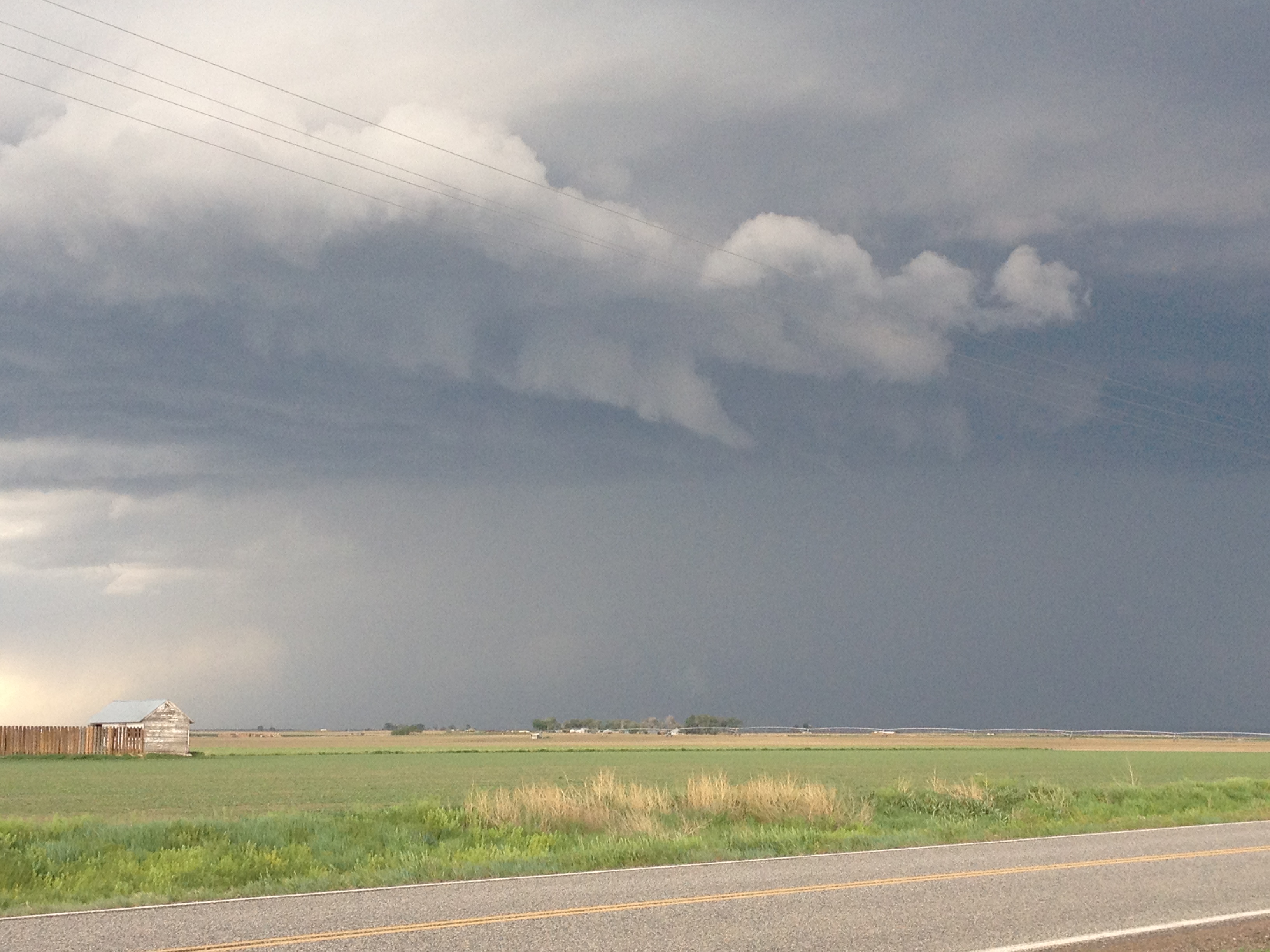
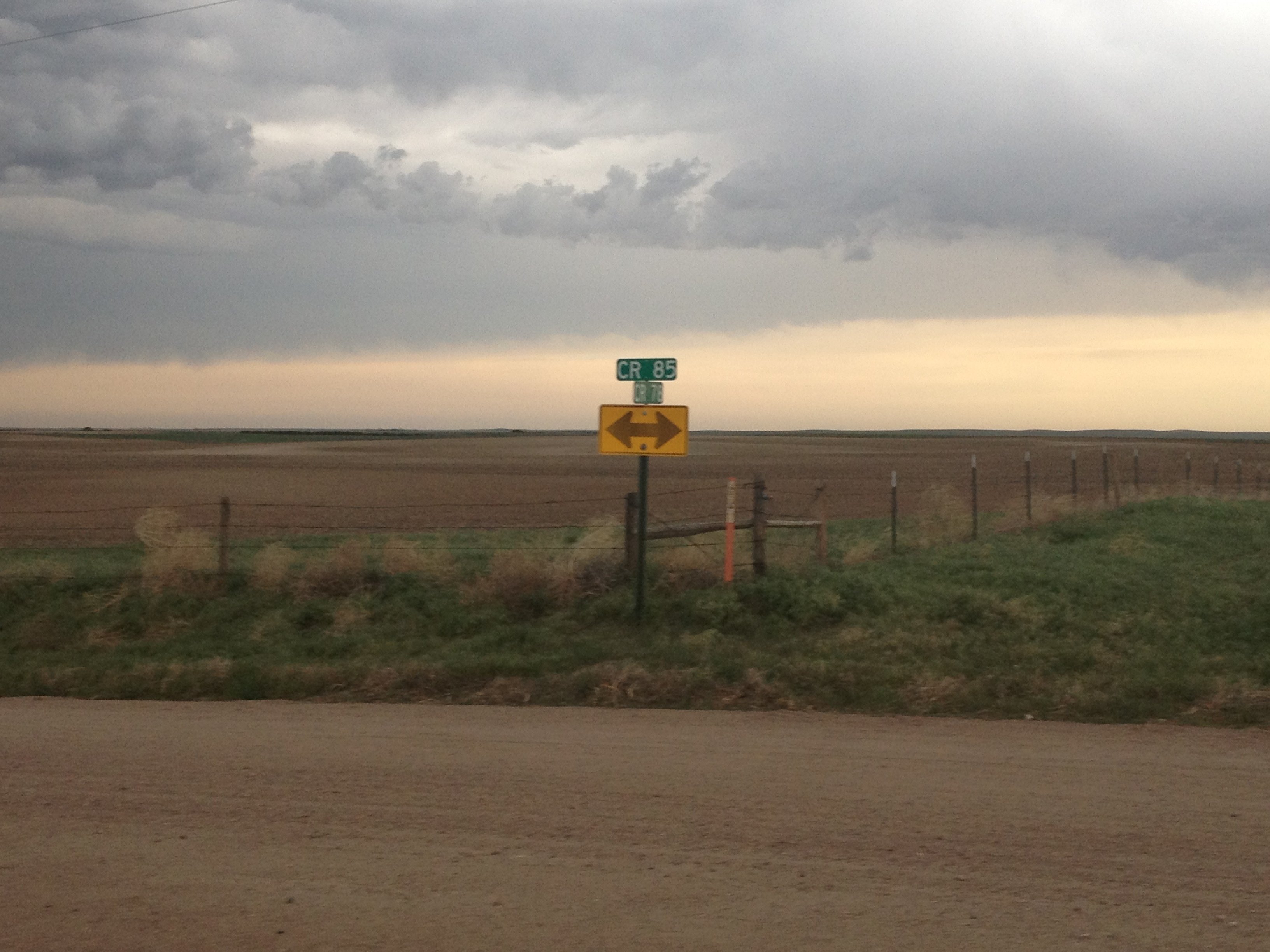
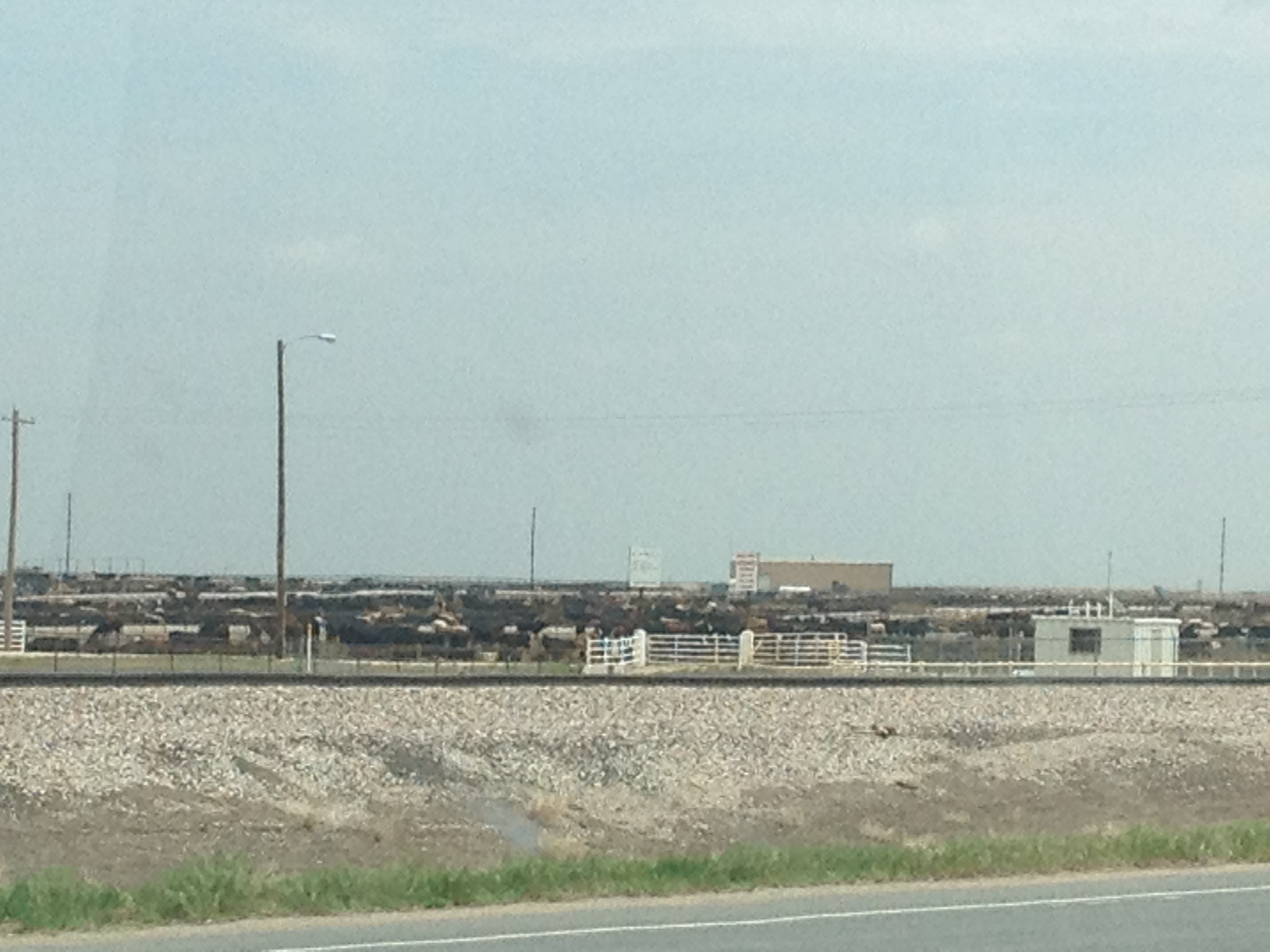
Anyone that has traveled around the United States knows there is a certain level of homogeneity throughout the nation.  One of the most major differences I have noticed is the complete change in building design when crossing the border from West Texas into New Mexico on a storm chase.  Regionally, there are differences across the nation in food, lifestyle, and cultural/religious values.  But there are some things that are similar throughout the country.  You can’t find a place in the U.S. where nobody eats cheeseburgers, nobody drinks coffee, and nobody follows football- except maybe a hippie commune.  That’s probably why I am so astounded by Europe.

America is one of three or four countries in the world where we have the option of completely ignoring the rest of the world.  There are almost no activities, aside from riding a functional rail system that we NEED to travel elsewhere for.  That is possibly why we come off as smug to the rest of the world.

I know I am supposed to come back from this type of trip with a new more “worldly” attitude.  At least that is what a standardized life script indicates.  But I am still just as understanding of what romantic “worldly” liberals refer to as a “typical American attitude” as I was before the trip.  Traveling to another country, especially one that does not speak your native language involves going outside our comfort zone.  Americans have an option of not doing this.  Many of us refuse to go outside our comfort zones in other areas of our lives, like talking to new people, going to a new kind of restaurant, changing careers, etc.  Who are we to criticize others for not going out of their comfort zone and traveling internationally?

Speaking of going outside your comfort zone, I definitely believe our first destination, Rome, was furthest outside our comfort zone of all.  The city’s layout is the most confusing and the most unlike ours.  As the trip progressed, it feels like each subsequent destination brought us “closer to home”.  Munich is by far the city I could feel most at home at- of the ones we visited.

Still, America is my home, and I am glad we live here.  I really enjoyed visiting all of the areas of Europe on this trip, but there are a number of things I like better in the USA.  On top of my list is the address system in Chicago and many other US cities.  We have a lot more streets like Western Avenue, which maintain the same coordinate for it’s entire duration, and the same name.  If I am given an address on Western Avenue, I automatically know the East-West coordinate of the location.  In Europe, and especially in Rome, street names change more frequently, sometimes every block.  That’s a lot more road names to remember.  Also, the numbering of our addresses tells you the other coordinate.  If someone tells me to meet them at 4006 N. Western, I know the establishment is just north of Irving Park Road, and on the west side of the street it is on.  European streets often have both even and odd numbers on the same side of the road with no numerical distinctions of blocks.

I also like the supermarkets being open later.  Most shops in Italy, Austria, and Germany close at 6 PM.  If we wanted to save money by not going out to eat, we had to decide this ahead of time.  I really enjoy being able to come home from work and decide on the spot whether or not to eat out.

I have always said it is great to respect and participate in other cultures, but that you should still live in your own.  I am American and I love American culture, but that did not stop me from enjoying all of the activities I did over the past few weeks.  I tried to order strange local food to get the full experience while here.  Italian food is not that different here.  Some items are more common, seafood, salami, and the sauce tends to be made differently.  Austrian and German food can be found in the US, but less frequently.  We’re kind of more into their beer, as a country.  But I did eat a lot of their local food and enjoyed it.  I love encased meats!

Also, everyone that we came across and dealt with was very friendly, especially the proprietors of Hotel Perseo in Florence, the Poggerino winery in Chianti, and everyone at the Laimer Hof in Munich, this includes the other guests who engaged me in conversation Tuesday night.  This makes me happier that we chose the places we chose.  Even the (likely) drugged up woman in Austria was friendly to me.  I just kind of feel bad for not learning the language.  After all, we did go to their county- not the other way around.  I’m grateful to all that accommodate us by knowing English.  In North America- heck, in all of the Americas, you can get by in over 80% of all places by knowing two languages- English and Spanish.  If you know four, English, Spanish, Portuguese and French, you can get by in over 99% of all places.  So, we generally learn fewer languages than our European counterparts.

I also wonder why they accommodate us like that, and whether or not they resent it in some way.  There has to be some kind of economic factor.  I mean, I know of other places where they are less accommodating.  And, it is not like I feel like everybody needs to accommodate me, like some kind of self-absorbed asshole, but if someone out there does accommodate us and is friendly, well, why not give them business and tourism money?  But, I bet some of the mare worried that we are trying to Americanize the world.  The band Rammstein’s not as famous (as Du Hast) follow up “Amerika” is about exactly this.

I really have no desire to Americanize Europe, or anywhere else for that matter.  There are some places in trouble that would benefit from American ideas, but I am under no delusion that our way is the only way to do things.  In fact, our differing geographies (US more spread out) and histories (Europe being older and more culturally different) dictate that we must be different.  On that note, those that want to Europeanize America are just as misguided.  Sure, I would love to be able to drink a beer on the street without worrying about open container laws, and I would love to have the train system Europe has.  But, maybe not at the expense of European tax rates and gas prices.

We travel to various destinations for various reasons, sometimes for work, sometimes to visit people.  Sometimes, we travel to visit a specific destination.  When we visit to go to a specific place, we visit them because in some way they are different from where we usually are, our homes.  Suburbanites come into the city; Chicagoans go to the Dells, heck, even a Pennsylvanian taking their family to Disney World all share something in common.  In all of these cases, something is different about where they are going.  That is why I look on with wonder as I see the Medieval looking town of Radda, where I can literally imagine knights riding up and down the rolling hills.  Or in Rome, at Circus Maximus, I imagine chariot racers jockeying for position.  History, culture, heck, even the future comes to life in special places at special times when we take a break from our day-to-day lives that so often consume us to the point where we don’t even realize how much time has gone by (The theme of the Talking Heads song Once in a Lifetime).

On my travels I saw various places that took me back to various times in history.  I also saw places that put me on a train of thought that lead me to wonder things about myself and the culture we all live in.  Are we really selfish?  Do we really need to crowd retail malls on Sunday, and what happened to spending that time with our families?  Is this why our families seem so dysfunctional these days?  Are some places destined to be wealthier than others?  Is it natural for mountainous places to be outdoorsier and health conscious?  Can we really be no more than a couple of bad elections from millions suffering they way they did?  Why do the European exit signs make it look like you are trying to make an escape, from like a mugging or something?

Really, the list could go on for pages.  And the list is different for everyone.  What matters more than the answers or even the questions is that we keep asking them-even if it is only to ourselves.  And that we keep visiting new places, whether they are geographical, sociological, or situational, and coming up with new questions based on new experience.  Of them includes international travel, and I am privileged to have traveled to a wide variety of new places in the spring of 2012.