Lessons Learned?

IMG_5847

Some events in life are clear.  They can be clearly labeled a success or a failure.  The reason for the success or failure is clear, and there is a clear lesson to be learned from it.  One comes out of an event of this nature much like an idealized application of the scientific method.  A piece of new information is obtained.  It either strengthens a pre-existing theory or calls it into question.

In the real world is not ideal like that.  Many observations, an many of our life experiences do not even produce a clear cut data point, a clear “success” or “failure”, or a clear lesson to be learned.  This was certainly the case on my first storm chase of the 2016 severe storm season, on Saturday, May 7th.

It was a day that did not require me to travel far to chase.  In fact, I returned home to Denver less than eight hours after departure, something that cannot typically be expected.  If I lived in a City right in the heart of “tornado alley”, such as Oklahoma City, Topeka, or Lincoln, I would expect to be able to regularly see great storms without having to allocate an entire day.  However, Denver is a bit West of the region most prone to severe thunderstorms, much the same way Chicago is a bit East of that region.  When I moved to Denver, I did have to make some adjustment with regards to storm chasing, but I did not significantly alter my expectations regarding time spent or distance traveled on a typical one-day storm chase.

Saturday’s severe storm setup provided me with a somewhat familiar dilemma, and one that is even more common chasing storms in Colorado, where many thunderstorms are initiated by orographic features.  Severe storms need a certain environment to thrive, one that is warm an moist, but also with some kind of boundary to create low-level wind sheer, which creates the rotation necessary for supercells, and tornadoes, to form.

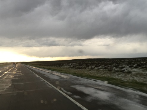
Saturday was not that kind of day in the Denver metropolitan area. The Denver area spent the entire day in a thick field of low level cloudiness that prevented the air from warming up.  The high temperature at Denver International Airport was only 53.  Ideal conditions were farther East.  That day the high in Fort Morgan, close to where a lot of the violent storms would hit, was 68.  As is the case with any storm chase, it is important to get into an area where the environment will be favorable for storm development.  So we drove East of the cloud deck.

IMG_5826

But then it happened, forced by the Palmer Divide, thunderstorms formed just to the North and East of Colorado Springs, in an area where conditions were not favorable for severe storms.  Sitting in Byers, roughly 40 miles East of Denver, we had a choice; do we go South and West to catch the storm now, or do we hang back and wait for the storm to reach our current location, in a more favorable environment?

Staying back means potentially missing what the storm does in its early phases.  However, being more aggressive means possibly missing a different storm, that may form in an area with better conditions for severe storms.  On Saturday, after some deliberation, we decided to go after the first storm.  We felt cold air, possibly the coldest I have ever been in while observing a thunderstorm, and saw a strong downdraft.  This is consistent with an atmosphere that is cooler and drier than the ideal one for producing severe weather.

IMG_5831.jpg

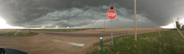
The storm raced northward.  We ended up being a little bit limited by the relatively sparse road network in Northeastern Colorado, having to follow the storm along a series of dirt roads that connected Strasburg, CO (along I-70), to Wiggins, CO (which is along I-76).

IMG_5836.jpg

In fact, there was even a time when we were pretty much directly under where the RADAR echoes showed the center of circulation to be.  This situation sort of made me nervous.  At the time I was thinking that if a tornado were to form, it might form quite close to my current location.

IMG_5837.jpg

For roughly an hour, it seemed like the storm was kind of teasing us.  One minute, these clouds would appear to be lowering and rotating, as if a tornado were ready to form, the next minute it would all just simply disappear.

IMG_5839

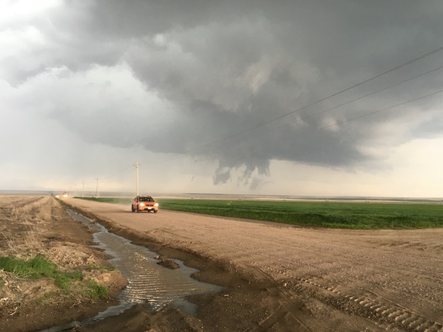
It was around this time that the storm reached I-76 near Wiggings.  Here, the storm interacted with a previously existing boundary, and, according to sources, went tornadic.  However, we were never able to observe the tornado.

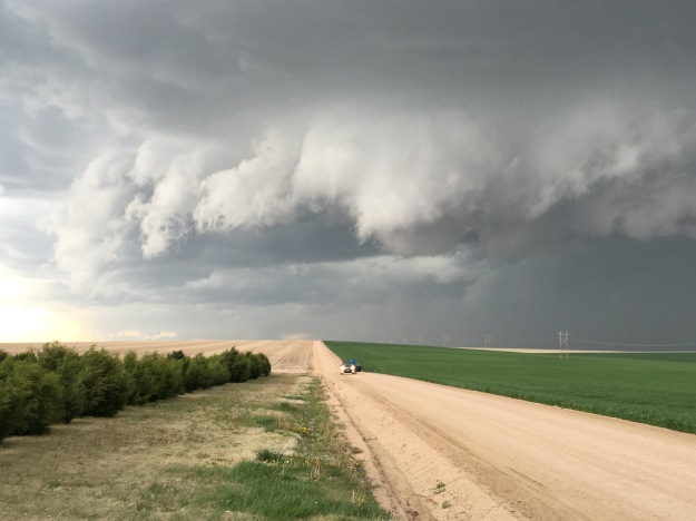
After this, the storm transitioned, as many severe storm clusters often do, into a large bow echo.

This is a clear indicator that the storm is entering a different phase, often associated with decay.  It has become dominated by downdrafts.  The most likely result is severe straight line winds.  At this point in time, the best thing to do is simply observe this gigantic thunderstorm, as despite no longer having the low-level rotation necessary for tornado formation, it is quite breathtaking in its own way.

Storm chasing, and storm observation is about more than just tornadoes, and it is quite unfair to describe all chases that do not result in viewing a tornado as a “failure”.  We really could not have picked a better place.  There was only one other cluster of storms that day that produced numerous severe storm reports.  That one formed farther East, a bit later, and produced tornadoes when it interacted with the same East-West oriented boundary.  We also still observed some interesting severe convective storms.

But still, it is frustrating to know that there was indeed a tornado, verified, within ten miles of where I was sitting, and I somehow did not get to actually see it.

I know being in position to view this storm was quite challenging, and it is likely that few chasers found themselves in such position to view the tornado.  But I wonder, had my group reached the I-76 corridor 15-20 minutes earlier, would we have been in the right position to see it?  We knew this boundary was there, and it was in the area with the most ideal conditions.  Was going after the storm initially an exercise in impatience?

IMG_5851.jpg

The day ended with a return trip, along I-76, back to Denver, through the area that was clearly just recently pelted with hail.  I returned knowing that there are aspects of this chase that can be considered a “success”, but others that can be considered a “failure”.  I also returned still wondering how to strike that proper balance between aggressively chasing after storms that initiate, and patiently waiting for storms to form or reach the location where the conditions appear to be most favorable.

A Visit to Albuquerque

People like to break things up into neat little groups.  It is a technique people use in order to try to simplify a world that, in reality, is quite complicated.  In the United States, we take our cities, and break them out into various groupings.  We place cities in groups based on their region, their size, and sometimes even by culture.  I am as guilty as anyone of doing this.  But, every once in a while, we find ourselves in a place that reminds us that we need to respect two basic tenants of humanity, which apply both to the Cities we visit, as an entity, as well as to each and every one of us individually.

Each City, just like every one of us, has a distinct and unique individual identity.  In this identity, we see reflections of factors such as its geographic location, its history, and some of its specific influences, such as specific personalities and prominent industries.  We also see some specific quirks that cannot be easily explained just by looking at what we observe elsewhere.  It is the same way with each and every one of us.  When we are being true to ourselves, our behavior patterns manifest in a similar unique manner, a manner that can only be described as attributed to our unique person.  I feel it every time any one of my friends responds to anything I do or say by simply saying “That’s so Steve”.

Also embedded in the character of any City I have ever visited are reflections of natural law, or the universal truths that bind us all together.

IMG_5691

Albuquerque reminded me of both of these two basic facts.  Albuquerque has a unique heritage.  It has similar beginnings as Santa Fe, and even has an Old Town Square that reflects these beginnings.

IMG_5737.jpg

However, much of the city was built in a much more sun-belt style car-centric manner.  It is one of the most storied towns along historic U.S. route 66.  Route 66 embodies multiple eras of U.S. history, including the mass migration to California during the Great Depression, and later the first decade after the second World War, when the American road trip first became accessible to a large swath of the American people; the middle class.

IMG_5701.jpg

Route 66 connected Chicago to Los Angeles from the late 1920s through the end of the 1970s.  While the route covers a large distance, traversing many different parts of the country, it is the Southwest, New Mexico and Arizona, that is often most commonly pictured when people imagine that classic road trip on route 66.  While the exact location of the route 66 town in Disney’s Cars is not disclosed, the imagery in the movie clearly points to a southwestern location.

IMG_5728

Albuquerque celebrates its pivotal position along route 66 by both preserving some of the places that were legendary stops for travelers along this highway.

IMG_5729 (1)

As well as creating restorations that recreate the experience of being at a travel stop along the old highway, much the same way old west towns recreate the American West during the 1800s.

IMG_5694 (1).jpg

Route 66 is even the subject of a major controversy in town.  A proposed Bus Rapid Transit project, called Albuquerque Rapid Transit, would more or less follow the path of historic route 66 through town.  Residents of a hip area of town adjacent to the University of New Mexico called Nob Hill appear united in opposition to the project.  Some of the signs I saw opposing the Albuquerque Rapid Transit referenced protecting the heritage of route 66.  However, I wonder if this opposition is motivated by route 66 preservation, or the desire to avoid any changes to the neighborhood.

IMG_5693.jpg

Regardless of whether the people are motivated by the desire to preserve route 66 in its historic format, or preserve their neighborhood the way it currently is, on display here is one aspect of humanity that appears consistent across all cultures.  When people are enjoying their current situation, they generally do not desire change, and, in many cases, will fiercely oppose it.  This has been the case for me, personally, at various stages in my own life, and is also evident in a lot of the behaviors I observe in others when they react to changes in the workplace or their favorite social media outlet.

IMG_5708 (1)

It also appears to be basic human nature to seek out a broader view of the world from time to time.  It is the reason people go to the top of the world’s tallest building, hike Mount Rainier, or sit and gaze down at Los Angeles from the Hollywood sign.  Albuquerque’s answer to this is the Sandia Peak Tramway.

IMG_5718 (1).jpg

This tramway takes passengers on a 15-minute ride from a base elevation of 6559 feet (already significantly higher than the center of town), to a peak of 10,378 feet. Here, visitors to the area can see unique rock formations.


IMG_5707IMG_5723

Learn about the unique biomes that can be found in the mountainous terrain (Breckenridge has a similar exhibit, but uses an actual garden).

IMG_5712

And, can get a view overlooking this city that actually covers a much broader area than just the Albuquerque city limits.  In fact, Sandia Peak is so high that it is quite difficult to make out individual buildings or even neighborhoods in town!

IMG_5716 (1)

The culture is unique as well, seeming to combine so many aspects of the West and Southwest.

IMG_5739IMG_5742

Along the Rio Grande River, which cuts through the center of town, a bike trail, as well as numerous parks provide the urban outdoor space that Westerners seem to value so much.  Whereas, in many other cities I have visited and lived in, living in close proximity to a park is desirable, but kind of a bonus, it feels as if people here in the West view being near a park as a prerequisite, a necessity of life itself!

IMG_5734.jpg

On this particular Sunday afternoon, a parade of classic cars rolled through Old Town Square, showing off their classic appeal, and the hard work each and every car owner put into maintaining their vehicle’s shine.

IMG_5733

That evening, on the West side of downtown, another group of people are gathered, also showing off their vehicles, and, almost downright partying.

When I think of all the cars revving their engines up at night, all I can say is, “That’s so Albuquerque”.  One could speculate what mix of cultural influences, old Spanish, sunbelt, Western, Hispanic, etc. lead to Albuquerque being the way it is today.  But it is more than that.  The same can be said about any other place one would visit.  That is why we travel, not just when we need to go somewhere for business, or when we wish to visit people that live in another place, but also when we desire an experience we simply cannot have in our respective hometowns.

Exploring New Mexico

IMG_5660 (1).jpg
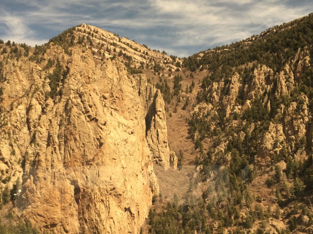
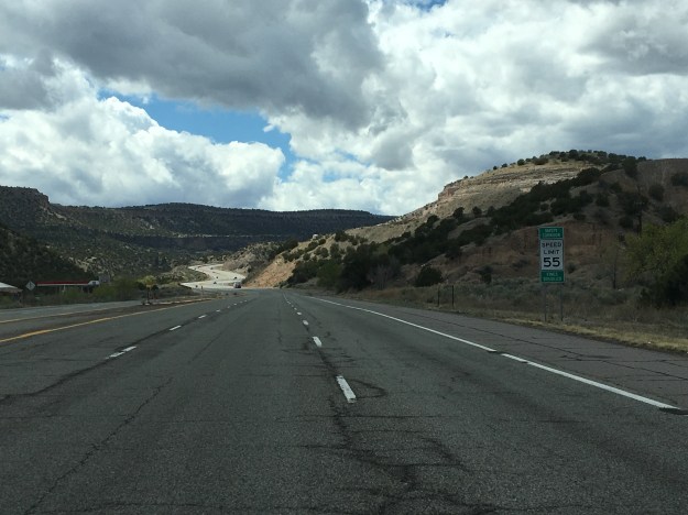
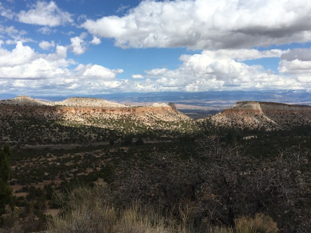
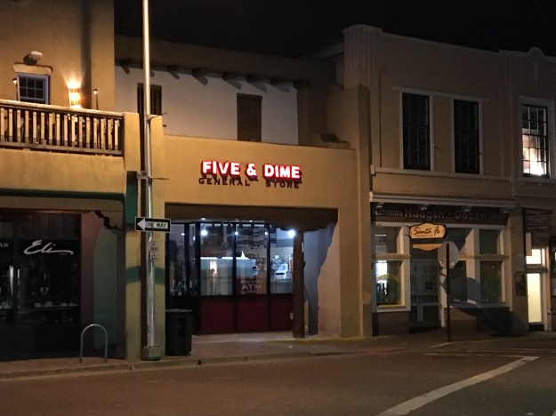
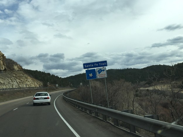
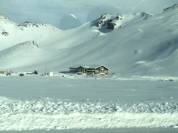
The northbound journey out of Santa Fe, along highway 84 towards Pojoaque, and Espanola could not possibly feel any more Southwestern.  Rolling hills are covered with bushes and sagebrush.  There are some trees here, but unlike in the East, their impact on the wide open landscape is minimal.  They are but mere dots, small points in a panoramic image that shows off the entirety of the landscape of the region, stretching for miles and miles.  As a consequence, mountain ranges can be seen in the distance in multiple directions.

IMG_5662 (1).jpg

Artwork depicting the culture of the American Southwest can be seen quite frequently along this entire stretch of highway, on roadside decorations, bridges, and even buildings in the distance.  There is something about sculptures and murals like these that invariantly make me think of the Southwest, even when I am in a completely different region.  The use of colors in particular are reminiscent of this region, warm and dry but still American.  The colors are warm, reds, oranges, browns.  Even when they use “cool” colors, like green and blue, these murals somehow find a way to make these colors feel warmer than they typically do in other drawings and signage.

I wonder, as much of the artwork of the region originated with the Native tribes that thrived in the area roughly a millennium ago, if the styles that came to be predominant in this region are a mere reflection of the manner in which the landscape, and climate, impact the human psyche.  And, is this an aspect of human nature that transcends culture?  Did the Spanish, and White and Hispanic people who would later inhabit the region adopt similar artistic styles because they were responding to the same conditions around them and reflecting them in a similar manner?

The reason I was headed in this direction out of Santa Fe, other than just merely to explore, which I do believe is a reasonable pursuit in of itself, was the desire to see one of the most significant, but also confusing places in the United States; Los Alamos.  Los Alamos is a place where some of the top scientists in the world came together during World War 2 in order to build the nuclear weapons that eventually ended the war.

Of course, at the time, it wasn’t the Japanese, but the Germans who were the main subject of concern. It was rumored that the Nazis were building this capability, which could have significantly altered the course of the war.  The Manhattan Project was both highly secretive (Americans were largely unaware this was going on at the time), and quite controversial, as it still is today.

IMG_5665.jpg

The entire area has a feel that continues to reflect how Los Alamos came about.  Headed towards town, on highway 502 West from Pojoaque, road signs indicate that the stretch of highway is a “safety corridor”.  What does that even mean?  I have never seen this before.  Anywhere else, this road would have a higher speed limit, less fines, and would likely not have three lanes in each direction.  Something must be going on here.  But, is it still going on?  If so, what?  And, how much of a secret is it?

IMG_5668.jpg

The truth is, Los Alamos is a place like no other place on earth, and like the rest of New Mexico, cannot be placed in a specific category.  It is, indeed, a place where discoveries are made.  But, unlike many other towns with major labs, and I am particularly thinking of Boulder, Colorado, which is near my home, it does not appear laid back at all.  After parking, I had an intense experience crossing the street to get to the Bradbury Science Museum.  This crosswalk had a walk/ don’t walk voice command that spoke words with a level of urgency that appeared to highlight the National Security and wartime origins of this town.  It felt as if 70 years later, the mindset had never really changed from its wartime heritage.  Or, in the very least, the town had kept its infrastructure, which was built specifically for time of extremely heightened security.

IMG_5669

The Bradbury Museum is quite well done, and for those traveling on a budget, is free.

I’d say slightly over half of the museums exhibits focus on the Manhattan Project, the A-Bomb and the original history of the laboratory.  However, the laboratory is operational, and has been involved in some high caliber research over the last 70 years, in areas such as cancer detection, energy conservation, and wildfire prevention.  It is amazing to think, the same place, the same people, the same lab, and the same knowledge base was used both to create the most destructive item on the face of the earth, nuclear weapons, but also to advance humanity and help countless people better their lives!

IMG_5667.jpg

One of the reasons Los Alamos was selected as the location for this top secret lab, was that it had to attract top scientists, many of the young at the time, to a project that likely meant years in seclusion.  While these young scientists would not have the benefits of urban nightlife, for Los Alamos, and the laboratory, they found an area with plenty of opportunity for outdoor activities.  The volume of hiking trails throughout Los Alamos County (a relatively small county) reflects this history.

IMG_5677 (1).jpg

Just West of town, and the lab, is a large area known as the Santa Fe National Forest.  This National Forest, in many ways resembles the National Forests that can be found throughout Colorado.  In fact, I can picture many of the same activities, backpacking, camping, and with the Jemez River, water activities such as fishing and boating.

IMG_5680 (1)IMG_5681

The main difference I felt, between here and many of the forested areas of Colorado I regularly frequent for hikes and such, is that this area seemed significantly less crowded- emptier.

Along highway 4, the main road through the forest, there is one area hot spot, a unique natural feature known as the Soda Dam, a waterfall the flows between a rock along the Jemez River.

IMG_5682 (1).jpg

Not only does this area feature a waterfall unlike any other place on earth, but there are geothermal features that make this river a popular pseudo hot spring.  I say pseudo- hot spring, as the water is not really hot, as it is in some areas where water temperatures resemble that of a hot tub.  It is just simply warmer than you would expect it to be given its high altitude origins.  It was warm enough that people were able to comfortably swim in it.

IMG_5685.jpg

It is an area that is just simply peaceful and panoramic, the kind of place where one can simply turn off the wheels that churn in their heads as a result of everyday life, and just sit, swim, float, or fish, gazing in the distance at the majesty of the region.  Two weeks later, I still gaze at this very photograph and feel as if I am entering a much more peaceful state of mind.  I almost need to place it in front of my desk, as a stress reliever.

IMG_5686 (1).jpg

The entire west is full of areas like this, where, due to unique geological history, the rocks take on a reddish color.  This is the color that many associated with the American Southwest.  Although most of Central New Mexico is much browner, especially in April, a section of bright red suddenly appears at the South end of Santa Fe National Forest, along highway 4, at the border of Jemez Pueblo, yet another Native American village.

The day ended with a final drive down highway 550 towards Albuquerque, where the Sandia Mountains, largely to the City’s Northeast, drew gradually closer as the drive progressed.

IMG_5688 (1).jpg

Thinking about all of the beautiful places I saw over the course of the day, my main regret is spending too much of the day in the car, and not being able to stop, hike, float, walk around, and just get immerced in area.  As a travel enthusiast who unfortunately has responsibilities at home, it is all too easy to get into the trap of planning too many activities for too short of a period of time.  This often makes travel feel rushed, like there is too little time to experience some of the places we see.  Luckily, I live in Colorado, and therefore can get similar experiences, National Forest recreation areas and such, closer to home.  But, there are some subtle differences, and things that make this area unique.  I would very much like to come back here at a much more relaxed pace, and experience another side of New Mexico life.


An Old World Town in a New World Region

In the U.S.A., we are quite accustomed to the seeing certain kinds of towns in certain parts of the country.  Since cities were built earlier on the East Coast, we expect to see towns laid out like Boston, Annapolis, or Charleston.  These cities tend to be a bit more challenging to navigate, as is particularly the case with Boston.

boston_street_map

By contrast, in the Western part of the country, we expect to see towns built more around automobile (or the automobile’s predecessor in the late 19th Century, the horse drawn carriage).  Cities like Phoenix, designed with driving in mind, have mostly straight-line roads, with suburban areas having windy subdivisions.

Phoenix_Street_map

This is what we have come to expect from towns in this part of the country.  So, when I first looked at Santa Fe’s road network, I was quite surprised to see a city full of windy roads that resembled something I would expect to see along the East Coast, or in Europe.

IMG_5647.jpg

Oddly enough, New Mexico is one of the oldest regions in the U.S., at least when it comes to architecture.  The historical lineage is just different.  New Mexico is home to over a hundred Native American Pueblos that date back to long before anyone associated with the United States of America would arrive.  Many of them are still inhabited, with some having been inhabited for over 1000 years!  This is quite a long time for this part of the world.

Santa Fe, New Mexico’s capitol city was founded originally as a Spanish colony in 1610, ten years before the Mayflower would come ashore in Massachusetts, and still retains much of its original Spanish style.  In some ways, driving into New Mexico feels like entering a whole different region, fairly instantaneously.  I first noticed this storm chasing in college. It was my first time in New Mexico, or Arizona.  I was previously unaware of the prevalence of adobe style buildings in these two states, and was somewhat surprised to see how abruptly the styles of the building around me changed once I crossed the border from Texas into New Mexico.

Santa Fe appears to have retained much of its cultural heritage.  Aware that New Mexico has a substantial Spanish history, I decided that it might be a good idea to check out a Spanish restaurant downtown.

IMG_5638.jpg

Taberna came highly recommended by the staff at the hotel, and certainly did not disappoint.  The food was excellent, and, on this particular evening, a performer named Jesus Bas performed for the customers.  I sincerely, if only for a moment while sipping a glass of wine, tasting enchiladas, and hearing Spanish music, felt like I was in Spain.  Well, at the very least, it made me want to go to Spain.

IMG_5642.jpg

I decided to somewhat follow in the footsteps of one of the people who inspired me to start writing about my travels, Anthony Bourdaine.  For those not familiar, he is a chef who eventually became the host of a series of food related travel shows.  I watched a lot of his previous Travel Channel show No Reservations, where he did not just simply describe the food he was eating, he would also reflect upon the experience, what certain places made him feel like, and what historical context they can be placed in and such.  His current show, which is actually a bit less food focused and more focused on the travel is called Parts Unknown.  So, I was actually quite excited to see a souvenir shop actually called Parts Unknown.  Additionally, the shop is located only a few doors down from one of the places Anthony Bourdaine visited on the Season 2 episode where he travels around New Mexico; the Five and Dime, a shop where he gets a Frito Chili Pie, a commonly served dish in New Mexico.

IMG_5643.jpg

I did not end up getting the Frito Chili Pie, as there were a limited number of meals I could have here in Santa Fe.  I mostly just looked around at the souvenirs available in this shop, which featured Santa Fe’s connection to one of my favorite aspects of American History, route 66 (although the route bypassed Santa Fe starting in 1937).

IMG_5646 (1).jpg

I ended up going to a place called Horesman’s Haven, a small restaurant on the edge of Santa Fe famous for authentic New Mexican style food where Anthony Bourdaine was caught off guard by the level of spice in their green chili.

IMG_5658.jpg

IMG_5659.jpg

My chili was not quite as spicy, but still packed quite a punch.  I am glad it did!  Many people try to avoid spicy food while on vacation, to avoid experiencing an upset stomach while far from home.  In this case, the level of spice was an important part of the experience.  Life is meant to be experienced.  Some people spend their entire lives trying to avoid bad outcomes.  In my view this is a sure fire way to miss out on countless rewarding experiences.  Bad outcomes are going to happen.  We just need to manage them in our own way.  Missing out on a whole bunch of experiences, and I am talking about things much more significant than one high quality meal, bears a much greater cost than the occasional unfavorable outcome.

I am guessing this is the attitude taken by the unexpectedly high number of people who make a living as an artist in this town.  In the downtown part of Santa Fe, it seemed like half of all buildings house art galleries.  Santa Fe is known for art galleries, but there seemed to be way more than is necessary to support a town of roughly 70,000 people, even if all of those people are wealthy and have dozens and dozens of pieces of artwork hanging from all of their walls.

Like New Mexico as a whole, Santa Fe appears to have an interesting set of values that does not fit neatly into one of the categories we have become familiar with.  It is western, but also European.  It is cowboy, but also quite diverse.

IMG_5654.jpg

It is a state capital, but has a state capital building that looks nothing like any of the other ones I have seen across the country.

IMG_5655 (1).jpg

It is the kind of place that erects historical markers dedicated to fiscal responsibility, an important, even if not flashy, achievement, and one that reflects the western values of personal responsibility.

IMG_5656 (1).jpg

It is also a place that erects building dedicated to the memory horrible death marches in Europe.

IMG_5652.jpg

It is both “old world”, and “new world”.  It does what we all need to do, both in our own cities, and more importantly, individually.  It combines old ideas with new ideas in a way that uniquely represents its individual identity.

Road Trip to Santa Fe

IMG_5623.jpg

I spent about half a decade working in the Insurance Industry, an industry with a significant presence in Bermuda.  At workshops, conferences, and in meetings, I would regularly interact with people who lived there.  The place certainly has its draw, and with the right opportunity, a person with experience in the industry could make a really good life there, despite the high cost of living.

I often imagine what it would be like to have a totally different life, in a totally different place, particularly when traveling, or when I meet someone from somewhere far away.  While working in the insurance industry, although I never seriously considered up and moving to Bermuda, I did imagine what it would be like a couple of dozen times.  Each time I imagined it, I would always end up dwelling on the lack of room to roam around there.  The island is only 20.6 square miles, and getting anywhere else requires a flight.  I pictured myself moving there, getting my swimming trunks out, snorkeling, attending a few parties and such, but then, eventually, just getting restless, and missing something I love to do here in mainland U.S.A.; taking a road trip.

There is something I really love about road trips.  When I refer to road trips, I am not talking about simply driving somewhere.  A lot of people drive to work every day, or to a relative’s house every other weekend, and those drives don’t feel like “road trips”.  I’m talking about driving somewhere a significant distance away that is not a routine trip; somewhere that is somewhat unknown.  On road trips, we have somewhat of an idea as to what to expect, based on what we have heard, read, or researched, but we do not know it intimately.  We have not experienced the towns we will pass along the way, which exits have the best deals on gas, and where the best restaurants are.  In other words, there are still some surprises, and we are still going to encounter something unexpected.

IMG_5619

Driving south along I-25, the first indication that one is reaching the Southernmost portion of Colorado is the Spanish Peaks.  While visible farther north, they take prominence south of Pueblo. The Spanish Peaks are nowhere near the tallest features in Southern Colorado.  In fact, within 30 miles or so, there are 5 mountains taller than 14,000 feet (14ers)!  But, since they are relatively isolated from other natural features, and can be seen quite some distance, they are a prominent landmark toady (an entire region is named Spanish Peaks country, as well as the names of countless business in the region), and were a prominent landmark on the old Santa Fe Trail.

Approaching Trinidad, CO, the last town before the New Mexico border, the Spanish Peaks disappear from the horizon as the highway enters a much hillier region approaching Raton Pass.  It is here that the path of Interstate 25 joins with the old Santa Fe Trail, which it will more or less follow for the remainder of the trip to Santa Fe.  This trail was first pioneered by the Spanish and later played a pivotal role in American history including westward expansion, and the eventual conquest of the Southwest from Mexico.

IMG_5622.jpg

I had mixed expectations of Raton Pass.  Many years back, I was on a ten-day storm chase. Our group was situated in Clovis, New Mexico, which is quite close to the Texas-New Mexico border.  We were discussing the possibility of chasing upslope storms roughly an hour northeast of Denver the following day.  Some of us brought up the possibility of driving west to Raton so we can take the Interstate to our target destination, but the group leader balked at the idea, instead suggesting driving up 385, as he felt it might be risky to take a large convoy of chase vehicles over Raton Pass.  We ended up deciding not to drive up to Northeastern Colorado, as, in the morning, the storm outlook had weakened, and we no longer felt it worth the drive.  By the way, this is common on storm chases, you really never know where you will end up going.  However, ever since then, I had kind of wondered what it was like to drive over this pass.

As the photos indicate, the road gets windy as motorists climb from Trinidad, at roughly 6000′ in elevation, over Raton Pass, which tops out at 7834′.  It’s definitely not nearly as rough as heading over the Rocky Mountains along I-70 or I-80, but definitely is a much more major incline than anything a group of people that drives largely in the Great Plains from Texas up to South Dakota would typically experience.

IMG_5626.jpg

Oh, and in one of the strangest of coincidences, the top of the pass is right at the border of Colorado and New Mexico.  This is odd as, first of all, the Colorado-New Mexico border is defined as the 37th parallel, and has nothing to do with where any mountain pass is located, and roads through mountain passes are built to take the safest and most effective route.  The fact that the place where this road crosses the 37th parallel most effectively happens to also be the high point seems to me as a pure coincidence.  Maybe someday I will read into this, the story behind the road and such, but I have yet to do so.

After a descent into Raton, the road reaches a segment that is long, flat, open, and rather empty.

I switched the music on the radio to classic rock, The Clash, Ozzy, Queensryche and such.  For some reason, there is something about the sound of guitar rock that makes more sense while driving through scenery like this than many other forms of music.  As the afternoon passed along this landscape, cloudy skies gave way to peaks from the sun only every once in a while.  A few periods of gentile, chilly rain fell from the skies.  In some ways it reminded me of a storm chase gone horribly wrong, the day slowly but surely slipping away with no prospects of favorable storm conditions developing.  However, in other ways, the drive was relaxing, allowing me to think without any distractions.

After passing through a town called Las Vegas, NM (which I assure you is nothing like the Las Vegas in Nevada), the highway turns West.  It kind of loops the last 60 or so miles into Santa Fe, even heading back northward for the last ten miles, following the route of the old Santa Fe trail.  However, unlike the previous 100 or so miles, this part of the trail, and the drive, is far from flat.

To the right, is the southernmost part of the Sangre de Cristo mountain range, and an area now part of the Santa Fe National Forest.  It is these mountains that the trail routed 19th century pioneers around.  To the left are a series of bluffs which, luckily, the trail did not have to also bypass, as it would have added many more miles to the journey.  The road itself slowly climbs over Glorietta Pass, descending only slightly into New Mexico’s Capitol City- Santa Fe.

The Colorado Model Railroad Museum

The later half of March is a confusing time to be in Colorado.  The range of possible weather events makes it a tough time period to plan for.  In the mountains, there are plenty of times snow continues to fall, and provides more high quality snow days for skiers and snowboarders.  But, the snow does not always continue to fall, and if it doesn’t, conditions on the mountain can deteriorate fast, as warmer temperatures are likely to eat away at the snow pack.

At lower elevations there is quite a bit of variance as well.  March can easily bring Denver, Fort Collins, and even Colorado Springs long strings of 70 degree days.  It can also bring heavy snowfall, as was the case this past Wednesday.

img_5529

There’s no guarantee that the weather will cooperate for any outdoor activities.  There is always the chance that skiing conditions will continue to deteriorate without conditions for cycling or hiking at lower elevations improving.  For people like me, this time of year has the potential to be quite underwhelming.  Due to this uncertainty, I would not personally recommend people travel any great distance to visit Colorado in the later half of March or April.

With leftover snow on the ground, covering the trails and such, this weekend ended up being a good time to visit one of Colorado’s indoor attractions.  I often lament that Colorado does have some quality museums, an indoor activity, but that I rarely actually visit them as I am planning outdoor adventures.  A weekend like this, with less than inspiring weather conditions is the perfect time visit the Colorado Model Railroad Museum in Greeley.

img_5567

As should be expected from a museum dedicated to model railroads, there is quite a bit on display here.  Following the suggested self-guided tour route through the museum, I started out by going upstairs, where I viewed the model rail display in its entirety.

Although it is neat to see these trains go by, each one carrying a different type of freight across the landscape, model railroads are about so much more than just the trains.  They depicts towns, industry, and scenery.  Some of the mountains depicted on this display even contain small components of real rock.

The upper floor of this museum is like a trip back in time.  Plastered on the wall is a map of regional railways, which were once the primary way in which we traveled around the area.  After viewing the photos of historic rail depots, posters from the middle of the 20th Century promoting passenger rail service, and old train schedules on display, I imagined myself in the setting of some quasi-ambiguous time in the middle part of last century, bags packed, ready to hop aboard one of these trains to embark on an adventure.  I gaze at these maps, and think about how much I enjoy not only the adventures I have at various travel destinations, but the process of getting there, the journey.  The railways, and these models, are all about the journey!

The second half of the self guided tour takes visitors downstairs, to see the components of this elaborate model train display individually.  Each segment of model trains tell a story, but not a straightforward story.  They show a snapshot of life in different places along this train’s route.  Looking at all of these individual displays, it is quite easy to imagine oneself there, as part of the story, or as an omnipresent type of observer.  The details and creativity allow visitors to develop a story based on what they see.

img_5577

In this thriving town along the rail route, I imagine myself getting a dollar out to purchase a soda from a vending machine on a hot day.  I imagine what this family is doing.  Did they just have a fight?  The Man’s arms are folded and the daughter is turned away from her parents, clinging to a stuffed bear.

img_5575

They got creative too.  The scene here is a wildfire being put out by firefighters.  This is one of many places throughout this gigantic exhibit where specific events are depicted.  Not only do we see where stores are, where houses are and such, imagining the day-to-day life in fictitious towns along the route, periodic occurrences are displayed before us as well.

In a few areas, the builders of this display got even more creative.  My favorite one here depicts a kayaking trip gone wrong.  This kayak now inhabited by a black bear, with two people having been thrown into the water, only one still holding on to their paddle.

img_5576

A ton of work went into the displays at this particular museum.  It’s been a long time since I have been to a museum like this one, but I picture most model railway museums being similar in nature.  It is impossible to overstate how important attention to detail is when creating an exhibit like this, or even when people create model train sets for their own homes and gardens.  I do not consider myself detail-oriented enough to put something like this together.  I am also probably way too extroverted to want to spend the time putting together a display like this.

Seeing this display, first in its entirety, and then by its individual components, gave me a newfound appreciation for the attention to detail payed when creating this exhibit.  None of it would have been nearly as good had anyone involved in building this exhibit taken the attitude I often take that details matter less than the big picture.  The story of this exhibit would not be presented properly had one little item, one tiny piece of brick at 1:87 scale been slightly off.  Maybe details need not be dismissed.  Maybe those of us that are frustrated with dealing with details we deem insignificant need to just understand how they fit into the big picture.


Iceland Air’s Glacier Hike and Northern Lights Tour

As part of their push to encourage tourism in Iceland, Iceland Air now offers a variety of one-day excursions that travelers can embark on whether they are visiting Iceland specifically, or taking a stopover on their way between Europe and North America.  These one-day tours offer a variety of options for experiences, including which places to visit and what types of activities to take part in.  For all of them, the general idea is the same; a bus picks tourists up at various hotels in Reykjavik, and gives visitors what basically amounts to a one-day “Taste of Iceland”.

My tour of choice was the Glacier Hike and Northern Lights tour, which offers a lot of what I was looking for out of my time in Iceland.  The Northern Lights is something I had never seen before.  In America, we hear about such phenomenon occasionally. Roughly once a year, we will hear in the news about a particularly strong solar event occurring, and the potential for the Northern Lights to be visible much farther from the North Pole than is typical.  Sometimes that zone would even reach the Northern parts of the United States, and news outlets would provide maps of where the lights could potentially be visible.

For years, living in Chicago, such stories would provide a particular brand of torment for someone that is curious about seeing the Northern Lights.  It is not possible to see the Northern Lights from such a large, lit up city.  One would need to travel somewhere less populated. To get outside the populated metropolitan area, I theoretically would be able to travel in any direction, but it makes little sense not to go North, as the lights get better the farther north one travels. However, North of Chicago is Milwaukee, and the area in between the two cities is populated enough to make it less than ideal for viewing the phenomenon.  So, the prospect of getting in a car and driving out to see the Northern Lights was always a multi-hour trip.  Some combination of time constraints, or frequent wintertime cloudiness in the Midwest always stopped me from driving up to Central Wisconsin (or Central Michigan) to try to see the Northern Lights.

The tour started like every one of the Iceland Air excursions, with a mid-sized bus going from hotel to hotel picking people up.  The bus went to about six different hotels to make pick-ups, finally leaving Reykjavik around noon.  The tour group was quite mixed.  There were a couple of other Americans, a few Canadians, and even two people from France on our tour, but the majority of the group was from Great Britain.  I have relatively little experience traveling to Europe (this trip, and a trip to Italy, Austria, and Germany in 2012), but on both occasions I ended up hanging out with tourists from the UK, specifically England.  I don’t know what that says about America, or who I am as a person, or if it is just due to a common language, but I am curious to see if that happens again next time I go to Europe.

IMG_5276.jpg

Driving East out of Reykjavik, towards Iceland’s South Coast area, the first thing I notice, which is common throughout Iceland are lava fields.  Across much of Iceland, the land is covered with ashes from previous volcanic activity.

IMG_5250.jpg

The previous day, I had learned at the Volcano House in Reykjavik that Iceland is one of the most volcanically active places in the world, as it sits on the ridge between the North American and Eurasian plates, which are drifting apart from one another.  In geologic terms, this is actually happening quite quickly.  On average, a volcano occurs somewhere on the Island once every 5 years, and as the plates pull apart, the Island is literally growing at a rate of 2 cm per year. 50 years from now, Iceland will be 1m wider than it is now!

IMG_5279.jpg

About 30 minutes into the trip, the bus passed by the hotel where one of the scenes in the 2013 film The Secret Life of Walter Mitty took place.  In the movie the volcano Eyjafjallajökull erupts, and Walter is lucky enough to have been picked up by a friendly local to escape before being covered in ashes. In real life, this gigantic volcano erupted quite explosively in 2010.  In the most unfortunate of circumstances, the wind happened to be coming from the Northwest that day, and the ashes covered the sky over Great Britain and much of mainland Europe halting air traffic for several days.

IMG_5286.jpg

The next stop on this tour was Skógafoss, one of Iceland’s largest waterfalls. Iceland is not only a hot spot for volcanoes, but it is also a hot spot for waterfalls. This is due to the glaciers, which cover 15% of the land area of the island, the terrain and relatively moderate maritime climate. Waterfalls like this can be found all over Iceland, and they probably look even more amazing in summer, when the ground appears lush and green!

IMG_5295IMG_5287

The main event of this tour, the Glacier hike, worked for me on multiple levels.  I love being outside, hiking and getting some exercise.  There are many times, when on vacation, I purposely try to find the most strenuous activities possible.  I especially do this when I am on a cruise or in some other kind of vacation package, where I know an activity does not need to be super challenging, or even that physically exhausting for them to be labelled as such.  I also got to try something new, hiking with crampons.  Now, I am not sure they were absolutely necessary for this particular hike, as back in Colorado I had hiked in areas that were steeper and more slippery and gotten by without them.  But, I did learn how to use them, how to attach them to my hiking boots, and how to walk with them on, a good thing to know for future activities down the road.

IMG_5298.jpg

In addition, the glacier, and what our tour guides told us about it was quite fascinating from a scientific perspective.  Apparently, this particular glacier is receding at a fairly rapid pace.  Along our hike, the tour guides pointed out where the glacier used to end in past years compared to where it ends now.  As recently as 2010, the glacier covered nearly all of the area near the entrance of the park that we traversed before getting onto the current glacier.  When this portion of the glacier melted, a gigantic lake was left behind in the lower lying area.

IMG_5302.jpg

The tour guides then informed us that we are actually witnessing a the formation of a fjord.  Roughly an hour into the hike, we had climbed to roughly 100m above sea level. However, the ice was thicker, somewhere between 150m and 200m.  Over time, the ice had pushed the land beneath it below sea level. Once these glaciers melt, the area will be under water, creating a fjord in this very spot.  This is one of many spots where this process is happening as we speak.

As a weather enthusiast, who had studied meteorology, I asked the tour guides what the primary mechanism was for the melting glacier.  Specifically, I asked if it was reduced winter snowfall or warmer summer temperatures.  They indicated that both were contributing factors, but also mentioned that, since temperatures in Iceland are commonly quite close to freezing, the area was starting to see precipitation fall in the form of rain (as opposed to snow) more frequently.  I could sense that, as even on this February day, the snow I stood upon was quite wet.

But that was not even the most fascinating scientific aspect of this tour.  Almost everyone is familiar with climate change, and it’s become the subject of sometimes-ridiculous debate.  The most fascinating thing I learned about this glacier is that fact that, due to the presence of volcanic ash, the glacier is creating terrain that is constantly changing.  Here, volcanic eruptions spill out on top of the ice, causing ice to melt faster in some areas.  The ice then flows in a manner that brings more ice into areas that are currently in “valleys”.  Even when there is no new volcanic activity, the cycle of ice flow and differential melting can happen rapidly enough that each year the terrain of any given section of ice is significantly different from the previous year.  Literally, if I were to return to Iceland at the same time next year, and come to this very glacier, the hike would be significantly different, as the terrain would have been significantly modified.  Amazing!

The glacier hike concluded a little after sun down, which was right around 6:00 P.M. After the hike, the tour bus took us to a hotel restaurant in the area for a traditional Icelandic meal.  To my surprise, the meal did not involve fish.  For some reason, I had this impression that since Iceland is an island in the North Atlantic, it would be a place where almost every meal consisted of fish.  Instead, the traditional Icelandic meal was a hearty meat soup.

IMG_5329.jpg

On the tour bus, I learned that the Icelandic cow, which is a special breed of cow that is smaller than the ones most of the world is familiar with is quite popular on Icelandic farms (they actually once voted in favor of keeping the cow over switching to a more efficient Norwegian cow).  In addition to these cows, many farms also keep lamb and sheep.

IMG_5331.jpg

After dinner we drove in search of an ideal place to view the Northern Lights.  This involved driving around and looking at weather conditions in a manner that actually seems reminiscent of storm chasing.  We drove around for hours, and every time it felt like we had found the right conditions (i.e. clear skies), something would change.  At one point, sometime between 9 and 10 P.M., as drove through an area where it suddenly started to snow!  At 11:30 I was in despair.  We were clearly headed back into Reykjavik, and I thought we were just going back to the hotel.  After all, the tour does not guarantee that the Northern Lights will be seen.  It can’t be guaranteed.  The weather is always changing, and the solar activity, which leads to the Aurora phenomenon, is also quite variable.

Oddly enough, though, just after midnight, we pulled into a pier on the far West end of town, along the shores of the Atlantic Ocean, on a peninsula.  Our tour guide informed us that we would now be able to view the lights, and, sure enough, they appeared. I was unable to capture them on camera in a manner that would do this amazing natural phenomenon any justice.  I mostly just sat there, in awe, watching the lights glow and move from side to side along the horizon.  I thought about how amazing this phenomenon was.  I wondered if people who lived here took it for granted, noticed it less, the same way many people become less appreciative of what is in their own back yards.  At the end, I just thought about what an amazing day it was, from when the tour began, over twelve hours ago, until now, ending with this amazing light display.

Life in a Northern Town

IMG_5245.jpg

It’s 8 AM on a Thursday morning in Reykjavik, Iceland’s Capitol and largest City.  The sun has yet to come up, as this far north (64 degrees latitude) days are still quite short in the middle part of February.  A quiet dawn persists over the town for nearly two hours, from 8 to about 10.  A couple of local teenagers are hanging outside the grocery store.  A group of tourists can be seen hanging outside one of the few restaurants that are open.  Otherwise, the streets are quite empty, and the shops are mostly closed.

IMG_5248IMG_5246

It’s odd because, in many most major cities, 8:00 is the peak of what is often referred to as “rush hour”.  It is a time of people hurrying to and from train stations, and crowding highways trying to get to work.  Even in the more touristy sections of cities, which this most certainly is, a lot of motion can still be found at this hour.  At places like Chicago’s Michigan Avenue, and New York’s Time Square, which are utterly packed with tourists nearly every day, there are still plenty of people to be found at 8:00 on a weekday morning, mostly people headed into work.  Here, that culture just does not seem to exist.  Are all the office jobs elsewhere?  Do people have office jobs?  Do they work different hours?  Or is the economy so heavy on tourism and fishing that there is just no point in being awake at an hour when all the tourists are likely still asleep and the sun is not out?

By noon, things start to pick up.  On some days, the sun comes out and hits the harbor.  At this latitude, when it hits the harbor, it hits it in a way that seems to highlight every single feature, from the boats in the harbor to the snowy mountains on the other side.  From the perspective of someone that has always lived in the mid-latitudes, is feels neither like mid-day nor twilight.  It is a different feeling altogether, and those who take a pause from their tourist itinerary and truly soak up the moment are reminded as to why it is worthwhile to visit different places in the first place; to see something, experience something, do something that cannot be done at home.

The day progresses.  Tourists fill streets whose names are too intimidating to even try to pronounce, make their way into the bars, the restaurants, and the dozens of souvenir stores that feature a gigantic stuffed puffin in the window.

The weather inevitably changes- but, well it doesn’t.

IMG_5350

There is this saying, “if you don’t like the weather, wait 5 minutes, it will change.”  Anyone that travels on a regular basis to places outside the tropics has most likely heard the phrase too many times to count.  It is used here.  At souvenir shops, mugs and shirts about Iceland sport the phrase.  And, it is true to some extent.  At any moment, it can turn from sunny to cloudy, or suddenly get windy.  But, the temperature does not vary too much.  On a four day trip to Iceland, the temperature, including daytime and nighttime, seemed to only vary between a few degrees below freezing and a few degrees above freezing.

Regardless of these changes, winter in Iceland is consistently cold and damp.  For this reason, one of the most popular items made in all of Iceland are wool sweaters.  While any visitor to Reykjavik can find these sweaters for sale all over town, the best deals on them are found at the Kolaportid Flea Market.  Even at the Flea Market, though, they can be quite expensive, the equivalent of roughly $100.  Money talks, and it is easy to figure out what a certain culture values by seeing what they are willing to spend money on.  Coloradans are willing to spend thousands of dollars annually on ski equipment.  Icelanders are willing to spend money on a warm wool sweater.

IMG_5348

Reykjavik’s population is only just over 200,000 people.  In fact, the population of all of Iceland is 330,000- significantly less than every borough of New York City, even Staten Island.  Yet, it is a place that knows how to party!  The nightlife is surprisingly good- probably better than many towns 2-3 times its size!

Making up for the lack of action at 9 in the morning, festivals, shows, and clubs give locals and tourists alike plenty to do in the nighttime hours.  Iceland has been promoting tourism quite hard since the economic collapse of 2008, which hit Iceland particularly hard.  Iceland Air has been particularly active in promoting tourism, by adding direct flights to more places in both Europe and North America, possibly with the goal of becoming a preferred airport for making connections while traveling between Europe and North America.

IcelandAir_Map

Looking at this map, it is hard not to imagine an executive with Iceland Air looking at at map, possibly even Risk the board game, and thinking of this grand plan to become a connecting point between the continents.

Well, it’s working.  Recently, more people talk about Reykjavik being their favorite place to make flight connections, and more and more people seem to have visited Iceland.  At this point, in Reykjavik, it is probably impossible for locals and tourists not to interact with one another in some way, especially at clubs and shows.

After hours of partying, all of a sudden it is 4 AM.  Many clubs still have lines to get in!

At 5 AM, on the streets, music can still be heard coming from multiple directions.  In fact, by this hour, it almost becomes easier to find a place to eat than it was at 9 AM on Thursday morning.

Sometime in the next few hours, the blurry memory of a fun filled night fades into the next morning, likely to be delayed through at least part of that lengthy twilight period.  In my particular case, it faded into the realization that it is now noon, and Millions of New Yorkers (where the local time is 7 A.M.), despite the time difference, have woken up before me on the other side of the Atlantic!

IMG_5346

I only spent four days in Iceland.  I do not know the full extent of life in this nearly arctic city of Reykjavik.  I only know what I experience in this short period of time, where I did the best I could to experience the local culture.  Regardless, it does appear quite different from any place I have ever been.


A Fancier Ski Experience

IMG_5028

There are plenty of things that make skiing at Beaver Creek Resort different from pretty much anywhere I have ever skied.  As soon as I walk into the ski village, I am greeted by the resort’s staff in an extremely friendly manner.  The friendliness of the staff reminds me of the few times I had visited high priced golf resorts, and was greeted by staff offering to wipe down my clubs after a round of golf.  In a away, right from the get-go I feel like I am not at a typical ski resort, but somewhat of a country club of ski resorts.

After this, as is the case with most other resorts, I walk through a ski village to get to the lifts.  However, at Beaver Creek, this walk involves getting on a series of elevators, something I have yet to see anywhere else I have ever skied.

In addition to the elevators, Starbucks coffee and other amenities in the village, every day at 3:00 P.M., cookies are brought out to guests at the main village — for free!  In fact, on days that are less busy, staff will come out with trays of cookies and often hand guests two cookies at a time!  Last time I visited this resort, I ended up eating 4 cookies!

It’s easy to build up an appetite for those cookies here.  In addition to the standard type of ski runs that one finds at many of the other mountains in the area, the resort has some interesting areas that are both unique and challenging.

Beaver_Creek_Terrain

First off, some of the steepest terrain can be found here, particularly for “groomed” trails. I use the term “groomed” loosely here, as when most people think of a groomed ski trail, they think of one that had been groomed recently, often with marks from the recent grooming.

IMG_5171.jpg

(Note: This particular image was taken at Keystone Resort)

This is some of the easiest terrain to ski on, a there are no small obstacles to take a skier off course, and the snow has been churned up by the groomers to make stopping relatively easier.  However, once the snow is pushed away, either by numerous skiers making turns on the trail, or by strong winds, the conditions become much more challenging, as they can get icy, making stopping more difficult.  This seems to be the case every time I go to the steepest part of Beaver Creek ski resort; areas called Grouse Mountain and Birds of Prey.

Birds of Prey is where the 2015 World Championships were held.  I had heard that this was the fastest ski trail in the State of Colorado, and that they actually purposely make the trail icier for competition.  I knew it would be scary to ski here, but I wanted to have the experience of actually skiing on a trail that professional skiers compete on.

IMG_5197IMG_5200IMG_5203

The trail certainly was icy (or “race surfaced”)!  I actually fell three times trying to get down this course, and apparently, although I could hardly imagine skiing on a surface any icier than this one, it wasn’t even as icy as it is during an actual competition.  I would later be reminded, by the friendly staff at one of the ski lifts that of the 36 contestants that entered the World Championships here, only 15 finished, the other 21 fell in some sort of way!

Due to it’s relatively lower base, at 7400′, Beaver Creek Resort is home to a significant amount of aspen glades.  By this I mean skiing through the trees, as can be done at pretty much any major ski resort worldwide, but rather than skiing through the pine and evergreen trees that are common at elevations from 9,000 to 12,000 feet (which is where a lot of the skiing at the other Central Colorado resorts is done), skiing through Aspen trees, which are more common at elevations closer to 8,000 feet.  Skiing in the Aspens offers a somewhat different tree skiing experience, primarily due to Aspen trees having significantly less branches.

IMG_5043.jpg

Discussion of Beaver Creek can be somewhat polarizing (although there is something polarizing about every resort in Central Colorado).  Beaver Creek is slightly farther away from Denver than Breckenridge, Copper Mountain, and Vail.  This means that the resort can often be slightly less crowded, but also means that most people who decide to visit this resort must consciously decide to drive past those other resorts.  Some people find the interesting experience, the unique amenities, cookies and special treatment worth the extra travel (and extra money).  Others don’t.


As an EPIC Season Pass holder, the money does not factor into the equation.  It is pretty much only the travel and opportunity cost.  Every time I come to Beaver Creek, I process the experience hoping to come to some kind of major interesting revelation about what makes some people chose the activities they do when they do.  In the end, all I actually end up thinking about is how much different the experience is than the experience I get at other resorts in the area, even Vail which is known to be a pretty fancy place in it’s own respect.

When I think about the people I ski with on a regular basis, I see a spectrum of attitudes, related to skiing, as there is with any activity.  On one side, there are the people who like to find something they like and stick to it.  These are the people who would be content to buy a pass to one resort, find their one favorite neighborhood bar, or have a standard order at a specific restaurant that they order every time.  These are the people who just want to enjoy the activity, and, know something they already enjoy, so feel no need to keep searching for something else.  On the other side are people who are always looking for variety, and always looking to mix things up.  People on this side of the spectrum can get bored going to the same places repeatedly even if they are incredible experiences.  In reality, almost everyone fits somewhere between these two extremes I describe.  I wonder, though, if for some people, particularly those who live in the area and ski somewhere in Central Colorado almost every weekend, if visiting Beaver Creek is a way to mix things up, doing something different, and ensuring that we get that variety in our experiences.  That may be what motivates many people to drive by Keystone, drive by Copper Mountain, and finally drive by Vail and come here to Beaver Creek.

When We Get Stuck

IMG_5082.jpg

Here we are, on the verge of something great!  It is right in front of us, in plain sight, a brand new endeavor, a great idea, something that’s going to either change the world, change our lives, or just be one heck of a great time!  The path in front of us is clear, exciting, invigorating.  Never have we felt so alive!  With excitement, enthusiasm, and passion, we enter this new endeavor without hesitation.  We do our due diligence, of course, but the excitement of what lies ahead by far overwhelms any concerns about what could possibly go wrong.

But then it happens.  Shortly into this new endeavor, due to something we either overlooked, poorly estimated, or never even considered in the first place, we find ourselves stuck, much like I was in Vail’s Orient Bowl.  That morning, I got off the ski lift, and saw the 15″ of fresh powder that Vail had recently received.  Instead of following tracks already made by those who skied in this area earlier in the day, I wanted to make my own tracks.  I expected a wild ride through this fresh powder!  On the contrary, I suddenly found myself slowing down, and sinking. The realization that I would find myself at a standstill, and need to work to dig my way back on track, is much akin to the realization many of us have when we realize that some aspect of our plan is not going to materialize the way we had anticipated.

IMG_5085

What is strange is that this experience, of suddenly finding myself stuck occurred at Vail Resort.  Vail Resort is not only home to one of the largest and highest rated ski resorts in the world, but it is also home to a ski museum, which has artifacts of the history of both skiing and the resort itself.

Vail_10thMountain

Vail ski mountain was founded by a man named Pete Siebert, who fought in World War 2 as part of the U.S. Army’s 10th Mountain Division.  This group of soldiers trained in the mountains of Colorado, mainly on skis, and were subsequently deployed to Northern Italy to lead an attack, on skis, in the heart of one of the Nazi strongholds in the region.  Many of the soldiers from the 10th Mountain Division, despite being from many different places all over the country, found their way back to Colorado, and alongside Siebert, helped develop the skiing industry into what it is today.

The story of skiing, and the story of Vail is summarized quite nicely at the Colorado Ski Museum.  In fact, the museum has other exhibits, including one on snowboarding, a bunch of facts about the origin of downhill skiing, which pre-dates Vail and even the 10th Mountain Division’s World War II efforts, and one that shows the history of the U.S. participation in skiing and snowboarding events in the Olympic Games.

IMG_5090

Yes, I had to get my picture taken with one of my favorite athletes, even if it is only a cardboard cutout.  I was not sure if I would get kicked out for taking this photo, so I made it quick.

The abridged version of the story of Vail is that it opened on December 15, 1962, struggled for a couple of years (the second year they had a snow drought and brought in the Southern Ute Indian Tribe to perform a snow dance for them), and then the resort took off in the later half of the 1960s.  After that, the resort periodically expanded, eventually combined with Beaver Creek and became what it is today.  For more details, I would seriously recommend visiting the museum.  With only a $3 suggested donation, it is a great activity for kind of day where skiers and snowboarders need to take an hour or two off due to weather or exhaustion.

The aspect of Vail’s history that is largely not covered by the Museum is the one that pertained to my own experience earlier that day- getting stuck.  The museum has an exhibit, and a video describing the 10th Mountain Division, how they trained, and what they accomplished.  They also describe the history of Vail as a ski resort in detail.  But, the 10th Mountain Division disbanded at the end of 1945, when the war ended.  Vail resort opened in 1962.  The only discussion of this roughly 17 year time period between these two events, was that Mr. Siebert was looking for the perfect place to open a ski resort.

IMG_5091

In detail, what did Pete Siebert do from 1946 through roughly 1960 (when he started laying the groundwork for Vail)?  Nobody knows, but it is definitely possible that he got stuck, much in the same way I was earlier that day.  Maybe, like many who returned from World War II, he came back and did not know what to do during Peacetime.  Or maybe, he looked at places for years and could not find the right one.  It is possible that he could have had a few “false starts”.

Those of us that have ever been, or currently are, stuck, can take solace in the fact that Mr. Siebert eventually, despite what is likely close to a decade of being stuck, put together a world class ski resort.  Additionally, many of his fellow 10th Mountain Division soldiers contributed to what Vail eventually became (the shops, restaurants, and even clubs that popped up in Vail Village).

After being stuck in the snow, I eventually made it down the mountain.  In fact, after only a short delay, I was able to climb my way out of the deep snow into a set of tracks just to my left.  Despite the fact that I did not get what I wanted out of that particular experience, I had a great experience with the remainder of that particular run, finding areas of deep powder farther down, where the terrain is a bit steeper, and then shooting through some glades.

In this particular case, I had no choice but to try to climb my way out of this section of deep powder.  In may other situations in life, we do have the option to give up.  Unfortunately, we often do prematurely, sometimes simply knowing that there is an easier path.  But, the easier path is rarely the more rewarding one.  The experience of getting stuck in the snow only to eventually have a great remainder of the run, followed by seeing a parallel experience with the founding of the very resort I was skiing at reminded me that it is often worthwhile to get “unstuck”, but also that it is less of a catastrophe to be stuck in the first place than we often imagine.

We live in a culture that reprimands people for being stuck only for a couple of months.  Two months with nothing to show for it- you’re on thin ice …. or out of a job!  Sometimes I even reprimand myself for “wasting” a single day!  Pete Siebert may have been stuck for over a decade!  Yet, he eventually founded Vail, and the experience of living in, or visiting, Colorado would not be the same if it weren’t for this important contribution.  So, maybe we need to be less hard on each other, and be less hard on ourselves.