Denver to Boulder by Bicycle

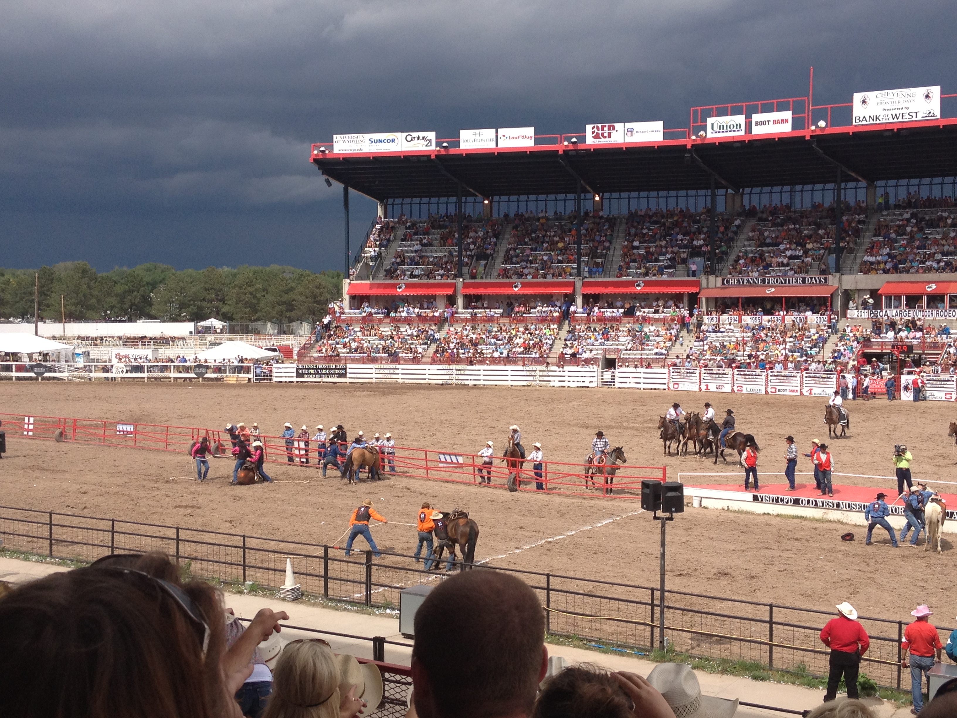
Recent studies have shown that not only has bicycle commuting increased in popularity over the course of the 21st Century thus far, but so has bicycle traveling.  Maybe it is the rise in gas prices.  Maybe it is the increased interest in combating obesity.  Or maybe it is just some kind of generational shift.  But, the increased interest in bicycle traveling has even lead to the development of a plan to implement a national bicycle route system similar to the highway system already in place for cars.

Locally in Colorado, one of the most important corridors for medium distance bicycle travel would be connecting Denver to Boulder.  Given the fact that both cities are very health conscious and bicycle friendly, and that enough people travel between the two cities every day to jam up highway 36, I have quite an interest in finding an ideal route between the two towns.  Well, the ideal route for now, until the bike path following U.S. 36 is developed, which may take some time.

Screen Shot 2013-08-21 at 2.20.06 PM

Today marked my second attempt to find the ideal bike route between the two towns.  My first attempt was back in May, a month that tends to have more ideal weather for intense activities at these elevations.

IMG_0965

My journey to Boulder, of course, began in the city of Denver, eventually following a route labelled D1.  The city of Denver actually has a local version of the National bicycle route plan envisioned, with a bunch of bicycle routes through the city labelled D1 through D22.  While Denver has better bicycle facilities and route labeling than most cities, labels such as this one are still somewhat intermittent.  Cyclists in Denver would benefit from signs alerting cyclists to when the route turns.  This particular route made two turns while I was on it, and neither turn was specifically signed.

IMG_0966 IMG_0967

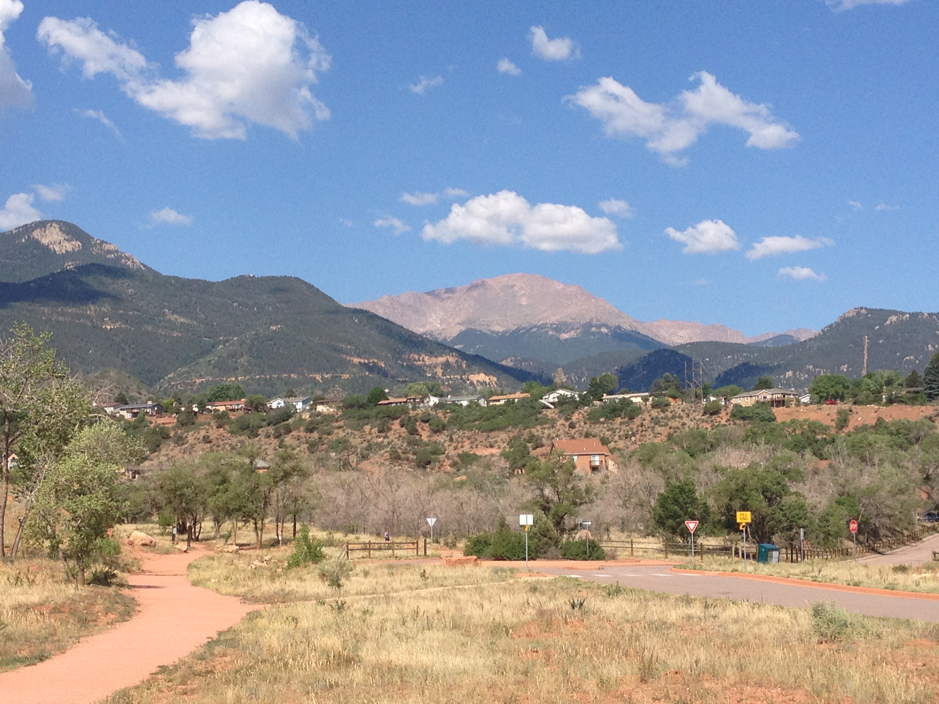
Despite the fact that Denver and Boulder both lie East of the Rocky Mountain Range, the ride between the two towns is definitely not flat, and includes some challenging parts.  Periodic hills, followed by descents into river (or creek) valleys occur throughout the ride.  In fact, the ride in Denver begins with a significant climb from downtown through a neighborhood called “The Highlands”, which, as it’s name advertises, actually rises a couple of hundred feet in elevation higher than downtown.  On this ride, I continued to climb until reaching the Denver City Limits, near Wilis Chase Golf Course, where entering Arvada, I encountered a pretty good view of the mountains, followed by one of the steepest downhill parts of the ride, into Clear Creek Valley.

IMG_0968 IMG_0970

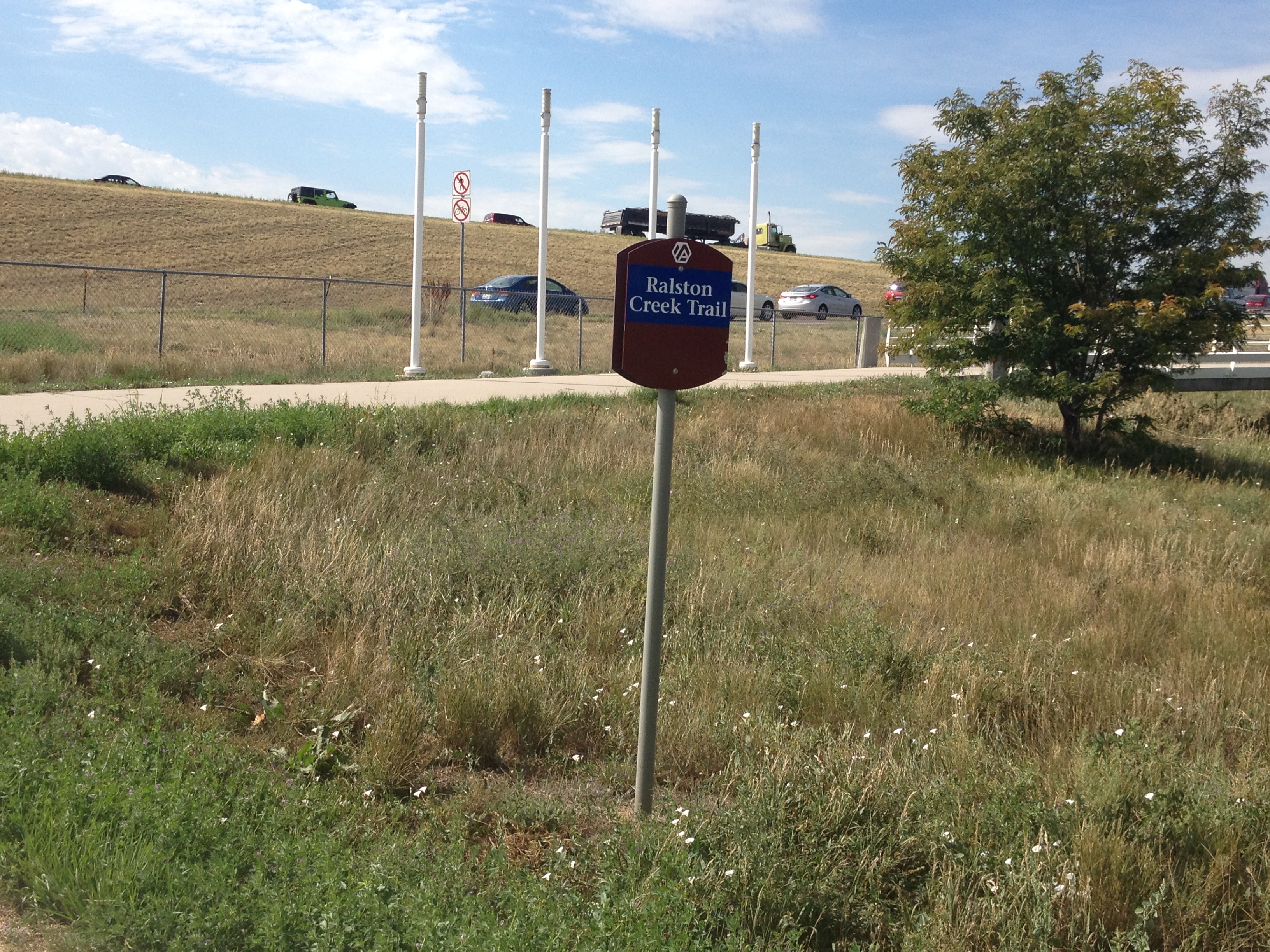
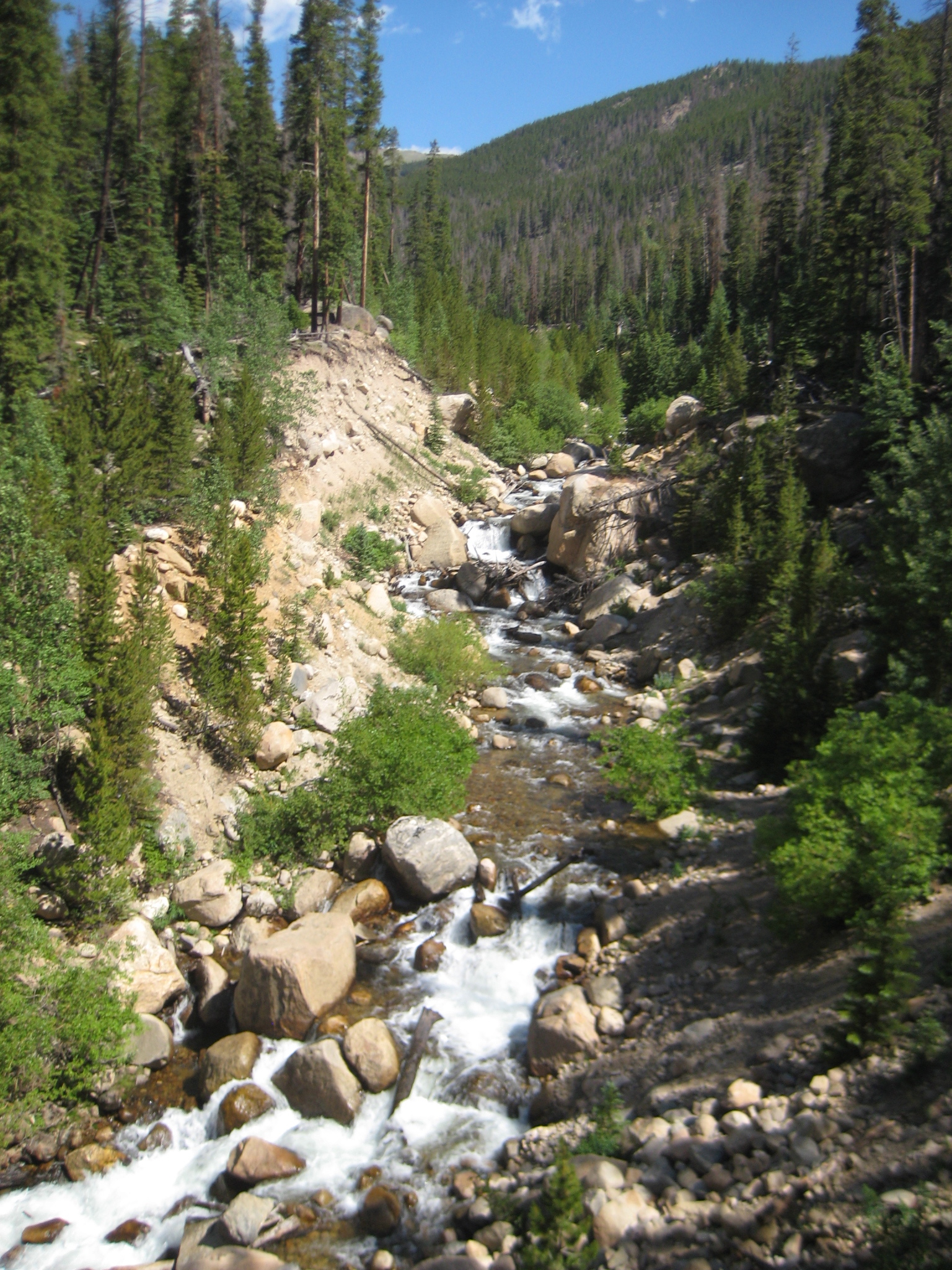
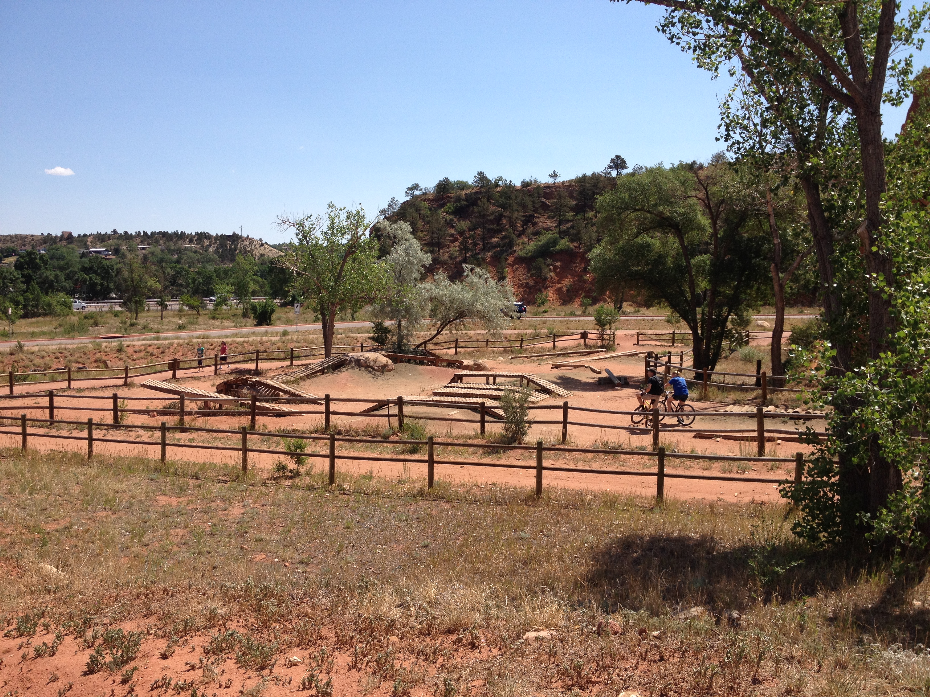
In Clear Creek Valley, I got to follow two bicycle trails, the Clear Creek Trail, and then the Ralston Creek Trail.  Although the Ralston Creek trail is not the nicest of bike trails (less underpasses, more curves), it has one of the best bicycle bridges I have ever had the privilege of riding over.  Bridges for bicycle trails are rarely as elaborate as this one.

IMG_0971

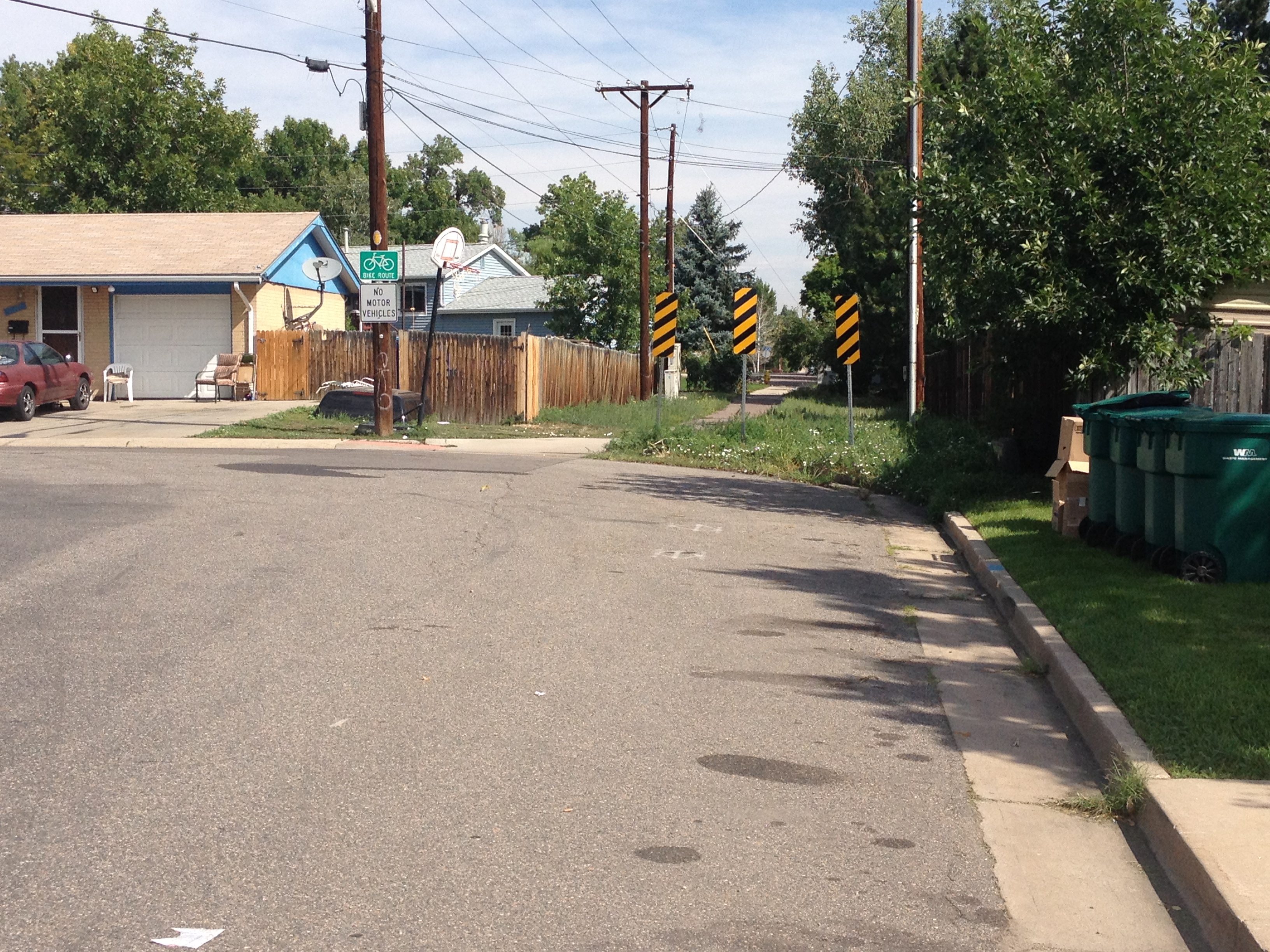
Arvada is reasonably bike friendly.  There are the aforementioned trails, and there are plenty of roads with bike lanes.  On Pierce St., the main street I followed north through the town of Arvada, there is even an area where the road itself is discontinuous, but a connecting bike path is available for cyclists.  Quite nice!

IMG_0973 IMG_0974

Unfortunately, the village of Westminster is not nearly as bike friendly.  To be fair, Westminster does have bike trails, but it does not really have bike trails designed to connect one place to another.  Their bicycle route system definitely indicates that the people of Westminster, at least at the time when they planned their town, viewed cycling primarily as a mode of recreation, and not as a mode of transportation.

My route through Westminster has always been to simply to take the sidewalk along Wadsworth Rd., a very major road with a lot of traffic lights, strip malls, etc.  This is already problematic as it is basically sidewalk bicycling, which involves a lot of bumps in the road, and the necessity of slowing down for every major intersection and being very careful for vehicular traffic.

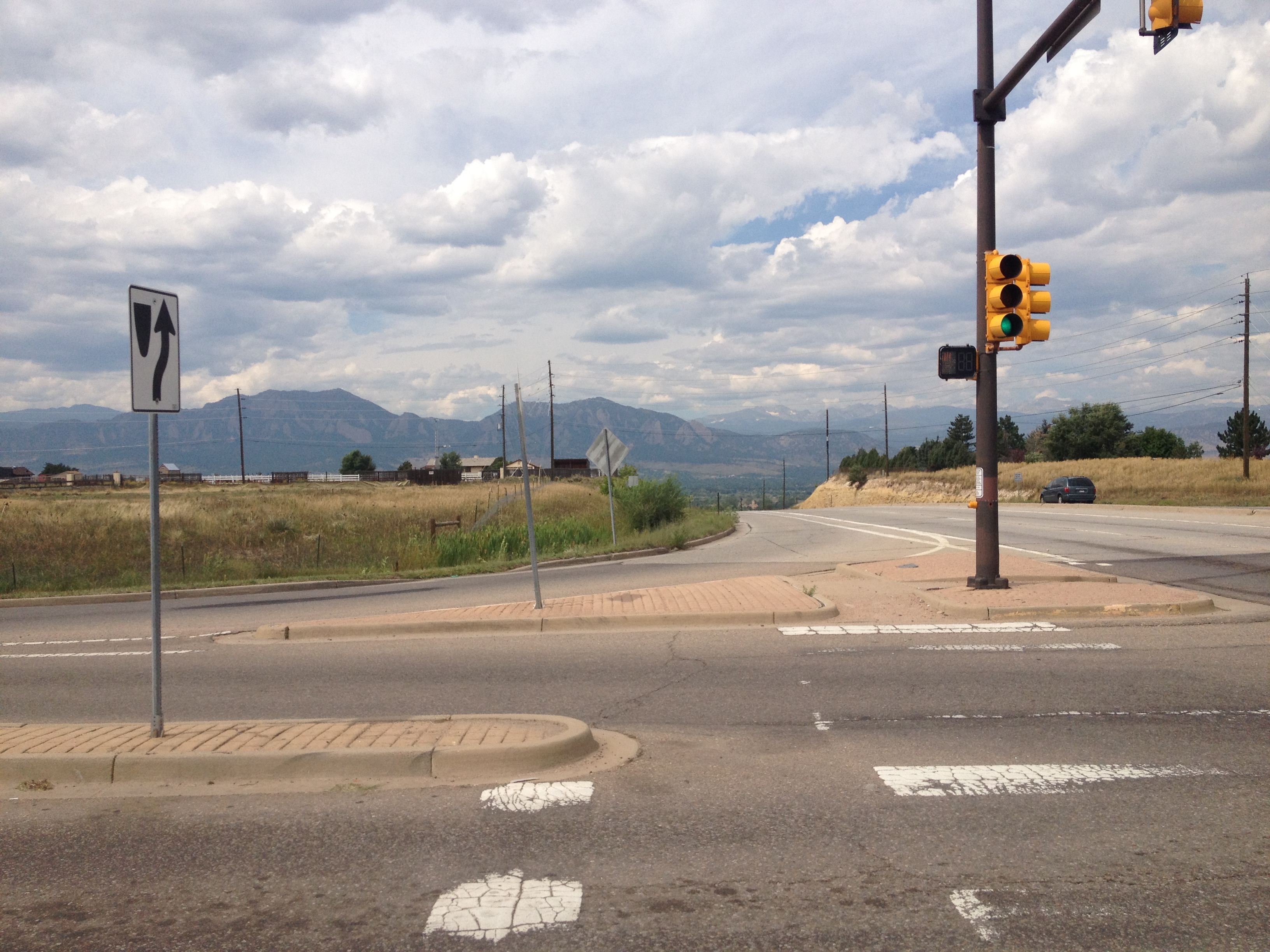
In addition to this issue, part of the sidewalk was closed, and under repair.  In addition, there was no real alternate option, as most of the roads in that are are parsed out in subdivisions, not connecting neighborhood to neighborhood, and rarely traveling in a straight line.  So, I rode through the shopping centers on the west side of the road.  The roads were smoother than the sidewalk had been even when it was not under repair, but there were a significant number of speed bumps I had to slow down for.  In the grand scheme of things, whenever riding through metro-Denver, the entire village of Westminster can be thought of as a speed bump.  Although it is not as unfriendly to bicycles as some suburbs I have encountered in other metropolitan areas, it is definitely the least friendly in the Denver area, and progress is definitely slowed whenever cycling through Westminster.

Finally, the sidewalk ended abruptly on two occasions.  Once, I took a detour that took me out of my way.  The second time, I actually got onto the shoulder, which is fairly wide north of all of the shopping centers, but the road speeds up to 55 mph, making the experience not as enjoyable.  After cycling this stretch of road, and uphill some more, I finally entered the town of Broomfield, where I knew conditions would improve.

IMG_0975

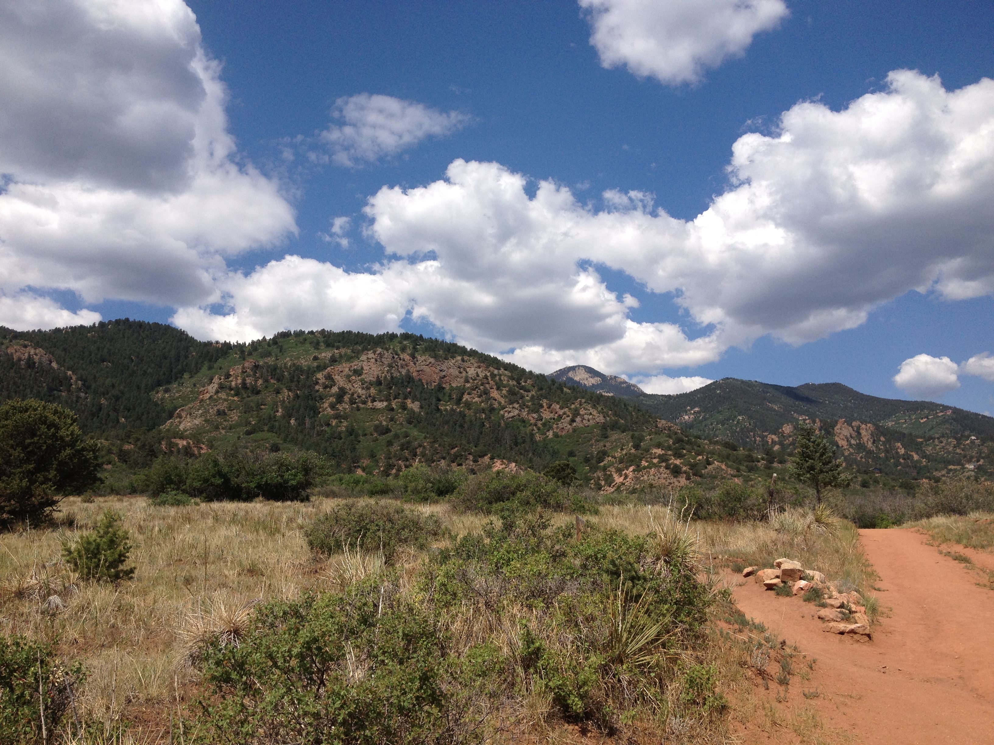
Broomfield also has a lot of windy roads, but it is significantly more bike friendly, with bike lanes on a lot of them, especially in the office park area, known as “Interlocken”, and the area by the Flatirons Mall, where I cycled through today.  In that way, it reminded me of Colorado Springs, health conscious, bike friendly, with a suburban look and feel to it.

I had always considered Westminster to have closer ties with Denver, and Broomfield to have closer ties with Boulder.  However, I have no real evidence to back that up, only hearsay from those around me.  However, the towns of Superior and Louisville, which I biked through next, definitely are more closely tied with Boulder.  This is where I reached the summit of my trip, if you can call it that, along McCaslin Rd.

IMG_0977 IMG_0978

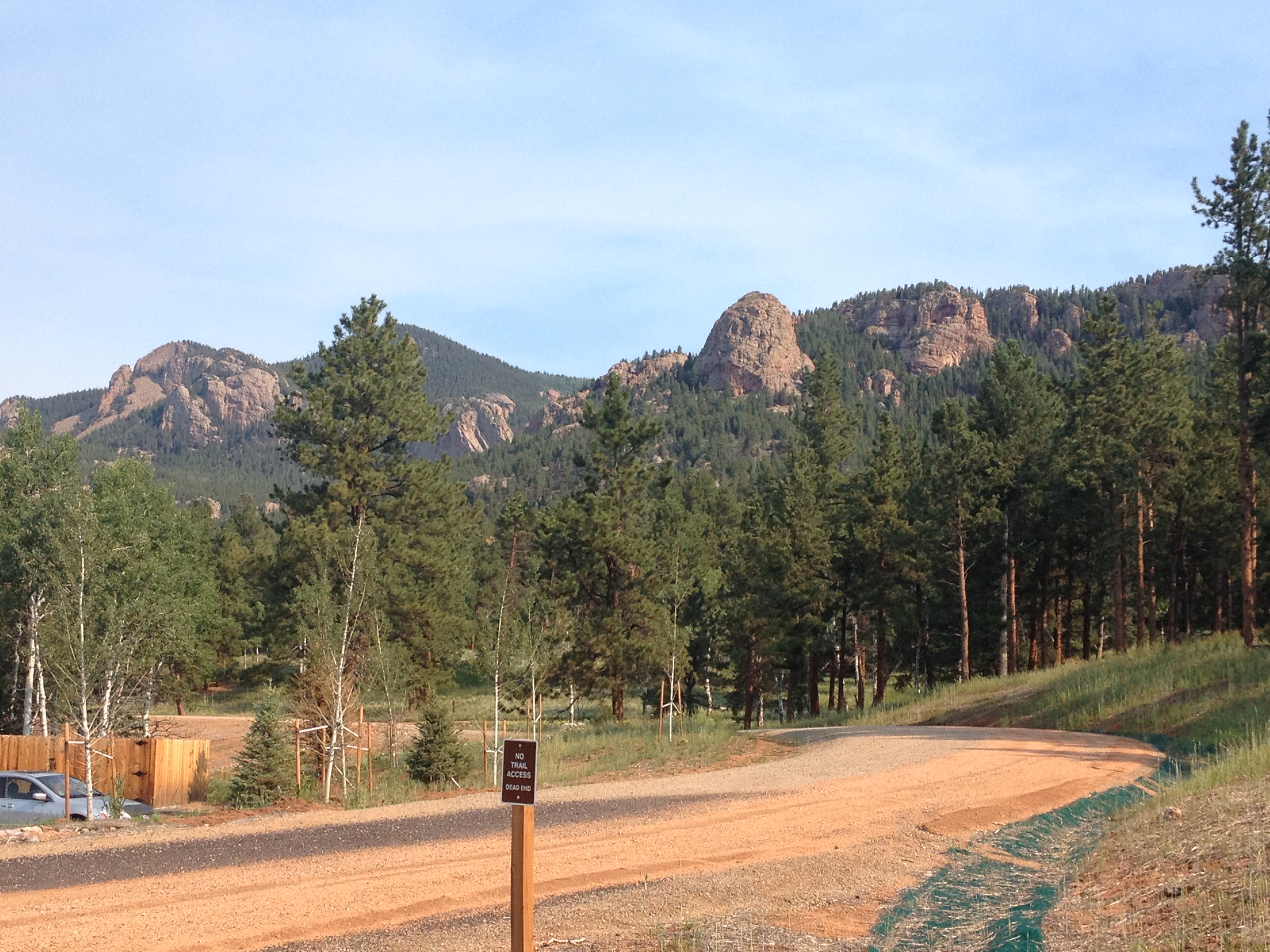
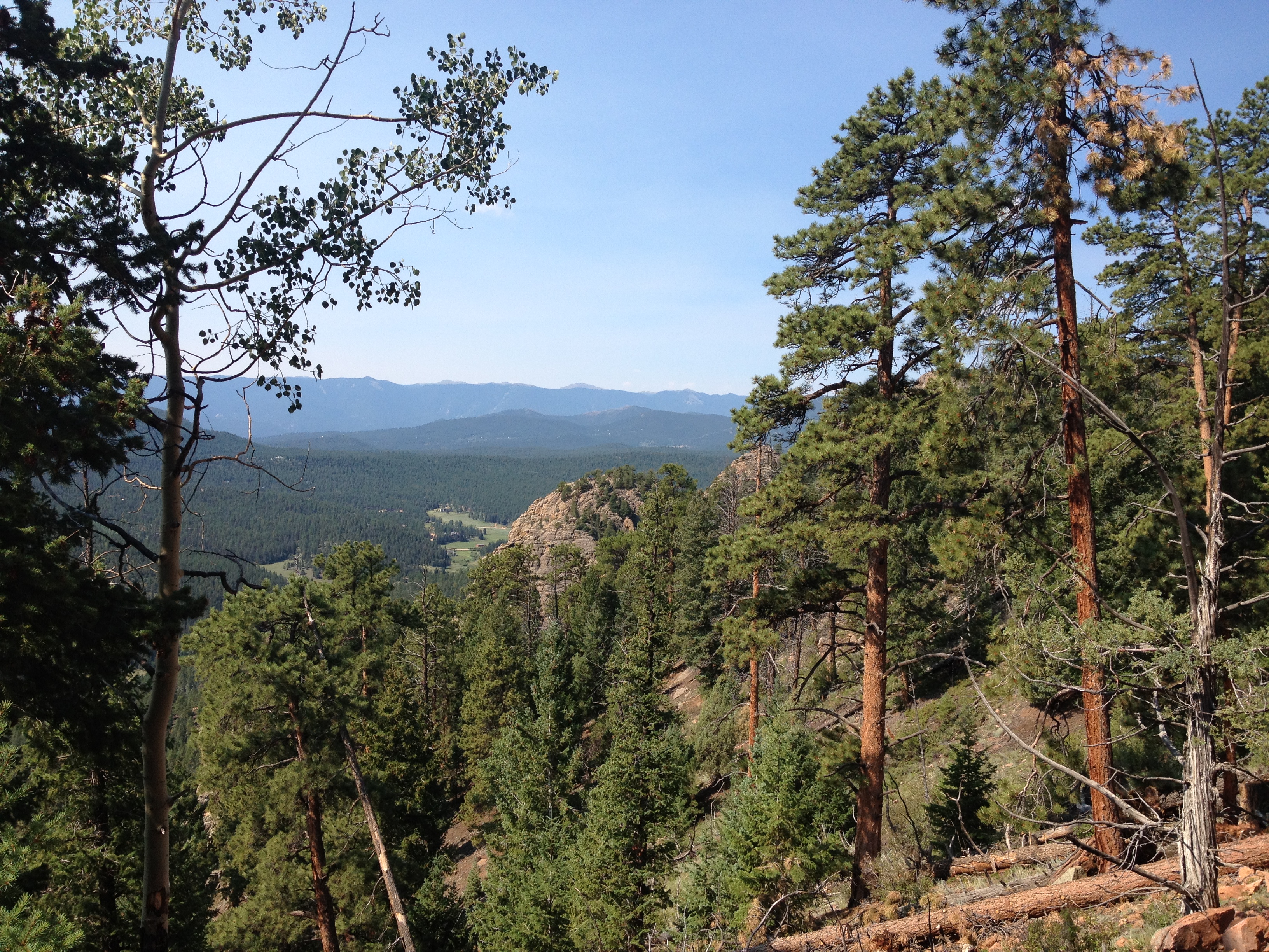
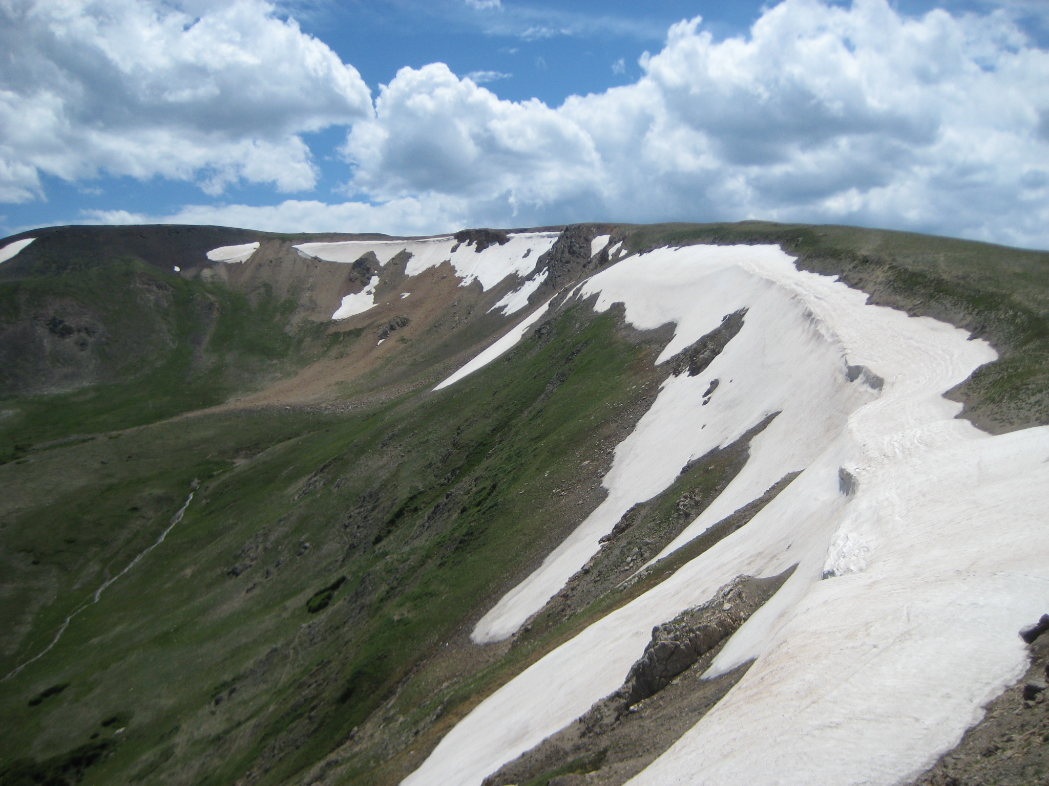
This hill is only about 400 feet higher in elevation than downtown Denver, but with it being the highest point in the area, climbing to this peak actually offers some of the best views of the Flatiorns, and the Rocky Mountains.  The Flatirons are a series of formations in the foothills of the Rocky Mountains, right outside of Boulder.  I believe they are called “The Flatiorns”, because the rocks actually form neat looking slanted sheets, as opposed to the smaller rocks, or more rounded terrain features more typically seen in this part of the country.  The Flatirons are a mountain feature that will always be synonymous with the city of Boulder, and the rest of my ride into Boulder was a rapid descent along South Boulder Road, directly facing this mountain feature.

IMG_0979

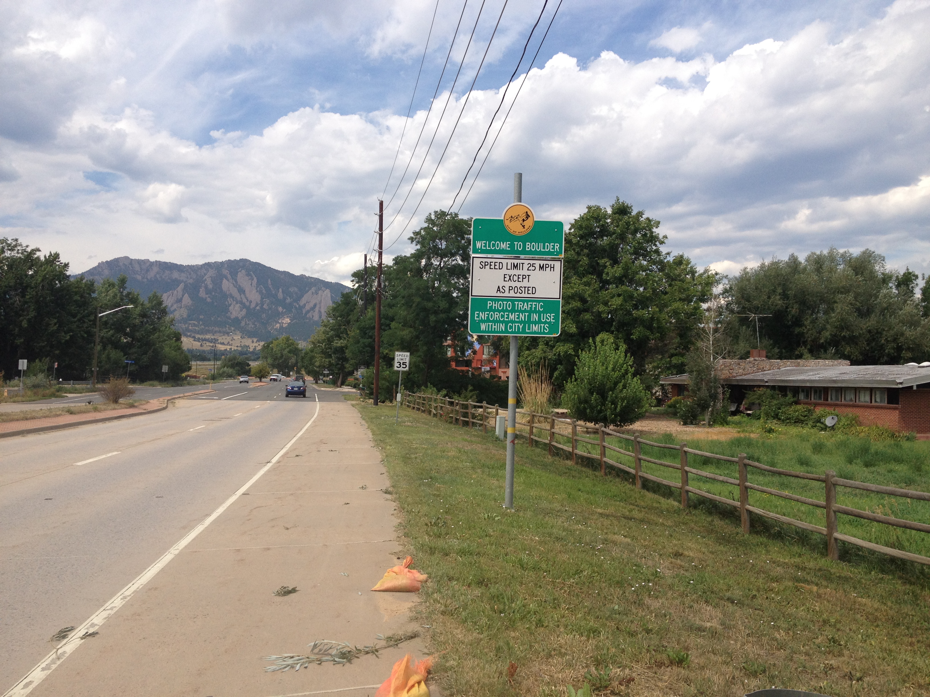
Four rapid miles, and something like ten minutes later, at an elevation over 300 feet lower than where I was on McCaslin Rd., I reached the Boulder city limits.  Once inside the city of Boulder, several things change abruptly.  First, in Boulder you can get anywhere by bicycle.  However, be prepared to be humbled.  From the time I left my home in Denver (South of downtown), I was passed once, only once.  Over the last three miles of my ride, inside Boulder, I was passed three times.

I was quite pleased with myself today.  I made it to Boulder in two and a half hours despite the slowdown that is Westminster, and was not nearly as tired as I was when I did this ride back in May.  Every single part of this ride, including many of the more challenging uphill segments, seemed easier, some significantly easier.  However, there is no place like Boulder, Colorado to remind you that there are people out there that are way better than you!

Goin’ Down to South Park

IMG_0958

I decided to break with a previous precedent I had set in this blog to only post one entry about a day’s travels.  In retrospect, some of the entries I posted a couple of months ago, which combined several activities into one post just because they were done on the same day seem like they may have come out a bit awkward.  In reflecting on the travel writing I had previously read, they appeared to make breakouts by experience way more than date.

Since I had already traveled to the South and West along highway 285 to get to Staunton State Park today, I decided to continue along the road a bit to get to Fairplay, Colorado.  By looking at my DeLorme Atlas, and then doing a subsequent Google search, I determined that the show South Park, is based (some argue loosely) on this town.

As someone who is a fan of this show, it probably sounds stupid that it took me over a decade, as well as over a year after moving to Colorado, to figure this out. But, I am not one to base my life around T.V. shows.  I feel like people nowadays focus too much on T.V. shows.  I get exhausted by conversations about T.V. shows, and saddened by people who appear to posses a greater understanding of the lives of fictitious characters on a weekly T.V. show than the lives of actual people who should be important to them.

In South Park though, I see a show that can come to represent something more.  Most shows people watch are entertaining, but don’t change anyone’s lives.  Sometimes, a groundbreaking show like Seinfeld will come along, but Seinfeld mainly changed the course of television, not history or society.  There have been shows like Fresh Prince of Bel-Air that produce commentary about real issues from time to time.  But South Park has come, to me at least, to represent an actual societal development.  It has come to represent the courage to retain the right to think individually, and come to a critical conclusion of almost anyone or anything regardless of what level of esteem they have come to enjoy by long-standing institutions or large groups of people.  It is the anti-group think, and the backlash to the political correctness movement of the 1990s.

IMG_0952 IMG_0953

However, the South Park Museum in town has absolutely nothing to do with the show.  But, it was a really good museum depicting life in the west in the 1870s/1880s.  The town was somehow preserved exactly as it was in that era, even down to the layout of the street and buildings.  There is even a historic train at the far end of the street.

Over 40 buildings were preserved, from homes, to the general store, saloon, blacksmith, and all of the quintessential buildings needed to make a true “old west” town.  Each building contained a significant amount of artifacts from that era, and museum attendees could actually walk through almost all of them and see most of the items used in day to day life here up close.  Walking through all of these buildings, I could actually imagine myself back in the old west.  I could picture myself living the life of the 300 or so residents of this town during that time period.  Overall, I have visiting my fair share of recreations like this, and this one has been the most realistic!

IMG_0956 IMG_0957

It is quite rare that any kind of museum, or historic town can lead to someone actually imagining themselves to be there!  However, there I was, imagining myself washing my clothes at the wash house, picking up supplies at the general store, boarding the train, and even getting involved in a game of cards at the saloon as if I were in the movie Maverick.  And all this was after I was expecting an entire museum about an animated T.V. series!

Also included in this museum was a 10 minute film strip about the town, and some basics about the history of the area.  All of this is not too far out of the ordinary.  As I visit more historical locations throughout the west, I have come to the conclusion that two themes are emerging from the beginning of the white man’s history of the west; fur and gold.  Most of the trails and even some of the towns in the area appear to have been established by fur trade, or gold rushes.  However, every gold rush appeared to have come to an end within a decade.  Some towns, like this one, found another niche (in the case of Fairplay it was ranching, and being a business center and county seat).  Others, like the ghost town I wandered through this past weekend, simply died when the gold ran out.

Overall, though, I can’t help but find it somewhat ironic that the history of the west was forced so much by fur and gold.  So, it feels to me that as much as we want to characterize the old west with images like this one.

11375403-cowboy-or-a-mountain-man

I can’t help but think that since most of the early settlers were searching for fur and gold, the old west can be just as easily characterized by images like this one.

12874308-beautiful-woman-with-clean-fresh-skin-wearing-gold-necklace-and-furry-coat-looking-straight-at-the-c

This recreation of the old west town was, of course, walled off from the rest of the town that was significantly more modern looking.  A few gift shops appeared to be trying to capitalize on the town’s association with the show, but not as many as I had expected.   The town had a somewhat similar layout to most small towns I am familiar with, with a central business district, and some larger shops and houses on the outskirts.  But, compared with the only other town above 9000 ft. I have spent a significant amount of time in, Breckenridge, it was a lot less dense.  The central business district was quite spread out, amongst a few streets and a fairly large area.

IMG_0959 IMG_0961

The one thing that definitely did remind me of the show, though, was the mountains outside of town.  Some of the mountain views from near town actually seemed to appear almost exactly as it appears in the cartoon.

IMG_0951


On the return trip, I once again encountered the Colorado Trail, at Kenosha Pass, which is the mountain pass that separates the “South Park” area from the Front Range.  I do find it odd, though, that this mountain pass is at an elevation less than 100 feet higher than the elevation of the town I was just in.


IMG_0962 IMG_0963

Finally, the two images above that I did not take, the mountain man and the woman with the fur and gold, are credited to the site http://www.123rf.com.


A New State Park

IMG_0939IMG_0940

Back in May, a new state park opened up in Colorado; Staunton State Park, near Conifer, which is just under an hour Southwest of Denver along highway 285.  I started hearing the buzz about this new state park during the springtime, just before and just after the park’s opening in mid-May.  The manner in which people talked about, and anticipated, the opening of a new state park in Colorado reminded me of how people would respond to the opening of a new restaurant, particularly by one of those celebrity chefs, in Chicago.

Through this, I came to the conclusion that the opening a new state park is the Colorado is the equivalent of the opening of a new restaurant in Chicago.  So, I applied the same crowd-avoidance rules to visiting this park that I would have applied to visiting a new restaurant in Chicago.  I waited a few months (until August), and I went on an off-peak day (today is Wednesday).  And, it worked!  It was not too crowded today at Staunton State Park.

I decided to check out a few different parts of the park, as well as a few different types of trails. Most of the trails in the park, or at least most of the trail length, permits mountain biking. The first mile or so of the trail was actually smooth enough that I would have felt comfortable riding my cyclocross bike on it.  A little bit farther up the road, a few rocks did begin to appear on the trail, but the trail still seemed quite smooth for a mountain biking trail, especially compared with the Apex trail near Golden.  For people who are thinking about getting started with mountain biking, or with little experience looking for something not too intimidating, I would definitely recommend Staunton State Park.

IMG_0941 IMG_0942

These trails also have a very moderate grade, making the hiking not too strenuous.  However, the few mountain bikers I saw traveling uphill on this trail appeared to be going rather slow.  So, it was probably steep enough to produce strain on a biker, but not a hiker.

I decided to check out one of the hiking-only trails.  A vast majority of the park is open to mountain bikes, with trails  that look like the pictures above, but there are a few places where only hikers are allowed.  The one hiking-only trail I took actually had a fairly strenuous section, with switchbacks and steep grades.  This strenuous section only lasted about 3/4 of a mile, making the hike overall significantly less strenuous than what would be labeled “strenuous” at a place like Rocky Mountain National Park, but it was not trivial by any stretch of the imagination, and would seriously challenge anyone that is not in shape.

IMG_0944 IMG_0945

Even these trails open to hikers only were quite wide and well-marked.  They reminded me of what I would refer to as “luxury hiking” back in the Midwest.  Well, without the restrooms and benches along the way.  But, the trail seemed to be laid out in a manner with greater comfort in mind than in many of the other places I have hiked in Colorado.

At the top of the ridge, I could not help but reflect on this view, as well as the views I had encountered at the top of the 14ers (14,000 ft. + mountains) that I had climbed last month.  The more I encounter views like this, and compare them with views like the one at the top of this page (photo taken near the park entrance), the more I begin to think that the best mountain views are taken somewhere between the base and the peak- basically somewhere in the middle.  This is kind of why the view of the Front Range mountains from the hill between Boulder and Louisville is so scenic.  At the top of the mountain, some of the features are a bit tougher to make out.  I guess it took me a while to come to this conclusion.

I did not get to view one of the park’s defining feature, Elk Falls.  The map I was handed at the park’s entrance indicated to me that the trail to these falls was not opened yet.  I guess this park is still a work in progress despite the fact that it is already open to the public.  I could have followed a series of trails to the Elk Falls Overlook, but I figured that with this park’s proximity to Denver (home), I would have plenty of chances to get back here after the trail to the falls directly opens.

IMG_0947 IMG_0948

I did, however, get plenty of views of the park’s other defining feature, the rock formations.  These rock formations appear to make it a great place for rock climbing.  In fact, the park even put together a climbing guide, and specifically labelled the trail that leads to the climbing area “Climbing Access”.  So, it appears to me that this would be a great place for rock climbers, but I would not know for sure.  I have never been rock climbing.  As a matter of fact, I am a bit unsure of whether or not I want to add this activity to my repertoire.  On one hand, people I know who climb appear to love it.  And, it would add an upper-body intensive activity to supplement my current activities, which are mainly lower-body intensive (mainly biking, hiking, and skiing).  However, rock climbing appears dangerous to me.  I am somewhat hesitant to take on a dangerous activity like this when I am perfectly happy with the less dangerous activities I currently do.  It’s just one of those decisions I will likely put off for a while and then make based on something arbitrary, like someone’s fairly ridiculous line of reasoning at a bar one night.

Overall, Staunton State Park appears like a good place to go for mountain biking and climbing, that still offers some fairly good hikes.  I look forward to checking this place out next year, hopefully with the Elk Falls Trail open, and seeing everything it has to offer.  However, I am thinking that for someone whose primary interest is hiking, the options for hiking that does not resemble walking down the road may run out pretty quickly.

The Lifeblood of the West

IMG_0920

The Colorado River is often referred to as the “Lifeblood of the West“.  Recent estimates place the number of people dependent on water from the Colorado River at close to 30 million.  This is a number that is likely expanding, and expanding fairly rapidly, given that water diverted from the Colorado River supplies water to some rapidly growing metropolitan areas, including Denver, Las Vegas, Phoenix, and Salt Lake City.  Most of the areas dependent on the Colorado River for water supply are deserts that receive precipitation irregularly.  These cities would not have been able to grow into the large cities they are today without this water source.  Without it, our country, and it’s population distribution would be quite different.  It made an entire region the powerhouse it is becoming today.  The importance of this particular river to the United States would be hard to over-estimate.

It is also one of the most iconic rivers in the United States.  Along it’s course, it carved out some of the most scenic canyons in the world.  This includes the Grand Canyon, a location iconic enough to make it into Arizona’s state motto and attract five million tourists a year.  The Colorado River not only conjures up images of all of these iconic canyons, but also images of rafters, kayakers, and other water sports enthusiasts.  And, of course, one of the most iconic images of the Colorado River is the Hoover Dam, over 700 feet tall, one of many dams that supplies both water and power to the Southwestern United States.

This gigantic cascading of water has it’s origins in Rocky Mountain National Park, near the Continental Divide.  The headwaters are not accessible by road.  A several mile hike is required in order to reach the headwaters of this iconic river.

This particular hike was not especially physically challenging.  Nearly every hiking guide rates this hike as “easy”, as opposed to “moderate”, “strenuous”, or Long’s Peak, which needs a category of it’s own.  Being a trail that follows a river valley, it is not surprising that the hike is easy, as steep grades are not common along river valleys.  This is why many trails follow rivers.  In the pre-automobile days following a river was often the safest and most direct route for fur traders, settlers, etc.  The automobile came along and made travel quite a bit easier, but many of today’s roads still follow these trails.

One interesting exception is Trail Ridge Road, the road I took to get to the Colorado River Trail.  This road traverses Rocky Mountain National Park, but it climbs to a peak elevation of over 12,000 ft. along a ridge in the north central part of the park, as opposed to following one of the river valleys like many other roads do.  It is also the route of U.S. highway 34, a route that proceeds eastward through Estes Park, and then towards Loveland, CO via the Big Thompson canyon.  The road follows a trail through a river valley east of Estes Park, but not west of town.  I wonder if that has anything to do with the fact that Rocky Mountain National Park was established in 1915, after the automobile had already been invented.  So, the people who planned the park could plan around visitors with cars.  Had it been established earlier, like Yellowstone, would the road follow one of the river valleys to the north or to the south, as opposed to it’s route up Trail Ridge?  Historical what-ifs are always fun to ponder, but never verifiable.  At least we know that as things actually are, visitors to the park can enjoy a scenic drive up Trail Ridge Road from mid-late May through the end of September.

IMG_0922 IMG_0924

Whenever a trail follows a river, there is an enhanced risk that the particular trail will be muddy.  The last couple of weeks have been rainier in North Central Colorado, and therefore, it was no real surprise to me that there were many places along this trail where the entire trail was covered with standing water, requiring hikers to either wade through it, or walk around it.  Anytime hiking, or bicycling along a dirt trail next to a river, one should prepare for such conditions after rainy days or rainy periods.

IMG_0925

I was expecting humble beginnings, and even considering titling this blog entry as such, but that is simply not true.  A mile or two into the trail, which is only a couple of miles from the source of the river, it already looks quite a bit wider than many rivers in this region.  Although the Colorado River gets a lot of additional force, and water flow, farther downstream, when it is joined by large tributaries, particularly the Gunnison, Green, and San Juan Rivers, seeing the river here it almost seems like this particular river stands out against every other river, creek or stream that flows off of the continental divide in this region.  Like that one child in grade school already reading at high school levels with a curious mind and appetite for learning, it seems destined for greatness at this early stage.

IMG_0927

One interesting thing about this particular trail is that it passes through a ghost town.  3.5 miles from the trailhead, is a place called Lulu City.  In my DeLorme Colorado Atlas, it receives some fairly large lettering, so I was expecting the ruins of a town of sorts, similar to what you see on the Plains, or in the Rust Belt when you drive through a town that has been abandoned.  However, it was nothing like that.  All that is there is this sign, stating that a town of 200 people existed here for a total of five years.  Only five years!  I wonder what the story of this place is, and why it even warranted this major mention both in my atlas and on the Rocky Mountain National Park trail maps and signs.

IMG_0929 IMG_0931 IMG_0933 IMG_0934

After another mile or so of not too strenuous hiking, I arrived at the headwaters of the Colorado River.  The hike took less than two hours, and that was after going out last night and getting about three hours of sleep, so I was not exactly in top condition today.  Anyone wanting to view the Colorado River’s headwaters should actually stress the drive there more than the hike.  From Estes Park it is at least a half hour drive as the road traverses the park up and down a windy road.  Usually, it will take longer, as travel through the park slows down at nearly every scenic overlook, as well as anytime wildlife is seen and people stop to take pictures.

And of course, I can now forever say that I have walked across the Colorado River.  And I really walked across it, as opposed to when I walked across it on the bridge at the top of the Hoover Dam seven years ago.  That does not count.  But, when I get to the Grand Canyon, Moab, or any other place where the Colorado River has carved out an iconic scene, I will know that I have actually traversed across this very river with the assistance of nothing other than two logs, probably placed in the river earlier this year by someone with the same wacky idea and reasoning that I had today.

IMG_0935 IMG_0937

Oh yeah, and I cannot claim the higher ground with regards to everyone stopping to take pictures of wildlife and causing delays getting across the park.  This was only the second time I have ever seen moose, and this bighorn picture could not be passed up.  Five and a half hours of driving, and three and a half hours of hiking later, I can at least take solace that I rode my bike 39 miles yesterday and therefore did not really need a lot of exercise today.

Mount Bierstadt on a Windy Sunday

One of the hardest truths to accept in life is that you never know when opportunities are going to run out.  There are all kinds of reasons life gets interrupted; new job, new city, new responsibility.  And, before you know it the opportunities for certain activities have come and passed.  This is why I embrace opportunities when they come about, unless I have a good reason not to.   In other words, I make yes a default.  It’s kind of like how in the United States, when you are on trial, you are considered innocent until proven guilty “beyond a reasonable doubt”.   I tend to say yes to things unless I have “reasonable doubt” about them for one reason or another (or another prior engagement, which is actually by far the most common reason I refuse invitations to anything).

Consistent with my desire to fully embrace the Colorado Rocky Mountain experience, when I got invited to climb another mountain, Mount Bierstadt, eight days after hiking my first 14er (peak whose elevation is greater than 14,000 feet), I accepted.  Although, the more I think about some of the interactions I have had with people around town, the more I realize that climbing mountain peaks at this frequency is far from unheard of.  I think I remember hearing about people climbing 10 in one year, which would have to involve at least 5 days (most likely more) of climbing, or 5 weekends, out of about 15 weekends from June to September where climbing these mountains does not involve trudging though excessive amounts of snow.

IMG_0893 IMG_0894

This particular trip came about when one of my friends wanted to take a friend from out of town on her first “14er”.  Despite this being her first climb above 14,000 feet, with more hiking experience than me, she is a stronger hiker than me.  Mount Bierstadt is actually one of the easiest “14ers” to climb, and it is also fairly easy to get to from Denver.  So, we were actually able to sleep relatively late, leaving Denver just after 6:00 A.M., not arriving at the trail head until about 7:30.

I already notice a few differences between this hike and the one I did last weekend.  This hike seemed to be about the same difficulty as the last one (Gray’s and Torrey’s Peak) minute for minute, but it lasted less time.  It took us only two hours and fifteen minutes to get to the top, and that is with me slowing my more experienced hiking partners down.  There was also not as much of an intimidation factor as there was at Gray’s Peak.  In fact, I was not even able to point out which mountain we would be climbing at first glance,  which I most definitely was able to at Gray’s and Torrey’s.  I had heard that this mountain was known for having “false summits”, where it looks like you are reaching the top of the mountain based on your viewpoint, but aren’t actually at the top.  There were a couple of places on this hike where I felt that way, but I still think there are more “false summits” at Rocky Mountain National Park, possibly because all of those hikes are mostly below the tree line, and therefore are in the woods where you can’t see as far.

The other thing I encountered on this mountain were guys, mostly by themselves, and mostly wearing headphones, practically running up the mountain.  My guess is that they are quite experienced with these types of hikes and were trying to make the best time possible.  I wonder how long it took them to get to the top, because I considered 135 minutes to be a decent time.  I really don’t see myself ever getting to this level.  In fact, seeing this does give me reasonable suspicion about going on a hiking trip like this with some of the most hard core people I know.

It reminds me of the saying that no matter how good you get at something you will always encounter someone better (although there are exceptions; Michael Jordan, Usain Bolt, etc.).  It is impossible to fully enjoy any activities like this without accepting this fact, and learning how to be satisfied with your own progress (as long as you find it acceptable) regardless of what you see from others around you.  This is the only way a beginner can get on that mountain, basketball court, or ballfield, knowing they’ll look a bit silly the first couple of times, but that even those most experienced participants around them were also once the newbies in awe of the performance of others, insecure about whether or not they truly belong.

IMG_0896

I decided not to take a picture with that sign that they pass around, with the name of the mountain, the elevation, and the date.  Maybe I was a bit scared to hold the sign, as it was significantly windier on this hike than it was on the hike I did last weekend.  While on the mountain, I wondered if this mountain tended to be windier than the others, as Colorado’s terrain causes a lot of small scale variations in weather.  However, on the way back to Denver, I noticed it was still windy.  So, I am thinking that Sunday was just a windier day, which makes sense because Friday and Saturday were stormy in the mountains.  This picture, I think, makes it pretty clear that we were  on the top of the mountain.

IMG_0897

Another interesting occurrence was what happened with the sandwich I packed in Denver, and ate at the summit of the mountain.  I guess this photo above proves that I pack my sandwiches well, as the bag expanded significantly due to the pressure decrease of being at a higher altitude.  Denver’s atmospheric pressure is around 850 millibars (sea level is just over 1000).  At 14,000 feet, the pressure is only about 600.

IMG_0900 IMG_0901

The trip back down the mountain was somewhat treacherous.  The part near the top is something often referred to as a “scramble”, which basically means that rather than a clear trail, it is mostly just rocks that you just kind of self-navigate the best path up.  This was the hardest part on the climb up the mountain, as it is pretty steep, at a high altitude, and required me to do a bit more with my upper body to propel me around the rocks.  Somewhat lower on the mountain, there are several areas with little streams that actually made the trail a bit wet.  On the way up the mountain, I did not care about this, but on the way down it did kind of worry me a bit.

Additionally, the time we were descending the mountain, from roughly 10:20 to 12:20, there seemed to be an even mix of people traveling in both directions (upwards and downwards).  I am guessing that since this hike is somewhat shorter than most “14ers”, it is more acceptable to get a somewhat later start here.  All of these factors probably made the trip down the mountain take nearly as much time as the trip up the mountain.  I really need to stop expecting the downward trip to take too much less time as the upward trip, but these are the kinds of things that we all learn through experience.

The only real annoyance on this particular trip was the traffic on Interstate 70 on the way back to Denver in the early afternoon.  I was told that is to be expected on any summer Sunday in Colorado, but for some reason all of us had just simply forgotten about this, and not really planned for it.  They are widening part of the road to three lanes in each direction, and the construction may have made the traffic worse.  Hopefully the additional lanes will make traffic move faster in the future.

I spent most of the day today (Monday) being worn out, but was back to my normal energy level sometime in the afternoon.  Maybe I am lucky that my energy recovers quickly, but I think part of the reason for it is that I embraced an active lifestyle long ago.  I started making yes a default long before the Jim Carey movie Yes Man came out, and, as a result, I have been on top of the world three times this month.

Cheyenne Frontier Days

IMG_0883

Every July, the World’s Largest Outdoor Rodeo (The Calgary Stampede is larger, but indoors) comes to Cheyenne, Wyoming.  Cheyenne’s Frontier Days is not only a rodeo.  It is a major nine-day event, and the most exciting time of the year to visit Cheyenne, Wyoming.  At Frontier Park, not only does one of the most major pro rodeo events take place each afternoon, but live concerts take place each night, and a carnival is set up just outside the park.  It is the week where Wyoming shows in full display it’s western heritage.  And while the “old west” can be thought of as encompassing part or all of 16 states, I find it hard to think of a state that shows more pride in it’s “old west” heritage than Wyoming.

Consistent with the culture on display at Cheyenne Frontier Days, most of the concerts that take place over the course of the week are country/western.  I am not a fan of country/western music.  I am from New York and Chicago, it is just the culture I grew up in.  So, I went to the only non-country/western show on the Frontier Days lineup, which happened to feature two of my favorite classic rock/ arena rock acts; Journey and Styx.

IMG_0868 IMG_0869

Styx went on first, and they began on-time!  This was at 8:00 P.M., Friday night, the first night of Cheyenne Frontier Days.  They put on a phenomenal show!  Some bands just don’t sound the same as they get older, but this band was quite good.  In fact, it reminded me how much I liked this band.  As an added bonus, I took pride in the fact that they are from Chicago.

IMG_0873

Journey was the main act of the night, and they also sounded really phenomenal!  Their story is quite an interesting one.  They scored their biggest commercial success in the time period from 1977 through 1984 with lead singer Steve Perry, who has a very unique sounding voice.  After breaking up, periodically reuniting, having a falling out with Steve Perry, and a few years with a different lead signer, in 2007, they hired Arnel Pineda, from the Philippines, as their new lead singer.  The interesting thing about this hire is that they hired him based on hearing his Journey Tribute band perform on YouTube.  It is interesting how this technology has helped a California based band find the most ideal new lead signer on pretty much the other end of the world.  How’s that for the benefits of the internet and connectivity?

I also love watching this guy in concert.  His attitude is just so positive!  Whenever I see him on stage, it just feels like singing for Journey has been a dream come true for him and that he is loving every minute of it.  I can feel his energy, and it seems like the crowd can feel his energy as well, and responds positively to it.  I think people in general just love it when someone seems really happy and enthusiastic about what they are doing.

IMG_0882 IMG_0877

In addition to seeing a wonderful show, we got to attend the show in a special section called the “Party Zone”.  This section of the venue is in front of the stands, fairly close to the band, which is how I got those fairly close-up pictures.  There are no seats here, and beer is sold right in the section, just slightly off to the side of where the crowd congregates.  Essentially, this is the section for people that came to dance, jump up and down, etc., as opposed to those that just want to sit and watch.  This is where I feel I belong.  So, I was happy to have good company, have a few beers, and see an amazing show.

IMG_0879 IMG_0880

The next day, Saturday, we went to the parade, which occurs four times throughout the duration of this festival.  Saturday morning’s was the first one, but there will be another one on Tuesday, Thursday, and the following Saturday.  For this day, I decided to find the most western looking attire I own, which includes a cowboy hat that I actually bought at last year’s Frontier Days.  I have no boots, no fancy belt buckle, or anything that would make me completely legit.  But, it was nice to somewhat look the part, and somewhat look like I fit in in a place that could not be more opposite from where I am from.

I am not a conformist.  I believe that everybody should feel free to be themselves.  However, sometimes I enjoy just fitting in.  It makes me feel like a versatile individual, like somebody that can find a way to feel comfortable in many different situations and scenarios.  Wearing jeans and a cowboy hat for one day did not in any way make me feel like I am compromising my values or losing my ability to be who I am.  I will return to my quite urban lifestyle when this is over.  So, why not fully embrace the experience while it is happening?

IMG_0886 IMG_0888

One thing I try not to do while attending major events is loose track of the actual purpose of the event.  The best example of this is the Mifflin Street Block Party in Madison, Wisconsin.  Originally a Vietnam War protest, this event quickly evolved into large early May block party with little purpose other than drinking heavily.  The major event at Cheyenne Frontier Days is the rodeo.  It is actually one of the most significant rodeo events on the pro rodeo circuit and attracts some of the best the sport has to offer.

Rodeos feature a variety of events, including your standard bull riding, and bucking broncos, but also the events pictured above; calf roping and barrel racing.  Calf roping is quite a crazy event.  A cowboy will first lasso a cattle.  Then, they jump off of their horse in order to tie it up, using a rope.  The best of the best can do this in a matter of 12 seconds.  Steer wrestling also features cowboys jumping off of their horse, but in order to wrestle a steer to the ground by the horns.  I saw someone do this in a matter of 7.6 seconds!

Of course, from the standpoint of an animal right activist, this is probably the worst sport in existence.  In order to get the bulls, as well as the broncos, to buck, they literally tie up their balls.  Maybe greyhound racing is worse, I don’t know, I am not PETA.

This particular rodeo ended with a unique and quite exciting event; a wild horse race.  For a lack of a better way of putting it, the wild horse race is literally a shit show.  Teams of three attempt to saddle up and ride an untamed horse, straight from the wild, one time around a track, in a fashion similar to a more proper horse race like the Kentucky Dirby.  However, because these horses are wild, anything can happen.  Before getting started, many of these horses started pulling their “handlers” in all sorts of directions, and some even “sat down”, if that is something a horse can do.  While running around the track, two of these horses jumped over the gate, throwing their riders off, and one of them completely changed directions out of nowhere.

All of this was quite amusing, but I actually kept thinking about this entire scene from the point of view of the horse.  Specifically, the people who were dragging the wild horse around in a vein attempt to get them to act like Man-O-War were, in some cases, riding trained horses.  These wild horses, being dragged into the arena must be wondering why these other horses are betraying their own species and helping the humans do this to them.  It’s got to be on their minds.

IMG_0889 IMG_0890

We also got quite lucky with regards to the weather.  Towards the end of the rodeo, around 3 P.M., storms started to form to our West, Northeast, and South.  But, luckily, the storms formed and tracked elsewhere, and very little rain fell on the rodeo itself.  The storms did, however, help cool things off.  In both Colorado and Wyoming, in summertime, storms are like power plants; you want them close to you but not close enough to mess things up.

Horsetooth Reservoir; A Great Place for Water Sports, and Your Dog

IMG_0857 IMG_0858

About ten minutes west of the town of Fort Collins, Colorado sits the Horsetooth Reservoir, a six and a half mile long, but fairly narrow lake at the edge of the foothills.  It was created in 1949 when the Bureau of Reclamation put up four dams in the area, as part of a larger project called the Colorado-Big Thompson project.  The intention of the project is to stabilize the supply of drinking water for the cities along the Front Range from Fort Collins down to Pueblo.  They do this by diverting water from the Western Slope (on the other side of the Continental Divide) to the Eastern Slope.  Thus, they effectively take water that would have flowed down the Colorado River to the Pacific Ocean via the Gulf of California.  It is interesting that some people here complain that the Hoover Dam takes significant amounts of water out of the Colorado River when we here on the Front Range in Colorado are also benefiting from water taken from the very same river.

Similar to places like Lake Mead and Lake Powell, the creation of a lake, originally intended as a reservoir to stabilize the supply of drinking water, ended up serving a secondary purpose; providing a spot for water recreation.  In the West, and especially in the Southwest, naturally occurring lakes are fairly rare.  They tend to be smaller and at higher altitudes than their Midwest counterparts.  The naturally occurring lakes I can remember seeing in Colorado are lakes like Fern Lake and Lawn Lake up over 10,000 feet in Rocky Mountain National Park.  With these lakes tougher to get to and smaller, these reservoirs have become a focal point for boating and other water related recreation areas in the region.

Yesterday was a perfect day along Colorado’s Front Range.  Temperatures topped out in the upper 80s to near 90 in most places from Fort Collins to Denver, and no thunderstorms occurred, not even in the foothills.  Afternoon thunderstorms typically occur in the region at this time of year, but yesterday all of the storms occurred West of the Continental Divide.  I guess that is good news for recreation enthusiasts in the populated part of the state of Colorado, but days like yesterday probably illustrate why it was necessary to divert water resources from Colorado’s Western slope to Colorado’s Eastern slope.

Yesterday I got the rare opportunity to join with a few people for some jet skiing on the Horsetooth Reservoir.  I do not own my own jet ski, and I haven’t ridden one for over five years.  But, I remember it being quite fun, and I knew there was no chance of storms in the forecast.  So, it ended up being a nearly perfect activity for a day like yesterday.  Also, since we traveled a significant distance away from Denver, and went on a Wednesday, there was significantly more open space then there would have had we gone to a place near town like Cherry Creek Reservoir on a weekend day.

IMG_0859 IMG_0860

Naturally, I got too carried away with the activity to think to get any pictures of myself on the jet skis.  I only got pictures of others.  This should be a testament to just how enjoyable the activity is.

As an added bonus, I got to bring my Siberian Husky; Juno.  Being a cold weather dog, she naturally wanted to get into the water as quickly as possible.  However, being a non-water dog, she spent a large part of the day just on shore, in the shade, periodically going into the water.  She still seemed to have a lot of fun here, in fact, enough to get her completely worn out.  If my husky enjoyed the experience this much, I can only imagine how enjoyable it would be for a retriever to come here for the day.

IMG_0856 IMG_0863

The water temperature here yesterday was perfect!  It was in that range where the water is cool enough to feel refreshing, but warm enough that it was comfortable to get in from the very beginning.  This contrasts with some pools I have gone in earlier this summer where the water felt quite cold at the beginning, before gradually getting used to it.  I was concerned that the water here would be even colder than that, but it wasn’t!

Overall, Horsetooth Reservoir was worth the $7 entry fee.  I am not sure how much more crowded it is on the weekends.  However, given the fact that this year’s weather in Colorado appears to have been fairly typical, I would expect most years to feature water temperatures in the same general range as yesterday’s, making Horsetooth Reservoir a wonderful place to go for both water sports, and dogs.

A Rite of Passage

IMG_2367 IMG_2376

Birth to roughly age 22 is an endless barrage of rites of passages.  There is birth itself, first steps, first words, first day of school, learning to ride a bike, first kiss, then high school and college are one eight year long rite of passage into adulthood which includes learning to drive, and then all of the other things you can legally do at age 17, then 18, then 21.  Due to the ridiculous drinking age in this country, many of us end up going a little bit overboard somewhere in there.  On top of that, there are a bunch of rites of passages in there that are specific to each individual, like first baseball games, or learning musical instruments.

The final rite of passage in all of this is graduating and getting a job (or, for some people graduate school).  At this point in time, most of us are quite sick of rites of passages.  This is especially true for some of us that went to graduate school.  The time has just come for us to stop preparing for our lives and live our lives.  However, the transition is quite abrupt.  We go from being in a near constant state of flux and trying to figure out where are lives are going, to a quasi-steady state, where day in, day out, week in, week out, year in, year out, has the potential to follow some routine that never changes, and never progresses.  After a few years of this, it is natural to get a bit restless.  Before long, we see American Pie, or Superbad, or Clueless, or whatever movie reminds us of that time in our lives, and almost become nostalgic for the time in our lives when the future, heck, the next week, was an open book, as opposed to a likely mirror of the last.

IMG_2347 IMG_2349

In Colorado, it is considered somewhat of a rite of passage to climb to the top of a “14er” for the first time.  A “14er” is a mountain whose peak is more than 14,000 feet in elevation.  The selection of the number 14,000 seemed a bit arbitrary to me at first.  It seemed like it just happened to be the nearest round number, and that it would be different if the U.S. were on the metric system.  But, this demarcation of peaks exceeding 14,000 feet seems useful to Coloradans for two reasons:

1.  With a total of 54 “14ers”, it gives Colorado hikers a large enough variety of places to go and hike these peaks, but not so many that climbing all of them is out of reach.

2.  With a total of 54 “14ers”, Colorado has significantly more of these peaks than all other states, including Alaska (14) and California (12).  So, despite the fact that those states have the tallest peaks in North America and the lower 48 respectively, Colorado has a basis to claim the top position in the country with regards to mountains and mountaineering.

This is why yesterday I woke up before sunrise and made the trek to Gray’s Peak in order to accomplish the feat of climbing my first “14er”, and becoming a true Coloradan (in the eyes of some).

IMG_2393

Gray’s peak is actually the highest point on the Continental Divide, and the trail up to the top of this peak (as well as Torrey’s Peak) is part of a national scenic trail that follows the continental divide.  This trail is only about 70% complete.  If someone wanted to traverse the entire trail, they would have to do some road-walking.  This is most likely why we don’t hear about this trail as much as the Appalachian and the Pacific Crest trails.

IMG_2354

I was lucky enough to go with a group of people that included three first timers (including myself), and a mixture of people who had varying levels of experience climbing “14ers”.  A couple of people had been up over ten of these peaks, some others had done only a couple.  It is also just fun for me to do activities in groups like this, and I am glad I got to share this accomplishment with them.

IMG_2355

Whenever attempting something that requires physical strength or endurance, part of the battle is always mental.  Seeing Gray’s Peak (left), and Torrey’s Peak (right, partially hidden behind the hill), toward the beginning of the climb definitely created an intimidation factor that somewhat reminded me of the first time I went skiing in the Rocky Mountains, at Steamboat Springs, and looked at the ski mountain, after having only seen ski mountains in the Midwest.

IMG_2358

The trail up the mountain follows a path that has been mapped out for some time, and has been improved and preserved by the Colorado Fourteeners Initiative.  It is likely the safest way to hike up the mountain, but it follows a ridge that looks a bit scary, as the thought of being on a small linear feature like the one seen in this picture can be somewhat frightening.  Luckily, when we got there, it was actually less scary up close than it was looking at it from afar.

IMG_2361 IMG_2362

With pretty much the entire hike being above the tree line, I began to get some pretty scenic views only halfway up the mountain, which is already above 12,000 feet in elevation.  It was quite interesting to see some of the other peaks looking away from the top of the mountain, to the north.  As a scientist, it is hard not to be intrigued by seeing a mountain where one side is getting a significant amount of sun and the other is not.  It appears as if grass grows on one side but not the other, which indicates a different ecosystem and a different climate, all within the arctic tundra, dependent on local topography.

IMG_2363 IMG_2365

For roughly the first two thirds of the way up the first peak, I was actually able to keep up with the fastest people among the group.  However, having less experience climbing at these altitudes, it was inevitable that I would eventually drop back.  I took this opportunity to get some image of the others in the group hiking, as there was a switchback zone after the ridge we had previously followed.  Hiking trails like these definitely involves a significant amount of looking at the ground, as there are a lot of small rocks, which need to be approached somewhat carefully.  Even after I let everyone know I was taking pictures, some people still did not look up.

It took me about three hours to get to the top, and I summited just after 10 A.M.  The feeling of getting to the top is hard to describe, especially for a first timer like myself.  It is definitely a feeling of accomplishment, and a really good confidence builder.  It is also mixed with this feeling of being on top of the world.  All of the mountains, the ones that I typically view from Denver as towering over the city from the west were all below me.  I had climbed to the top, conquered it in a way.  I may never look upon these mountains the same way again.  The very scenery that I can see on all non-cloudy days from the back window of my apartment has been suddenly transformed from symbolizing what is challenging, wild, and untamed to symbolizing that all things are possible, and that challenges can be met with determination and proper planning.

IMG_2370 IMG_2369 IMG_2368

At the top of Gray’s Peak, we actually found a pretty nice place to sit, where the rocks somewhat shielded us from the wind.  For some reason, it is always significantly windier at the top of a mountain peak than it is just a mere 100 feet lower.  I have noticed this before, but wondered if it would feel different on this hike, which was pretty much all above the tree line.  It wasn’t, it felt more than twice as windy at the top of Gray’s peak.  I also learned something very surprising about hiking yesterday.  On the way up to the mountain, I was told that all hikers should bring a lemon with them on their hike.  This made absolutely no sense to me, as I was under the impression that I should stick with sandwiches and power bars to avoid carrying excess weight.  Liz and Laura (pictured above) followed by this advice, brought the lemons, and actually let us have some.  I had one lemon wedge, so I probably did not receive too much impact from it, but it did seem refreshing and energizing.  Who would have thought.IMG_2372

I also brought Bigfooting to new heights, doing my pose at 14,270 feet above sea level, and on the Continental Divide!  The scenery behind me is looking in the other direction (South), where I could see more gigantic mountains from above- exhilarating!

IMG_2375 IMG_2379

From Gray’s Peak, it is possible to “saddle” over to Torrey’s Peak.  To do this, I had to descend 575 feet along a ridge between the two peaks, which actually follows along the Continental Divide, and then climb up the second peak.  Apparently, this picture taken at the top of Torrey’s Peak, with a Which Which bag in the photo, entitles me to a free sandwich at Which Which.  I wonder if I can upgrade to a large size sandwich for posting this picture here.

Climbing up Torrey’s Peak was harder than climbing up Gray’s.  The trail up was steeper, and, possibly because I was already tired from climbing the first peak, I had to stop and catch my breath several times.

IMG_2382

When I reached the top of my second “14er”, I was quite worn out.  This is how I knew that I had given it my everything, and truly pushed my limit.  I could have stopped after peak #1 already having accomplished my rite of passage.  But, I decided I wanted to leave with absolutely no doubt that I had pushed my body as hard as it was willing to go.  I even had to leave the Bigfooting up to others on this peak.

IMG_2381

Going down was scary, especially this second peak, which was steeper than the first.  I don’t know how I feel about it.  I had become accustomed to having trees to hold onto in a pinch, but this hike was all above the tree line.  I actually went pretty slow at first, but then started resorting to descending the mountain using some of my skiing techniques, primarily facing my feet sideways and turning back and forth.

IMG_2384 IMG_2385

To get down from Torrey’s Peak, one must return to the saddle area between the two peaks, and then follow another trail down towards the parking area.  This lead us down the mountain on a slightly different path.

IMG_2390 IMG_2391

We actually had to trudge through an area with residual snowpack.  While I do find it interesting to ponder why part of this mountainside still has snow and other parts, facing the same direction do not, this was my least favorite part of the hike.  It was real slippery and we were descending.  I consider hiking and skiing (or snowshoeing) to be two different activities, and usually plan to avoid hiking on too much snow.  This snow is still melting obviously, and some small streams of water from this snowmelt were observed further down the trail.

After another area of switchbacks, the descent got less steep, and the rest of the hike was somewhat uneventful.  We got back to the parking lot around 2:30 P.M., about an hour before thunderstorms erupted in the area, but apparently there were already storms elsewhere in the area.  What was amazing for me to see, were people starting their ascent up the mountain after noon.  We wanted to tell them to turn back and wait for another day, but I am never sure what to do about that.  As someone who is typically not a fan of unsolicited advice, I am hesitant about giving it to people, even in the case where their idiocy is blatantly obvious.  A general rule about climbing “14ers” is to get there as early as possibly, preferably before 7 A.M. (which we did not quite make).  If arrival before 9 A.M. is not possible, it is probably not worth it to go.  I learned this within a month of moving to Colorado, without even seeking this knowledge.  So I find it hard to believe that someone would try to scale this mountain starting at 1 P.M. on a day with greater than normal monsoonal thunderstorm likelihoods.

IMG_2387 IMG_2388 IMG_2389

It was wonderful to have completed this, my first “14er”, and traversed this rite of passage.  Having done this will give me something akin to the Colorado version of street-cred.  With two other first timers amongst us, we took some “graduation photos”, with the mountains we had climbed in the background.  I actually billed this the “14er Class of 2013”, but I was possibly a bit warn out and light-headed when I came up with that one.  At this level (still over 13,500 feet), there is 35-40% less oxygen available than at sea level.

Does this make me a true Coloradan now?  No.  It actually makes me something more akin to a true Colorado transplant.  One of the things I have learned over the past year is that it is the transplants that are the ones obsessed with skiing, hiking, and all of the mountain activities in general.  The only people I have met over the past year here that do not ski have been Colorado natives.  But, what makes someone a true Coloradan?  One could argue that those of us that are going out and experiencing what Colorado has to offer are the truest Coloradans there are.  It is in the same vein that some argue that some immigrants can be counted amongst the truest Americans there are.  Of course, there are valid arguments on the other side, but as I have viewed tons of Colorado Native bumper stickers over the past year, I do find it hard to accept that being born in a certain location is a prerequisite for belonging there.

Regional Familiarity

IMG_2317

Within only a month or so of moving to Colorado, one of the things I missed quite a bit about the Midwest was the familiarity I had with the region.  After 19 years in the Midwest, I had grown quite familiar with the area.  I knew the traffic patterns of Chicago, as well as all of the good alternate routes.   I knew what areas were popular in which situations, and therefore knew where to expect crowds.  I knew how much time to allocate for driving between any area in the Midwest, allowing me to allocate my life quite efficiently.  I also knew about restaurants, bar specials, people’s typical behavior patterns, and, well a host of other little intangibles that help an individual operate their lives smoothly.

I suspect many people begin to feel this way when moving to a new place.  Although it is important to embrace a new experience, in order to get the best result possible, it is hard not to long for that familiarity.  Different things are important to different people.  But, after living in a place for a few years, most people will have gradually obtained the knowledge that is important to them.  However, that first year or two always involves a scramble.

Yesterday, I learned a lesson about Colorado.  I had decided I wanted to go to Rocky Mountain National Park for two reasons:

1.  I decided that it was a good time to do a hike that contained a vertical climb somewhere in the neighborhood of 2,000 feet at a fairly high elevation.  This, of course, is mostly me wanting to fit in here, with the activities that a lot of people in my age group like to do.  At the University of Wisconsin-Madison, fitting in involved developing an alcohol tolerance.  Here it means being able to physically handle terrain, by hiking, biking, climbing, skiing, etc.

2.  Last month at Badlands National Park, I bought an annual pass to the National Parks for $80, with the specific intention on using the National Parks here in Colorado.

What I found out was, leaving at 7:30 A.M. was not early enough.  Well, not to do what I wanted to do, which was hike the Lawn Lake Trail, a 6.2 mile trail with a 2,450 foot accent to Lawn Lake, in the Mummy Mountain Range, and return to the car safely before thunderstorm chances increase in the afternoon.  My problem was that I departed right around the height of the morning rush hour, and, decided to take U.S. highway 36 through Boulder.  Not only did I encounter traffic before even getting out of Denver, but I encountered the usual Denver to Boulder traffic, and the usual delays in Boulder, where traffic is quite lousy for a city it’s size.  After all of this, I did not arrive at the entrance to the park until just after 10 A.M.  Luckily, I had learned from all of my recent travels that traveling within a National Park can be slow going, and therefore had selected a trail not too far from Estes Park, where I had planned to enter the park.

IMG_2318

By that time, all of the parking spaces at the Lawn Lake Trailhead parking lot had been taken, so I had to park across the street.  This was somewhat fortunate, as one of the best pictures I got from the area actually came walking across the street to get to the trailhead.

IMG_2319

On some hiking trails, it is surprisingly easy to take a wrong turn.  But, not on this one, as the trail was well marked by rocks the entire way, and even had periodic signs pointing the way.

IMG_2320 IMG_2321

As was advertised, the trail was quite steep.  In fact, it began with several switchbacks, and it was less than half a mile into the trail that some meaningful uphill progress began to appear.  That was when I saw another reminder that I am still a Colorado novice.  On one of the trail markers, I saw someone had actually left a hoodie on the post.  My first instinct was that having just worked up a sweat climbing the initial few switchbacks, the person had overheated a bit and decided to take their sweatshirt off.  But then, I thought to myself, why would anyone want to dump off a layer of clothing when going uphill, where it will only get cooler with elevation.  I also wondered if this was any kind of a signal that Coloradans know about that I do not.  Could it be similar to someone tying a tie around the door knob of a college dorm room to signal to their roommates that they have company and need to not be disturbed?  Only walking in on your roommate, as scary as that sounds, sounds less scary than being suddenly attacked by a bear, or giant falling rock because I did not understand this signal.

IMG_2322

I also seem to always happen upon waterfalls at Rocky Mountain National Park.  And, happening upon a waterfall I was not expecting kind of also made me reflect on some major differences between living here and in the Midwest.  I happened upon a waterfall when my destination was a lake.  This feels like the opposite of the way it would occur in the Midwest.  In the Midwest, waterfalls are hard to come by, and it is not uncommon to travel hours to encounter a good waterfall.

IMG_2324 IMG_2325

Knowing the thunderstorm threat at this time of year, and the amount of time I had, I had to change courses and chose to hike the shorter trail, Ypsilon Lake.  This trail, however, is also rated as “strenuous”, and at Rocky Mountain National Park, when they describe a trail as strenuous, they mean it!

IMG_2326 IMG_2328

I knew I had made some significant uphill progress because the density of the trees had begun to thin out.  From viewing the area around me, I concluded that I was roughly 1,000 feet below the “tree line”.  Later, after consulting my fabulous Colorado DeLorme Atlas, I determined that I turned around only about a mile and a half from the end of the trail, but that I had done pretty much all of the climbing.  From a base elevation of 8,540 feet, I had reached somewhere in the vicinity of 10,500 feet, leaving something in the neighborhood of 200 or 250 feet of climbing remaining.  I still wonder if I should have continued the rest of the way to the lake so that I could have completed the trail, but I guess I need to chalk the whole experience up to just not quite having the feel for how Colorado works yet.

IMG_2332 IMG_2333

Additionally, despite the fact that clouds seemed to be building on my decent, the thunderstorms actually held off.  So, I ended up deciding to do a little bit of driving along the famed Trail Ridge Road, which actually ascends up to nearly 12,000 feet.  On this road, one actually ascends above the tree line.  According to the Alpine Visitors Center, the tree line in Northern Colorado is at 11,400 feet of elevation.  Above this elevation, few trees are found, and pockets of residual snow can actually be found.

IMG_2335 IMG_2342

Overall, I guess I still had a productive day at Rocky Mountain National Park, but I still wish I could have traversed the entire trail to Lawn Lake.  I pictured myself getting there significantly earlier than I did.  I learned that Rocky Mountain National Park is farther away than I think of it in my head.  For some reason I always think of this place as being right in Denver’s backyard, because, from the point of view of 1,000 miles away, it kind of is.  But, it does take nearly two hours to get there from Denver.  Perhaps it would be faster to follow I-25 to Longmont, cutting over to Lyons on route 66?  I’ll probably try this next time, as Boulder does not do a good job of accommodating traffic.

I also learned not to expect this place to be much less crowded on a Tuesday than a Saturday.  This is because most of the people here are actually not from Colorado.  I actually saw a ton of Illinois plates here.  People come here on vacation, and, with the kids out of school for the summer, they are likely to be vacationing for a whole week.  If I really want to find a less crowded place to hike on a Tuesday, it would probably be best that I look somewhere completely different.  These are all things that people who have lived in Colorado for several or more years probably know and understand well.  And, over time, I will gradually get the feel for.  For now, I must learn all of this, either through experiences like this one, or through solicitations of advice from others.

Red Rock Canyon Open Space

Two miles south of Garden of the Gods, a place called Red Rock Canyon Open Space offers some of the same natural features.  Red Rock Canyon Open Space is a city park, belonging  to the city of Colorado Springs, but it is actually kind of halfway between Colorado Springs and Manitou Springs.

IMG_0830

There are two main differences between the Red Rock Canyon Open Space and the Garden of the Gods.  The most important difference is the density of the rock features.  The rock features at Red Rock Canyon do look similar to those at Garden of the Gods, but, these features are much farther apart than the features at Garden of the Gods.  This is most likely the reason that Garden of the Gods is more popular than Red Rock Canyon.

The other main difference is the hiking (and mountain biking).  Although Red Rock Canyon Open Space does not offer hard core hiking, there is more terrain here to climb than there is at Garden of the Gods.  Garden of the Gods can be thought of as more of a scenic walk than a hike, Red Rock Canyon does offer “strenuous” trails, that do have a little bit of grade.

IMG_0827 IMG_0825

Based on a previous understanding that the ratings assigned to hiking trails were relative, we decided to find the most strenuous set of trails possible in the park.  This actually took us on a mix of trails that were open to mountain bikers and trails that were labelled hiking only.  The trails we took wandered through some of the rock formations in the park, which, up close looked a lot like they did from up close at Garden of the Gods.  Oddly enough, one of the trails we ended up on was actually labelled the “Contemplative Trail”, which is odd because my previous post about Garden of the Gods was actually titled “Garden of the Gods, A Place to Collect Thoughts”.

IMG_0826 IMG_0829

We actually hiked far enough to leave the technical boundaries of the park, which took us a bit higher in elevation than those who remained within the park’s boundaries.  This is something I would definitely recommend to anyone else that is planning on hiking at Red Rock Canyon, as it provided us with some of the best views of the day.  From here, we could once again see the effects of last year’s major wildfires, which charred up all of the trees over a large segment of the mountainside.

IMG_0831 IMG_0833

At this location, the trail actually meets up with something called the “Section 16 Trail”, which appears to be a hike through the forest/ foothills with more elevation gain.  I still wonder what it is section 16 of, but my initial research, which primarily involves searching on Google, has not provided me with an answer as of yet.

The second half of this day will eventually feature thunderstorms over the higher terrain, west of both Denver and Colorado Springs.  This is actually a common occurrence, as air is compressed by the mountains.  On days like these, thunderstorms form in the mountainous part of the state, but not in the plains.  Occasionally, the thunderstorms do track eastward, affecting places like Denver and Colorado Springs, but not always, and it always takes quite a bit of time.  Although these storms did not form until afternoon, we could sense these storms were going to form because the wind was blowing up the mountain and already starting to form cumulus clouds.  Pictured below are the cloud formations at 10:30 this morning, and the RADAR image from 3:30 P.M.  Notice how the storms are only present in the mountainous part of the state.

IMG_0832 Screen Shot 2013-07-04 at 3.43.05 PM

Pike’s Peak, the defining feature of the region, was only visible for part of the hike.  In other parts of the hike, it was hidden behind other terrain features near Red Rock Canyon itself.  Of course, almost anywhere within Colorado Springs, Pike’s Peak can be seen towering over the city.  However, Pike’s Peak had a significantly different look this time up than last time.  Last time, in mid-May, Pike’s Peak was snow covered above basically the tree line.  Since then, all that snow has melted and the mountain is pretty much bare, making for a completely different look.

IMG_0377 IMG_0824

My May 16th photograph of Pike’s Peak, compared to the one taken today, July 4th.

Finally, as we finished up our hike, we encountered an unexpected feature.  It was one of those terrain park areas for mountain bikes.  I had never really seen any of those before, and I actually saw a few people riding their bikes around, up and down the railway and sea-saw features.  It seems like a neat thing to do, albeit somewhat scary.  I think I am personally going to stick to long-distance road biking.

IMG_0834

Today’s hike had a surprisingly southwestern feel to it.  And, the whole time it made me wonder, where does the southwest really begin?  The south-westernmost part of Colorado, Durango and the Four Corners region, I can imagine, definitely is part of the southwest the way we know it.  Northeastern Colorado is definitely the plains, but North Central, like Fort Collins and even Denver do not particularly feel southwestern.  They feel basically central Rockies.  Maybe all red-ish features just make me think of all things southwestern, and I am getting it all wrong.  But, still, I wonder if I am entering an entirely new region every time I drive south on I-25 over Monument Pass.