Tag Archives: Hiking

Hell’s Hole: A Lesser Known Hike for a Busy Weekend

IMG_1116 (1).jpg

It would be hard to find a day, or an event, that brings about more mixed emotions for me than Labor Day….

I love the fact that Americans get a holiday, the first Monday of every September. I hate the fact that so many Americans get so little time away from the office and their other daily responsibilities that Labor Day weekend represents a rare opportunity for travel, leisure, etc. As a result, roads, recreations areas, National Parks, and tourist attractions are very busy the entire weekend!

The history of the holiday is complex and contested. It started as a celebration of the Labor Movement, whose original purpose was to stand up for fair treatment of workers in the wake of industrialization. Leaving out some more controversial opinions, let’s just say I appreciate the fact that there is a Labor Movement and a lot of what it has done, but I do not always appreciate every manner in which it manifests.

Over the years, the workforce changed, and the holiday kind of morphed. Today, the holiday is less about parades celebrating the American worker, and more about recreation, parties, events, travel, and outdoor adventure. It also serves as the unofficial end of Summer. Yet another mixed emotion. I love seeing people get out and enjoy the world. But, I am bummed that Summer is ending.

The crowds also necessitate some outside the box thinking. The National Parks will be crowded. So will many highways, and other high-profile destinations. With the weather typically being pleasant, the three-day weekend ends up being a good opportunity to visit some lower-profile destinations, particularly for those of us that are fortunate enough to get more than three opportunities (Memorial Day, Independence Day and Labor Day) for summer adventure and exploration.

IMG_1089 (1).jpg

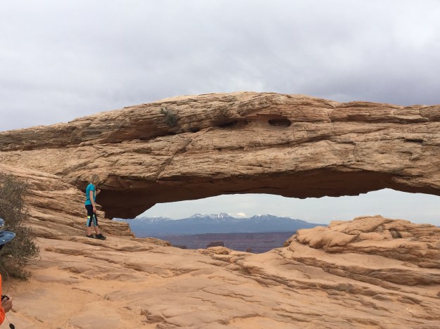
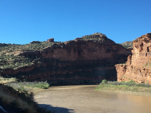
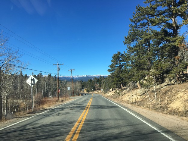
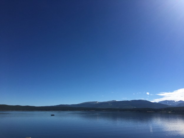
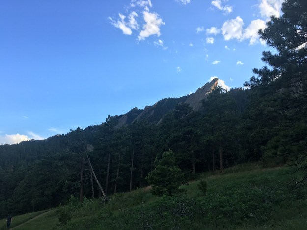
Mount Evans itself is a fairly high profile destination. Just over an hour’s drive from central Denver, it can be reached by driving up the highest paved road in North America. People also commonly hike or even cycle to the top of the 14,264 foot peak.

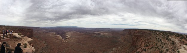
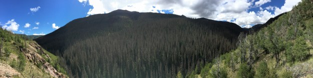
The Mount Evans Wilderness is a 116 square mile are surrounding the mountain, with rugged terrain, many other peaks, and numerous other trails to hike and backpack.

IMG_1114 (1).jpg

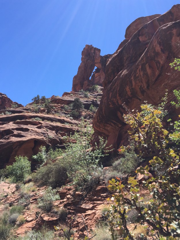
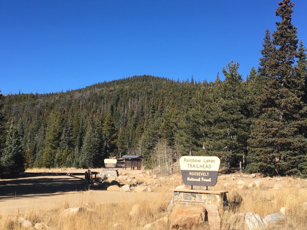
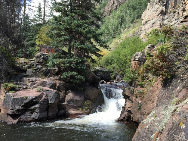
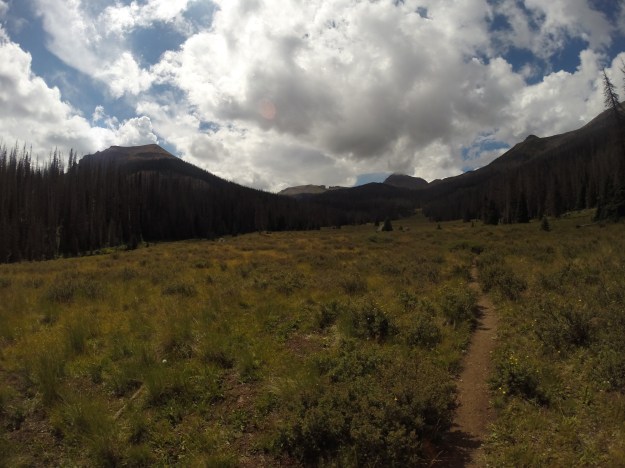
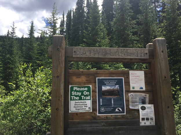
Hell’s Hole (I have no idea why they call it that) is a trail that stretches a little over 4 miles (estimate vary depending on source, a common issue for hikes in Colorado) just to the West of Mount Evans.

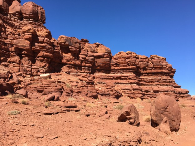
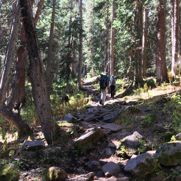
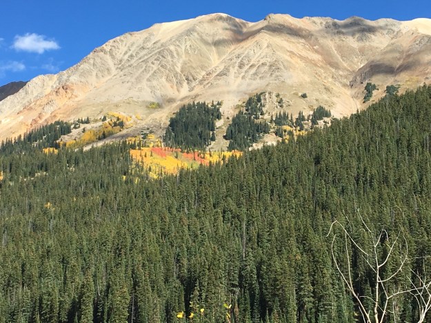
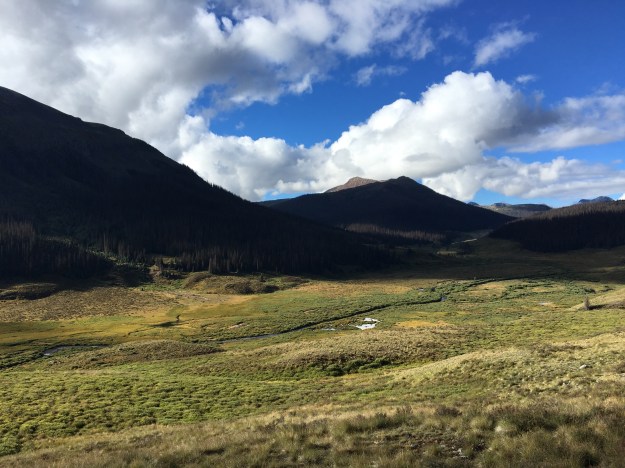
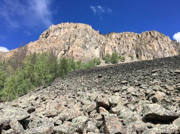
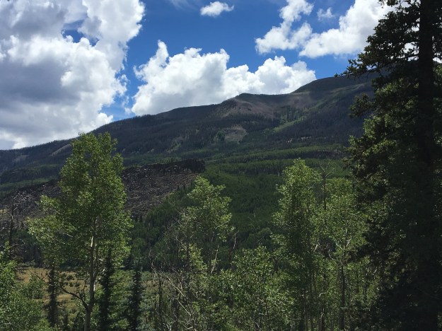
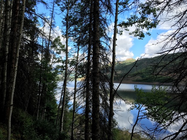
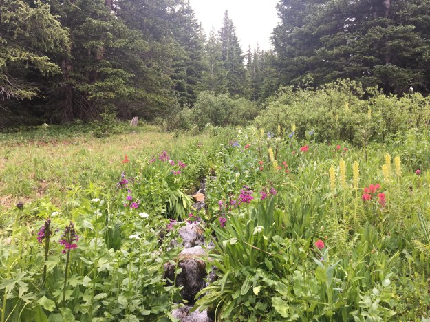
Starting at an elevation just over 9500 feet, the trail climbs a total of roughly 2000 feet, making it moderate in difficulty- overall. However, that difficulty is not spread evenly throughout the hike. Most of the climb occurs in the first two miles, as the trail ascends, first through a forest of mainly Aspen trees, then into a dense forest of Pines. Near the top, the trees begin to thin, and Mount Evans, the giant 14,000 foot peak periodically appears through the trees.

IMG_1107 (1).jpg

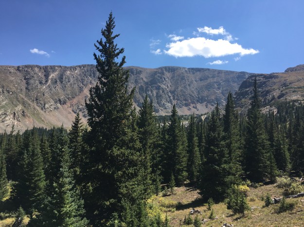
At a moderate pace, one should reach the end of the trail in roughly two hours, with the second half of the trek begin more gentle in slope. The gentler slop still manages to top out close to the “tree line”.

IMG_1111 (1).jpg

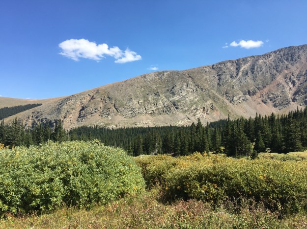
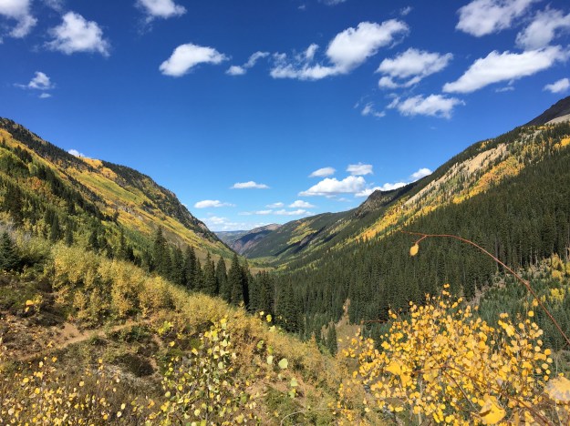
Although the final mile and a half of trail offers periodic glimpses at the mountains in all directions, it is only the last quarter of a mile of the trail that is truly wide open. To get the full experience, I would seriously recommend hiking the entire length of the trail, which totals roughly nine miles round trip.

For some reason, it took until the second half of the hike, the descent back to the trailhead to notice any signs that summer was indeed coming to an end. An unseasonably hot day, reminiscent of mid-July, temperatures in parts of the Denver metro area hit 100F, and even weather stations near 10,000 feet in elevation peaked out above 80F. The entirety of the hike felt no different than mid-summer.

IMG_1122

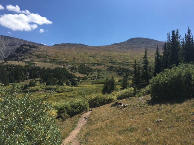
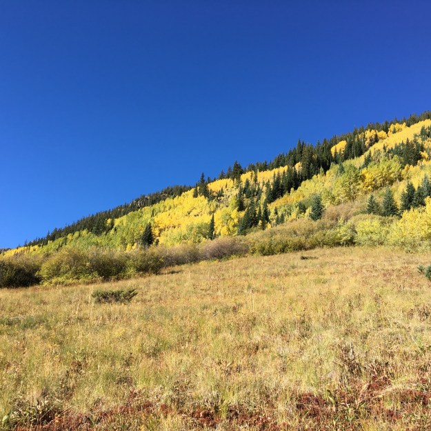
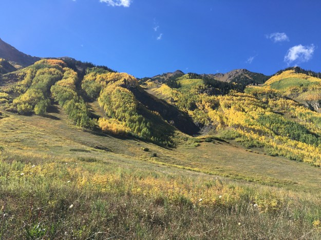
Yet, hints of fall appeared, and were suddenly noticeable when the ascent was complete. Shades of yellow began to appear in the shrubs that often dominate the landscape just above the treeline.

IMG_1125 (1)

Further down, gold colors even began to periodically appear in the Aspens closer to the trailhead.

IMG_1123 (1).jpg

People often think of Labor Day as summer’s farewell, summer making one last appearance before ending. Of course, the weather does not always line up that way, and it is quite possible that many more hot days are still yet to come.

Emotionally, and sociologically, a lot more can be controlled. Most children have already returned to school. Those still on summer break will be back in the classroom shortly. Anyone on summer schedules or summer dress codes will return to normal within a week. For those in the most traditional types of corporate structures, the next holiday may not be coming until Thanksgiving (late November).

On the descent, we spent some time discussing topics related to work, finding purpose in life, and other topics that were less about travel and adventure and more about life at “home”. It was almost as if the weather, the physical appearance of everything around me, as well as the general mood, was lining up to serve the purpose Labor Day serves in the 21st Century; a farewell to summer before a new season takes hold.

For many, this new season represents a return to some form of structure, but could also represent new opportunities to learn, achieve, and reach the next level. In life, we all need breaks, time to do that in which we enjoy. We also need time to work, and get things done and serve other human beings. While our current society may not have found the right balance, that does not mean we need to shun work altogether, and not embrace the season that is to come.

Get Lost in the Rockies

IMG_0386 (1)

“Dispersed Camping” is a concept that is often foreign to those living in large metropolitan areas. It is camping without a campground. There are no numbered spots. There are no amenities such as outlets, washrooms, and an office that sells water and wood. It’s just people plopping their tents down wherever they can. It is the purest, and most rugged form of camping.

Colorado has an almost limitless supply of places where people can literally just find a spot and set up camp.

National-Forests-Map-CO

Spots for dispersed camping are usually found in National Forests, which cover nearly half the state. Specific details about which spots allow dispersed camping can be hard to find online, as each section of the National Forest system maps out their area differently. However, every section of National Forest has a significant amount of area where one can just set up camp. Many of these spots even have fire pits already set up by previous campers!

IMG_0357 (1)

During periods of heightened fire danger, it is common to for counties to issue fire bans or fire restrictions to limit the risk of wildfires. With fire being a major component of the camping experience, the status of these fire restrictions should be considered when planning any summertime mountain adventure that involves camping.

CO_FireBans_20170714

Colorado map of county fire restrictions as of July 14, 2017

There is, perhaps, no better place to start a Rocky Mountain adventure than Leadville, Colorado, which sits at an elevation of just over 10,000 feet in the central part of Lake County, a county where there happened to not be a fire ban in mid-July 2017.

colorado_topo_Leadville

Spawned from the mid-19th Century Gold rush, and rich with old west history, the town, in the heart of the Rocky Mountains, is tucked away between mountains that rise several thousand feet higher in every direction.

This includes the Sawatch Range to the immidiate West and South, where Colorado’s two tallest peaks; Mount Elbert and Mount Massive, sit.

IMG_0364 (1)

Only five miles to the west of town is Turquoise Lake.

IMG_0361 (1)

Expansive, beautiful, and protected by steep hills and dense forests, the lake stretches west, into the Mount Massive Wilderness, where densely packed trees and rugged terrain create a feeling of seclusion and wonder.

IMG_0398 (1).jpg

Wandering through the wilderness, trees partially conceal the tall mountain peaks. Like a well made movie preview, they reveal some, but not all, of what lays ahead for anyone wandering through the woods, whether on trail or off.

IMG_0400 (1)

Around every curve, the wilderness reveals what had been hidden between the trees.

IMG_0397 (1)

Streams reveal the source of the water that drains into Turqouise Lake below.

IMG_0401 (1)

Flowers of all colors pop out, tickling multiple senses, making the experience more vivid, more full.

IMG_0391 (1)

After roughly 90 minutes of hiking on the Highline Trail, which starts only a few miles west of Turquoise Lake, the trail climbs above the forest.

IMG_0405 (1)

Just below 12,00 feet, the trees disappear. Mountain ranges, are once again seen in every direction. The ground is surprisingly green grass, making the scene reminiscent of The Sound of Music.

At these elevations, with an atmosphere roughly 30% less thick than it is at sea level, the sun commands somewhat of a decieving presence, particularly in the months of June and July.

IMG_0411 (1)

Less deterred by the atmosphere, direct sunlight at these elevations can create an almost tropical feeling of warmth at temperatures that barely top out above 60F (16C), temperatures where some at sea level, under cloudy skies, would still be wearing jackets.

IMG_0352 (1)

Wandering through the dense pine forests that make up the Mount Massive wilderness, especially as daytime gradually faded into evening, it is easy to imagine being truly lost in the Rocky Mountains.

IMG_0350 (1)

Away from day-to-day life, hustle, drama and the like, I could not help but worry about the future. As soon as I got to the west side of Turquoise Lake (away from town) all cell signals disappeared. How long will this be the case? Are they working on connecting the whole world with Wi-Fi? If so, where will people go, to escape? To not be tempted to check their work email? Or see what was posted on social media?

The way I see it, people give up the conveniences of modern life to go on trips like this one for three reasons:

  1. Despite the fact that there is more physical labor (setting up tents, cooking, etc.), it is less stressful. There are a ton of modern life concerns that disappear in the woods (social status, money, etc.).
  2. It feels much less structured. Sure, there are patterns, but there is no calendar with a list of meetings, tasks, things to do. There are no set eating hours and itineraries.
  3. It feels more human. This is quite possibly the most significant one of all. Work and the digital age has a somewhat robotic of feel to it. We are expected to perform. We are often asked to follow sets of procedures. Emotions are not supposed to be shown. There are even places where people are expected to refrain from laughing and too much “socializing”.

If we ever get to the point where there is no place on Earth without data, WiFi, or some kind of connection to our normal stresses and responsibilities, I sure hope we have found another way in which to periodically disconnect. Or, at the very least, that most people’s attitudes about things such as mental health days, and expectations regarding work availability and how we set our priorities in life, will have changed.


An After Work Hike to Royal Arch

IMG_0176 (1).jpg

June is a month with tons of opportunities, if for no other reason than the amount of daylight many places in the Northern Hemisphere receive. The long days and late sunsets make a lot of activities possible for people who work traditional hours. It is only in and around this time of year that those working “normal working hours” (I want to make clear that I in no way advocate traditional working hours), have enough daylight for hikes, as we’ll as many other outdoor activities, on weekdays after work.


Royal Arch is a fairly strenuous three and a half mile (round trip) hike that originates at Chautauqua Park in Boulder, Colorado. Located at the Southwest edge of town, these trails are very popular, and Chautauqua Park can be quite busy at certain times of year. Although a high number of people reach this trailhead by bike or on foot (this is Boulder after all), parking is quite limited. One should not expect to find a parking spot in the lot by the trailhead any time conditions are ideal for hiking. This includes both weekend days, as well as on weeknights like this one.

IMG_0134 (1)

For a unique experience, I arrived at the trailhead at roughly 6:45 P.M. This is later than I would recommend arriving for anyone that desires to hike this trail at a moderate pace and finish before it gets dark, even at this time of year.

At this time of the evening, shortly after starting the hike, the sun had already descended behind the mountains to the west. Alpenglow could still be seen, hitting the top of the long flat diagonal rocks that are often referred to as the “Flatirons”.

IMG_0138 (1)

Hiking mainly after 7 P.M. also put most of the hike in the shade, as the sun was already behind the mountain peaks to the west. This made the hike more comfortable, as the temperature was in the upper 80s, a normal level for this time of year, before the hike.

Most of the trail is fairly strenuous, with a consistent climb. This changes at Sentinel Pass, which is within about a half a mile of the end of the trail.

Many hikes are said to have “false summits”; places where the trail appears to be reaching a summit, which is usually the final destination of a hike. Sentinel Pass, in a way, is both a false summit and a real summit.

IMG_0156.jpg

It is actually a summit! However, it is not the end of the trail. The trail continues. There is a short but steep descent right after Sentinel Pass. The descent is followed by another steep uphill section, where, after another 15 minutes or so of hiking, Royal Arch is reached.

IMG_0158 (1)IMG_0170 (1)IMG_0178

It ended up taking me just under an hour to reach Royal Arch. For a hike of 1.7 miles with 1600’ of net vertical, and some areas that are quite strenuous, this is a relatively quick pace.

After resting and enjoying the view for a mere 10 minutes at the top, I was still barely able to make it back down to the trailhead before darkness fell upon the area.

IMG_0183 (1).jpg

This is why I would recommend for most people to either arrive earlier (which shouldn’t be an issue for most work schedules), or bring a headlamp. Even in the week following the summer solstice, with some of the latest sunsets of the year, there are limitations to what can be done after working a typical 9-to-5-ish day.

One of life’s major challenges is making the most of whatever opportunities come our way. June, and its lengthy days, represents an opportunity to simply get outside more and get more exposure to sunshine.

For a variety of reasons it appears that the modern digital, sedentary lifestyle is taking its toll on us. It feels as if every five to ten years, some new set of dietary recommendations come out. Either a new set of foods become the secret, magic ticket to a healthier life. Or, some different type of food suddenly becomes the new “boogeyman”, and is suddenly to blame for all these widespread health problems.

I am not a health expert. However, based on my observations and reasoning, it appears that many of our health problems are related to two things; many people being way too sedentary, and, primarily in the United States, some ridiculous portion sizes. There also appears to be some merit behind staying hydrated and getting enough sleep.

Our bodies were meant to move. It’s been shown that sitting for even a couple of hours at a time can actually lead to negative health impacts, including the supply of oxygen being cut off from our brains. The predominant form of employment in 2017 is still 7-10 hours per day sitting in front of a computer. This cannot possibly be good for our minds or our bodies.

There has also been countless articles published recently regarding the connection between happiness and exposure to sunshine. Not only were we not meant to spend well over half of our waking hours seated, we also were not meant to spend nearly as much time indoors.

In our current culture, it is really hard to avoid having to perform a lot of work that requires being seated in front of a computer. Heck, writing this, I am, in fact, seated in front of a computer. This does not mean we cannot seek out and take advantage of opportunities, whenever we can, to be outdoors, be in motion,  and/ or be social (separate topic), as much as we can.

IMG_0187 (1)

On the descent, I spent half the time talking to random people. The other half, I was lost in my own thoughts. I imagined myself in various scenarios, settings I could see myself in, places I would be, people I would talk to, etc. All the scenarios I imagined involved me encouraging others. I encouraged others to believe in themselves, to have confidence, to stand up to naysayers, and to make the most of their lives. Part of that involves taking part in activities that enrich our lives. So, I encourage everyone to take advantage of summer, particularly this first part of summer, and the opportunities it affords us by checking out places like Royal Arch for evening hikes.


Greyrock Mountain- An Ideal Hike for May

IMG_9765.jpg

For the majority of people who like to hike on weekends, or in their spare time, hiking anywhere in the American West in the month of May requires two additional considerations.

  1.  There is typically still a residual snowpack at higher elevations.  While this can vary quite a bit from year to year and even day to day, even on a warm, sunny day, those that don’t want to encounter slippery conditions or deep snow covering the trails should generally stick to lower elevations.  In Colorado, that generally means below 9500 feet in elevation.
  2. Although everyone’s body behaves differently, most people still respect the seasonality of the activities they take part in, hiking less frequently in winter than in summer.  Therefore, most people still need to, in some way, work up to the most challenging hikes they will take on later in the summer.

IMG_9733

Tucked away in the Poudre Canyon 15 miles West of Fort Collins, Colorado (which is an hour north of Denver), the Greyrock Trailhead starts at an elevation of roughly 5600 feet.

IMG_9734

The hike to the top of Greyrock Mountain, on the most direct path is 3.1 miles, with an elevation gain right around 2000 feet.  For those who spent their winters either sedentary or on unrelated activities, and maybe have done two or three hikes thus far in the spring, it is strenuous enough to help get the body back into summer mode.  And, topping out at 7600 feet, it remains well below the elevations where residual snowpack and large amounts of mud would still be present on a sunny day in May.

IMG_9731

Of course, many people are aware of these seasonal considerations.  Therefore, the area does get busier than usual, particularly if it is a nice day and/or on the weekend.

Still, there is plenty of quiet to be found on this appropriately named mountain, just not the level of solitude one would expect on, say, a remote backpacking trip.

On the 13th of May 2017, a dry day in which Fort Collins reached a high temperature of 85F (and was preceded by two dry days) nearly all of the trail was dry.  It was only in certain sections, close to streams, where mud would appear.  These sections got interesting, as groups of butterflies, both red and blue, would loop around the sky, periodically congregating in and around areas of standing water.

IMG_9745

The blue butterflies are actually extremely well camouflaged, only showing their color when the wings are flapped open.

IMG_9751

IMG_9755

A closer look at the muddy surface reveals dozens of these butterflies nearly completely blended into the muddy surface, something many hikers don’t even notice!

IMG_9761.jpg

Roughly 2/3 of the way up, the first real scenic overlook is reached.  This is the point just before the two trails merge back together, at an elevation of roughly 7000 feet.

The final 600 feet of ascent looks, well, far more daunting than a typical 600 foot climb.  And, well, it is.  After a short flat area, following the scenic overlook, the trail begins to climb up a series of rocky areas, often referred to as “scrambles” by hikers.

These parts require some strategizing, both on the way up and on the way down.

The final section of the trail is the one area where it is possible to get lost.

On top of rocks, the trail passes by several lakes, where the sound of frogs can be heard, and is marked only by periodic signs 2-3 feet tall and the occasional standard rock pile (referred to as a Cairn).

IMG_9783

The summit is also just kind of a series of rocks, that need to be climbed over to reach the best lookout point.  Being at the top of Greyrock Mountain is somewhat of an unique experience.  In some ways, it feels just like being on top of the world, as noting in the immediate vicinity is at a higher elevation.

IMG_9792.jpg

However, out on the horizon to the West and Southwest reveals mountains whose peaks dwarf this one by over 5,000 feet.

It feels like a metaphor for a certain life situation that nearly every human being will find themselves in at one point.  The mountain has been climbed, a goal has been achieved, and there is reason to celebrate… temporarily.  But, there is still a lot that must be done, and much higher aspirations.  It is finishing a degree and moving on to start a new job.  It is successfully navigating nine months of pregnancy now knowing that it is hard work to raise another human being.  It is knowing that one has achieved as much as is possible in a current endeavor, and that there is something more meaningful, a higher calling, awaiting that requires a pivot, a new strategy, and renewed effort.


Moab- An Active Destination

IMG_9301

Some trips are restful, while others are more active.  There are some destinations that lend themselves to more restful trips; cottages in the woods near quaint towns, tropical beaches, and resorts.  Moab, is a place where it is nearly impossible to imagine anything other than an active itinerary, with a variety of activities, and a lot of places to see.  Situated in East Central Utah, several hours from the nearest major city, this popular tourist destination is surrounded by too much natural beauty to picture anyone coming here and spending large amounts of time sitting in one place.

First of all, Moab is surrounded by two National Parks, Arches and Canyonlands.

Both National Parks are, as National Parks tend to be, filled with tons of natural beauty and unique places.  At both National Parks, while it is possible to see a lot of interesting natural features without straying too far from the road, the best features at both parks require hiking.

FullSizeRender (1)

Getting to the signature feature of Arches National Park, Delicate Arch, requires a 1.5 mile hike from the Delicate Arch Trailhead.  Interestingly enough, this trail starts near the historic Wolfe Ranch, and traverses by some other unique features including some Ute Indian Rock art.

It is also quite difficult to imagine making a trip to Arches National Park and not viewing some of the other arches (Yes, it’s Arches National Park, not Arch National Park).  There is a section of the park known as Devil’s Garden, with somewhat of a network of trails taking visitors to all kinds of other arches.

The most famous of these arches is Landscape Arch, a long and wide arch whose name provides a clear recommendation as to how to orient any photograph of this particular feature (for those familiar with landscape vs. portrait  ).

IMG_9345

To get to most of the remaining arches requires a bit of a steep climb, which starts pretty much right after Landscape Arch.

IMG_9346

The hiking in the entire Moab area, not just at Arches National Park, is considerably different from the typical hiking experience.  Much of the hiking I’ve experienced, is on trails covered in dirt, gravel, and sometimes small to medium sized rocks at places such as the top of Quandry Peak.  All around Moab, I found myself on surfaces such as this one, on top of solid rock, sometimes for nearly the entire duration of the trail.  Traversing these trails required me to use my upper body more, and even do a little bit of jumping, from one rock to another.

At the top of this Mesa, there are arches with multiple partitions, arches people can hike under, and even one arch with an opening that lends itself to laying inside it to soak up the sun, the surroundings, and the experience!

The entire loop, including all the side trips in the trail network, is a total of 7.2 miles.  So, if a visitor desires to see all of these features, as well as Delicate Arch, a total of 10.2 miles of hiking is required.

And some people decide to add even more activities to their day.  In a shaded off-shoot of the Devil’s Garden Trail, I witnessed a sizable group of people playing a game of Frisbee, using the walls of this tiny canyon to make trick shots.

IMG_9391

Since immersing oneself in the here and now, and contributing to the local culture of a place creates a more enriching travel experience, I decided to play my part.

First, I decided to bring my own arches into the park..

IMG_9332

Disclaimer: I did properly dispose of that cup

Then, when the opportunity presented itself, I decided it was time that we started making our own arches, contributing to the park’s plethora of natural beauty.

IMG_9374

IMG_9444

Canyonlands National Park is even bigger than Arches, broken up into three sections by the Colorado and Green rivers, whose confluence is right in the center of the park.  Without any bridges connecting over either river, and with the entrances to each section over an hour apart, it is all but impossible to visit more than one section in a day.

IMG_9461.jpg

The most common image of Canyonlands National Park is an almost Grand Canyon-like overlook into a deep river valley, sometimes with one of the two isolated mountain ranges in the background.  However, at the scenic overlooks in the parks’ Island In The Sky region, it is actually quite difficult to see the rivers themselves.  The canyons that make up Canyonlands National Park are quite expansive, with multiple tiers.  To see these canyons from the best vantage points requires a bit of hiking.  The hike to the Confluence Overlook (an overlook of the confluence between the Green and Colorado Rivers) is 10 miles round trip, something that could require the better part of a day!

Canyons are not the only interesting feature to Canyonlands National Park.  Being only roughly 20 miles away from Arches (as the crow flies), Canyonlands has some arches of its’ own.  The most interesting one is an arch called Mesa Arch, where one can see both the peaks of the nearby La Sal Mountain range, and actually another arch by looking through the arch at the right angle!

IMG_9471IMG_9468

And some features are random, like Upheaval Dome.

IMG_9427

Scientists still do not know whether or not this particular salt deposit is a remanat of a meteorite that would have theoretically collided with the earth roughly 20 million years ago.

The two National Parks are not even close to all that Moab has to offer, all of which is “active” in one way or another.  Dead Horse Point State Park, located between the two National Parks, is a place where one can hike to one of Moab’s most picturesque locations: Goose Neck.

IMG_9494

The entire region, regardless of what any spot is named, or whether it contains a state or federal distinction, is rich with abundant natural beauty, and places to hike, bike, jeep, climb, or even just explore.

Anyone driving into Moab from the East (from Colorado), would be well advised to take the additional time it takes to follow the windy State Highway 128 through Professor Valley, essentially following the Colorado River into town.

IMG_9209

We set up camp at a place called Hunter Canyon.

Twenty minutes from town, Hunter Canyon is a place where each part of the day, from sunrise to sunset, lights up a different rock formation.  It felt almost as if nature was putting on a show, with lighting, stage props, and characters coming on and off the stage for different scenes.

I also saw bike trails nearly everywhere I went.  Moab is known as a mecca for mountain biking, an activity we did not get around to (is is… really… impossible to do EVERYTHING in Moab without something like two weeks).  But, with trails like these, Moab is also a phenomenal place for road biking.

IMG_9401.jpg

And, everywhere I went red rock formations, each one distinct from the next, would pop up, in and out of view.

It was next to impossible not to imagine these rock formations as something else.  While driving around, I would often point out to the rest of the group what each individual rock formation looked like, or what I perceived it to look like.  Some, I said looked like specific animals, some looked like people, others, still, looked like various specific objects, such as hammers, cooking utensils, or even a turkey wishbone (by the way, the following image is an arch, residing in neither National Park, they really are everywhere)!

IMG_9237.jpg

And, what amazed me was how often others in my group would actually see the exact same thing when they look at a rock formation and say, yes, I also saw an octopus.  This means that either my imagination is quite accurate, or, I have managed to surround myself only with similar minded people.  Both are very much a possibility!

IMG_9241

But, the analogy I came to in my head most frequently, throughout the trip, is between the rock formations and the ruins of an ancient city.  Every time I saw a structure such as this one, I would imagine what is would be like if, for some unknown reason, there actually was a civilization here, many thousands of years ago.  And each one of these rock formation was actually the remnant of an ancient skyscraper, or even a larger building like Chicago’s Merchandise Mart, weathered down by thousands of years of natural erosion.  I imagined what this ancient city would have been like, in an Atlantis-like scene that would play through my mind.

Since Samantha Brown’s presentation at last month’s Travel and Adventure Show, I had been trying to live in the here and now, and experience the current culture of a place, as she had advised.

For me, this included another new activity (for me)- Jeeping!

IMG_9521

And, I got to experience some crazy roads and some crazy places.

But, as I find in many of my travels, there is no way to truly avoid thinking about the past, and imagining another setting.  A video at the Canyonlands Visitors Center explained the actual process in which these rocks came to be formed, which took place over the course of 200 million years, back to a time when much of Utah and Colorado were near sea level, with some sections underwater and others above.  In fact, that is part of the reason why there is so much small scale variance in the color of the rocks throughout this region.

Everywhere I went, everywhere I looked, there were echoes of the past, both real and imaginary, and both ancient and more recent.

IMG_9507.jpg

The experience of visiting Moab for a long weekend is as jam-packed as I have made this aritcle.  Around every corner, something new, something exciting, and something unique.  While there are some travel destinations, like Miami, one can make as active or as restful as they would desire, Moab is one destination that requires one to be active, at least in some way, to truly experience.  To come to Moab, and not wander, not explore, not do a little bit of hiking, biking, or jeeping, one would miss out on so much of what is around every corner in this region.


Hiking in the Front Range in Mid-April

IMG_9073

April can sometimes be a tough month.  It’s a hard month to plan too far ahead of time, as there is such a wide variety of weather conditions that one can experience in many parts of North America.  There have been instances, in April, where places like Nebraska have experienced both a tornado threat and snowfall within the same day!

This is especially true in Colorado.  Over the past five Aprils (2012-2016), Denver has received snowfall of an inch or more 11 times!  At higher elevations, April snowfall can be almost twice as frequent.  Yet, over the same five Aprils, Denver reached temperatures of 80F (26C) or above 6 times, and highs exceeded 70F (21C), on average, 9 days out of 30, or about 30% of the time.

A typical challenge in April is to find hikes at lower elevations as there is often still a significant snowpack higher up.  April 8th’s snowpack exceeded 40 inches at most places above 8000′ in elevation, despite the period of warmer weather April 5-7.

CO_Snowpack_20170408

Looking primarily at start and end elevation, and for a place I have yet to hike, I selected Deer Creek Canyon, a place, oddly enough I can ride my bicycle to in just under 90 minutes.

IMG_9087.jpg

And, much to my surprise the trailhead is actually located at Colorado’s Center of Population (according to the 2000 census).

IMG_9065 (1)

The quickest route from the trailhead to the top of Mount Plymouth is roughly 2.4 miles.  With an elevation gain of about 1200 feet, this particular hike would definitely fall into the “moderate” category for difficulty.

The other surprise was encountering not just a random structure, but an entire subdivision, roughly half a mile into the hike (taking the shortest route).

IMG_9067IMG_9066

The people who live here seem to have the life!  The houses are quite large, they have a spectacular view of some pretty interesting looking red rocks and rolling hills, and easy access to hiking trails.  Oh, and they live pretty much at Colorado’s center of population.  For a while, we discussed what it would be like to live in a place like this, and whether or not we would enjoy it.  Being fairly close to Denver, I bet these homes are quite expensive.  Yet, moving to a place like this would still entail giving up some urban conveniences.


I had hoped to avoid snowpack and mud, and for the most part we did.  Starting the hike at about 9:45 A.M., at least 2/3 of the hike was in the sun, and those parts of the trail were dry.  Toward the top, some ares with a little bit of mud, and even a bit of slush could be found in shaded areas.  Parts of the area had received close to a foot of snow several days prior, which, despite warmth thereafter, had not completely melted in areas above roughly 6800′ that are shaded from the sun most of the day.

Whether it be on the way up to the top of Plymouth Mountain, or on the return trip to the trailhead, I would certainly recommend following the remaining part of the loop on the Plymouth Trail.

IMG_9078IMG_9096

It was in this section of the loop where we found the best views of Denver’s skyline, and found some more interesting rocks to climb on.

We also veered off the main Plymouth Trail to follow The Meadowlark trail for the final 1.5 miles down to the trailhead.  This trail traverses through forests of short trees with minimal foliage.  I have encountered these trees before, always at roughly this elevation near the foothills of the Rocky Mountains.  It is a unique experience, to be surrounded by trees in all directions, but to still be nearly completely exposed to the sun.  I wonder what conditions make these particular trees grow here.

IMG_9082

And, rather than going by the subdivision again, this trail cuts a bit farther north.  In several places, the trail overlooks the canyon that was carved out by Deer Creek.  I have previously ridden this road on a bicycle.  From the vantage point of the road, it’s hard to to truly appreciate the extent to which the rugged terrain had been carved out by a relatively small creek.

IMG_9084


After a period of inactivity, it felt really good just to be outdoors and active, feeling the sun for hours on end, and smelling the rocks, trees, and dirt.  As a culture, we likely spend way too much time indoors and sedentary.  Something about it just feels a bit unnatural to me- always has.  The entire duration of the hike, I just felt grateful for Colorado, the opportunities and access to so many amazing places like this.

I often tell people who are looking to visit Colorado not to come in April, as well other parts of the year are more exciting.  But, one thing I realized is that, this particular hike, mostly in the sun, with a maximum elevation of 7274′, would likely be very hot in the middle of the summer.  I can only imagine what it would be like with temperatures exceeding 90F (32C).

Many of us reserve the summer months, particularly June through September, for activities that require more travel, more planning, and more certainty.  In April, it is less worthwhile to plan more major activities, as conditions are so variable.  Thus, April is the ideal time for activities that are closer to home and more moderate in nature.  It is a time to embrace some amount of uncertainty, and think on the fly.

In pervious years, I became frustrated with Colorado in April, contemplating leaving for this period of time that is uncertain and commonly fails to deliver.  But, with uncertainty comes the excitement of the unknown, and the possibilities for new opportunities.  In life, we need a balance, between the planned and the unplanned, between familiar and the unfamiliar, and between the distant and the local.  April, and the changing of the seasons in general, ensures that we continue to calibrate this balance.

Pure Instinct

Day-to-day life over the past month or so had left me kind of burnt out.  I was inexplicably feeling exhausted.  I was not at my best- which I truly hate.  I’d realized weeks ago I would eventually need a day to disconnect.  We all need that every once in a while.  I figured out that I would not want to hear everybody’s recap of the election (regardless of the result), and Wednesday’s weather was forecasted to be unseasonably warm.

IMG_7976.jpg

So, I took Wednesday off, got in my car and just started to drive.  I had no plan, no idea as to where I would be headed when I left.  I purposely refrained from making a plan.  I didn’t look into options, or pre-meditate in any sort of way.  I wanted to try something different than what we all typically do when we travel.  I wanted to lean simply on my instinct, and just let it determine where I should go as I go.  Everywhere I went, every decision I made regarding when and where to turn, I made on the fly, just based on what felt right.

I went west out of Denver, following highway 6 through Golden, than 93 north, and 72 west towards Nederland.  I continuously resisted the urge to pull out my map book, or my phone, or turn to any other source of information to achieve a welcome break from one of the things that may be exhausting all of us in the mid-2010s.  This is the process of gathering information.  In this era, often gather way too much of it, agonizing over it, to the point where we delay actually making the decision, sometimes far too long!

Along the way, I experienced this strange hyper-emotional calm.  I began to tear up.  I was breathing heavy.  But, it felt really good.  It felt as if for the past couple of months, emotions were one by one filling up inside my head, bouncing around like molecules until they gradually started to reach a critical mass, where there was no longer room for them to move around.  They had just become jammed .  And, now, with whatever barrier that was keeping them inside removed, I was suddenly free to just let them out, and let them all out at once.

IMG_7983.jpg

As I continued along this windy path, this strange hyper-emotional calm became accompanied by a feeling of optimism.  I felt like I knew I was in the right place, doing the right things, and making progress toward where I wanted to be.  I’d freed myself from all the data, all the second guessing that gradually erodes away at our confidence.  I knew that, both that day, and in life, I was moving in the right direction even when I didn’t see the destination.

For a while, I had no idea as to why I was experiencing burnout.  The term typically conjures up images of someone working long hours into the night, neglecting their friends, their families, and other areas of their lives.  Burnout is people working 70+ hour  weeks, which I most certainly had not been for the duration of 2016.  So, why was I burned out?  Why did I feel drained so often?

Having searched for answers regarding this, through reading, conversation, and observing people, I came to a series of important realizations about burnout, which run contrary to the image of long nights with pots of coffee.

It’s not the amount of work that burns us out.

Workload can contribute, but more important is how we feel while we are doing our work.

The primary source of burnout is feeling as if we are being phony, or fake.

Pretending to be someone else, for whatever reason we do it, is exhausting.  It is not sustainable.  The only way to be is our true selves.  That is what our instincts tell us to do.

Negative energy in all forms leads to burnout.

One of the nastiest forms is fear, trying to prevent some sort of bad outcome such as loss of job or status.  When we act out of fear, or anger, hate, etc., everything we do is significantly more draining.

One of the most exhausting things we do is try to prove ourselves.

I’ve seen plenty of instances where someone is working long hours, but is not burned out because they are doing what they love and they feel confident while doing it.

img_7989

My instinct even took me down a random dirt road, something I otherwise never would have done if it were not my previously specified destination.

img_7990

I ended up at a place called Rainbow Lakes, part of the Indian Peak Wilderness.

img_7996

I hiked roughly 2.5 miles, getting to the treeline, which was surprisingly nearly snow free!  This is definitely not encouraging for fans of winter sports.

img_7997

As, well, as can often be the case in our lives as a whole, the change of season that winter sports fans are waiting for is simply not happening yet.  This hike, on Wednesday Nov. 9th, felt shockingly similar to the way it would have felt in the middle of the summer.

img_7998

Just over the ridge, I got myself to a place that was extremely inspiring.  Unfortunately, I did not get a photo, as, well, my phone died.  It was a sign that what I needed to do was disconnect, and, once again, connect to my own thoughts.  Just for good measure, though, here’s a pic I found of the exact place where I sat.

rainbowlakes_20161109

I actually stared at that one little gap in the rock straight ahead.

Our subconscious thoughts do take into account recent information, even as our conscious minds look for more info and don’t know what to make of it.  My subconscious mind, my instinct, though, processed all of this; the election, interactions with people, my own feelings, and summed it up neatly in one sentence, a sentence that simply popped into my head…

The age of deference is over

Make what you want of that.

I also came to another revelation regarding a matter that is more specific to my life.  I had been thinking a lot about the concept of acceptance.  It is why we are always trying to prove ourselves, and often exhausting ourselves.  Afternoon exhaustion, dissatisfaction, lack of inspiration, all of these concepts are inter-related.

We want to be accepted, and can only be accepted as who we are.

But, for each person individually, myself included…

If we want to be accepted as who we genuinely are, we must do so for others as well.

We’re all looking for acceptance, but if we make it easier on each other, as well as ourselves, we might all have a bit more energy leftover for other things.

The previous night’s election, regardless of how any of us feel about it, is yet another example where sometimes more information, more data, is not better.  The best models, based on every piece of data available, made predictions that were quite flawed.  My instinct, many months back, came to a more accurate conclusion about what was to occur.

In an era where we have access to unlimited information, and are often bombarded by it, sometimes we need to realize that less is more.  I, for sure, will, going forth, make a better effort to rely less on data and more on instinct.  After all, it brought me to Rainbow Lakes, without even so much as looking at my atlas, or my Google Maps App.


The Longest Day Hike of My Life

DCIM160GOPRO

Conundrum Hot Springs

The hike from the Conundrum Trailhead to Conundrum Hot Springs is roughly 8.5 miles.  Round trip is at least 17 miles of hiking.  I say AT LEAST as I have been on plenty of hikes where side excursions, both planned and unplanned, lead to covering a total distance that exceeded the official distance of the hike.

Due to the distance, and the destination, nearly all the people we encountered on this hike were backpacking.  This is an attractive option, as the trail is pretty long but not terribly challenging, and the hot springs are the kind of destination one would want to spend a significant amount of time at.  However, Conundrum Hot Springs is a popular destination, and there are limited camping sites in the immediate vicinity of the springs.

Conundrum Hot Spring is close to Aspen, which is three and a half hours from Denver.  Some of the people in our group, myself included, were not able to leave early enough on Friday for us to be confident that we could secure a camping spot.  We ended up deciding to find a campground somewhat close to the trailhead, and hike to and from the springs as a day hike.  As an added bonus, we would not have to bring, or carry nearly as much equipment, as we would be “car camping”.  The hike would be both easier and harder.  We would not be carrying nearly as much weight, but we would be cramming 17 miles of hiking into one day.

Up in the mountains of Central Colorado, trees change color earlier in the Fall than they do in many other parts of the Country.  In general, the second half of September, and maybe the first few days of October, is the best time to see the Aspen trees here change colors.  I was partially surprised by how vibrant the colors were, by September 16th.  For the first two hours or so of the drive, before sunset, we saw a preview of the kind of colors we’d be seeing during the hike, certainly early season, but vibrantly colorful, with sections of bright yellows and oranges periodically appearing in front of us.

To be sure we would have enough time, we had to wake up, eat breakfast and leave the campground at Lincoln Creek (dispersed camping roughly 40 minutes from the trailhead) all before sunrise.  We arrived at the trailhead and started hiking at roughly 15 minutes after 7 A.M.

The morning chill was both an obstacle and a boost.  Overnight temperatures dropped to roughly 30F (-1C) at the campground.  For the first 90 minutes of the hike, the ground was covered in frost.  In fact, the frost even made our first river crossing a bit slippery.

This morning cold made me cary several layers, adding a little bit to the weight of my backpack (although it was still way, way, lighter than it would have been had we been backpacking).  However, the cold weather motivated us to begin our hike at a rapid pace.

We would cover over four miles before we even reached the sun!

IMG_7577.jpg

I would describe at least the first five miles of the hike as “easy” from the standpoint of evolution gain.

img_7579img_7580img_7581

Many sections of the trail are actually close to perfectly flat, giving me plenty of time to take in the natural beauty that is around me, and also connect with my friends who I was hiking with.  When hiking, it is challenging to have a conversation when hiking up steep terrain, but fairly easy to do so in largely flat sections.

IMG_7582.jpg

The appearance of small lakes precludes the transition to the more challenging part of the trail.

This occurs somewhere around six and a half miles into the hike.  First of all, there are sections that are more technically challenging, including a couple of tricky creek crossings, and a section where one must scramble over rocks.

IMG_7589.jpg

There last two miles of the trail also includes some fairly steep sections.  I wouldn’t say they are overly challenging, but in the context of a 17 mile day that included hiking at a rapid pace towards the beginning, they ended up being fairly exhausting.

We ended up spending roughly two hours at the hot springs (including changing and eating lunch).  There were a lot of people in the hot springs, but it was not as crowded as some of us had feared.

img_7601img_7603

For a variety of reasons, the fall colors appeared even more magnificent on the way back down!  The most significant reason had to be the manner in which the trees appeared in the mid-afternoon sun.

img_7604

I was also pleasantly surprised to see a significant amount of deep orange shades.  In prior experience with fall in the Rockies, I had almost exclusively seen the yellow shade that seems to be the most common fall color for Aspen trees.  While “autumn gold” is pretty, I had, in some ways, missed wide variety of shades that leaves on maple trees take on during fall.

img_7606

I would definitely describe the color we enountered as “early season”.  There were still many Aspen trees primarily shaded green, particularly at lower elevations.  This indicates that the next two weekends could be just, or perhaps even more, colorful!  The colorful trees, the yellows and the oranges, tended to be those higher up.  The several patches of deep shaded orange I saw were nearly exclusively up closer to the tree line.

Conudnrum_FallCOlors_Sept2016.JPG

Both the hike up to the hot springs and the return trip took roughly four hours.

IMG_7607.jpg

We got back to the trailhead sometime just after 5 P.M., and, after the 40 minute drive back to Lincoln Creek, I finally got to see what the campground looked like.  And I got to do something I had not previously done.  I got to park my car with the rear left tire on top of a rock, showing off just how rugged my vehicle is.  Well, at least in an auto show pamphlet sort of way.

Capping off an exhausting day was a side excursion, to a waterfall, well, multiple waterfalls, that those of us in our group lucky enough to be able to leave early Friday had located roughly a quarter of a mile from the campground.  In fact, they hyped this place up over the course of the hike.  So, we had to go.  Additionally, this side excursion was enough for me to achieve something meaningless, but also something I am likely never again to achieve.  I recorded 50,000 steps on that step counter thing that comes with every iPhone6.  Yay me!

We would explore this likely unnamed waterfall area again Sunday morning before departing for Denver.

img_7631img_7636img_7641img_7642

If you count all the places where water squirts out of random places in the rock, there are probably close to a dozen “waterfalls” in this area.  What a great unexpected treat!

The return trip on Sunday was eventful as well, with some great stops at Independence Pass and Twin Lakes, both places I had driven by on Friday, but after the sun had already set.

img_7656img_7660

I titled this blog “The Longest Day Hike of My Life”, as, well, I can not picture a day where I hike more than 17 miles on a day trip.  However, I probably would have never imagined hiking 17 miles in one day a few years back, so there is no way to definitively say never.  I am prepared, though, for this to be my longest hike, and understand the significance of it. Like many of the adventures I had over the course of this summer, and in previous years, it was both exhausting and amazing.  But, most worthwhile experiences, from relationships to starting successful businesses and such, are.  Being exhausted after this experience should be a reminder to all of us that what is easiest is often the least rewarding, and that which is most challenging often comes with the greatest reward.


Backpacking in the Weminuche Wilderness: Day 3

IMG_7252

The Weminuche Wildreness appeared to be particularly devastated by the recent Mountain Pine Beetle epidemic.  While a portion of the second day was spent above the tree line and in storms for much of the journey, we wound our way in and out of the forest, alternating between hiking through the forest itself, and hiking across an open meadow where we could gaze upon the forest to both our left and our right.

IMG_7229

Throughout the State of Colorado, and throughout the West, I observe areas where the Pine Beetles have decimated the forest, changing the ecosystem forever.  Nowhere, though, have I seen a higher concentration of dead trees.  I would estimate that, over the course of the trip, some 70-75% of all the pine trees I saw, were, in fact, dead.

IMG_7228

But I did notice some signs of life, particularly at the campground Sunday (Day 3) morning.  Tucked away amongst the densely pack forests of decimated trees, little signs of life seemed to appear.  It reminded me of many American cities, circa 1982, decay being the overarching theme but, signs of life and pockets of hope beginning to appear here and there for those willing to observe.  Maybe indeed, the worst has now passed for this particular forest.  As was the case for many of our cities, it is possible that in a decade or so, we will revisit areas like this, and see once again a thriving forest, albeit, as was the case with our cities, with a different character?

IMG_7246.jpg

As is typically the case on a three day excursion like this one, the last day was primarily a descent.  As we descended, we quickly reached elevations where Aspens, rather than Pine trees made up a significant proportion of the forest.

IMG_7267IMG_7268

Maybe it is different at this latitude, farther South than the Denver area, where I live and spend most of my time.  But, it feels as if in this wilderness, Aspen trees are able to grow at some pretty high elevations.

IMG_7302

We figured out the tree line here to be somewhere close to 12,000 feet in elevation.  When looking upon sections of forest from afar like this, it is easy to picture some of these Aspen trees living at elevations close to 11,00 feet.  Over the course of my four years in the Denver area, I had grown accustomed to them disappearing between 9,000 and 10,000 feet.

Sunday’s hike was a 7.3 mile trek along the Ute Creek trail (the East Ute Creek trail we had followed the previous day merged with the main Ute Creek trail).  The trail alternated a bit, climbing up and out of the valley formed by the creek for some sections, and descending back toward the creek for others.  Due to the previous night’s onslaught of rain, which likely impacted the entire valley, the trails on this, the final day, were at times even muddier than the were the prior two days.  At the end of three days, our total distance came out around 25 miles.  I speculated as to whether the extra distance we traveled stepping around puddles, and veering left and right to avoid some of the muddiest sections of trail, over the course of three days made this a mile or so longer than it would have been had the trails been completely dry.

IMG_7287

I personally added some distance on top of that.  I love side excursions, whether hiking/backpacking, cycling, or on a road trip.  And, in addition to the side excursion to the feature known as “the window” the previous day, I took one completely on my own the final day.  Roughly halfway through the hike, I saw a place where I could cut down to the creek, and see a mini-waterfall.

IMG_7291

The final part of the day consisted of a small climb out of the Ute Creek valley, followed by a descent back towards the Rio Grande Reserviour.

IMG_7299

It is inevitable that, on the last day of any trip, we all begin to ponder our return home, and a return to our “normal lives”, whatever they may be.  This return, though, is somewhat unique, as a trip into the woods is not just a journey away from our jobs, or certain responsibilities, it feels more like a complete separation from the modern world, or as some people refer to it, the “real world”.  All of us were separated, not just from work, but from TV, from the news, from Twitter, and even the manner in which society is structured in the 21st Century.

Since my return to Denver was a return to, after being completely separated from, the “real world”, I started to contemplate the “real world” as one big entity, which, even for a big-picture abstract curious minded thinker like me, turned out to be strange.  I feel like we often compartmentalize the “real world” into buckets; the working world, the relationship world, the school world, etc.  We will write blogs, have conversations, confide in others about our hardships, or celebrate our successes, with respect to one specific bucket of the “real world” at a time.  Some people will even chose to accept or rebel against the modern world on a bucket-by-bucket basis.  “I’m a freelancer, happily married with two kids and a picket fences house.”  “I work 9-to-5 for a large corporation, but I only eat organically certified food.”

I’m not saying there is anything wrong with any of the partially-rebellious lifestyles I am describing here.  We often try to oversimplify the actions and lifestyles of others as being either “conformist” or “rebellious”.  When I thought about life in the woods, and the few people that actually do it, live off the grid, and off the land, I think of those people as “rebellious”.  But, then I thought of human beings as part of the animal kingdom, and thought about what all non-domesticated animals do.  They live in the woods.  They hunt their food, many wandering around nomadically.  When thought of in that manner, it is us human beings, and our domesticated cats and dogs, that are rebelling against the way the rest of the animal kingdom works by farming our food and setting up permanent shelters.

IMG_7304

At the conclusion of our journey, we had to actually wade across the Rio Grand River to get to the car, as the trail ended abruptly at the river.  This likely explained why we did not see any other people the entire time we were on the East Ute Creek and Ute Creek trails yesterday and today.

IMG_7309IMG_7310

Shortly after leaving the trailhead, I saw what looked like baby mule deer living along the steepest part of the hill.

IMG_7323.jpg

Like the journey to the Wilderness, the journey home took us by some of Colorado’s highest peaks and most stunning mountainous features.  I thought of the “real world” I was gradually re-entering, the life I live and the journey I just took.  It is not important whether we are “conforming” or “rebelling”, because, like life in the woods, it can be thought of as conformist or rebellious depending on perspective.

Those of us that are honest with ourselves, and with those around us, will undoubtedly find ourselves in both situations.  We’ll find ourselves in a place where our choices are the same as those around us, and be suseptable to being labelled “conformists”.  We’ll also, at some point, find ourselves in a place where our choices are not those of the majority, and be met with skepticism, hostility, and possibly even pressure to change.  What matters most, is not fitting into an image we may have of ourselves, whether it be the upstanding citizen, rebel, outcast, or whatever, it is that we have the courage to be all things, depending on our setting, in order to be true to ourselves.

Backpacking in the Weminuche Wilderness: Day 1

G0141034.JPG

During the month of August I had fallen back into some bad habits.  In particular, I’d fallen into the very habit I often criticize my own generation for: scrolling.  I know the costs outweigh the benefits.  By gazing at the predictable content of our news feeds and customized social media echo chambers on our phones, we miss out on countless opportunities out there in the real world, all to avoid the discomfort of boredom, or a potentially awkward interaction with another human being.

It’s not just about scrolling.  Scrolling is what we all see.  It’s the same routine day in and day out.  It’s going to the same bars and restaurants over and over.  It’s watching movies and TV shows we have already seen multiple times instead of calling people up and organizing a social gathering.  It is all the things that we do because the alternative requires a greater amount of effort.  It’s low risk, low effort, and low reward.  Unfortunately, for me, it lacks stimulation, it lacks enthusiasm, and over time can even lead to depression.

I haven’t thought of a better word for it than “defaulting”.  I often feel as if there is some sort of invisible force always dragging us toward this kind of life, this “defaulting”.  There seems to be a constant struggle, to mix things up, to avoid the mundane, to avoid losing contact with people.  And, while I think my personal record is pretty good (i.e. all the things I write about in this blog), there are times when I get tired of the struggle, and times when I do feel as if this invisible force is indeed advancing on me.  At these times, it is good to have some sort of activity, or some sort of trip that helps us hit the “reset” button.

IMG_7091.jpg

For this purpose, there truly is nothing like going into the woods, away from it all, out of cell service, completely out of my comfort zone, and in a place where “defaulting” is not only no longer easier, but not an option at all!

Our three day backpacking trip began at ThirtyMile Campground, just a mile or so east of the Rio Grande Reservoir.

After passing by a weather station, that is near and dear to me, as it is one of the stations that helped me calibrate the mean impact cold air funneling, in valleys throughout Colorado, has on nighttime lows, we encountered the Rio Grande Reservoir within the first mile of our trip.

IMG_7098.jpg

Going into this trip, which had been planned for several weeks ahead of time, we knew there would be muddy trails, and a heightened chance of rain.  Not only is Southwestern Colorado the most active part of the state during the late summer monsoon season, but this past weekend featured an active pattern in the region.

Friday was supposed to be the most active day, with regards to chances for precipitation.  Yet, we lucked out.  Leaving at 10 AM, after enjoying a nice relaxing morning at the campground, we hiked 7.5 miles, up the Weminuche Trail, dealing with very little rain, only with muddy trails.  Mindful of the storm threat, we stopped shortly after 3:00 P.M., having found a good spot to set up camp, near a stream and some trees.  Despite the periodically ominous looking skies, the storms held off until after sundown, giving us plenty of time to set up camp, cook a nice meal, and take in the wilderness, now being officially away from civilization.

I felt exhausted at the end of the day, as I had not gotten a good night sleep the prior evening at the campground.  So, I ended up going to sleep shortly after sundown.  With two backpacking trips behind me, I am starting to think that sleeping even more than the normal 7.5 hours per night is pretty normal on trips like this.

I spent the last waking hour of the evening inside the tent, listening to the sound of gentile rain tapping on the fly.  Under normal circumstances, many of us drown out these sounds, with TV, music, or some other sound.   Hearing this sound, for nearly an hour before falling asleep made me imagine a completely different life.

I imagined myself, as I often do, as a completely different person, with a completely different personality, upbringing, circumstance, and desires.  I imagined myself living in the woods, in a cabin of sorts, not too unlike the kind many people in Michigan, Minnesota, or Wisconsin have today.  It would be a modest sized cabin, with one main room, a bunch of bedrooms, a kitchen, and a closet, to keep things like cross-country skis, wet suits, and all of the other necessary equipment.  But, I would not have too many high tech or expensive toys.  It would be a life in a small community of sorts, where people know one another, spend a lot of time over at each other’s houses for dinner and games.  It would be a life way closer to, and way more connected with nature.  It would be a life that would never satisfy the real me, as restless as I get for one adventure after the next, one major social interaction after another, and testing limits.  But, for this alternate person I imagine myself being, as I drift off to sleep on a rainy August evening high in the San Juan Mountains of Southwest Colorado, it is perfect, cozy, and quaint.