Category Archives: geography

North Dakota’s Role in the History of the West

IMG_4296

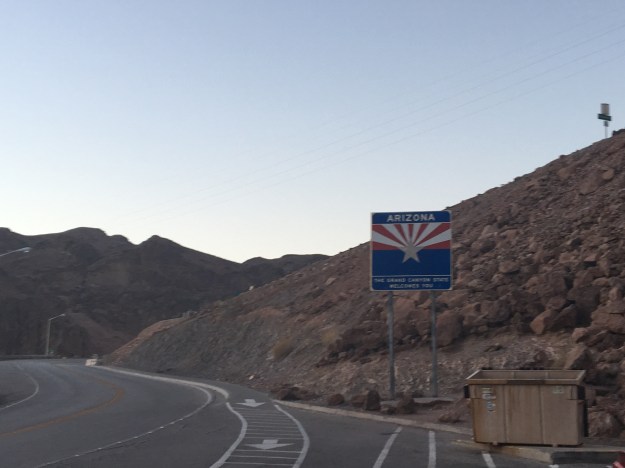
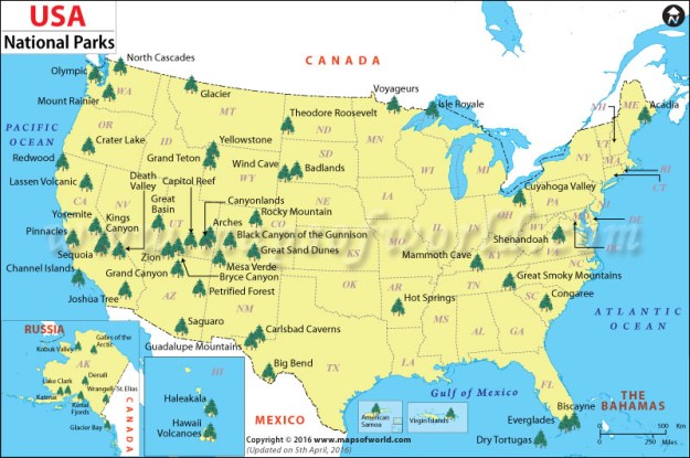
In my childhood, I never knew what to think of North Dakota. Like most people living in metropolitan areas, I never gave the place much thought. I do recall hearing, at some point in the late 1990s, that North Dakota was the least visited state in the country. However, a more recently published list indicates that the state sees far more visitors now due to the recent oil boom. Apparently, Alaska, the hardest state to get to, is now the least visited state in the country, which makes sense.

My ideas about North Dakota were just kind of hazy. I’d wonder if the culture was just like that South Dakota and Nebraska. Or, if the proximity to Minnesota or Canada made it kind of different.

IMG_4316.jpg

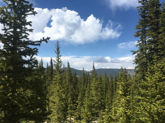
A drive across North Dakota along Interstate 94 will confirm what most people think. It is a Great Plains State with a Great Plains feel. If anything, there are even less trees and fewer towns than the rest of the Great Plains.

However, there are some surprising encounters, with both natural beauty and history to be found, without going more than a mile off the Interstate.

IMG_4305

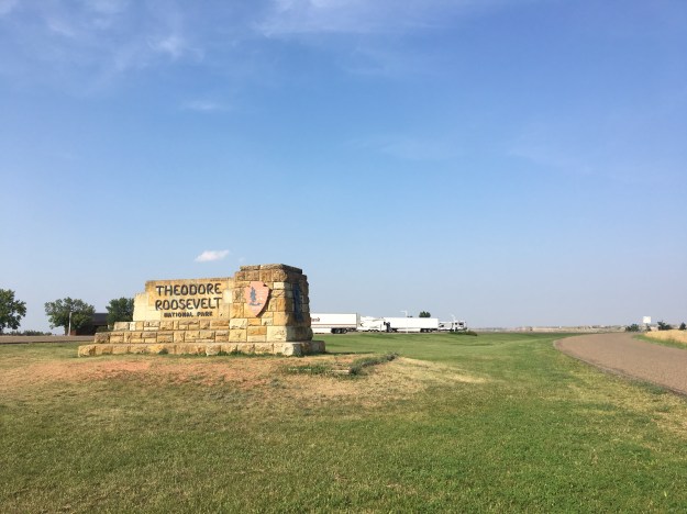
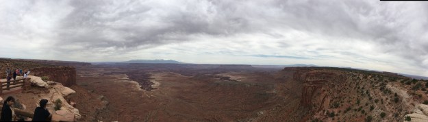
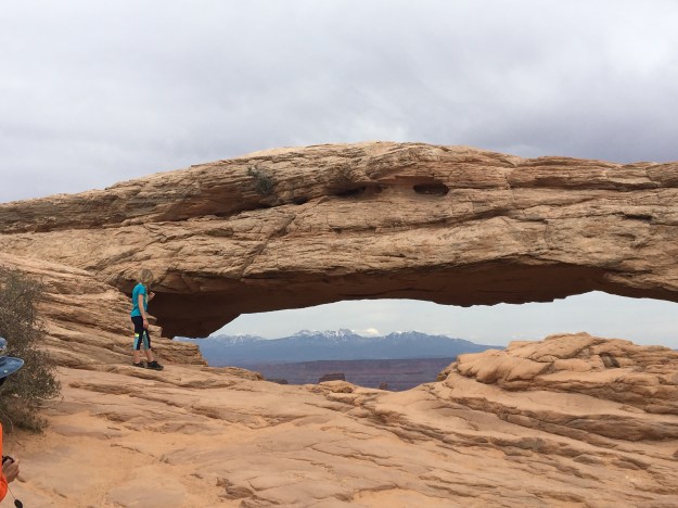
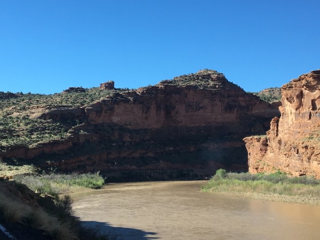
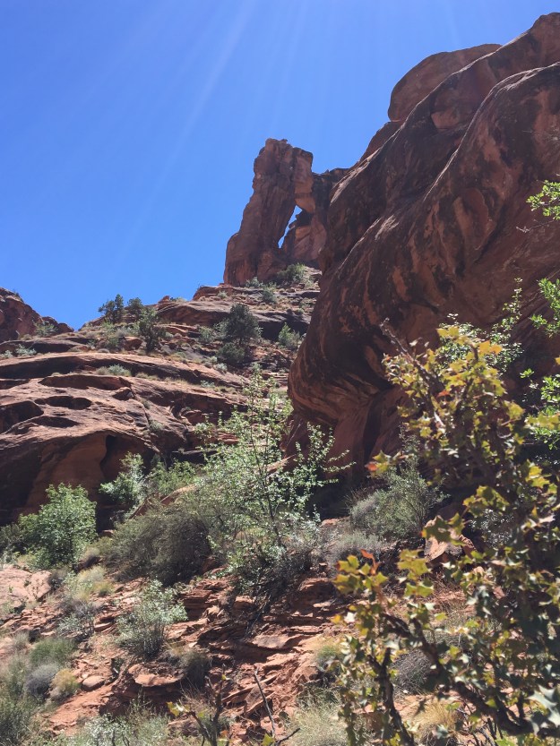
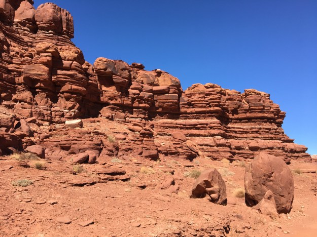
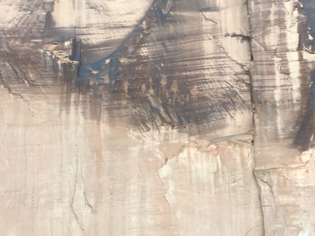
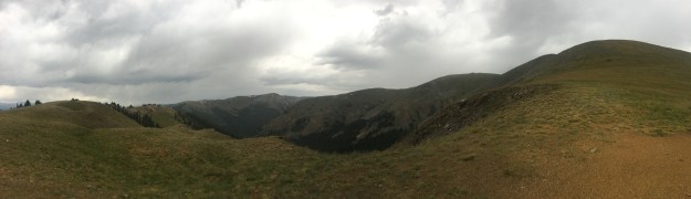
One of the most amazing parts of Theodore Roosevelt National Park, the Painted Canyon,  can be viewed just by going to a rest stop right off the highway.

IMG_4309

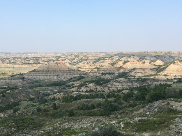
This is pretty amazing, considering that adjacent to the park in all directions is nothing but endless wide open prairie.

Theodore Roosevelt National Park’s significance to the history of the west is, as expected, related to the president the park was named after. Theodore Roosevelt first encountered this land on a train trip to Montana. He fell in love with the wide open spaces, colorful valley, and quiet seclusion the area offered. He would later buy a ranch here, and it is said that experiences like these influenced the conservationist policies he would pursue as president, including a major expansion of the National Park System.

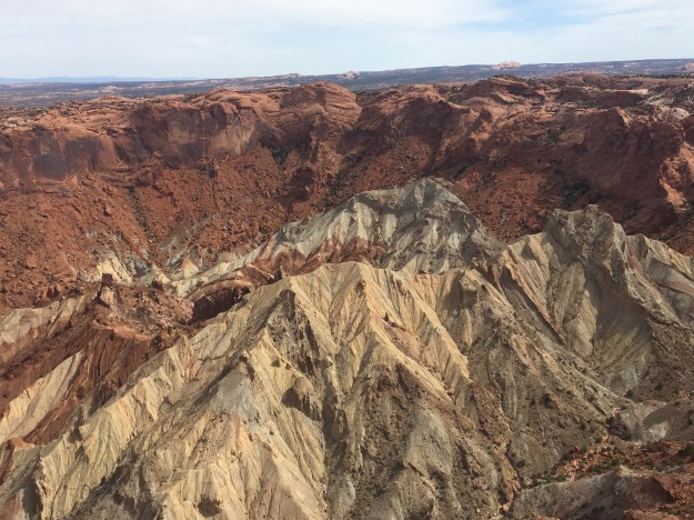
Halfway across the State, I encountered another scenic area, or, at least the sign indicated it as such.

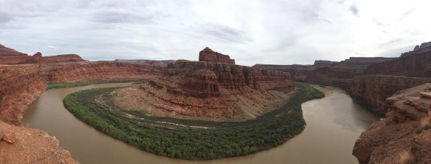
In both North and South Dakota, the Missouri River Valley, and the surrounding bluffs provide some variance in what is otherwise a fairly homogenous drive.

IMG_4326

This river crossing is also where explorers Lewis and Clark met Sakakawea, a 17-year-old Native American who would play an important role in helping the explorers complete their journey. The Shoshone were the predominant tribe in areas of what is now Idaho and Montana, where Lewis and Clark were headed to cross the Rockies. Sakakawea, a Shoshone who was captured by the Hidasta tribe and brought to present-day North Dakota, had the language experience Lewis and Clark needed for much of the remainder of the journey. She was even reunited with her brother, who turned out to be one of the tribe chiefs Lewis and Clark needed to trade with.

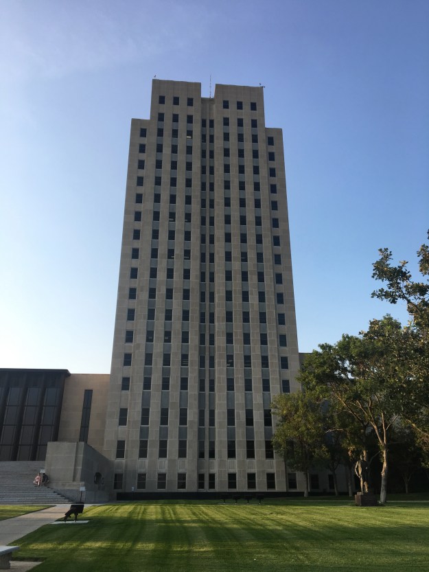
It was here in Bismarck I encountered a sizable North Dakota town, as well as a State Capitol building with a very unique shape.

IMG_4334.jpg

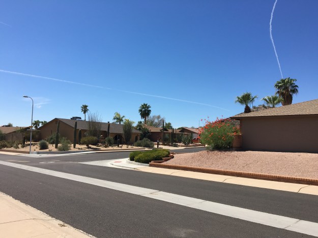
I was not sure how to feel. As I prepared to interact with people, my mind wandered to every pre-concieved notion I had about North Dakota. I wondered what people here do on a day-to-day basis. I wondered if, despite the fact that it was only the second day of August, people who live here are already dreading the winter to come.

I overheard some conversations from people who sounded like they were locals. What I heard was not complaints about excessive boredom, fear about a sub-zero temperatures four months in the future, or some foreign sounding discussion about fracking I cannot follow. I heard people with a lot of the same concerns I often have: How to help that one friend or family member going through some hard times. People’s concerns over changes being made at their workplace. Health concerns and other day-to-day topics that are common amongst almost all the people of all the world.

I thought to myself “Have I become this disconnected from really?” Do I now struggle to relate to people when they aren’t discussing some major global issue, an invention at a setting like start-up week or some grand adventure?

IMG_3395.jpg

Even in the most innovative cities in the world, more people would prefer to discuss their day than a diagram like this one.

It would be easy for anyone to say that, right now, North Dakota’s only really significance is in the world of energy production. However, that would be ignorant to history. For, if it weren’t for Lewis and Clark meeting a friendly tribe to camp with for the winter (Fort Mandan), and get the help they needed from Sakakawea, it may have taken several more decades for the West to be opened up. And, if it weren’t for a young future president finding picturesque Badlands he desperately wanted to preserve, the National Park system, which has a much larger presence in the West than the East, could look significantly different than it does right now.

usa-national-park-map

What occurred to me as I continued Eastward from Bismarck was that, whether the number of annual visitors is closer to 2 or 20 Million, most North Dakotans probably do not care about the relatively small number of annual visitors. It reminds me of some of the people I interact with in Colorado that were born there decades ago. Many of them actually did not want this gigantic influx of people and visitors that fundamentally transformed the state. Many of them just wanted to enjoy their state the way it was, and that is what North Dakotans get to do.

Chasing Records- Spearfish, SD

IMG_4286

At 7:30 A.M. on January 22, 1943, the temperature in Spearfish, South Dakota was -4ºF. A mere two minutes later, the temperature had suddenly jumped to +45ºF, a swing of nearly 50 degrees in a manner of two minutes. The Great Plains is known to be a region with extremely volatile weather. However, with respect to volatility on this short of a time scale, this one event is still in the record books.

75 years later, locals, as well as those interested in weather, still talk about the event. In fact, the event is mentioned in the Wikipedia entry on Spearfish.

But, why so much volatility? Why here? The answer to that question lays in the geography of the region.

Spearfish_Topography

Spearfish sits just north of the region known as the Black Hills. The Black Hills, although detached from the Rocky Mountains, are actually quite mountainous, with peaks rising several thousand feet above the river valleys. The manner in which peaks rise up in either direction while rock formations are carved out by small creeks is quite reminiscent of the Rockies.

Just over the border, in Northeastern Wyoming, Buttes of varying colors pop out of the more open, but still hilly landscape.

Only ten miles south of Spearfish is one of what feels like 500 different waterfalls that goes by the name “Bridal Veil Falls“.

IMG_4285.jpg

It is, nonetheless, breathtaking, but, what is it about this name? Did the wedding industry  somehow collaborate with the outdoor industry to try to convince tourists looking at waterfalls to be thinking about fancy weddings through this common nomenclature? Was there an early 20th Century conversation that went something like this…

“Okay, we’ll name every other waterfall ‘Bridal Veil Falls’. In exchange, you will encourage every newlywed couple to take something referred to as a ‘honeymoon’.”
“A honeymoon.. what is that?”
“A vacation that everyone is expected to take right after getting married. Think about it, both of our industries can make a ton of money off of this. We’ll get people thinking about getting married and specifically doing so with a fancy dress, likely to cost a lot of money, and then you make sure that when they wed, they are spending money on another vacation.”
“Sounds like a win-win.”

Okay, maybe it was not exactly like that, but it does seem pecular.

As far as Spearfish is concerned, traveling in the other direction, North, from town, could not be a more opposite experience.

IMG_4287.jpg

It is the Great Plains, and specifically the Dakotas, the way most people picture it.

It is this contrast, and specifically the North-South orientation of this contrast, in Spearfish that created this record breaking temperature change. When air travels from high elevation to low elevation, it warms. It is this exact reason that Denver, Colorado, just east of the Rocky Mountains, has frequent warm spells in the middle of the winter. In fact, January 16th is the only calendar date in which Denver’s record high is lower than 65ºF (it’s 64).

With the flat, wide-open, treeless land to the North, it could not be easier for bitter cold air straight from the North Pole to reach Spearfish. However, when warmer air does come from the South, it is further warmed by its trip over the Black Hills.

IMG_6101

But, why all the fuss about setting records? Specifically, why do people care so much about bizarre records? In 1943, the news about the wild temperature swings in Spearfish provided a war-weary American public with some lighter news. And while the impact was only a bunch of broken windows, people can learn from these records.

The wild temperature ride in Spearfish demonstrates how the atmosphere works. Is there something similar to be learned by the man who broke 46 toilet seats with his head in one minute? Do people who have watched that video avoid breaking their own toilet seat at home?

Or, is there something other than intellectual curiosity at work? Records like this one are interesting to people regardless of whether or not they care about the ins-and-outs of how the atmosphere works. They are just entertaining. They also provide people with one of the main things we are all searching for in the modern world; significance.

The people of Spearfish can always bring up this wild temperature swing as something that makes their town stand out among all of the towns of roughly 10,000 people out there. It is the same for the man who bloodied his head breaking toilet seats, or that one person in everyone’s social circle that did something bizarre, like stop at every Arby’s between Chicago and Saint Louis (there are 13). They have this way of making the world just a bit more interesting.


A Weekend in Nature 90 Minutes from Denver

IMG_4190.jpg

One mistake I witness quite often is people constantly turning their getaways into some form of challenge of their own. There is probably nobody more guilty of this than me; always seeking the far away destination, wanting to climb the tallest mountain, cycle over 100 miles a day.

Challenging ourselves is important. We all build character by challenging ourselves, especially outside of work. However, we also all sometimes need a break that is a genuine break, not stressing ourselves to get to a faraway destination with no spare time, exhausting ourselves physically, creating an alternate form of stress- “vacation stress”.

IMG_4179.jpg

Summer in Colorado began with an extreme drought, large wildfires all over the state, and restrictions on fires in nearly every county.

CO_Fire_EndofJuly

Fire restrictions across Colorado July 28, 2018

With some rainfall in the mountains, in the past week, some counties in Central Colorado began to lift these fire bans, permitting fires at campsites.

One of the problems we have here in the United States is limitations related to time. According to Project Time Off, an organization whose mission is to remove the stigma around taking time off from work, the average American takes less than 20 days of vacation per year, and Americans collectively forfeit over 200 million days off due to concern for how they will be perceived at the office. Therefore, it is not all that common for Americans to feel the need to maximize their vacation time, utilizing every precious hour.

This stigma will not go away overnight. Most likely change will be gradual, and considerations related to time limitation will still be a factor in the coming decades. However, given our recent mental health challenges, and recent research pointing to the psychological benefits of being in nature, trips like these are probably more important than ever.

IMG_4193

Georgia Pas is one of several areas about a 90 minute drive from Denver, right in the middle of the Rocky Mountains, with dispersed camping, meaning camping without the amenities of a campground.

IMG_4161.jpg

These camping areas are nearly always within a short drive of the kinds of places where the high peaks of the Rocky Mountains can be seen in all of their majesty. Georgia Pass, less traveled than mountain passes along paved roads, like Hoosier Pass and Guanella Pass, offers the same panoramic views but with less people.

It also, based on this one trip, feels like a place with more wildlife.

IMG_4186IMG_4163IMG_4168

However, sometimes the camping experience is not about the feeling of being on top of the world on a mountain pass, or overlooking a photogenic lake, as is commonly shown on the cover of travel magazines. Sometimes, camping is about being in a strangely calming place like this, with trees, bushes, other random vegetation, and a creek moving fresh mountain water along to a gentle rythm.

IMG_4194.jpg

There is something about this specific scene, deep in the forest, surrounded by nature. It feels in a way, like the exact opposite of stress. There is no hurry here, nobody is causing unnecessary anxiety, and the only abrupt changes in plans occur when a thunderstorm pops up unexpectedly.

There is, however, work. Camping isn’t just sitting around the fire. The fire must be started and maintained. Meals must be cooked. Tents need to be set up, and dishes washed manually. It isn’t a resort vacation. In fact, while camping, far more work goes into filling the basic human needs of food, water, and shelter than it does back in the city, even on the most stressful day.

There are ways to relax that require little to no work. Watching television only requires owning a television and selecting a program. Laying at a beach only requires finding a way to get to the beach. Yet, sitting around a campfire with loved ones, looking at the stars and watching the full moon rise between alpine trees, then waking up to the alpenglow hitting the tops of the trees, somehow actually feels far more relaxing than just laying around at home or nearby.

Or maybe it is about getting away from all of the things that are currently creating anxiety in our lives, which include TV (mostly the news), our phones, work, and, competitiveness in general. This takes work. It takes work to get away from life’s pressures. However, it is good for us, regardless of our situations, to occasionally escape our stress sources, without substituting them with “vacation stress”. Unfortunately, many of us in the United States still find ourselves in situations where we feel our time away is so precious, taking part in activities that create this “vacation stress” is the only way to get meaningful experience out of the limited time we have to vacation.

Cycling from Colorado Springs to Denver

COSprings_to_Denver.png

It started with a two hour bus ride, from Denver to Colorado Springs, on something called the Bustang. Bustang is a pretty good service for cyclists in Colorado, as each bus has bike racks on the front. It would be a great service with more schedule options. For anyone thinking of making this journey, the only real option is the 7:35 A.M. departure from Denver, which arrived in downtown Colorado Springs just after 9:30.

IMG_3821.jpg

Colorado Springs is an interesting town. People who think about Colorado Springs often think about one of two things; its affiliation with Christian conservative causes, as it is where Focus on the Family is headquartered, and Pike’s Peak, the mountain that towers over the city to the west.

IMG_3824.jpg

Pike’s Peak is actually only the 20th tallest peak in the State. Yet, it is often amongst the most visited and talked about because, compared to many of Colorado’s other mountains, it is relatively isolated.

14ers_PikesPeak

Perhaps most importantly, Colorado Springs is among the most active and fittest cities in America.

This was apparent as I began to pedal north from downtown Colorado Springs. The Pike’s Peak Greenway, was quite crowded for much of the journey, with joggers, packs of runners, and other cyclists.

At the northern border of Colorado Springs, the Pike’s Peak Greenway connects to the New Santa Fe Trail. Both of these trails are part of a long term plan to create what is being called the Front Range Trail, a network of trails that will eventually cross the entire state from the Wyoming border to the New Mexico border, through many of Colorado’s most populated cities. Sings for the Front Range Trail have already been put in place here.

For some riders, the New Santa Fe Trail has the potential to be the roughest part of the ride. Much of it is both uphill, and unpaved. It also runs right through the property of the United States Air Force Academy.

IMG_3835.jpg

Many sections of it are quite rough, probably more suitable for mountain bikes than road or touring bikes. Along this stretch, there were about half a dozen instances where I had to dismount and walk my bike for a short distance.

IMG_3837.jpg

It was still a beautiful place to bike. The trail cuts through fields of Piñon Pines, and Monument Creek creates some picturesque mini-cliffs in front of the mountains.

However, although the journey up the hill is actually quite subtle, with no switchbacks or steep climbs, it did take more time and energy than anticipated to get to Palmer Lake, the high point of the trip, at an elevation of about 7,300 feet (2225 m).

IMG_3840.jpg

The next part of the ride was my favorite, north along Perry Park Road. This section is mostly downhill, but with some rolling hills. It was a wonderful 25 mile per hour ride on a smooth road, with bright blue skies, wide open spaces, rock formations popping out on both sides around every turn, and a light cooling breeze.

IMG_3843

There are a few route options at this point, and following Perry Park Road as long as I did, a little over 10 miles to Tomah Road, does bypass the town of Larkspur. I found it worthwhile, as I was enjoying the ride, but it does mean a total of about 20 miles between towns.

IMG_3846

Turning East, Tomah Road was actually the most challenging climb on the entire ride. The total climb is pretty small, from about 6200 feet to just over 6800. However, that climb occurred in less than two miles, and can be unexpected, as Castle Rock is at 6200 feet and this climb came from one of the subtle terrain features east of the Rocky Mountains.

After climbing and descending Tomah Road, the route was follows the Frontage Road along I-25 for about four miles into Castle Rock. Despite it being right next to the interstate, the road was quite crowded, and with no shoulder. It was probably the least enjoyable part of the ride.

IMG_3848

This was also where I struggled the most. It was the hottest part of the day, and after the unanticipated challenges, I began to doubt whether or not I could complete the ride. In these situations, it is usually good to stop and take a rest. The additional time it took on the unpaved trail up Monument Hill had set me back at least half an hour, but I definitely needed a rest, a snack, and, most importantly, I had a coke.

Maybe it was the caffeine, maybe it was the sugar, but the coke re-energized me, and I was back on my way.

Crawfoot Valley Road, the road that connects Castle Rock and Parker was surprisingly crowded. It is a good thing there is a wide enough shoulder for bikes. This area is growing quite rapidly, and seems to get busier every time I ride this segment.

My next burst of energy was actually mental, which is usually the battle we are actually facing when we decide to undertake physical challenges like this. In Parker, the route connects to the Cherry Creek Trail, an amazing trail that is fun, well kept, and mostly flat.

IMG_3853.jpg

From here, it is 30 miles to downtown Denver. This sign (the Cherry Creek Trail has one every 1/2 a mile, but this is the first one I saw when I joined the trail) felt like a welcoming of sorts, to the home stretch. The final 30 miles of the trip would feel like a victory lap.

I knew there was only one real climb remaining, the part where the trail goes around the Cherry Creek Reservoir.

IMG_3855.jpg

It reminded me of this weird place we often find ourselves in life, where we know some sort of “victory” is coming. We can sense it on the horizon. We are anticipating it. However, it is not there yet. There is still some amount of work that needs to be done, and there is still some things that can go wrong.

Is it too soon to start feeling good about ourselves? Can we start celebrating something that is “about” to happen? Or, do we remain cautious and diligent, understanding that although we feel we deserve this victory, it has not yet happened, and it is still not yet time to celebrate?

That was how the final 30 miles felt for me. The first half went by fast. However, as I got closer and closer, anticipation increased, and this “homestretch” seemed to drag on.

IMG_3857.jpg

At that point, there really is no choice but to pound out that final ten miles, with those mixed emotions. I knew I had persevered, ended up having to take on more than expected, and would arrive at home triumphant that I had ridden my bike from Colorado Springs to Denver. However, I would have to keep pedaling those last few miles before I could check that box off my internally kept bucket list.

Welcome to Summer

Week after week is spent focusing on some sort of life endeavor; a major project at work, a personal improvement initiative, a diet, starting a business, preparing for kids. Meanwhile, the world around us continues to tick. All of a sudden we realize that everything has changed. A jacket is no longer needed in the morning. Darkness does not set in until well after 8 P.M. Every evening, the neighborhood kids are outside being lively. While our focus had been elsewhere, the subtle process of seasonal transition has transformed the world around us. It is now summer!

IMG_3339.jpg

Although it has felt like summer, here in Colorado, for a few weeks, in the United States, Memorial Day is often referred to as some sort of unofficial beginning to summer. With most businesses not providing time off for the Easter holiday, and Cesar Chavez Day being a holiday in only two states, for many, Memorial Day is the first day off in several months. I have even had a pervious employment situation where there were no holidays between New Years Day and Memorial Day.

With vacation shaming running rampant in this country, causing Americans to collectively leave over 700 million vacation days unused annually, it is easy to imagine countless American who spent the three months leading up to Memorial Day doing little else besides work and tending to home and family needs.

2018 in particular was a year where the Spring Season was easy to miss, as winter felt quite persistent across much of the country through April.

April_2018_TEMP.png

Chicago even reported measurable snow four times in the Month of April!

Many experienced the kind of weather they typically associate with Spring only briefly before summer-like conditions spread across the country.

MemDay2018_TEMP

By Memorial Day, 100 degree temperatures were reached in Minneapolis, while the Florida Panhandle was experiencing the start of the tropical storm season.

While it is completely understandable why some people were completely blindsided by the start of summer, it feels, in a major way, unnatural. Seasonal cycles are embedded in how our culture developed, flushed and progressed. They can be seen in the way our calendars were constructed, the holidays we celebrate, the traditions we all enjoy and even in art and music. Perhaps most importantly, they guarantee that we must periodically stop what we are doing, and move on to a new set of experiences and a different kind of energy. In a way, they guarantee progress.

All the major biomes in the Colorado Rocky mountains were alive this Memorial Day weekend, as if they knew this Memorial Day deadline for the start of summer existed and needed to be complied with.

IMG_3450.jpg

IMG_3478.jpg

The Aspen trees glowed an almost neon green in the bright sunshine, contrasting with the pine trees in some places, while clustering up, highlighting their own light gray branches in others.

IMG_3457.jpg

Somewhere slightly above 10,000 feet (3.05 km) in elevation the forest transitions to densely packed evergreens.

IMG_3460.jpg

Nourished from the melting of the residual snow at higher elevations, they shade the ground below them with a raw power almost feels as if they are, collectively, the protectors of the mountains.

IMG_3477.jpg

Along the trail, they reveal only what they want to reveal. Periodically, they reveal small previews of what is to come, building suspense and creating an experience.

IMG_3468.jpg

Above the trees, the remnants of the snowy season, which is any time of year besides summer at 12,000 feet (3.6 km) in elevation, fades away slowly transitioning the energy of the surrounding rocks, bushes and grass.

In the modern world, summertime for many feels like a time to thrive. It is often the busiest time of year. Surprisingly, this appears to be true for both weather dependent activities such as travel and recreation, as well as indoor ones. It is also the time of year where more is possible. Long days, less travel hazards, and in many cases less discomfort when outdoors gives us the chance to both let in and out a deep breath and smile, but also take our activities to the next level.

IMG_3480.jpg

Many of us did not keep our New Years resolutions, some could have even had their goals and desires forgotten about over the past few months. However, the start of a new season, indicated by the coming and passing of Memorial Day weekend, provides no better opportunity for each and every one of us to re-orient ourselves towards what we really want out of life. The coming season may be the best time to make a change- to chose life!

IMG_3428.jpg

As the floodwaters gradually recede, I look forward to the calm feeling the warmth of summer provides. I look forward to the energy of cities and towns alike, flooded with people walking to the park, walking their dogs a little longer, and to festivals and cookouts. I look forward to the energy it produces in each and every one of us, inspiring us to leave the computer screen, put down the remote, and go outside an play a little. I look forward to the brightness of the sun lightening the hearts of all of us. I look forward to seeing the lives that will be transformed by summer’s energy!

What Independence Day Means for Travel and Adventure

img_0231-1Every year, we Americans celebrate the founding of our nation on the Fourth of July. This commemorates the day in which the Declaration of Independence was signed in 1776, officially declaring our intention to separate from the British Empire and form our own Nation, or more accurately at the time, confederation of states.

It is an active day, and often an active weekend for the country as a whole.

IMG_0690

Some use the time off to explore some of the country’s most spectacular places.

IMG_4592

Others use it to visit vacation homes, or have quiet weekends by the lake.

Some also flock into cities, to visit friends, and attend festivals.

img_0242

As is the case with many holidays, I often wonder whether or not this one loses its meaning. Those that know the true meaning of Saint Patrick’s Day, Cinco De Mayo, and Memorial Day will often observe that the way most people celebrate these days is inconsistent with the actual intent of these particular holidays.

What about Independence Day?

IMG_3859

Are these large firework displays appropriate? What are most people thinking about, as they are exploring parks, visiting friends, barbecuing and watching these colorful displays?

How many people are thinking about their own lives vs. the Nation we are celebrating? Or are our minds on regionally specific considerations? For example, in the Rocky Mountains, the Fourth of July is kind of the start of the season for high altitude hikes. After a three-month process of snowmelt in the highest terrain, many trails are finally free of residual snowpack and mud.

img_7262

In fact, there is even a trailhead just south of Rocky Mountain National Park that was named the Fourth of July Trailhead.

IMG_4467

Trails originating from here provide access to a series of high peaks just east of the Continental Divide. This particular section of the Central Rocky Mountains is commonly shadowed from the sun and heavily forested. At places like this the snow melts the slowest in the springtime. This trailhead was given this name because it is generally not recommended for hikers to hike here until the Fourth of July!

What people chose to do on the Fourth of July may have something to do with how people view the United States of America.

There’s a spectrum of people across this country, from those that take extreme pride in being “American”, to those that take a more critical view and may wish we adopted some policies of other nations. Where someone stands on this spectrum may have something to do with whether someone sees July 4th as extremely meaningful, or just as a convenient day to have off in the middle of the summer.

Being who I am, I cannot help but reflect, and come to a conclusion that is a bit more nuanced. One of the virtues that this nation was founded on is individual liberty. Even if we have fallen short of that ideal on certain occasions past and present, it still represents an ideal that we aspire to. Liberty, and self-determination are considered a justifiable end here. There are other places where it is not.

As someone who yearns for adventure, it is easy for me to view, with envy, European countries where vacationing for the entire month of August is common practice, and work weeks tend to be shorter. However, that is not the full picture. There are large areas of the world where most people cannot take vacations at all. There are places where the majority of the population lacks the prosperity and/or individual liberty that makes everything we do here possible.

Reflecting on this, it needs to be understood that we are indeed quite fortunate. This does not mean we should not yearn for more, as, in many ways, we can and should do better. It does mean having everything put into proper perspective. With the right priorities, most Americans at least have the opportunity to have an adventurous life. This is something we all should be grateful for.

I Like Ike

IMG_9962.jpg

There are Presidential Museums for every President that served over the past 100 years, usually located in or near the their “hometown”. Some of the more memorable presidents from the 18th and 19th Century also have museums dedicated to their lives and accomplishments. While some of these museums are located in or near major cities, there have also been a good number of presidents who came from small towns. Their museums can sometime be interesting places to stop while traveling.

The first time I ever visited a presidential museum, I was driving from Saint Louis to Chicago on Interstate 55, a drive that had become familiar and dull to me. It was a July day and temperatures were close to 100 degrees. I knew both me and my car needed a break in the middle of the afternoon. So, I visited the Abraham Lincoln Museum in Springfield, a museum I would certainly recommend. I love stopping at places like this on a long drive, allowing the body to move around a bit, and stimulating the mind with some historical information.  So, on my drive back to Denver from Kansas City, I decided to stop at the Eisenhower Presidential Museum in Abeline, Kansas.

IMG_9971.jpg

The museum is located in the EXACT SPOT that the former president grew up.

IMG_9951

On the museum campus is Dwight Eisenhower’s boyhood home, and, with admission, visitors get a brief tour of the house.

Ike_Museum_Location

Map from Museum’s Webpage- does not include parts of I-35

The museum is only a few miles from Interstate 70. As president, one of Eisenhower’s signature accomplishments was the signing of the Interstate Highway Act in 1956. So, it seems fitting that this interstate highway system would find a way to serve the town Eisenhower grew up in. Arriving here without using the interstate would feel wrong in a way.

IMG_9960.jpg

Every president, no matter the background, has two stories. A story about what they did before they became president, and the story about what they did as president. Before becoming president, Eisenhower was known primarily as the general that oversaw the Allies European Victory in World War 2.

In fact, Eishenhower’s military career, and exhibits regarding World War 2, appear to make up the largest part of this museum. Later in life, Eisehnhower himself considered his role in the military as the most significant one he had played. In his retirement, he preferred to be addressed as “General Eishenhower”, as opposed to “Mr. President” (which is how former presidents are usually addressed).

IMG_9997

After helping start the North Atlantic Treaty Organization (NATO), he decided to run for President of the United States in 1952. The museum portrayed him, in a way, as a reluctant president. There is no way of knowing what truly is inside anybody’s heart. However, the way the story is portrayed is not of a man with a strong desire to become president, but of a man who spent his entire life fulfilling the various duties to which he was called. After being called to do so by countless associates, supporters, and both major political parties, leading the nation, as president, was just the final in a series of duties he was called to and performed over the course of his life.

IMG_9950.jpg

The entire life story that is Dwight David Eisenhower felt like a story out of a completely different time in history. This idea seems almost like a long-dormant old folklore in American culture. The hero turned leader. A person who wins the adoration and respect of a large group of people based on some heroic acts and then goes on to lead decisively, yet not divisively. A person who sincerely tries to lead all the people, rather than just the ones that are supportive. And, a person who finds a way to be both transformative and a consensus builder with views that are strong without being extreme.

[I will leave the exact details of his presidency to the history books and the museum itself.]

This feels, in a way, like the exact opposite of what has been going on recently. When it comes to this idea of a military veteran/ war hero president, there are plenty of examples throughout history, but no clearer example than Eishenhower.

I do not want to make this another angry political blog (there are way too many as it is), but I do not consider our current president, nor his predecessor, to be a hero, at least not in a general sense like the heroes past. Sure, both men are heroes to a subset of our population. However, both men were also dismissive, and sometimes in a nasty way, to other groups of people within our country. Being the first president of mixed racial background, or the first non-politician president may be important steps for our country. But it’s hard to consider being a community organizer or a business tycoon “heroic” in the traditional sense.

IMG_9966.jpg

There is a time and a place for everything. Maybe the middle of the 20th Century was the time and the place for the hero. It could be seen throughout the culture of that time; the Western Hero/Villain movies, characters like the Lone Ranger, and such. Our society has changed significantly since then. Movies this decade more commonly feature protagonists with some form of character flaw, and antagonists who draw some amount of sympathy based on their life experiences or perspectives.

As our culture progresses, we enter a period where maybe we should not look to a hero, but within ourselves. Most of the problems we face today are not as straight-forward as a General coming in and defeating Nazis. They’re more complex, like structural racism which results from the cumulative effect of people’s individual attitudes and pre-conceptions, the negative emotional and communal effects selfishness and the accessibility of smart phones create, or the susceptibility of those that feel disenfranchised to messages promoting radical and sometimes violent behavior. They are not solved by a leader, an army, or a bunch of laws. They are solved by each person’s behavior, one by one, day in and day out.

Across Kansas on Interstate 70

IMG_9831People generally don’t seek out the opportunity to take a road trip across the state of Kansas.  It is certainly not on the list of scenic drives in the United Sates, and will never compare to the majesty of places like the Pacific Coast Highway, Yellowstone, the Adirondacks, or the Grand Canyon.  Getting across Kansas on Interstate 70 takes, at a minimum, five and a half hours, with each mile often looking quite similar to the mile before it.

IMG_9839

However, this is still a heavily traveled road.  In fact, each year more people end up passing through Kansas along this route than end up visiting some more scenically spectacular, but far more remote, places like Crater Lake or Big Bend.

Each year, millions of Americans end up traveling across Kansas on I-70, or along similar routes across the Great Plains, mostly passing through on the way to some other destination.  After all, Kansas is the site of the mid-point of the continental United States.  It is naturally going to be on the way to and from a lot of places.  Any cross-country road trip does require trekking across the Great Plains.

IMG_9830

Frequently in life, people will look at what is directly in front of them, whether it be their homes, their jobs, a social situation, or even a specific event, see it as less than ideal, and insist on remaining focused on what makes the situation, well, less than ideal.  This is the easy way of handling such situations.  It is a trap I often find myself falling into.  However, while it is comforting to endlessly lament a circumstance, it is not productive.  It does nothing to improve the situation at hand.

Kansas itself, in a way, knows what it is.  It is not the peaks and valleys of Rocky Mountain National Park, the majestic maple trees of New Hampshire in autumn, or the amusement parks of Florida.  Most people here are driving through, and most of the accommodations along the interstate are clearly geared at travelers.

And, occasionally to people who need to get out of the car and explore some things along the way.

Kansas also seems to be a place that embraces what it is.

IMG_9949

As well as what it once was.

IMG_9944

Even if in many cases its significance then is no different than its significance now; a place people generally pass through on the way to somewhere else.

In my own experience, what typically happens on drives like this is strikingly similar to what occurs in the process of meditation.  As is the case when I attempt to rid myself of unnecessary distractions, turn off all forms of entertainment, and reconnect with my own mind <link to disconnect to connect blog>, I get anxious at first.  I long for something, anything to emerge to entertain me.  I need to adjust.  To let go.  And after that process, I get to a place where I can finally see the beauty of the surroundings.  After driving across this landscape for a couple of hours, I saw this place for what it truly is, actually quite beautiful.  As was the case on previous trips, I spent some time just soaking it in.

IMG_9976

I am reminded that, when we embrace our situations for what they are, even if they are not what we had hoped for, we can often still find some beauty in it.

It may not be what we had hoped for, but, as long as we continue to move, our destination will eventually be reached.

IMG_9922.jpg

And, sometimes even the journey to the destination gets a bit more interesting.

One thing many do not realize is that the section of Kansas that follows the Kansas River, from Manhattan, through Topeka and Lawrence, and into Kansas City is far more lush and hilly than other parts of the Great Plains.  The area ends up feeling way more like the Midwest.

Moab- An Active Destination

IMG_9301

Some trips are restful, while others are more active.  There are some destinations that lend themselves to more restful trips; cottages in the woods near quaint towns, tropical beaches, and resorts.  Moab, is a place where it is nearly impossible to imagine anything other than an active itinerary, with a variety of activities, and a lot of places to see.  Situated in East Central Utah, several hours from the nearest major city, this popular tourist destination is surrounded by too much natural beauty to picture anyone coming here and spending large amounts of time sitting in one place.

First of all, Moab is surrounded by two National Parks, Arches and Canyonlands.

Both National Parks are, as National Parks tend to be, filled with tons of natural beauty and unique places.  At both National Parks, while it is possible to see a lot of interesting natural features without straying too far from the road, the best features at both parks require hiking.

FullSizeRender (1)

Getting to the signature feature of Arches National Park, Delicate Arch, requires a 1.5 mile hike from the Delicate Arch Trailhead.  Interestingly enough, this trail starts near the historic Wolfe Ranch, and traverses by some other unique features including some Ute Indian Rock art.

It is also quite difficult to imagine making a trip to Arches National Park and not viewing some of the other arches (Yes, it’s Arches National Park, not Arch National Park).  There is a section of the park known as Devil’s Garden, with somewhat of a network of trails taking visitors to all kinds of other arches.

The most famous of these arches is Landscape Arch, a long and wide arch whose name provides a clear recommendation as to how to orient any photograph of this particular feature (for those familiar with landscape vs. portrait  ).

IMG_9345

To get to most of the remaining arches requires a bit of a steep climb, which starts pretty much right after Landscape Arch.

IMG_9346

The hiking in the entire Moab area, not just at Arches National Park, is considerably different from the typical hiking experience.  Much of the hiking I’ve experienced, is on trails covered in dirt, gravel, and sometimes small to medium sized rocks at places such as the top of Quandry Peak.  All around Moab, I found myself on surfaces such as this one, on top of solid rock, sometimes for nearly the entire duration of the trail.  Traversing these trails required me to use my upper body more, and even do a little bit of jumping, from one rock to another.

At the top of this Mesa, there are arches with multiple partitions, arches people can hike under, and even one arch with an opening that lends itself to laying inside it to soak up the sun, the surroundings, and the experience!

The entire loop, including all the side trips in the trail network, is a total of 7.2 miles.  So, if a visitor desires to see all of these features, as well as Delicate Arch, a total of 10.2 miles of hiking is required.

And some people decide to add even more activities to their day.  In a shaded off-shoot of the Devil’s Garden Trail, I witnessed a sizable group of people playing a game of Frisbee, using the walls of this tiny canyon to make trick shots.

IMG_9391

Since immersing oneself in the here and now, and contributing to the local culture of a place creates a more enriching travel experience, I decided to play my part.

First, I decided to bring my own arches into the park..

IMG_9332

Disclaimer: I did properly dispose of that cup

Then, when the opportunity presented itself, I decided it was time that we started making our own arches, contributing to the park’s plethora of natural beauty.

IMG_9374

IMG_9444

Canyonlands National Park is even bigger than Arches, broken up into three sections by the Colorado and Green rivers, whose confluence is right in the center of the park.  Without any bridges connecting over either river, and with the entrances to each section over an hour apart, it is all but impossible to visit more than one section in a day.

IMG_9461.jpg

The most common image of Canyonlands National Park is an almost Grand Canyon-like overlook into a deep river valley, sometimes with one of the two isolated mountain ranges in the background.  However, at the scenic overlooks in the parks’ Island In The Sky region, it is actually quite difficult to see the rivers themselves.  The canyons that make up Canyonlands National Park are quite expansive, with multiple tiers.  To see these canyons from the best vantage points requires a bit of hiking.  The hike to the Confluence Overlook (an overlook of the confluence between the Green and Colorado Rivers) is 10 miles round trip, something that could require the better part of a day!

Canyons are not the only interesting feature to Canyonlands National Park.  Being only roughly 20 miles away from Arches (as the crow flies), Canyonlands has some arches of its’ own.  The most interesting one is an arch called Mesa Arch, where one can see both the peaks of the nearby La Sal Mountain range, and actually another arch by looking through the arch at the right angle!

IMG_9471IMG_9468

And some features are random, like Upheaval Dome.

IMG_9427

Scientists still do not know whether or not this particular salt deposit is a remanat of a meteorite that would have theoretically collided with the earth roughly 20 million years ago.

The two National Parks are not even close to all that Moab has to offer, all of which is “active” in one way or another.  Dead Horse Point State Park, located between the two National Parks, is a place where one can hike to one of Moab’s most picturesque locations: Goose Neck.

IMG_9494

The entire region, regardless of what any spot is named, or whether it contains a state or federal distinction, is rich with abundant natural beauty, and places to hike, bike, jeep, climb, or even just explore.

Anyone driving into Moab from the East (from Colorado), would be well advised to take the additional time it takes to follow the windy State Highway 128 through Professor Valley, essentially following the Colorado River into town.

IMG_9209

We set up camp at a place called Hunter Canyon.

Twenty minutes from town, Hunter Canyon is a place where each part of the day, from sunrise to sunset, lights up a different rock formation.  It felt almost as if nature was putting on a show, with lighting, stage props, and characters coming on and off the stage for different scenes.

I also saw bike trails nearly everywhere I went.  Moab is known as a mecca for mountain biking, an activity we did not get around to (is is… really… impossible to do EVERYTHING in Moab without something like two weeks).  But, with trails like these, Moab is also a phenomenal place for road biking.

IMG_9401.jpg

And, everywhere I went red rock formations, each one distinct from the next, would pop up, in and out of view.

It was next to impossible not to imagine these rock formations as something else.  While driving around, I would often point out to the rest of the group what each individual rock formation looked like, or what I perceived it to look like.  Some, I said looked like specific animals, some looked like people, others, still, looked like various specific objects, such as hammers, cooking utensils, or even a turkey wishbone (by the way, the following image is an arch, residing in neither National Park, they really are everywhere)!

IMG_9237.jpg

And, what amazed me was how often others in my group would actually see the exact same thing when they look at a rock formation and say, yes, I also saw an octopus.  This means that either my imagination is quite accurate, or, I have managed to surround myself only with similar minded people.  Both are very much a possibility!

IMG_9241

But, the analogy I came to in my head most frequently, throughout the trip, is between the rock formations and the ruins of an ancient city.  Every time I saw a structure such as this one, I would imagine what is would be like if, for some unknown reason, there actually was a civilization here, many thousands of years ago.  And each one of these rock formation was actually the remnant of an ancient skyscraper, or even a larger building like Chicago’s Merchandise Mart, weathered down by thousands of years of natural erosion.  I imagined what this ancient city would have been like, in an Atlantis-like scene that would play through my mind.

Since Samantha Brown’s presentation at last month’s Travel and Adventure Show, I had been trying to live in the here and now, and experience the current culture of a place, as she had advised.

For me, this included another new activity (for me)- Jeeping!

IMG_9521

And, I got to experience some crazy roads and some crazy places.

But, as I find in many of my travels, there is no way to truly avoid thinking about the past, and imagining another setting.  A video at the Canyonlands Visitors Center explained the actual process in which these rocks came to be formed, which took place over the course of 200 million years, back to a time when much of Utah and Colorado were near sea level, with some sections underwater and others above.  In fact, that is part of the reason why there is so much small scale variance in the color of the rocks throughout this region.

Everywhere I went, everywhere I looked, there were echoes of the past, both real and imaginary, and both ancient and more recent.

IMG_9507.jpg

The experience of visiting Moab for a long weekend is as jam-packed as I have made this aritcle.  Around every corner, something new, something exciting, and something unique.  While there are some travel destinations, like Miami, one can make as active or as restful as they would desire, Moab is one destination that requires one to be active, at least in some way, to truly experience.  To come to Moab, and not wander, not explore, not do a little bit of hiking, biking, or jeeping, one would miss out on so much of what is around every corner in this region.


48th State

IMG_7464.jpg

Arizona is the third most recent state to join the Union.  The only two states admitted more recently are Alaska and Hawaii.  This means that, when it comes to mainland U.S.A., this very much was the “final frontier”, an area that remained wild and unsettled for over a century while areas were being converted from frontier, to small villages, and eventually into powerhouses connected by networks of trails, ports, and railroads.

img_7422

The primary cultural image of Arizona is the “Old West”.  Cowboys roaming around wide open spaces.  Small isolated towns where outlaws and town sheriffs fight a continuous battle that resembles the internal conflict we all have between the innate desire for freedom and the desire for justice and order.  Crazy games of poker in whiskey salons that often end in guns being drawn.

Historically, it is correct that Arizona, like much of the west, is the site of many epic battles that often lead to gunfire.  This lead to places such as Tombstone, and Rawhide, being depicted in numerous Western themed movies and TV shows.  Tourists today can relive the experience of the wide open, unsettled, west by visiting these places.

However, movies and TV shows can frequently lead people to inaccurate perceptions.  Films and shows are designed for entertainment purposes, and therefore must focus on the interesting aspects of life in a specific place, like a shoot-out between two gangs.  Anyone that compares their lives to those of characters from TV and movies will often come out feeling that their life is uninteresting.  After all, no movie will show someone sitting at a cubicle for six hours, or doing laundry and ironing shirts.  They focus on the parts that will, well, entertain the people that watch them.

Recent studies have indicated that, while these high profile gunfights did occur in the old west, they were the exception rather than the rule.  Some studies (although not all) have even suggested that the western frontier of the later 19th century was actually a safer place than America today.  There is speculation as to why the “Old West” is depicted and thought of in the manner in which it is, leading some to entertain conspiracy theories.  Regardless of what the reality of what life in this time and place know as the “Old West” was truly like, it is encouraging to see people look at it statistically, as opposed to based on anecdotes and catch phrases.

IMG_7415.jpg

Arizona may have grown up late, but it grew up fast.  Based on the 2010 census, Arizona is now the fourth most populous state west of the Mississippi River.

IMG_7420.jpg

Growing up in the middle to late 20th century, Arizona grew up in a manner that is very car-centric.  Depictions of present day Arizona life, in movies like Bad Santa, commonly show life in car-centic suburbs, with winding subdivisions, malls and such.

img_7443

There is also no forgetting Arizona’s position along the famed Route 66, which took countless motorists between Chicago and Los Angeles during the middle part of the 20th century.  In popular culture, the Arizona stretch of this major historic thoroughfare is amongst the most celebrated, providing the inspiration for the setting of the Route 66 based movie Cars.

The most high profile destination in Arizona is the Grand Canyon.  After all, the state’s nickname, which is labelled on all Arizona license plates is “The Grand Canyon State”.  However, by taking a road trip from Phoenix to Las Vegas, one will traverse the landscapes that cover a much larger portion of the State.

Passing through the Sonoran Desert, which includes Phoenix and much of the surrounding  area, one will encounter hills covered in sagebrush and cactus plants.

img_7441

Periodically, one will also encountered Joshua Trees, mountain ranges, and mesas.

IMG_7429.jpg

img_7431

Closer to Vegas, the landscape transitions to the Mojave Desert, which is sometimes even hotter, drier, and more baren than the Sonoran.

img_7447img_7450

Two developments made Arizona’s rapid expansion in population possible.  First, is the much discussed invention of, and subsequent proliferation of air conditioning.  This, of course, made living in places prone to hot weather more desirable.  The second is the creation of dams, canals, irrigation systems, and water pipelines, which facilitated supplying these dry regions with the water resources needed to sustain life.

IMG_7475.jpg

The Hoover Dam, located at the border of Arizona and Nevada, is one of many places throughout the west that diverts water resources from a major river (the Colorado River) to major metropolitan areas.


As is the case with the idealized image of the rugged individual of the “Old West”, present day life in Arizona, when discussed, elicits some divided responses, as well as some different interpretations.

img_7411

This is very much the image of standard life in Arizona.  A house in suburban looking neighborhood, a pool in the backyard, mountains, and, in many cases, golf.  Some love it.  Some see it as the natural culmination of the “American Dream”.  Some can’t wait to get away from the frigid winters many experienced in other parts of the country, move down here and enjoy the life.  Others, and particularly those concerned with the environment, feel it is irresponsible for so many people to be living comfortable lifestyles, with swimming pools, irrigated lawns, and golf courses in a climate this dry.  People here seem to adhere to the “haters gonna hate” mentality.  The knowledge that people in some distant land are disapproving of their living, eating, hiking, and golfing in the desert does not seem to phase them.

IMG_7413.jpg