Category Archives: Western US

Do We Have Too Many Updates?

Elk Falls, in Stauton State Park, is a fairly lengthy hike. The round trip from the main parking lot (called the Meadow Parking Lot) is about 11 miles, depending on where you park. It begins with a mostly flat, 3.1 mile section called the Staunton Ranch Trail.

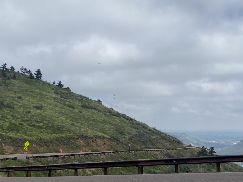
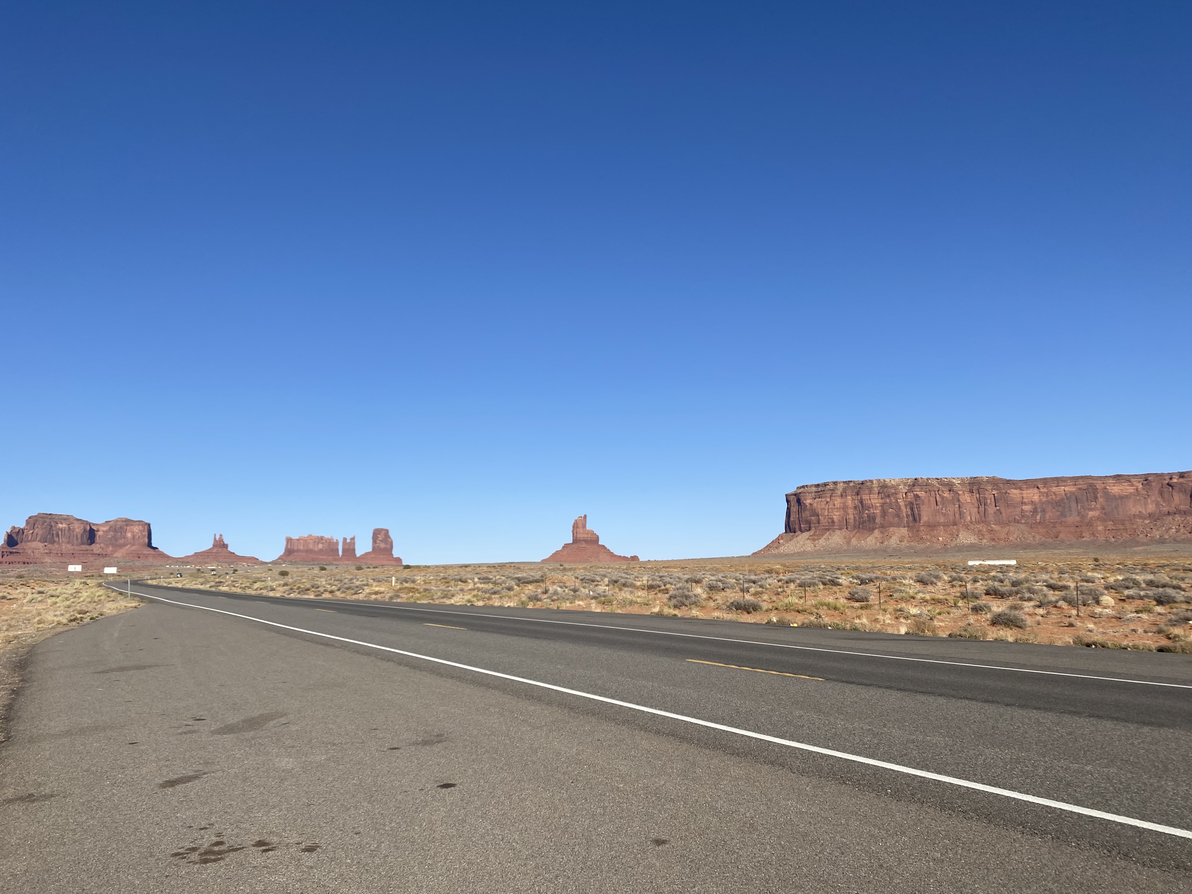
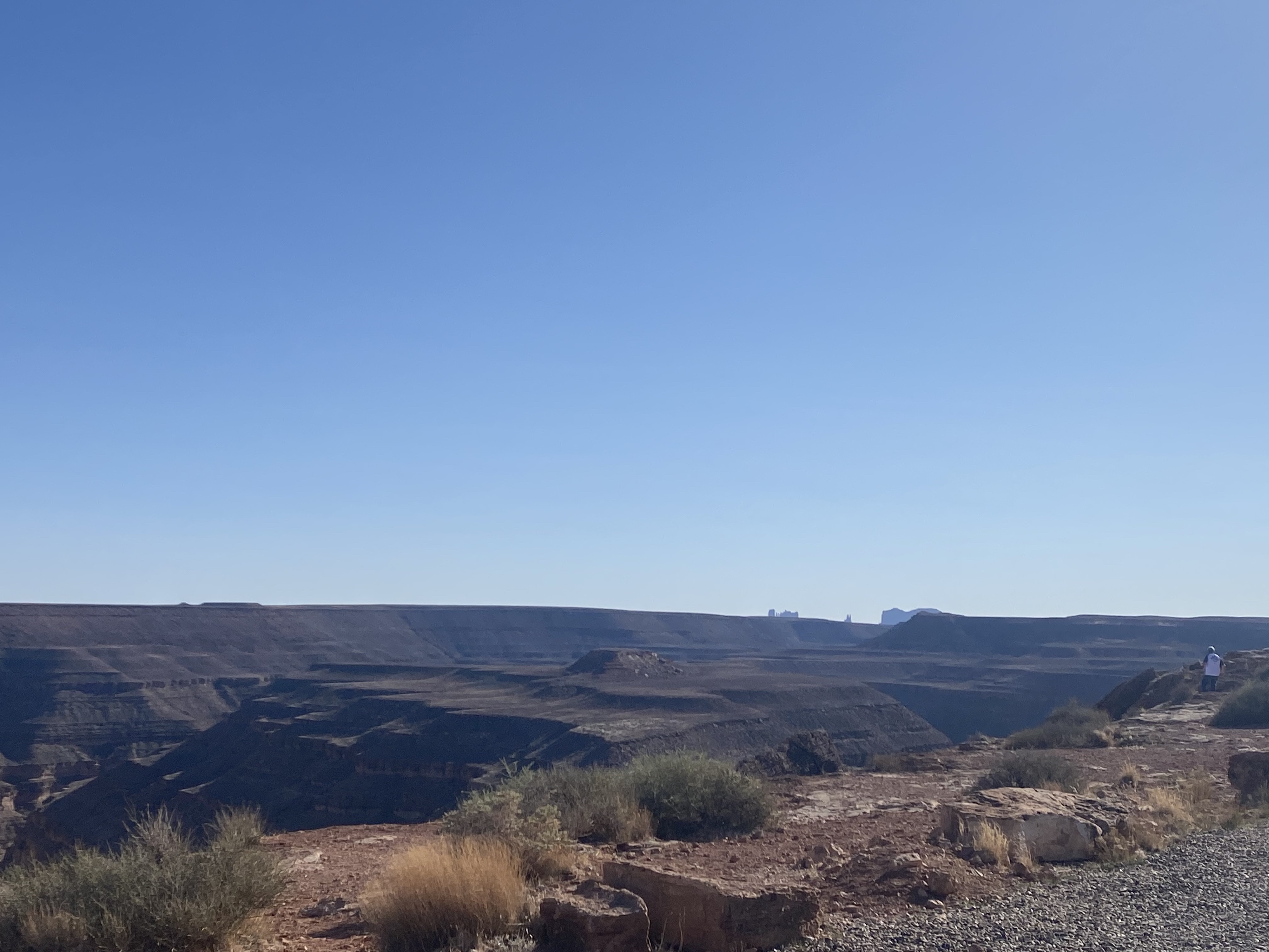
The trail passes by areas of interesting rocks where people climb.

And even crosses a county line.

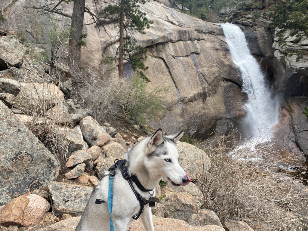
As is the case with most State Parks, this trail is part of a network of trails that connect several important features. Elk Falls just happens to be the most commonly discussed feature, as it is the tallest waterfall within an hour drive of Denver.

Staunton State Park is one of the easiest trail networks to navigate. At each trail junction, there is a sign that not only identifies the trails, but also serves as a mile marker.

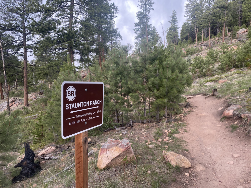
At this point, I had hiked 2.6 miles and had 1.6 miles to the Elk Falls Pond.

With an additional 1.2 miles from the pond to the waterfall, this sign was quite close to the halfway point of the hike.

The hike from the parking lot to the falls would take just over two hours (the return trip would be about the same length). Over the course of the trip, the signage would provide me with a total of about five mileage updates. I actually found this to be quite close to the frequency I desired.

However, I wondered, how many updates we really need and what impact it is having on our experience. I thought about the explorers of centuries past, who would travel great distances using maps that, while state of the art for the time, would be considered woefully insufficient today. Lewis and Clark, for example, famously underestimated the length of their journey by many months. Yet, today we demand mapping software that estimates our time of arrival to the minute. These software packages, available to anyone who has a smart phone, even adjusts expectations for the one aspect of travel that still lead to uncertainty at the turn of the century- traffic. Now, at any moment in time, we can say exactly how much distance and how much time we have left.

Has this detracted from the experience? Are we bombarding ourselves with too many updates? Does checking the map on our phone for updates too frequently cause us to focus too much on the destination, preventing us from enjoying the journey? Could it even be causing anxiety? Elk Falls is the destination and the highlight of the trip, but while still over an hour away from the Falls, it is certainly better to enjoy what is in front of me than to spend the entire time anxiously awaiting the Falls. The same can be said for the trip back to the parking lot.

It makes me think of everything else in life we excessively look for updates on. How much is too much? How often do we check…

  • The number of likes our photo received?
  • The current status of our investments?
  • Whatever device is tracking our fitness goals?
  • The news?

And, what impact does it have on…

  • The experience we have in the places where we took those photos
  • How we think about the investments we chose to make
  • Our feelings about our bodies
  • How we feel about the state of the world

It feels like we’ve reached a point where we are updating ourselves too frequently on too many things. Maybe it’s time to back off all of it and try to be more present in the moment. Maybe this will require some degree of acceptance, of things how they are as opposed to how we wish them to be.

The Last Week of the Off-Season in Summit County, Colorado

Keystone Village Ice Rink three days before Memorial Day Weekend 2021

Somewhere along the line, a holiday set aside to remember those who had died serving in the U.S. military became the “unofficial start of summer”. This year the holiday also happens to coincide with many places lifting restrictions related to COVID-19, as a significant proportion of Americans have been vaccinated and case numbers have declined. In 2021, the contrast between Spring and Summer promises to be far greater than in any other year. It is a contrast between a “socially distanced” offseason and a fully re-open summer that unofficially began Memorial Day Weekend. The week before Memorial Day literally felt like the calm before the storm.

I spent most of the week riding my bike around the area. It felt like the last time in quite a while that these trails (the Summit County’s bike trail system) would be so quiet.

The weather was quite nice, although a bit chilly in the mornings. Yet, since it was still technically off-season, the crowds had not yet arrived.

Downtown Frisco Tuesday May 25th

Each season in the mountains is unique and as Spring transitions into summer, the sun is bright, but mountain tops still have a lot of snow on top of them. The middle part of a sunny day in May or Early June may be the brightest the area ever feels.

There are so many places of natural beauty and so many stretches of trail, throughout the county, where one can just be alone with their thoughts.

It’s hard not to feel spiritually refreshed after several days of cycling around the area.

The way the world is currently set up, cycling is by far the best way for me to process my thoughts. Almost anywhere else I find myself, there is the temptation to look at my phone or engage with some other distraction. Cycling, I need to have both hands on my handlebars. Therefore, there is a lot of value in riding long distances. It is on these rides that I process through life developments and often come up with ideas.

Wednesday was quite possibly the most significant day of this trip. The day started with the Super Flower Blood Moon, a lunar eclipse visible just after 5 A.M. It was visible for a while but then the moon slid behind the clouds as the sky started to brighten up. From a spiritual standpoint, I was told that lunar eclipses are a time for us to release things. So, at the time when the eclipse had peaked, although behind the clouds, I set the intention of letting go of a couple of things that were no longer serving me in life.

Later in the day I rode my bike from Keystone to Breckenridge, a 16 mile (25 km) ride (each way) with a moderate hill climb. When I arrived in Breckenridge, I randomly encountered a parade they were throwing for this year’s high school graduates, on Main Street.

Summit High School Class of ’21 celebrating on Main St. May 26, 2021

It warmed my heart. This year’s graduates in particular got a raw deal from the pandemic. It impacted both their Junior and Senior years. I was glad to hear them all happy, with many of them looking forward to the life they have in front of them. Written on many cars was the college the students were about to attend.

One of my favorite things about bike travel is randomly encountering events like this. They are much harder to miss riding a bicycle than driving on a highway. I even encountered the parade being staged, in the parking lot for the ski resort, which is empty because it’s off-season.

In a few weeks, this place will once again be active, with summer activities. Visiting the week before Memorial Day may have been the best of both worlds, nice weather but still not crowded. However, it is important to recognize it as a transition week, a time when one season ends and another begins. Many people fly from one activity to another, one endeavor to the next, not taking any time to slow down, process what happened and take in the lessons learned. The super blood moon was a time to let go of what isn’t serving us well. Hopefully, the entire week, as was the case for the graduates marching down Main Street preparing for College, was a time to reflect and prepare for what is to come. A time to close one chapter and enter the next.

Cycling up Mountains in a Storm

Loveland Pass on Sunday May 23, 2021

Colorado can be a pretty confusing and frustrating place in the Springtime. In most mid-latitude Northern Hemisphere places, Spring is a time of revival. It is the time of year where people who had mostly been indoors and inactive during the winter return to life. Here in Colorado, Springtime is a period of major weather fluctuations. In Denver, March and April are often the snowiest months. It can even snow in May. Sometimes it feels like we go from tracking the weather for snow to 90 degree heat with barely a week or two in-between.

Credit Channel 7 Denver

At higher elevations it snows quite a bit during springtime (Leadville is 10,200 feet (3.1km) above sea level), even as the snow melts into mud on most trails. It is probably the most inactive time of year in the mountains.

Image from Weather Atlas

Springtime in Colorado requires a combination of planning, adjustment and resiliency. The weekend of May 22nd and 23rd would test my resiliency because I kind of dropped the ball on planning.

On Saturday, I climbed Lookout Mountain, a ride in Golden, Colorado that climbs from 5500 feet (1675m) to 7300 feet (2200 m).

The day was somewhat stormy but also quite active. Paragliders took off from Lookout Mountain, flying over the town.

And the road was packed with cyclists. Only about 20 miles (32 km) from Denver, this is a very popular ride!

After noon, with even more paragliders taking off from the mountain, I encountered the storm.

Some cyclists chose to wait out the rain by finding a building to stand next to. I raced back home, into a fairly significant wind down the hill.

The next day, I went up to Loveland Pass to climb another mountain, this one at a much higher elevation. My ride began at the parking lot of Loveland Ski Area, which sits at around 10,600 feet (3230 m). I could already see that the storms had returned.

As is the case with going upwards in elevation, the weather was much colder, probably only around 45°F (7°C) at the start of the ride. From the very beginning, the ride felt like it was taking place in a different season.

Much of the ground was still covered with snow. Unlike on Lookout Mountain, I was the only one on a bicycle on the road up to Loveland Pass that day. The only other people I encountered were backcountry skiing. One joking asked me for a ride to the top of the pass on my handlebars.

Higher up the mountain, I suddenly found myself doing something I typically try to avoid, riding in the snow. It became scary as it was obvious that slippery conditions existed.

Near the top visibility continued to decline.

Finally, just to be true to the cycling community I belong to, I took a photo holding up my bike in front of the sign that indicated I had reached the top of the pass at just shy of 12,000 feet (3650 m).

There I stood, the only cyclist, almost out of place, like I was suddenly in the wrong season. It reminded me of how often we forget that different people in different places are often having quite different experiences. Two months ago, towards the end of March, while most places in North America were seeing people emerge from their winter dormancy and return to life, life in the Central Rockies was slowing down as the ski season was coming to an end. Now, there could not be more contrast all around me.

As the United States has mostly put the COVID-19 pandemic behind us, countries with slower vaccine rollouts are dealing with some pretty bad case numbers associated with newer, more rapidly spreading, variants of the disease. This sits in sharp contrast to last summer, when other more prepared countries had much greater success in containing the virus through behavioral measures than we had. Heck, even the period of time westerners refer to as the “dark ages“, were not a dark time for everybody. The Tang Dynasty was remembered as a golden age for China. It was also a time of great advancement in the Islamic world. Finding myself on my bike in the snow in the second half of May reminded of the benefit of understanding that not everyone and not every place is having the same experience.

The Prescott-Skull Valley Loop

This 54 mile loop is a common ride for road bikers in Prescott. It is even an annual event. The official ride starts and ends in Prescott, which is called Arizona’s “Mile High City”. It’s official elevation is just over a mile at 5367 feet (1636 m). The official ride starts with a short climb and then a major descent into Skull Valley, whose elevation is closer to 4000 feet (1200 m). Then, the larger climb back towards Prescott is in the second half of the ride I, however, decided to start my ride at the ride’s low point, in a town even smaller, called Kirkland (not to be confused with the Costco brand).

From this side, the ride starts out with a relatively shallow grade up into Skull Valley.

Skull Valley is also quite tiny, feeling mostly like a randomly placed trading post along an old western trail. It is also where the climb starts to get intense.

There was a total of 20 miles of climbing along county highway 10. The road felt quite accommodating the entire time. There were not too many cars and with the exception of a couple of bridges, there is plenty of shoulder space.

Unsurprisingly, the other bicyclists I encountered were traveling in the opposite direction, the official direction of the ride.

The road reaches it’s summit at a place called Iron Springs Pass.

And then descends into the town of Prescott.

This was the other advantage I saw in parking in Kirkland and riding the loop in this direction. Not only does it feel better to do most of the climbing earlier, but it was great to stop in Prescott in the middle of the day and hang around the courthouse in the center of the city.

There were a lot of people out and about on a mid-April Friday and there seemed to be an interesting natural feature in the background in every direction I looked. As was the case in many other places I had explored in Arizona on this trip, there were definitely signs that a lot of ex-Chicagoans had settled there. I even had a true Chicago style hot dog.

The trip back into the valley follows state highway 89 through Prescott National Forest.

There was one last hill climb, of a little under 1,000 ft. (300 m). It was the last climb of the last ride of my weeklong trip down to Arizona.

There was still about 15 miles left in the ride, but it was all downhill. On rides like these, it is quite common for a feeling of accomplishment to set in around this point. The last true challenge was done. This rapid paced downhill part, with much of the same natural beauty of the climb earlier in the day, felt like a victory lap of sorts.

I could gaze out upon the mountains in all directions feeling like I was doing exactly what I had came out here to do.

Whenever taking on any kind of challenge, anything that requires doing things that are hard, that require effort and getting out of our comfort zone, a common question is why. This is a question we are asked by others but also ask ourselves.

On both the uphill and downhill portions of the Prescott-Skull Valley loop, my why once again became quite clear as this was the exact type of bike ride so many of us work towards. It is the feeling of using my own power to traverse beautiful mountainous terrain while feeling the air in my face and smelling what is around me. The immersion in these surroundings cannot be replicated inside an automobile. The experience also becomes far more special when one has the capacity to enjoy it rather than focus single-handedly on the pain they are enduring just to make it up these big hills. Rides like these are a reminder of how we “level up”.

And then, inevitably, we enjoy the rewards the come with it.

The Cycling Trails of Metro Phoenix

People tend to think of Phoenix as a sun-belt car centric city, and for the most part they are correct. While Arizona ranks fairly low in terms of miles driven per capita, biking and public transit are not widely used in the Phoenix area. As is the case in other sun belt places like Southern California and Texas, driving is the default way to get from point A to point B. However, this does not mean that the region has no bike trails, nor does it mean that the area cannot be explored by bicycle.

Maricopa County Bike Map

The bike trails are quite nice and not crowded at all. My visit to Phoenix came at probably the best time of year to bike around the city, in the middle of April, and I was commonly the only one on the trail.

There are also a good number of trails, all connecting most parts of Phoenix and the nearby suburbs.

The crown jewel of the trail system is the Arizona Canal Path, a trail nearly 70 miles in length connecting places as far apart as Glendale and Scottsdale.

The trail has a very unique feel. The canal is obviously not natural. Nothing about it feels free flowing like the rivers and creeks I am accustomed to seeing elsewhere. It was constructed in the late 19th century kind of as the towns around Phoenix were being settled and incorporated. They needed the water and the means to transport goods, which was then far more dependent on water then. Later, they built Arizona Falls to harness some power from the canal.

Still, none of this is what I typically envision when I think of riding a bicycle along a river and seeing a waterfall.

However, the ride is not without natural beauty. Mountains, cactus and palm tress emerge around every curve.

It’s such an interesting feeling. Little mini-mountains in the middle of a city with over 1.5 Million People. Natural beauty around every curve, but every curve was planned carefully by engineers. Some of us are so accustomed to thinking of natural experiences as being separate from human development. This is especially the case in places like New York and Chicago where our homes are surrounded by development but we travel a few hours to be away from that development in nature. However, here on all of the Phoenix area bike trails, there is both, right there in front of my eyes.

Along these trails, it is possible to visit a lot of the area attractions. From the kinds of places you’ll see in almost every major city.

To spring training facilities for baseball and softball alike.

To the college and professional sports stadiums.

While exploring, you also never know what kind of random attractions you’ll encounter. Right in the middle of town there is a castle, and just east of town there is this hole in a rock people like to hike into.

I even got to see Central Station under construction and the one light rail line downtown.

I also learned one other important lesson, the difference between cycling long distances in a semi-arid area like Denver and a full-blown desert like Phoenix.

Usa Map Of Köppen Climate Classification - 2018 Iecc Climate Zone Map -  Free Transparent PNG Download - PNGkey

In this part of Arizona, it was hard to drink enough water without even doing anything that involves physical exertion. Spending the whole day riding my bicycle felt like a constant search for water. I guess I now understand why the bike trails are empty and why they follow a series of waterways built to bring water into the area. It even facilitates some agriculture surprisingly close to the city center.

Still, there is nothing like the feeling of visiting so many tourist attractions traveling by bicycle on a day with sunshine and temperatures in the 80s (26-32° C).

The Musical Instrument Museum

Unique places like the Musical Instrument Museum are the essence of travel. The reason it becomes worthwhile for anyone to leave the place they live and travel to places beyond where they typically find themselves is to see something different, something unique, something they can’t see in their hometown. Often times they are places of natural beauty or specific cultural experiences. However, this museum, on the Northeast side of Phoenix is something few people have in their metropolitan areas. It is a museum dedicated to musical instruments and the musical experience around the world.

Upon entry into the museum the motivation behind building it is apparent and obvious.

For reasons that are hard to impossible to explain, music is and has always been a major part of the human experience. It is hard to imagine a world without it, and music historians speculate that music has been around longer than language. Music is an experience that cannot be accurately explained in words. The reasons different people have different reactions to music cannot be programmed into an algorithm or explained using science, language or any left-brained tactics.

The museum itself has a lot of exhibits. The downstairs has exhibits demonstrating the importance of specific musical instruments.

While the upstairs contains exhibits showing the musical traditions of every country around the world.

Each county’s exhibit contains videos of popular songs, performances or dance rituals in their country, as well as artifacts of instruments past and present.

Coming out of a very isolating year, with the COVID-19 pandemic, it is hard not to get emotional at some of these exhibits. While the venues vary, especially from poorer countries to richer countries, music seems to be a means by which people gather together and have fun. Many of the videos show people doing ritualistic dances together or performing in front of a large audience. It is exactly everything the world has been missing as many have been forced to “social distance” for a year or more. Seeing people gathered together and enjoying music is seeing exactly what the world needs and exactly what the world is craving.

It was also interesting to note that even the poorest of countries have musical traditions. Pure logic would dictate that in places where people live in extreme poverty, where their basic needs for food, water and shelter are not secure, people should spend every last bit of their time and resources trying to fill these needs. Even in these places, people are willing to use natural resources to build drums rather than secure their fragile homes or build weapons to hunt food. They are willing to expend energy that could be used to build, hunt, and prepare food, water and shelter dancing and even making costumes for some rituals.

It shows that no matter how much some people emphasize things like advancement, monetization and efficiency, there is an intrinsic value in things that don’t specifically correspond to money or material wealth. People in wealthy countries are willing to spend their money on concert tickets and streaming services. People in poorer countries are willing to use their resources to play music and dance in their communities. Both represent people using resources that could be used for personal advancement or obtaining something material on an experience that makes life joyous. The same could be said for all kinds of other experiences, from spiritual pursuits to sports and other activities with friends. Humanity shows, over and over again that joy, connection and fulfillment are valuable.

The United States and Canada section is quite diverse, honoring all of the musical traditions that graced this diverse continent, from the Native American traditions all the way up to rock and roll and hip hop.

It was great to see that all traditions were represented, seemingly without bias.

To view all of the videos and learn about all of the musical traditions around the world would probably warrant an entire day. However, it is possible to get a pretty in-depth experience in a couple of hours. By displaying the music traditions of all people all over the world, the Musical Instrument Museum gives the true respect music deserves for its role in shaping humanity.

Suburbia Continues to Expand

This recently built “active adult” community is an hour’s drive from downtown Phoenix and surrounded in all directions by sagebrush and cactus. This spot is one of many places all over North America where previously untouched land is being developed into homes and other facilities.

It is a trend that really began in earnest following World War 2. Despite the much talked about “urban renaissance” of the 1990s and 2000s, suburbia continued to grow. Houses continued to be built on previously untouched land.

Just ten miles to the East of this randomly placed community is the City of Surprise, an outer suburb that has recently grown from a population around 30,000 at the turn of the century to over 140,000 today! This rapid growth occurred right through the height of the “urban renaissance” and the housing market collapse of 2007-2009.

Demand for suburban homes is expected to expand once again as people continue to embrace remote work after the pandemic. The emerging consensus appears to be some kind of “hybrid” scenario where people have an office to come into for meetings and group work, but also have the flexibility to work at least half of their time from home. This is the perfect scenario for continued expansion of outer suburbs like Surprise, as an hour commute is far less painful one or two days a week than five. With this scenario, people will now desire homes large enough to be comfortable in their home offices.

As is the case with any trend, some will appreciate it while others will not. At any given point in time, nearly everyone will be able to point to at least one trend they are enjoying or encouraged by and at least one other trend they view far more negatively. When observing things like these, it is important to remember a few things.

First, no trends are permanent. A look back into history can show examples of countless trends that found a way of reversing themselves. The “hippies” of the 1960s and 1970s became the “yuppies” of the 1980s and 1990s. In an even a more recent example, most of the 2010s saw pop music get slower and more depressing. Over the past several years, this trend has reversed itself. It would be foolish to assume any trend will continue on its current course forever.

Second, it is quite difficult to try to reverse or impact any of these larger scale trends. They are often the result of something far more major. Right now, suburbia is becoming more attractive because of the need for space for home offices with increased remote work. Developments like the expansion of ride sharing companies like Uber and the promise of self-driving cars are also making larger suburban homes more attractive to some. Similar explanations can be made for other trends and observations. Much of what is going on right now, socially and politically, are the result of a combination of human nature/ psychology and recent technological advancements. The only people who are able to have any real impact on trends like these are the ones that are both influential and relentless.

Finally, for those that are not in a position to impact societal trends, the best thing to do is to anticipate and react accordingly. This is most effectively done by understanding the mechanisms behind a trend and observing when it feels like the underlying conditions are going to change. This is the part that has the potential to be really enjoyable for curious people who love to speculate about the future. On the flip side, it is possible for some to spend too much time lamenting the trends they do not view as positive developments. In many cases, it leads to people focusing too much on what they can’t control and can have unfortunate negative impacts on their ability to live their best lives. Those that can control this urge and anticipate shifts in trends, however, will be well positioned for the future.

Mingus Mountain: A 3500 foot climb in Arizona

A view of Mingus Mountain from the edge of Clarkdale, Arizona

My day did not start out well. It may have been poorly planned. To train for Ride The Rockies 2021, a very challenging organized bike ride in mid-June, I decided to travel to Arizona in April where the weather would be more hospitable for mountainous bike rides. I looked at lists of Arizona’s top bike rides and determined that Mingus Mountain should be on my itinerary. However, upon looking at the specifics of the Mingus Mountain loop, I decided to shy away from a ride that would involve cycling on the interstate.

Instead, I came up with a plan that turned out to be unrealistic. I would park in Prescott and bike from Prescott to Sedona (and then back). I figured I wanted to push myself, and this long ride would enable me to see all of Central Arizona’s top spots in one day! I would start the day at beautiful Watson Lake.

Almost immediately I encountered problems. Highway 89-A is busy, and in parts of Prescott it is a limited access road much like an interstate highway. The alternate road I planned to bike on turned out to be closed.

Determined to find a way to continue with my original plan, I spent about an hour pedaling through neighborhoods under construction only to continuously be re-routed by dead ends and roads that were either closed or still in the process of being built. I ended up in a spot where the only reasonable course of action would be to follow an unpaved trail back to my vehicle.

First, i figured I would just drive around 15 miles down the highway, find a place to park and continue on my path. However, the road continued to be heavily trafficked without a shoulder to accommodate bicycles.

Also, this parking spot that I had just imagined to exist never actually materialized. Before I knew it, I was driving over Mingus Mountain.

So, I figured I would drive to Sedona and pedal up the mountain from the East side. Then, I encountered Clarkdale and Cottonwood. Riding through these towns, would have involved five or six miles, both ways, of riding on suburban feeling sidewalks.

My “plan” was never a good one. It involved too many assumptions about things I failed to fully research, including parking, bicycle accommodations, etc. Doing this due diligence is a lesson I had learned but somehow forgotten during the pandemic. How frequently lessons have to be re-learned can be one of the most frustrating occurrences in life. A “re-lapse” is not just a drug addict that starts using again. Unfortunately, it’s all too common for people who had improved things like their habits and mindset to slip back into their old patterns that were not serving them well.

I was fortunate enough to find a tourist information center.

Where I was told I could park at the gas station on the far West end of town to ride my bike up Mingus Mountain.

The ride itself is beautiful right from the start, and, although I had a delay I was doing exactly what I had come to Arizona to do, ride my bike up big hills in nice weather.

Clarkdale sits at only 3545 feet (1080 m) in elevation. So, it is already a significant climb just to get to the ghost town of Jerome.

Jerome is a unique spot! Like many ghost towns of the West, it boomed in the late 19th Century due to mining (copper) and then went bust.

However, unlike other ghost towns, it is now a popular tourist destination with a lot of visitors.

Evidence of its past, as a lawless “old west” town can be seen everywhere.

Sitting on the side of a cliff, it also takes on the feel of a Mediterranean town.

Pedaling uphill through Jerome ended up being one of the hardest parts of the entire climb!

A scenic overlook a half a mile up the road from Jerome

Above Jerome the climb continued to be intense, but the amount of cars drops off significantly making for a quieter ride.

One thing I would grow to love about Arizona’s highway system throughout the week was their elevation signs. Their highways commonly have signs denoting the 1000 foot increments in elevation, providing a fantastic reference point!

The highest 1000 feet (300 m) of the climb was stunning. The panoramic views provided an almost instant reward for level of muscle exhaustion I was experiencing.

This is perhaps why I love cycling so much. When it comes to physical exercise, it is quite rare to be so immersed in the core motivating factor for the hard work, exhaustion and pain. Typically during workouts people remind themselves they are building endurance, improving their health, losing weight, etc. to keep their motivation. Here in the mountains on my bicycle, all I needed to do was continue to look all around me, feel and smell the fresh air and I knew exactly why I was willing to endure so much.

It is always exciting to reach the top of a climb. Seeing the signs and the road turn downwards for the first time in over an hour is a sweet feeling that one must experience to truly understand.

It is a great place to rest and enjoy the beauty of the place I had worked so hard to get to.

As is the case with all other components of our lives, it is crucial to savor moments like these, enjoy them while they are happening. It would have been a huge disservice to myself, as well as the natural environment around me to dwell on my prior setbacks. After all, the world is in a constant state of flux. We never know what experiences will no longer be available to return to.

Yes, that day I actually saw the forest rangers update the fire risk to high on the grounds that the humidity was 8%.

Northern Arizona 1000 Years Ago

When we think about remnants of ancient civilizations, we often think of places like Egypt, Greece or Italy. Athens, Cairo and Rome are certainly places people visit for the primary purpose of observing and learning about history. However, one thing I learned about travel, generally speaking, is that history is all around us. Evidence of historical events, both the human and natural kind, can be found almost everywhere, and sometimes in some unexpected places.

Wupatki National Monument sits about 30 miles north of Flagstaff and is easily accessible via U.S. highway 89. Those traveling through the area can visit the remnants of several abandoned pueblos, as well as sunset crater, the site of a volcanic eruption, on a convenient 36 mile scenic drive.

In the 11th, 12th and early 13th centuries, the region around the present day four corners was home to one of the most advanced civilizations in North America north of the Aztec Empire.

They had houses large and small.

They even had buildings that would serve the equivalent function to the larger buildings we have in urban areas today.

Recent evidence indicates that the population of the continent before Columbus’s arrival was likely much higher than we had originally thought. Before the pueblos were abandoned and subject to 700 years of weathering, these building were certainly more densely packed together than they appear today. Archeologists and historians are still debating why the settlements here and in other nearby places were just abandoned. It is likely that a combination of drought and over-hunting made the region no longer ideal for civilization at the time. Looking out upon them and imagining this past, it becomes possible to speculate about people’s lives at the time.

Some things were certainly different from our lives today. For example, they did not have the means to travel long distances, as horses would be introduced by the Spanish centuries later. So, there were few journeys or adventures. However, based on human nature, there was certainly the friendships, conflicts, drama, power struggles, rivalries, parties, shared experiences and accomplishments that go along with life in towns and cities.

There were definitely events, one of which is evidenced by Sunset Crater Volcano National Monument on the same scenic drive

Evidence points to this volcano erupting in the later half of the 11th century. The eruption was seen by Anasazi and Sinagua inhabitants of the region. They probably talked about it for years, possibly even the entire two-ish centuries between the eruption and their mysterious departure from the region.

The volcanic eruptions changed the landscape of the area in ways that can still be seen today. Slopes in the area still appear black from the ash that followed the eruption.

Scientists can identify the minerals deposited on the rocks in the area.

These minerals likely altered the manner in which the Anasazi and Sinagua people farmed the area when they lived in these pueblos.

I began to wonder what other records, knowledge and traditions were lost when these civilizations collapsed. Could they have had scientific knowledge that we will never benefit from? Did they have philosophical ideas worthy of our consideration? Is there a history we could be learning from?

Sometimes it feels like we fail to consider the history of a place before “our” involvement- before we arrived. What event constitutes “our” arrival is open to debate. Regardless, “our” involvement in the North American continent spans between 150 and just over 500 years out of a history that goes back at least 13,000. What happened on this continent before Columbus arrived certainly impacts our lives today.

Even if we talk about the course of events on the scale of our individual lives, the same bias often surfaces. We’ll move to a city and learn what highways jam up at what hours of the day, what restaurants to go to, etc. But, what about the city a few decades ago? There is often a reason, based on the migration of people, why the best Italian restaurants are in one neighborhood and the best Chinese ones are in another.

As I took a deep breath and gazed out into the open sky I thought about a phenomenon I had first thought of nearly 20 years ago. Right now, there is something happening, in another town, involving people I do not know yet, that will have a significant impact on my life. The same can be said for anyone else, including anyone reading this entry.

The Best of Southeast Utah

Monument Valley from 2 miles south

Monument Valley is the quintessential image associated with The American West. Perhaps because of how frequently it has appeared in films, particularly westerns, it is quite difficult to look at this grouping of red rock formations without imagining cowboys riding horses across the landscape.

Despite the fact that the natural processes associated with its formation are culturally agnostic, and the fact that the monument sits on the Navajo Indian Reservation, these rocks have become forever associated with the culture of the American West. The fact that the first music video that pops into my head when I think of Monument Valley is by a German Band, the Scorpions, does not even seem to temper that association. Every American hard rock song feels like it fits in perfectly with this landscape.

Speaking of the landscape, Monument Valley is one of those places with a command of the landscape for miles away. Particularly approaching from the north (or northeast as that is where the highways are), it can be seen from some 50 miles away.

The interesting thing about Monument Valley is how different it can appear on either side of the monument. In the afternoon, the north (northeast) side has a much different appearance than the view from the south, which represents the standard iconic view of the feature, with the sun shining on it.

How this specific iconic set of rocks became associate with 19th century American pioneers on horseback, and the enduring culture and ethos of the Interior American West is probably a challenging question to answer. Yet, it is most certainly the repetition of this association throughout culture and media that makes people living some half a century or more after all of these films were produced continue to feel a certain feeling when they gaze upon this monument. It is hard to imagine a better example of how repetition creates and perpetuates and association than this one. I am truly curious about what the Navajo Nation thinks of it.

The strange thing is that this association has lead me to think of gold prospectors, cowboys on horseback, shootouts and such at other places with a similar feel. Like most naturally occurring features, Monument Valley is not the only place where the natural processes that created these features occured.

The rock formations about 160 miles to the Northeast, outside of Moab, Utah, take on a very similar feel. It almost feels as if any movie or music video filmed at Monument Valley could have just as easily been filmed here to the same effect.

It would be a huge missed opportunity to visit Monument Valley without also visiting Goosenecks State Park, only about 30 miles away.

This is another spot that is photographed quite frequently. Unlike Monument Valley, it seems to have a stronger association with that which is current about the American West; tourism, outdoor adventures, and, of course, the search for the perfect instagram photo.

Visitors to the park can also see Monument Valley from a distance.

I had previously visited Arches National Park, traveling to the most iconic of the arches.

On that trip, I had failed to realize that just a half an hour south on highway 191, it is possible to see one of these arches without ever leaving the highway.

Like any other place in the West, Southeast Utah has places that are underrated, not trying to be noticed.

And places trying to get people to stop that don’t make much sense.

It’s unique natural features connect the past to the present, activate the imagination and provide experiences that are indicative of Western North America as a whole, yet unique to the specific location.