Category Archives: Outdoor Activities

Saint John; Virgin Islands

Saint John Island is one of the most remote places within the United States.  A part of the United States Virgin Islands territory, it’s year-round population is a meager 4200 people.  It can only be accessed via ferry or boat.  For mainlanders, Saint John can be accessed by a 20 minute ferry ride, after a half hour cab ride from the airport on nearby Saint Thomas.  The flying time to Saint Thomas is listed as roughly three hours from the nearest major airport in the mainland; Miami, Florida.  Therefore, the minimum travel time for any mainlander is four hours.  For most, the journey is much longer.

I spent my time on Saint John primarily in two places; Cruz Bay, which is the main population center on the island, and Caneel Bay, a resort about ten minutes farther up the coast of the island.

IMG_2819 IMG_2817

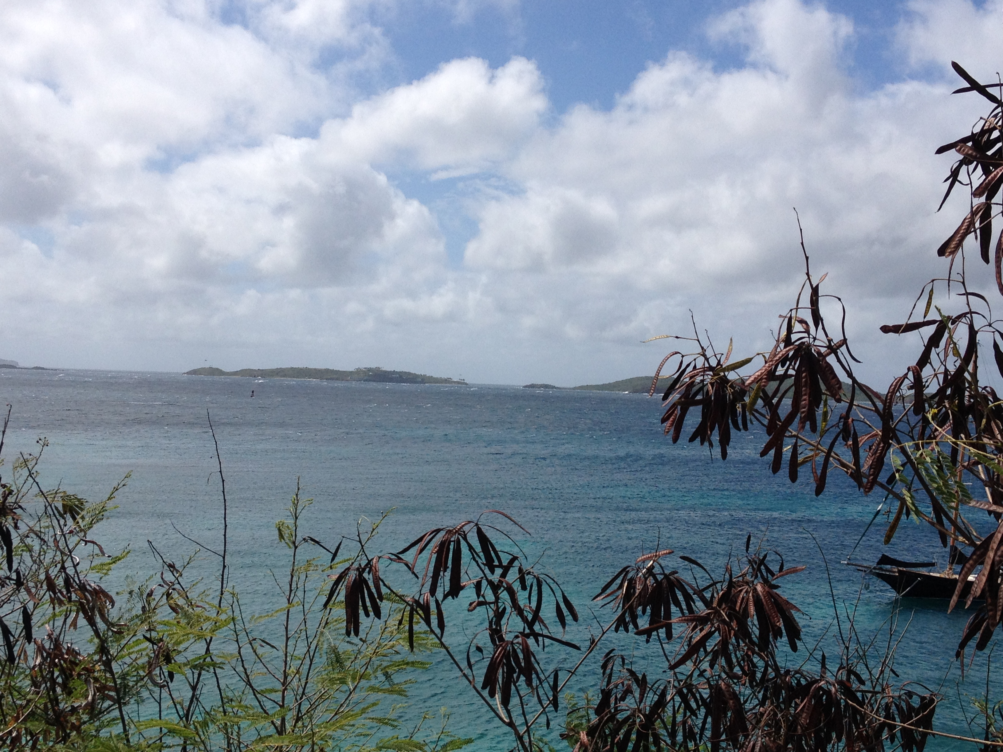
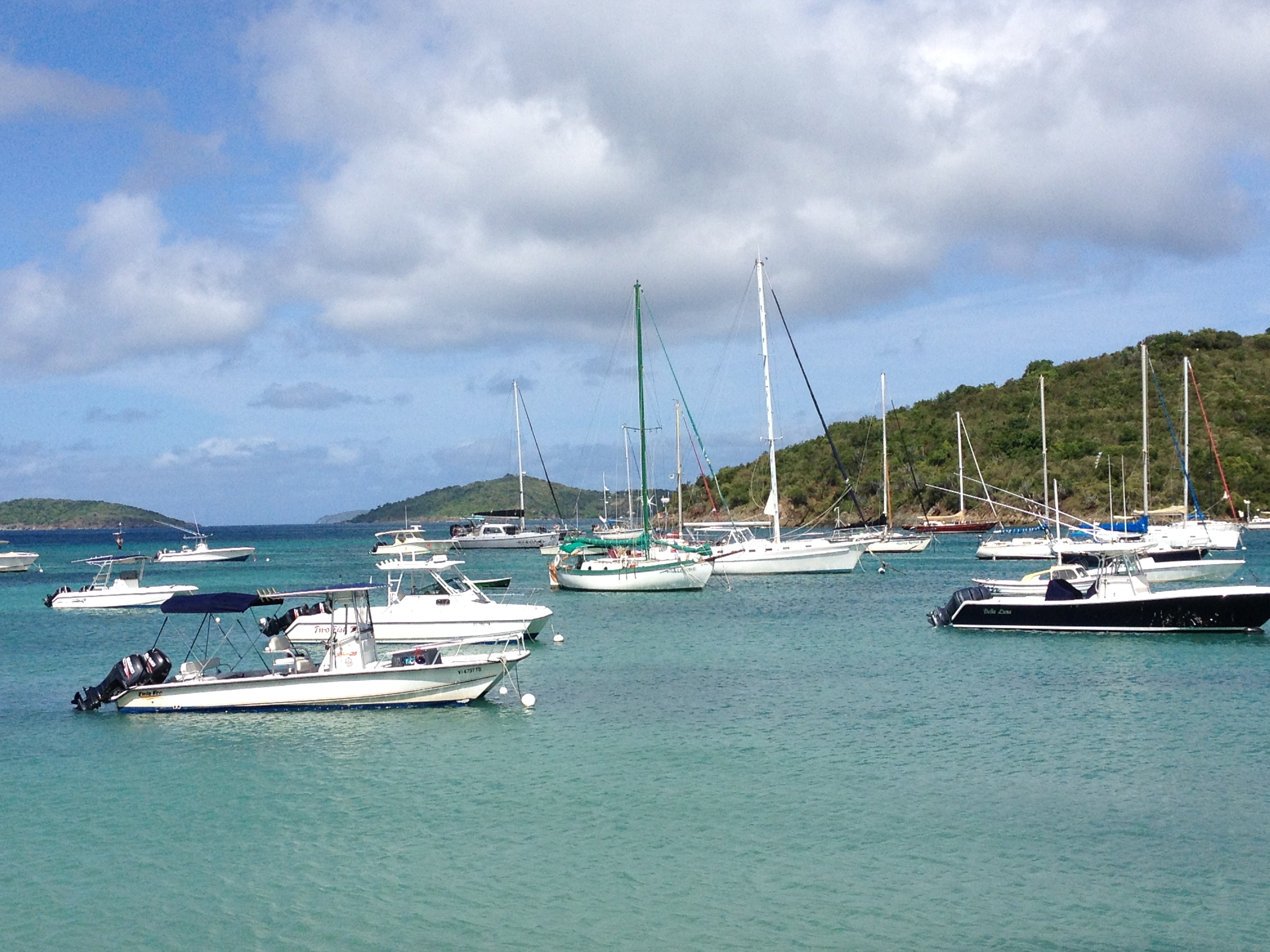
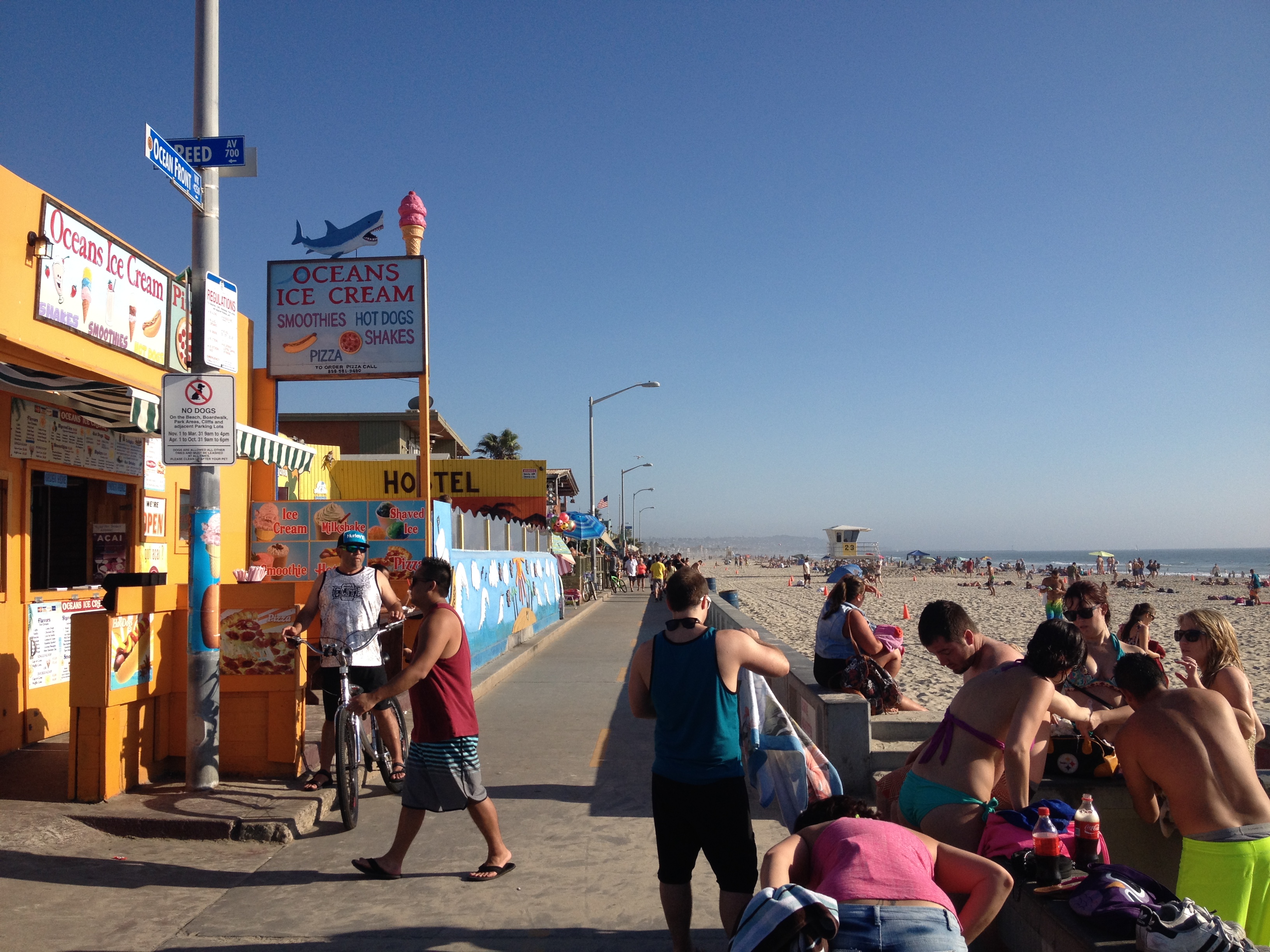
Cruz Bay is where the ferry from Saint Thomas first arrives.  It is the first place any visitor to this island sees.  It is Saint John’s front door, it’s first impression.  And it doesn’t disappoint.  The ocean here is as stunning and picturesque as anywhere I could possibly imagine.  In fact, even at some of the best kept lakes in the United States, I have never seen water this magically blue.

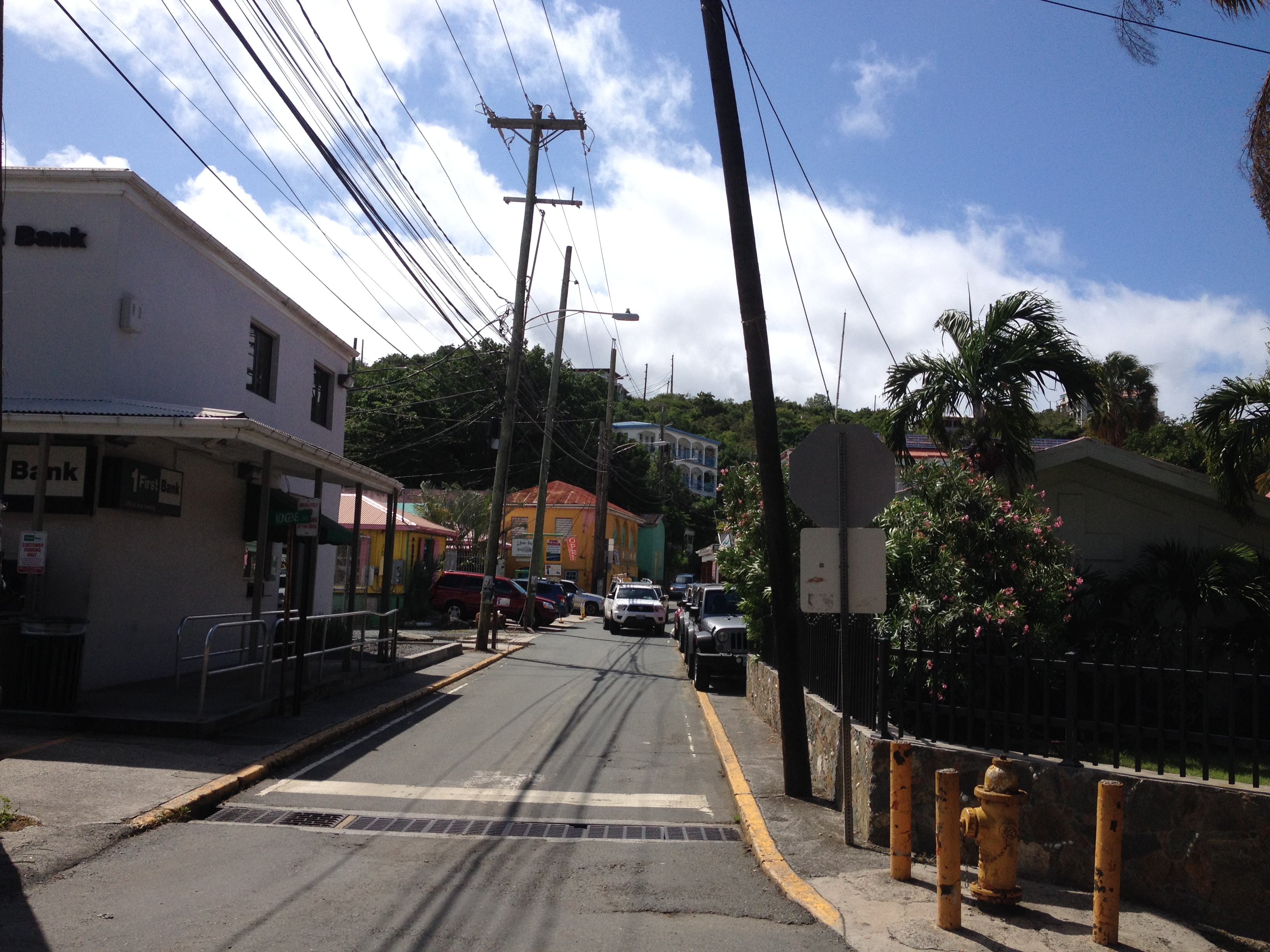
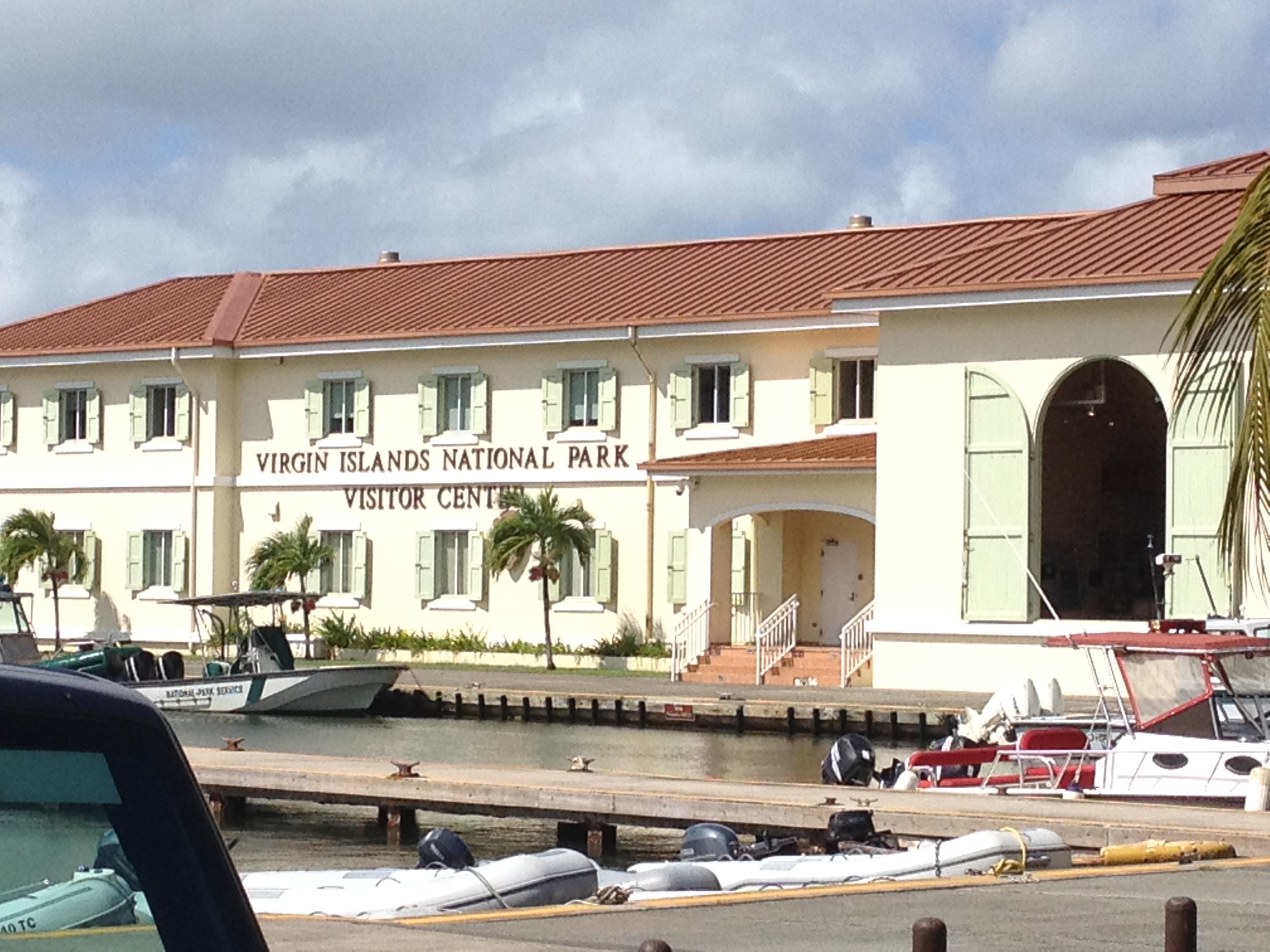
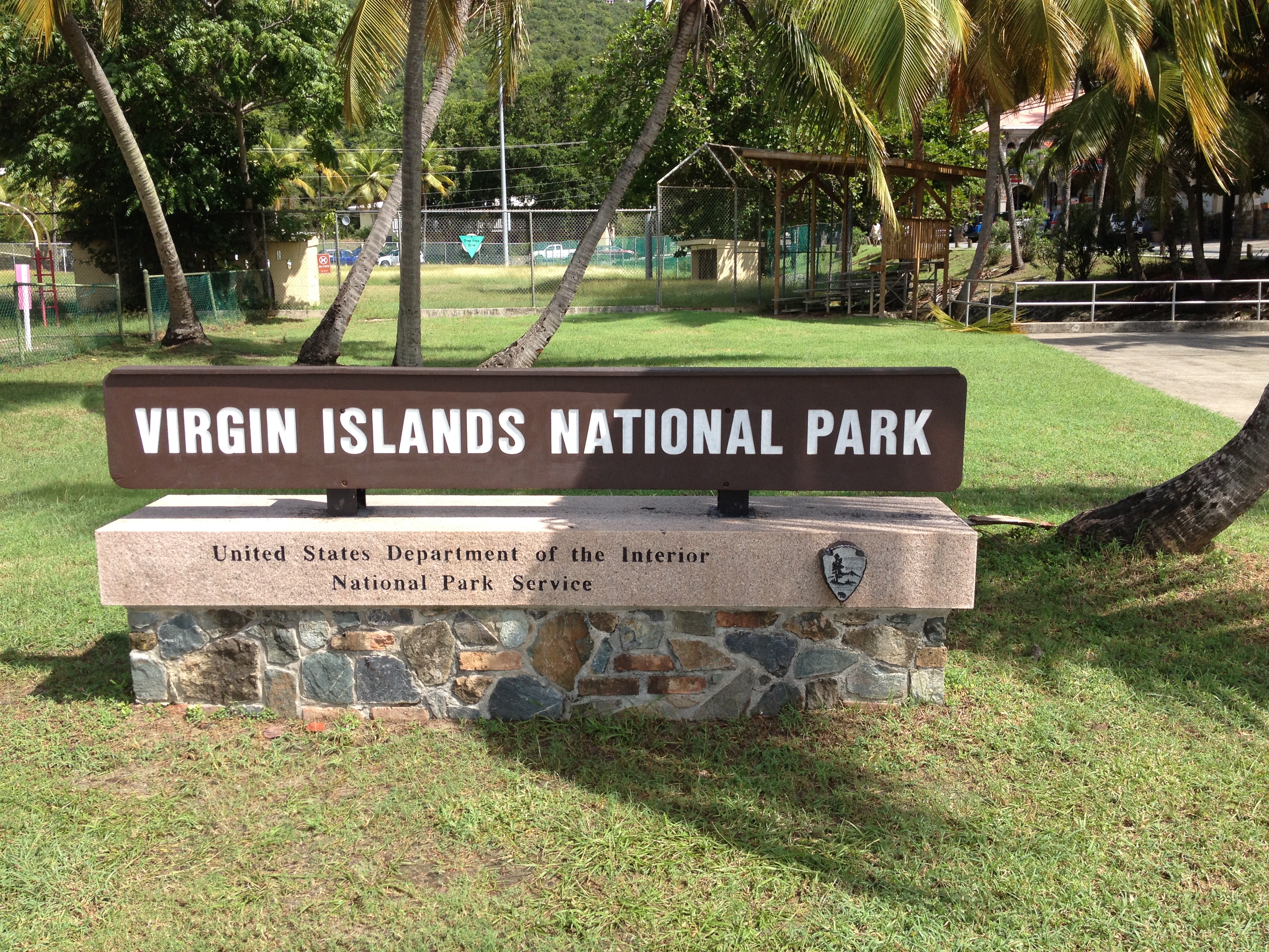
Upon arrival to Cruz Bay on the ferry, one immediately sees a plethora of tourist accommodations.  To the left is the Virgin Islands National Park Visitor Center.  In front are the beaches, boats and restaurants.

IMG_2824 IMG_2827

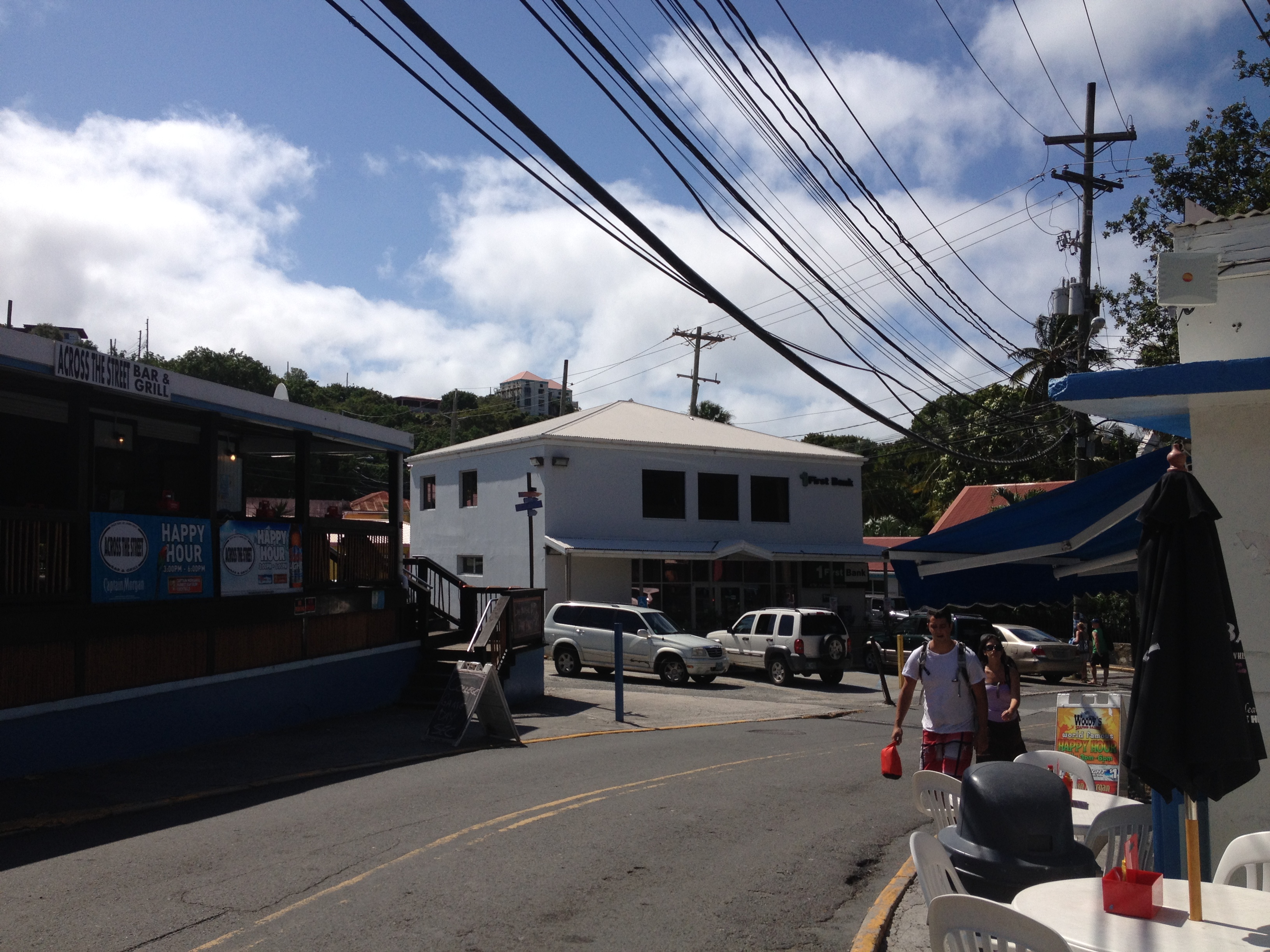
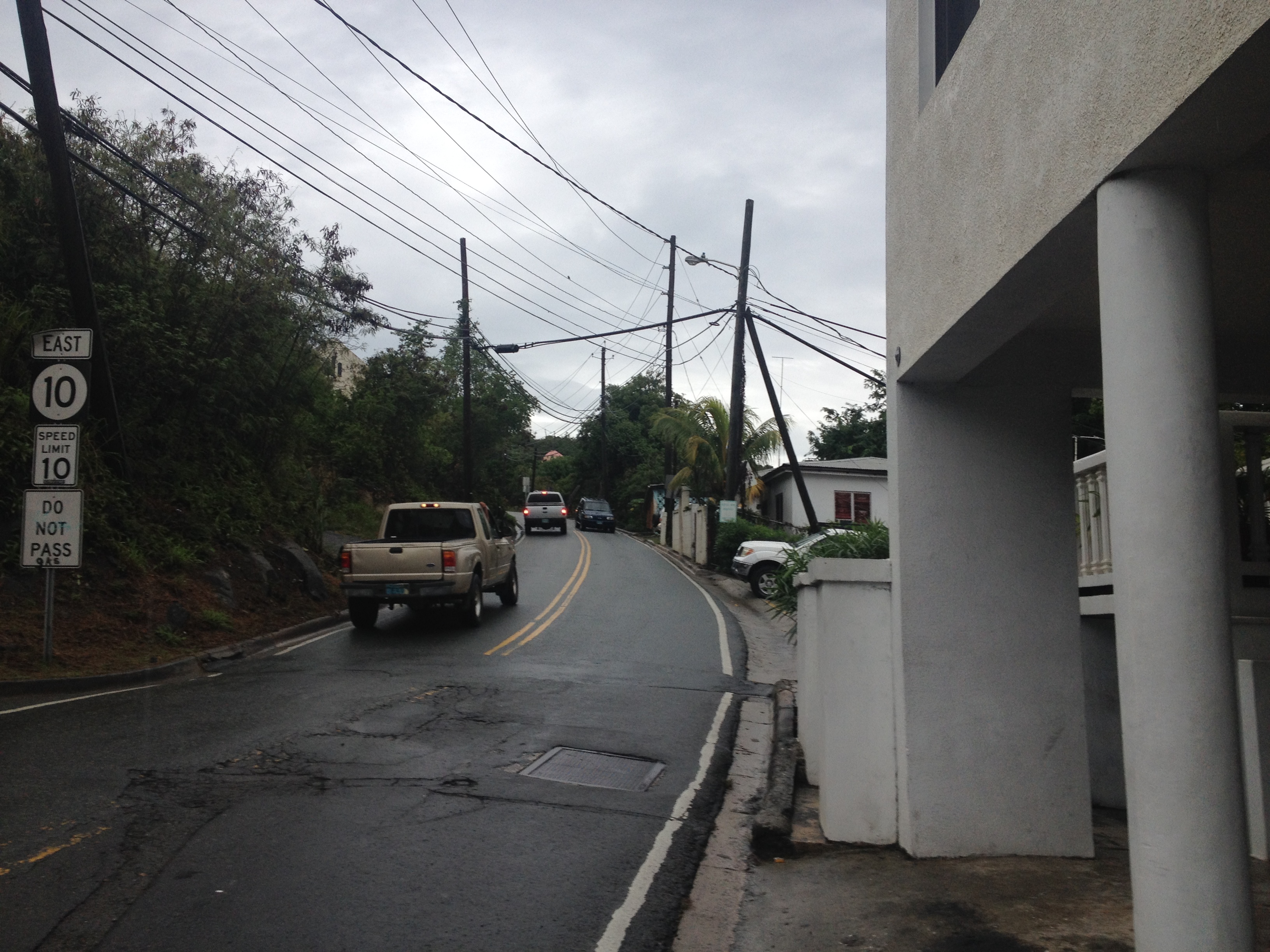
A tourist that walks up the road straight in front of them (road names are not obvious here) will encounter a road lined with bars and restaurants that obviously cater to those not from the Islands.  Walking along this street in the evening, rather than traditional Caribbean music, one will hear the likes of Jimmy Buffet, modern American pop, and a surprising amount of Country-Western music.  And, a vast majority of the proprietors and patrons of any of these restaurants are obviously tourists or those who moved here from the mainland to work tourism related jobs.

Most of the residents of this island are black (or Afro-Caribbean).  Although this did not really surprise me, I still wonder how this came to be, as I had never really been taught about the history of the Caribbean Islands beyond the arrival of Christopher Columbus in 1492 and the subsequent voyages to the “New World” that the news of this voyage inspired.

However, when I look around me, and take a couple of trips to less touristy parts of the Island, where one can see a better representation of how those native to Saint John live, I can’t help but have the present rather than the past on my mind.

How do the lives of those that live here year round differ from our own?

How do they feel about being a part of the United States?  And, more specifically, how do they feel about their status as a U.S. territory (and not a state)?  We commonly hear about issues regarding Puerto Rico’s similar status, and the razor thin margin between those who support and those who oppose statehood.  But, we never really hear much about the U.S. Virgin Islands’ status and how it impacts the people here.

Most importantly, how do they feel about us, and our presence here?  Do they debate the economic impact of tourism vs. the cultural disruption that it causes?  Do they ponder the fact that within the mainland part of the U.S., we have places like Catalina, Key West and South Padre, places where many of us could theoretically get a similar experience without invading their island?

Ultimately, are they fighting for their identities, their culture, or are they enjoying the economic benefit of our presence, as well as their association with the United States of America?   When we think of the Caribbean, we often think of pop icons, including Bob Marley, but also more recent pop icons from the region, such as Daddy Yankee and Sean Kingston.  The music produced by these artists take us to the pristine tropical oceans of the Caribbean, if nowhere else but in our minds.

However, it is these pop icons that appear to represent the dichotomy of the possible responses that seem plausible given the current situation of those that live in the U.S. Virgin Islands.  Marley, from his lyrics, considered himself part of a struggle for the culture and identity of himself and his people.  But modern pop stars like Kingston appear to be simply enjoying the economic benefit of their stardom, much of which comes from the U.S. and the western world that Marley rallies against.

Although there is a lot more to any one person’s life that what we witness through the media, Kingston and Co. do appear to be thoroughly enjoying their lives.

IMG_2847 IMG_2849

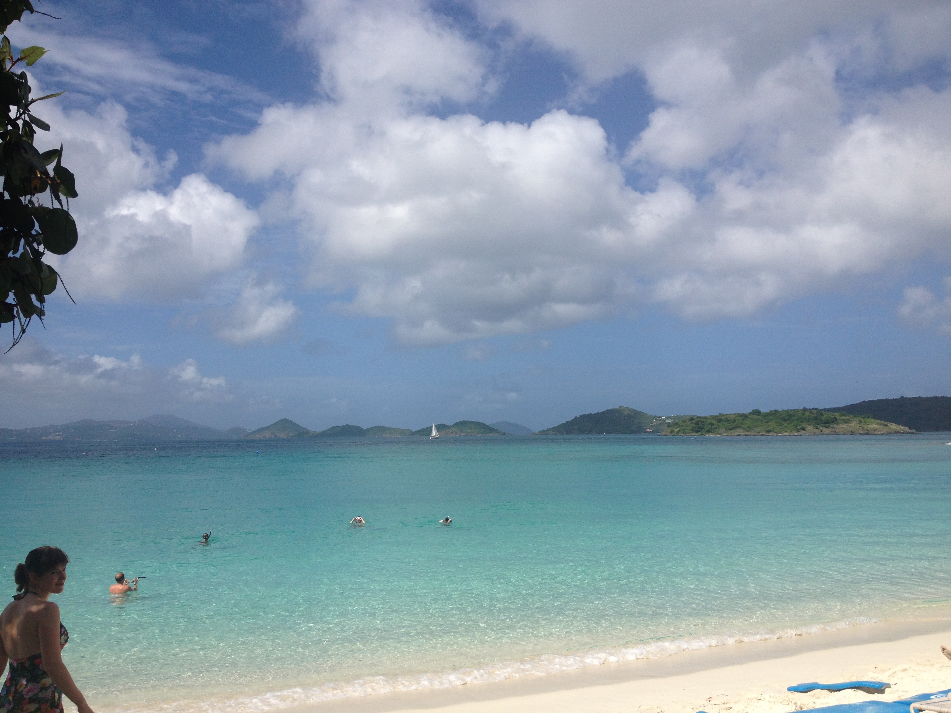
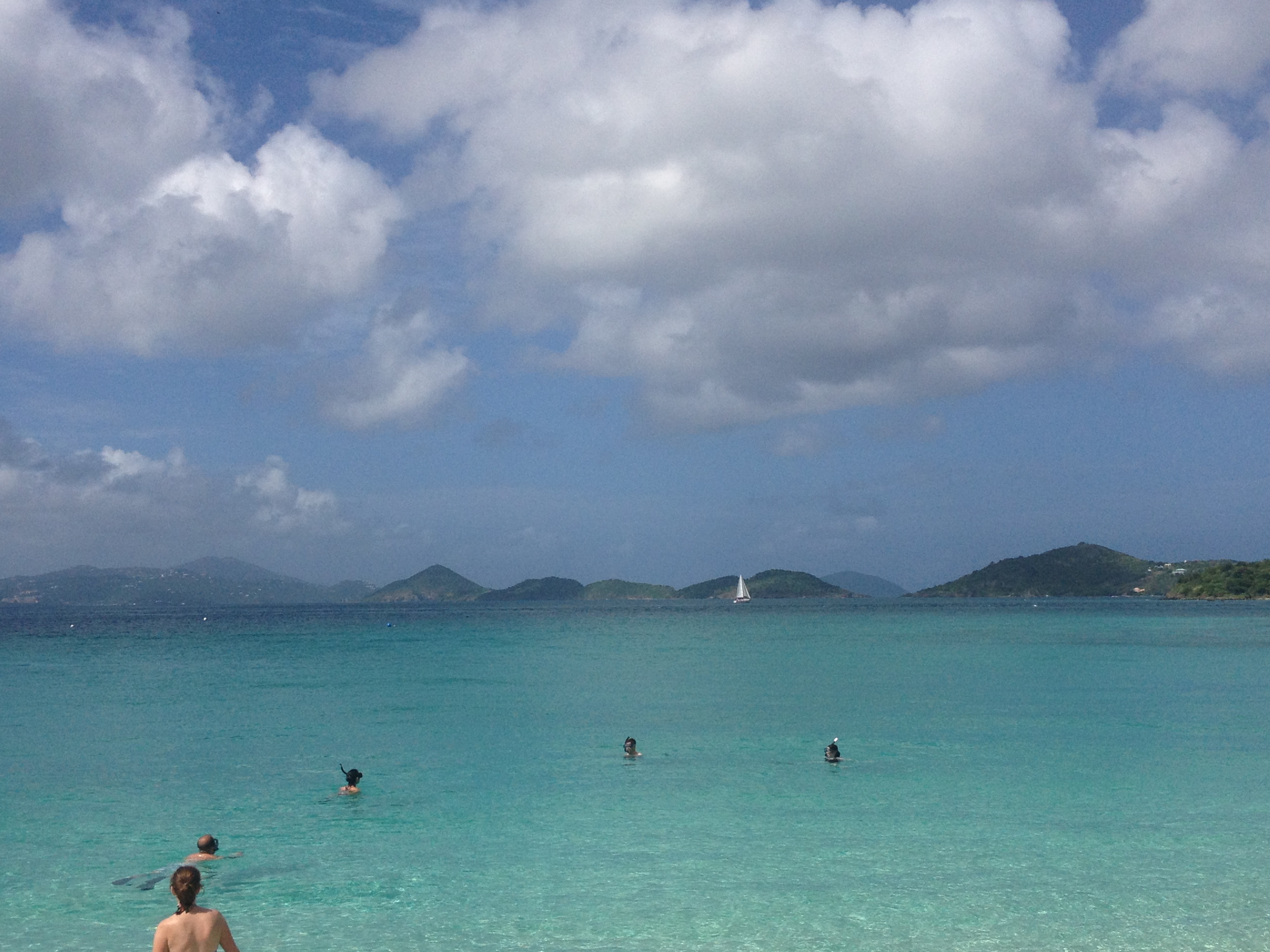
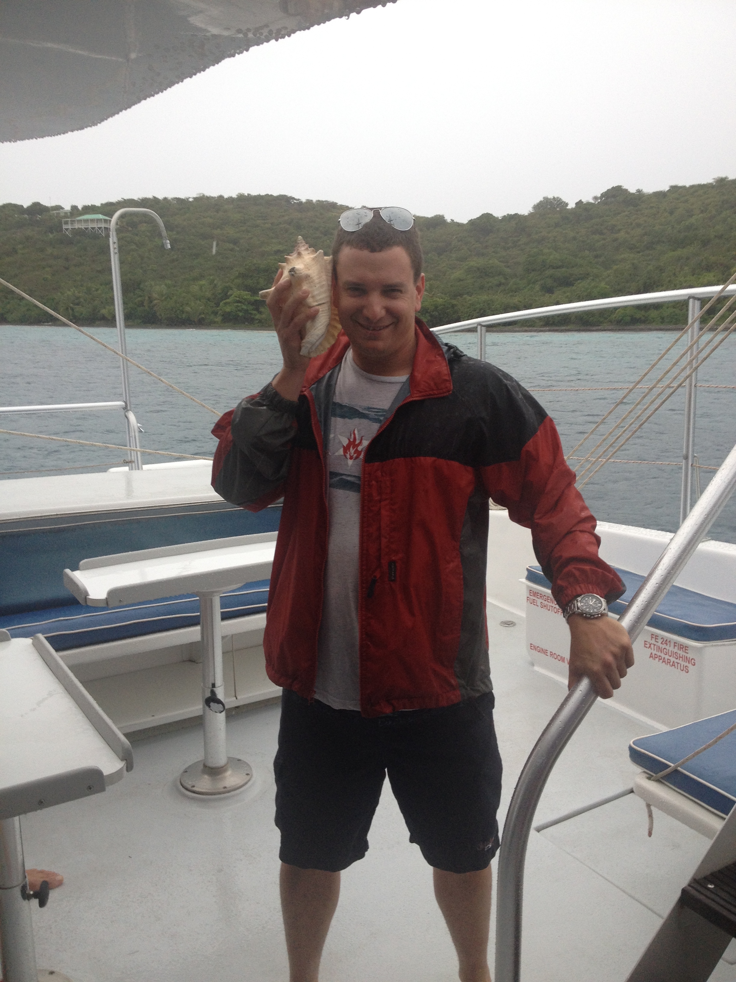
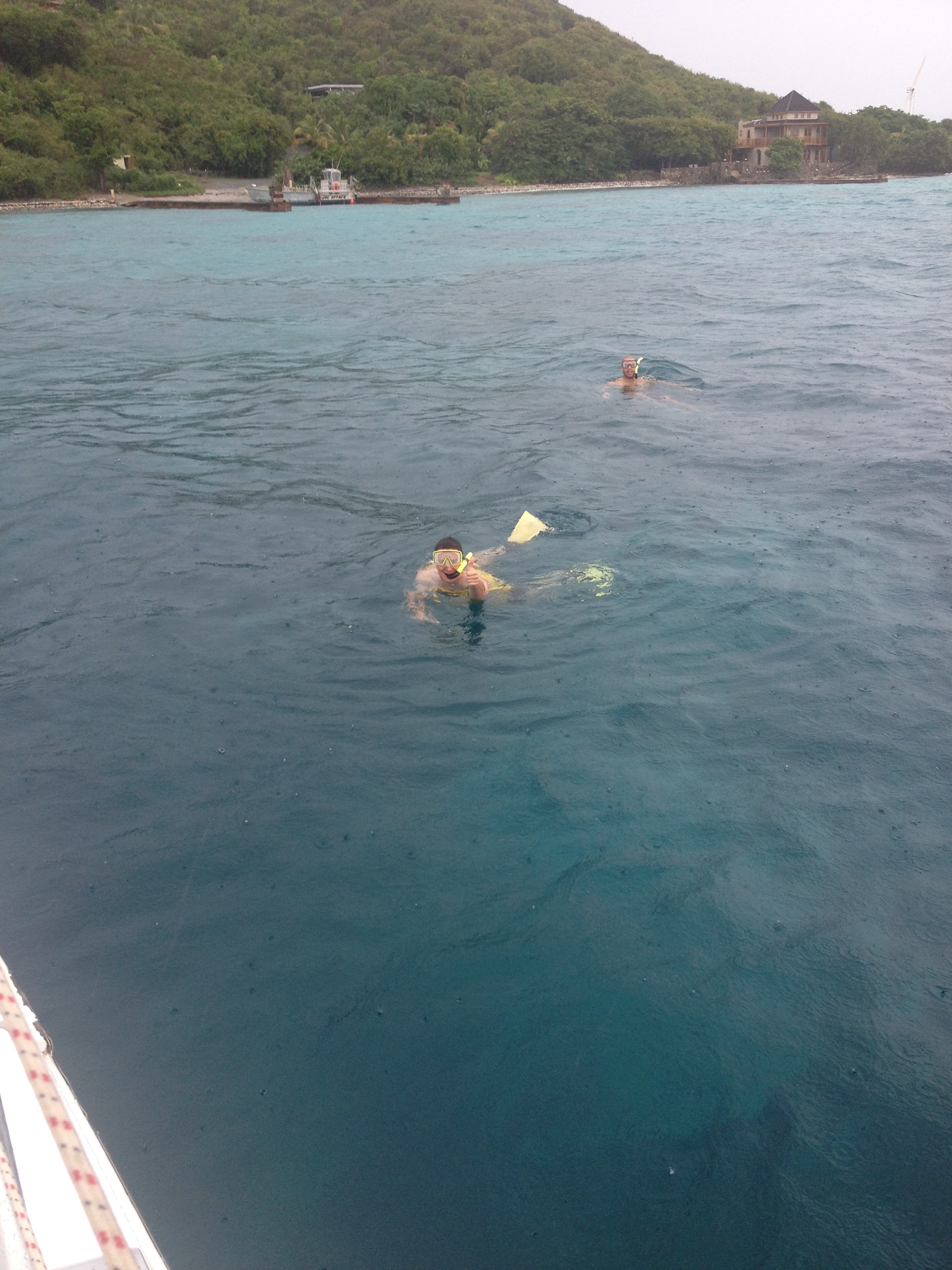
After multiple nights of partying, I lay exhausted on Scott Beach, the finest beach on Caneel Bay resort.  I watch the boaters and snorkelers go by.  Some even tell me that it was here, in the clear waters of the Caribbean, that they had one of the best snorkeling experiences of their lives.  They did so by being willing to visit a place a little bit out of the way, a place where the people, the culture, and the way of life are different than their own.

That is when it occurred to me that the world is full of people who are different from me.  The world is full of people who look different, act different, have different customs, beliefs, values, and different ways of understanding the world.  We can either learn to live with different types of people, and try to relate to them as best as we can, or we can accept the limitations that go along with confining ourselves to people with sufficient similarities to ourselves.

In practice, we all implore somewhat of a combination of the two strategies; accepting some differences but trying to stay away from others.  However, there are some that believe that in an increasingly connected world, the future belongs to those that can bridge the gap between different cultures.  I am not sure if I inherently believe that the ability to bridge cultural gaps is a prerequisite for success in the 21st Century, as many people have built fortunes designing products that largely cater to one segment of society.  However, when I watch people enjoy Saint John Island, and watch videos by Kingston and other similar artists, I see firsthand the benefits of being able to relate to those with different backgrounds and ways than my own.

Sort of Leaving the Country

IMG_2818

I never had any specific plans to visit the U.S. Virgin Islands.  I had always been aware of their existence, and their Puerto Rico like murky status as part of the United States.  And, every time I saw images like this one, showing the magnificently clear water of the Caribbean, the plethora of activities that are available, and the obviously phenomenal weather, it had always seemed like a magnificent place to go.  However, for some reason, I just never made any specific plans to make a trip here.  Maybe it was the knowledge that it would be a fairly expensive trip that kept me away.  But, more likely, it was the plethora of other pursuits, other destinations, and other activities that are constantly circulating around my head.

This is why, when it comes to travel as well as general life activities, it is sometimes best to follow the lead of others.  If I were to only take part in the activities that I had personally selected to be a part of, and only gone to the places I had decided on my own I wished to go, I would have missed out on hundreds of great experiences over the past couple of decades.  I would never have learned activities like water skiing, or camping.  I would have never discovered some of my favorite foods, like chicken wings, or Thai food.  And, I would have never attended some interesting events, like rodeos, plays, and some interesting comedy shows.  I would essentially be a completely different person than who I am today.

Following the lead of others, I was brought to the Virgin Islands to attend a destination wedding.  After nearly an entire day of travel, I arrived at a destination that is not quite American, yet not quite foreign.

IMG_2815 IMG_2826

The U.S. Virgin Islands is considered a part of the United States.  All of the signs read in English.  There is no talk of any foreign currency.  And, more than half of St. John Island is a part of a U.S. National Park.  Yet, there are some major differences between how things work and operate in the U.S. Virgin Islands vs. the mainland.  The first, most glaring difference that greets any tourist when they arrive on either of the Islands is the fact that cars drive on the left side of the road.  For some reason, I figured this would be the case in the British Virgin Islands, but not the U.S. islands, as we drive on the right in our country.

IMG_2803 IMG_2823

Other major differences that become obvious right away include the taxis, which are sized and shaped quite differently than anywhere in the U.S., even tropical places like California or Florida.  As opposed to basically being cars for hire, taxis here are high profile vans with several rows of seating, built to accommodate roughly a dozen people if need be.  Their fare structure is also different.  Most rides are a flat, destination dependent, per person fee, regardless of the size of the party.  In the mainland, fees are mostly destination dependent, with the cost difference between transporting a single passenger, and several passengers differing by only a couple of dollars.

Also, a large majority of the streets here lack sidewalks, or any other type of pedestrian accommodation.  Walking around Saint John Island, I mainly had to figure out a way to maneuver around structures, both natural and man-made, and live with the traffic being so close to me.

Walking in close proximity to vehicles driving on the opposite side of the road that one is accustomed to, along with significantly different mannerisms, and the extremely thick accents of the natives, would be enough to make an extremely sheltered person freaked out.  For me, I felt only partially outside of my comfort zone.  It was really unclassifiable.  It was as if I was walking some kind of fine line, or living on the “edge”, as people used to say.  I was neither completely out of my element, nor reverting to the familiar.  I was neither “outside the box”, nor “inside the box”.  Maybe I was on the top of the box?

IMG_2808 IMG_2809

Fittingly, my new activity for the weekend was snorkeling in the Caribbean.  Like my experience in the U.S. Virgin Islands as a whole, this activity took me part of the way out of my comfort zone, but not completely.  I have swam, water skied, and jet skied before.  I have plenty of experience with water activities.  The main challenge snorkeling presented to me, as a first timer, was mastering the breathing.  I’d say it was also mastering the use of the flippers, but I most certainly did not master those.  I still moved around quite inefficiently.  However, once I was able to overcome my high elevation instincts to try to breath through my nose, and open my mouth wider to take in more oxygen while engaging in physical activity, I was able to breathe properly, and truly enjoy the activity.

It is said that the Caribbean is one of the best places to snorkel due to it’s clarity.  I was able to see some coral reefs, and moving fish.  Those the dove deeper down, either by scuba diving, or holding their breath, were able to see some turtles, a lobster, and view the coral much more closely.  Although I chose not to go too far down, I still saw underneath the Ocean for the first time ever, and was glad that I went part of the way outside my comfort zone, in both visiting the Virgin Islands, and snorkeling in the Caribbean.

Pacific Beach San Diego

I laid there for over an hour in the hot California sun.  In fact, it was unusually hot for the oceanfront.  While areas further inland regularly get significantly hotter, temperatures well into the 80s with insane humidity is quite rare for the beech.  Despite the unusual conditions, I still captured this California experience.  In fact, the entire time I felt as if I had stepped right into a Red Hot Chili Peppers song.

IMG_2633 IMG_2634

There is the ocean, the palm trees, the waves, and most importantly, the surfers.  Boy were there a lot of surfers.  I had never seen so many surf boards in my life.  Even in my most vivid imagination of a California stereotype, there were not nearly as many surf boards in one place.  On the way to and from the beach, a clear majority of vehicles had surf boards in them.

And I watched, gradually getting a nasty sunburn on my back.  I watched people walk by.  I saw a group of people play football in the water.  I saw about a dozen “wind surfers”, and even got to witness the challenge involved in using the wind, a much more variant force than that of a boat (used for activities like water skiing), to get up onto the water.  The most experienced wind surfers still appeared to require a few attempts to get up onto the water.  By contrast, experienced water skiers seem to always get up on their first attempt.

Mostly, I observed the surfers catch wave after wave.  I wondered if these waves were better or worse than a typical Saturday on Pacific Beach.  I wondered how long it took the better surfers to achieve this level, and whether or not their form was truly as great as it appeared to an outsider like me.

Normally, my attention span would wane much sooner than this.  But I was capturing the moment.  And, also I was quite exhausted.

IMG_2621 IMG_2649

The previous afternoon, I had flown into San Diego and attended my friend’s bachelor party, which was mostly held in Downtown San Diego’s Gas Lamp Quarter.  Similar to the French Quarter in New Orleans, or Midtown Manhattan, this district is touristy and quite expensive, but not overly cheesy.  There are a few chain restaurants and bars, but many of the establishments are unique to San Diego.  The nightlife here is not confined to one or two stretches of a road, as in places like the “Las Vegas Strip”.  The entire square mile was majorly hopping, with restaurants, bars, loud music, dancing, and the sidewalks where quite full with patrons, most of whom likely spent upwards of $100 over the course of the night.

The main thing that set the “Gas Lamp Quarter” apart from similar districts in other large cities was how many times we were solicited, and how aggressively we were solicited, by wait staff at bars and restaurants while walking down the street.  Someone from nearly every restaurant we walked by would talk to us, and tell us about their food and specials and such.  The only other place I remember being solicited walking down the street was along Division Street in Chicago’s Gold Coast, and those conversations were always brief.

IMG_2636 IMG_2638

I only spent three days in San Diego, and a good chunk of it was tied up by the bachelor party, rehearsal, and the wedding itself.  So, I did not get a chance to go to Sea World, or any of the standard San Diego tourist places.  However, I did really appreciate where the wedding was held; At a resort called the Catamaran along San Diego’s Sail Bay.

At this location, I spent most of my time in the Pacific Beech (and Mission Beach) area.  Aside from the standard boardwalk, the neighborhood has several active roads with lots of restaurants and bars, and is the kind of place where you can find almost anything within a short walk of each other, as well as the beech.  Both during the day, and in the evening, streets like Mission, Grand, and Garnett were filled with people taking part in many different activities.

California is a unique place with a distinct culture, and although I was only here for three days, I did get to observe a lot of it for myself.  People here really do drive everywhere!  Even though Pacific Beech is a walkable area on a grid system, the type of area you would expect to be more pedestrian/transit oriented in another major city, almost everyone seemed to be arriving here by car.  And this means that parking is hard to find in a lot of places.  As we left the beech that day, we were asked by a car full of surfers coming to the beech where our car was, in hopes that they could take our parking spot.

IMG_2648

While San Diego does have a transit system, almost all of the people I talked to basically did not consider it an option.  I did ride on both a bus and the train.  The bus driver told me there were no “transfers” (i.e. from one bus to another or from bus to train on one fare), making the system seem inconvineint for most.

IMG_2635

The fish tacos here are truly amazing!  And it really is the tortillas that make some fish tacos  more amazing than others.

IMG_2629

There are tons of other foods that are somewhat unique to the area, including a lot of foods with avocado and/or sprouts.  I particularly enjoyed San Diego style fries, which include meat, cheese, avocado, and garlic.

Although Southern California is known to be less obsessed with football than the rest of the U.S., there are still tons of people who get really into football, both college and professional.

Bicycle riders are clearly divided into two types; One that rides hard core and comes out early in the day wearing full bike gear, and one that rides cruisers, goes about 10 mph, and only pedals when absolutely necessary.  The later group does not wear helmets.

People here in general appear healthy- about as healthy as Denver, and far more healthy than the Midwest.

I really wish to return to San Diego, as I still feel there is much more to do that time allotted.  In a future trip, I think it would be neat to actually take a lesson and learn to surf, spend some time in some of the other popular neighborhoods, and I would really like to have some sushi, as there is probably a lot of really good sushi here.  And, I definitely wouldn’t mind seeing more scenes like this one.

IMG_2619

Bergen Peak; Beating the Weather

IMG_2266

If anyone were seeking my advice about living in Colorado, amongst the topics I would address would be the weather.  One thing that differentiates Colorado’s day-to-day life from life in many other places is how significant of an impact weather can have on daily activities, and how imperative it is that Colorado residents pay attention to weather and weather changes.  Colorado, being an outdoor oriented place with significant weather changes on many different time scales, is a place where residents find their plans impacted by weather significantly more often than in most other places.

Today was one of those days.  Weather forecasts called for significant thunderstorm chances along the Front Range of the Rocky Mountains starting at 2:00.  This is not too terribly uncommon for this time of year.  As a result, it is a fairly common practice to begin all hikes in the mountains at this time of year early in the morning.  This lead me to wake up at 6 AM in order to complete the 9.6 mile round trip hike of Bergen Peak prior to the anticipated onset of thunderstorms.  The frequency in which people begin their activities early has implications beyond those activities.  It is fairly certain that a significant number of people forgo Friday and Saturday night activities in anticipation of early morning hikes.  Some even head up to the mountains the evening prior to their anticipated activity in order to save time.  The end result; less people out at bars and more people at cabins and campgrounds on any given Friday or Saturday night at this time of year.

IMG_2254 IMG_2255

Getting to this trail-head is actually quite easy from Denver.  Overall, the drive takes less than an hour, and it does not require any off-road type driving.  While the best route is along Interstate 70, the exit is far enough East that one could drive here from Denver without contending with the parts of the highway farther into the mountains where weekend traffic delays are common.  This hike is both moderate in intensity (elevation gains and such), and quite well marked.  This is possibly because the trail is often open to, and is quite popular with, mountain bikers.

IMG_2260 IMG_2263

The first mile from the parking lot, along the Meadow View trail was fairly flat.  This trail connected us with a loop that consisted of the Bergen Peak Trail and the Too Long Trail.  We decided to take the loop in a clockwise direction, starting with the Bergen Peak Trail.

IMG_2256 IMG_2262

This trail took us up some steeper areas, as well as some areas of densely packed trees.  The occasional opening along the trail was marked with a sign indicating a “scenic view”.  These scenic views were pretty nice, but on this particular day, our visibility was limited by a significant amount of haze.  Once again, life was being impacted by weather, but this time a longer-term trend.  This summer has been more humid than is typical for Colorado standards, leading to significantly more haze than normal.

IMG_2267 IMG_2268

A one mile spur off of the main “loop” brought us to the top of Bergen Peak a little bit after 10 AM.  By this time, the skies had gotten even more hazy.  At the top of the mountain, there is some kind of tower (most likely for phones), as well as this sort of random building.  I really do not know what it is for, and I was unable to enter the building.  I really hope it is not home to some crazy recluse making secret revenge plans.  Nothing good would come of that.

IMG_2275 IMG_2280

Continuing the loop, we took the Too Long Trail, which felt as if it was living up to its name.  The trail itself is listed as only 2.4 miles, less than the 2.7 miles indicated for the Bergen Peak Trail.  However, it felt a bit longer, as the trail was more of a semi-circle, and connected to another trail, called the Elk Meadow Trail.  Along this trail, we were, indeed, closer to the meadow.  However, we did not see any Elk today.

IMG_2261 IMG_2272 IMG_2274 IMG_2276

What we did see, though, were a significant number of different species of flowers, and some mica.  In one spot (pictured above), purple flowers were actually growing off of a dead tree branch.  Quite amazing!

IMG_2279

I’m glad we took the Too Long Trail, even if it lengthened our hike to something close to 10 miles.  Not only did we actually experience why it is called Elk Meadow Park, but we also encountered the most unique find on this hike.  Apparently, someone felt it would be interesting to decorate one single tree, roughly halfway up the Too Long Trail, with Christmas decorations.  It was just one tree, seemingly randomly selected, with roughly a dozen ornaments placed on it.  For one with an imaginative mind, there are dozens of different scenarios that can be pondered that would lead to this outcome.  But, even more so, I wonder what the people who operate the park think of all of this.  And, I wonder how well it would be received if I were to return to this tree, and add a contribution of my own.  If others have the same thoughts, what could this tree look like a year from now?

While hiking this trail today, I did not believe I was going to get any good photos at all (due to the haze, and the tree density of most of the hike).  However, the more I look a the photo I chose to lead this entry with, the more I fall in love with it!  It is not the kind of perfect photo that you will find on commercials or billboards (see this image).  It is a photo of the same place, but from a different perspective; one of a world that is not quite so perfect but beautiful in its own way.  It is an image of a world where people wake at 6 AM to get in a hike before a round of thunderstorms that never materialized.  It is a world where we know enough about what is in front of us to stay out of danger, but with enough haze to keep the excitement associated with the mystery of the unknown.  That is the world in which we live in, and the frustration occasionally waking up early unnecessarily is a small price to pay for the wonder and the mystery that accompanies it.

A Whole Different Kind of Camping

For me, at least, this is a whole different kind of camping than what I am used to.  I am not a very experienced camper.  In the entire course of my life I think I have camped maybe a couple of dozen nights.  All of these nights took place at a campground, typically reserving a site ahead of time.  Last night, I took part in a style of camping that is fairly common in the State of Colorado, but seemed quite strange to me when I first heard of it.

There are no specified campsites or reservations.  There is no park office to check you in, collect a fee, and sell you firewood.  There are no restrooms or showers, and there are certainly no vending machines.  This type of camping simply involves finding a spot in the forest to lay down tents.  It is so basic, and so obvious.  Just go and camp.  Yet, in the context of the modern world that we live in, it sounds so strange.

IMG_2166

In fact, I did not even know how to prepare for this trip.  When we all went to the store to get supplies, I was the only idiot grabbing burgers, buns and cheese, as if I was preparing for a barbecue, until I was instructed otherwise by those who have actually camped in such places before.  There are no grills here.  You can only prepare food supported by the equipment that you bring.

We camped high up in the Rocky Mountains, around 60 miles west of Denver, just south of a place called Guanella Pass.  This wilderness region is particularly significant, as trailheads leading to the top of two major mountains, Mount Bierstadt and Mount Evans, can be found throughout the area.  So, although there is no specific campsite, it is still a common place to camp, as many heading up one or both of these mountains set up camp in the area.

IMG_2169 IMG_2171

We set up camp in the area along Geneva Creek, where a significant number of campfire setups like this one are left behind by previous campers.  So, while I can count this among the most remote places I have spent an evening, I realized that there are places that are even more rustic, more primitive, and farther “away from it all” than here.

IMG_2173 IMG_2172

We did not intend to climb a major mountain, nor did we have the time to do so.  This trip was actually planned last minute by people more knowledgeable than me about such things.  We ended up hiking a more moderate, and shorter trail called the Burning Bear Trail, which follows a creek by the same name.

IMG_2177 IMG_2178

The trail starts off pretty flat, and looking more like a dirt trail than a typical hiking trail.

IMG_2179 IMG_2182

As the trail picked up, I saw a significant amount of chopped down tree branches, many of which were chopped down in some sort of regular pattern.  In one section, the tree branches appeared to have been arranged to form some sort of tepee.  I took a gander inside, but it did not feel too useful.  Also pictured above is the columbine, which is Colorado’s State Flower.

IMG_2183 IMG_2185

While there were no major waterfalls, there were a lot of small waterfalls along the trail, and plenty of places where my dog could cool off in the creek.

IMG_2187 IMG_2189

After hiking roughly 2.5 miles, and climbing probably about 900 feet, we reached some kind of old cabin, which made for a good stopping point, where we could turn around and get back to the campground with plenty of time to prepare fire and dinner and such.

IMG_2190

Returning to the trailhead around 6:15 P.M., we encountered what I thought was the most amazing view of the entire wilderness area of the day.  By that hour, the sun had reached a lower angle, accentuating the mountain’s higher peaks.

IMG_2193

In some ways camping that evening was similar to a typical camping experience.  We cooked some food, set up a campfire, told some ridiculous stories, and went to bed around 11.  There was marshmallow roasting, and people throwing all kinds of random items into the fire to see how they would interact with the heat and flames.  Mosquitoes came out in gradually greater and greater numbers as the evening progressed, and went away around sundown.

However, in some other ways it was different.  As previously mentioned, we were not grilling.  Instead, we were cooking food on small stoves.  Although we did use some previously purchased bundles of firewood, we also used a significant amount of firewood that we gathered from random tree branches.  In fact, we even tried to lite branches that were retrieved from the creek.  They turned out to be a bit too wet.

IMG_2196

There were a couple of other firsts for me on this journey.  Aside from being my first time camping at a place other than a designated campsite, it was my first time camping with a dog.  This presented some other challenges, but, my dog definitely seemed to enjoy it.  Also, at an elevation close to 10,000 feet, it was by far the highest elevation I had ever camped at.

In the end, one of my favorite parts of the evening was when I arrived back at the campsite at roughly 6:30, went back to the tent, and threw all of my stuff down, including my wallet, phone, and keys.  I had previously not thought about this, but these three things represent the basic necessities of our connected 21st century world.  Most days when I wake up, I reflexively pack those three things into my pants pockets.  Even when I am going for a bike ride, I have them in my camelback.  In a way, setting these three items aside is symbolic of having truly escaped to somewhere different.  It is truly having left everything behind and actually haven taken a break from whatever your day-to-day life typically entails, including it’s stress, anxiety, and uncertainty.  Once those three items are put away, the here and now is all that needs to be considered, and there is something inherently amazing about that, which I had previously failed to appreciate.


Whitewater Rafting on the Poudre

Rafting_3

One of many things that makes June a phenomenal month, is that it is typically the best month of the year for whitewater rafting in Colorado.  Snowmelt from the higher mountain peaks combine with fairly frequent thunderstorms to create higher water levels and faster rapids along many of Colorado’s rivers.  And, while sometimes river flows associated with the spring snowmelt peak a bit earlier in the season, by mid-June somewhat warmer air and water temperatures makes for a more pleasant experience.

After weeks of training for, and then subsequently riding the Denver Century Ride on the June 14th, I figured that the following weekend, June 21st, would be an ideal time for some whitewater rafting.  Colorado offers a lot of great places to raft.  I hope to try as many of them as possible.  Based on the time constraints of all the people involved in this trip, as well as the quality of trips offered, I opted for rafting in Poudre Canyon, just to the west of Fort Collins, Colorado.  Here, along the Poudre River (technically Cache la Poudre River), average June streamflows produce many sections of class 3 and class 4 rapids.  Sometimes, higher water produces even rougher waters.  And, had we opted to raft a bit earlier in the season (late May/ early June), higher water would have actually prevented us from doing part of the journey we did on Saturday due to safety concerns.

IMG_2120 IMG_2118

Friday night we camped at a place called Kelly Flats, slightly farther up the river from where our whitewater adventure would occur the following morning.  Because of how long the days are in June, we were able to work a full day on Friday, and still make it up the campground in time to set up our tents before it got dark.  YAY June!  Seriously, if I could find a way to not sleep for the entirety of June, and make up for it by sleeping extra hours in a lamer month, like December, I would do so in a heartbeat.

IMG_2122 IMG_2123

Saturday’s rafting trip was a half day trip called “The Plunge”, through an outfitter called Mountain Whitewater Descents.  This is considered one of the more intense trips.  But, hey, go big or go home.

For this trip, we met at 8 A.M. to discuss safety, expectations, and technique.  There have been stories in the news about people getting seriously injured, or even killed, on this river this year.  Going with a guided tour like this one all but eliminates this risk.

IMG_2124

Then we get our equipment, wet suits, jackets, helmets, etc., and ride in a big school bus for about half an hour to our starting point.  Arriving a bit after 9, the trip itself, as in time in the raft on the river runs for 2.5 to 3 hours.

I do not have any pictures of my group rafting.  I did not feel like taking the risk of bringing either a camera or my phone onto the raft where they would probably fall out into the river.  Pictures and videos are taken of every group by Mountain Whitewater Descents.  And, while I found the trip itself to be more than worth the $70 per person we paid, obtaining the pictures of our group’s excursion ended up costing more money than I wanted to spend.  So, I selected a couple of pictures from Mountain Whitewater Descent’s photo gallery to capture the essence of the experience.

Rafting_1 Rafting_2

The trip starts with a mile or so of easy rapids.  This is so that the group in the raft can get into a paddling rhythm, and get aquanited with the guide and her commands.  After the warm-up part, when we started into the rougher rapids (first class 3 and then class 4), I felt that our group had gotten into a really good rhythm while paddling.  The video we saw after the trip revealed to me that we were actually quite out of synch.

Still, I really enjoyed the group that I got to raft with on Saturday.  My group consisted of 10 people.  With each raft holding 8 people (including the guide), our group was split in two, with 5 members of our group being joined by two other people.  Of course, with two boats belonging to the same group, it is common for water wars, as pictured above, to break out between the boats during downtime.  The two young ladies that ended up riding with us in our raft were very good sports about not only our crazy discussions along the way, but ending up in the “crossfire” of our “water wars”.  Additionally, I felt like our guide did a wonderful job, and would definitely recommend this trip to anybody.

The oddest aspect of this excursion for me was that I was never scared.  NEVER.  NOT AT ALL.  And, our rafting guide told me that Saturday’s rapids were amongst the most intense rapids that they would legally be permitted to enter as a commercial recreation business.  I really just felt exhilarated.  I felt, well, alive.  And, this made me think of the oddest thing- billboards.

Right around the time we first figured out that we would be moving to Colorado, billboards like this one starting popping up around Chicago.  These billboards are designed to get tourists to come to Colorado, with “Come to Life” being the slogan.

Suddenly this became the only State tourism slogan that made sense to me.  I have seen a lot of state tourism slogans.

Some of them are nearly completely nonsensical.

Pure Michigan; What does that even mean?  Do I want something to be pure?  What makes Michigan Pure?

Great Faces, Great Places, South Dakota; I don’t even think Mount Rushmore is South Dakota’s best attribute.

Some of them don’t deliver what they promise.

Wisconsin, You’re Among Friends; Wisconsin has been a non-stop political fight for a decade or so.  And if you are in Madison, they are not friendly about it.

New Jersey and You, Perfect Together; If you think the odor of landfills and refineries, a strange combination of old money suburbs and random ghettos, and the desire to go to any extent possible to avoid making a left hand turn is my ideal match, then I have an expletive for you.

But, Colorado’s slogan, “Come to Life”, which originally sounded like complete nonsense to me, suddenly made sense, as the opportunities provided by Colorado simply made me feel alive.


Two Ways Up Lookout Mountain

IMG_1993

The first time I heard about Lookout Mountain, the first thing I thought of was teenagers making out in their cars half an hour after sunset.  It just seemed like the kind of place a crazy new high school couple, with access to a vehicle along with the freedom that comes with it for the first time in their lives, would go.  It is that perfect middle ground for high schoolers starved for both attention and alone time.  They are far enough out of the “public eye” (i.e. social circle) to not feel too awkward, but not far enough out of the “public eye” to not get the recognition they crave.

To some, the fact that I automatically defaulted to this thought process is a demonstration of a disturbing level of immaturity.  But, I am strangely comforted by the fact that my mind occasionally defaults to such ideas and pursuits.  One of my goals as I get older is to never lose that youthful sense of wonder that makes everything seem so significant and magical early on in life.  Sure, if I were still trying to take high school girls “up to Lookout” at this age, it would be quite pathetic!  However, I take significant pride in the ability to still see places like this and imagine it’s possibilities from a perspective that is quite youthful, while still approaching it with the wisdom and maturity that I have gained over the years by being an astute observer of the world, humans, and human nature.

So, although my first thought of this mountain was one of 16 year olds making out in cars and possibly allowing themselves to go further, I came to understand it’s cultural significance to Colorado and the Rocky Mountains when it became the first major mountain I climbed on my bicycle after moving here from Illinois.  In a way, Lookout Mountain welcomes people like me to the world of cycling in the Rockies the same way I imagine it welcoming those 16 year olds to “adulthood”.

As the stormy weather that plagued Colorado the week leading up to Memorial Day came to a close, I decided to pursue this mountain in another unique manner.  I decided that on Monday, I would hike up the Mountain, using the Chimney Gulch and Lookout Mountain trails.  Then, on Tuesday, I would ride my bike up Lookout Mountain Road.

IMG_1984 IMG_1983

Regardless of whether one decides to pursue this mountain on foot or by bicycle, it begins at a (relatively) light to moderate level of difficulty.  The trail heads up a gentile slope that would be considered “moderate” in terms of hiking.  The bike ride is up a slope that most with little or no climbing experience would consider quite difficult, but it is a bit over a mile into the ride before the climb picks up.

IMG_1987 IMG_2003

While the bike ride does offer some amazing views, and I would argue better views of the Denver skyline, about a mile into the hike, some waterfalls form at this time of year, when rains are significant, giving me a whole new perspective of Lookout Mountain.

IMG_1988 IMG_1989

It is at this point cyclists will encounter their first major set of switchbacks (along with some steeper terrain).  The hiking part also picks up in intensity.

Just after the halfway point comes a somewhat easier part of the climb.  It is at this point the road somewhat flattens out for cyclists, and most can shift up a gear or two and pick up a few miles per hour in speed.

Roughly 2/3 of the way up the mountain, the hiking trail meets up with Lookout Mountain road for the second and final time, at a place called Windy Saddle Park (near Windy Saddle Peak).

Windy_Saddle IMG_1990

Windy Saddle Park offers a great view of the Clear Creek Valley to the West.  The photo to the left was actually taken back in April on a previous bicycle trip up Lookout Mountain, while the one on the right was taken on Memorial Day.  Colorado is typically a very dry state, with a very brown or red look (depending where you are).  However, the week preceding Memorial Day was quite wet, with daily thunderstorms, and even four consecutive days of hail.  These photos, taken from the same place, demonstrate how different Colorado can look during different seasons and weather patterns.

IMG_1991 IMG_1992

After Windy Saddle Park comes the most challenging part of the trip, regardless of whether one is hiking or cycling.  Cyclists will encounter a series of switchbacks with a higher grade and frequency than the switchbacks in the earlier part of the climb.  When I continued on the hiking trail, I had anticipated the same increase in intensity.  What surprised me was the sudden change in tree density.  It felt as if we had suddenly left the wide open and entered a forest.

IMG_1995 IMG_1996

There are two trail junctions in this more challenging (although still not “14er” level) part of the trail.  First, the Beaver Brook Trail, which is a longer trail that winds through the rest of Jefferson County, breaks off to the right.  Luckily, these trail junctions are clearly marked so nobody spends hours wandering around wondering when they will finally get to the top.  The second junction is with the Buffalo Bill Trail, which goes to the part of the mountain where Buffalo Bill’s grave is.

IMG_2011 Buffalo_Bill_Grave

Lookout Mountain is not a single peak.  It is more of a mound.  One one end of the mound is the tower most commonly associated with Lookout Mountain.  On this other end is Buffalo Bill’s Grave.  Buffalo Bill’s Grave is a great destination point for cyclists.  There is a gift shop at the top offers water for free, nice bathrooms, and great snacks.  Being pretty much at the same elevation as the other side of Lookout Mountain, one can stop and turn around without feeling like they cheated themselves out of part of the climb.

While (excluding driving) there are two ways up the mountain, there are three ways down.  One other thing I discovered about Lookout Mountain is that it is a popular place for hang-gliding/ para-sailing.

Lookout_Gliding

Depending on the day of the week and conditions, it is not too terribly uncommon to encounter around a dozen gliders taking off and landing at different points on the east side of the mountain.

Between the awkward adolescents in their cars just past sundown, cyclists like me achieving our first significant Rocky Mountain climbs, and hang-gliders soaring through the air over town, Lookout Mountain is truly a place where dreams come true.  It is a place where people feel a sense of achievement, a sense of advancement, and a sense of welcome into what’s ahead.  For cyclists like me, it is even more challenging bike rides, higher into the mountains.  For those adolescents, it is adulthood, and all of the challenges that will come.  Either way, it is both magnificent and scary, but best appreciated by looking upon it with the same sense of wonder that we begin our lives with.

A Bike Ride to Roxborough State Park

IMG_1933

The primary reason I love cycling as much as I do is that I am able to go places a significant distance away completely under my own power.  For many years I have enjoyed commuting to work (now only 1.5 miles but formerly 6 miles), running errands, visiting specific places, and getting myself to and from specific events by bicycle.  I feel the benefits are two-fold.  There is the obvious money savings on fuel (and/or parking/ transit).  In addition to the monetary savings, I find the exercise and time outdoors to have a been a great value to my health, both mentally and physically, over the years.

Roxborough State Park is about 30 miles South of central Denver.  It is a place I had never really thought about visiting up until a few weeks ago when I was looking for new interesting places to ride my bike to, and wanted a ride that would be roughly two hours each way.  In Denver, it is possible to cover a good amount of distance quite quickly using the metro area’s bike trails, which bypass traffic signals, as well as most terrain features that would normally slow a cyclist down.

IMG_0337IMG_1913

The Platte River trail can be followed from Denver southward to it’s terminus at the C-470 trail, about 16 miles south of downtown.  The Platte River trail is quite flat, as it tracks right along the river.  However, the C-470 trail, which roughly follows the highway (which is the Metro area’s outer loop), contains a lot more rolling hills.  After several miles on the C-470 trail, I arrived at Chattfield State Park, a reservoir, and popular boating destination on the southern fringe of the metro area.

IMG_1916 IMG_1917

A couple of years ago, this was the destination of a couple of rides I had done.  Last year, I did a ride to Waterton Canyon, the starting point of the Colorado Trail, a place I also rode by on my way to Roxborough State Park.  It is somewhat encouraging to actually see my continued progress as a cyclist right in front of me.  However, it also made me realize that there is one disturbing parallel between cycling (or any activity of this nature) and drug addiction; as the more I ride my bicycle, the farther and more intense of a ride I need to do to feel “satisfied”.  This is beginning to feel eerily similar to the gradual increase in tolerance a regular drinker experiences, or the ever increasing doses many drug addicts demand over time.

IMG_1921 IMG_1922

There was a fairly long line of cars at the entrance to this park.  Luckily, I was able to bypass this line, saving me both roughly 20 minutes of time, as well as the $7 entrance fee to the park.

The road from the entrance to the visitor center, basically the last two miles of the ride, was not all that fun.  It was gravel and bumpy for much of the way.  I felt uncomfortable going over 13 miles per hour.  However, the park rangers were quite pleased that I did not try to use my bicycle on any of the trails, as they do not permit bicycles on the trails.

IMG_1927 IMG_1928

At the visitor center, I realized that one of the main attractions of this particular park is the wildlife.  Showing people the fur and bones of dead animals seems like a somewhat sick way of presenting what the park had to offer to it’s visitors, but it was really neat to actually feel the fur of a black bear for the first time in my life!

IMG_1929 IMG_1934

The rock formations at Roxborough State Park were actually quite similar to what I saw at Garden of the Gods.  In fact, it is easy to see how the same geological processes created the rock formations that run up and down the edge of the front range, including the Garden of the Gods, the place, as well as places like Red Rocks.

IMG_1931 IMG_1936

The park is also set up quite similar to Garden of the Gods.  Both places make it easy for the average non-outdoorsy tourist to attain a good view of the park.  Here, the Fountain Valley Overlook, a mere half mile from the parking lot with only a slight grade, provides views like the one at the top of this entry to those with no interest whatsoever of getting any exercise.  The park also offers somewhat more strenuous hiking.  Carpenter Peak is roughly 1000 feet higher in elevation than the visitor center.

IMG_1930

I meandered around the park a bit, but decided not to do the more strenuous hike as to preserve my energy for bicycling.  The only wildlife I encountered were these three deer, which is not particularly out of the ordinary.  However, I did encounter them at a much closer distance than I typically do.

IMG_1940

For much of my time at Roxborough State Park, I was intrigued by these relatively short trees I encountered all over the park.  These tress are quite different than the ones I typically see around Colorado.  I later read, on the way out of the park, that there are some unique species of trees, as well as insects and animals, that live here due to the micro-climates created by the wind patterns that these rock formations create.  In fact, Roxborough State Park is considered a destination not only for it’s rock formations, but also for it’s unique wildlife.

IMG_1935IMG_1938

While marveling at the beauty of the park, and considering how awesome it might be to live in one of those houses that overlooks the place, the weather caught me off guard.  Prior to this ride, I looked at the forecast for Denver, which called for a threat of rain after 3 P.M.  However, 30 miles farther south (and closer to the Palmer Divide), and roughly 1,000 feet higher in elevation, any threat of thunderstorms is naturally going to come earlier in the day.  Right around noon, I noticed a few raindrops, and suddenly noticed the clouds beginning to build overhead.

My bike ride home ended up being a race against mother nature, which I barely won, partially by blatantly ignoring the 15 mile per hour speed limits posted along the trail through South Suburban Littleton.  With a little bit of help from the wind at times, I was able to make the 28 mile ride from Roxborough State Park in 100 minutes, returning home by 1:45 P.M.  As someone who typically pays close attention to the weather, and understands weather patterns quite well, this was a somewhat embarrassing oversight on my part.  However, I do feel a sense of accomplishment in making the return ride so quickly.  And, once again, I was reminded of what I love most about cycling; being able to travel a good amount of distance, and even see my own progress on a map, all under my own power.

Maxwell Falls; The distance between reality and expectation

IMG_1886

Often times in life, the reality of a situation turns out significantly different than the expectation.  In fact, this has been one of the biggest challenges that I have had to deal with.  Like many in my generation, I grew up in a time of prosperity and high hopes for the future, and was told by parents, teachers, etc. about the rewarding life that awaits those that generally do the right thing.  While nearly every person who reaches adulthood has to come to terms with the fact that the world is unfair and that sometimes the wrong people get their way, those in our generation, particularly since the 2008 crash, have had to come to terms with a world where opportunities are fewer and harder to come by than what we had initially prepared for.

I went to Maxwell Falls, near Evergreen, CO, expecting two things that did not materialize.  Most hikes in Colorado are an uphill climb from a trail-head to a specific destination (a summit, lake, natural feature).  I had become so accustomed to this standard formula, that it had never occurred to me that this hike could be any different.

IMG_1887 IMG_1889

The beginning part of the hike was rather uneventful.  The climb was fairly moderate, and the trail would occasionally descend slightly to cross over creeks.  This is kind of typical across Colorado, especially in places like Rocky Mountain National Park.  However, about a mile and a half, maybe two miles into the trail, we reached an unexpected junction.

IMG_1894 IMG_1895

After a short section where the climb was more rigorous, I was surprised not only to find a spot where five separate trails seemed to merge together, but also find out (from talking to people) that none of these “forks” in the trail actually represented a part of the loop I had been expecting to encounter.  The sign pointed to which way to follow the trail, which also, shockingly took us on a fairly rapid descent.  This is not what I had become accustomed to, nor was it what I had expected.

IMG_1897IMG_1898

The descent was fairly lengthy too.  It almost felt like we had descended halfway back to the trailhead’s elevation!  It was there we finally encountered the loop we had anticipated.

Facing unexpected junctions, getting routing advice from strangers on the way, and anticipating landmarks that take longer to reach than anticipated made me think of Lewis and Clark.  On their expedition they would seek advice from many of the Native American tribes they encountered along the way.  They also encountered a few river junctions that made them pause and investigate which way to go.  They came into their journey with little information about features such as Great Falls, and the Rocky Mountains.  All they knew going into the mission was that these features existed, and they had a general idea of where they were.  Both of these featured proved more challenging to pass through than expected.  However, despite these unexpected challenges, they were still successful in their mission, and are still commemorated over 200 years later!

IMG_1900 IMG_1903

The falls themselves also did not quite meet the expectations.  The expectations I had about a waterfall hike largely came from hiking Brandywyn Falls in Cuyahoga Valley National Park, as well as viewing other falls in Rocky Mountain National Park, and Yellowstone National Park.  In all of those situations, the trail would either arrive right at a scenic view of the falls, or a spur coming off the main trail would take hikers right up the falls.  At Maxwell Falls, it was tough to find a really good view of the falls.  We ended up crossing the river and making a somewhat dangerous scramble to a remote rock to see the falls from a somewhat different vantage point.

It was still really neat to see the true power of water falling, even from a short distance, and to actually watch the residual spring ice melting right in front of our eyes.  But, it was still far from what I had been expecting from my previous waterfall hiking experience.

IMG_1908

Despite not getting the picturesque view of the waterfalls, this hike offered some other neat features that I had not necessarily anticipated.  After climbing up the Cliff Loop, we encountered views of the mountains that were much more splendid than I had imagined.  It actually reminded me what I had been missing.  Prior to this hike, I had not gone on a hike for several months.  A couple of months ago, I started a new job in Denver, and had been focusing on making that job, as well as my life in Denver in general, work.  I love to travel, have new experiences, and explore new places.  But, unfortunately, for a while, my life’s demands had taken me elsewhere.

IMG_1907

In addition to the splendid views at the higher points on the trail, which did turn out to be a series of ups and downs, we also encountered one of the most unique rock formations I have ever seen.  This rock, I refer to as “Troll Rock”, as it looks quite like a troll.  It was quite amazing, and was the subject of wonder for quite some time about what unique combination of all of the processes of nature could have lead to this particular rock shape.

IMG_1909 IMG_1910

The end of the day saw the sun come out, and the temperature rise.  This was an unfortunate turn of event for my Husky, who is built for colder conditions.

One of the things that still amazes me quite a bit about life itself is how often the specific experiences we have at a specific time actually mirror what is going on in our lives, or in society, on a much larger scale.  Today I expected a hike where I would climb up to a waterfall, be taken right up to that waterfall, and then make the ascent back to my car.  Instead, I got periodic climbs and descents throughout the duration of the hike, and awkward scramble around strange rocks to largely overlook a waterfall, but also unexpectedly encountered wonderful views at the top and unique rock formations.

In life, I expected to do well at school, generally stay out of trouble, and find a fulfilling job in my field of study.  Instead, I found a world where the seemingly well deserving nice people end up reporting to control freaks that often find sinister ways to get ahead, opportunities do not always present themselves, and many of the specific jobs I had originally hoped for have some expected downsides to them.  So, now, I am trying to make something completely different work, and thus far it is largely working out!  It appears that sometimes the path to fulfillment is not the expected one, and the reasons we end up enjoying the things we enjoy are not things we had previously considered.  Maybe what our generation as a whole needs to do is let go of what we had hoped for out of this world and remain open to finding fulfillment in a completely new way.

An Overlook of the City

Starting sometime between the ages of 3 and 7, we are all asked the same question;  What do you want to be when you grow up?  Sometime between the day we are first asked this question and the first time we purchase an alcoholic beverage legally, we all answer this question.  Some of us, inspired by an event, a hero, or something we are really interested in, figure this out at a young age.  Meanwhile, others answer this question later on, after a year or two in college with an “undeclared” major.

Whether we answer this question at the age of 5 or 20, we all determine “what we want to be” believing that we have some kind of final answer to this question.  One of the biggest surprises that we all encounter in the adult world is that “What do you want to be when you grow up?” is a question that we never stop answering.  Sure, some of us may spend up to a few years at a time in a sort of steady-state, remaining in one place.  But, eventually, inevitably, some form of change, or opportunity for a change, will come our way, requiring us to revisit the question.

I actually learned this fact years ago, when I was actually given two different options for where to take my career by a former boss.  So, the fact that I am currently approaching a crossroads that may take me down a different career path, to a different location, or both, does not come as a complete shocker to me.  While not surprised, there is still plenty to think about, and sometimes the best thinking is done in another setting.

A common scene in the movies (and on TV) is for one of the main characters to absorb recent events and ponder what they are to do next while overlooking their city’s skyline.  This is a scene I reenacted somewhat accidentally today when I discovered the best view of the Denver skyline I have seen to date from a place called Mount Galbraith.

IMG_1701 IMG_1694

Mount Galbraith is located just to the west of the town of Golden, Colorado.  With a peak at only 7,260 feet, hiking to the top is not challenging.  The vertical climb from the parking lot probably does not even reach 1,000 feet.  For someone looking to hike in Colorado with no prior hiking experience, this may be a good choice.  Unlike other trails near Golden, there is no mountain biking permitted on these trails, and the trails are significantly less crowded than any of the trails near Boulder.

I do not know why I came to this park today.  I had a lot on my mind today, and needed to get away from the distractions that often disrupt my thought process; in particular YouTube, the internet, and the Olympics.  So, I pretty much just got in the car and started to drive with no plan whatsoever.  Before I knew it, I was approaching Golden, and I had remembered seeing a sign for some kind of hiking trail on the way to Golden Gate Canyon State Park.  Knowing that in the month of February it is always safer to stay at lower elevations (this is due to both wind and snow pack), I decided at the last minute to stop.

IMG_1698

I also made my Siberian Husky come along for the ride, but she seemed to enjoy it.  This is probably the closest I will ever come to getting a picture of my dog overlooking a city skyline, something that I think makes for a neat picture.  In fact, I think Dogs Overlooking Skylines would make for an awesome calender.  12 different cities, 12 different dog breeds.  If someone made it, I would buy one for sure!

Today I followed my instinct, and I did what countless movie and TV characters have done; find a good view of the city skyline and ponder what is going on in my life.  I’m guessing most people feel that when they come to a place like this they are taking a step back from life, and looking at what is going on from above.  It almost feels as if we are taking a big-picture omnipresent view of day-to-day life when we observe from a place like this.  While on a typical day, we are looking at one particular block, one building, or even one desk.  Coming to a place like this, the entire city, as well as many places around it, all come into view.  It is natural for this view to prompt anyone to look at the big picture.

And, it is time to apply this big picture view to that age old question.  What do you want to be when you grow up?  Or, for those of us that are already grown up, we can more simply say, what do you want to be?  Whenever anyone asks or answers this question, it seems like the discussion always revolves 100% around jobs and careers.  But, there is more to who someone is than their career.  Maybe you want to be the person your friends can depend on?  Maybe you want to travel and have some interesting experiences?  Or maybe you just want to have a balanced life?  When it comes to “what you want to be”, ambitions like these are a valid part of the discussion and should not be ignored.