Category Archives: Western US

An Unexpected Glacier

IMG_1103

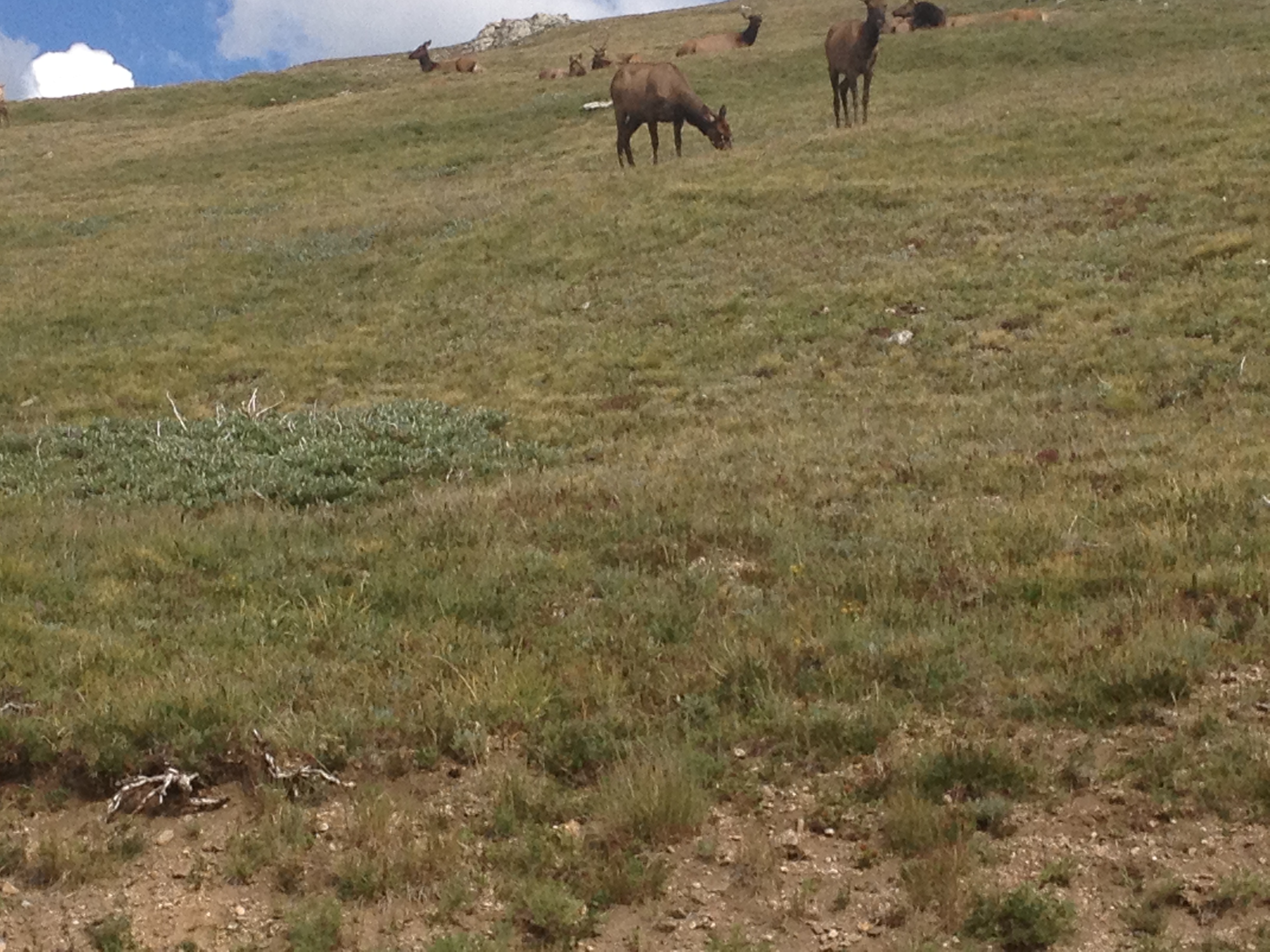
It’s the first of October.  The temperature is around 60 degrees, and the sun is shining.  It is the type of weather that would have certainly depleted 6-12 inches of snow back in any East Coast or Midwestern city.  And that is with a wintertime sun angle, and much more atmosphere to obstruct the sun’s impact on the snow.  With this weather being possible on the first of October, it is quite likely that many warmer days occurred on St. Mary’s Glacier during July and August.  Despite all of this, the Glacier still sits here, occupying the little piece of ground in the mountains of Central Colorado that it occupies.

Part of me is actually bothered by it’s existence.  At roughly 11,000 feet in elevation, and at about the same latitude as Denver, it feels like it needs to be either higher or significantly farther north to exist.  Most other glaciers in Colorado are significantly higher in elevation.  So, knowing it is at a latitude an elevation that produces so many 60 degree+ temperatures, how does St. Mary’s glacier exist?

IMG_1094 IMG_1095 IMG_1096 IMG_1097

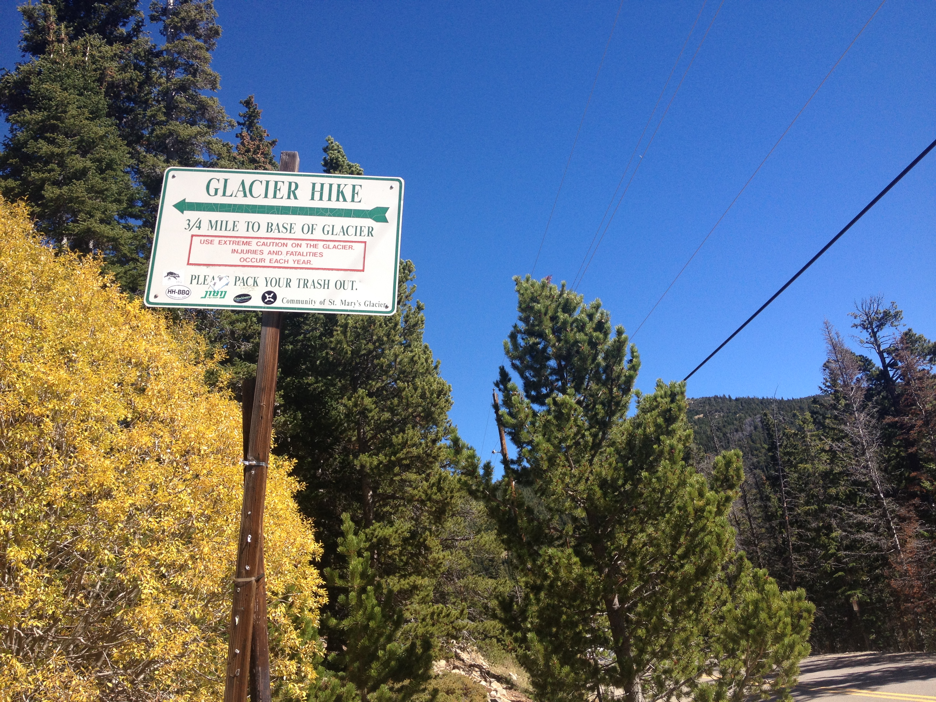
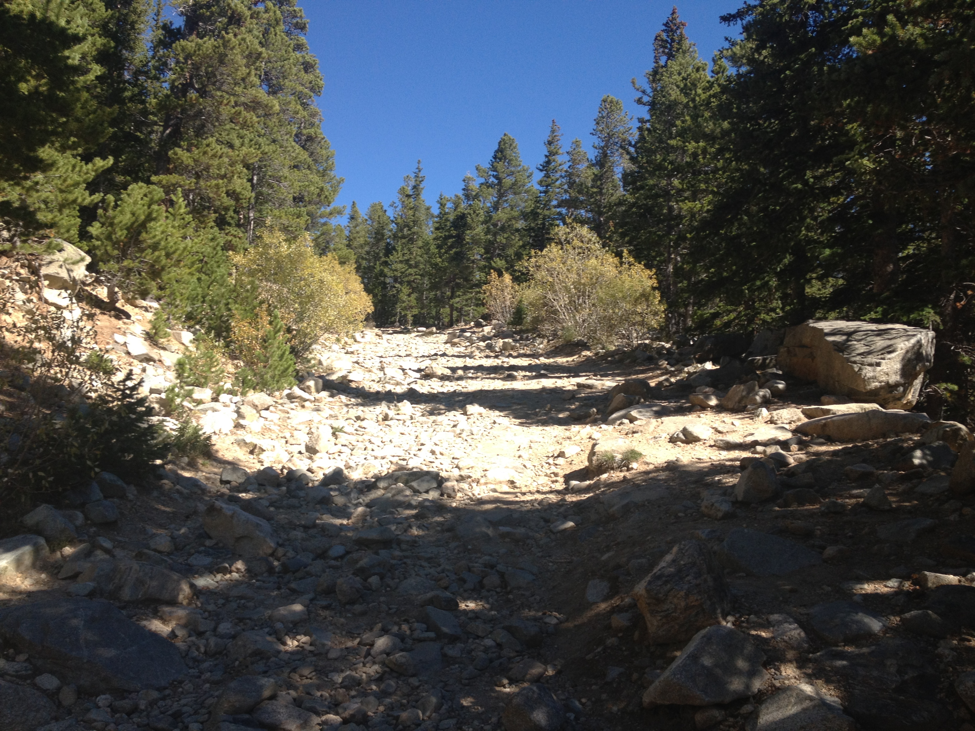
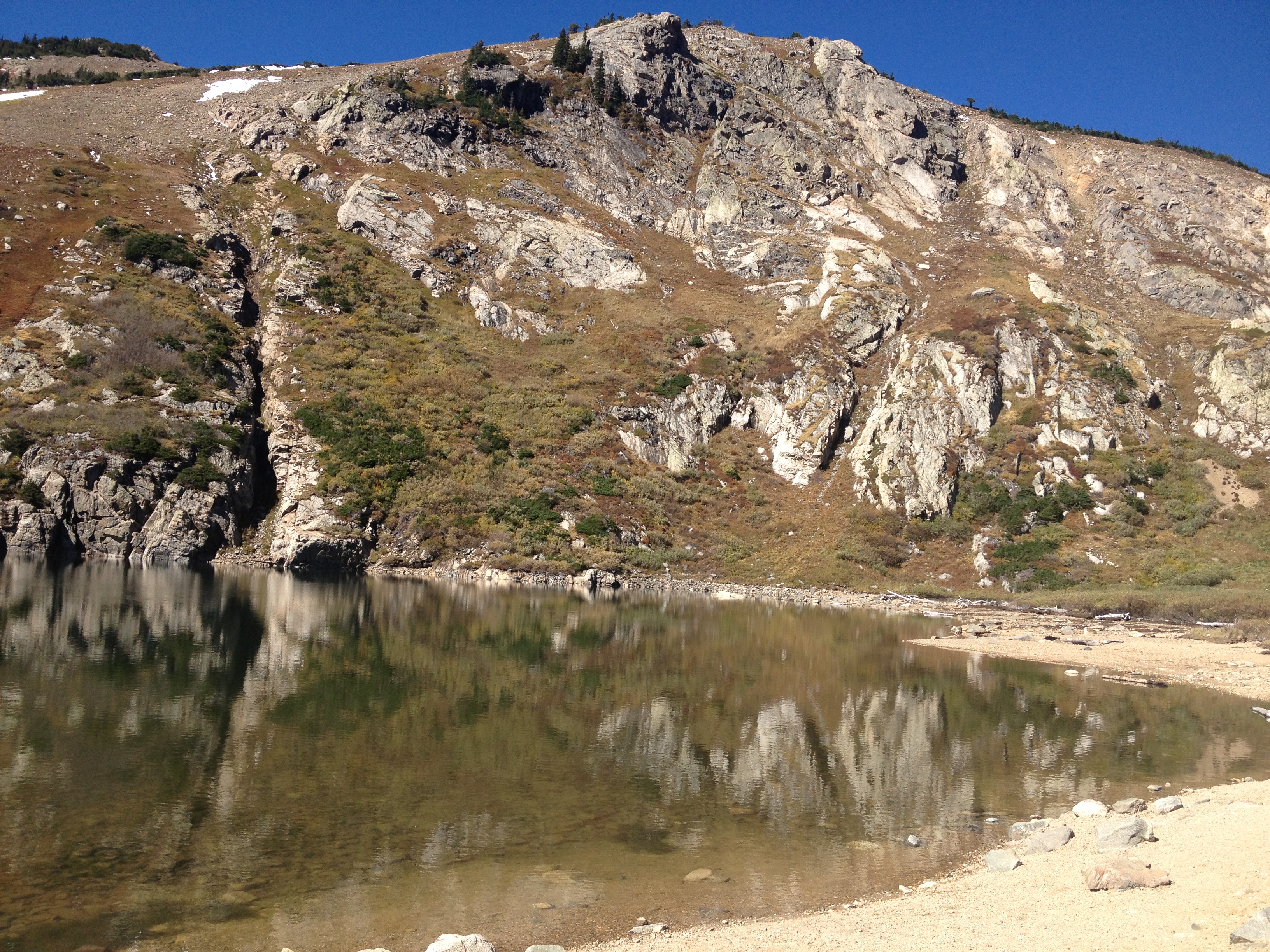
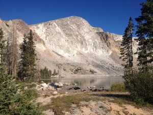
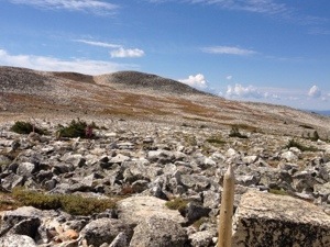
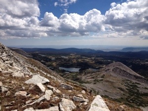
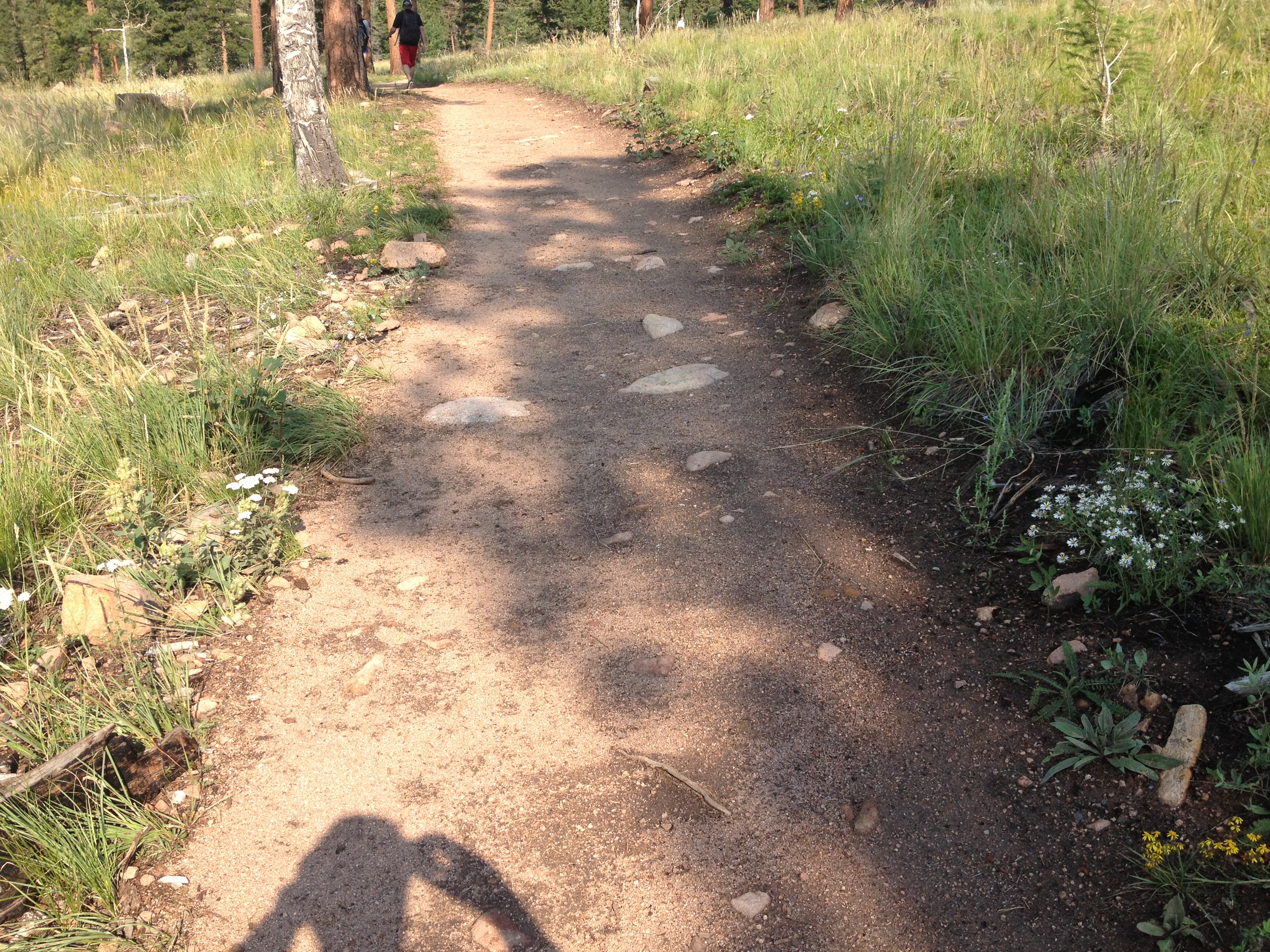
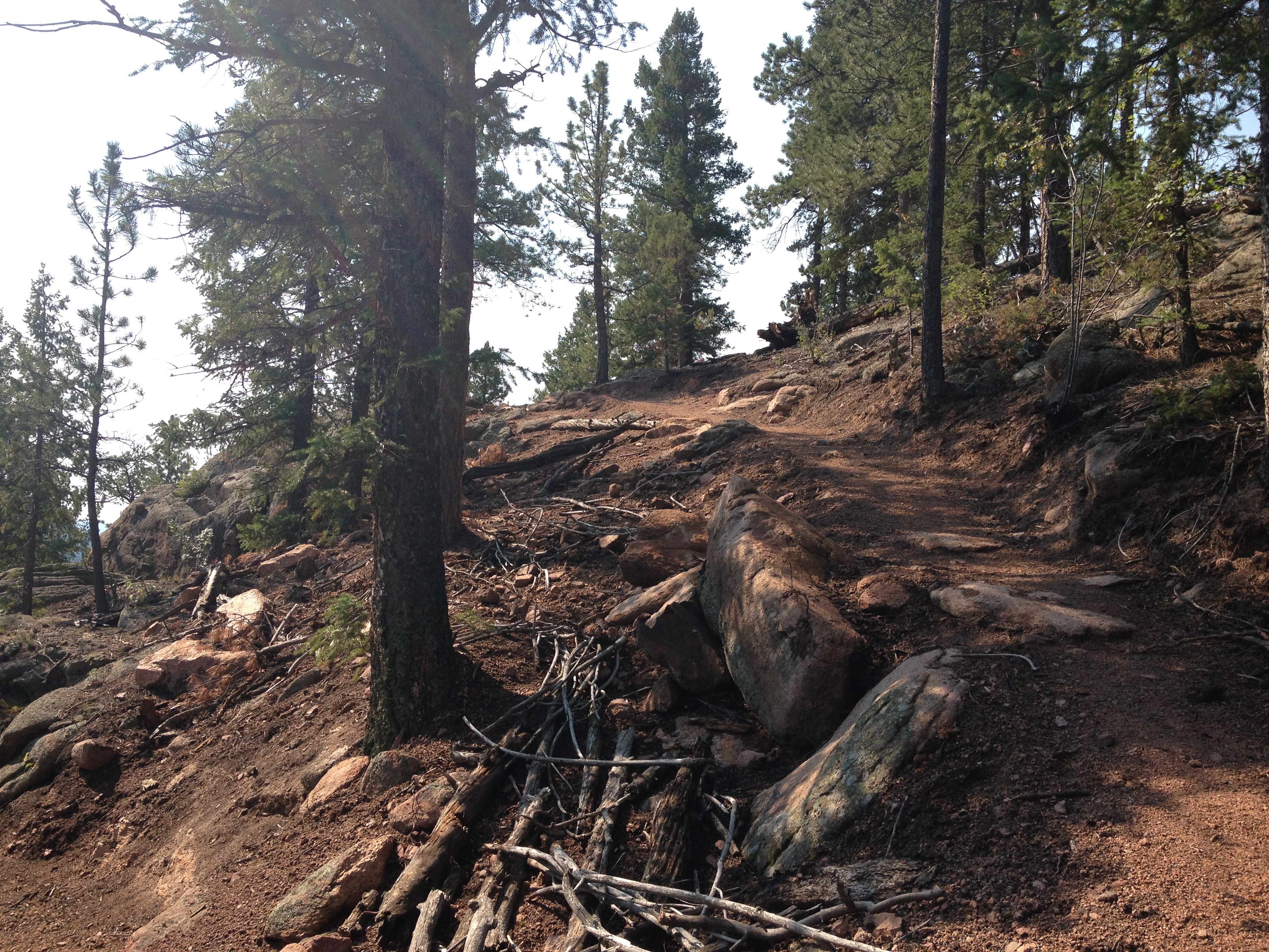
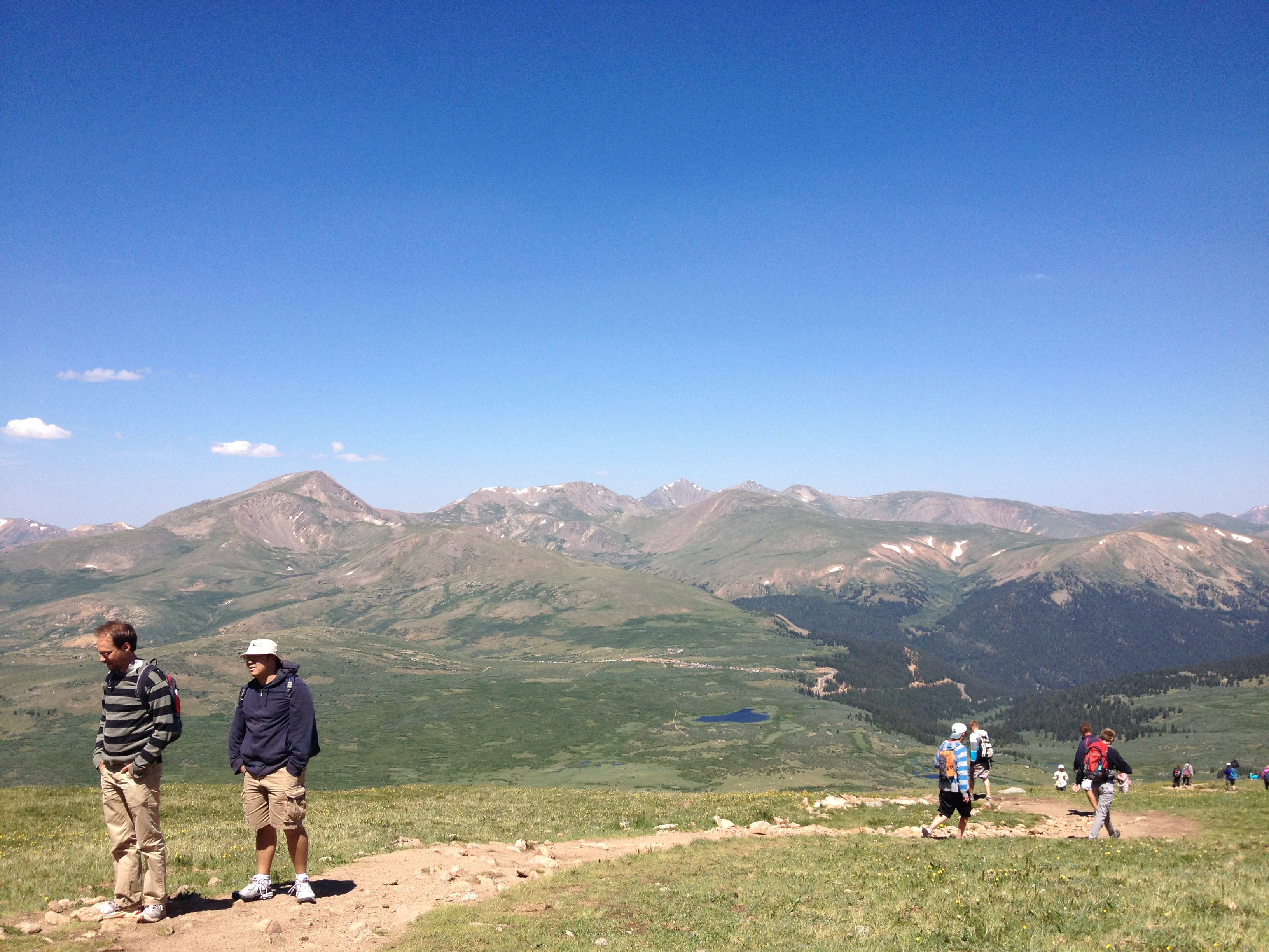
That is the question I pondered today, after driving past some of the best fall foliage I had seen thus far in Colorado, and climbing a rocky 3/4 mile trail to the base of St. Mary’s Glacier.  Before getting to the glacier, the trail meanders by St. Mary’s lake, a lake pretty much produced by melting glacial waters.  I would not recommend going into this lake, as the water is really cold!  However, it would be really dumb of anyone to not realize this, as the glacier is in clear view, along with the water running off from it.  It is clear for anyone to see that the water in this lake was recently part of that glacier 100 feet or so up the hill.

IMG_1100IMG_1101

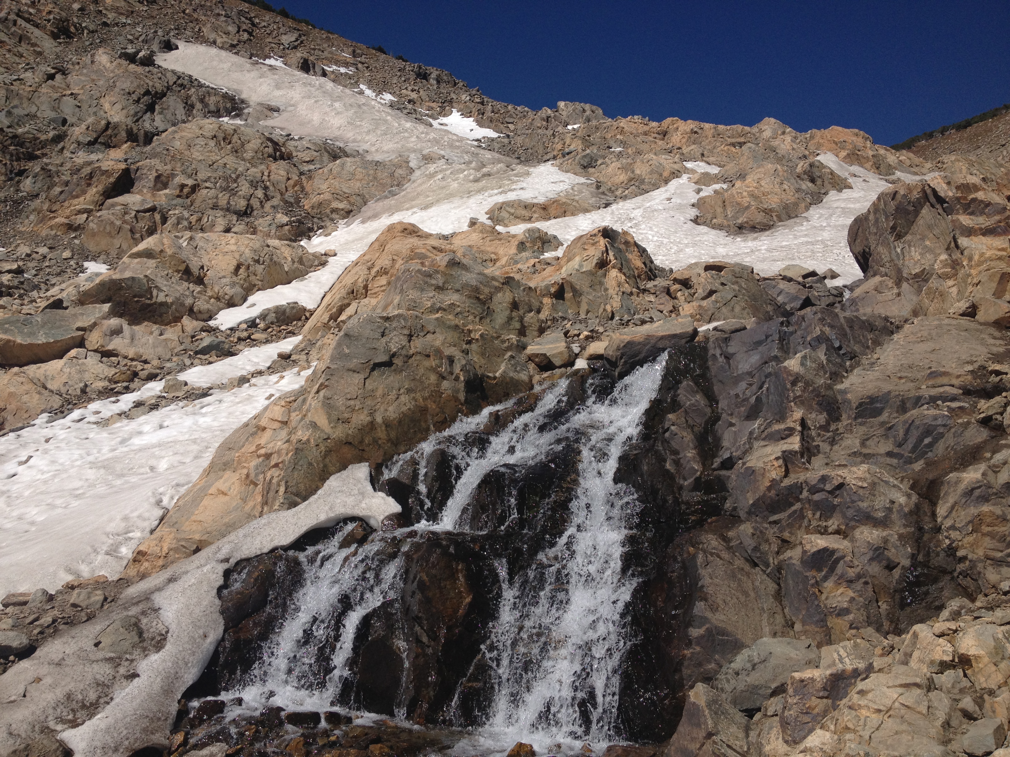
The cascades of water along the trail were moving quite fast on this day.  That made sense, given the warmth and sunshine.  But, it still seems to me that 4 months worth of weather like this would eliminate any snow and ice remaining on the surface.  So, what is going on?

Well, the weather in Colorado is actually quite complicated, and highly dependent on local terrain features.  Snowfall rates can vary significantly from location to location in the mountains depending on the wind pattern and terrain.  In fact, this variance caused enough frustration to motivate a local ski enthusiast to create a web page dedicated to finding the best snow and snow conditions in the area.

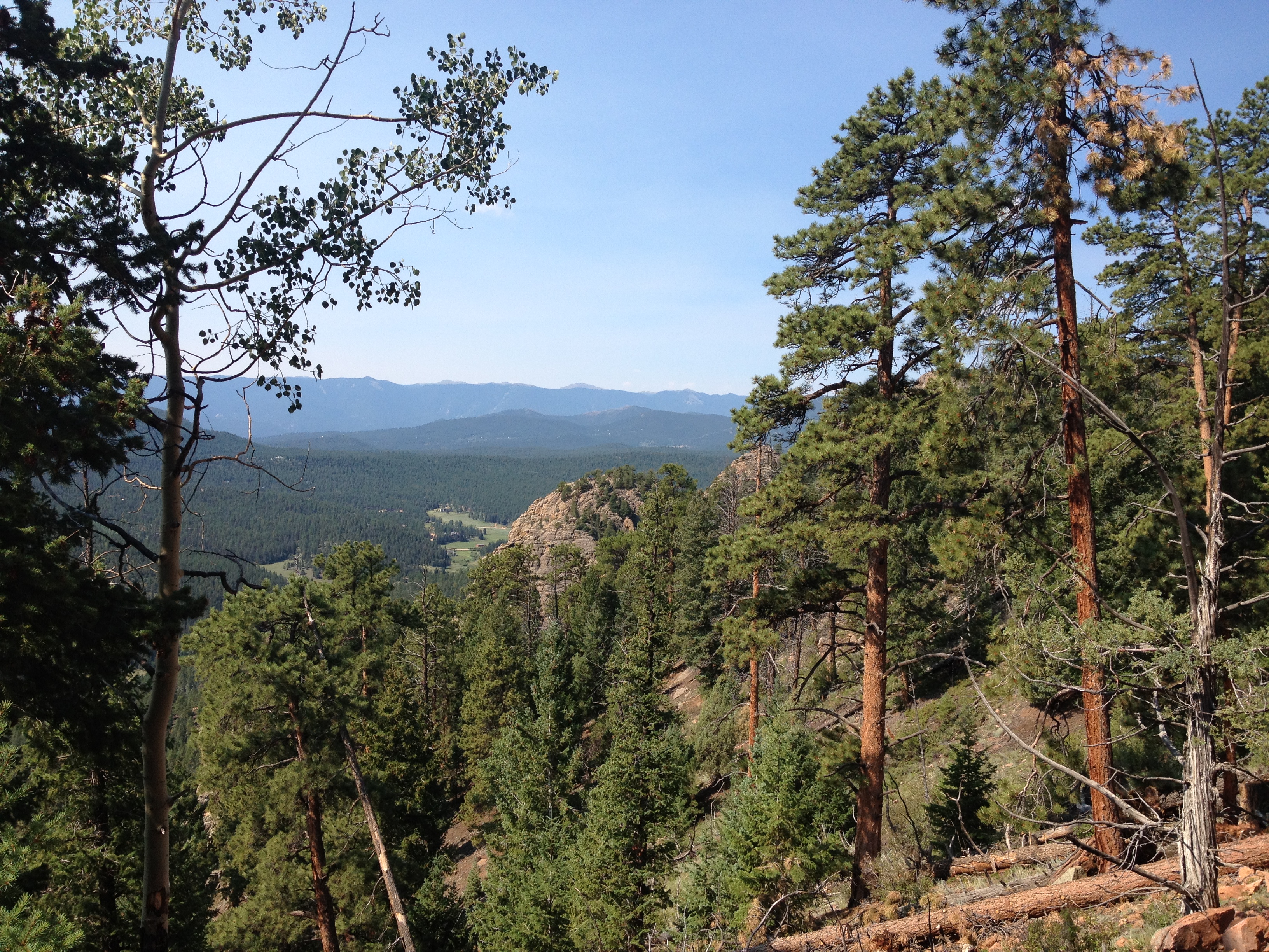
The terrain features at this particular location must cause snowfall to be significantly higher here than at similar locations I had previously visited.  Earlier this summer, I climbed Gray’s and Torrey’s Peaks.  The trailheads were at about the same elevation as the base of St. Mary’s Glacier, maybe even a little bit higher.  Yet, no glaciers existed.  Another possible part of the explanation is cold air funneling between the two mountain peaks that surround the area.  Unfortunately more detailed observations would be needed to actually conclude that this is why this glacier exists at an altitude where it shouldn’t.

Another conclusion that cannot be made simply from my observations today is the long-term (decades) fate of this glacier.  With the current heated debate about anthropogenic global warming, it is easy for one to view how rapidly the glacier is melting today and consider it evidence that the earth is warming, and that this glacier is melting.  However, the melting of some of the ice and snow on the glacier during the summer months is actually part of a glacier’s annual cycle in which snowfall in the cold season adds to its’ mass and melting in the warm season reduces it’s mass.  If there were no mass reduction of a glacier in the warm season, they would ever expand at the expense of our oceans.

IMG_1104 IMG_1105

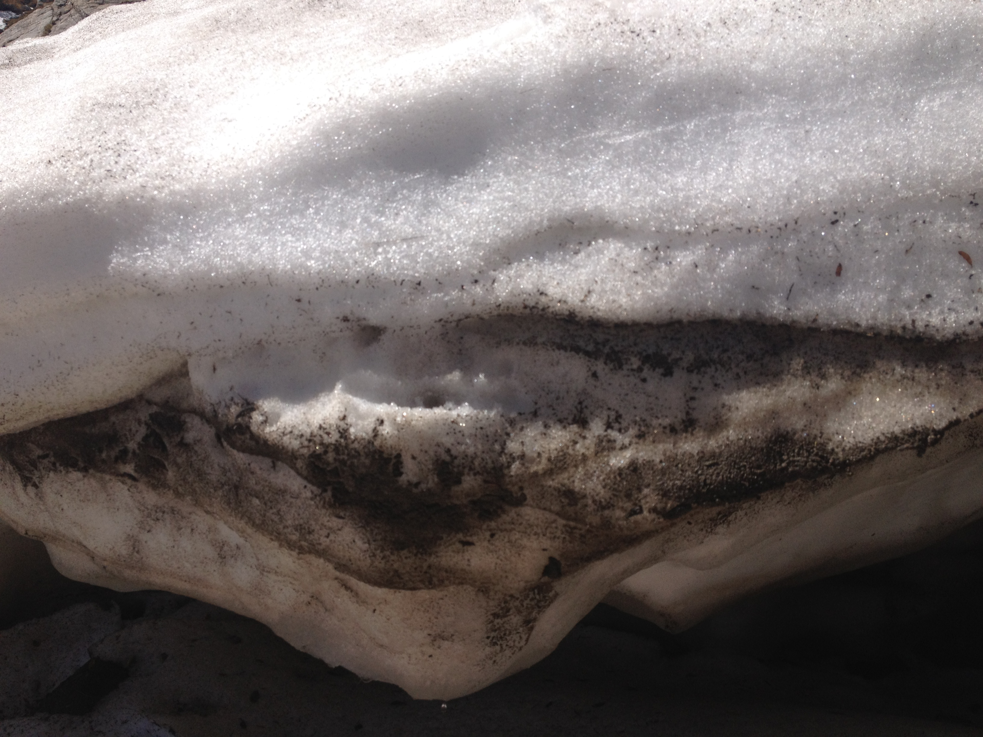
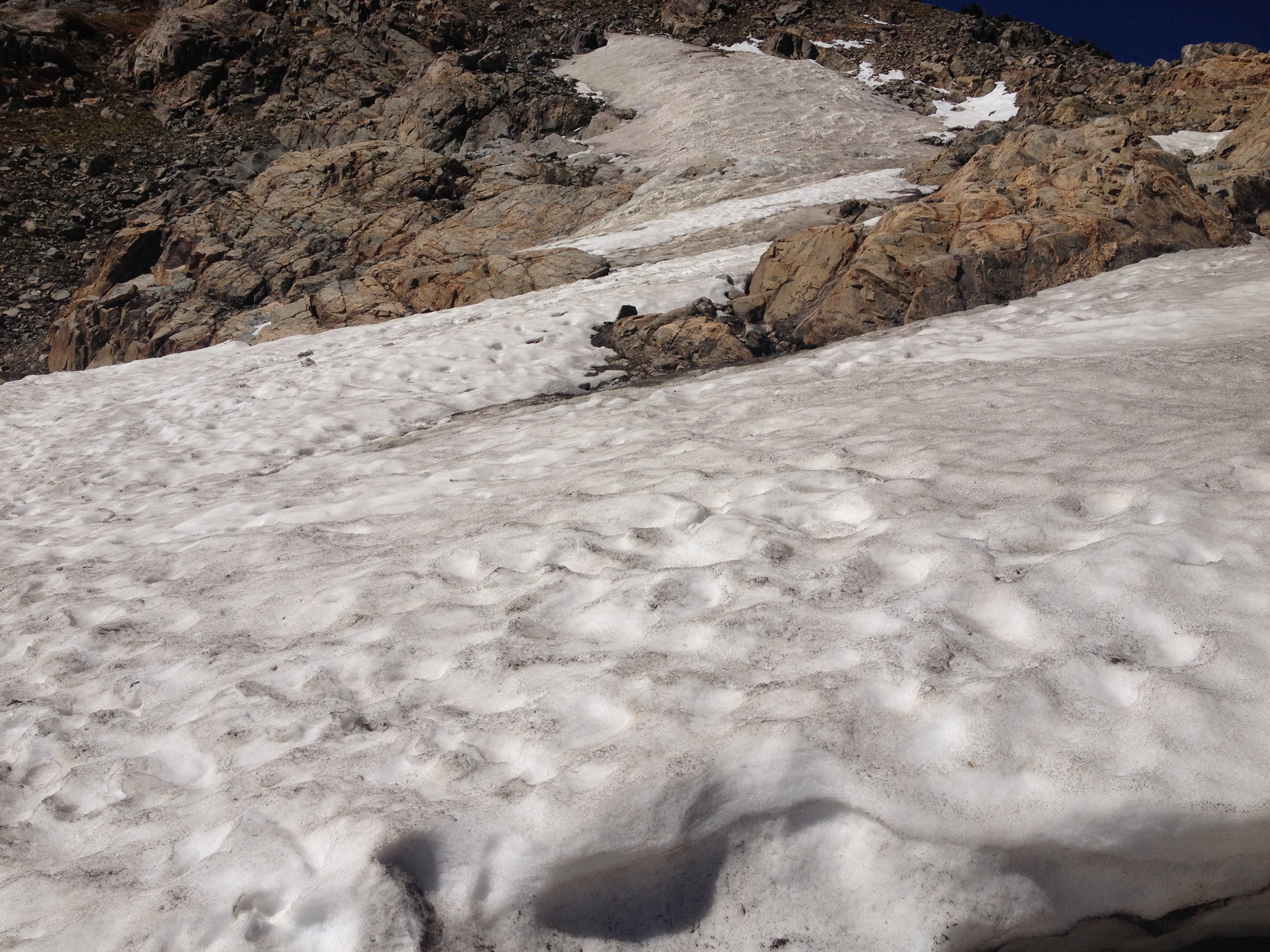
In fact, a close up view of the glacier’s ice shelf showcases this annual cycle.  This ice shelf has very white looking snow on top of a darker layer of snow.  The snow on top is newer snow, most likely from the most recent snow season.  On a warm day like today, it had the consistency of wet, snowball making snow.  However, the dark layer of snow underneath had a much icier consistency, indicating that it had survived multiple summers.  This is, in fact, an easy way to verify with no other observations or knowledge that the snow field you are looking at is indeed a glacier (as opposed to just residual snow from last spring).  Some of the ice in this middle part of the glacier has likely been around for decades.

The bottom layer of the ice shelf was dripping pretty rapidly from the melting.  There may be some really fun icicles here on some cooler days.  Given that melting is occurring this rapidly October 1st, it is possible to speculate that this glacier is losing mass over time, but that can only be concluded with more observations.

With it being warmer here than at most glaciers, it makes sense to me that this would be a popular attraction.  What makes less sense to me after today is why people seem to prefer to drink water from glaciers.  At least I see it all over advertisements for bottled water (i.e. the Evian Logo).  Today I saw ice and snow in constant direct contact with dirt and rocks, walked on by humans and dogs, melt and run off into cascading streams where the water is also consistently in contact with dirt, rocks, and possibly more dog pee.  This did not feel to me like the cleanest water I could be drinking.  I guess there are no chemicals.  Still, I think I will trust my city’s water purification system.

Maybe rather than being bothered by this glacier’s existence, I should be inspired.  This glacier has managed to continue to exist despite not so favorable conditions.  It is much like the one remaining factory in a decaying rust-belt town, or that tree in Wyoming the grew out of a rock.  They later built Interstate 80 around this tree, further disrupting it, but it still persists to be alive.  Like that tree, St. Mary’s glacier, and that one person you know who doesn’t seem to have any bull-shit at their job, evidence that bucking the trend is possible is still out there.  It is just a matter of finding out how they did it, and how much of it is luck.

Mount Evans The Easy Way

The United States of America is not perfect.  There are definitely some aspects of our history that seem a bit shady, and there are definitely some things I would change if I had my way.  But I still love this country, and feel lucky to live here.  One of the things I love about this country is that we attempt to accommodate nearly everybody.  We have lifestyles that range from the crowds of Manhattan to empty parts of Wyoming, and many other things in between.  Despite the fact that I have come across a few Americans who would like to eradicate one or more of our prevalent lifestyles, we remain a county that accommodates.  If anything, we are becoming more accommodating, as more and more places add bike lanes, and some communities allow people to follow their dreams of traveling everywhere by golf cart.

To get to the top of the mountains in Colorado, we also accommodate many different methods.  Most Coloradans prefer to hike up our tallest peaks, and nearly every tall mountain here has multiple hiking trails to the top.  Two of Colorado’s tallest peaks, Mount Evans and Pike’s Peak, have paved roads to the top.  During the summertime, people can drive or ride a bicycle to the top of these peaks.  In fact, the ride from Idaho Springs to the top of Mount Evans was featured as one of Bicycling Magazine’s Top Bike Rides.  Pike’s Peak can even be reached by train.

The easiest way to the top of a mountain is to drive.  Having already hiked three of these peaks this summer, I decide to take a drive (or, more accurately, go along for a ride) up Mount Evans.  The road up to Mount Evans is actually North America’s highest paved road, and a very scenic one.  There are plenty of wonderful places on the way up this highway, including dense pine forests, alpine lakes, and places where you can see the mountains in the distance.  These are the kinds of images you will often find on a calender.

IMG_1074 IMG_1075

One added bonus of taking this trip in late September was the fall colors.  The fall colors here in Colorado come primarily from the Aspen trees, and primarily turn the color yellow.  This makes a fall image here in Colorado quite different than what you would see in the east.  Firstly, with more pine trees here, not all of the trees are changing colors.  And, with the trees mostly changing the same color, yellow, there is less variety.  In that sense, I would say anyone looking to take a vacation for the primary purpose of viewing fall foliage would be better off going to New England or the Smoky Mountains.  But, the colors did add an extra element to the views on this trip.

IMG_1076

Some places in higher terrain just recently received their first snow of the season.  The snowfall was not particularly heavy, but it still could be seen, especially from the shaded areas once we climbed above 9,000 feet.

IMG_1077

As a result of this recent snowfall, as well as a heavier snowfall at the highest peaks (during the floods a couple of weeks ago), the road was not open all the way to the top of Mount Evans.  The farthest up we could go is Summit Lake, which is around 12,800 feet in elevation.  This is not too atypical, as these higher elevations typically start receiving snow in September, and plowing a road at this elevation is not an easy task.

IMG_1078 IMG_1079

I love science!  I love the way some scientific phenomenon can create some unique observations, and I love the process of figuring it all out.  It was a very windy day at Summit Lake, and I could feel it as soon as I got out of the car.  In fact, the wind confirmed for me that it would have been quite unpleasant to try to hike at this elevation.  What I observed on this lake is a phenomenon I had seen years back when I was living in Madison, WI.  On a cold, windy morning, the wind blows water off of the lake onto nearby grass and rocks.  If it is cold enough, those water particles freeze on contact, much as they would in an ice storm.

When I observed this in Madison, WI, it was a similar situation.  In that case it was December, as it gets cold a lot earlier in the year at high elevations, but the progression of events is the same.  Water has a higher heat capacity and therefore both warms up and cools down slower than air.  It takes more than a few cold mornings to freeze over a lake, even a smaller lake like this one.  So, at the time of year when winter-like chill first arrives, this phenomenon can be observed near lakes.  Larger lakes like Lake Michigan and Lake Superior never freeze over in the winter, and sea spray events like this one can be observed pretty much all winter long.  Although I have seen the result of this combination of weather conditions a couple of times, I am now kind of curious to see it actually occurring.

The world is a tough place to understand.  Life often seems to unfold in ways that do not make too much sense.  Often times, after a particular endeavor does not turn out the way I had hoped, I spend a good deal of time scratching my head, wondering why.  When something impacts my life in a negative way, my response is always to try to figure out where it went wrong, as to avoid making the same mistakes.  But, most of the time it does not work that way, particularly when social interactions and group dynamics are involved.

In a way, I feel like I can take comfort in science.  In science, there are universal laws, and certain things that will always behave the same way, even in an unfamiliar place.  The cold windy night on Summit Lake created the same ice patters that it did on Lake Mendota.  No matter where you are light waves of 550nm will appear green to the human eye.  This, and a host of other things, can be counted on, will always make sense, and can provide some comfort in unfamiliar situations.  Yet, unlike some predictable things, like re-watching movies and T.V. reruns, it does not become mundane and uninteresting over time.  There is always something new to be discovered, a new phenomenon to be observed and investigated, and a new possibility to be opened up.

IMG_1073 IMG_1090

On the return trip, we stopped in Idaho Springs, walked around and ate lunch.  I have driven by this town many times, but never really spent much time here.  In a narrow valley, with steep terrain on either side, the town actually has some houses on higher terrain.  From the highway, it’s appearance consistently reminds me of model train sets.  In addition, the town, which champions itself as “Where the Gold Rush Began”, actually named it’s high school team the “Golddiggers”.  I still wonder if the the marching band plays that Kanye West song when the team comes out onto the field.

I was pretty impressed with the downtown.  It is a nice, kind of small, western town.  It is not over touristy, as it is not adjacent to a big attraction the way Estes Park is.  The shops seem well kept, and also seemed to have variety.  We ate at Tommyknockers, a microbrewery downtown with bar food, and also a lot of buffalo burgers.  From walking around town, I see several other places I would like to try, on subsequent trips.  But, I really do not know when I will be coming into town again, as it is not a typical stop-off for me on ski trips and such.

A Journey to Another Nation

In some of my travels earlier this year, I was exposed to more of the history of the American West; particularly our series of battles and treaties with the Native American population. Earlier this week, as I gazed towards the east, towards the Great Plains, I pondered people that society often overlooks. Quite possibly the most overlooked people in our society today are the Native Americans. In that vein, I took advantage of an opportunity I got to visit the Pine Ridge Indian Reservation in Southwestern South Dakota. This is one of the poorest places anyone can find within the United States, and a place where a lot of people in the West go to do charity work.

20130921-094233.jpg20130921-094246.jpg

The drive up to the Pine Ridge Indian Reservation is primarily through the Nebraska panhandle, through an area I am mainly familiar with through storm chasing. With a little bit of extra time, we got a chance to visit a couple of roadside attractions near Alliance, NE. The primary attraction there is a place called Carhenge. Carhenge is a replication of Stonehenge with old cars that was built by some rancher a couple of decades ago. Apparently, ranchers have nothing to do in the winter, and often end up bored. So, from time to time, they come up with something creative, which explains why we also saw this roadside attraction, only a couple of miles further up the road.

20130921-094643.jpg

As we travel north and approach the border of South Dakota, the empty and largely flat land typically associated with Western Nebraska gives way to some rolling hills and pine trees. This first begins to appear near the Niobrara River Valley, a river that actually produces some of Nebraska’s most interesting scenery. In fact, farther down this river, just east of Valentine, NE, is a place called Smith Falls, a waterfall with a 75 foot drop, which is really not to shabby at all.

20130921-095355.jpg

On the road we came in on, Nebraska highway 78, we enter the Indian Reservation as soon as we cross the border into South Dakota. On the border, there is a town called Whiteclay, NE, where Native Americans largely go to buy liquor, as for some strange reason it can’t be sold on the reservation. The town of Pine Ridge, the main town on the reservation is a mere couple of miles into the reservation. There, I met the people who assist with coordinating the volunteer efforts of those looking to help. They have an office, which looks like a small house from the outside. Inside, I see a map showing the poorest counties in the United States, a good amount of Native American artwork, and a calendar, with plenty of appointments for people to visit and help written on it.

20130921-103239.jpg

20130921-103248.jpg

Out of respect, I took a limited amount of pictures on the Reservation. However, I did take a couple of pictures, one of one of the houses we were working on, and one of the neighborhood. At some point, I was under the impression that Indian Reservations are places where people still live in tepees and chase buffalo off of cliffs. But, in reality, they live in towns much like how the rest of us do. We always kind of romanticize the idea of Native Americans as nomads who hunt and gather their food, but history does show that is not always the reality. Particularly in the Southwest, ruins of villages from long before any European Explorer arrived can be found in places like Taos Pueblo and Mesa Verde National Park.

The town did look obviously poor. Many of the yards had broken cars and many of the homes were in disrepair. In that sense, it kind of reminded me of some of the poorer parts of Chicago that I had seen, on the West and South sides. I did definitely feel a lot less danger in being there than I had when I had ventured to those parts of Chicago. I guess I did not feel as if I was liable to get jumped, or be hit by a stray drive-by. However, the level of poverty did not feel any less.

20130921-104819.jpg

After working on a few homes, we got to go to lunch with a couple of the people who coordinate the volunteer effort, at a place called the Lakota Cafe. I got a chance to have a small discussion with a couple of the people who coordinate the volunteer efforts, and also have some involvement with Indian affairs (with the U.S. Government). I have a ton of questions I would have liked to ask them. I really do not understand everything about our relations with the Native American tribes, as it is a topic that is not commonly discussed in depth. These reservations are sort-of another nation, but also sort of not. Apparently there are a lot of legal controversies in situations where our federal law is different than the laws enacted by the tribes. There are also controversies over water rights, particularly for water from the Missouri River. The water rights controversies in some ways remind me of the ones along other rivers, with those downstream accusing those upstream of taking too much. However, there is definitely a component of it that relates to the treaties we had formed with the tribes (some of which we blatantly violated). Apparently, one of the treaties permits some of the tribes to take the water from the Missouri River in South Dakota.

The biggest mystery to me about our affairs with the Native Americans is why we cannot simply just live together like we do, more or less with other racial groups. I mean, we do self-segregate, but we live under the same governmental and societal structure. And this is with different groups of people with differing histories, including some that did not come here willingly. Of course, the history with the Native Americans is also unique, as they were here long before Columbus introduced the continent to the Europeans. Seeing that the reservation has houses, cars, roads, stores, etc. just like us makes it even more of a mystery to me, as the idea of a place where people still chase the buffalo would definitely not vibe with our modern day American culture, but they seemed to have opted to live in towns now.

As much as I would really like to know their perspective on this, I decided it was not my place to ask them these questions. It could have been taken the wrong way, as there are a lot of people who feel like the Native American tribes should not have their reservations, and have become a drain on society. They don’t know me, and do not know my intentions, or how I feel about anything. Nor do I really know how I feel about all of this stuff. The more I hear them describe how the law operates within the confines of the reservation, how they coordinate with Badlands National Park and such, the more confused I get.

It is the point of view of the Native Americans that their land was taken away from them, little by little, and that in a large part their culture was taken away from them. However, nearly all of the world was once nomadic hunter-gatherers. One by one, different places took to living in cities, agriculture and the like. So, can the Native American tribes be expected to do so as well? It seems like there are towns in the reservations, so I get the impression that the issue is not even necessarily about the idea of nomadically chasing the buffalo. From my visits to places like Crazyhorse, and Fort Larmaie, it does seem like we made a lot of treaties, and broke them. But I don’t know the reason why. Nor do I have anything near a good understanding of that history.

I was born nearly a whole century after the last “Indian War” happened. I did not chose to come to a new continent, nor did I chose how we relate with the Native Americans. The only other time in my life I even encountered Native Americans was in Wisconsin in 2004, when we were protesting a professor by the name of Ward Churchill for making outlandish claims about the victims of 9/11. The Natives stood alongside us, as they felt Professor Churchill, only something like 1/16 Native American was stealing their identity to make a political point. So, while it is natural for me to feel that we did historically treat these Native Americans well, I also wonder how much I can personally be expected to feel responsible for something that was done by people who only really have one thing in common with me; their race?

In the end, the conclusion I came to today is that I am in no place to take a position on any of these issues, as I simply don’t understand them. I have become tired of people taking strong, decisive political opinions, often deriding those who disagree with them, based on incomplete understandings of facts and history. I believe that people should at least understand the uncertainty around their points of view before they start saying things that could potentially upset others. At this point in time, I am applying the same standard to myself with regards to this particular issue. To take either side, even if I were to take the side of the Native Americans due to what appears to be a failure on our part to honor the treaties, at this point in time would be disingenuous. And, I believe that the Native Americans would think this to be so even if I did take their side with what little knowledge I have of the true history, and the true reasons why thins are the way they are at this present point in time. All I can do is listen, to all points of views, learn more, and be willing to help out those in need.

Green Mountain; The Edge of Two Worlds

A lot of rivers, mountains, and land features are named for the color in which they appear.  According to the Wikipedia disambiguation, there are eight land formations, and three towns named “Green Mountain”. This, in addition to the “Green Mountains” in Vermont, which refers to the entire mountain range.

The Green Mountain I am referring to here is the one in Lakewood, CO, inside William F. Hayden Park.  What makes this particular mountain so special is it’s location.  At 6,855 feet, it is not particularly tall, but it is amongst the first actual peaks that one would come across as they travel to the West.  At least geographically speaking, it marks the border between the Great Plains to the East, and the Rocky Mountains to the West.

GreenMountain_Lakewood_Map

It is also only 12 miles from central Denver, and is known to be one of the places that dries out the quickest after a precipitation event.  So, if there is a place to check out on a nice sunny day only half a week after one of the worst flooding events in Colorado history, this is the place.

To get to William F. Hayden, I rode my bicycle, as it is only 12 miles away from my apartment, and I found a route through Lakewood, mostly on 1st Avenue that did not involve the bicycle trails, most of which are in river valleys in this area, and could still be muddy or sandy from the recent floods.  Most of this route, heading to the west through Lakewood, is a steady but slight uphill climb.  However, after I cut over to Alameda Ave. and followed the path alongside that road to the West and Southwest, the climb got steeper.  By the end of this climb, I was already at an elevation over 6100 feet.  This means that I had already done most of the climbing on my bicycle, before I even started this trail.

IMG_1040 IMG_1041Upon entering the parking lot, I was surprised to see that the trail conditions were still labeled as “Very Muddy”, and that they were still not recommending use.  I am assuming that these ratings were designed mostly with mountain biking in mind.  Still, the idea of a “very muddy trail” does not appeal to me for hiking, and I traversed the parking lot expecting not to be able to hike at all, but prepared to be satisfied with my bike ride.  However, I saw a lot of people, both hiking and biking the trails, and they appeared fine.  Two mountain bikers, who appeared to have already used the trails, confirmed that the conditions would be fine, so I decided to assume that the sign above was not updated, and hike the remaining 700-ish feet to the top of Green Mountain.

IMG_1043

There are several routes to the top of this mountain, but the best option for someone who really wants to do some uphill hiking, traverses a radio tower, which is near the top.  Although this may take away from the pureness of a hiking experience, it seems to me like a good idea, from a scientific perspective, to have a radio tower on top of a hill, where it can reach more people.

IMG_1044 IMG_1046

The top of this hill did feel like looking at the edge of two worlds.  Looking to the West, one could see the Rocky Mountains, well, mostly the foothills, but it was clear that anyone headed west would encounter taller and taller peaks.  Gazing Eastward there is a pretty good view of the skyline of the city of Denver.  In fact, observing the skyline of Denver from Green Mountain kind of reminded me of all of those iconic movie and T.V. show scenes where a small group of people would drive up to somewhere like the Hollywood sign and gaze at their city below them.  This would usually involve some kind of deep moment, either someone contemplating their life, kissing for the first time, or reminiscing on something.  Either way, I have this idea that major moments occur at places like this.

I hung out at the top of this mountain for a while today.  For a while, I switched back and forth between looking west and looking east, pondering what each direction meant.  To the west, the mountains represent excitement, challenge, and dreams.  A lot of people think of the glory of living the good life in a town like Vail, or Aspen.  To the east, I initially thought of Denver, but then started to look beyond Denver itself, towards what lies to the East of Denver, toward an area that is periodically overlooked and ignored.

If the west view at this peak represents challenge, dreams, and the possibility of achieving the good life, the east view represents being ignored, overlooked, and stagnation.  In fact, if I had not become interested in storm chasing, I might still have no idea what this place is all about.  The cultural centers of this country, primarily New York and Los Angeles, do not think about this area too much.  People from large cities either just fly over this area or resentfully drive across it.

There have been periods where people in large urban areas achieved greater and greater economic prosperity, while the people of the Great Plains continued to struggle.  Politicians routinely ignore people living outside the urban centers as there are fewer votes to be won there.  In fact, there are some people in the Great Plains portion of Colorado feel so ignored, they are developing plans to secede from the state.

As I leave the mountain, I think about how I am lucky to have had the experience of storm chasing, an interacting with all of these people.  Their lifestyle is not one that I would want, but what they do is still important.  People don’t think too much about the farmer and the rancher when they buy their food, but they are benefiting from what the people in this forgotten part of the country do.  Most of the interactions I have had with the locals while storm chasing have been positive and friendly.  In fact, one time in Sublette, KS, our entire chase group got free hamburgers, as they were having a celebration for the opening of their new co-op gas station, and let us join.  One of the great things about this country is that we do provide a variety of lifestyle options; something for everyone.  Hopefully one day, we will heal this urban-rural divide, and come to appreciate one another as parts of the complete social and economic system that makes all of our lives richer

Medicine Bow Peak

Labor Day Weekend represents somewhat of a rare occurrence in our modern world. For many with standard salary positions, Labor Day Weekend, along with Memorial Day Weekend and sometimes the 4th of July, are the three times of year in which a three-day weekend occurs automatically at a time of year with reliable weather. It is the rare opportunity to embark on certain adventures without having to dip into what is a precious commodity for many; vacation days. With how little chance many people have to go out and enjoy our natural world, see new places, and find new experiences, it is hard not to feel some kind of pressure to take advantage of weekends like these. Many even plan their excursions months in advance.

I come from this world. And, no matter how independent-minded I try to be, I find it hard not to feel this same pressure. There is some kind of pull on me, some strange aspect of my subconscious, my psyche reminding me of this scarcity. A voice in my head will actually tell me that not having some kind of an adventure on one of these “major weekends”, which includes Labor Day Weekend, is a waste of a resource more precious than anything monetary. It engulfs me, telling me that a mediocre Labor Day Weekend could possibly indicate that I am no longer an interesting person, regardless of what kind of activities I had been involved in the pervious weekends, or have planned for the coming weekends.

I bet this same pressure is felt by many. Therefore, I am told that on Labor Day Weekend nearly all of the popular recreation destinations in Colorado are “crowded”. But, I still really do not know what that means. Everybody has different thresholds for what constitutes crowded. And, part of me still suspects that to the average Coloradan, still not really that terribly used to the idea of Denver as a large city (or at least significantly larger than it used to be), the threshold for a place being considered “crowded” is much lower. Despite the fact that part of me reasons that being told something is “crowded” in Colorado is not something I need to concern myself with, I heed the advice given to me and head up to Wyoming, where I am told crowds are significantly less, even on a weekend like this one.

20130831-210404.jpg

20130831-210415.jpg

Today I headed up to Medicine Bow Peak, which is about 35 miles west of Laramie, Wyoming, basically in South Central Wyoming. And, well, the advice I was given actually turned out to be correct. The hiking trail, from Lake Marie to the top of Medicine Bow Peak, the highest peak in the region, is actually surprisingly not crowded. The crowd is probably less than half the crowd I encountered both times I climbed “14ers” earlier this summer, and probably comparable to what I would encounter on day hikes in Colorado on weekdays! Amazing for a holiday weekend like this one.

20130831-211950.jpg

Today’s hike began at Lake Marie, at about 10,500 feet in elevation, but started out climbing rapidly up the side of the mountain. This is actually something I was quite prepared for, as the mountain itself looked quite steep from approach. Today’s climb would only take me to slightly over 12,000 feet in elevation, a roughly 1500 foot climb, but the first half of the climb occurred quite quickly, and it did not take long for the lake, and the parking lot to appear significantly below us.

20130831-212334.jpg

20130831-212346.jpg

The next part of the hike, however, did take me by surprise. After climbing nearly 1,000 feet in the first mile, and feeling like I was actually on the verge of completing the hike, the trail flattened out. On the way to Medicine Bow Peak, there are several closer peaks that some would consider “false summits”, because they blocked the peaks behind them. We would hike around each peak in a semi-circle, the trail being either flat or having some minor rolling hills. This even included some downhill sections on the hike up the trail, which made the hike overall somewhat more challenging than other 1500 foot climbs.

I referred to this as “orbiting” these peaks. After each “orbit”, a new peak would appear, showing itself to be 100 feet or so higher than the pervious one. Each time, we would reason that the new peak was the one we needed to summit, only to be surprised to find the trail meandering on to the left of the peak once again, and another peak appearing in the distance.

20130831-213040.jpg

20130831-213048.jpg

After four of these peaks, we finally encountered the peak we were destined to summit. After another steeper section, summiting this peak involved 100 feet of “scrambling”, which basically means climbing up a fairly steep vertical on rocks, with no one intended path. However, before the “scramble”, I was able to look down and see kind of an overview of the land I had already traversed. WIth all of the smaller peaks we had “orbited” around, we actually made some significant progress in the horizontal direction, and were quite far away from Lake Marie. A series of lakes near the trailhead appeared on the horizon looking down. The true beauty of the area could be seen from above, but did appear significantly different from it’s view from below.

20130831-213757.jpg

20130831-213803.jpg

The trek up this mountain actually reminded me of climbing “14ers” earlier this summer in a few ways. First of all, most of the trail was above the tree line, and had a similar feel to it. Secondly, despite the fact that this peak barely rises over 12,000 feet in elevation, it is the tallest peak in the region. So, the top of the mountain had a similar “on top of the world” feel to it. And, of course, the rock and the scrambling.

I would say overall that this particular hike would be a great warm-up for those planning to hike “14ers”. It has a similar feel, is also in the arctic tundra at high altitudes, but is less challenging with less vertical climbing. The “14ers” I climbed earlier this year were similar in length (7-8 miles total), but were steeper climbs in general, without the flat-ish section. They also generally contained longer and steeper scrambles at the top. For the purpose of working up to the challenge, I would recommend this hike for anyone that is looking for a good warm-up for a “14er”.

Denver to Boulder by Bicycle

Recent studies have shown that not only has bicycle commuting increased in popularity over the course of the 21st Century thus far, but so has bicycle traveling.  Maybe it is the rise in gas prices.  Maybe it is the increased interest in combating obesity.  Or maybe it is just some kind of generational shift.  But, the increased interest in bicycle traveling has even lead to the development of a plan to implement a national bicycle route system similar to the highway system already in place for cars.

Locally in Colorado, one of the most important corridors for medium distance bicycle travel would be connecting Denver to Boulder.  Given the fact that both cities are very health conscious and bicycle friendly, and that enough people travel between the two cities every day to jam up highway 36, I have quite an interest in finding an ideal route between the two towns.  Well, the ideal route for now, until the bike path following U.S. 36 is developed, which may take some time.

Screen Shot 2013-08-21 at 2.20.06 PM

Today marked my second attempt to find the ideal bike route between the two towns.  My first attempt was back in May, a month that tends to have more ideal weather for intense activities at these elevations.

IMG_0965

My journey to Boulder, of course, began in the city of Denver, eventually following a route labelled D1.  The city of Denver actually has a local version of the National bicycle route plan envisioned, with a bunch of bicycle routes through the city labelled D1 through D22.  While Denver has better bicycle facilities and route labeling than most cities, labels such as this one are still somewhat intermittent.  Cyclists in Denver would benefit from signs alerting cyclists to when the route turns.  This particular route made two turns while I was on it, and neither turn was specifically signed.

IMG_0966 IMG_0967

Despite the fact that Denver and Boulder both lie East of the Rocky Mountain Range, the ride between the two towns is definitely not flat, and includes some challenging parts.  Periodic hills, followed by descents into river (or creek) valleys occur throughout the ride.  In fact, the ride in Denver begins with a significant climb from downtown through a neighborhood called “The Highlands”, which, as it’s name advertises, actually rises a couple of hundred feet in elevation higher than downtown.  On this ride, I continued to climb until reaching the Denver City Limits, near Wilis Chase Golf Course, where entering Arvada, I encountered a pretty good view of the mountains, followed by one of the steepest downhill parts of the ride, into Clear Creek Valley.

IMG_0968 IMG_0970

In Clear Creek Valley, I got to follow two bicycle trails, the Clear Creek Trail, and then the Ralston Creek Trail.  Although the Ralston Creek trail is not the nicest of bike trails (less underpasses, more curves), it has one of the best bicycle bridges I have ever had the privilege of riding over.  Bridges for bicycle trails are rarely as elaborate as this one.

IMG_0971

Arvada is reasonably bike friendly.  There are the aforementioned trails, and there are plenty of roads with bike lanes.  On Pierce St., the main street I followed north through the town of Arvada, there is even an area where the road itself is discontinuous, but a connecting bike path is available for cyclists.  Quite nice!

IMG_0973 IMG_0974

Unfortunately, the village of Westminster is not nearly as bike friendly.  To be fair, Westminster does have bike trails, but it does not really have bike trails designed to connect one place to another.  Their bicycle route system definitely indicates that the people of Westminster, at least at the time when they planned their town, viewed cycling primarily as a mode of recreation, and not as a mode of transportation.

My route through Westminster has always been to simply to take the sidewalk along Wadsworth Rd., a very major road with a lot of traffic lights, strip malls, etc.  This is already problematic as it is basically sidewalk bicycling, which involves a lot of bumps in the road, and the necessity of slowing down for every major intersection and being very careful for vehicular traffic.

In addition to this issue, part of the sidewalk was closed, and under repair.  In addition, there was no real alternate option, as most of the roads in that are are parsed out in subdivisions, not connecting neighborhood to neighborhood, and rarely traveling in a straight line.  So, I rode through the shopping centers on the west side of the road.  The roads were smoother than the sidewalk had been even when it was not under repair, but there were a significant number of speed bumps I had to slow down for.  In the grand scheme of things, whenever riding through metro-Denver, the entire village of Westminster can be thought of as a speed bump.  Although it is not as unfriendly to bicycles as some suburbs I have encountered in other metropolitan areas, it is definitely the least friendly in the Denver area, and progress is definitely slowed whenever cycling through Westminster.

Finally, the sidewalk ended abruptly on two occasions.  Once, I took a detour that took me out of my way.  The second time, I actually got onto the shoulder, which is fairly wide north of all of the shopping centers, but the road speeds up to 55 mph, making the experience not as enjoyable.  After cycling this stretch of road, and uphill some more, I finally entered the town of Broomfield, where I knew conditions would improve.

IMG_0975

Broomfield also has a lot of windy roads, but it is significantly more bike friendly, with bike lanes on a lot of them, especially in the office park area, known as “Interlocken”, and the area by the Flatirons Mall, where I cycled through today.  In that way, it reminded me of Colorado Springs, health conscious, bike friendly, with a suburban look and feel to it.

I had always considered Westminster to have closer ties with Denver, and Broomfield to have closer ties with Boulder.  However, I have no real evidence to back that up, only hearsay from those around me.  However, the towns of Superior and Louisville, which I biked through next, definitely are more closely tied with Boulder.  This is where I reached the summit of my trip, if you can call it that, along McCaslin Rd.

IMG_0977 IMG_0978

This hill is only about 400 feet higher in elevation than downtown Denver, but with it being the highest point in the area, climbing to this peak actually offers some of the best views of the Flatiorns, and the Rocky Mountains.  The Flatirons are a series of formations in the foothills of the Rocky Mountains, right outside of Boulder.  I believe they are called “The Flatiorns”, because the rocks actually form neat looking slanted sheets, as opposed to the smaller rocks, or more rounded terrain features more typically seen in this part of the country.  The Flatirons are a mountain feature that will always be synonymous with the city of Boulder, and the rest of my ride into Boulder was a rapid descent along South Boulder Road, directly facing this mountain feature.

IMG_0979

Four rapid miles, and something like ten minutes later, at an elevation over 300 feet lower than where I was on McCaslin Rd., I reached the Boulder city limits.  Once inside the city of Boulder, several things change abruptly.  First, in Boulder you can get anywhere by bicycle.  However, be prepared to be humbled.  From the time I left my home in Denver (South of downtown), I was passed once, only once.  Over the last three miles of my ride, inside Boulder, I was passed three times.

I was quite pleased with myself today.  I made it to Boulder in two and a half hours despite the slowdown that is Westminster, and was not nearly as tired as I was when I did this ride back in May.  Every single part of this ride, including many of the more challenging uphill segments, seemed easier, some significantly easier.  However, there is no place like Boulder, Colorado to remind you that there are people out there that are way better than you!

Goin’ Down to South Park

IMG_0958

I decided to break with a previous precedent I had set in this blog to only post one entry about a day’s travels.  In retrospect, some of the entries I posted a couple of months ago, which combined several activities into one post just because they were done on the same day seem like they may have come out a bit awkward.  In reflecting on the travel writing I had previously read, they appeared to make breakouts by experience way more than date.

Since I had already traveled to the South and West along highway 285 to get to Staunton State Park today, I decided to continue along the road a bit to get to Fairplay, Colorado.  By looking at my DeLorme Atlas, and then doing a subsequent Google search, I determined that the show South Park, is based (some argue loosely) on this town.

As someone who is a fan of this show, it probably sounds stupid that it took me over a decade, as well as over a year after moving to Colorado, to figure this out. But, I am not one to base my life around T.V. shows.  I feel like people nowadays focus too much on T.V. shows.  I get exhausted by conversations about T.V. shows, and saddened by people who appear to posses a greater understanding of the lives of fictitious characters on a weekly T.V. show than the lives of actual people who should be important to them.

In South Park though, I see a show that can come to represent something more.  Most shows people watch are entertaining, but don’t change anyone’s lives.  Sometimes, a groundbreaking show like Seinfeld will come along, but Seinfeld mainly changed the course of television, not history or society.  There have been shows like Fresh Prince of Bel-Air that produce commentary about real issues from time to time.  But South Park has come, to me at least, to represent an actual societal development.  It has come to represent the courage to retain the right to think individually, and come to a critical conclusion of almost anyone or anything regardless of what level of esteem they have come to enjoy by long-standing institutions or large groups of people.  It is the anti-group think, and the backlash to the political correctness movement of the 1990s.

IMG_0952 IMG_0953

However, the South Park Museum in town has absolutely nothing to do with the show.  But, it was a really good museum depicting life in the west in the 1870s/1880s.  The town was somehow preserved exactly as it was in that era, even down to the layout of the street and buildings.  There is even a historic train at the far end of the street.

Over 40 buildings were preserved, from homes, to the general store, saloon, blacksmith, and all of the quintessential buildings needed to make a true “old west” town.  Each building contained a significant amount of artifacts from that era, and museum attendees could actually walk through almost all of them and see most of the items used in day to day life here up close.  Walking through all of these buildings, I could actually imagine myself back in the old west.  I could picture myself living the life of the 300 or so residents of this town during that time period.  Overall, I have visiting my fair share of recreations like this, and this one has been the most realistic!

IMG_0956 IMG_0957

It is quite rare that any kind of museum, or historic town can lead to someone actually imagining themselves to be there!  However, there I was, imagining myself washing my clothes at the wash house, picking up supplies at the general store, boarding the train, and even getting involved in a game of cards at the saloon as if I were in the movie Maverick.  And all this was after I was expecting an entire museum about an animated T.V. series!

Also included in this museum was a 10 minute film strip about the town, and some basics about the history of the area.  All of this is not too far out of the ordinary.  As I visit more historical locations throughout the west, I have come to the conclusion that two themes are emerging from the beginning of the white man’s history of the west; fur and gold.  Most of the trails and even some of the towns in the area appear to have been established by fur trade, or gold rushes.  However, every gold rush appeared to have come to an end within a decade.  Some towns, like this one, found another niche (in the case of Fairplay it was ranching, and being a business center and county seat).  Others, like the ghost town I wandered through this past weekend, simply died when the gold ran out.

Overall, though, I can’t help but find it somewhat ironic that the history of the west was forced so much by fur and gold.  So, it feels to me that as much as we want to characterize the old west with images like this one.

11375403-cowboy-or-a-mountain-man

I can’t help but think that since most of the early settlers were searching for fur and gold, the old west can be just as easily characterized by images like this one.

12874308-beautiful-woman-with-clean-fresh-skin-wearing-gold-necklace-and-furry-coat-looking-straight-at-the-c

This recreation of the old west town was, of course, walled off from the rest of the town that was significantly more modern looking.  A few gift shops appeared to be trying to capitalize on the town’s association with the show, but not as many as I had expected.   The town had a somewhat similar layout to most small towns I am familiar with, with a central business district, and some larger shops and houses on the outskirts.  But, compared with the only other town above 9000 ft. I have spent a significant amount of time in, Breckenridge, it was a lot less dense.  The central business district was quite spread out, amongst a few streets and a fairly large area.

IMG_0959 IMG_0961

The one thing that definitely did remind me of the show, though, was the mountains outside of town.  Some of the mountain views from near town actually seemed to appear almost exactly as it appears in the cartoon.

IMG_0951


On the return trip, I once again encountered the Colorado Trail, at Kenosha Pass, which is the mountain pass that separates the “South Park” area from the Front Range.  I do find it odd, though, that this mountain pass is at an elevation less than 100 feet higher than the elevation of the town I was just in.


IMG_0962 IMG_0963

Finally, the two images above that I did not take, the mountain man and the woman with the fur and gold, are credited to the site http://www.123rf.com.


A New State Park

IMG_0939IMG_0940

Back in May, a new state park opened up in Colorado; Staunton State Park, near Conifer, which is just under an hour Southwest of Denver along highway 285.  I started hearing the buzz about this new state park during the springtime, just before and just after the park’s opening in mid-May.  The manner in which people talked about, and anticipated, the opening of a new state park in Colorado reminded me of how people would respond to the opening of a new restaurant, particularly by one of those celebrity chefs, in Chicago.

Through this, I came to the conclusion that the opening a new state park is the Colorado is the equivalent of the opening of a new restaurant in Chicago.  So, I applied the same crowd-avoidance rules to visiting this park that I would have applied to visiting a new restaurant in Chicago.  I waited a few months (until August), and I went on an off-peak day (today is Wednesday).  And, it worked!  It was not too crowded today at Staunton State Park.

I decided to check out a few different parts of the park, as well as a few different types of trails. Most of the trails in the park, or at least most of the trail length, permits mountain biking. The first mile or so of the trail was actually smooth enough that I would have felt comfortable riding my cyclocross bike on it.  A little bit farther up the road, a few rocks did begin to appear on the trail, but the trail still seemed quite smooth for a mountain biking trail, especially compared with the Apex trail near Golden.  For people who are thinking about getting started with mountain biking, or with little experience looking for something not too intimidating, I would definitely recommend Staunton State Park.

IMG_0941 IMG_0942

These trails also have a very moderate grade, making the hiking not too strenuous.  However, the few mountain bikers I saw traveling uphill on this trail appeared to be going rather slow.  So, it was probably steep enough to produce strain on a biker, but not a hiker.

I decided to check out one of the hiking-only trails.  A vast majority of the park is open to mountain bikes, with trails  that look like the pictures above, but there are a few places where only hikers are allowed.  The one hiking-only trail I took actually had a fairly strenuous section, with switchbacks and steep grades.  This strenuous section only lasted about 3/4 of a mile, making the hike overall significantly less strenuous than what would be labeled “strenuous” at a place like Rocky Mountain National Park, but it was not trivial by any stretch of the imagination, and would seriously challenge anyone that is not in shape.

IMG_0944 IMG_0945

Even these trails open to hikers only were quite wide and well-marked.  They reminded me of what I would refer to as “luxury hiking” back in the Midwest.  Well, without the restrooms and benches along the way.  But, the trail seemed to be laid out in a manner with greater comfort in mind than in many of the other places I have hiked in Colorado.

At the top of the ridge, I could not help but reflect on this view, as well as the views I had encountered at the top of the 14ers (14,000 ft. + mountains) that I had climbed last month.  The more I encounter views like this, and compare them with views like the one at the top of this page (photo taken near the park entrance), the more I begin to think that the best mountain views are taken somewhere between the base and the peak- basically somewhere in the middle.  This is kind of why the view of the Front Range mountains from the hill between Boulder and Louisville is so scenic.  At the top of the mountain, some of the features are a bit tougher to make out.  I guess it took me a while to come to this conclusion.

I did not get to view one of the park’s defining feature, Elk Falls.  The map I was handed at the park’s entrance indicated to me that the trail to these falls was not opened yet.  I guess this park is still a work in progress despite the fact that it is already open to the public.  I could have followed a series of trails to the Elk Falls Overlook, but I figured that with this park’s proximity to Denver (home), I would have plenty of chances to get back here after the trail to the falls directly opens.

IMG_0947 IMG_0948

I did, however, get plenty of views of the park’s other defining feature, the rock formations.  These rock formations appear to make it a great place for rock climbing.  In fact, the park even put together a climbing guide, and specifically labelled the trail that leads to the climbing area “Climbing Access”.  So, it appears to me that this would be a great place for rock climbers, but I would not know for sure.  I have never been rock climbing.  As a matter of fact, I am a bit unsure of whether or not I want to add this activity to my repertoire.  On one hand, people I know who climb appear to love it.  And, it would add an upper-body intensive activity to supplement my current activities, which are mainly lower-body intensive (mainly biking, hiking, and skiing).  However, rock climbing appears dangerous to me.  I am somewhat hesitant to take on a dangerous activity like this when I am perfectly happy with the less dangerous activities I currently do.  It’s just one of those decisions I will likely put off for a while and then make based on something arbitrary, like someone’s fairly ridiculous line of reasoning at a bar one night.

Overall, Staunton State Park appears like a good place to go for mountain biking and climbing, that still offers some fairly good hikes.  I look forward to checking this place out next year, hopefully with the Elk Falls Trail open, and seeing everything it has to offer.  However, I am thinking that for someone whose primary interest is hiking, the options for hiking that does not resemble walking down the road may run out pretty quickly.

The Lifeblood of the West

IMG_0920

The Colorado River is often referred to as the “Lifeblood of the West“.  Recent estimates place the number of people dependent on water from the Colorado River at close to 30 million.  This is a number that is likely expanding, and expanding fairly rapidly, given that water diverted from the Colorado River supplies water to some rapidly growing metropolitan areas, including Denver, Las Vegas, Phoenix, and Salt Lake City.  Most of the areas dependent on the Colorado River for water supply are deserts that receive precipitation irregularly.  These cities would not have been able to grow into the large cities they are today without this water source.  Without it, our country, and it’s population distribution would be quite different.  It made an entire region the powerhouse it is becoming today.  The importance of this particular river to the United States would be hard to over-estimate.

It is also one of the most iconic rivers in the United States.  Along it’s course, it carved out some of the most scenic canyons in the world.  This includes the Grand Canyon, a location iconic enough to make it into Arizona’s state motto and attract five million tourists a year.  The Colorado River not only conjures up images of all of these iconic canyons, but also images of rafters, kayakers, and other water sports enthusiasts.  And, of course, one of the most iconic images of the Colorado River is the Hoover Dam, over 700 feet tall, one of many dams that supplies both water and power to the Southwestern United States.

This gigantic cascading of water has it’s origins in Rocky Mountain National Park, near the Continental Divide.  The headwaters are not accessible by road.  A several mile hike is required in order to reach the headwaters of this iconic river.

This particular hike was not especially physically challenging.  Nearly every hiking guide rates this hike as “easy”, as opposed to “moderate”, “strenuous”, or Long’s Peak, which needs a category of it’s own.  Being a trail that follows a river valley, it is not surprising that the hike is easy, as steep grades are not common along river valleys.  This is why many trails follow rivers.  In the pre-automobile days following a river was often the safest and most direct route for fur traders, settlers, etc.  The automobile came along and made travel quite a bit easier, but many of today’s roads still follow these trails.

One interesting exception is Trail Ridge Road, the road I took to get to the Colorado River Trail.  This road traverses Rocky Mountain National Park, but it climbs to a peak elevation of over 12,000 ft. along a ridge in the north central part of the park, as opposed to following one of the river valleys like many other roads do.  It is also the route of U.S. highway 34, a route that proceeds eastward through Estes Park, and then towards Loveland, CO via the Big Thompson canyon.  The road follows a trail through a river valley east of Estes Park, but not west of town.  I wonder if that has anything to do with the fact that Rocky Mountain National Park was established in 1915, after the automobile had already been invented.  So, the people who planned the park could plan around visitors with cars.  Had it been established earlier, like Yellowstone, would the road follow one of the river valleys to the north or to the south, as opposed to it’s route up Trail Ridge?  Historical what-ifs are always fun to ponder, but never verifiable.  At least we know that as things actually are, visitors to the park can enjoy a scenic drive up Trail Ridge Road from mid-late May through the end of September.

IMG_0922 IMG_0924

Whenever a trail follows a river, there is an enhanced risk that the particular trail will be muddy.  The last couple of weeks have been rainier in North Central Colorado, and therefore, it was no real surprise to me that there were many places along this trail where the entire trail was covered with standing water, requiring hikers to either wade through it, or walk around it.  Anytime hiking, or bicycling along a dirt trail next to a river, one should prepare for such conditions after rainy days or rainy periods.

IMG_0925

I was expecting humble beginnings, and even considering titling this blog entry as such, but that is simply not true.  A mile or two into the trail, which is only a couple of miles from the source of the river, it already looks quite a bit wider than many rivers in this region.  Although the Colorado River gets a lot of additional force, and water flow, farther downstream, when it is joined by large tributaries, particularly the Gunnison, Green, and San Juan Rivers, seeing the river here it almost seems like this particular river stands out against every other river, creek or stream that flows off of the continental divide in this region.  Like that one child in grade school already reading at high school levels with a curious mind and appetite for learning, it seems destined for greatness at this early stage.

IMG_0927

One interesting thing about this particular trail is that it passes through a ghost town.  3.5 miles from the trailhead, is a place called Lulu City.  In my DeLorme Colorado Atlas, it receives some fairly large lettering, so I was expecting the ruins of a town of sorts, similar to what you see on the Plains, or in the Rust Belt when you drive through a town that has been abandoned.  However, it was nothing like that.  All that is there is this sign, stating that a town of 200 people existed here for a total of five years.  Only five years!  I wonder what the story of this place is, and why it even warranted this major mention both in my atlas and on the Rocky Mountain National Park trail maps and signs.

IMG_0929 IMG_0931 IMG_0933 IMG_0934

After another mile or so of not too strenuous hiking, I arrived at the headwaters of the Colorado River.  The hike took less than two hours, and that was after going out last night and getting about three hours of sleep, so I was not exactly in top condition today.  Anyone wanting to view the Colorado River’s headwaters should actually stress the drive there more than the hike.  From Estes Park it is at least a half hour drive as the road traverses the park up and down a windy road.  Usually, it will take longer, as travel through the park slows down at nearly every scenic overlook, as well as anytime wildlife is seen and people stop to take pictures.

And of course, I can now forever say that I have walked across the Colorado River.  And I really walked across it, as opposed to when I walked across it on the bridge at the top of the Hoover Dam seven years ago.  That does not count.  But, when I get to the Grand Canyon, Moab, or any other place where the Colorado River has carved out an iconic scene, I will know that I have actually traversed across this very river with the assistance of nothing other than two logs, probably placed in the river earlier this year by someone with the same wacky idea and reasoning that I had today.

IMG_0935 IMG_0937

Oh yeah, and I cannot claim the higher ground with regards to everyone stopping to take pictures of wildlife and causing delays getting across the park.  This was only the second time I have ever seen moose, and this bighorn picture could not be passed up.  Five and a half hours of driving, and three and a half hours of hiking later, I can at least take solace that I rode my bike 39 miles yesterday and therefore did not really need a lot of exercise today.

Mount Bierstadt on a Windy Sunday

One of the hardest truths to accept in life is that you never know when opportunities are going to run out.  There are all kinds of reasons life gets interrupted; new job, new city, new responsibility.  And, before you know it the opportunities for certain activities have come and passed.  This is why I embrace opportunities when they come about, unless I have a good reason not to.   In other words, I make yes a default.  It’s kind of like how in the United States, when you are on trial, you are considered innocent until proven guilty “beyond a reasonable doubt”.   I tend to say yes to things unless I have “reasonable doubt” about them for one reason or another (or another prior engagement, which is actually by far the most common reason I refuse invitations to anything).

Consistent with my desire to fully embrace the Colorado Rocky Mountain experience, when I got invited to climb another mountain, Mount Bierstadt, eight days after hiking my first 14er (peak whose elevation is greater than 14,000 feet), I accepted.  Although, the more I think about some of the interactions I have had with people around town, the more I realize that climbing mountain peaks at this frequency is far from unheard of.  I think I remember hearing about people climbing 10 in one year, which would have to involve at least 5 days (most likely more) of climbing, or 5 weekends, out of about 15 weekends from June to September where climbing these mountains does not involve trudging though excessive amounts of snow.

IMG_0893 IMG_0894

This particular trip came about when one of my friends wanted to take a friend from out of town on her first “14er”.  Despite this being her first climb above 14,000 feet, with more hiking experience than me, she is a stronger hiker than me.  Mount Bierstadt is actually one of the easiest “14ers” to climb, and it is also fairly easy to get to from Denver.  So, we were actually able to sleep relatively late, leaving Denver just after 6:00 A.M., not arriving at the trail head until about 7:30.

I already notice a few differences between this hike and the one I did last weekend.  This hike seemed to be about the same difficulty as the last one (Gray’s and Torrey’s Peak) minute for minute, but it lasted less time.  It took us only two hours and fifteen minutes to get to the top, and that is with me slowing my more experienced hiking partners down.  There was also not as much of an intimidation factor as there was at Gray’s Peak.  In fact, I was not even able to point out which mountain we would be climbing at first glance,  which I most definitely was able to at Gray’s and Torrey’s.  I had heard that this mountain was known for having “false summits”, where it looks like you are reaching the top of the mountain based on your viewpoint, but aren’t actually at the top.  There were a couple of places on this hike where I felt that way, but I still think there are more “false summits” at Rocky Mountain National Park, possibly because all of those hikes are mostly below the tree line, and therefore are in the woods where you can’t see as far.

The other thing I encountered on this mountain were guys, mostly by themselves, and mostly wearing headphones, practically running up the mountain.  My guess is that they are quite experienced with these types of hikes and were trying to make the best time possible.  I wonder how long it took them to get to the top, because I considered 135 minutes to be a decent time.  I really don’t see myself ever getting to this level.  In fact, seeing this does give me reasonable suspicion about going on a hiking trip like this with some of the most hard core people I know.

It reminds me of the saying that no matter how good you get at something you will always encounter someone better (although there are exceptions; Michael Jordan, Usain Bolt, etc.).  It is impossible to fully enjoy any activities like this without accepting this fact, and learning how to be satisfied with your own progress (as long as you find it acceptable) regardless of what you see from others around you.  This is the only way a beginner can get on that mountain, basketball court, or ballfield, knowing they’ll look a bit silly the first couple of times, but that even those most experienced participants around them were also once the newbies in awe of the performance of others, insecure about whether or not they truly belong.

IMG_0896

I decided not to take a picture with that sign that they pass around, with the name of the mountain, the elevation, and the date.  Maybe I was a bit scared to hold the sign, as it was significantly windier on this hike than it was on the hike I did last weekend.  While on the mountain, I wondered if this mountain tended to be windier than the others, as Colorado’s terrain causes a lot of small scale variations in weather.  However, on the way back to Denver, I noticed it was still windy.  So, I am thinking that Sunday was just a windier day, which makes sense because Friday and Saturday were stormy in the mountains.  This picture, I think, makes it pretty clear that we were  on the top of the mountain.

IMG_0897

Another interesting occurrence was what happened with the sandwich I packed in Denver, and ate at the summit of the mountain.  I guess this photo above proves that I pack my sandwiches well, as the bag expanded significantly due to the pressure decrease of being at a higher altitude.  Denver’s atmospheric pressure is around 850 millibars (sea level is just over 1000).  At 14,000 feet, the pressure is only about 600.

IMG_0900 IMG_0901

The trip back down the mountain was somewhat treacherous.  The part near the top is something often referred to as a “scramble”, which basically means that rather than a clear trail, it is mostly just rocks that you just kind of self-navigate the best path up.  This was the hardest part on the climb up the mountain, as it is pretty steep, at a high altitude, and required me to do a bit more with my upper body to propel me around the rocks.  Somewhat lower on the mountain, there are several areas with little streams that actually made the trail a bit wet.  On the way up the mountain, I did not care about this, but on the way down it did kind of worry me a bit.

Additionally, the time we were descending the mountain, from roughly 10:20 to 12:20, there seemed to be an even mix of people traveling in both directions (upwards and downwards).  I am guessing that since this hike is somewhat shorter than most “14ers”, it is more acceptable to get a somewhat later start here.  All of these factors probably made the trip down the mountain take nearly as much time as the trip up the mountain.  I really need to stop expecting the downward trip to take too much less time as the upward trip, but these are the kinds of things that we all learn through experience.

The only real annoyance on this particular trip was the traffic on Interstate 70 on the way back to Denver in the early afternoon.  I was told that is to be expected on any summer Sunday in Colorado, but for some reason all of us had just simply forgotten about this, and not really planned for it.  They are widening part of the road to three lanes in each direction, and the construction may have made the traffic worse.  Hopefully the additional lanes will make traffic move faster in the future.

I spent most of the day today (Monday) being worn out, but was back to my normal energy level sometime in the afternoon.  Maybe I am lucky that my energy recovers quickly, but I think part of the reason for it is that I embraced an active lifestyle long ago.  I started making yes a default long before the Jim Carey movie Yes Man came out, and, as a result, I have been on top of the world three times this month.