Category Archives: Outdoor Activities

July 2015 Bicycle Journey Day 3: Yellowstone’s Grant Village to Jackson, Wyoming

IMG_3840

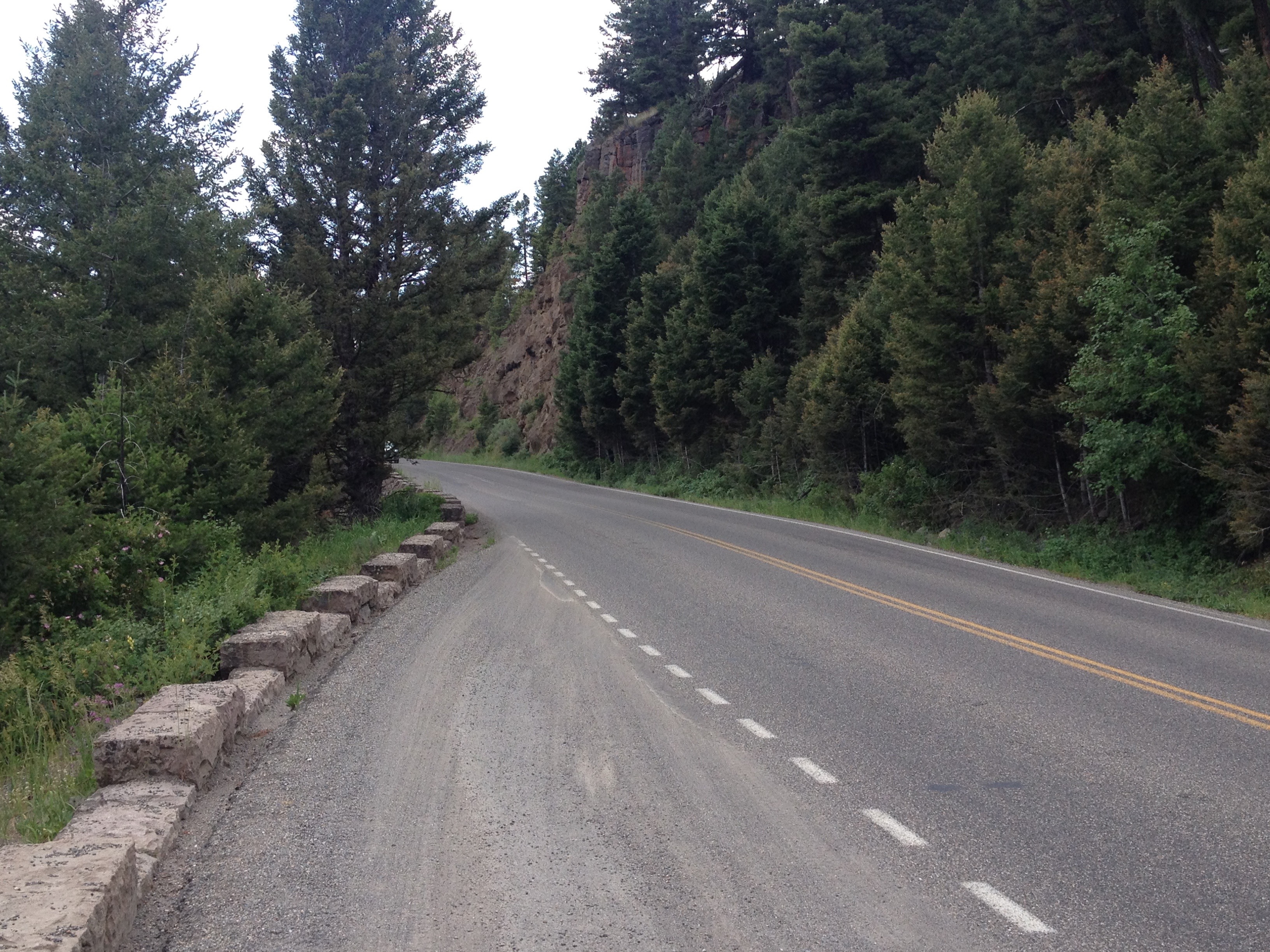
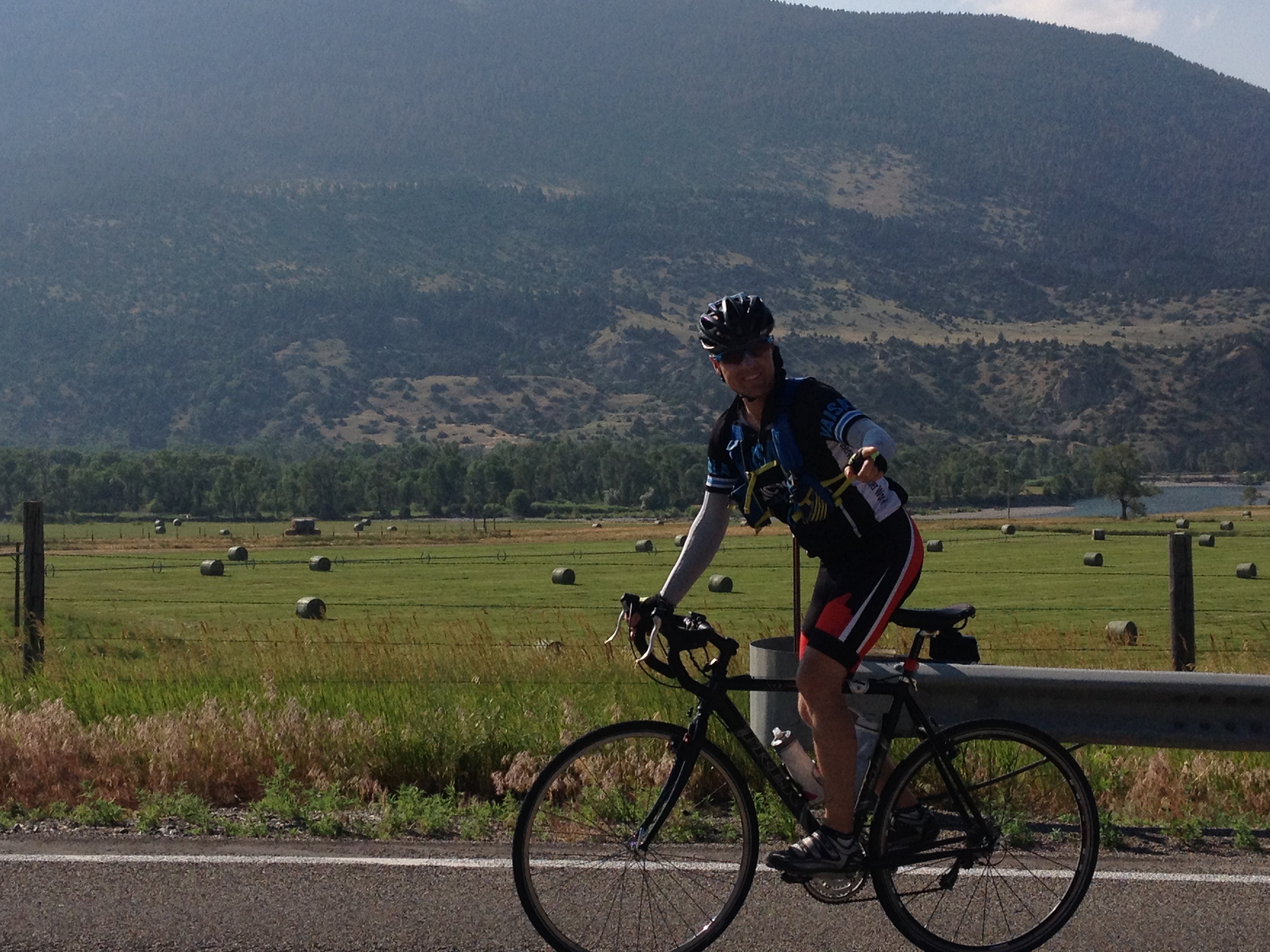
What a difference a day makes!  After the most exhausting bicycling day of my life, day 3 seemed like a breeze.  Everything seemed different, even in subtle ways.  Whereas on day 2 I felt like I had to struggle, even on the flatter portions of the ride, certain segments of this day seemed to breeze by.  It was almost as if there was some kind of invisible force that had been holding me back on the previous day, but now was helping me along.

IMG_3819

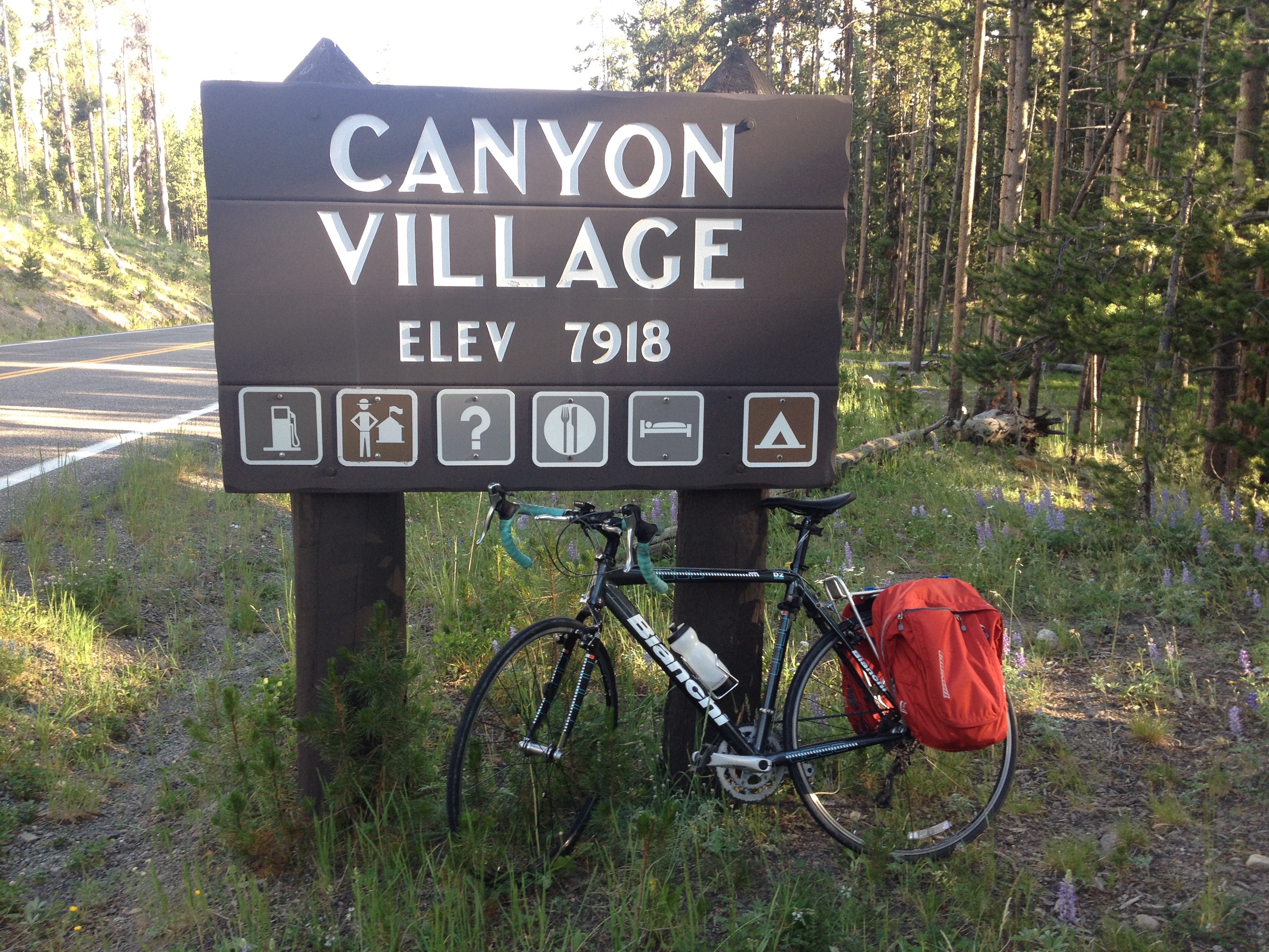
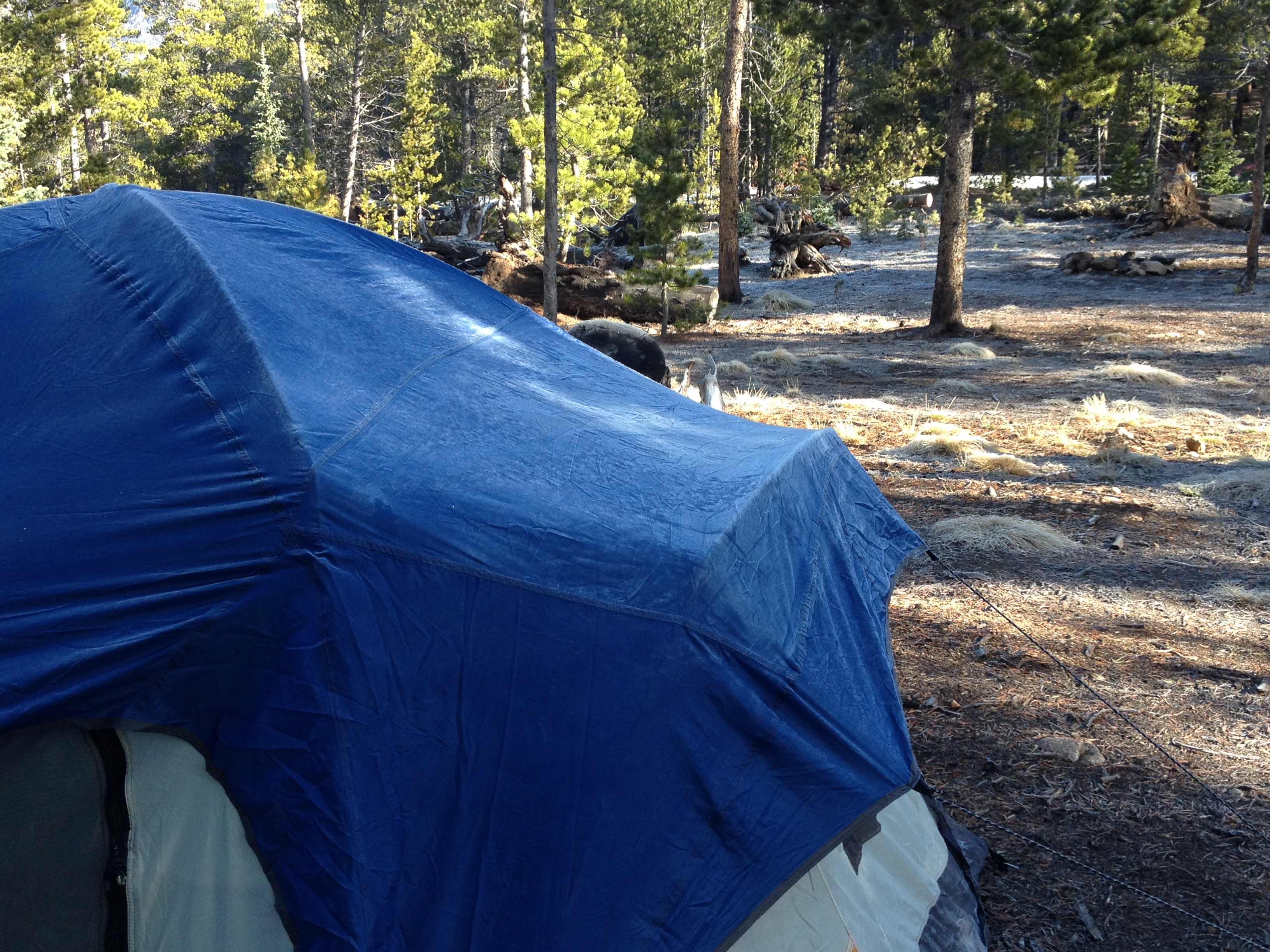
We left the Grant Village campground having done none of the activities that are typically associated with camping (other than putting up and tearing down a tent).  We did not set up a fire.  We did not cook anything.  We did not even spend a significant amount of time at the campsite other than sleeping. The next morning, we got some breakfast, and headed South, towards Grand Teton National Park.

IMG_3820

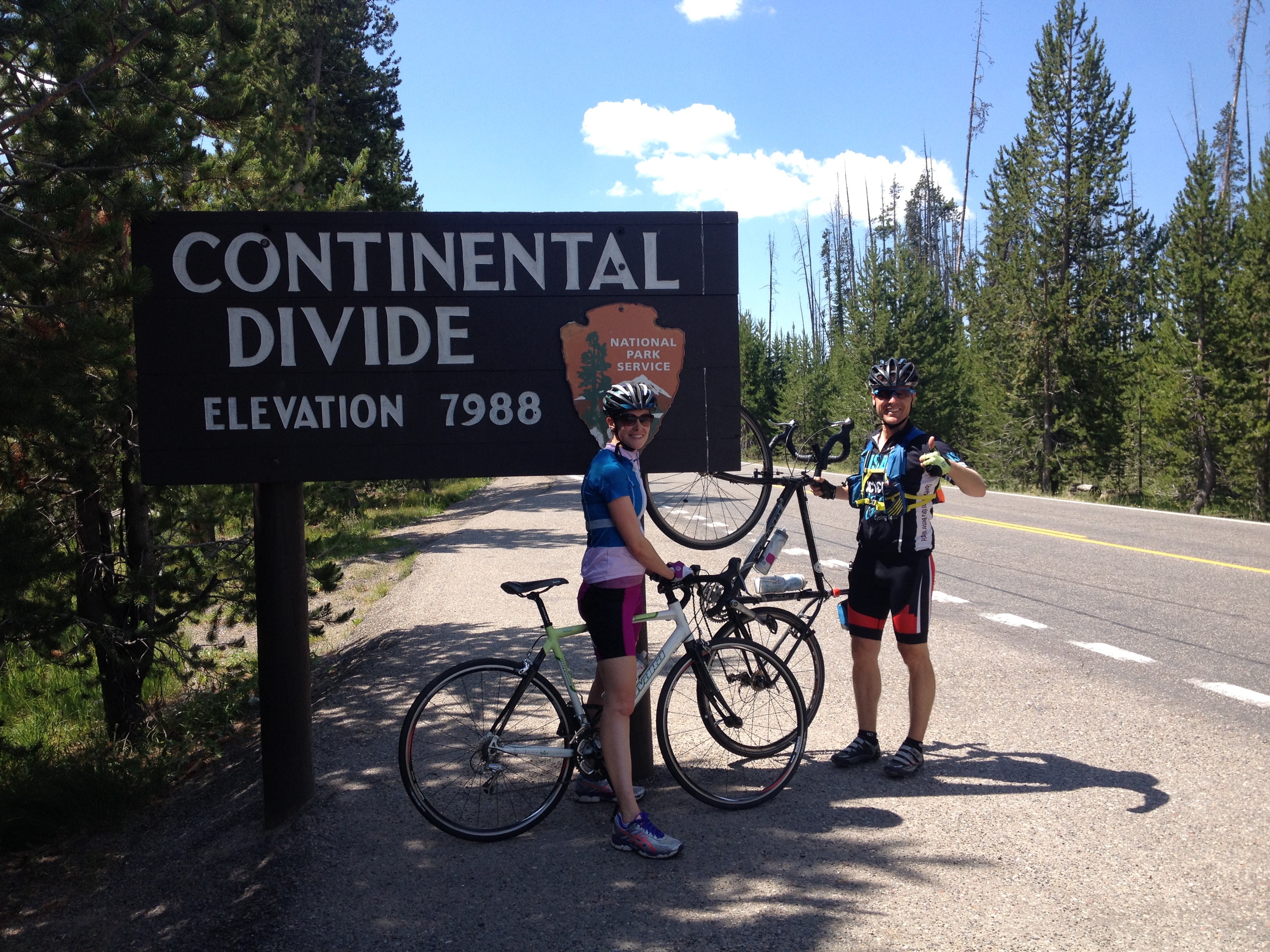
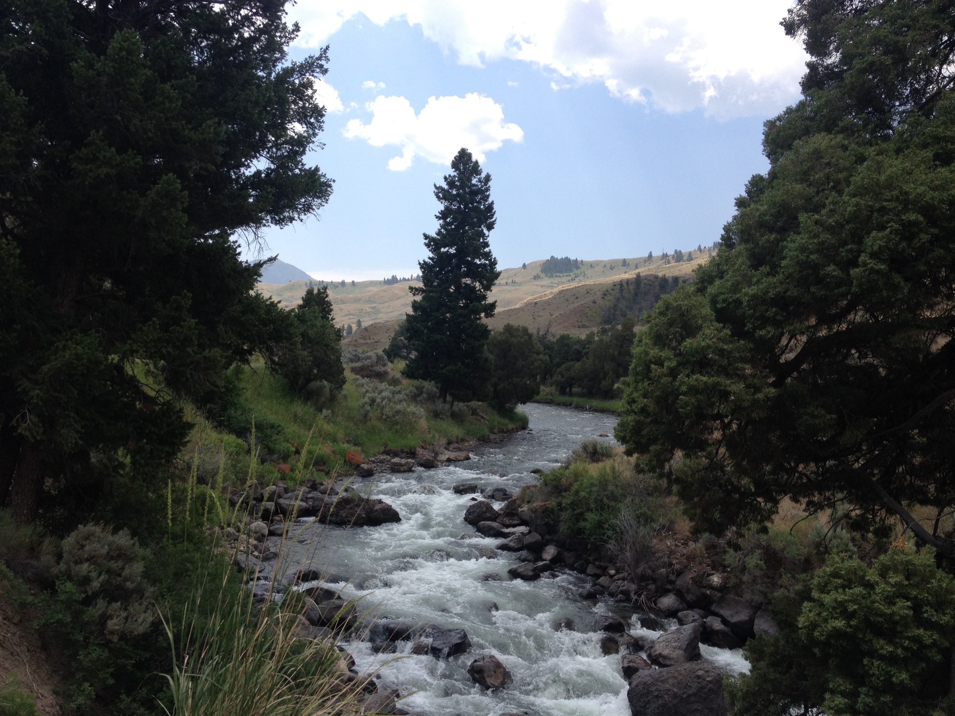
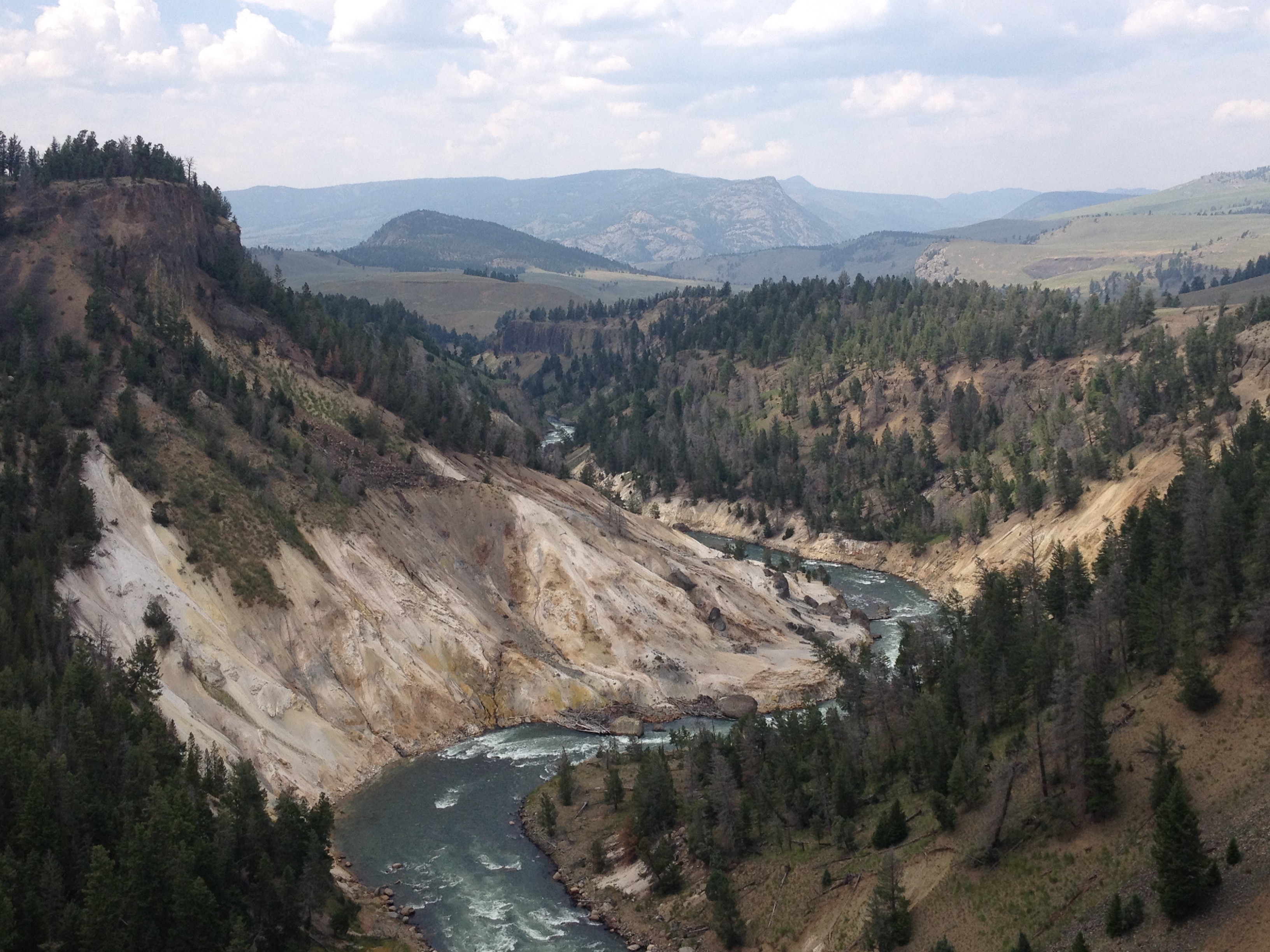
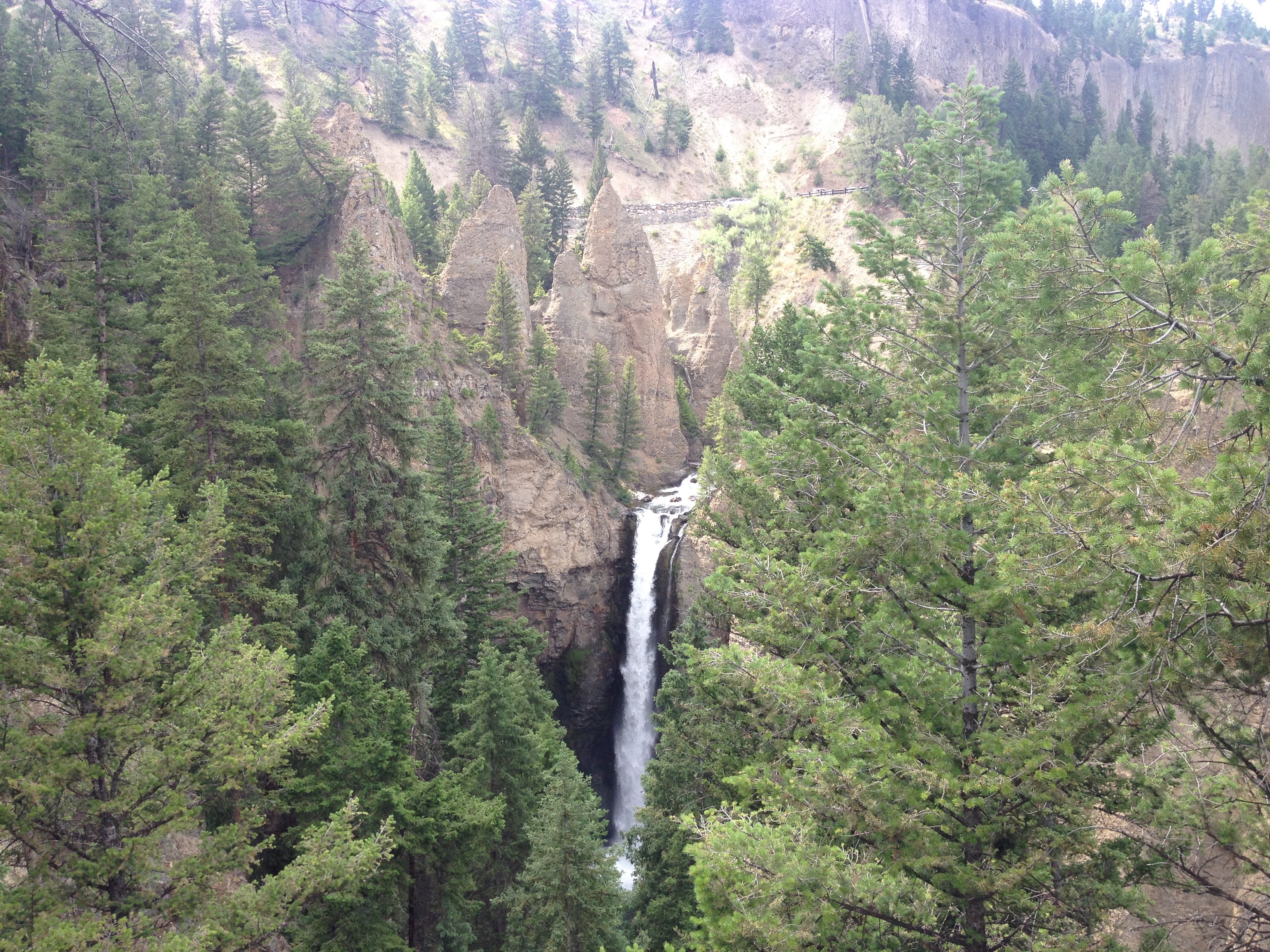
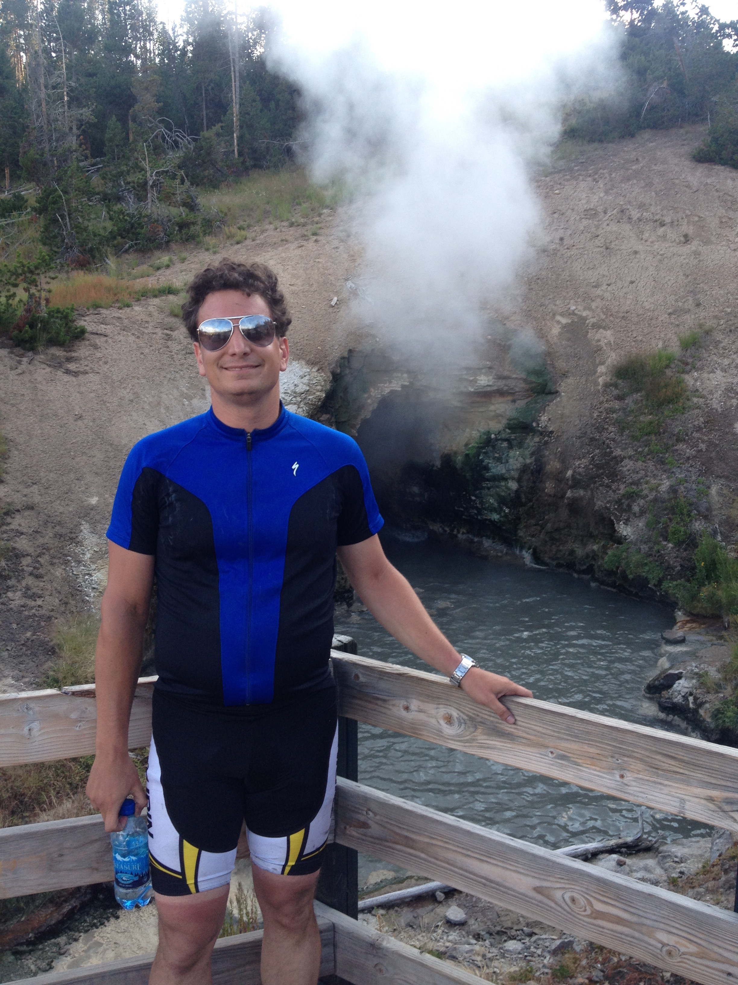
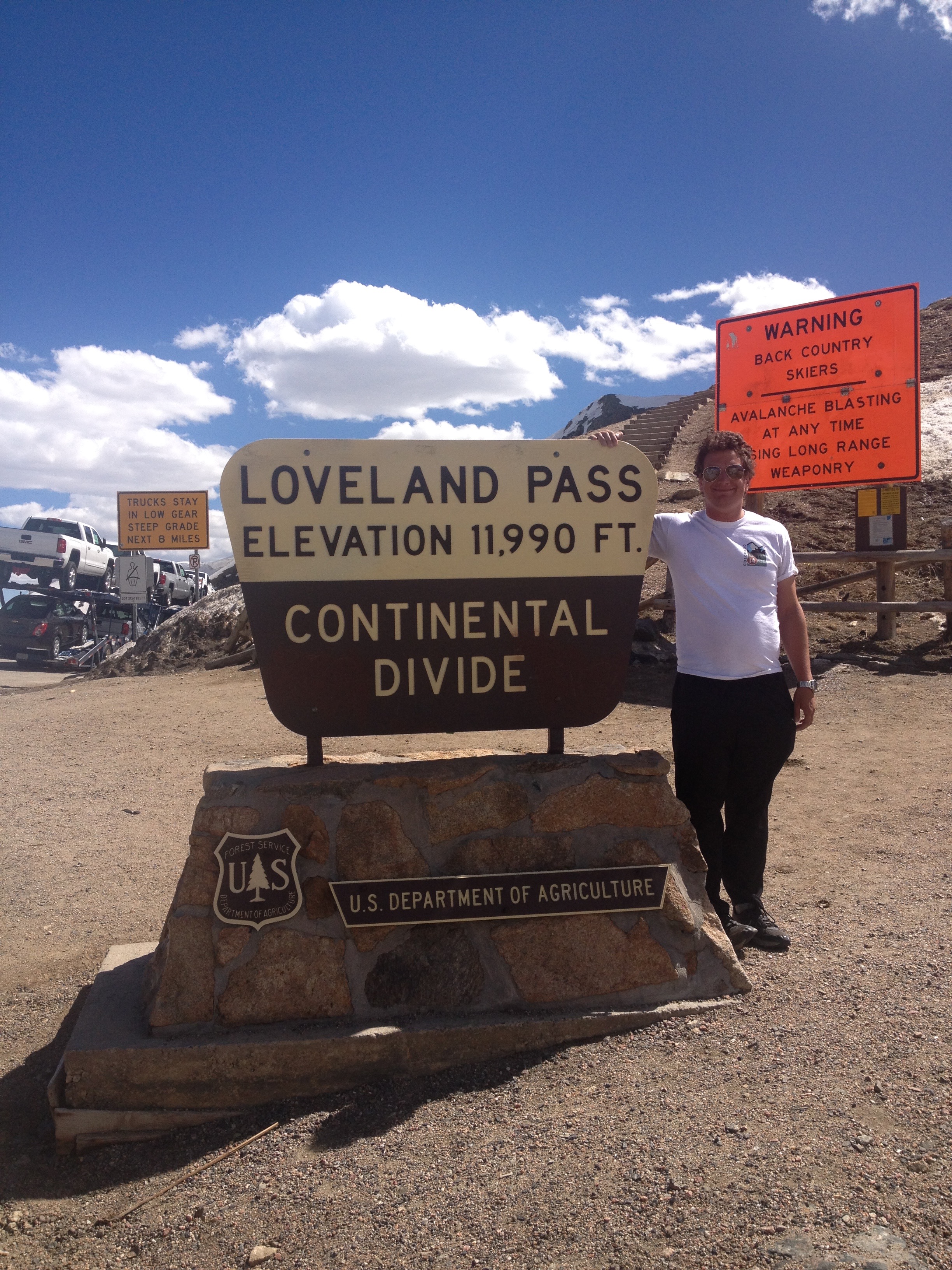
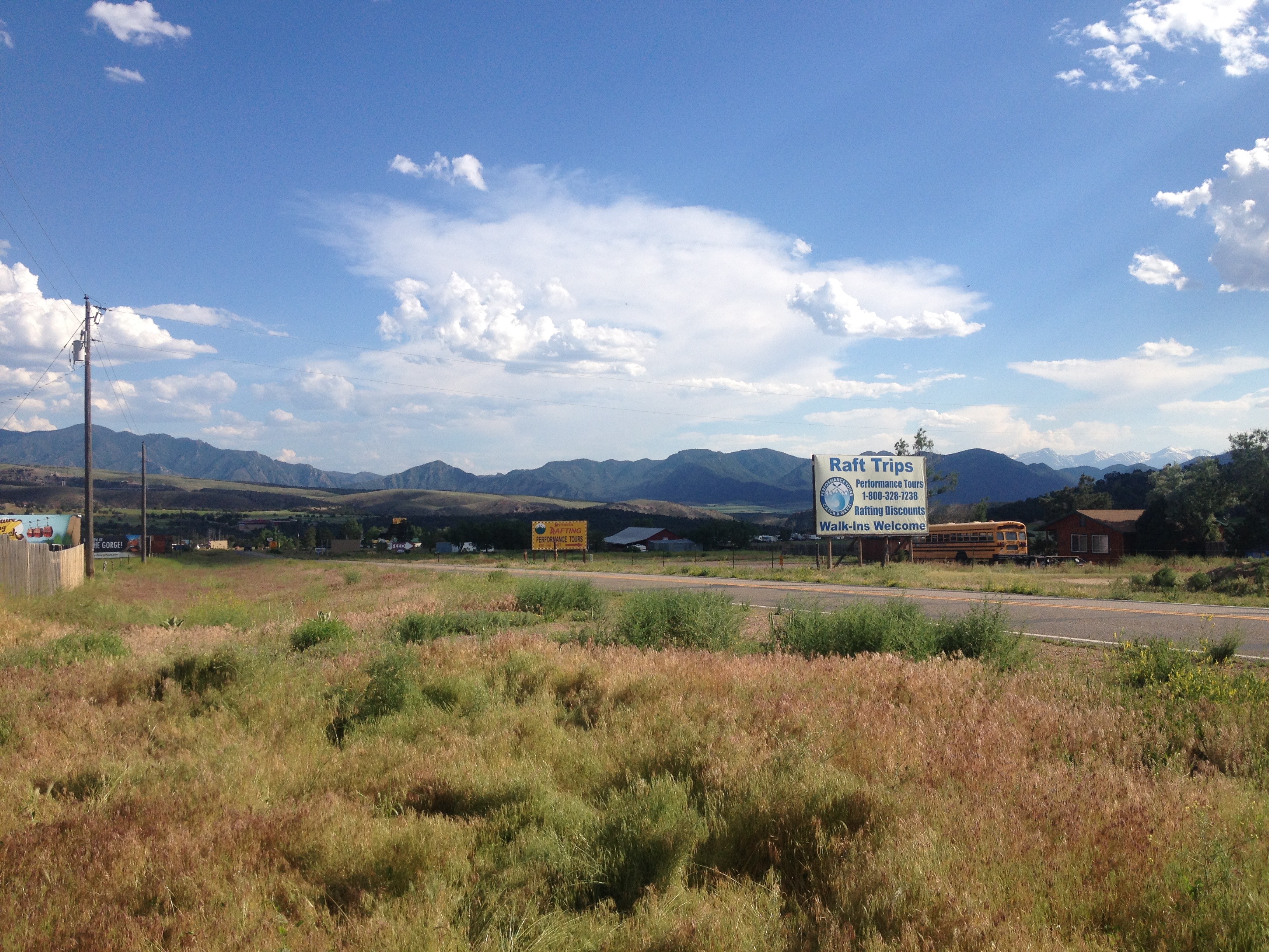
The day started with a climb, albeit a very small one, and one that event felt easier than a similar sized climb would have felt the previous day.  Only four miles into the ride, we crossed the Continental Divide, and immediately started headed downhill.  The next eight miles flew by as we reached our last major stop in Yellowstone National Park; Lewis Falls.

IMG_3822 IMG_3823

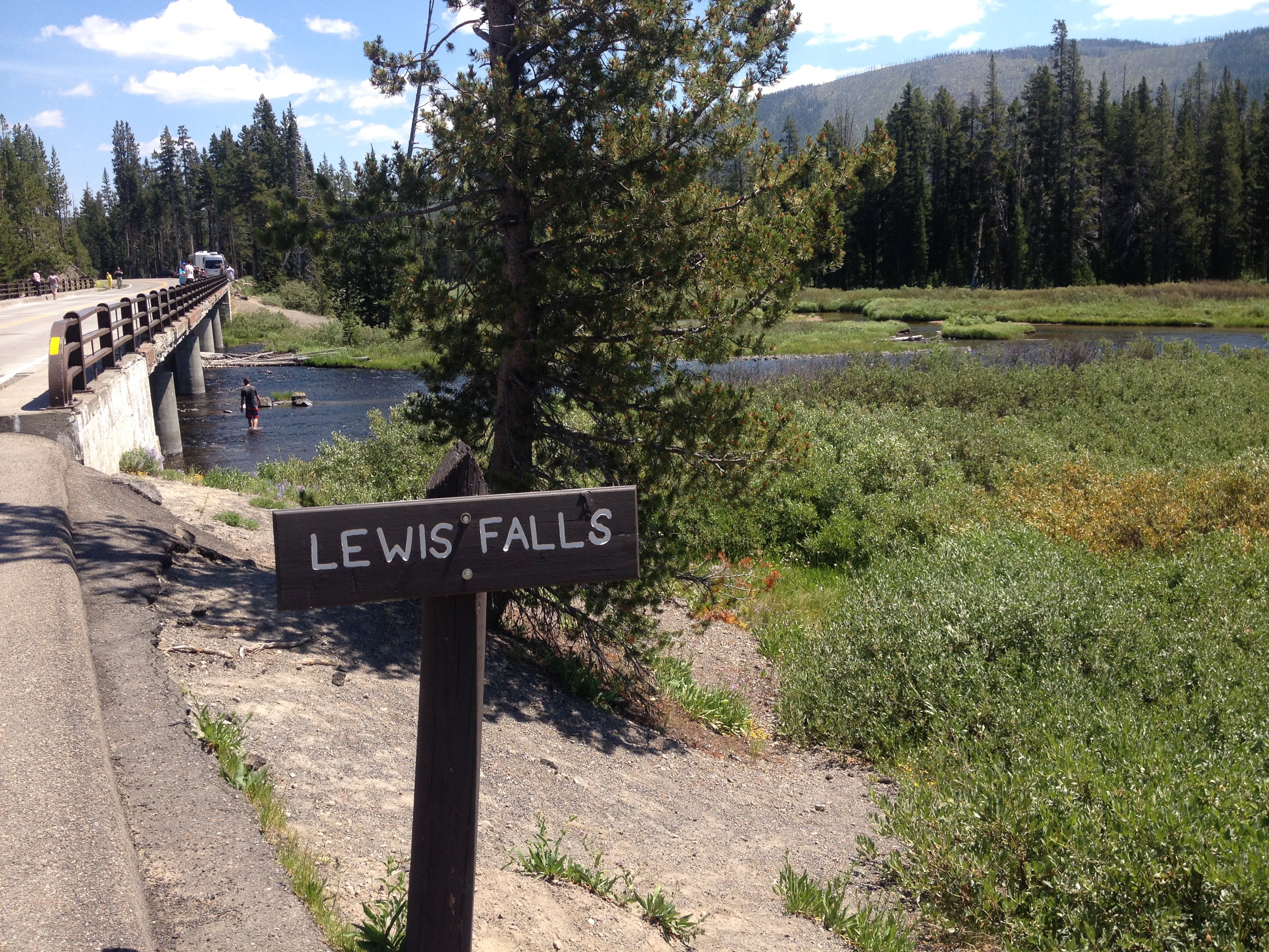
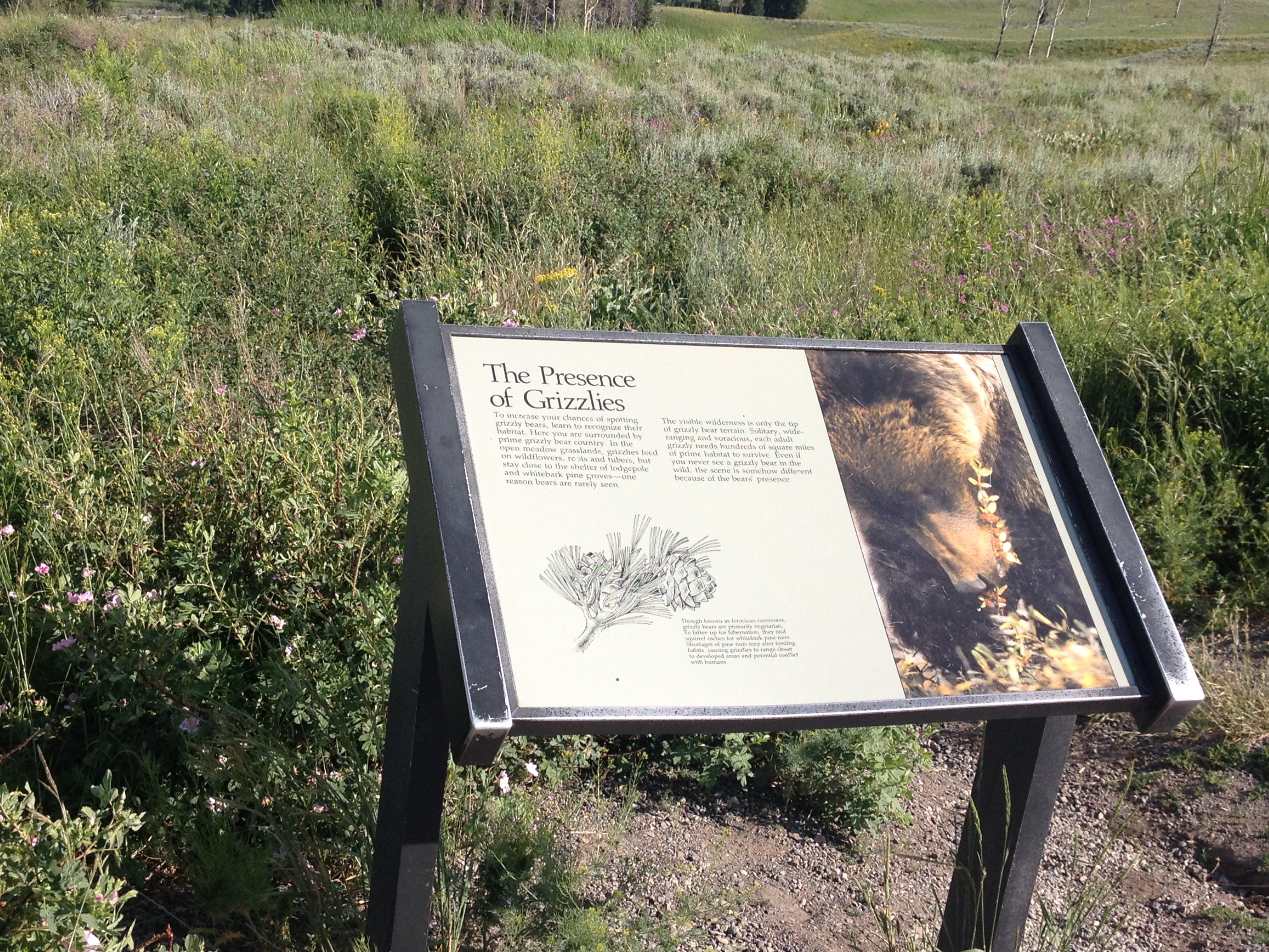
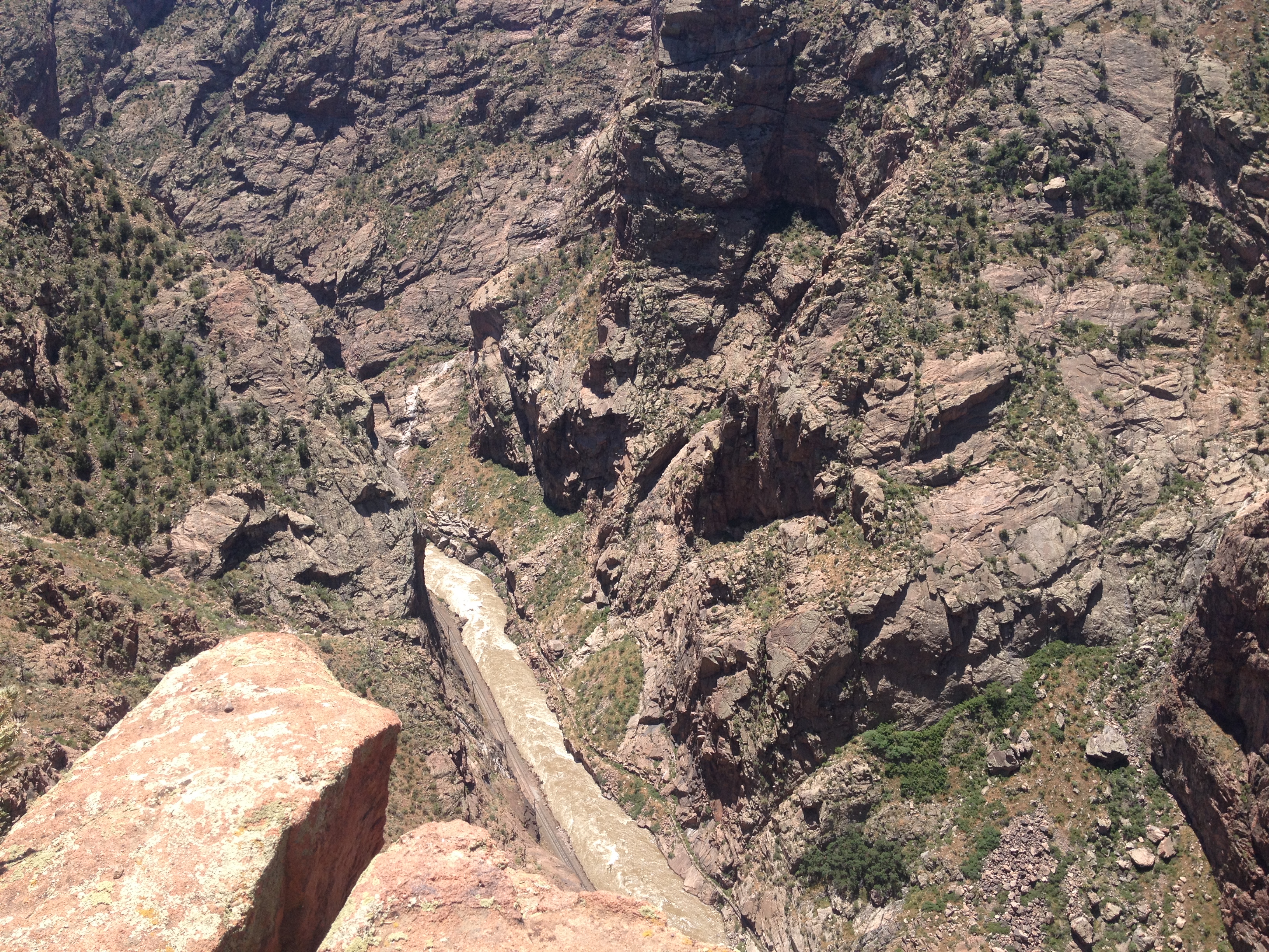
I feel like I got a fairly exhaustive tour of Yellowstone’s waterfalls.  And, while I had seen several waterfalls while in Yellowstone, each one was different in characteristics.  Undine Falls, which I saw yesterday, was skinny and tall.  Lewis Falls is much wider, with a smaller drop.  It is shaped much more like Niagara.  At this point in my journey, 12 miles in, I was energized!  I felt almost as if I could have handled anything on that day.  In fact, I am 100% sure that I had more energy at that point in the day than I would have had I been resting over the last several days.  There is just something about getting through a really rough day of riding, and then riding downhill.

Until this trip, most of my riding had consisted of day trips.  Before moving to Colorado, those trips were pretty much about how many miles I traveled, as Illinois is flat.  Since then, I have begun to tackle some climbs.  In each of these rides, there is a similar theme, I go up, and then I go down.  There is a climb, and it is followed by a “reward”, a chance to go fast.  This almost felt like a way more stretched out version of this.  I spent an entire day pretty much climbing.  The previous day was my climb, and this day of primarily descending was my reward.  Therefore, the feeling of guilt that usually passes over me when I descend without having climbed first did not manifest.  The whole time I knew that I had earned this day of rapid riding through the exhaustion I had endured on the prior day.

IMG_3827 IMG_3829

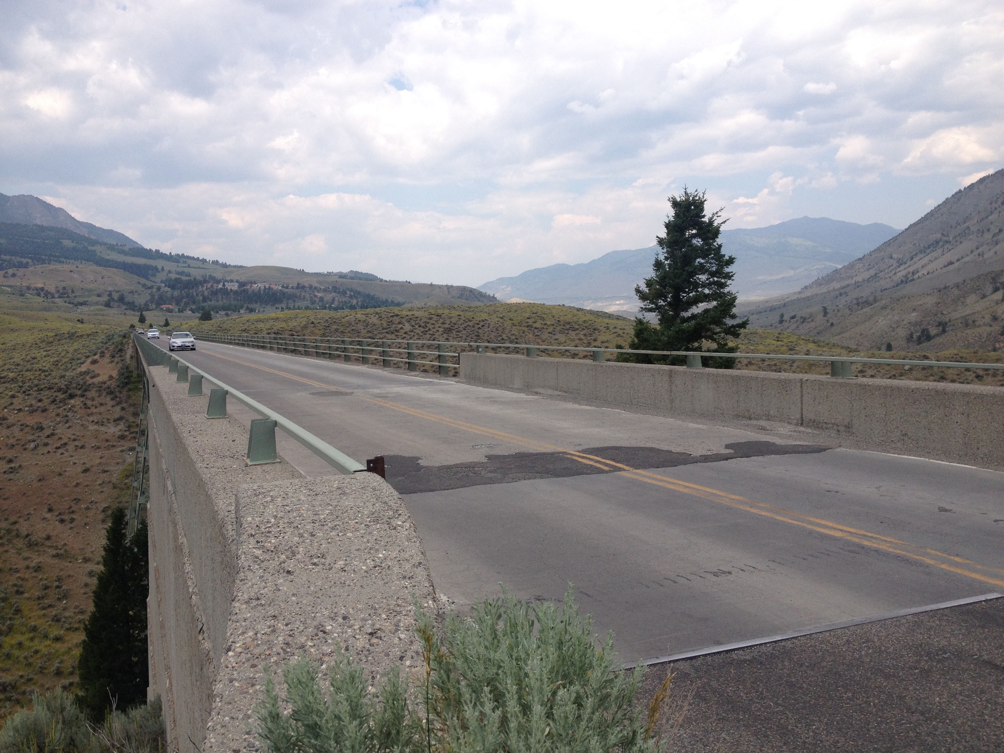
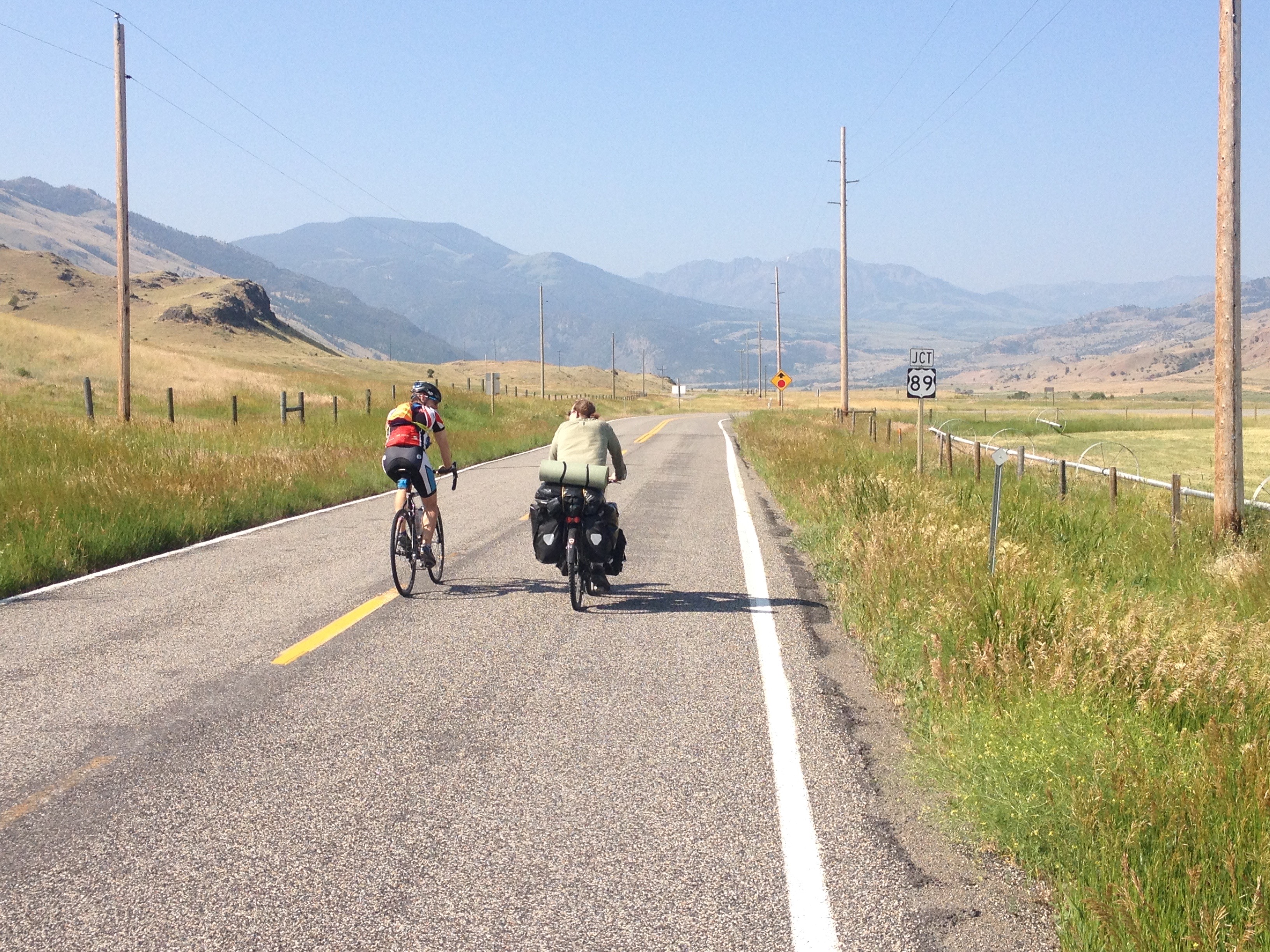
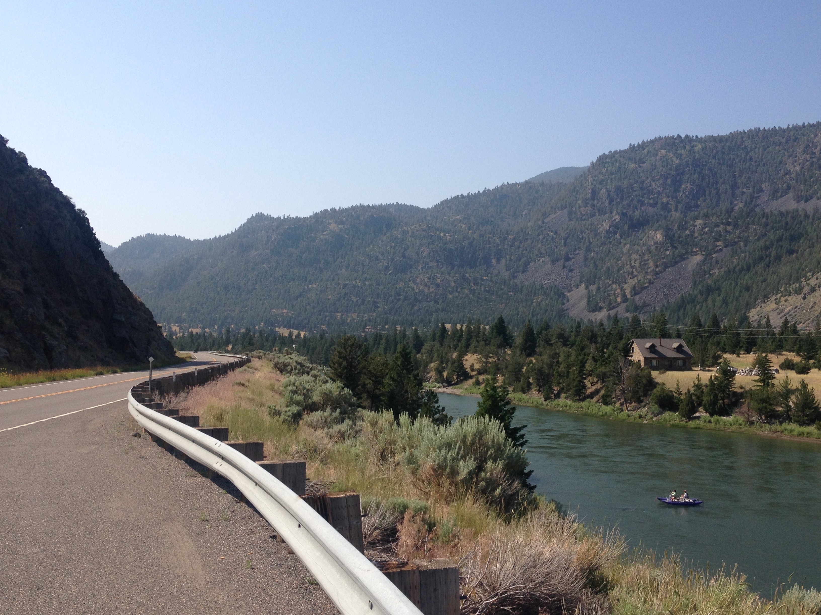
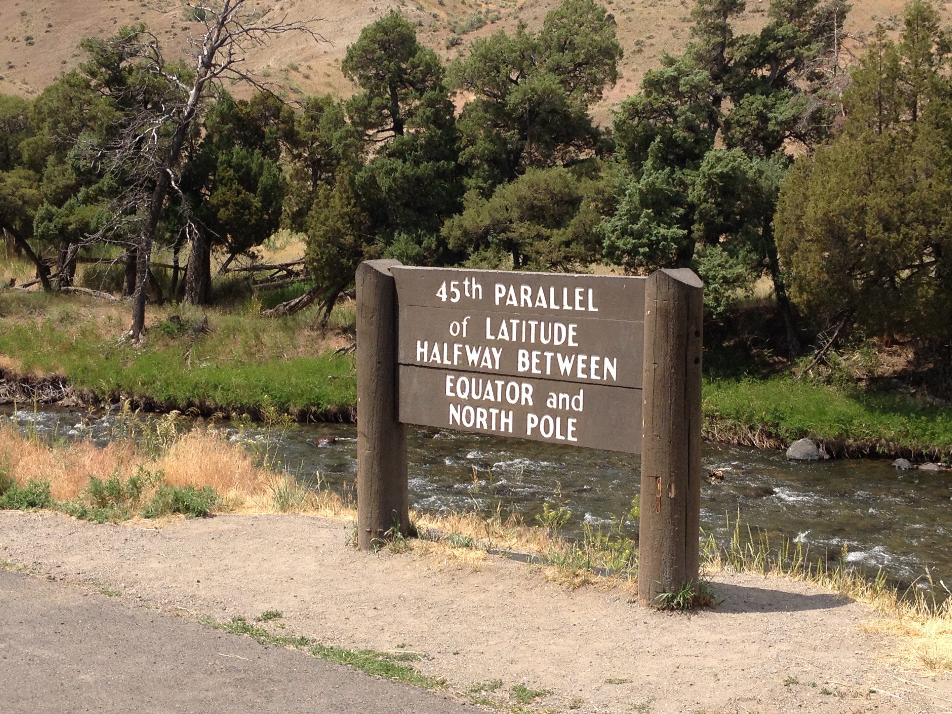
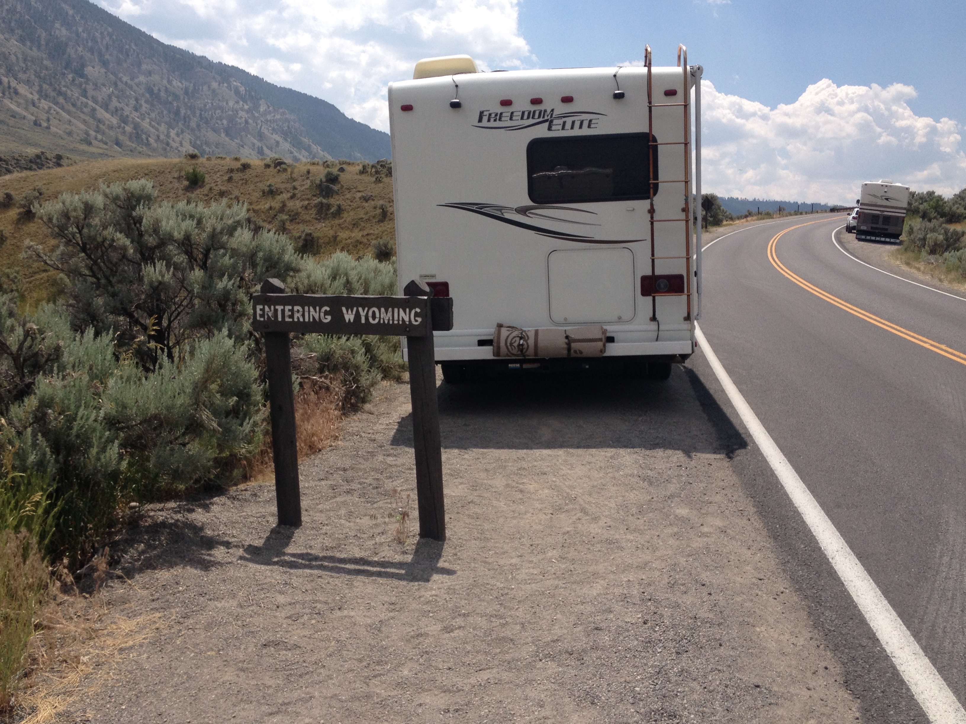
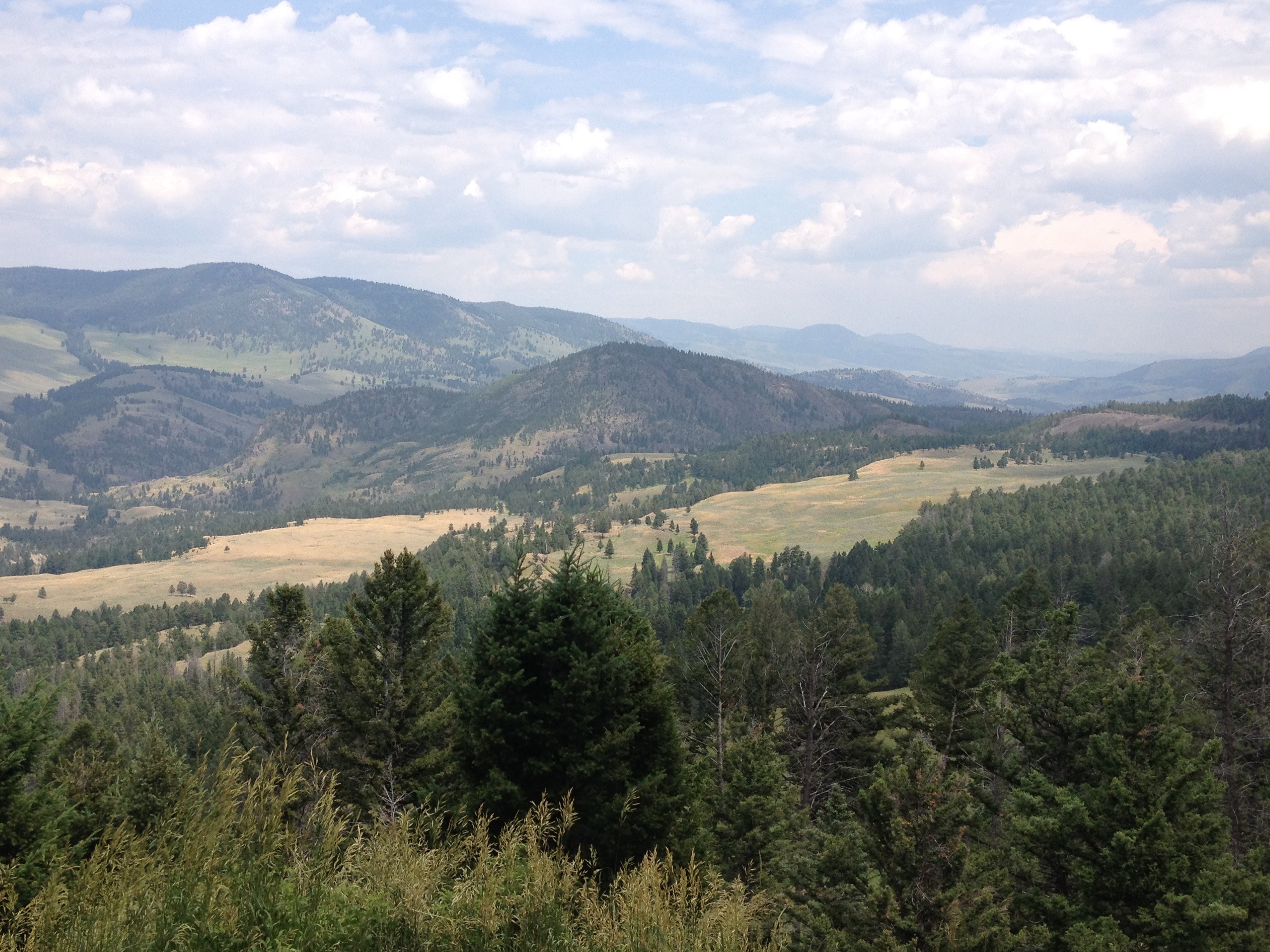
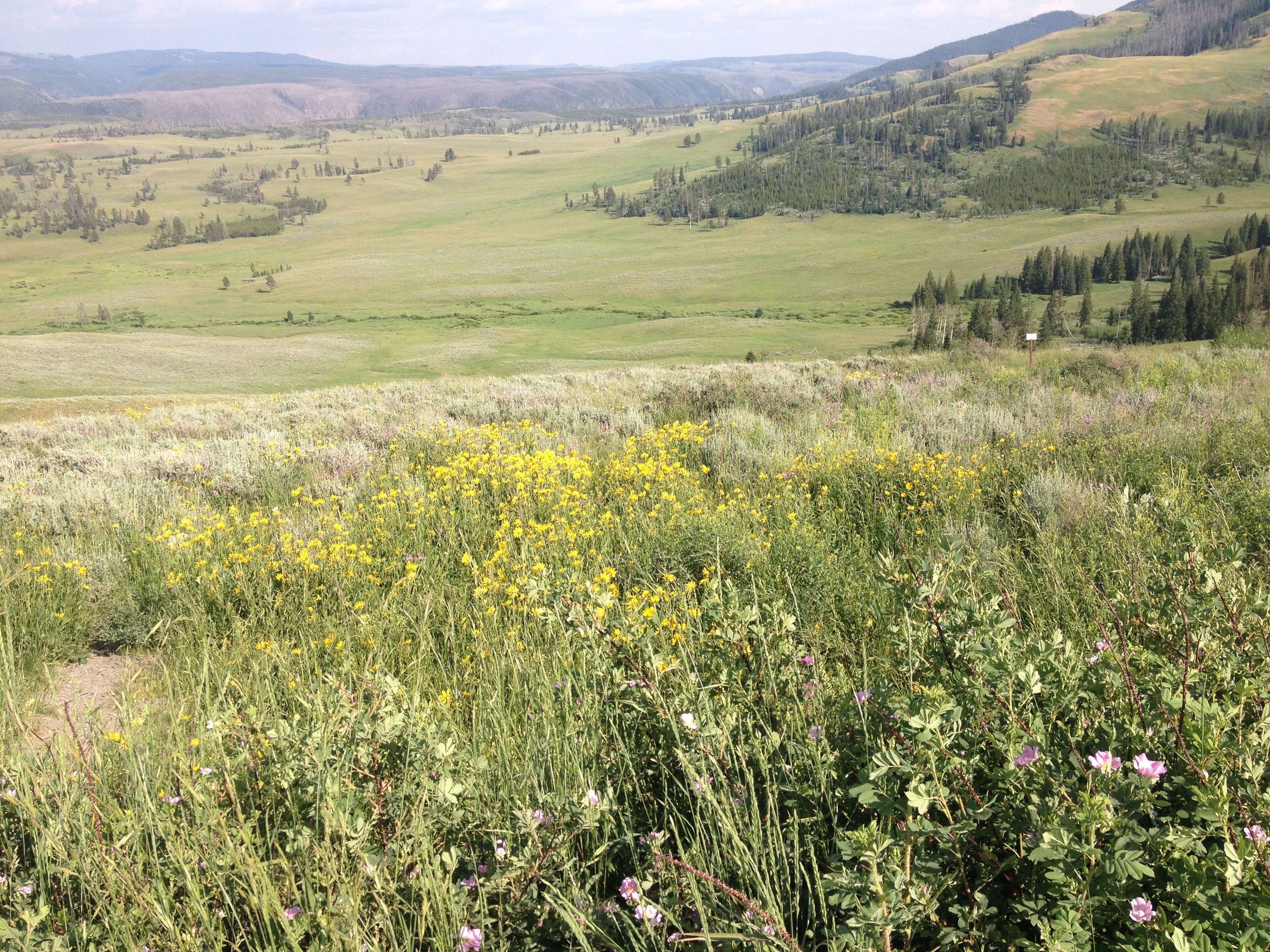
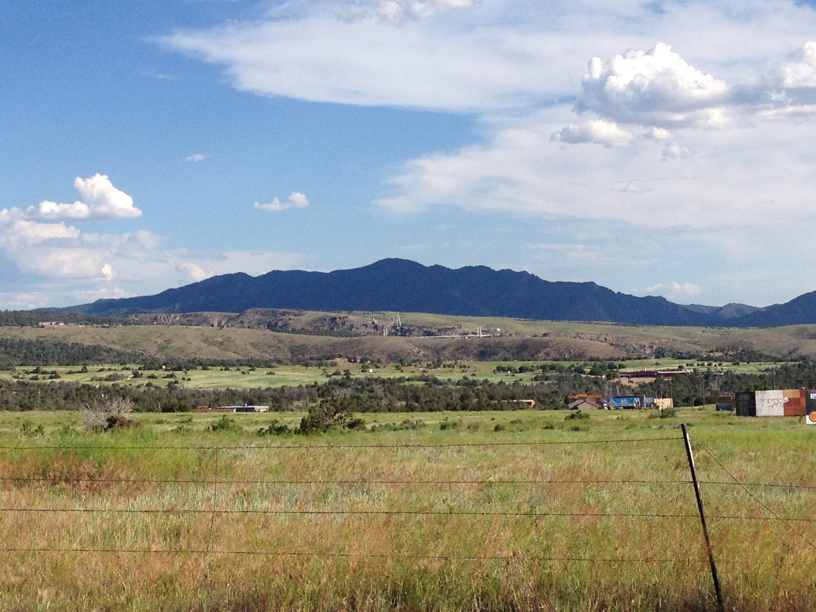
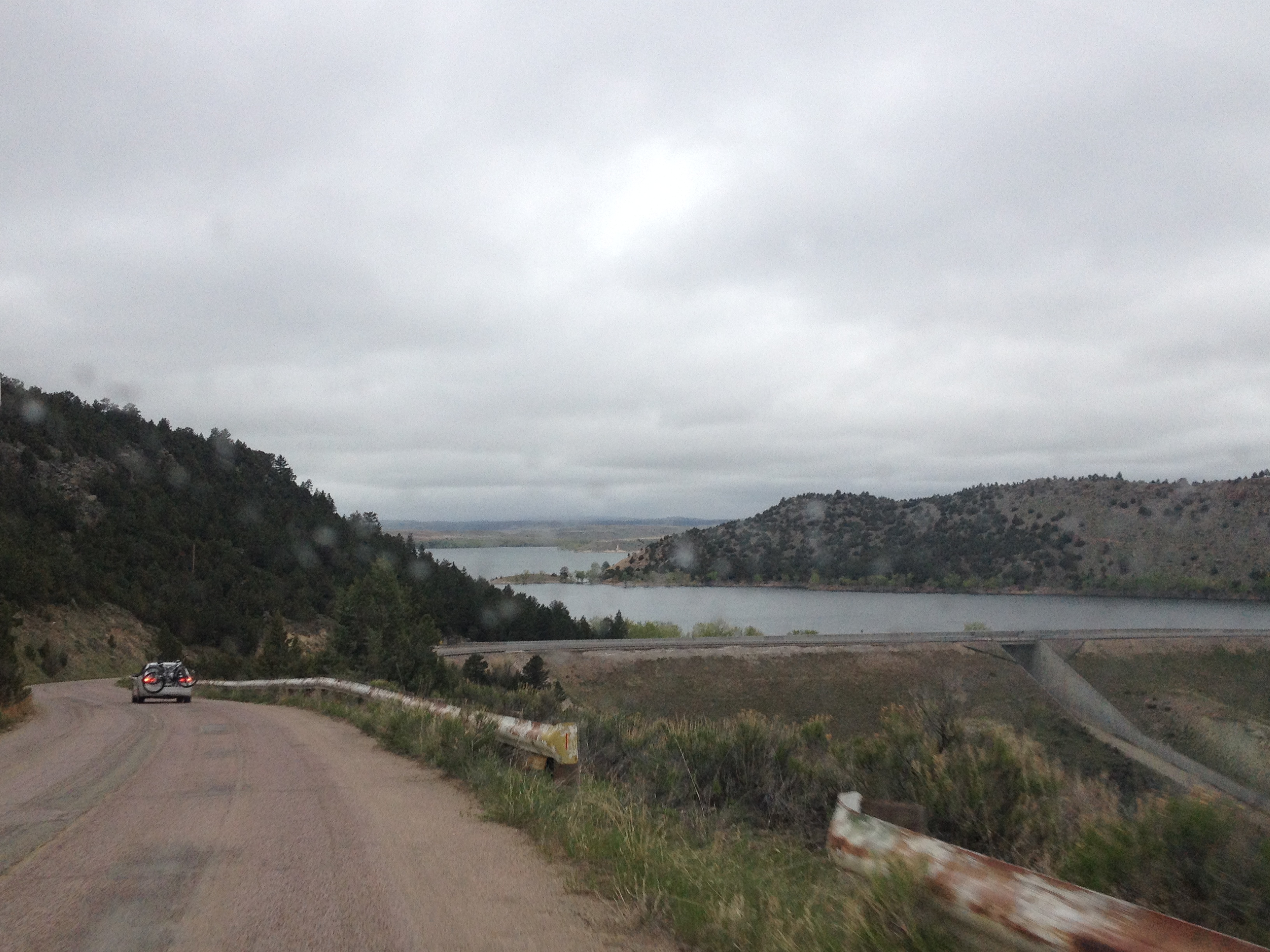
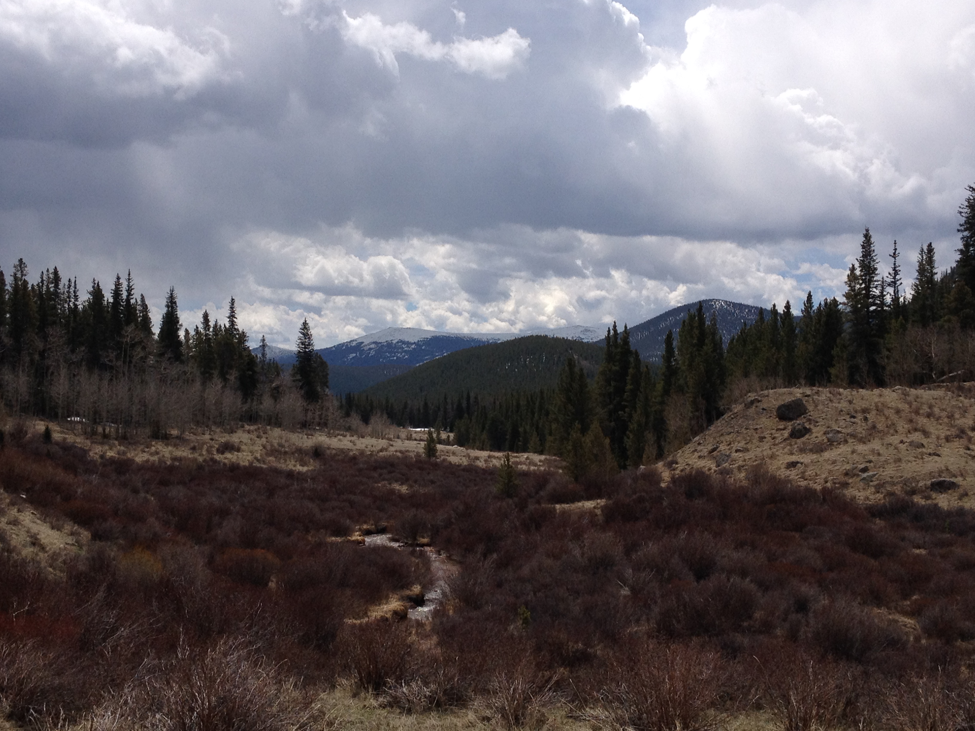
By the time we left Yellowstone National Park, we had already descended a significant amount.  That descent was interrupted by the days only climb, in the 6 mile space that separates Yellowstone and Grand Teton National Parks.  This is a strange place.  Although you are technically in neither National Park, signs posted along the road remind motorists that National Park speed limits and enforcement are still in effect.  Also, there is no official entrance into Grand Teton National Park from the north, at least not along US-89.  It is pretty much assumed that all motorists (and I guess cyclists too) had already paid to get into Yellowstone and do not need to pay again.

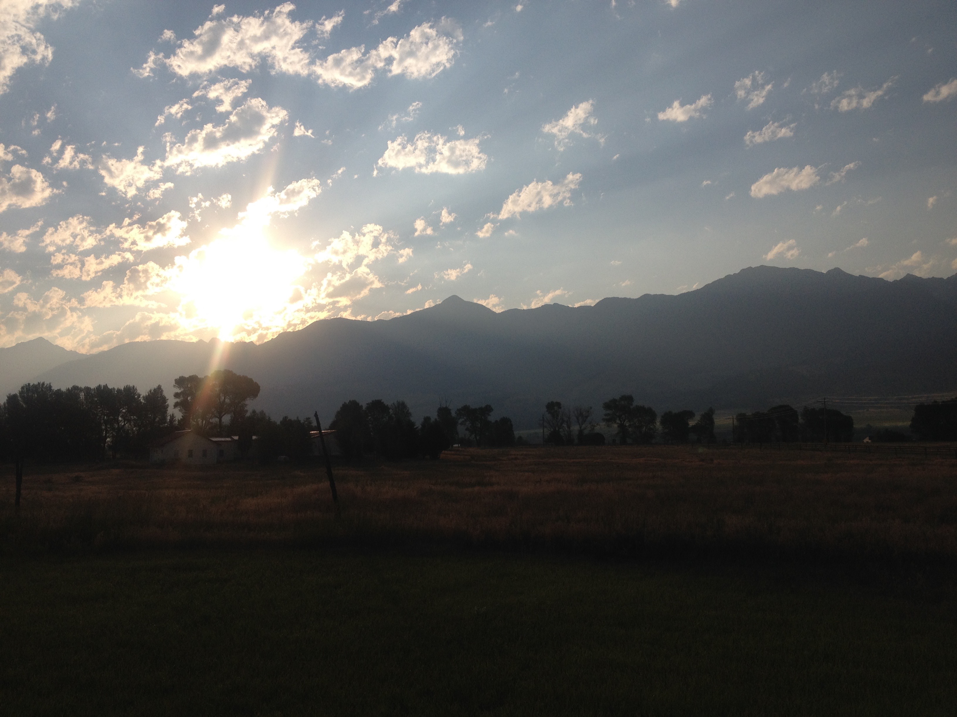
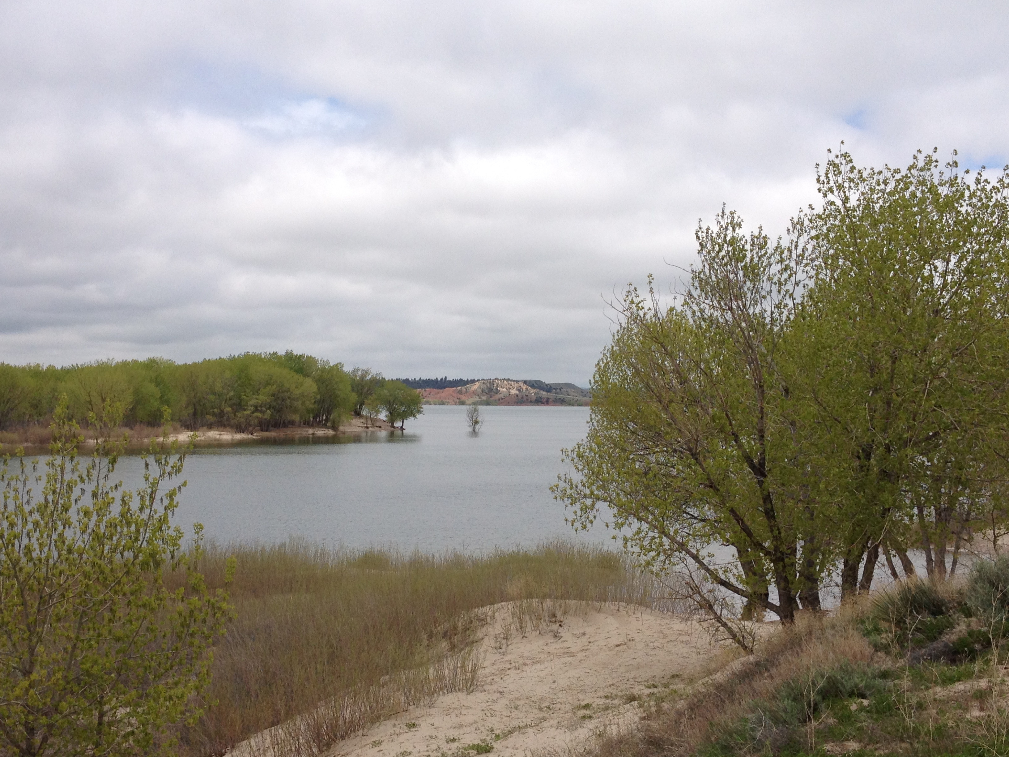
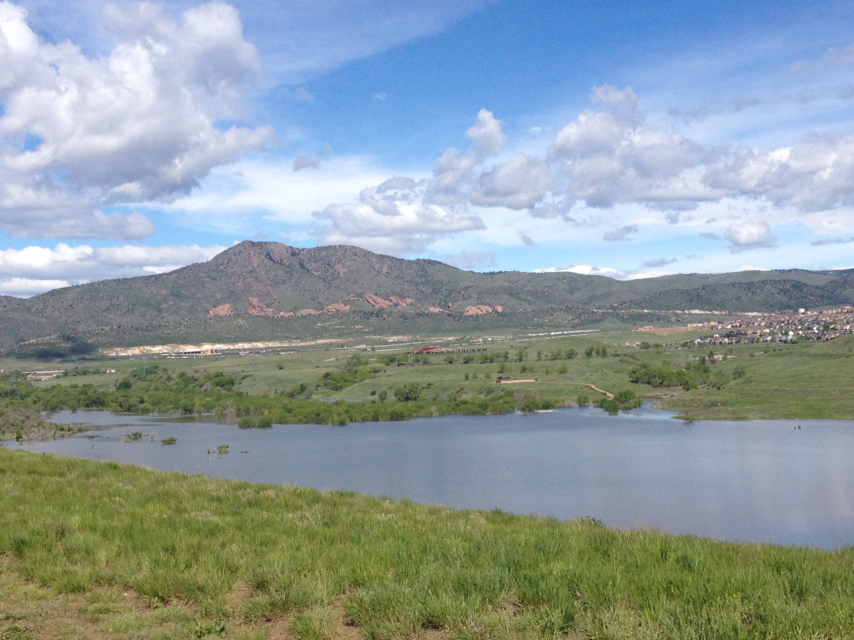
After climbing for a little bit, there is a rapid descent towards Lake Jackson, and the heart of the Grand Tetons.

IMG_3830

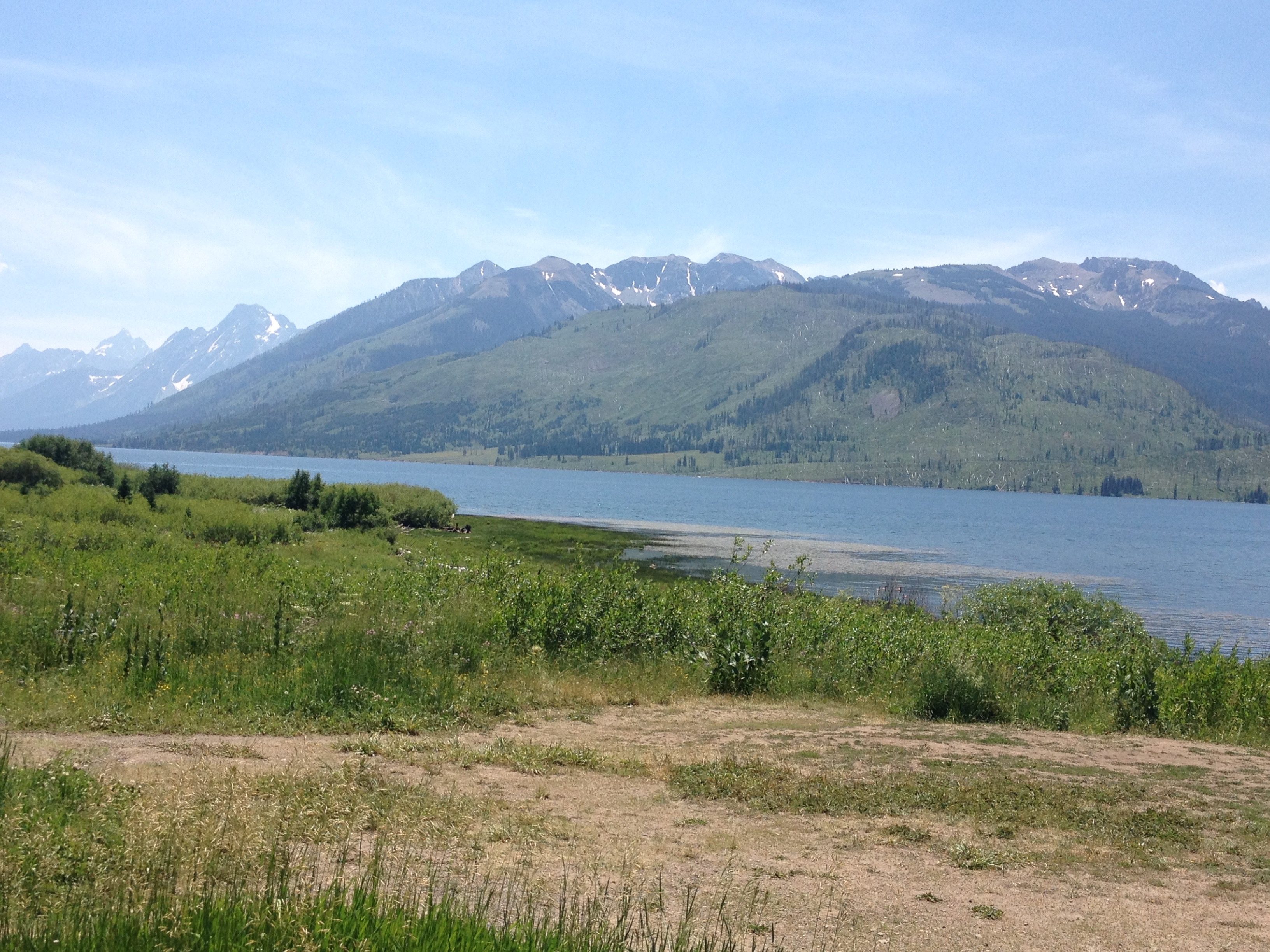
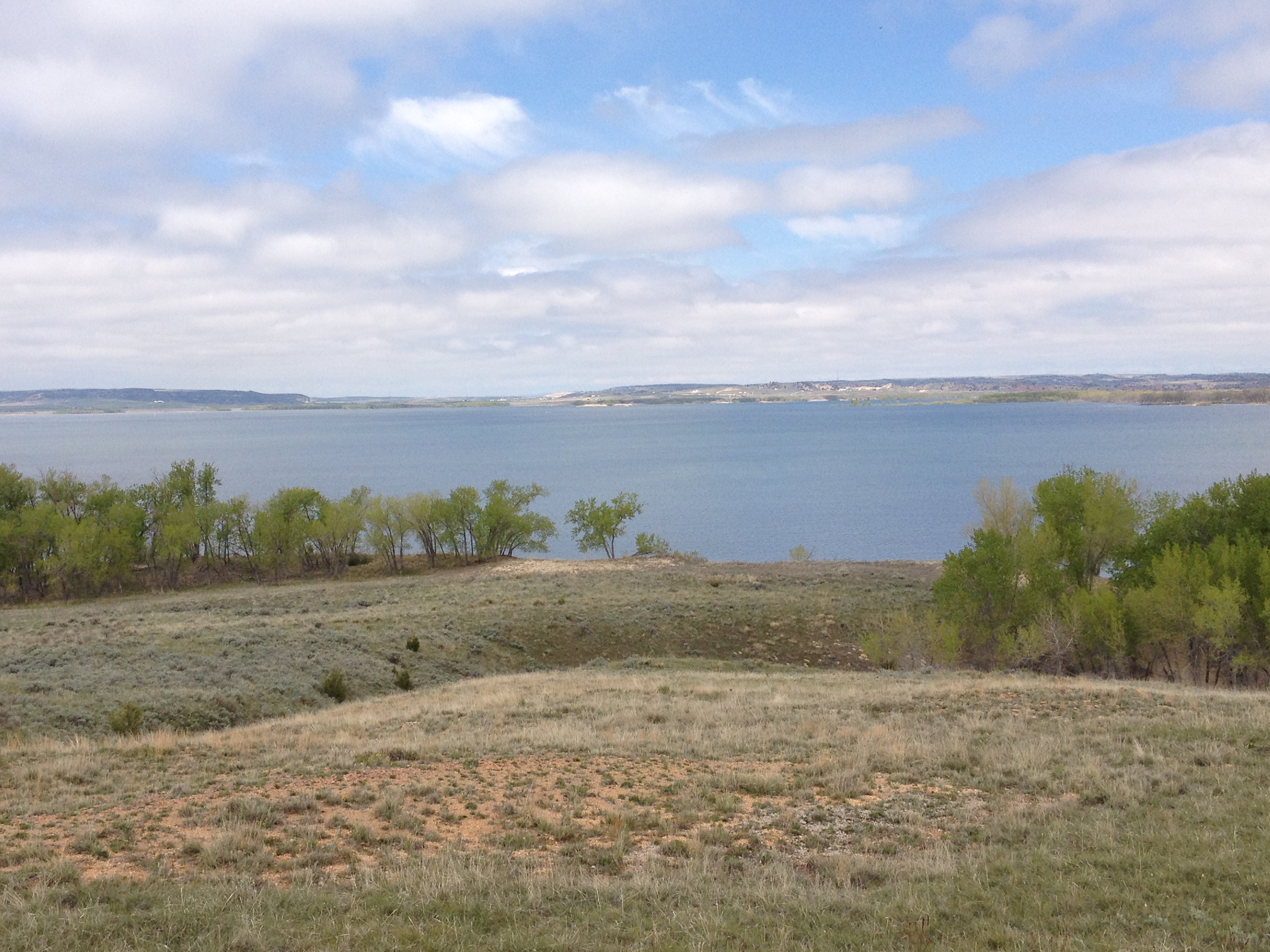
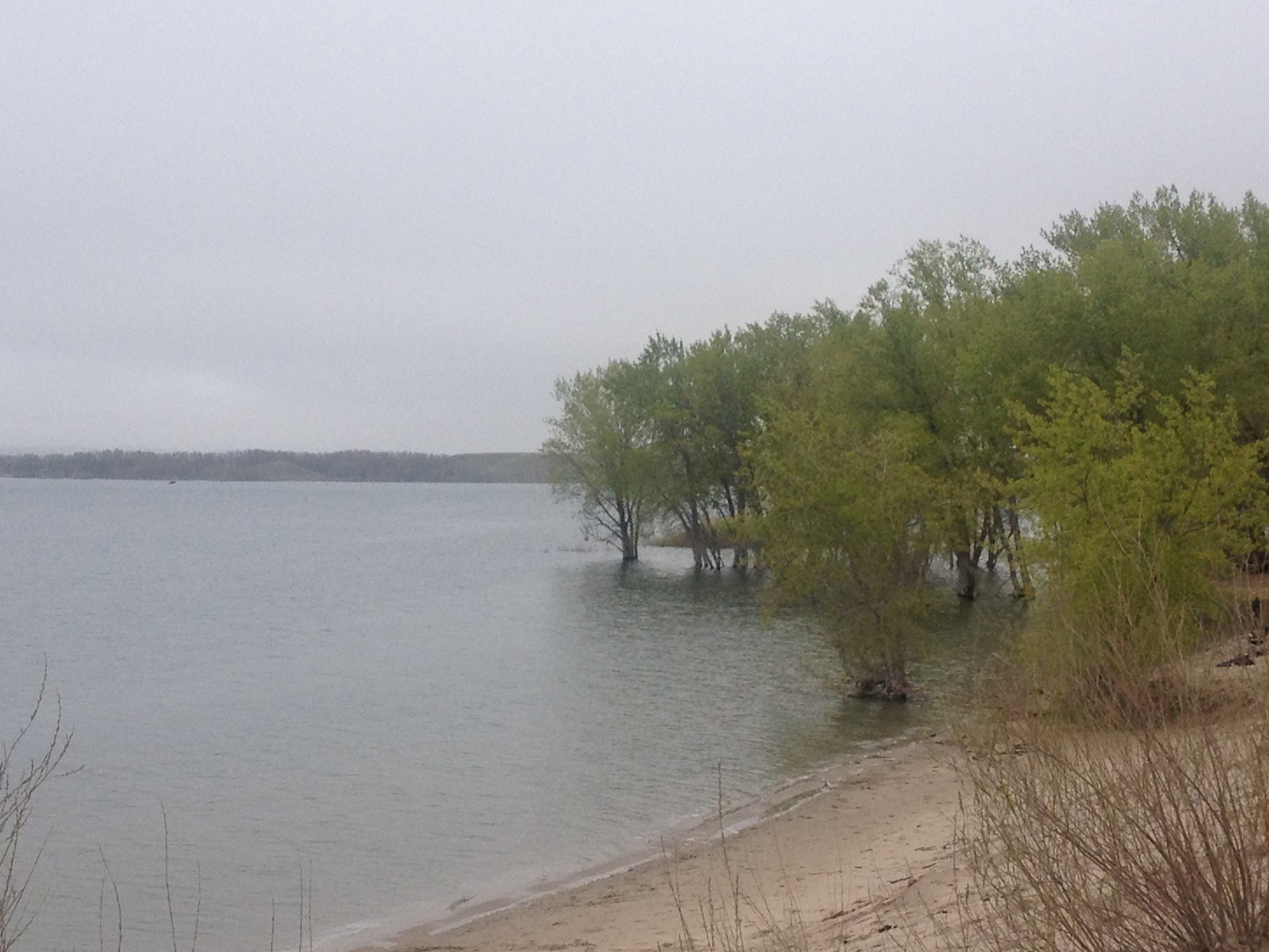
This lake is gigantic, and one of the defining features of the National Park.  And, as one travels farther, into the heart of the Park, one can sometimes get some of the most stunning views of the Tetons from the other side of the lake.

IMG_3832 IMG_3833

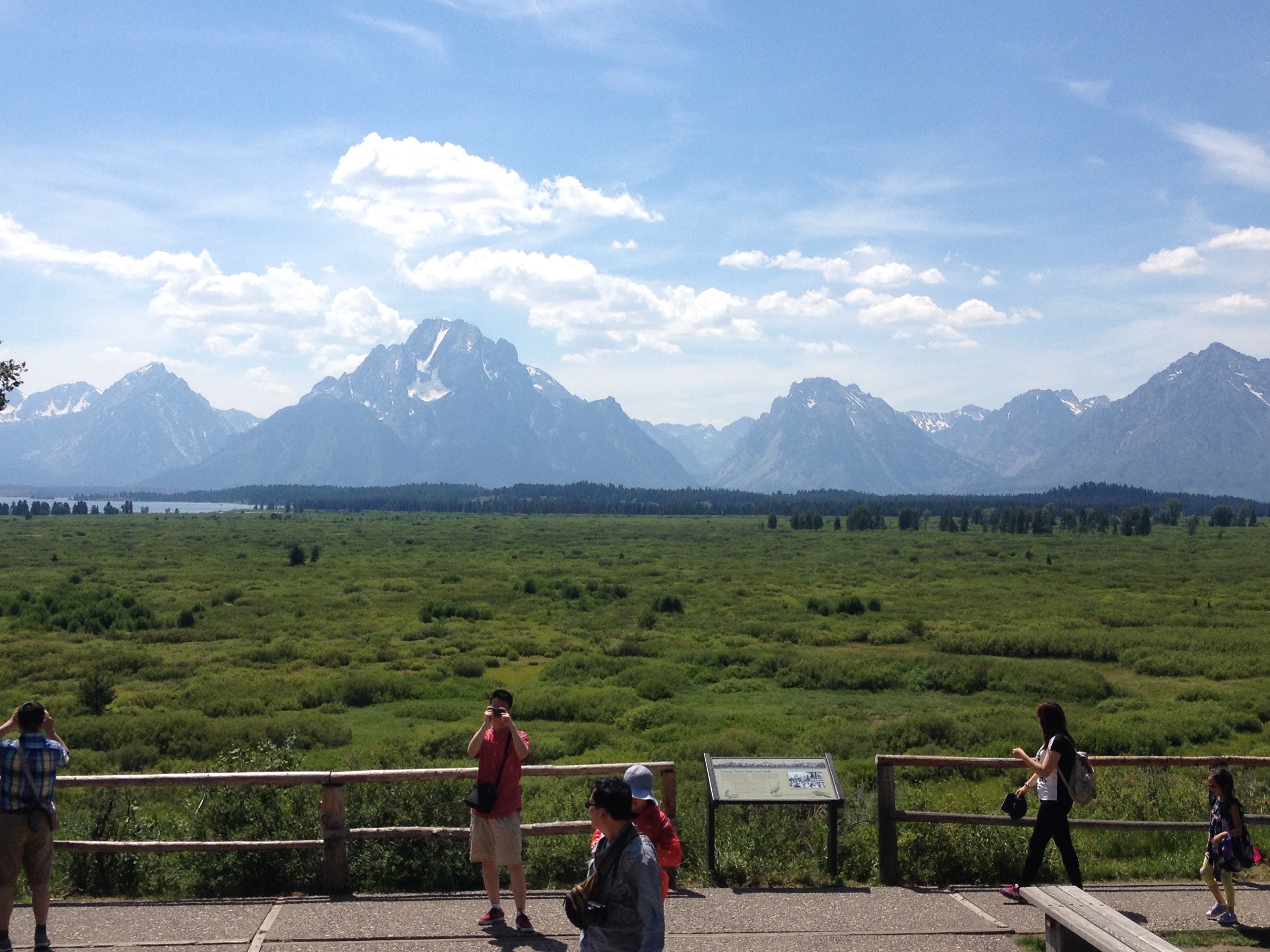
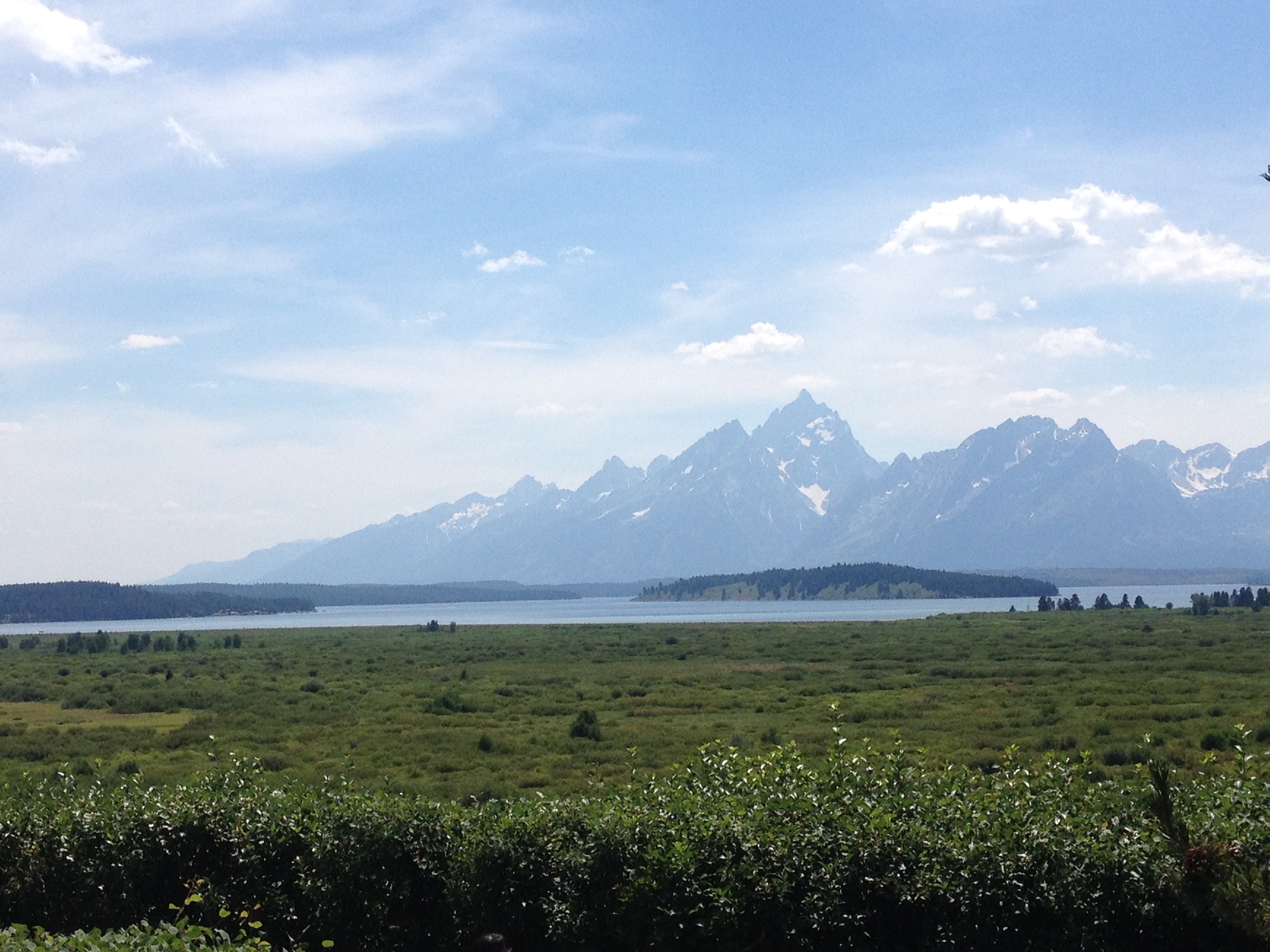
The Grand Tetons are the most photographed location in Wyoming.  The primary reason they are so photogenic is that this particular mountain range not only has a prominence (how much higher in elevation the peaks are from the area around them) of over 7,000 feet, but there are no foothills to obstruct one’s view of the mountains.

IMG_3838 IMG_3840

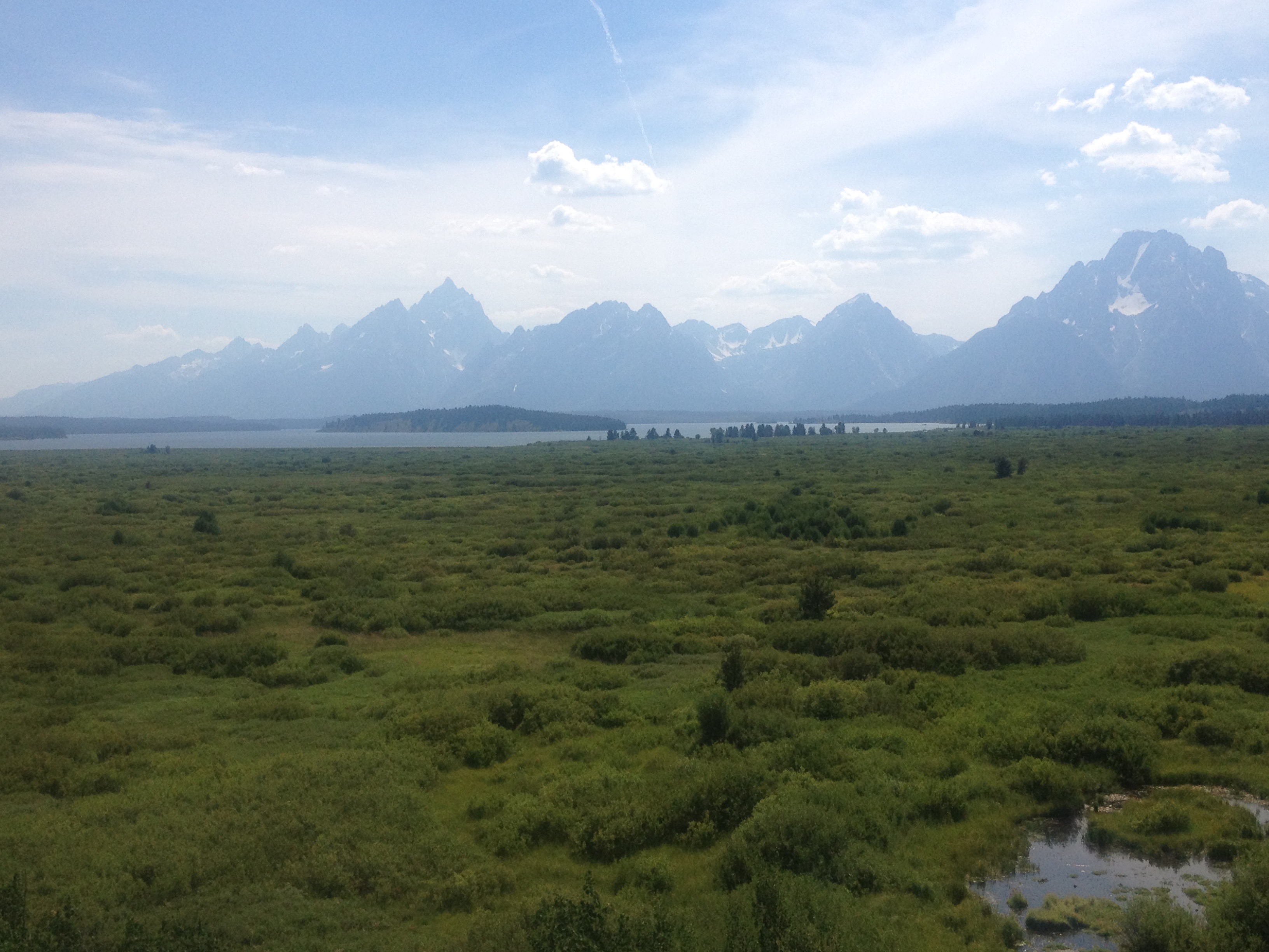
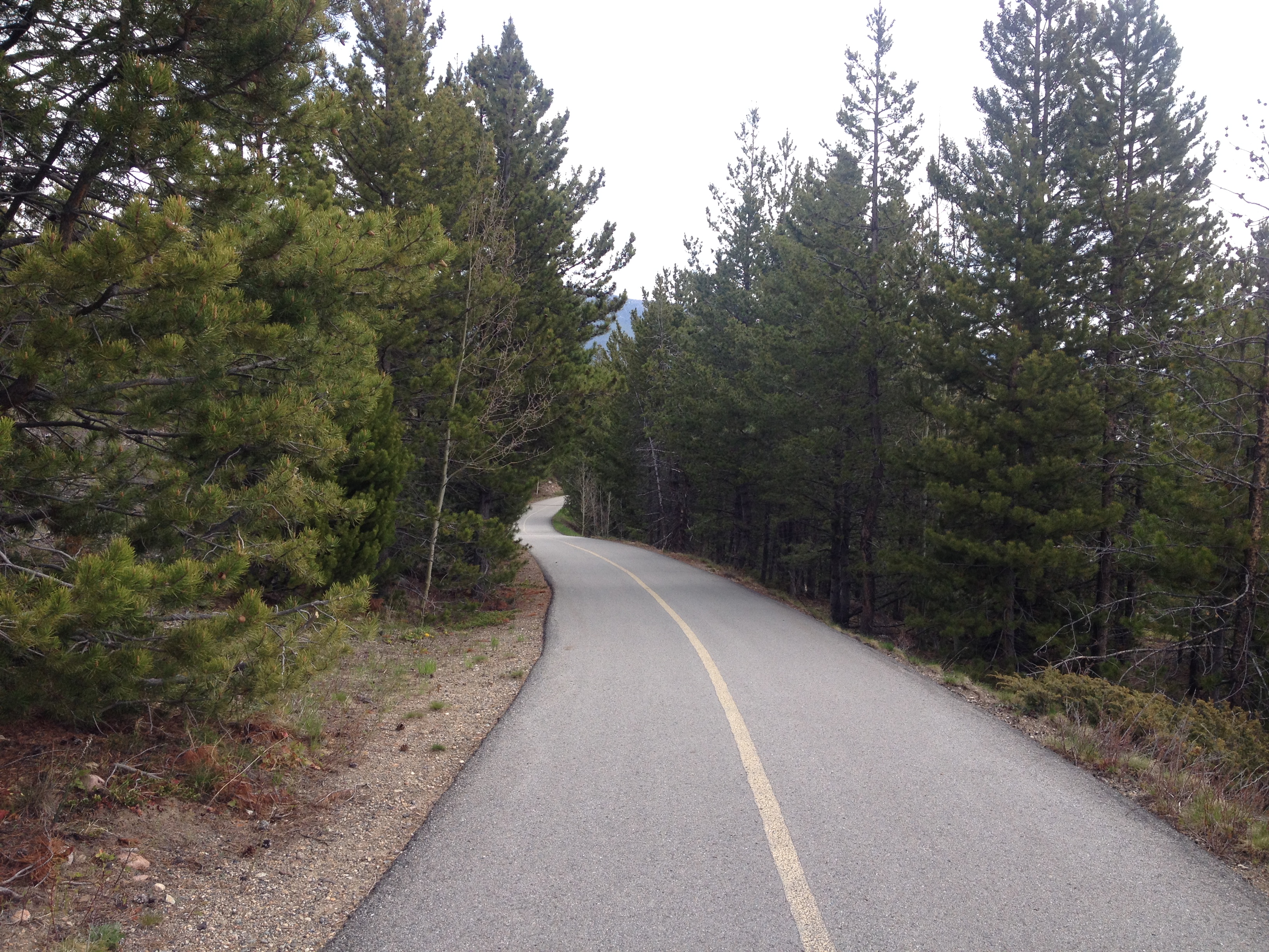
There really is nothing like experiencing the Tetons, at a nice comfortable pace of 15-20 miles per hour, from the seat of a bicycle, up and down some gentile rolling hills, as the afternoon progresses. As was the case in Yellowstone, I decided not to push myself and hurry through the park.  Only this time, on a day that had been mostly downhill, it felt way more comfortable.  I wasn’t climbing up a major pass, putting my legs through all of that exhaustion.  I was just gliding kinda.

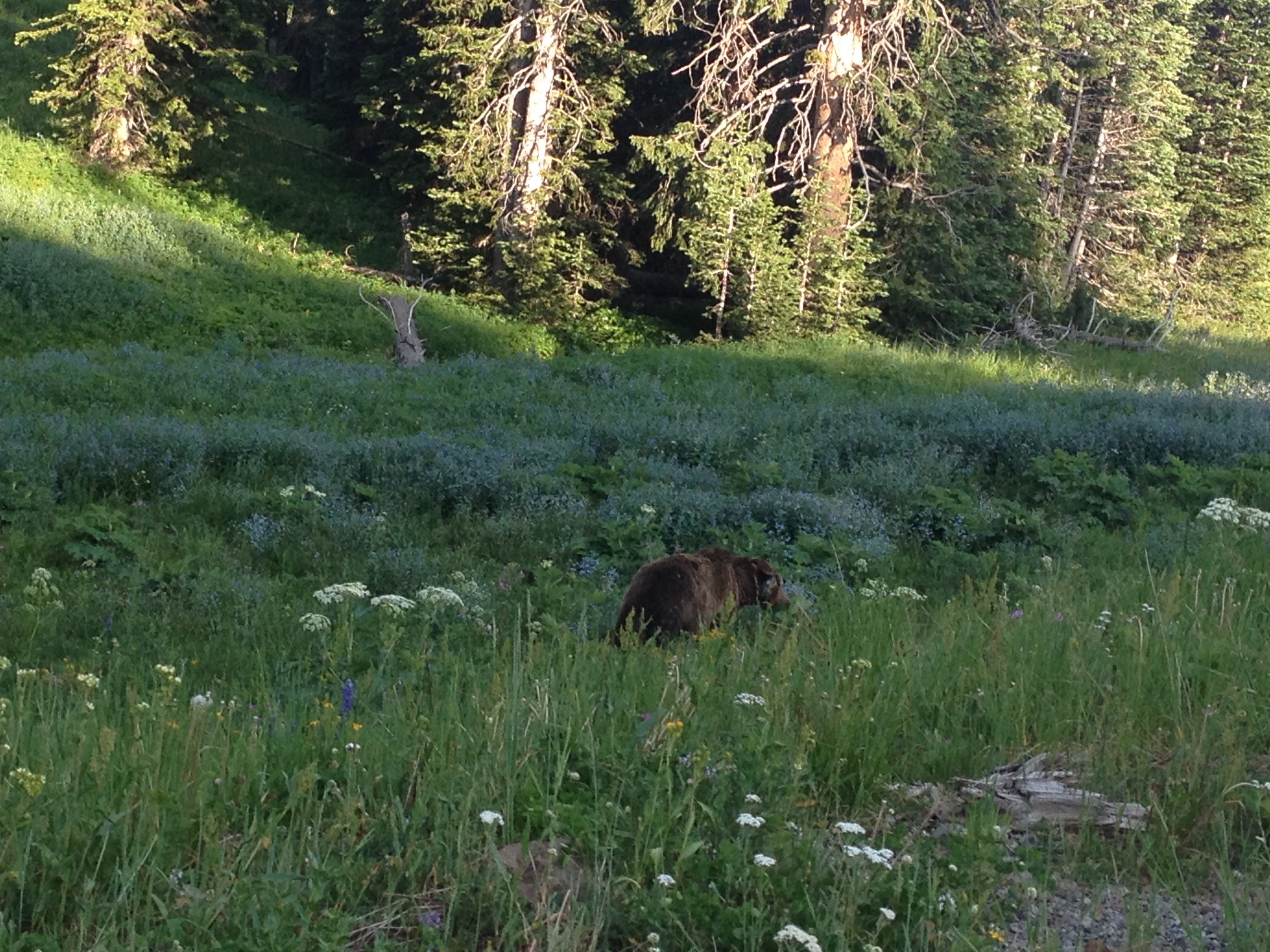
The final part of the trip into Jackson took me on a bike trail, where I encountered the last wildlife of my journey, a coyote.

IMG_3845 IMG_3847

In the end, I once again rode over 80 mies on the final day of my journey.  However, the last part of the ride felt quite a bit different for me on day 3 as it had on day 2.  At some point, I came to the realization that on my final day’s ride, it wasn’t the energy I had left in my legs that was limiting the number of miles I felt like I could do, it was other intangibles.  It was how my butt felt about getting back on the seat.  It was how many times my right fingers had been used to shift gears, as well as the amount of weight I had placed on my forearms in general over the course of many hours on the seat.  In this case, I wonder if the strategy of biking a bit faster, but taking more frequent stops to get up and off the seat may be a better strategy for handling these long distance rides.

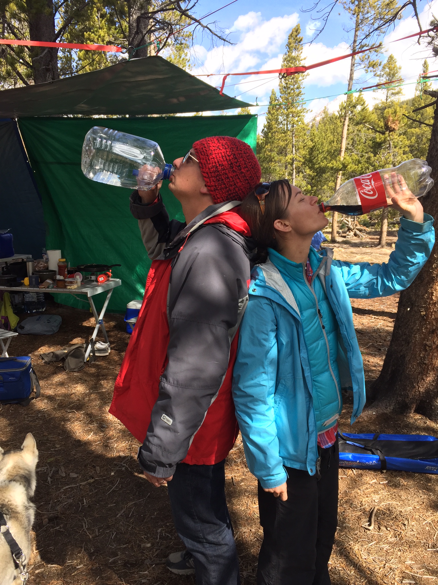
The last five miles of my ride, on the trail, headed into Jackson were counted off by little markers in the trail; white lines labelled 5.0, 4.5, 4.0 and so on, counting off the distance from Jackson at the end of the trail.  These markers countered down, pretty much, the end of my trip.  So while I was excited to make it all the way into Jackson, and really anxious to take a shower and have a coca-cola, it still felt bittersweet to me, knowing that this bicycle trip that I had been anticipating for so long was quickly coming to an end.

IMG_3848 IMG_3851 IMG_3853

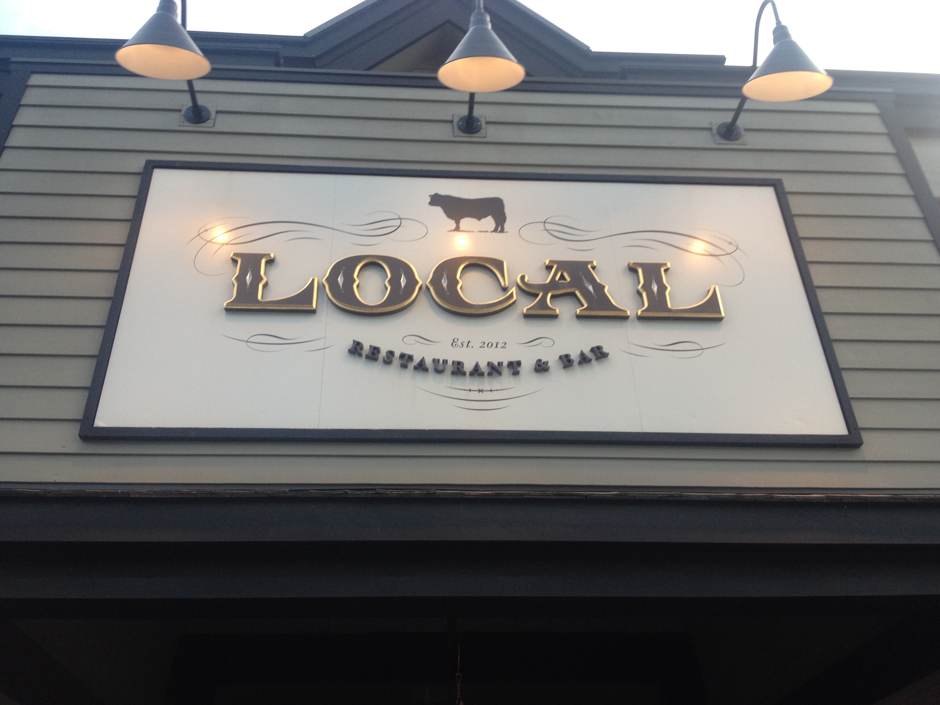
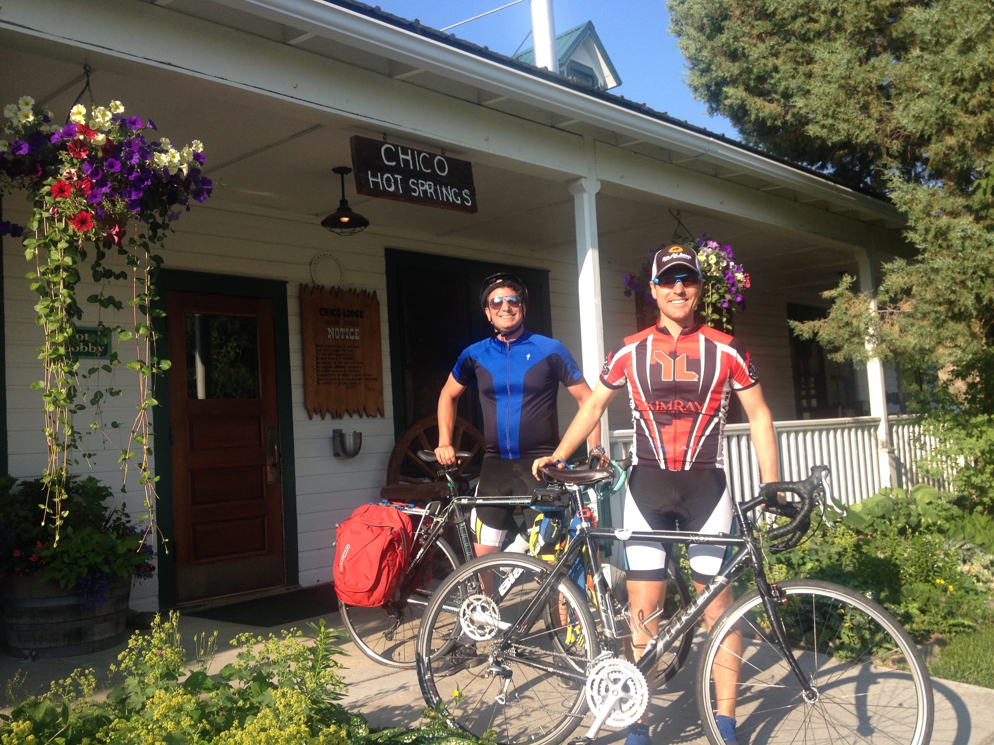
Two days earlier, at Chico Hot Springs, I had refrained from eating chicken wings, as I was unsure if the choice would negatively impact my bike ride the next day.  Now, with no more bike riding ahead of me, it was time to finally fulfill that craving.  So, after showering and changing, we went to a place called Local, right in downtown Jackson, and, yes, I had my wings.  Oh, and they were amazing.  One thing I learned the first time I attempted bike travel, ten years ago, was that wings always taste better on a bike journey.

IMG_3856 IMG_3859

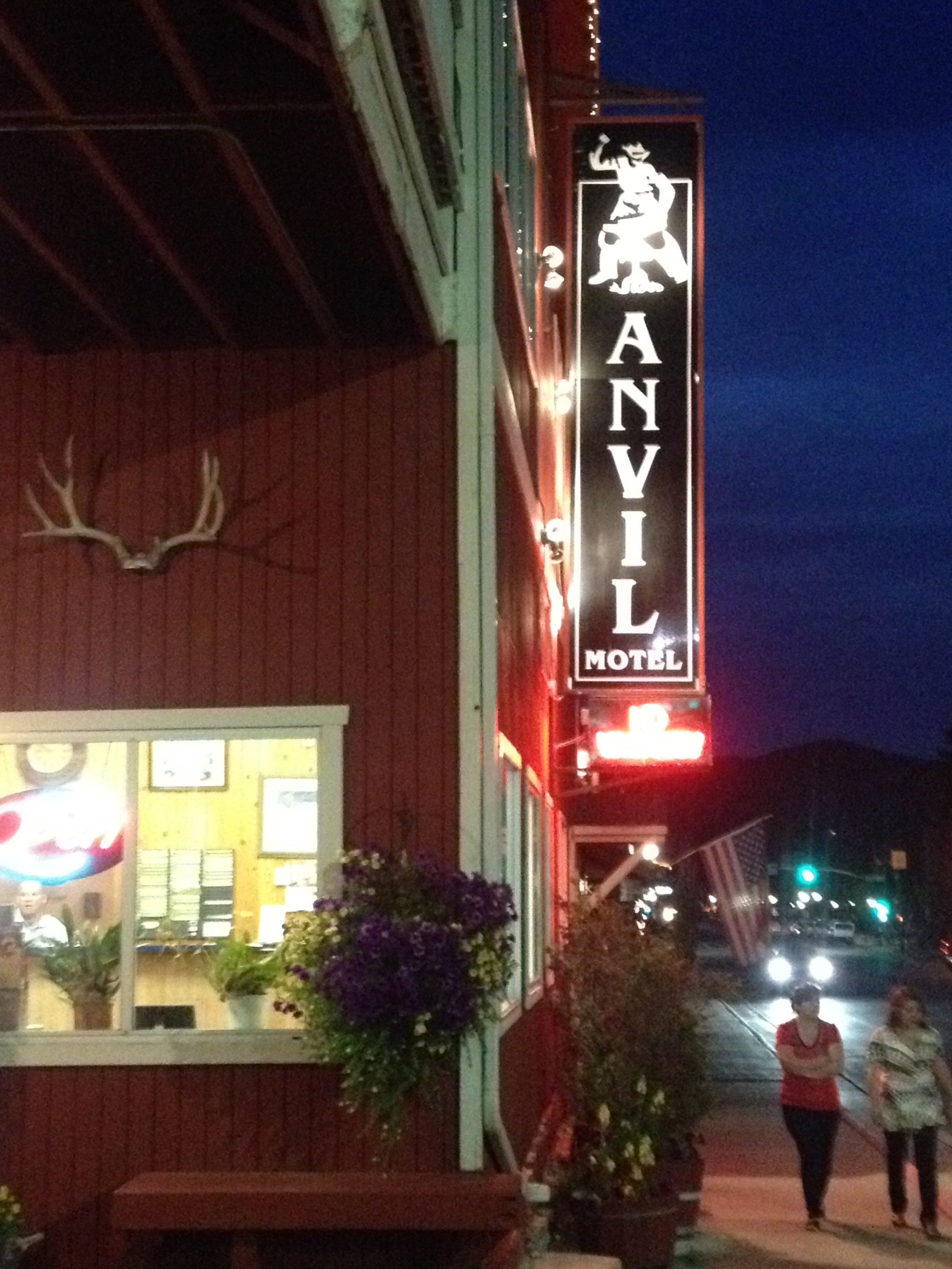
That evening, we stayed at the Anvil Motel downtown, and watched the 4th of July firework show.  As I watched the fireworks light up the night sky, I thought to myself about how I had celebrated our Nation’s independence by traveling through some of the most beautiful places in the country.  I cannot think of a better way to honor The United States of America than that.

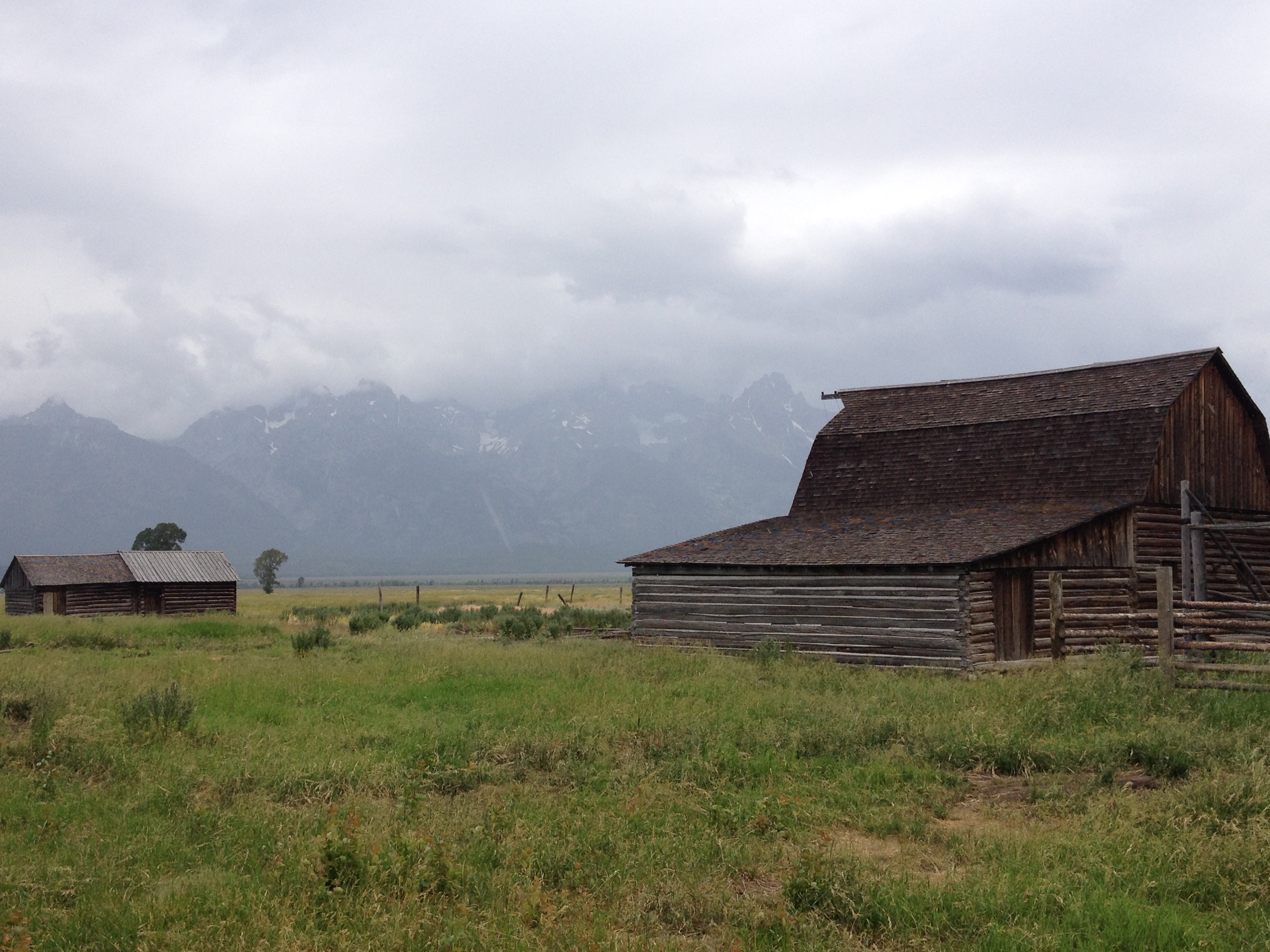
The only regret I really had was that the haziness of the day had seriously impacted the images I had taken of the Grand Tetons.  This regret was remedied, as we spent another day in Jackson before headed home, and got to see some more sights, including different images of the Tetons, under different weather conditions, both Sunday and Monday, as well as the iconic images that one encounters in the famous Mormon Row settlement to the east of the National Park.

IMG_3864 IMG_3867 IMG_3871 IMG_3894

By completing this journey, I feel like I have entered a whole new league when it comes to bike riding, and bike travel.  Before this trip, I could only speculate as to what rides I would one day love to take on.  I could only respond to people’s own bicycle travel stories with statements such as “wow, that seems incredible”, or “good job”.  I was not truly belonging to the group.  Now, with this trip behind me, I have finally earned the right to consider myself a bike traveler.  I have earned the right to actually chime in with my own anecdotes, about biking long distances, road conditions, places to go, pannier setup, and all sorts of other topics bicycle tourists typically discuss.  I have reached the pros- sort of.

And, because of this experience, Montana and Wyoming now have a special place in my heart, something that someone born on Long Island, New York would never have expected.  I almost feel like Teddy Roosevelt this weekend, New Yorker in attitude and mannerisms through and through, but lover of the West, lover of America’s beauty and lover of the National Parks.

IMG_3906 IMG_3907

As I rode home Monday, July 6th, it suddenly occurred to me how little I missed my regular life.  I think I missed some of the people and some of the socializing.  But I really didn’t miss the kind of stuff that many would assume.  I had yet to watch a single minute of television, and had yet to use the internet for anything other than looking up the weather and writing a blog entry on this site.  I certainly had not looked at the news or anything.  I definitely did not miss either TV or the internet at all.  As of the time of writing this blog, July 9th, my TV total for the month of July still does not exceed one single hour.  And, the odd thing is, I also knew that if I needed to get back on that bike again and ride more distance, I was more than capable of it.  Maybe that is the way I truly know I have reached a whole new level with regards to bicycling.

July 2015 Bicycle Journey Day 2: Chico Hot Springs to Yellowstone’s Grant Villiage

IMG_3776

I was 43 miles into a 100 mile bike ride.  I had already climbed over 1,000 feet from my starting location.  I knew I had over 2,000 more vertical feet to climb before I would reach the high point of my day.  The road mercilessly took a turn downhill.  This was vertical height I had already worked hard to climb.  I knew that somewhere down the road, I would once again have to climb this several hundred vertical feet that I was now descending.  I sped up and continued down the road, already exhausted, knowing that I still had more than half my day left to go, both in terms of milage as well as vertical climb.

IMG_3759

That was when I found myself going over a bridge, over the Gardner River.  The views in all four directions, including downward were spectacular.  Not only was I viewing all of the scenery in all directions, I was smelling it.  I was feeling the air around me.  It was at this moment that I realized that, despite how exhausted I already was, and despite how agonizing the steep hills I had in front of me were going to be, that all of this was worth it.  The effort of pedaling harder than I had ever pedaled before, and enduring hours of pure pain was worth it to experience what I was experiencing on that day.

Miles 44 and 45 would take forever, as I climbed up and out of the river valley and onto the Blacktail Deer Plateau in the Northern part of Yellowstone National Park.  Knowing that I still had so much painful climbing left to go, once again “This Summer’s Gonna Hurt” by Maroon 5, a song that I had heard many times this year, and, like most Maroon 5 songs, catches in one’s head quite easily, popped into my head as I pondered the pain that I was enduring, as well as the pain that would come.

IMG_3715 IMG_3718

That morning, I woke up in Paradise Valley with a strange feeling.  I was half worn out from my first day of cycling, but also felt ready to go.  It is a feeling that people who cycle long distances probably experience quite frequently, but it was a feeling that I had not truly experienced before.  Sure, I had undertaken multi-day tasks before, but never one like this, where in my head I knew I was about to tap into pretty much everything I have, physically, but I also knew that it would make for one of the most exciting days I’ve ever had.

IMG_3724

On the way out of Paradise Valley, we encountered the only other cyclist we would encounter that day, an Austrian gentleman headed for the Grand Canyon.  He was traveling fully self-contained, with all of his camping gear attached to his bike, and therefore taking it slower.

IMG_3726 IMG_3728

After turning back onto US-89 South towards Gardiner, we entered an area known as Yankee Jim Canyon. It is here where we started to see some rafters.  Over the next few miles, we would wonder who was this “Yankee Jim” that this canyon was named after.

IMG_3729 IMG_3731

Unfortunately, even the signage along the highway, the signage that eluded to both history and Yankee Jim, did not tell me anything about who Yankee Jim was.  After the trip, I did a full web search.  Nothing.  I still have no idea who was this man they call Yankee Jim. Maybe if I ever go to a Montana History Museum of some kind I’ll find out, but to this day, it remains a mystery.

IMG_3735 IMG_3733

Luckily, several miles up the road, as we approached Gardiner, there was a distraction.  We encountered a place called Devil’s Slide, a uniquely shaped exposed area of red sedimentary rock that appears to lend itself to stupid, and potentially dangerous adolescent ideas.  I am quite thankful that nobody turned it into a cheesy touristy site.  There are enough overpriced alpine slides elsewhere in the West.

IMG_3738 IMG_3743

We stopped for Ice Cream just before noon in Gardiner, Montana, and stepped out into much hotter air as we entered Yellowstone National Park.

IMG_3746

Back when I lived in Chicago, I never understood why advertisements for Montana tourism would feature images of Yellowstone National Park, which is primarily in Wyoming, with the phrase “Gateway to Yellowstone”.  But, apparently, this was the original entrance to the National Park, and, when the park first opened up, the only way to get in.  This structure right here, that I found myself riding under, was the first entrance ever created to the first National Park established.

IMG_3748 IMG_3749

And I knew the climb was coming, the first climb of the day, which would eventually take me past the 45th Parallel, into the State of Wyoming, and up to Mammoth Hot Springs, where I was now roughly 1000 feet higher than Gardiner.

IMG_3750 IMG_3751 IMG_3754

But, it wasn’t just the climbs that made the ride exhausting.  It was all of the other rolling hills I was not 100% expecting.

IMG_3762

There are very few flat parts of Yellowstone National Park, and even the area between Mammoth Hot Springs and Tower Falls, which starts and ends at a similar elevation had many hills of different sizes.  It was around there that I decided that I was in no hurry to get to the campsite.  After all, I was in Yellowstone National Park, and in a part of the park I did not get to see the last time I visited.  I was gonna see some stuff.

After having to climb back up out of the Gardiner River Valley, I took a look at the Undine Falls.

IMG_3763

Unfortunately, I did not feel I had the energy to add a mile of hiking (round trip) to my day, and see the Wraith Falls.

IMG_3766

But, I stopped several other times to enjoy the scenery along the Blacktail Deer Plateau, and even got a chance to see a blue-billed duck through some bincoulars.

IMG_3770 IMG_3775

In the middle of the afternoon, I reached one of Yellowstone’s more breathtaking, but underrated features, Tower Fall.

IMG_3777

It was here I took a more lengthy break, as I knew ahead of me I had a climb tougher than any climb I had ever undertaken in my life.  After that exhausting 30 mile stretch from Gardiner, up into the park and then over the plateau and all of the rolling hills, I would climb over 2000 feet, to the highest point of any road in Yellowstone; Dunraven Pass.  But, it was here that I also realized that not only was I more than halfway through my trip overall (63 miles into today with 61 miles behind me yesterday), but I was now at a higher elevation than where I would end the trip (Jackson, Wyoming is at 6200 feet).  In every sense of the phrase, I was more than halfway there.

The climb, 12 miles and almost 2600 feet in elevation gain, took me nearly two hours.  It was exhausting, and intense.  I pretty much had to stop every mile.  Somewhere roughly halfway up the pass, I started to see some beautiful alpine flowers; yellow and purple.

IMG_3781

But, signage told me that the presence of these wonderful flowers also signified that I was in Grizzly Bear territory.

IMG_3782

So, it should not have been too much of a surprise to me that when I finally got to the top of the pass,  after two long hours of huffing and puffing, I saw my first Grizzly Bear!

IMG_3786 IMG_3790

Just as I had realized 31 miles (and almost 3000 feet of net climbing) ago, when I was going over that breathtaking bridge over the Gardner River, all of the riding, all of the sweat, and all of the pain did have its reward.  To be honest, it would have been more than worth all of the physical exertion without even seeing the bear.  But, seriously, there was nothing like encountering this animal, so beautiful, so majestic, yet so dangerous and overwhelming, in the manner in which I did; from my bike, out in the open, yet at the top of a pass, knowing that if I needed to outrun it, I could by pedaling as hard as I could on the next downhill stretch.

IMG_3791

By then, after hanging out with the bear for a little while, it was nearly 7 P.M.  I had neither the energy, nor the remaining daylight to take the walk down to Yellowstone’s iconic Lower Falls.  Luckily I saw those last time I was here, so I was glad to have taken the time to see the other waterfalls in the park.

The last real feature I visited that evening was Yellowstone’s Mud Volcano area.

IMG_3798 IMG_3801

There I stood, with the water bottle I had filled up something like 6 times that day, and I came to the realization of just how geothermal Yellowstone Park is.  Like many of the geysers in the park, this “mud volcano” smelled like sulfur.  In fact, it smelled kind of yucky.  And, while I had spent most of the day looking at waterfalls, scenic river valleys, and finally those yellow and purple flowers, it is these types of features that make Yellowstone National Park unique.  We do have waterfalls, canyons, river valleys and the like all over the west, including within an hour or so of home.  All of these geothermal features … I cannot think of where else to see them!  It almost felt like this park was built on sulfur.

IMG_3802 IMG_3803

After seeing an elk on the side of the road, near Yellowstone Lake, I reached the campground at Grant Village.

It had been, without a doubt, the toughest day of riding I had ever undertaken.  Going into this trip, I knew it would be, so I was prepared.  But, I was still pretty much without any residual energy at the end of the day.  In fact, I was kind of acting like I was drunk.  I guess my body had gone through an experience that some would consider “traumatic”, given how far I pushed myself.  But, for me, it is how you grow as an individual, and it is how you gain confidence.  I know that soon I will have to return to “regular life”.  In “regular life”, there is competition, there is conflict, and there are things that are just plain hard.  But, they become easier for those of us that are confident in ourselves.  Accomplishments like these simply serve as a reminder to ourselves that we are awesome.  In fact, I would love to market a bumper sticker that simply says “Smile, you are you, and you are awesome.”  Or, something like that.  There is probably a better, and catchier way to phrase that.  But the point remains that experiences like these do remind us that we are often capable of more than we believe, and are told, that we are.

July 2015 Bicycle Journey Day 1: Bozeman to Chico Hot Springs

There is no feeling like actually beginning something you had set out to do.  Lots of people talk about what they would like to do, or think about what they will someday do.  And, sure, anticipation is fun.  But it certainly does not compare to that feeling you get when you actually start something major.  For years I had been thinking about traveling long distances by bicycle.  The idea of traveling a significant distance under my own power had always thrilled me.  So, I read stories of others who had traveled by bicycle.  I looked at bicycle travel routes, particularly from the Adventure Cycling Association.  I bought the necessary equipment.  I trained.  And, finally, I planned an actual trip.  Well, I decided to join my friend’s cross-country bike ride for a three day segment, from Bozeman, Montana to Jackson, Wyoming.

IMG_3685

When I met up with my friend in Bozeman along his journey, Thursday, July 2nd finally became “Day 1”.  They say that the journey of 1000 miles begins with one step.  In my case, it begins with one pedal stroke.  And, when I started to pedal, headed East out of town, I finally had a “Day 1” of my own.  I was finally doing it.  I was traveling by bike.  What was once just an idea, something on a bucket list, had matured, first into detailed plans, and than into action!

IMG_3686 IMG_3687

The fact that I was finally on a bicycle journey of my own felt ever more real when I left town.  After all, many people bike around town all the time.  I had biked around town quite a bit earlier in the day- roughly 10 miles total.  And, none of that really felt like I was actually on my way.  It was when i departed from town that I truly achieved that “Day 1” feeling.

IMG_3688

That feeling soon got complicated with another first, bicycling along an interstate highway.  At the REI, I found out that the route I had originally intended on taking was not paved, leaving no other choice but to basically follow I-90 from Bozeman to Livingston; roughly 25 miles.  Unfortunately, there is a five mile stretch where I-90 does not have a frontage road.  This actually occurs quite frequently in the West, particularly in canyons.  In many cases, there are no other roads in which to use to get from one town to another.  And, for this reason, many Western states, unlike their Eastern counterparts, permit bicycling on Interstates.

The fact that it was completely legal for me to cycle down I-90 did not make it any less scary.  In some sections, the shoulder width was not nearly as wide as they are on typical interstates.  It felt like a mere 6 feet of distance separated the edge of the right lane and the guard rails, all on a road with a speed limit of 75!  Needless to say, when we were able to exit the highway, I was relieved.

IMG_3690

A couple of miles later, I had reached the top of what is referred to as Bozeman Pass, and completed the first climb of my trip.  I did not take this climb too seriously.  I stayed in my big gear the entire way up.  For part of it, I was more concerned with 80 mile per hour traffic.  But, when I looked down at what I had just climbed, after reading one of the many Lewis and Clark related information boards along this route, I realized that I had actually climbed a significant amount.

On the other side of the pass, I rapidly descended into Livingston, a town we would not spend too much time in.

IMG_3692

We pretty much just took a bathroom break, filled up on water, and headed out, southbound, towards Yellowstone, or at least that is what pretty much all of the signs for Highway 89 south say as one heads out of town.

IMG_3695

This road follows the Yellowstone River into an area known as Paradise Valley.  This particular area was stunning to travel through.  Paradise Valley is a wide river valley surrounded by mountain ranges on both sides.  When one travels through this valley, particularly when they cross the Yellowstone and follow the less traveled MT-540/ East River Road, they cannot help but truly feel the solitude that this region offers.

IMG_3697 IMG_3698 IMG_3700 IMG_3703

One will often see a lone building, a lone animal, a lone boat on the river, and even a lone cyclist making the journey through the region.  It is almost as if every single person, and every single animal came here to experience the solitude that is oh so elusive in their daily lives.

There were a lot of small climbs on East River Road, as the road periodically climbs up to an overlook of the river, only to descend back down towards the level of the river.  It was also an overall gradual ascent, as we were headed upriver in the direction of Yellowstone National Park.  I felt somewhat exhausted on this part of the ride despite the fact that I would only ride 61 miles on the day (and I had fresh legs).  I wondered if I had burned myself out going over Bozeman Pass.  Should I have taken it slower up that hill?  I knew I had a really challenging day of riding ahead of me.  Was I not pacing myself properly?

As the journey continued, and I approached the end of the day, I realized that I was not properly fueled.  I had eaten a moderate lunch, as I had recently been trying to avoid unnecessary weight gain, which would have made this journey tougher.  I had also not taken my water needs too seriously, not stopping for water too terribly frequently, as I was energized, excited about finally starting my journey, and my mind was filled with anticipation.

IMG_3705

When I arrived at Chico Hot Springs resort, I grabbed some of the beef jerky I had with me, and drank a good amount of water.  I felt much better for it, and came to the realization that, on bike journeys, you need to take care of your body.  On a bike trip, your body is your engine, not your bike.  I’d always thought of the bike as being the vehicle that we use to get places when traveling by bike.  I went to great lengths to ensure that my bike was properly prepared for this journey.  On this day, I learned that our bodies, and particularly our need to be properly fueled and hydrated, probably need to be taken just as seriously.

IMG_3710

After some time in the pool, we ate dinner at the resort.  It was a bar/pub type of place.  Upon being seated, the smell of chicken wings overwhelmed me, as they were being served to someone.  I cannot even being to tell you how good that smelled to me after all that cycling today.  Still, I restrained myself.  This is a bicycle trip.  It is not about the food.

IMG_3711 IMG_3714

I was fortunate enough to spend the evening in a nice cabin, where I would get plenty of rest for the next day, a day when I would take precautions to make sure I am properly fueled and hydrated, but a day where I would also take on the challenge of cycling in Yellowstone National Park.

Bozeman, Montana; Where My Journey Begins

IMG_3684

“I had always known that we had the best downtown in all of Montana.  And then last year, we were voted the best downtown in all of Montana.”  At least that is how Bozeman was described to me by one of the locals, while giving me lunch recommendations.  He eventually told me that every place downtown was good, and to only avoid chain restaurants.

The first person I interacted with in Bozeman was the cab driver that drove me from the airport to the REI, where my bicycle had been shipped to, reassembled, and was waiting for me.  He described Bozeman as a “town full of expert skiers”.  With all of the other observations I had made while in town, and with the other interactions I had with people from Montana, it feels to me as if Bozeman is like a smaller and more extreme version of Denver or Boulder.  The cab driver indicated that the town almost shuts down on powder days, as everyone is headed to the mountains.  And, the people coming in and out of the bike shops appeared to be people that could ride a fair number of miles in challenging conditions.

IMG_3672

Bozeman is only 50-some miles from Big Sky, one of the most famous ski resorts in the country.  Locals, however, appeared more proud of their local ski resort, Bridger Bowl, only 16 miles from town, as indicated by this sign.  It was also described to me as “the only non-profit ski resort in the Country”.

However, my mind was not on skiing at the time.  My mind was on bicycling, as this was the beginning of a 3-day bicycle journey that would take me through some of the country’s most amazing natural features.  And, it would be the most challenging ride I have ever attempted.

After picking up my bike, as well as all of the necessary supplies I needed for my trip at the REI, I rode the first 1.3 miles of my journey, to the Bozeman Inn, where I would spend the evening.

IMG_3671

Having my bike shipped to the REI and assembled there worked out quite well for me.  The price to assemble the bike from the box is $40, and they pretty much made sure that nothing was wrong with the bike, which is something I really wanted for a bicycle journey that would take me through long stretches without bike shops.  They even checked the spokes, trued the wheel, and made sure everything else was working.  And, when they realized they still had my tire lock key, someone from the shop brought it to me downtown.

It would be nearly 10:00 P.M. before the sun went down that evening.  I had already checked into the motel, but was looking for some information about the town, maybe a bike map, or even a restaurant guide for the time I would be in Bozeman.  Instead, there was just a bar and grill located adjacent to the motel.  “Lights” by Ellie Goulding was playing quite loudly where people were drinking inside.  It was a clear reminder of what evenings were like on a normal night during my “normal life”.  So, I had the instinct to go inside, drink a little, enjoy the music, and try to meet some locals.  But, I knew better.  I was on the verge of something special.  It would be a challenging ride, and I needed my energy.

IMG_3675 IMG_3674

I loaded up my bike with all of my supplies packed nicely into the panniers I had carried with me on the flight into Bozeman the previous evening.  I looked around me and saw mountains in all directions, reminding me that, yes, I was in for some challenging climbs in the coming days.

Spending the morning, and mid-day, in Bozeman gave me some time to mentally prepare for the challenge I knew I had ahead of me.  I decided to check out the attraction I had heard about the most; The Museum of the Rockies.

IMG_3676

This museum has somewhat of an interesting local take on geological, biological, and natural history.  Like the Field Museum in Chicago, it has an exhibit that displays how life evolved over time, starting with the single celled organisms that dominated the earth for Billions of years prior to the Cambrian explosion, through the time of the Dinosaurs and beyond in chronological order.

IMG_3677 IMG_3679

This museum’s exhibit was way more dinosaur centric than the other life over time exhibits I’ve been to.  Their main attraction is the “Montana T-Rex”, the biggest T-Rex to be discovered inside the State of Montana.

IMG_3681

The museum is quite locally focused.  The exhibits on geological history contain a lot of information specific to the geographical area around Bozeman.  Most of the dinosaur exhibits are displayed along with a map of Montana which show where the bones were dug up.

IMG_3678 IMG_3682

Seeing some of these specific exhibits actually changed the way I look at scenery.  Exhibits like this one, about the Beartooth Mountains, don’t just show how pretty they are, but show what rock formations can be seen, and how and when they developed.  The geological history behind all of these processes, from plate tectonics to atmospheric composition changes, and even processes involving air pressure changes and erosion all help explain why everything we observe is the color and shape that it currently is.  And, ultimately, for people who study natural history, all of these rock formations that we observe provided clues to Earth’s past, and helped these scientists discover what we now know.

I’ve looked at a lot of mountains, and a lot of natural scenery over the past few years.  It occurs to me that the scenery that we observe means something different to everybody.  Some people focus on the aesthetic nature of what they see, a beautiful mountain, a beautiful lake, a scenic overlook.  Others focus on the adventure.  Wow, this mountain would be great to climb, or this river would be crazy to kayak in.  But, still others are trying to deduce how this scenic view in front of them came to be.  They are the ones that see red rocks and see the process of rusting, which occurred over the course of 2 billion years, as early photosynthetic life gradually increased the oxygen content of the atmosphere, lead to the chemical reactions that made some rocks red, so long as they have had significant above ground exposure.  They are the ones that look at the rocks and see as story, a progression of events.

I almost felt bad, walking around the museum in my bicycle clothes, looking kind of like a bad-ass, talking to people about my bike trip, when the truth is, that I had only biked 7 miles so far, from the REI, to my hotel, and then to the museum.  It was the guy at the ticket window that had told me that Bozeman’s downtown was the best one in Montana.  He informed me that the museum and downtown were the two places to really see in Bozeman, so I decided to ride my bike downtown, get some lunch, and wait for my friend to join me.

IMG_3673

I was impressed by the downtown, particularly the bike parking.  After eating lunch at a Co-op (the kind of place that looks like a grocery store but sells fresh made lunch food to workers in downtown areas), I had some time to kill.  I was excited, getting kind of anxious, and my mind was active!  Maybe it was the 10 miles I had already ridden, enough to get my blood moving.  Maybe it was knowing what was to come.  Or, maybe it was the downtown, the vibrancy, and the unique-ness.

From book stores, to local shops, everywhere I went seemed to put me into an active process of deep thought.  For example, I saw a book.  It was titled “Faith vs. Fact: Why Science and Religion are incompatible.”  I thought to myself how ironic it is.  People become attracted to either Science or Religion, but usually do so due to the positive aspects of it; science and it’s intellectual curiosity, religion and the hope and purpose that it brings.  Yet, so many people, after choosing to love one or the other, spend more time focusing on the negative aspects of the other one, as opposed to the positive things that brought them to love either science or religion.

Just like that book, everything I saw brought me to some weird intellectual thought pattern.  I should go back to Bozeman sometime under different circumstances, and see if this is just the way the town works.  Is there something about the energy of this town that makes people just think in unique ways?

Many Montanans refer to Bozeman as “Boze-Angeles”.  In this part of the country, I am guessing this is not meant as a compliment.  That evening, after riding to Chico Hot Springs (more on that in my next post), a woman from Butte, MT would describe Bozeman as “pretentious”, and the place in Montana where one is most likely to be judged.  And, although I did not necessarily feel judged, I definitely sensed the pride here, consistent with what the cab driver, and others told me.  Still, I enjoyed the feeling of being adventurous, intellectual, and on the verge of a major adventure that would also be a major challenge, a major accomplishment, and open me up in a whole new way.

A Month Without Sleep

IMG_3499 IMG_3514

I guess it would be an exaggeration to say that I, or anyone else for that matter, went a whole month without sleep.  But, sometimes life, and the procession of events, activities, changes and emotions, refuses to come at you at a steady and workable pace.  One day we find ourselves stagnant and antsy, wondering what is next, and wishing for something significant to happen to us.  Then, out of nowhere, we suddenly can’t seem to keep up with all the planning, deadlines, issues, and events.  We literally find ourselves unable to spare a single hour out of a crammed week.  Sure, we always think to ourselves of ways to avoid both extremes.  We think of ways to shift some activities from busier periods to quieter periods.  But, it never seems to work out that way.  Something always comes up.  Some sort of factor we had not previously considered prevents us from utilizing those slow periods when we get antsy.  And, these periodic episodes that test our endurance are still going to come.

Both of these images were taken on restless nights during the month of June.  Both nights were restless for completely different reasons.  And, both photos are beautiful, in a very artistic sort of manner.  As I gaze at these pictures, I can’t help but imagine art enthusiasts looking at these images, discussing their settings, their emotions, their significance, all that deep stuff.  I wonder how many of these artists would come to conclusions similar to the actual stories behind these pictures.  The picture on the left is a sunset picture in the city, taken after a busy and emotional Monday at the office.  The photo on the right was taken after a particularly festive Saturday night in Vail that lasted well past sunrise Sunday morning.  Both nights I did not get any sleep, but for reasons that could not be any farther apart from one another.

June is a terrible time for any of the drama associated with “regular life”, whether it be moving, career issues, financial problems, or family and relationship issues to come up.  There is just way too much fun stuff to do- everywhere!  No matter what city you live in, there are festivals all over the place.

IMG_3628 IMG_3646

It is the peak time of year for Whitewater Rafting in this part of the country.

IMG_3589

There is the ongoing severe thunderstorm season.

IMG_3632

And, there is also tons of daylight, and pleasant weather up in the mountains.

IMG_2044

I have no time for anything else in June.  All those “regular life” things that demand my attention just need to wait.  There will be plenty of time when the snow reappears on the mountain tops, nights get longer, days get chillier, and opportunities inevitably shrink with the passing of the season, for me to turn my attention to all of that other stuff.

June, for me consisted of a plethora of experiences.  Some of them familiar.  As I did last year, I went to the GoPro games in Vail June’s first full weekend.  Just as I did last year, I went rafting the third weekend of the month.  And, as always, I spent some time out on the town, and did some goofy stuff.

IMG_3522 IMG_3511

But, some things were unique to this particular June.  I was lucky to have been joined in Colorado by some of my friends from Chicago, who came for a week to see some sights around the State.

IMG_3542

We also experienced copious amounts of rain.  Rivers and creeks expanded to cover areas that are typically dry- including bike trails.

IMG_3644 IMG_3666

On top of all that, career related anxiety, which began months ago, but mercilessly intensified during the month of June, lead me to seek out some places where I typically go to clear my head.

IMG_3668 IMG_3669

It was not until the final Sunday of June, the 28th, when I finally took a pause, and realized just how intense June had been.  It almost felt like my first real day of rest for the entire month.  You see, on top of all of the activities I have been involved in, seeking out answers related to my job, and trying to get more involved in some some social groups, I have also been training for, as well as planning out my next epic trip, which will begin in less than 48 hours.

I had always dreamed of traveling long distances by bicycle.  In fact, I am a member of the Adventure Cycling Association, and have been following their push to develop cross-country bicycle routes for years.  This fourth of July weekend, I will be embarking on the biggest journey by bicycle of my life, a ride from Bozeman, Montana to Jackson, Wyoming.

Bike_Trip_July2015

This three day, roughly 230 mile bike ride will take me through some of this country’s greatest treasures, including Yellowstone and Grand Teton National Parks.  On the way into Yellowstone, I will be riding through a region known as Paradise Valley, which includes Chico Hot Springs, and other unique features.

Planning, and training for, this ride definitely added to an already crammed month of June, but I sincerely believe it will be worth it.  Just as we have daytime and nighttime on a 24 hour cycle, we have both active and restful periods on a larger scale.  And, although July is not looking too much more restful than June for me, there will eventually will come another break in activity, another lull, another time to regroup, and “sleep”.  Maybe I’ll even figure out some of that pesky “regular life” stuff too.  But one thing is for sure, it will not be as epic as this.

Full Service Camping

IMG_3562

Camping is not just camping.  In fact, there is an entire spectrum of different types of camping one can take part in.  On one end of the spectrum is the type of bare bones camping that can be found in National Forests and other wilderness areas.  I took part in this type of camping for the first time last year at Gunnella Pass.  These are places where you just put down your tent, and pretty much are on your own.  Maybe there’s a fire pit leftover from the last set of people who plopped their tents there.

On the other end of the spectrum are places like Starlite Classic Campground.  These campgrounds have their own office, where one can usually buy the ice, firewood, and other standard camping supplies, specific camping sites reserved in advance for various group sizes, and often have plenty of other amenities.

On this campground, we had a pool, which we ended up spending a significant amount of time in, as temperatures soared well in to the 90s Friday, Saturday, and Sunday.

IMG_3588

Next to the pool is a children’s play area, which I probably spent way more time than any adult should at, but, hey, I am also a grown-up throwing myself a half birthday party, so, it kinda fits.

IMG_3571 IMG_3580

And, not to mention, a whole bunch of other games, including horseshoes, volleyball, and even a mini-golf course.

IMG_3559 IMG_3564 IMG_3566

All this made for a completely different kind of experience than your standard camping trip.  When most people think of camping, they ponder up images of a campfire, roasting marshmallows, and a fairly quiet experience, which can often involve some reflection, star gazing, and deep conversations in the wilderness.  With the hot temperatures, mid-June daylight lasting until nearly 9 P.M., all the amenities at Starlite, and a total of 17 people participating in the weekend (including both camping and rafting), very little of your standard camping experience happened.  In fact, the weekend kind of felt like some kind of hybrid experience between being at a campsite and a party!

Starlite Classic Campground is located just across the street from Performance Tours, the outfitter we used for our rafting trip.  We had a mere two minute walk to get where we needed to go in the morning.  In fact, the evening before the trip, we could see the very bus we would be getting on the following morning to start our raft trip.

IMG_3567

With the purchase of the group site at Starlite, we received a significant discount on the rafting trip, as they have some sort of deal.

IMG_3565 IMG_3570

In addition to all of the fun, the scenery was amazing.  Just four miles south of the campground is the Royal Gorge Bridge, which can be seen by gazing across the open plane of the Arkansas River Valley.  A quick turn to the right, and one can see the Sangre de Cristo Mountain Range, which contains numerous peaks over 14,000 feet, and extends all the way into Northern New Mexico.

IMG_3582 IMG_3586

As I walked across the open field that evening, staring across a the Sangres, and the bridge, and some of the other terrain features that look so breathtaking when the setting sun hits them at just the right angle, I came to the realization that I had entered the sweet spot that I am always looking for in life.  By this I mean being the best version of me, the version of me I wish I could be all the time, but somehow can’t.

Without the help of any substance, drugs, alcohol, or even caffeine for that matter, all the anxiety had just vanished.  I was just content.  It’s hard to explain.  But, it was like I had just simply left the competitive world that we live in behind for a few days.  I did not feel I was competing with people, needing to prove anything, or potentially being judged for anything.  Maybe what I felt was acceptance, something we all long for in life, and something I sincerely appreciate those who joined me on this trip for.

IMG_3583

Out here, organizational structures, hierarchies, deadlines, and all of the things that make life stressful simply don’t exist.  It is just you, whoever you chose to make the trip with, and the scenery.  And, once you get to that place where you can let go of everything in your head, you find that best version of you, the one you know you are capable of.  It is the you that is confident, eager to take on a new activity, and in no way hiding any aspect of who you are out of fear of judgement.  It is the you that the people who you value are drawn to, and it is the you that should be celebrated, even if that means throwing yourself parties like this one.

IMG_3607 IMG_3611 IMG_3615

For me, when I am being true to myself, it means being goofy, and, well this area offers plenty of opportunities for that.  This section of U.S. highway 50, near Royal Gorge, has more than just one campsite and one whitewater outfitter.  There are more campsites, more whitewater outfitters, other activities (such as helicopter rides), and shops and restaurants that serve the needs of the tourists in the area.  Not to say that this area is a full-fledged tourist trap similar to Estes Park.  But, there are some places to wander around to at night if one is so inclined.

IMG_3623

The return trip home involved one mildly disappointing stop; the World’s Largest Rocking Chair.  The chair was large, but we could not get in, as the shop that houses it has been closed for a year.

As I faced the return trip to the city, the return to work, and normal life, I could not help but think about the feeling I had this weekend, and how to be the best version of myself, the me that I was all weekend, every day.  What I struggle with is that “normal life” offers pretty much two typical paths.  First, one could work hard and “move up” in their organization, get promoted, become the boss, and maybe even reach leadership positions.  However, I have frequently observed that in many organizations, reaching higher levels requires some level of conformity, and one often must make some compromises on who they are and what they value to get in the good graces of those higher up- particularly in larger organizations.

Then, of course, there is always the option to be content to simply stay at the bottom of the totem pole.  This is a better path for those that prefer to keep their work load at reasonable levels, and seriously value work-life balance.  But, unfortunately, those that chose this route will always be answering to somebody, a boss, and sometimes for somewhat arbitrary reasons.  Being at the mercy of one person (and that person can suddenly change), who may be having a bad day, a bad month, or just simply be a bad person, has lead to countless terrible outcomes, all of which result in people not being the best version of themselves.

This is not to say that all is lost.  There are plenty of people that find a path outside the typical two options laid out above.  Many even write about their experiences here on WordPress.  There are also plenty of people that find a good environment using one of the two standard paths outlined above.  But, we all have a struggle.  And, this weekend, I realized that in order to make this struggle easier for both myself and the people around me, I need to celebrate the attributes in others that draw me to them, and also celebrate my own attributes that draw others to me.  Regardless of our paths, this authenticity needs to be encouraged.

Flooding on the Arkansas River

RoyalGorgeRaftingRowdyCelebrating my half birthday with Whitewater Rafting has become somewhat of a tradition for me, even though this is only the second year that I have organized such a trip.  And, this year’s trip was a doozy!

Mid June is typically prime-time for rafting in Colorado, as a combination of snowmelt from the mountains and periodic spring thunderstorms create the faster moving waters that adventurers seek.  This year, however, an unusually rainy May across Central Colorado created rapids on the Arkansas not seen in a generation.  According to our raft guide, this is the highest the water had ever been on June 20th, and the highest the water had been since 1995!  And, of course, the river reached what is referred to as “flood stage” the day before the trip.

RoyalGorgeRaftingcalm

Even the calmer parts of the trip were quite rapid.  The trip we signed up for was Performance Tours’ Royal Gorge half day trip.  With the speed that we were moving downstream, we covered the 10 mile distance in a little over an hour.  As is the case with nearly every commercial rafting outfitter, we began our trip on somewhat calmer waters so we could figure out our paddling rhythm and review some commands prior to tackling the bigger rapids.  Last weekend on the Arkansas, this was about as calm as it got.

It was not long before we were fully in rapids, ones that would be considered class 3 and 4.  The raft frequently bounced up and down during this entire middle section of the journey.  The roughest stretch came about 2/3 of the way into the trip.  It was a section of rapids that the instructor said some consider class 5, which is the highest rating navigable.  Unfortunately, we were not quite so lucky here.  In this section of rapids, our raft was quickly flung to the right bank of the river by a powerful burst of water.  The raft tipped sideways, dumping all six occupants (including the raft guide) into the rapidly moving river.

RGRaftingTipOver

I did not even believe it was happening at the time.  On these rafting trips, many people look out the bus window, at the rapids they are about to take on, with a feeling of terror.  I had always believed I could conquer anything, as, well, for some reason rafting just never really scared me.  I just handle the bumps, lean in when necessary, and enjoy the ride!  But this time, we were all really going down.  Before I knew it, I was directly underneath the raft for what felt like an extended period of time (but in reality was only about 3 seconds).  Getting out from under the raft, and being able to pick my head up out of the water and breath was quite the relief.  It was an even bigger relief when I was able reach out and grab the paddle that our rafting guide extended towards us to pull us to shore.  And, although only three of us were able to grab onto that paddle, all five of us got out of the river with little to no injury.  After recovering my breath after all the water I swallowed while taking the unplanned dip into the river, all five of us got back on the raft and finished the trip.  It was quite the experience, one that the rafting guides told me, makes you “a pro”.

IMG_3590

Perhaps the craziest aspect of the rafting experience was having the trip all to ourselves.  Almost every whitewater rafting trip one will take on, particularly on a popular river during a popular time of the year, is shared with strangers, basically, whoever also booked this particular trip at this particular time.  However, on this particular tour, perhaps due to sheer luck, or perhaps due to people canceling their trips due to the enhanced danger, my group of 16 ended up having the trip all to ourselves, which made the back and forth banter between the three boats on the trip interesting.

The one real drawback to having the water levels as high as they were was that it prevented us from physically rafting through Royal Gorge, which could not be entered (by raft) safely under these conditions.

IMG_3600

It would have been amazing to actually traverse right through this gorge on a raft.  And, on a calmer year, or in a calmer part of this year (say, August), it will be possible.  But, since I really wanted to see Royal Gorge, after the rafting trip, we picked up and drove the four miles to Royal Gorge Bridge & Park.

IMG_3597 IMG_3596

This park offers a variety of crazy ways to get across this gorge, from the red gondola, to zip lining across, to simply walking across the bridge.  Unfortunately, walking across the bridge costs $23.  Any of the other activities would surely add to that price.  None of us really thought it was worth it to pay $23 just to walk across the bridge, but looking around, we saw plenty of people on that bridge.  I would probably rather experience this gorge by paying only slightly more money for the scenic railway, or by rafting through it on a calmer weekend.

IMG_3601 IMG_3594

For free, we were still able to get on a short trail in the parking lot, to a nice over look.  It is really quite an amazing place, almost reminiscent of the large canyons one will find farther west, at places like Glenwood, Moab, and, of course, the Grand Canyon.

The craziest thing about the remainder of my Saturday was how little I had been “shaken up” by the entire experience.  Rather than being scared, and not wanting to continue (or ever go rafting again), my first instinct was to want to re-do the trip, and get it right this time (i.e. handle the rapids correctly).  If there is one thing I can take from this entire experience, it is the importance of being resilient, and taking experiences like this in stride.  If anything, I was far more upset about how much it costs to walk over the bridge ($23) than about falling out of the raft.  Hopefully this means I am still young and resilient, and not that I am actually crazy.

Cycling in Summit County

The Appropriately named Summit County (Colorado) sits right in the heart of the Central Rocky Mountains.   With multiple mountain ranges extending into the County on all sides, anywhere you will travel within the County, you will be pretty much surrounded by mountains in all directions.  In fact, Summit County is one of only six counties in the entire nation with a mean elevation of over 10,000 feet.

CO_Counties_over10000'

All six of these Counties are within the State of Colorado.  Outside of Colorado, not only are there no counties with mean elevations greater than 9,000 feet (Colorado has a total of 15), but only three counties outside of Colorado have mean elevations exceeding 8,000 feet (Colorado has 24).  Those looking to “go to the Mountains”, would be hard pressed to find a more suitable place than this one.

Summit County is probably best known as a skiing destination, with five popular ski resorts, including the incredibly popular Breckenridge and Copper Mountain.  However, it may also be one of the best places in the world for high-altitude cycling, which is important for those who train at high altitude to increase lung capacity.

Summit_County_RecPaths

Due in part to a series of rail lines that were created during gold and silver rushes and later abandoned in subsequent bust years, the county has an extensive network of recreational pathways.    The re-purposing of abandoned railways as recreational trails is actually the source of some of the nation’s best bicycling trails.  For those interested in seeing these rails-to-trails well maintained, and seeing more created, there is an advocacy group called the rails-to-trails conservancy leading this effort.

These recreational paths connect almost all destinations within the county.  Within this network of trails, one can find relatively flat rides, as well as intense climbing, all with a variety of amazing scenery.  The network is largely centered around the town of Frisco, a town of roughly 2700 people at an elevation just under 9,100 feet.  Located just off of Interstate 70, it is a relatively easy place to get to (when there aren’t traffic delays), and as good of a place as any to use as a home base for a weekend of high altitude cycling.

My first ride of the weekend was also the toughest one, from Frisco west to Vail Pass.  This ride involves two trails, the Tenmile Canyon trail and the Vail Pass trail.  Heading Southwest from Frisco, the first few miles on the Tenmile Canyon trail includes a fairly significant amount of climbing.

IMG_3464

Indicative of how recreation-centric this part of the country is, the entire trail network is well marked, with signage indicating which trails lead to which towns, and a significant number of signs like this one, indicating mileage.

IMG_3468

This sign denotes the halfway point between Frisco and Copper Mountain.  And while the total mileage to Copper is 7.4, a cyclist that has reached this point has already done most of the climbing from Frisco’s 9,100′ elevation to Copper’s 9,800′.

IMG_3471

In fact, the final couple of miles of this trail, headed into Copper is pretty much flat.  But, even during this flat segment, I knew where I would be headed, which would bring me farther up into the mountains.

IMG_3474 IMG_3475With it not being ski season, and there not being an actual town there, there was not much going on in Copper Village.  Many places were closed.  The most notable thing I encountered while at Copper was a junction with both the Colorado Trail and the Continental Divide National Scenic Trail, which share the same path here.  Just the thought that anyone I encounter cycling or hiking could be headed as far as Durango, or the Mexican border, is just incredible!  At the West end of Copper Village is the Vail Pass trailhead.  Despite what is indicated in the signage, the trek from Copper to Vail Pass is actually only four miles.  Not only did I clock this myself, but a cyclist with over twenty years of experience cycling here told me that this sign has been “wrong for over 20 years”.

IMG_3476 IMG_3479The Vail Pass trail is kind of a mixed bag.  Over four miles, the trail climbs somewhere between 800 and 900 feet.  However, it is a mix of some fairly flat segments, and some fairly intense areas with switchbacks and such.  I would say there are three sections of this trail that are intense climbing.  One fairly shortly after beginning the climb from copper, one right in the middle, or about two miles from Copper (pictured here), and one close to the top.

IMG_3482

Strangely, most of this trail is actually in the middle of I-70, between the Eastbound and Westbound lanes, which are farther apart for much of the segment between Copper Mountain (exit 195) and the Vail Pass summit (exit 190).  The top of the trail is a rest area that cyclists share with motorists.  Here, a connection could be made with the Eagle County tail network, and cyclists could continue West towards Vail Villiage.

IMG_3483 IMG_3484

However, my plans take my back towards Frisco, where, I not only encountered another sign indicating that the trail is six miles long rather than four, but a speed limit sign.  I am not sure if and how this speed limit of 25 is enforced.  But, it does provide those concerned with safety with a guideline.

The descent back to Frisco, just over 12 miles in total when one includes getting from the tailhead back to home base (in my case Hotel Frisco on Main St.) went rather rapidly, at a speed that must have averaged fairly close to that assigned speed limit.

After stopping for lunch, in the afternoon, I took on another ride to explore more of the Summit County trail system.  This one, a loop around the Dillon Reservoir.

IMG_3485

The ride starts out “flat”, as the trail stays at roughly the elevation of the lake.  However, “flat” here is a relative term.  Even the rides described as flat and easier, here in Summit County, can contain some rolling hills.  And, while significantly easier than a “climb”, these trails are nowhere near as flat as a trail one would find in a place like Illinois where there is pretty much no terrain change.  There are small rolling hills, as nowhere in Summit County is really flat.

After a fairly “flat” ride on the Dillon Dam recpath and the Snake River recpath, in order to traverse the entire loop around the reservoir, one must climb Swan Mountain, which is actually a 1200′ climb.

IMG_3487

After two significant climbs, and nearly 50 miles of exploring this amazing system of trails, I was ready to call it a day.

I did a little more exploring on Sunday, mostly on the easier trails.

IMG_3493 IMG_3494

I came to really appreciate the portions of these trails that wind through the trees, often with small rolling hills.  While getting up to the top of a major climb provided me with a sense of accomplishment, these trail segments were just pleasant and enjoyable to ride through.  The smell of the pine trees reminded me of cabins, and camping, and all the things we do in life to get away from our day to day responsibilities.  The twists and turns just made me feel like I was on a ride of sorts, almost like a roller coaster in some places.  And, there were some other interesting areas, like these bogs.  In the end, I am glad I did both the big challenging climbs, and the gentler trail sections.

And, I was also glad to have experienced the town of Frisco a little bit more.

IMG_3490

Frisco is somewhat of an interesting place.  It has that Western feel that many of these towns have, with a Main Street lined with stores, and mountains in the backdrop.  It is somewhat touristy, but not overwhelmingly so.  It seems to occupy some kind of middle ground.  With bus service to Breckenridge, Copper Mountain, and Keystone ski resorts, they get their fair share of ski related tourism.  But, not as much as there is in Breckenridge, or any other town that is actually adjacent to the ski resort.  This appears to have created demand for a variety of different hotels and restaurants, but without some of the major crowds, or the dozens of souvenir shops that line the streets of many other tourist destinations.

Over the course of the weekend, I tried five different restaurants in Frisco; Boatyard American Grill, Begalis, Prost, Butterhorn Bakery and Cafe, and Lost Cajun.  All were within a block of Hotel Frisco, and each one provided a different experience.  Boatyard is a great place to get a burger, or bar type food.  Begalis provides a nice moderately upscale Italian dining experience.  The sausages at Prost were amazing.  Butterhorn is a very popular place for breakfast/ brunch.  And, I am particularly impressed by the free samples provided to customers at Lost Cajun prior to ordering.  And, I enjoyed the casual Louisiana style experience.

IMG_3497

Overall, it is hard for me to imagine a better place for high altitude bicycle training.  Right in the middle of the Rocky Mountains, there is a place with an extensive network of recreational paths that connect nearly every community in the area.

A Bizarre Memorial Day Weekend in Wyoming

IMG_3445It is hard for me to really describe a place like Glendo Reservoir in East Central Wyoming.  It feels like this place is a complete contradiction of itself.    It is in Wyoming, a mountainous State with the second highest mean elevation in the country, at 6700 feet.  Yet, this reservoir sits at a paltry 4635 feet, lower than many of the larger cities of the Rocky Mountain region.  Unlike many of the other popular destinations in Wyoming, no mountains can be seen from here.

In fact, like many lakes here in the West, this particular lake is a Reservoir, meaning it is manmade and does not naturally exist.  Glendo’s average annual precipitation is roughly 14 inches per year, which is about what one can expect anywhere on the high plains just East of the Rocky Mountains.  Lakes like this one, and the even higher profile Lake McConaughy in Western Nebraska, exist only because of hydrological dams created in the 20th Century.  To anyone not thinking about the creation of these dams and the reason for them, lakes like these appear completely out of place for a section of the country that is quite dry.  The pioneers who followed the famed Oregon Trail during the westward expansion period of the 19th Century followed this very river westward through what is now Nebraska and Eastern Wyoming.  They would have seen none of these manmade lakes that now serve as popular weekend destinations for boating and fishing enthusiasts with few other places in the region to go.

In a way, this place does not even feel like it is in Wyoming at all.  When most of us think of Wyoming, or any other Rocky Mountain State, we think of destinations that are either in the mountains, or within view of the mountains.  Most Americans understand that there is much flatter terrain in the Eastern portions of Colorado, Montana, New Mexico and Wyoming.  However, these places are dry grasslands with abundant cattle ranches and oil fields, not the kind of place one would think to bring a boat, jet skis, kayaks, and fishing poles.

IMG_3425 IMG_3427Camping at Glendo Reservoir is already a bizarre experience.  Making the experience even more bizarre was the bizarre weather.  May had already been quite wet, with rainfall totals prior to Memorial Day Weekend more than double the monthly average for nearly all of Colorado, as well as the Southern half of Wyoming.  As a result, Glendo Reservoir was roughly 94% full prior to the weekend.  All over the lake, images like these were common, with trees that typically stand on dry land temporarily underwater.  The air was far more humid, and the skies were far more cloudy than is typically the case in Eastern Wyoming.

IMG_3428 IMG_3438The cool, damp overcast weather reminded me of the Midwest as a whole, as the entire region is prone to be damp and cloudy at times.  The size of the lake, however, reminded me specifically of Wisconsin, where I would frequently spend weekends on lakes roughly this size.  Bringing boats up to the lake on summer weekends is a major part of the culture there.  And, the sand dunes and trails that surrounded the lake reminded me of some of the dunes I would typically encounter on the Lake Michigan shoreline in Indiana and Michigan.  At times, it felt impossible to even remember that I was actually in Wyoming, and not in the Midwest.

After a fairly cold night of camping, we were able to have some fun on Saturday.  After a damp, foggy start, the skies gradually cleared throughout the morning hours, and temperatures reached comfortable levels.  During this time period, we were able to do some hiking on the sandy trails around the lake, hang out at the beach (another concept that seems foreign to the state of Wyoming), and even do some kayaking.  The water was quite cold, as the Lake is fed from the North Platte River whose origins are pretty high in elevation.

The rain did not start up again until 4 P.M., which was later than some forecasts had indicated.  Unfortunately, however, once the rain started, it came down quite heavy.  In fact, it actually ended up cutting the trip short, as, well, camping in the rain can be a less than enjoyable experience at times.  However, it was not the rainfall that pounded us in the afternoon and early evening hours that made me decide to leave Glendo behind on Saturday.  It was the expectation that the rain would continue throughout most of the day on Sunday that pushed me to leave, as enduring the evening of cold, wet weather huddled inside a tent would not produce a reward.  Those who decided to press on with the trip and stay at the campground confirmed that the rain was still falling Sunday morning.

IMG_3423

I could be disappointed in only getting one day at the lake this weekend.  But, unfortunately, that is part of the reality of taking part in outdoor activities as a whole.  People can make all the plans they want, but, in the end, Mother Nature really does not give a shit about whatever plans have been made.  The Earth, the sun, the air, and wildlife move about in a manner that we cannot truly control.  The best thing we can do is be prepared for it, both in the sense of remaining safe in adverse conditions, and in a way that allows us to use our most precious resource of all, our time, in a more optimal manner.

Thus, I decided to head back to Denver (home), where prospects for Monday, the final day of Memorial Day weekend, appeared better.  The decision proved to be the right one, as Monday morning was pleasant, and it did not rain until after 4 P.M.  I was able to get a solid bike ride in well before the onset of rain.

IMG_3449 IMG_3452

Life is full of unexpected experiences.  Nobody expects it to rain nearly every day in this part of the country, creating lakes where they typically don’t exist.  I did not expect to encounter a lake in the middle of nowhere in Eastern Wyoming or Western Nebraska.  And, people are often surprised that some of the people they meet like certain food, or genres of music that do not match their upbringing.  But, these anomalous experiences do happen, and happen quite frequently.  When we make expectations in life, we need to account for, and prepare for, uncertainty.

Mud Season

IMG_3372

“Mud Season” is a term used to describe a time of year when a combination of melting snow and frequent rain can cause the ground to become muddy for an extended period of time.  The term originated in Northern New England to describe the first part of Spring in Maine, New Hampshire, and Vermont, when rural dirt roads are significantly tougher to pass through.  It is now used quite extensively in the Rocky Mountains as well.  Here, “mud season” refers to the time period between ski season and the onset of summer activities; basically most of April and May.  With a drier climate, Rocky Mountain “mud season” is not nearly as muddy as its New England counterpart.  But, the lull in activity produces similar results.

“Mud season”, no matter where you are physically located, is the outdoor recreation equivalent of a matinee movie showing, a red-eye flight, or well liquor.  Those who chose to travel during this time of year are rewarded with significantly cheaper hotel rates, much less traffic to contend with, and campgrounds that are significantly emptier.  However, as is the case with any other off-peak event, there is reduced demand for a reason.  And, there are tradeoffs.  Matinee moviegoers are giving up greater opportunities than those who pay more to see a movie at night, a red-eye flight can mess up sleep schedules, and well liquor can produce significantly worse hangovers.

IMG_3368 IMG_3371

The main reason camp sites are easier to come by here in the Central Rocky Mountains in late April/ early May is that, at 10,000 feet in elevation, conditions are still not optimal.  This past weekend, both Friday and Saturday nights saw temperatures drop below the freezing mark.  Camping in these conditions is far less comfortable.  It necessitates chopping more firewood, packing more layers, and sometimes even breaking camp with frost on top of your tent!

In my case, there were plenty of people around to handle campfire preparation.  This particular camping excursion was actually a multi-day birthday party.  And, at some point Saturday evening, there was around 20 people at the campfire.  It was a strange mix, being in a remote, secluded area away from civilization, but also being at a major social gathering.  We were out of cell phone range, miles from any town, and a significant distance from the nearest other campers, but also using battery powered speakers to play music at a significant volume.  It was a truly amazing experience!  I got to both be around a large group of people, but also wander into the woods and collect my thoughts in perfect silence, all in the same day!

IMG_3384

Social gatherings of these kinds are always somewhat of a balancing act.  At any social gathering like this, you will find people that will fit into the following three categories:

First, there are the people you are solidly friends with.  You have seen them sometime recently.  You have your shared experiences, your silly jokes and the like.  Most likely you have some kind of plan to see them again.  Maybe you coordinated rides with them, or even lost a silly bet on a basketball game several weeks ago.  That is what happened to me, and why I had to wear this silly sombrero for most of the weekend!

IMG_3406 IMG_3385

In the second category are people who you know, but not terribly well yet.  These are the people you would typically describe as “friends of friends”.  You’ve definitely had some experience with them.  They showed up at the bar last weekend, or the last house party you attended.  You’ve hung out with them, conversed, danced, played games at various intoxication levels.  And, maybe someday in the future someone in this category will eventually be a good friend.  But, with people in this category, the next time you will see them will be at another event coordinated by your mutual friends.

And, finally, there are the people you are meeting for the first time ever.

A balance needs to be had.  I find it important to engage with people that would fit into all three of these categories over the course of the evening.  You need to enjoy your time with your friends, but also be open to letting more people into your life.  It’s about sharing in the activities you know, reliving the experiences you have had, and continuing the ongoing jokes you already share, but also trying new activities, exploring new ideas, and creating new jokes in your circle.

I dabbled in the old, as well as the new.  I even tried, once again, and failed, once again, at mastering the art of wood chopping.  That silly sombrero I had to wear did not help.

IMG_3396

Let’s be honest, my form here, it looks terrible, and look at all of those silly little chunks of wood that ended up splattered all over the place.  At least the activity kept me warm.

As is the case with any off-peak activity, there are some cases to take either side of tradeoff.  Someone who works a non traditional schedule may financially benefit from seeing a cheaper matinee movie.  A red-eye flight may be a more efficient use of time for someone capable of dozing off on an airplane.  And, well liquor could be a good cheaper alternative for someone whose plan for the following day does not necessitate being alert.  During “mud season” in the Rockies, hotels are cheaper and camp sites are far easier to come by.  It is also way easier to find both privacy and seclusion.  To get to a place that is truly peaceful, one must travel less distance, and often spend less time in traffic to get there.  Therefore, for those not looking to mountain bike, climb a tall mountain, or use muddy trails, it may be worth the trade-off to come up to the Rocky Mountains during “mud season”.  And, like the person who is capable of falling asleep on an airplane, or those who work non-traditional schedules, some are more adept at handling the cold nights of “mud season”.

IMG_3405

Like this Siberian Husky, who, if anything, feels at home in chillier conditions, there are off-peak opportunities out there for nearly any activity one engages in.  And, those who figure out the ones that are right for them, can save money, time and hassle.