Category Archives: Scenic Drives

48th State

IMG_7464.jpg

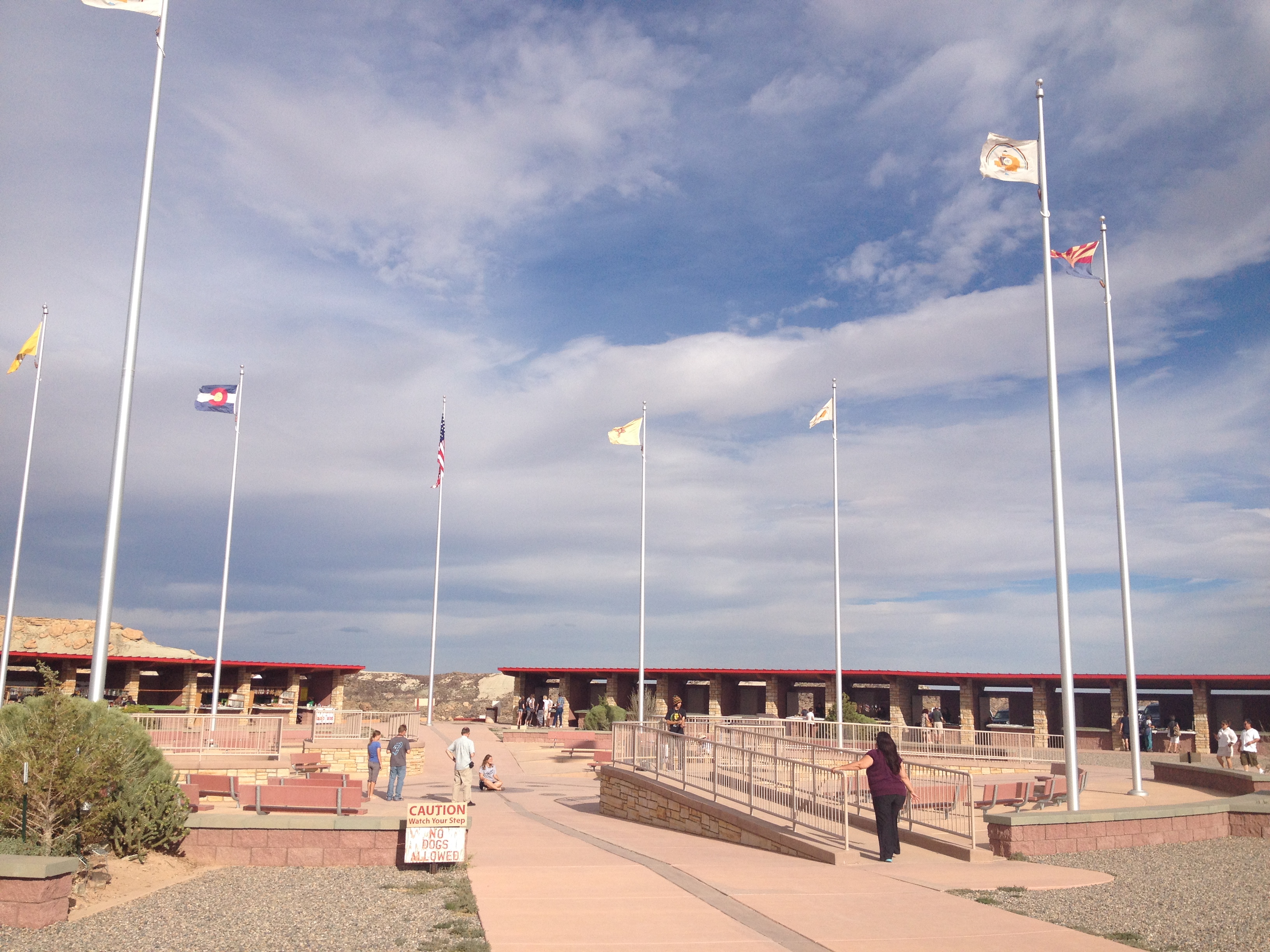
Arizona is the third most recent state to join the Union.  The only two states admitted more recently are Alaska and Hawaii.  This means that, when it comes to mainland U.S.A., this very much was the “final frontier”, an area that remained wild and unsettled for over a century while areas were being converted from frontier, to small villages, and eventually into powerhouses connected by networks of trails, ports, and railroads.

img_7422

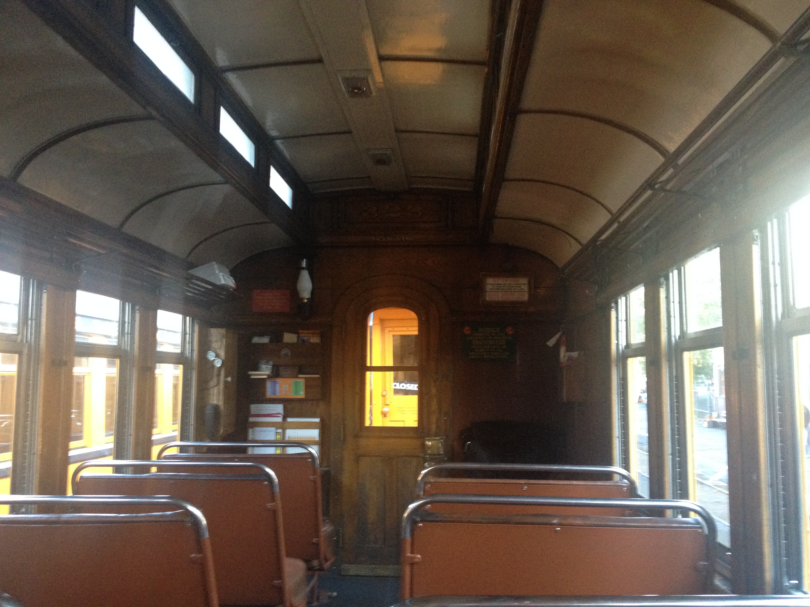
The primary cultural image of Arizona is the “Old West”.  Cowboys roaming around wide open spaces.  Small isolated towns where outlaws and town sheriffs fight a continuous battle that resembles the internal conflict we all have between the innate desire for freedom and the desire for justice and order.  Crazy games of poker in whiskey salons that often end in guns being drawn.

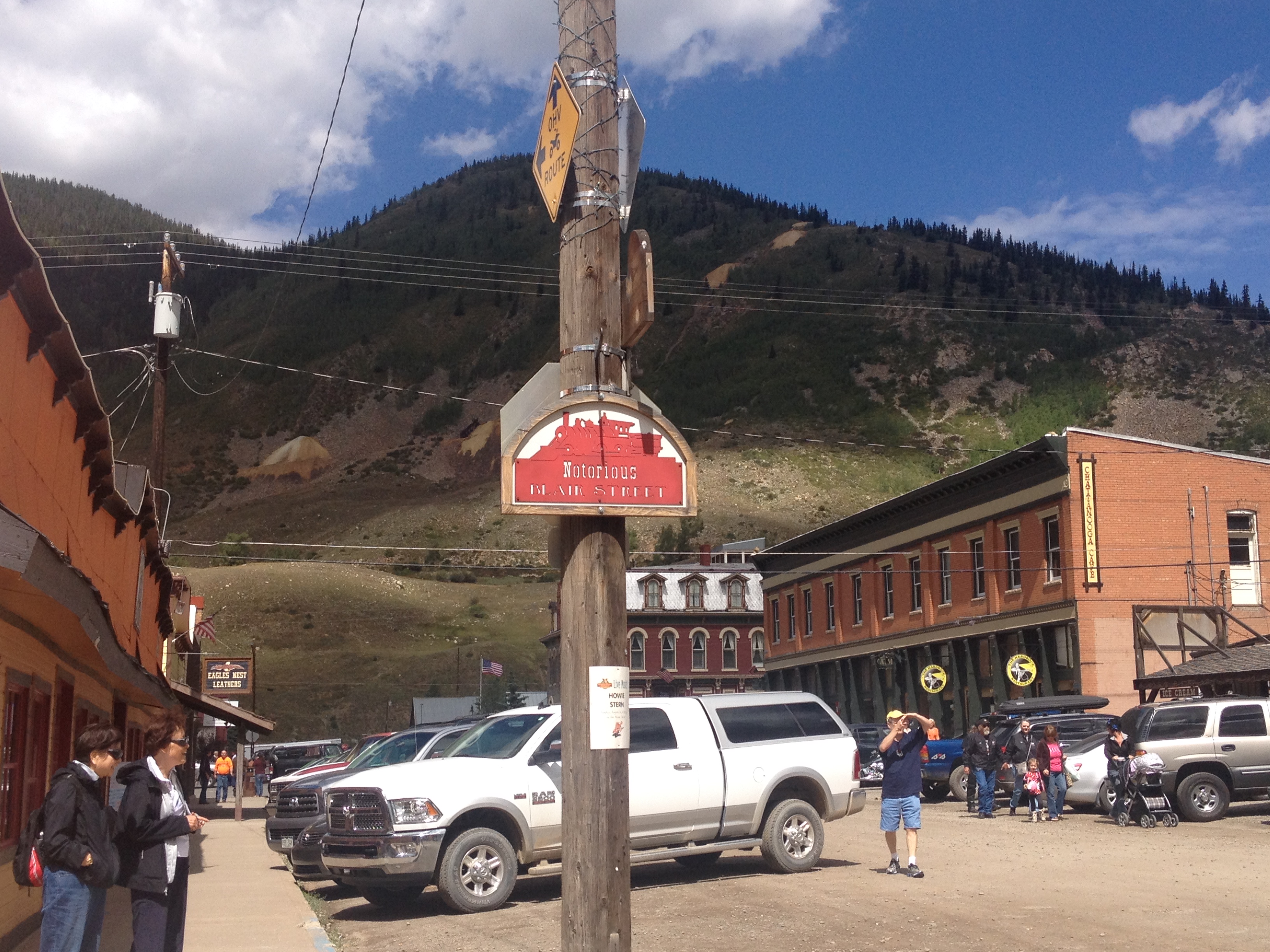
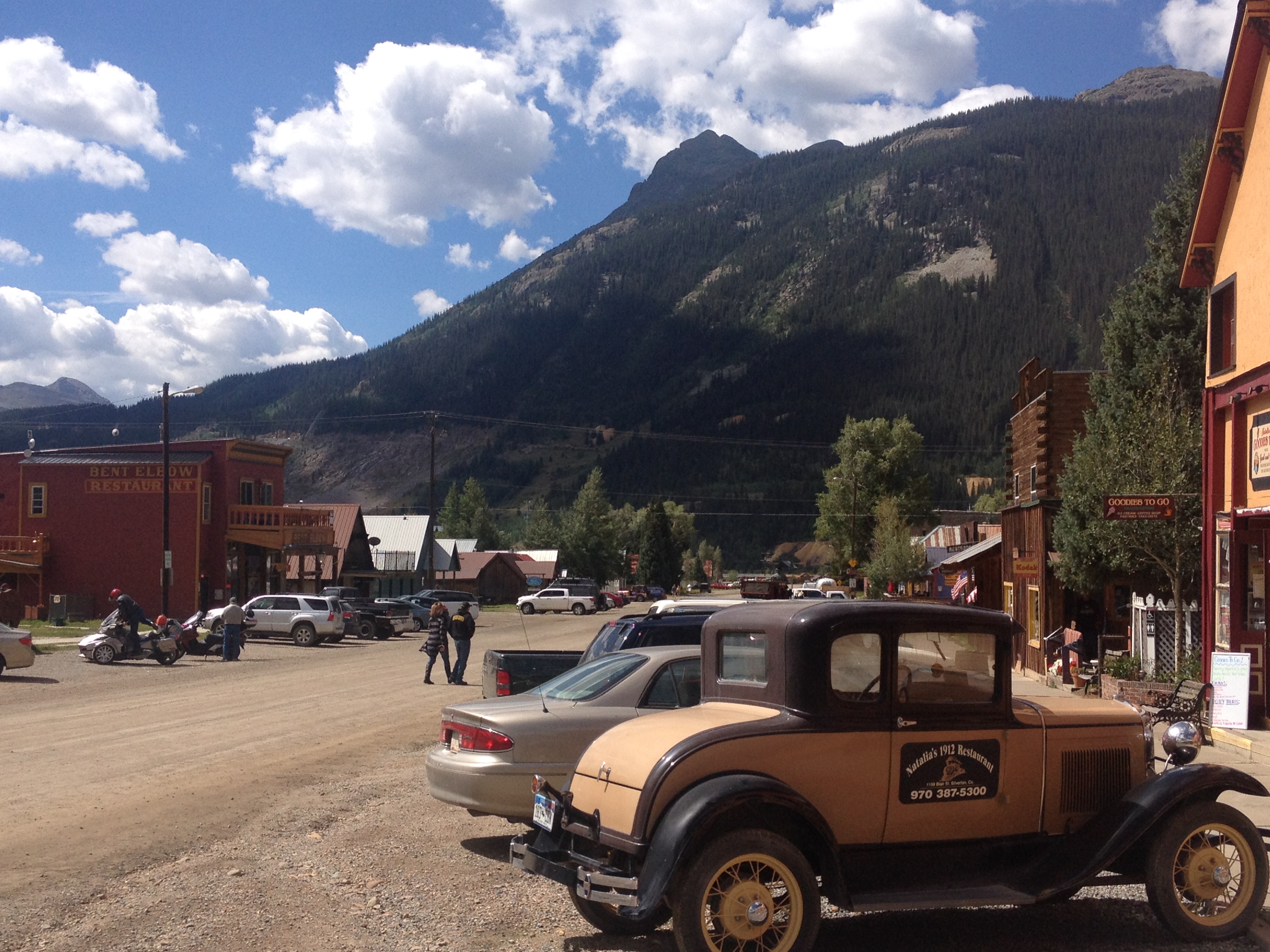
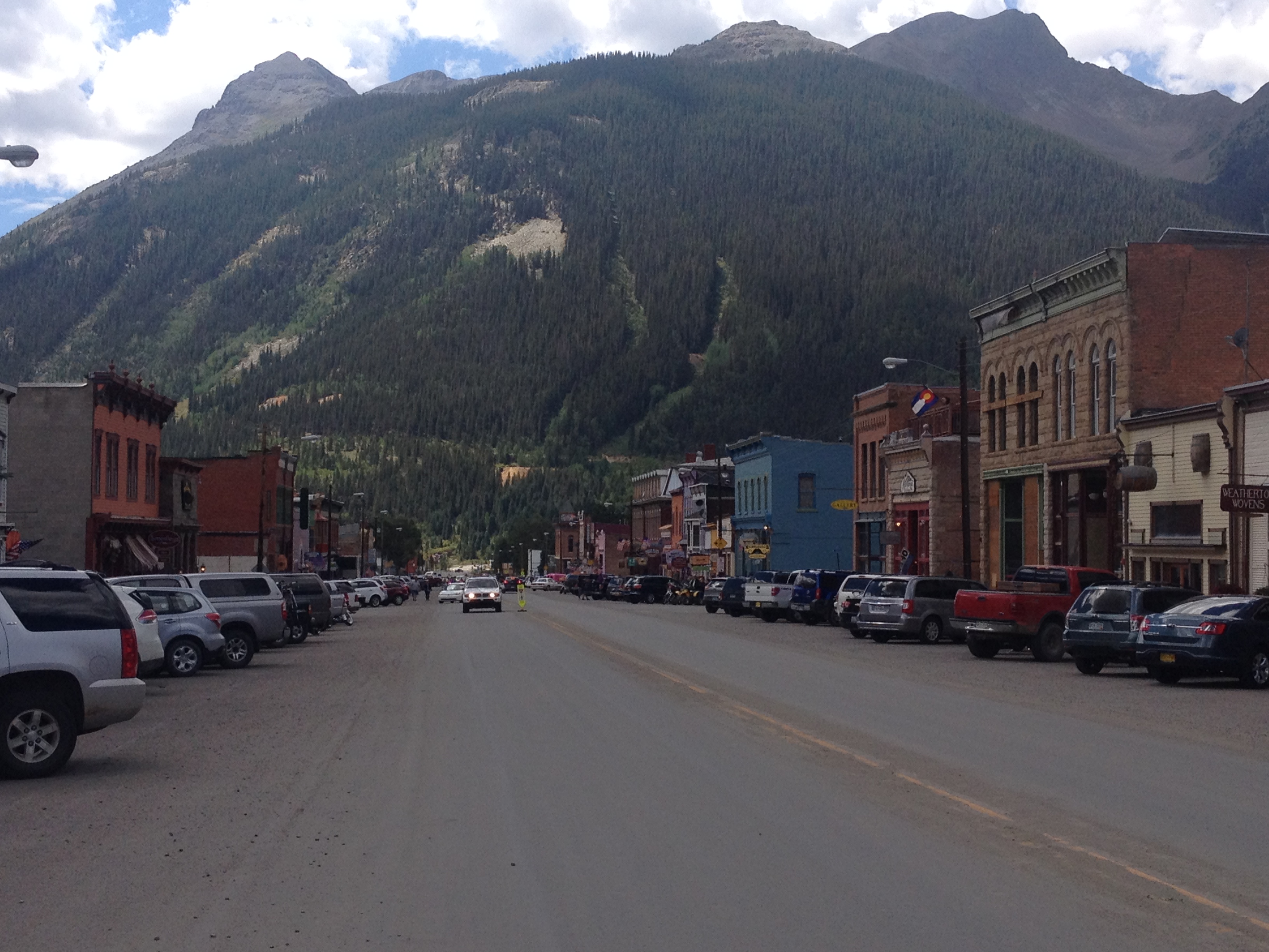
Historically, it is correct that Arizona, like much of the west, is the site of many epic battles that often lead to gunfire.  This lead to places such as Tombstone, and Rawhide, being depicted in numerous Western themed movies and TV shows.  Tourists today can relive the experience of the wide open, unsettled, west by visiting these places.

However, movies and TV shows can frequently lead people to inaccurate perceptions.  Films and shows are designed for entertainment purposes, and therefore must focus on the interesting aspects of life in a specific place, like a shoot-out between two gangs.  Anyone that compares their lives to those of characters from TV and movies will often come out feeling that their life is uninteresting.  After all, no movie will show someone sitting at a cubicle for six hours, or doing laundry and ironing shirts.  They focus on the parts that will, well, entertain the people that watch them.

Recent studies have indicated that, while these high profile gunfights did occur in the old west, they were the exception rather than the rule.  Some studies (although not all) have even suggested that the western frontier of the later 19th century was actually a safer place than America today.  There is speculation as to why the “Old West” is depicted and thought of in the manner in which it is, leading some to entertain conspiracy theories.  Regardless of what the reality of what life in this time and place know as the “Old West” was truly like, it is encouraging to see people look at it statistically, as opposed to based on anecdotes and catch phrases.

IMG_7415.jpg

Arizona may have grown up late, but it grew up fast.  Based on the 2010 census, Arizona is now the fourth most populous state west of the Mississippi River.

IMG_7420.jpg

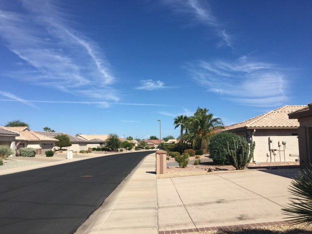
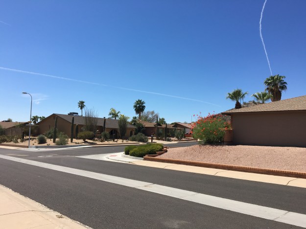
Growing up in the middle to late 20th century, Arizona grew up in a manner that is very car-centric.  Depictions of present day Arizona life, in movies like Bad Santa, commonly show life in car-centic suburbs, with winding subdivisions, malls and such.

img_7443

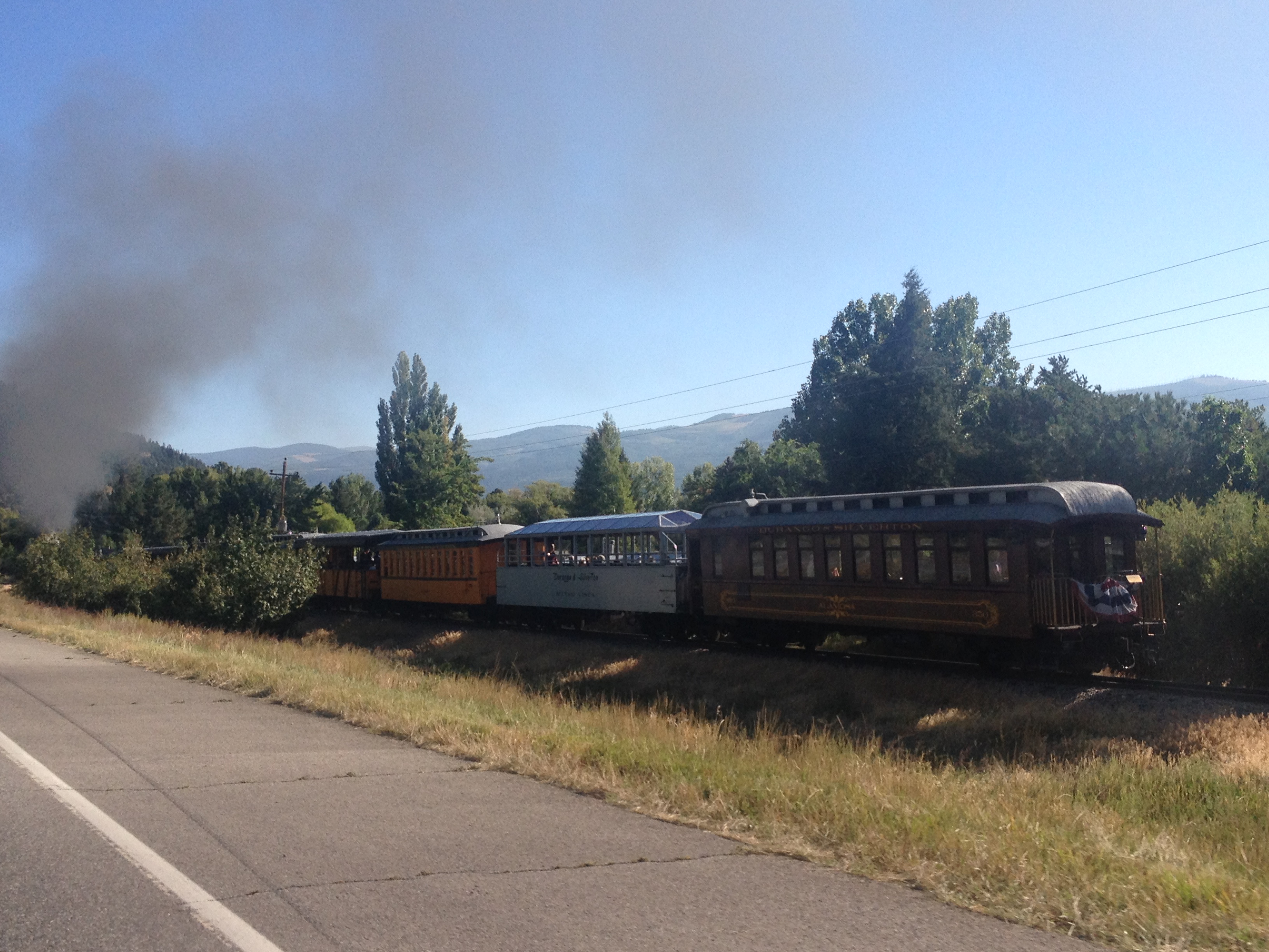
There is also no forgetting Arizona’s position along the famed Route 66, which took countless motorists between Chicago and Los Angeles during the middle part of the 20th century.  In popular culture, the Arizona stretch of this major historic thoroughfare is amongst the most celebrated, providing the inspiration for the setting of the Route 66 based movie Cars.

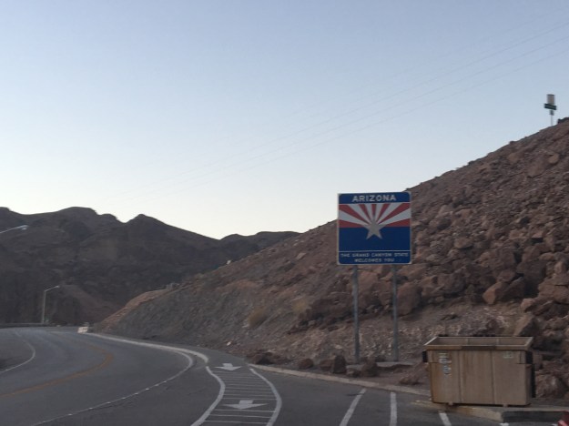
The most high profile destination in Arizona is the Grand Canyon.  After all, the state’s nickname, which is labelled on all Arizona license plates is “The Grand Canyon State”.  However, by taking a road trip from Phoenix to Las Vegas, one will traverse the landscapes that cover a much larger portion of the State.

Passing through the Sonoran Desert, which includes Phoenix and much of the surrounding  area, one will encounter hills covered in sagebrush and cactus plants.

img_7441

Periodically, one will also encountered Joshua Trees, mountain ranges, and mesas.

IMG_7429.jpg

img_7431

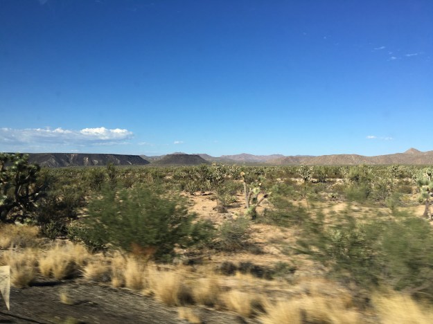
Closer to Vegas, the landscape transitions to the Mojave Desert, which is sometimes even hotter, drier, and more baren than the Sonoran.

img_7447img_7450

Two developments made Arizona’s rapid expansion in population possible.  First, is the much discussed invention of, and subsequent proliferation of air conditioning.  This, of course, made living in places prone to hot weather more desirable.  The second is the creation of dams, canals, irrigation systems, and water pipelines, which facilitated supplying these dry regions with the water resources needed to sustain life.

IMG_7475.jpg

The Hoover Dam, located at the border of Arizona and Nevada, is one of many places throughout the west that diverts water resources from a major river (the Colorado River) to major metropolitan areas.


As is the case with the idealized image of the rugged individual of the “Old West”, present day life in Arizona, when discussed, elicits some divided responses, as well as some different interpretations.

img_7411

This is very much the image of standard life in Arizona.  A house in suburban looking neighborhood, a pool in the backyard, mountains, and, in many cases, golf.  Some love it.  Some see it as the natural culmination of the “American Dream”.  Some can’t wait to get away from the frigid winters many experienced in other parts of the country, move down here and enjoy the life.  Others, and particularly those concerned with the environment, feel it is irresponsible for so many people to be living comfortable lifestyles, with swimming pools, irrigated lawns, and golf courses in a climate this dry.  People here seem to adhere to the “haters gonna hate” mentality.  The knowledge that people in some distant land are disapproving of their living, eating, hiking, and golfing in the desert does not seem to phase them.

IMG_7413.jpg


Glenwood Springs: Where Canyon Country Begins

IMG_0014.jpg

When people think of the American West, certain images often come to mind:  the unique natural features of Yellowstone.  Iconic mountains that tower over the nearby landscape, such Rainier and Hood.  The canyons that carve through the American Southwest, creating popular destinations such as the Grand Canyon.

The Grand Canyon is not the only canyon of the American West.  In fact, it is not the only canyon carved out by the Colorado River, the continent’s fifth longest running river.  The river, has its source at Rocky Mountain National Park and snakes through the west carving out  numerous canyons.  In fact, there are some that believe that the canyon in Southern Utah that was flooded when Glen Canyon Dam was built, a couple of hundred miles upstream of the Grand Canyon, was even more scenic than the Grand Canyon itself (some are even looking to remove the dam despite the Wests water needs).

An overly simplified model of Colorado’s geography, is that of the three flavored boxes Neapolitan Ice Cream.  Colorado’s three sections are the Plains, the Central Rockies, and a region generally referred to as the Western Slope.  While the Western Slope is officially defined as anywhere west of the Continental Divide, culturally, we tend to think of it as west of Ski Country, which also happens to coincide with where canyon country begins.

Glenwood_20160725

On the above map, the two yellow stars are Denver, where the Plains end and the Central Rockies begin, and Glenwood Springs, where, traveling west the terrain transitions from tall peaks to canyons, mesas, and plateaus.

The official reason for the trip to Glenwood this year was whitewater rafting, a group trip that I organize every year, with a different destination each time.

This year, the trip was a little bit later in the season, early July, rather than mid-June.  The later date allowed more of the mountain snowpack to melt, particularly this year, as the period around the fourth of July was quite hot across the state.  As a result, the rapids were not nearly as intense as the previous two years.  However, the trip was not without its moments.  This time, everybody stayed in the raft!

As was the case last year and the year prior (this is the third year of my annual trip), we camped.  We selected a somewhat peculiar place to camp this year, on top of the White River Plateau north of town.

IMG_6664

To get to the Plateau, we had to follow a road called Coffee Pot Road, a bumpy road that rose up out of the Colorado River Valley below us and onto the plateau several thousand feet above it.

IMG_6661.jpg

Here is where I fully came to the realization that I was on the border of two of Colorado’s “stripes”.  Looking east from the campground, in clear view are the tallest peaks of the Central Rockies, the Sawatch Range, which includes Mount Evans, Colorado’s tallest peak.

IMG_6715.jpg

A mere mile to the west of our campsite sits Deep Creek Canyon.  I had no idea this canyon existed.  Deep Creek is a tiny creek, carrying very little water at the time we saw it.  Yet, it manages to carve a 2100 foot deep crevice in the landscape in a manner similar to Black Canyon and other Western Canyons.

IMG_6667IMG_6669

What really made this feel like a peculiar place to camp was the range of temperatures we would experience over the course of the weekend.  We spent the middle part of the day in the valley, first rafting in the Colorado River than in town, all at elevations below 6000 feet.  Daytime temperatures soared well into the 90s!  At night, we returned to our campground, above 10,000 feet in elevation, where nighttime temperatures fell into the upper 40s.  If one were looking to experience comfortable temperatures, it would make sense to do the exact opposite, spending the daytime hours at higher elevations where it is cooler and then returning to the valley at night.

IMG_6682

The town of Glenwood Springs is a touristy town.  Everyone around, from the rafting instructors to the bus drivers describe it as such.  However, it is touristy in a different way than some other places I’ve visited.  I didn’t see 50 ice cream shops like I do in South Haven, MI.  I did not see anything like Ripley’s Believe it Not or the other places I see at the Wisconsin Dells.  And, I certainly didn’t see 150 T-shirt shops as I do when I visit Cooperstown.  It seemed like more bars and restaurants than anything else here.  And, of course, one of Glenwood’s other main draws, the hot springs.

IMG_6683

Maybe Glenwood’s tourism industry is simply trying to accommodate a different mix of people than those other places, or maybe they are simply trying to stay true to their own unique identity.  After all, there are a lot of activities in the area, and a lot of reasons for people to visit.

IMG_6680.jpg

Just east of town, is the area known as Glenwood Canyon.  Due to the narrowness of this valley, there are sections of I-70 where the speed limit drops to 50 miles per hour, the westbound lanes are stacked on top of the eastbound lanes, and parts of the highway are tunneled underneath rock that goes right up to the River.

IMG_6684

It is in this canyon, several miles east of town, where Glenwood’s signature hike, Hanging Lake Trail draws so many tourists, that the parking lot is commonly full.  In fact, both Friday and Saturday, highway signage indicated that this lot was full anytime we drove by it.  We were able to get parking spots in the later part of the afternoon, around half past four, after the rafting trip, and lunch in town.

Hanging Lake is a short but challenging trail.  Only 1.2 miles long, it climbs 1200 feet in elevation.  This, both made sense and surprised me at the same time.  Being in a canyon, I knew that any hike in the area would be steep, and this one sure had its steep parts.  What surprised me was, how far up the canyon hanging lake is.

IMG_6691

I had seen pictures of this lake before, and knew the trail was short, I just pictured it being much shorter and much closer to the bottom of the canyon.

The trail was crowded, which should not be surprising, given that the parking lot was still almost completely full when we arrived.  What surprised me was the ethnic diversity of the crowd hiking this trail.  On the way up to hanging lake, which probably took a little over 30 minutes, I heard people speaking all sorts of different languages!  I enjoyed seeing so many different kinds of people enjoying scenery, nature, and, as I speculate, a weekend away from it all.

There is only one area attraction I did not get to, the Glenwood Caverns Adventure Park.  It’s hard to get to everything on a short weekend trip.  I guess there is still a lot more for me to see here in Glenwood, where Westbound travelers leave the high peaks of the Central Rockies and enter the land of deep canyons.


Exploring New Mexico

IMG_5660 (1).jpg
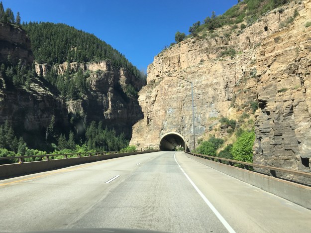
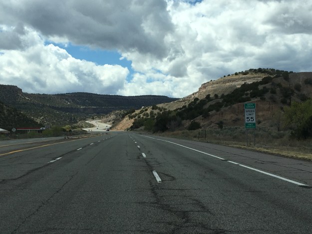
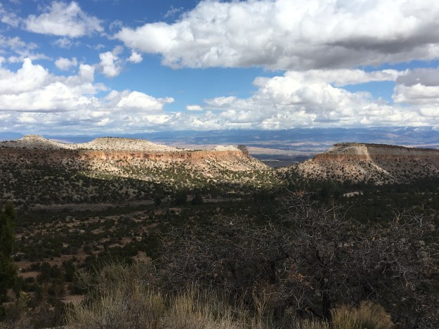
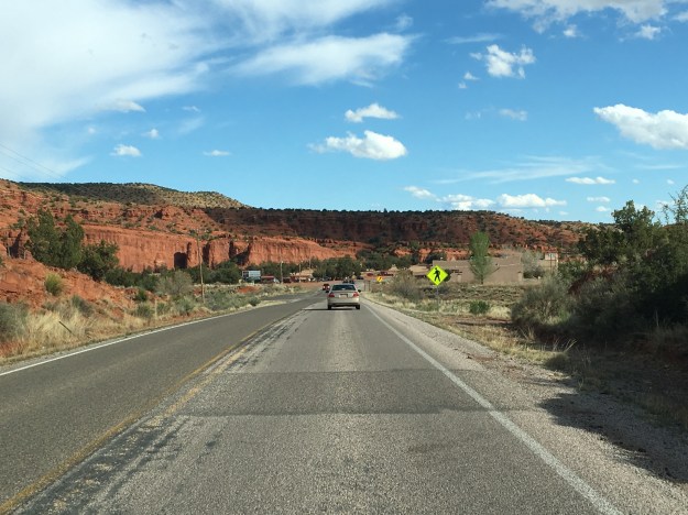
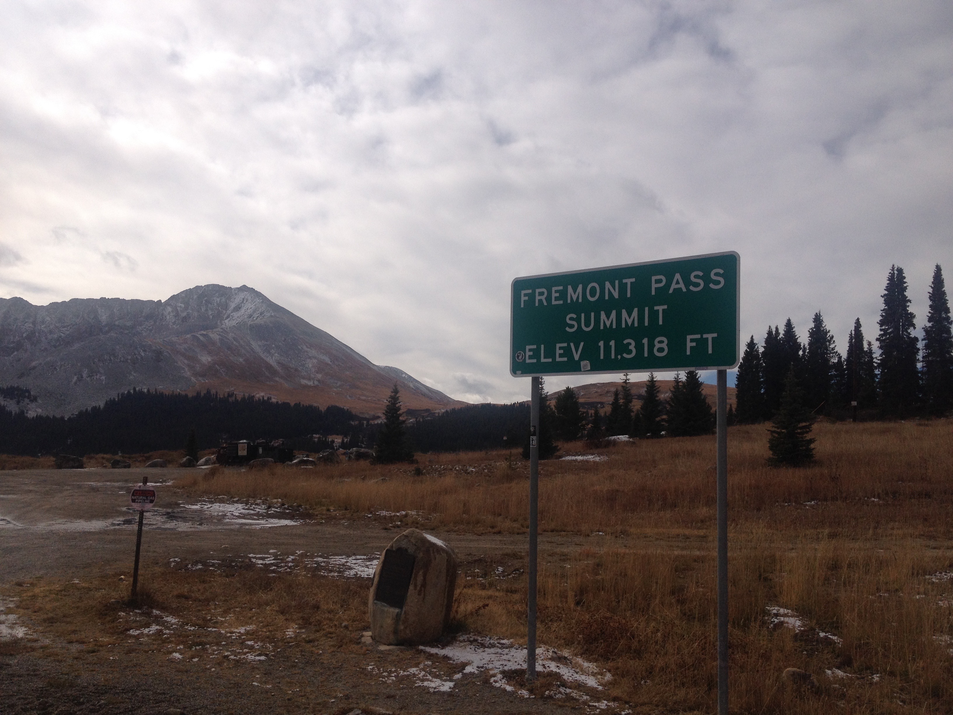
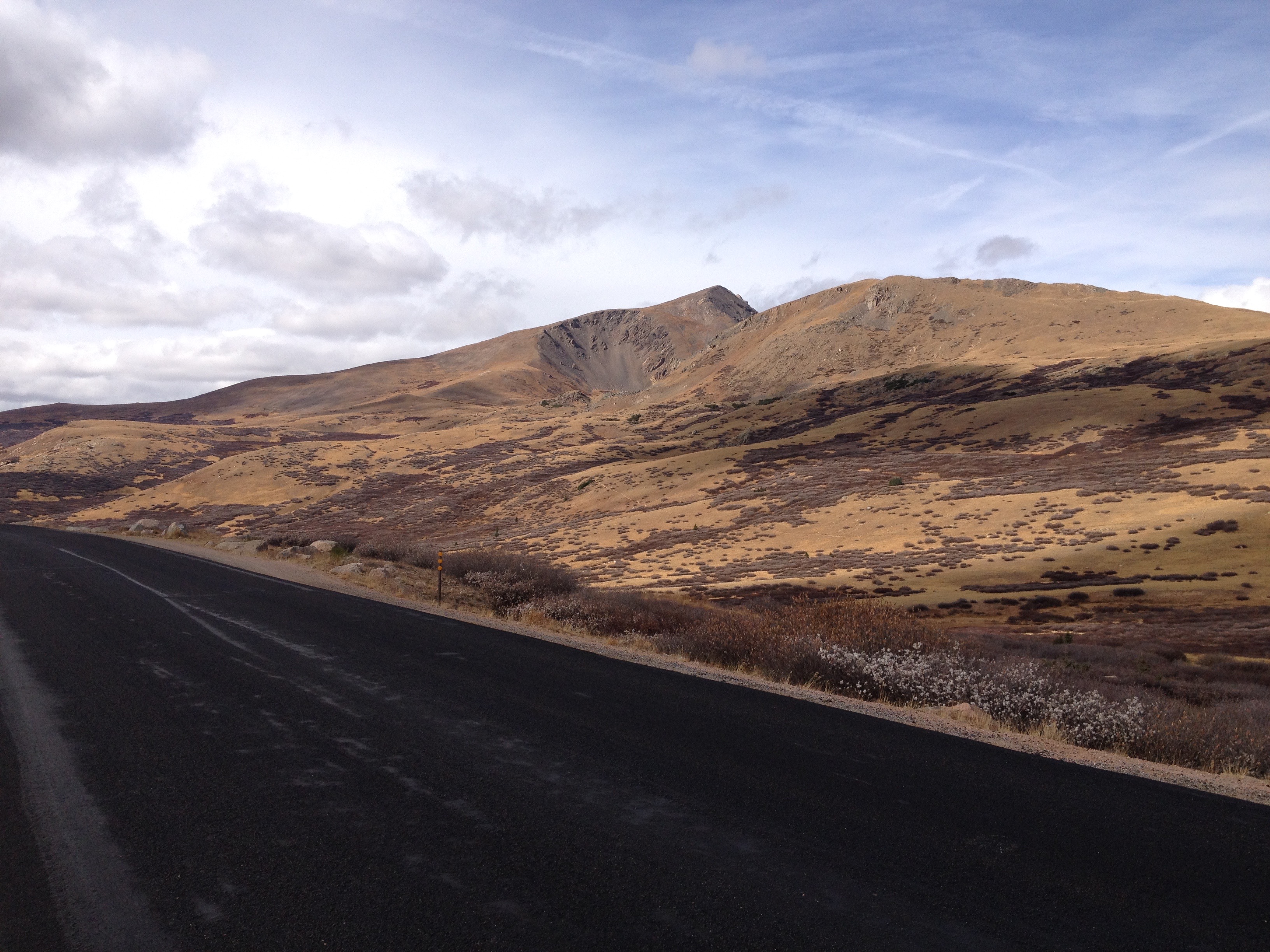
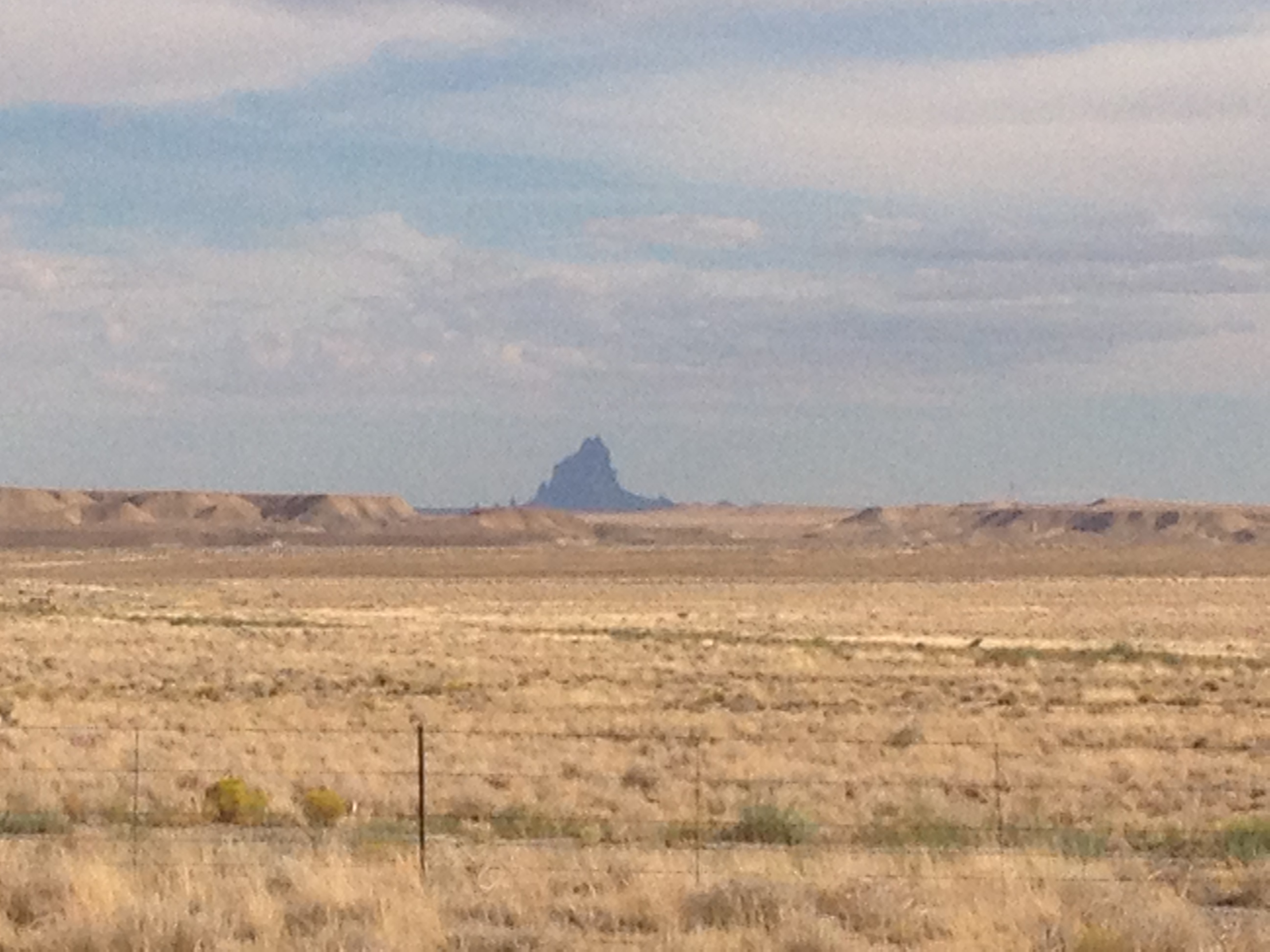
The northbound journey out of Santa Fe, along highway 84 towards Pojoaque, and Espanola could not possibly feel any more Southwestern.  Rolling hills are covered with bushes and sagebrush.  There are some trees here, but unlike in the East, their impact on the wide open landscape is minimal.  They are but mere dots, small points in a panoramic image that shows off the entirety of the landscape of the region, stretching for miles and miles.  As a consequence, mountain ranges can be seen in the distance in multiple directions.

IMG_5662 (1).jpg

Artwork depicting the culture of the American Southwest can be seen quite frequently along this entire stretch of highway, on roadside decorations, bridges, and even buildings in the distance.  There is something about sculptures and murals like these that invariantly make me think of the Southwest, even when I am in a completely different region.  The use of colors in particular are reminiscent of this region, warm and dry but still American.  The colors are warm, reds, oranges, browns.  Even when they use “cool” colors, like green and blue, these murals somehow find a way to make these colors feel warmer than they typically do in other drawings and signage.

I wonder, as much of the artwork of the region originated with the Native tribes that thrived in the area roughly a millennium ago, if the styles that came to be predominant in this region are a mere reflection of the manner in which the landscape, and climate, impact the human psyche.  And, is this an aspect of human nature that transcends culture?  Did the Spanish, and White and Hispanic people who would later inhabit the region adopt similar artistic styles because they were responding to the same conditions around them and reflecting them in a similar manner?

The reason I was headed in this direction out of Santa Fe, other than just merely to explore, which I do believe is a reasonable pursuit in of itself, was the desire to see one of the most significant, but also confusing places in the United States; Los Alamos.  Los Alamos is a place where some of the top scientists in the world came together during World War 2 in order to build the nuclear weapons that eventually ended the war.

Of course, at the time, it wasn’t the Japanese, but the Germans who were the main subject of concern. It was rumored that the Nazis were building this capability, which could have significantly altered the course of the war.  The Manhattan Project was both highly secretive (Americans were largely unaware this was going on at the time), and quite controversial, as it still is today.

IMG_5665.jpg

The entire area has a feel that continues to reflect how Los Alamos came about.  Headed towards town, on highway 502 West from Pojoaque, road signs indicate that the stretch of highway is a “safety corridor”.  What does that even mean?  I have never seen this before.  Anywhere else, this road would have a higher speed limit, less fines, and would likely not have three lanes in each direction.  Something must be going on here.  But, is it still going on?  If so, what?  And, how much of a secret is it?

IMG_5668.jpg

The truth is, Los Alamos is a place like no other place on earth, and like the rest of New Mexico, cannot be placed in a specific category.  It is, indeed, a place where discoveries are made.  But, unlike many other towns with major labs, and I am particularly thinking of Boulder, Colorado, which is near my home, it does not appear laid back at all.  After parking, I had an intense experience crossing the street to get to the Bradbury Science Museum.  This crosswalk had a walk/ don’t walk voice command that spoke words with a level of urgency that appeared to highlight the National Security and wartime origins of this town.  It felt as if 70 years later, the mindset had never really changed from its wartime heritage.  Or, in the very least, the town had kept its infrastructure, which was built specifically for time of extremely heightened security.

IMG_5669

The Bradbury Museum is quite well done, and for those traveling on a budget, is free.

I’d say slightly over half of the museums exhibits focus on the Manhattan Project, the A-Bomb and the original history of the laboratory.  However, the laboratory is operational, and has been involved in some high caliber research over the last 70 years, in areas such as cancer detection, energy conservation, and wildfire prevention.  It is amazing to think, the same place, the same people, the same lab, and the same knowledge base was used both to create the most destructive item on the face of the earth, nuclear weapons, but also to advance humanity and help countless people better their lives!

IMG_5667.jpg

One of the reasons Los Alamos was selected as the location for this top secret lab, was that it had to attract top scientists, many of the young at the time, to a project that likely meant years in seclusion.  While these young scientists would not have the benefits of urban nightlife, for Los Alamos, and the laboratory, they found an area with plenty of opportunity for outdoor activities.  The volume of hiking trails throughout Los Alamos County (a relatively small county) reflects this history.

IMG_5677 (1).jpg

Just West of town, and the lab, is a large area known as the Santa Fe National Forest.  This National Forest, in many ways resembles the National Forests that can be found throughout Colorado.  In fact, I can picture many of the same activities, backpacking, camping, and with the Jemez River, water activities such as fishing and boating.

IMG_5680 (1)IMG_5681

The main difference I felt, between here and many of the forested areas of Colorado I regularly frequent for hikes and such, is that this area seemed significantly less crowded- emptier.

Along highway 4, the main road through the forest, there is one area hot spot, a unique natural feature known as the Soda Dam, a waterfall the flows between a rock along the Jemez River.

IMG_5682 (1).jpg

Not only does this area feature a waterfall unlike any other place on earth, but there are geothermal features that make this river a popular pseudo hot spring.  I say pseudo- hot spring, as the water is not really hot, as it is in some areas where water temperatures resemble that of a hot tub.  It is just simply warmer than you would expect it to be given its high altitude origins.  It was warm enough that people were able to comfortably swim in it.

IMG_5685.jpg

It is an area that is just simply peaceful and panoramic, the kind of place where one can simply turn off the wheels that churn in their heads as a result of everyday life, and just sit, swim, float, or fish, gazing in the distance at the majesty of the region.  Two weeks later, I still gaze at this very photograph and feel as if I am entering a much more peaceful state of mind.  I almost need to place it in front of my desk, as a stress reliever.

IMG_5686 (1).jpg

The entire west is full of areas like this, where, due to unique geological history, the rocks take on a reddish color.  This is the color that many associated with the American Southwest.  Although most of Central New Mexico is much browner, especially in April, a section of bright red suddenly appears at the South end of Santa Fe National Forest, along highway 4, at the border of Jemez Pueblo, yet another Native American village.

The day ended with a final drive down highway 550 towards Albuquerque, where the Sandia Mountains, largely to the City’s Northeast, drew gradually closer as the drive progressed.

IMG_5688 (1).jpg

Thinking about all of the beautiful places I saw over the course of the day, my main regret is spending too much of the day in the car, and not being able to stop, hike, float, walk around, and just get immerced in area.  As a travel enthusiast who unfortunately has responsibilities at home, it is all too easy to get into the trap of planning too many activities for too short of a period of time.  This often makes travel feel rushed, like there is too little time to experience some of the places we see.  Luckily, I live in Colorado, and therefore can get similar experiences, National Forest recreation areas and such, closer to home.  But, there are some subtle differences, and things that make this area unique.  I would very much like to come back here at a much more relaxed pace, and experience another side of New Mexico life.


Road Trip to Santa Fe

IMG_5623.jpg

I spent about half a decade working in the Insurance Industry, an industry with a significant presence in Bermuda.  At workshops, conferences, and in meetings, I would regularly interact with people who lived there.  The place certainly has its draw, and with the right opportunity, a person with experience in the industry could make a really good life there, despite the high cost of living.

I often imagine what it would be like to have a totally different life, in a totally different place, particularly when traveling, or when I meet someone from somewhere far away.  While working in the insurance industry, although I never seriously considered up and moving to Bermuda, I did imagine what it would be like a couple of dozen times.  Each time I imagined it, I would always end up dwelling on the lack of room to roam around there.  The island is only 20.6 square miles, and getting anywhere else requires a flight.  I pictured myself moving there, getting my swimming trunks out, snorkeling, attending a few parties and such, but then, eventually, just getting restless, and missing something I love to do here in mainland U.S.A.; taking a road trip.

There is something I really love about road trips.  When I refer to road trips, I am not talking about simply driving somewhere.  A lot of people drive to work every day, or to a relative’s house every other weekend, and those drives don’t feel like “road trips”.  I’m talking about driving somewhere a significant distance away that is not a routine trip; somewhere that is somewhat unknown.  On road trips, we have somewhat of an idea as to what to expect, based on what we have heard, read, or researched, but we do not know it intimately.  We have not experienced the towns we will pass along the way, which exits have the best deals on gas, and where the best restaurants are.  In other words, there are still some surprises, and we are still going to encounter something unexpected.

IMG_5619

Driving south along I-25, the first indication that one is reaching the Southernmost portion of Colorado is the Spanish Peaks.  While visible farther north, they take prominence south of Pueblo. The Spanish Peaks are nowhere near the tallest features in Southern Colorado.  In fact, within 30 miles or so, there are 5 mountains taller than 14,000 feet (14ers)!  But, since they are relatively isolated from other natural features, and can be seen quite some distance, they are a prominent landmark toady (an entire region is named Spanish Peaks country, as well as the names of countless business in the region), and were a prominent landmark on the old Santa Fe Trail.

Approaching Trinidad, CO, the last town before the New Mexico border, the Spanish Peaks disappear from the horizon as the highway enters a much hillier region approaching Raton Pass.  It is here that the path of Interstate 25 joins with the old Santa Fe Trail, which it will more or less follow for the remainder of the trip to Santa Fe.  This trail was first pioneered by the Spanish and later played a pivotal role in American history including westward expansion, and the eventual conquest of the Southwest from Mexico.

IMG_5622.jpg

I had mixed expectations of Raton Pass.  Many years back, I was on a ten-day storm chase. Our group was situated in Clovis, New Mexico, which is quite close to the Texas-New Mexico border.  We were discussing the possibility of chasing upslope storms roughly an hour northeast of Denver the following day.  Some of us brought up the possibility of driving west to Raton so we can take the Interstate to our target destination, but the group leader balked at the idea, instead suggesting driving up 385, as he felt it might be risky to take a large convoy of chase vehicles over Raton Pass.  We ended up deciding not to drive up to Northeastern Colorado, as, in the morning, the storm outlook had weakened, and we no longer felt it worth the drive.  By the way, this is common on storm chases, you really never know where you will end up going.  However, ever since then, I had kind of wondered what it was like to drive over this pass.

As the photos indicate, the road gets windy as motorists climb from Trinidad, at roughly 6000′ in elevation, over Raton Pass, which tops out at 7834′.  It’s definitely not nearly as rough as heading over the Rocky Mountains along I-70 or I-80, but definitely is a much more major incline than anything a group of people that drives largely in the Great Plains from Texas up to South Dakota would typically experience.

IMG_5626.jpg

Oh, and in one of the strangest of coincidences, the top of the pass is right at the border of Colorado and New Mexico.  This is odd as, first of all, the Colorado-New Mexico border is defined as the 37th parallel, and has nothing to do with where any mountain pass is located, and roads through mountain passes are built to take the safest and most effective route.  The fact that the place where this road crosses the 37th parallel most effectively happens to also be the high point seems to me as a pure coincidence.  Maybe someday I will read into this, the story behind the road and such, but I have yet to do so.

After a descent into Raton, the road reaches a segment that is long, flat, open, and rather empty.

I switched the music on the radio to classic rock, The Clash, Ozzy, Queensryche and such.  For some reason, there is something about the sound of guitar rock that makes more sense while driving through scenery like this than many other forms of music.  As the afternoon passed along this landscape, cloudy skies gave way to peaks from the sun only every once in a while.  A few periods of gentile, chilly rain fell from the skies.  In some ways it reminded me of a storm chase gone horribly wrong, the day slowly but surely slipping away with no prospects of favorable storm conditions developing.  However, in other ways, the drive was relaxing, allowing me to think without any distractions.

After passing through a town called Las Vegas, NM (which I assure you is nothing like the Las Vegas in Nevada), the highway turns West.  It kind of loops the last 60 or so miles into Santa Fe, even heading back northward for the last ten miles, following the route of the old Santa Fe trail.  However, unlike the previous 100 or so miles, this part of the trail, and the drive, is far from flat.

To the right, is the southernmost part of the Sangre de Cristo mountain range, and an area now part of the Santa Fe National Forest.  It is these mountains that the trail routed 19th century pioneers around.  To the left are a series of bluffs which, luckily, the trail did not have to also bypass, as it would have added many more miles to the journey.  The road itself slowly climbs over Glorietta Pass, descending only slightly into New Mexico’s Capitol City- Santa Fe.

Places that Used to Be

IMG_4573

Many different types of images come to mind whenever anyone talks about “ghost towns”.  I think of all of those images of abandoned, and partially decayed buildings that are pictured on the cover of books about ghost towns.  I think of that abandoned cabin you see while on a hike.

IMG_4329

Sometimes I think back to the recently abandoned town in West Texas I passed through a decade ago on a storm chase.  I even think of other, more recently abandoned, “21st Century” ghost towns.  Heck, sometimes parts of Detroit even come to mind.

But something felt creepy when I came across the site of not one, but three towns that used to exist, as recently as the middle part of last century.

IMG_4574 IMG_4575 IMG_4576

I looked around in all directions.  There were no buildings at all, not even one of those rotted out wooden buildings that appears to be on the verge of collapse due to neglect.  I looked far and wide along the valley for some sort of evidence that there were three whole towns in the area as recently as the 1960s.  Maybe an abandoned platform along the tracks.  Or even piles of wood, or rocks.  Nothing!  The only evidence anyone passing along this route would have that there ever was any human civilization in the area is a historical marker that marked what once was the site of the highest masonic lodge in the U.S.A.  It’s creepy enough that these towns appeared to be completely erased out of existence.  But, the only indication that these towns ever actually existed is due to the Masons, a secretive organization that many also find creepy.

Three miles up the road, is Fremont Pass, another place with echos of the past.

IMG_4577 IMG_4578

Fremont Pass, it appears, is home to another “ghost town”, the town of Climax.  Here, I at least found some evidence of this town’s existence.

IMG_4579

This particular location played a significant role in history on two occasions.  As indicated by the historical marker, the Continental Divide is the western boundary of the Louisiana Purchase.  In fact, this very location was an international border from 1803, when the Louisiana Purchase was signed, until 1821, when the Adams-Onis Treaty established slightly different borders between U.S. and Spanish territory.  The border would remain in a somewhat nearby location until the conclusion of the Mexican-American war in 1845.

Later, the Climax Mine would play a pivotal role in the U.S. efforts in both World War 1 and World War 2, as it sits on one of the largest deposits of a little known substance of molybdenum.  To be completely honest, I have no clue what molybdenum is.  All I know is that it is one of those middle elements on the Periodic Table, which, I am guessing is more than the average person knows.

What I did gather, though, was that like the three other ghost towns in the area, this is a place that was significant, actually quite significant, at a point in our history, but now it is basically gone.  In fact, the only real reason I know about Climax is related to one of my other projects.  I recently created an algorithm to calculate seasonal normals at any given point in Colorado for the purpose of planning out activities across this beautiful state.  To develop this algorithm, I needed to find as many reliable weather observation sites in places with different geographical features as possible.  Climax, it turns out, is the site of one of the highest reliable CO-OP weather stations.

IMG_4580

Not only was this weather station particularly helpful in developing that algorithm, it is also a great source of information regarding snowpack conditions at high elevations for the purpose of avalanche forecasting, as well as determining where to hike or snowshoe.  So, although that molybdenum plant re-opened a few years ago, in my world, this weather station is currently Climax’s most significant attribute.

The fact that places both rise and decline in significance is not a new concept.  Places like Egypt and Sumeria formed the cradle of civilization, only to eventually cede that power to other cities and regions.  Similarly, in today’s United States, we are currently seeing places like Texas and Florida gain province, while parts of the Northeast and Midwest decline.

This particular situation is strange though.  When I think of the “Fall of Rome”, for example, I think of a process that occurred over roughly two centuries.  The ghost towns near Freemont Pass were culturally significant a mere half a century ago.  Today, they are all but vanquished from existence.

I am also not accustomed to seeing this process occur over such a small spatial scale outside an urban area.  Most of Colorado is thriving, particularly the mountainous part of Central Colorado.  These three erased towns are only ten miles up the road from Copper Mountain Ski Resort, a resort that is so popular that it one of only three ski resorts to receive its own detailed forecast from OpenSnow (the other two are Steamboat and Vail).

IMG_3204

Roughly ten miles or so in the other direction, is Leadville, a former mining town that also appears to still be doing quite well for itself.

IMG_4581 IMG_4583

When I think this all through rationally, I understand why the civilization left the Fremont Pass area.  The economy was largely driven my one obscure material.  When the price for that one material declined, the entire economy left.  Sometimes, though, it takes some time for information to process through the logical mind.  My gut reaction was still one of disbelief, as it still definitely feels strange to see a set of towns decline so quickly to the point of non-existance in a region that as popular and ascendent as Central Colorado.

An Eerie Feeling on Guanella Pass

IMG_4557

Those that love to travel, whether they be the rare few, the people who get to travel for a living, or those who find a way to travel as much as possible, understand that Planet Earth is full of amazing places!  One of the things that makes traveling interesting is the wide variety of types of places to visit, all of which will produce different scenery, and different experiences.  It is nearly impossible to describe or capture the true range of experiences one could theoretically attain through travel, but the Discovery Channel’s Planet Earth Series does a pretty good job.

When people come to visit me here in Denver, I typically take them, in some capacity, into the mountains.  I will particularly ensure that a trip to the mountains gets on the agenda if I get visitors from places like Chicago, which couldn’t be further from any kind of mountain range.  After all, one of the reasons we travel is to see things we do not typically see.  From Denver, it doesn’t typically take too long to get somewhere spectacular.  About half an hour west of downtown, there is a segment of I-70 where the full prominence of the Central Rocky Mountains suddenly appears in quite spectacular fashion.  I remember being amazed by the view that pops out in front of me the first time I traveled up I-70.  Many photographs have been taken from this location, and it was even noted as a point of interest at the History Colorado Center.

IMG_4567

Now that I have lived in Denver for over three years, a short excursion into the mountains typically takes me to a place I have already been, sometimes even a place I have been numerous times.  However, as is noted by the Planet Earth video series, these places often look quite different during different seasons.  Those that visit Colorado in the winter or spring will see mountains covered with snow.  This view, from I-70 near Genesee, will look significantly different, likely in just a few weeks.

October is sometimes a tricky time of year to determine activities in Colorado’s Rocky Mountains.  It is that transition season where often times conditions are no longer favorable for summer activities (and many of the seasonal roads have already closed for the season), but a significant snowpack has yet to develop.  This fall has been anomalously warm here in Colorado, and the extent of the snowpack that has developed in the mountains appears in this picture below.

IMG_4566

However, according to the National Operational Hydrologic Remote Sensing Center (NOHRSC), by mid-late October, the typical snowpack over the high terrain of the Central Rocky Mountains is still less than a foot (and not consistent year to year).

SnowDepth_Departure_20151008

This map displays snow depth anomalies for Sunday, October 18th according to the NOHRSC.  The actual snow depth, across the entire region, was zero.  The anomalies show just how far below normal this is, which, in the highest terrain on this map, falls into the 4 to 8 inch range, indicating that even at locations above 14,000 feet, there is typically not too much snowpack by mid-October.

Knowing that most seasonal roads would still be open due to the lack of snow, but with somewhat limited time for an excursion into the mountains, we opted to take a trip over Guanella Pass, which is still less than an hour’s drive from Denver.  Despite having been there several times, the experience for me was already new, as a new paved road had just been built, connecting the town of Grant, along highway 285, with Georgetown, along I-70.  This new road is likely to get mixed reactions, as traveling along it is now much easier (and now possible without AWD).  However, there are sections of this pass that are popular among campers, particularly people looking for a quiet camping experience.  On Sunday’s excursion, I encountered several groups of motorcycles.  The prevalence of motorcycles, and the noise they make, could possibly make some of the Guanella Pass campers seek a more remote experience elsewhere.

Without having to focus on driving over rocks and bumps, I noticed places I simply did not notice on previous drives up Guanella Pass, like this waterfall.

IMG_4556

However, that was not the full extent of the new experience I had on Sunday.  The final approach to the summit took me above the tree line, where I suddenly got an eerie feeling from what was around me.

IMG_4558 IMG_4560 IMG_4563

It’s hard to describe.  It felt almost like I was on another planet.  It was isolated.  Most of the time that we stopped at the summit, we were the only ones there, and my car was the only one on the road.  The sagebrush of the alpine tundra had taken on brown color that I am not accustomed to seeing.  Some combination of the sun angle, unusual ground color, and isolation definitely gave me a really strange feeling.  It was eerie, creepy, out of this world, I really did not know what to make of it.  It was just, well, strange.

However, I came back feeling glad that different seasons can create different experiences out of the same places.  Typically, when I make the trek up to elevations just above the tree line, there is one of two experiences.

IMG_2911 IMG_4245

The alpine tundra is white in winter (and often still white well into the springtime), and green and lush in the summer.  In October, though, it took on a whole new color, one I had not seen before.

This planet has plenty of places that are unique, unlike any other place on earth.  Some of them even feel out of this world.  Sunday’s experience at Guanella Pass reminded me of two things.  A lot of these unique experiences that we plan trips to get to are seasonally dependent.  And, sometimes these experiences can happen unexpectedly.

Saying Goodbye to a Travel Partner

This week, it is with great sadness that I say goodbye to a travel partner that has been with me for over a decade; my 1997 Chevrolet Malibu.  After showing signs of weakness for several years, it’s performance just recently started declining rapidly, to the point where it can no longer be driven with any degree of confidence.  At its age, it would be quite difficult to justify spending any more money on repairs.  After holding on to this vehicle, potentially longer than I should have, it is finally time to say goodbye, and time to move on.

IMG_2674

To some people, a car is just a car.  It is just simply a tool for one to get from place to place, just like any of the other pieces of machinery they own.  Obviously, those that lease new cars every three years do not get attached to their vehicles, preferring to always have the latest in technology.  And, there is no clear reason to have any kind of emotional attachment to a mechanical object with no thoughts or emotions of its own.

However, as someone who loves to travel (and is addicted to being in motion), I cannot help but be extremely sad to know that I have taken my last drive inside this vehicle.  The feeling of being inside this car, and being behind the wheel is one that I had become so accustomed to, it almost felt like second nature.  For some time, it felt like a place I really belonged, and there was definitely a year or two in there when I felt more at home inside this car than the places where I actually lived.

When I purchased this vehicle, I was still in college, and longing for the independence associated with having a car of my own that I can drive at will, at any time I wish, and to any place I wish.  Like any guy that has not turned 21 yet (and even many who have), I thought that having my own car would make me more interesting, more popular, and more desirable.  I had somehow thought that having my own car would help fill one of the missing pieces of my life.

The year before I bought my own car, I had been using many different cars to get places.  Some belonged to family members, some belonged to friends at college.  But, all were different.  None were mine.  I did not really become particularly accustomed to the specific dimensions, specific quirks, and optimal use of any of those vehicles.  That, of course, changed when I bought my first car.  It was my first major purchase as a young adult.  For the first time in my life, I could call something major my own!

In a way, the story of my first car is the story of my own coming of age.  However, coming of age also means a fairly rapid rate of change and significant turmoil.  Most young adults experience a significant amount of turmoil in their lives as they go through college, start their careers, try to establish themselves as adults, and determine kind of person they were destined to be.

My vehicle saw me through the transition to graduate school, several career related disappointments (or setbacks), numerous relationship related fumbles, lots of really crazy travel, lots of adventures, and even some lewd behaviors I am not proud of.  It was also the setting of some of the more significant discussions I had with trusted friends, in which we would attempt to navigate some of the situations that puzzle young adults, and ponder our futures as they were unfolding in front of us.

Traveling not only provides adventures, stories, places to be, things to do, and ways in which to see the people I care about, and take part in activities I love, but it also provides an outlet.  Often when I feel frustrated, disappointed, or short-changed by life, I just need to go somewhere, get a change of scenery, and get a fresh perspective.  I did a significant amount of traveling well before I decided to start writing this blog, and took some major road trips.  In a way, I did exactly as the commercials at the time told me, I saw the U.S.A. in my Chevrolet.

I knew this day would eventually come.  In fact, it came significantly later than I had expected.  Over the years, I became increasingly interested in bicycling, and subsequently moved to the City of Chicago, where significantly less miles are driven in day-to-day life.  So, despite my car being 17 years old, it reached 150,000 miles only a few months ago (now at 151K).

IMG_2111

Still, as I struggled to get this car started for it’s last spin, I felt a sadness that was tough to explain.  I’d look at the car, and think of all of these memories, all that I had done, all that I had gone through, and how my years of coming of age shaped me into who I am, for better or for worse.

Life should never stop being an adventure.  I shared many of my adventures in the Midwest with my Mailbu.  There was no better car for all of those nights cruising on Dundee Road, those days passing people on the right on the Chicago Skyway, racing down I-65, or looking for tornadoes in Iowa.  Now that I live in Colorado, I am having completely different kinds of adventures.  And, although I am sad to have lost a travel partner that suited me well for a long time, I have been provided with an opportunity to find a new travel partner that is quite suited for the adventures I am destined to have in this part of the world.

IMG_2676

This morning I purchased a brand new Mazda CX-5, which may just be my travel partner for the next decade to come (or more).  With high clearance and all wheel drive, it is well suited for the State of Colorado.  With a little more pep to the engine than many of the other vehicles in it’s class, it also suits who I am.

Maybe these vehicles are just simply vehicles, inanimate objects built by humans.  Or maybe I had a loyal travel companion that selflessly determined that it had become time to step aside for another- one that suits where I now am a bit better.


Welcome to Fall

IMG_2656

Although the weather in many places in the country is still quite warm, the fall season is upon us.  Along with it comes all of the things associated with fall; shorter days, football games, all sorts of stuff made out of pumpkin, and, of course the fall colors.

For many, fall’s best feature is the colors that arrive as some species of trees make the necessary preparations for the coming winter season.  The Aspen trees at higher elevations in the Rocky Mountains are amongst the first to change colors.  In fact, at elevations near 10,000′, fall colors can even arrive towards the beginning of September.  In the Eastern States, colors will only begin to appear at the end of September in places like Northern Minnesota and the higher terrain in New England.  Most places will see their peak colors in October or Early November.

To view some of these Aspen trees, I headed to Rocky Mountain National Park, which actually has more of these trees than I had previously remembered seeing.  Of course, I had never been there during the fall before today, and probably did not pay enough attention to the tree types on my summer trips.  Like most places in Colorado, there are still more pine trees (and other “evergreen” varieties) than Aspens.  But, there are enough to make large patches of yellow and orange stand out while viewing the park.

IMG_2660 IMG_2664

Also, the colors themselves appeared more vivid here than they did in the places I had previously gone to view fall colors in Colorado.  I found out that this is one of the most popular places in Colorado for viewing fall colors.  This weekend, Estes Park is holding their annual Autumn Gold Festival, indicating that this is indeed the best time of year to search for fall colors in Rocky Mountain National Park.

IMG_2661 IMG_2665

The arrival of these fall colors, of course, indicates the changing of the seasons.  They remind us (just in case the football and pumpkin flavored everything is not enough) of the transition that is currently occurring, and, of course, of the winter that lies ahead.  They also remind us of the cyclical nature of most things on this planet.  And, they also remind us that all things on this planet, whether they be as periodic and predictable as an ocean tide, or as complicated as the global economy, undergo periodic transformations.

Those among us currently experiencing a rough period can look to the colors on the trees, and take solace in the fact that nothing is permanent, including situation they are currently in.  Just as the season must change, and just as periods of war and peace are inevitable, one’s current situation will eventually transform too, for better or worse.  And, at some point, regardless of how any particular person feels about their life’s situation, it will come time to move on to the next phase, or the next “chapter” of their life.  We did not chose to enter fall- fall just started.  I am sure there are some that would gladly stay in summer for a few more months.

Alongside, each individual’s periodic transformations, society as a whole also undergoes periodic transformations, which often end up intertwined with each person’s individual story.  Here in the United States, the 1950s-1970s was a time of great transition in which our society became more inclusive and individualistic.  More recently, the proliferation of the internet and later social media transformed the way we communicate.

Of course, with every transition, there is some level of predictability, but also some level of uncertainty with regards to the eventual outcome.  Will the coming winter be bitterly cold, or mild?  How much snow will we get?  Will it be a good ski season?

What can I expect from my new job?  Will my marriage work?  Will I like the city I chose to move to?

And, of course, the European philosophers that ignited the Age of Enlightenment had no clue that these ideas would lead to a series of revolutions amongst their colonized land in the “New World”.  Nor did the global political and economic community know what was to come of these newly established countries until several decades into their existence.

I believe our society is currently undergoing a transition, partly in response to the recent economic collapse, but also partly in response to some of the shortcomings of our current societal structure.  Maybe the internet and social media transformation has yet to be completed, and we are still working out how our society is going to incorporate all of these new innovations.  In-person interaction was somewhat degraded by the proliferation of social media and smart phones, and there is much talk about periodically “unplugging” from technology.  The cause of, and lessons to be taken from, the financial collapse is still very much under debate.  But, with the increased competition for both jobs and business, many are taking aim at one of the most destructive aspects of early 21st Century culture; the demand for instant gratification.  As is the case with any other transition, there is a lot of uncertainty, and what our society will look like in 10 years is anyone’s guess.  But, I am cautiously optimistic about these developments.

IMG_2658

For those unable to get up to their favorite fall color viewing spot this weekend, there is still time.  While many trees have already changed colors, there are some that have yet to “turn”.  Those who make it up to Rocky Mountain National Park over the next couple of weeks will still be able to enjoy some fall colors.

The Way We Used to Travel

IMG_2512

One hundred years ago, most of us traveled on steam engine trains.  The proliferation of railroads across the continent during the 19th Century revolutionized how we got around, and connected us in ways we had never been before.  At the start of the 19th century, it took Lewis and Clark multiple years to get from one end of the continent to the other.  By the end of the 19th Century, that trip could be made in only one week by train.

During the 20th Century, more and more people were able to afford automobiles and flights.  Many of the train lines across the country went away as people switched transportation methods.  Those that remain have long since converted to more modern technologies; diesel or electric, and are primarily used for commutes between cities and/or suburbs at times of high traffic volume.

There are a few places where one can still ride a steam train, exactly how we used to ride in the late 19th and early 20th centuries.  One of those places is in the San Juan Mountains of Southwestern Colorado, where a Narrow Gauge Railway offers daily trips between Durango and Silverton, primarily for tourism purposes.

IMG_2475 IMG_2477

The train schedule is set for tourists to ride the train from Durango north to Silverton in the morning, and then return in the afternoon.  There are three departure time options, the earliest of which (and the one we took) departs at 8 A.M.

IMG_2479

Part of the novelty of taking a train ride like this is how authentic the ride is, including the inside of the train.  Today, we are accustomed to traveling with a higher level of comfort than this.  But, the inside of this train definitely had the same exact feeling as one would have experienced one hundred years ago, making the experience as authentic as one can get.

This particular train route, from Durango to Silverton, follows alongside the Animas River the entire length of it’s 45.2 mile route.  The breathtaking scenery in which this train traverses makes the train ride appeal to many different kinds of tourists, as opposed to just train enthusiasts.

IMG_2481 IMG_2485

The train leaves Durango, at 6512′ above sea level, and begins it’s climb quite slowly, through a wide open river valley.

IMG_2493 IMG_2543

For the first section of the trip, the train follows the same path as the highway.

IMG_2513 IMG_2497

Some 15 or 20 miles into the trip, the train deviates paths from the highway, at a large lake called Electra Lake.  This is where the scenery really becomes quite unique and breathtaking.

IMG_2502 IMG_2504 IMG_2515 IMG_2516

The river valley becomes much more narrow as it meanders through the Needle Mountains.  The narrowness of the valley is the reason the train is “Narrow Gague”, and also the reason that roads could not be built to follow the river valley.

“Million Dollar Highway”, the highway that connects Durango to Silverton (and eventually Ouray), was necessarily built along a different route; traversing two mountain passes well above Silverton’s elevation of 9300(-ish) feet.

IMG_2547 IMG_2548

The route along “Million Dollar Highway” is also considered very scenic, but in a different way.  In fact, this highway is also a popular bicycle route, and even the venue of an annual bicycle race.  I would definitely recommend experiencing the journey from Durango to Silverton in both the old fashioned (steam train), and the modern (by car or with a nice road bike) way if time permits, as each set of views are great in a distinct way.

IMG_2517 IMG_2521 IMG_2522 IMG_2524

The train completes it’s journey into town in the heart of the Needle Mountains, where the gradual change in the color of the rocks surrounding the river reminds riders of the town’s history as a destination for miners.

IMG_2550 IMG_2552

Along Million Dollar Highway, motorists and cyclists view the Needle Mountains from both a higher elevation and a little bit of a distance, seeing them in their entirety.  This is followed by a descent that first winds around Molas Lake, and then provides an aerial view of the town.

IMG_2525 IMG_2534

Silverton is quite the unique place as well.  As soon as I stepped off the train, I felt as if I had entered the Old West.  In fact, I have never felt more genuinely in the Old West in an operational town (as opposed to a restoration like South Park City) as I did in Silverton.

IMG_2527 IMG_2530

With the exception of Main Street, Silverton’s roads remain unpaved.  Many of the storefronts are still reminiscent of Old West businesses, in design and font, and there are even a few cars that resemble those produced in the early days of the automobile’s availability.

We at a restaurant called Grumpy’s Saloon, right in the heart of town.  This restaurant also felt like an Old West recreation.  Between the wall decorations, the waitresses dressed clothing that seemed like it came right out a film like Maverick, and an old man playing tunes on the piano, it actually felt as if they were trying too hard.

IMG_2528 IMG_2529

The only real drawback to taking the Durango-Silverton Narrow Gague Railway is the length of time the trip takes.  A trip of only 45.2 miles actually takes close to three and a half hours each way. By contrast, the trip by car took roughly and hour.  And, while it may take around the same amount of time for a cyclist like me to get from Durango to Silverton, the mainly downhill return trip could likely be done in around two hours.

I guess, like all other aspects of this trip, the travel time is also true to the exact way it was one hundred years ago.  While it was great to get the real experience, the return trip did start to drag on a bit, particularly when the train entered the less exciting scenery in the later part of the return trip to Durango.  My advice would be to either pay the extra money to ride the bus on the return trip, or to bring a book or magazine for the last 60-90 minutes of this trip.

IMG_2532


Places of Questionable Significance

IMG_2460

In 1983, an incredibly drunk Ozzy Osborne made the mistake of deciding to relieve himself on the Alamo, a building of historical significance.  He was arrested (Isn’t public urination usually just a ticket?), and scorned by many, primarily due to the fact that the Alamo is an important symbol of pride amongst Texans.  However, to Ozzy, a British rock star, the building probably did not mean too terribly much.  While a sober Ozzy (if that existed in 1983) would probably have realized the building is significant due to the presence of tourists, he probably would not have felt the same affinity or pride when standing in front of the Alamo.

With the exception of a few wide eyed hippies that believe that every place is significant, and a few hard core cynics, that fail to see the significance in any place (or anything), the significance of most places is dependent on the person and the culture.  There is no better of an example of a place like this than Four Corners, U.S.A.

Four Corners is unique due to the fact that it is the only place in the United States where four states all border one another.  If one wanted to stand in five different states at one time, it would not be possible.  If one wanted to stand in four different states at once, there is only one place where it can be done; Four Corners Monument.

IMG_2455 IMG_2456

The primary reason people visit this particular monument is to take silly pictures like this one.  Assuming the location of the four-state border is correctly marked (some question that is in the right place), in this picture I am in four states at once.

IMG_2462 IMG_2468

However, in the absence of state borders, this particular spot would really actually be quite insignificant.  There is no natural demarcation point, or significant change in scenery.  Even on the Colorado side, the wide open landscape, periodic mesas, and sagebrush screams Arizona much more than Colorado.  This Arizona-like feel persists for over thirty miles into Colorado until the San Juan Mountains start to show up on the horizon somewhere east of Cortez.

IMG_2457

The significance of this place is further muddled by the fact that this point is not the border of four different jurisdictions.  The monument is actually on an Indian Reservation.  Thus, you do not even get the standard differences in policies and sales tax that usually accompany state borders.  An equal number of souvenir stands exists on all four sides of the monument.  I am not sure whether or not marijuana is legal on this particular reservation, but the policy is the same on all sides.  I did not observe all of the pot heads clustered in the Colorado quadrant of this monument.

In the absence of state borders (and people obsessed with exact points of latitude and longitude), the most significant site in this region is a rock formation a dozen or so miles away called Shiprock, which has cultural and religious significance to the Navajo people who have inhabited the region since well before the Spanish arrived.

IMG_2467

From a completely neutral standpoint, the rock formation definitely seems to stand out way more than any other feature in the area, which is mainly small mesas and creeks.  But that does not mean the wide open space where the monument should lack significance to all people.

For most likely a variety of neurological, sociological, and historical reasons, Western Culture associates wide open spaces like this one with freedom.  It’s the wild.  It’s the untamed.  It’s the place where you can yell as loud as you want, shoot any kind of weapon you want, and start a fight without anyone to break it up.  There is nobody to tell you where you can (and can’t) hike, climb, tie a rope to an arch or mesa to swing from it, or even try to catapult small rodents.  It’s the last refuge of people seeking to escape every single one of society’s restrictions and limitations.

But the one set of regulations that one can really never escape is the ones that exist only inside their own heads.  I often refer to these as the “invisible chain”.  And by this, I am referring to all of the anxiety, fear, and self-consciousness that often stop us from doing what we feel we should be doing.  It stops us from telling people what we really think.  It stops us from talking to that interesting and attractive stranger on the train.  It stops us from dancing when fun music comes on.  In some ways, it stops us from living.  And, millions of Americans are in the process of destroying their livers trying to reclaim it.  In these pictures of the free, wild, and untamed west, there are typically very few people, or buildings to indicate the presence of people.  There is nobody to judge you, and nobody to make you feel self-conscious about what you chose to wear, say, and do.  The fact that this is where we go to seek freedom indicates where we, as a people, believe most of our restrictions come from.

Therefore, if one could overcome this “invisible chain”, the restrictions placed upon us would be limited only to those officially legislated by some kind of governing body and effectively enforced by law enforcement personnel.  The few lucky individuals that manage this are able to find this greater level of freedom in places like London, Hong Kong, or New York City; places that provide the interaction with other human being that we all crave.

We often see the desire for community and human interaction as pulling us in one direction, while the desire for freedom and individuality pulling us in the opposite direction.  As an extrovert, I often struggle with the fear that asserting my individuality and refusing to conform, will cost me in the social realm.  Reflecting upon all of this in the wide open spaces of the desert southwest, I re-realized that being an individual and reducing that fear actually helps in the social realm.  Negative responses from those that fear non-conformity are more than outweighed by positive responses by those that appreciate authenticity and variety in nearly all circumstances.  The key is to understand that we all have freedom of choice, and not to allow any of the hate to translate into hatred towards others.  This applies even the people that have ridiculed me and caused me hurt.  They have the freedom say what they want.  The only way to truly overcome that ridicule is not to ridicule them back, or “defeat” them in an argument.  It is to not be affected by that ridicule and continue to be the way you are despite anything they say.

This is one of several lessons, I re-learned on this trip.  These re-realizations make this place significant to me, even if the official reason for the significance of any of these places is questionable.  Everyone has a different experience here, and it is completely understandable for someone to come to Four Corners, find out it is on a reservation, buy nothing at the souvenir stands, and leave seeing the place as pointless.  For me, however, this is where I got my mind off some of life’s frustrations, and got back on the path to becoming a better person.