Category Archives: history

Road Trip to Santa Fe

IMG_5623.jpg

I spent about half a decade working in the Insurance Industry, an industry with a significant presence in Bermuda.  At workshops, conferences, and in meetings, I would regularly interact with people who lived there.  The place certainly has its draw, and with the right opportunity, a person with experience in the industry could make a really good life there, despite the high cost of living.

I often imagine what it would be like to have a totally different life, in a totally different place, particularly when traveling, or when I meet someone from somewhere far away.  While working in the insurance industry, although I never seriously considered up and moving to Bermuda, I did imagine what it would be like a couple of dozen times.  Each time I imagined it, I would always end up dwelling on the lack of room to roam around there.  The island is only 20.6 square miles, and getting anywhere else requires a flight.  I pictured myself moving there, getting my swimming trunks out, snorkeling, attending a few parties and such, but then, eventually, just getting restless, and missing something I love to do here in mainland U.S.A.; taking a road trip.

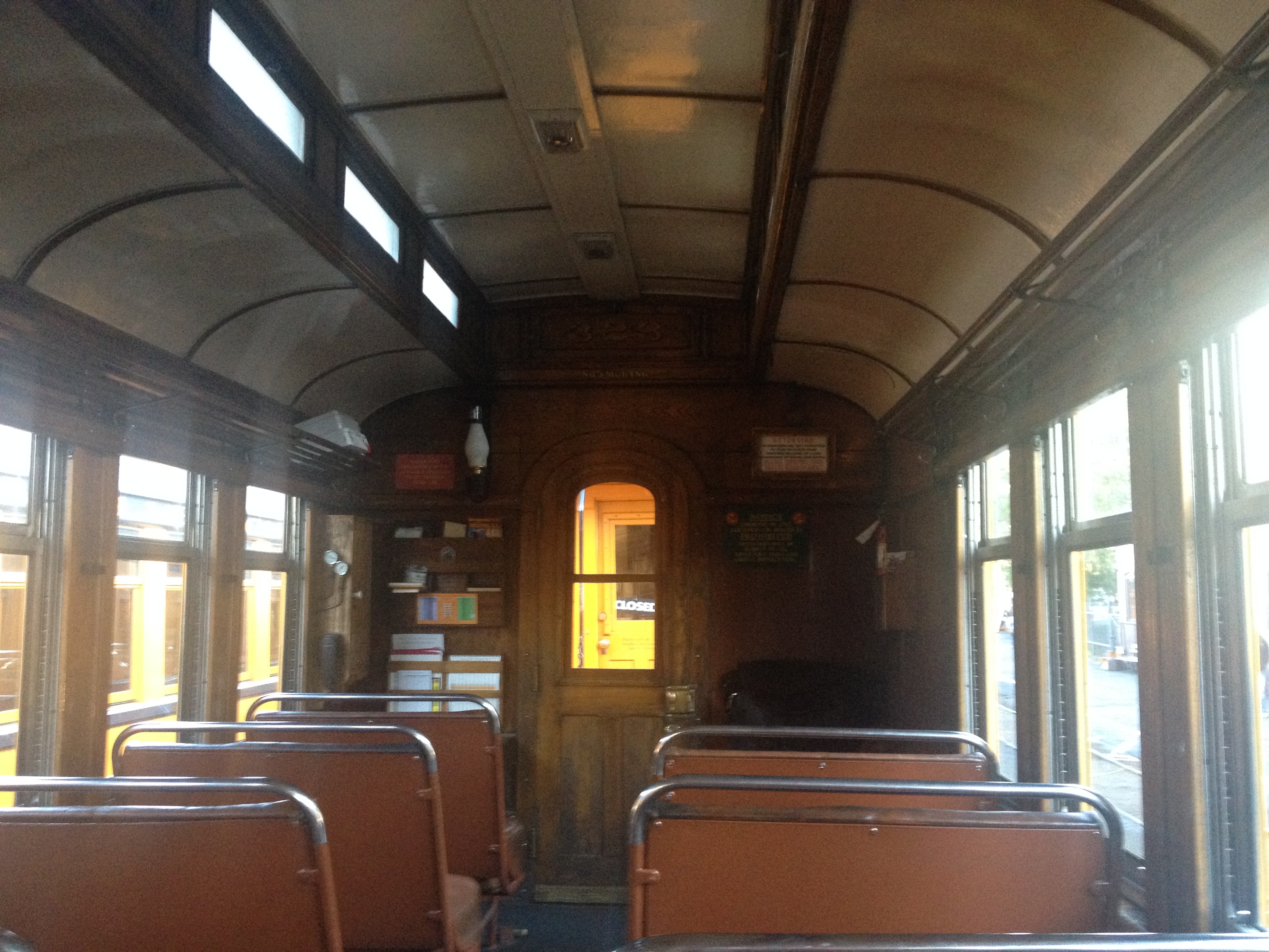
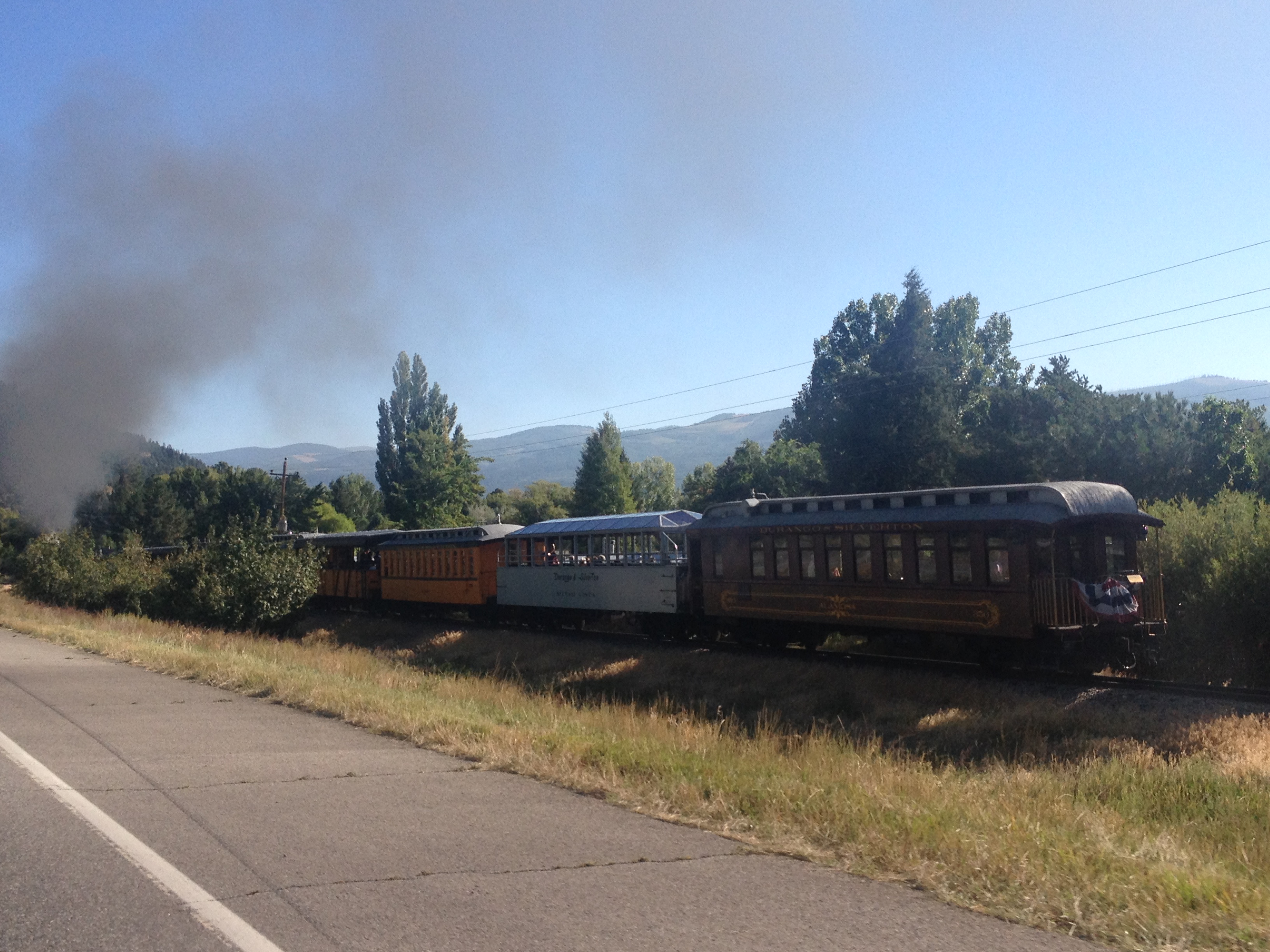
There is something I really love about road trips.  When I refer to road trips, I am not talking about simply driving somewhere.  A lot of people drive to work every day, or to a relative’s house every other weekend, and those drives don’t feel like “road trips”.  I’m talking about driving somewhere a significant distance away that is not a routine trip; somewhere that is somewhat unknown.  On road trips, we have somewhat of an idea as to what to expect, based on what we have heard, read, or researched, but we do not know it intimately.  We have not experienced the towns we will pass along the way, which exits have the best deals on gas, and where the best restaurants are.  In other words, there are still some surprises, and we are still going to encounter something unexpected.

IMG_5619

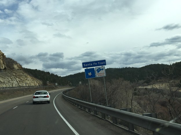
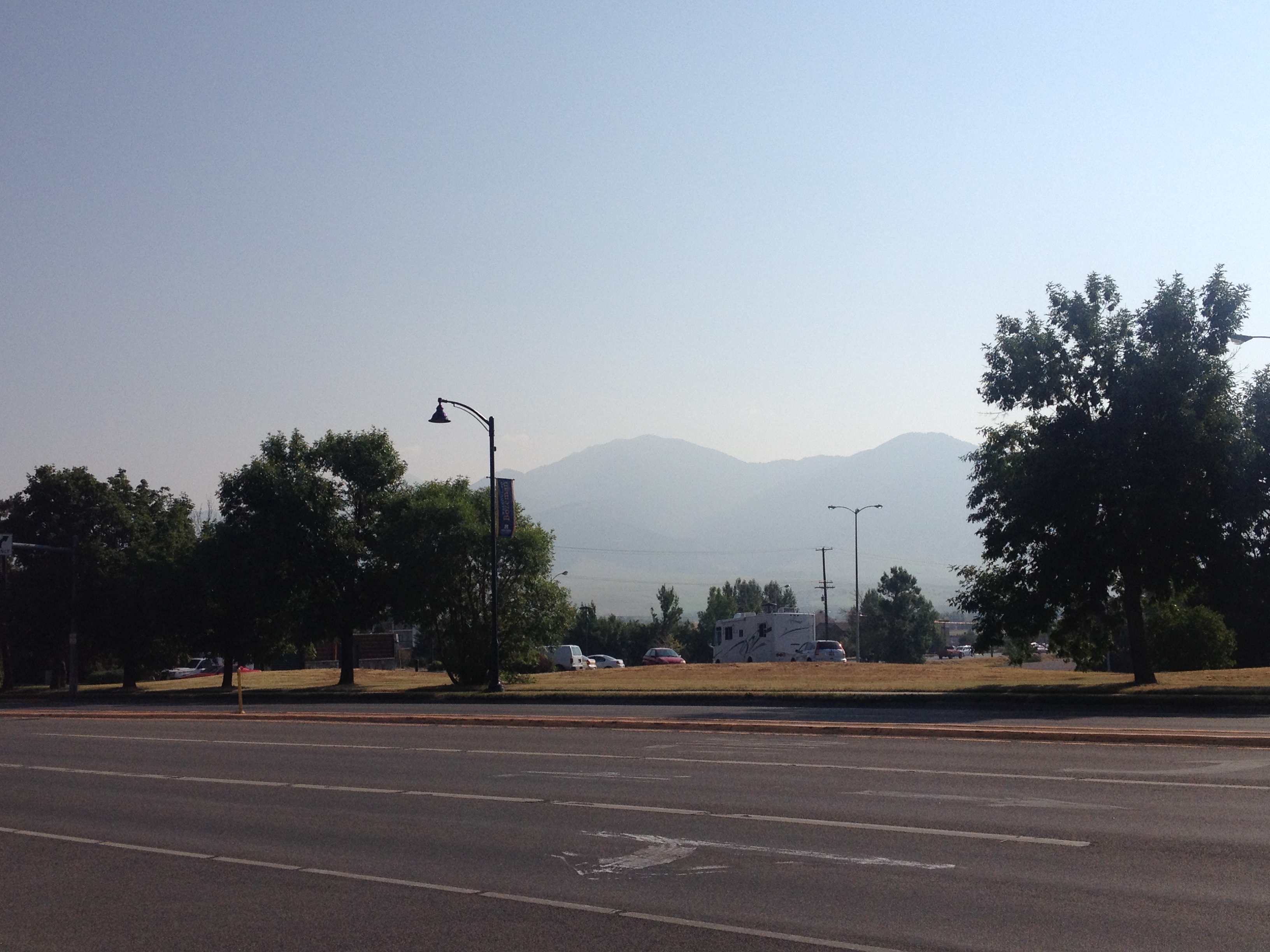
Driving south along I-25, the first indication that one is reaching the Southernmost portion of Colorado is the Spanish Peaks.  While visible farther north, they take prominence south of Pueblo. The Spanish Peaks are nowhere near the tallest features in Southern Colorado.  In fact, within 30 miles or so, there are 5 mountains taller than 14,000 feet (14ers)!  But, since they are relatively isolated from other natural features, and can be seen quite some distance, they are a prominent landmark toady (an entire region is named Spanish Peaks country, as well as the names of countless business in the region), and were a prominent landmark on the old Santa Fe Trail.

Approaching Trinidad, CO, the last town before the New Mexico border, the Spanish Peaks disappear from the horizon as the highway enters a much hillier region approaching Raton Pass.  It is here that the path of Interstate 25 joins with the old Santa Fe Trail, which it will more or less follow for the remainder of the trip to Santa Fe.  This trail was first pioneered by the Spanish and later played a pivotal role in American history including westward expansion, and the eventual conquest of the Southwest from Mexico.

IMG_5622.jpg

I had mixed expectations of Raton Pass.  Many years back, I was on a ten-day storm chase. Our group was situated in Clovis, New Mexico, which is quite close to the Texas-New Mexico border.  We were discussing the possibility of chasing upslope storms roughly an hour northeast of Denver the following day.  Some of us brought up the possibility of driving west to Raton so we can take the Interstate to our target destination, but the group leader balked at the idea, instead suggesting driving up 385, as he felt it might be risky to take a large convoy of chase vehicles over Raton Pass.  We ended up deciding not to drive up to Northeastern Colorado, as, in the morning, the storm outlook had weakened, and we no longer felt it worth the drive.  By the way, this is common on storm chases, you really never know where you will end up going.  However, ever since then, I had kind of wondered what it was like to drive over this pass.

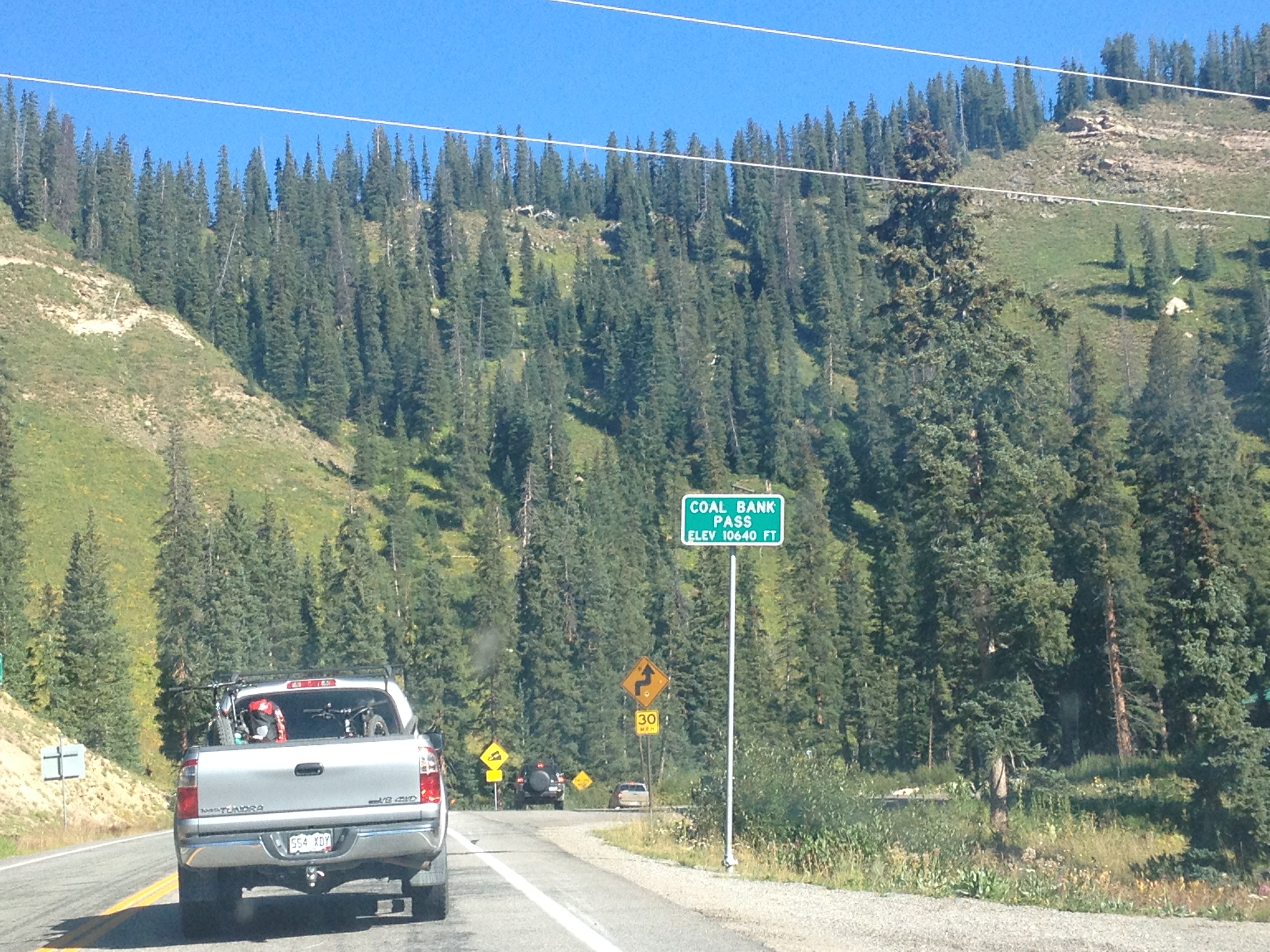
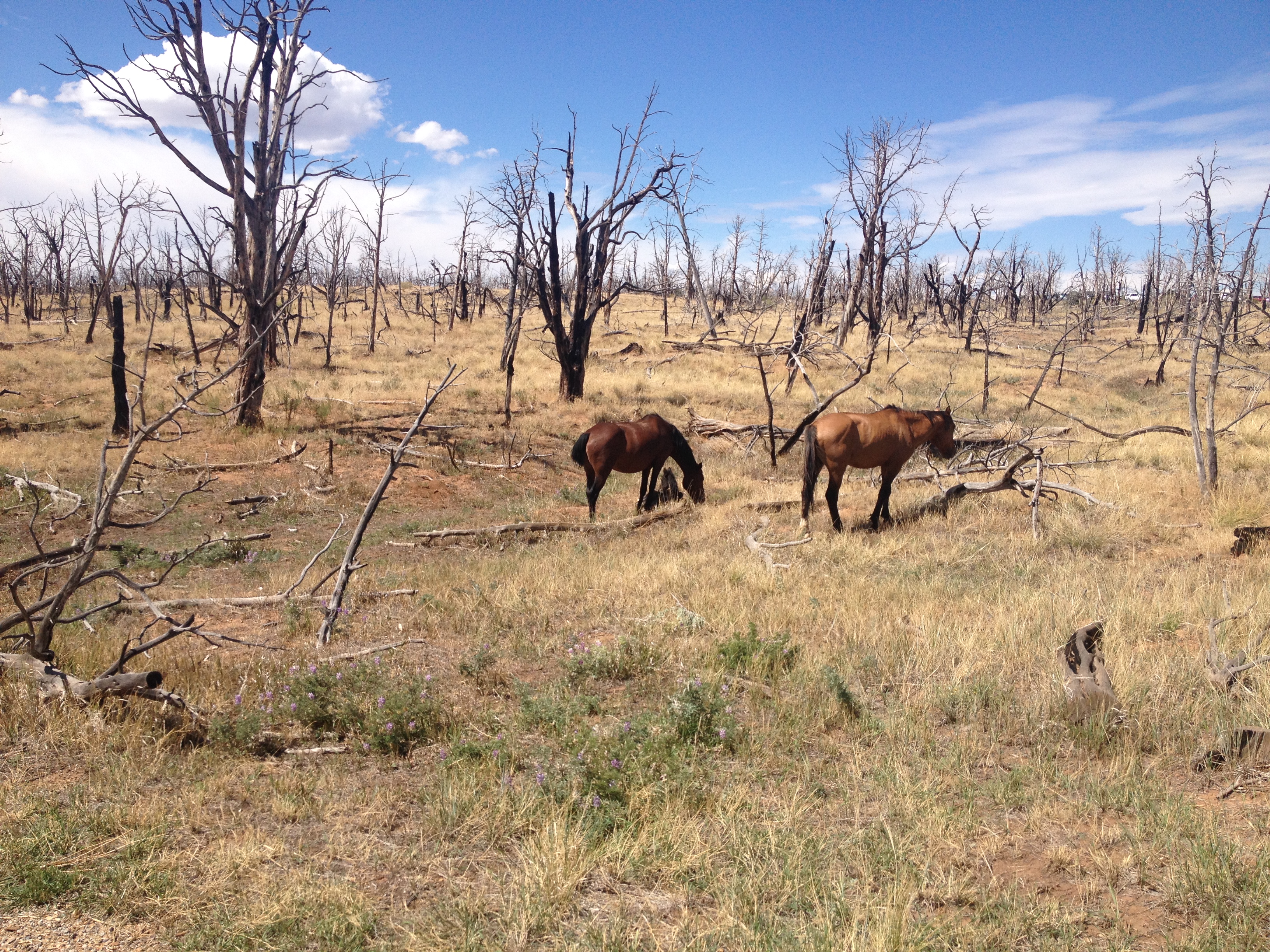
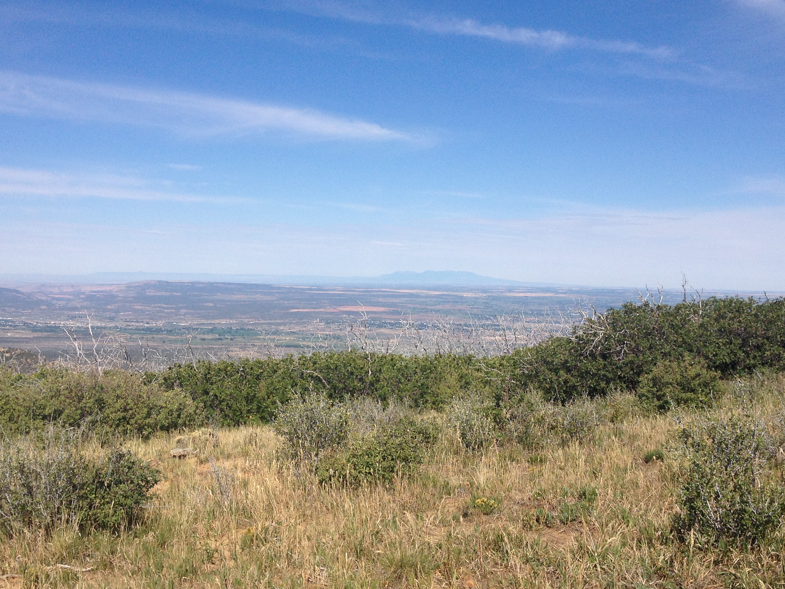
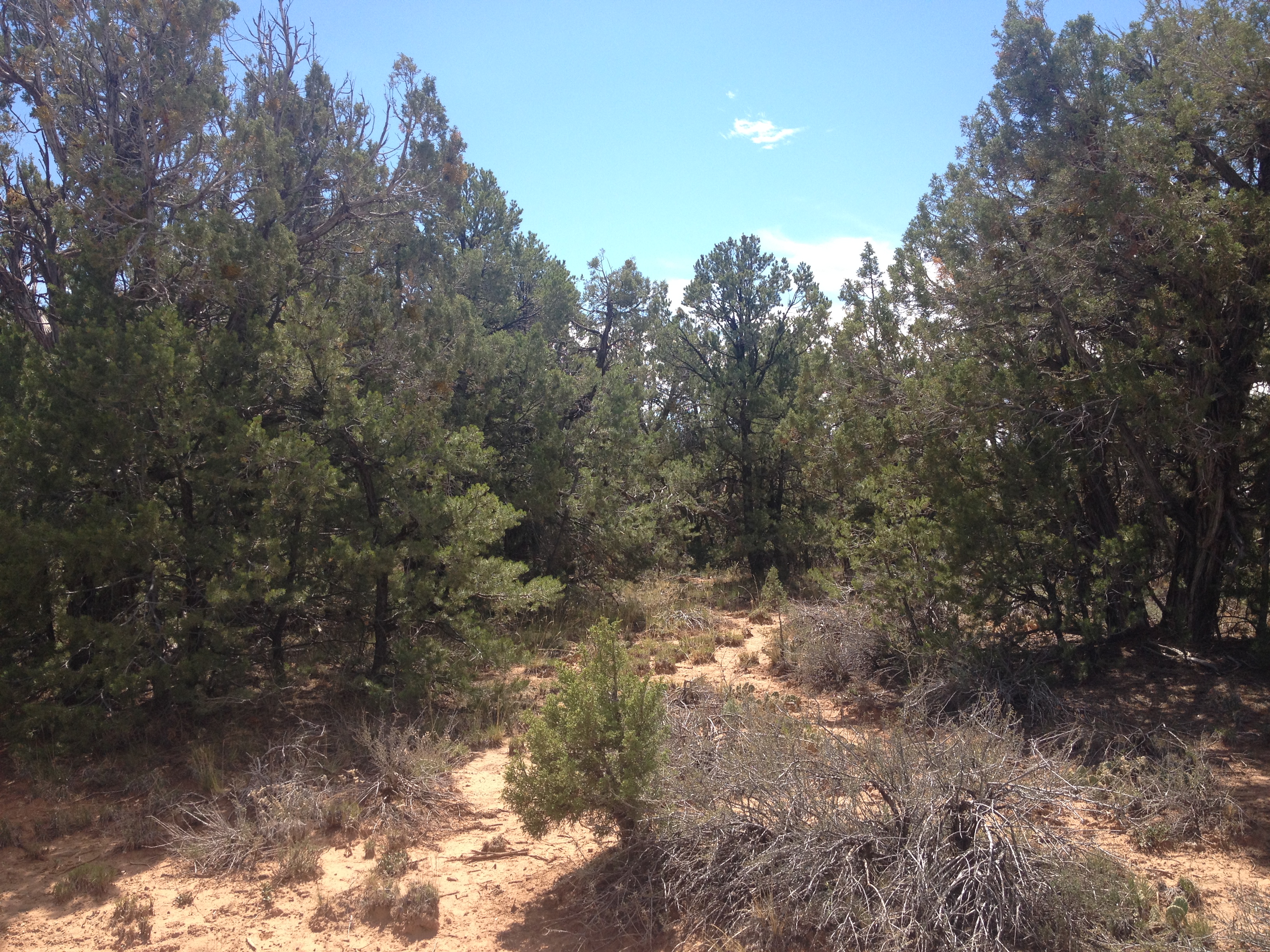
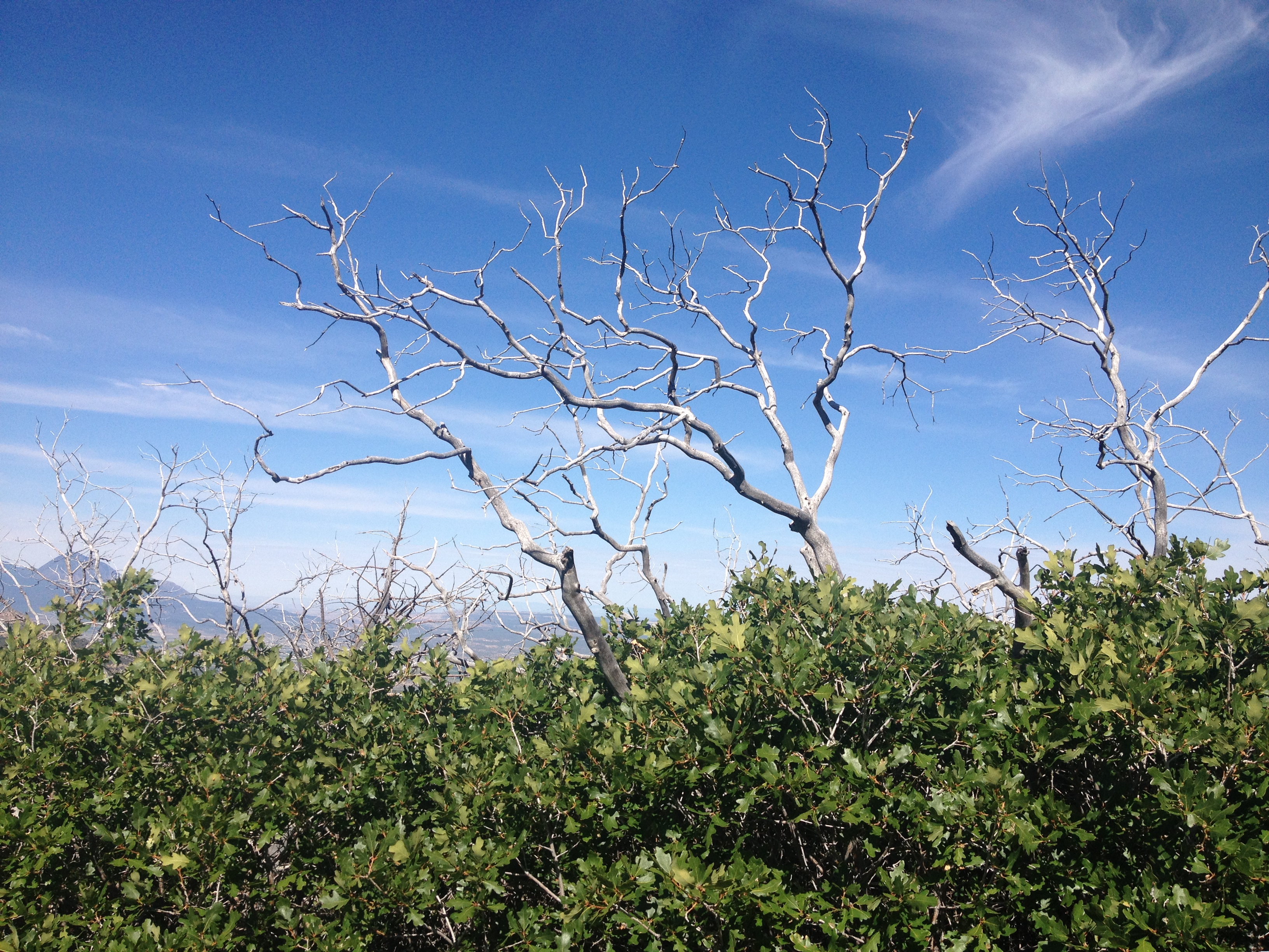
As the photos indicate, the road gets windy as motorists climb from Trinidad, at roughly 6000′ in elevation, over Raton Pass, which tops out at 7834′.  It’s definitely not nearly as rough as heading over the Rocky Mountains along I-70 or I-80, but definitely is a much more major incline than anything a group of people that drives largely in the Great Plains from Texas up to South Dakota would typically experience.

IMG_5626.jpg

Oh, and in one of the strangest of coincidences, the top of the pass is right at the border of Colorado and New Mexico.  This is odd as, first of all, the Colorado-New Mexico border is defined as the 37th parallel, and has nothing to do with where any mountain pass is located, and roads through mountain passes are built to take the safest and most effective route.  The fact that the place where this road crosses the 37th parallel most effectively happens to also be the high point seems to me as a pure coincidence.  Maybe someday I will read into this, the story behind the road and such, but I have yet to do so.

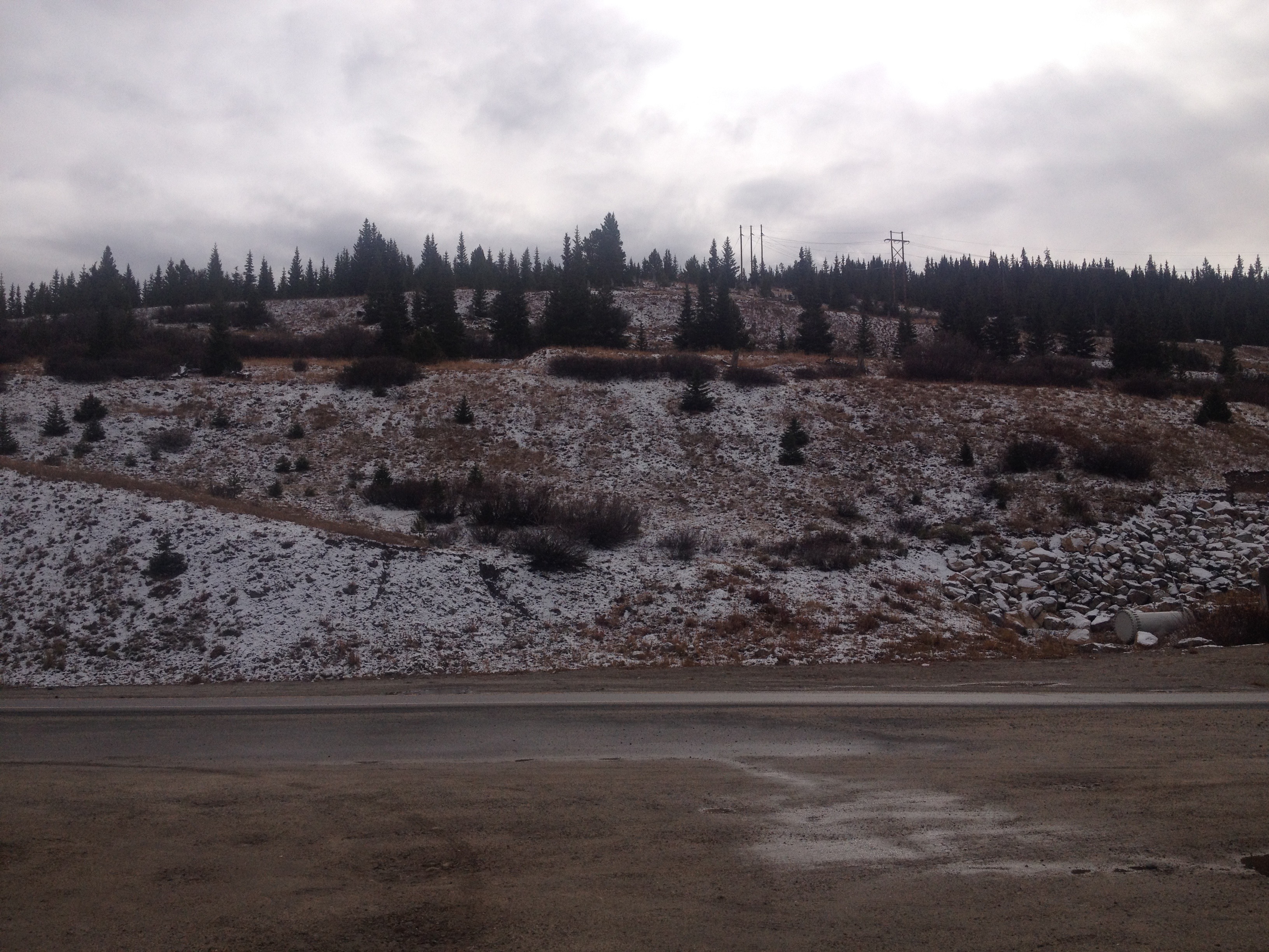
After a descent into Raton, the road reaches a segment that is long, flat, open, and rather empty.

I switched the music on the radio to classic rock, The Clash, Ozzy, Queensryche and such.  For some reason, there is something about the sound of guitar rock that makes more sense while driving through scenery like this than many other forms of music.  As the afternoon passed along this landscape, cloudy skies gave way to peaks from the sun only every once in a while.  A few periods of gentile, chilly rain fell from the skies.  In some ways it reminded me of a storm chase gone horribly wrong, the day slowly but surely slipping away with no prospects of favorable storm conditions developing.  However, in other ways, the drive was relaxing, allowing me to think without any distractions.

After passing through a town called Las Vegas, NM (which I assure you is nothing like the Las Vegas in Nevada), the highway turns West.  It kind of loops the last 60 or so miles into Santa Fe, even heading back northward for the last ten miles, following the route of the old Santa Fe trail.  However, unlike the previous 100 or so miles, this part of the trail, and the drive, is far from flat.

To the right, is the southernmost part of the Sangre de Cristo mountain range, and an area now part of the Santa Fe National Forest.  It is these mountains that the trail routed 19th century pioneers around.  To the left are a series of bluffs which, luckily, the trail did not have to also bypass, as it would have added many more miles to the journey.  The road itself slowly climbs over Glorietta Pass, descending only slightly into New Mexico’s Capitol City- Santa Fe.

The Colorado Model Railroad Museum

The later half of March is a confusing time to be in Colorado.  The range of possible weather events makes it a tough time period to plan for.  In the mountains, there are plenty of times snow continues to fall, and provides more high quality snow days for skiers and snowboarders.  But, the snow does not always continue to fall, and if it doesn’t, conditions on the mountain can deteriorate fast, as warmer temperatures are likely to eat away at the snow pack.

At lower elevations there is quite a bit of variance as well.  March can easily bring Denver, Fort Collins, and even Colorado Springs long strings of 70 degree days.  It can also bring heavy snowfall, as was the case this past Wednesday.

img_5529

There’s no guarantee that the weather will cooperate for any outdoor activities.  There is always the chance that skiing conditions will continue to deteriorate without conditions for cycling or hiking at lower elevations improving.  For people like me, this time of year has the potential to be quite underwhelming.  Due to this uncertainty, I would not personally recommend people travel any great distance to visit Colorado in the later half of March or April.

With leftover snow on the ground, covering the trails and such, this weekend ended up being a good time to visit one of Colorado’s indoor attractions.  I often lament that Colorado does have some quality museums, an indoor activity, but that I rarely actually visit them as I am planning outdoor adventures.  A weekend like this, with less than inspiring weather conditions is the perfect time visit the Colorado Model Railroad Museum in Greeley.

img_5567

As should be expected from a museum dedicated to model railroads, there is quite a bit on display here.  Following the suggested self-guided tour route through the museum, I started out by going upstairs, where I viewed the model rail display in its entirety.

Although it is neat to see these trains go by, each one carrying a different type of freight across the landscape, model railroads are about so much more than just the trains.  They depicts towns, industry, and scenery.  Some of the mountains depicted on this display even contain small components of real rock.

The upper floor of this museum is like a trip back in time.  Plastered on the wall is a map of regional railways, which were once the primary way in which we traveled around the area.  After viewing the photos of historic rail depots, posters from the middle of the 20th Century promoting passenger rail service, and old train schedules on display, I imagined myself in the setting of some quasi-ambiguous time in the middle part of last century, bags packed, ready to hop aboard one of these trains to embark on an adventure.  I gaze at these maps, and think about how much I enjoy not only the adventures I have at various travel destinations, but the process of getting there, the journey.  The railways, and these models, are all about the journey!

The second half of the self guided tour takes visitors downstairs, to see the components of this elaborate model train display individually.  Each segment of model trains tell a story, but not a straightforward story.  They show a snapshot of life in different places along this train’s route.  Looking at all of these individual displays, it is quite easy to imagine oneself there, as part of the story, or as an omnipresent type of observer.  The details and creativity allow visitors to develop a story based on what they see.

img_5577

In this thriving town along the rail route, I imagine myself getting a dollar out to purchase a soda from a vending machine on a hot day.  I imagine what this family is doing.  Did they just have a fight?  The Man’s arms are folded and the daughter is turned away from her parents, clinging to a stuffed bear.

img_5575

They got creative too.  The scene here is a wildfire being put out by firefighters.  This is one of many places throughout this gigantic exhibit where specific events are depicted.  Not only do we see where stores are, where houses are and such, imagining the day-to-day life in fictitious towns along the route, periodic occurrences are displayed before us as well.

In a few areas, the builders of this display got even more creative.  My favorite one here depicts a kayaking trip gone wrong.  This kayak now inhabited by a black bear, with two people having been thrown into the water, only one still holding on to their paddle.

img_5576

A ton of work went into the displays at this particular museum.  It’s been a long time since I have been to a museum like this one, but I picture most model railway museums being similar in nature.  It is impossible to overstate how important attention to detail is when creating an exhibit like this, or even when people create model train sets for their own homes and gardens.  I do not consider myself detail-oriented enough to put something like this together.  I am also probably way too extroverted to want to spend the time putting together a display like this.

Seeing this display, first in its entirety, and then by its individual components, gave me a newfound appreciation for the attention to detail payed when creating this exhibit.  None of it would have been nearly as good had anyone involved in building this exhibit taken the attitude I often take that details matter less than the big picture.  The story of this exhibit would not be presented properly had one little item, one tiny piece of brick at 1:87 scale been slightly off.  Maybe details need not be dismissed.  Maybe those of us that are frustrated with dealing with details we deem insignificant need to just understand how they fit into the big picture.


When We Get Stuck

IMG_5082.jpg

Here we are, on the verge of something great!  It is right in front of us, in plain sight, a brand new endeavor, a great idea, something that’s going to either change the world, change our lives, or just be one heck of a great time!  The path in front of us is clear, exciting, invigorating.  Never have we felt so alive!  With excitement, enthusiasm, and passion, we enter this new endeavor without hesitation.  We do our due diligence, of course, but the excitement of what lies ahead by far overwhelms any concerns about what could possibly go wrong.

But then it happens.  Shortly into this new endeavor, due to something we either overlooked, poorly estimated, or never even considered in the first place, we find ourselves stuck, much like I was in Vail’s Orient Bowl.  That morning, I got off the ski lift, and saw the 15″ of fresh powder that Vail had recently received.  Instead of following tracks already made by those who skied in this area earlier in the day, I wanted to make my own tracks.  I expected a wild ride through this fresh powder!  On the contrary, I suddenly found myself slowing down, and sinking. The realization that I would find myself at a standstill, and need to work to dig my way back on track, is much akin to the realization many of us have when we realize that some aspect of our plan is not going to materialize the way we had anticipated.

IMG_5085

What is strange is that this experience, of suddenly finding myself stuck occurred at Vail Resort.  Vail Resort is not only home to one of the largest and highest rated ski resorts in the world, but it is also home to a ski museum, which has artifacts of the history of both skiing and the resort itself.

Vail_10thMountain

Vail ski mountain was founded by a man named Pete Siebert, who fought in World War 2 as part of the U.S. Army’s 10th Mountain Division.  This group of soldiers trained in the mountains of Colorado, mainly on skis, and were subsequently deployed to Northern Italy to lead an attack, on skis, in the heart of one of the Nazi strongholds in the region.  Many of the soldiers from the 10th Mountain Division, despite being from many different places all over the country, found their way back to Colorado, and alongside Siebert, helped develop the skiing industry into what it is today.

The story of skiing, and the story of Vail is summarized quite nicely at the Colorado Ski Museum.  In fact, the museum has other exhibits, including one on snowboarding, a bunch of facts about the origin of downhill skiing, which pre-dates Vail and even the 10th Mountain Division’s World War II efforts, and one that shows the history of the U.S. participation in skiing and snowboarding events in the Olympic Games.

IMG_5090

Yes, I had to get my picture taken with one of my favorite athletes, even if it is only a cardboard cutout.  I was not sure if I would get kicked out for taking this photo, so I made it quick.

The abridged version of the story of Vail is that it opened on December 15, 1962, struggled for a couple of years (the second year they had a snow drought and brought in the Southern Ute Indian Tribe to perform a snow dance for them), and then the resort took off in the later half of the 1960s.  After that, the resort periodically expanded, eventually combined with Beaver Creek and became what it is today.  For more details, I would seriously recommend visiting the museum.  With only a $3 suggested donation, it is a great activity for kind of day where skiers and snowboarders need to take an hour or two off due to weather or exhaustion.

The aspect of Vail’s history that is largely not covered by the Museum is the one that pertained to my own experience earlier that day- getting stuck.  The museum has an exhibit, and a video describing the 10th Mountain Division, how they trained, and what they accomplished.  They also describe the history of Vail as a ski resort in detail.  But, the 10th Mountain Division disbanded at the end of 1945, when the war ended.  Vail resort opened in 1962.  The only discussion of this roughly 17 year time period between these two events, was that Mr. Siebert was looking for the perfect place to open a ski resort.

IMG_5091

In detail, what did Pete Siebert do from 1946 through roughly 1960 (when he started laying the groundwork for Vail)?  Nobody knows, but it is definitely possible that he got stuck, much in the same way I was earlier that day.  Maybe, like many who returned from World War II, he came back and did not know what to do during Peacetime.  Or maybe, he looked at places for years and could not find the right one.  It is possible that he could have had a few “false starts”.

Those of us that have ever been, or currently are, stuck, can take solace in the fact that Mr. Siebert eventually, despite what is likely close to a decade of being stuck, put together a world class ski resort.  Additionally, many of his fellow 10th Mountain Division soldiers contributed to what Vail eventually became (the shops, restaurants, and even clubs that popped up in Vail Village).

After being stuck in the snow, I eventually made it down the mountain.  In fact, after only a short delay, I was able to climb my way out of the deep snow into a set of tracks just to my left.  Despite the fact that I did not get what I wanted out of that particular experience, I had a great experience with the remainder of that particular run, finding areas of deep powder farther down, where the terrain is a bit steeper, and then shooting through some glades.

In this particular case, I had no choice but to try to climb my way out of this section of deep powder.  In may other situations in life, we do have the option to give up.  Unfortunately, we often do prematurely, sometimes simply knowing that there is an easier path.  But, the easier path is rarely the more rewarding one.  The experience of getting stuck in the snow only to eventually have a great remainder of the run, followed by seeing a parallel experience with the founding of the very resort I was skiing at reminded me that it is often worthwhile to get “unstuck”, but also that it is less of a catastrophe to be stuck in the first place than we often imagine.

We live in a culture that reprimands people for being stuck only for a couple of months.  Two months with nothing to show for it- you’re on thin ice …. or out of a job!  Sometimes I even reprimand myself for “wasting” a single day!  Pete Siebert may have been stuck for over a decade!  Yet, he eventually founded Vail, and the experience of living in, or visiting, Colorado would not be the same if it weren’t for this important contribution.  So, maybe we need to be less hard on each other, and be less hard on ourselves.

Tea that Isn’t Really Tea

IMG_4704

Tea is not something I ever give any real thought to.  For me, it is one of those products that has always just been there.  As much as I claim to be a curious-minded person, I had never even sat and pondered who was the first person to come up with the idea to take a bunch of ground up leaves, put it in a tiny little bag and dip it into a cup of hot water.  In fact, if you think about almost every product we use on a regular basis from the standpoint of a culture that has never been introduced to that product, it probably sounds absurd.  As I write this, I am eating a bagel.  Imagine telling someone who has never heard of a bagel that you have an idea to take condensed bread, bake it into a cylindrical shape with a hole in the middle, and maybe put some random seeds on top.

You would have probably been told, by at least some portion of the people around you, that your idea was either absurd, or unnecessary.  If I could, I would communicate this point to an entire generation of aspiring entrepreneurs, as nearly all of them, will at some point receive a similar reaction from people they describe their idea to.  In fact, some will even be turned down and laughed at by potential customers and investors.

IMG_4615

One of the reasons I had never given tea too much thought is that in my mind I had always associated it with things that I do not find too exciting.  Our subconscious minds have this strange ways of synthesizing our experiences, the experiences we hear about, and even some of the media we consume into some general associations.  Whenever anyone mentions tea, the image that naturally pops into my head is a fancy table with fancy chairs on someone’s lawn, in front of a garden on a day with the most pleasant weather imaginable, and people wasting that pleasant afternoon, with so many possibilities to engage in activities and explore what the world has to offer, just sitting around drinking tea.

In fact, I did not even start drinking tea until I got my first job after Graduate School.  It was free at work.  I started drinking it to save both money and calories, particularly on chilly mornings.  The only variety of tea that was free at my job was “black” tea, which is perfect, because, as I learned at the Celestial Seasonings tour, it is one of the most heavily caffeinated teas out there (surpassed only by Oolong tea).  So, I conditioned my taste buds to the rather plain flavor of black tea and did not ponder other options.

IMG_4701

However, Celestial Seasonings is a place that has way more character than the stuffy images I think of when I think of the average “tea time”.  It was started by a bunch of hippies, which should not really surprise me given that it is in Boulder and was started in the late 1960s.  They would gather leaves in the Rocky Mountains outside of Boulder to make their beverages.

IMG_4514

However, the leaves that constitute “tea” come from plants that cannot be grown in this part of the world.  So, the beverages they put together were drinks that could not actually be considered “tea” by the technical definition.  They would have been considered “herbal infusions”.  The phrase “herbal infusion” had a clear association with the hippie movement.  So, to sell these products to the general public, which was (and still is) largely skeptical of the hippie movement, they labeled the beverages “herbal teas”.

IMG_4703

Now nearly a half a century has passed.  A lot has happened.  First, the hippies reached full-fledged adulthood (over 30, is that what they said?), got jobs, bought houses on cul-de-sacs, and, eventually SUVs and mini-vans.  A new generation emerged, powered by a rejuvenated economy, and became Yuppies.  They managed to both continuously enlarge the houses and vehicles in suburbia, while also turning formally blighted neighborhoods in city centers across the country into high-class urban playgrounds.  Many of the areas that were once focal points to the hippie sub-culture, including San Francisco, and even Boulder, are now firmly under the domain of this new urban culture.  Of course, this is all an over simplification, but hippie communes still exist, largely in the same way soda fountains and other relics still exist.  A family will randomly encounter one in an out of the way place on a road trip, and grandma and grandpa will explain to the children what they are/ were all about.

Yet, the label “herbal tea” is still there, both in this tasting room, and in their packaging.  It is still there despite the fact that so much has changed.  Not only does the general public have absolutely nothing to fear from the hippie sub-culture anymore, but, I would argue that many of their ideas have penetrated our mainstream thinking, both “right” and “left”.  We do not wear suits to baseball games anymore.  People aren’t mocked or reprimanded nearly as much when they explore their feelings, and try to find themselves.  There is no more stigma around going to seek therapy, and tons of people participate in yoga classes.  We may largely be in boring cubicles and offices, but it is not unheard of to openly defy the authority structures there.

Despite all of this, people are still drinking “herbal tea” instead of “herbal infusions”.  “Herbal teas” are Celestial Seasoning’s three top selling “teas”.  Is this simply the power of inertia?  Are there still a significant enough number of people that would shy away from drinking something if it was labeled an “herbal infusion”?  Or is something greater at work?  Our world is in a constant state of flux, and that flux includes language, definitions, and standards.  The hippie movement did not survive, but some of the ideas joined the mainstream.  Maybe, although, these “herbal infusions” were not considered “tea” in 1969, they are now.  Very few people, when they buy these products at the store, even ever realize that they are not actually drinking tea.  For all practical purposes, it is tea despite the technical definition.  After all, Colorado is already a major part of a movement that changed the standards for what is considered beer, why not another product?

Places that Used to Be

IMG_4573

Many different types of images come to mind whenever anyone talks about “ghost towns”.  I think of all of those images of abandoned, and partially decayed buildings that are pictured on the cover of books about ghost towns.  I think of that abandoned cabin you see while on a hike.

IMG_4329

Sometimes I think back to the recently abandoned town in West Texas I passed through a decade ago on a storm chase.  I even think of other, more recently abandoned, “21st Century” ghost towns.  Heck, sometimes parts of Detroit even come to mind.

But something felt creepy when I came across the site of not one, but three towns that used to exist, as recently as the middle part of last century.

IMG_4574 IMG_4575 IMG_4576

I looked around in all directions.  There were no buildings at all, not even one of those rotted out wooden buildings that appears to be on the verge of collapse due to neglect.  I looked far and wide along the valley for some sort of evidence that there were three whole towns in the area as recently as the 1960s.  Maybe an abandoned platform along the tracks.  Or even piles of wood, or rocks.  Nothing!  The only evidence anyone passing along this route would have that there ever was any human civilization in the area is a historical marker that marked what once was the site of the highest masonic lodge in the U.S.A.  It’s creepy enough that these towns appeared to be completely erased out of existence.  But, the only indication that these towns ever actually existed is due to the Masons, a secretive organization that many also find creepy.

Three miles up the road, is Fremont Pass, another place with echos of the past.

IMG_4577 IMG_4578

Fremont Pass, it appears, is home to another “ghost town”, the town of Climax.  Here, I at least found some evidence of this town’s existence.

IMG_4579

This particular location played a significant role in history on two occasions.  As indicated by the historical marker, the Continental Divide is the western boundary of the Louisiana Purchase.  In fact, this very location was an international border from 1803, when the Louisiana Purchase was signed, until 1821, when the Adams-Onis Treaty established slightly different borders between U.S. and Spanish territory.  The border would remain in a somewhat nearby location until the conclusion of the Mexican-American war in 1845.

Later, the Climax Mine would play a pivotal role in the U.S. efforts in both World War 1 and World War 2, as it sits on one of the largest deposits of a little known substance of molybdenum.  To be completely honest, I have no clue what molybdenum is.  All I know is that it is one of those middle elements on the Periodic Table, which, I am guessing is more than the average person knows.

What I did gather, though, was that like the three other ghost towns in the area, this is a place that was significant, actually quite significant, at a point in our history, but now it is basically gone.  In fact, the only real reason I know about Climax is related to one of my other projects.  I recently created an algorithm to calculate seasonal normals at any given point in Colorado for the purpose of planning out activities across this beautiful state.  To develop this algorithm, I needed to find as many reliable weather observation sites in places with different geographical features as possible.  Climax, it turns out, is the site of one of the highest reliable CO-OP weather stations.

IMG_4580

Not only was this weather station particularly helpful in developing that algorithm, it is also a great source of information regarding snowpack conditions at high elevations for the purpose of avalanche forecasting, as well as determining where to hike or snowshoe.  So, although that molybdenum plant re-opened a few years ago, in my world, this weather station is currently Climax’s most significant attribute.

The fact that places both rise and decline in significance is not a new concept.  Places like Egypt and Sumeria formed the cradle of civilization, only to eventually cede that power to other cities and regions.  Similarly, in today’s United States, we are currently seeing places like Texas and Florida gain province, while parts of the Northeast and Midwest decline.

This particular situation is strange though.  When I think of the “Fall of Rome”, for example, I think of a process that occurred over roughly two centuries.  The ghost towns near Freemont Pass were culturally significant a mere half a century ago.  Today, they are all but vanquished from existence.

I am also not accustomed to seeing this process occur over such a small spatial scale outside an urban area.  Most of Colorado is thriving, particularly the mountainous part of Central Colorado.  These three erased towns are only ten miles up the road from Copper Mountain Ski Resort, a resort that is so popular that it one of only three ski resorts to receive its own detailed forecast from OpenSnow (the other two are Steamboat and Vail).

IMG_3204

Roughly ten miles or so in the other direction, is Leadville, a former mining town that also appears to still be doing quite well for itself.

IMG_4581 IMG_4583

When I think this all through rationally, I understand why the civilization left the Fremont Pass area.  The economy was largely driven my one obscure material.  When the price for that one material declined, the entire economy left.  Sometimes, though, it takes some time for information to process through the logical mind.  My gut reaction was still one of disbelief, as it still definitely feels strange to see a set of towns decline so quickly to the point of non-existance in a region that as popular and ascendent as Central Colorado.

Bozeman, Montana; Where My Journey Begins

IMG_3684

“I had always known that we had the best downtown in all of Montana.  And then last year, we were voted the best downtown in all of Montana.”  At least that is how Bozeman was described to me by one of the locals, while giving me lunch recommendations.  He eventually told me that every place downtown was good, and to only avoid chain restaurants.

The first person I interacted with in Bozeman was the cab driver that drove me from the airport to the REI, where my bicycle had been shipped to, reassembled, and was waiting for me.  He described Bozeman as a “town full of expert skiers”.  With all of the other observations I had made while in town, and with the other interactions I had with people from Montana, it feels to me as if Bozeman is like a smaller and more extreme version of Denver or Boulder.  The cab driver indicated that the town almost shuts down on powder days, as everyone is headed to the mountains.  And, the people coming in and out of the bike shops appeared to be people that could ride a fair number of miles in challenging conditions.

IMG_3672

Bozeman is only 50-some miles from Big Sky, one of the most famous ski resorts in the country.  Locals, however, appeared more proud of their local ski resort, Bridger Bowl, only 16 miles from town, as indicated by this sign.  It was also described to me as “the only non-profit ski resort in the Country”.

However, my mind was not on skiing at the time.  My mind was on bicycling, as this was the beginning of a 3-day bicycle journey that would take me through some of the country’s most amazing natural features.  And, it would be the most challenging ride I have ever attempted.

After picking up my bike, as well as all of the necessary supplies I needed for my trip at the REI, I rode the first 1.3 miles of my journey, to the Bozeman Inn, where I would spend the evening.

IMG_3671

Having my bike shipped to the REI and assembled there worked out quite well for me.  The price to assemble the bike from the box is $40, and they pretty much made sure that nothing was wrong with the bike, which is something I really wanted for a bicycle journey that would take me through long stretches without bike shops.  They even checked the spokes, trued the wheel, and made sure everything else was working.  And, when they realized they still had my tire lock key, someone from the shop brought it to me downtown.

It would be nearly 10:00 P.M. before the sun went down that evening.  I had already checked into the motel, but was looking for some information about the town, maybe a bike map, or even a restaurant guide for the time I would be in Bozeman.  Instead, there was just a bar and grill located adjacent to the motel.  “Lights” by Ellie Goulding was playing quite loudly where people were drinking inside.  It was a clear reminder of what evenings were like on a normal night during my “normal life”.  So, I had the instinct to go inside, drink a little, enjoy the music, and try to meet some locals.  But, I knew better.  I was on the verge of something special.  It would be a challenging ride, and I needed my energy.

IMG_3675 IMG_3674

I loaded up my bike with all of my supplies packed nicely into the panniers I had carried with me on the flight into Bozeman the previous evening.  I looked around me and saw mountains in all directions, reminding me that, yes, I was in for some challenging climbs in the coming days.

Spending the morning, and mid-day, in Bozeman gave me some time to mentally prepare for the challenge I knew I had ahead of me.  I decided to check out the attraction I had heard about the most; The Museum of the Rockies.

IMG_3676

This museum has somewhat of an interesting local take on geological, biological, and natural history.  Like the Field Museum in Chicago, it has an exhibit that displays how life evolved over time, starting with the single celled organisms that dominated the earth for Billions of years prior to the Cambrian explosion, through the time of the Dinosaurs and beyond in chronological order.

IMG_3677 IMG_3679

This museum’s exhibit was way more dinosaur centric than the other life over time exhibits I’ve been to.  Their main attraction is the “Montana T-Rex”, the biggest T-Rex to be discovered inside the State of Montana.

IMG_3681

The museum is quite locally focused.  The exhibits on geological history contain a lot of information specific to the geographical area around Bozeman.  Most of the dinosaur exhibits are displayed along with a map of Montana which show where the bones were dug up.

IMG_3678 IMG_3682

Seeing some of these specific exhibits actually changed the way I look at scenery.  Exhibits like this one, about the Beartooth Mountains, don’t just show how pretty they are, but show what rock formations can be seen, and how and when they developed.  The geological history behind all of these processes, from plate tectonics to atmospheric composition changes, and even processes involving air pressure changes and erosion all help explain why everything we observe is the color and shape that it currently is.  And, ultimately, for people who study natural history, all of these rock formations that we observe provided clues to Earth’s past, and helped these scientists discover what we now know.

I’ve looked at a lot of mountains, and a lot of natural scenery over the past few years.  It occurs to me that the scenery that we observe means something different to everybody.  Some people focus on the aesthetic nature of what they see, a beautiful mountain, a beautiful lake, a scenic overlook.  Others focus on the adventure.  Wow, this mountain would be great to climb, or this river would be crazy to kayak in.  But, still others are trying to deduce how this scenic view in front of them came to be.  They are the ones that see red rocks and see the process of rusting, which occurred over the course of 2 billion years, as early photosynthetic life gradually increased the oxygen content of the atmosphere, lead to the chemical reactions that made some rocks red, so long as they have had significant above ground exposure.  They are the ones that look at the rocks and see as story, a progression of events.

I almost felt bad, walking around the museum in my bicycle clothes, looking kind of like a bad-ass, talking to people about my bike trip, when the truth is, that I had only biked 7 miles so far, from the REI, to my hotel, and then to the museum.  It was the guy at the ticket window that had told me that Bozeman’s downtown was the best one in Montana.  He informed me that the museum and downtown were the two places to really see in Bozeman, so I decided to ride my bike downtown, get some lunch, and wait for my friend to join me.

IMG_3673

I was impressed by the downtown, particularly the bike parking.  After eating lunch at a Co-op (the kind of place that looks like a grocery store but sells fresh made lunch food to workers in downtown areas), I had some time to kill.  I was excited, getting kind of anxious, and my mind was active!  Maybe it was the 10 miles I had already ridden, enough to get my blood moving.  Maybe it was knowing what was to come.  Or, maybe it was the downtown, the vibrancy, and the unique-ness.

From book stores, to local shops, everywhere I went seemed to put me into an active process of deep thought.  For example, I saw a book.  It was titled “Faith vs. Fact: Why Science and Religion are incompatible.”  I thought to myself how ironic it is.  People become attracted to either Science or Religion, but usually do so due to the positive aspects of it; science and it’s intellectual curiosity, religion and the hope and purpose that it brings.  Yet, so many people, after choosing to love one or the other, spend more time focusing on the negative aspects of the other one, as opposed to the positive things that brought them to love either science or religion.

Just like that book, everything I saw brought me to some weird intellectual thought pattern.  I should go back to Bozeman sometime under different circumstances, and see if this is just the way the town works.  Is there something about the energy of this town that makes people just think in unique ways?

Many Montanans refer to Bozeman as “Boze-Angeles”.  In this part of the country, I am guessing this is not meant as a compliment.  That evening, after riding to Chico Hot Springs (more on that in my next post), a woman from Butte, MT would describe Bozeman as “pretentious”, and the place in Montana where one is most likely to be judged.  And, although I did not necessarily feel judged, I definitely sensed the pride here, consistent with what the cab driver, and others told me.  Still, I enjoyed the feeling of being adventurous, intellectual, and on the verge of a major adventure that would also be a major challenge, a major accomplishment, and open me up in a whole new way.

The Way We Used to Travel

IMG_2512

One hundred years ago, most of us traveled on steam engine trains.  The proliferation of railroads across the continent during the 19th Century revolutionized how we got around, and connected us in ways we had never been before.  At the start of the 19th century, it took Lewis and Clark multiple years to get from one end of the continent to the other.  By the end of the 19th Century, that trip could be made in only one week by train.

During the 20th Century, more and more people were able to afford automobiles and flights.  Many of the train lines across the country went away as people switched transportation methods.  Those that remain have long since converted to more modern technologies; diesel or electric, and are primarily used for commutes between cities and/or suburbs at times of high traffic volume.

There are a few places where one can still ride a steam train, exactly how we used to ride in the late 19th and early 20th centuries.  One of those places is in the San Juan Mountains of Southwestern Colorado, where a Narrow Gauge Railway offers daily trips between Durango and Silverton, primarily for tourism purposes.

IMG_2475 IMG_2477

The train schedule is set for tourists to ride the train from Durango north to Silverton in the morning, and then return in the afternoon.  There are three departure time options, the earliest of which (and the one we took) departs at 8 A.M.

IMG_2479

Part of the novelty of taking a train ride like this is how authentic the ride is, including the inside of the train.  Today, we are accustomed to traveling with a higher level of comfort than this.  But, the inside of this train definitely had the same exact feeling as one would have experienced one hundred years ago, making the experience as authentic as one can get.

This particular train route, from Durango to Silverton, follows alongside the Animas River the entire length of it’s 45.2 mile route.  The breathtaking scenery in which this train traverses makes the train ride appeal to many different kinds of tourists, as opposed to just train enthusiasts.

IMG_2481 IMG_2485

The train leaves Durango, at 6512′ above sea level, and begins it’s climb quite slowly, through a wide open river valley.

IMG_2493 IMG_2543

For the first section of the trip, the train follows the same path as the highway.

IMG_2513 IMG_2497

Some 15 or 20 miles into the trip, the train deviates paths from the highway, at a large lake called Electra Lake.  This is where the scenery really becomes quite unique and breathtaking.

IMG_2502 IMG_2504 IMG_2515 IMG_2516

The river valley becomes much more narrow as it meanders through the Needle Mountains.  The narrowness of the valley is the reason the train is “Narrow Gague”, and also the reason that roads could not be built to follow the river valley.

“Million Dollar Highway”, the highway that connects Durango to Silverton (and eventually Ouray), was necessarily built along a different route; traversing two mountain passes well above Silverton’s elevation of 9300(-ish) feet.

IMG_2547 IMG_2548

The route along “Million Dollar Highway” is also considered very scenic, but in a different way.  In fact, this highway is also a popular bicycle route, and even the venue of an annual bicycle race.  I would definitely recommend experiencing the journey from Durango to Silverton in both the old fashioned (steam train), and the modern (by car or with a nice road bike) way if time permits, as each set of views are great in a distinct way.

IMG_2517 IMG_2521 IMG_2522 IMG_2524

The train completes it’s journey into town in the heart of the Needle Mountains, where the gradual change in the color of the rocks surrounding the river reminds riders of the town’s history as a destination for miners.

IMG_2550 IMG_2552

Along Million Dollar Highway, motorists and cyclists view the Needle Mountains from both a higher elevation and a little bit of a distance, seeing them in their entirety.  This is followed by a descent that first winds around Molas Lake, and then provides an aerial view of the town.

IMG_2525 IMG_2534

Silverton is quite the unique place as well.  As soon as I stepped off the train, I felt as if I had entered the Old West.  In fact, I have never felt more genuinely in the Old West in an operational town (as opposed to a restoration like South Park City) as I did in Silverton.

IMG_2527 IMG_2530

With the exception of Main Street, Silverton’s roads remain unpaved.  Many of the storefronts are still reminiscent of Old West businesses, in design and font, and there are even a few cars that resemble those produced in the early days of the automobile’s availability.

We at a restaurant called Grumpy’s Saloon, right in the heart of town.  This restaurant also felt like an Old West recreation.  Between the wall decorations, the waitresses dressed clothing that seemed like it came right out a film like Maverick, and an old man playing tunes on the piano, it actually felt as if they were trying too hard.

IMG_2528 IMG_2529

The only real drawback to taking the Durango-Silverton Narrow Gague Railway is the length of time the trip takes.  A trip of only 45.2 miles actually takes close to three and a half hours each way. By contrast, the trip by car took roughly and hour.  And, while it may take around the same amount of time for a cyclist like me to get from Durango to Silverton, the mainly downhill return trip could likely be done in around two hours.

I guess, like all other aspects of this trip, the travel time is also true to the exact way it was one hundred years ago.  While it was great to get the real experience, the return trip did start to drag on a bit, particularly when the train entered the less exciting scenery in the later part of the return trip to Durango.  My advice would be to either pay the extra money to ride the bus on the return trip, or to bring a book or magazine for the last 60-90 minutes of this trip.

IMG_2532


Places of Questionable Significance

IMG_2460

In 1983, an incredibly drunk Ozzy Osborne made the mistake of deciding to relieve himself on the Alamo, a building of historical significance.  He was arrested (Isn’t public urination usually just a ticket?), and scorned by many, primarily due to the fact that the Alamo is an important symbol of pride amongst Texans.  However, to Ozzy, a British rock star, the building probably did not mean too terribly much.  While a sober Ozzy (if that existed in 1983) would probably have realized the building is significant due to the presence of tourists, he probably would not have felt the same affinity or pride when standing in front of the Alamo.

With the exception of a few wide eyed hippies that believe that every place is significant, and a few hard core cynics, that fail to see the significance in any place (or anything), the significance of most places is dependent on the person and the culture.  There is no better of an example of a place like this than Four Corners, U.S.A.

Four Corners is unique due to the fact that it is the only place in the United States where four states all border one another.  If one wanted to stand in five different states at one time, it would not be possible.  If one wanted to stand in four different states at once, there is only one place where it can be done; Four Corners Monument.

IMG_2455 IMG_2456

The primary reason people visit this particular monument is to take silly pictures like this one.  Assuming the location of the four-state border is correctly marked (some question that is in the right place), in this picture I am in four states at once.

IMG_2462 IMG_2468

However, in the absence of state borders, this particular spot would really actually be quite insignificant.  There is no natural demarcation point, or significant change in scenery.  Even on the Colorado side, the wide open landscape, periodic mesas, and sagebrush screams Arizona much more than Colorado.  This Arizona-like feel persists for over thirty miles into Colorado until the San Juan Mountains start to show up on the horizon somewhere east of Cortez.

IMG_2457

The significance of this place is further muddled by the fact that this point is not the border of four different jurisdictions.  The monument is actually on an Indian Reservation.  Thus, you do not even get the standard differences in policies and sales tax that usually accompany state borders.  An equal number of souvenir stands exists on all four sides of the monument.  I am not sure whether or not marijuana is legal on this particular reservation, but the policy is the same on all sides.  I did not observe all of the pot heads clustered in the Colorado quadrant of this monument.

In the absence of state borders (and people obsessed with exact points of latitude and longitude), the most significant site in this region is a rock formation a dozen or so miles away called Shiprock, which has cultural and religious significance to the Navajo people who have inhabited the region since well before the Spanish arrived.

IMG_2467

From a completely neutral standpoint, the rock formation definitely seems to stand out way more than any other feature in the area, which is mainly small mesas and creeks.  But that does not mean the wide open space where the monument should lack significance to all people.

For most likely a variety of neurological, sociological, and historical reasons, Western Culture associates wide open spaces like this one with freedom.  It’s the wild.  It’s the untamed.  It’s the place where you can yell as loud as you want, shoot any kind of weapon you want, and start a fight without anyone to break it up.  There is nobody to tell you where you can (and can’t) hike, climb, tie a rope to an arch or mesa to swing from it, or even try to catapult small rodents.  It’s the last refuge of people seeking to escape every single one of society’s restrictions and limitations.

But the one set of regulations that one can really never escape is the ones that exist only inside their own heads.  I often refer to these as the “invisible chain”.  And by this, I am referring to all of the anxiety, fear, and self-consciousness that often stop us from doing what we feel we should be doing.  It stops us from telling people what we really think.  It stops us from talking to that interesting and attractive stranger on the train.  It stops us from dancing when fun music comes on.  In some ways, it stops us from living.  And, millions of Americans are in the process of destroying their livers trying to reclaim it.  In these pictures of the free, wild, and untamed west, there are typically very few people, or buildings to indicate the presence of people.  There is nobody to judge you, and nobody to make you feel self-conscious about what you chose to wear, say, and do.  The fact that this is where we go to seek freedom indicates where we, as a people, believe most of our restrictions come from.

Therefore, if one could overcome this “invisible chain”, the restrictions placed upon us would be limited only to those officially legislated by some kind of governing body and effectively enforced by law enforcement personnel.  The few lucky individuals that manage this are able to find this greater level of freedom in places like London, Hong Kong, or New York City; places that provide the interaction with other human being that we all crave.

We often see the desire for community and human interaction as pulling us in one direction, while the desire for freedom and individuality pulling us in the opposite direction.  As an extrovert, I often struggle with the fear that asserting my individuality and refusing to conform, will cost me in the social realm.  Reflecting upon all of this in the wide open spaces of the desert southwest, I re-realized that being an individual and reducing that fear actually helps in the social realm.  Negative responses from those that fear non-conformity are more than outweighed by positive responses by those that appreciate authenticity and variety in nearly all circumstances.  The key is to understand that we all have freedom of choice, and not to allow any of the hate to translate into hatred towards others.  This applies even the people that have ridiculed me and caused me hurt.  They have the freedom say what they want.  The only way to truly overcome that ridicule is not to ridicule them back, or “defeat” them in an argument.  It is to not be affected by that ridicule and continue to be the way you are despite anything they say.

This is one of several lessons, I re-learned on this trip.  These re-realizations make this place significant to me, even if the official reason for the significance of any of these places is questionable.  Everyone has a different experience here, and it is completely understandable for someone to come to Four Corners, find out it is on a reservation, buy nothing at the souvenir stands, and leave seeing the place as pointless.  For me, however, this is where I got my mind off some of life’s frustrations, and got back on the path to becoming a better person.

Mesa Verde: A Window to the Past

IMG_2396

For some reason, the history classes I took in Jr. High School and High School left me with the impression that the North American continent prior to the arrival of Europeans was one populated by nomadic hunter-gatherer tribes that never really established a civilization.  The popular characterization of Native America is a series of quasi-nomadic tribes following herds of Bison and other big game animals around vast open areas.  Thus, it is hard not to think of our continent as lacking the ruins of ancient civilizations that are quite prevalent in places like Egypt and Rome.

However, there are places in North America where one can view the ruins of ancient civilizations that existed long before the Spanish established the first European settlement at Saint Augustine, Florida.  The most high-profile pre-European (pre-Hispanic) civilization in the area is that of the Mayans, who archeologists discovered to have been quite advanced in writing, math, and the sciences, at a time when Europe was wallowing in the “dark ages”.   Those ruins can be found in Belize, Guatemala, Honduras, and Mexico.

Closer to home (for me), there are a handful of places, mostly in the Southwestern United States, where ruins of ancient civilizations can be viewed.  Preserving this history was significant enough for the United States to establish (in 1906) Mesa Verde National Park, as the only archeology themed National Park in the system.

IMG_2452 IMG_2451

Mesa Verde National Park is located in Southwestern Colorado, in a part of the state where mountains are less numerous than they are in the popular tourist destinations in central Colorado.  The drive from Denver is roughly seven hours, making it a somewhat difficult destination for many to reach.  In fact, the nearest interstate highway is over 100 miles away, and so are all airports that normal people can afford to fly into (I am assuming flying into Telluride is pricey even in summer).  As a result, even on a popular weekend like Labor Day Weekend, the place is significantly less crowded than many other National Parks.

IMG_2433 IMG_2434

The history of “civilization” in this park begins sometime in the 6th Century with the construction of “pit houses”.  Archeologists believe that this was the first time any kind of permanent residence was established here.  The tribes that would eventually inhabit this area were believed to have been semi-nomadic prior to the 6th century A.D.  Over time, these civilizations gradually got more complicated, and houses (referred to as Kivas) were grouped together into little villages.

IMG_2443 IMG_2415

Although the period of Ancestral Puebloan civilization at this site lasted over 600 years, it is the very end period, mainly from the middle 1100s through the middle 1200s that receive the most attention at this park.  This, of course, is the period in which most of the Cliff Dwellings were inhabited.  The Cliff Dwelling we visited is referred to as Long House.  For $4 per person (in addition to the entrance fee), the Long House tour provides the most in-depth explanation of the civilization that existed in the region.  This 90-minute tour is only available from Memorial Day to Labor Day.  The road to access Long House (on the far west end of the park) is also only open Memorial Day to Labor Day.  Visitors who come to the park later in the fall, or earlier in the spring, can visit other Cliff Dwellings, and take other tours.

IMG_2409 IMG_2410

The inhabitants of this region were a very resourceful people.  In addition to the corn, beans, and squash that they grew in the region, they took advantage of most other plants in the area, including Cactus, and the fruit-bearing Yucca plant.  They even resorted to ever awful-tasting plants like Juniper berries in meager years.

IMG_2413 IMG_2432

They even invented the first diaper from Juniper bark.

IMG_2424 IMG_2425

Of course, in a dry climate like this one, one of the scarcest resources is water.  For this, the Ancestral Puebloans devised a system to capture what little water precipitates through a system of little streams and holes designed to capture water when it comes.  Even with this resourcefulness, water was still always in short supply, and a long-term drought is often cited as a potential reason as to why these villages were abandoned sometime in the 13th century.

IMG_2426 IMG_2427Their homes, or “Kivas”, were significantly smaller than our homes today, even in large cities like New York.  The standard “Kivas” appear smaller than most people’s garages today.  Even the “Grand Kivas” would pale in comparison to the size of most present-day one bedroom apartments.
This is most likely because this civilization did not view the concept of the “home” in a way we are accustomed to.  A recent commercial (for some kind of real estate agency) describes home as “a place for your life to happen”.  The commercial reflects the prominent views of mainstream America today.  The Ancestral Puebloans who inhabited Mesa Verde from the 6th through the 13th centuries, used these “kivas” as places to sleep, gather, and sometimes have ceremonies.  However, it was not where their “life happened”.  The remainder of their lives was still primarily outside.

IMG_2420 IMG_2417Archeological analysis has also revealed that these homes were actually built in a rather hurried manner, with little attention to details.  It was hinted that there was always this view that any residence would be considered temporary.  According to the exhibits at the Visitor Center, while many scientists and archeologists concur that the reason this site was abandoned in the 13th century was scarcity of resources (water and animals), the descendents of the inhabitants of this region indicate that it was simply time for their people to move on, to another chapter of their story, in a different place.   Coming from this point of view, the concept of homeowner’s insurance, something practically considered a necessity in our present culture, would have been rejected as an absurd idea in 12th century Mesa Verde.  Fire?  Move on.  Earthquake?  Just put up a new building.  Not the big deal that it has become for us today.
IMG_2448 IMG_2406 IMG_2439 IMG_2403 Mesa Verde’s more recent history appears to be driven by wildfires, always a concern in regions like this.  While traveling about the park, the landscape of any given area can vary significantly depending on how recently it has been burned by fire.  A major fire in the year 2000 engulfed nearly half of the park, causing significant portions of the park to appear as this picture above, with a creepy combination of larger, older, dead trees, and the newer vegetation that has developed over the past decade and a half.For those on a tighter budget, I would certainly recommend staying in the town of Mancos.  It is the nearest town to the entry of the park (only 6 miles away).  It is a town of only 1300 residents, and does not boast too many amenities.  However, it offers, by far, the best deals on hotel rooms in the area.  Our hotel room was the Country West Motel, and I would recommend it to anyone.  A classic looking, modest roadside motel, it had it’s own courtyard, sizable enough rooms, and even a poster that I really enjoyed having in my room.
IMG_2389 IMG_2391 IMG_2387 IMG_2474

Happy Independence Day

IMG_2161

In honor of the holiday today, I decided to write a somewhat different kind of blog than what I usually write.  Typically, as is the case with most travel writing, I visit a specific destination (or multiple destinations), and write about the experience.  Following the lead of some of my favorite travel writing, I also tend to include my thoughts on the place I visited, the experience I had, or the significance of something related to it.

But last night, I traveled all of 12 blocks to Denver’s Civic Center Park to watch the firework show put on by the City of Denver.  Not exactly a major trip- I walked there!  However, just as certain places and experiences can lead to significant pondering and revelations, specific events, especially ones of historical significance like this one, can also lead to similar conclusions.

I found myself pondering what it means to be  an “American” and whether or not this is something I should be proud of.  Over the course of my life I have heard a wide variety of perspectives on this.  Many in this country sincerely believe the USA to be the greatest country in the world.  Some say this based on blind Patriotism, but some say this based on well though out reasoning.  On the other end of the spectrum, we have those that do not place that much pride in their country.  They either believe that taking pride in a specific nation is a silly concept, or are ashamed of this country based on something about it that they find foolish.

I grew up being pretty certain of America’s greatness.  But, that was at a time, the 1980s and 1990s, when it was quite easy to place a lot of faith in the USA.  The new millennium has been a bit rougher for this country.  Since the dawn of the new millennium, we’ve had a more shaky economy, more controversial events and political decisions, and some social movements that have angered people on all sides of the spectrum.  Nearly every American, from every part of the country, from every sociological, economic, political, or ethnic group, and of nearly any personality type, can point to something that the USA has done since 2000 that has made them feel utterly ashamed of our country.

What I realized while watching the fireworks last night, and pondering the anniversary of our Independence today is that while there are some things about our society and our country that are messed up, unfair, and inefficient, in the grand scheme of things, we are still pretty well off, and we are still a truly great country.  Most of us can count on a lot of the basic necessities of life, like clean water.  When we speak our minds, about any issue, we worry about being shunned, or dismissed, rather than being imprisoned or executed by those in power.  Anybody can make their best effort at being anything, and we are all free to associate with whoever we please.  And, while we have a political culture that has become polarized, and verbally vicious, violence between “warring” political factions in the U.S. has been very minimal thus far.

And, we have a variety of different adventures we can pursue right here in the U.S.  The breadth of the travel opportunities is quite possibly our greatest asset.  Within the borders of the United States, you can find everything from the frozen tundra of Alaska to tropical Hawaii.  We have the peaks of Colorado and the Rocky Mountains, as well as the perfectly flat regions of Northern Illinois and Indiana.  From the Grand Canyon in Arizona to Isle Royal National Park in Michigan, many different types of natural scenery can be found right here in the United States.  From the hustle and bustle of New York City to the quiet ranches of Wyoming, every pace of life can be found.  And, nearly every activity, from skiing to sailing can be found in great abundance here.  As a matter of fact, I cannot even keep track of the number of places I would like to visit, the list just keeps on getting longer as I hear about more and more great places.

I am not one of those rare people that has absolutely no shame regarding any aspect of my country at this point in time.  Like most of the rest of you, I have a list in my head of things I would love to change.  I undoubtedly count myself amongst the clear majority of Americans that believe this country is on the wrong track.  And, I would genuinely like to see some action taken on certain items to make this a better places to live.  However, on this Fourth of July, I would like to show some appreciation for what we do have, and how fortunate we are to have enjoy the freedom and prosperity that we do enjoy.  And, while I do not believe there are no other great places to live in this world, I am still proud of the one that I call home.