Category Archives: history

History Colorado Center

It has been unprecedentedly cold across Colorado these past several days!  It’s been so cold that no outdoor activity, not even skiing, sounds even remotely appealing.  So, in order to make the most of my time, I decided that today would be a good day to check out the new exhibit at the History Colorado Center.  As, I do want to check it out, and will likely be skiing or traveling elsewhere the next several weekends.

IMG_1502 IMG_1504

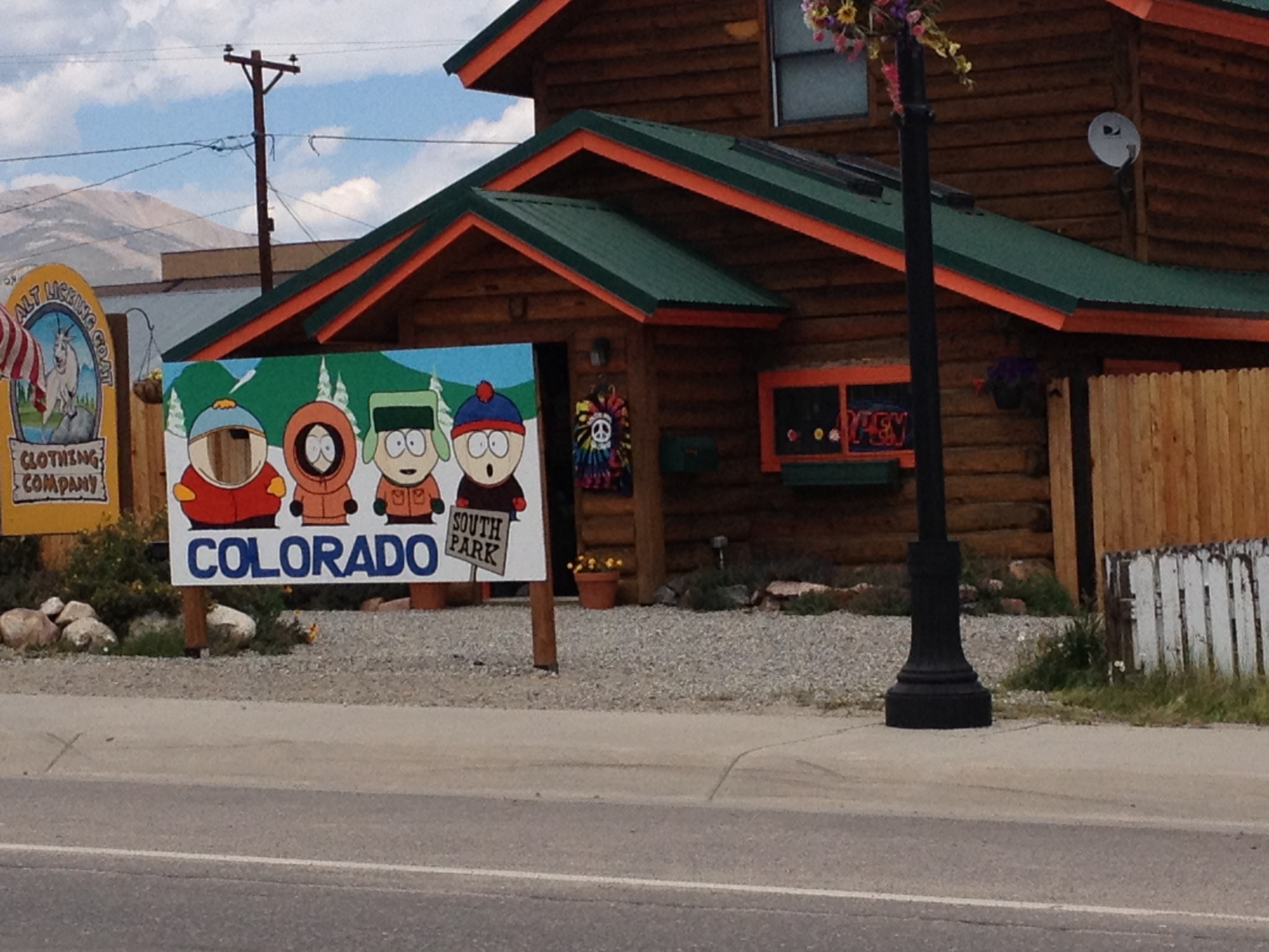
The History Colorado Center is a State history museum in Central Denver, located just south of downtown.  As the name advertizes, the museum covers the history of the State of Colorado.  A similar museum can most likely be found in nearly all state capitol cities.

In my biased opinion, the History Colorado Center is one of the best museums I have ever been to.  The reason I say it is a biased opinion is that I definitely prefer museums that cover topics I am personally interested in.  I tend to be more interested in science and history than art and lifestyle museums.  In addition, I have not been to too terribly many museums, as I tend to spend more time on outdoor activities.  So, my recommendation of this museum can be taken for what it’s worth; based on a strong personal bias and a limited sample set of options.  But, I do feel like this museum is worth the $12 admission. Today we spent just shy of three hours there, but I do feel like I could spend close to an entire day here.

I really enjoy this museum for three reasons:

1.  The museum is highly interactive.

This seems to be a trend in museums of late.  I am not sure what instigated this particular trend, but over the past decade more museums have been moving towards more interactive exhibits.  This particular museum was constructed only a couple of years ago (replacing the previous Colorado History Museum), and thus many of the exhibits at the museum are indicative of this trend.

IMG_1511

Just inside the entryway to the museum is a “time machine” exhibit.  These two “time machines” can be physically moved across a gigantic map of the State of Colorado.  Depending on where these devices are placed, a user can select a year from a list.  Each selection contains a different historical story of Colorado.  These stories come from many different time periods and nearly all portions of the state.  If one were to watch all of the stories available in this exhibit, it would definitely take multiple hours.

Other interactive exhibits at this museum include a silver mining exhibit, a bunch of screen-selecting games, and my personal favorite, the ski jump simulator.  The ski jump simulator not only simulates the building of speed, becoming airborne, and subsequent landing, but also requires that the user mimics the right ski jumping technique.  All this is done in from of a screen that shows the ski jump in progress.  Improper technique will result in a crash in the simulation, and the length of the jump is also dependent on technique.  It is interesting to attempt this ski jump simulation several times to get the best possible result.

2.  The museum presents a fairly complete representation of state history.

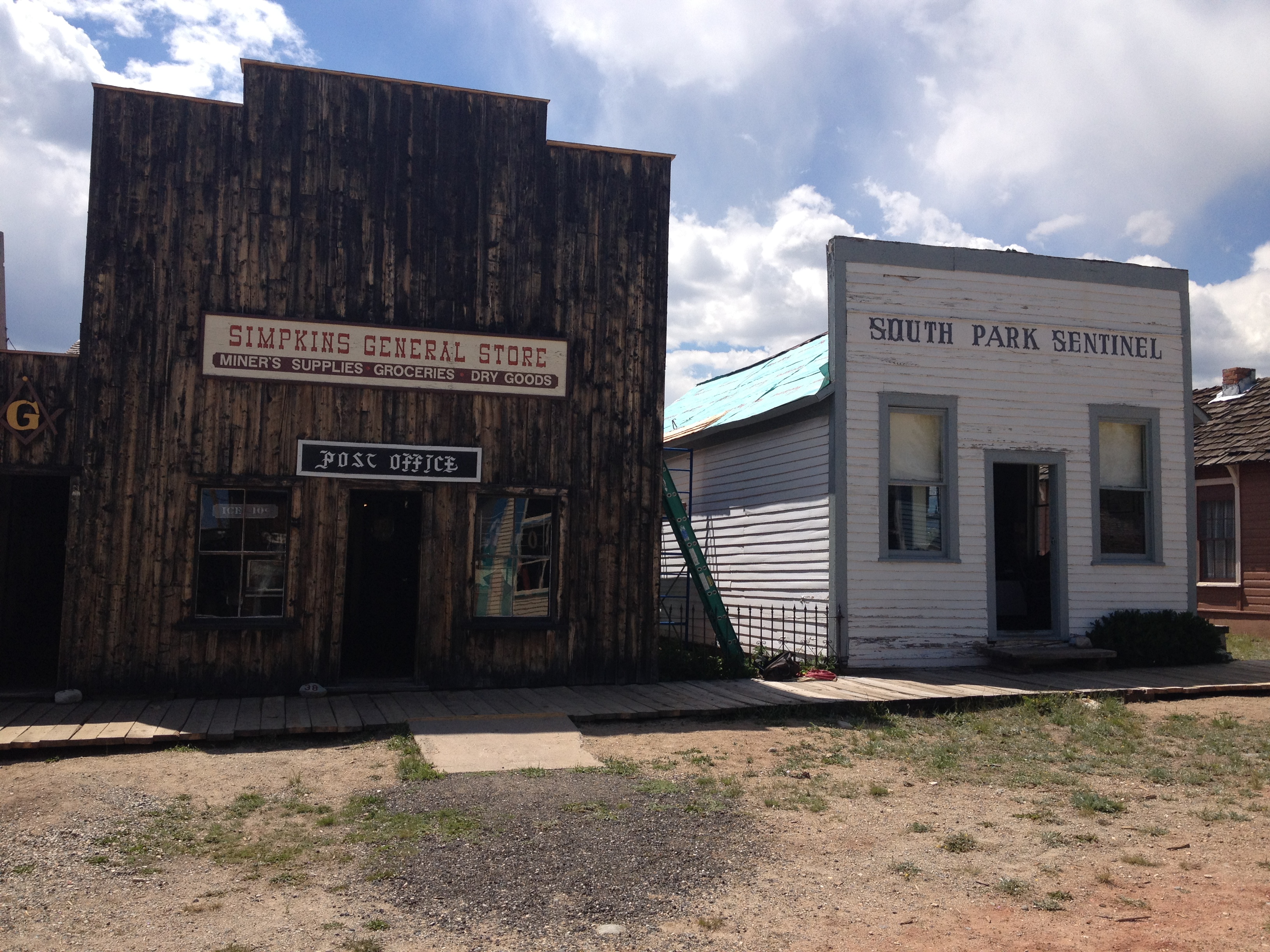
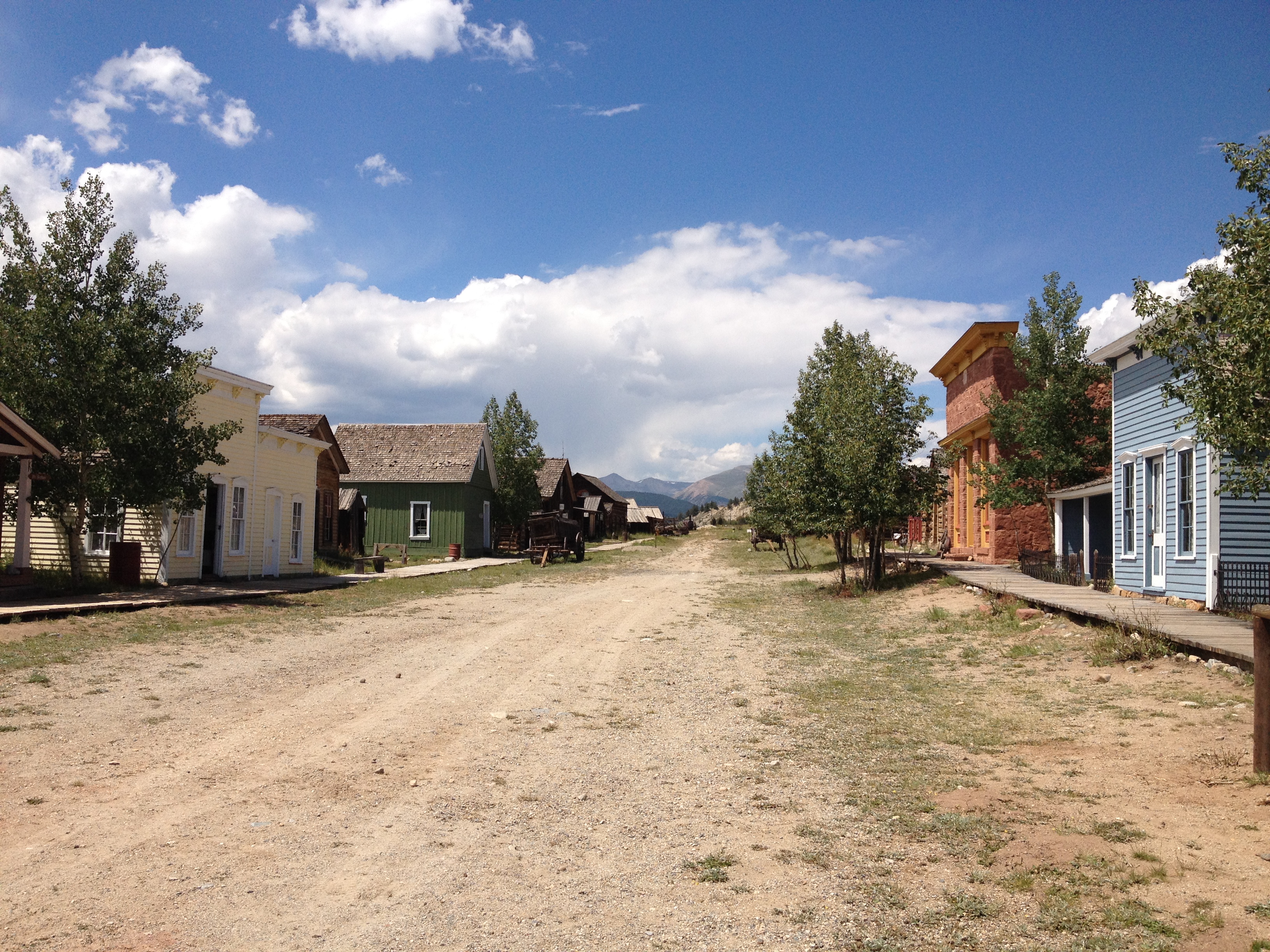
By this I mean the all regions of the state, all time periods, and all types of people appear to be represented at this museum.  Many people think of Colorado and think only of the mountains and the activities associated with the mountains.  Some think of Denver and the Front Range cities, but the entire Eastern 1/3 of the state is often ignored.  This museum actually includes several exhibits that cover life in the Great Plains portion of the state.

IMG_1508 IMG_1509

Half of the first floor of the museum is dedicated to the story of a small town named Keota on the plains in Northeastern Colorado.  Like many town in this area, it’s economy was primarily based on farming and ranching.  Although the town did fairly well in the first couple of decades of the 20th century, it did not fare well during the dust bowl and now is basically a ghost town.

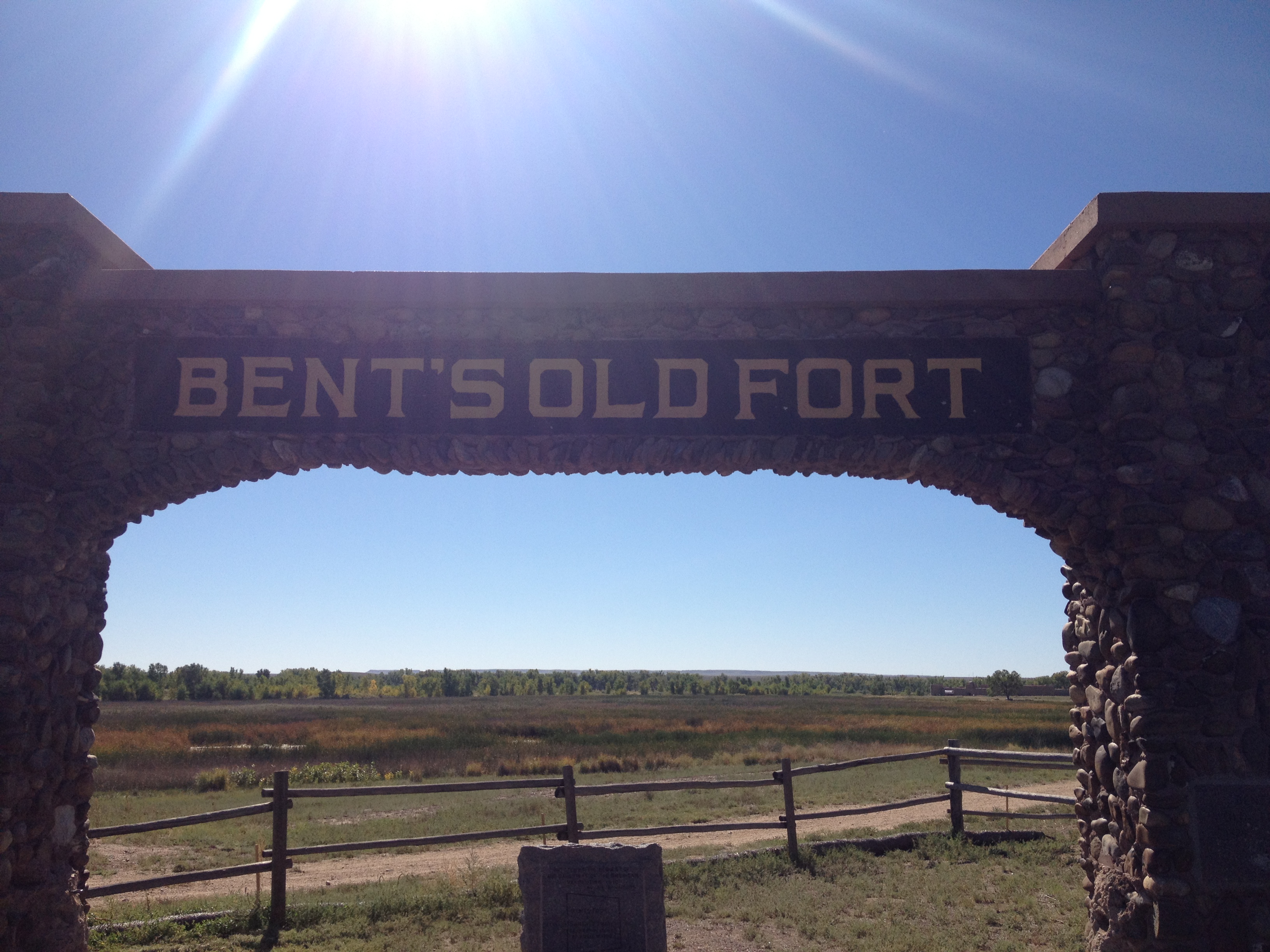
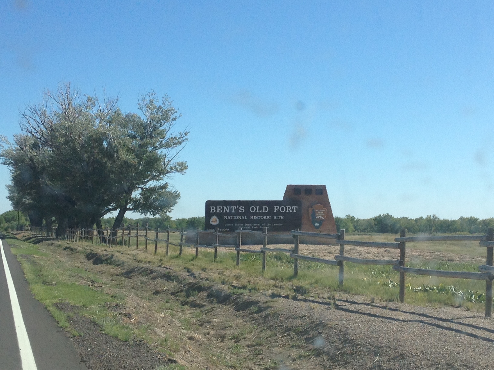
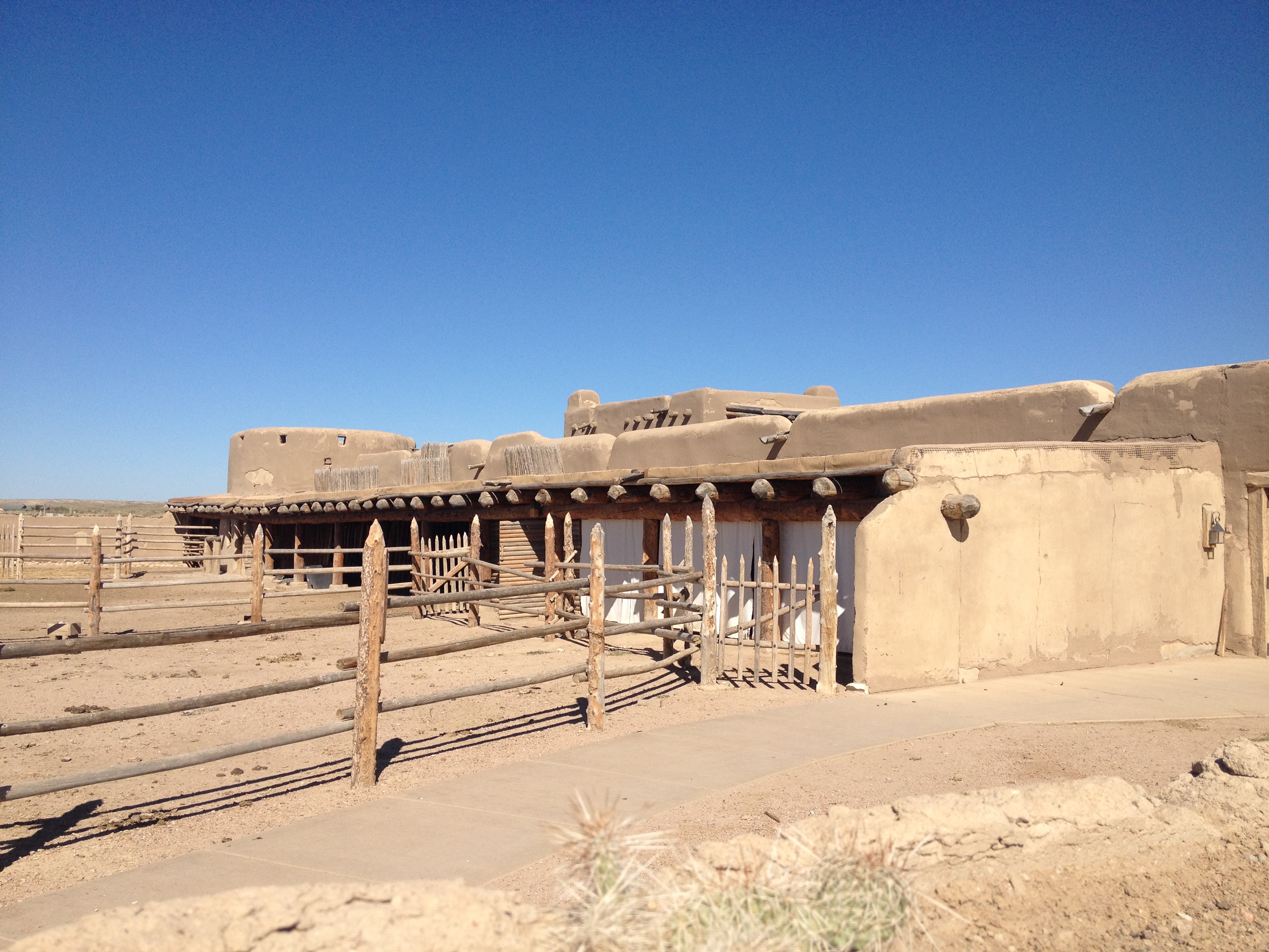
Other exhibits about the history of Colorado’s often forgotten Eastern portion include one on Bent’s Old Fort, and one on the Sand Creek Massacre.  With these exhibits, and several others, the History Center Colorado also presents history from the point of view of nearly every ethnic group to ever inhabit the state.  One exhibit describes Colorado’s history as a borderland between the United States and Mexico prior to the Mexican-American war.  Another one describes the Japanese Internment Camps during World War 2.  And, despite the fact that Colorado is only 4% black (as a state), the museum contains an exhibit about a place called Lincoln Hills, a resort in the mountains developed by black people for black people at a time when many places refused to serve them.

In addition to presenting history from all portions of the state, as well as from multiple perspectives, the museum covers times all time periods, as well as both good times and bad times.  The Steamboat Springs Winter Carnival is a celebration of the winter sport activities that make Colorado a destination for many.  However, the new exhibit covers the importance of water resources in the state of Colorado.  This exhibit covers three periods of time where water resources and the management of them made a major difference in life in Colorado.  In the 13th century water resources were depleted from the “Mesa Verde” area, leading to hard times for the once thriving Pueblo Indians in that region.  Their response was to move south to areas where resources appeared more abundant.  Remnants of this civilization can still be viewed at Mesa Verde National Park, the only archeological U.S. National Park.  The dust bowl was one of the hardest times in Colorado.  Many farmers suffered from a combination of low prices and extreme drought.  This began a population decline in the plains, but some remained on the land.  Finally, current concerns about water resources were covered, as reduced snowpack from climate change combined with population increases threaten shortages of water resources.

3.  The museum has character.

IMG_1503

By this I mean there are a lot of little fun things like this Bison topped with a Santa hat.  Throughout the museum there are a lot of other little decorations here and there, such as the Welcome to Colorado sign, that just make the atmosphere a bitmore fun.  They do this without either going over the top, or seeming too cheesy, which I very much appreciate.

Visiting the History Colorado Center today was a good change of pace from my normal activities, and a wonderful way to take advantage of a day with less than ideal weather.  With a fun yet intelligent atmosphere, a complete view of Colorado’s history as a state, and a plethora of interactive exhibits, my visit to the History Colorado Center  was a memorable experience.  It gave me a lot to think about, and a good overview of the state that I now call home.

Pennsylvania’s Lincolnway

IMG_1365 IMG_1377IMG_1371

Nearly a decade before the much celebrated route 66 was commissioned, the first cross country automobile route, “The Lincolnway”, was developed.  This cross country route from New York to San Francisco, first labelled in 1913, roughly follows what would later become U.S. highway 30 through much of the country.  Although less songs and movies have been written about “The Lincolnway”, it is just as historic.

IMG_1368 IMG_1369

Accessing the Lincolnway in Pennsylvania is quite easy.  In fact, from the Southeast, it can be accessed without even exiting the highway.  In a town called Breezewood, PA, all Interstate 70 traffic comes to a grinding halt.  In order to continue on I-70 westbound, one must make a right hand turn, followed by a left hand turn, and enter the Pennsylvania Turnpike, where I-70 shares with I-76 for about 86 miles.  This is the only place I know where interstate highway traffic must actually come to a stop at a traffic light.  In many other places, following an interstate highway requires exiting and merging onto different roads, but I don’t know anywhere else where traffic lights are actually part of the main interstate highway route.  As a result of every I-70 traveler having to stop here, Breezewood is mainly just a bunch of gas stations (truck stops) and hotels.

The road that motorists encounter when I-70 comes to a halt is actually the Lincolnway, U.S. highway 30.  Since I have some extra time on my journey, and some level of disdain for the Pennsylvania Turnpike, I decide to follow the Lincolnway through much of Pennsylvania and check out some of the sights along the way.

IMG_1372 IMG_1373

After bypassing the larger towns of Everett and Bedford, I make my first stop at a place called Shawnee State Park, roughly 5 miles west of Bedford.  I have always been kind of impressed with Pennsylvania’s State Park System.  I do not ever recall being asked to pay to enter a state park here, which is quite common in other states, and most of these state parks are well kept, even having recycling bins at some places.  The parking area here, less than mile off the Lincolnway, looks like the kind of place where one can relax, do a little hiking, and have a nice picnic.  After less than ten minutes of walking I discovered something truly amazing!

IMG_1374 IMG_1375

Lake Shawnee actually reminded me of what I would consider one of my dream vacations.  One of the things I would love to do most is get somewhere between 8-14 fun, energetic people and go to a cabin or campground near a lake just like this one.  It would involve boating, swimming, beach volleyball, a little bit or partying, and some hiking, all of which seem readily available at this place.  In addition, this state park is well out of the way of most major cities, and the lake area is also out of the way of any parking lots, which would make for a true escape from day-to-day life.

It was already closed for the season by the time I arrived, but I could imagine this place in summer, with people swimming, boating, and just relaxing.  Well, not relaxing the way many of us think of it.  I will refer to it as “relaxation for the active”.  For those of us that would not necessarily enjoy a full day of just sitting around and watching T.V., this would be our version of relaxing and getting away from it all.  For people with very fast paced lives and/or high intensity goals like training for a marathon, it would still represent a slow-down of sorts, and I would still consider it a way of recharging.

IMG_1379

A few miles farther west, the Lincolnway enters a section of Pennsylvania referred to as the “Laurel Highlands”.  I am not sure if this is an official region, or some kind of a tourism marketing strategy.  There was a section of brochures dedicated to this part of the state at the Pennsylvania Welcome Center.  Upon entering the Laurel Highlands, the highway actually ascends up a fairly steep slope, going from basically sea level to periodic summits between 2600 and 2900 feet in elevation.

IMG_1380 IMG_1381 IMG_1382 IMG_1383

One of the main points of interest in this region is the United Flight 93 memorial near Stoystown, PA.  On September 11, 2001, terrorists hijacked this plane as part of a four plane attack on the United States.  Two of the planes were flown into the World Trade Center, and one was flown into the Pentagon.  This flight was headed for the Capitol Building (most likely) when the passengers and crew on this flight mounted a plan to retake the plane.  Their plan caused enough confusion to prevent a fourth strike that day, and the plane instead crashed in an empty field in Southwestern Pennsylvania.  All of these passengers, as well as the flight crew, lost their lives that day.  All 40 of them are buried and memorialized on this site.  I don’t know the names of these people, nor will I ever.  But they are people who truly embodied the word courage, and made an unexpected sacrifice for their country.  In a strange way I felt their presence here as people who have earned, and deserve all of our respect.  I would never had thought of this had I not traveled through this area, but I am really glad that someone decided to put up a memorial to these 40 heroes of recent American history.

IMG_1386

For almost all of this stretch of the Lincolnway, the towns I go through are really quite small.  In fact, they are smaller than I expected.  Finding even your basic road trip mainstays like McDonalds and Subway was quite difficult.  One could also see some remnants of the pre-interstate days on this road much the same way they could see these remnants traveling route 66.  Some of these motel signs even contained some outdated advertisements, such as “Color TV”.  I have a DvD series at home about route 66, which discusses all of the famous stop-off places along that route.  I wonder if anything similar has been done for the Lincolnway.

IMG_1387 IMG_1388

On the other side of the main summits in the Laurel Highlands, I stop at one of the State Parks, a place called Linn Run State Park.  This one, several miles off the Lincolnway, is quite different.  It is far more of a rustic fishing and hiking state park, with some really beautiful fall colors at this time.  The main odd thing I saw here were little homes, most likely people’s second homes, inside the park.  I did not know State Parks allowed people to build homes in them, but apparently this one does.

IMG_1391 IMG_1392

Continuing west on U.S 30 the drive got a little bit frustrating.  Just past the town of Ligonier, the road opens up into a multi-lane highway, but it does not take long for the road to become suburban in nature, with lots of traffic lights, shopping malls, etc.  Traveling roads like this does take significantly more time than traveling on an interstate.  This is why nearly everybody that travels long distances across the country takes almost exclusively interstate highways.  However, I have noticed today, traveling along the interstate does often mean missing some great places along the way, and I truly enjoyed having the time to take this route.  On the interstate, travel is quite monotonous.  Every exit seems to largely have the same places, the same gas stations, the same fast food, etc.  This is especially true of roads like the Pennsylvania Turnpike, where exits can be over 20 miles apart in places, and most of the eating/fueling is done at rest stops, which are designed to all look the same.  Travel on state and U.S. highways, and one can see what makes each town unique, and see spots that they cannot see anywhere else.  This is why I enjoy traveling on roads like this when not in a hurry.

IMG_1394

My final stop-off was somewhat of a disappointment.  In the travel guide I picked up at the Pennsylvania Welcome Center, I saw an advertisement for a Big Mac Museum.  I immediately thought it was a neat concept.  I wondered how much material there would be about one single sandwich, but was intrigued by the idea of a museum dedicated to one sandwich.  However, this museum was not really a museum.  It was just a McDonalds with a giant plastic Big Mac and Big Mac related newspaper clippings behind some glass thrown periodically throughout the restaurant as decorations.  It is really no more special than the “Rock N Roll McDonalds”, and if this can be considered a “museum”, than every single Five Guys can be thought of as a museum to their burgers.

IMG_1396 IMG_1397

Knowing that the Lincolway was about to go through even more suburbia and then downtown Pittsburgh, I decided to finally hop on the Pennsylvania Turnpike.  I got on at exit 76 and followed it the final 76 miles to the Ohio border.  This cost me $4.80 in tolls, which reminded me of another reason I dislike traveling on this road.  However, more important than the price of toll roads is the opportunities provided by other roads.  By traveling the Lincolnway across part of Pennsylvania, I got to see some magnificent state parks, some interesting towns where I could picture the day to day lives of people much different from me, and part of our nation’s history.

Gettysburg 150 Years Later

IMG_1326


When any American thinks about the key places in the American Civil War, Gettysburg is without a doubt one of the first to come to mind.  It was here that the war reached some kind of turning point.  As I had learned in history class, prior to the Battle of Gettysburg the momentum in the war was clearly with the Confederates.  The Union victory at this battle turned the tide of the war, which eventually resulted in a Union victory.  I sometimes speculate that the history is actually more complicated than this narrative.  But, this narrative does seem like it makes a good high-level summary, and the Gettysburg Battlefield is an important battle regardless of what other factors and events contributed to the Civil War’s outcome.

IMG_1339 IMG_1330


The town of Gettysburg is a fairly small town in South Central Pennsylvania close to the foothills of the Appalachian Mountains.  After a string of victories, Robert E. Lee determined that if he could wind a few decisive victories in “northern” towns, he could demand some form of surrender in Washington.  I am guessing that meant the United States recognizing their independence.  Effectively, the invasion of Gettysburg was part of a plan for the South to complete their victory.

IMG_1336 IMG_1337

Most of the Battle occurred just outside of town.  The first shot was fired in a field a little bit west of town, as the confederates invaded from the west.  It was tough to get a good picture of this monument due to the sun angle, but this marker indicates where the first shot actually took place.

Due to the chaotic nature of battles, it is hard to follow all of the events in Gettysburg in chronological order without criss-crossing paths and recovering ground.  The Gettysburg Military Park offers a driving route that covers many of the battle’s key locations and events, but it does not cover them in chronological order,

IMG_1338

One of the first places I visited after the location of the first shot is this cut in the railroad tracks that many soldiers used strategically to hide from bullet shots.  What I find amazing was that this land had already been cut out and these railroad tracks had already been built.  From what I remember about railroad history, 1863 was still kind of early in the development of the railroads.  So, I conclude that Gettysburg was somewhat ahead of the game with regards to getting railroads through their town.

IMG_1340IMG_1343


The entire battlefield area, which is quite large in area (a couple of dozen square miles) has plenty of monuments to specific people involved in the battle.  And, in order to attract visitors from all places, the monuments represent both the Union and Confederate sides.  This monument to Robert E. Lee is placed near a giant field where the Confederates made the final blunder of this battle.  Essentially, both the Union and Confederacy had “lines” where they had set up, and faced each other from roughly a mile away.  On the final day of the battle, General Pickett marched a whole bunch of Confederate soldiers right into the center of the “Union” line as part of a three-prong strategy that did not work.  There were massive casualties, and some soldiers even aborted the mission.  General Lee admitted his mistake to the remaining troops.

IMG_1342


The battlefield also contained a lot of replicas of cannons from the civil war era.  I could not really figure out the rhyme or reason as to why they were placed where they were placed.  But, there were a lot of them.

IMG_1344 IMG_1345IMG_1355


Gettysburg is somewhat of a strange place as the area seems to have a mixture of open fields and more wooded areas.  I was told that some of these areas were not as wooded in 1863 as they are today, but given how long trees live, some of these trees had to have been here in 1863.  In fact, there is one section of the auto tour where the trees appeared to be a nice fall color, an added bonus of the trip.  It was here, in a wooded place called “Little Round Top”, at the southern flank of the battle lines, that one of the key turning points in the battle occurred when Union troops fought back a Confederate advance on the second day of battle.  It was a turning point event of a turning point battle.  This one spot can almost be thought of as a place that changed history.  It is amazing how what was once just a pile of rocks on a gentle slope now becomes one of the places that shaped our country and who we are.

IMG_1347


There are also several places on site where the war turned uglier.  By this I refer to areas where casualties mount, but little to no land actually changes hands.  This is how I imagine the “trench warfare” during WW1 to have been.  This one wheat field apparently changed hands over six times during the three day period of the battle.  Hundreds upon hundreds continued to die with neither side advancing too much.


IMG_1349 IMG_1351 IMG_1352

I kind of ended up on information overload a bit.  There is a lot to understand about this battle, and prior to today I had really only thought of it as the battle, and the Gettysburg Address.  We decided to stop for lunch at a place called the Appalachian Brewing Company, which has a whole bunch of locally brewed beers, and burgers with their label on them.  I have never really seen any company burn a label into a burger bun.  Last week I saw how the Louisville Slugger bat company burns their label into their bats, but a burned label into a burger bun seems quite unique and different to me. Either way, it was an interesting experience, and I left the place actually feeling a little bit tipsy after this beer “flight”.

IMG_1354 IMG_1356


After lunch, back on the battlefield tour, I did do a couple of things one could consider a bit goofy.  I saw a spot on Little Round Top where they had created an iconic image of the Civil War, a photograph of a dead Confederate soldier.  I hope I did not offend anyone when I decided to reenact this photo.  Sometimes I like to feel history come to life when I visit these places.  This is why I was excited to see a Civil War reenactor standing at the top of the hill.  I actually wonder how often Civil War reenactments occur in Gettysburg.  I imagine a lot, and I picture the 8,000 people that live in Gettysburg to run into, and even be delayed by Civil War reenactments all of the time.

IMG_1360


The battlefield also contains memorials to all of the infantry units that fought in this battle.  Each one of these memorial stones contains statistics about the number of soldiers lost in battle.  Reading just some of these stones I conclude that nearly half the people who came to this battle did not leave.  This, of course, is what makes war so sad.  Military history can be interesting, and it sounds like fun to take part in one of those reenactments.  But it is important to remember how many people do lose their lives whenever there is war.

IMG_1328 IMG_1333


From the statues commemorating Abraham Lincoln, and the naming of one of our oldest cross country routes the Lincolnway, the impact that the outcome of this battle has had is quite evident all around us.  After hearing all of these details about the battle, strategies, events and such, my main takeaway from all of it is that General Robert E. Lee lost this battle due in part to an over aggressive strategy following a series of decisive victories.  When I process this through my head it actually makes a great deal of sense to me.

I think we have all been in situations where we get arrogant, aggressive, and sloppy after a series of ego boosts.  I can relate this to sports teams that blow giant halftime leads, and executives that push through major new product lines without the full vetting of the product.  It is easy to get caught up in a “winning streak”, and lose sight of the need to make careful decisions.  I do not know if the war’s outcome would have been different had Robert E. Lee exercised a bit more patience and due diligence at this point in time.  The war had other fronts and many battles elsewhere.  It is still strange to think about that possibility though, the possibility that the world could be completely different if only a few events at a key point in history had unfolded differently.  Alternate history writing often makes that speculation, and also speculates about how today’s world would be had the outcome been different.

Would the Southern and Northern States have ever reconciled their differences and reunited?

When would the Confederate States have outlawed slavery?

Could this have changed the outcome of the 20th century conflicts in Europe?

These questions and many more are discussed by many writings and videos often with wildly different answers.  There is no real way of knowing what would have happened had this war turned out differently.  This is part of what makes it fun to speculate.  However, Gettysburg is not about alternate history.  It is about real history, and history we can learn from.  This is why I find it important to not just learn the fact, but also the lessons.  One can memorize the sequence of events in this battle, and every battle of the Civil War but still fail to take away the lessons from it.  One such lesion from this battle is to make sure we all continue to make smart decisions even when our egos have been boosted and our confidence peaked by a series of victories, in any situation in life.

Bent’s Old Fort

IMG_1112

The idea of racial unity, or more accurately the idea of two or more racial/national groups living side-by-side without conflict, and mutual respect for one another is not new.  It isn’t, as it feels like some people believe, something that mankind first came up with in the middle of the 20th century after finally sorting through the fallout from World War 2.  It is just an idea that has never really overcome other pressures.

In the early to mid 19th century, brothers William and Charles Bent, of Saint Louis Missouri, actually believed that it was possible.  Early in life, these brothers participated in a series of trade missions along the Santa Fe Trail.  As the Bent brothers encountered both Mexicans and Native Americans on these missions, over time they established good relations with both groups of people.  William Bent was even accepted into the Cheyenne tribe, and participated in negotiations on their behalf.  This included negotiations with other native tribes, as well as with the United States. The two brothers, along with Ceran St. Vrain established a trading fort in what is now Southeastern Colorado, along the Santa Fe trail.

For this reason, I decided to make the trip to Bent’s Old Fort, but I ran into one minor issue.  Apparently, I did not realize that Bent’s Old Fort is a National Historic Site, and therefore is closed due to the current government shutdown.

IMG_1111 photo

So, I did the only sane thing.  I pulled my car off to the side of the road (the parking lot was also closed), and I snuck around the gate.  Heck, I didn’t have to pay the entry fee!

IMG_1115 IMG_1116

The fort is reconstructed really well.  I should probably come here sometime when I could actually get inside the building.  And also when the bulls and horses that are kept there are contained rather than wondering around where I could have theoretically provoked them and wound up in trouble.  In fact, that is why I did not stay very long, and did not take any pictures of the animals and the trail.  I was, however, able to imagine what it was like for pioneers and traders to travel along this trail, and encounter this fort, the first building of any sort travelers along the trail would find for miles.  And, according to the information presented in the parking lot, which I did get to read, from 1833 (when it was built) through 1849, this place would have been bustling.  Surely, a welcome sight for travelers.

IMG_1113

One question that often comes to mind when learning about Bent’s Fort, is why it was placed where it was, near La Junta, Colorado.  Currently, most of Colorado’s largest cities are a lot closer to the mountains, within 20 miles or so.  From the perspective of modern day Colorado, it appears illogical for this major trading post to be located over 60 miles east of Pueblo, the mountains, and all of the good fur and pine.   However, at the time Bent’s fort was built, 1833, it was built right on the border with Mexico.  For someone traveling west on the Santa Fe Trail, this fort marked the end of the portion of the trail in the United States.  After this, travelers would have entered Mexico, or, after 1836,  the Republic of Texas.

Unfortunately, both Bent brothers ended up on the wrong side of history despite their good intentions.  Actually, it was perhaps because of their good intentions.  Charles Bent, the older brother, was appointed the first territorial governor of New Mexico following the Mexican-American war.  The reading material outside the fort suggested that he was appointed to this position due to his good relations with the people there.  However, he was killed by the Native Americans in the Taos Revolt in 1847.

The younger Bent brother, William, was persecuted by the other side.  During the Sand Creek Massacre, he was captured by General John Chivington after attempting to make peace between the U.S. and the Native tribes during the gold rush.  He was forced to lead Chivington and his troops to the Cheyenne campsite where he conducted the Sand Creek Massacre, killing hundreds of Native Americans.  William’s end was not nearly as dramatic as his brother’s, but his efforts failed to create peace between the U.S. and the Native Americans.

The story of the Bent family and their fort reminds us that it is important to judge everybody as an individual, and not paint every member of some group with one brush.  Throughout this time, there were definitely more white people like Chivington, who murdered natives despite their efforts to make peace, and also more white people like the Bents, who approached native tribes with deep respect for their culture, and attempted to share in the human experience with them.  There is more to who someone is than their racial identity.

Just in case the lines were not blurred enough in this whole story, John Chivington was a hard-core abolitionist.  He could not wait to free the black population and share our culture with them.  Yet, he viewed all Native Americans as savages that needed to be exterminated.  On the flip side, the Bent brothers owned slaves, and William would eventually support the cause of the confederacy.  So, there is a group of people out there who would potentially view Chivington in a more favorable light than Bent.

So, who is the good guy and who is the bad guy?  People like to simplify history, assign one side ad good the other as bad, and establish one or two themes.  This makes them feel like the have a good handle on the situation.  However, in reality, history is about as complicated as the human mind, and all of the many mechanisms that cause people to behave in the way that they do.  Some people may know more individual facts about history, but that does not necessarily mean they understand history better.  Some people view all facts through the lens of a preconditioned idea about the nature of the people involved, and cannot appreciate all of the facts.

IMG_1120 IMG_1123

One amazing thing about traveling is that travel has this way of causing people to build upon their thoughts.  Sometimes it almost feels as if the world has found a way to set itself up in such a pattern that it creates certain themes in everybody’s lives, or at least each person’s individual trips.  After pondering these thoughts on the drive from La Junta back to the interstate, the drive home took me through two towns that recently made waves in our current political climate; Pueblo and Colorado Springs.

Last month, these two towns made news across the state as they surprising recalled two of Colorado’s state senators.  One of them was actually the leader in the senate!  The recall election was at least partially about the gun control debate, but other factors may have contributed.  Advocates on each side of the debate appeared, at least to me, to be motivated by ideological differences rather than some form of tribalism.

But is it all just ideology?  Have we really replaced racial issues with actual issues about how we view our government and society (which would be a positive change)?  Unfortunately, last year’s election results, and specifically the large difference in voting patterns by race indicates differently.  Race also still finds it’s way into may of the political debates we have in this country today.  I am not going to assign blame to either side on this one.  This is not a partisan political blog.  But, pondering the racial component to our politics, the self-segregated neighborhoods in Chicago and other places, the Indian Reservations and the like, makes me think that we are not really living side-by-side the way the Bents had envisioned.  The middle of the 20th century saw a major push towards that end, with Matrin Luther King’s I Have a Dream speech articulating that goal in a manner that most can relate to.  But, there does still appear to be a disconnect.

Tribalism is an inevitable part of human nature.  But will our “tribes” always be dictated by our origins?  The internet now provides us access to nearly everybody around the world, and more and people are moving more frequently.  These factors may encourage our future “tribes” to be more determined on different grounds, such as worldview, or common interests.  But, would this be better?  Less disconnected?  Less violent?  Maybe the key is not how we determine our “tribes”, but having respect for other “tribes”, or at least letting them live the way they want to as long as they are not hurting you.  This is a tall task for the human race, but one that is theoretically possible.  All challenges can be met, like the one below, Pike’s Peak, which I got one last view of before it once again becomes snow packed tomorrow (which is fine, it looks better with the snow on it anyways).  A mountain whose peak was once unreachable, is not reached by People on foot, in their cars, and by the cog railway.

IMG_1125

Goin’ Down to South Park

IMG_0958

I decided to break with a previous precedent I had set in this blog to only post one entry about a day’s travels.  In retrospect, some of the entries I posted a couple of months ago, which combined several activities into one post just because they were done on the same day seem like they may have come out a bit awkward.  In reflecting on the travel writing I had previously read, they appeared to make breakouts by experience way more than date.

Since I had already traveled to the South and West along highway 285 to get to Staunton State Park today, I decided to continue along the road a bit to get to Fairplay, Colorado.  By looking at my DeLorme Atlas, and then doing a subsequent Google search, I determined that the show South Park, is based (some argue loosely) on this town.

As someone who is a fan of this show, it probably sounds stupid that it took me over a decade, as well as over a year after moving to Colorado, to figure this out. But, I am not one to base my life around T.V. shows.  I feel like people nowadays focus too much on T.V. shows.  I get exhausted by conversations about T.V. shows, and saddened by people who appear to posses a greater understanding of the lives of fictitious characters on a weekly T.V. show than the lives of actual people who should be important to them.

In South Park though, I see a show that can come to represent something more.  Most shows people watch are entertaining, but don’t change anyone’s lives.  Sometimes, a groundbreaking show like Seinfeld will come along, but Seinfeld mainly changed the course of television, not history or society.  There have been shows like Fresh Prince of Bel-Air that produce commentary about real issues from time to time.  But South Park has come, to me at least, to represent an actual societal development.  It has come to represent the courage to retain the right to think individually, and come to a critical conclusion of almost anyone or anything regardless of what level of esteem they have come to enjoy by long-standing institutions or large groups of people.  It is the anti-group think, and the backlash to the political correctness movement of the 1990s.

IMG_0952 IMG_0953

However, the South Park Museum in town has absolutely nothing to do with the show.  But, it was a really good museum depicting life in the west in the 1870s/1880s.  The town was somehow preserved exactly as it was in that era, even down to the layout of the street and buildings.  There is even a historic train at the far end of the street.

Over 40 buildings were preserved, from homes, to the general store, saloon, blacksmith, and all of the quintessential buildings needed to make a true “old west” town.  Each building contained a significant amount of artifacts from that era, and museum attendees could actually walk through almost all of them and see most of the items used in day to day life here up close.  Walking through all of these buildings, I could actually imagine myself back in the old west.  I could picture myself living the life of the 300 or so residents of this town during that time period.  Overall, I have visiting my fair share of recreations like this, and this one has been the most realistic!

IMG_0956 IMG_0957

It is quite rare that any kind of museum, or historic town can lead to someone actually imagining themselves to be there!  However, there I was, imagining myself washing my clothes at the wash house, picking up supplies at the general store, boarding the train, and even getting involved in a game of cards at the saloon as if I were in the movie Maverick.  And all this was after I was expecting an entire museum about an animated T.V. series!

Also included in this museum was a 10 minute film strip about the town, and some basics about the history of the area.  All of this is not too far out of the ordinary.  As I visit more historical locations throughout the west, I have come to the conclusion that two themes are emerging from the beginning of the white man’s history of the west; fur and gold.  Most of the trails and even some of the towns in the area appear to have been established by fur trade, or gold rushes.  However, every gold rush appeared to have come to an end within a decade.  Some towns, like this one, found another niche (in the case of Fairplay it was ranching, and being a business center and county seat).  Others, like the ghost town I wandered through this past weekend, simply died when the gold ran out.

Overall, though, I can’t help but find it somewhat ironic that the history of the west was forced so much by fur and gold.  So, it feels to me that as much as we want to characterize the old west with images like this one.

11375403-cowboy-or-a-mountain-man

I can’t help but think that since most of the early settlers were searching for fur and gold, the old west can be just as easily characterized by images like this one.

12874308-beautiful-woman-with-clean-fresh-skin-wearing-gold-necklace-and-furry-coat-looking-straight-at-the-c

This recreation of the old west town was, of course, walled off from the rest of the town that was significantly more modern looking.  A few gift shops appeared to be trying to capitalize on the town’s association with the show, but not as many as I had expected.   The town had a somewhat similar layout to most small towns I am familiar with, with a central business district, and some larger shops and houses on the outskirts.  But, compared with the only other town above 9000 ft. I have spent a significant amount of time in, Breckenridge, it was a lot less dense.  The central business district was quite spread out, amongst a few streets and a fairly large area.

IMG_0959 IMG_0961

The one thing that definitely did remind me of the show, though, was the mountains outside of town.  Some of the mountain views from near town actually seemed to appear almost exactly as it appears in the cartoon.

IMG_0951


On the return trip, I once again encountered the Colorado Trail, at Kenosha Pass, which is the mountain pass that separates the “South Park” area from the Front Range.  I do find it odd, though, that this mountain pass is at an elevation less than 100 feet higher than the elevation of the town I was just in.


IMG_0962 IMG_0963

Finally, the two images above that I did not take, the mountain man and the woman with the fur and gold, are credited to the site http://www.123rf.com.


The Fourth Largest State

Earlier this week, when I was camping in some remote areas (as in, no WiFi), I fell behind on my blog posts. This is the main reason why today, for the second day in a row, three new entries are posted up on this blog. At the end of every day, I had been writing down my thoughts, but had not been able to upload the pictures into this site. Last night, I had a hotel room, and was able to load up my pictures. This weekend, I will be in the hotel world as well. So, with this entry, I will officially be caught up on my entires. On the return trip to Denver, I will most likely re-enter the camping world.

One way I have been amazing myself on this entire trip has been how consistently I have been waking up without provocation. Starting with Saturday morning, every morning I have been waking up at more or less 6 A.M., and not really having any problems. This is a far cry from when I was waking up to a desk job I did not enjoy every morning, and having to force myself out of bed every day, and struggling to be up at 7:00, or even 7:30. I thought this may have been an artifact of being outside camping, but, this morning, at the fabulous Super 8 in Hardin, I awoke at 5:45 with no problems.

Today’s journey was a nearly 400 mile journey across the state of Montana to get to Missoula for my Leadership Training. To be honest, I was somewhat concerned that I would get bored on this drive due to the large spacing between towns, and how traveling on only interstate highways get. But, this was not the case at all. In fact, I ended up finding a lot of Montana to be a pleasant place to drive across, with scenery that gave me serene and pleasant thoughts. It was quite a nice drive.

My first stop was in Billings for gas. Normally this is not really anything worth writing about, except that I was a little taken aback by the 85.5 octane ratings here in Montana. I had always been accustomed to 87 octane being the lowest grade fuel. Then, I moved to Denver where it is 85. I did not even know decimals existed for octane ratings in fuel until today.

20130606-221010.jpg

Another notable thing about Montana’s gas stations is that they have casinos! I took a look inside one of them, and all it was were slot machines and a poker table, but it was still an interesting and unique sight to see. The truck stops here also sold plenty of liquor and such. Montana’s attitude seems kind of like anything goes. It is almost like the people here have found a way to live free of everything uptight about the rest of the country, and avoided the unnecessary behavior restrictions that go along with it. In the grander scheme of things, thinking about this actually makes me feel like Denver may indeed be the place for me. I don’t think I could actually live in Montana, as I am kind of hooked on city life in a way. But, Chicago and New York come out with a bunch of unnecessary silly laws. Denver could be a really good compromise between the two.

Although it was pretty flat (albeit, nowhere near as flat as Nebraska), mountains quickly began to appear. To be honest, I don’t really remember the names of all the Mountain ranges here in Montana. I’ve just gotten to the point where I know most of them in Colorado. But, let’s just say scenes like this one were common throughout the drive. It was common to see mountains, but not have to drive through them like I-70 in Colorado.

20130606-221712.jpg

Bozeman was a nice town. It looked pretty well to do, and had some good Western qualities to it.

20130606-221833.jpg

With a couple of hours to spare, it was time for me to get my Lewis and Clark on. Those that know me know that I love to hear about the journey of Lewis and Clark and actually wish to recreate the adventure on my bicycle someday. In fact, that is the reason I know about the Adventure Cycling Association, as they are the organization that outlined a route in which to follow this historic mission on my bicycle.

So. We took a stop at the Missouri River headwaters, an important point on the Lewis and Clark journey, as well as a very significant place in our nation’s water system. The Missouri River is formed near Three Forks, MT, where the Madison, Jefferson, and Gallatin rivers meet. The Missouri River is actually the longest river in the U.S.A., running from this point all the way to Saint Louis. But, could it be even longer? Who was the one who decided that these three rivers, by three separate names, came together to form the Missouri? Why isn’t it two rivers flowing into the Missouri? This are the questions we pondered while throwing sticks into the river, knowing that sometime next month they would show up in Saint Louis, an amazing feeling.

20130606-222421.jpg

20130606-222432.jpg

20130606-222440.jpg

After this, we passed over the continental divide, which was only at 6300 or so feet. Significantly lower than in Colorado, where the divide is consistently over 10,000 ft. I notice a few cool rock formation, and also a lack of pine beetle damage to the trees. Last year’s drought did not extend this far north, and therefore Montana’s forests, unlike those of Colorado and South Dakota, actually look pretty much in tact.

20130606-222824.jpg

After a little bit of construction, I finally arrived at my destination, Missoula, MT, and the organization I had been reading about on the Internet for a decade.

20130606-222942.jpg

Hiking in the Black Hills

June 4, 2013

Mount Harney is the tallest peak in South Dakota. In fact, it is the tallest peak anywhere east of the Rocky Mountains. The guy at the Custer State Park visitors center actually said it was the “Tallest peak between the Rockies and the Alps”. While that is technically true, it is a bit of a stretch. At 7242 ft., it is taller than anything in Appalachia, including the tallest peaks in the Smoky Mountains, but not really by too much. The difference is less than 1000 ft., and is probably made up for by the fact that the bases of those mountains are at lower levels.

However, it was still a really good hike. In fact, it kind of reminded me of hiking near Boulder a bit. It is at similar elevations, a similar total climb, and there are some major rock formations here too. Our loop from Sylvan Lake up to Harney Peak and around by two other major features; Little Devil’s Tower, and the Cathedral Spires, took us a bit over 8 miles today. With what is probably close to 2000 ft. of vertical climbing, between the main climb and a couple of side climbs, it was a very satisfying hike. With this morning’s drive taking us by the ” Needles Eye”, we have actually seen nearly half of the unique natural features of South Dakota. Not bad considering that we only arrived in South Dakota on Sunday.

20130606-152731.jpg

20130606-152744.jpg

At the top of Harney Peak there was a strange lookout point. It was actually the remnants of an old building. We think people actually hid out here, but I am not sure who. It was still interesting to see the place, and imagine the life of someone living on top of the tallest peak in the area. From this vantage point, you can see all of the peaks. We could look out on all of the peaks of the Black Hills, including the ones we had driven up and down yesterday and today, and they all showed up significantly below us. This may be the first time I have experienced this exact feeling, climbing my own way up to the top of the highest peak in the area. In 2005, I biked up Blue Mounds (Wisconsin), but the terrain there is nothing compared to what it is here. In 1998, my family and I drove up Pike’s Peak, but, we drove.

20130606-152544.jpg

20130606-152552.jpg

The alternate trail we took on the return trip to the car took us real close to the Cathedral Spires. These rock formations remind me of the Dolomites in Northern Italy, with their mostly vertical, but imperfect, gray colored rock structures of varying heights. In fact, for the entirety of the hike, as well as in many cases before and after, I have been referring to this feature as “The Dolomites”. And, no, I am not trying to show off that I am Italian, or that I have been to Italy. It is just kind of natural for people to make the association in their head based on the visual. I am reminded of an instance when someone I knew kept referring to the green sauce that they provide with samosa at an Indian restaurant as guacamole. He was not trying to show off his Mexican-ness, it was just that his previous experiences with green sauces in restaurants had mainly been guacamole, and the natural association was made. In the same vein, the other time. I had seen rock formations like that, it was the Dolomites. Some of the other rock formations did look like the Flatirons in Boulder, with a major exception being that they are lighter in color.

20130606-152834.jpg

20130606-152849.jpg

On this hike, in several places, both on and off the trails we were traversing, we passed through some tight areas inside rock formations. This was a good deal of fun, although somewhat scary. Oddly enough, I enjoy doing things like this, and I have not even completely figured out why. I guess there is a slight element of danger in it, and it does provide the hike with some variety. But, hiking is already an interesting enough activity that it does not need variety. And, I am not really pushing my limits anymore with this nonsense, as I have done it plenty of times over the past several years. Maybe it is just curiosity, the entrance into the unknown, the feeling you get when anything can happen. In this sense, it would be the same feeling that drives people to take a new route home, enter into new activities and new social circles, or even drink or do drugs. The flirtation with the unknown seems to come out in me a lot; skiing, hiking, parties, etc.

One final note about the hike. Boy have these pine beetles done a number on the forrest here. Scenes like this one are seen everywhere, and when viewed at a distance, parts of the “Black Hills” look quite red! I knew this was a big problem in Colorado, but it actually seems like the beetles have done even worse to the forests here. It is sad to think that the very nature of these places are bound to change forever, but in life, change is inevitable. It cannot be avoided at any costs.

20130606-152926.jpg

Our other activity today was visiting Crazy Horse. Crazy Horse is a statue of a famous Native American hero that sits on the other side of the black hills from Mount Rushmore. But, it is incomplete. It has actually been under construction since 1948, and is still nowhere near close to done. According to the hosts at our campground last night, the Crazy Horse statue will “not be completed in your grandchildren’s lifetime”. This slow progress is due to the desire to make this statue quite enormous, as well as their commitment to use only private funds. Turning down money shows a significant amount of pride, and/ or adherence to principles. Maybe both, they are actually probably quite related.

20130606-152949.jpg

20130606-153001.jpg

At Crazy Horse is also a museum of the Native American. We did not intend to spend all day there, so I pick a few excerpts to read, some about famous Native Americans. I don’t even remember the stories themselves, but reading these stories makes me more curious about Native American culture in general. History is written by the winners, and in the battle for North America, we, the white man, are the winners. But, it is hard to ignore the fact that we kept making and then Subsequently breaking treaty after treaty with these Native tribes. I would love to know the full story behind this, from both perspectives, and how the modern day Native Americans feel about all this, as well as the situation they are in now. Are they happy to have all the modern conveniences associated with the U.S.A.? Do they feel that we are the ones protecting the freedom of all? Or do they feel they cannot live the lifestyle of their choosing, and their continent has been usurped? I bet you get some real mixed emotions.

On the campground tonight, we got a bit goofy. In fact, we spent probably about half an hour, sometime around sunset, trying to throw pine cones into the campfire from various places. Most of them were from the top of a rock. It was some unexpected (and free) fun. I think our society could use a bit more of that if you ask me. One of my favorite things about trips like this are actually simple things like this that bring joy out of nowhere, unexpectedly.

20130606-153140.jpg

Oregon Trail Historical Sites in Wyoming

Image

I am not on vacation, nor am I on any kind of a long trip.  I have a couple of more major trips planned in the near future, and I intend to write about them.  Today, I took a day trip up to Fort Laramie and Guernsey, Wyoming to see some historical sites related to the Oregon Trail.  For those who don’t know of the Oregon trail, and have not played the popular 1990s computer game, the Oregon trail is one of several trails commonly taken during the 1800s era of Westward expansion.  As the name suggests, this trail was the route to Oregon.  It originated in Saint Louis, Missouri, which was a common starting point for many westward voyages.  Thus, the Gateway Arch and museum was built in Saint Louis to commemorate the city’s role in Westward expansion.

Several historic trails actually followed the North Platte River from it’s split in North Platte, NE to just west of Casper, WY.  Not only did the Oregon trail follow this route, but so did the California trail (which, as the name suggests went to California rather than Oregon), and the Mormon-Pioneer trail, which was used to establish Utah as the base area for the Mormon population.  These trails break off in different directions farther West, but in order to take advantage of the most efficient pass through the Mountains, they all followed this route, passing through Fort Laramie and Guernsey in Eastern Wyoming along the way.

The main attraction to this particular site is the ability to see the wagon ruts quite clearly, as shown in the picture above.  The wagon ruts are so clear to this day because in this section of the trail, the wagons passed through rock as opposed to dirt.  So, the process of weathering over the past 100+ years did not remove the evidence of heavy wagon traffic here, the way it did in many other points along the trail.

Fort Laramie also had major historic significance.  It was a major stopping point for pioneers making the Westward voyage, providing them with a place to rest, and a trading post for them to obtain supplies for their journey, which was about to enter a more treacherous phase, going through the mountains.  It is, in fact, at this point along the journey, where those traveling West first start to see the Mountains in front of them.  Up until this point, the trek from Saint Louis, along the Missouri, Platte, an North Platte rivers mainly through Missouri and Nebraska is relatively easy compared to what lies ahead.  I can even picture some people making this journey to have put the upcoming challenge that these Mountains pose out of their mind, after a month or so of mostly flat terrain.  While looking Westward from the Fort, I tried to imagine what would be going through the mind of someone traveling the trail in the mid to late 1800s, suddenly being reminded that their voyage was about to get much trickier, and much more dangerous.

It is always interesting how history seems to come alive in places like this.  I know not everyone does this, but whenever I visit historic places like this, I always kind of imagine the actual historic scene that is being commemorated.  In this case, it is Westward expansion, the movement of people from the East across a relatively unknown vast expanse of land, to a whole new life in the West.  I imagine the people at the Fort, discussing their voyage up to this point, and what lied ahead.  Maybe even some of them had a few drinks and had long talks about what they expect from their new lives, in Oregon, California, Utah, or wherever else they may be going.

The first time I ever remember imagining history was on a family trip to Plymouth Rock when I was eight years old.  On this trip, not only did we visit the rock where the Mayflower landed (I was disappointed, I thought it would be bigger), but we also went to Boston Harbor, where the Boston Tea Party had actually taken place.  They even had a ship with mock boxes of tea, so tourists could actually lift these boxes and act as if they were dumping the tea into the sea, the way the colonists did in 1773.

It is when I thought of this experience, and how it taught me to visualize history that I suddenly made the connection between these two places.  The Mayflower is basically where history began (from our perspective) for the state of Massachusetts.  The story of everything in that part of the world begins with the Mayflower’s arrival, then to Thanksgiving, and onward to the revolution, etc.  Where I live now, in the West, history begins much later,  pretty much with this very trail.

The first people to use this trail were actually fur traders, as early as the 1790s.  They made no permanent settlement in the area, but they did “blaze the trail”.  They were the ones that figured out what path was best to take through the Mountains, followed the rivers trapping beaver and such.  In essence, they mapped the route for the settlers that would begin making that voyage several decades later.  Along this trail would be the first white settlement in the region the same way the Mayflower was for the Northeast.  It is truly amazing what kind of connections we can make when we let our thoughts flow like this.

The other major historical significance was Fort Laramie’s military presence.  This is an aspect of our history that is significantly less triumphant and more questionable than the voyages across the country.  When I think of the pioneers, I think of them with pride, as they risked their lives to settle new areas and open up new opportunities to us all.  However, the military presence has a much more morally questionable history.  The military base at Fort Laramie played a role in a ridiculous shoot out with a group of natives over the theft of a cow, as well as some of the “Indian wars”, which, it appears from the way the history was presented there, came about when us, the European settlers, violated a treaty with the native tribes that we had previously made.  The previous treaty had given the native tribes the black hills, but once gold was discovered there, we decided we wanted it.

History is never as clear as we would like it to be.  Everyone loves to study World War 2 and the battle against the Nazis because it presents us as the “good guys” in a manner that is about as clear as any historical event would ever be.  Almost every other event has many shades of gray, and much more complexity to consider.  It is often presented through a biased lenz, but I have found out through further investigation that there is quite frequently more to the picture that what is commonly presented in history class, the media, or any other common discussion.

This bias, of course, is no more evident than my own thoughts earlier in this blog about how Massachusetts “history” started in 1620, while Wyoming “history” started with the first fur traders in the 1790s.  Both those places had been occupied by native tribes prior to those dates, which represents the first time European settlers entered the picture.  They may have a rich history as well, with stories of conflict, adversity, triumph, courage, and even some questionable actions, much like our own story of these places over the past few centuries.  But, I don’t know the story.  Maybe it’s been forgotten, maybe someone still knows it, but the rest of us Americans of European descent just don’t care.  Heck, I find that many people don’t even care about the history our direct descendants were directly involved with, let alone a history of our land that has basically been erased over the past few centuries.

I’ll probably never know that story, and there are probably many aspect of the story of the settlers of the 1800s that I am not aware of.  But, going to places like this does give some perspective, and encourages many of us to think about our history; the good, the bad, and the questionable.  History is not something that can be changed, but learning it gives us all a little bit of perspective.  As Bob Marley put it “if you know your history, then you’ll know where you’re coming from”.

The Dachau Concentration Camp

Today was a rather somber day.  The weather kind of sucked, could, drizzly, and I doubt it got above 10°C.  We spent most of the day in Dachau at the concentration camp memorial and museum.  Dachau, which is less than half an hour from Munich, was the site of one of the largest concentration camps and the one that set the standard for many others.  Nazis would refer to it as the “Dachau spirit”, when demonstrating how other concentration camps should operate.

I did not expect to spend nearly as much time there as we ended up doing.  In fact, we ended up missing a meal because of that.  Maybe that was fitting for the experience of being at a concentration camp.  As we learned today, those detained in the concentration camps often experienced starvation.  The museum and audio guide had a lot of information.  It also included a detailed history of Adolf Hitler’s NAZI party, and a lot of videos and first hand accounts of the day-to-day life inside the concentration camps.

The overarching theme is just how horrific it was.  Those imprisoned- their life meant nothing, their suffering- nothing.  Many starved to death, were gassed, forced to work, and were mocked and humiliated on a regular basis.  I’d always known about this horrific event, but until today I had never seen actual images and videos of it.  This put it in a whole new perspective.  I was mostly in disbelief about how something so bad could happen.  And it happened in a first world country only several years before my Dad was born.  Maybe that is one reason we are so fascinated with NAZI history, it is not nearly as far removed from us in the early 21st Century United States as Greeks, Romans, Barbarians, etc.

Hitler and the Nazis are brought up and quoted a bit in causal conversation, in my opinion way too callously.  Sure, it may be possible to compare the Defense Authorization Act with some things that occurred in mid 1930s Germany (specifically granting the government the right to detain indefinitely without due process), but after viewing this I feel it is kind of disrespectful to those who actually experienced the holocaust.   We usually bring up Hitler and the Nazis to prove a point.  But, we can probably find a more respectful way to make our points about the political climate in the early 21st Century.

More thoughts ran through my head, as despite our overuse of NAZI comparisons, it is still a very interesting case study in how a major economy/ first world country could go down such an evil path, and so recently too.  The rise of Adolf Hitler in Germany is almost always linked to the penalties and sanctions placed on Germany in the Treaty of Versailles that ended the First World War.  But, what really lead to World War I?  It seems less well known than WW II.  I am sure historians have good theories, but they are certainly less discussed in history class.  Also, were we (US and allies) the good guys in WW I?  After finally learning about Woodrow Wilson’s anti-German propaganda machine in the 1910s (no thanks to high school history class), I just don’t know anymore.  I think this is one reason people love to talk about World War II.  There is a very clear sense that we were the good guys, and NAZI Germany was the bad guys.  Very few wars are like this.  We try to romanticize past wars, especially the Civil War when you learn about it in Illinois, but further investigation shows that it was not nearly as clear-cut as the Land of Lincoln would like it to be.

Another thing that has pestered my in my head about Hitler is why he is always labeled a “right-wing” dictator.  Usually, this is done to contrast him with Communist dictators; Mao and Stalin.  There are important differences.  Most notably, Hitler’s Germany did not squash all corporate activity.  In fact, there were corporations who worked with the Reich.  However, the label is still misleading.  When translated into English, NAZI translates to “National Socialist Movement”.  In the U.S. socialism is considered left wing, at least on economic scale.  Also, many of the propaganda posters for the NAZI party I saw in the museum complained about the evils of greed and capitalism.  Rallying against “Jewish Capitalism” was seen in a lot of NAZI propaganda in advance of the 1932 elections.

I also learned that different groups of people were treated differently inside the camps.  For instance, Austrian nationals captured after the 1938 annexation of Austria were treated much better than Jews.  The more favored groups, while still having it rough, were not treated as rough, and had a higher survival rate.  Before today, I did not know that people were actually occasionally released from concentration camps.  This occurred mainly before the war.  And then there was a period of time in 1943 when they tried to improve conditions in the camps to increase survival rates to meet labor demand for the war effort.

I also did not know that corporations would pay the secret service for slave labor from these camps.  In fact, the German economy kind of became dependent on this labor, much in the same way the pre-civil war South was.  Overall, it was a learning day.  But, after all the walking, and the chilly weather, I was tired, so we did not do much else.

My Last Day in Italy

It was our only full day in Tuscany, and our last full day in Italy.  Tomorrow, we’ll take the train straight to Innsbruck, Austria.  I already begin to wonder if I have seen enough of Italy.  However, John, the guy, one of the organizers of this B&B informed us that our train route tomorrow will go through the Dolomites north of Verona, so I guess I will see more of Italy.

Before this trip I knew I wanted to make Italy a part of this trip.  My family heritage is 50% Italian, and I had always considered that a part of who I am.  Mostly, to explain my lack of patience sometimes I would say: “I have about the level of patience you’d expect from an Italian-American New Yorker”.  However, I’d never known about the culture, beyond the basics.  Now, I kind of understand, or feel like I understand it more.  From now on, those maps of Italy put onto pizza boxes in America will mean more to me.

Today we went to the town of Siena, after an amazing breakfast cooked by the staff here at Poggerino.  Siena, like Florence, “grew up”, in the Middle Ages.  For a few centuries (1000 to 1400-ish), these cities were constantly in conflict with each other over supremacy and influence in the region.  Florence, more or less, eventually won this battle, and Siena was “vanquished” to smaller status (still true today).  This was around the time the Middle Ages gave way to the Renaissance.   It is probably no coincidence that Florence became the city in Italy most associated with the Renaissance, attracting thinkers/inventors from all over Europe.

In a way every place we visited has an associated time period.  Rome- the Roman Empire, Siena- The Middle Ages, Florence- The Renaissance, The Tuscan Vineyards- now, as it is currently one of the wealthiest and best known parts of Italy.  So, given the small allocation of time, I think I did well and learned a lot about Italian culture and history, about my history in a way.

Finally, I was wayyy excited to have purchased salami, cheese, bread, soda, and an orange from a local shop in Radda, and eaten at home.  It was only 8,64 Euro, so we saved between 25 and 50 (Euro), and we ate at 6 PM (after all, we are American), and did not have to drive unlit roads in rough terrain at night like last night.

Staying at home allowed us to witness a casual fire around 8 PM.  This week’s weather has been warm and dry.  I’ve already gone though all of the short-sleeved shirts I brought.  Today though was windier, making it seem like textbook wildfire weather.  This fire was actually on Poggerino property.  It appeared as though the wind ignited a fire among a pile of dry leaves and wood pieces.  We were worried, and even tried to contact the proprietors of this establishment.  But, noting came of it, and the fire died around 10 PM, when the wind calmed down.  Maybe I am a stupid city slicker.  Or, maybe we got lucky and I need to learn to be more self-sufficient.