Category Archives: hiking

Back on Top of the World

IMG_4128

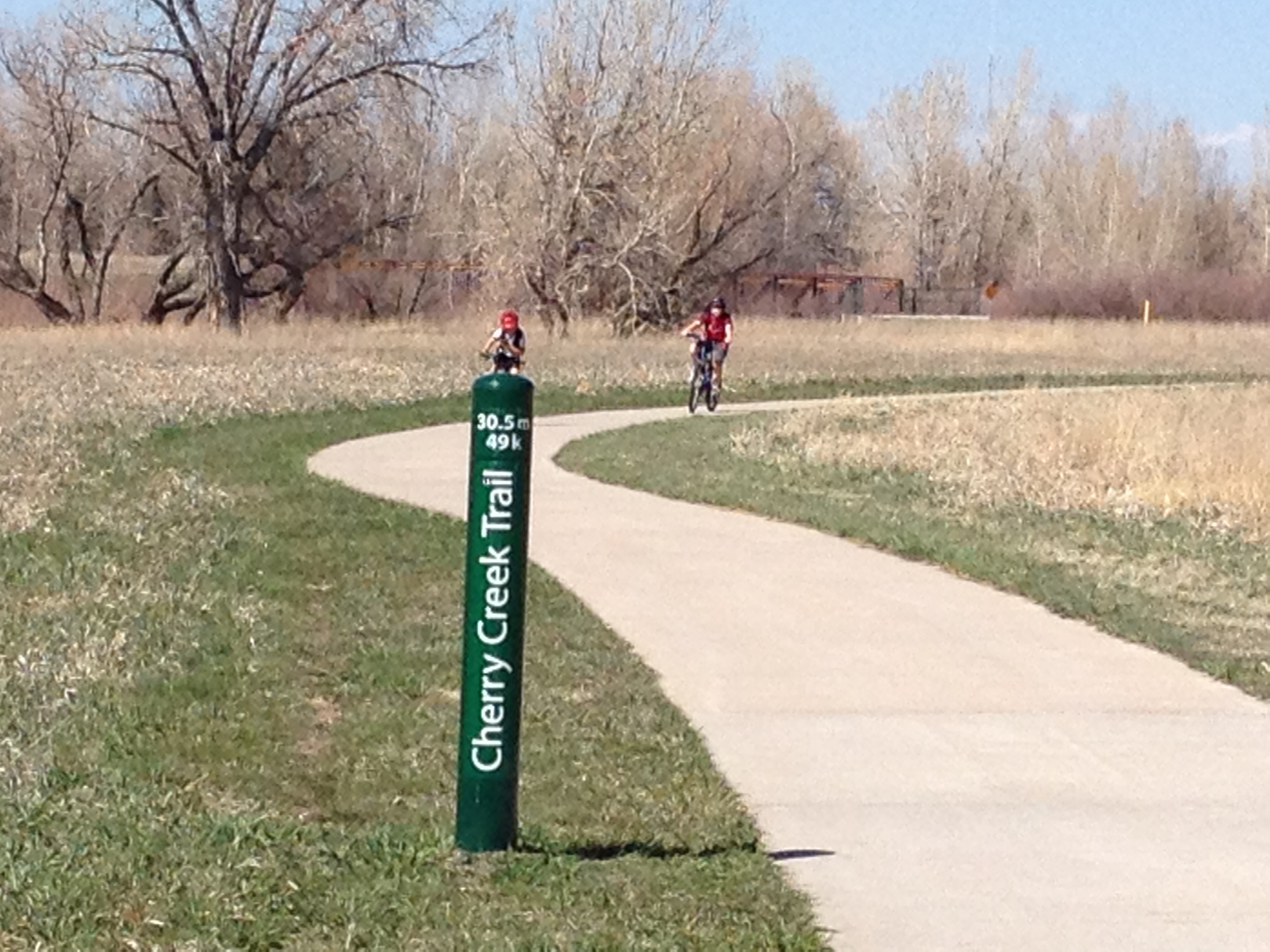
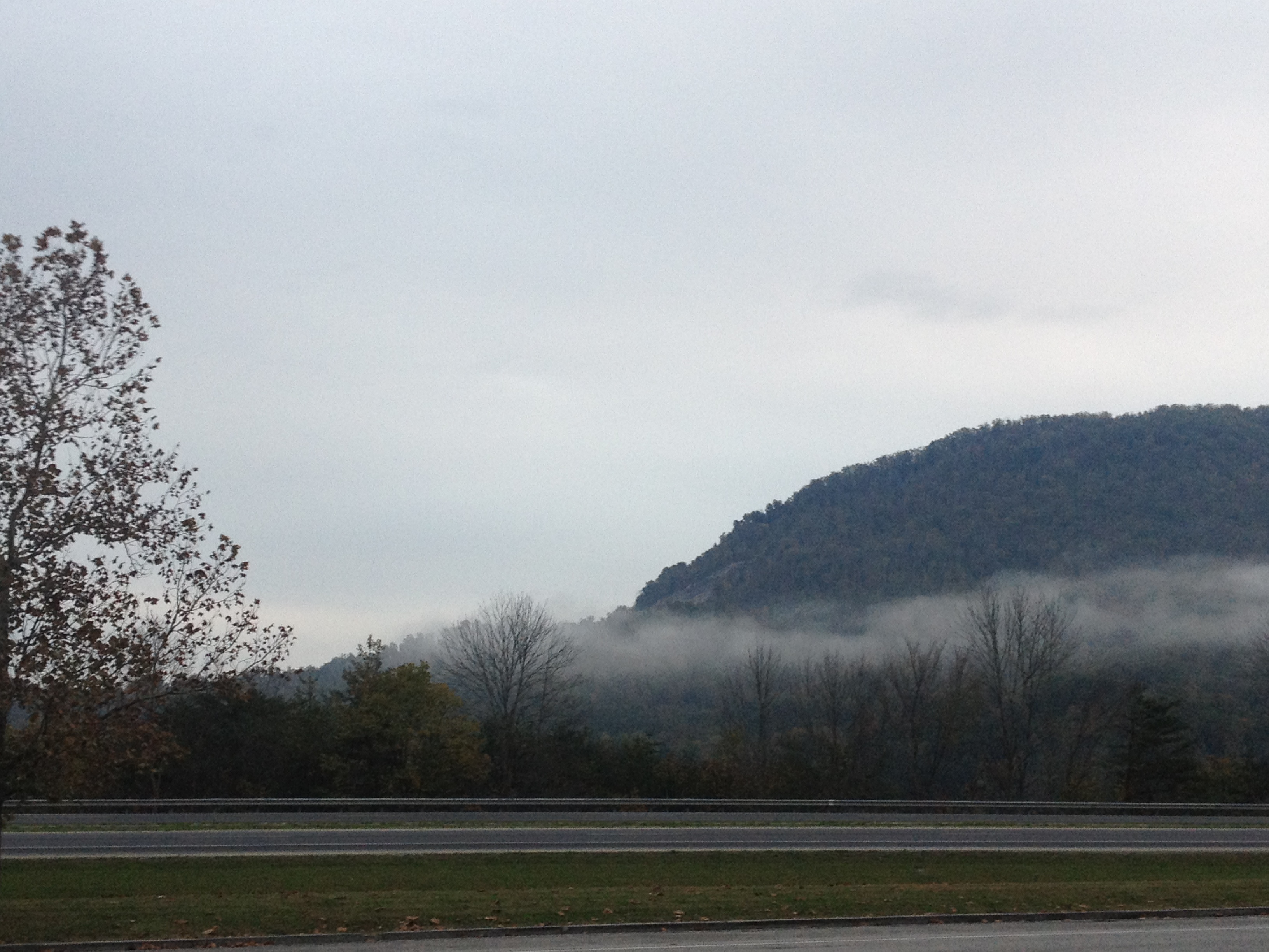
Four in the morning is such as strange time of day.  It feels almost surreal.  Everything around you is so much quieter than we all have become accustomed to seeing it.  It is a time when the streets of your home town, even the blocks surrounding your home, feel strange and distant.  For many of us, it is the only time that our surroundings appear restful, as nearly every other time of day, the streets are full of people; people in motion, with agendas, and tasks to attend to.  It is almost as if you are experiencing a completely different place than the one you experience on a day-to-day basis during normal waking hours.

The few people you do see out and about at this hour have widely differing experiences.  There are some for which it is still last night.  The parties, after parties, drama, and other events that had been unfolding since the previous evening are still unfolding.  They have not transitioned to the next day yet.  For others, though, the new day has already begun.  They are starting some sort of project that has already carried them into the new day.  Basically, although the calendar says Sunday, some people are still on Saturday, while others had moved on to Sunday.  It very much reminds me of the International Date Line, which physically separates one day from the next day.  Only here, it is much murkier.  And having been on both sides of this line, it is definitely a challenge to make sense of everything I see around me.

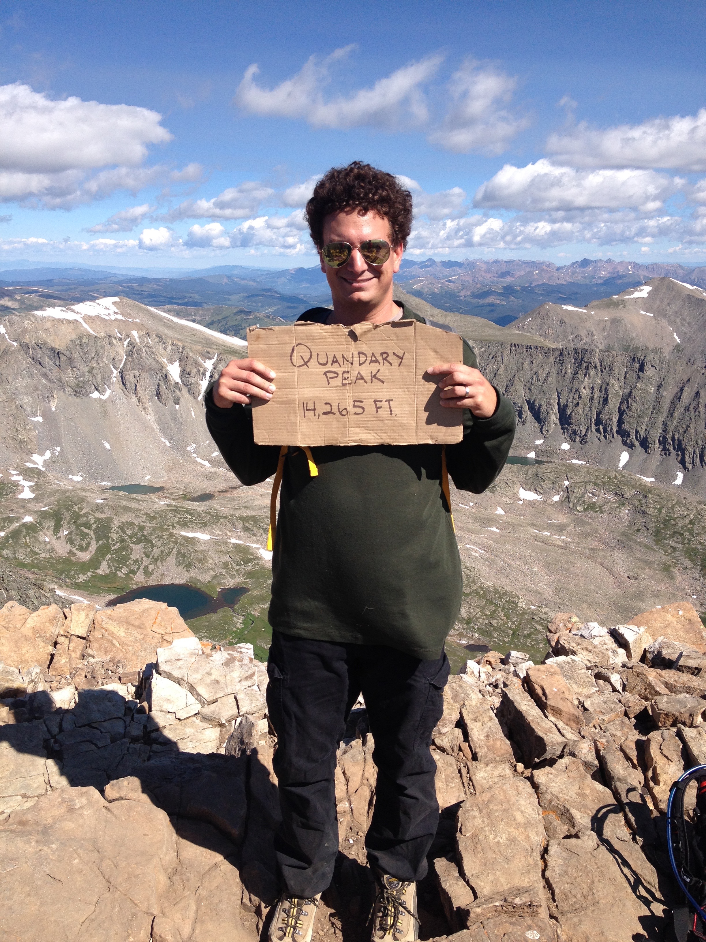
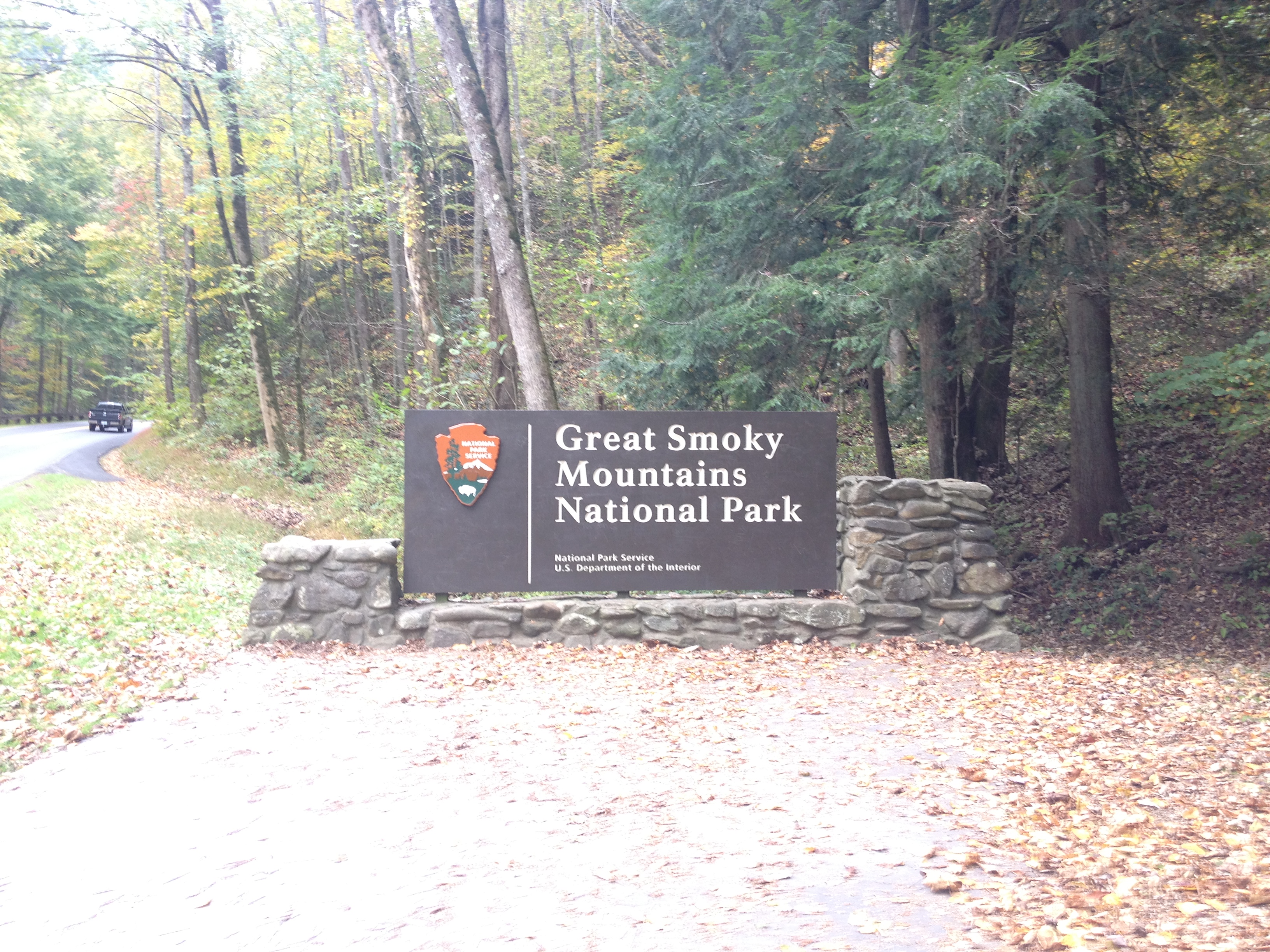
I woke up at four in the morning in order to climb Quandary Peak, one of Colorado’s “14ers“, located in Summit County, just under two hours from Denver.  Climbing “14ers” is one of Colorado’s pastimes, and a rite of passage I first accomplished just over two years ago.  Unfortunately for anyone that hates early mornings, those climbing these peaks are generally advised to get an early start for safety reasons, as the weather here can be somewhat chaotic.  Sometimes unexpected weather here can lead to horrible results, even on days when inclement weather was not expected.  It is recommended that most hikers begin these climbs by 7 A.M. to minimize such risks.  So, I woke up at 4, to get ready, and get to the trailhead by 7.

IMG_4107

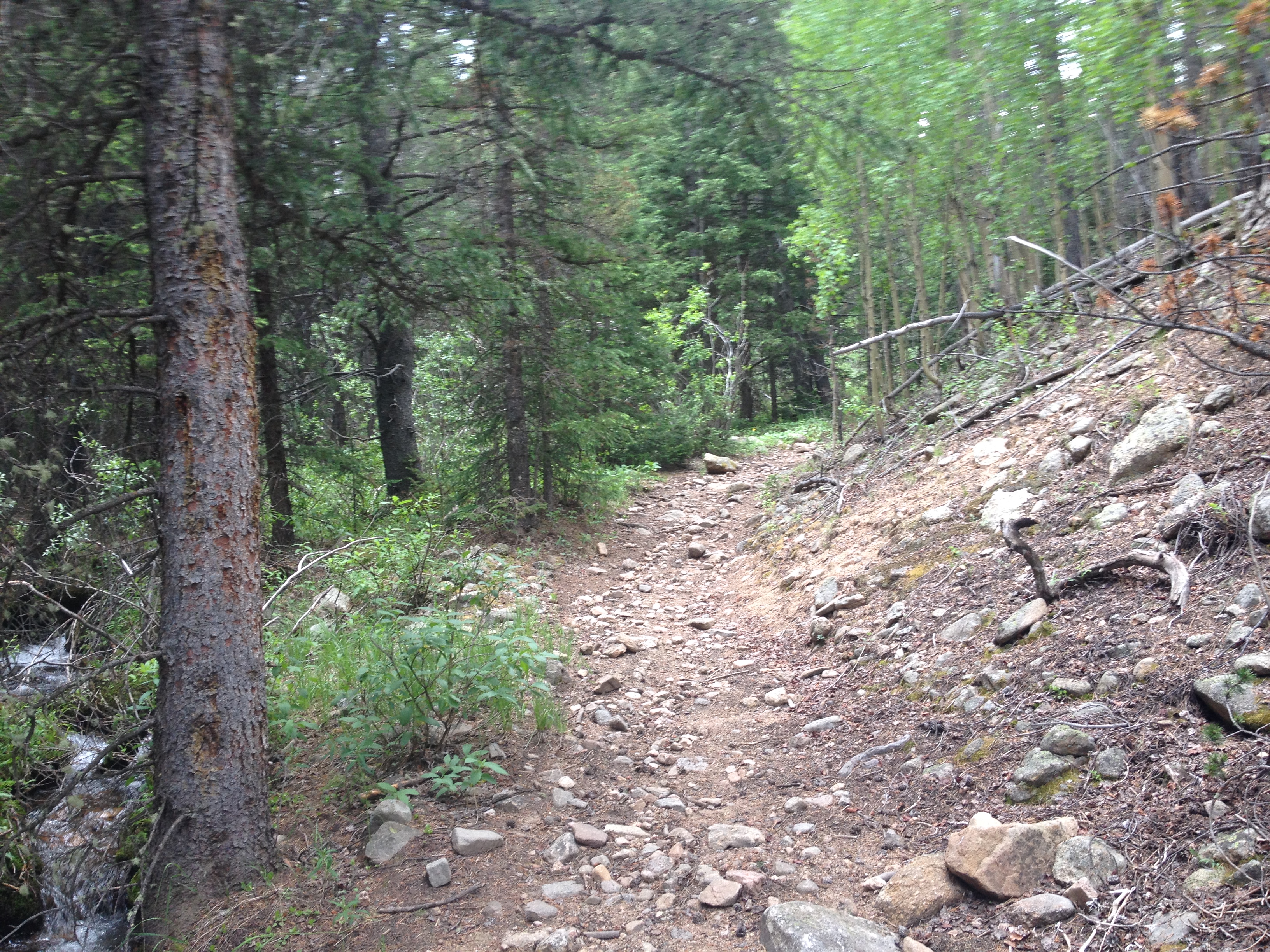
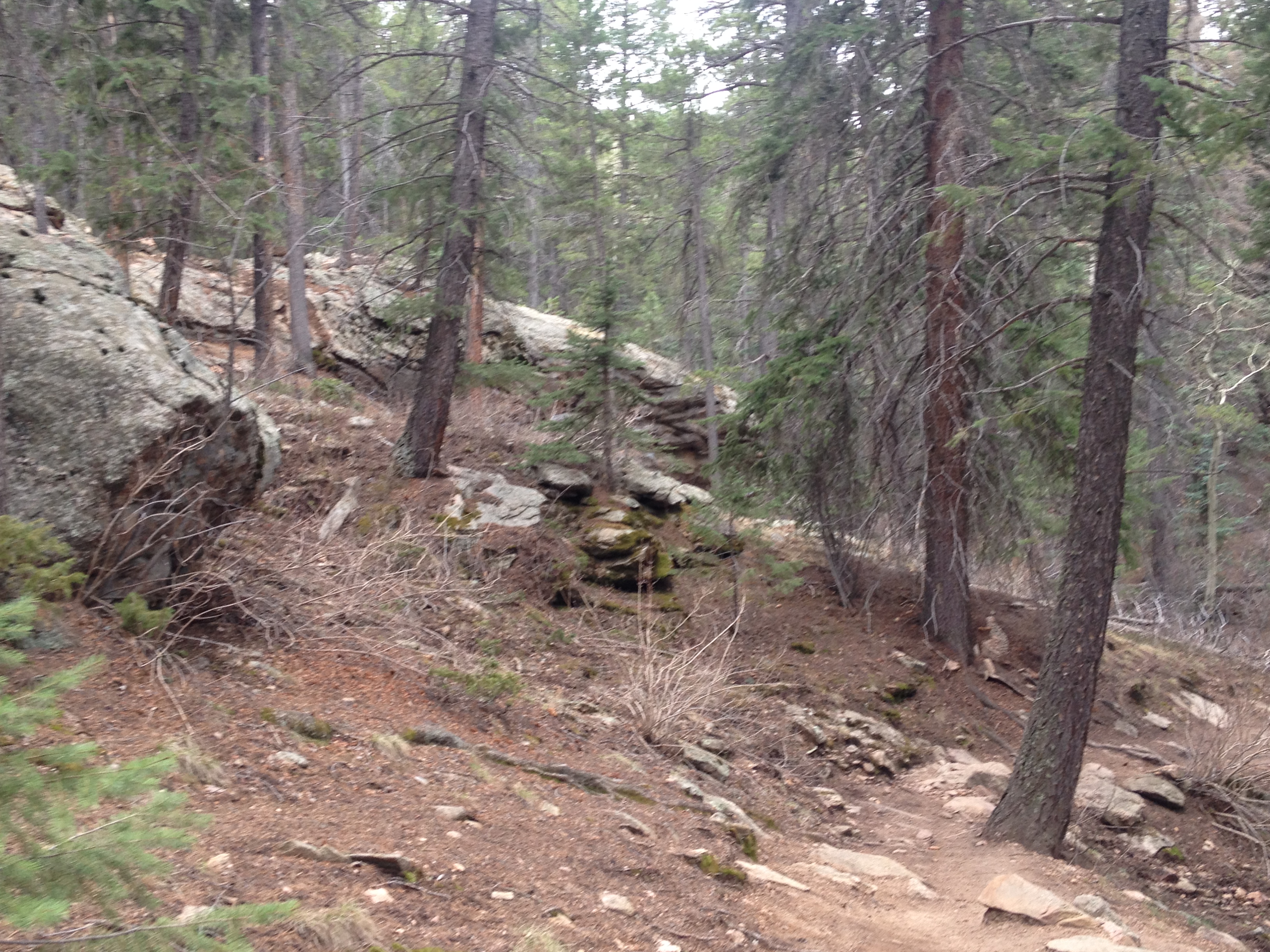
I have only climbed three other 14ers, so I have little experience to compare this particular hike to.  But, from the very beginning this hike seemed anomalous.  Most hikes, particularly Mount Bierstadt, begin relatively flat, with steeper grades coming farther into the hike, and closer to the top of the mountain.  This hike, however, had some fairly intense grades right at the start of the trail.

IMG_4110 IMG_4111

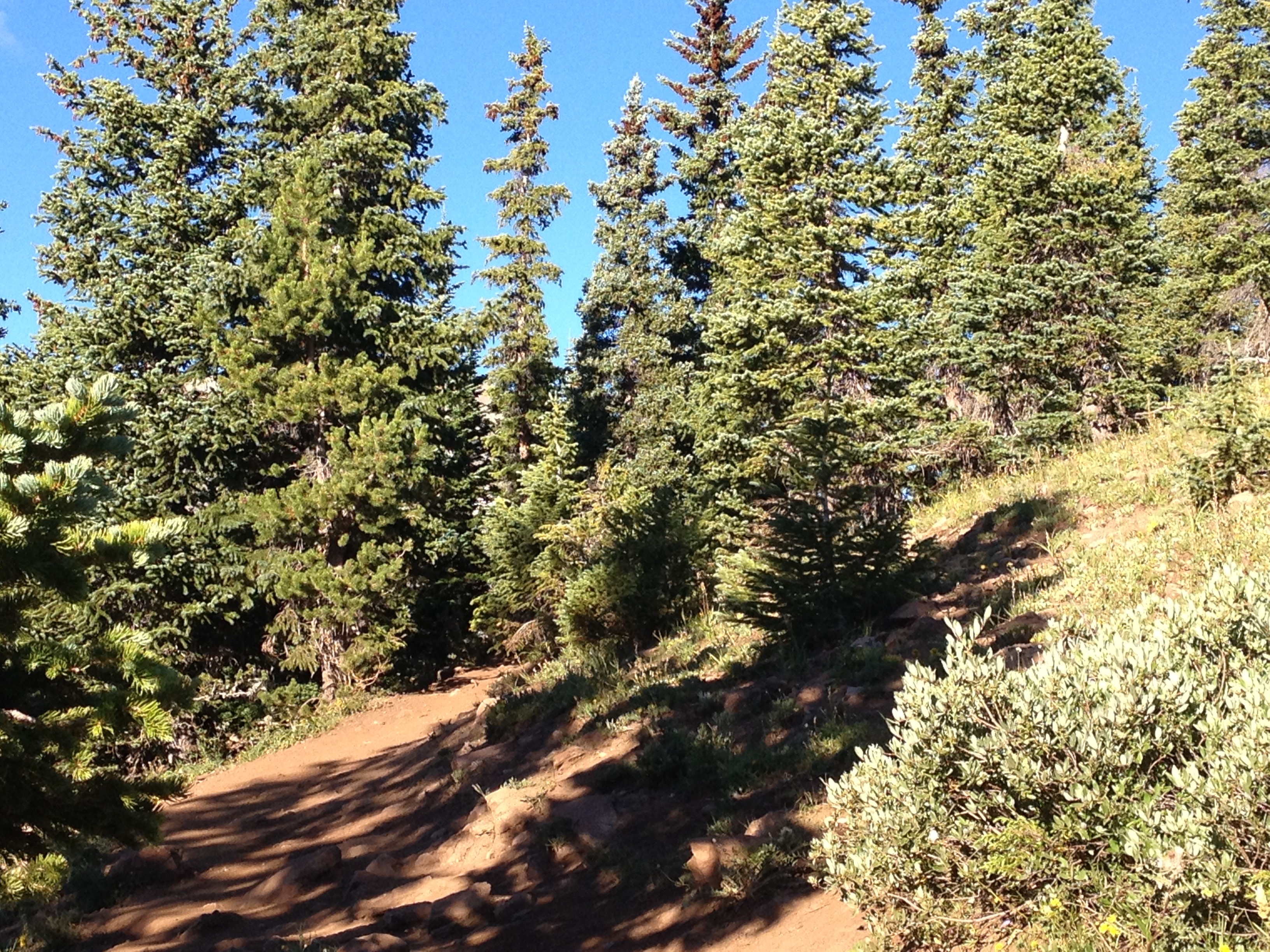
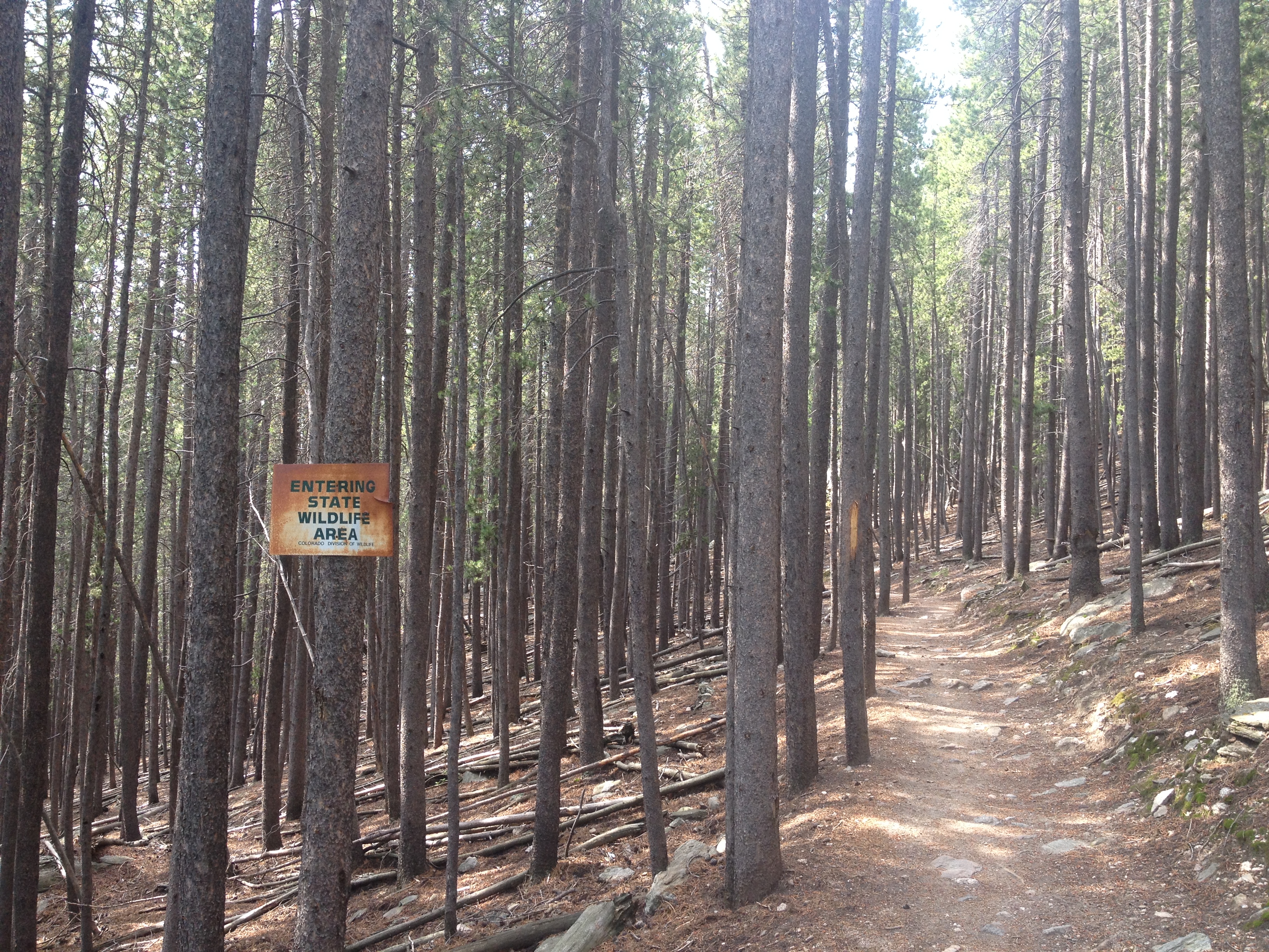
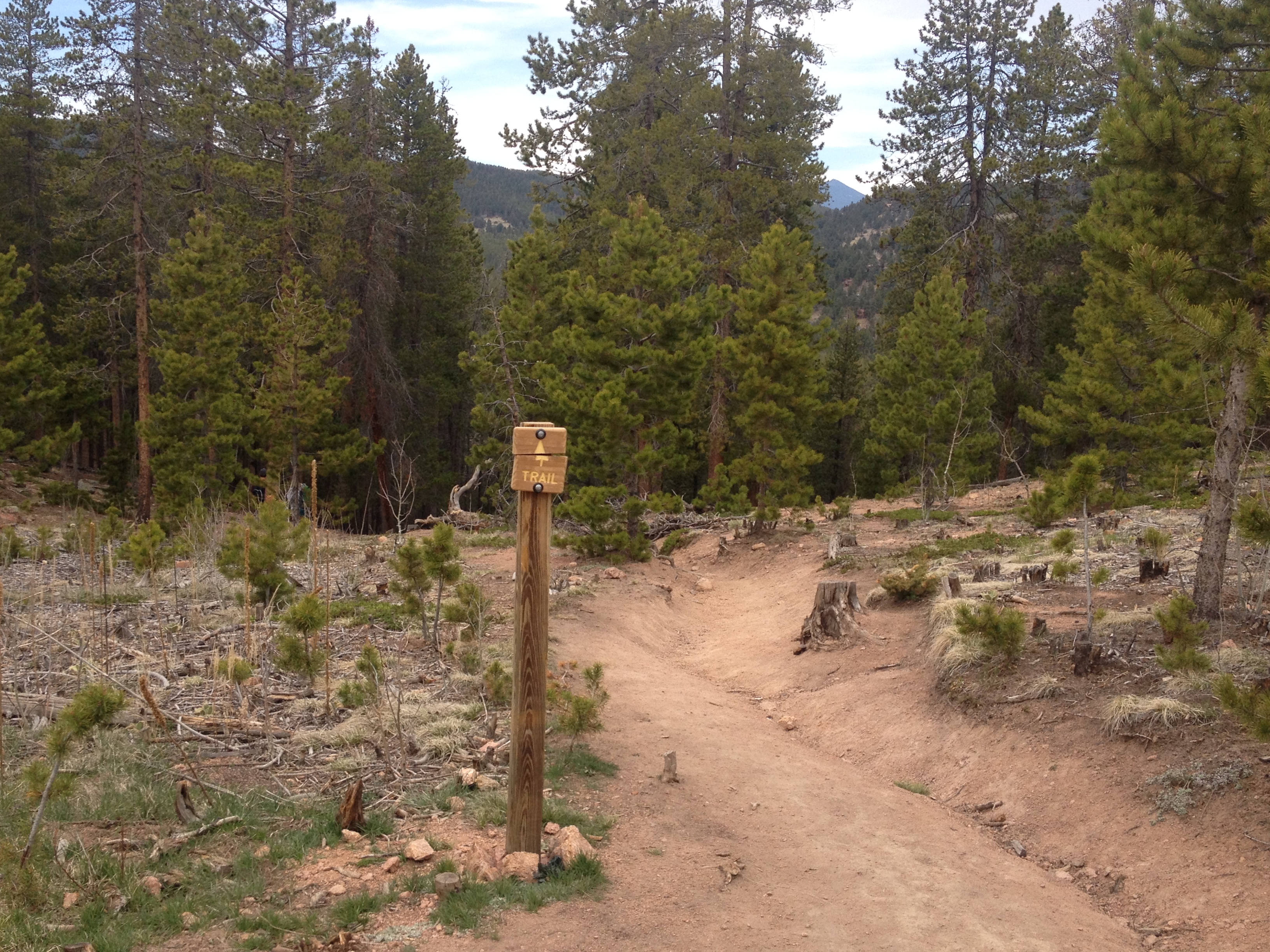
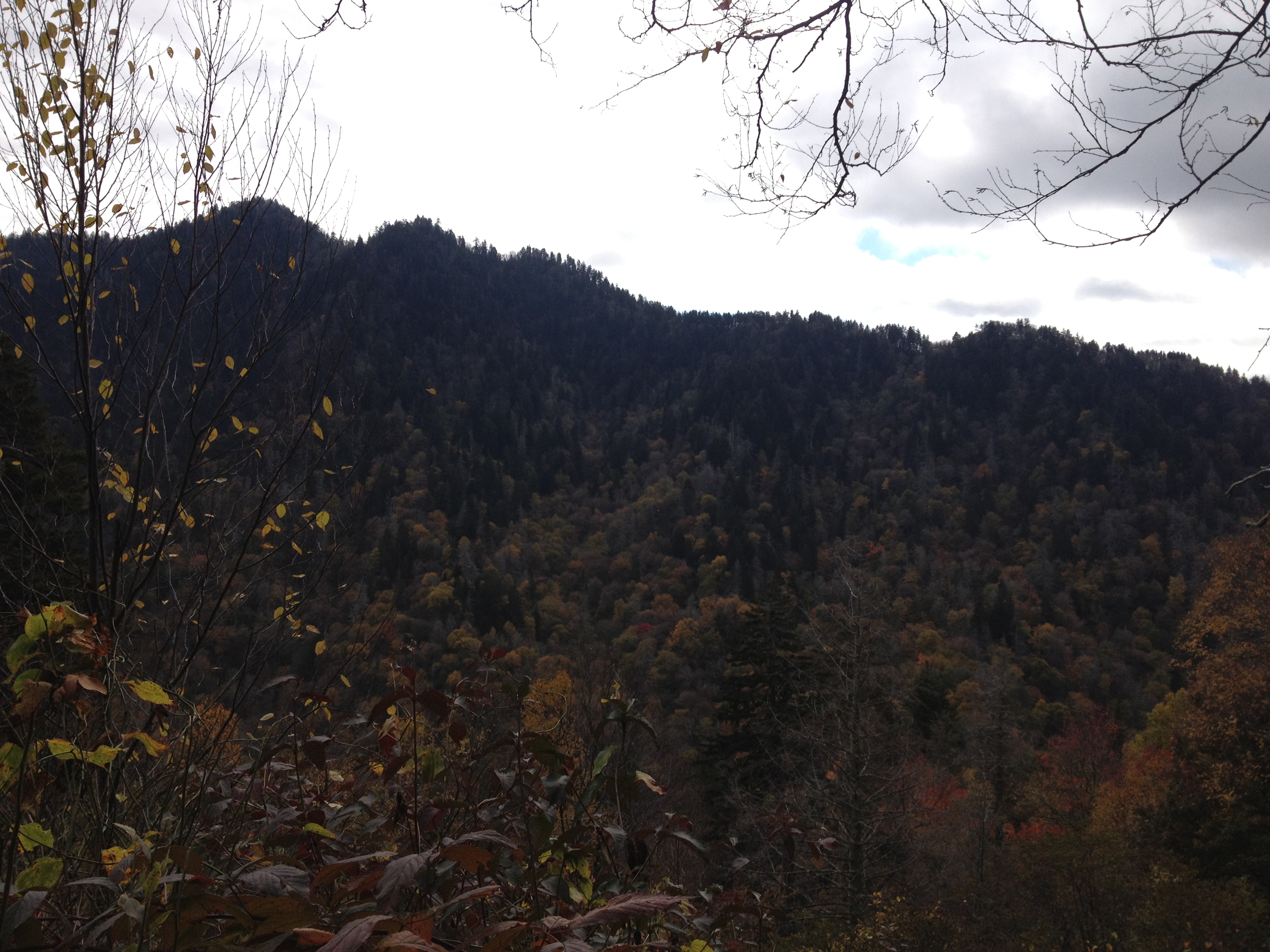
Still, it felt like we spent a considerable amount of time, 40 minutes or so, hiking before we got above the tree line.  There is some variance as to the elevation of the tree line in Colorado.  On this hike, it certainly felt like I climbed to nearly 12,000 feet in elevation before getting above the trees.

IMG_4118 IMG_4146

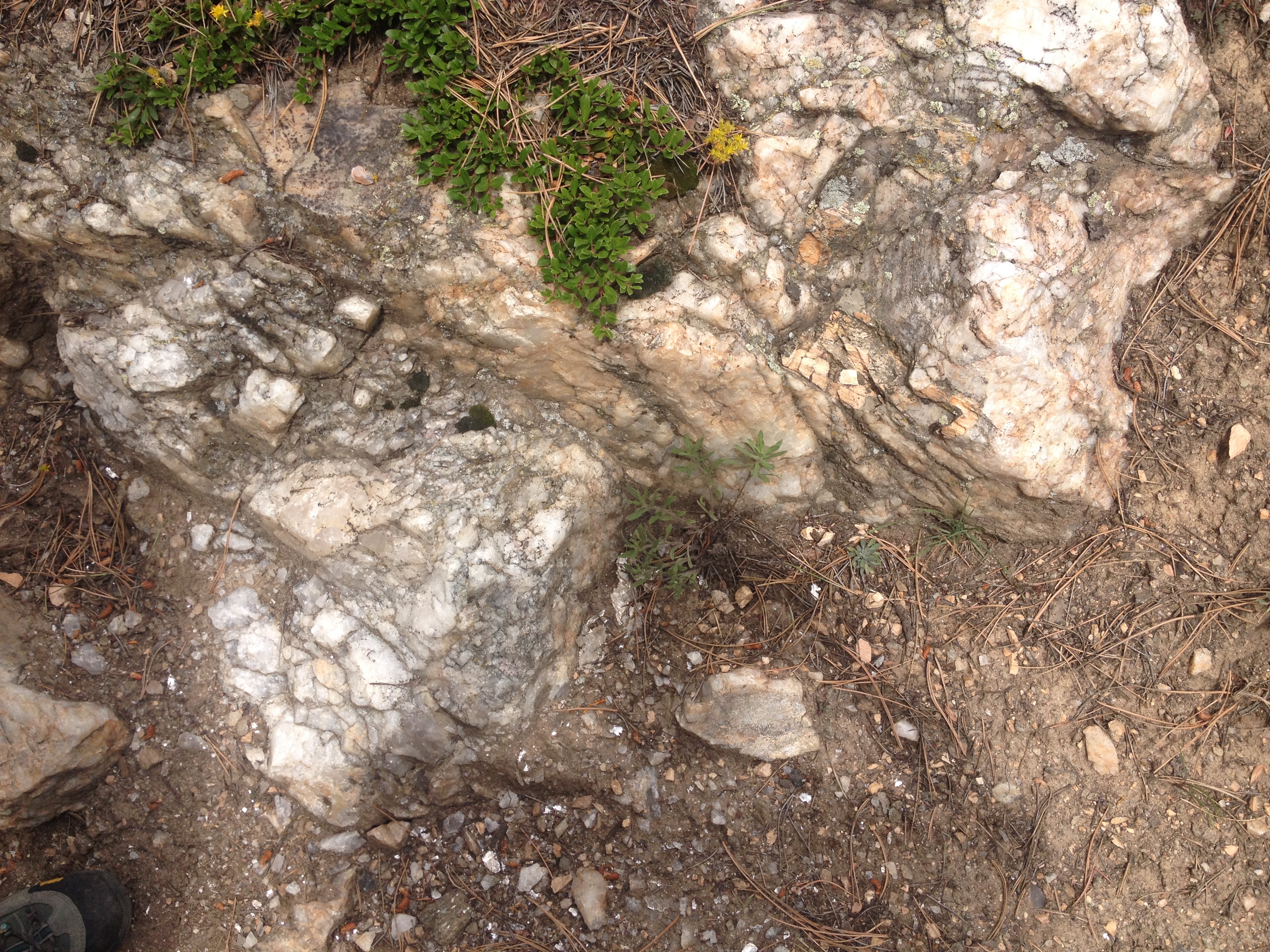
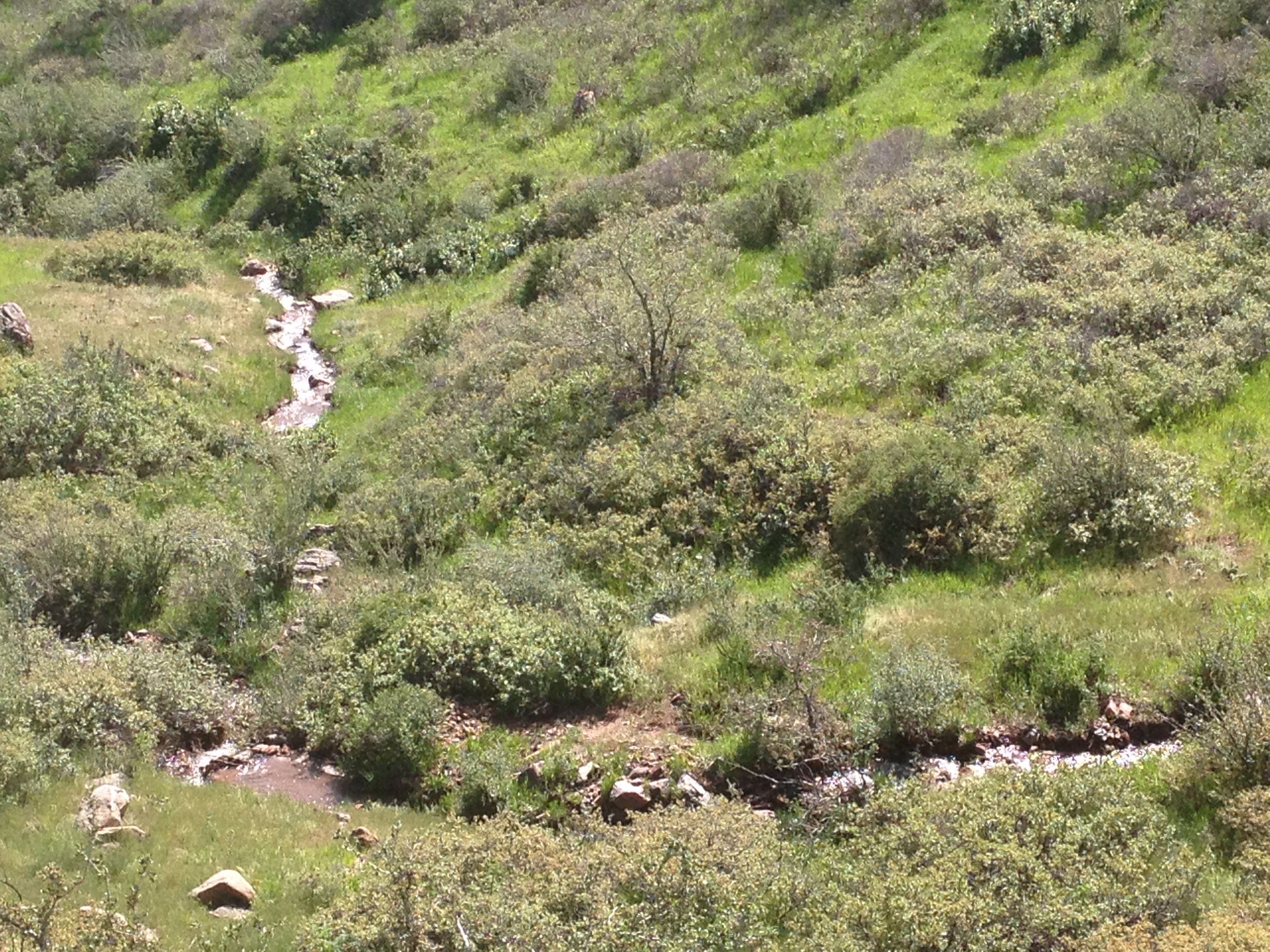
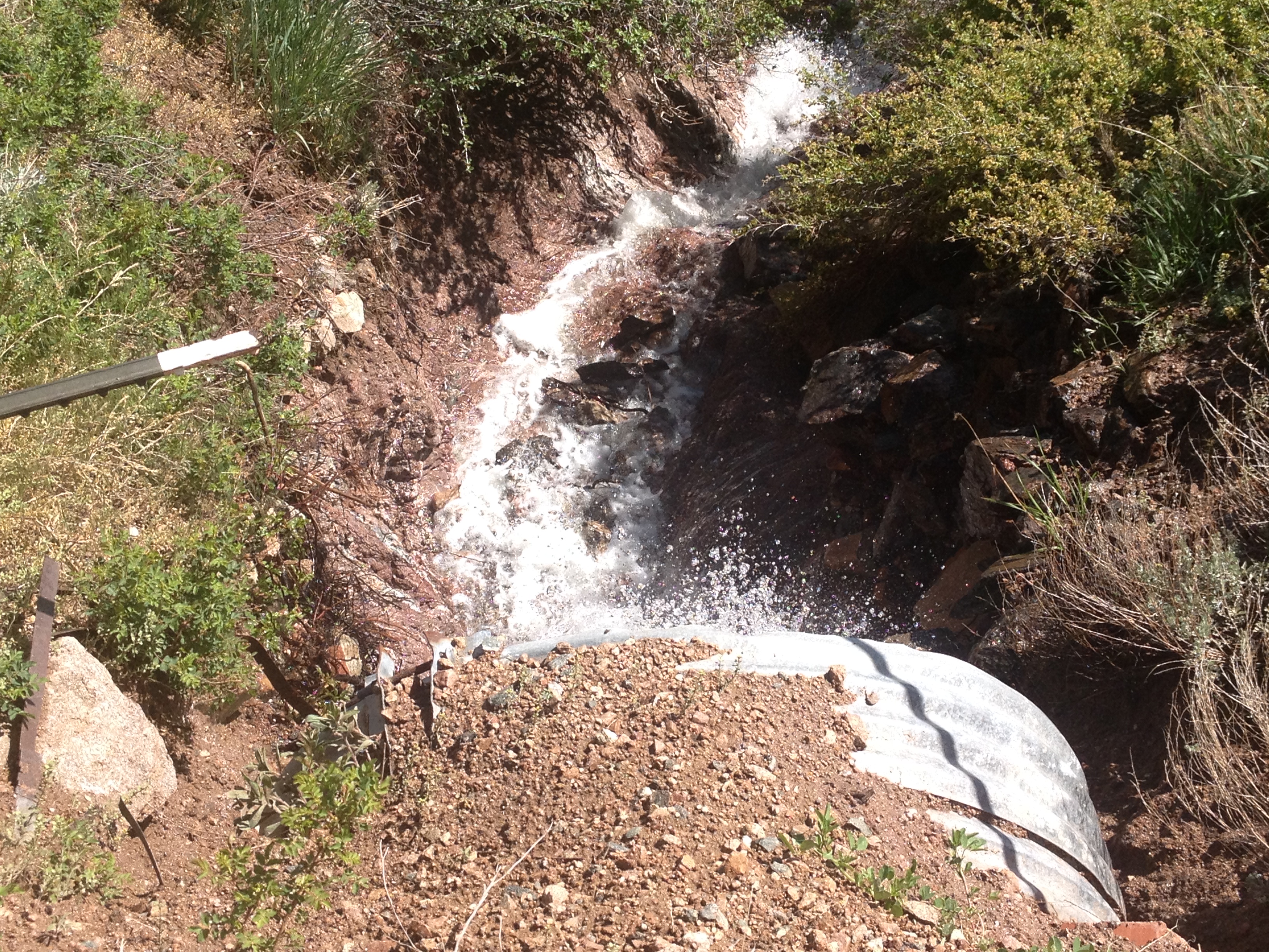
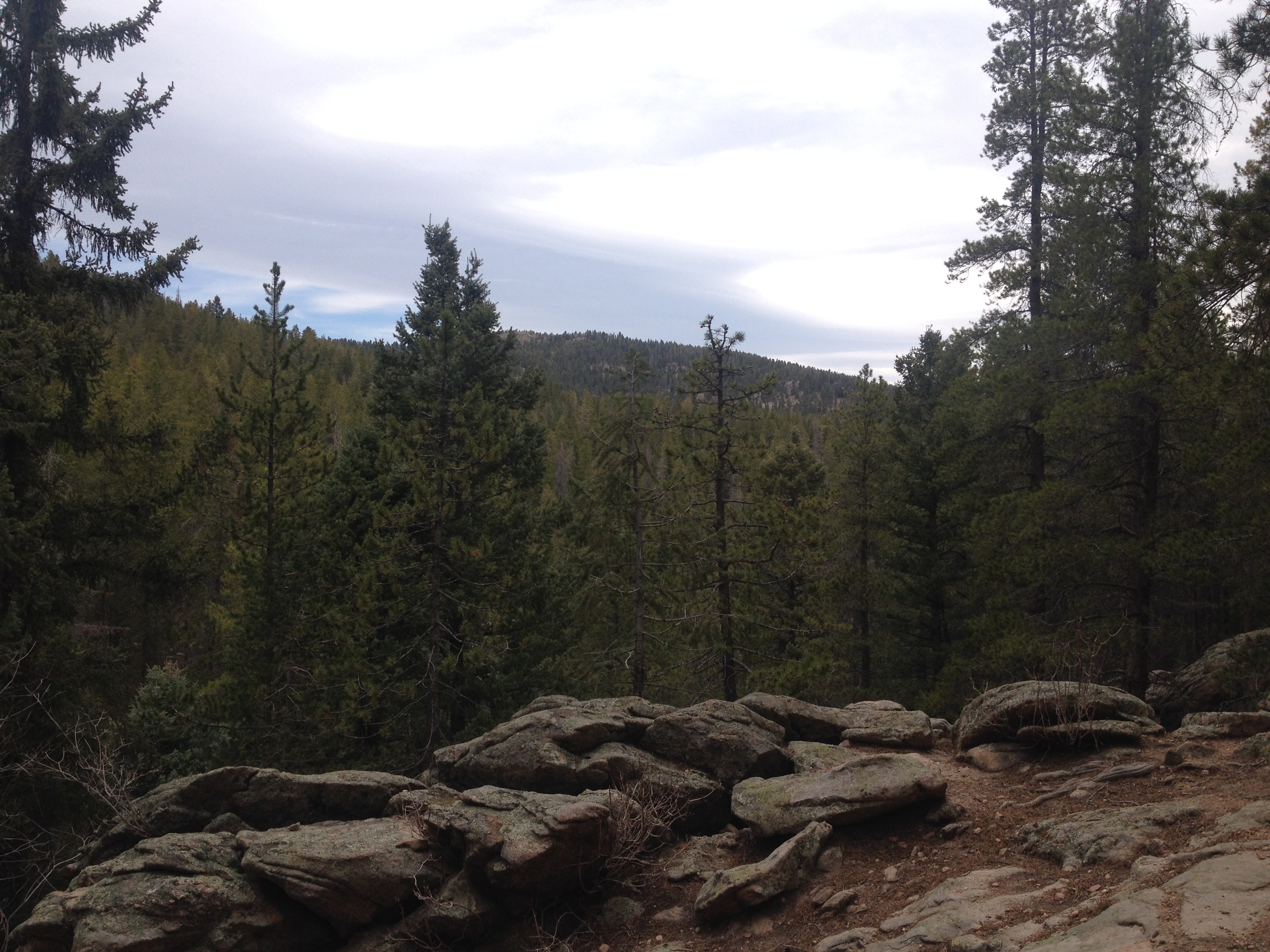
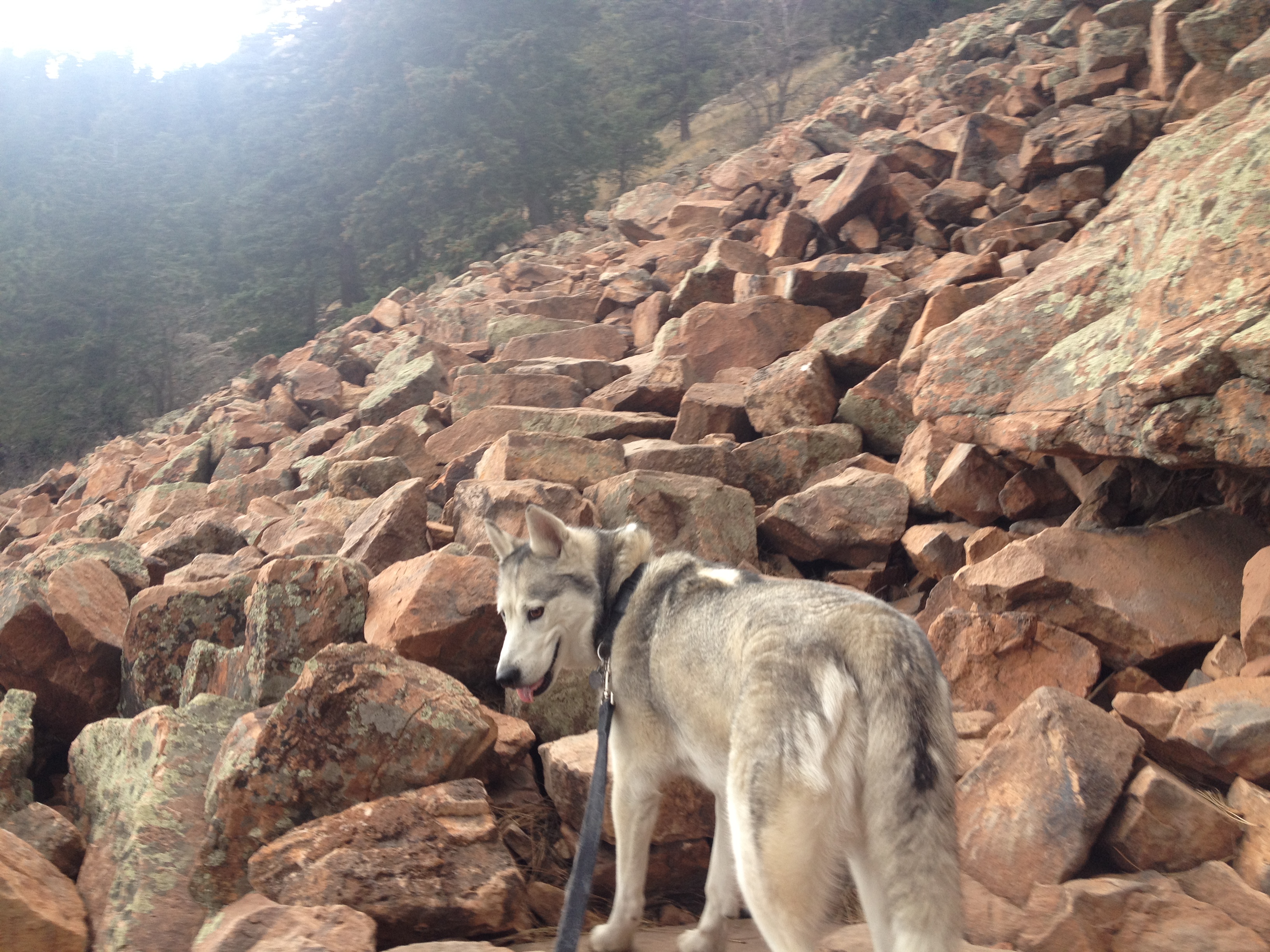
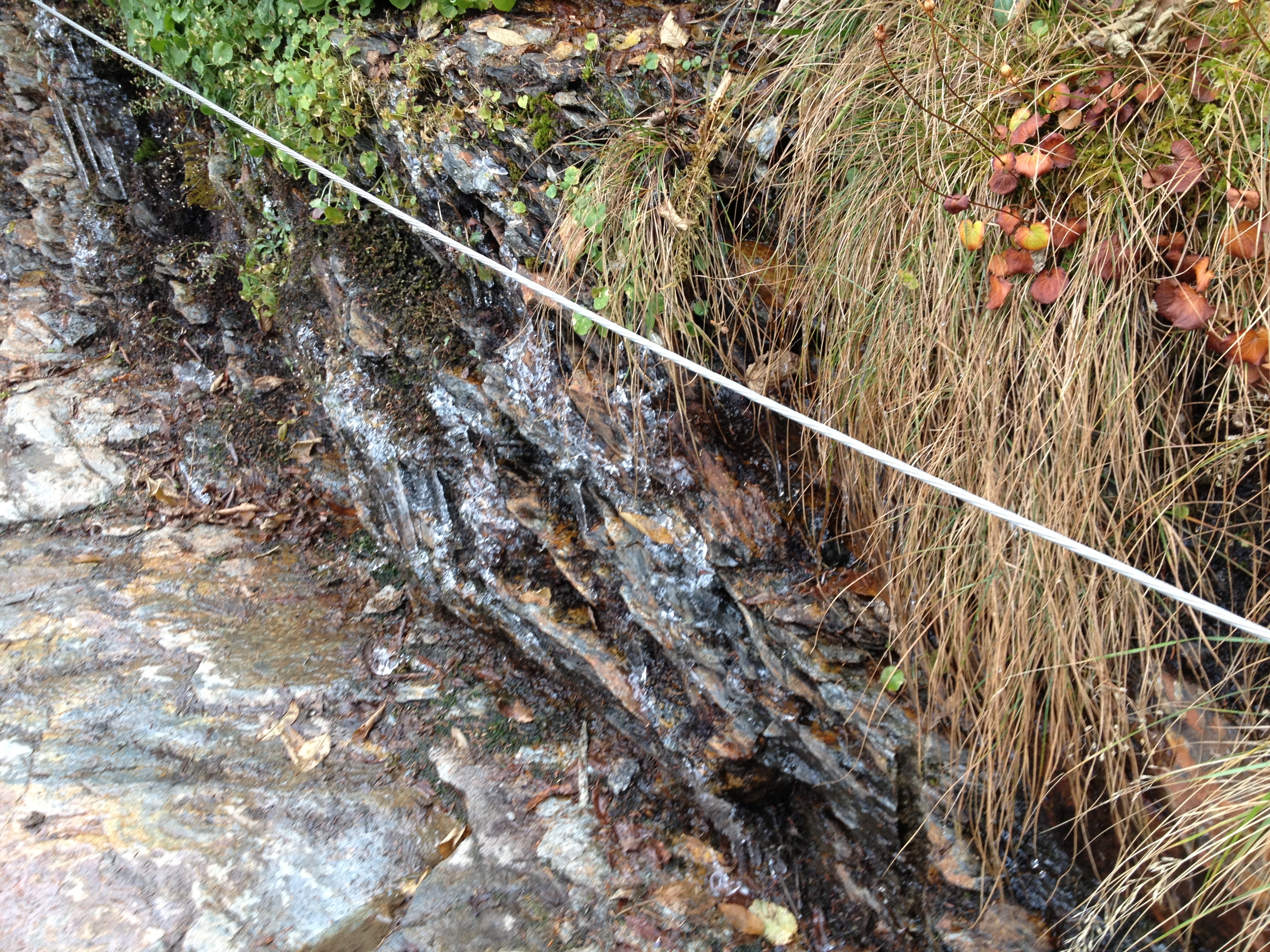
The other aspect of this particular trail that sets it apart from nearly every hike I have ever undertook is how much of this trail is covered by rocks.  The portion of the trail above the tree line, which is most of the trail, is more than half covered by rocks.  This is well more rock coverage than I remember from the other 14ers I have climbed.

IMG_4115 IMG_4116 IMG_4124 IMG_4145

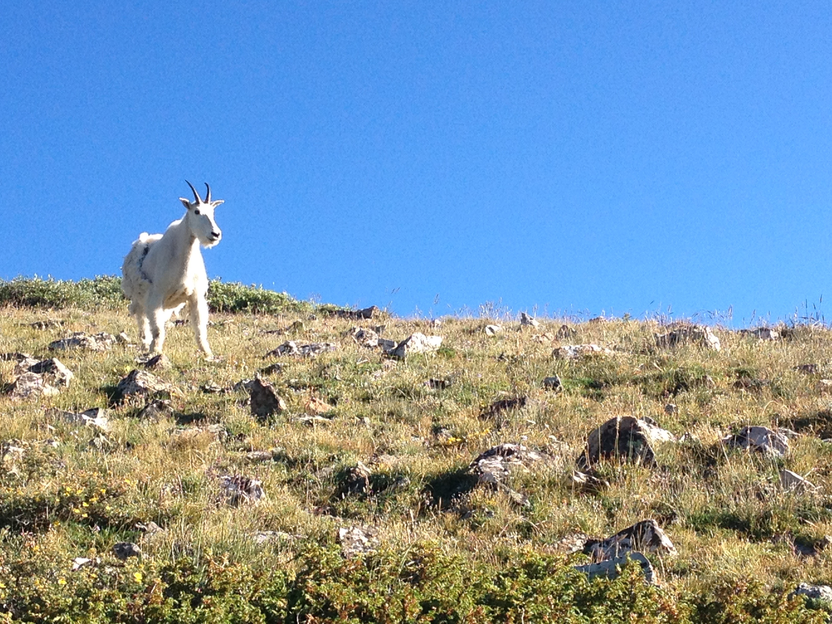
And then there were the mountain goats.  I probably encountered roughly a dozen of them today.  Most of them hung out a little bit above the tree line, but there were a couple of them that were actually spotted closer to the summit. I was surprised to encounter the first mountain goat I came across today.  I was even more surprised to keep encountering them, sometimes in packs.

Unlike many other mountains, Quandary Peak’s “intimidation factor” actually slowly builds up as one approaches the summit.

IMG_4109

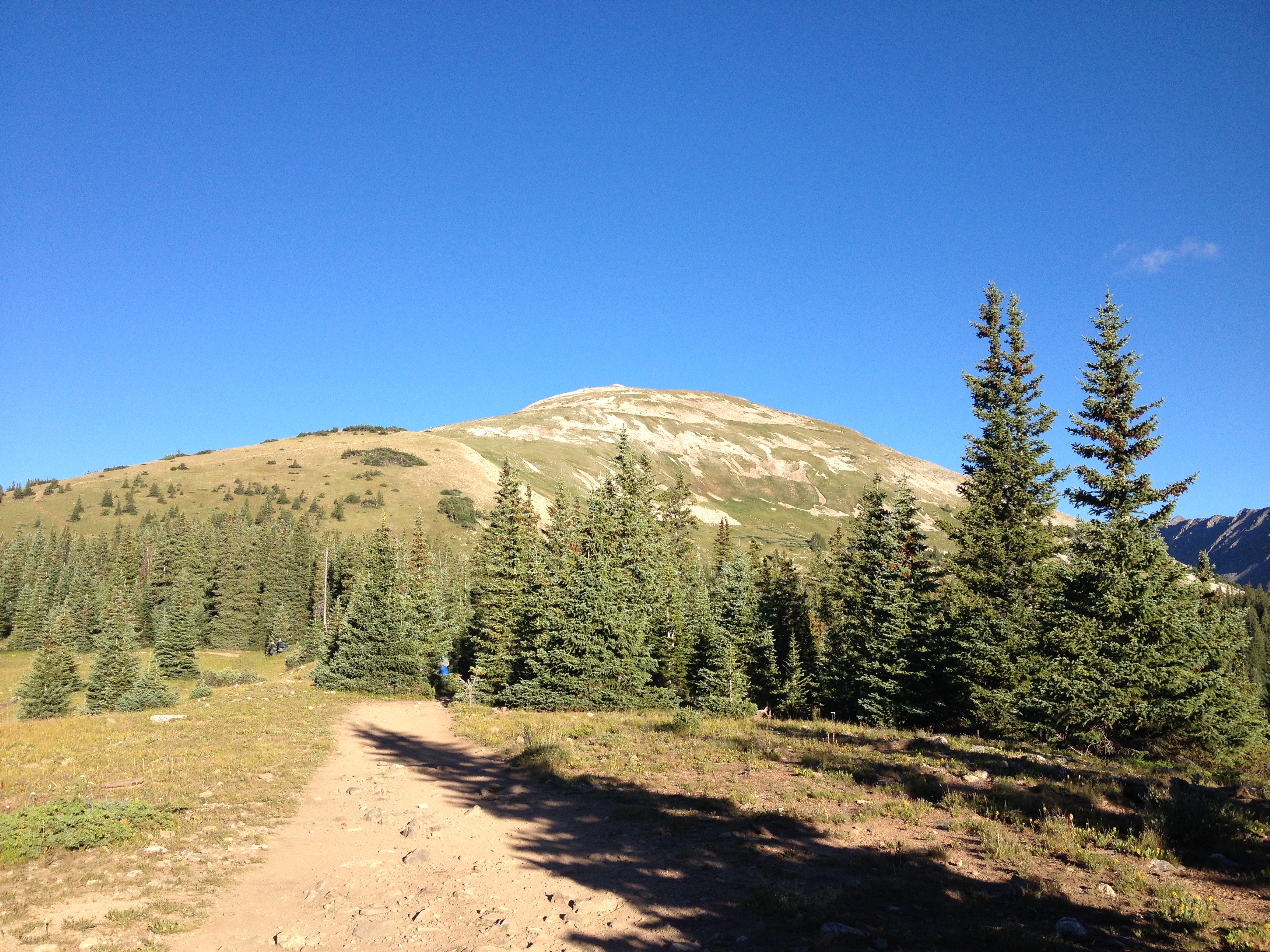
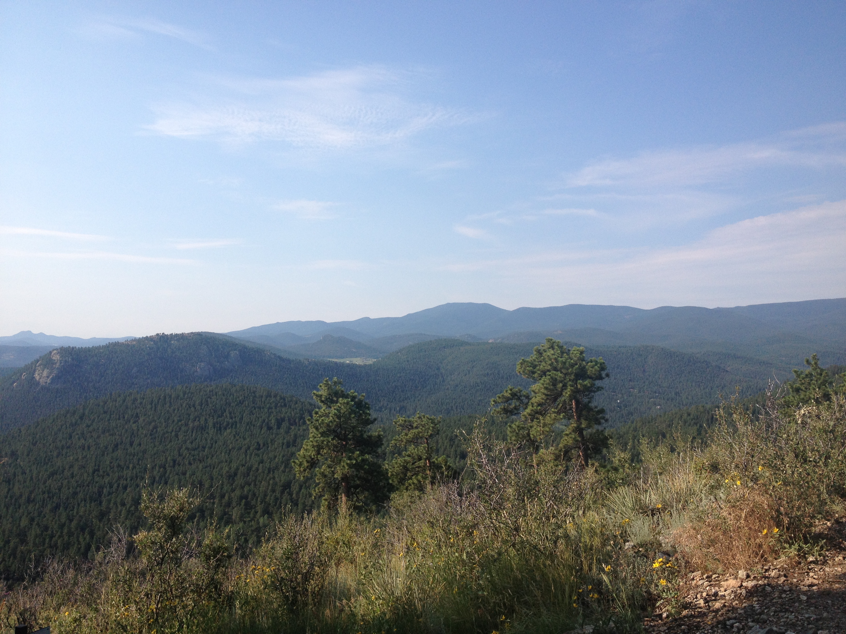
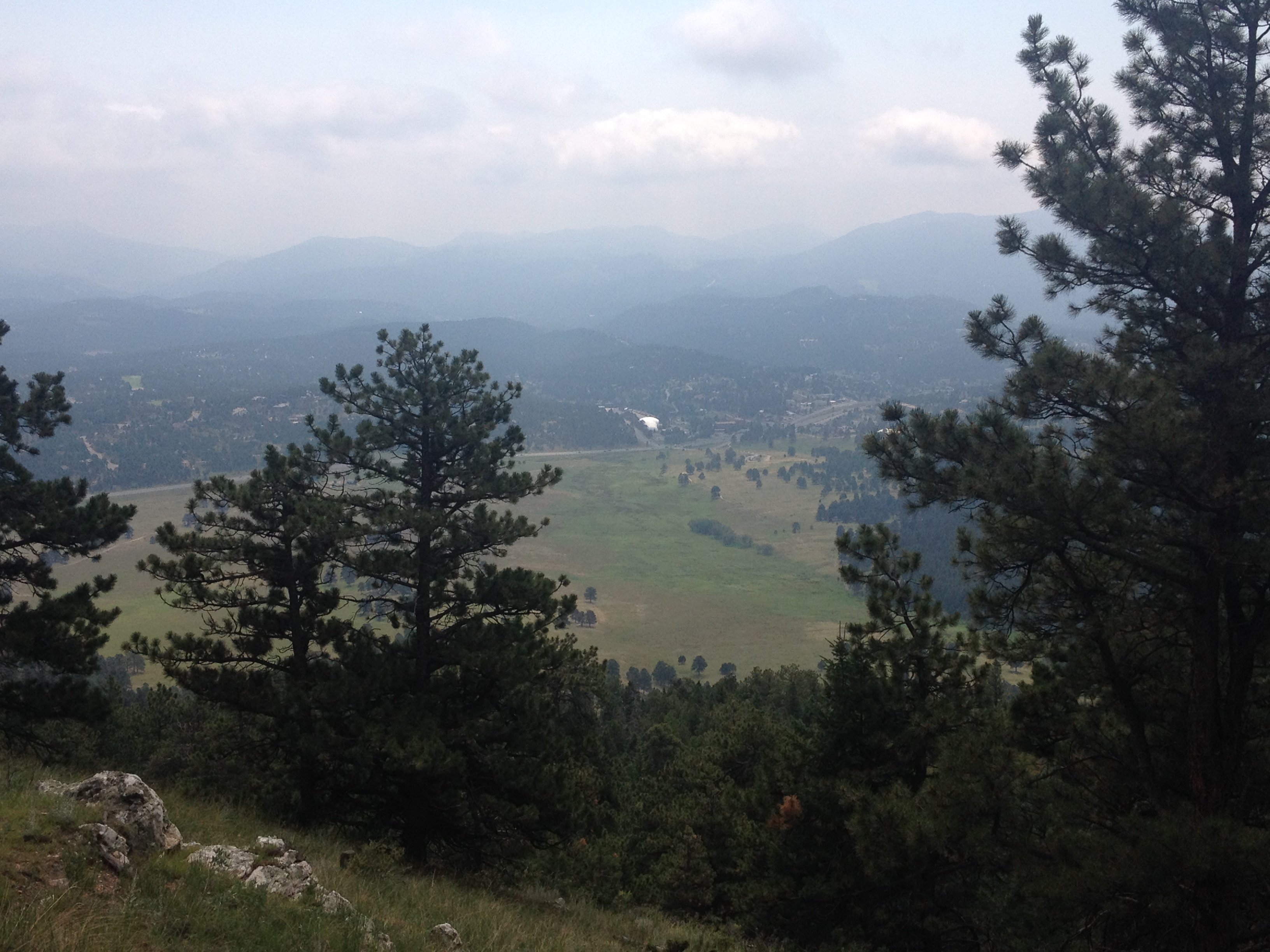
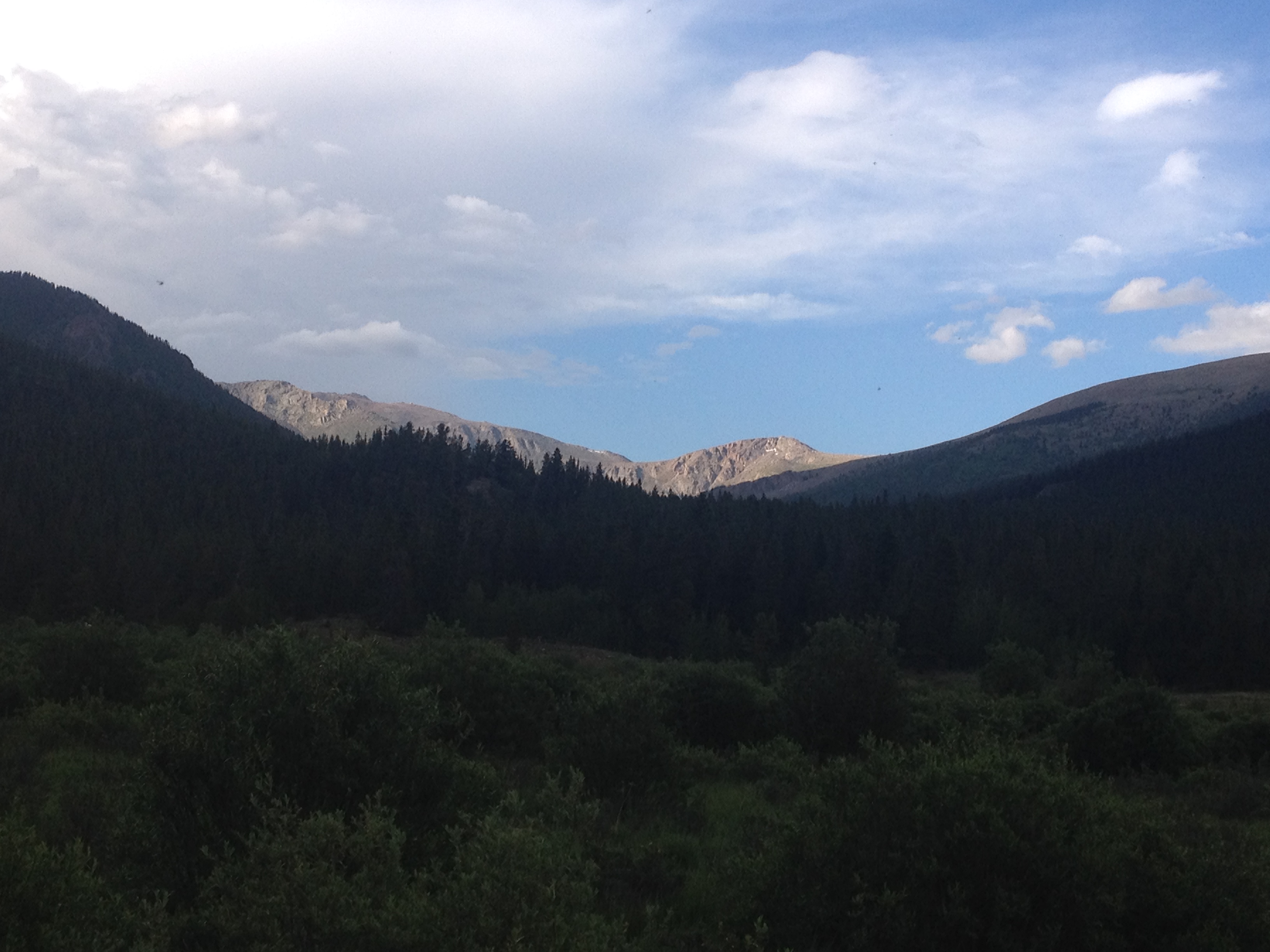
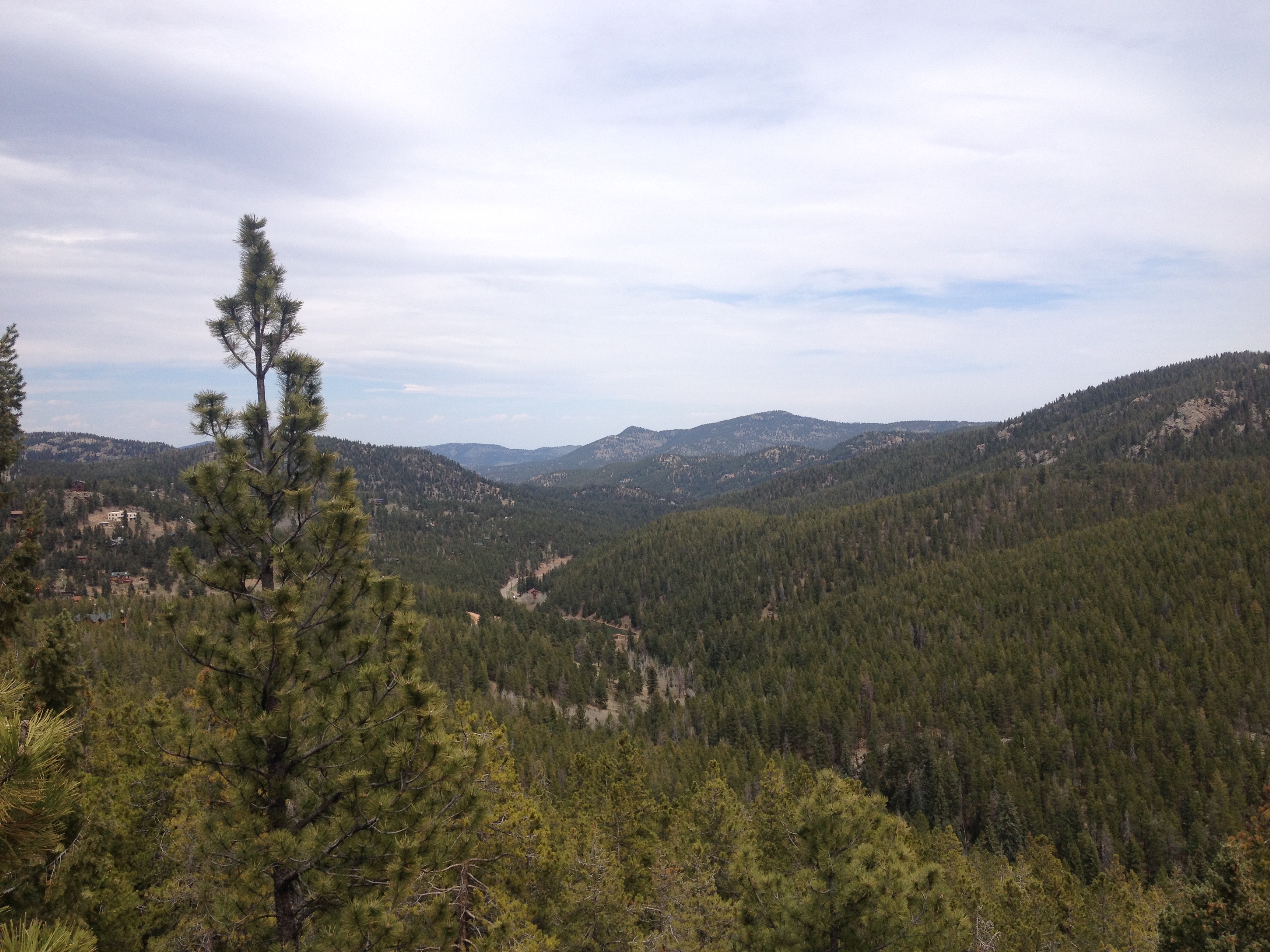
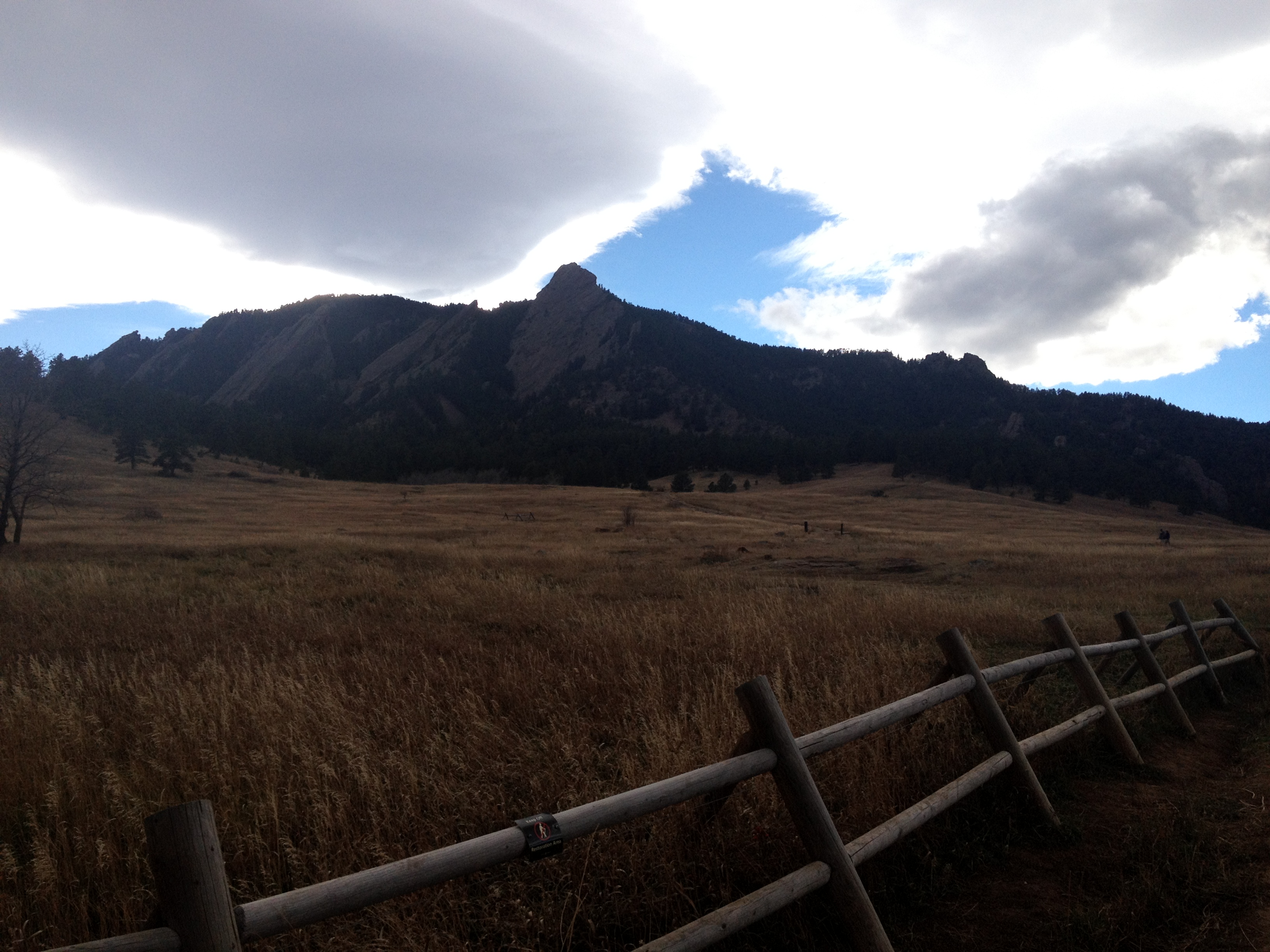
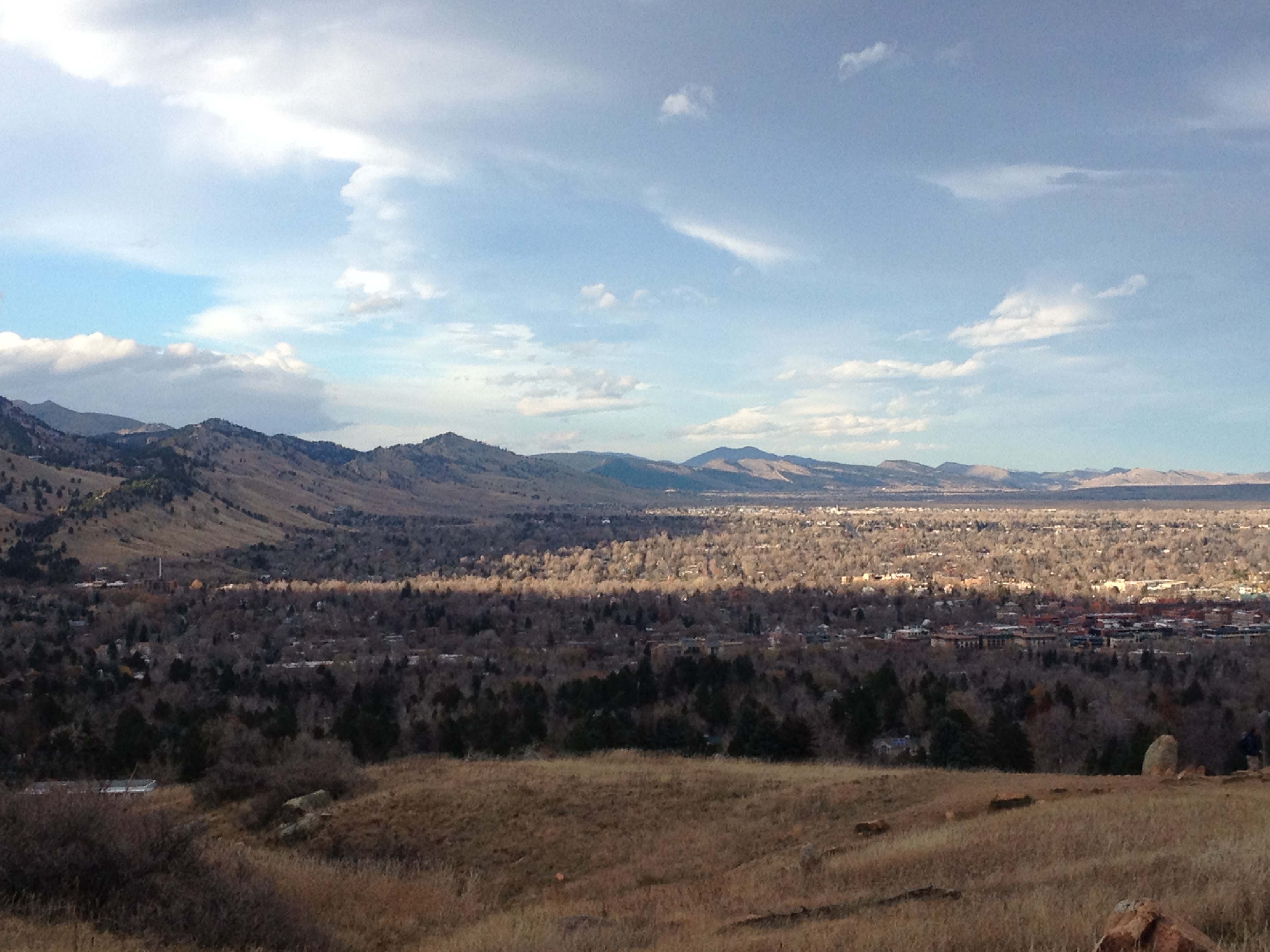
While the mountain does appear big from the start, it appears somewhat gentile in nature when compared to some of the other mountains I have hiked.  From this vantage point, still below the tree line, it almost feels as if there will be a slow, steady, and merciful climb to this peak.

IMG_4120 IMG_4117

Just above the tree line the mountain’s summit comes into clear view, appearing significantly less gentile than it did just 30 short minutes ago.

IMG_4122 IMG_4123

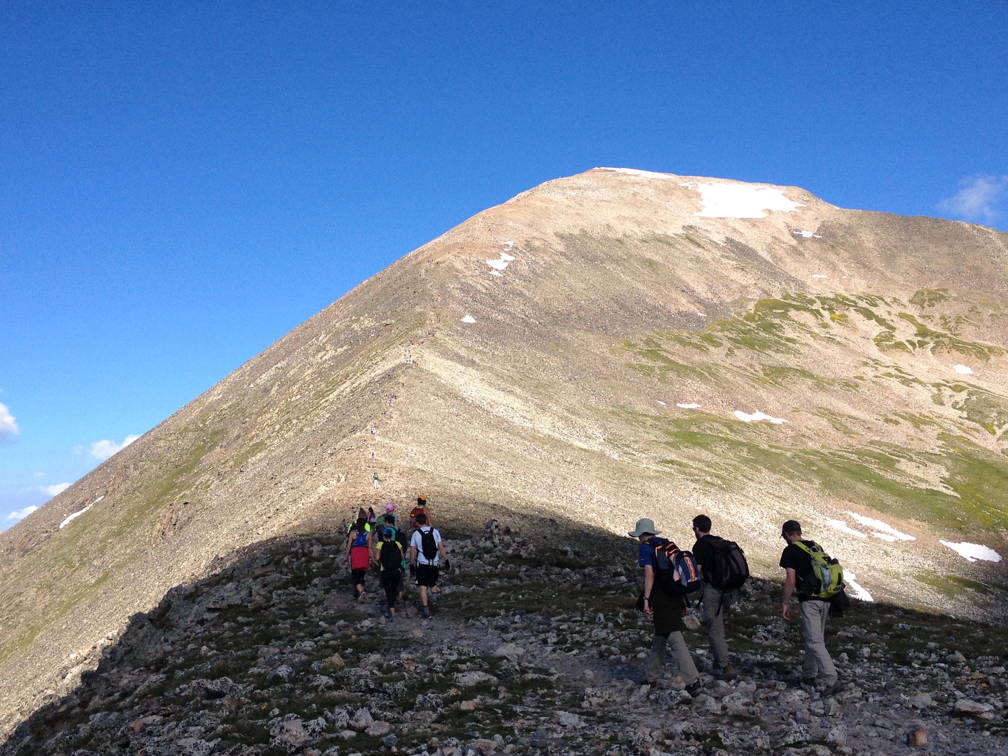
The closer I got to the summit, the more I realized that the last 1000 foot climb would not be gentile at all.  In fact, this final stretch resembles any other 14er I have experienced or seen posts about.  This final section, leading up to the summit, will be a place where I will trudge to the top, focusing one exhausting step at a time.  This is the way it always goes down.

IMG_4126 IMG_4131 IMG_4132

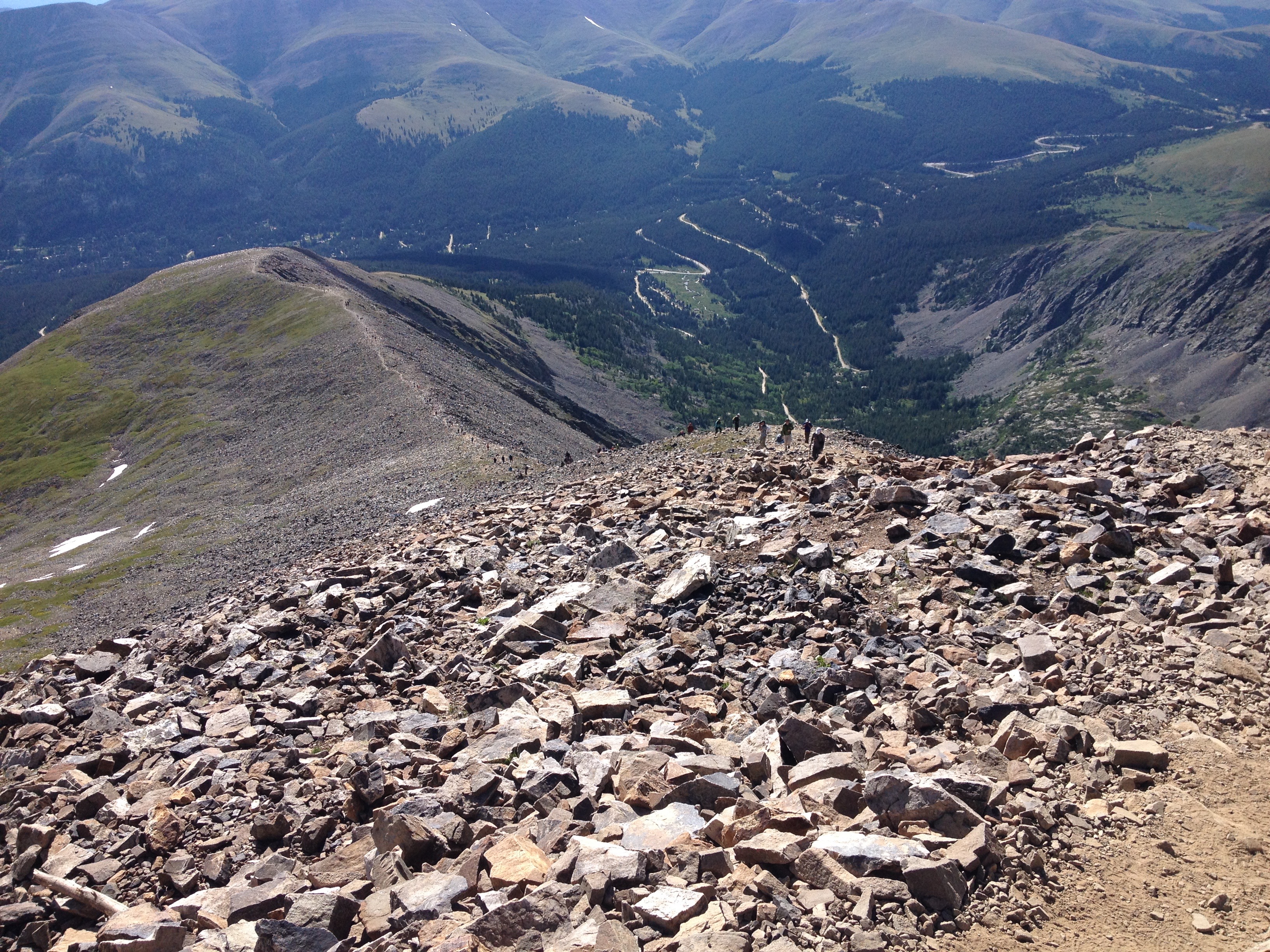
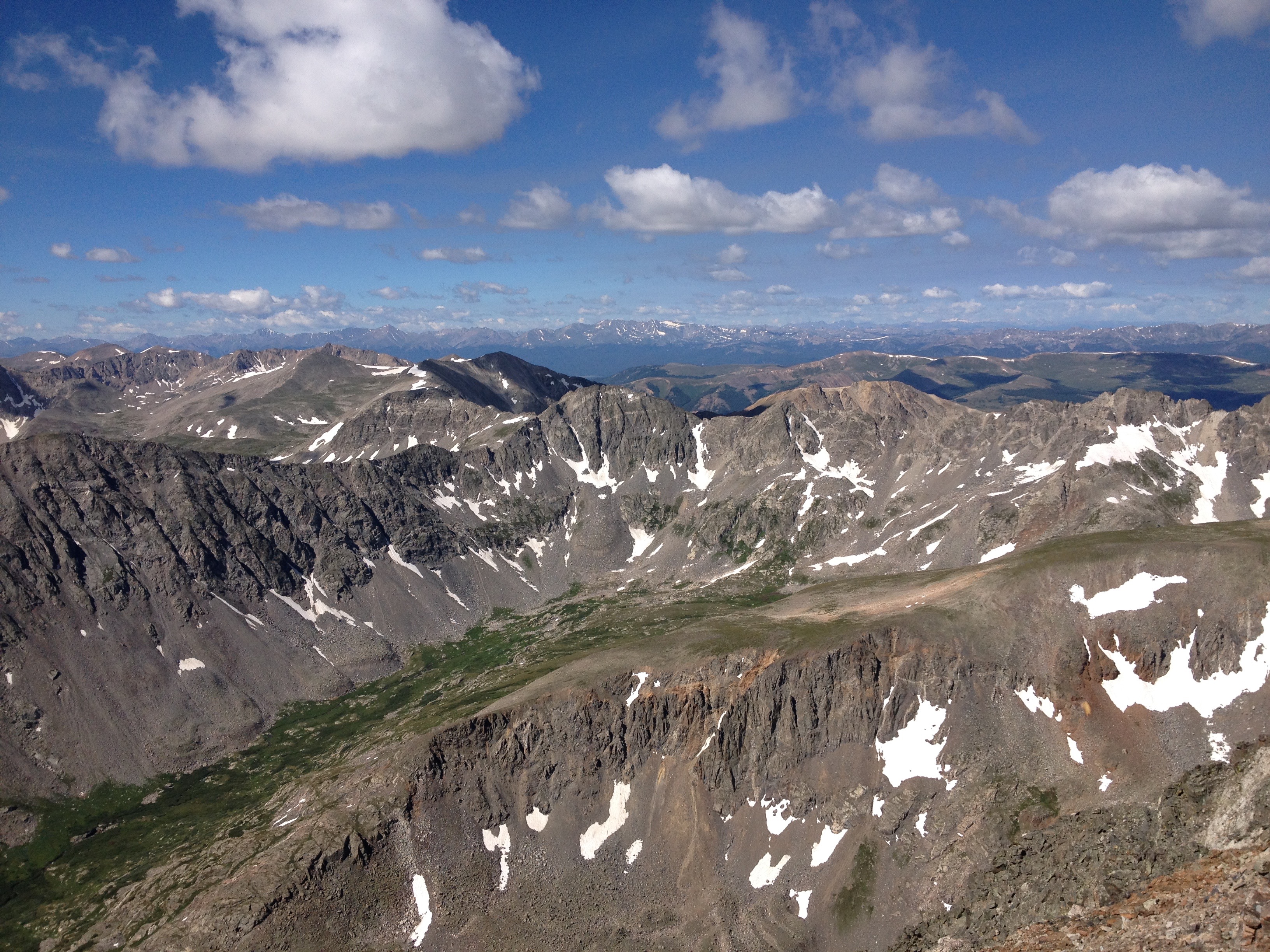
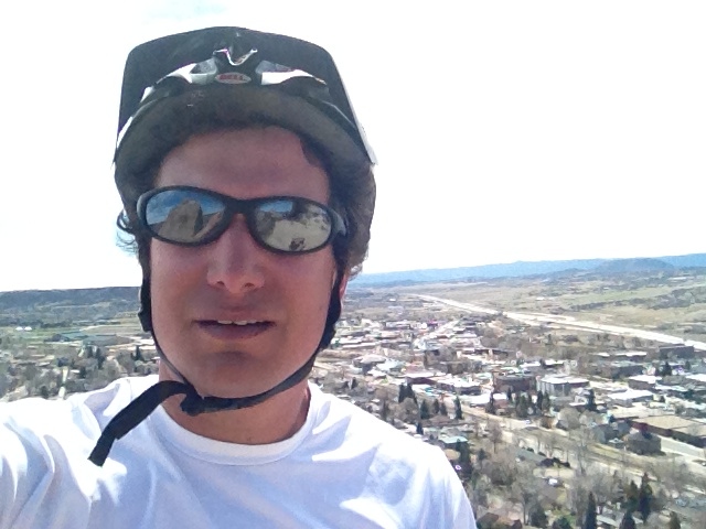
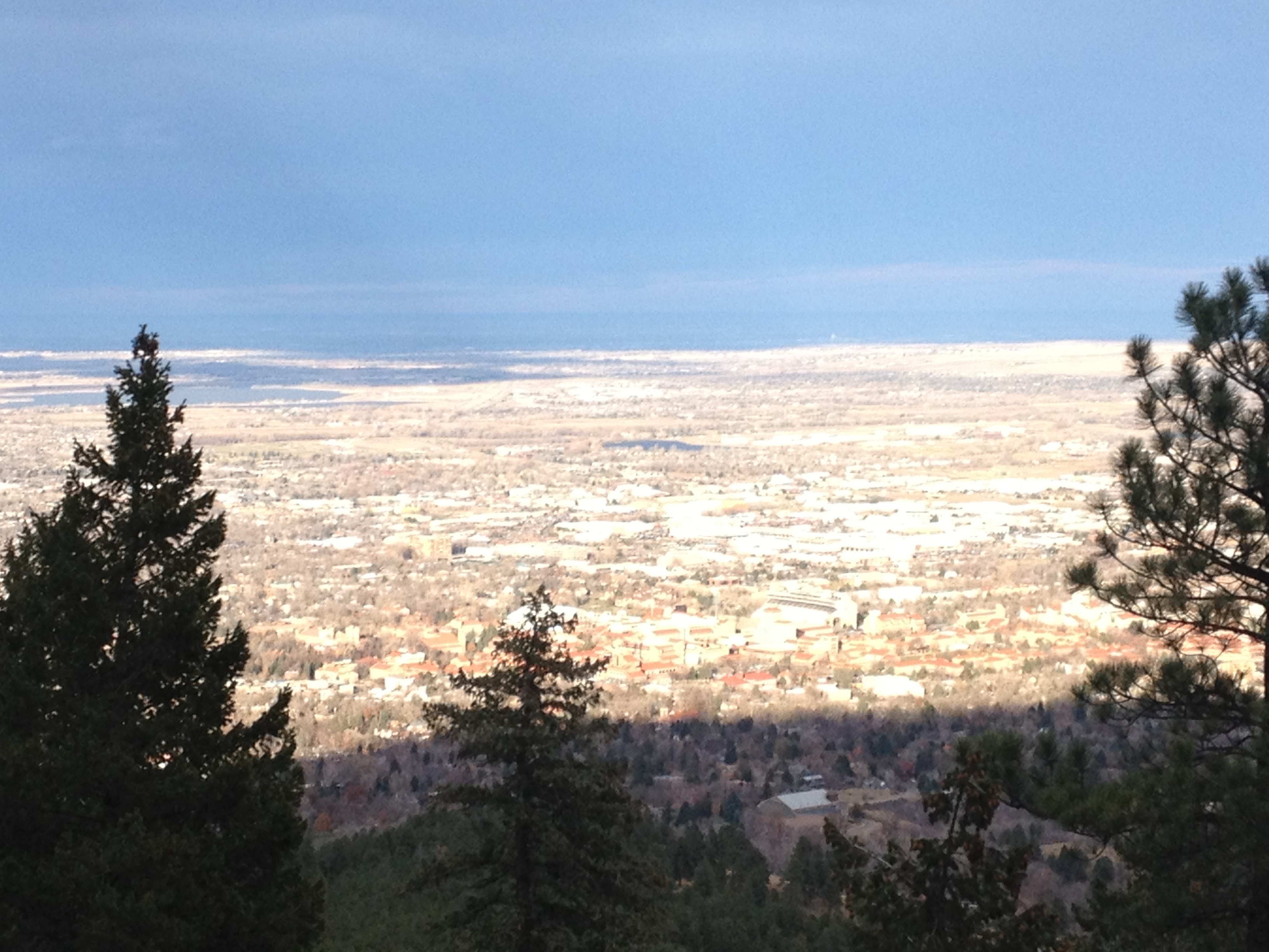
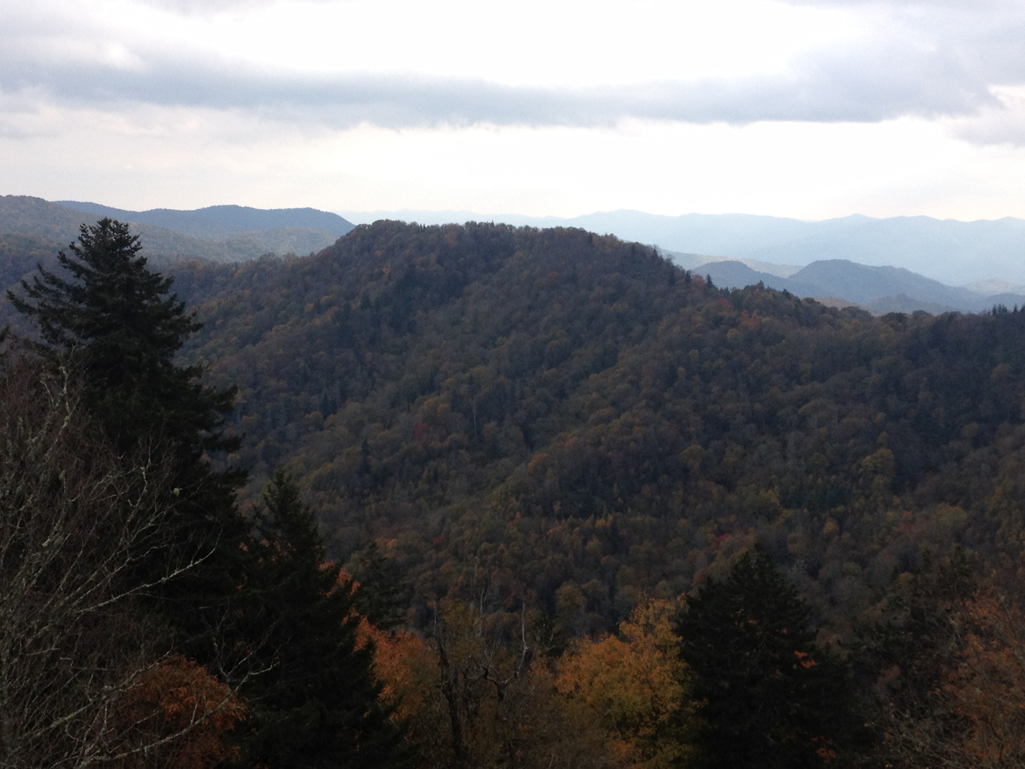
Despite the fact that I have already successfully hiked to the top of a mountain that is technically a few feet taller than this one, it was hard not to feel a sense of accomplishment when reaching this summit.  Looking down on the intense terrain I had just navigated, and the mountains that surround me, all of which are below me, I was once again on top of the world.  And, once again, I had earned it.

As the day progressed, I saw more and more of two types of people on the trail.  First, large groups of either high school or college aged people.  But, also, I began to see more people wearing headphones on their hikes.  And, unlike the trail runners in headphones I encountered on Bierstadt, the people wearing them were not all trail runners.  Or, well, they were not all running.  Some were climbing the mountain at a fairly leisurely (for an intense climb like this) pace.

It made me wonder what this experience was about for these particular individuals.  How does having music on change the experience of the scenery around you?  I can imagine it having a negative impact on the connection one can make with nature at a place like this.  I am for certain that it would have a negative impact on one’s ability to share experiences with others.

IMG_4136

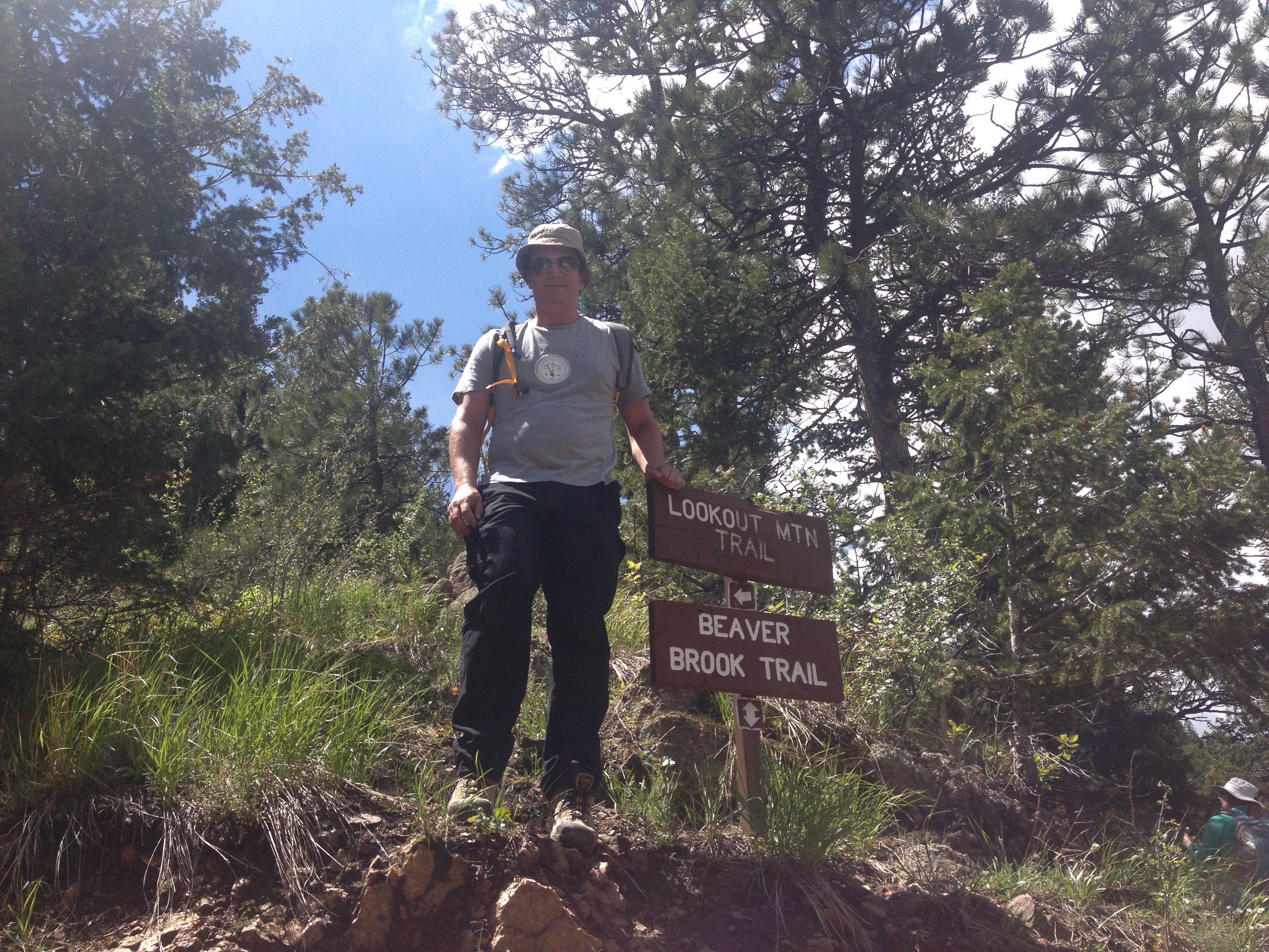
As was the case with the other 14ers I had climbed a couple of years ago, I was fortunate to have good company with me for the journey.  The experience, like many of the others I write about, would not have been the same had I taken them on alone.  My friend and I were discussing a mutual acquaintance who was hiking one of these 14ers solo.  I know that I would have significantly more trouble motivating myself to get up at the hour of 4 A.M. for a solo excursion.  For me, connecting with others plays a significant role in a lot of what I do, and I would have a hard time finding myself wearing headphones at a place like this.

Testing Our Limits

IMG_3247

A good friend of mine once told me that nearly all people are capable of much more than what they believe they can do.  And that, in fact, when challenged, most would actually be surprised by what they are physically able to do once they have been pushed to their very limit.

When it comes to most activities, people generally tend to stop when tired.  After all, exhaustion is generally an unpleasant experience for most, and has the potential to make an activity no longer enjoyable.  However, from time to time, life issues some kind of challenge that forces us to give everything we have, way beyond what we had been wanting to give.  Most of us have experienced that unexpectedly challenging assignment in college that forced us to “pull an all nighter”, or had to tend to someone they truly care about at a time when completely exhausted.  It is at these moments, when we completely drain ourselves, that we figure out the true boundary of what we are capable of.  And, for physical activities, such as cycling, it is when our bodies actually physically begin to give out on us, that we truly understand what we are capable of doing.

Heading into a new season, I decided it was time to challenge myself.  Monday, I had an entire day available with no prior engagements, so I decided to take on a ride that would potentially test the limits of my endurance at its current state; A bike ride from Denver to Castle Rock, and back, in one day.

IMG_3241 IMG_3259

The first 30 miles of this trek is on the Cherry Creek trail, from Denver to the suburb of Parker.  Most of this trail is relatively flat.  A gradual upslope, combined with a few uphill segments, takes a rider from Denver’s 5280′ in elevation to Parker’s 5900′.  This part of the journey was not too terribly challenging.  In fact, in this segment, my biggest challenge was finding water to refill my water bottle.  I had assumed, for some reason, since it was already the end of March, and that there have already been 12 days with high temperatures of 70 or above, that the water fountains around the suburbs would be turned on for the spring.  I was wrong, and was quite thirsty and relieved to see this sign, indicating that although the water fountain was not operational, that the bathroom had available water.  You would be surprised how many suburban park bathrooms do not have running water.

IMG_3243

To get from Parker to Castle Rock, one must follow a road called Crawfoot Valley Road.  The road is quite luxurious for cyclists, with a shoulder wide enough for roughly two bikes.  In fact, it is labelled a bike lane for some parts of this eight mile stretch of road.  The first three miles, headed southwest from Parker, however, is a bit of a climb, and a deceptive one.  The climb is nowhere near as steep as one in the mountains, and one only climbs 500-600 feet.  But, it is one of those frustrating climbs where the road winds around a bit, and, with each turn, a cyclist will wonder whether or not they are approaching the apex only to see another uphill segment gradually appear as they approach.

IMG_3245 IMG_3246

Once this road levels off, facing southwest, the ride becomes almost surreal.  To the left of the road, one can see Pike’s Peak, standing there all by its lonesome.  To the right, the mountains of the Front Range, due west of Denver appear.  Riding sort of directly at these mountains, with the vantage point of being up at roughly 6500 feet in elevation, I cannot help but take a deep breath and marvel at how wondrous the world can be sometimes.

IMG_3248 IMG_3247

After just over 40 miles of cycling, I arrived at Castle Rock.  When I got to Castle Rock, I decided to add on a mini-hike to my day of activity.  After all, I spent almost three hours getting here, why wouldn’t I head up to this little rock structure- my destination!

IMG_3250 IMG_3253 IMG_3256 IMG_3257

This is a fairly short hike, with stair-step features that indicate that it was designed primarily for tourists, and not hard-core hikers.  So, I did not feel too bad about adding this hike to my already exhausting daily itinerary.

After all, the return trip to Denver would be much easier, after the initial climb out of town on Crawfoot Valley Road, the rest of the trip would be more or less downhill, descending, overall, from an elevation of 6200′ at Castle Rock back to 5280′ at Denver.

That turned out to be wrong.  As I approached Parker, a northerly wind developed, and, although the wind itself was not too terribly strong (10-12 mph range), the gusts began to pick up and become more frequent.  It was here, peddling into the wind, that an already challenging ride became one where I ended up testing the limits of what my body can do.

There are three levels of tired.  First, there is just general tiredness, where we just feel like stopping.  Many people do indeed stop at this point.  However, those who stop at this first level of tiredness generally do not develop any further endurance.  Level two tired is where we begin to ache, or feel some level of pain.  At this point, it is typically recommended that one stop.  This is the level of tiredness I had expected out of Monday’s ride.  However, the gusty winds on the return trip brought my level of tiredness to the third level, the level in which you simply cannot go anymore.

Working to each level of tiredness achieves a different goal.  An activity that stops at level 1 tiredness maximizes our enjoyment of an activity.  An activity that stops at level 2 tiredness is most beneficial to our fitness.  When we push to level 3 tiredness, we achieve personal accomplishments, the kind that make us feel as if we are achieving something with our activities.

The key is, for almost anyone involved in any kind of physical activity, to find a balance between working to each of the three levels, as they feed off of each other.  The original, and ultimate purpose of any activity should be to have fun, but, for most, an activity become even more enjoyable when we improve, take on new challenges, and accomplish new things.  Much like a skier that starts out on the green slopes, moves up to the blues, then blacks, and finally extreme terrain, I am looking to take my bike out longer distances, and to places that were previously unreachable.  However, in order to plan out how to test my own personal limits, I first have to know where those limits are.  So, as much as I can be pissed off that this ride ended up being more difficult than expected due to the wind, the wind allowed me to actually measure my personal limit, so I can start the process of improving.

Bergen Peak; Beating the Weather

IMG_2266

If anyone were seeking my advice about living in Colorado, amongst the topics I would address would be the weather.  One thing that differentiates Colorado’s day-to-day life from life in many other places is how significant of an impact weather can have on daily activities, and how imperative it is that Colorado residents pay attention to weather and weather changes.  Colorado, being an outdoor oriented place with significant weather changes on many different time scales, is a place where residents find their plans impacted by weather significantly more often than in most other places.

Today was one of those days.  Weather forecasts called for significant thunderstorm chances along the Front Range of the Rocky Mountains starting at 2:00.  This is not too terribly uncommon for this time of year.  As a result, it is a fairly common practice to begin all hikes in the mountains at this time of year early in the morning.  This lead me to wake up at 6 AM in order to complete the 9.6 mile round trip hike of Bergen Peak prior to the anticipated onset of thunderstorms.  The frequency in which people begin their activities early has implications beyond those activities.  It is fairly certain that a significant number of people forgo Friday and Saturday night activities in anticipation of early morning hikes.  Some even head up to the mountains the evening prior to their anticipated activity in order to save time.  The end result; less people out at bars and more people at cabins and campgrounds on any given Friday or Saturday night at this time of year.

IMG_2254 IMG_2255

Getting to this trail-head is actually quite easy from Denver.  Overall, the drive takes less than an hour, and it does not require any off-road type driving.  While the best route is along Interstate 70, the exit is far enough East that one could drive here from Denver without contending with the parts of the highway farther into the mountains where weekend traffic delays are common.  This hike is both moderate in intensity (elevation gains and such), and quite well marked.  This is possibly because the trail is often open to, and is quite popular with, mountain bikers.

IMG_2260 IMG_2263

The first mile from the parking lot, along the Meadow View trail was fairly flat.  This trail connected us with a loop that consisted of the Bergen Peak Trail and the Too Long Trail.  We decided to take the loop in a clockwise direction, starting with the Bergen Peak Trail.

IMG_2256 IMG_2262

This trail took us up some steeper areas, as well as some areas of densely packed trees.  The occasional opening along the trail was marked with a sign indicating a “scenic view”.  These scenic views were pretty nice, but on this particular day, our visibility was limited by a significant amount of haze.  Once again, life was being impacted by weather, but this time a longer-term trend.  This summer has been more humid than is typical for Colorado standards, leading to significantly more haze than normal.

IMG_2267 IMG_2268

A one mile spur off of the main “loop” brought us to the top of Bergen Peak a little bit after 10 AM.  By this time, the skies had gotten even more hazy.  At the top of the mountain, there is some kind of tower (most likely for phones), as well as this sort of random building.  I really do not know what it is for, and I was unable to enter the building.  I really hope it is not home to some crazy recluse making secret revenge plans.  Nothing good would come of that.

IMG_2275 IMG_2280

Continuing the loop, we took the Too Long Trail, which felt as if it was living up to its name.  The trail itself is listed as only 2.4 miles, less than the 2.7 miles indicated for the Bergen Peak Trail.  However, it felt a bit longer, as the trail was more of a semi-circle, and connected to another trail, called the Elk Meadow Trail.  Along this trail, we were, indeed, closer to the meadow.  However, we did not see any Elk today.

IMG_2261 IMG_2272 IMG_2274 IMG_2276

What we did see, though, were a significant number of different species of flowers, and some mica.  In one spot (pictured above), purple flowers were actually growing off of a dead tree branch.  Quite amazing!

IMG_2279

I’m glad we took the Too Long Trail, even if it lengthened our hike to something close to 10 miles.  Not only did we actually experience why it is called Elk Meadow Park, but we also encountered the most unique find on this hike.  Apparently, someone felt it would be interesting to decorate one single tree, roughly halfway up the Too Long Trail, with Christmas decorations.  It was just one tree, seemingly randomly selected, with roughly a dozen ornaments placed on it.  For one with an imaginative mind, there are dozens of different scenarios that can be pondered that would lead to this outcome.  But, even more so, I wonder what the people who operate the park think of all of this.  And, I wonder how well it would be received if I were to return to this tree, and add a contribution of my own.  If others have the same thoughts, what could this tree look like a year from now?

While hiking this trail today, I did not believe I was going to get any good photos at all (due to the haze, and the tree density of most of the hike).  However, the more I look a the photo I chose to lead this entry with, the more I fall in love with it!  It is not the kind of perfect photo that you will find on commercials or billboards (see this image).  It is a photo of the same place, but from a different perspective; one of a world that is not quite so perfect but beautiful in its own way.  It is an image of a world where people wake at 6 AM to get in a hike before a round of thunderstorms that never materialized.  It is a world where we know enough about what is in front of us to stay out of danger, but with enough haze to keep the excitement associated with the mystery of the unknown.  That is the world in which we live in, and the frustration occasionally waking up early unnecessarily is a small price to pay for the wonder and the mystery that accompanies it.

A Whole Different Kind of Camping

For me, at least, this is a whole different kind of camping than what I am used to.  I am not a very experienced camper.  In the entire course of my life I think I have camped maybe a couple of dozen nights.  All of these nights took place at a campground, typically reserving a site ahead of time.  Last night, I took part in a style of camping that is fairly common in the State of Colorado, but seemed quite strange to me when I first heard of it.

There are no specified campsites or reservations.  There is no park office to check you in, collect a fee, and sell you firewood.  There are no restrooms or showers, and there are certainly no vending machines.  This type of camping simply involves finding a spot in the forest to lay down tents.  It is so basic, and so obvious.  Just go and camp.  Yet, in the context of the modern world that we live in, it sounds so strange.

IMG_2166

In fact, I did not even know how to prepare for this trip.  When we all went to the store to get supplies, I was the only idiot grabbing burgers, buns and cheese, as if I was preparing for a barbecue, until I was instructed otherwise by those who have actually camped in such places before.  There are no grills here.  You can only prepare food supported by the equipment that you bring.

We camped high up in the Rocky Mountains, around 60 miles west of Denver, just south of a place called Guanella Pass.  This wilderness region is particularly significant, as trailheads leading to the top of two major mountains, Mount Bierstadt and Mount Evans, can be found throughout the area.  So, although there is no specific campsite, it is still a common place to camp, as many heading up one or both of these mountains set up camp in the area.

IMG_2169 IMG_2171

We set up camp in the area along Geneva Creek, where a significant number of campfire setups like this one are left behind by previous campers.  So, while I can count this among the most remote places I have spent an evening, I realized that there are places that are even more rustic, more primitive, and farther “away from it all” than here.

IMG_2173 IMG_2172

We did not intend to climb a major mountain, nor did we have the time to do so.  This trip was actually planned last minute by people more knowledgeable than me about such things.  We ended up hiking a more moderate, and shorter trail called the Burning Bear Trail, which follows a creek by the same name.

IMG_2177 IMG_2178

The trail starts off pretty flat, and looking more like a dirt trail than a typical hiking trail.

IMG_2179 IMG_2182

As the trail picked up, I saw a significant amount of chopped down tree branches, many of which were chopped down in some sort of regular pattern.  In one section, the tree branches appeared to have been arranged to form some sort of tepee.  I took a gander inside, but it did not feel too useful.  Also pictured above is the columbine, which is Colorado’s State Flower.

IMG_2183 IMG_2185

While there were no major waterfalls, there were a lot of small waterfalls along the trail, and plenty of places where my dog could cool off in the creek.

IMG_2187 IMG_2189

After hiking roughly 2.5 miles, and climbing probably about 900 feet, we reached some kind of old cabin, which made for a good stopping point, where we could turn around and get back to the campground with plenty of time to prepare fire and dinner and such.

IMG_2190

Returning to the trailhead around 6:15 P.M., we encountered what I thought was the most amazing view of the entire wilderness area of the day.  By that hour, the sun had reached a lower angle, accentuating the mountain’s higher peaks.

IMG_2193

In some ways camping that evening was similar to a typical camping experience.  We cooked some food, set up a campfire, told some ridiculous stories, and went to bed around 11.  There was marshmallow roasting, and people throwing all kinds of random items into the fire to see how they would interact with the heat and flames.  Mosquitoes came out in gradually greater and greater numbers as the evening progressed, and went away around sundown.

However, in some other ways it was different.  As previously mentioned, we were not grilling.  Instead, we were cooking food on small stoves.  Although we did use some previously purchased bundles of firewood, we also used a significant amount of firewood that we gathered from random tree branches.  In fact, we even tried to lite branches that were retrieved from the creek.  They turned out to be a bit too wet.

IMG_2196

There were a couple of other firsts for me on this journey.  Aside from being my first time camping at a place other than a designated campsite, it was my first time camping with a dog.  This presented some other challenges, but, my dog definitely seemed to enjoy it.  Also, at an elevation close to 10,000 feet, it was by far the highest elevation I had ever camped at.

In the end, one of my favorite parts of the evening was when I arrived back at the campsite at roughly 6:30, went back to the tent, and threw all of my stuff down, including my wallet, phone, and keys.  I had previously not thought about this, but these three things represent the basic necessities of our connected 21st century world.  Most days when I wake up, I reflexively pack those three things into my pants pockets.  Even when I am going for a bike ride, I have them in my camelback.  In a way, setting these three items aside is symbolic of having truly escaped to somewhere different.  It is truly having left everything behind and actually haven taken a break from whatever your day-to-day life typically entails, including it’s stress, anxiety, and uncertainty.  Once those three items are put away, the here and now is all that needs to be considered, and there is something inherently amazing about that, which I had previously failed to appreciate.


Two Ways Up Lookout Mountain

IMG_1993

The first time I heard about Lookout Mountain, the first thing I thought of was teenagers making out in their cars half an hour after sunset.  It just seemed like the kind of place a crazy new high school couple, with access to a vehicle along with the freedom that comes with it for the first time in their lives, would go.  It is that perfect middle ground for high schoolers starved for both attention and alone time.  They are far enough out of the “public eye” (i.e. social circle) to not feel too awkward, but not far enough out of the “public eye” to not get the recognition they crave.

To some, the fact that I automatically defaulted to this thought process is a demonstration of a disturbing level of immaturity.  But, I am strangely comforted by the fact that my mind occasionally defaults to such ideas and pursuits.  One of my goals as I get older is to never lose that youthful sense of wonder that makes everything seem so significant and magical early on in life.  Sure, if I were still trying to take high school girls “up to Lookout” at this age, it would be quite pathetic!  However, I take significant pride in the ability to still see places like this and imagine it’s possibilities from a perspective that is quite youthful, while still approaching it with the wisdom and maturity that I have gained over the years by being an astute observer of the world, humans, and human nature.

So, although my first thought of this mountain was one of 16 year olds making out in cars and possibly allowing themselves to go further, I came to understand it’s cultural significance to Colorado and the Rocky Mountains when it became the first major mountain I climbed on my bicycle after moving here from Illinois.  In a way, Lookout Mountain welcomes people like me to the world of cycling in the Rockies the same way I imagine it welcoming those 16 year olds to “adulthood”.

As the stormy weather that plagued Colorado the week leading up to Memorial Day came to a close, I decided to pursue this mountain in another unique manner.  I decided that on Monday, I would hike up the Mountain, using the Chimney Gulch and Lookout Mountain trails.  Then, on Tuesday, I would ride my bike up Lookout Mountain Road.

IMG_1984 IMG_1983

Regardless of whether one decides to pursue this mountain on foot or by bicycle, it begins at a (relatively) light to moderate level of difficulty.  The trail heads up a gentile slope that would be considered “moderate” in terms of hiking.  The bike ride is up a slope that most with little or no climbing experience would consider quite difficult, but it is a bit over a mile into the ride before the climb picks up.

IMG_1987 IMG_2003

While the bike ride does offer some amazing views, and I would argue better views of the Denver skyline, about a mile into the hike, some waterfalls form at this time of year, when rains are significant, giving me a whole new perspective of Lookout Mountain.

IMG_1988 IMG_1989

It is at this point cyclists will encounter their first major set of switchbacks (along with some steeper terrain).  The hiking part also picks up in intensity.

Just after the halfway point comes a somewhat easier part of the climb.  It is at this point the road somewhat flattens out for cyclists, and most can shift up a gear or two and pick up a few miles per hour in speed.

Roughly 2/3 of the way up the mountain, the hiking trail meets up with Lookout Mountain road for the second and final time, at a place called Windy Saddle Park (near Windy Saddle Peak).

Windy_Saddle IMG_1990

Windy Saddle Park offers a great view of the Clear Creek Valley to the West.  The photo to the left was actually taken back in April on a previous bicycle trip up Lookout Mountain, while the one on the right was taken on Memorial Day.  Colorado is typically a very dry state, with a very brown or red look (depending where you are).  However, the week preceding Memorial Day was quite wet, with daily thunderstorms, and even four consecutive days of hail.  These photos, taken from the same place, demonstrate how different Colorado can look during different seasons and weather patterns.

IMG_1991 IMG_1992

After Windy Saddle Park comes the most challenging part of the trip, regardless of whether one is hiking or cycling.  Cyclists will encounter a series of switchbacks with a higher grade and frequency than the switchbacks in the earlier part of the climb.  When I continued on the hiking trail, I had anticipated the same increase in intensity.  What surprised me was the sudden change in tree density.  It felt as if we had suddenly left the wide open and entered a forest.

IMG_1995 IMG_1996

There are two trail junctions in this more challenging (although still not “14er” level) part of the trail.  First, the Beaver Brook Trail, which is a longer trail that winds through the rest of Jefferson County, breaks off to the right.  Luckily, these trail junctions are clearly marked so nobody spends hours wandering around wondering when they will finally get to the top.  The second junction is with the Buffalo Bill Trail, which goes to the part of the mountain where Buffalo Bill’s grave is.

IMG_2011 Buffalo_Bill_Grave

Lookout Mountain is not a single peak.  It is more of a mound.  One one end of the mound is the tower most commonly associated with Lookout Mountain.  On this other end is Buffalo Bill’s Grave.  Buffalo Bill’s Grave is a great destination point for cyclists.  There is a gift shop at the top offers water for free, nice bathrooms, and great snacks.  Being pretty much at the same elevation as the other side of Lookout Mountain, one can stop and turn around without feeling like they cheated themselves out of part of the climb.

While (excluding driving) there are two ways up the mountain, there are three ways down.  One other thing I discovered about Lookout Mountain is that it is a popular place for hang-gliding/ para-sailing.

Lookout_Gliding

Depending on the day of the week and conditions, it is not too terribly uncommon to encounter around a dozen gliders taking off and landing at different points on the east side of the mountain.

Between the awkward adolescents in their cars just past sundown, cyclists like me achieving our first significant Rocky Mountain climbs, and hang-gliders soaring through the air over town, Lookout Mountain is truly a place where dreams come true.  It is a place where people feel a sense of achievement, a sense of advancement, and a sense of welcome into what’s ahead.  For cyclists like me, it is even more challenging bike rides, higher into the mountains.  For those adolescents, it is adulthood, and all of the challenges that will come.  Either way, it is both magnificent and scary, but best appreciated by looking upon it with the same sense of wonder that we begin our lives with.

Maxwell Falls; The distance between reality and expectation

IMG_1886

Often times in life, the reality of a situation turns out significantly different than the expectation.  In fact, this has been one of the biggest challenges that I have had to deal with.  Like many in my generation, I grew up in a time of prosperity and high hopes for the future, and was told by parents, teachers, etc. about the rewarding life that awaits those that generally do the right thing.  While nearly every person who reaches adulthood has to come to terms with the fact that the world is unfair and that sometimes the wrong people get their way, those in our generation, particularly since the 2008 crash, have had to come to terms with a world where opportunities are fewer and harder to come by than what we had initially prepared for.

I went to Maxwell Falls, near Evergreen, CO, expecting two things that did not materialize.  Most hikes in Colorado are an uphill climb from a trail-head to a specific destination (a summit, lake, natural feature).  I had become so accustomed to this standard formula, that it had never occurred to me that this hike could be any different.

IMG_1887 IMG_1889

The beginning part of the hike was rather uneventful.  The climb was fairly moderate, and the trail would occasionally descend slightly to cross over creeks.  This is kind of typical across Colorado, especially in places like Rocky Mountain National Park.  However, about a mile and a half, maybe two miles into the trail, we reached an unexpected junction.

IMG_1894 IMG_1895

After a short section where the climb was more rigorous, I was surprised not only to find a spot where five separate trails seemed to merge together, but also find out (from talking to people) that none of these “forks” in the trail actually represented a part of the loop I had been expecting to encounter.  The sign pointed to which way to follow the trail, which also, shockingly took us on a fairly rapid descent.  This is not what I had become accustomed to, nor was it what I had expected.

IMG_1897IMG_1898

The descent was fairly lengthy too.  It almost felt like we had descended halfway back to the trailhead’s elevation!  It was there we finally encountered the loop we had anticipated.

Facing unexpected junctions, getting routing advice from strangers on the way, and anticipating landmarks that take longer to reach than anticipated made me think of Lewis and Clark.  On their expedition they would seek advice from many of the Native American tribes they encountered along the way.  They also encountered a few river junctions that made them pause and investigate which way to go.  They came into their journey with little information about features such as Great Falls, and the Rocky Mountains.  All they knew going into the mission was that these features existed, and they had a general idea of where they were.  Both of these featured proved more challenging to pass through than expected.  However, despite these unexpected challenges, they were still successful in their mission, and are still commemorated over 200 years later!

IMG_1900 IMG_1903

The falls themselves also did not quite meet the expectations.  The expectations I had about a waterfall hike largely came from hiking Brandywyn Falls in Cuyahoga Valley National Park, as well as viewing other falls in Rocky Mountain National Park, and Yellowstone National Park.  In all of those situations, the trail would either arrive right at a scenic view of the falls, or a spur coming off the main trail would take hikers right up the falls.  At Maxwell Falls, it was tough to find a really good view of the falls.  We ended up crossing the river and making a somewhat dangerous scramble to a remote rock to see the falls from a somewhat different vantage point.

It was still really neat to see the true power of water falling, even from a short distance, and to actually watch the residual spring ice melting right in front of our eyes.  But, it was still far from what I had been expecting from my previous waterfall hiking experience.

IMG_1908

Despite not getting the picturesque view of the waterfalls, this hike offered some other neat features that I had not necessarily anticipated.  After climbing up the Cliff Loop, we encountered views of the mountains that were much more splendid than I had imagined.  It actually reminded me what I had been missing.  Prior to this hike, I had not gone on a hike for several months.  A couple of months ago, I started a new job in Denver, and had been focusing on making that job, as well as my life in Denver in general, work.  I love to travel, have new experiences, and explore new places.  But, unfortunately, for a while, my life’s demands had taken me elsewhere.

IMG_1907

In addition to the splendid views at the higher points on the trail, which did turn out to be a series of ups and downs, we also encountered one of the most unique rock formations I have ever seen.  This rock, I refer to as “Troll Rock”, as it looks quite like a troll.  It was quite amazing, and was the subject of wonder for quite some time about what unique combination of all of the processes of nature could have lead to this particular rock shape.

IMG_1909 IMG_1910

The end of the day saw the sun come out, and the temperature rise.  This was an unfortunate turn of event for my Husky, who is built for colder conditions.

One of the things that still amazes me quite a bit about life itself is how often the specific experiences we have at a specific time actually mirror what is going on in our lives, or in society, on a much larger scale.  Today I expected a hike where I would climb up to a waterfall, be taken right up to that waterfall, and then make the ascent back to my car.  Instead, I got periodic climbs and descents throughout the duration of the hike, and awkward scramble around strange rocks to largely overlook a waterfall, but also unexpectedly encountered wonderful views at the top and unique rock formations.

In life, I expected to do well at school, generally stay out of trouble, and find a fulfilling job in my field of study.  Instead, I found a world where the seemingly well deserving nice people end up reporting to control freaks that often find sinister ways to get ahead, opportunities do not always present themselves, and many of the specific jobs I had originally hoped for have some expected downsides to them.  So, now, I am trying to make something completely different work, and thus far it is largely working out!  It appears that sometimes the path to fulfillment is not the expected one, and the reasons we end up enjoying the things we enjoy are not things we had previously considered.  Maybe what our generation as a whole needs to do is let go of what we had hoped for out of this world and remain open to finding fulfillment in a completely new way.

An Overlook of the City

Starting sometime between the ages of 3 and 7, we are all asked the same question;  What do you want to be when you grow up?  Sometime between the day we are first asked this question and the first time we purchase an alcoholic beverage legally, we all answer this question.  Some of us, inspired by an event, a hero, or something we are really interested in, figure this out at a young age.  Meanwhile, others answer this question later on, after a year or two in college with an “undeclared” major.

Whether we answer this question at the age of 5 or 20, we all determine “what we want to be” believing that we have some kind of final answer to this question.  One of the biggest surprises that we all encounter in the adult world is that “What do you want to be when you grow up?” is a question that we never stop answering.  Sure, some of us may spend up to a few years at a time in a sort of steady-state, remaining in one place.  But, eventually, inevitably, some form of change, or opportunity for a change, will come our way, requiring us to revisit the question.

I actually learned this fact years ago, when I was actually given two different options for where to take my career by a former boss.  So, the fact that I am currently approaching a crossroads that may take me down a different career path, to a different location, or both, does not come as a complete shocker to me.  While not surprised, there is still plenty to think about, and sometimes the best thinking is done in another setting.

A common scene in the movies (and on TV) is for one of the main characters to absorb recent events and ponder what they are to do next while overlooking their city’s skyline.  This is a scene I reenacted somewhat accidentally today when I discovered the best view of the Denver skyline I have seen to date from a place called Mount Galbraith.

IMG_1701 IMG_1694

Mount Galbraith is located just to the west of the town of Golden, Colorado.  With a peak at only 7,260 feet, hiking to the top is not challenging.  The vertical climb from the parking lot probably does not even reach 1,000 feet.  For someone looking to hike in Colorado with no prior hiking experience, this may be a good choice.  Unlike other trails near Golden, there is no mountain biking permitted on these trails, and the trails are significantly less crowded than any of the trails near Boulder.

I do not know why I came to this park today.  I had a lot on my mind today, and needed to get away from the distractions that often disrupt my thought process; in particular YouTube, the internet, and the Olympics.  So, I pretty much just got in the car and started to drive with no plan whatsoever.  Before I knew it, I was approaching Golden, and I had remembered seeing a sign for some kind of hiking trail on the way to Golden Gate Canyon State Park.  Knowing that in the month of February it is always safer to stay at lower elevations (this is due to both wind and snow pack), I decided at the last minute to stop.

IMG_1698

I also made my Siberian Husky come along for the ride, but she seemed to enjoy it.  This is probably the closest I will ever come to getting a picture of my dog overlooking a city skyline, something that I think makes for a neat picture.  In fact, I think Dogs Overlooking Skylines would make for an awesome calender.  12 different cities, 12 different dog breeds.  If someone made it, I would buy one for sure!

Today I followed my instinct, and I did what countless movie and TV characters have done; find a good view of the city skyline and ponder what is going on in my life.  I’m guessing most people feel that when they come to a place like this they are taking a step back from life, and looking at what is going on from above.  It almost feels as if we are taking a big-picture omnipresent view of day-to-day life when we observe from a place like this.  While on a typical day, we are looking at one particular block, one building, or even one desk.  Coming to a place like this, the entire city, as well as many places around it, all come into view.  It is natural for this view to prompt anyone to look at the big picture.

And, it is time to apply this big picture view to that age old question.  What do you want to be when you grow up?  Or, for those of us that are already grown up, we can more simply say, what do you want to be?  Whenever anyone asks or answers this question, it seems like the discussion always revolves 100% around jobs and careers.  But, there is more to who someone is than their career.  Maybe you want to be the person your friends can depend on?  Maybe you want to travel and have some interesting experiences?  Or maybe you just want to have a balanced life?  When it comes to “what you want to be”, ambitions like these are a valid part of the discussion and should not be ignored.

Hiking Boulder’s Flatirons in late November

IMG_1472

One of the things a lot of people don’t realize about Colorado is that it is actually possible to hike here year round.  For sure, winters in Colorado are characterized by a lot of snow, but at lower elevations, warm-ups are also quite frequent.  Earlier this year I made some calculations with some data from the National Climatic Data Center, and concluded that even in the coldest part of winter high temperatures can be expected to exceed 50F in Denver more than one in three days.

At higher elevations it is more consistently cold and snowpacked.  This is why Colorado has great skiing, but also why hiking at higher elevations beyond the month of October generally unrealistic.  However, it is great knowing that there is a place where both skiing and hiking could be available on the same calender day.  Sunday I went skiing, Monday I rode my bicycle, and yesterday I hiked.  What an interesting place!

IMG_1471

With that in mind, this is a great time of year to check out many of the hikes available at lower elevations.  This includes the Flatirons in Boulder, Colorado.  Many of the trails up this mountain feature can be accessed from Chautauqua Park on Boulder’s Southwest side.  With the park being in town, and downtown Boulder being only about a mile and a half away, and this park can easily be reached by bike or bus, making this one of the few places in the country where one can frequently hike and even rock climb without access to a car.  So, I can kind of see why it is an expensive place to live, but I really did not mind driving, so I’ll spare myself the extra $400 a month in rent.

IMG_1473 IMG_1474

Hiking in the Boulder Flatirons is quite different than climbing a trail up a mountain.  Rather than one trail up and one trail down, there is a network of trails that need to be navigated for one to reach their destination.  From the parking lot, the Chautauqua Trail can be followed up to the Flatiron Loop Trail.  The Chautauqua Trail is a fairly consistent moderate uphill grade.  The Flatiron Loop Trail, however, gets both steeper and rockier.  Climbing this trail reminded me how high in elevation the Flatiron features really are.  With the features known as the Flatirons being so close to town, it is easy for one to think of these features as extending down almost to the elevation of town, roughly 5400 ft.  But, the reality is that these features are largely between 7000 and 8000 ft. in elevation.

Some of the rockier areas of the trail scared my dog a little bit.  Despite this, I did see a significant amount of dogs on the trail.  However, in Boulder, I would consider the Mount Sanitas Trail more dog-friendly, as it does not contain segments like this one.

What I did not realize until yesterday’s hike was that the Flatirons are numbered.  The Flatiron Loop Trail traverses Flatirons #1 though #3.  For each of these peaks, a spur off the trail provides climbing access.  The first Flatiron, pictured above, looks somewhat different up close.  Small scale features, particularly indentations in the rock, do not show up when viewing these features at a distance.  Like some famous paintings, they look nicer from afar than they do from close up.  The trail reaches it’s peak elevation between Flatiron #2 and Flatiron #3, and beyond Flatiron #3 is the trail I intended to do, the Royal Arch trail.

IMG_1478 IMG_1479

Unfortunately, this trail was closed, most likely due to the flooding.  As an alternate, I decided to hike the Flatiron #3 climbing access trail, as I still wanted to get to the top of these features.  This trail was even steeper than the Flatiron Loop Trail, and also a lot narrower and rockier.  It is one of those trails where one follows the rocks as an indicator of the trail’s path.

IMG_1481 IMG_1480

Flatirons #2 and 3 appeared somewhat more as I imagined them; rock formations poking out of the trees, with a near steady slant of around 45 degrees.  As I viewed each of these features up close, I could not help but be reminded of the rock features near Red Rocks.  Of course, these features are not nearly as red in color, but their shapes looked quite similar, making me believe that some of the same geological processes must have been at work in the creation of both of these features.

IMG_1484

On the return trip, back to the parking lot, I actually came to the conclusion that Flatiron #1 just looks somewhat different than the other two.  A later Google image search would confirm this for me.  I guess this one is not quite a “flat” as the other ones.

IMG_1486

It was actually nearly 3/4 of the way back down to Chautauqua Park that I encountered what I consider the best view of the day.  The time was around 3:30 P.M., which in late November means that the sun was already starting to descend in the western sky behind the mountains.  However, the sun was still an hour or so from setting.  As a result, the shadow created by the mountains can be seen quite clearly in contrast with the bright sunshine, making for a breathtaking image that is unique to that particular time of day.  Half an hour earlier, it would have looked like your standard daytime image of the foothills of the Rocky Mountains, and half an hour later this entire area would be shadowed and the entire region would be significantly darker.

I did not specifically plan to be here at this exact time, in this exact place.  In fact, if I were to try to calculate what time of day I would need to be here to see this exact view, I likely would have calculated it incorrectly.  Sometimes in life the best results come not from careful planning, but from simply going to new places, trying new things, and being ready to absorb and enjoy what comes your way.  This is what comes to mind when I look at this particular photograph.

The Cuyahoga Valley

I frequently hear people describe Ohio in a negative manner.  People often describe Ohio as a dull, based on the experience of driving across the state on cross-country road trips.  Much of Ohio is associated with the “rust belt”, a term used to describe heavily Industrial parts of this country that have experienced major decline in the past 40 years.  This area tends to be centered around the Great Lakes.  I’ve heard Cleveland, Ohio’s most historically significant city, referred to as the “mistake by the lake”, and seen an entire episode of TV’s 30 Rock dedicated to mocking the city.

However, there is more to Ohio than most people realize.  Cincinnati is a vibrant, if not glamorous, city and a good place to catch a sporting event.  Cedar Point Amusement Park is the best theme park I have ever been to.  And, prior to my trip to Yellowstone National Park, Cuyahoga Valley National Park’s Brandywine Falls was the best waterfall I had ever seen!

brandywine-falls-in-cuyahoga

The Cuyahoga Valley actually offers a plethora of recreation opportunities.  The Cuyahoga Valley National Park is located near the Ohio Turnpike between the cities of Cleveland and Akron.  A towpath trail, which follows the Cuyahoga River through the National Park offers a bicycle connection between the two cities through a very scenic river valley.  Surrounding the national park are parks associated with the Cleveland Metro Parks system, as well as Akron’s Summit County Parks.  At these parks, one can find yet more scenic views, hikes, picnics, and recreation.  Overall, it is an entire region of interesting scenery and fun activities that many seem to overlook when they put down the state of Ohio.

I have previously been to Cuyahoga Valley National Park, and seen Brandywine Falls.  So, this week I visited two other parks in the area; one in Cleveland’s Metro Park system, and on in the Summit County System.

IMG_1414 IMG_1403 IMG_1404


Summit County’s Sand Run Metro Park, located on Akron’s Northwest side seems to be a popular place for people to go running/ jogging.  I was actually blown away by the fall colors in this park!  It was among the best colors I had seen on this trip.  My friend’s house actually backs up to this park.  One could simply walk out the backyard of his house, or anyone’s house in the neighborhood, right into this park!  As someone who has lived in urban areas/ apartment buildings for over a decade (including campus related apartments), the idea of walking out of a place of residence straight into somewhere like this comes across as truly amazing to me.

IMG_1408


My main hiking excursion in Ohio was at a place called Bedford Reservation, which is part of Cleveland’s Metro Park system.  This park is located just to the east of the Cuyahoga River, along a creek called Tinker’s Creek.  This Creek flows directly into the Cuyahoga, and therefore, this area would still be considered part of the Cuyahoga Valley.

IMG_1410 IMG_1411 IMG_1412


The hike along the Bridle Trail here at Bedford Reservation is a scenic hike with rolling terrain.  After about 3/4 of a mile, it leaves the river valley and climbs up onto the ridge.  This climb is fairly steep, but also fairly short lived.  It was steep enough to cause someone to lose their breath a little bit, but not exactly tiring.  The rest of the hike also contains kind of a mixture of ups and downs.  This, of course, differs greatly from the typical hiking experience in Colorado, as well as the hike I did at the Smoky Mountains, where the hike is only uphill on the way out and only downhill on the way back.  In this sense, it reminds me of a typical hike in the midwest, where this is more common.

IMG_1399


Driving across Ohio on the Turnpike still sounds like a dull experience to me.  But that does not mean we need to judge the value of the entire state from this experience.  The entire Cuyahoga Valley is quite scenic, and contains some interesting recreation opportunities.  I think on my next visit here I would like to try to ride a bicycle from Akron to Cleveland along the towpath.

Great Smoky Mountains National Park

America’s most visited National Park is Great Smoky Mountains National Park.  Situated  in the Southern Appalachian Mountain Range, along the border of North Carolina and Tennessee, it is not the easiest place to get to.  When I think of National Parks, places like Yellowstone and the Grand Canyon first come to mind.  This is why I am somewhat surprised that this National Park takes the prize as most visited, with something like 10 million visitors annually.

IMG_1228 IMG_1229


The drive down to the Smoky Mountains was quite scenic.  It was mostly along Interstate 75, which I joined just north of Richmond, Kentucky.  Mountains began to appear as I approached the border of Tennessee.  And, with it being a cold morning, fog appeared along the sides of the mountains near the border.  I have only driven this road once before, but I actually recall it being prone to fog.  I even remember fog related caution lights the last time I was here, which I did not see this time.

IMG_1232 IMG_1233

As I approached the National Park, I began to think that there may be places besides the National Park itself that are just as scenic.  I knew the park would be crowded, which it was, with slight backups on the way both in and out of the park.  I still wonder if I could have gotten the same experience at a slightly different location.  Most mountain ranges are larger than the parks that are built to celebrate them.

IMG_1234


As I entered the park I notice that the trees in this area have largely not turned yet.  This, of course, is at lower elevations, and as I traveled up the mountains, the scenery would change.  This is one of the things that made this trip quite interesting.

IMG_1235


My Thursday hike would take me up the Alum Cave Trail to the top of Mount LeConte.  This trail is right in the middle of the park, and one of the most popular trails here.  It is kind of describes as your “quintessential Smoky Mountain hike”, and since this is my first time here, I figured I might as well start with this one.

IMG_1237

The hike starts off somewhat easy.  The first mile or so treks along the valley of a creek, gradually gaining elevation from a start of something like 3500 feet to just over 4000 feet.  It is in this part of the park, the middle elevations (as it has places lower than 2000, but also peaks above 6000) where the fall foliage was at it’s peak this week.  Knowing this, I would still recommend late October as an ideal time of year to visit the Smoky Mountains.

IMG_1238


Arch Rock is the first defining feature on this trail, 1.4 miles in.  It is at this point that the trail becomes more difficult.  In fact, I think there are a lot of people that end their hike here.

IMG_1240 IMG_1241 IMG_1242


As I continue up the trail, I notice more great views of the mountains and the foliage.  The hike overall is somewhat difficult, but I would say I have done harder hikes in Colorado, especially due to the elevation.  However, I did get a chance to feel really awesome, as I was the fastest person on the trail that day.  I would spend most of the day passing people up, and only get passed up once, at the very end of my descent, right before reaching the car again.  This, of course, is the opposite of the experience that I typically have in Colorado, where I am the one usually getting passed up.  I should really not compare myself to others, especially regarding something like hiking, but it still felt kind of good, almost like I know what it feels like to be one of those guys with their headphones on running up Mt. Bierstadt.

IMG_1244 IMG_1245


The trail’s main defining feature is Alum Cave, which is not a cave, but more of a series of bluffs.  This point is also a common stopping point for hikers.  It was a cold day, especially for Tennessee standards.  Highs would only get into the lower-middle 50s at the base of the mountain, and most of my hike would be in temperatures in the 30s and 40s.  A little nervous about the cold, I thought about stopping here, but decided to keep going anyways, up Mt. LeConte, which would take me over 6500 feet in elevation.

IMG_1247 IMG_1248


I had perviously noticed a white looking feature to the top part of the mountains.  One could mistake this feature for snow, but one of the hikers informed me that it was a really heavy frost.  This, of course, is something that would never happen in Colorado due to the lack of moisture, and is one of many features that make the Appalachian Mountains different from the Rocky Mountains.  When I finally got to this level, I was relieved to find that this frost was not present on the ground, which would have made the hike slippery.

IMG_1250 IMG_1251


There were some really neat icicle formations near the side of the trail, but there were really only one or two parts I would consider slippery.  The top of the mountain did have some dense pine forests.  With their heavy coating of frost, walking in and out of these areas was somewhat creepy feeling- appropriate for Halloween.  There was some wind at the top of the mountain.  It was no faster than 10 mph, but was enough to blow some of this frost off the trees.  The frost flying through the air felt kind of like it was snowing, but being the scientist I am, I knew that it was not actually snowing.

IMG_1253 IMG_1254


0.2 miles before the top of the mountain, there were a bunch of cabins.  I actually saw some people with full backpacks headed there to stay the night.  The top of the mountain was foggy, which dampened my view.  WIth it being cold and windy, I only stayed up there for about 10 minutes; long enough to take this picture and eat a 6″ sub from Subway, which I brought with me in my backpack.

IMG_1257

The hike took me about 5 hours overall, 3 to get up and 2 to get down.  Other hikers told me that it was an impressive time, but I was kind of in a hurry, as it was cold and I did not want to take long breaks.  The additional time gave me a chance to see some of the park’s other features.

IMG_1259 IMG_1260


The first of such features was the Newfoundland Gap, which was apparently discovered in the early 19th century as an alternate route to the Cumberland Gap.  Looking out at the natural features, I struggle to figure out where this gap is, and what makes it an easy route for settlers to get across the Appalachians.  I am guessing it is the valley between this hills, but it seems as though they would still have to climb to the elevation I am sitting at, 5048 ft.

IMG_1261

I also got to see a small section of the famed “Appalachian Trail”, which follows the high points along the NC/TN state-line through most of the park.

IMG_1263


I drove up the road to Clingman’s Dome, the highest point in the park.  But, the cold, windy weather, and fog at the observation deck stopped me from actually going up there.

Overall, I enjoyed my experience at the Great Smoky Mountains National Park, and I think the area offers something for everyone.  Just outside the park are the towns of Gatlinberg and Pigeon Forge.

IMG_1264


Both towns are quite touristy, with tons of restaurants, hotels, and other attractions like roller coasters and family fun centers.  However, Gatlinberg was more dense, the kind of place where one would largely walk to most of the places they desire to go to.

IMG_1230


Pigeon Forge, on the other hand, is a driving place.  I saw few people walking around here (as I saw a lot in Gatlinberg), but there were still tons of attractions, probably even more than in Gatlinberg as Pigeon Forge is home to Dollywood.

For those that want a more rustic experience, there is plenty of that too.  In fact, just off the Smoky Mountain Parkway (the highway that connects these two towns to Interstate 40), it gets a lot more rustic quite quickly, with lots of cabin sites, but also areas with tubing and other outdoor activities.  I can imagine nearly everyone getting something out of their Smoky Mountain experience, and I can imagine spending a significant amount of time here.  Between this, my experience in Nashville last year, and what I hear about Memphis, Tennessee seems to me like a state that really knows how to party!

One other thing I noticed while in Tennessee is that there are parts of the country where Krispy Kreme donuts are still popular.  In fact, my hotel offered free Krispy Kreme donuts to their guests, as a manner in which to draw people (as competition is quite stiff in this area).  In this part of the country, Krispy Kreme donuts were popular long before the Krispy Kreme fad up north around a decade ago, and remain a cultural institution.  When I ate my donuts, I realized once again that these are good donuts.

We urban, cosmopolitan, northerners (or however you describe pop-culture influenced mainstream America) seem to do a good job of taking cultural mainstays from other regions and turning them into short-lived fads.  Shortly after the Krispy Kreme fad (which was roughly 2001-2004), we created a fad out of Caribbean reggaton music, culminating with Daddy Yankee’s widely successful BarrioFino album.  For those that don’t know, Daddy Yankee is still producing albums that are widely successful in the Caribbean, and even moderated a gubernatorial debate in Puerto Rico.  We are now doing the same thing with twerking, which has been part of African American culture for two decades.  Actually, that fad may already be over!

After my breakfast, I head back to the park to visit one last destination; Cades Cove.  This part of the park is mainly for wildlife viewing.  I have limited luck, as much of the area is pretty empty.  There are a lot of horses here, but that is kind of what I expect.  I was amazed, though, at how people went right up to the wildlife, even if it was deer, something I see all the time.  At the other National Parks I have visited this year, mainly Yellowstone and Rocky Mountain National Park, anywhere I’d seen wildlife, there were park rangers making sure people don’t get too close.  Here, it appeared as if people were walking up to the animals, just daring them for a fight.

IMG_1266 IMG_1267

I would very much like to come back here.  There is so much more to see and do in Great Smoky Mountains National Park, as well a in Gatlinberg and Pigeon Forge.  However, I am also curious to go somewhere else in this mountain range where it may be less crowded.  Perhaps I could go somewhere like Mount Mitchell, or to an area north or south along the range, just to see if the foliage and hiking experience would be just a good without the traffic and crowds.  However, I do think it is interesting to see these mountain ranges in the east, as they are quite different from the Rocky Mountains, near where I live.  They have much more of a densely forested feel to them than the wide open Rockies.  The colors are different, and the mountains feel somewhat different in orientation.