Category Archives: Outdoor Activities

Dog Sledding in the Rockies

IMG_1615

For thousands of years humans have assembled teams of dogs to transport themselves (as well as other items of significance) across the cold arctic regions of the planet.  It is a tradition that nearly all human beings are aware of.  Most have seen images or video of popular dog sled races like the Iditarod and the Yukon Quest.  While the average American probably views this tradition as a recreation activity, or a sport that takes place somewhere far away, for many cultures across North America, Russia, and Mongolia, teams of dog sleds have been, and still are, an integral part of day-to-day life.

Sometimes the only way to truly understand something is to experience it for yourself.  A small taste of the dog sledding experience can be found at Good Times Adventures, just outside of Breckenridge, Colorado.   Over 150 dogs are kept here, ready to take those that wish to sample this experience on a short dog sledding voyage.  Dogs kept here get to live quite an active life, typically going on two voyages per day with customers throughout the season.  When it is time for a trip, they howl in anticipation, impatiently await the go-ahead from the tour guide, and enthusiastically begin to pull their passengers across the snow.  What an experience!

IMG_1608 IMG_1609

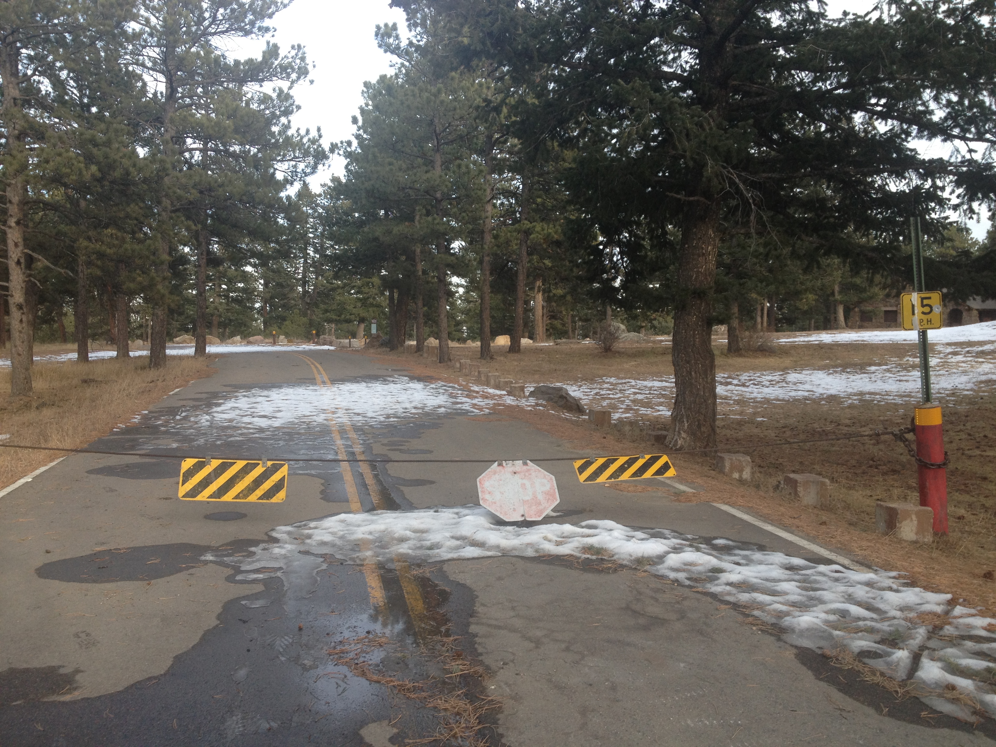
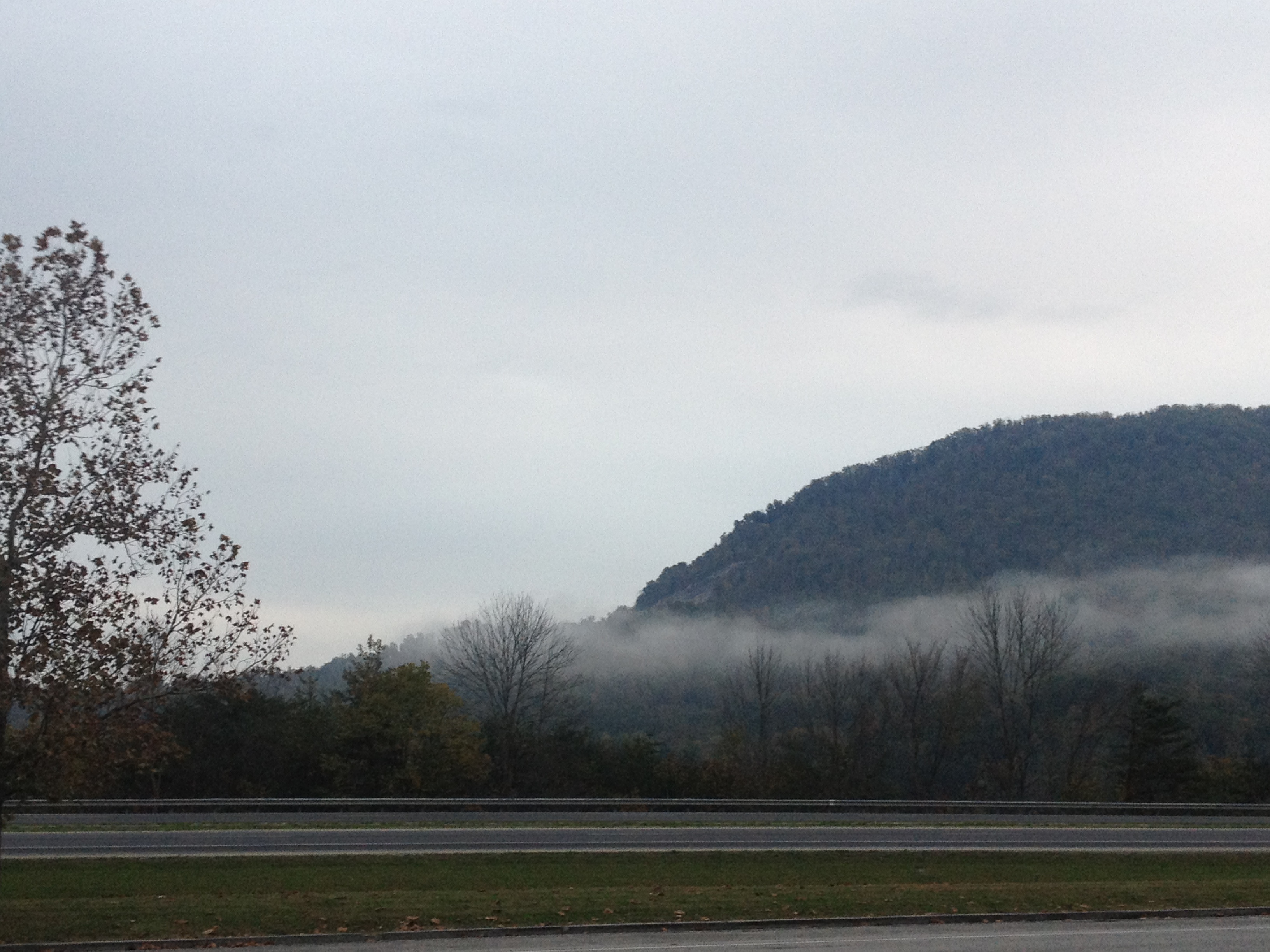
Going on a 60-90 minute dog sledding tour on a sunny afternoon in Breckenridge leaves plenty of additional time in the day for other activities.  As a season pass holder to Vail Resorts (a pass called the EPIC pass) that other activity is pretty obvious- skiing!  Breckenridge ski resort (part of the pass), is located less than half an hour from Good Times Adventures.  We planned our sled trip to begin at 1:15 in the afternoon, and used the morning to ski.  Morning is often the best time to ski, as snow conditions deteriorate as the day progresses (due to use) more frequently than not.  Following a series of major snow accumulations to start off 2014, snow conditions were ideal at Breckenridge ski resort today.

IMG_1601 IMG_1603

I will post more about Breckenridge ski resort, as well as the other ski resorts I ski regularly during wintertime, later.

IMG_1607

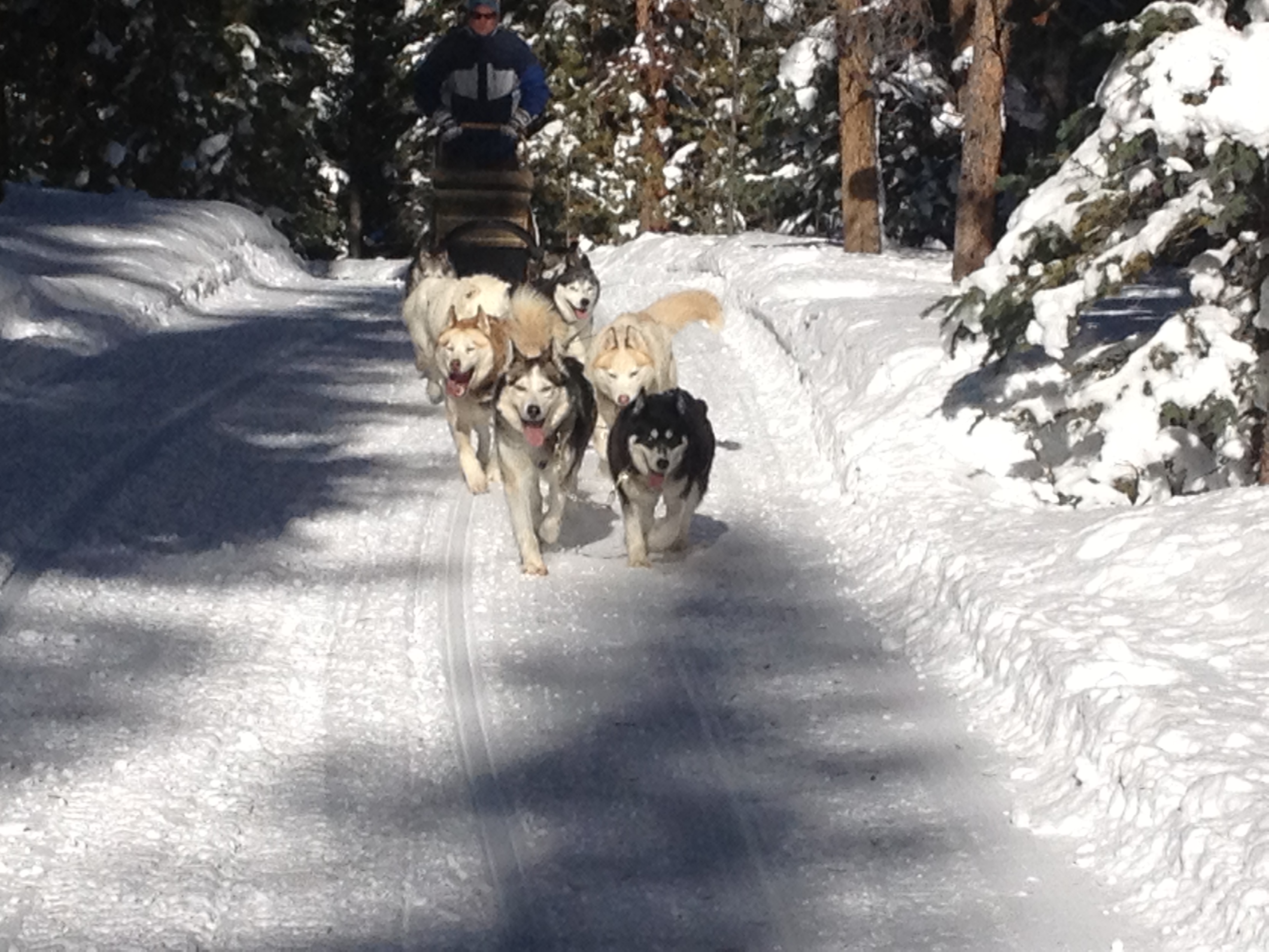
After several hours of great skiing, it was time to meet the dogs.  The eight-dog team was made up of huskies.  Across the north, huskies are traditionally used to transport lighter amounts of cargo at a faster speed.  This, of course, includes people.  For heavier cargo, the Alaskan Malamute is often used.  Essentially, a team of huskies would be analogous to a car in today’s world, while a team of malamutes would be analogous to a truck.

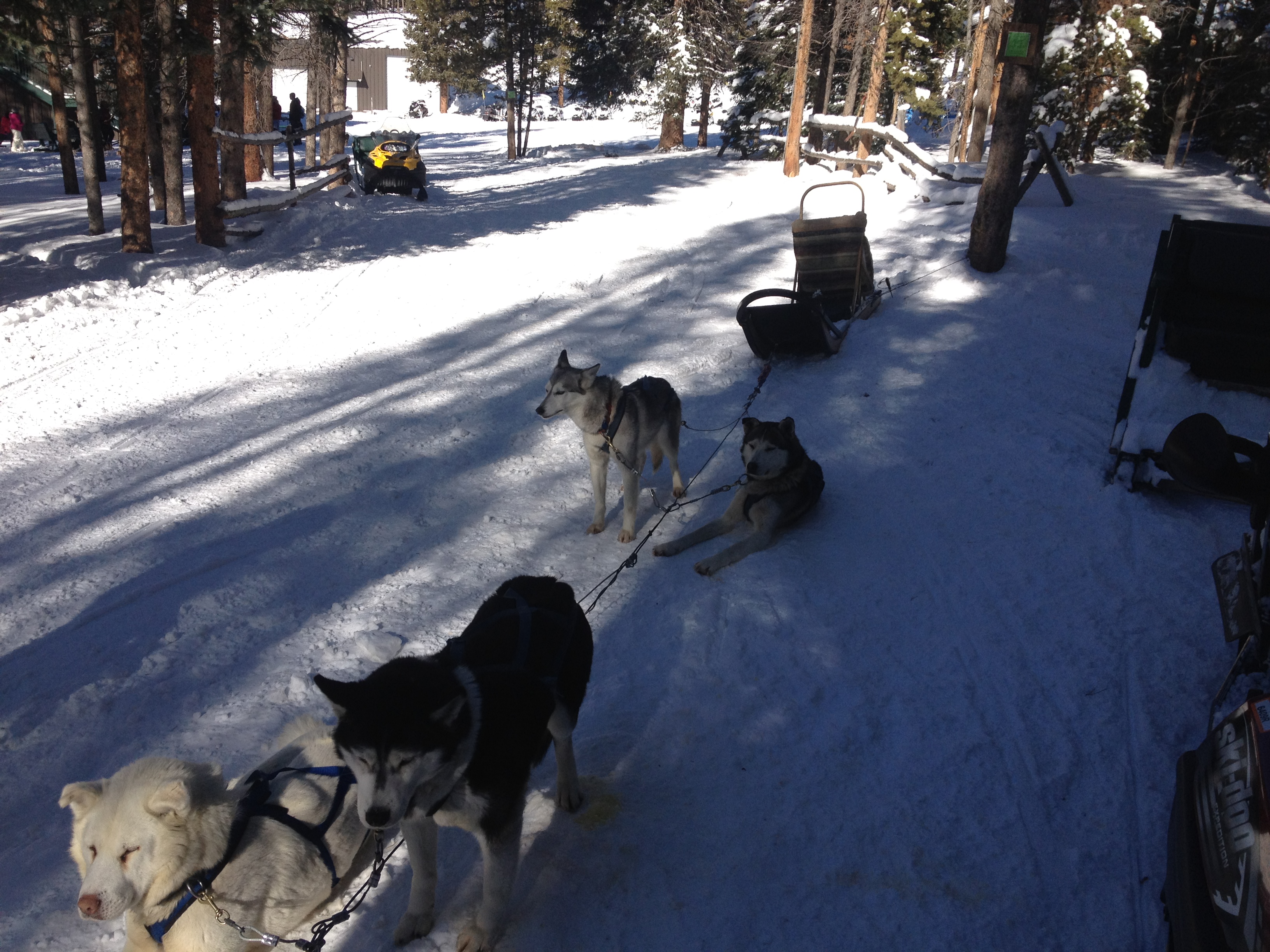
The dogs we met at the resort were friendly.  Towards us, they were friendly almost in a business-like way.  It almost felt like they had some kind of understanding that we were customers and that they are conducting a business.  Sometimes dogs have this eerie way of sensing a situation, and us humans cannot even begin to figure out how they do it.  Almost every dog owner can think of one instance in which they came home quite upset and found their dog ready to give them a comforting embrace.  These dogs seemed understand that we were customers and not their owners/friends quite clearly.

IMG_1610

One of the dog was briefly too friendly with his female companion.  But, hey, with almost two hundred dogs and an expanding business, Good Times Adventures could probably use a few more puppies from time to time- no matter what the source.

IMG_1620

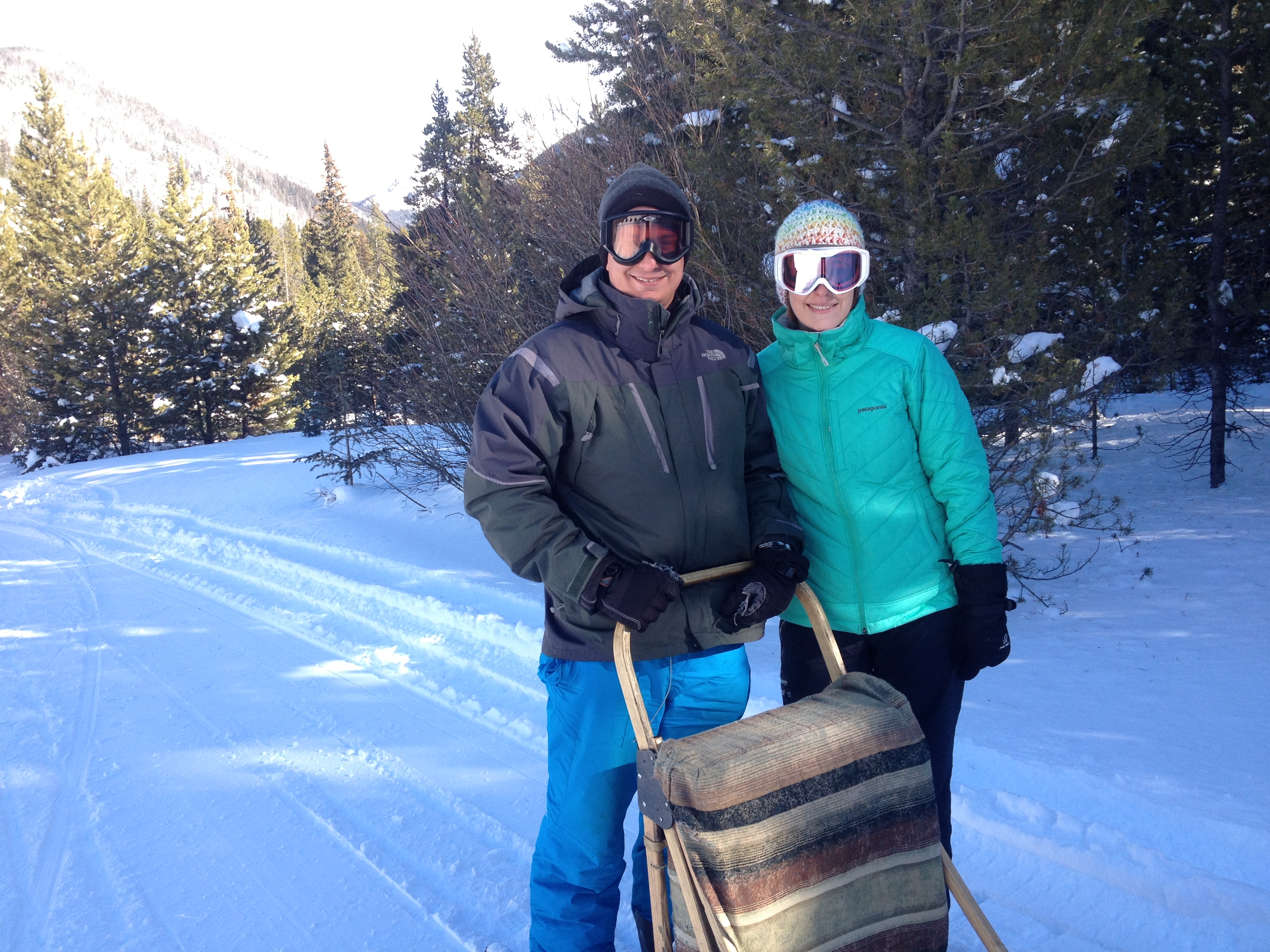
I was pleasantly surprised that I got to actually drive the sled, exactly the way the mushers do it on the dog sledding circuit.  The tour guide gave us all a brief lesson on how to steer, how to break, and some basic strategies (like leaning into a turn).  While I am sure there is a lot more to what professional mushers do, and that they do it at faster speeds on tougher courses, it definitely felt real.  I was really experiencing the culture that brought us the tradition of dog sledding, albeit only a sample.

IMG_1614

Most activities are not truly appreciated until they are experienced.  It is for this reason that people who participate or have participated in a sport are more likely to be fans of that sport.  It is the understanding of what is happening that only a fellow participant can relate to.  The speed at which the dogs are able to pull the sled across the snow is something that must be experienced.  Speed feels differently depending on the venue.  When I am able to get up to 30 mph on my bike it feels quite a bit different from skiing at 30 mph, and nothing like the extremely uninspiring experience of driving a car at 30 mph.  The same can be said of the speed at which the dogs pull the sled.  My first up close view of the dogs pulling another sled across the snow, and when I first hopped on the sled and experienced it myself surprised me quite a bit.  Huskies truly are amazing dogs!

IMG_1618 IMG_1622

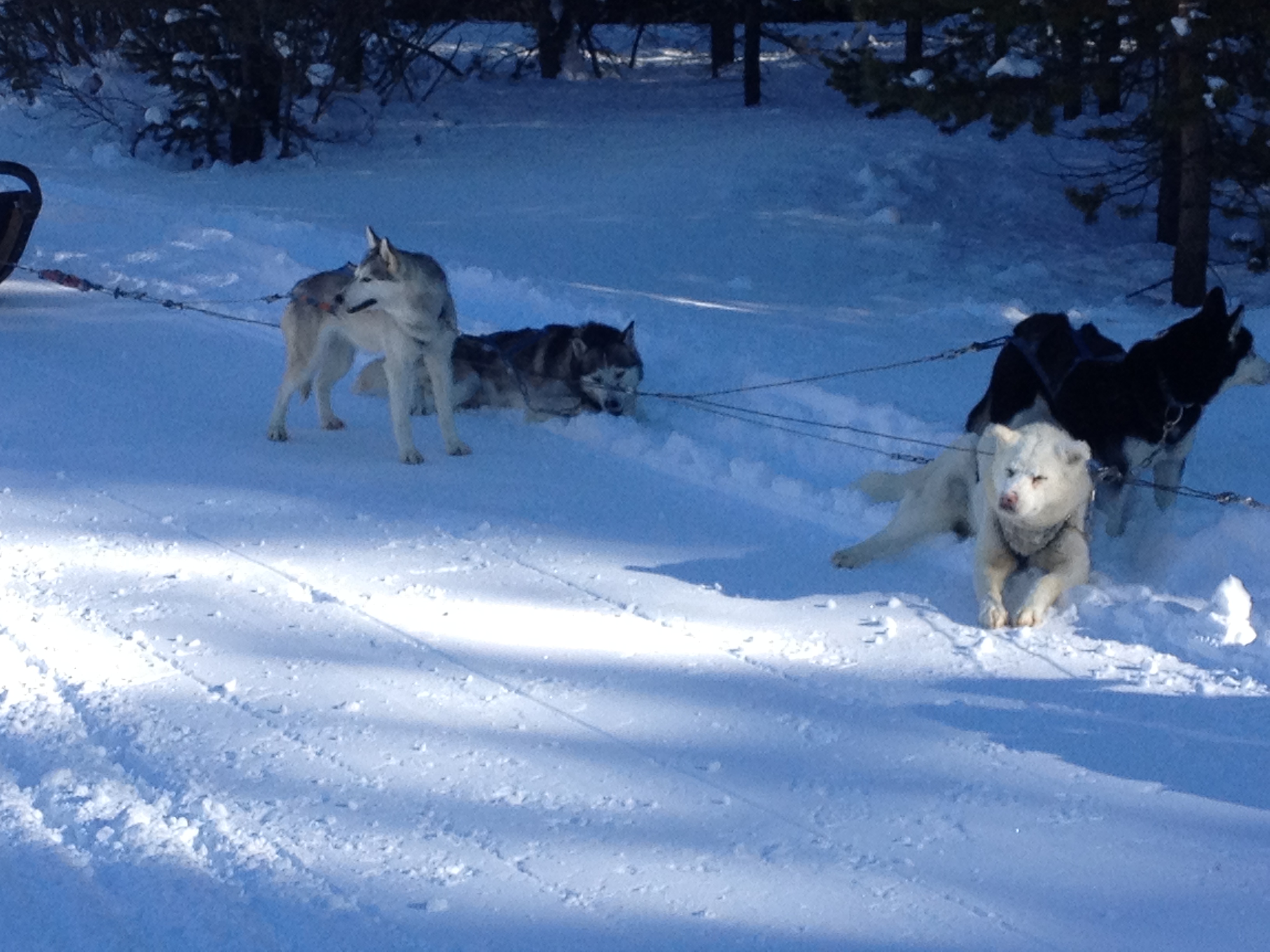
According to the tour guide, huskies are built for temperatures well below 0 (F), and it is at those temperatures that they feel the most comfortable.  Today’s temperatures in the lower 30s were therefore quite hot for these dogs.  Combined with the strenuous workout of pulling a sled at high speeds, the dogs were overheating.  In order to cool off, at every stopping point (we stopped regularly to give everyone multiple turns driving the sled) many of the dogs would actually jump into the snowbanks along the edge of the trail in order to cool off.  Some even basically covered themselves in snow!  I could not imagine living somewhere where I would regularly overheat in the middle of winter- let alone summer.

How we transport ourselves is an important aspect of our culture, and one of the ways we define who we are.  Route 66 remains an icon of American culture of the 1930s-1960s era.  The bicycling world remains its own community with its own identity.  And, one of the main differences between modern urban, suburban, and rural cultures is the manner in which we transport ourselves. Without trains, and eventually cars, the United States of America would not be what it is.

Without sled dogs, the culture of the north would not be what it is either.  By partaking in the main transportation mechanism of the cultures of the north, I was participating in their culture.  I was experiencing what they experience.  I was partaking in an activity that created a way of life, and was later harnessed to save an entire town from an epidemic.

A Weekend to Remember for Under $100?

Genesee Park is a place I had never really thought too much about.  For most of my first year and a half in Colorado, I was barely aware of it’s existence.  I mostly knew that there was some kind of park at the spot along Interstate 70 where the high peaks of the Rocky Mountains first appear, which is about half an hour west of Denver.  But, on most of those trips I would be on my way to the ski resort, or some other destination that is more well known, and farther West along the interstate.  With about half a day’s worth of spare time, and little appetite for a long drive, as holiday travels await, I decided to explore this area and see what I would find.

IMG_1529 IMG_1527

Not surprisingly, I was the only person at Genesee Park today.  Not only is it off-season for places like this, but it is also a weekday, a time when most other people are working.  In addition, the park was closed for the season.  Being alone in a place like this is somewhat of a strange experience, especially for someone who is accustomed to an urban environment, with a plethora of noise and crowds.  However, being completely alone was what allowed me to truly tap into my imagination and discover what could come of a place like this during the summertime.

IMG_1525 IMG_1526

What surprised me about this mountain park were the plethora of available activities.  The two short red poles are obviously for horseshoes, and the two taller metal poles are for setting up a volleyball net.

IMG_1530 IMG_1533 IMG_1534

Additionally, the park had a pretty wide open softball field, which even included a home plate and a backstop.  Combined with a subtle smell of wood near the stoves adjacent to the picnic tables and I instantly imagined myself here on a warm summer’s day, with groups of campers taking part in a multitude of activities.  I pictured not only the activities the park is specifically set up for, but a multitude of others, such as Ultimate Frisbee, or just simply goofing off with all of the logs and pine cones all over the ground.  Children seem to never run out of things to do at a place like this, but sometimes a weekend up here can bring out that imaginative side of adults as well.  With the right group of people, a simple weekend away at a place like this could prove to be quite memorable.

It also dawned on me that the experiencing I am currently imagining at this place would also be quite inexpensive, at least compared to many other activities.  I did not do the math, to calculate the cost of gas, food, tents, etc., but I could not imagine it coming out to more than $100 per person.  In fact, it could end up being quite a bit less.  Just the thought of having an incredible weekend like this for such a small price demonstrates what is really important in this world.

It is odd that Christmas time, a time originally designed for people to reflect on what is really important in life, can now have the opposite effect.  Regardless of what people think of the practice, few people avoid the stress involved in purchasing Christmas gifts at this time of year.  But, what is it that people really want?  And what do people really need for Christmas?  After a quick mental survey of the people I know, as well as society as a whole, I came to the conclusion that while a new shirt may help someone’s confidence, and a new game may prove fun to play with, we are generally looking in the wrong places to satisfy ourselves.  What many of us need is not a new gadget, or an expensive coat.  What we need is more subtle.  We need things like companionship, appreciation, a sense of purpose, and security.  These are the things that we can often find at places like Genesee Park when we share experience with one other, and share ourselves with one another amongst the breathtaking backdrop of some unexpected mountain views.

IMG_1531 IMG_1532

However, it seems to me that all too often, rather than looking to places like Genesee, or to the people around us to fulfill what we need in life, we look to places like this.

IMG_1535

I will certainly give and receive presents this Christmas.  Some may even excite me quite a bit.  But, in the long run, the things that matter most will be more reflected in the way we view ourselves, the way we view life, the people around us, the way we treat one another, and the experiences we all have.

The Last Chance Of The Year

IMG_1493

There is a saying that “old habits die hard”.  This is possibly an overstatement, and it might not apply to everybody.  But it is a powerful statement of inertia that applies to a large segment of the population.  A major stress factor, such as the discovery of a new food allergy or the loss of a job, can change people’s habits rapidly and decisively.  However, in the absence of some kind of major push, most people’s habits will change slowly or even not at all.  It is for this reason that bad habits like watching too much TV, engaging in frequent unprotected sex with strangers, and even smoking can persist for decades.

I would not consider the habit I am referring to as a bad one.  It is mostly just annoying to some people around me.  It all started in the 8th grade when I became somewhat obsessed with football.  A typically Sunday for me that fall I would not only watch a couple of NFL games, but I would also watch the pre-game show at 11 A.M., as well as NFL Primetime at 6 P.M.  On any given Sunday, I’d watch as much as 8 hours of football!

This also caused me to put off too much of my schoolwork.  Then one November weekend, I suddenly realized that I had a major Science project due and I was running out of time to complete it.  That Friday evening, I came home from school knowing that I would have to scramble to finish this project on-time, and calculated that I would have almost no time for anything else that weekend.  My parents were disappointed in me, and actually feared that my grades would suffer because of it.

That weekend’s weather was especially nice, with high temperatures reaching 70 on Sunday.  Sometime on Sunday my father reminded me that this would probably be the last 70-degree day until April.  As a weather tracker from a young age, this was a fact that I was already well aware of.  But, it was something I had not been thinking about through all of this.  At this time, my father was just trying to be a good parent, and inform me that procrastination had consequences.  But the sudden reminder, that it would be at least three, and up to five months before weather like this would return prompted me to go outside that minute, even though I knew all I could afford was a 10-15 minute break from my work.

The previous winter was my first in Illinois, and it was quite harsh!  Not only had I just moved from Long Island, New York, a place with milder winters, but that winter was harsh for Chicago area standards too!  Temperatures were significantly colder than their long-term averages, particularly in January and February.  I recalled seeing a snowpack persist for over five weeks, something I had never seen before, and school was closed a couple of days due to extreme temperatures (below -20).  It was quite a shock for me, and something I did not enjoy.  Feeling that fresh air, and knowing that these ten minutes would be all I get for such a long time made me regret my obsessive watching of football in a way I had never regretted anything before.  It was that day that I realized that I cared significantly more about activities that I personally participate in than watching professional sports (or anything on TV).  I did not completely give up on watching professional sports that day.  But, since that day I’ve have had a clear understanding of where my priorities lie.

The winter that followed would be modestly mild for Chicago standards.  But, it was still colder than the ones I remembered in New York, and there were still very few days warm enough to be enjoyable for outdoor activities.  It was enough to cement in me the lessons I learned that November day.  I would spend seventeen more years in the Midwest, in either Illinois, Indiana, or Wisconsin.  Only one winter season would be more oppressively cold than that first one (and I was in Wisconsin- a colder place overall).  Many of the winters would be milder, some significantly milder.  Still, I would rehearse the same pattern every fall.  Starting around Halloween weekend, any day where temperatures were projected to reach the 60s or 70s would basically sound an alarm off inside of me.  I would start planning ahead of time how to take advantage of these particular days, and bill it “the last nice day of the year.”  Sometimes, I would even have some “false starts” in this process, where I would be prompted to enjoy “the last nice day of the year” only to have another stretch (or even two or three) of warm weather occur before winter set in.

Now that I live in Denver, this practice is not necessary.  Not only do sunny and mild days occur quite frequently in the middle of the winter, but winter is one of the most exciting times to be in Colorado- due to skiing.  But, we are also not in an ordinary weather pattern.  Today’s highs will top out somewhere between 60 and 65.  But, after this, an abnormally prolonged period of cold weather is expected in Colorado.  It might even be too cold to ski, as highs between 10 and 20, and lows below 0 are anticipated for Denver.  It will be even colder in the mountains!  So, that alarm in my head triggered me to take advantage of this day as if it were the last chance I would have this year to go on a bike ride, which I did.

IMG_1495 IMG_1496

Of course, one of the challenge in taking advantage of the last nice day of the year is that in November and December, the days are quite short.  Today I also had an added time constraint, as I knew the winds around Denver would pick up around noon, making bicycling much more unpleasant.  So, I stuck to a much simpler ride, down the Cherry Creek Trail to  Cherry Creek State Park, a 25 mile round trip.  Most of the ride is flat, or slightly uphill on the way out and slightly downhill on the way back.  The first major terrain feature is a large hill near Kennedy Golf Course, which is followed by the climb up to the reservoir.

IMG_1499IMG_1497

The Cherry Creek Trail is one of the best trails I have ever ridden!  It follows the river, through all of the underpasses, and avoids nearly all traffic lights.  This makes it a perfect way to get somewhere quickly on a bicycle.  There is some terrain climbing up to Cherry Creek State Park, but overall, the ride here only involves three “climbs”, and each one is only a couple of hundred feet in elevation.  Therefore, this would be a great ride for people who are only in moderately good shape, or not looking for a major challenge.

It will be too cold for bicycling in Denver to be enjoyable for at least another week and a half.  But, in all likelihood, this was not my “last chance of the year” to ride.  Therefore, I probably did not need to be too concerned about taking advantage of today’s weather.  However, I am also not seeing any negative consequences in taking advantage of a day like this.  I did not miss out on anything important, and everything I need to work on I can complete in the later part of this week when the weather turns awful.  So, this old habit is going to “die hard”, and probably won’t change much until it leads to a poor result.

Hiking Boulder’s Flatirons in late November

IMG_1472

One of the things a lot of people don’t realize about Colorado is that it is actually possible to hike here year round.  For sure, winters in Colorado are characterized by a lot of snow, but at lower elevations, warm-ups are also quite frequent.  Earlier this year I made some calculations with some data from the National Climatic Data Center, and concluded that even in the coldest part of winter high temperatures can be expected to exceed 50F in Denver more than one in three days.

At higher elevations it is more consistently cold and snowpacked.  This is why Colorado has great skiing, but also why hiking at higher elevations beyond the month of October generally unrealistic.  However, it is great knowing that there is a place where both skiing and hiking could be available on the same calender day.  Sunday I went skiing, Monday I rode my bicycle, and yesterday I hiked.  What an interesting place!

IMG_1471

With that in mind, this is a great time of year to check out many of the hikes available at lower elevations.  This includes the Flatirons in Boulder, Colorado.  Many of the trails up this mountain feature can be accessed from Chautauqua Park on Boulder’s Southwest side.  With the park being in town, and downtown Boulder being only about a mile and a half away, and this park can easily be reached by bike or bus, making this one of the few places in the country where one can frequently hike and even rock climb without access to a car.  So, I can kind of see why it is an expensive place to live, but I really did not mind driving, so I’ll spare myself the extra $400 a month in rent.

IMG_1473 IMG_1474

Hiking in the Boulder Flatirons is quite different than climbing a trail up a mountain.  Rather than one trail up and one trail down, there is a network of trails that need to be navigated for one to reach their destination.  From the parking lot, the Chautauqua Trail can be followed up to the Flatiron Loop Trail.  The Chautauqua Trail is a fairly consistent moderate uphill grade.  The Flatiron Loop Trail, however, gets both steeper and rockier.  Climbing this trail reminded me how high in elevation the Flatiron features really are.  With the features known as the Flatirons being so close to town, it is easy for one to think of these features as extending down almost to the elevation of town, roughly 5400 ft.  But, the reality is that these features are largely between 7000 and 8000 ft. in elevation.

Some of the rockier areas of the trail scared my dog a little bit.  Despite this, I did see a significant amount of dogs on the trail.  However, in Boulder, I would consider the Mount Sanitas Trail more dog-friendly, as it does not contain segments like this one.

What I did not realize until yesterday’s hike was that the Flatirons are numbered.  The Flatiron Loop Trail traverses Flatirons #1 though #3.  For each of these peaks, a spur off the trail provides climbing access.  The first Flatiron, pictured above, looks somewhat different up close.  Small scale features, particularly indentations in the rock, do not show up when viewing these features at a distance.  Like some famous paintings, they look nicer from afar than they do from close up.  The trail reaches it’s peak elevation between Flatiron #2 and Flatiron #3, and beyond Flatiron #3 is the trail I intended to do, the Royal Arch trail.

IMG_1478 IMG_1479

Unfortunately, this trail was closed, most likely due to the flooding.  As an alternate, I decided to hike the Flatiron #3 climbing access trail, as I still wanted to get to the top of these features.  This trail was even steeper than the Flatiron Loop Trail, and also a lot narrower and rockier.  It is one of those trails where one follows the rocks as an indicator of the trail’s path.

IMG_1481 IMG_1480

Flatirons #2 and 3 appeared somewhat more as I imagined them; rock formations poking out of the trees, with a near steady slant of around 45 degrees.  As I viewed each of these features up close, I could not help but be reminded of the rock features near Red Rocks.  Of course, these features are not nearly as red in color, but their shapes looked quite similar, making me believe that some of the same geological processes must have been at work in the creation of both of these features.

IMG_1484

On the return trip, back to the parking lot, I actually came to the conclusion that Flatiron #1 just looks somewhat different than the other two.  A later Google image search would confirm this for me.  I guess this one is not quite a “flat” as the other ones.

IMG_1486

It was actually nearly 3/4 of the way back down to Chautauqua Park that I encountered what I consider the best view of the day.  The time was around 3:30 P.M., which in late November means that the sun was already starting to descend in the western sky behind the mountains.  However, the sun was still an hour or so from setting.  As a result, the shadow created by the mountains can be seen quite clearly in contrast with the bright sunshine, making for a breathtaking image that is unique to that particular time of day.  Half an hour earlier, it would have looked like your standard daytime image of the foothills of the Rocky Mountains, and half an hour later this entire area would be shadowed and the entire region would be significantly darker.

I did not specifically plan to be here at this exact time, in this exact place.  In fact, if I were to try to calculate what time of day I would need to be here to see this exact view, I likely would have calculated it incorrectly.  Sometimes in life the best results come not from careful planning, but from simply going to new places, trying new things, and being ready to absorb and enjoy what comes your way.  This is what comes to mind when I look at this particular photograph.

The Cuyahoga Valley

I frequently hear people describe Ohio in a negative manner.  People often describe Ohio as a dull, based on the experience of driving across the state on cross-country road trips.  Much of Ohio is associated with the “rust belt”, a term used to describe heavily Industrial parts of this country that have experienced major decline in the past 40 years.  This area tends to be centered around the Great Lakes.  I’ve heard Cleveland, Ohio’s most historically significant city, referred to as the “mistake by the lake”, and seen an entire episode of TV’s 30 Rock dedicated to mocking the city.

However, there is more to Ohio than most people realize.  Cincinnati is a vibrant, if not glamorous, city and a good place to catch a sporting event.  Cedar Point Amusement Park is the best theme park I have ever been to.  And, prior to my trip to Yellowstone National Park, Cuyahoga Valley National Park’s Brandywine Falls was the best waterfall I had ever seen!

brandywine-falls-in-cuyahoga

The Cuyahoga Valley actually offers a plethora of recreation opportunities.  The Cuyahoga Valley National Park is located near the Ohio Turnpike between the cities of Cleveland and Akron.  A towpath trail, which follows the Cuyahoga River through the National Park offers a bicycle connection between the two cities through a very scenic river valley.  Surrounding the national park are parks associated with the Cleveland Metro Parks system, as well as Akron’s Summit County Parks.  At these parks, one can find yet more scenic views, hikes, picnics, and recreation.  Overall, it is an entire region of interesting scenery and fun activities that many seem to overlook when they put down the state of Ohio.

I have previously been to Cuyahoga Valley National Park, and seen Brandywine Falls.  So, this week I visited two other parks in the area; one in Cleveland’s Metro Park system, and on in the Summit County System.

IMG_1414 IMG_1403 IMG_1404


Summit County’s Sand Run Metro Park, located on Akron’s Northwest side seems to be a popular place for people to go running/ jogging.  I was actually blown away by the fall colors in this park!  It was among the best colors I had seen on this trip.  My friend’s house actually backs up to this park.  One could simply walk out the backyard of his house, or anyone’s house in the neighborhood, right into this park!  As someone who has lived in urban areas/ apartment buildings for over a decade (including campus related apartments), the idea of walking out of a place of residence straight into somewhere like this comes across as truly amazing to me.

IMG_1408


My main hiking excursion in Ohio was at a place called Bedford Reservation, which is part of Cleveland’s Metro Park system.  This park is located just to the east of the Cuyahoga River, along a creek called Tinker’s Creek.  This Creek flows directly into the Cuyahoga, and therefore, this area would still be considered part of the Cuyahoga Valley.

IMG_1410 IMG_1411 IMG_1412


The hike along the Bridle Trail here at Bedford Reservation is a scenic hike with rolling terrain.  After about 3/4 of a mile, it leaves the river valley and climbs up onto the ridge.  This climb is fairly steep, but also fairly short lived.  It was steep enough to cause someone to lose their breath a little bit, but not exactly tiring.  The rest of the hike also contains kind of a mixture of ups and downs.  This, of course, differs greatly from the typical hiking experience in Colorado, as well as the hike I did at the Smoky Mountains, where the hike is only uphill on the way out and only downhill on the way back.  In this sense, it reminds me of a typical hike in the midwest, where this is more common.

IMG_1399


Driving across Ohio on the Turnpike still sounds like a dull experience to me.  But that does not mean we need to judge the value of the entire state from this experience.  The entire Cuyahoga Valley is quite scenic, and contains some interesting recreation opportunities.  I think on my next visit here I would like to try to ride a bicycle from Akron to Cleveland along the towpath.

Great Smoky Mountains National Park

America’s most visited National Park is Great Smoky Mountains National Park.  Situated  in the Southern Appalachian Mountain Range, along the border of North Carolina and Tennessee, it is not the easiest place to get to.  When I think of National Parks, places like Yellowstone and the Grand Canyon first come to mind.  This is why I am somewhat surprised that this National Park takes the prize as most visited, with something like 10 million visitors annually.

IMG_1228 IMG_1229


The drive down to the Smoky Mountains was quite scenic.  It was mostly along Interstate 75, which I joined just north of Richmond, Kentucky.  Mountains began to appear as I approached the border of Tennessee.  And, with it being a cold morning, fog appeared along the sides of the mountains near the border.  I have only driven this road once before, but I actually recall it being prone to fog.  I even remember fog related caution lights the last time I was here, which I did not see this time.

IMG_1232 IMG_1233

As I approached the National Park, I began to think that there may be places besides the National Park itself that are just as scenic.  I knew the park would be crowded, which it was, with slight backups on the way both in and out of the park.  I still wonder if I could have gotten the same experience at a slightly different location.  Most mountain ranges are larger than the parks that are built to celebrate them.

IMG_1234


As I entered the park I notice that the trees in this area have largely not turned yet.  This, of course, is at lower elevations, and as I traveled up the mountains, the scenery would change.  This is one of the things that made this trip quite interesting.

IMG_1235


My Thursday hike would take me up the Alum Cave Trail to the top of Mount LeConte.  This trail is right in the middle of the park, and one of the most popular trails here.  It is kind of describes as your “quintessential Smoky Mountain hike”, and since this is my first time here, I figured I might as well start with this one.

IMG_1237

The hike starts off somewhat easy.  The first mile or so treks along the valley of a creek, gradually gaining elevation from a start of something like 3500 feet to just over 4000 feet.  It is in this part of the park, the middle elevations (as it has places lower than 2000, but also peaks above 6000) where the fall foliage was at it’s peak this week.  Knowing this, I would still recommend late October as an ideal time of year to visit the Smoky Mountains.

IMG_1238


Arch Rock is the first defining feature on this trail, 1.4 miles in.  It is at this point that the trail becomes more difficult.  In fact, I think there are a lot of people that end their hike here.

IMG_1240 IMG_1241 IMG_1242


As I continue up the trail, I notice more great views of the mountains and the foliage.  The hike overall is somewhat difficult, but I would say I have done harder hikes in Colorado, especially due to the elevation.  However, I did get a chance to feel really awesome, as I was the fastest person on the trail that day.  I would spend most of the day passing people up, and only get passed up once, at the very end of my descent, right before reaching the car again.  This, of course, is the opposite of the experience that I typically have in Colorado, where I am the one usually getting passed up.  I should really not compare myself to others, especially regarding something like hiking, but it still felt kind of good, almost like I know what it feels like to be one of those guys with their headphones on running up Mt. Bierstadt.

IMG_1244 IMG_1245


The trail’s main defining feature is Alum Cave, which is not a cave, but more of a series of bluffs.  This point is also a common stopping point for hikers.  It was a cold day, especially for Tennessee standards.  Highs would only get into the lower-middle 50s at the base of the mountain, and most of my hike would be in temperatures in the 30s and 40s.  A little nervous about the cold, I thought about stopping here, but decided to keep going anyways, up Mt. LeConte, which would take me over 6500 feet in elevation.

IMG_1247 IMG_1248


I had perviously noticed a white looking feature to the top part of the mountains.  One could mistake this feature for snow, but one of the hikers informed me that it was a really heavy frost.  This, of course, is something that would never happen in Colorado due to the lack of moisture, and is one of many features that make the Appalachian Mountains different from the Rocky Mountains.  When I finally got to this level, I was relieved to find that this frost was not present on the ground, which would have made the hike slippery.

IMG_1250 IMG_1251


There were some really neat icicle formations near the side of the trail, but there were really only one or two parts I would consider slippery.  The top of the mountain did have some dense pine forests.  With their heavy coating of frost, walking in and out of these areas was somewhat creepy feeling- appropriate for Halloween.  There was some wind at the top of the mountain.  It was no faster than 10 mph, but was enough to blow some of this frost off the trees.  The frost flying through the air felt kind of like it was snowing, but being the scientist I am, I knew that it was not actually snowing.

IMG_1253 IMG_1254


0.2 miles before the top of the mountain, there were a bunch of cabins.  I actually saw some people with full backpacks headed there to stay the night.  The top of the mountain was foggy, which dampened my view.  WIth it being cold and windy, I only stayed up there for about 10 minutes; long enough to take this picture and eat a 6″ sub from Subway, which I brought with me in my backpack.

IMG_1257

The hike took me about 5 hours overall, 3 to get up and 2 to get down.  Other hikers told me that it was an impressive time, but I was kind of in a hurry, as it was cold and I did not want to take long breaks.  The additional time gave me a chance to see some of the park’s other features.

IMG_1259 IMG_1260


The first of such features was the Newfoundland Gap, which was apparently discovered in the early 19th century as an alternate route to the Cumberland Gap.  Looking out at the natural features, I struggle to figure out where this gap is, and what makes it an easy route for settlers to get across the Appalachians.  I am guessing it is the valley between this hills, but it seems as though they would still have to climb to the elevation I am sitting at, 5048 ft.

IMG_1261

I also got to see a small section of the famed “Appalachian Trail”, which follows the high points along the NC/TN state-line through most of the park.

IMG_1263


I drove up the road to Clingman’s Dome, the highest point in the park.  But, the cold, windy weather, and fog at the observation deck stopped me from actually going up there.

Overall, I enjoyed my experience at the Great Smoky Mountains National Park, and I think the area offers something for everyone.  Just outside the park are the towns of Gatlinberg and Pigeon Forge.

IMG_1264


Both towns are quite touristy, with tons of restaurants, hotels, and other attractions like roller coasters and family fun centers.  However, Gatlinberg was more dense, the kind of place where one would largely walk to most of the places they desire to go to.

IMG_1230


Pigeon Forge, on the other hand, is a driving place.  I saw few people walking around here (as I saw a lot in Gatlinberg), but there were still tons of attractions, probably even more than in Gatlinberg as Pigeon Forge is home to Dollywood.

For those that want a more rustic experience, there is plenty of that too.  In fact, just off the Smoky Mountain Parkway (the highway that connects these two towns to Interstate 40), it gets a lot more rustic quite quickly, with lots of cabin sites, but also areas with tubing and other outdoor activities.  I can imagine nearly everyone getting something out of their Smoky Mountain experience, and I can imagine spending a significant amount of time here.  Between this, my experience in Nashville last year, and what I hear about Memphis, Tennessee seems to me like a state that really knows how to party!

One other thing I noticed while in Tennessee is that there are parts of the country where Krispy Kreme donuts are still popular.  In fact, my hotel offered free Krispy Kreme donuts to their guests, as a manner in which to draw people (as competition is quite stiff in this area).  In this part of the country, Krispy Kreme donuts were popular long before the Krispy Kreme fad up north around a decade ago, and remain a cultural institution.  When I ate my donuts, I realized once again that these are good donuts.

We urban, cosmopolitan, northerners (or however you describe pop-culture influenced mainstream America) seem to do a good job of taking cultural mainstays from other regions and turning them into short-lived fads.  Shortly after the Krispy Kreme fad (which was roughly 2001-2004), we created a fad out of Caribbean reggaton music, culminating with Daddy Yankee’s widely successful BarrioFino album.  For those that don’t know, Daddy Yankee is still producing albums that are widely successful in the Caribbean, and even moderated a gubernatorial debate in Puerto Rico.  We are now doing the same thing with twerking, which has been part of African American culture for two decades.  Actually, that fad may already be over!

After my breakfast, I head back to the park to visit one last destination; Cades Cove.  This part of the park is mainly for wildlife viewing.  I have limited luck, as much of the area is pretty empty.  There are a lot of horses here, but that is kind of what I expect.  I was amazed, though, at how people went right up to the wildlife, even if it was deer, something I see all the time.  At the other National Parks I have visited this year, mainly Yellowstone and Rocky Mountain National Park, anywhere I’d seen wildlife, there were park rangers making sure people don’t get too close.  Here, it appeared as if people were walking up to the animals, just daring them for a fight.

IMG_1266 IMG_1267

I would very much like to come back here.  There is so much more to see and do in Great Smoky Mountains National Park, as well a in Gatlinberg and Pigeon Forge.  However, I am also curious to go somewhere else in this mountain range where it may be less crowded.  Perhaps I could go somewhere like Mount Mitchell, or to an area north or south along the range, just to see if the foliage and hiking experience would be just a good without the traffic and crowds.  However, I do think it is interesting to see these mountain ranges in the east, as they are quite different from the Rocky Mountains, near where I live.  They have much more of a densely forested feel to them than the wide open Rockies.  The colors are different, and the mountains feel somewhat different in orientation.


Interstate 65: The Raceway

IMG_1176 IMG_1177

I designed a road trop that would mix the familiar with the new.  The first day of my road trip focused on the familiar, and few roads are more familiar to me than interstate 65 between Chicago and Indianapolis.  During my time living in the State of Indiana, people would often refer to Interstate 65 as “the raceway”.  This, of course, referred to how fast traffic would move on this highway.   Traffic most likely moves this fast on this particular road because the two cities it connects both contain a lot of fast drivers.  At the time when I was living in Indiana, the highway speed limit was 65 and traffic tended to move at a speed of about 80 mph.  Since then, the speed limit has increased to 70, meanwhile gas prices have risen substantially.  Still, with the exception of when trucks are slowing down the highway by passing one another, traffic moves at about the same pace.

IMG_1179 IMG_1178

Most of this route would be considered quite dull by most.  It pretty much looks like this, open fields of corn and soy stretching endlessly into the distance.  And, there is little variance.  Nearly every highway I crossed would contain the same features, a few gas stations, and signs pointing motorists to both Chicago and Indianapolis.  For many, this is a dreadfully dull ride, but for me it is slightly differnt.  As I had spent a significant amount of time in the area, and gained a lot of interesting experiences here, the highway actually brought back a plethora of memories for me.  Many of the exits I encountered on this trip reminded me of interesting experiences I had years back.  It was almost like a trip through a period of my life, and almost like I was reliving many of these memories.

IMG_1180

I felt it appropriate to stop at Arbys, a staple of this region.  In fact, whenever I think of central Illinois and Indiana, I think of Arbys, as they are plentiful here.  One time, while driving interstate 55 from Saint Louis to Chicago, I decided to count the number of Arbys- there were 13, and that was only the number I could see signed from the highway.

IMG_1183

There is one place where the endless fields of corn and soy give way to a very different scenery; in the vicinity of the Wabash River near Lafayette, Indiana.  WIth dense trees, and even a little bit of terrain, this region is always a welcome break from the monotony of this trip, even when I am reliving memories from my past.  In fact, I recollect this area being one of the few areas I explored beyond the local fast food joints and truck stops on this trip.  I was hoping for more color, given that it is well into October, but I heard that the weather had just cooled down recently.  So, the colors will have to wait.

IMG_1189

Indianapolis is not a glamorous city.  In fact, it is mostly known for being quite affordable compared to most cities its’ size and larger.  I recall seeing lists that compare median income to median home costs, and seeing that Indianapolis is one of the easiest places for someone with the average paying job to afford a home.

IMG_1190

However, it is not without its’ interesting places.  The bike trails here are pretty unique, albeit they do not seem like they would be efficient.  In town, I got the chance to check out the Indianapolis City Market, which seems like the kind of place people go to eat lunch during an average workday downtown.  By the time we arrive there, around 4:15 P.M., most of the businesses seem closed.  However, there is one open establishment, called the Tomlinson Tap Room that serves beer from different microbreweries throughout the state.  They even serve “flights” on boards shaped like the State of Indiana, which I found to be a unique idea.

IMG_1191 IMG_1192 IMG_1193

Looking at the clientelle at this establishment, it appears to be one of those after work type of places that tends to die down around 8 or 9 P.M.  Plenty of these types of places can be found in central business districts of many large cities, as other districts are more sought after with regards to nightlife.

Although I can never think of a defining feature about Indianapolis, I always enjoy my trips here.  My last time here was in 2010, when I was Wisconsin defeat Michigan State in the inaugural Big 10 Championship game.  I remember getting pitchers of Long Island Iced Tea for only $7 at a place called Tiki Bob’s.  And this was on a Saturday night, and the night of a major sporting event.  There is something to be said about affordable cities, and even affordable neighborhoods of our own cities.  People here seem to be enjoying the same experiences for a fraction of the cost.  Sometimes I even wonder if the joke is one me, and others that chose cities and neighborhoods that are trendy or well known.  They are probably sitting back, enjoying their $3 drinks and $550/ month apartments wondering why we pay so much to be where we are and do what we do.


Golden Gate Canyon State Park

IMG_1152

Only half an hour outside of Golden, Colorado, Golden Gate Canyon State Park represents one of the easiest hiking places to get to from the Denver metropolitan area.  It is definitely a lot shorter of a drive then Rocky Mountain National Park, but is probably a little bit longer than The Flatirons in Boulder.  My visit to this park was not in peak season, on the 19th of October, but it was on a weekend.  Based on what I saw today, it appears that this park is significantly less crowded than both Rocky Mountain National Park and the Flatirons, and therefore may represent a more tranquil alternative to those two destinations for day hikes.

Yesterday, we visited the east side of the park, parking in the first parking lot in the state park off of Crawford Gulch Rd.  At this parking lot, our elevation was just short of 7,800 feet.  I have to admit, I was a little bit apprehensive about doing a hike this high in elevation well into October.  Last spring I came to the conclusion that the in-between seasons, when it is not warm enough to for activities at high elevations, but not quite ski season, are the best times of year to explore areas at lower elevations.  But, I knew that it was going to be a warmer day in Colorado, with southwest winds, and highs in the 60s in Denver, which would mean temperatures could be tolerable at this elevation.

IMG_1153 IMG_1154

Upon exiting the car, I immediately noticed two potential hazards.  One was the wind, which was quite strong that day, and made the temperatures, near 50 at the time, seem quite a bit chillier.  It did not help that our hike’s destination was a place called “windy peak”.  I kept thinking to myself, if it is this windy at the trailhead, I am in for an unpleasant summit.  Second was the fact that hunting is permitted in pretty much the entire area where we would be hiking.  Most likely, this is one of those irrational fears that we all seems to have.  It’s kind of like all of those posts we see that indicate that more children get injured by trampolines and swimming pools than by strangers, yet, most parents seem way more afraid of their kids talking to strangers than using their backyard trampolines and swimming pools unsupervised.  But, for some reason I did get a little nervous when I saw this sign.  Luckily, I was able to put this out of mind pretty quickly.  We would only see one group of hunters on this hike, and they seemed like they knew what they were doing.

IMG_1155 IMG_1156

On this hike, we dealt with the remnants of two recent weather events.  First was the major flooding event last month.   In fact, one of the roads to the trailhead was washed out by this flood and closed.  We had to park right by the main road, and hike a little extra to get to the trail.  This was no big deal, and based on this, we could see why repairing this road would be a relatively low priority for the State of Colorado (compared with, say U.S. highways 34 and 36 near Estes Park).  We also had to traverse through some snowy areas.  Friday morning, Denver actually received it’s first snow of the year (which seems really early to me).  There was more snow in the mountains, and parts of the trail, especially those in the shadowy areas, and near our highest elevations, were snowpacked.  The snowpack, however, did not exceed 6″, where it would start to make the hike tougher and eventually impassible.  It did, however, make some downhill stretches a bit slippery and more hazardous than normal.

IMG_1158 IMG_1159 IMG_1160

Somewhere between 1/2 and 2/3 of the way up, we saw a couple of neat rock formations, like this one, and decided to go off trail and take a few side excursions.  This mostly meant physically climbing up the rock, and then rejoining the trail the next place we see it.  It’s the kind of thing I periodically do with hikes that are not going to completely exhaust me (like a “14er”) to add a little extra spice to the experience.  Upon completion of the second of these side excursions, I saw the tall peaks in the distance for the first time.  These peaks, which I would later be able to identify as Mt. Evans, Mt. Bierstadt, Gray’s and Torrey’s Peaks, showed up in the southwest sky.

IMG_1162 IMG_1161

The end part of the hike involved traversing through a fairly uniformly snowpacked and fairly dense forest.  We arrived at Windy Peak, whose elevation is just shy of 9,100 ft.  The views from windy peak are pretty spectacular, but, as promised, it was quite windy here, and quite chilly.  It was definitely windier than it was at the trailhead, and this hike seemed to follow the similar pattern of the summit being significantly windier than even places a mere 50-100 feet down the mountain.  Due to the conditions, we did not remain at Windy Peak too long.  Basically, we remained there long enough to eat a cliff bar without feeling like we were rushing through it, and to take a few pictures.

IMG_1163

On the way down the mountain, we actually noticed significant snowmelt.  In fact, the road to the park was icy in the morning, but clear in the afternoon.  We also came to the conclusion that Golden Gate Canyon State Park is one of the best signed hiking destinations we had ever been to.  Every trail junction has signs like these, with a complete map of the park, and arrows pointing to where to go.  I’d say getting lost at Golden Gate Canyon State Park is next to impossible!

Colorado is full of places to explore.  In fact, as a relative newcomer, it is somewhat overwhelming.  I think I am finally well versed on all of the skiing options in the state, and I am getting a handle on all of the whitewater places.  But, hiking, climbing, and bicycling, it seems like can be done almost anywhere.  And nearly every trail area seems to have trails varying from easy to very difficult like this one.  How any Coloradan chooses where to go on a particular day remains a mystery to me

A New Activity

It has been said many times in life that each and every one of us has something called a “comfort zone”. This “comfort zone” consists of wherever we feel comfortable. It is a set of situations, places, activities, and types of people. Inside our comfort zones, we feel a certain calm. The situation does not call for any kind of panic, and does not induce a certain kind of stress. I think we all enjoy being in our comfort zones, and can have some of our best times in life in places that are familiar to us, around people that we know and trust, and doing activities we know we excel at. Outside our “comfort zones”, we feel stressed. We often have some level of self-doubt, about our ability to handle a certain situation, excel at a certain new activity, or relate to an unfamiliar group of people.

It is also commonly stated that our “comfort zones” are in a perpetual state of flux, and at all times they are always either expanding or contracting. And, believe it or not, whether our “comfort zones” are expanding or contracting is typically at least partially under our control. When we open ourselves up to new experiences, we allow our comfort zone to expand. Nearly every activity any one of us enjoys was once strange and unfamiliar. LeBron James was once new to basketball, and Lindsey Vonn was once new to skiing.

Those that do not leave their “comfort zones” from time to time tend to see their comfort zones contract over time. This is because, well, in life, change is inevitable. We have all had the experience of one of our favorite places, perhaps a restaurant or a store, either closing down, or changing under new management. Likewise, sometimes friends take a different path in life, or change in some kind of a way making the friendship simply not what it used to be, or gone altogether. If we don’t perpetually find new places, new activities, new people, and new situations, we are doomed to enojy less and less as time goes by.

In that vein, I decided to take advantage of an opportunity to do a new activity today: mountain biking. Today’s adventure took me to Alderfer/ Three Sisters Park near Evergreen, CO, which is actually less than an hour from Denver.

20131009-223244.jpg

20131009-223253.jpg

Some might say that mountain biking is not too different of a sport from road biking, which I have done over 1,000 miles of every year since 2009. I even came into this thinking it was only slightly different, like how baseball is to softball. But, there are actually much larger differences than I imagined.

The main difference between the two sports can be summed up as balance vs. speed (or power). In road biking, when idle, it is proper to have one pedal down and one pedal up, and be positioned in an aerodynamic stance. This is because the top priority is sped, and putting our legs in the most powerful position possible will help us develop that speed. In mountain biking, it is proper to put both pedals at roughly the same height, especially on downhill sections with rocks and jumps. This, along with an upright position off the saddle, bent arms, and weight back is the best position for maintaining balance, which is the top priority when mountain biking.

20131009-224441.jpg

This was the hardest downhill stretch I did today. In fact, it took me three tries to get down this without either crashing or hitting a rock, which would make me come to a stop, and have to dismount. Even upon completion, I am sure I looked quite lame. However, I was told I did pretty well for a first timer.

Stretches like this become both easier and more fun, as one develops to confidence to take them at faster speeds. In this sense, mountain biking actually reminds me of skiing. Most people don’t understand how enjoyable skiing is when first learning. My first day of skiing, when I was 14, all I did was try not to fall. As I got better at it, and, most importantly, developed more confidence in myself, allowing me to go faster, the sport became more enjoyable. In fact, I came to the conclusion today that if an activity is easy to master, within the first day, it will likely get boring over time. Some of the most enjoyable activities, the best games, and most interesting topics, cause frustration at times, especially at first.

Later in the day, I crashed on a similar downhill stretch. I broke my pants and got a couple of scrapes. This is, of course, bound to happen to anyone that goes outside their “comfort zones”. Whether it be the physical “scrape” I got my first day of mountain biking, or the mental “scrape” of a 14 year old who got rejected after asking someone out on a date, we all take this risk when we exit our comfort zones. Assuming we can overcome our “scrapes”, and learn from our experiences, we will all be the better for it. In reality, we have a choice. We can either let fear control us, or gain control of our fears. This does not mean we eliminate fear. I was quite scared today. It means we work through it, and refuse to let our fears close us off from new experiences and relegate us to an ever contracting set of options in our lives.

An Unexpected Glacier

IMG_1103

It’s the first of October.  The temperature is around 60 degrees, and the sun is shining.  It is the type of weather that would have certainly depleted 6-12 inches of snow back in any East Coast or Midwestern city.  And that is with a wintertime sun angle, and much more atmosphere to obstruct the sun’s impact on the snow.  With this weather being possible on the first of October, it is quite likely that many warmer days occurred on St. Mary’s Glacier during July and August.  Despite all of this, the Glacier still sits here, occupying the little piece of ground in the mountains of Central Colorado that it occupies.

Part of me is actually bothered by it’s existence.  At roughly 11,000 feet in elevation, and at about the same latitude as Denver, it feels like it needs to be either higher or significantly farther north to exist.  Most other glaciers in Colorado are significantly higher in elevation.  So, knowing it is at a latitude an elevation that produces so many 60 degree+ temperatures, how does St. Mary’s glacier exist?

IMG_1094 IMG_1095 IMG_1096 IMG_1097

That is the question I pondered today, after driving past some of the best fall foliage I had seen thus far in Colorado, and climbing a rocky 3/4 mile trail to the base of St. Mary’s Glacier.  Before getting to the glacier, the trail meanders by St. Mary’s lake, a lake pretty much produced by melting glacial waters.  I would not recommend going into this lake, as the water is really cold!  However, it would be really dumb of anyone to not realize this, as the glacier is in clear view, along with the water running off from it.  It is clear for anyone to see that the water in this lake was recently part of that glacier 100 feet or so up the hill.

IMG_1100IMG_1101

The cascades of water along the trail were moving quite fast on this day.  That made sense, given the warmth and sunshine.  But, it still seems to me that 4 months worth of weather like this would eliminate any snow and ice remaining on the surface.  So, what is going on?

Well, the weather in Colorado is actually quite complicated, and highly dependent on local terrain features.  Snowfall rates can vary significantly from location to location in the mountains depending on the wind pattern and terrain.  In fact, this variance caused enough frustration to motivate a local ski enthusiast to create a web page dedicated to finding the best snow and snow conditions in the area.

The terrain features at this particular location must cause snowfall to be significantly higher here than at similar locations I had previously visited.  Earlier this summer, I climbed Gray’s and Torrey’s Peaks.  The trailheads were at about the same elevation as the base of St. Mary’s Glacier, maybe even a little bit higher.  Yet, no glaciers existed.  Another possible part of the explanation is cold air funneling between the two mountain peaks that surround the area.  Unfortunately more detailed observations would be needed to actually conclude that this is why this glacier exists at an altitude where it shouldn’t.

Another conclusion that cannot be made simply from my observations today is the long-term (decades) fate of this glacier.  With the current heated debate about anthropogenic global warming, it is easy for one to view how rapidly the glacier is melting today and consider it evidence that the earth is warming, and that this glacier is melting.  However, the melting of some of the ice and snow on the glacier during the summer months is actually part of a glacier’s annual cycle in which snowfall in the cold season adds to its’ mass and melting in the warm season reduces it’s mass.  If there were no mass reduction of a glacier in the warm season, they would ever expand at the expense of our oceans.

IMG_1104 IMG_1105

In fact, a close up view of the glacier’s ice shelf showcases this annual cycle.  This ice shelf has very white looking snow on top of a darker layer of snow.  The snow on top is newer snow, most likely from the most recent snow season.  On a warm day like today, it had the consistency of wet, snowball making snow.  However, the dark layer of snow underneath had a much icier consistency, indicating that it had survived multiple summers.  This is, in fact, an easy way to verify with no other observations or knowledge that the snow field you are looking at is indeed a glacier (as opposed to just residual snow from last spring).  Some of the ice in this middle part of the glacier has likely been around for decades.

The bottom layer of the ice shelf was dripping pretty rapidly from the melting.  There may be some really fun icicles here on some cooler days.  Given that melting is occurring this rapidly October 1st, it is possible to speculate that this glacier is losing mass over time, but that can only be concluded with more observations.

With it being warmer here than at most glaciers, it makes sense to me that this would be a popular attraction.  What makes less sense to me after today is why people seem to prefer to drink water from glaciers.  At least I see it all over advertisements for bottled water (i.e. the Evian Logo).  Today I saw ice and snow in constant direct contact with dirt and rocks, walked on by humans and dogs, melt and run off into cascading streams where the water is also consistently in contact with dirt, rocks, and possibly more dog pee.  This did not feel to me like the cleanest water I could be drinking.  I guess there are no chemicals.  Still, I think I will trust my city’s water purification system.

Maybe rather than being bothered by this glacier’s existence, I should be inspired.  This glacier has managed to continue to exist despite not so favorable conditions.  It is much like the one remaining factory in a decaying rust-belt town, or that tree in Wyoming the grew out of a rock.  They later built Interstate 80 around this tree, further disrupting it, but it still persists to be alive.  Like that tree, St. Mary’s glacier, and that one person you know who doesn’t seem to have any bull-shit at their job, evidence that bucking the trend is possible is still out there.  It is just a matter of finding out how they did it, and how much of it is luck.