Category Archives: Scientific Phenomenon

A Bike Ride to Roxborough State Park

IMG_1933

The primary reason I love cycling as much as I do is that I am able to go places a significant distance away completely under my own power.  For many years I have enjoyed commuting to work (now only 1.5 miles but formerly 6 miles), running errands, visiting specific places, and getting myself to and from specific events by bicycle.  I feel the benefits are two-fold.  There is the obvious money savings on fuel (and/or parking/ transit).  In addition to the monetary savings, I find the exercise and time outdoors to have a been a great value to my health, both mentally and physically, over the years.

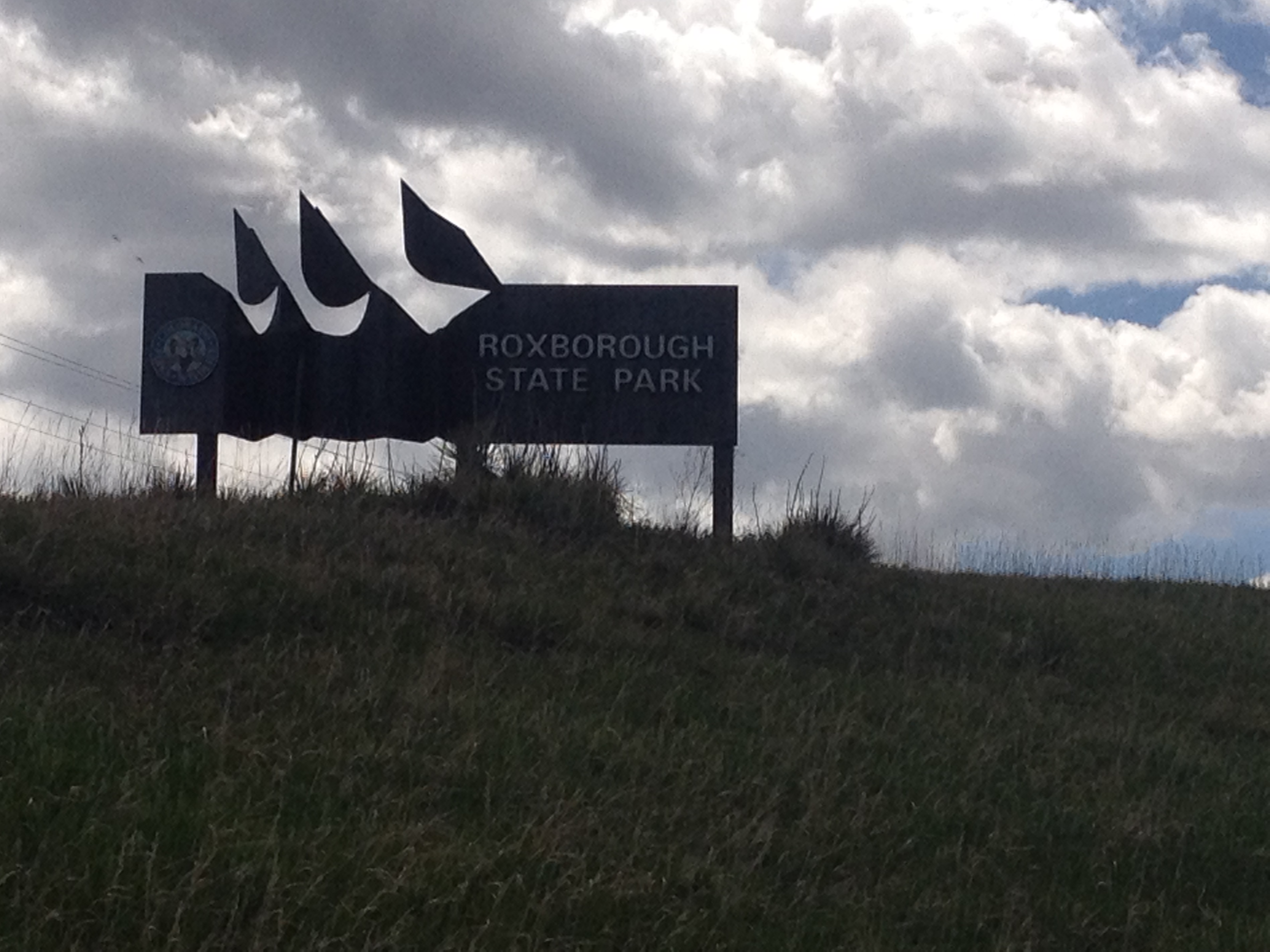
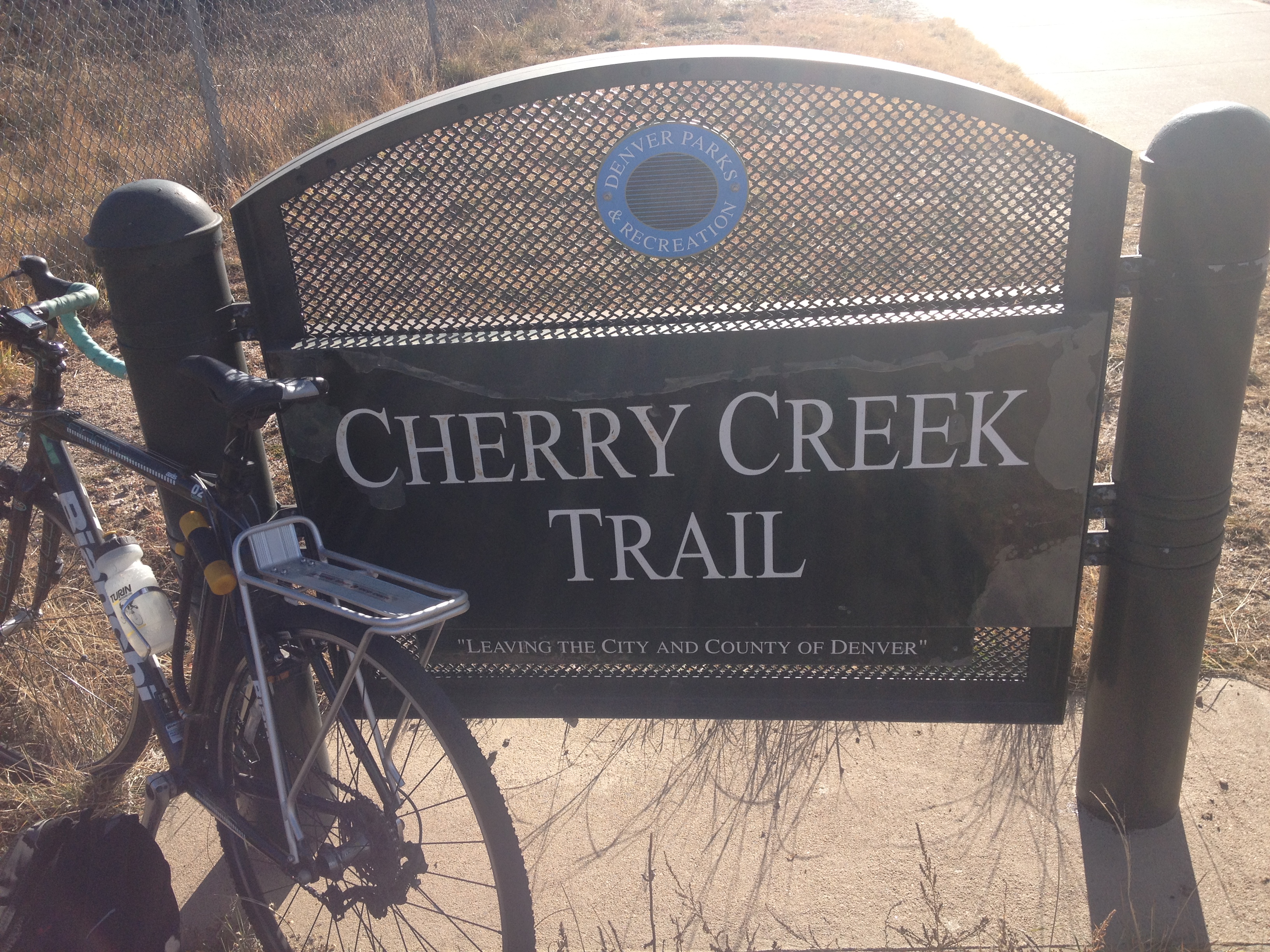
Roxborough State Park is about 30 miles South of central Denver.  It is a place I had never really thought about visiting up until a few weeks ago when I was looking for new interesting places to ride my bike to, and wanted a ride that would be roughly two hours each way.  In Denver, it is possible to cover a good amount of distance quite quickly using the metro area’s bike trails, which bypass traffic signals, as well as most terrain features that would normally slow a cyclist down.

IMG_0337IMG_1913

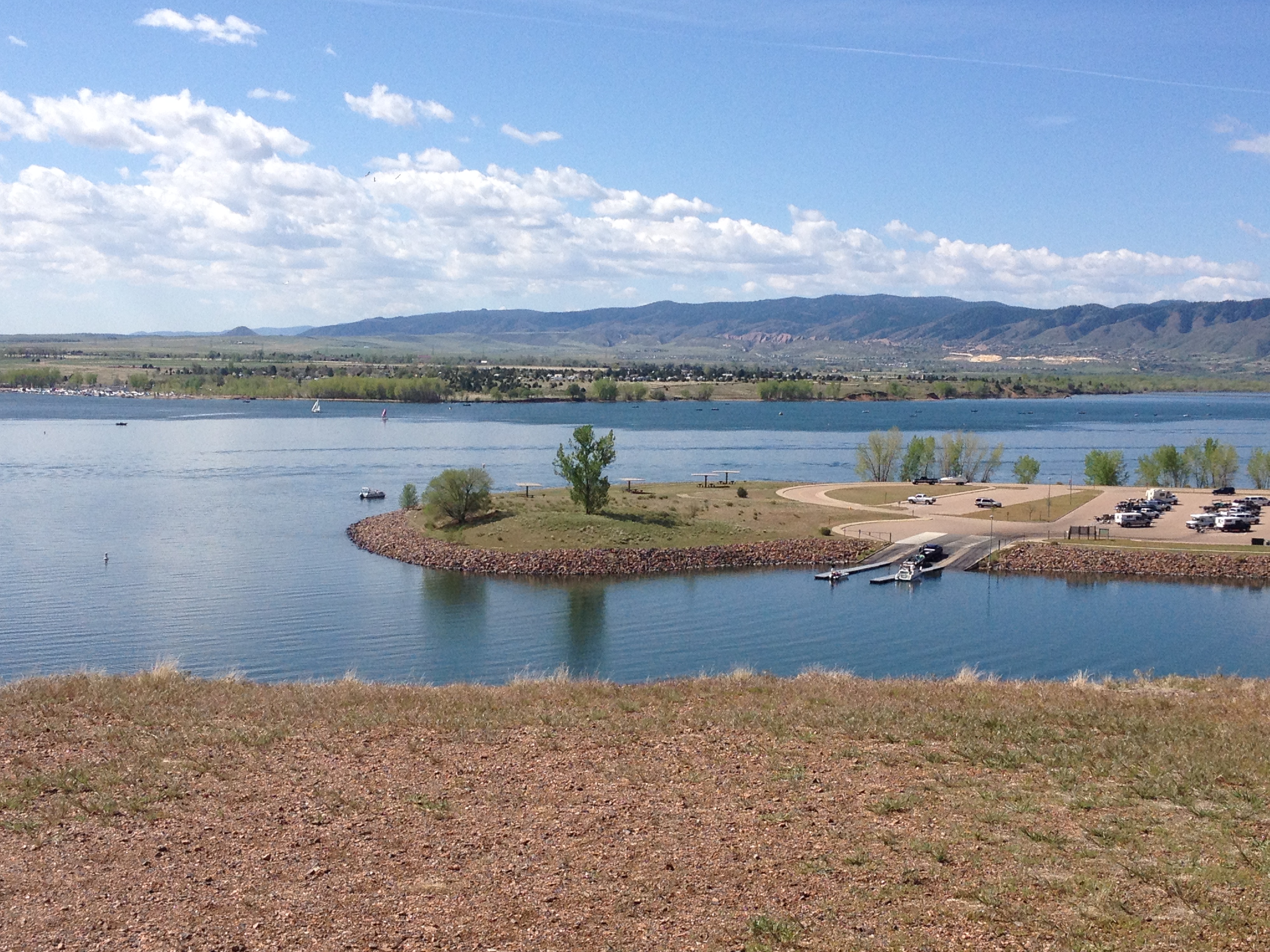
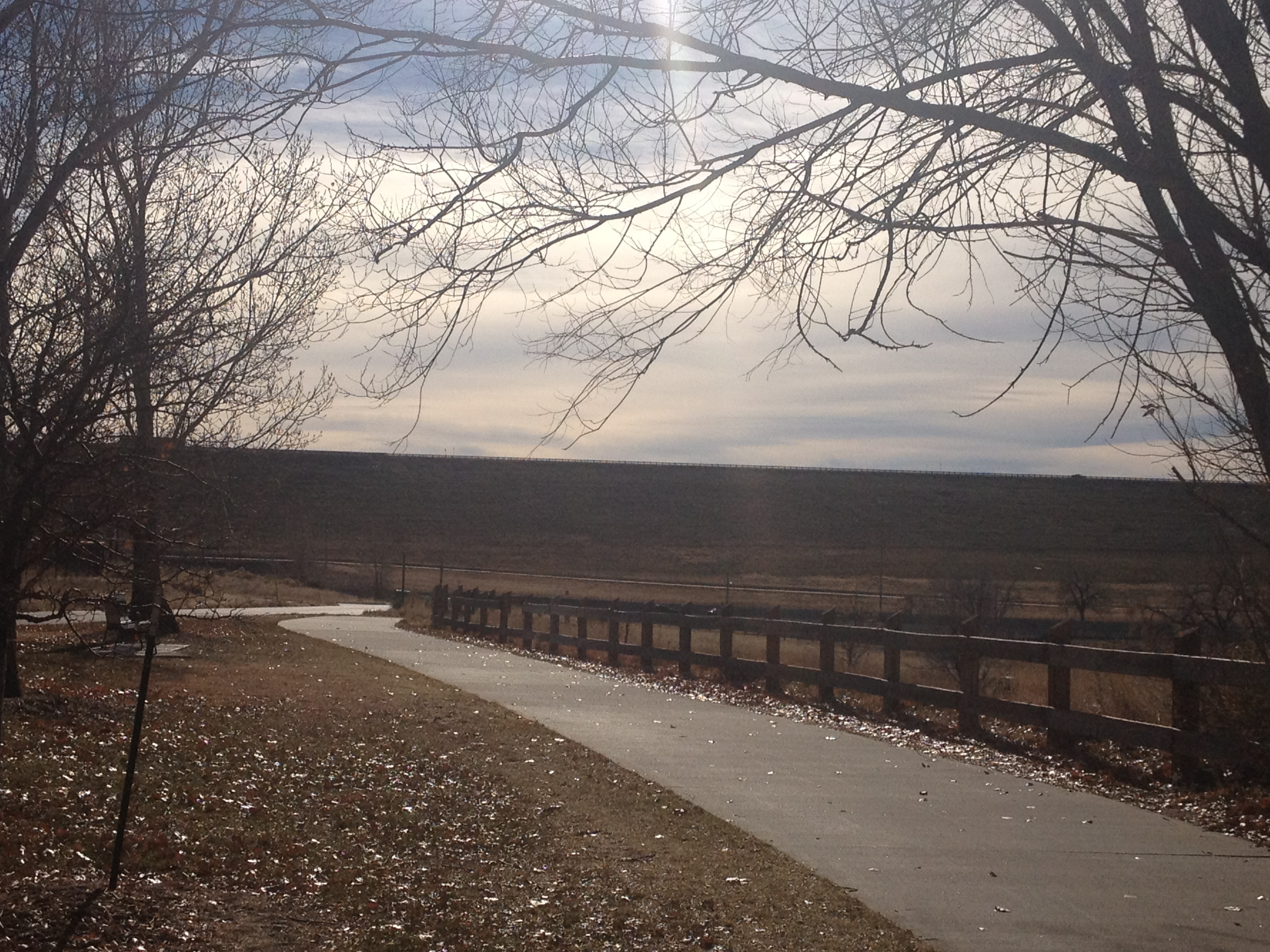
The Platte River trail can be followed from Denver southward to it’s terminus at the C-470 trail, about 16 miles south of downtown.  The Platte River trail is quite flat, as it tracks right along the river.  However, the C-470 trail, which roughly follows the highway (which is the Metro area’s outer loop), contains a lot more rolling hills.  After several miles on the C-470 trail, I arrived at Chattfield State Park, a reservoir, and popular boating destination on the southern fringe of the metro area.

IMG_1916 IMG_1917

A couple of years ago, this was the destination of a couple of rides I had done.  Last year, I did a ride to Waterton Canyon, the starting point of the Colorado Trail, a place I also rode by on my way to Roxborough State Park.  It is somewhat encouraging to actually see my continued progress as a cyclist right in front of me.  However, it also made me realize that there is one disturbing parallel between cycling (or any activity of this nature) and drug addiction; as the more I ride my bicycle, the farther and more intense of a ride I need to do to feel “satisfied”.  This is beginning to feel eerily similar to the gradual increase in tolerance a regular drinker experiences, or the ever increasing doses many drug addicts demand over time.

IMG_1921 IMG_1922

There was a fairly long line of cars at the entrance to this park.  Luckily, I was able to bypass this line, saving me both roughly 20 minutes of time, as well as the $7 entrance fee to the park.

The road from the entrance to the visitor center, basically the last two miles of the ride, was not all that fun.  It was gravel and bumpy for much of the way.  I felt uncomfortable going over 13 miles per hour.  However, the park rangers were quite pleased that I did not try to use my bicycle on any of the trails, as they do not permit bicycles on the trails.

IMG_1927 IMG_1928

At the visitor center, I realized that one of the main attractions of this particular park is the wildlife.  Showing people the fur and bones of dead animals seems like a somewhat sick way of presenting what the park had to offer to it’s visitors, but it was really neat to actually feel the fur of a black bear for the first time in my life!

IMG_1929 IMG_1934

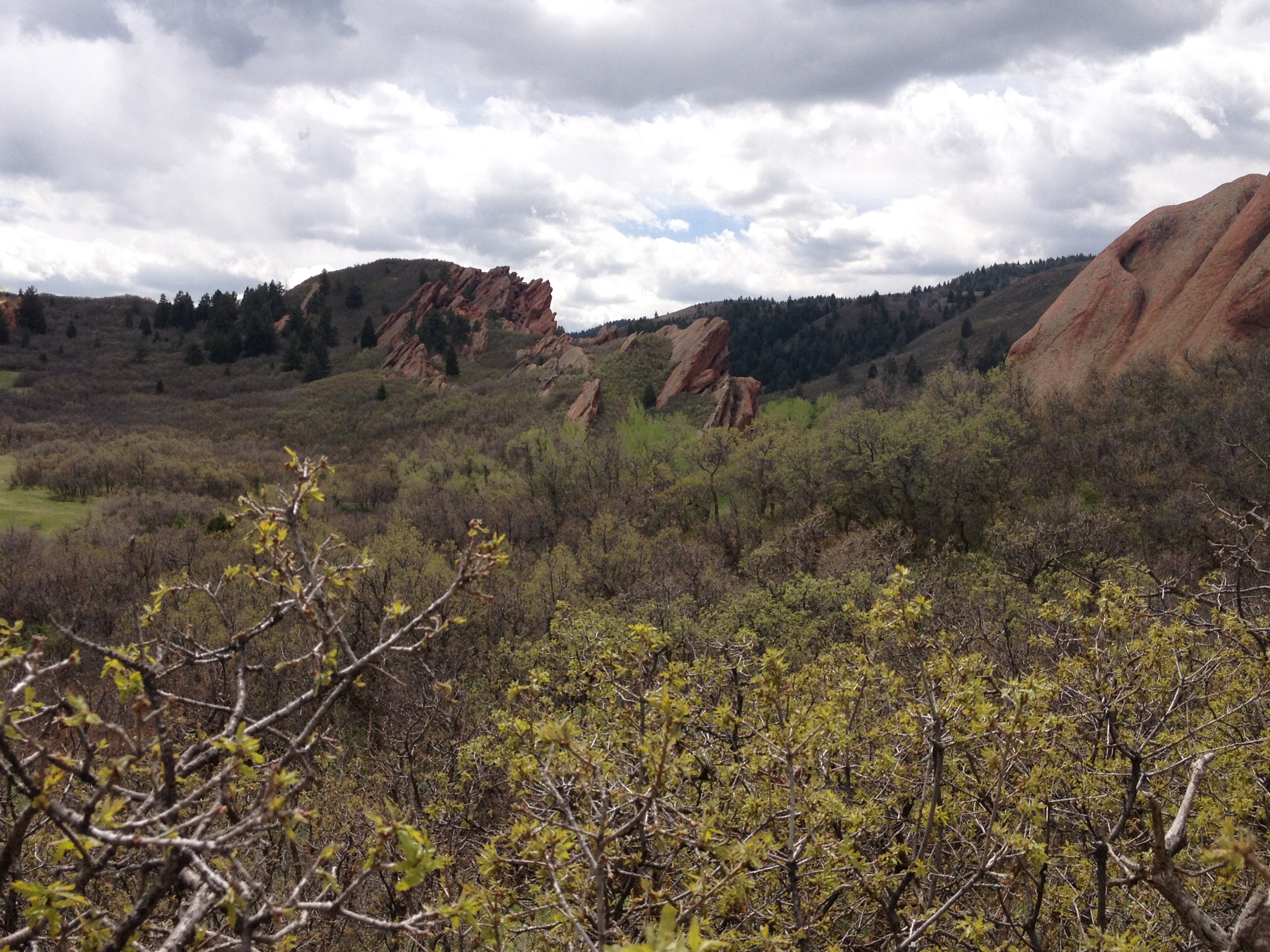
The rock formations at Roxborough State Park were actually quite similar to what I saw at Garden of the Gods.  In fact, it is easy to see how the same geological processes created the rock formations that run up and down the edge of the front range, including the Garden of the Gods, the place, as well as places like Red Rocks.

IMG_1931 IMG_1936

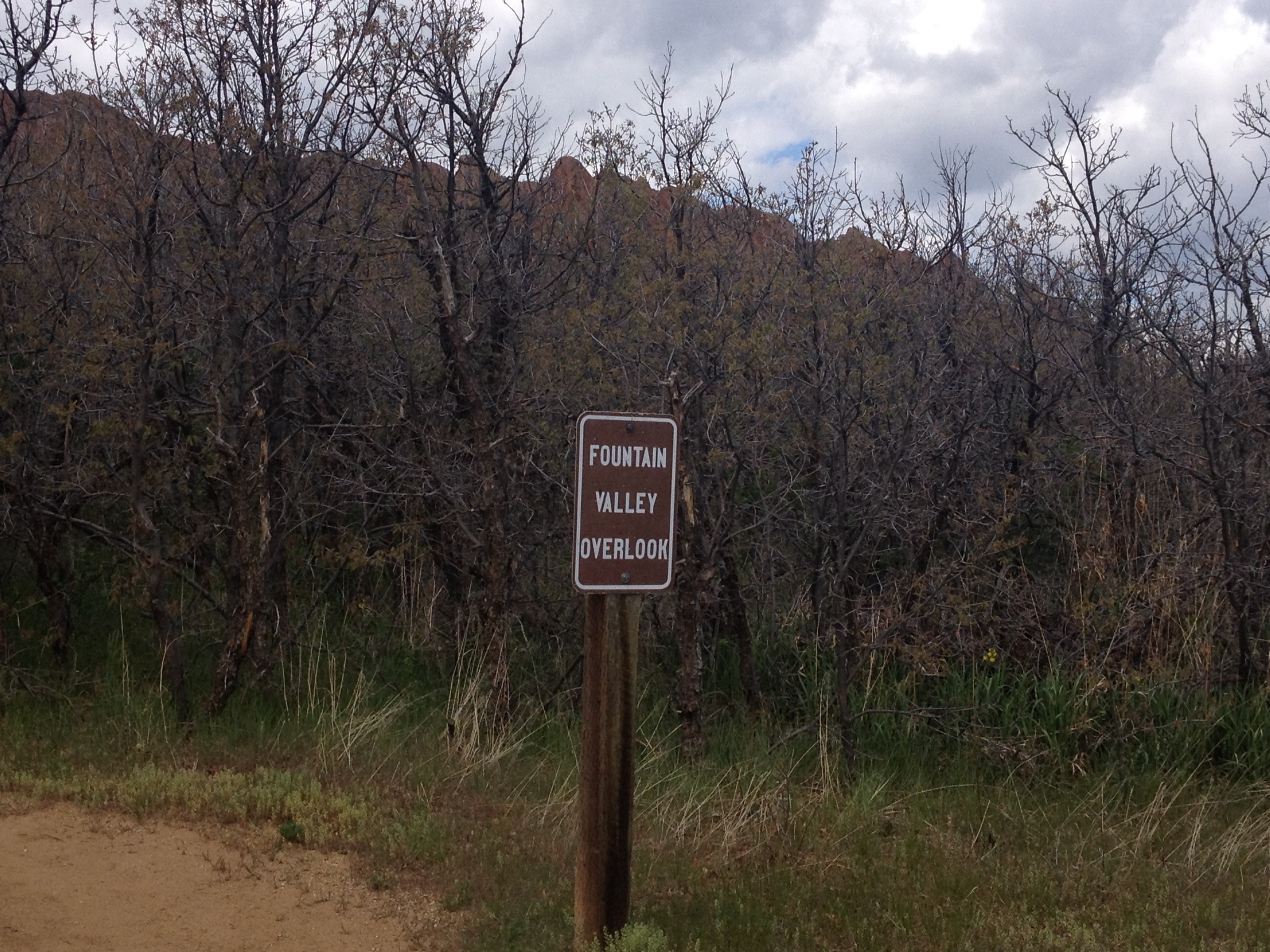
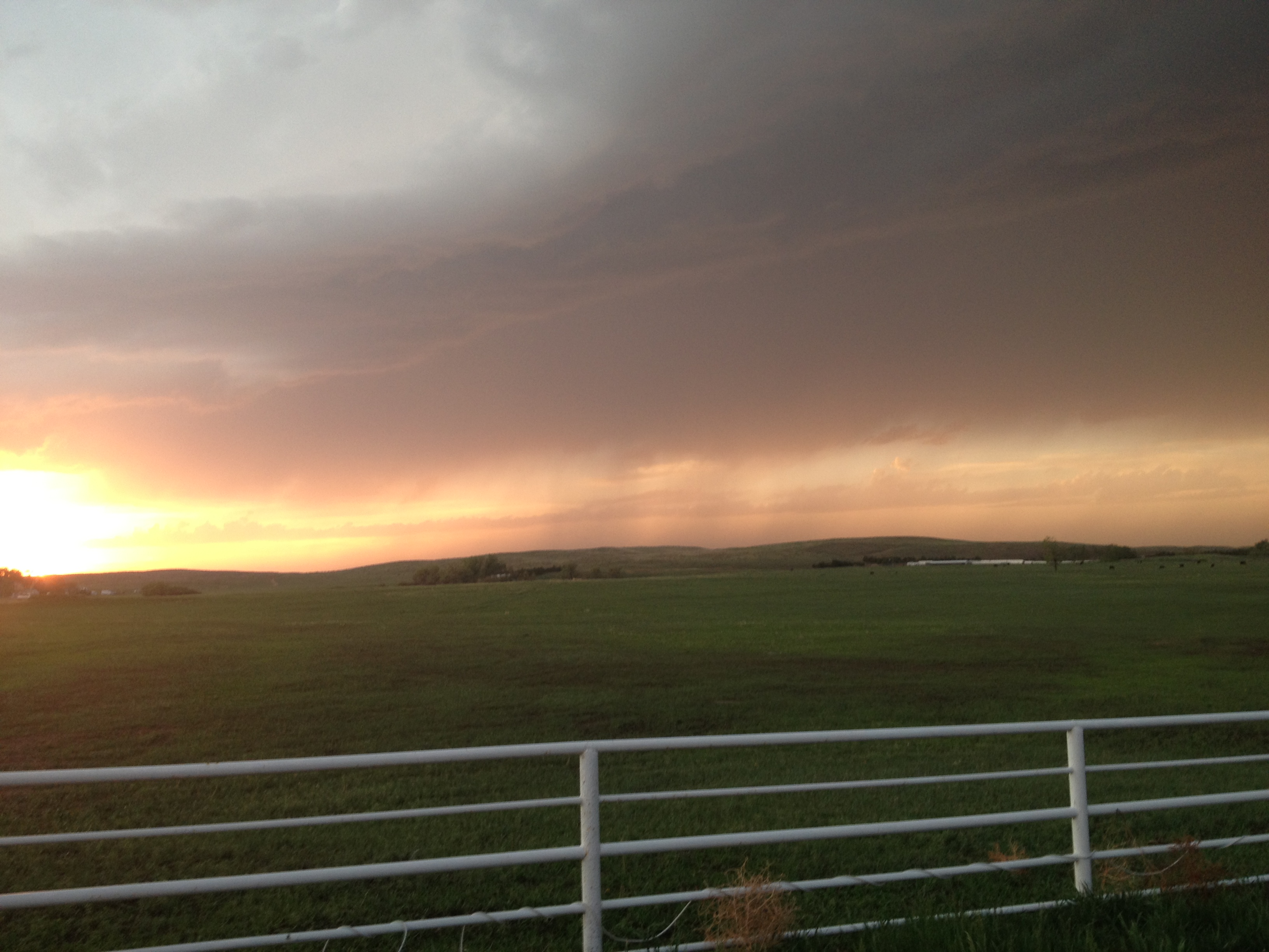
The park is also set up quite similar to Garden of the Gods.  Both places make it easy for the average non-outdoorsy tourist to attain a good view of the park.  Here, the Fountain Valley Overlook, a mere half mile from the parking lot with only a slight grade, provides views like the one at the top of this entry to those with no interest whatsoever of getting any exercise.  The park also offers somewhat more strenuous hiking.  Carpenter Peak is roughly 1000 feet higher in elevation than the visitor center.

IMG_1930

I meandered around the park a bit, but decided not to do the more strenuous hike as to preserve my energy for bicycling.  The only wildlife I encountered were these three deer, which is not particularly out of the ordinary.  However, I did encounter them at a much closer distance than I typically do.

IMG_1940

For much of my time at Roxborough State Park, I was intrigued by these relatively short trees I encountered all over the park.  These tress are quite different than the ones I typically see around Colorado.  I later read, on the way out of the park, that there are some unique species of trees, as well as insects and animals, that live here due to the micro-climates created by the wind patterns that these rock formations create.  In fact, Roxborough State Park is considered a destination not only for it’s rock formations, but also for it’s unique wildlife.

IMG_1935IMG_1938

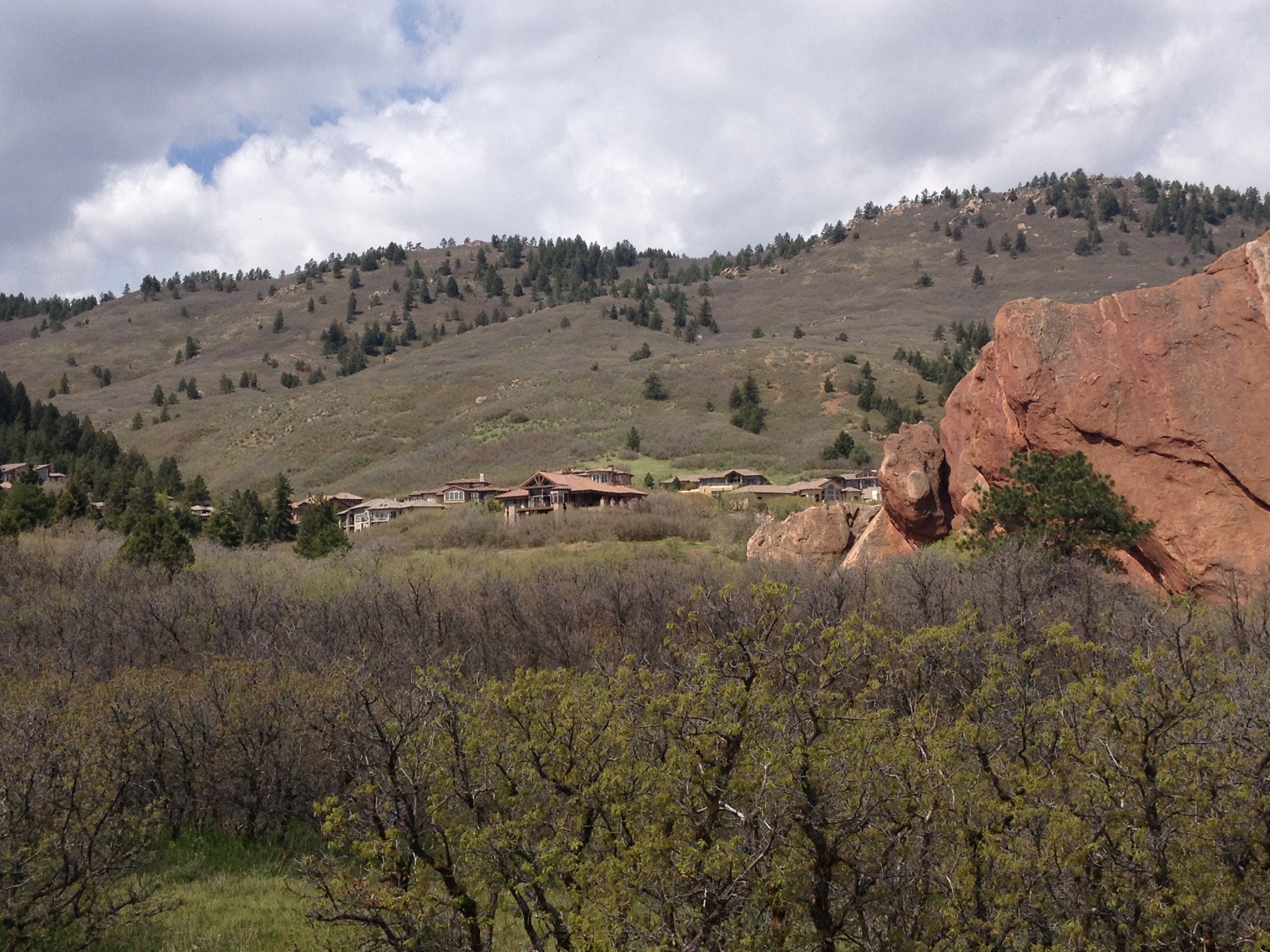
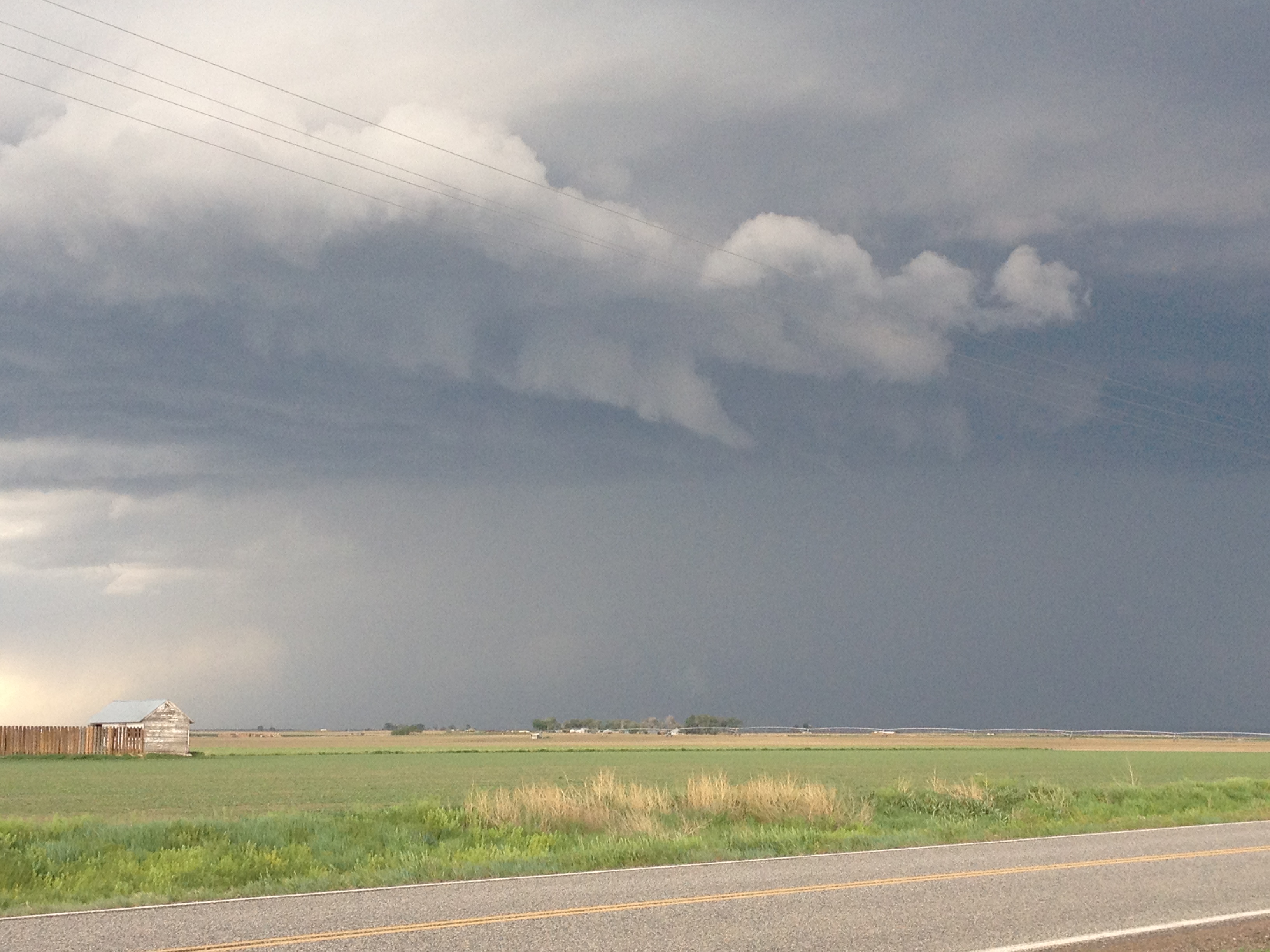
While marveling at the beauty of the park, and considering how awesome it might be to live in one of those houses that overlooks the place, the weather caught me off guard.  Prior to this ride, I looked at the forecast for Denver, which called for a threat of rain after 3 P.M.  However, 30 miles farther south (and closer to the Palmer Divide), and roughly 1,000 feet higher in elevation, any threat of thunderstorms is naturally going to come earlier in the day.  Right around noon, I noticed a few raindrops, and suddenly noticed the clouds beginning to build overhead.

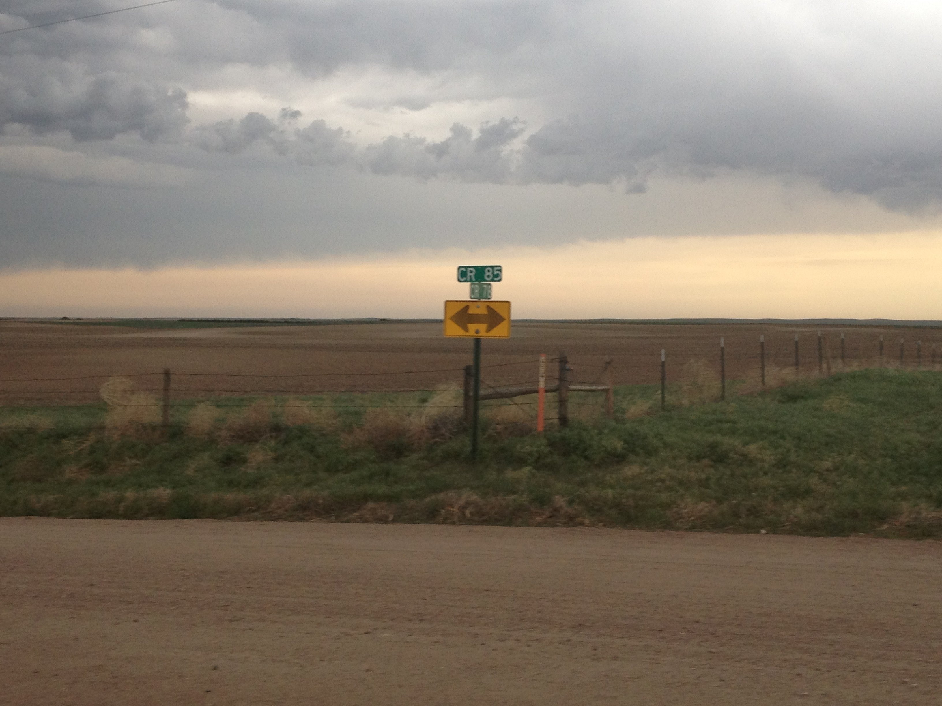
My bike ride home ended up being a race against mother nature, which I barely won, partially by blatantly ignoring the 15 mile per hour speed limits posted along the trail through South Suburban Littleton.  With a little bit of help from the wind at times, I was able to make the 28 mile ride from Roxborough State Park in 100 minutes, returning home by 1:45 P.M.  As someone who typically pays close attention to the weather, and understands weather patterns quite well, this was a somewhat embarrassing oversight on my part.  However, I do feel a sense of accomplishment in making the return ride so quickly.  And, once again, I was reminded of what I love most about cycling; being able to travel a good amount of distance, and even see my own progress on a map, all under my own power.

The Last Chance Of The Year

IMG_1493

There is a saying that “old habits die hard”.  This is possibly an overstatement, and it might not apply to everybody.  But it is a powerful statement of inertia that applies to a large segment of the population.  A major stress factor, such as the discovery of a new food allergy or the loss of a job, can change people’s habits rapidly and decisively.  However, in the absence of some kind of major push, most people’s habits will change slowly or even not at all.  It is for this reason that bad habits like watching too much TV, engaging in frequent unprotected sex with strangers, and even smoking can persist for decades.

I would not consider the habit I am referring to as a bad one.  It is mostly just annoying to some people around me.  It all started in the 8th grade when I became somewhat obsessed with football.  A typically Sunday for me that fall I would not only watch a couple of NFL games, but I would also watch the pre-game show at 11 A.M., as well as NFL Primetime at 6 P.M.  On any given Sunday, I’d watch as much as 8 hours of football!

This also caused me to put off too much of my schoolwork.  Then one November weekend, I suddenly realized that I had a major Science project due and I was running out of time to complete it.  That Friday evening, I came home from school knowing that I would have to scramble to finish this project on-time, and calculated that I would have almost no time for anything else that weekend.  My parents were disappointed in me, and actually feared that my grades would suffer because of it.

That weekend’s weather was especially nice, with high temperatures reaching 70 on Sunday.  Sometime on Sunday my father reminded me that this would probably be the last 70-degree day until April.  As a weather tracker from a young age, this was a fact that I was already well aware of.  But, it was something I had not been thinking about through all of this.  At this time, my father was just trying to be a good parent, and inform me that procrastination had consequences.  But the sudden reminder, that it would be at least three, and up to five months before weather like this would return prompted me to go outside that minute, even though I knew all I could afford was a 10-15 minute break from my work.

The previous winter was my first in Illinois, and it was quite harsh!  Not only had I just moved from Long Island, New York, a place with milder winters, but that winter was harsh for Chicago area standards too!  Temperatures were significantly colder than their long-term averages, particularly in January and February.  I recalled seeing a snowpack persist for over five weeks, something I had never seen before, and school was closed a couple of days due to extreme temperatures (below -20).  It was quite a shock for me, and something I did not enjoy.  Feeling that fresh air, and knowing that these ten minutes would be all I get for such a long time made me regret my obsessive watching of football in a way I had never regretted anything before.  It was that day that I realized that I cared significantly more about activities that I personally participate in than watching professional sports (or anything on TV).  I did not completely give up on watching professional sports that day.  But, since that day I’ve have had a clear understanding of where my priorities lie.

The winter that followed would be modestly mild for Chicago standards.  But, it was still colder than the ones I remembered in New York, and there were still very few days warm enough to be enjoyable for outdoor activities.  It was enough to cement in me the lessons I learned that November day.  I would spend seventeen more years in the Midwest, in either Illinois, Indiana, or Wisconsin.  Only one winter season would be more oppressively cold than that first one (and I was in Wisconsin- a colder place overall).  Many of the winters would be milder, some significantly milder.  Still, I would rehearse the same pattern every fall.  Starting around Halloween weekend, any day where temperatures were projected to reach the 60s or 70s would basically sound an alarm off inside of me.  I would start planning ahead of time how to take advantage of these particular days, and bill it “the last nice day of the year.”  Sometimes, I would even have some “false starts” in this process, where I would be prompted to enjoy “the last nice day of the year” only to have another stretch (or even two or three) of warm weather occur before winter set in.

Now that I live in Denver, this practice is not necessary.  Not only do sunny and mild days occur quite frequently in the middle of the winter, but winter is one of the most exciting times to be in Colorado- due to skiing.  But, we are also not in an ordinary weather pattern.  Today’s highs will top out somewhere between 60 and 65.  But, after this, an abnormally prolonged period of cold weather is expected in Colorado.  It might even be too cold to ski, as highs between 10 and 20, and lows below 0 are anticipated for Denver.  It will be even colder in the mountains!  So, that alarm in my head triggered me to take advantage of this day as if it were the last chance I would have this year to go on a bike ride, which I did.

IMG_1495 IMG_1496

Of course, one of the challenge in taking advantage of the last nice day of the year is that in November and December, the days are quite short.  Today I also had an added time constraint, as I knew the winds around Denver would pick up around noon, making bicycling much more unpleasant.  So, I stuck to a much simpler ride, down the Cherry Creek Trail to  Cherry Creek State Park, a 25 mile round trip.  Most of the ride is flat, or slightly uphill on the way out and slightly downhill on the way back.  The first major terrain feature is a large hill near Kennedy Golf Course, which is followed by the climb up to the reservoir.

IMG_1499IMG_1497

The Cherry Creek Trail is one of the best trails I have ever ridden!  It follows the river, through all of the underpasses, and avoids nearly all traffic lights.  This makes it a perfect way to get somewhere quickly on a bicycle.  There is some terrain climbing up to Cherry Creek State Park, but overall, the ride here only involves three “climbs”, and each one is only a couple of hundred feet in elevation.  Therefore, this would be a great ride for people who are only in moderately good shape, or not looking for a major challenge.

It will be too cold for bicycling in Denver to be enjoyable for at least another week and a half.  But, in all likelihood, this was not my “last chance of the year” to ride.  Therefore, I probably did not need to be too concerned about taking advantage of today’s weather.  However, I am also not seeing any negative consequences in taking advantage of a day like this.  I did not miss out on anything important, and everything I need to work on I can complete in the later part of this week when the weather turns awful.  So, this old habit is going to “die hard”, and probably won’t change much until it leads to a poor result.

Hiking Boulder’s Flatirons in late November

IMG_1472

One of the things a lot of people don’t realize about Colorado is that it is actually possible to hike here year round.  For sure, winters in Colorado are characterized by a lot of snow, but at lower elevations, warm-ups are also quite frequent.  Earlier this year I made some calculations with some data from the National Climatic Data Center, and concluded that even in the coldest part of winter high temperatures can be expected to exceed 50F in Denver more than one in three days.

At higher elevations it is more consistently cold and snowpacked.  This is why Colorado has great skiing, but also why hiking at higher elevations beyond the month of October generally unrealistic.  However, it is great knowing that there is a place where both skiing and hiking could be available on the same calender day.  Sunday I went skiing, Monday I rode my bicycle, and yesterday I hiked.  What an interesting place!

IMG_1471

With that in mind, this is a great time of year to check out many of the hikes available at lower elevations.  This includes the Flatirons in Boulder, Colorado.  Many of the trails up this mountain feature can be accessed from Chautauqua Park on Boulder’s Southwest side.  With the park being in town, and downtown Boulder being only about a mile and a half away, and this park can easily be reached by bike or bus, making this one of the few places in the country where one can frequently hike and even rock climb without access to a car.  So, I can kind of see why it is an expensive place to live, but I really did not mind driving, so I’ll spare myself the extra $400 a month in rent.

IMG_1473 IMG_1474

Hiking in the Boulder Flatirons is quite different than climbing a trail up a mountain.  Rather than one trail up and one trail down, there is a network of trails that need to be navigated for one to reach their destination.  From the parking lot, the Chautauqua Trail can be followed up to the Flatiron Loop Trail.  The Chautauqua Trail is a fairly consistent moderate uphill grade.  The Flatiron Loop Trail, however, gets both steeper and rockier.  Climbing this trail reminded me how high in elevation the Flatiron features really are.  With the features known as the Flatirons being so close to town, it is easy for one to think of these features as extending down almost to the elevation of town, roughly 5400 ft.  But, the reality is that these features are largely between 7000 and 8000 ft. in elevation.

Some of the rockier areas of the trail scared my dog a little bit.  Despite this, I did see a significant amount of dogs on the trail.  However, in Boulder, I would consider the Mount Sanitas Trail more dog-friendly, as it does not contain segments like this one.

What I did not realize until yesterday’s hike was that the Flatirons are numbered.  The Flatiron Loop Trail traverses Flatirons #1 though #3.  For each of these peaks, a spur off the trail provides climbing access.  The first Flatiron, pictured above, looks somewhat different up close.  Small scale features, particularly indentations in the rock, do not show up when viewing these features at a distance.  Like some famous paintings, they look nicer from afar than they do from close up.  The trail reaches it’s peak elevation between Flatiron #2 and Flatiron #3, and beyond Flatiron #3 is the trail I intended to do, the Royal Arch trail.

IMG_1478 IMG_1479

Unfortunately, this trail was closed, most likely due to the flooding.  As an alternate, I decided to hike the Flatiron #3 climbing access trail, as I still wanted to get to the top of these features.  This trail was even steeper than the Flatiron Loop Trail, and also a lot narrower and rockier.  It is one of those trails where one follows the rocks as an indicator of the trail’s path.

IMG_1481 IMG_1480

Flatirons #2 and 3 appeared somewhat more as I imagined them; rock formations poking out of the trees, with a near steady slant of around 45 degrees.  As I viewed each of these features up close, I could not help but be reminded of the rock features near Red Rocks.  Of course, these features are not nearly as red in color, but their shapes looked quite similar, making me believe that some of the same geological processes must have been at work in the creation of both of these features.

IMG_1484

On the return trip, back to the parking lot, I actually came to the conclusion that Flatiron #1 just looks somewhat different than the other two.  A later Google image search would confirm this for me.  I guess this one is not quite a “flat” as the other ones.

IMG_1486

It was actually nearly 3/4 of the way back down to Chautauqua Park that I encountered what I consider the best view of the day.  The time was around 3:30 P.M., which in late November means that the sun was already starting to descend in the western sky behind the mountains.  However, the sun was still an hour or so from setting.  As a result, the shadow created by the mountains can be seen quite clearly in contrast with the bright sunshine, making for a breathtaking image that is unique to that particular time of day.  Half an hour earlier, it would have looked like your standard daytime image of the foothills of the Rocky Mountains, and half an hour later this entire area would be shadowed and the entire region would be significantly darker.

I did not specifically plan to be here at this exact time, in this exact place.  In fact, if I were to try to calculate what time of day I would need to be here to see this exact view, I likely would have calculated it incorrectly.  Sometimes in life the best results come not from careful planning, but from simply going to new places, trying new things, and being ready to absorb and enjoy what comes your way.  This is what comes to mind when I look at this particular photograph.

Back on the Reservation

A few weeks ago, I had the opportunity to visit an Indian Reservation for the first time in my life.  I learned quite a bit from that visit.  I learned that these reservations do not look like many of us imagine them to.  I also concluded that our history is complicated.  I do not have a good understanding regarding why relations between us and the Native Americans progressed the way they did, and it would be disingenuous for me to take a position on these issues.  However, I did see people in need due to their circumstances.

There are some things universal about helping out those in need.  Contrary to some people’s belief, helping out those in need is not dependent on ideology, wealth, or status.  It is only loosely dependent on what someone believes about the person (or people) they are helping.  Caring parents will often bail out their children with financial or housing support even if they believe their child had been lazy, stupid, or malicious in the behavior that led them into trouble.

In my belief, in order to be genuine in helping someone out, there are two necessary conditions.

  1. There must not be coercion.  This one is obvious, being forced to help someone out, or forcing somebody else to help someone out is not genuine charity.
  2. There must be no expectation of a reward.  This includes not only a monetary reward, but also the guy who does charity work and then starts telling girls at the bar about it to help him get lucky.  Or, likewise, anyone that hopes for any praise or increase in status from their charity work.  To be fair, rewards can come.  But they have to not be the reason for it.

For this reason, I was hesitant about writing about this in my blog.  It could come across that I am trying to show off that I did charity work.  I am really just trying to explain the reason I went back to the Pine Ridge Indian Reservation, as it is one of the poorest places in the country.  But, you have no real way of knowing that for sure.  Maybe I could have left this whole part out.

IMG_1135

The Pine Ridge Indian Reservation is in Southwestern South Dakota, with it’s southern border being the Nebraska/South Dakota border.  So, as soon as we entered South Dakota, we were on the reservation.  Last week, this area got an unexpected early season blizzard.   In the Black Hills, to the north, some places got over 40″ of snow.  This is something that rarely ever occurs in mid-winter in this part of the country, let alone in early October.  Pine Ridge, more on the southern flank of this storm, got about 12″, still a lot, and the evidence of this snowstorm could still be seen.

IMG_1140 IMG_1139

The task yesterday was tiling, and we put up tiling like the one pictured above at a couple of houses in this neighborhood in Pine Ridge.  So, just like the day before,  I learned a new activity.  In fact, I continued on the theme of expanding my comfort zone, as over the course of the day I became comfortable using machinery that initially intimidated me.

Spending an entire day on the reservation, I made a couple of observations I hadn’t last time (when I was only there for the morning).  Last time I felt that the reservation may have just as poor as some of the dispirited urban neighborhoods I had previously observed, but not as dangerous.  However, I was only there for the morning, which tends to be the least dangerous time of day.  I noticed this hole in the window of one of the homes I helped work on.

IMG_1143

This hole in the window may just be more evidence that the area is poor and do not have the resources to repair such a thing.  Still, I wonder who it got there.  Stray bullets from gang related activity tends to be one of the biggest fears one has about visiting poor neighborhoods in the United States.  Either way, I am not about to go ask the homeowner how this happened- that would be rude.

IMG_1145 IMG_1144

I was also quite astonished by the number of stray dogs in the neighborhood.  All day long, I encountered stray dogs just wandering up and down the street.  I recall one of my former co-workers in Chicago telling me that stray dogs were common on the south side, but I have no idea what that meant.  Occasionally I would see a stray dog in my neighborhood, but usually there was someone there to call animal control, or try to find them a shelter.  Here they were everywhere, wandering in and out of people’s yards, sometimes getting into people’s trash, and even pooping in the yard (which I was lucky to avoid).  I guess I just wonder why there is a different attitude towards dogs here than what I am used to.

The return trip also gave me an unexpected surprise; the quintessential Nebraska experience.  For me, this means thunderstorms and steak.  On the return trip southbound across the Nebraska Panhandle, we encountered a series of really fun storms, with lots of lightning.

RADAR_20131010 IMG_1146

Thunderstorms are my favorite type of weather, at least from an observers point of view.  There really is nothing like the raw, natural power of these storms.  I also love the differentiation within the storms, and how abruptly things change inside a thunderstorm.  With the heavy rain, frequent lightning, hail, and abrupt wind changes, there is so much to see.  There is so much going on I feel like I can make a diagram like those Xs and Os the football commentators make.  It is the weather phenomenon for people who love to see all things energetic.

It is also the weather phenomenon for people who love efficiency.  Seattle and Kansas City average about the same amount of annual precipitation (37-38″).  However, in Seattle, precipitation occurs 155 days per year, while in Kansas City, precipitation only occurs 104 days per year.  Kansas City achieves the same result with 41 more rain-free days.  In addition, many days with thunderstorms are mostly sunny for large sections of the day, with the exception of the hour or two when the storms are rolling through.  Overall, many more productive hours.  For me, it is the long, humid day, followed by the abrupt thunderstorm that makes the Great Plains what it is.

We stopped at a steakhouse called Cantu’s in the town of Bridgeport, NE right after we finished rolling through the storms.  The place is right on highway 385, the main street through the center of town.  I have many times stopped at random places I encounter on the main streets of towns while driving through.  I really like doing this because it gives me a sense of what makes that town unique to every other town I have ever been to, something I won’t get by eating at a chain restaurant.

Of course, I have had a variety of experiences, ranging from great to horrible at restaurants like this.  However, when on the Great Plains, particularly in areas near a lot of ranches, I’ve have mostly good experiences with steakhouses.  The trend definitely continued today.  I really enjoyed my sirloin steak at Cantu’s.

An Unexpected Glacier

IMG_1103

It’s the first of October.  The temperature is around 60 degrees, and the sun is shining.  It is the type of weather that would have certainly depleted 6-12 inches of snow back in any East Coast or Midwestern city.  And that is with a wintertime sun angle, and much more atmosphere to obstruct the sun’s impact on the snow.  With this weather being possible on the first of October, it is quite likely that many warmer days occurred on St. Mary’s Glacier during July and August.  Despite all of this, the Glacier still sits here, occupying the little piece of ground in the mountains of Central Colorado that it occupies.

Part of me is actually bothered by it’s existence.  At roughly 11,000 feet in elevation, and at about the same latitude as Denver, it feels like it needs to be either higher or significantly farther north to exist.  Most other glaciers in Colorado are significantly higher in elevation.  So, knowing it is at a latitude an elevation that produces so many 60 degree+ temperatures, how does St. Mary’s glacier exist?

IMG_1094 IMG_1095 IMG_1096 IMG_1097

That is the question I pondered today, after driving past some of the best fall foliage I had seen thus far in Colorado, and climbing a rocky 3/4 mile trail to the base of St. Mary’s Glacier.  Before getting to the glacier, the trail meanders by St. Mary’s lake, a lake pretty much produced by melting glacial waters.  I would not recommend going into this lake, as the water is really cold!  However, it would be really dumb of anyone to not realize this, as the glacier is in clear view, along with the water running off from it.  It is clear for anyone to see that the water in this lake was recently part of that glacier 100 feet or so up the hill.

IMG_1100IMG_1101

The cascades of water along the trail were moving quite fast on this day.  That made sense, given the warmth and sunshine.  But, it still seems to me that 4 months worth of weather like this would eliminate any snow and ice remaining on the surface.  So, what is going on?

Well, the weather in Colorado is actually quite complicated, and highly dependent on local terrain features.  Snowfall rates can vary significantly from location to location in the mountains depending on the wind pattern and terrain.  In fact, this variance caused enough frustration to motivate a local ski enthusiast to create a web page dedicated to finding the best snow and snow conditions in the area.

The terrain features at this particular location must cause snowfall to be significantly higher here than at similar locations I had previously visited.  Earlier this summer, I climbed Gray’s and Torrey’s Peaks.  The trailheads were at about the same elevation as the base of St. Mary’s Glacier, maybe even a little bit higher.  Yet, no glaciers existed.  Another possible part of the explanation is cold air funneling between the two mountain peaks that surround the area.  Unfortunately more detailed observations would be needed to actually conclude that this is why this glacier exists at an altitude where it shouldn’t.

Another conclusion that cannot be made simply from my observations today is the long-term (decades) fate of this glacier.  With the current heated debate about anthropogenic global warming, it is easy for one to view how rapidly the glacier is melting today and consider it evidence that the earth is warming, and that this glacier is melting.  However, the melting of some of the ice and snow on the glacier during the summer months is actually part of a glacier’s annual cycle in which snowfall in the cold season adds to its’ mass and melting in the warm season reduces it’s mass.  If there were no mass reduction of a glacier in the warm season, they would ever expand at the expense of our oceans.

IMG_1104 IMG_1105

In fact, a close up view of the glacier’s ice shelf showcases this annual cycle.  This ice shelf has very white looking snow on top of a darker layer of snow.  The snow on top is newer snow, most likely from the most recent snow season.  On a warm day like today, it had the consistency of wet, snowball making snow.  However, the dark layer of snow underneath had a much icier consistency, indicating that it had survived multiple summers.  This is, in fact, an easy way to verify with no other observations or knowledge that the snow field you are looking at is indeed a glacier (as opposed to just residual snow from last spring).  Some of the ice in this middle part of the glacier has likely been around for decades.

The bottom layer of the ice shelf was dripping pretty rapidly from the melting.  There may be some really fun icicles here on some cooler days.  Given that melting is occurring this rapidly October 1st, it is possible to speculate that this glacier is losing mass over time, but that can only be concluded with more observations.

With it being warmer here than at most glaciers, it makes sense to me that this would be a popular attraction.  What makes less sense to me after today is why people seem to prefer to drink water from glaciers.  At least I see it all over advertisements for bottled water (i.e. the Evian Logo).  Today I saw ice and snow in constant direct contact with dirt and rocks, walked on by humans and dogs, melt and run off into cascading streams where the water is also consistently in contact with dirt, rocks, and possibly more dog pee.  This did not feel to me like the cleanest water I could be drinking.  I guess there are no chemicals.  Still, I think I will trust my city’s water purification system.

Maybe rather than being bothered by this glacier’s existence, I should be inspired.  This glacier has managed to continue to exist despite not so favorable conditions.  It is much like the one remaining factory in a decaying rust-belt town, or that tree in Wyoming the grew out of a rock.  They later built Interstate 80 around this tree, further disrupting it, but it still persists to be alive.  Like that tree, St. Mary’s glacier, and that one person you know who doesn’t seem to have any bull-shit at their job, evidence that bucking the trend is possible is still out there.  It is just a matter of finding out how they did it, and how much of it is luck.

Mount Evans The Easy Way

The United States of America is not perfect.  There are definitely some aspects of our history that seem a bit shady, and there are definitely some things I would change if I had my way.  But I still love this country, and feel lucky to live here.  One of the things I love about this country is that we attempt to accommodate nearly everybody.  We have lifestyles that range from the crowds of Manhattan to empty parts of Wyoming, and many other things in between.  Despite the fact that I have come across a few Americans who would like to eradicate one or more of our prevalent lifestyles, we remain a county that accommodates.  If anything, we are becoming more accommodating, as more and more places add bike lanes, and some communities allow people to follow their dreams of traveling everywhere by golf cart.

To get to the top of the mountains in Colorado, we also accommodate many different methods.  Most Coloradans prefer to hike up our tallest peaks, and nearly every tall mountain here has multiple hiking trails to the top.  Two of Colorado’s tallest peaks, Mount Evans and Pike’s Peak, have paved roads to the top.  During the summertime, people can drive or ride a bicycle to the top of these peaks.  In fact, the ride from Idaho Springs to the top of Mount Evans was featured as one of Bicycling Magazine’s Top Bike Rides.  Pike’s Peak can even be reached by train.

The easiest way to the top of a mountain is to drive.  Having already hiked three of these peaks this summer, I decide to take a drive (or, more accurately, go along for a ride) up Mount Evans.  The road up to Mount Evans is actually North America’s highest paved road, and a very scenic one.  There are plenty of wonderful places on the way up this highway, including dense pine forests, alpine lakes, and places where you can see the mountains in the distance.  These are the kinds of images you will often find on a calender.

IMG_1074 IMG_1075

One added bonus of taking this trip in late September was the fall colors.  The fall colors here in Colorado come primarily from the Aspen trees, and primarily turn the color yellow.  This makes a fall image here in Colorado quite different than what you would see in the east.  Firstly, with more pine trees here, not all of the trees are changing colors.  And, with the trees mostly changing the same color, yellow, there is less variety.  In that sense, I would say anyone looking to take a vacation for the primary purpose of viewing fall foliage would be better off going to New England or the Smoky Mountains.  But, the colors did add an extra element to the views on this trip.

IMG_1076

Some places in higher terrain just recently received their first snow of the season.  The snowfall was not particularly heavy, but it still could be seen, especially from the shaded areas once we climbed above 9,000 feet.

IMG_1077

As a result of this recent snowfall, as well as a heavier snowfall at the highest peaks (during the floods a couple of weeks ago), the road was not open all the way to the top of Mount Evans.  The farthest up we could go is Summit Lake, which is around 12,800 feet in elevation.  This is not too atypical, as these higher elevations typically start receiving snow in September, and plowing a road at this elevation is not an easy task.

IMG_1078 IMG_1079

I love science!  I love the way some scientific phenomenon can create some unique observations, and I love the process of figuring it all out.  It was a very windy day at Summit Lake, and I could feel it as soon as I got out of the car.  In fact, the wind confirmed for me that it would have been quite unpleasant to try to hike at this elevation.  What I observed on this lake is a phenomenon I had seen years back when I was living in Madison, WI.  On a cold, windy morning, the wind blows water off of the lake onto nearby grass and rocks.  If it is cold enough, those water particles freeze on contact, much as they would in an ice storm.

When I observed this in Madison, WI, it was a similar situation.  In that case it was December, as it gets cold a lot earlier in the year at high elevations, but the progression of events is the same.  Water has a higher heat capacity and therefore both warms up and cools down slower than air.  It takes more than a few cold mornings to freeze over a lake, even a smaller lake like this one.  So, at the time of year when winter-like chill first arrives, this phenomenon can be observed near lakes.  Larger lakes like Lake Michigan and Lake Superior never freeze over in the winter, and sea spray events like this one can be observed pretty much all winter long.  Although I have seen the result of this combination of weather conditions a couple of times, I am now kind of curious to see it actually occurring.

The world is a tough place to understand.  Life often seems to unfold in ways that do not make too much sense.  Often times, after a particular endeavor does not turn out the way I had hoped, I spend a good deal of time scratching my head, wondering why.  When something impacts my life in a negative way, my response is always to try to figure out where it went wrong, as to avoid making the same mistakes.  But, most of the time it does not work that way, particularly when social interactions and group dynamics are involved.

In a way, I feel like I can take comfort in science.  In science, there are universal laws, and certain things that will always behave the same way, even in an unfamiliar place.  The cold windy night on Summit Lake created the same ice patters that it did on Lake Mendota.  No matter where you are light waves of 550nm will appear green to the human eye.  This, and a host of other things, can be counted on, will always make sense, and can provide some comfort in unfamiliar situations.  Yet, unlike some predictable things, like re-watching movies and T.V. reruns, it does not become mundane and uninteresting over time.  There is always something new to be discovered, a new phenomenon to be observed and investigated, and a new possibility to be opened up.

IMG_1073 IMG_1090

On the return trip, we stopped in Idaho Springs, walked around and ate lunch.  I have driven by this town many times, but never really spent much time here.  In a narrow valley, with steep terrain on either side, the town actually has some houses on higher terrain.  From the highway, it’s appearance consistently reminds me of model train sets.  In addition, the town, which champions itself as “Where the Gold Rush Began”, actually named it’s high school team the “Golddiggers”.  I still wonder if the the marching band plays that Kanye West song when the team comes out onto the field.

I was pretty impressed with the downtown.  It is a nice, kind of small, western town.  It is not over touristy, as it is not adjacent to a big attraction the way Estes Park is.  The shops seem well kept, and also seemed to have variety.  We ate at Tommyknockers, a microbrewery downtown with bar food, and also a lot of buffalo burgers.  From walking around town, I see several other places I would like to try, on subsequent trips.  But, I really do not know when I will be coming into town again, as it is not a typical stop-off for me on ski trips and such.

A Storm Chase Without Feedlots

IMG_0445

Just when I was concerned that the entire Northeastern section of Colorado had turned into one giant feedlot, yesterday I was able to go on a storm chase, completely (albeit barely) confined to the Northeastern Plains of Colorado, without encountering a single feedlot.  This is phenomenal news!  There actually is room for more!  If someone were to get elected Governor on a platform of wanting to reduce the price of beef to a dollar a pound and literally stop caring about the quality of the food we are consuming- it could be done!

After seeing the hail shaft pictured above, one of the first major events of our chase was getting tumbleweed stuck in the grill of the car.

IMG_0446

Tumbleweeds are often found in this part of the country.  In modern society, they have become synonymous with isolation, desolation, and decay, often portrayed as showing up in the wake of an economic decline or some kind of abandonment.  However, in this situation, the presence of tumbleweeds blowing across the highway was actually a positive sign for our mission, which is to see really cool storms.  The tumbleweeds were actually blowing across the road at this time of day because powerful inflow currents had developed, which fuels storms.  If I ever needed more reassurance that I had blazed my own path in life, and not followed the track that everyone else does, this is it.  I am in Northeastern Colorado and on a mission where seeing tumbleweeds blow across the road and get stuck in the car is a major positive sign.  Because it led to this.

IMG_0448 IMG_0449

These funnel clouds did not quite reach the ground, but were still really cool to see.  These storms were seen near Sterling, Colorado.  Apparently, there is something about the location of this town that makes it especially susceptible to tornadoes.  I wonder if that is why their roads are in bad shape, and their light cycles are timed in such a way that it seems like they try to virtually guarantee that you will stopped at over 50% of all traffic lights in town.

We tracked the storms north out of Sterling (after we eventually got out of Sterling), towards the Nebraska border, where we saw a couple of other cool features.  First, some downdrafts, which are what leads to strong wind events, and then another funnel formed on the storm.  This funnel was rather small.  All this indicated that the atmosphere yesterday was marginally fit for tornado development, but not anything like the atmosphere that lead to the gigantic tornadoes in Oklahoma last week.

IMG_0454 IMG_0456

Unfortunately, when you get out into this part of the country, good paved roads can be quite far apart from one another, in some cases over 20 miles.  Storms don’t really care where the roads are.  So, in this case, to continue to follow the storm circulation northeast of Sterling, we ended up having to take dirt roads.  The chase kind of ended on a dirt road that was literally less than half a mile from the Nebraska border.  At this point, we had kind of decided that we had already seen some really nice storms and it would be good to get home at a reasonable hour.  The storms we were looking at had kind of become one big cluster, which makes them hard to see anyways.

IMG_0458

For people hoping to get to as many states as possible, something like this would be frustrating.  It actually reminds me of a chase I had in 2003 where we spent a good deal of time in Nebraska, and on something like three occasions (on different days too) came within a mile of the border with South Dakota, but never entered the State.  I guess that would piss off people wanting to get to as many states as possible, but I have been in Nebraska a whole bunch of times, even been bored on a drive between Denver and Chicago where Nebraska, along I-80 feels like it goes on endlessly.  A couple of decades ago someone wrote a comedy song called “Interstate 80 Iowa”, basically mocking that 90% of what you encounter on that drive is corn.  But, when it comes to boredom, Interstate 80 Nebraska kind of blows Iowa out of the water!

Our final destination was Fort Morgan, where we went to a local pub to get some food.  This was around dark, so kind of late.  While there, another storm rolled through, producing some pretty major winds.  When looking outside at the wind, some of the locals at the restaurant looked at me and replied “Welcome to Morgan”.  This seemed to indicate to me that they knew we were not from the area and that those from the area do not even blink at stuff like this anymore.  We were something like 75 minutes East of Denver, but in a whole different world.  Upon reflection on this, I guess this Fort Morgan town can kind of be thought of as where “tornado alley” begins, with it stretching eastward from there to Missouri.  Pretty neat for a not all that exciting town.

A More Successful Storm Chase

I promise anyone that is reading this that this blog is going to have a good deal of variety.  I have a good deal of travel plans starting next week, in which I will be traveling almost non-stop the first half of June.  But, for now, I guess there are going to be two consecutive blogs about storm chasing.  It is May, the peak month for tornadoes, and I plan to blog about the interesting places that I go.  It just so happened to be that two back to back entries ended up being storm chases.  I mean, I am not going to blog about things that are not too interesting, like my dog chewing up my underwear yesterday.  I guess I could write about partying, but for now I am keeping this a travel blog.

This is my first season of chasing out of Denver, so I am still getting used to certain things about chasing from here rather than Chicago.  Storm chasing from Denver means that you will always be going east to try to catch the storms, and trying to catch them from behind.  This is the opposite of chasing from Chicago which almost always entailed going west.  Strong thunderstorms often form on a weather feature known as a dry line.  Dry lines are boundaries between dry and moist air, with moist air to the east and dry air to the west.  It took us a couple of hours to get to the moist side of the dry line (which is more favorable for storms), but when we first started to see storms form, we were still in a very dry air mass near Akron, Colorado.

IMG_0400 IMG_0401

From now on, I am going to refer to U.S. highway 34 from Greeley to the Nebraska state line as “feed lot highway”.  I didn’t take another picture of the feedlots because one picture is enough, but I am still amazed by how may cows you encounter along this road in eastern Colorado.  I noticed that there is a gigantic feedlot about four miles west of the town of Wray, Colorado.  If there is a west wind, that town must smell horrible, and all 100 or so people must be pissed off.  There was a part of the drive when we were unable to get the smell of 1000s of cows all jammed up into something like 5 acres of land out of the car.  I remember the first time I drove by a feedlot (also on a storm chase).  I remember thinking that I had finally encountered a worse smelling road than the New Jersey Turnpike, and it only took me 19 years!

We chased four storms today.  The first two we caught up to near Holyoke, CO, about 35 miles north of Wray.  The first storm we caught actually showed some rotation, and produced some major hail.  I looked it up later, and the reports we saw indicated hail sizes of up to 2.75″.  Luckily for our chasing vehicle, we did not end up in that section of the storm, but we did see some smaller hail, as seen on the road in the below picture.

IMG_0402 IMG_0406

We followed the first storm for a while, and then started following the storm just to the east of it.  Tracking this storm took us across the stateline into Nebraska.

IMG_0408

This is the best picture I could get of the welcome to Nebraska sign on state route 23.  One of the strange things that makes me happy is when a state highway crosses into another state and maintains the same number in the adjacent state.  This is actually somewhat rare.  For example, Indiana state highway 2 becomes Illinois state highway 17 when you cross the border.  If you look at state highways on a map, you will see that it is way more common for them to take on a different number when crossing a border.  But, this crossing was an exception, Colorado state highway 23 became Nebraska state highway 23!

By the way, when it comes to state welcome signs, Nebraska is without a doubt blown away by all of it’s neighbors.  South Dakota’s welcome sign has an image of Mount Rushmore.  Kansas’s has a sunflower.  Colorado’s is the classic wooden sign saying “Welcome to Colorful Colorado”.  Wyoming’s forever west ones are a neat depiction of the state’s cowboy heritage.  Iowa’s say “Fields of Opportunities”.  Okay, that is kind of a stupid slogan, but at least it is memorable.  Home of Arbor Day?  Really, Nebraska?  Of all the facts about your state that you could present to me every time I enter Nebraska, you chose Arbor Day?  I’d rather see a picture of Warren Buffet every time I enter the state.

Anyways, that storm kind of crapped out, so we went after a few storms a bit farther north, near Ogallala.  Here we actually saw a funnel cloud.  It did not reach the ground and therefore was not a tornado.  In fact, there were no tornadoes reported today, only large hail and strong winds.  So, seeing this, we did feel like bad-asses for being on the best storm of the day even if it was not a tornado.

IMG_0409 IMG_0410

These pictures came north of Ogallala, near Lake Mcconaughy.  Basically, somewhere along the line someone decided to dam up the North Platter River just northeast of Ogallala, NE.  Behind it, as is typically the case with dams, a lake was created and suddenly Nebraskans had a place to bring their boats.  This is not too interesting of a story, but I am sure it is more interesting than Arbor Day.

The other problem we ran into was lack of a good road network in the area north and east of Ogallala.  Therefore, we had to let this particular storm, which was the most interesting one we saw today, go.  Luckily, there was one other storm behind it, tracking northeast from the west edge of Lake Mcconaghy.  So, we decided to watch this storm go by- well until sunset.

IMG_0417

At this ranch, where there were hundreds of cows out on the range, making plenty of noise (it was really funny actually), this spectacular sunset took place.  There was something kind of awe inspiring about the way the sun set gradually just to the left of a major thunderstorm that was producing frequent lightning.  It’s the kind of event that you really have to be there to truly appreciate, but let’s just say it was one of those things that really got me thinking.

IMG_0423

I tried to get a picture of lightning, but it is hard to do so with a cell phone camera.  But, I really liked the feeling of being on an empty two lane undivided road looking straight into a thunderstorm around sunset.  I think it just had a specific feeling to it.  It’s kind of like stepping into the unknown, and taking a path less traveled, but still knowing you are not going anywhere too terribly dangerous.  It is stepping far enough outside your comfort zone to generate an excitement in you, but not so far that you get truly scared, kind of like trying a new restaurant or taking a new class.

This scene also reminded me of a time in my life when roughly half of my weekends would start out this way; traveling on the open road on a Friday evening.  This was in college and graduate school when I would frequently be headed elsewhere in the general Midwest area; Chicago, Madison, Minneapolis, Indianapolis, Ann Arbor, Saint Louis, Bloomington, Champaign, etc.  I remember months where I would literally have spent 24 total hours traveling, but realize that I had not even left the corn belt.  Most of those weekends actually ended up being somewhat similar.  They would involve parties (or bars, etc.) with a couple of people I knew, and a bunch of people I did not know.  It was exactly that mix of the familiar and the unknown that is captured by driving down a desolate road into a thunderstorm.  In a way, it is the balance we are all seeking.  Very few people are satisfied continuing to do the same thing over and over again for their entire lifespan.  So, we all must learn new things, meet new people, and develop new experiences.  But, we must all do so at our own pace.

As I watched the sun slowly descend the horizon I continued to ponder what it meant.  I thought to the feelings I had on those countless Friday and Saturday evenings on the road last decade.  It is usually about what lies ahead.  Sometimes life can get frustrating.  When life does get frustrating, it is the promise of some kind of new experience that can help alleviate the feeling of melancholy that attempts to infect your mind.

It is impossible to know what kind of storms you are going to see when storm chasing.  Anyone that says they only want to go storm chasing if they know they will see a tornado simply does not understand storm chasing and should not be invited on future chases.  The unknown needs to be embraced.  It is the same with traveling to a place you have never been to before, trying something you have never done before, or meeting someone new.  The place may be a disappointment, like when I was 8 years old and I thought Plymouth Rock would be bigger.  You could always try a new activity or a new type of food and discover you don’t like it.  And, we have all met assholes.  But, the uncertainty is part of what makes it exciting.  Any task where a certain outcome is guaranteed quickly becomes just another task, indistinguishable from work, chores, etc.

This is why I gamble.  This is why I go to parties and dance with complete strangers.  This is why I am always looking to go somewhere I have never been to before.  And, in a way, this is why I chase storms and study the weather.  There is always a chance for a surprise, which makes these experiences the exact opposite of watching a movie you have already seen.  I for one, cannot wait for my next journey into the unknown, regardless of what type of unknown it is.

Storm Chasing in Kansas and Nebraska

Yesterday, for the first time since moving to Denver, I went storm chasing.  Thanks to the movie Twister, the discovery channel’s TV series on storm chasers, and other media, most people are familiar with the practice of storm chasing.  Basically, it is groups of people driving around looking for severe thunderstorms.  Seeing a tornado would typically be the biggest prize of all, but I have seen some really amazing non-tornadic storms in the past, including one that where we measured 71 mph winds from our vehicle.  I used to chase storm a lot more back in college and graduate school, but the combination of a more regular work schedule (essentially the real world), being around less meteorologists, and higher gas prices have made this a less common occurrence for me.

One of the things I find the most interesting about storm chasing is that it commonly takes you to places you would not otherwise visit.  Tornadoes and severe thunderstorms are most common on the Great Plains, an area a lot of people just fly over.  As a result of storm chasing, I have actually spent considerable time in the Great Plains from Texas north to South Dakota.  Yesterday’s chase was no different, as our initial target was near the borders of Colorado, Kansas, and Nebraska.  We head out East from Denver on I-76, exit at Fort Morgan to take U.S. 34 East to Wray, CO.  On the way there, one thing I keep seeing is cows.  These gigantic lots of cattle seem to show up everywhere in Eastern Colorado.  I remember seeing a few on previous storm chases, and a couple of big ones when I went to Greeley last year, but I must have come across something like ten of these between Fort Morgan and Wray.  These cows are kept in close quarters, and are most likely injected with some kind of hormones to maximize their growth.  They are probably not the best for you, and Chipotle and other restaurants take pride in not using beef from lots like this.  But, I guess it puts food on the table for some people who cannot afford to pay more for grass-fed or free range beef.

IMG_0384

We spent a little bit of time in Wray, CO waiting for the storms to fire up.  Wray, CO is also quite an interesting place.  It is in the Easternmost part of Colorado, less than ten miles from the Nebraska border.  In the Republican River valley (North Fork), it’s elevation is only 3500 feet.  It would take about three hours for someone to drive from Wray, CO to the mountains.  In fact, within the state of Colorado, it would be nearly impossible to find a settlement farther away from the mountains than Wray.  In essence, it is the most un-Colorado like place in Colorado.  This must be especially difficult for people from Wray, or Julesburg, or Lamar, or any other small town in the easternmost part of the state.  I can imagine that anytime anyone tells people they are from Colorado, they will would be immediately asked about skiing, snowboarding, hiking, or any of the other activities that are associated with mountains, and therefore associated with Colorado in the heads of almost all Americans.  People from there must get tired of having to explain to them that while they are technically from Colorado, they may as well be from Kansas given the nature of the area.

Most of yesterday’s chase was spent in the northwestern part of Kansas, kind of along U.S. highway 36.  After initially going East from Wray (into southwest Nebraska) to find atmospheres with more moisture and greater favorability for severe storms, we went South to chase a few storms that had popped up in northwest Kansas.

IMG_0385IMG_0386

The storms we found were quite large, but did not produce tornadoes.  The tornado producing storms actually ended up being in two places.  One farther Southeast from where we were, along I-70 between WaKenney and Hays, and another up in the Nebraska panhandle.  Although we did not see any tornadoes, we did see some major storms.  Additionally, we learned something about storm chasing.  Being from the midwest, I am use to chasing faster moving storms.  Storm motions in Illinois, Indiana, Iowa, and Wisconsin, storms tend to move 30-40 mph quite frequently, and sometimes even faster.  When storms move that fast, it is important to stay ahead of the storm if you want to keep following it, and I’ve lost storms by falling behind before.  The storms we chased yesterday were moving quite slow, 10-15 mph.  We ran into trouble by trying to hard to stay ahead of the storm instead of going straight towards it.  It is kind of like the difference between playing fast-pitch baseball and slow-pitch softball, a major adjustment.

Hopefully, I’ll get another chance to chase this year, but I have a lot of other travel plans for June, much of which will be to places I have never been to before.  I’m still glad to have had a learning experience if nothing else.