Category Archives: history

The History of the Rocky Mountains

IMG_1691 (1)Many travelers are motivated to visit a variety of destinations by intellectual curiosity; Curiosity about culture, people and history. Curiosity about nature, science, and how our planet works. Unique natural features, such as Arches National Park and the Badlands, always make me wonder. How did this these distinct features come to be? Why can this be seen on this little section of our planet and seemingly not everywhere else? Is there anything similar, anywhere else?

This leads us back to history; history that pre-dates human beings. The geological processes that produced the colors, shapes and terrain we admire often occur over multiple millions of years. Some even pre-date any of our mammalian ancestors. Over the course of any one person’s lifespan, it is highly unlikely that any changes in our natural world resulting from geological processes will be noticeable. Nonetheless, geological processes can manifest themselves in some rather explosive ways, including earthquakes, volcanoes and sinkholes.

All this is true of unique natural features like Old Faithful Geyser in Yellowstone National Park, as well as the ring of volcanoes in places like Iceland and Hawaii. This is also true of the larger natural feature that in many ways defines life in Western North America; The Rocky Mountains.

As it turns out, the Rocky Mountains, as far as mountain ranges go, are quite unique.

IMG_1684 (1)

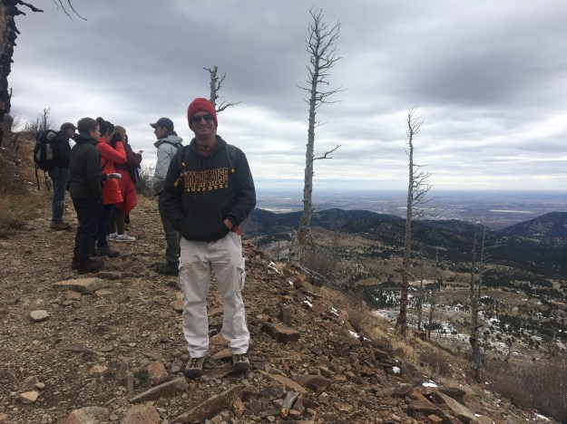
This past weekend, Drs. Robert Anderson and Lon Abbott of the University of Colorado-Boulder, lead a group of people up Sugarloaf Mountain to examine the geological history of the Rocky Mountains. This event was put on by the TEDxMileHigh organization as one of their adventures.

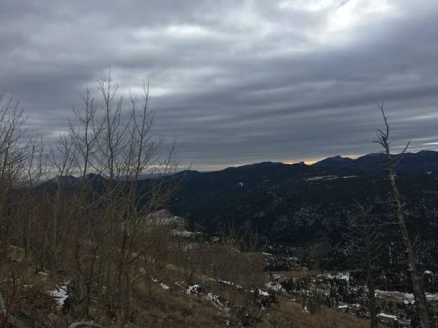
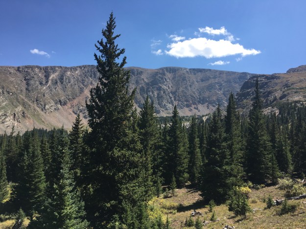
Sugarloaf Mountain is a relatively easy hike 15 minutes West of Boulder, along the Boulder Canyon. The distance from the trailhead to the top of the mountain is only about 1.4 miles, and the vertical gain is less than 600 feet. However, it is said to have one of the best views of Boulder Canyon in the area.

IMG_1682 (1)

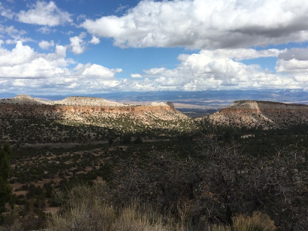
This particular hike was chosen to as a backdrop for presenting Colorado’s geological history based on the specific terrain features that appear along the trail. For example, 1.7 Billion Years ago, Colorado was a shallow Ocean with tall mountains sticking up out of the ground, much the way present-day New Zealand is. Some of the mountains in the distance resemble the mountains that one would see had they been floating (or canoeing) across this area at the time.

300 Million years ago, it was a tropical seashore. The Rocky Mountains themselves formed from a period of time roughly 70 Million years ago to about 40 Million years ago. More recently (over the past 8 million years), the Great Plains, which the trail periodically overlooks, began to subside, creating the sharp contrast between the flat terrain east of the mountains and the high peaks of the Central Rockies that we see in our present day world.

IMG_1689 (1).jpg

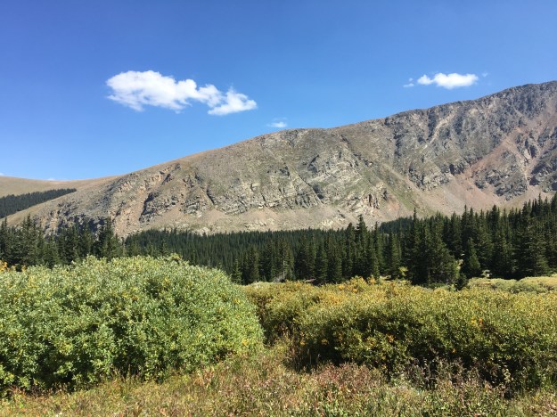
At this exact elevation threshold, roughly 8500 feet, the type of rock observed changes, also a result of some of the long-term processes that created the Rocky Mountains.

The same combination of processes and events created some of the most celebrated unique rock formations of the region, including Red Rocks and Garden of the Gods. Thanks to the University of Colorado Department of Geology, this short hike became a trip through time.

IMG_1692 (1)

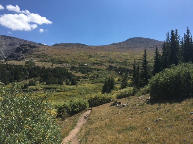
The view at the top didn’t disappoint. It was interesting to see the high peaks of the Rocky Mountains on an October day with some sun, but also plentiful cloudiness. It felt quite different from many of my hiking days Colorado, where there is often near total sunshine. I had previously forgotten about how much I enjoy seeing mountainous terrain like this, with sections of it lit by the sun, and other sections shadowed by the clouds, creating unique color contrasts that gradually shift over time.

The geological history of the Rocky Mountains is somewhat unique, and has yet to be fully explained. Geographically speaking, looking at a present day map of the world, the Rocky Mountains are fairly unique due to how far away from any major fault line they are.

IMG_1678 (1)

Many mountain ranges like the Andes and the Himalayans are right on a fault line and associated with geological activity; earthquakes and volcanoes. Colorado is not a hotbed for either, making for a somewhat unique mountain experience.

Geologists are still trying to explain why the mountains formed here the way they did. The Rockies continue to puzzle the scientific community. Why the mountains are as tall as they are when other properties of the Earth’s crust would indicate otherwise? Why did the Great Plains subside and become “disconnected” from the Front Range? Nevertheless, since geological processes are so slow, the mountains, as we see them today, are unlikely to change too much within any of our lifetimes.

Regardless of whether we are intellectually curious about why they are the way they are, or simply want to ski, hike, raft and climb, there are there and will continue to be there for us. They are confusing but consistent, much like life itself.

The Motor City- Without a Vehicle

“And you may say to yourself, well, how did I get here”- David Byrne.

I found myself in Detroit, Michigan on an unexpectedly pleasant October week asking myself just that question.

On one level, of course I know how I got here: Delta Airlines. I am not that reckless :).

On a whole other level, and the level that David Byrne was clearly referencing in Once in a Lifetime, I was quite confused.

How did the sequence of events in my life come together that lead me here?

To this forum…

img_1465

In this city…

With this group of people….


Is there a reason for it? Was it “meant to be” for any reason? Or is it a result of decisions I made aggregated over the course of time? Had I made these decisions differently, prioritized things in my life in a different order, or just paid more attention to a few specific things, would it have lead to a result that is significantly different?

This song was on my mind because last time I was in Detroit, way before I even had the idea to start writing about my travels, I recorded a dance to this music video at the Henry Ford Museum.

This was in 2008, a time when Detroit was at some kind of a low point. The story of Detroit is familiar to many, as it has been written about extensively.

IMG_1396 (1)

As the headquarters to America’s three biggest car manufacturers, the city was prominent and prosperous in the middle of the 20th Century. However, it fell on hard times in the later part of the 20th Century due to a combination of customers increasingly buying foreign cars and the decline in manufacturing in the U.S.

Nearly every time anyone writes about Detroit, they write about the city’s economic fortunes, often making points about social issues, economic policies, etc. Even when I came to Detroit with no desire to address the city’s economic misfortune and current attempts at recovery, it is hard to escape. Evidence of it is everywhere.

IMG_1430 (1).jpg

Visitors from other parts of the country kept telling me how eerie it felt; the lack of crowds, empty streets and mostly empty bars. Even acknowledging that these were all weeknights, it still felt different than what most people experience in urban areas throughout the country.

The history, as well as current state, of any place is always going to be a part of any travel experience. And, for Detroit, this includes the history people focus on (decline from 1960-2008), but also some of its history prior to this.

Strangely enough, despite the fact that Detroit is “The Motor City”, and best known for its role in the automobile industry, much of its history, and many of the interesting attractions, can actually be reached without a motorized vehicle.

Within downtown, one can walk to many of the city’s historical, and current attractions.

IMG_1414 (1)

For those willing to walk a mile, the only places that really require vehicular transportation are the Motown Museum and the Henry Ford Museum. The Cobo Center, all the attractions along the Riverfront, Detroit’s historic Opera House, the Fox Theater, the venues for all of Detroit’s sports teams, as well as multiple casinos can all be reached on foot within roughly a mile and a half of each other.


Interestingly enough, there is a lot one can do in the “Motor City” without even using a motor!

Much of this was actually built in Detroit after the decline of the auto industry. One of the reasons I visited Detroit in 2008 was to see their newly built baseball stadium, right downtown.

My 2017 visit to Detroit was to attend a conference related to a client I am currently consulting with. The reason is complicated as organizations rarely send consultants to conferences to represent their brand. Consultants are temporary and technically not a member of the organization.

It makes my identity, like Detroit’s identity as a city, feel way more fluid and complex than it was in the past. In the mid 20th Century, a place could have a simplistic identity; The Motor City, The Rubber City, The Iron City, etc. Today’s growing cities, like Denver, have identities that revolve around multiple areas of focus.

Many people are rooting for Detroit to make a comeback. Places like Greektown and Corktown, adjacent and walkable from downtown, are emblematic of a new, different, and more multi-faceted Detroit emerging from the ashes of the decay that plagued the prior half a century. One day, Detroit will find itself anew, unrecognizable to the Detroit of Motown, and people will ask “how did it get here”. They may even ask “My God, what have I done” (from the same song).

The point of David Byrne’s song is that people need to stop and periodically think about their lives, the directions they are headed, their priorities, etc. Otherwise, they will just kind of like drift, with nobody really understanding whey they are where they are, doing what they are doing, with the people they are with.

There are unique things about Detroit. Obviously the large amounts of empty space, some of which is being converted to farmland.

Also, their proximity to the Canadian border, rust belt infrastructure, and continued contributions to the music industry.


Attending this conference was a reminder to me. No matter where I go, no matter what I am doing, I cannot help but be me. While we all need to periodically re-think things, come up with new ideas, and even take on a somewhat different identity, there will always be some things fundamental about ourselves that do not change. Detroit’s current transitions reminds me of this.

Hell’s Hole: A Lesser Known Hike for a Busy Weekend

IMG_1116 (1).jpg

It would be hard to find a day, or an event, that brings about more mixed emotions for me than Labor Day….

I love the fact that Americans get a holiday, the first Monday of every September. I hate the fact that so many Americans get so little time away from the office and their other daily responsibilities that Labor Day weekend represents a rare opportunity for travel, leisure, etc. As a result, roads, recreations areas, National Parks, and tourist attractions are very busy the entire weekend!

The history of the holiday is complex and contested. It started as a celebration of the Labor Movement, whose original purpose was to stand up for fair treatment of workers in the wake of industrialization. Leaving out some more controversial opinions, let’s just say I appreciate the fact that there is a Labor Movement and a lot of what it has done, but I do not always appreciate every manner in which it manifests.

Over the years, the workforce changed, and the holiday kind of morphed. Today, the holiday is less about parades celebrating the American worker, and more about recreation, parties, events, travel, and outdoor adventure. It also serves as the unofficial end of Summer. Yet another mixed emotion. I love seeing people get out and enjoy the world. But, I am bummed that Summer is ending.

The crowds also necessitate some outside the box thinking. The National Parks will be crowded. So will many highways, and other high-profile destinations. With the weather typically being pleasant, the three-day weekend ends up being a good opportunity to visit some lower-profile destinations, particularly for those of us that are fortunate enough to get more than three opportunities (Memorial Day, Independence Day and Labor Day) for summer adventure and exploration.

IMG_1089 (1).jpg

Mount Evans itself is a fairly high profile destination. Just over an hour’s drive from central Denver, it can be reached by driving up the highest paved road in North America. People also commonly hike or even cycle to the top of the 14,264 foot peak.

The Mount Evans Wilderness is a 116 square mile are surrounding the mountain, with rugged terrain, many other peaks, and numerous other trails to hike and backpack.

IMG_1114 (1).jpg

Hell’s Hole (I have no idea why they call it that) is a trail that stretches a little over 4 miles (estimate vary depending on source, a common issue for hikes in Colorado) just to the West of Mount Evans.

Starting at an elevation just over 9500 feet, the trail climbs a total of roughly 2000 feet, making it moderate in difficulty- overall. However, that difficulty is not spread evenly throughout the hike. Most of the climb occurs in the first two miles, as the trail ascends, first through a forest of mainly Aspen trees, then into a dense forest of Pines. Near the top, the trees begin to thin, and Mount Evans, the giant 14,000 foot peak periodically appears through the trees.

IMG_1107 (1).jpg

At a moderate pace, one should reach the end of the trail in roughly two hours, with the second half of the trek begin more gentle in slope. The gentler slop still manages to top out close to the “tree line”.

IMG_1111 (1).jpg

Although the final mile and a half of trail offers periodic glimpses at the mountains in all directions, it is only the last quarter of a mile of the trail that is truly wide open. To get the full experience, I would seriously recommend hiking the entire length of the trail, which totals roughly nine miles round trip.

For some reason, it took until the second half of the hike, the descent back to the trailhead to notice any signs that summer was indeed coming to an end. An unseasonably hot day, reminiscent of mid-July, temperatures in parts of the Denver metro area hit 100F, and even weather stations near 10,000 feet in elevation peaked out above 80F. The entirety of the hike felt no different than mid-summer.

IMG_1122

Yet, hints of fall appeared, and were suddenly noticeable when the ascent was complete. Shades of yellow began to appear in the shrubs that often dominate the landscape just above the treeline.

IMG_1125 (1)

Further down, gold colors even began to periodically appear in the Aspens closer to the trailhead.

IMG_1123 (1).jpg

People often think of Labor Day as summer’s farewell, summer making one last appearance before ending. Of course, the weather does not always line up that way, and it is quite possible that many more hot days are still yet to come.

Emotionally, and sociologically, a lot more can be controlled. Most children have already returned to school. Those still on summer break will be back in the classroom shortly. Anyone on summer schedules or summer dress codes will return to normal within a week. For those in the most traditional types of corporate structures, the next holiday may not be coming until Thanksgiving (late November).

On the descent, we spent some time discussing topics related to work, finding purpose in life, and other topics that were less about travel and adventure and more about life at “home”. It was almost as if the weather, the physical appearance of everything around me, as well as the general mood, was lining up to serve the purpose Labor Day serves in the 21st Century; a farewell to summer before a new season takes hold.

For many, this new season represents a return to some form of structure, but could also represent new opportunities to learn, achieve, and reach the next level. In life, we all need breaks, time to do that in which we enjoy. We also need time to work, and get things done and serve other human beings. While our current society may not have found the right balance, that does not mean we need to shun work altogether, and not embrace the season that is to come.

I Like Ike

IMG_9962.jpg

There are Presidential Museums for every President that served over the past 100 years, usually located in or near the their “hometown”. Some of the more memorable presidents from the 18th and 19th Century also have museums dedicated to their lives and accomplishments. While some of these museums are located in or near major cities, there have also been a good number of presidents who came from small towns. Their museums can sometime be interesting places to stop while traveling.

The first time I ever visited a presidential museum, I was driving from Saint Louis to Chicago on Interstate 55, a drive that had become familiar and dull to me. It was a July day and temperatures were close to 100 degrees. I knew both me and my car needed a break in the middle of the afternoon. So, I visited the Abraham Lincoln Museum in Springfield, a museum I would certainly recommend. I love stopping at places like this on a long drive, allowing the body to move around a bit, and stimulating the mind with some historical information.  So, on my drive back to Denver from Kansas City, I decided to stop at the Eisenhower Presidential Museum in Abeline, Kansas.

IMG_9971.jpg

The museum is located in the EXACT SPOT that the former president grew up.

IMG_9951

On the museum campus is Dwight Eisenhower’s boyhood home, and, with admission, visitors get a brief tour of the house.

Ike_Museum_Location

Map from Museum’s Webpage- does not include parts of I-35

The museum is only a few miles from Interstate 70. As president, one of Eisenhower’s signature accomplishments was the signing of the Interstate Highway Act in 1956. So, it seems fitting that this interstate highway system would find a way to serve the town Eisenhower grew up in. Arriving here without using the interstate would feel wrong in a way.

IMG_9960.jpg

Every president, no matter the background, has two stories. A story about what they did before they became president, and the story about what they did as president. Before becoming president, Eisenhower was known primarily as the general that oversaw the Allies European Victory in World War 2.

In fact, Eishenhower’s military career, and exhibits regarding World War 2, appear to make up the largest part of this museum. Later in life, Eisehnhower himself considered his role in the military as the most significant one he had played. In his retirement, he preferred to be addressed as “General Eishenhower”, as opposed to “Mr. President” (which is how former presidents are usually addressed).

IMG_9997

After helping start the North Atlantic Treaty Organization (NATO), he decided to run for President of the United States in 1952. The museum portrayed him, in a way, as a reluctant president. There is no way of knowing what truly is inside anybody’s heart. However, the way the story is portrayed is not of a man with a strong desire to become president, but of a man who spent his entire life fulfilling the various duties to which he was called. After being called to do so by countless associates, supporters, and both major political parties, leading the nation, as president, was just the final in a series of duties he was called to and performed over the course of his life.

IMG_9950.jpg

The entire life story that is Dwight David Eisenhower felt like a story out of a completely different time in history. This idea seems almost like a long-dormant old folklore in American culture. The hero turned leader. A person who wins the adoration and respect of a large group of people based on some heroic acts and then goes on to lead decisively, yet not divisively. A person who sincerely tries to lead all the people, rather than just the ones that are supportive. And, a person who finds a way to be both transformative and a consensus builder with views that are strong without being extreme.

[I will leave the exact details of his presidency to the history books and the museum itself.]

This feels, in a way, like the exact opposite of what has been going on recently. When it comes to this idea of a military veteran/ war hero president, there are plenty of examples throughout history, but no clearer example than Eishenhower.

I do not want to make this another angry political blog (there are way too many as it is), but I do not consider our current president, nor his predecessor, to be a hero, at least not in a general sense like the heroes past. Sure, both men are heroes to a subset of our population. However, both men were also dismissive, and sometimes in a nasty way, to other groups of people within our country. Being the first president of mixed racial background, or the first non-politician president may be important steps for our country. But it’s hard to consider being a community organizer or a business tycoon “heroic” in the traditional sense.

IMG_9966.jpg

There is a time and a place for everything. Maybe the middle of the 20th Century was the time and the place for the hero. It could be seen throughout the culture of that time; the Western Hero/Villain movies, characters like the Lone Ranger, and such. Our society has changed significantly since then. Movies this decade more commonly feature protagonists with some form of character flaw, and antagonists who draw some amount of sympathy based on their life experiences or perspectives.

As our culture progresses, we enter a period where maybe we should not look to a hero, but within ourselves. Most of the problems we face today are not as straight-forward as a General coming in and defeating Nazis. They’re more complex, like structural racism which results from the cumulative effect of people’s individual attitudes and pre-conceptions, the negative emotional and communal effects selfishness and the accessibility of smart phones create, or the susceptibility of those that feel disenfranchised to messages promoting radical and sometimes violent behavior. They are not solved by a leader, an army, or a bunch of laws. They are solved by each person’s behavior, one by one, day in and day out.

The World War 1 Museum

IMG_9874.jpg

In my history classes in Junior High and High School, we spent plenty of time covering World War 2. In retrospect, I realize that the reason people love to talk about World War 2 is that it is the closest thing in history to a real life battle between good and evil. Nearly every other war, struggle, or conflict, no matter how it is portrayed in the history books, is far more nuanced.

What I learned about World War 1 can be rudamentally summed up into the following sequence of events….

  1. Some archduke got assassinated
  2. There were so many entangling alliances that countries one by one started declaring war on one another
  3. There were these trenches and a lot of people died
  4. America came in and saved the day

I later read that World War 1 may be way more significant than the amount of coverage it got in history class.  So, when I found out that Kansas City had a museum dedicated exclusively to World War One, I decided it was worth a visit.

img_9873.jpg

The main part of the museum depicts the war’s events in chronological order. Visitors walk through the museum, with the chronological order of events displayed on one side and a mixture of war artifacts and other exhibits on the other.

The museum is pretty well balanced between the global USA-specific perspectives. The first section is dedicated to the events before the United States entered the war (1914-1916).  In the middle, a video describes the sequence of events that lead to our entry into the war. The final section is dedicated to the events of 1917 and 1918, as well as how the world was changed by the war.

To truly get the most out of a visit to this museum, I would recommend setting aside at least a couple of hours to read through the full list of chronological events.  If you are like me, and always have a burning need to both think and talk through the implications of everything you read, an additional hour might be necessary.

I came away from this museum with an even greater understanding of how nuanced this war was. First of all, in some ways, this war is often seen in a historical context as inevitable. Nationalism was on the rise, there were ongoing technological and geopolitical changes, and there were all of those alliances. But, the war also started by accident! The mission to assassinate Archduke Franz Ferdinand was aborted. However, the assassins that shot him did not get the message, and assassinated him anyways. This one event would trigger a cascading of war declarations that would descend nearly the entire world into war!

Also, in most wars there is one side that wins and another that loses. While this war had a winning and losing side, there were some exceptions. For example, Russia sided with the alliance that won the war. But, their war was on a different front, and, with a revolution at home that caused them to exit the war 18 months prior to the war’s conclusion, well, they lost. They clearly lost, and lost territory. Italy, the perpetual side switcher of Europe, also pretty much lost. And, the Serbians and Slavs, subjected to Austro-Hungarian rule, despite being on the losing side, won- they won their own nations.

IMG_9919.jpg

By the end of the day my mind was feeling, well, just busy. While looking backwards, 100 years in time, my mind kept drifting to the future. In a way, World War 1 created the modern world.  It created the shapes of many of our countries as they are today, but also solidified the concept of the modern nation. Before that there were far more empires, as well as loosely bound city-states. There are also a frightening number of parallels between the world leading up to World War 1 and the world today.

I just kept thinking about what is ahead in the context of what had already occurred. The world was not always the way it is today. It would be foolish to assume it won’t change in the coming years. Three decades from now, the very way our society is organized could be quite different from what we know today.

IMG_9921.jpg

The museum also had several special exhibits, the best of which covered how the war-torn French reacted to the United States entering the war in 1917. Children in school throughout France were asked to draw pictures, and write essays, describing how the U.S. entry in to the war made them feel.

IMG_9920

Why is it that we commonly get what we want at the wrong time? I remember joining alongside my classmates in school in groaning when asked to do additional assignments such as this one. Now that I am a full fledged adult, I often desire nothing more than to spend my days doing the kinds of things my teachers would ask me to do in school, rather the work I must do to earn a living. I imagine many young adults feeling the same way.

The other special exhibits at the museum covered revolutions and signs of how the world was changing, murals, maps of the conflict, artifacts such as Wilson’s war proclamation, and posters encouraging people at home to support the war effort.

The museum does contrast with some of the more recently built museums I have visited. Museums built or fully updated in the past ten years tend to have two distinctions from older museums.

  1. Far more interactive exhibits, and interactive exhibits geared not just toward children but also towards adults.
  2. A greater willingness to take a somewhat critical view of history from the protagonist perspective, such as the Colorado History Center’s exhibits about Japanese Internment Camps, racial resentment in Denver, and the Sand Creek Massacre.

This museum largely lacked these two features. There were only a couple of interactive exhibits, and they were quite basic.

IMG_9925.jpg

The war posters, both in the main section and the special exhibits, refrained from depicting the extremely negative portrayal of German-Americans during the war effort, sticking to propaganda posters encouraging citizens to buy bonds and such.

Likewise, the censorship and jailing of political opponents under the Wilson administration (among its other misgivings) are really not touched upon. Still, I came into my visit to this museum with a hard opinion that our entry into this war was a mistake, and was at least able to see a new perspective on this when reading all of the facts here at the World War 1 museum.

48th State

IMG_7464.jpg

Arizona is the third most recent state to join the Union.  The only two states admitted more recently are Alaska and Hawaii.  This means that, when it comes to mainland U.S.A., this very much was the “final frontier”, an area that remained wild and unsettled for over a century while areas were being converted from frontier, to small villages, and eventually into powerhouses connected by networks of trails, ports, and railroads.

img_7422

The primary cultural image of Arizona is the “Old West”.  Cowboys roaming around wide open spaces.  Small isolated towns where outlaws and town sheriffs fight a continuous battle that resembles the internal conflict we all have between the innate desire for freedom and the desire for justice and order.  Crazy games of poker in whiskey salons that often end in guns being drawn.

Historically, it is correct that Arizona, like much of the west, is the site of many epic battles that often lead to gunfire.  This lead to places such as Tombstone, and Rawhide, being depicted in numerous Western themed movies and TV shows.  Tourists today can relive the experience of the wide open, unsettled, west by visiting these places.

However, movies and TV shows can frequently lead people to inaccurate perceptions.  Films and shows are designed for entertainment purposes, and therefore must focus on the interesting aspects of life in a specific place, like a shoot-out between two gangs.  Anyone that compares their lives to those of characters from TV and movies will often come out feeling that their life is uninteresting.  After all, no movie will show someone sitting at a cubicle for six hours, or doing laundry and ironing shirts.  They focus on the parts that will, well, entertain the people that watch them.

Recent studies have indicated that, while these high profile gunfights did occur in the old west, they were the exception rather than the rule.  Some studies (although not all) have even suggested that the western frontier of the later 19th century was actually a safer place than America today.  There is speculation as to why the “Old West” is depicted and thought of in the manner in which it is, leading some to entertain conspiracy theories.  Regardless of what the reality of what life in this time and place know as the “Old West” was truly like, it is encouraging to see people look at it statistically, as opposed to based on anecdotes and catch phrases.

IMG_7415.jpg

Arizona may have grown up late, but it grew up fast.  Based on the 2010 census, Arizona is now the fourth most populous state west of the Mississippi River.

IMG_7420.jpg

Growing up in the middle to late 20th century, Arizona grew up in a manner that is very car-centric.  Depictions of present day Arizona life, in movies like Bad Santa, commonly show life in car-centic suburbs, with winding subdivisions, malls and such.

img_7443

There is also no forgetting Arizona’s position along the famed Route 66, which took countless motorists between Chicago and Los Angeles during the middle part of the 20th century.  In popular culture, the Arizona stretch of this major historic thoroughfare is amongst the most celebrated, providing the inspiration for the setting of the Route 66 based movie Cars.

The most high profile destination in Arizona is the Grand Canyon.  After all, the state’s nickname, which is labelled on all Arizona license plates is “The Grand Canyon State”.  However, by taking a road trip from Phoenix to Las Vegas, one will traverse the landscapes that cover a much larger portion of the State.

Passing through the Sonoran Desert, which includes Phoenix and much of the surrounding  area, one will encounter hills covered in sagebrush and cactus plants.

img_7441

Periodically, one will also encountered Joshua Trees, mountain ranges, and mesas.

IMG_7429.jpg

img_7431

Closer to Vegas, the landscape transitions to the Mojave Desert, which is sometimes even hotter, drier, and more baren than the Sonoran.

img_7447img_7450

Two developments made Arizona’s rapid expansion in population possible.  First, is the much discussed invention of, and subsequent proliferation of air conditioning.  This, of course, made living in places prone to hot weather more desirable.  The second is the creation of dams, canals, irrigation systems, and water pipelines, which facilitated supplying these dry regions with the water resources needed to sustain life.

IMG_7475.jpg

The Hoover Dam, located at the border of Arizona and Nevada, is one of many places throughout the west that diverts water resources from a major river (the Colorado River) to major metropolitan areas.


As is the case with the idealized image of the rugged individual of the “Old West”, present day life in Arizona, when discussed, elicits some divided responses, as well as some different interpretations.

img_7411

This is very much the image of standard life in Arizona.  A house in suburban looking neighborhood, a pool in the backyard, mountains, and, in many cases, golf.  Some love it.  Some see it as the natural culmination of the “American Dream”.  Some can’t wait to get away from the frigid winters many experienced in other parts of the country, move down here and enjoy the life.  Others, and particularly those concerned with the environment, feel it is irresponsible for so many people to be living comfortable lifestyles, with swimming pools, irrigated lawns, and golf courses in a climate this dry.  People here seem to adhere to the “haters gonna hate” mentality.  The knowledge that people in some distant land are disapproving of their living, eating, hiking, and golfing in the desert does not seem to phase them.

IMG_7413.jpg


My First Long Day of Cycling

IMG_6357

I woke up in the morning with a good feeling.  It wasn’t a premonition regarding something specific, like when people set out to run a triathlon or take a key exam and get this feeling of confidence that they are going to achieve what they set out to do.  After all, this is a bike journey.  Accomplishment does not come at the end of this day.  It comes at the end of the last day, five days later, when I reach the coast of Maine after six days of riding.

The feeling I started the day with was just a general positive vibe, that I knew I was going to have a good day.  It is a Tuesday, a day where many people will simply be grinding out their daily lives.  For tragically many people, this means stressing out at jobs that do not fulfill them.  I get to ride my bicycle, spend the day outside, and see places I have never seen before.  I must be thankful for that.

On bike journeys there are plenty of things that can go wrong.  There’s always the possibility of unpleasant weather, unexpected storms, or an unexpected unfavorable shift in wind direction.  There are also the many possible mechanical issues that can occur to a bicycle, particularly one that was recently shipped across the country.  The feeling I got was that none of those things would happen, and that I would simply have an enjoyable day on my bicycle.

IMG_6356.jpg

Most Canadians will recognize my way of starting my day off right, with a nice breakfast at Tim Hortons.  Food is crucial on a bike trip.  It is so crucial that when I took the Adventure Cycling Association’s Leadership Training Course three years ago, it was the very first thing they talked about, before bike mechanics, camping/lodging, or even the basics of bike touring.  How to pack trailers, roof racks, panniers, etc. would not be covered until the next day!  I know one bad meal can really strain a bike trip, particularly if it’s breakfast, so I made it a good one before crossing the border back into the United States.

IMG_6360.jpg

Before leaving the Niagara area, I took one last view of the falls from a place called Goat Island.  Goat Island is between the two falls, and on the American side.  It offers a pretty good alternate view of Horseshoe Falls, which is directly across from a place called Terrapin Point.  It might be the best view on the American side of the falls, but, as I mentioned in my prior post, the Canadian side still offers better views overall.

I would spend most of my day cycling on one of the Nation’s longest bike paths, the Erie Canal trail.

IMG_6367.jpg

I knew that this was going to be a flat ride.  The Erie Canal is a waterway that was built in 1824 to provide a shipping route between the Great Lakes and the Atlantic Ocean.  In order for the very concept to work, they had to find a route with very minimal elevation change.  When the canal was built, a series of locks were built to regulate the water flow.  The first town we encountered after picking up the trail was Lockport, New York, a small town with one of these locks at the center of town.


East of Lockport, the trail surface becomes crushed limestone.

IMG_6377.jpg

Staying right next to the Erie Canal, the scenery I encountered was quite constant.  Much of my day looked exactly like this.  This trail is flat, and largely straight, which is good for covering a large number of miles in one day.  I spent most of my time on this trail just thinking about the Erie Canal itself, the amount of work it must have taken to build it, and its role in transporting goods across the Union in the Civil War, which some consider to be a major factor in the eventual Union victory.

IMG_6383

On a day like today, covering a lot of miles on a trail with consistent scenery, it is easy to lose track of each individual town.  This is why one of my favorite features of the Erie Canal Trail, at least in Western New York, is these bridges.  Each of them have the name of the town labelled on top of the bridge, so as cyclists approach, they know which town they are, in fact, approaching.

IMG_6375

I generally liked Western New York for bicycling, and bicycle accommodations.  Obviously, there is the trail, but also many of the roads include wide enough shoulders to accommodate bicycling.  Additionally, New York is one of the states that has labelled state-wide bike routes, which add some level of legitimacy to cycling as a form of transportation.

The exception, at least for me and the route we followed, was Rochester.  We split off the Erie Canal trail in order to ride, and eventually camp, along Lake Ontario.  This involved getting off the trail and following State Highway 104 into town.  Like other Western New York roads, this road had a shoulder.  However, this shoulder had frequent obstacles, mainly sewers, that we needed to cut into traffic to avoid.  After that, we cut over to the lake in a suburb called Sea Breeze only to find out that the bridge we were hoping to take, over Irondequoit Bay, was closed for the summer.

IMG_6388.jpg

We were told that the bridge would re-open in November.  I am accustomed to roads being closed in wintertime, but not in summertime.  I never would have thought to even check to see if any bridge that I was hoping to take would be closed.  What was so frustrating about this was that the bridge itself, seen in the distance, and also on this map, is so short.

Screen Shot 2016-07-06 at 6.49.28 AM.png

It couldn’t cover more than fifty feet, and, as a result of that bridge being closed, we had to back track all the way around Irondequoit Bay, adding a significant number of miles to the trip.

I ended up having to invoke my backup plan.  I had already ridden more miles in one day, 112, than I had ever before in my life, smashing my previous record of 104.  Without the detour, I would already be close to my destination for the day.  But, I knew I needed to save some energy for five more days of riding.

So, I got a ride for the remainder of the day’s trip, which ended at Sodus Point, at a campground where I could watch a beautiful sunset along Lake Ontario.

IMG_6397.jpg

The obstacle I faced was not one of the ones I had anticipated.  Usually when I think of what can go wrong on a bike trip, wind, rain, and flat tires are the first things that come to mind.  A bridge closed for the summer is the last thing that would occur to me.  In fact, it took nearly three days for me to eventually realize the likely reason for a summer bridge closure; so boats can pass through from the bay into the lake.  Still, I consider this sunset along one of America’s Great Lakes a great end to a great day on my bicycle.


A Visit to Albuquerque

People like to break things up into neat little groups.  It is a technique people use in order to try to simplify a world that, in reality, is quite complicated.  In the United States, we take our cities, and break them out into various groupings.  We place cities in groups based on their region, their size, and sometimes even by culture.  I am as guilty as anyone of doing this.  But, every once in a while, we find ourselves in a place that reminds us that we need to respect two basic tenants of humanity, which apply both to the Cities we visit, as an entity, as well as to each and every one of us individually.

Each City, just like every one of us, has a distinct and unique individual identity.  In this identity, we see reflections of factors such as its geographic location, its history, and some of its specific influences, such as specific personalities and prominent industries.  We also see some specific quirks that cannot be easily explained just by looking at what we observe elsewhere.  It is the same way with each and every one of us.  When we are being true to ourselves, our behavior patterns manifest in a similar unique manner, a manner that can only be described as attributed to our unique person.  I feel it every time any one of my friends responds to anything I do or say by simply saying “That’s so Steve”.

Also embedded in the character of any City I have ever visited are reflections of natural law, or the universal truths that bind us all together.

IMG_5691

Albuquerque reminded me of both of these two basic facts.  Albuquerque has a unique heritage.  It has similar beginnings as Santa Fe, and even has an Old Town Square that reflects these beginnings.

IMG_5737.jpg

However, much of the city was built in a much more sun-belt style car-centric manner.  It is one of the most storied towns along historic U.S. route 66.  Route 66 embodies multiple eras of U.S. history, including the mass migration to California during the Great Depression, and later the first decade after the second World War, when the American road trip first became accessible to a large swath of the American people; the middle class.

IMG_5701.jpg

Route 66 connected Chicago to Los Angeles from the late 1920s through the end of the 1970s.  While the route covers a large distance, traversing many different parts of the country, it is the Southwest, New Mexico and Arizona, that is often most commonly pictured when people imagine that classic road trip on route 66.  While the exact location of the route 66 town in Disney’s Cars is not disclosed, the imagery in the movie clearly points to a southwestern location.

IMG_5728

Albuquerque celebrates its pivotal position along route 66 by both preserving some of the places that were legendary stops for travelers along this highway.

IMG_5729 (1)

As well as creating restorations that recreate the experience of being at a travel stop along the old highway, much the same way old west towns recreate the American West during the 1800s.

IMG_5694 (1).jpg

Route 66 is even the subject of a major controversy in town.  A proposed Bus Rapid Transit project, called Albuquerque Rapid Transit, would more or less follow the path of historic route 66 through town.  Residents of a hip area of town adjacent to the University of New Mexico called Nob Hill appear united in opposition to the project.  Some of the signs I saw opposing the Albuquerque Rapid Transit referenced protecting the heritage of route 66.  However, I wonder if this opposition is motivated by route 66 preservation, or the desire to avoid any changes to the neighborhood.

IMG_5693.jpg

Regardless of whether the people are motivated by the desire to preserve route 66 in its historic format, or preserve their neighborhood the way it currently is, on display here is one aspect of humanity that appears consistent across all cultures.  When people are enjoying their current situation, they generally do not desire change, and, in many cases, will fiercely oppose it.  This has been the case for me, personally, at various stages in my own life, and is also evident in a lot of the behaviors I observe in others when they react to changes in the workplace or their favorite social media outlet.

IMG_5708 (1)

It also appears to be basic human nature to seek out a broader view of the world from time to time.  It is the reason people go to the top of the world’s tallest building, hike Mount Rainier, or sit and gaze down at Los Angeles from the Hollywood sign.  Albuquerque’s answer to this is the Sandia Peak Tramway.

IMG_5718 (1).jpg

This tramway takes passengers on a 15-minute ride from a base elevation of 6559 feet (already significantly higher than the center of town), to a peak of 10,378 feet. Here, visitors to the area can see unique rock formations.


IMG_5707IMG_5723

Learn about the unique biomes that can be found in the mountainous terrain (Breckenridge has a similar exhibit, but uses an actual garden).

IMG_5712

And, can get a view overlooking this city that actually covers a much broader area than just the Albuquerque city limits.  In fact, Sandia Peak is so high that it is quite difficult to make out individual buildings or even neighborhoods in town!

IMG_5716 (1)

The culture is unique as well, seeming to combine so many aspects of the West and Southwest.

IMG_5739IMG_5742

Along the Rio Grande River, which cuts through the center of town, a bike trail, as well as numerous parks provide the urban outdoor space that Westerners seem to value so much.  Whereas, in many other cities I have visited and lived in, living in close proximity to a park is desirable, but kind of a bonus, it feels as if people here in the West view being near a park as a prerequisite, a necessity of life itself!

IMG_5734.jpg

On this particular Sunday afternoon, a parade of classic cars rolled through Old Town Square, showing off their classic appeal, and the hard work each and every car owner put into maintaining their vehicle’s shine.

IMG_5733

That evening, on the West side of downtown, another group of people are gathered, also showing off their vehicles, and, almost downright partying.

When I think of all the cars revving their engines up at night, all I can say is, “That’s so Albuquerque”.  One could speculate what mix of cultural influences, old Spanish, sunbelt, Western, Hispanic, etc. lead to Albuquerque being the way it is today.  But it is more than that.  The same can be said about any other place one would visit.  That is why we travel, not just when we need to go somewhere for business, or when we wish to visit people that live in another place, but also when we desire an experience we simply cannot have in our respective hometowns.

Exploring New Mexico

IMG_5660 (1).jpg
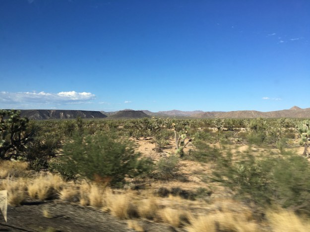
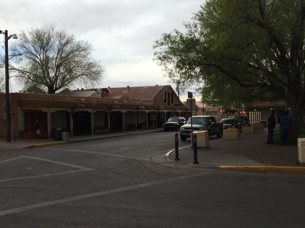
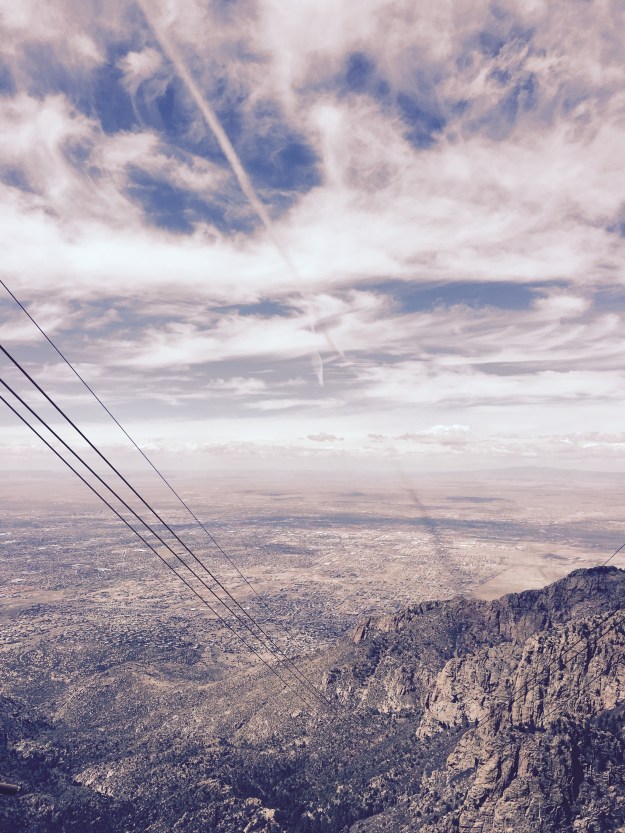
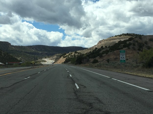
The northbound journey out of Santa Fe, along highway 84 towards Pojoaque, and Espanola could not possibly feel any more Southwestern.  Rolling hills are covered with bushes and sagebrush.  There are some trees here, but unlike in the East, their impact on the wide open landscape is minimal.  They are but mere dots, small points in a panoramic image that shows off the entirety of the landscape of the region, stretching for miles and miles.  As a consequence, mountain ranges can be seen in the distance in multiple directions.

IMG_5662 (1).jpg

Artwork depicting the culture of the American Southwest can be seen quite frequently along this entire stretch of highway, on roadside decorations, bridges, and even buildings in the distance.  There is something about sculptures and murals like these that invariantly make me think of the Southwest, even when I am in a completely different region.  The use of colors in particular are reminiscent of this region, warm and dry but still American.  The colors are warm, reds, oranges, browns.  Even when they use “cool” colors, like green and blue, these murals somehow find a way to make these colors feel warmer than they typically do in other drawings and signage.

I wonder, as much of the artwork of the region originated with the Native tribes that thrived in the area roughly a millennium ago, if the styles that came to be predominant in this region are a mere reflection of the manner in which the landscape, and climate, impact the human psyche.  And, is this an aspect of human nature that transcends culture?  Did the Spanish, and White and Hispanic people who would later inhabit the region adopt similar artistic styles because they were responding to the same conditions around them and reflecting them in a similar manner?

The reason I was headed in this direction out of Santa Fe, other than just merely to explore, which I do believe is a reasonable pursuit in of itself, was the desire to see one of the most significant, but also confusing places in the United States; Los Alamos.  Los Alamos is a place where some of the top scientists in the world came together during World War 2 in order to build the nuclear weapons that eventually ended the war.

Of course, at the time, it wasn’t the Japanese, but the Germans who were the main subject of concern. It was rumored that the Nazis were building this capability, which could have significantly altered the course of the war.  The Manhattan Project was both highly secretive (Americans were largely unaware this was going on at the time), and quite controversial, as it still is today.

IMG_5665.jpg

The entire area has a feel that continues to reflect how Los Alamos came about.  Headed towards town, on highway 502 West from Pojoaque, road signs indicate that the stretch of highway is a “safety corridor”.  What does that even mean?  I have never seen this before.  Anywhere else, this road would have a higher speed limit, less fines, and would likely not have three lanes in each direction.  Something must be going on here.  But, is it still going on?  If so, what?  And, how much of a secret is it?

IMG_5668.jpg

The truth is, Los Alamos is a place like no other place on earth, and like the rest of New Mexico, cannot be placed in a specific category.  It is, indeed, a place where discoveries are made.  But, unlike many other towns with major labs, and I am particularly thinking of Boulder, Colorado, which is near my home, it does not appear laid back at all.  After parking, I had an intense experience crossing the street to get to the Bradbury Science Museum.  This crosswalk had a walk/ don’t walk voice command that spoke words with a level of urgency that appeared to highlight the National Security and wartime origins of this town.  It felt as if 70 years later, the mindset had never really changed from its wartime heritage.  Or, in the very least, the town had kept its infrastructure, which was built specifically for time of extremely heightened security.

IMG_5669

The Bradbury Museum is quite well done, and for those traveling on a budget, is free.

I’d say slightly over half of the museums exhibits focus on the Manhattan Project, the A-Bomb and the original history of the laboratory.  However, the laboratory is operational, and has been involved in some high caliber research over the last 70 years, in areas such as cancer detection, energy conservation, and wildfire prevention.  It is amazing to think, the same place, the same people, the same lab, and the same knowledge base was used both to create the most destructive item on the face of the earth, nuclear weapons, but also to advance humanity and help countless people better their lives!

IMG_5667.jpg

One of the reasons Los Alamos was selected as the location for this top secret lab, was that it had to attract top scientists, many of the young at the time, to a project that likely meant years in seclusion.  While these young scientists would not have the benefits of urban nightlife, for Los Alamos, and the laboratory, they found an area with plenty of opportunity for outdoor activities.  The volume of hiking trails throughout Los Alamos County (a relatively small county) reflects this history.

IMG_5677 (1).jpg

Just West of town, and the lab, is a large area known as the Santa Fe National Forest.  This National Forest, in many ways resembles the National Forests that can be found throughout Colorado.  In fact, I can picture many of the same activities, backpacking, camping, and with the Jemez River, water activities such as fishing and boating.

IMG_5680 (1)IMG_5681

The main difference I felt, between here and many of the forested areas of Colorado I regularly frequent for hikes and such, is that this area seemed significantly less crowded- emptier.

Along highway 4, the main road through the forest, there is one area hot spot, a unique natural feature known as the Soda Dam, a waterfall the flows between a rock along the Jemez River.

IMG_5682 (1).jpg

Not only does this area feature a waterfall unlike any other place on earth, but there are geothermal features that make this river a popular pseudo hot spring.  I say pseudo- hot spring, as the water is not really hot, as it is in some areas where water temperatures resemble that of a hot tub.  It is just simply warmer than you would expect it to be given its high altitude origins.  It was warm enough that people were able to comfortably swim in it.

IMG_5685.jpg

It is an area that is just simply peaceful and panoramic, the kind of place where one can simply turn off the wheels that churn in their heads as a result of everyday life, and just sit, swim, float, or fish, gazing in the distance at the majesty of the region.  Two weeks later, I still gaze at this very photograph and feel as if I am entering a much more peaceful state of mind.  I almost need to place it in front of my desk, as a stress reliever.

IMG_5686 (1).jpg

The entire west is full of areas like this, where, due to unique geological history, the rocks take on a reddish color.  This is the color that many associated with the American Southwest.  Although most of Central New Mexico is much browner, especially in April, a section of bright red suddenly appears at the South end of Santa Fe National Forest, along highway 4, at the border of Jemez Pueblo, yet another Native American village.

The day ended with a final drive down highway 550 towards Albuquerque, where the Sandia Mountains, largely to the City’s Northeast, drew gradually closer as the drive progressed.

IMG_5688 (1).jpg

Thinking about all of the beautiful places I saw over the course of the day, my main regret is spending too much of the day in the car, and not being able to stop, hike, float, walk around, and just get immerced in area.  As a travel enthusiast who unfortunately has responsibilities at home, it is all too easy to get into the trap of planning too many activities for too short of a period of time.  This often makes travel feel rushed, like there is too little time to experience some of the places we see.  Luckily, I live in Colorado, and therefore can get similar experiences, National Forest recreation areas and such, closer to home.  But, there are some subtle differences, and things that make this area unique.  I would very much like to come back here at a much more relaxed pace, and experience another side of New Mexico life.


An Old World Town in a New World Region

In the U.S.A., we are quite accustomed to the seeing certain kinds of towns in certain parts of the country.  Since cities were built earlier on the East Coast, we expect to see towns laid out like Boston, Annapolis, or Charleston.  These cities tend to be a bit more challenging to navigate, as is particularly the case with Boston.

boston_street_map

By contrast, in the Western part of the country, we expect to see towns built more around automobile (or the automobile’s predecessor in the late 19th Century, the horse drawn carriage).  Cities like Phoenix, designed with driving in mind, have mostly straight-line roads, with suburban areas having windy subdivisions.

Phoenix_Street_map

This is what we have come to expect from towns in this part of the country.  So, when I first looked at Santa Fe’s road network, I was quite surprised to see a city full of windy roads that resembled something I would expect to see along the East Coast, or in Europe.

IMG_5647.jpg

Oddly enough, New Mexico is one of the oldest regions in the U.S., at least when it comes to architecture.  The historical lineage is just different.  New Mexico is home to over a hundred Native American Pueblos that date back to long before anyone associated with the United States of America would arrive.  Many of them are still inhabited, with some having been inhabited for over 1000 years!  This is quite a long time for this part of the world.

Santa Fe, New Mexico’s capitol city was founded originally as a Spanish colony in 1610, ten years before the Mayflower would come ashore in Massachusetts, and still retains much of its original Spanish style.  In some ways, driving into New Mexico feels like entering a whole different region, fairly instantaneously.  I first noticed this storm chasing in college. It was my first time in New Mexico, or Arizona.  I was previously unaware of the prevalence of adobe style buildings in these two states, and was somewhat surprised to see how abruptly the styles of the building around me changed once I crossed the border from Texas into New Mexico.

Santa Fe appears to have retained much of its cultural heritage.  Aware that New Mexico has a substantial Spanish history, I decided that it might be a good idea to check out a Spanish restaurant downtown.

IMG_5638.jpg

Taberna came highly recommended by the staff at the hotel, and certainly did not disappoint.  The food was excellent, and, on this particular evening, a performer named Jesus Bas performed for the customers.  I sincerely, if only for a moment while sipping a glass of wine, tasting enchiladas, and hearing Spanish music, felt like I was in Spain.  Well, at the very least, it made me want to go to Spain.

IMG_5642.jpg

I decided to somewhat follow in the footsteps of one of the people who inspired me to start writing about my travels, Anthony Bourdaine.  For those not familiar, he is a chef who eventually became the host of a series of food related travel shows.  I watched a lot of his previous Travel Channel show No Reservations, where he did not just simply describe the food he was eating, he would also reflect upon the experience, what certain places made him feel like, and what historical context they can be placed in and such.  His current show, which is actually a bit less food focused and more focused on the travel is called Parts Unknown.  So, I was actually quite excited to see a souvenir shop actually called Parts Unknown.  Additionally, the shop is located only a few doors down from one of the places Anthony Bourdaine visited on the Season 2 episode where he travels around New Mexico; the Five and Dime, a shop where he gets a Frito Chili Pie, a commonly served dish in New Mexico.

IMG_5643.jpg

I did not end up getting the Frito Chili Pie, as there were a limited number of meals I could have here in Santa Fe.  I mostly just looked around at the souvenirs available in this shop, which featured Santa Fe’s connection to one of my favorite aspects of American History, route 66 (although the route bypassed Santa Fe starting in 1937).

IMG_5646 (1).jpg

I ended up going to a place called Horesman’s Haven, a small restaurant on the edge of Santa Fe famous for authentic New Mexican style food where Anthony Bourdaine was caught off guard by the level of spice in their green chili.

IMG_5658.jpg

IMG_5659.jpg

My chili was not quite as spicy, but still packed quite a punch.  I am glad it did!  Many people try to avoid spicy food while on vacation, to avoid experiencing an upset stomach while far from home.  In this case, the level of spice was an important part of the experience.  Life is meant to be experienced.  Some people spend their entire lives trying to avoid bad outcomes.  In my view this is a sure fire way to miss out on countless rewarding experiences.  Bad outcomes are going to happen.  We just need to manage them in our own way.  Missing out on a whole bunch of experiences, and I am talking about things much more significant than one high quality meal, bears a much greater cost than the occasional unfavorable outcome.

I am guessing this is the attitude taken by the unexpectedly high number of people who make a living as an artist in this town.  In the downtown part of Santa Fe, it seemed like half of all buildings house art galleries.  Santa Fe is known for art galleries, but there seemed to be way more than is necessary to support a town of roughly 70,000 people, even if all of those people are wealthy and have dozens and dozens of pieces of artwork hanging from all of their walls.

Like New Mexico as a whole, Santa Fe appears to have an interesting set of values that does not fit neatly into one of the categories we have become familiar with.  It is western, but also European.  It is cowboy, but also quite diverse.

IMG_5654.jpg

It is a state capital, but has a state capital building that looks nothing like any of the other ones I have seen across the country.

IMG_5655 (1).jpg

It is the kind of place that erects historical markers dedicated to fiscal responsibility, an important, even if not flashy, achievement, and one that reflects the western values of personal responsibility.

IMG_5656 (1).jpg

It is also a place that erects building dedicated to the memory horrible death marches in Europe.

IMG_5652.jpg

It is both “old world”, and “new world”.  It does what we all need to do, both in our own cities, and more importantly, individually.  It combines old ideas with new ideas in a way that uniquely represents its individual identity.