Category Archives: Western US

A 50 Mile Bike Ride in the Dead of Winter

I am not sure where the phrase “The Dead of Winter” came from.  In fact, I am not even 100% sure people still use that phrase (in 2015).  But, I do recall hearing that phrase growing up in both New York and Illinois, referring to the period of time from roughly New Years through President’s Day.

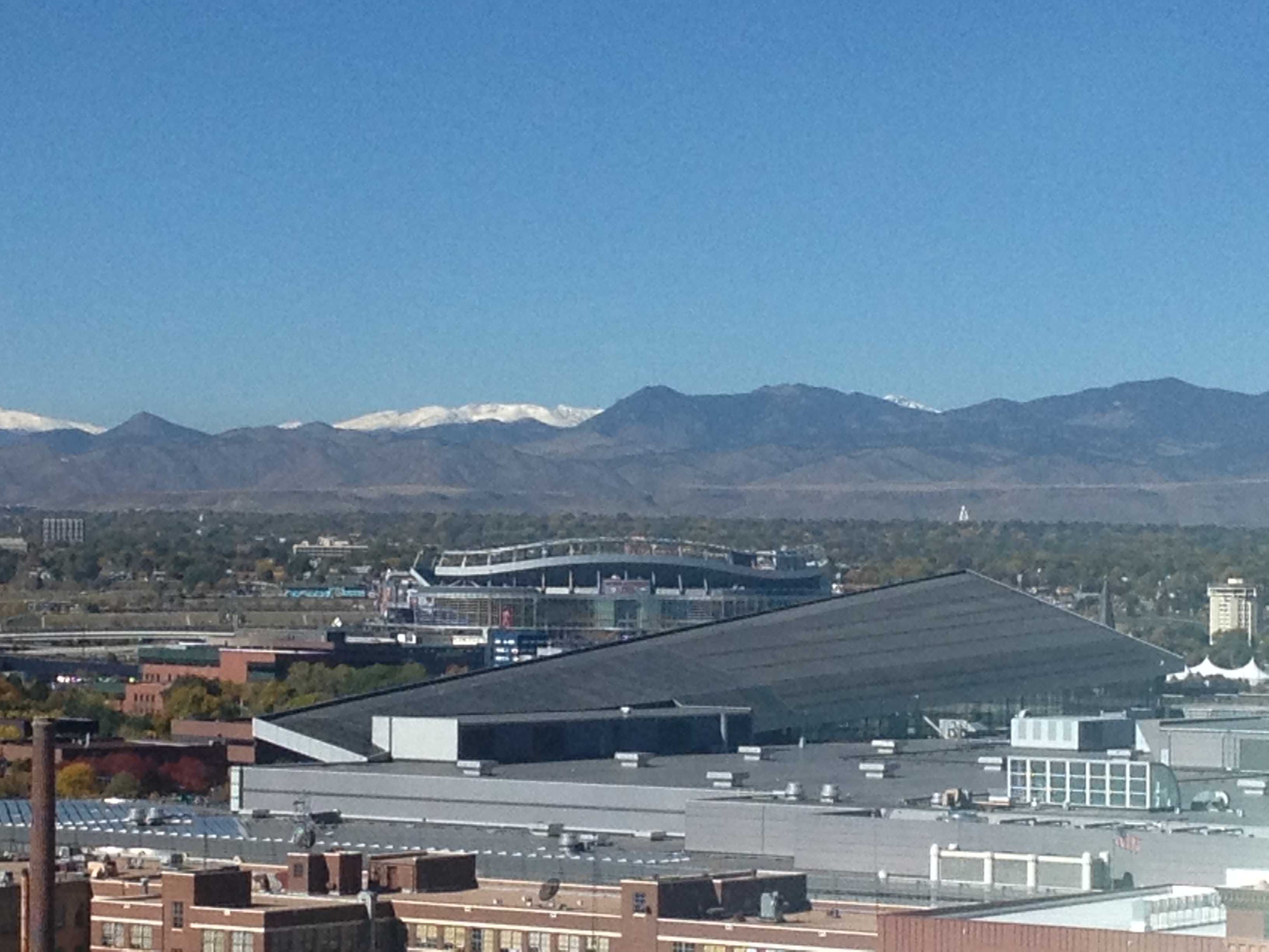
My best guess is that the phrase comes from scenes like this one appearing in many major Northern Hemisphere cities.  Trees having long since lost all of their leaves, the grass taking on a lifeless brown-ish color, and overcast skies combine to create a cold, lifeless image that can persist for long periods of time.

IMG_2940

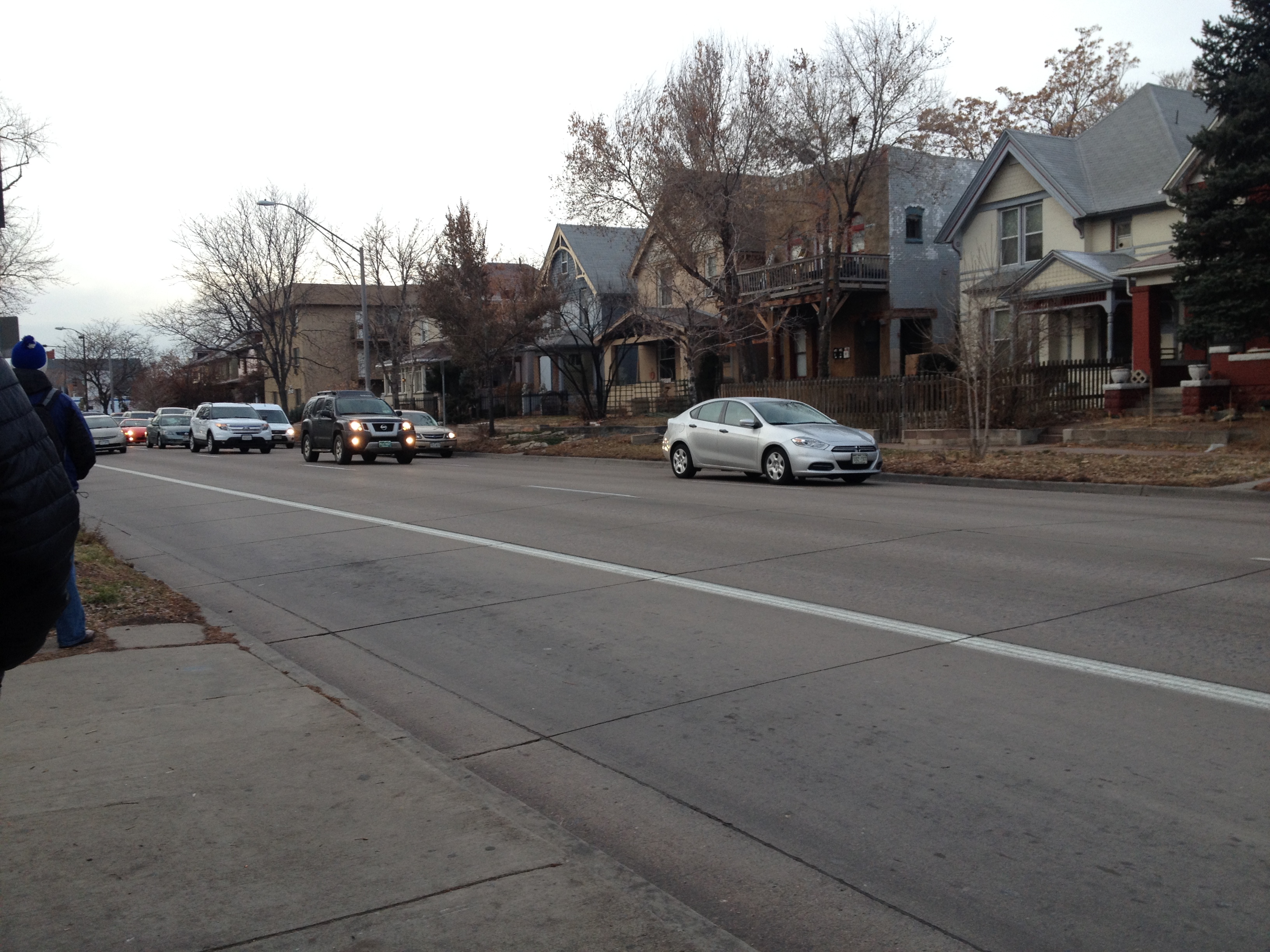
No month epitomizes the depths of winter more than the month of January.  By January, most northern cities have already experienced a significant amount of winter.  Residents of these cities have typically been through a dozen or so days they would consider “very cold” (which does vary by city).  Also, by January, most cities have experienced their version of lousy winter whether, whether that be lack of sunshine, heavy snow, ice storms, that cold drenching rain, or some kind of combination of the four.  With the holidays over, if winter is going to wear you down, it will most definitely do so in the month of January, as it runs its course.

For many, winter (and particularly January) is something of a metaphor for a rough period of time, or a low point.  In American history, the winter at Valley Forge is remembered as a low point for the American Revolution.  Winter is also used periodically to describe low points in people’s individual lives.  With the chill, darkness, and frequent inclement weather, there is not only commonly more hardships, but also more limitations.

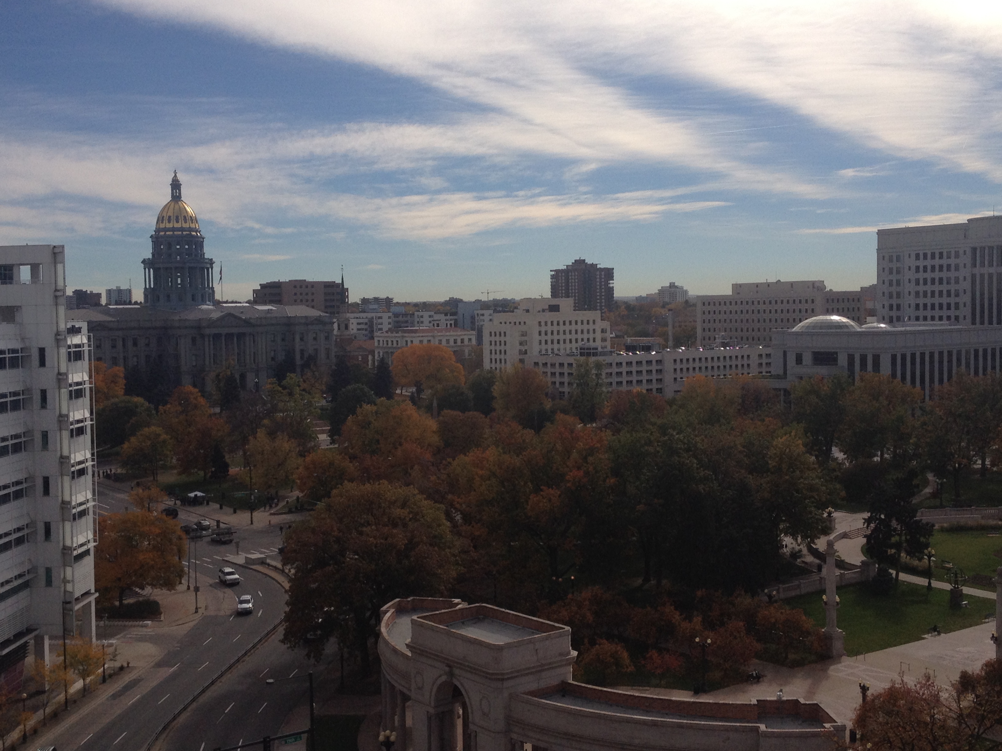
This is true even when mother nature offers periodic breaks from cold and gloomy weather.  After a cold start to 2015, the middle part of January brought warmer conditions to Colorado, including several consecutive days with highs in the 50s or 60s here in Denver.  And, while today ended up being one of the best possible January days for a bike ride, the amount of riding I could do was still limited significantly by the sheer fact that it is January.

Even on a mild day, it is typically too cold to start riding at sunrise, the coldest part of the day.  As the day began with temperatures in the 30s, I waited until roughly 9:30 to begin my ride.  Even with this later departure, I still encountered significant amounts of water, and even ice on the trails.  In several sections, I needed to stop and dismount my bike for safety reasons.

IMG_3018

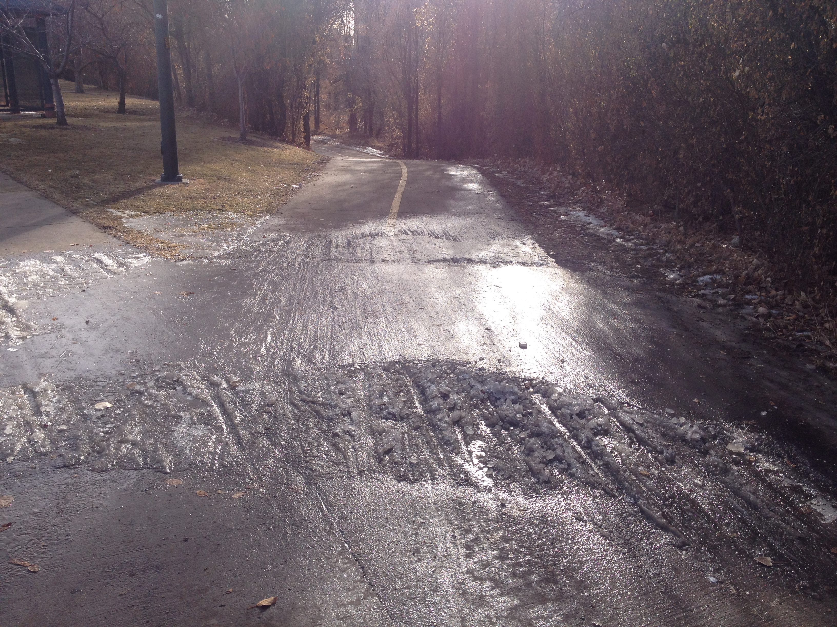
The mere possibility that ice like this will be present on the trail also makes it extremely unsafe to ride after dark.  With sunset occurring right around 5 P.M. at this time of year, the window of time for a bike ride is significantly shorter than it is in other season.

IMG_3025

Another major limitation to what places I can bike to in January is the wind.  In winter, wind can be quite unpredictable, and can lead to unexpected slow-downs.  Also, higher terrain can get quite windy, even on days where there is little to no wind in town and in the river valleys.

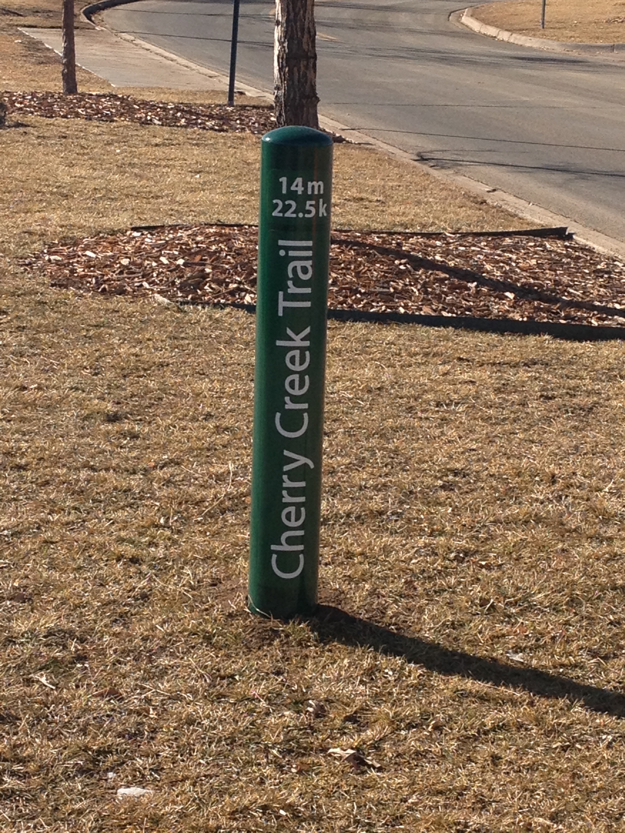
Therefore, I decided to ride up Cherry Creek trail, and make the 50-mile round trip ride from Denver to Parker, an exurb 25 miles to the Southeast.

IMG_3019 IMG_3020

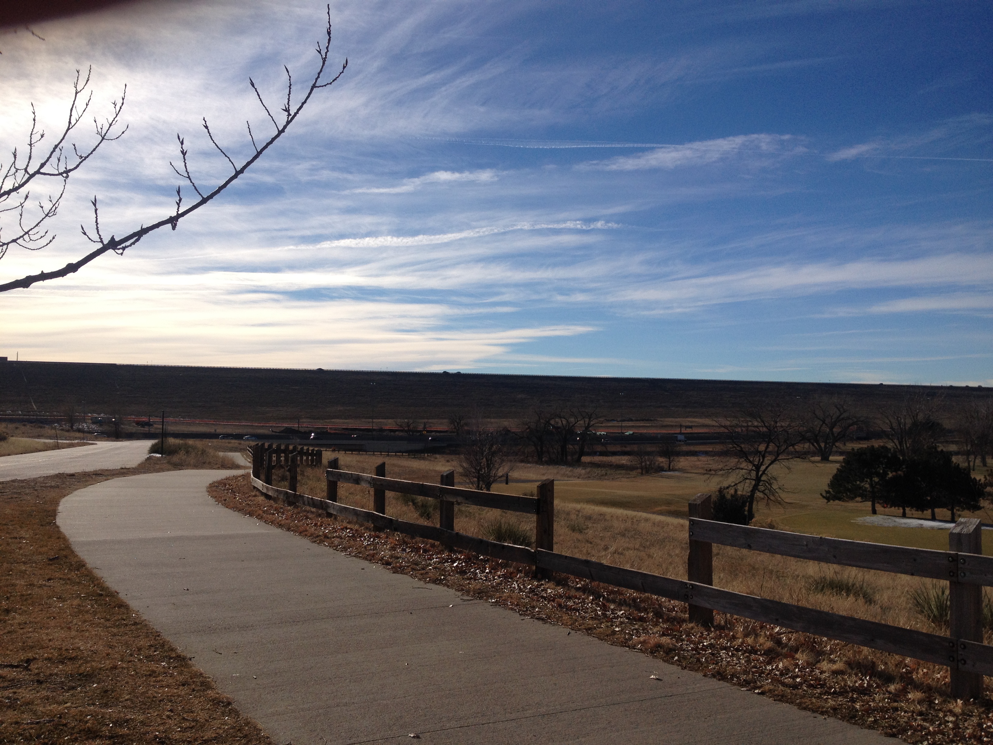
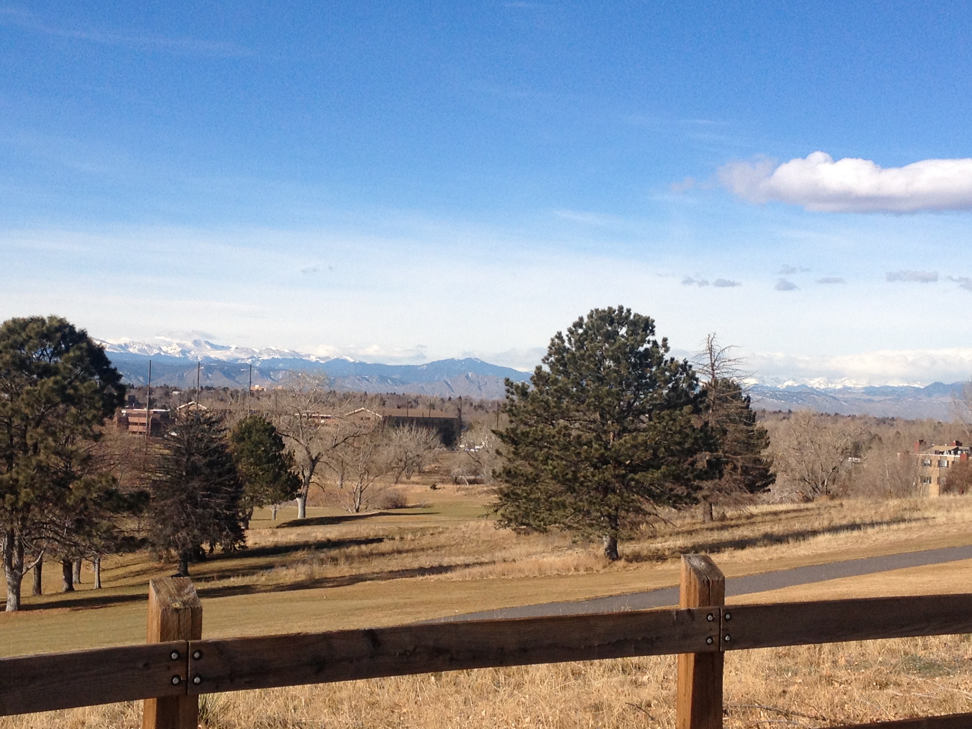
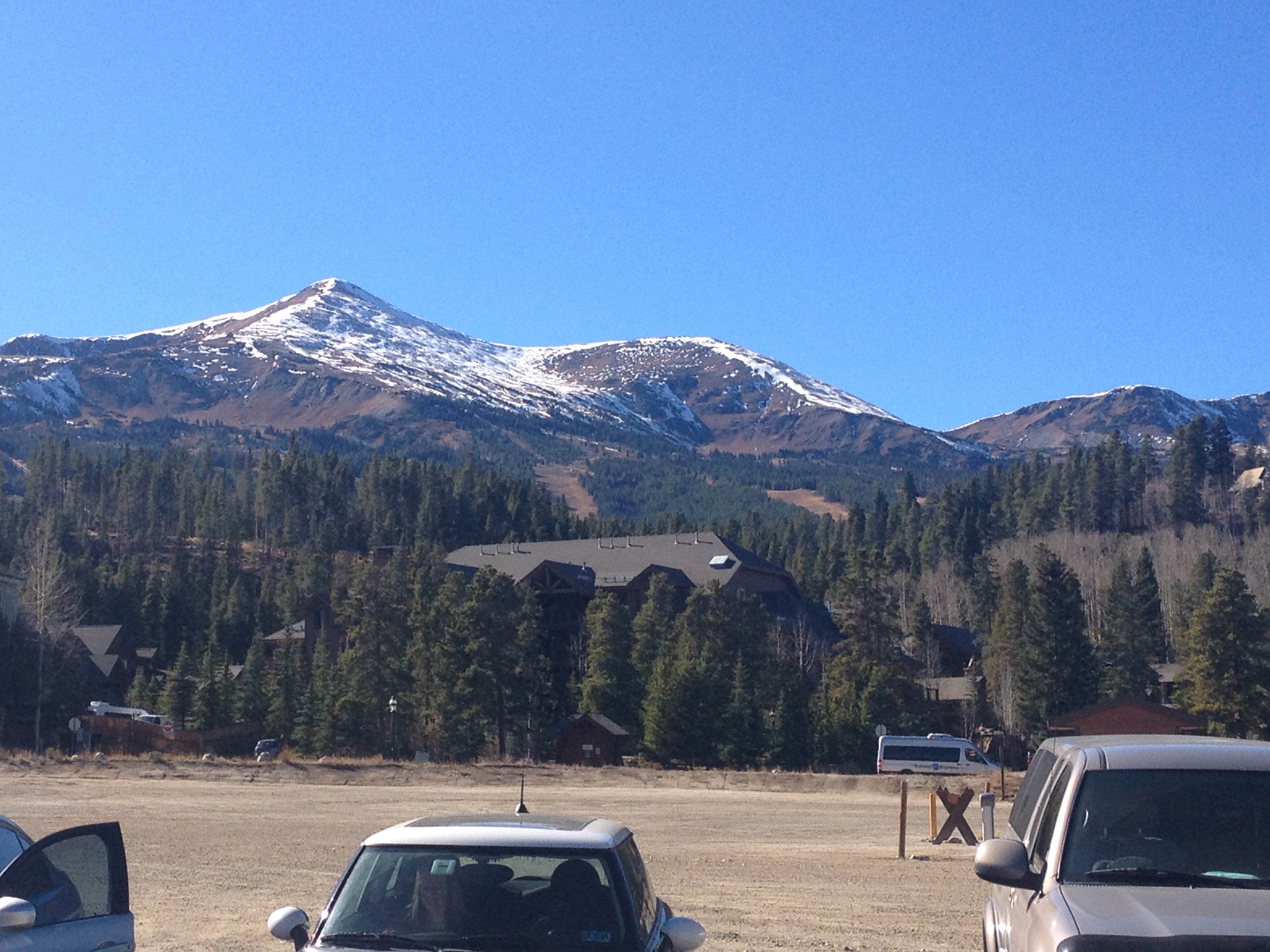
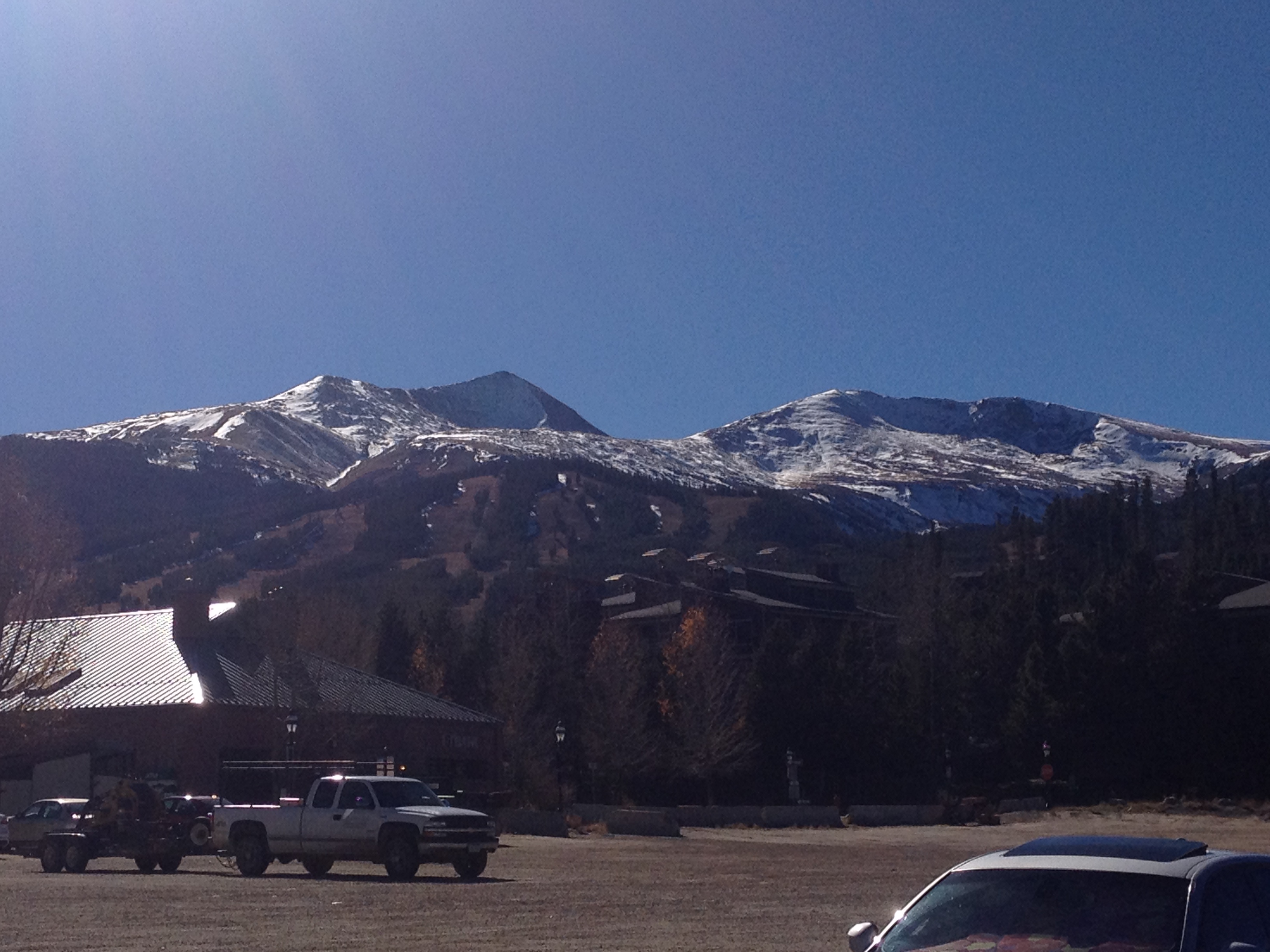
Despite the slow-downs associated with random standing water and ice on the trail, I was still able to reach Cherry Creek Dam in roughly 45 minutes.  Here, the only “climbing” portion of the ride appears in the distance.  For those with little to no “climbing” experience, the uphill sections can actually be a bit exhausting.  However, for anyone that has previously ridden up a mountain, or a large hill, the climb up the hill is quite tame.  With the mountains still appearing in the distance, there is a clear reminder that even after a mild stretch of weather, climbing too high in elevation would also lead to slippery conditions.  In essence, this “climb”, although quite tame, is the most significant climb one can make safely in the month of January.

IMG_3023 IMG_3024

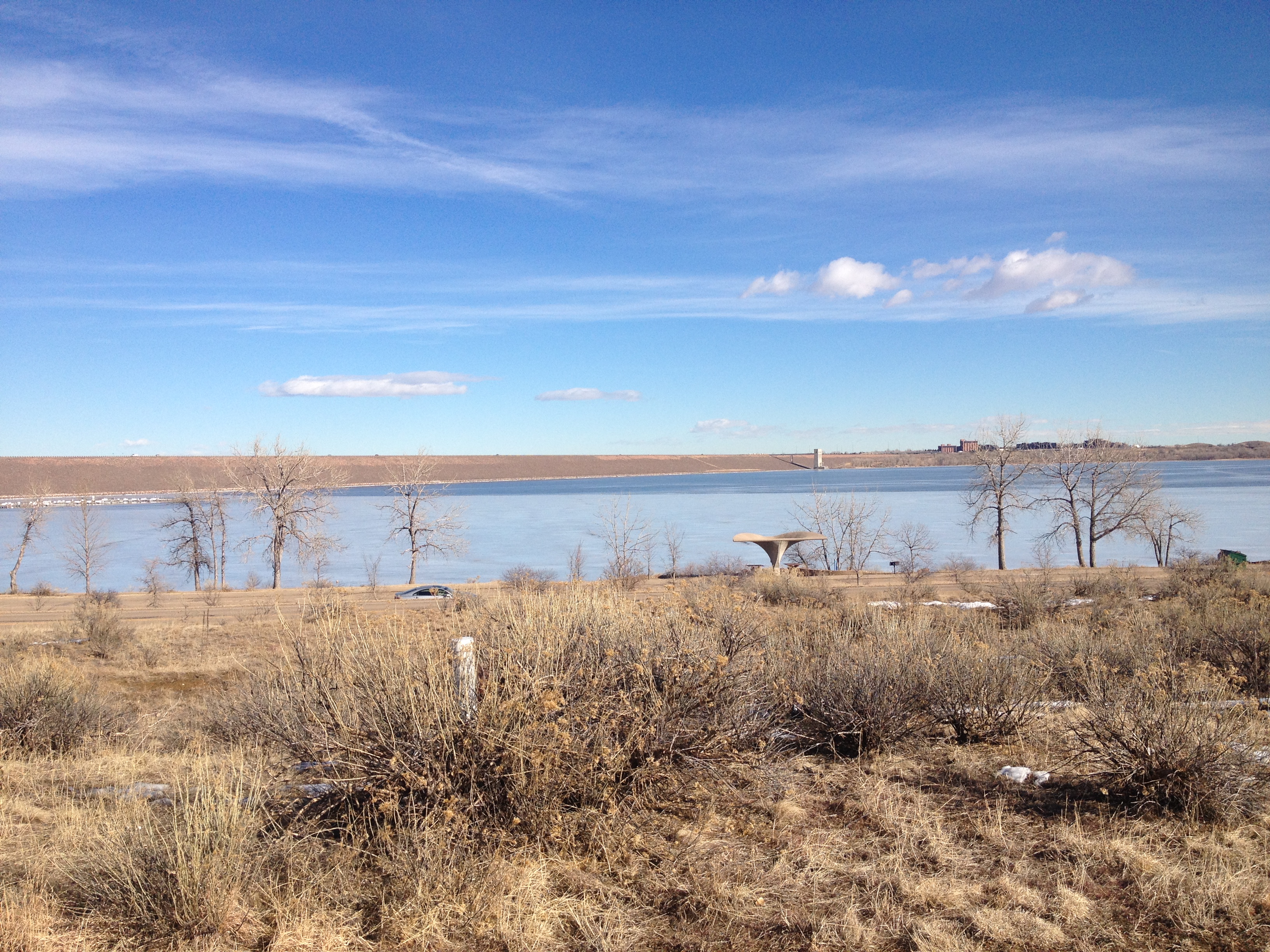
Behind the dam, the trail winds around Cherry Creek Reservior.  Only half covered with ice (and probably thin ice), I am relieved to see nobody trying to ice fish, or stand out on the lake at this time.

IMG_3028 IMG_3029

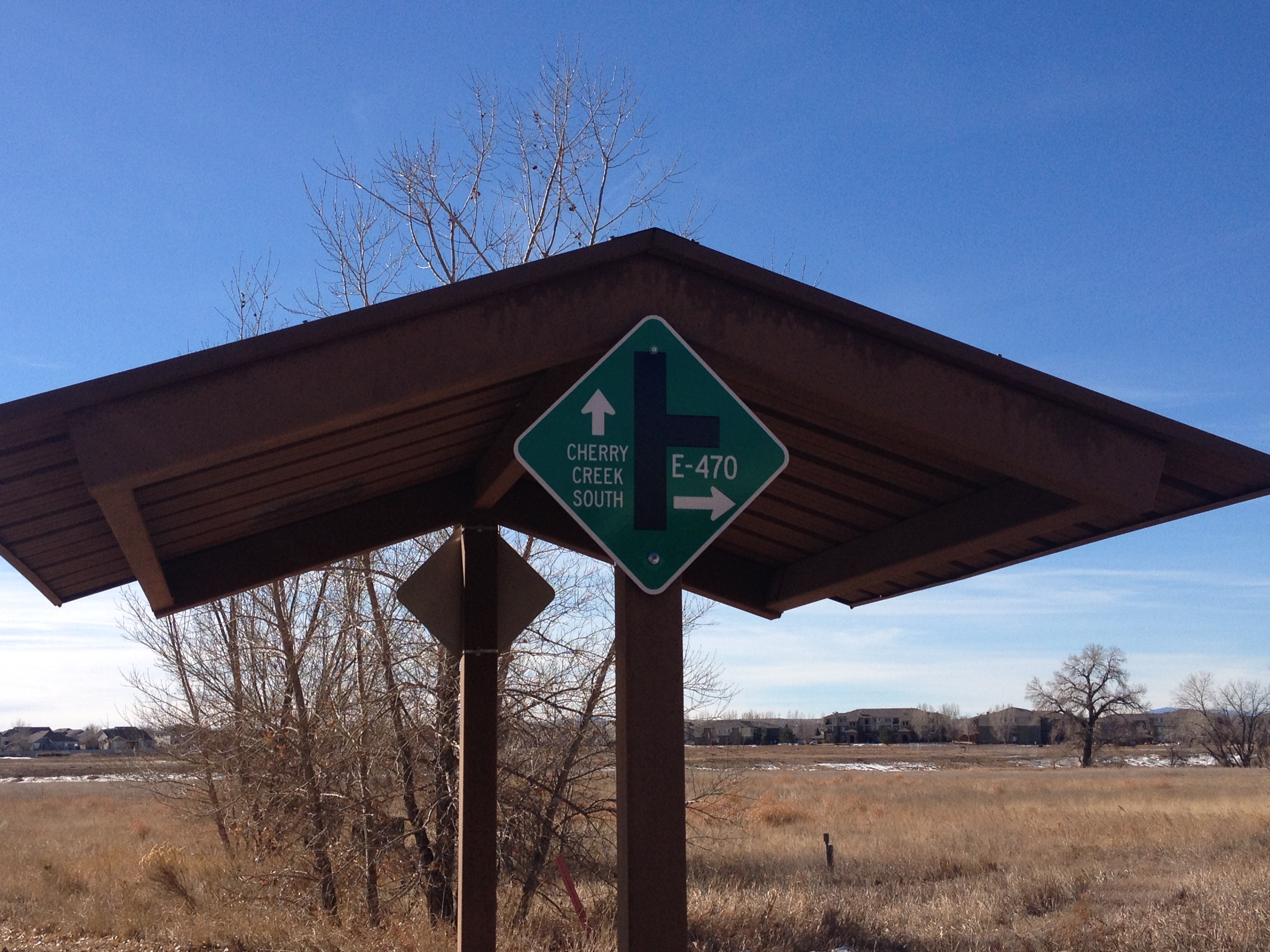
With some amount of wind, and having not ridden a significant amount of miles in one sitting in quite some time, I ended up taking it a bit slower on the trail today than I normally would have in mid-summer.  As a result, it ended up taking me nearly another hour to reach Parker, where the 470 trail, another major trail in the metro Denver trail system, terminates at the 40-mile long Cherry Creek Trail.

And, while it took me a bit longer than normal to ride 25 miles, not exhausting myself to achieve a better time had it’s reward.  Neither overly exerting myself, nor traveling too slowly, the return trip flew by!  Mile after mile passed, almost as if I was living out a montage of my own life.  I passed mile 25, 24, 23, winding around, smiling at nearly every person I passed by as the wind, and my direction shifted back and forth.

IMG_3030 IMG_3022

Before I knew it, it was mile 15, 14, 13.  On a typical ride, exhausted at the end of the day, I am anticipating each mile, and tracking how far I am from home.  Today, I achieved somewhat of a state of euphoria.  I almost feel as if I had achieved the “runners high” often discussed (albeit on a bicycle, as opposed to running).

In the end, despite my slower than usual pace, I thoroughly enjoyed the ride, and was actually only passed on the trail once!

For those wanting to take advantage of a mid-winter warm-up, and get on the trail (or roads), I offer the following tips

  • Plan extra time (maybe half an hour) for your ride.  There is a distinct possibility that mud, ice, or snow on the trail can slow you down, as well as unexpected winds.  It is not safe to ride at night, and it will get cold again.  You are better off taking on a goal that would be considered modest during the warm season than ending up in trouble.
  • Listen to your legs.  I know “shut up legs” is a popular poster to hold up at long distance rides, but often times a ride can be done more effectively if you allow yourself to downshift when the ride feels exhausting.  This may mean being on a specific segment of trail, or road, in a lower gear than what you would typically be in.  But, maybe that combination of the 5 pounds you gained over the holidays, and that 8 mph cross-wind is enough to warrant being one gear lower.  It is best not trying to exhaust yourself early just to be in your usual gear regime.  That being said, there also may be opportunities to shift up and go faster where there is an unexpected tail wind.
  • Don’t shy away from undertaking a major bike ride immediately after a hard day of skiing.  Cycling uses mostly different muscles than skiing, and I have been surprised by how little recent hard core skiing has impacted my cycling performance on rides like the one today.

A Stormy January Weekend in the Mountains

2015 is already off to an adventurous start for me.  This past weekend, the first weekend of the new year, I had the opportunity to accompany some friends on a trip to their cabin in Alma, Colorado.  Alma is the highest incorporated municipality in the United States (with permanent residents).  It is about 15 miles South of Breckenridge Ski Resort along state highway 9.  However, between Alma and Breckenridge lies a mountain pass, called Hoosier Pass, as well as the Continental Divide.

Still, visiting Breckenridge ski resort is significantly easier staying at a place like this than it is driving up there from Denver in the morning.  Not only is the distance much shorter, but there is no need to plan around the traffic patterns along I-70.  On a typical weekend day in Colorado, skiers traveling along I-70 from Denver to the area ski resorts must leave by around 6:00 A.M. to avoid significant delays.  The trek from Alma up to Breckenridge is typically only delayed by weather, and even if delayed will take significantly less time.

IMG_2997 IMG_2998

Unfortunately, this past weekend turned out to be one of those weekends.  Waking up Saturday morning (after driving up from Denver Friday evening), I was amazed by the views from the cabin!  The cabin, which is located in town, and walking distance from the town’s main street, sat on the side of a hill, with forests around it in every direction.  However, I was also startled to see some low clouds appearing to our North, the very direction we needed to travel to get to Breckenridge.

The ski day was kind of a mixed bag.  With a significant amount of recent snowfall, the snow was in really good shape- neither icy nor “skied off”.  However, as the day progressed, the snow began to pick up, and so did the wind.  With temperatures in the mid to upper teens most of the day, and winds picking up to about 15 mph, the wind chills were commonly near 0!  This, along with the sensation of snow hitting me in the face at high speeds (especially on faster trails going 50 mph), made the conditions less than ideal.  In the end, we decided to do slower runs in the trees, and still ended up with a really good day of skiing.

This weekend’s weather caught us by surprise– partially.  I know it is quite dangerous to be in the mountains when a major storm hits.  And, when a major storm is on it’s way, I tend to stay home.  However, this weekend’s storm was quite minor by Colorado standards.  48 hour snowfall totals across most of the region were only a couple of inches, not enough to make me reconsider any plans.  However, an area of heavier snow happened to occur right over Breckenridge.  The map below indicates snowfall totals this weekend.  The one little “bullzeye” of snowfall exceeding 6″ is located right over Breckenridge!  So, we were impacted by the most significant part of fairly minor storm system.

CO_Precip_2015_1_03_04

This made for a treacherous drive back over Hoosier Pass at the end of the day.  However, when we got back to Alma, it was not snowing at all.  In fact, the vehicle left at the cabin did not have any snow on it, and we did not have to shovel snow in front of the cabin.

In many parts of the country, seeing such drastic differences in weather conditions over the stretch of only 15 miles is quite a strange occurrence.  However, up here in the mountains, it is actually quite normal due to the impact the topography has on storms coming through.  Alma is considered part of South Park, a flat region of Central Colorado with elevations near 10,000 ft.  Due to it being surrounded by mountains in all directions, this region is significantly drier than other parts of the state.  The town of Breckenridge, at 9600 ft. in elevation, is actually more than twice as likely to receive significant precipitation in the winter than the South Park area, and receives more precipitation all year round.

co_precip_Breck_Alma

When selecting a home, whether it be a permanent residence, or a second home (vacation home), there are many factors to consider, one of which is location.  This weekend, with it’s kind of moderate snow event, provided a good showcase of both the advantages and disadvantages of choosing a place like Alma to have a cabin.

The major advantage seems to be how much you get for your money.  This place we stayed at is quite nice.

IMG_3006 IMG_3001 IMG_3002

It has three levels, each with it’s own sizable bedroom.  Each one has a different theme appropriate for the mountains.  The middle floor has a large kitchen, dining, and entertaining area.  And, perhaps one of the best features is the water heaters, which provide so much hot water that one can take a lengthy hot shower after a long day in the snow without having to worry about running out of hot water.  Overall, it is way more luxurious than any place I had stayed at closer to the ski resort.  I can imagine a place like this closer to one of the major ski resort being significantly more expensive.

However, the drive over Hoosier Pass in the snow was a clear demonstration of the downside of choosing a location like this.  Those with second homes in town would not have to travel too far to get to the resort, and not have to deal with icy roads and dangerous conditions.

IMG_3009

In addition, from this location it is also significantly less convenient to reach some of the other major ski resorts in the area, particularly Vail, Beaver Creek, and Copper Mountain.

Of course, the entire construct of this tradeoff implies a passion for skiing, because it is this passion for skiing that largely forces the pricing of these second homes in Central Colorado.  For those who prefer other activities, Alma, and the rest of South Park is quite an attractive location.

In the summertime, it is quite easy to reach tons of great hiking trails, including about a dozen “14ers” (peaks of 14,000 feet or higher).  And, a straight shot down an easy to travel highway is Buena Vista, the site of the most popular whitewater rafting river (the Arkansas River) in the country.  Finally, for those who just like solitude, the town’s population is only 270.

Due to the uncomfortable conditions, we decided not to ski again on Sunday.  Rather, we slept late, and made a leisurely journey back to Denver avoiding any traffic delays that could have built in the afternoon.  It was the prudent choice, even if we theoretically could have pushed ourselves a bit more.  Part of life in the mountains is having to accept some last minute changes in plans based on highly variable weather conditions.  So, in a way, changing up the plan for Sunday was part of an authentic mountain experience.


Christmastime in Breckenridge

IMG_2903 IMG_2917

Last winter, I spent around a dozen days in Breckenridge, Colorado, including a week-long stay here in late February.  Only a 90 minute drive from Denver, I feel quite comfortable coming up here on a day trip, without spending money on lodging, on a regular basis.  To wake up, drive to Breckenridge, ski for six hours or so, and then drive back does not make for an overwhelmingly tiring day.

When traveling to a particular destination becomes as regular as this one has become for me, the lines become kind of blurred.  In a physical sense, I am most definitely traveling.  I prepare, I pack, and I get in a vehicle and go to a different location which is a non-trivial distance away.  It is not a run of the mill trip to the grocery store or a neighbor’s house.  However, there are a significant number of people who commute longer than 90 minutes each way to work every day.  For them, a trip that takes at least as long as my trip to Breckenridge (when there isn’t bad traffic), has become routine.  It is certainly not something that any of these commuters would categorize as “travel”.  A trip up to Breckenridge for me is without a doubt more interesting and exciting than a 90 minute drive to work, but it is only slightly less routine.  I know what to pack, I know what to expect, and I know where everything is.  So, a trip like this straddles some kind of middle ground between what most would consider “travel”, and what most would consider just a part of life’s routine.

However, for many, Breckenridge is most definitely a highly sought after travel destination.  In fact, according to a fairly recent Travel + Leisure article, Breckenridge is the second most visited North American ski resort, behind only Vail.  And, since the printing of that particular article, the resort has actually gotten bigger, with the opening of a whole new section of the resort- Peak 6.

Breckenridge_SkiMap_2014

Despite its size, it is actually fairly easy to get around the resort.  Each peak on the resort labelled numerically, and both the ski lifts and trails are labelled quite clearly.

IMG_1643 IMG_2905

A variety of great trails, and panoramic views, already existed before the opening of Peak 6.

IMG_1601 IMG_2907

Peak 6 added something unique; essentially intermediate level skiing in a wide open area above the tree line.

IMG_1707 IMG_1644

Even with Peak 6 rising to 12,300 feet, the highest point on the mountain is still the top of Imperial Express.

IMG_2911 IMG_2914

At 12,840 feet, the very top of the mountain it often gets quite windy.  In fact, this part of the resort gets closed quite frequently due to high winds, even on some perfectly sunny days.  If there are relatively strong winds at any of the other parts of the mountain, I will often have no desire to come up here, and deal with even stronger wind at this elevation.  Luckily for us, Saturday was a relatively calm day, making it an ideal time to head to this part of the mountain.  For anyone that can handle the more challenging terrain up here, I would recommend making a trip to the top of the resort at least once on a calmer day, as there are very few places where you can overlook a ski area from above as you can here.

Town of Breckenridge in the Winter

In addition to the popular ski resort, Breckenridge is a pretty vibrant town, especially during ski season, and one that I greatly appreciate.  Main Street, which is lined with shops, restaurants, and even nightlife, is a mere two blocks from the ski resort’s main Gondola parking.  Numerous condos line the roads that offshoot from Park Avenue, providing many visitors with places to stay within walking distance of both the ski lifts and Main Street!

In addition, the town is fairly unique.  Surrounding nearly every other ski resort I have visited is a ski village that was built primarily to serve the ski resort.  These villages are typically pedestrian-only areas (usually buses can come in) that lie between the main parking lot and the ski resort.  Since these towns were built around the ski resorts, they typically have all of the amenities that anyone on a ski trip would need, often including numerous hotels and ski shops.  However, Breckenridge, having existed long before the ski resort, offers the experience of a ski town that has the layout, and feel, of a normal town.  It feels a bit less like one is visiting a resort village, and more like one is visiting a town that happens to have an incredibly popular ski resort next to it.

With the lighting of the Christmas tree Saturday night, Breckenridge “officially” kicked off the Christmas season.  For many, the Christmas season has already begun.  In fact, some do not even wait until Thanksgiving to begin preparing for Christmas.  However, now, for better or worse, the season has kicked into full gear.

On the drive back Sunday, after another nearly full day of skiing, some lamented that it was time to return to “normal life”.  But, did we ever really leave our “normal lives”?  All of us involved in this trip live in Denver, and ski up in the mountains quite regularly, carrying season passes to multiple resorts.  Having skied 22 days last winter, 18 the year prior, and with the expectation of skiing nearly as frequently this winter, I feel as if last weekend, I was simply enjoying a funner part of my “normal life”.  And, this Christmas, I can be thankful that something as fun and enjoyable as skiing in Breckenridge is not a “vacation” or “travel” from which I will return from, but a part of the cadence that represents my “normal life” in its’ current state.

Early Season Skiing

IMG_2876

Winter is on its way!  And, unlike in many other parts of the country, here in Colorado, the arrival of winter is highly anticipated by those who love snow and snow related sports.  At the highest elevations in the mountains of Central Colorado, snow is possible at any time of year.  However, it is not until November when consistent snowpack can be expected at elevations between 8,000 and 12,000 feet, where most of the major ski resorts reside.

For those who truly love skiing or snowboarding, November often becomes somewhat of a waiting game.  This year, the snow was late to arrive in the mountains of Colorado.  The image below shows the snow pack in the Central Rocky Mountains on November 1st, 10th and 22nd (left, center, and right).  As indicated by this image, the month started with virtually no snow in the mountains, as October was quite warm.  However, a major shift in the weather pattern around Veterans day (Nov. 11) brought with it much colder weather for most of the Nation, and significant snowfalls to the Central Rockies.  The mountain snowpack in Colorado is now closer to the average for this time of year, and the ski resorts have finally been able to open up some of their trails.

http://www.nohrsc.noaa.gov/snow_model/images/full/Central_Rockies/nsm_depth/201411/nsm_depth_2014110105_Central_Rockies.jpghttp://www.nohrsc.noaa.gov/snow_model/images/full/Central_Rockies/nsm_depth/201411/nsm_depth_2014111005_Central_Rockies.jpghttp://www.nohrsc.noaa.gov/snow_model/images/full/Central_Rockies/nsm_depth/201411/nsm_depth_2014112205_Central_Rockies.jpg

It wasn’t 100% my decision to begin my ski season this past Saturday.  When is comes to activities like this, decisions on when and where to go very rarely truly rest in the hands of one individual.  Functionally, the decision to ski, or take part in any kind of activity in the mountains, is always partially dependent on the schedules of all of the people involved, and partially dependent on the weather.

Saturday’s conditions at Keystone were not too terribly uncommon for early season skiing.  As previously mentioned, snowpacks are now close to the typical amounts for mid to late November.  However, more recently, the weather warmed up.  And, as is not too terribly uncommon for those who try to ski prior to Thanksgiving, temperatures were above freezing by mid-morning on all parts of the mountain, and reached well into the 40s at the base.

One of the biggest issues with skiing this early in the year is that typically not all of the trails have opened yet.  On Saturday, most of the trails on the main part of the mountain, Dercum Mountain, were open.  However, most of the rest of the mountain remained closed.  The result was that a higher volume of skiers and boarders were concentrated on the part of the resort that is open.

IMG_2877

The lines for the ski lifts were quite long all day long.  At the start of the day, snow conditions were quite good.  However, they would deteriorate quite quickly.  Despite the fact that the mountain’s overall patronage was just over half what one would expect on a typical weekend day in January or February, by early afternoon much of the opened parts of the resort had become both crowded and “skied off”.

IMG_2879

“Skied off” refers to the conditions that occur after thousands of skiers and boarders have already gone down the trail, and moved the snow around as they make their turns.  On more powdery days, the snow will often clump up at various portions of the mountain.  On a warmer day like Saturday, after this large of a volume of skiers have traversed the mountain, it is pretty common for parts of the mountain to become icy- especially in the steeper areas where more turns are being made and more snow is being pushed down the mountain.

In either circumstance, the conditions become less favorable.  In fact, there is somewhat of a divide amongst skiers in the area, with some electing to wait for more enjoyable conditions, and others still believing the trip up to the mountains to be worthwhile.

It has frequently been pointed out to me that although these conditions are far from optimal compared to what can typically be found in Colorado, many other parts of the country cannot be so choosy.  Those that have skied a significant amount in the Northeast or Mid-Atlantic will often describe a day like Saturday as a “typical day in New England”.  Some have even said that despite the iciness and crowds, these conditions are better than what they typically see in that part of the country.

In the evening, I returned to Denver to see Warren Miller’s film No Turning Back screened at the Paramount Theater.  The film featured extreme skiing and snowboarding adventures in various parts of the world.  They included incredibly steep terrain, major jumps, and tricks that are undoubtedly life threatening.  The people featured in this film were definitely amongst the craziest and most daring in the sport.  These are the skiers that would generally not be able to enjoy skiing at a resort on a day like Saturday.  Their experience and appetite mandates more; better conditions, more challenging terrain, and, much more significantly, more effort to reach their ideal venues.

I can see some parallels in some of the skiers and boarders I have encountered in Colorado.  I have heard people say that they can only truly enjoy skiing if it is a powder day.  And, others that stick to back country skiing and hike-to-terrain, both of which require a much greater effort than simply riding on the ski lift or gondola.  Maybe this just comes with experience, and improving at something.  But, although the moves seem quite bad-ass (for lack of a better way to put it), and I know that the skiing I do will never be something that warrants viewership by an audience, I can’t help but feel like the people in this film are more limited in some ways.  These extremely experienced skiers and boarders have overcome limits regarding challenge, but in turn, have new limits, as they are now limited by finding ideal conditions, and ideal locations.  These are limitations I still live without, and being able to enjoy skiing Keystone on Saturday November 22nd is a clear demonstration.

Swing State USA 2014: The Current State of Colorado

IMG_2733 IMG_2741

What is the current state of your location?  What are the trends?  What do people like to do?  What makes your particular location unique?  What are people talking about?  What are people concerned about?  What are the hopes and fears for the future?

These are amongst the questions often answered through travel.  Sometimes, even when a traveler has nothing of this nature on his or her mind, answers to questions like these present themselves.  This is why I have thoroughly enjoyed all of the travel related shows hosted by Anthony Bourdain.  In each and every show he has been involved in, he travels to various locations with the simple goal of getting a comprehensive sample of a particular region’s food.  However, in nearly every show, he strikes up conversations with people local to the area, and learns quite a lot about their culture, history, and expectations.

IMG_2558 IMG_2720

Colorado has been on a lot of people’s minds lately.  Most surveys rank it one of the top 5 (or at the very least in the top 10) fastest growing states in the country.  Most of this population growth has come from migration of people from elsewhere in the country.

Colorado has also drawn significant national attention for a variety of reasons this year.  Recently, football fans at Sports Authority Field got to witness quarterback Peyton Manning break the all time record for career touchdowns.  This year, Colorado became the first state in the nation legalize the sale of recreational marijuana.  And, the city of Denver was recently ranked the 4th most influential city in the country, according to a survey of mayors.

With this being the autumn of an election year, and Colorado being a closely contested state (a “swing state”), much of the recent national media attention has turned to Colorado, and our two closely contested elections.  As the story goes, in two weeks, two very important elections are about to take place; one that will determine the direction the State of Colorado takes in the coming years (Gubernatorial), and one that may determine the direction the whole nation takes in the coming years (Senatorial).

Living in the Capitol City of such as state, one would expect these two important contests, and the political implications of them to garner a significant amount of intensity and enthusiasm.  However, if I had a dollar for every time someone asked me who I was planning to vote for in either election, I would be not a cent richer than I currently am.  By contrast, if I had a dollar for every time I was inquired about the other all important state question, whether I was getting the Epic Pass or the Rocky Mountain Super Pass, I would probably accumulate enough money for an amazing night out.

While this could be just the people I happened to associate with here in Colorado, or the types of conversations I tend to pursue, a walk through my neighborhood reveals significantly less yard signs than in most election years.

Baker_Denver_Oct2014

What I do see throughout my neighborhood, as well as most areas nearby, including downtown, are fliers like this one everywhere, sometimes multiple fliers per block, attempting to get people to inquire about campaign jobs for the coming election.

IMG_2714

Nearly every one of them appears exactly as this one does ,with close to all of the tabs underneath the flier remaining un-pulled.  In fact, this past Wednesday evening, after a networking event, I returned to my bicycle to find a similar flier had been wedged into my brake lever; something I had never expected to see, but also something that demonstrates to me campaigns are actually having a hard time getting some of these paid positions filled.

All of this tells me that Coloradans have other things on their mind.

IMG_2732

There is a significant of excitement around the Denver Broncos, by far Colorado’s most cherished sports team.

IMG_2745 IMG_2740

And, while this October has featured some beautiful weather, and some amazing fall colors that are atypical of this areas, many are concerned that this may delay the opening of ski season.  Most of the ski trails remain snow-free.

And, of course, people are quite divided regarding the rapid growth of the region.  Some cherish the opportunity to become the next significant and influential mega-region, with all of the privileges and responsibilities that it brings, while others lament the changes that are making the place significantly different than it was just a mere half a decade ago.

So, which is it?  Is Colorado, with its high density of start-ups, leadership in the craft brewing movement, and unique way of life, the place where trail-blazers grab the bull by the horn and reshape the world?

IMG_2730

Or is it still a place largely isolated from the population centers and mega regions, where people go to explore the world on their own, and escape as many outside influences as possible?

IMG_0034

Or, more importantly for the future, can we find a way to be both?


Welcome to Fall

IMG_2656

Although the weather in many places in the country is still quite warm, the fall season is upon us.  Along with it comes all of the things associated with fall; shorter days, football games, all sorts of stuff made out of pumpkin, and, of course the fall colors.

For many, fall’s best feature is the colors that arrive as some species of trees make the necessary preparations for the coming winter season.  The Aspen trees at higher elevations in the Rocky Mountains are amongst the first to change colors.  In fact, at elevations near 10,000′, fall colors can even arrive towards the beginning of September.  In the Eastern States, colors will only begin to appear at the end of September in places like Northern Minnesota and the higher terrain in New England.  Most places will see their peak colors in October or Early November.

To view some of these Aspen trees, I headed to Rocky Mountain National Park, which actually has more of these trees than I had previously remembered seeing.  Of course, I had never been there during the fall before today, and probably did not pay enough attention to the tree types on my summer trips.  Like most places in Colorado, there are still more pine trees (and other “evergreen” varieties) than Aspens.  But, there are enough to make large patches of yellow and orange stand out while viewing the park.

IMG_2660 IMG_2664

Also, the colors themselves appeared more vivid here than they did in the places I had previously gone to view fall colors in Colorado.  I found out that this is one of the most popular places in Colorado for viewing fall colors.  This weekend, Estes Park is holding their annual Autumn Gold Festival, indicating that this is indeed the best time of year to search for fall colors in Rocky Mountain National Park.

IMG_2661 IMG_2665

The arrival of these fall colors, of course, indicates the changing of the seasons.  They remind us (just in case the football and pumpkin flavored everything is not enough) of the transition that is currently occurring, and, of course, of the winter that lies ahead.  They also remind us of the cyclical nature of most things on this planet.  And, they also remind us that all things on this planet, whether they be as periodic and predictable as an ocean tide, or as complicated as the global economy, undergo periodic transformations.

Those among us currently experiencing a rough period can look to the colors on the trees, and take solace in the fact that nothing is permanent, including situation they are currently in.  Just as the season must change, and just as periods of war and peace are inevitable, one’s current situation will eventually transform too, for better or worse.  And, at some point, regardless of how any particular person feels about their life’s situation, it will come time to move on to the next phase, or the next “chapter” of their life.  We did not chose to enter fall- fall just started.  I am sure there are some that would gladly stay in summer for a few more months.

Alongside, each individual’s periodic transformations, society as a whole also undergoes periodic transformations, which often end up intertwined with each person’s individual story.  Here in the United States, the 1950s-1970s was a time of great transition in which our society became more inclusive and individualistic.  More recently, the proliferation of the internet and later social media transformed the way we communicate.

Of course, with every transition, there is some level of predictability, but also some level of uncertainty with regards to the eventual outcome.  Will the coming winter be bitterly cold, or mild?  How much snow will we get?  Will it be a good ski season?

What can I expect from my new job?  Will my marriage work?  Will I like the city I chose to move to?

And, of course, the European philosophers that ignited the Age of Enlightenment had no clue that these ideas would lead to a series of revolutions amongst their colonized land in the “New World”.  Nor did the global political and economic community know what was to come of these newly established countries until several decades into their existence.

I believe our society is currently undergoing a transition, partly in response to the recent economic collapse, but also partly in response to some of the shortcomings of our current societal structure.  Maybe the internet and social media transformation has yet to be completed, and we are still working out how our society is going to incorporate all of these new innovations.  In-person interaction was somewhat degraded by the proliferation of social media and smart phones, and there is much talk about periodically “unplugging” from technology.  The cause of, and lessons to be taken from, the financial collapse is still very much under debate.  But, with the increased competition for both jobs and business, many are taking aim at one of the most destructive aspects of early 21st Century culture; the demand for instant gratification.  As is the case with any other transition, there is a lot of uncertainty, and what our society will look like in 10 years is anyone’s guess.  But, I am cautiously optimistic about these developments.

IMG_2658

For those unable to get up to their favorite fall color viewing spot this weekend, there is still time.  While many trees have already changed colors, there are some that have yet to “turn”.  Those who make it up to Rocky Mountain National Park over the next couple of weeks will still be able to enjoy some fall colors.

Pacific Beach San Diego

I laid there for over an hour in the hot California sun.  In fact, it was unusually hot for the oceanfront.  While areas further inland regularly get significantly hotter, temperatures well into the 80s with insane humidity is quite rare for the beech.  Despite the unusual conditions, I still captured this California experience.  In fact, the entire time I felt as if I had stepped right into a Red Hot Chili Peppers song.

IMG_2633 IMG_2634

There is the ocean, the palm trees, the waves, and most importantly, the surfers.  Boy were there a lot of surfers.  I had never seen so many surf boards in my life.  Even in my most vivid imagination of a California stereotype, there were not nearly as many surf boards in one place.  On the way to and from the beach, a clear majority of vehicles had surf boards in them.

And I watched, gradually getting a nasty sunburn on my back.  I watched people walk by.  I saw a group of people play football in the water.  I saw about a dozen “wind surfers”, and even got to witness the challenge involved in using the wind, a much more variant force than that of a boat (used for activities like water skiing), to get up onto the water.  The most experienced wind surfers still appeared to require a few attempts to get up onto the water.  By contrast, experienced water skiers seem to always get up on their first attempt.

Mostly, I observed the surfers catch wave after wave.  I wondered if these waves were better or worse than a typical Saturday on Pacific Beach.  I wondered how long it took the better surfers to achieve this level, and whether or not their form was truly as great as it appeared to an outsider like me.

Normally, my attention span would wane much sooner than this.  But I was capturing the moment.  And, also I was quite exhausted.

IMG_2621 IMG_2649

The previous afternoon, I had flown into San Diego and attended my friend’s bachelor party, which was mostly held in Downtown San Diego’s Gas Lamp Quarter.  Similar to the French Quarter in New Orleans, or Midtown Manhattan, this district is touristy and quite expensive, but not overly cheesy.  There are a few chain restaurants and bars, but many of the establishments are unique to San Diego.  The nightlife here is not confined to one or two stretches of a road, as in places like the “Las Vegas Strip”.  The entire square mile was majorly hopping, with restaurants, bars, loud music, dancing, and the sidewalks where quite full with patrons, most of whom likely spent upwards of $100 over the course of the night.

The main thing that set the “Gas Lamp Quarter” apart from similar districts in other large cities was how many times we were solicited, and how aggressively we were solicited, by wait staff at bars and restaurants while walking down the street.  Someone from nearly every restaurant we walked by would talk to us, and tell us about their food and specials and such.  The only other place I remember being solicited walking down the street was along Division Street in Chicago’s Gold Coast, and those conversations were always brief.

IMG_2636 IMG_2638

I only spent three days in San Diego, and a good chunk of it was tied up by the bachelor party, rehearsal, and the wedding itself.  So, I did not get a chance to go to Sea World, or any of the standard San Diego tourist places.  However, I did really appreciate where the wedding was held; At a resort called the Catamaran along San Diego’s Sail Bay.

At this location, I spent most of my time in the Pacific Beech (and Mission Beach) area.  Aside from the standard boardwalk, the neighborhood has several active roads with lots of restaurants and bars, and is the kind of place where you can find almost anything within a short walk of each other, as well as the beech.  Both during the day, and in the evening, streets like Mission, Grand, and Garnett were filled with people taking part in many different activities.

California is a unique place with a distinct culture, and although I was only here for three days, I did get to observe a lot of it for myself.  People here really do drive everywhere!  Even though Pacific Beech is a walkable area on a grid system, the type of area you would expect to be more pedestrian/transit oriented in another major city, almost everyone seemed to be arriving here by car.  And this means that parking is hard to find in a lot of places.  As we left the beech that day, we were asked by a car full of surfers coming to the beech where our car was, in hopes that they could take our parking spot.

IMG_2648

While San Diego does have a transit system, almost all of the people I talked to basically did not consider it an option.  I did ride on both a bus and the train.  The bus driver told me there were no “transfers” (i.e. from one bus to another or from bus to train on one fare), making the system seem inconvineint for most.

IMG_2635

The fish tacos here are truly amazing!  And it really is the tortillas that make some fish tacos  more amazing than others.

IMG_2629

There are tons of other foods that are somewhat unique to the area, including a lot of foods with avocado and/or sprouts.  I particularly enjoyed San Diego style fries, which include meat, cheese, avocado, and garlic.

Although Southern California is known to be less obsessed with football than the rest of the U.S., there are still tons of people who get really into football, both college and professional.

Bicycle riders are clearly divided into two types; One that rides hard core and comes out early in the day wearing full bike gear, and one that rides cruisers, goes about 10 mph, and only pedals when absolutely necessary.  The later group does not wear helmets.

People here in general appear healthy- about as healthy as Denver, and far more healthy than the Midwest.

I really wish to return to San Diego, as I still feel there is much more to do that time allotted.  In a future trip, I think it would be neat to actually take a lesson and learn to surf, spend some time in some of the other popular neighborhoods, and I would really like to have some sushi, as there is probably a lot of really good sushi here.  And, I definitely wouldn’t mind seeing more scenes like this one.

IMG_2619

The Way We Used to Travel

IMG_2512

One hundred years ago, most of us traveled on steam engine trains.  The proliferation of railroads across the continent during the 19th Century revolutionized how we got around, and connected us in ways we had never been before.  At the start of the 19th century, it took Lewis and Clark multiple years to get from one end of the continent to the other.  By the end of the 19th Century, that trip could be made in only one week by train.

During the 20th Century, more and more people were able to afford automobiles and flights.  Many of the train lines across the country went away as people switched transportation methods.  Those that remain have long since converted to more modern technologies; diesel or electric, and are primarily used for commutes between cities and/or suburbs at times of high traffic volume.

There are a few places where one can still ride a steam train, exactly how we used to ride in the late 19th and early 20th centuries.  One of those places is in the San Juan Mountains of Southwestern Colorado, where a Narrow Gauge Railway offers daily trips between Durango and Silverton, primarily for tourism purposes.

IMG_2475 IMG_2477

The train schedule is set for tourists to ride the train from Durango north to Silverton in the morning, and then return in the afternoon.  There are three departure time options, the earliest of which (and the one we took) departs at 8 A.M.

IMG_2479

Part of the novelty of taking a train ride like this is how authentic the ride is, including the inside of the train.  Today, we are accustomed to traveling with a higher level of comfort than this.  But, the inside of this train definitely had the same exact feeling as one would have experienced one hundred years ago, making the experience as authentic as one can get.

This particular train route, from Durango to Silverton, follows alongside the Animas River the entire length of it’s 45.2 mile route.  The breathtaking scenery in which this train traverses makes the train ride appeal to many different kinds of tourists, as opposed to just train enthusiasts.

IMG_2481 IMG_2485

The train leaves Durango, at 6512′ above sea level, and begins it’s climb quite slowly, through a wide open river valley.

IMG_2493 IMG_2543

For the first section of the trip, the train follows the same path as the highway.

IMG_2513 IMG_2497

Some 15 or 20 miles into the trip, the train deviates paths from the highway, at a large lake called Electra Lake.  This is where the scenery really becomes quite unique and breathtaking.

IMG_2502 IMG_2504 IMG_2515 IMG_2516

The river valley becomes much more narrow as it meanders through the Needle Mountains.  The narrowness of the valley is the reason the train is “Narrow Gague”, and also the reason that roads could not be built to follow the river valley.

“Million Dollar Highway”, the highway that connects Durango to Silverton (and eventually Ouray), was necessarily built along a different route; traversing two mountain passes well above Silverton’s elevation of 9300(-ish) feet.

IMG_2547 IMG_2548

The route along “Million Dollar Highway” is also considered very scenic, but in a different way.  In fact, this highway is also a popular bicycle route, and even the venue of an annual bicycle race.  I would definitely recommend experiencing the journey from Durango to Silverton in both the old fashioned (steam train), and the modern (by car or with a nice road bike) way if time permits, as each set of views are great in a distinct way.

IMG_2517 IMG_2521 IMG_2522 IMG_2524

The train completes it’s journey into town in the heart of the Needle Mountains, where the gradual change in the color of the rocks surrounding the river reminds riders of the town’s history as a destination for miners.

IMG_2550 IMG_2552

Along Million Dollar Highway, motorists and cyclists view the Needle Mountains from both a higher elevation and a little bit of a distance, seeing them in their entirety.  This is followed by a descent that first winds around Molas Lake, and then provides an aerial view of the town.

IMG_2525 IMG_2534

Silverton is quite the unique place as well.  As soon as I stepped off the train, I felt as if I had entered the Old West.  In fact, I have never felt more genuinely in the Old West in an operational town (as opposed to a restoration like South Park City) as I did in Silverton.

IMG_2527 IMG_2530

With the exception of Main Street, Silverton’s roads remain unpaved.  Many of the storefronts are still reminiscent of Old West businesses, in design and font, and there are even a few cars that resemble those produced in the early days of the automobile’s availability.

We at a restaurant called Grumpy’s Saloon, right in the heart of town.  This restaurant also felt like an Old West recreation.  Between the wall decorations, the waitresses dressed clothing that seemed like it came right out a film like Maverick, and an old man playing tunes on the piano, it actually felt as if they were trying too hard.

IMG_2528 IMG_2529

The only real drawback to taking the Durango-Silverton Narrow Gague Railway is the length of time the trip takes.  A trip of only 45.2 miles actually takes close to three and a half hours each way. By contrast, the trip by car took roughly and hour.  And, while it may take around the same amount of time for a cyclist like me to get from Durango to Silverton, the mainly downhill return trip could likely be done in around two hours.

I guess, like all other aspects of this trip, the travel time is also true to the exact way it was one hundred years ago.  While it was great to get the real experience, the return trip did start to drag on a bit, particularly when the train entered the less exciting scenery in the later part of the return trip to Durango.  My advice would be to either pay the extra money to ride the bus on the return trip, or to bring a book or magazine for the last 60-90 minutes of this trip.

IMG_2532


Places of Questionable Significance

IMG_2460

In 1983, an incredibly drunk Ozzy Osborne made the mistake of deciding to relieve himself on the Alamo, a building of historical significance.  He was arrested (Isn’t public urination usually just a ticket?), and scorned by many, primarily due to the fact that the Alamo is an important symbol of pride amongst Texans.  However, to Ozzy, a British rock star, the building probably did not mean too terribly much.  While a sober Ozzy (if that existed in 1983) would probably have realized the building is significant due to the presence of tourists, he probably would not have felt the same affinity or pride when standing in front of the Alamo.

With the exception of a few wide eyed hippies that believe that every place is significant, and a few hard core cynics, that fail to see the significance in any place (or anything), the significance of most places is dependent on the person and the culture.  There is no better of an example of a place like this than Four Corners, U.S.A.

Four Corners is unique due to the fact that it is the only place in the United States where four states all border one another.  If one wanted to stand in five different states at one time, it would not be possible.  If one wanted to stand in four different states at once, there is only one place where it can be done; Four Corners Monument.

IMG_2455 IMG_2456

The primary reason people visit this particular monument is to take silly pictures like this one.  Assuming the location of the four-state border is correctly marked (some question that is in the right place), in this picture I am in four states at once.

IMG_2462 IMG_2468

However, in the absence of state borders, this particular spot would really actually be quite insignificant.  There is no natural demarcation point, or significant change in scenery.  Even on the Colorado side, the wide open landscape, periodic mesas, and sagebrush screams Arizona much more than Colorado.  This Arizona-like feel persists for over thirty miles into Colorado until the San Juan Mountains start to show up on the horizon somewhere east of Cortez.

IMG_2457

The significance of this place is further muddled by the fact that this point is not the border of four different jurisdictions.  The monument is actually on an Indian Reservation.  Thus, you do not even get the standard differences in policies and sales tax that usually accompany state borders.  An equal number of souvenir stands exists on all four sides of the monument.  I am not sure whether or not marijuana is legal on this particular reservation, but the policy is the same on all sides.  I did not observe all of the pot heads clustered in the Colorado quadrant of this monument.

In the absence of state borders (and people obsessed with exact points of latitude and longitude), the most significant site in this region is a rock formation a dozen or so miles away called Shiprock, which has cultural and religious significance to the Navajo people who have inhabited the region since well before the Spanish arrived.

IMG_2467

From a completely neutral standpoint, the rock formation definitely seems to stand out way more than any other feature in the area, which is mainly small mesas and creeks.  But that does not mean the wide open space where the monument should lack significance to all people.

For most likely a variety of neurological, sociological, and historical reasons, Western Culture associates wide open spaces like this one with freedom.  It’s the wild.  It’s the untamed.  It’s the place where you can yell as loud as you want, shoot any kind of weapon you want, and start a fight without anyone to break it up.  There is nobody to tell you where you can (and can’t) hike, climb, tie a rope to an arch or mesa to swing from it, or even try to catapult small rodents.  It’s the last refuge of people seeking to escape every single one of society’s restrictions and limitations.

But the one set of regulations that one can really never escape is the ones that exist only inside their own heads.  I often refer to these as the “invisible chain”.  And by this, I am referring to all of the anxiety, fear, and self-consciousness that often stop us from doing what we feel we should be doing.  It stops us from telling people what we really think.  It stops us from talking to that interesting and attractive stranger on the train.  It stops us from dancing when fun music comes on.  In some ways, it stops us from living.  And, millions of Americans are in the process of destroying their livers trying to reclaim it.  In these pictures of the free, wild, and untamed west, there are typically very few people, or buildings to indicate the presence of people.  There is nobody to judge you, and nobody to make you feel self-conscious about what you chose to wear, say, and do.  The fact that this is where we go to seek freedom indicates where we, as a people, believe most of our restrictions come from.

Therefore, if one could overcome this “invisible chain”, the restrictions placed upon us would be limited only to those officially legislated by some kind of governing body and effectively enforced by law enforcement personnel.  The few lucky individuals that manage this are able to find this greater level of freedom in places like London, Hong Kong, or New York City; places that provide the interaction with other human being that we all crave.

We often see the desire for community and human interaction as pulling us in one direction, while the desire for freedom and individuality pulling us in the opposite direction.  As an extrovert, I often struggle with the fear that asserting my individuality and refusing to conform, will cost me in the social realm.  Reflecting upon all of this in the wide open spaces of the desert southwest, I re-realized that being an individual and reducing that fear actually helps in the social realm.  Negative responses from those that fear non-conformity are more than outweighed by positive responses by those that appreciate authenticity and variety in nearly all circumstances.  The key is to understand that we all have freedom of choice, and not to allow any of the hate to translate into hatred towards others.  This applies even the people that have ridiculed me and caused me hurt.  They have the freedom say what they want.  The only way to truly overcome that ridicule is not to ridicule them back, or “defeat” them in an argument.  It is to not be affected by that ridicule and continue to be the way you are despite anything they say.

This is one of several lessons, I re-learned on this trip.  These re-realizations make this place significant to me, even if the official reason for the significance of any of these places is questionable.  Everyone has a different experience here, and it is completely understandable for someone to come to Four Corners, find out it is on a reservation, buy nothing at the souvenir stands, and leave seeing the place as pointless.  For me, however, this is where I got my mind off some of life’s frustrations, and got back on the path to becoming a better person.

Mesa Verde: A Window to the Past

IMG_2396

For some reason, the history classes I took in Jr. High School and High School left me with the impression that the North American continent prior to the arrival of Europeans was one populated by nomadic hunter-gatherer tribes that never really established a civilization.  The popular characterization of Native America is a series of quasi-nomadic tribes following herds of Bison and other big game animals around vast open areas.  Thus, it is hard not to think of our continent as lacking the ruins of ancient civilizations that are quite prevalent in places like Egypt and Rome.

However, there are places in North America where one can view the ruins of ancient civilizations that existed long before the Spanish established the first European settlement at Saint Augustine, Florida.  The most high-profile pre-European (pre-Hispanic) civilization in the area is that of the Mayans, who archeologists discovered to have been quite advanced in writing, math, and the sciences, at a time when Europe was wallowing in the “dark ages”.   Those ruins can be found in Belize, Guatemala, Honduras, and Mexico.

Closer to home (for me), there are a handful of places, mostly in the Southwestern United States, where ruins of ancient civilizations can be viewed.  Preserving this history was significant enough for the United States to establish (in 1906) Mesa Verde National Park, as the only archeology themed National Park in the system.

IMG_2452 IMG_2451

Mesa Verde National Park is located in Southwestern Colorado, in a part of the state where mountains are less numerous than they are in the popular tourist destinations in central Colorado.  The drive from Denver is roughly seven hours, making it a somewhat difficult destination for many to reach.  In fact, the nearest interstate highway is over 100 miles away, and so are all airports that normal people can afford to fly into (I am assuming flying into Telluride is pricey even in summer).  As a result, even on a popular weekend like Labor Day Weekend, the place is significantly less crowded than many other National Parks.

IMG_2433 IMG_2434

The history of “civilization” in this park begins sometime in the 6th Century with the construction of “pit houses”.  Archeologists believe that this was the first time any kind of permanent residence was established here.  The tribes that would eventually inhabit this area were believed to have been semi-nomadic prior to the 6th century A.D.  Over time, these civilizations gradually got more complicated, and houses (referred to as Kivas) were grouped together into little villages.

IMG_2443 IMG_2415

Although the period of Ancestral Puebloan civilization at this site lasted over 600 years, it is the very end period, mainly from the middle 1100s through the middle 1200s that receive the most attention at this park.  This, of course, is the period in which most of the Cliff Dwellings were inhabited.  The Cliff Dwelling we visited is referred to as Long House.  For $4 per person (in addition to the entrance fee), the Long House tour provides the most in-depth explanation of the civilization that existed in the region.  This 90-minute tour is only available from Memorial Day to Labor Day.  The road to access Long House (on the far west end of the park) is also only open Memorial Day to Labor Day.  Visitors who come to the park later in the fall, or earlier in the spring, can visit other Cliff Dwellings, and take other tours.

IMG_2409 IMG_2410

The inhabitants of this region were a very resourceful people.  In addition to the corn, beans, and squash that they grew in the region, they took advantage of most other plants in the area, including Cactus, and the fruit-bearing Yucca plant.  They even resorted to ever awful-tasting plants like Juniper berries in meager years.

IMG_2413 IMG_2432

They even invented the first diaper from Juniper bark.

IMG_2424 IMG_2425

Of course, in a dry climate like this one, one of the scarcest resources is water.  For this, the Ancestral Puebloans devised a system to capture what little water precipitates through a system of little streams and holes designed to capture water when it comes.  Even with this resourcefulness, water was still always in short supply, and a long-term drought is often cited as a potential reason as to why these villages were abandoned sometime in the 13th century.

IMG_2426 IMG_2427Their homes, or “Kivas”, were significantly smaller than our homes today, even in large cities like New York.  The standard “Kivas” appear smaller than most people’s garages today.  Even the “Grand Kivas” would pale in comparison to the size of most present-day one bedroom apartments.
This is most likely because this civilization did not view the concept of the “home” in a way we are accustomed to.  A recent commercial (for some kind of real estate agency) describes home as “a place for your life to happen”.  The commercial reflects the prominent views of mainstream America today.  The Ancestral Puebloans who inhabited Mesa Verde from the 6th through the 13th centuries, used these “kivas” as places to sleep, gather, and sometimes have ceremonies.  However, it was not where their “life happened”.  The remainder of their lives was still primarily outside.

IMG_2420 IMG_2417Archeological analysis has also revealed that these homes were actually built in a rather hurried manner, with little attention to details.  It was hinted that there was always this view that any residence would be considered temporary.  According to the exhibits at the Visitor Center, while many scientists and archeologists concur that the reason this site was abandoned in the 13th century was scarcity of resources (water and animals), the descendents of the inhabitants of this region indicate that it was simply time for their people to move on, to another chapter of their story, in a different place.   Coming from this point of view, the concept of homeowner’s insurance, something practically considered a necessity in our present culture, would have been rejected as an absurd idea in 12th century Mesa Verde.  Fire?  Move on.  Earthquake?  Just put up a new building.  Not the big deal that it has become for us today.
IMG_2448 IMG_2406 IMG_2439 IMG_2403 Mesa Verde’s more recent history appears to be driven by wildfires, always a concern in regions like this.  While traveling about the park, the landscape of any given area can vary significantly depending on how recently it has been burned by fire.  A major fire in the year 2000 engulfed nearly half of the park, causing significant portions of the park to appear as this picture above, with a creepy combination of larger, older, dead trees, and the newer vegetation that has developed over the past decade and a half.For those on a tighter budget, I would certainly recommend staying in the town of Mancos.  It is the nearest town to the entry of the park (only 6 miles away).  It is a town of only 1300 residents, and does not boast too many amenities.  However, it offers, by far, the best deals on hotel rooms in the area.  Our hotel room was the Country West Motel, and I would recommend it to anyone.  A classic looking, modest roadside motel, it had it’s own courtyard, sizable enough rooms, and even a poster that I really enjoyed having in my room.
IMG_2389 IMG_2391 IMG_2387 IMG_2474