Category Archives: North America

Pure Magic

Las Vegas, Nevada!  Magical!

IMG_7480.jpgWhile I am not sure everyone agrees, it is one of those rare situations where, at least from my perspective, one word can be used to sum up a place.

The word magic itself can be a tricky one to pin down.  Most people think of magicians pulling rabbits out of hats.  Some people think about some kind of supernatural force, something that cannot be explained by science and logic, which, for many, has a negative connotation.

To me, magic is the power to transform.  No illusions are necessary, nor are any supernatural powers (although, as an open minded individual I will not rule them out).  I find it “magical” anytime a specific situation has the power to transform something into something else, regardless of whether anything that can be considered supernatural is involved.  Magic can occur in the standard magician situation, like when one sits there wondering how the four of hearts suddenly became a mountain goat.  But, it can also happen when someone meets a new person, when a rainbow suddenly appears, or when a new experience leads to people viewing the world a different way.  All of these “transformations” occur well within the realm of what can physically be explained by either science or logic.

As soon as I set foot in Las Vegas, I see a world transformed into something completely different.

IMG_7483.jpg

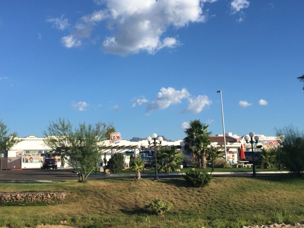
Paris is a mile from New York, and just across the street from Caesar’s Palace.  Less than a mile up the road is Treasure Island.

IMG_7509.jpg

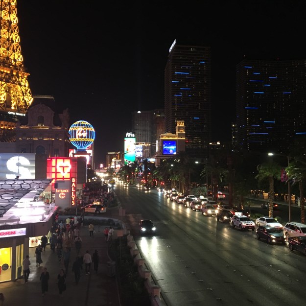
Suddenly midnight is “early”, and 3 A.M. is not too particularly “late”.

IMG_7505.jpg

Money transforms from paper into little round discs.  Suddenly, $5 is a “nickel”, and $25 is a “quarter”.

IMG_7482.jpg

People are suddenly willing to take on all sorts of risks they’d otherwise be unable to fathom.

IMG_7495.jpg

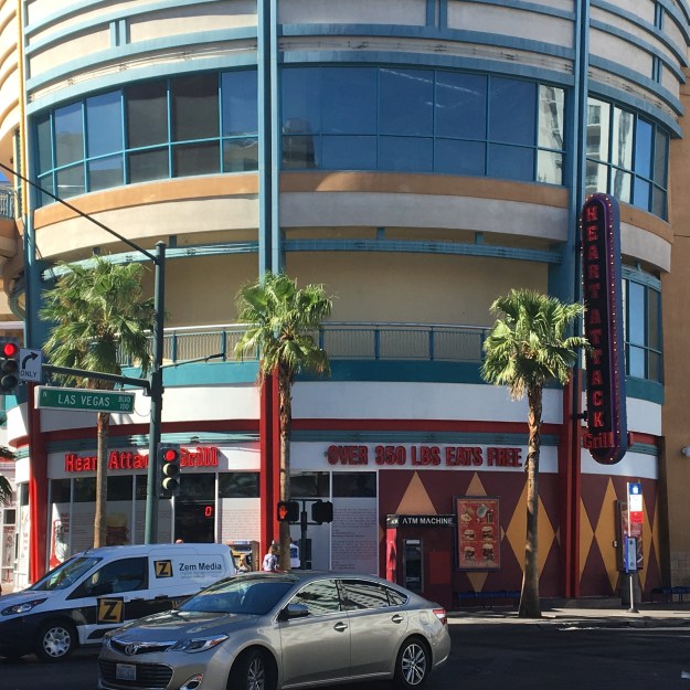
And, those weighing over 350 pounds, most likely typically shamed in their day-to-day life, can eat for free at a place called the Heart Attack Grill!

When I think of the people I talk to, or have talked to on a regular basis, I would say that Las Vegas appeals to roughly 2/3 of the population.  I do frequently encounter people who tell me they have no interest in visiting Vegas.  It is, after all, somewhat of a hyperbole for a certain aspect of adult life, particularly young adult life, that is wild and unrestricted, but also potentially destructive in multiple ways.

IMG_7488.jpg

Vegas got its start as a gambling destination.  Gambling is still probably the first thing anyone would think of when the think of Las Vegas.

Gambling in Las Vegas can be a number of different types of experiences.  There are plenty of different kinds of games and plenty of different kinds of experiences, from the fancier resorts, like Aria and the Wynn, to more affordable places like Casino Royale and Circus Circus.

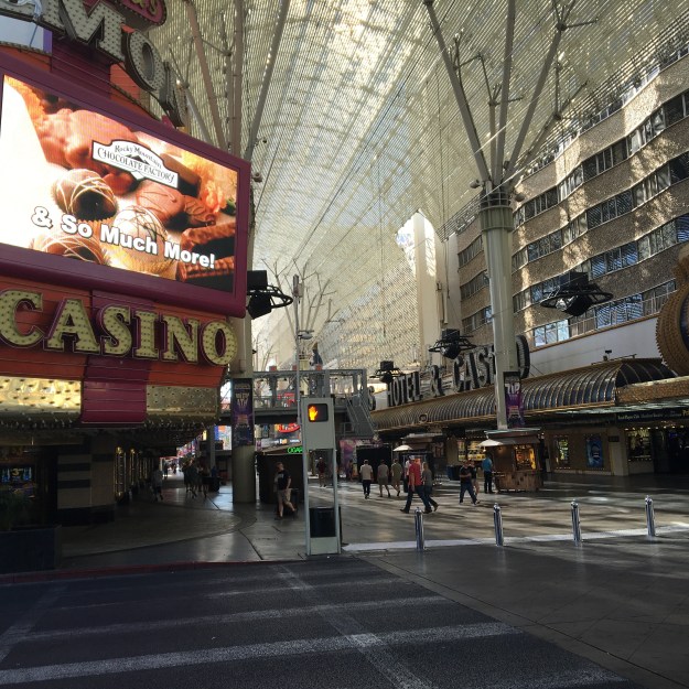
Those that prefer lower stakes can opt for a change of pace at the Freemont Street Experience.  This was the original Las Vegas, and some of these casinos, right in the heart of what is considered Downtown Las Vegas, a few miles north of the strip, are among the first ones developed here in the middle part of the 20th Century.

IMG_7492.jpg

The pedestrian mall in some ways is reminiscent of similar streets in other major cities.  The street almost becomes a non-stop party, with attractions, tons of places to drink (and in this case gamble), and areas where stages are commonly set up for bands to play.

My primary gambling mode is, and probably always will be, table games, usually black jack or craps.  On this particular trip, I found my sweet spot at places that fit somewhere in the middle of the spectrum, such as the Flamingo, Cromwell, Ballys and Treasure Island.

IMG_7504.jpg

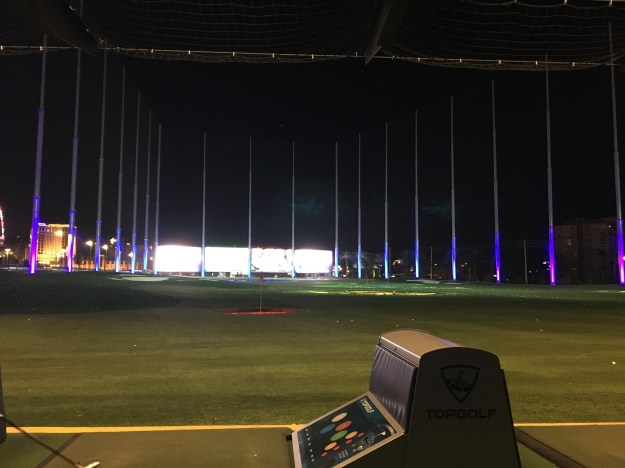
But Vegas is more than gambling.  In fact, there are plenty of visitors that come and do very little gambling, preferring to spend their time at the clubs, at pools, shopping, or taking part in another activity altogether.

IMG_7486.jpg

The common thread to everything that goes on here is that people are enjoying themselves, embracing their wild sides, in their own way, and letting go of at least some component of the restriction they live under during their normal lives, even if it’s as simple as piling up large amounts of foods that do not typically “go together” at a buffet.

IMG_7500.jpg

As a single entity, Vegas makes me think of what it would be like to live in a movie, or on some natural version of a drug high.  Everything feels more significant.  The dull parts are cut out.  There is no doing laundry, ironing shirts or anything like that.  Heck, even sleeping is reduced.  Decorations and shows appear everywhere in a manner that stimulates all five senses until they are overloaded.

I’d say the “real world” (however you want to define it) is not magical, but whose fault is that?  Could I be missing the “magic” that does occur on a day-to-day basis?  As people become entrepreneurs, find new relationships, have the courage to leave bad relationships, discover who they truly are, and go on life changing trips.  Could I be failing to take the opportunities to create “magic” when they present themselves?  When someone needs help, when someone has an idea, or when a truly splendid rainbow appears in the sky, just begging me to stop what I am doing, forget whatever my mind is currently fixated on, and just allow myself to take in the experience.

The truth is, with a good enough imagination, enough confidence, and a willingness to act, any place can be “magical”.  But, whenever I lose sight of that, I know I can always go back to Vegas to reconnect with it.

48th State

IMG_7464.jpg

Arizona is the third most recent state to join the Union.  The only two states admitted more recently are Alaska and Hawaii.  This means that, when it comes to mainland U.S.A., this very much was the “final frontier”, an area that remained wild and unsettled for over a century while areas were being converted from frontier, to small villages, and eventually into powerhouses connected by networks of trails, ports, and railroads.

img_7422

The primary cultural image of Arizona is the “Old West”.  Cowboys roaming around wide open spaces.  Small isolated towns where outlaws and town sheriffs fight a continuous battle that resembles the internal conflict we all have between the innate desire for freedom and the desire for justice and order.  Crazy games of poker in whiskey salons that often end in guns being drawn.

Historically, it is correct that Arizona, like much of the west, is the site of many epic battles that often lead to gunfire.  This lead to places such as Tombstone, and Rawhide, being depicted in numerous Western themed movies and TV shows.  Tourists today can relive the experience of the wide open, unsettled, west by visiting these places.

However, movies and TV shows can frequently lead people to inaccurate perceptions.  Films and shows are designed for entertainment purposes, and therefore must focus on the interesting aspects of life in a specific place, like a shoot-out between two gangs.  Anyone that compares their lives to those of characters from TV and movies will often come out feeling that their life is uninteresting.  After all, no movie will show someone sitting at a cubicle for six hours, or doing laundry and ironing shirts.  They focus on the parts that will, well, entertain the people that watch them.

Recent studies have indicated that, while these high profile gunfights did occur in the old west, they were the exception rather than the rule.  Some studies (although not all) have even suggested that the western frontier of the later 19th century was actually a safer place than America today.  There is speculation as to why the “Old West” is depicted and thought of in the manner in which it is, leading some to entertain conspiracy theories.  Regardless of what the reality of what life in this time and place know as the “Old West” was truly like, it is encouraging to see people look at it statistically, as opposed to based on anecdotes and catch phrases.

IMG_7415.jpg

Arizona may have grown up late, but it grew up fast.  Based on the 2010 census, Arizona is now the fourth most populous state west of the Mississippi River.

IMG_7420.jpg

Growing up in the middle to late 20th century, Arizona grew up in a manner that is very car-centric.  Depictions of present day Arizona life, in movies like Bad Santa, commonly show life in car-centic suburbs, with winding subdivisions, malls and such.

img_7443

There is also no forgetting Arizona’s position along the famed Route 66, which took countless motorists between Chicago and Los Angeles during the middle part of the 20th century.  In popular culture, the Arizona stretch of this major historic thoroughfare is amongst the most celebrated, providing the inspiration for the setting of the Route 66 based movie Cars.

The most high profile destination in Arizona is the Grand Canyon.  After all, the state’s nickname, which is labelled on all Arizona license plates is “The Grand Canyon State”.  However, by taking a road trip from Phoenix to Las Vegas, one will traverse the landscapes that cover a much larger portion of the State.

Passing through the Sonoran Desert, which includes Phoenix and much of the surrounding  area, one will encounter hills covered in sagebrush and cactus plants.

img_7441

Periodically, one will also encountered Joshua Trees, mountain ranges, and mesas.

IMG_7429.jpg

img_7431

Closer to Vegas, the landscape transitions to the Mojave Desert, which is sometimes even hotter, drier, and more baren than the Sonoran.

img_7447img_7450

Two developments made Arizona’s rapid expansion in population possible.  First, is the much discussed invention of, and subsequent proliferation of air conditioning.  This, of course, made living in places prone to hot weather more desirable.  The second is the creation of dams, canals, irrigation systems, and water pipelines, which facilitated supplying these dry regions with the water resources needed to sustain life.

IMG_7475.jpg

The Hoover Dam, located at the border of Arizona and Nevada, is one of many places throughout the west that diverts water resources from a major river (the Colorado River) to major metropolitan areas.


As is the case with the idealized image of the rugged individual of the “Old West”, present day life in Arizona, when discussed, elicits some divided responses, as well as some different interpretations.

img_7411

This is very much the image of standard life in Arizona.  A house in suburban looking neighborhood, a pool in the backyard, mountains, and, in many cases, golf.  Some love it.  Some see it as the natural culmination of the “American Dream”.  Some can’t wait to get away from the frigid winters many experienced in other parts of the country, move down here and enjoy the life.  Others, and particularly those concerned with the environment, feel it is irresponsible for so many people to be living comfortable lifestyles, with swimming pools, irrigated lawns, and golf courses in a climate this dry.  People here seem to adhere to the “haters gonna hate” mentality.  The knowledge that people in some distant land are disapproving of their living, eating, hiking, and golfing in the desert does not seem to phase them.

IMG_7413.jpg


Backpacking in the Weminuche Wilderness: Day 3

IMG_7252

The Weminuche Wildreness appeared to be particularly devastated by the recent Mountain Pine Beetle epidemic.  While a portion of the second day was spent above the tree line and in storms for much of the journey, we wound our way in and out of the forest, alternating between hiking through the forest itself, and hiking across an open meadow where we could gaze upon the forest to both our left and our right.

IMG_7229

Throughout the State of Colorado, and throughout the West, I observe areas where the Pine Beetles have decimated the forest, changing the ecosystem forever.  Nowhere, though, have I seen a higher concentration of dead trees.  I would estimate that, over the course of the trip, some 70-75% of all the pine trees I saw, were, in fact, dead.

IMG_7228

But I did notice some signs of life, particularly at the campground Sunday (Day 3) morning.  Tucked away amongst the densely pack forests of decimated trees, little signs of life seemed to appear.  It reminded me of many American cities, circa 1982, decay being the overarching theme but, signs of life and pockets of hope beginning to appear here and there for those willing to observe.  Maybe indeed, the worst has now passed for this particular forest.  As was the case for many of our cities, it is possible that in a decade or so, we will revisit areas like this, and see once again a thriving forest, albeit, as was the case with our cities, with a different character?

IMG_7246.jpg

As is typically the case on a three day excursion like this one, the last day was primarily a descent.  As we descended, we quickly reached elevations where Aspens, rather than Pine trees made up a significant proportion of the forest.

IMG_7267IMG_7268

Maybe it is different at this latitude, farther South than the Denver area, where I live and spend most of my time.  But, it feels as if in this wilderness, Aspen trees are able to grow at some pretty high elevations.

IMG_7302

We figured out the tree line here to be somewhere close to 12,000 feet in elevation.  When looking upon sections of forest from afar like this, it is easy to picture some of these Aspen trees living at elevations close to 11,00 feet.  Over the course of my four years in the Denver area, I had grown accustomed to them disappearing between 9,000 and 10,000 feet.

Sunday’s hike was a 7.3 mile trek along the Ute Creek trail (the East Ute Creek trail we had followed the previous day merged with the main Ute Creek trail).  The trail alternated a bit, climbing up and out of the valley formed by the creek for some sections, and descending back toward the creek for others.  Due to the previous night’s onslaught of rain, which likely impacted the entire valley, the trails on this, the final day, were at times even muddier than the were the prior two days.  At the end of three days, our total distance came out around 25 miles.  I speculated as to whether the extra distance we traveled stepping around puddles, and veering left and right to avoid some of the muddiest sections of trail, over the course of three days made this a mile or so longer than it would have been had the trails been completely dry.

IMG_7287

I personally added some distance on top of that.  I love side excursions, whether hiking/backpacking, cycling, or on a road trip.  And, in addition to the side excursion to the feature known as “the window” the previous day, I took one completely on my own the final day.  Roughly halfway through the hike, I saw a place where I could cut down to the creek, and see a mini-waterfall.

IMG_7291

The final part of the day consisted of a small climb out of the Ute Creek valley, followed by a descent back towards the Rio Grande Reserviour.

IMG_7299

It is inevitable that, on the last day of any trip, we all begin to ponder our return home, and a return to our “normal lives”, whatever they may be.  This return, though, is somewhat unique, as a trip into the woods is not just a journey away from our jobs, or certain responsibilities, it feels more like a complete separation from the modern world, or as some people refer to it, the “real world”.  All of us were separated, not just from work, but from TV, from the news, from Twitter, and even the manner in which society is structured in the 21st Century.

Since my return to Denver was a return to, after being completely separated from, the “real world”, I started to contemplate the “real world” as one big entity, which, even for a big-picture abstract curious minded thinker like me, turned out to be strange.  I feel like we often compartmentalize the “real world” into buckets; the working world, the relationship world, the school world, etc.  We will write blogs, have conversations, confide in others about our hardships, or celebrate our successes, with respect to one specific bucket of the “real world” at a time.  Some people will even chose to accept or rebel against the modern world on a bucket-by-bucket basis.  “I’m a freelancer, happily married with two kids and a picket fences house.”  “I work 9-to-5 for a large corporation, but I only eat organically certified food.”

I’m not saying there is anything wrong with any of the partially-rebellious lifestyles I am describing here.  We often try to oversimplify the actions and lifestyles of others as being either “conformist” or “rebellious”.  When I thought about life in the woods, and the few people that actually do it, live off the grid, and off the land, I think of those people as “rebellious”.  But, then I thought of human beings as part of the animal kingdom, and thought about what all non-domesticated animals do.  They live in the woods.  They hunt their food, many wandering around nomadically.  When thought of in that manner, it is us human beings, and our domesticated cats and dogs, that are rebelling against the way the rest of the animal kingdom works by farming our food and setting up permanent shelters.

IMG_7304

At the conclusion of our journey, we had to actually wade across the Rio Grand River to get to the car, as the trail ended abruptly at the river.  This likely explained why we did not see any other people the entire time we were on the East Ute Creek and Ute Creek trails yesterday and today.

IMG_7309IMG_7310

Shortly after leaving the trailhead, I saw what looked like baby mule deer living along the steepest part of the hill.

IMG_7323.jpg

Like the journey to the Wilderness, the journey home took us by some of Colorado’s highest peaks and most stunning mountainous features.  I thought of the “real world” I was gradually re-entering, the life I live and the journey I just took.  It is not important whether we are “conforming” or “rebelling”, because, like life in the woods, it can be thought of as conformist or rebellious depending on perspective.

Those of us that are honest with ourselves, and with those around us, will undoubtedly find ourselves in both situations.  We’ll find ourselves in a place where our choices are the same as those around us, and be suseptable to being labelled “conformists”.  We’ll also, at some point, find ourselves in a place where our choices are not those of the majority, and be met with skepticism, hostility, and possibly even pressure to change.  What matters most, is not fitting into an image we may have of ourselves, whether it be the upstanding citizen, rebel, outcast, or whatever, it is that we have the courage to be all things, depending on our setting, in order to be true to ourselves.

Backpacking in the Weminuche Wilderness: Day 2

IMG_7153

Before moving to Colorado, I experienced seasons in a completely different way.  While there would be some anomalies, for the most part, winter was winter and summer was summer.  Snow was something I experienced starting in November, through the winter, probably one last time in early April, and then not again for 6-9 months.  Likewise, heat would be primarily confined to the summer months.  In other words, I experienced being cold and being warm in two separate parts of the year.  The experience would generally only mix during the in between seasons; mid-spring and mid-fall.

In Colorado it’s all different.  In Denver I’ve seen temperatures reach the lower 70s (23 C) in the middle of February.  At higher elevations snow can fall nearly year round, and there are places where snowpack persists well into the summer.

IMG_7154.jpg

Saturday morning, the start of my second day in the Weminuche Wilderness, was a cold one.  The chill had awoken me at 3:00 in the morning, when I reached for my warm hat and for the zipper to zip my sleeping bag all the way shut.  At roughly 6:30 I woke up for good, and crawled out of the tent to find ice on the fly!  Frost was found on many of the items we left outside, including this bear cannister.

It warmed up fairly quickly at the campsite making me wonder why I did not simply stay inside the tent for another hour.  All the weather forecasts we had looked at prior to this backpacking trip had indicated that a wet period was coming to a slow end, and that each day would get progressively drier (lower probability of rain).  Yet, in the morning I saw something that would indicate differently; alto-cumulus clouds.  These are puffy clouds with a base somewhat higher up in the sky than the clouds we typically see.  On some storm chases, the presence of alto-cumulus clouds indicated the presence of moisture at higher levels of the atmosphere.  This was seen as a good sign on a storm chase, but, on a backpacking trip, is a bad sign.

The first few miles of the day took us by a lake we are glad we did not chose to camp at the prior evening, and then back into the woods, where once again the trail was muddy kind of on-and-off.

Headed farther up in elevation, towards the summit of the day, we approached the tree line, encountering several waterfalls.  This one, by far, was the most pictureqsue.

IMG_7175.jpg

I did not even know the name of any of these waterfalls.  In fact, I did not even verify that they even have a name.  It didn’t even seem important at the time.  We just liked what we saw.  At that time, most of the conversation within our group revolved around whether we would see marmots in the nearby rocks, and speculation as to what elevation the tree line was at at this latitude.

We followed the Rincon La Vaca (Cow Canyon) trail, which is also considered a section of the Continental Divide Scenic trail, above the tree line, and approached a rock formation we had been looking at since early the prior afternoon, “The Window”.

IMG_7183

This is where we decided to stop for lunch, at a lake where we could safely refill our water bottles.

IMG_7188

It was noon when we finished eating lunch and, four of us (out of a group of six) decided, despite the potentially ominous weather, to make a side excursion.  We dropped our packs and hiked the 500-ish feet (and half a mile) up to “The Window”

We got back to the lake, where our backpacks were, around 1:00.  As soon as we prepared to move, and catch up with the rest of the group, it started to rain.  A few minutes later, ice pellets began to fall from the sky.

IMG_7200

We briefly took shelter from the inclement weather, but eventually soldiered on through the not quite rain not quite ice, which would eventually change over to snow!

IMG_7203.jpg

I experienced a lot of this living in Chicago.  I called it “precipitation jambalaya”.  But, I never thought I would hike through it, and, well, am used to experiencing this in December, not late August!  Once again, that thing about the seasons!

IMG_7205

The precipitation stopped right before we turned off the Continental Divide/ Rincon la Vaca trail, and started looking for the trail we would take back towards the reservoir, the East Ute Creek Trail.

IMG_7207

The scene looked familiar.  The shape of the Ute Creek Valley where we were headed, with an open meadow surrounded by mostly dead forests on either side looked quite similar to the Weminuche Creek Valley we had hiked through the prior day.  The trail, though, was hard to find.

For the first mile we kept losing the trail, or we just saw it show up only as a barely visible line in the grass.  We actually speculated as to whether or not this trail was so infrequently used and/or maintained that mother nature was basically starting to take it back!

IMG_7213IMG_7214

We hiked until roughly 5:00 P.M., and by the time the day was over we hike a total of 10.2 miles (11.2 for those of us that took the side excursion to “the window”).  The last hour featured two crazy river crossings where we actually removed our socks and shoes.

We found a campground near a small lake called Black Lake, where, once again, the weather took a turn for the worse.

IMG_2867.JPG

The rain started shortly after 6 P.M., and did not let up until after sundown.  I rushed back into my tent!  With all of the experiences of the day, the mixed precipitation at over 12,000 feet elevation, wading through water, and now, once again, more icy rain, I was cold!  I was way colder than I wanted to be, and way colder than I ever imagined being in the month of August.  For the first 20-30 minutes, I had to lie sitting still inside my sleeping bag, otherwise I would start to shiver.

All I could think of were things that were HOT and DRY.  I wasn’t even thinking of warm, pleasant experiences, like drinking rum on a beach in Puerto Rico at sunset.  I was thinking about things that would immediately heat me up and dry me off; sheets that were pulled directly out of the drier, a sauna, Death Valley!

IMG_7237

With the hard hiking parts over with, I had originally hoped to have kind of a party with the group on Saturday night.  We had even brought flasks, filled with whiskey for such an occasion.  But, the weather changed my plans, as the rain continued and I continued to periodically hear thunder through the 7:00 and 8:00 hours.

I also did something I never do on group trips; read.  I joke I often bring a magazine or even a book, places, but never touch it.  This time I actually read.  It was the July edition of Adventure Cyclist.  Fitting for the mood, thinking about warm places while trying to stay warm, I read full stories about cycling journeys through Morocco and Hawaii, both warm places!

I guess regardless of whether you are in an urban setting or in the wilderness, life has a way of changing plans.  In the city, it is some merger, or a random change in commodities prices.  In nature, it is the weather.  But, when it comes to rain, and anytime rain changes my plans, I always do my best not to complain.  Even while I was bummed that I was not partying with my friends and hating how cold I was in my tent, I was mindful to remember that rain is necessary for the food we eat, the water we drink, as well as everything that made this trip possible in the first place.  I do not want to be one of those people that fails to realize this, and cannot put up with a little bit of rain.


Backpacking in the Weminuche Wilderness: Day 1

G0141034.JPG

During the month of August I had fallen back into some bad habits.  In particular, I’d fallen into the very habit I often criticize my own generation for: scrolling.  I know the costs outweigh the benefits.  By gazing at the predictable content of our news feeds and customized social media echo chambers on our phones, we miss out on countless opportunities out there in the real world, all to avoid the discomfort of boredom, or a potentially awkward interaction with another human being.

It’s not just about scrolling.  Scrolling is what we all see.  It’s the same routine day in and day out.  It’s going to the same bars and restaurants over and over.  It’s watching movies and TV shows we have already seen multiple times instead of calling people up and organizing a social gathering.  It is all the things that we do because the alternative requires a greater amount of effort.  It’s low risk, low effort, and low reward.  Unfortunately, for me, it lacks stimulation, it lacks enthusiasm, and over time can even lead to depression.

I haven’t thought of a better word for it than “defaulting”.  I often feel as if there is some sort of invisible force always dragging us toward this kind of life, this “defaulting”.  There seems to be a constant struggle, to mix things up, to avoid the mundane, to avoid losing contact with people.  And, while I think my personal record is pretty good (i.e. all the things I write about in this blog), there are times when I get tired of the struggle, and times when I do feel as if this invisible force is indeed advancing on me.  At these times, it is good to have some sort of activity, or some sort of trip that helps us hit the “reset” button.

IMG_7091.jpg

For this purpose, there truly is nothing like going into the woods, away from it all, out of cell service, completely out of my comfort zone, and in a place where “defaulting” is not only no longer easier, but not an option at all!

Our three day backpacking trip began at ThirtyMile Campground, just a mile or so east of the Rio Grande Reservoir.

After passing by a weather station, that is near and dear to me, as it is one of the stations that helped me calibrate the mean impact cold air funneling, in valleys throughout Colorado, has on nighttime lows, we encountered the Rio Grande Reservoir within the first mile of our trip.

IMG_7098.jpg

Going into this trip, which had been planned for several weeks ahead of time, we knew there would be muddy trails, and a heightened chance of rain.  Not only is Southwestern Colorado the most active part of the state during the late summer monsoon season, but this past weekend featured an active pattern in the region.

Friday was supposed to be the most active day, with regards to chances for precipitation.  Yet, we lucked out.  Leaving at 10 AM, after enjoying a nice relaxing morning at the campground, we hiked 7.5 miles, up the Weminuche Trail, dealing with very little rain, only with muddy trails.  Mindful of the storm threat, we stopped shortly after 3:00 P.M., having found a good spot to set up camp, near a stream and some trees.  Despite the periodically ominous looking skies, the storms held off until after sundown, giving us plenty of time to set up camp, cook a nice meal, and take in the wilderness, now being officially away from civilization.

I felt exhausted at the end of the day, as I had not gotten a good night sleep the prior evening at the campground.  So, I ended up going to sleep shortly after sundown.  With two backpacking trips behind me, I am starting to think that sleeping even more than the normal 7.5 hours per night is pretty normal on trips like this.

I spent the last waking hour of the evening inside the tent, listening to the sound of gentile rain tapping on the fly.  Under normal circumstances, many of us drown out these sounds, with TV, music, or some other sound.   Hearing this sound, for nearly an hour before falling asleep made me imagine a completely different life.

I imagined myself, as I often do, as a completely different person, with a completely different personality, upbringing, circumstance, and desires.  I imagined myself living in the woods, in a cabin of sorts, not too unlike the kind many people in Michigan, Minnesota, or Wisconsin have today.  It would be a modest sized cabin, with one main room, a bunch of bedrooms, a kitchen, and a closet, to keep things like cross-country skis, wet suits, and all of the other necessary equipment.  But, I would not have too many high tech or expensive toys.  It would be a life in a small community of sorts, where people know one another, spend a lot of time over at each other’s houses for dinner and games.  It would be a life way closer to, and way more connected with nature.  It would be a life that would never satisfy the real me, as restless as I get for one adventure after the next, one major social interaction after another, and testing limits.  But, for this alternate person I imagine myself being, as I drift off to sleep on a rainy August evening high in the San Juan Mountains of Southwest Colorado, it is perfect, cozy, and quaint.


Three Truths About Paradise

IMG_7012.jpg
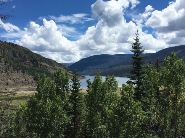
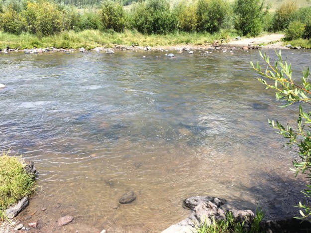
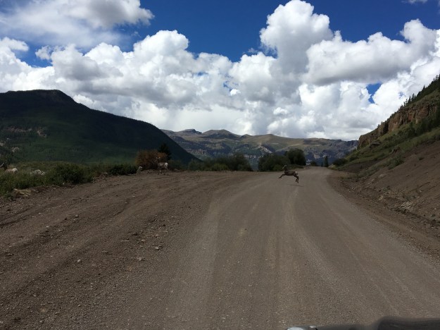
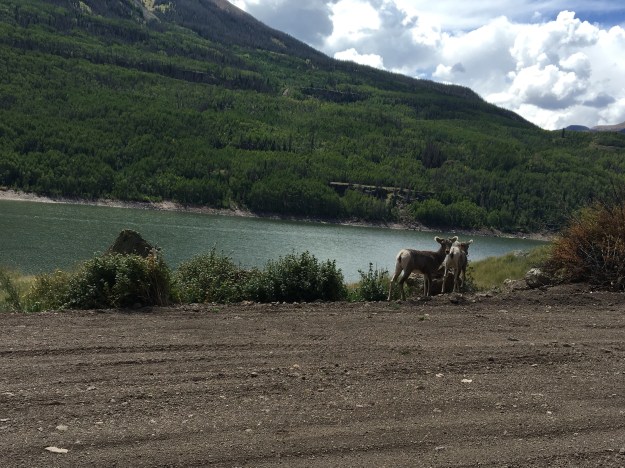
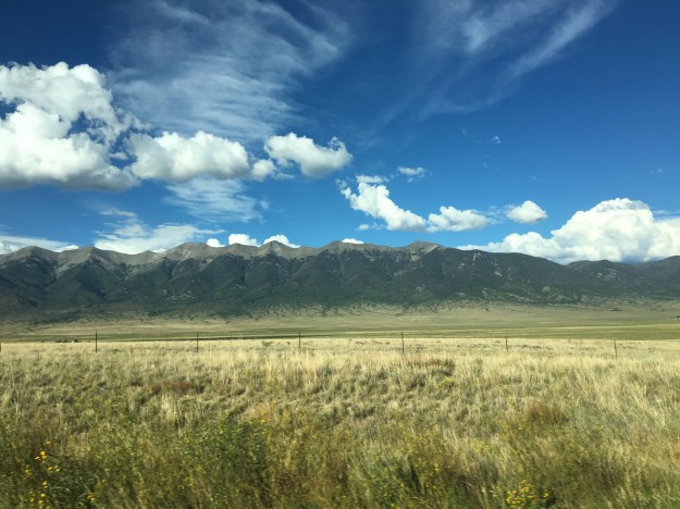
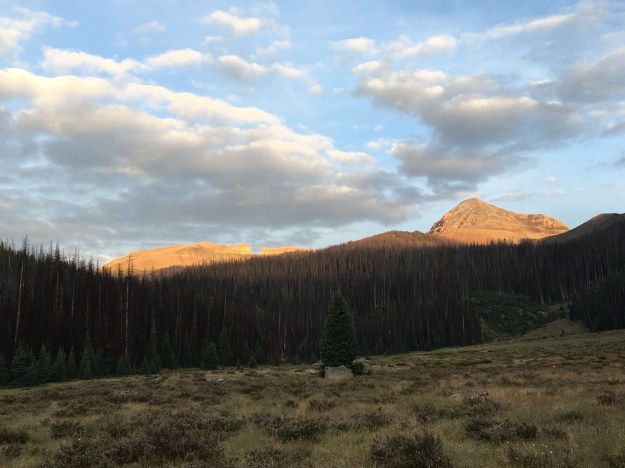
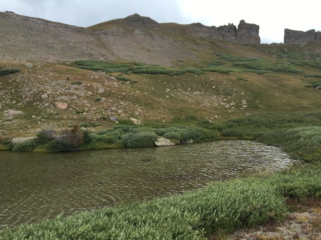
Our ever evolving languages can often lead to some complicated terms, and concepts that can often be difficult to both describe and properly comprehend.  One of those concepts is paradise, this concept of a place where everything is ideal, happy and worry free.  But, in various places within our culture, there are vastly differing depictions of it.

IMG_3697

Last year, I rode my bike through a place called Paradise Valley, in Southern Montana, along the Yellowstone River Valley.  This “paradise” is a calm, quiet, and sparsely populated picturesque landscape in the mountains.  When many people here in Colorado talk about “paradise”, they are commonly discussing places that meet this very description.

IMG_2847

A google image search for the word paradise primarily produces images of a tropical beach.  This is the image of paradise depicted in commercials for products like Corona.  In my observation, this is the most common way paradise is depicted in our culture, and for anyone that has ever spent a winter in the Midwest, it serves as a dream vacation.

And then there is the world of music, and its plethora of widely varying references to paradise; As a specific act of intense sexual pleasure (L.L. Cool J.).  As a hyperbole for a horrible life situation (Phil Collins).  Sarcastically (Green Day).  Detroit based rapper Big Sean comes closest to appreciating the true, complex nature of the concept, when, in his song, Paradise, he discusses his lifestyle as a whole, and the pride he has taken in earning it.

IMG_7006.jpg

I wasn’t expecting to find any inspiration here at Evergreen Lake.  I mainly came up here to free myself from the distractions at home, and also avoid the 90 degree heat in Denver, without traveling too far.  I did not know what to expect from this place.  I hoped to find somewhere I can alternate between walking and reading.  What I saw was a popular public place, with outfitters renting out paddle boats, stand-up paddle boards, and other strange water contraptions, families having picnics, and groups of friends just enjoying themselves in the areas surrounding the lake.

It felt like paradise- sort of.  In a way, it felt reminiscent of paradise, what it truly is and isn’t.  The concept of paradise is kind of complex, but lost in all of our songs, pictures, and conversations, are three basic truths about paradise.

  1. Paradise is not just a geographical location- it’s a setting!

It’s the time of day and time of year.  It’s who you are with (or not with), your situation, and what’s on your mind.  It’s a “setting”, in the full sense of the word, as it is applied to stories, plays, etc.  This can include not only the place a person is, but where they just were, where they are going, and how they feel about all of it.

  1. Paradise is different for every person.

Gazing upon people giggling amongst each other, playing games, paddling their boats and such, I realized that, as a true extrovert, my version of paradise is probably not this quiet retreat in the mountains, or an empty beach.  It probably falls a lot closer to Big Sean’s, a life well lived and earned!  But, also a place where people are interacting with one another in a manner that is enjoyable.

  1. We often don’t recognize paradise until after the fact.

I was inspired by multiple specific things I saw.  A group of older people playing bocce ball reminded me that life did not have to become dull and uninspiring with age (as I often fear).  There was also a group of younger people, cheerleaders, doing cartwheels and giggling about what had transpired over the course of their weekend.  Witnessing this reminded me of all of the times I had spent socializing with good friends over the past decade or so.  It was almost like a montage playing through my head.

I recalled the times I would be envious of people in a large group that seemed to be doing something more interesting than what I was doing, only to remember how frequently, I am on the other side of that equation, part of a large group, likely being obnoxious.  I recall in particular, one time, in Chicago, when I tried to replicate the experience of passing around a boot of beer, a German tradition also common in Madison, Wisconsin.  I found a place that served boots, and assembled a group of a dozen or so people only to realize that this was more of a family establishment, and not necessarily a place to go to recreate college type antics.  We still had a good time, and there may have been some that wished for that level of excitement out of their evening!

Of the crowd at Lake Evergreen, I wonder how many of them are like me.  I wonder how many of them are enjoying their own personal version of paradise, and, as I had so many times in the past, not realized it until a couple of weeks after the fact.

Cycling from Denver to Cheyenne

IMG_6854On the evening of July 3rd, having just finished an exhausting six-day bike ride, including four days of cycling over one hundred miles, my body felt a bit relieved.  I was actually ready to rest, ready to sit in front of a computer again!  Clay, however, told me that I was going to wake up the next morning, realize I was not biking 100+ miles and not know what to do with myself.

The truth ended up being somewhere in the middle.  I could not have pictured cycling at all the next day.  This was literally how I felt.

IMG_6644

The next day, I biked six miles, to and from Union Station from my home.  And, I was perfectly fine with that.

However, I did eventually get antsy, despite two other, closer to home adventures.  By Tuesday July 19th, I posted this picture on Instagram, stating I was bored and wishing to get on my bike and explore again!

IMG_6808

I ride the new RTD A-Line train, which connects downtown Denver with Denver International Airport, roughly three days a week for a gig I am currently working at the airport.  At Central Park Station, one of six intermediate stops between downtown and the airport, this curious piece of potentially symbolic artwork sits atop a pillar.

IMG_6809

Whenever I am on the train, and not trying to sleep for efficiency sake, I see it, and sincerely wonder what its purpose is.  It seems to depict a person running to catch the next train, but headless.  But why headless?  Could it actually be a satire on the futility of the rat race?  Could the artist who created the sculpture have had an alterior motive?  Could he or she have created this sculpture with the secret hope that a few commuters each day would look at this sculpture and be prompted to ask; what am I doing and why am I doing it?  Is this the life I wanted?  Is this the natural state of human condition?  Etc.?

I, however, had other plans, actually for the next Friday, and, they once again involved my 2012 Bianchi Cyclocross bicycle.  The Cheyenne Frontier Days Rodeo was starting, and, I was going to ride my bike there!

The prior evening, I spent the night in Broomfield, after a softball game in Boulder.  So, even before this next 100+ mile bike ride, I was already spending some significant time on my bike again.  Knowing it was going to be hot, we got an early start.  I actually wish we had gotten an earlier start.

BikeRoute_DenvertoCheyenne

A lot of people hear about my bike adventures and immediately sounds perplexed…

Is there a trail there?

Are there safe roads to bike on there?

There’s a lot of trucks on that road.

I would never ride my bike on those roads, you could get killed.

Etc.…

There is some risk, no denying it.  When I was a child, one of my favorite bands, the Offspring, told me “Back up your rules.  Back up your jive.  I’m sick of not living just to stay alive.”  More recently, Drake told me, “Everybody dies, but not everybody lives.”  The truth is that there is the possibility of death doing nearly everything.  People die on the slopes.  People die rafting.  But, people also die commuting to work.  And, due to the health risk factors such as cardiovascular disease and such, sitting around watching television can be deadly!

That being said, I still considered risk when choosing a route, and am still willing to go a few extra miles to reduce my risk.  I am just not willing to miss out on opportunities altogether out of fear.

IMG_6814

The first part of the ride was pleasant, 95th St. from Broomfield to Longmont is a road I knew had bicycle accommodations in the form of bike lanes or wide enough shoulders.

Longmont was a little bit tougher to navigate.  Like many towns, their bike route network was designed primarily with travel within the town in mind.  I stared at their bike map for a good half an hour to figure out the best route through town, but it ended up being a fun route.

IMG_6817

I particularly enjoyed all the sculptures along the Saint Vrain Greenway!

IMG_6818

One thing people miss when they drive along I-25 between Denver and Fort Collins is how many lakes there are in the area.  On the interstate, there are none.  On this route between Longmont and Fort Collins, through Berthoud and Loveland, we actually saw a lot of lakes.

I’d been pondering riding my bike from Denver to Cheyenne for years, even going as far as thinking about some of the details, such as what time of year to go and what route to take.  As soon as I started thinking about routing, there was one segment I knew I was going to do, the combination of Taft Avenue and Shields St. through Loveland and Fort Collins, roughly half a mile west of highway 287.  This straight shot through both towns has a bike lane the entire way, and made navigating through Loveland and Fort Collins was easier than navigating through Longmont.

IMG_6821

This is where I started to feel the heat, which was right around 10:30 or 11:00.  The temperature probably hit 90 sometime while we were in Fort Collins, making me regret having not left even earlier than we did (we departed at about quarter to 7 in the morning).

Also, the wind had a slight easterly component that day.  This made the next two segments of the ride, first from Fort Collins to Wellington, where we stopped for lunch around noon, and then from Wellington to Nunn to reach U.S. highway 85, quite possibly the most challenging segments of the ride.  I had this nagging feeling about entering Weld County.  I do not know why, I just felt as if something bicycle unfriendly would happen to me in this county specifically.  It was mainly just a premonition that bore out to be true, just not in the way I had anticipated.

IMG_6845

Upon entering Weld County, the road we were following switched to newly paved blacktop, while the temperatures had climbed probably into the mid-90s.  This lead to the closest thing to heat exhaustion we would experience during the ride.

IMG_6846

By the time we reached Nunn, we were desperate to get out of the heat for a few minutes and get some water.  Unfortunately, despite the fact that Nunn has a water tower that says “Watch Nunn grow”, I’m 100% sure that my calf muscles were growing faster than Nunn that day.  The only place we could find to fill up our water bottles was the police station/town hall, and the only reason that option was available to us is because we were riding on a weekday (Friday).

IMG_6847

We followed U.S. 85 for the last 30 miles of the ride.  We ended up having to wait out a mid-afternoon thunderstorm near the Colorado-Wyoming border, at the only building within a 10-mile radius.

IMG_6850

The storm was, however, neat, and I felt as if I were storm chasing on my bicycle (even though in real life that would have been a disaster).

We arrived in Cheyenne during rush hour, which was a little nerve racking as this is the only part of the ride where the shoulder on U.S highway 85 disappears, the last couple of miles before entering town.

After 109 miles of riding, we were there, Cheyenne Frontier Days, miraculously with enough energy left to party, parade, and rodeo!

A Moderate Hike at Reynolds Park

IMG_6790
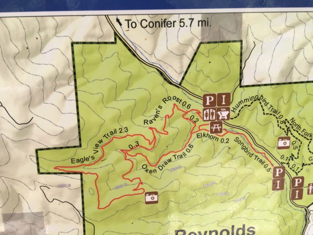
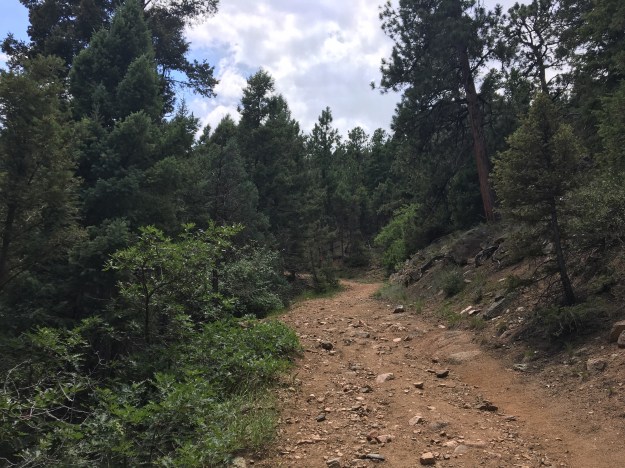
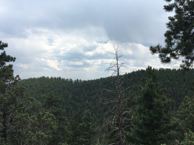
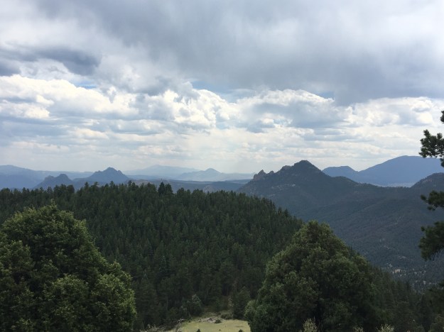
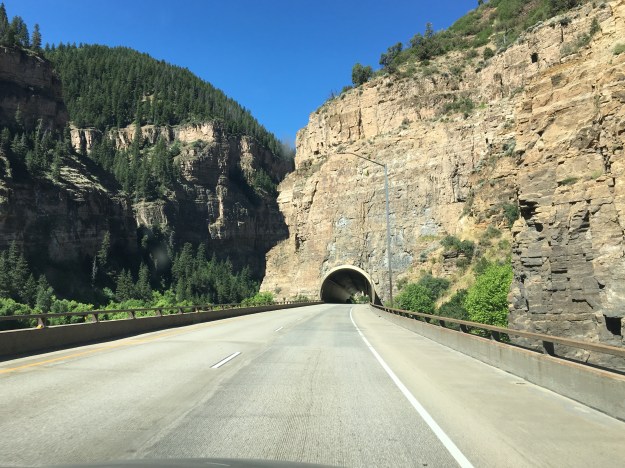
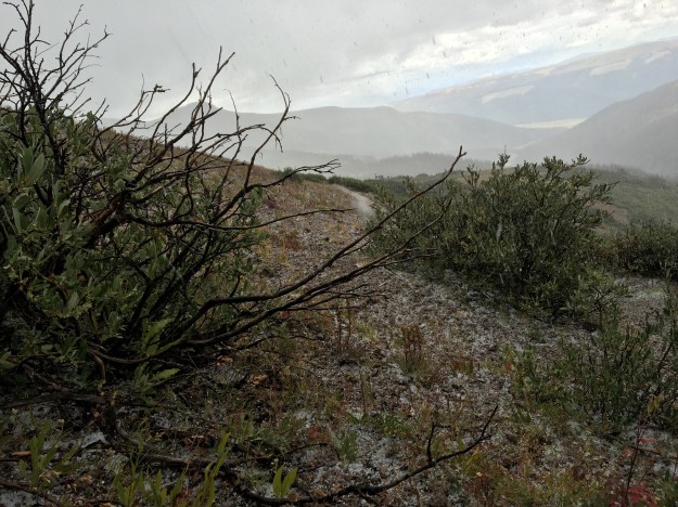
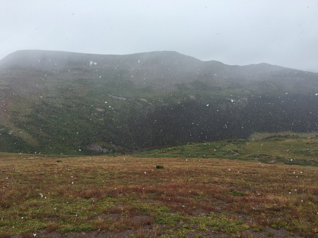
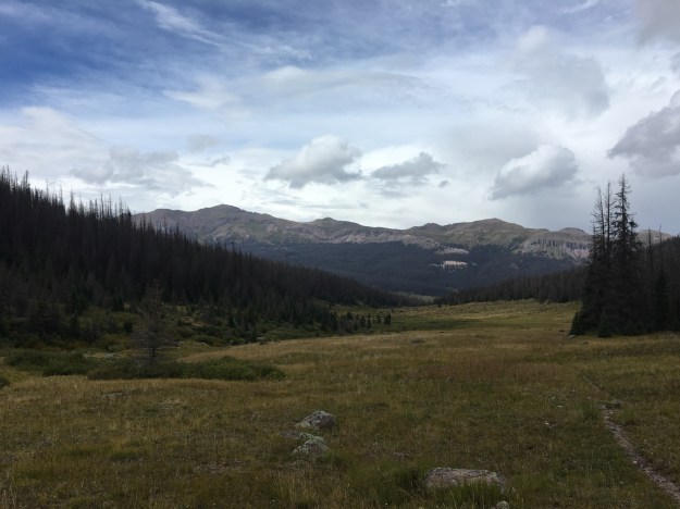
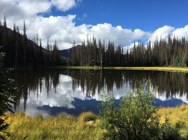
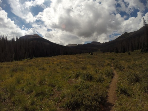
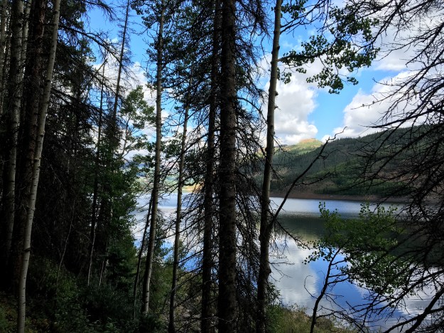
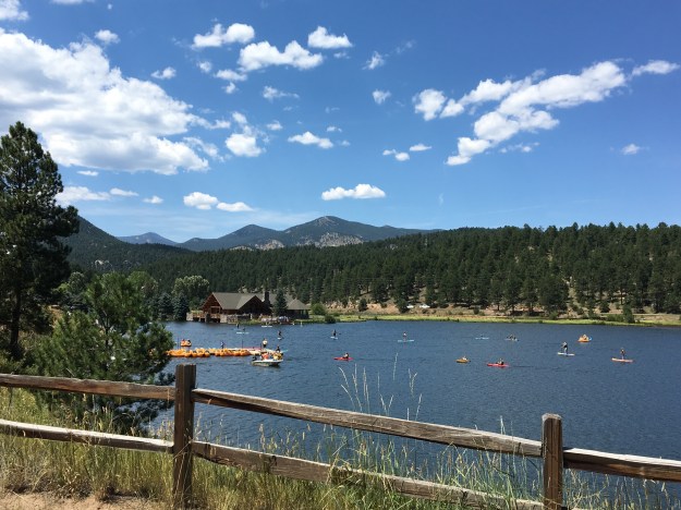
I became interested in the weather at a young age, in part, because its impact on all of our lives is quite evident, almost every day.  While the weather has an impact on nearly all aspects of our lives, it has the greatest impact on many of the activities we take part in for enjoyment and fulfillment.  Activities such as hiking, playing on a friendly softball team, or having a family picnic in the park take place outdoors, and require a certain type of weather conditions, otherwise they are either not possible or not enjoyable.  For many, including me, activities like these make up an essential part of life, an essential part of feeling “alive”, and an essential part of the human experience.

The weather also behaves in a sort-of predictable but sort-of not predictable manner.  From sheer observation, we can recognize certain patterns in how the weather behaves.  But, there are always some surprises, some deviations, something to keep us on our toes.  If we always knew what exactly what weather conditions to expect, some aspects of life would be easier to plan, but the weather would be far less interesting.

In Colorado, each season presents a different set of considerations.  In winter, we watch the snowpack grow, as well as when and where storms that make travel perilous hit.  In spring, we watch as the snowpack melts and the runoff produces both rapids, and potential floods.   In the summer, an issue for some in places close to Denver, Fort Collins, Pueblo, etc. is the heat.  Mid-summer in particular can get quite hot in these locations, with most days reaching highs in excess of 90 degrees.  Those looking to avoid this heat can do one of two things; wake up early or travel to a higher elevation.

I needed a calmer weekend.  The summer had been active, and I still have to expend some energy in order to make a living.  I am not extremely lucky or extremely wealthy.  But, I am hardly one to sit inside all weekend in the middle of the summer.

IMG_6761

Luckily, there are places one can get to from Denver in roughly an hour, sometimes less, that offer moderate intensity hikes at a high enough elevation to escape some of summer’s heat.  One such place is Reynold’s Park, close to Conifer, where we were able to find a set of trails that offer a six-and-a-half-mile loop, with a vertical climb of just over 1000 feet.  This hike is described as “moderate” in difficulty (as opposed to the hanging lake trail, with a similar vertical climb that is described as “strenuous”), and I would certainly agree with the assessment.

IMG_6763

We took the loop in the counterclockwise direction, using the Raven’s Roost Trail to connect to the Eagle’s Nest Trail.  I am actually glad we decided to take this loop in this direction.

IMG_6765

We spent roughly an hour getting to the summit, and were fortunately enough to be shielded from the sun for part of the time, due to both sections of denser forest, and partial cloud cover that afternoon.

IMG_6779

However, hiking the loop in this direction, we actually saved the best for last.  After “summiting”, there was a section of the hike that was generally flat, and also densely packed with pine trees.

I guess we “descended” a little bit, meaning 150 feet or so into the valley of a small creek.  When we popped out of that valley, we actually encountered the best view of all, as a clearer (from trees) section of the trail gave us clear views of some of the more interesting rock formations in the distance, including “cathedral rock” in the background of this photo.

IMG_6789

As we descended, I thought to myself about how sometimes I do get disappointed when I do not “save the best for last”.  What a letdown it is indeed when the best part of any hike happens within the first 45 minutes!  In fact, every time I eat a meal there is always a battle going on in my head.  I genuinely want to save the best for last, meaning, saving my favorite parts of the meal for the end.  But, I also do not want to get full on the other stuff, and not have enough room for what I enjoy the most.  This is what makes collecting the proper food at Indian Lunch Buffets a particularly daunting task.  Anyone going to one should know their appetite.  In fact, I suggest only going when there is a robust appetite, particularly for those with FOMO (Fear Of Missing Out).

I’ve been trying to, of late, capture some better pictures of wildlife.  While I haven’t necessarily been out in search of it recently, I have been trying to keep my eyes out for it, as opposed to just looking for waterfalls, unique rock formations, summits and the like as I typically do.  The previous week, in Glenwood, I took this photograph of a chipmunk eating a little cracker (also posted in my previous entry).

IMG_6701

At Reynolds Park, I got a chance to take this amazing close up photo of a butterfly in the parking lot after the hike.

IMG_6796

In fact, this particular butterfly chose to land on a yellow colored post and sit there with its wings out, color coding herself in a manner that almost felt like it was purposeful, as if the butterfly somehow thought there was a possibility it would get famous from this photo; possibly ending up as the July photo in a 2017 Butterflies of Colorado calendar that people will see at the mall, or at Barnes and Noble.

IMG_6793

Add to that the craziest sap discharge I have ever seen (okay, trees really aren’t wild but you get the picture), and, well I was pretty successful in trying to expand my photo-taking to new horizons.

In a divine sort of sense, sometimes I wonder if one of the reasons for changes in seasons, changes in weather patterns and such is to ensure that people are forced to go to different places, try different things, and have some kind of a variety in their lives and activities.  It is easy to do the same thing over and over again, but it is also the least satisfying way to live.  But, sometimes we need a push.  Whether that be some sort of tough situation at work, an unwelcome new presence in our community, a terrible breakup or anything else, sometimes the silver lining in all of it is getting involved in something new, something more satisfying than what was before.  While 95 degree temperatures and exhaustion are certainly less extreme than any of these situations, I know it helps push people towards variety and is giving at least some other people a chance to select a more moderate activity while taking time to appreciate nature, have a nice chat with friends, or, in my case, both.

Glenwood Springs: Where Canyon Country Begins

IMG_0014.jpg

When people think of the American West, certain images often come to mind:  the unique natural features of Yellowstone.  Iconic mountains that tower over the nearby landscape, such Rainier and Hood.  The canyons that carve through the American Southwest, creating popular destinations such as the Grand Canyon.

The Grand Canyon is not the only canyon of the American West.  In fact, it is not the only canyon carved out by the Colorado River, the continent’s fifth longest running river.  The river, has its source at Rocky Mountain National Park and snakes through the west carving out  numerous canyons.  In fact, there are some that believe that the canyon in Southern Utah that was flooded when Glen Canyon Dam was built, a couple of hundred miles upstream of the Grand Canyon, was even more scenic than the Grand Canyon itself (some are even looking to remove the dam despite the Wests water needs).

An overly simplified model of Colorado’s geography, is that of the three flavored boxes Neapolitan Ice Cream.  Colorado’s three sections are the Plains, the Central Rockies, and a region generally referred to as the Western Slope.  While the Western Slope is officially defined as anywhere west of the Continental Divide, culturally, we tend to think of it as west of Ski Country, which also happens to coincide with where canyon country begins.

Glenwood_20160725

On the above map, the two yellow stars are Denver, where the Plains end and the Central Rockies begin, and Glenwood Springs, where, traveling west the terrain transitions from tall peaks to canyons, mesas, and plateaus.

The official reason for the trip to Glenwood this year was whitewater rafting, a group trip that I organize every year, with a different destination each time.

This year, the trip was a little bit later in the season, early July, rather than mid-June.  The later date allowed more of the mountain snowpack to melt, particularly this year, as the period around the fourth of July was quite hot across the state.  As a result, the rapids were not nearly as intense as the previous two years.  However, the trip was not without its moments.  This time, everybody stayed in the raft!

As was the case last year and the year prior (this is the third year of my annual trip), we camped.  We selected a somewhat peculiar place to camp this year, on top of the White River Plateau north of town.

IMG_6664

To get to the Plateau, we had to follow a road called Coffee Pot Road, a bumpy road that rose up out of the Colorado River Valley below us and onto the plateau several thousand feet above it.

IMG_6661.jpg

Here is where I fully came to the realization that I was on the border of two of Colorado’s “stripes”.  Looking east from the campground, in clear view are the tallest peaks of the Central Rockies, the Sawatch Range, which includes Mount Evans, Colorado’s tallest peak.

IMG_6715.jpg

A mere mile to the west of our campsite sits Deep Creek Canyon.  I had no idea this canyon existed.  Deep Creek is a tiny creek, carrying very little water at the time we saw it.  Yet, it manages to carve a 2100 foot deep crevice in the landscape in a manner similar to Black Canyon and other Western Canyons.

IMG_6667IMG_6669

What really made this feel like a peculiar place to camp was the range of temperatures we would experience over the course of the weekend.  We spent the middle part of the day in the valley, first rafting in the Colorado River than in town, all at elevations below 6000 feet.  Daytime temperatures soared well into the 90s!  At night, we returned to our campground, above 10,000 feet in elevation, where nighttime temperatures fell into the upper 40s.  If one were looking to experience comfortable temperatures, it would make sense to do the exact opposite, spending the daytime hours at higher elevations where it is cooler and then returning to the valley at night.

IMG_6682

The town of Glenwood Springs is a touristy town.  Everyone around, from the rafting instructors to the bus drivers describe it as such.  However, it is touristy in a different way than some other places I’ve visited.  I didn’t see 50 ice cream shops like I do in South Haven, MI.  I did not see anything like Ripley’s Believe it Not or the other places I see at the Wisconsin Dells.  And, I certainly didn’t see 150 T-shirt shops as I do when I visit Cooperstown.  It seemed like more bars and restaurants than anything else here.  And, of course, one of Glenwood’s other main draws, the hot springs.

IMG_6683

Maybe Glenwood’s tourism industry is simply trying to accommodate a different mix of people than those other places, or maybe they are simply trying to stay true to their own unique identity.  After all, there are a lot of activities in the area, and a lot of reasons for people to visit.

IMG_6680.jpg

Just east of town, is the area known as Glenwood Canyon.  Due to the narrowness of this valley, there are sections of I-70 where the speed limit drops to 50 miles per hour, the westbound lanes are stacked on top of the eastbound lanes, and parts of the highway are tunneled underneath rock that goes right up to the River.

IMG_6684

It is in this canyon, several miles east of town, where Glenwood’s signature hike, Hanging Lake Trail draws so many tourists, that the parking lot is commonly full.  In fact, both Friday and Saturday, highway signage indicated that this lot was full anytime we drove by it.  We were able to get parking spots in the later part of the afternoon, around half past four, after the rafting trip, and lunch in town.

Hanging Lake is a short but challenging trail.  Only 1.2 miles long, it climbs 1200 feet in elevation.  This, both made sense and surprised me at the same time.  Being in a canyon, I knew that any hike in the area would be steep, and this one sure had its steep parts.  What surprised me was, how far up the canyon hanging lake is.

IMG_6691

I had seen pictures of this lake before, and knew the trail was short, I just pictured it being much shorter and much closer to the bottom of the canyon.

The trail was crowded, which should not be surprising, given that the parking lot was still almost completely full when we arrived.  What surprised me was the ethnic diversity of the crowd hiking this trail.  On the way up to hanging lake, which probably took a little over 30 minutes, I heard people speaking all sorts of different languages!  I enjoyed seeing so many different kinds of people enjoying scenery, nature, and, as I speculate, a weekend away from it all.

There is only one area attraction I did not get to, the Glenwood Caverns Adventure Park.  It’s hard to get to everything on a short weekend trip.  I guess there is still a lot more for me to see here in Glenwood, where Westbound travelers leave the high peaks of the Central Rockies and enter the land of deep canyons.


Cycling Northern New England

Selecting the best possible route can be a challenge on bike trips.  In an ideal situation, there would be a direct route, a road or a trail, safe for cycling, pleasant, providing a direct path from point A to point B, and conveniently jaunting by all of the point Cs that are of interest along the way.  In the sparsely populated West, there rarely is an ideal route, but there often is only one option.  I could not picture taking any route other than the standard cycling route when traveling from Portland, Oregon to Missoula, Montana.  When following one of the Adventure Cycling’s bike routes, the job of selecting the best possible route is already done, by experts with tons of experience bike touring.

Being in neither situation, we spent the better part of an hour looking over maps before settling on the ideal route from Greensboro, Vermont to Conway, New Hampshire.  Choosing a route in places like this can often be a matter of factoring in various considerations and determining how to manage priorities.  I’d predict that six different cycling groups would select at least four different routes for this particular ride.  Some people want to avoid adding extra miles to an already lengthy ride.  Others wish to avoid obstacles such as wind, hills, and towns with numerous stoplights.  Others still may prioritize seeing as many sights as possible, while there are probably some that just want to find the safest route.

We had imperfect information, as in we couldn’t find information such as whether or not certain small roads are paved, or whether roads like U.S. Highway 5 have a wide enough shoulder for cycling.  Still, we took kind of a balanced approach, and I believe the route we selected served us well.

The first 45 miles of the ride were in Vermont.  On this first segment, I got what felt like the full Vermont experience, in a way I never could have had traveling by other means.

IMG_6540

I stopped in one of those off the wall small town convenience shops that is sort of a grocery store and also sort of a cultural center.

IMG_6541

I rode by lakes.

IMG_6546.jpg

Over some rolling hills.

Got to stop in one of those cheese and maple syrup shops with the arts and crafts and all.

We went by a couple of houses with interesting designs in their front yard that made me simply say, “That’s so Vermont”.  They screamed some sort of combination of people having a lot of time on their hands, and also looking for ways to express their individuality.

IMG_6556

We even rode through a forest, along an unpaved road, where trees were being tapped for maple syrup.

IMG_6557

And finally, stopped in a quintessential small Vermont town, Peacham, settled in 1776, and even talked to some people in the cafe.

IMG_6559.jpg

We took a little bridge over the Connecticut River, and, once again, I was disappointed not to see the gigantic Welcome to New Hampshire sign.

For the second day in a row, I crossed a major river, entered a new state, and found myself feeling like I was in a completely different place, with different types of people with different attitudes.  Before taking on the major climbs I knew lied ahead of me, I stopped at the Walmart in Woodsville to get water and a quick snack.  I immediately heard different accents.  A stick of beef jerky and a candy bar cost me $1.79, with no sales tax!

The first climb began right away.  In fact, it began before even leaving town!  We saw a couple of covered bridges (Clay thought we’d see them in Vermont, but at least we finally saw one here in New Hampshire), and a home with a pet pig in the yard, and finally, entered the White Mountain National Forest.

IMG_6570.jpg

The climb was not particularly steep.  I’ve been in plenty of situations where I’ve had to climb steeper hills, achieving more elevation gain over a shorter distance.  But, it was long, lasting nearly 17 miles!  This made the climb quite exhausting.

IMG_6574IMG_6580

It felt like I was following a river called the “Lost River” the entire duration of the climb, on both the uphill and downhill sides.

IMG_6569.jpg

At this point, I may not have been as mentally sharp as I typically am, due to physical exhaustion.  But, this river, with its tan-ish hue felt like it was with me for the entire ride between Woodsville and Lincoln.

At Lincoln, I took another break.  Even though I had descended a bit, probably around 1000 feet from the summit of my last climb, I was still feeling delirious.  I first confused the tiny town of Woodstock on the other side of Interstate 93 for Lincoln itself, then it took me a while to find the place where the rest of my party had already stopped for lunch.  Exhausted and delirious, I entered the room and immediately exclaimed, “that ride was like a college affair gone wrong, beautiful, exhausting, and now I am just confused”.

Lincoln is a super touristy town, which I did not expect.  There is the typical arrangement of hotels, pizza shops, ice cream stands, souvenir shops, and outdoor outfitters I’ve come to expect from any town like this.  Unlike other tourist hot spots I’ve been to, everywhere I looked I saw outfitters offering Moose tours. Some of them even offered something like a 97% guarantee of a Moose spotting!  This sounds incredible given that I have always known Moose to be elusive and hard to find.

IMG_6585.jpg

In fact, as soon as I left town, to take on another climb, back in the National Forest, and to even higher heights, I saw a sign I’ve never seen before, urging motorists to be on the lookout for Moose.  So, well, I get the point, there are a lot of Moose here.

I geared myself up for this climb more than the last one.  So, while it was likely more challenging than the first climb, I felt more comfortable, as I had set my expectations for something even crazier than this.  I still took a couple of stops to take in the scenery, as I personally prefer stopping on climbs rather than descents.

It was the exhausting final mile of climbing up Kancamagus Pass.  I needed something, anything, to divert my attention from the fatigue that had come over me.  In my head, the phrase, “Live Free or Die”, New Hampshire’s State motto, played inside my head, over and over again, to the exact rhythm of my pedal strokes.  I did not do this on purpose.  It’s what just popped in my head, as I was just in New Hampshire, and the activity I was doing, climbing on one of New England’s most iconic roads, made me think of both living free and dying, at the same time.  But, I have been told that repeating a phrase in your head is an effective way to manage challenges like this.

IMG_6599.jpg

The descent scared me.  It scared me before I even made it to the top of the pass!

IMG_6603

I had looked it up prior to leaving Lincoln.  I knew that Kancamagus Pass was at 2855 feet in elevation, and Conway, our destination for the evening was at 465 feet.  The descent was  almost 2400 feet!  But, I also made a slight miscalculation when determining both how long my ride for the day and how frightening the descent would be.  While delirious, in Lincoln, my bike computer registered at 73 miles for the day.  I was told that the ride to Conway was 37 miles.  Normally, I am good at math, but for some reason I spent most of the ride thinking that my total ride would be 100 miles, even though 73 + 37 is 110.  So, when I reached the top, I thought I had only 11 miles to go (instead of 21), but also thought I would be descending a lot faster.

IMG_6606

The last part of the ride, a slow descent into Conway dragged on forever. I repeatedly saw signs indicating what highway I was on, New Hampshire route 112, one of New England’s most challenging and iconic cycling roads.  It started to feel like a victory lap.  Unlike at the Adirondacks, where I looked back upon what I had just “conquered”, at the end of my White Mountains ride, I looked forward, seeing the signs as a reminder of what I had just achieved.

The end of the ride was slowed down by one final annoyance, periodic poor road conditions, causing me not to get into Conway until nearly sundown.  Bumpy sections of roads like this are another piece of information that cannot be obtained while looking at maps and selecting routes.  Over 100 miles into a ride, these bumps became most unwelcome.  They offer the poor choice of either putting more pain onto my butt in the sitting position or relying on my exhausted legs to pull me out of the saddle.

Even had I known this, I still would have selected more or less the same route.  Today was a success.  It was among the most physically challenging rides I have ever done.  I also felt that we had successfully solved the riddle of route selection for optimal cycling experience.