Category Archives: Road Trips

A Weekend to Remember for Under $100?

Genesee Park is a place I had never really thought too much about.  For most of my first year and a half in Colorado, I was barely aware of it’s existence.  I mostly knew that there was some kind of park at the spot along Interstate 70 where the high peaks of the Rocky Mountains first appear, which is about half an hour west of Denver.  But, on most of those trips I would be on my way to the ski resort, or some other destination that is more well known, and farther West along the interstate.  With about half a day’s worth of spare time, and little appetite for a long drive, as holiday travels await, I decided to explore this area and see what I would find.

IMG_1529 IMG_1527

Not surprisingly, I was the only person at Genesee Park today.  Not only is it off-season for places like this, but it is also a weekday, a time when most other people are working.  In addition, the park was closed for the season.  Being alone in a place like this is somewhat of a strange experience, especially for someone who is accustomed to an urban environment, with a plethora of noise and crowds.  However, being completely alone was what allowed me to truly tap into my imagination and discover what could come of a place like this during the summertime.

IMG_1525 IMG_1526

What surprised me about this mountain park were the plethora of available activities.  The two short red poles are obviously for horseshoes, and the two taller metal poles are for setting up a volleyball net.

IMG_1530 IMG_1533 IMG_1534

Additionally, the park had a pretty wide open softball field, which even included a home plate and a backstop.  Combined with a subtle smell of wood near the stoves adjacent to the picnic tables and I instantly imagined myself here on a warm summer’s day, with groups of campers taking part in a multitude of activities.  I pictured not only the activities the park is specifically set up for, but a multitude of others, such as Ultimate Frisbee, or just simply goofing off with all of the logs and pine cones all over the ground.  Children seem to never run out of things to do at a place like this, but sometimes a weekend up here can bring out that imaginative side of adults as well.  With the right group of people, a simple weekend away at a place like this could prove to be quite memorable.

It also dawned on me that the experiencing I am currently imagining at this place would also be quite inexpensive, at least compared to many other activities.  I did not do the math, to calculate the cost of gas, food, tents, etc., but I could not imagine it coming out to more than $100 per person.  In fact, it could end up being quite a bit less.  Just the thought of having an incredible weekend like this for such a small price demonstrates what is really important in this world.

It is odd that Christmas time, a time originally designed for people to reflect on what is really important in life, can now have the opposite effect.  Regardless of what people think of the practice, few people avoid the stress involved in purchasing Christmas gifts at this time of year.  But, what is it that people really want?  And what do people really need for Christmas?  After a quick mental survey of the people I know, as well as society as a whole, I came to the conclusion that while a new shirt may help someone’s confidence, and a new game may prove fun to play with, we are generally looking in the wrong places to satisfy ourselves.  What many of us need is not a new gadget, or an expensive coat.  What we need is more subtle.  We need things like companionship, appreciation, a sense of purpose, and security.  These are the things that we can often find at places like Genesee Park when we share experience with one other, and share ourselves with one another amongst the breathtaking backdrop of some unexpected mountain views.

IMG_1531 IMG_1532

However, it seems to me that all too often, rather than looking to places like Genesee, or to the people around us to fulfill what we need in life, we look to places like this.

IMG_1535

I will certainly give and receive presents this Christmas.  Some may even excite me quite a bit.  But, in the long run, the things that matter most will be more reflected in the way we view ourselves, the way we view life, the people around us, the way we treat one another, and the experiences we all have.

Pennsylvania’s Lincolnway

IMG_1365 IMG_1377IMG_1371

Nearly a decade before the much celebrated route 66 was commissioned, the first cross country automobile route, “The Lincolnway”, was developed.  This cross country route from New York to San Francisco, first labelled in 1913, roughly follows what would later become U.S. highway 30 through much of the country.  Although less songs and movies have been written about “The Lincolnway”, it is just as historic.

IMG_1368 IMG_1369

Accessing the Lincolnway in Pennsylvania is quite easy.  In fact, from the Southeast, it can be accessed without even exiting the highway.  In a town called Breezewood, PA, all Interstate 70 traffic comes to a grinding halt.  In order to continue on I-70 westbound, one must make a right hand turn, followed by a left hand turn, and enter the Pennsylvania Turnpike, where I-70 shares with I-76 for about 86 miles.  This is the only place I know where interstate highway traffic must actually come to a stop at a traffic light.  In many other places, following an interstate highway requires exiting and merging onto different roads, but I don’t know anywhere else where traffic lights are actually part of the main interstate highway route.  As a result of every I-70 traveler having to stop here, Breezewood is mainly just a bunch of gas stations (truck stops) and hotels.

The road that motorists encounter when I-70 comes to a halt is actually the Lincolnway, U.S. highway 30.  Since I have some extra time on my journey, and some level of disdain for the Pennsylvania Turnpike, I decide to follow the Lincolnway through much of Pennsylvania and check out some of the sights along the way.

IMG_1372 IMG_1373

After bypassing the larger towns of Everett and Bedford, I make my first stop at a place called Shawnee State Park, roughly 5 miles west of Bedford.  I have always been kind of impressed with Pennsylvania’s State Park System.  I do not ever recall being asked to pay to enter a state park here, which is quite common in other states, and most of these state parks are well kept, even having recycling bins at some places.  The parking area here, less than mile off the Lincolnway, looks like the kind of place where one can relax, do a little hiking, and have a nice picnic.  After less than ten minutes of walking I discovered something truly amazing!

IMG_1374 IMG_1375

Lake Shawnee actually reminded me of what I would consider one of my dream vacations.  One of the things I would love to do most is get somewhere between 8-14 fun, energetic people and go to a cabin or campground near a lake just like this one.  It would involve boating, swimming, beach volleyball, a little bit or partying, and some hiking, all of which seem readily available at this place.  In addition, this state park is well out of the way of most major cities, and the lake area is also out of the way of any parking lots, which would make for a true escape from day-to-day life.

It was already closed for the season by the time I arrived, but I could imagine this place in summer, with people swimming, boating, and just relaxing.  Well, not relaxing the way many of us think of it.  I will refer to it as “relaxation for the active”.  For those of us that would not necessarily enjoy a full day of just sitting around and watching T.V., this would be our version of relaxing and getting away from it all.  For people with very fast paced lives and/or high intensity goals like training for a marathon, it would still represent a slow-down of sorts, and I would still consider it a way of recharging.

IMG_1379

A few miles farther west, the Lincolnway enters a section of Pennsylvania referred to as the “Laurel Highlands”.  I am not sure if this is an official region, or some kind of a tourism marketing strategy.  There was a section of brochures dedicated to this part of the state at the Pennsylvania Welcome Center.  Upon entering the Laurel Highlands, the highway actually ascends up a fairly steep slope, going from basically sea level to periodic summits between 2600 and 2900 feet in elevation.

IMG_1380 IMG_1381 IMG_1382 IMG_1383

One of the main points of interest in this region is the United Flight 93 memorial near Stoystown, PA.  On September 11, 2001, terrorists hijacked this plane as part of a four plane attack on the United States.  Two of the planes were flown into the World Trade Center, and one was flown into the Pentagon.  This flight was headed for the Capitol Building (most likely) when the passengers and crew on this flight mounted a plan to retake the plane.  Their plan caused enough confusion to prevent a fourth strike that day, and the plane instead crashed in an empty field in Southwestern Pennsylvania.  All of these passengers, as well as the flight crew, lost their lives that day.  All 40 of them are buried and memorialized on this site.  I don’t know the names of these people, nor will I ever.  But they are people who truly embodied the word courage, and made an unexpected sacrifice for their country.  In a strange way I felt their presence here as people who have earned, and deserve all of our respect.  I would never had thought of this had I not traveled through this area, but I am really glad that someone decided to put up a memorial to these 40 heroes of recent American history.

IMG_1386

For almost all of this stretch of the Lincolnway, the towns I go through are really quite small.  In fact, they are smaller than I expected.  Finding even your basic road trip mainstays like McDonalds and Subway was quite difficult.  One could also see some remnants of the pre-interstate days on this road much the same way they could see these remnants traveling route 66.  Some of these motel signs even contained some outdated advertisements, such as “Color TV”.  I have a DvD series at home about route 66, which discusses all of the famous stop-off places along that route.  I wonder if anything similar has been done for the Lincolnway.

IMG_1387 IMG_1388

On the other side of the main summits in the Laurel Highlands, I stop at one of the State Parks, a place called Linn Run State Park.  This one, several miles off the Lincolnway, is quite different.  It is far more of a rustic fishing and hiking state park, with some really beautiful fall colors at this time.  The main odd thing I saw here were little homes, most likely people’s second homes, inside the park.  I did not know State Parks allowed people to build homes in them, but apparently this one does.

IMG_1391 IMG_1392

Continuing west on U.S 30 the drive got a little bit frustrating.  Just past the town of Ligonier, the road opens up into a multi-lane highway, but it does not take long for the road to become suburban in nature, with lots of traffic lights, shopping malls, etc.  Traveling roads like this does take significantly more time than traveling on an interstate.  This is why nearly everybody that travels long distances across the country takes almost exclusively interstate highways.  However, I have noticed today, traveling along the interstate does often mean missing some great places along the way, and I truly enjoyed having the time to take this route.  On the interstate, travel is quite monotonous.  Every exit seems to largely have the same places, the same gas stations, the same fast food, etc.  This is especially true of roads like the Pennsylvania Turnpike, where exits can be over 20 miles apart in places, and most of the eating/fueling is done at rest stops, which are designed to all look the same.  Travel on state and U.S. highways, and one can see what makes each town unique, and see spots that they cannot see anywhere else.  This is why I enjoy traveling on roads like this when not in a hurry.

IMG_1394

My final stop-off was somewhat of a disappointment.  In the travel guide I picked up at the Pennsylvania Welcome Center, I saw an advertisement for a Big Mac Museum.  I immediately thought it was a neat concept.  I wondered how much material there would be about one single sandwich, but was intrigued by the idea of a museum dedicated to one sandwich.  However, this museum was not really a museum.  It was just a McDonalds with a giant plastic Big Mac and Big Mac related newspaper clippings behind some glass thrown periodically throughout the restaurant as decorations.  It is really no more special than the “Rock N Roll McDonalds”, and if this can be considered a “museum”, than every single Five Guys can be thought of as a museum to their burgers.

IMG_1396 IMG_1397

Knowing that the Lincolway was about to go through even more suburbia and then downtown Pittsburgh, I decided to finally hop on the Pennsylvania Turnpike.  I got on at exit 76 and followed it the final 76 miles to the Ohio border.  This cost me $4.80 in tolls, which reminded me of another reason I dislike traveling on this road.  However, more important than the price of toll roads is the opportunities provided by other roads.  By traveling the Lincolnway across part of Pennsylvania, I got to see some magnificent state parks, some interesting towns where I could picture the day to day lives of people much different from me, and part of our nation’s history.

A Drive Across Virginia

IMG_1271


Virginia is a very pretty state.  It is kind of an overlooked state when it comes to natural scenery.  At least it is from the perspective of someone who has spent most of their lives in the Midwest.  I know Shenendoah National Park can be quite nice, but I did not set aside time to visit on this road trip.  Instead, I chose to go straight from the Great Smokies to Farifax Co./ the DC Metro area.  This made for a long drive, nearly 8 hours, but it was a very pretty drive too.

IMG_1272 IMG_1273


I spent most of the day on Interstate 81, which I was on for 300 miles from the TN/VA state line to Strasburg, VA, where I turned onto I-66.  Through the Southwest part of Virginia, I was able to see mountains on both sides of the highway, but without driving up or down any major terrain features.  This differs greatly from many of the scenic drives I have taken across the state of Colorado, which typically involve driving up and down mountains.  The mountains here, while legit, also seem to be spread out a bit more, making for a scenic, yet still relaxing drive.

IMG_1274 IMG_1275


It was also nice to have relatively cheap gas.  I filled up in Wytheville (which I am told is pronounced with-ville), a town that is kind of in the shadows of a couple of fairly major mountain peaks.  Later that day, we would actually have a fairly in-depth discussion about some of these strange pronunciations of place names, and how they effective act as a manner in which people use to identify outsiders.  If I were to have talked to any local, I would have tried to pronounce the name of this town the way it is spelled, making it clear that I am not from here.

IMG_1279 IMG_1280


After my stop in Wytheville, the highway actually took me closer to the mountains, but still without a major climb.  This part of the drive is quite scenic.  The only thing I wish they had was more rest stops/ scenic overlooks like there are in other parts of the country.  But, with nearly all of this interstate being quite scenic, the people who designed this highway probably find little need to identify one specific spot as worthy of a pull-off.  Instead, I think the point of this experience is just to have a nice, consistent drive.

Also, at this point I got a pleasant surprise when the sun emerged and the clouds gradually dissipated.  By the end of the day/drive it would be completely sunny.  The sun made it pleasant, and warmer by my next stop.

IMG_1282 photo-1


Virginia does not seem to me like the kind of place for the truly rebellious, anti-establishment types.  At least it doesn’t seem so from this particular drive.  Throughout the drive I continually saw signs indicating that the speed limit was enforced by aircraft, something I have not seen in any other place I have driven in recently.  The rest stops contained a lot of police related messages, and I did see a lot of highway patrol on the road, either pulling someone over, or waiting in the median, clocking people.

IMG_1288

The second half of the drive up I-81 drives around Shenendoah National Park.  I am not sure whether or not this particular feature I am looking at is part of the park or a ridge outside the park.  This is part of what happens when travels take you to a place that is unfamiliar.  If I were somewhere I currently, or have ever lived, I would be able to pick out all of the land features based on memory.  In places I have never been to, I am left with pure speculation, or the prospect of buying a map to figure it out.  With all of the drive along both I-81 and I-66 I certainly believe I saw some features from the road associated with the national park, but I am also left kind of wishing I had set aside some time to visit the park, or at least drive through.

IMG_1291


After a long day’s drive, I approached my destination glad I was traveling in the direction I was traveling in, eastbound on I-66.  The traffic going the other way was quite heavy, most likely people from the D.C. area headed out of town for the weekend.  Many were probably on their way to Shenendoah National Park to see it during the peak fall foliage season.  There also could have been some people who live that far away from the city, as I had already begun to see housing developments and such appear.  As a person who has always generally lived in a metropolitan area, there is something about the appearance of traffic, extra lanes on the highways and signs for park-and-rides that makes me feel at home after a long drive like this.

I had heard the Interstate 81 across Virginia was a pretty drive and I am glad to have done it.  I really appreciate how one can look at the mountains, off to both the left and the right, without having to traverse through anything majorly treacherous.  This combination of features made the drive unique, and kind of made it a relaxing drive.  Well, if it weren’t for signs telling me airplanes were tracking my speed in a state known to have a sizable military presence, it would have been quite relaxing.  Also, with Friday starting off cloudy, but clearing out sometime shortly after noon, I got to experience the scenery in both cloudy and sunny skies.  Maybe the features look slightly better in the sun, but the early part of my drive was still quite nice underneath a cloud deck, making it a drive that would be pleasant for many motorists in many different conditions.

Great Smoky Mountains National Park

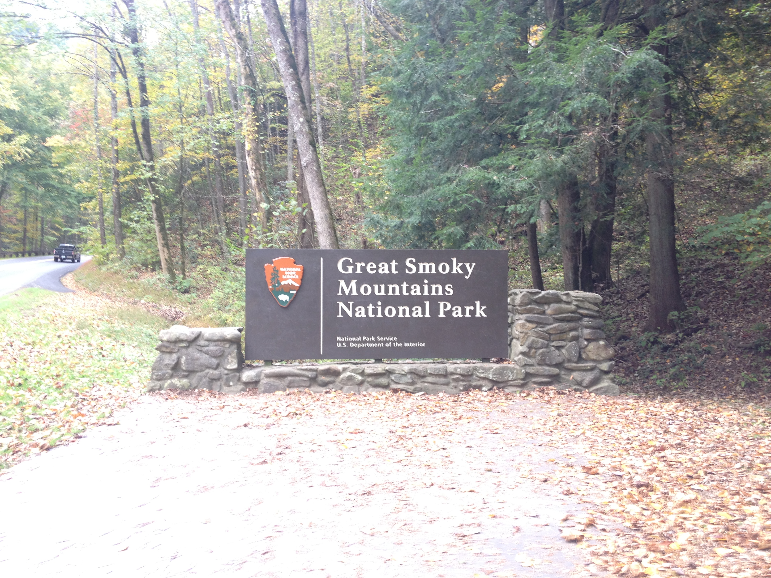
America’s most visited National Park is Great Smoky Mountains National Park.  Situated  in the Southern Appalachian Mountain Range, along the border of North Carolina and Tennessee, it is not the easiest place to get to.  When I think of National Parks, places like Yellowstone and the Grand Canyon first come to mind.  This is why I am somewhat surprised that this National Park takes the prize as most visited, with something like 10 million visitors annually.

IMG_1228 IMG_1229


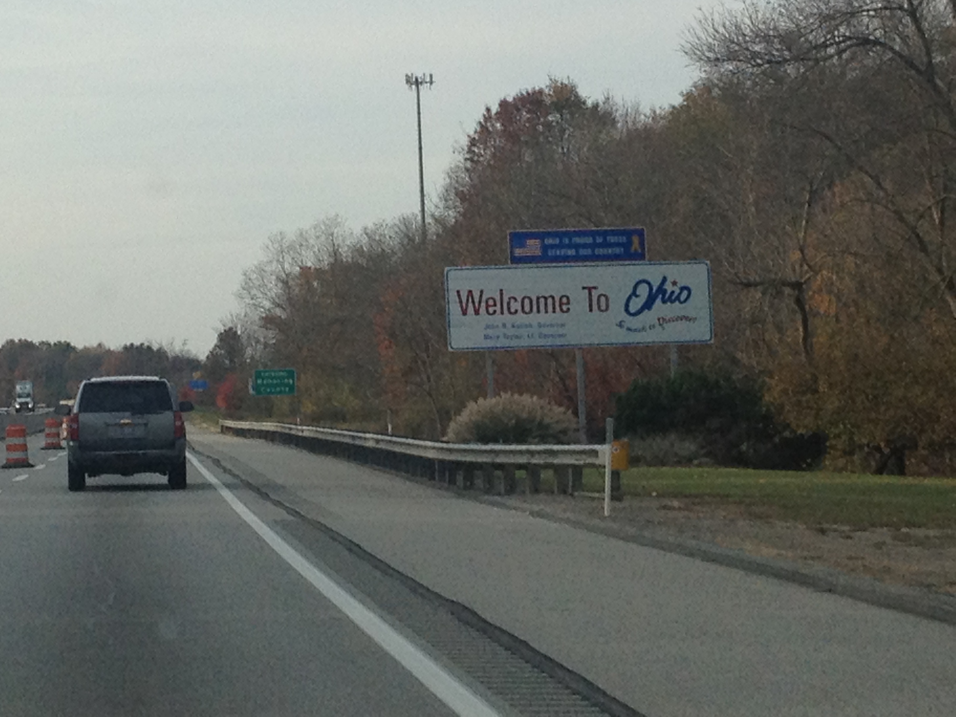
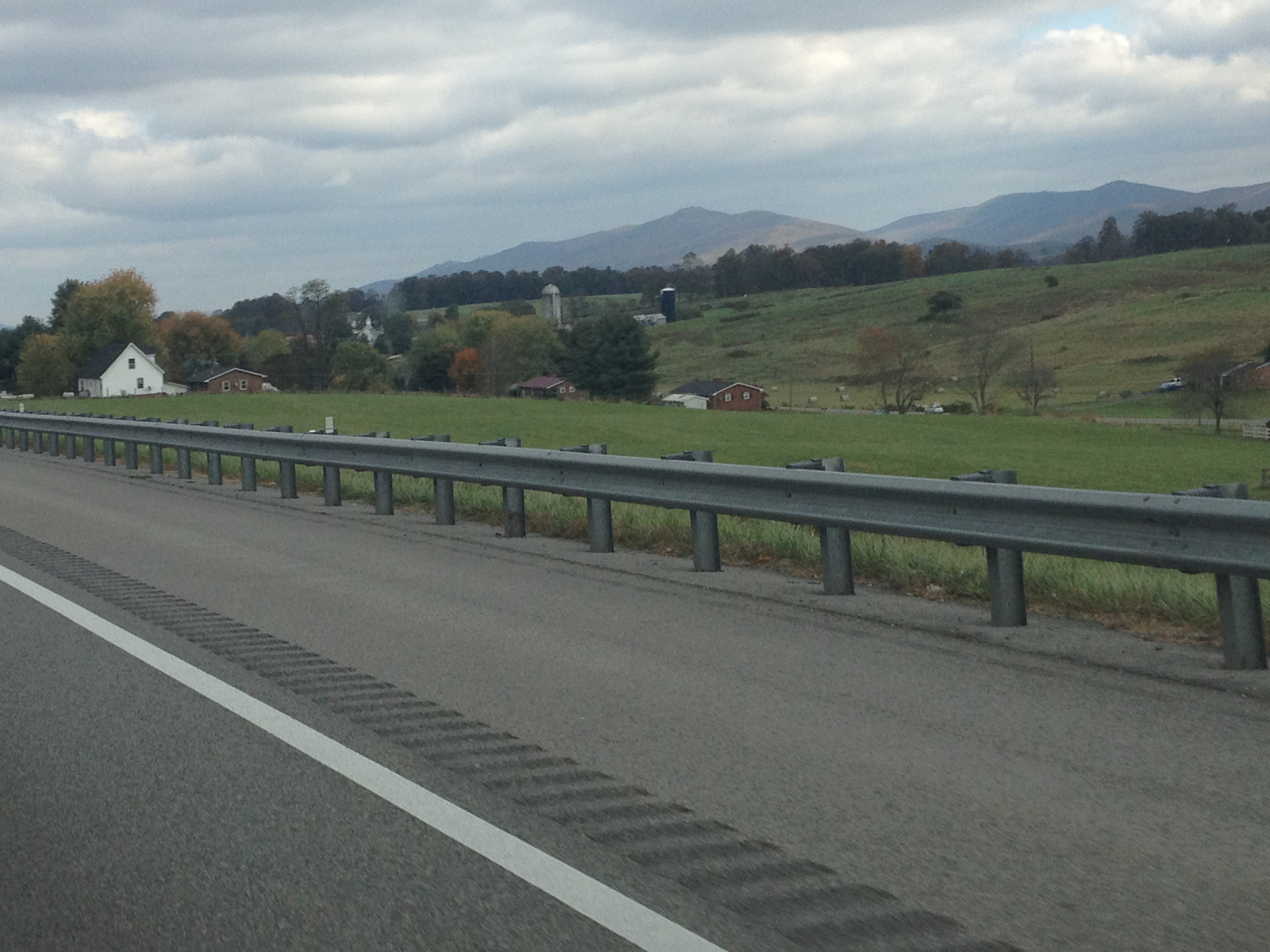
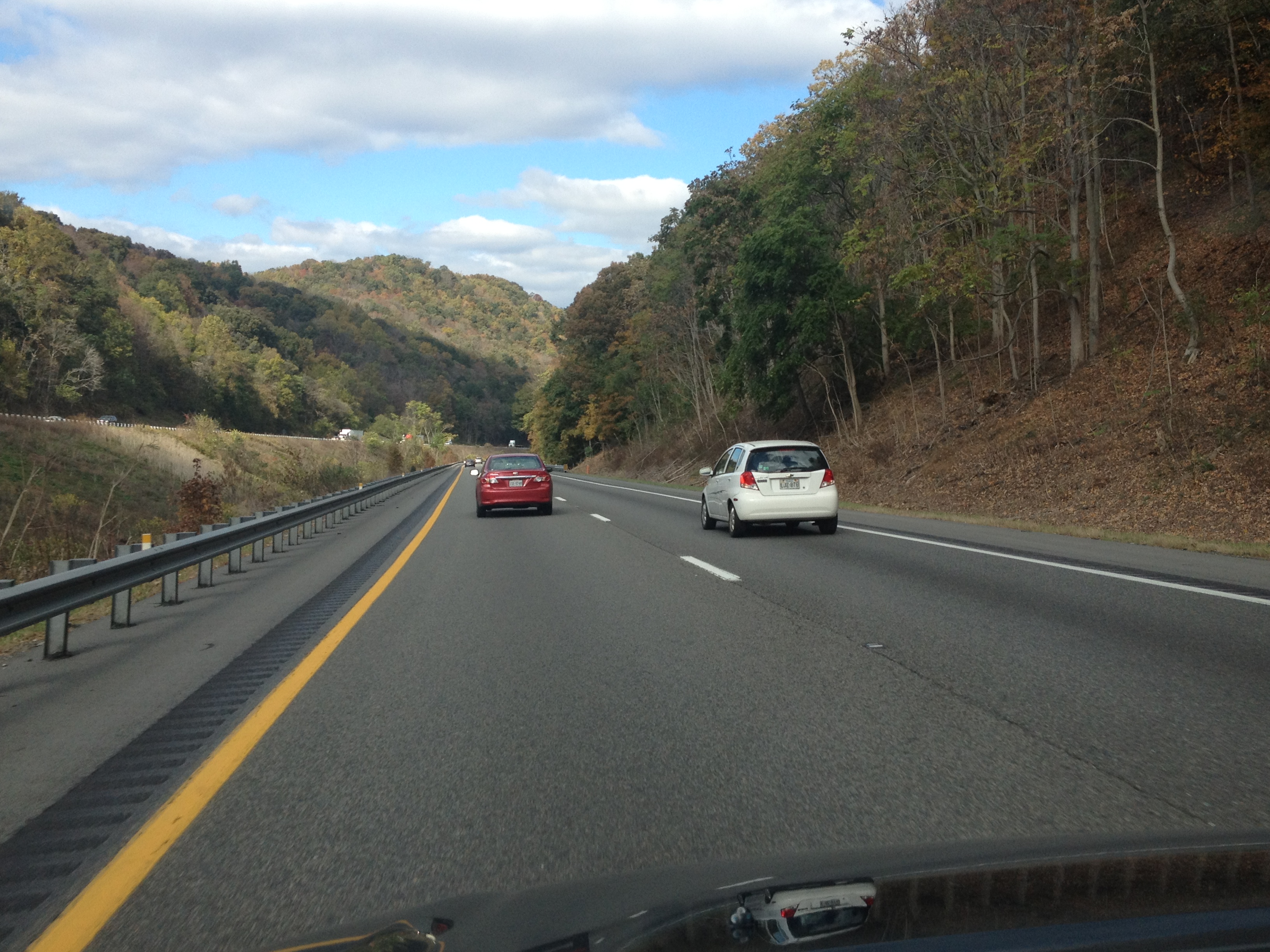
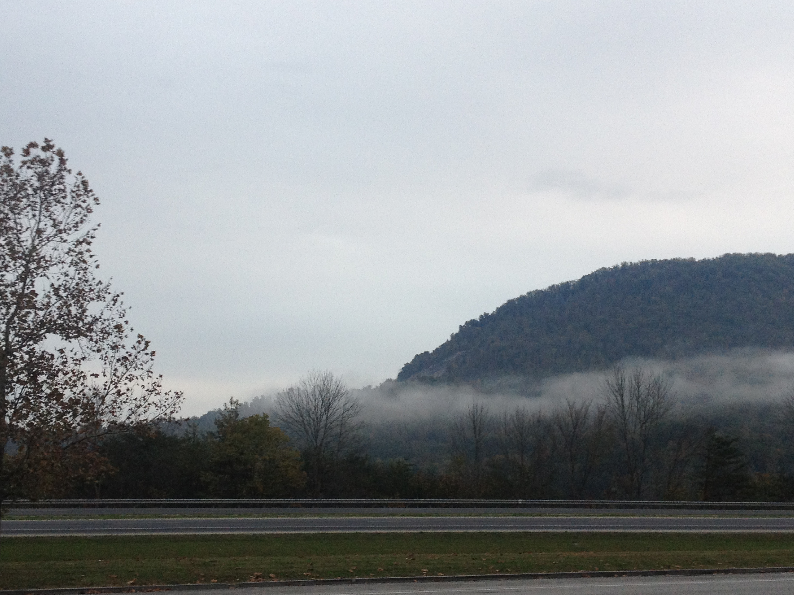
The drive down to the Smoky Mountains was quite scenic.  It was mostly along Interstate 75, which I joined just north of Richmond, Kentucky.  Mountains began to appear as I approached the border of Tennessee.  And, with it being a cold morning, fog appeared along the sides of the mountains near the border.  I have only driven this road once before, but I actually recall it being prone to fog.  I even remember fog related caution lights the last time I was here, which I did not see this time.

IMG_1232 IMG_1233

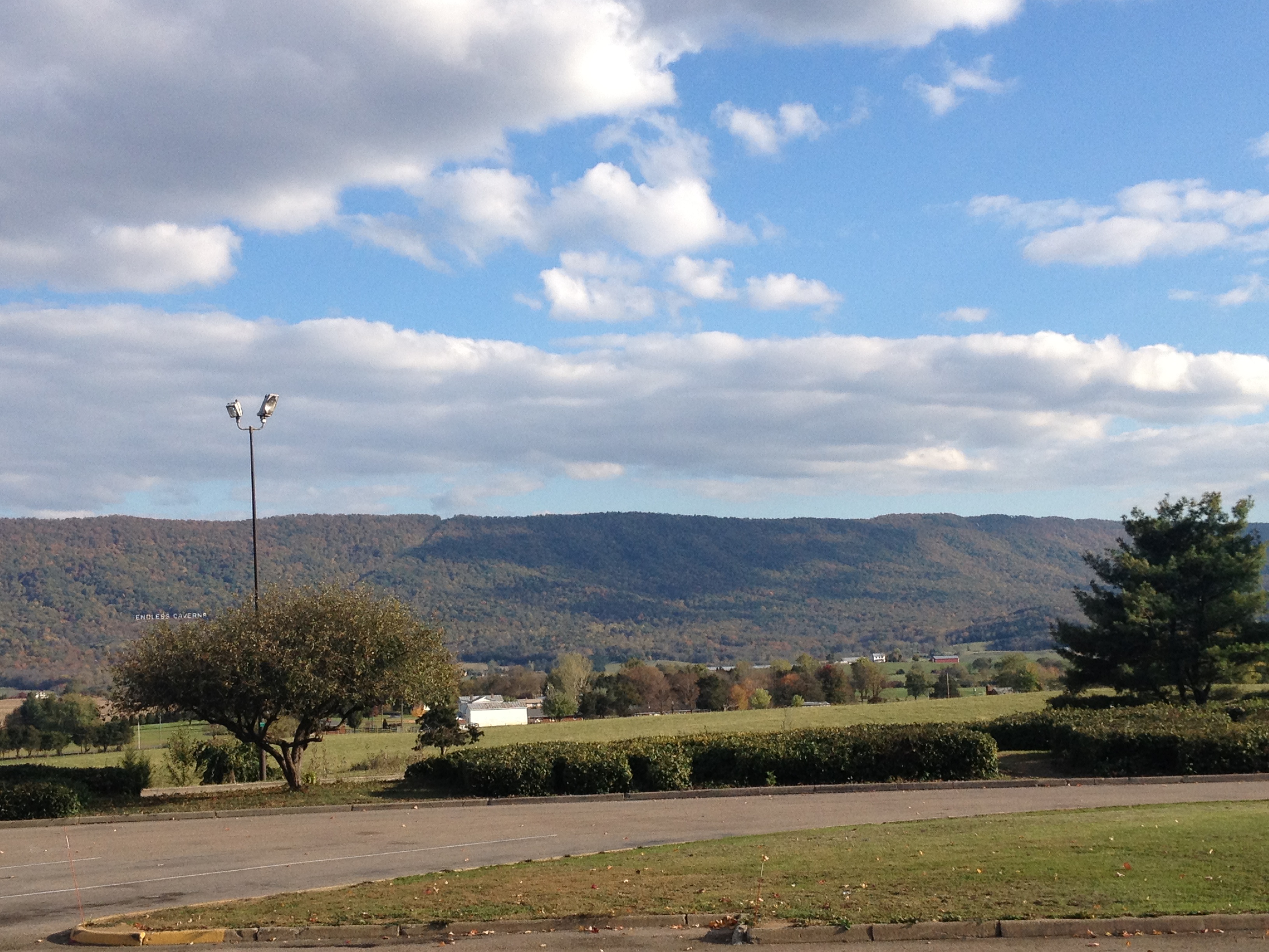
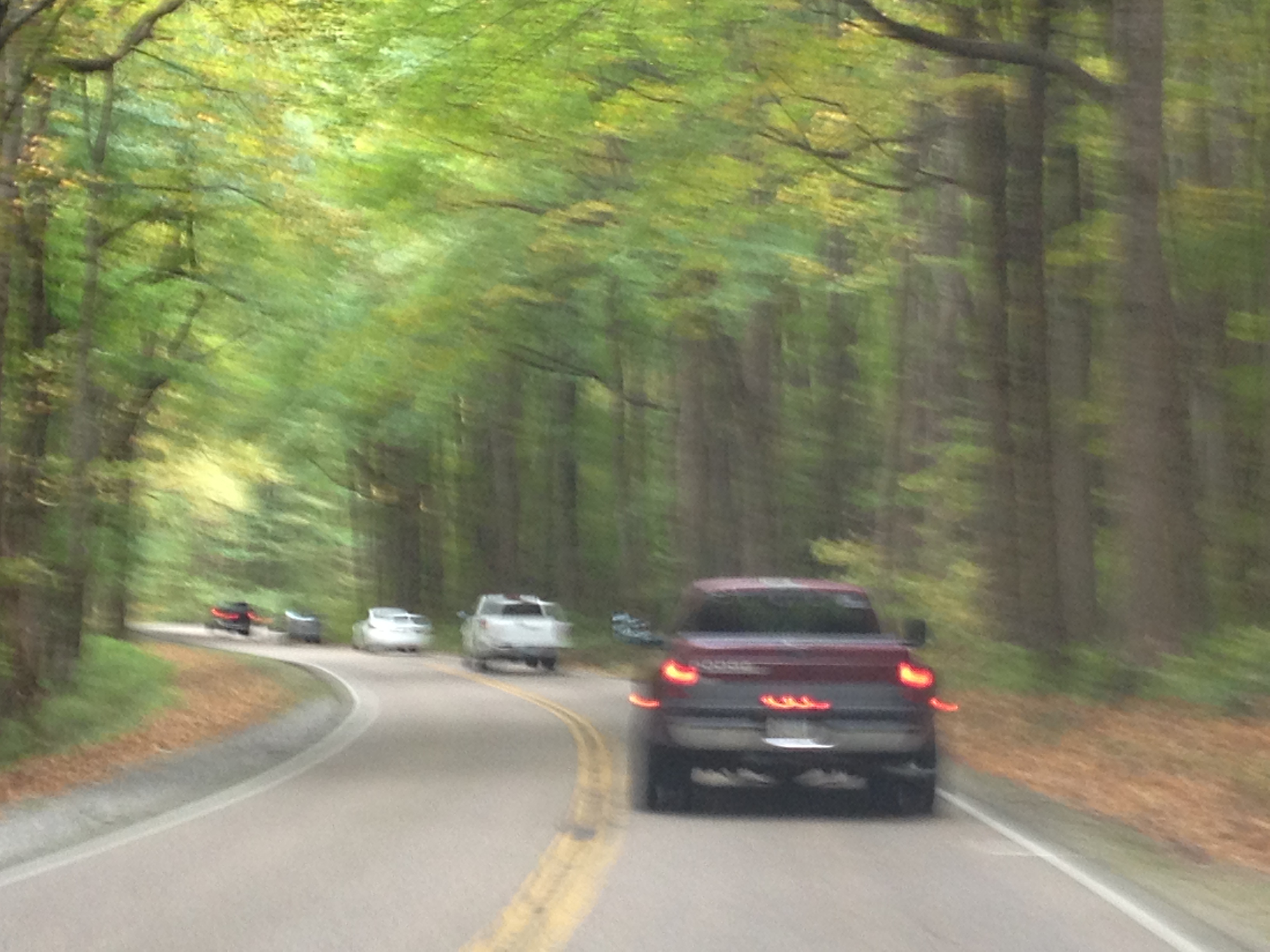
As I approached the National Park, I began to think that there may be places besides the National Park itself that are just as scenic.  I knew the park would be crowded, which it was, with slight backups on the way both in and out of the park.  I still wonder if I could have gotten the same experience at a slightly different location.  Most mountain ranges are larger than the parks that are built to celebrate them.

IMG_1234


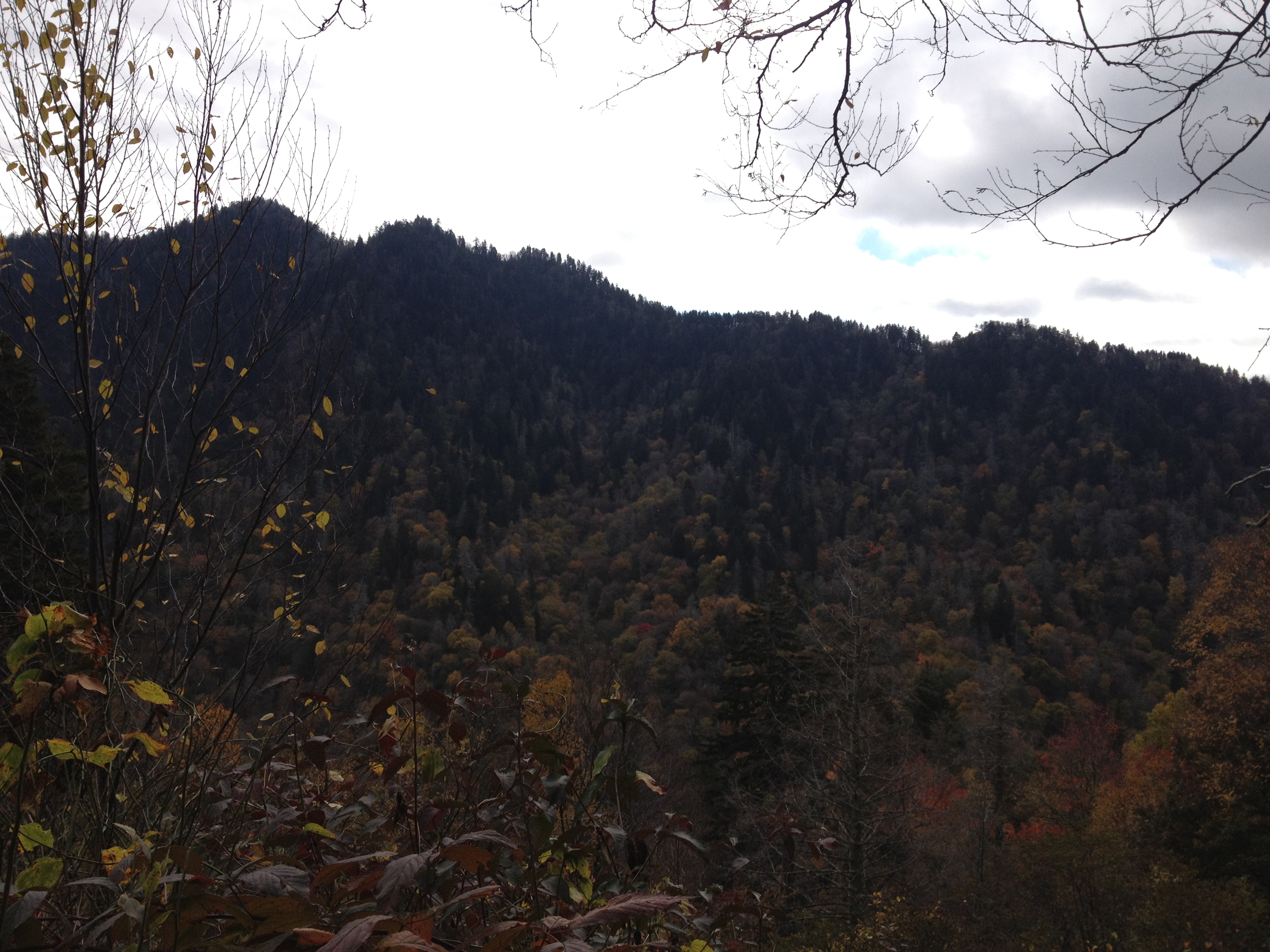
As I entered the park I notice that the trees in this area have largely not turned yet.  This, of course, is at lower elevations, and as I traveled up the mountains, the scenery would change.  This is one of the things that made this trip quite interesting.

IMG_1235


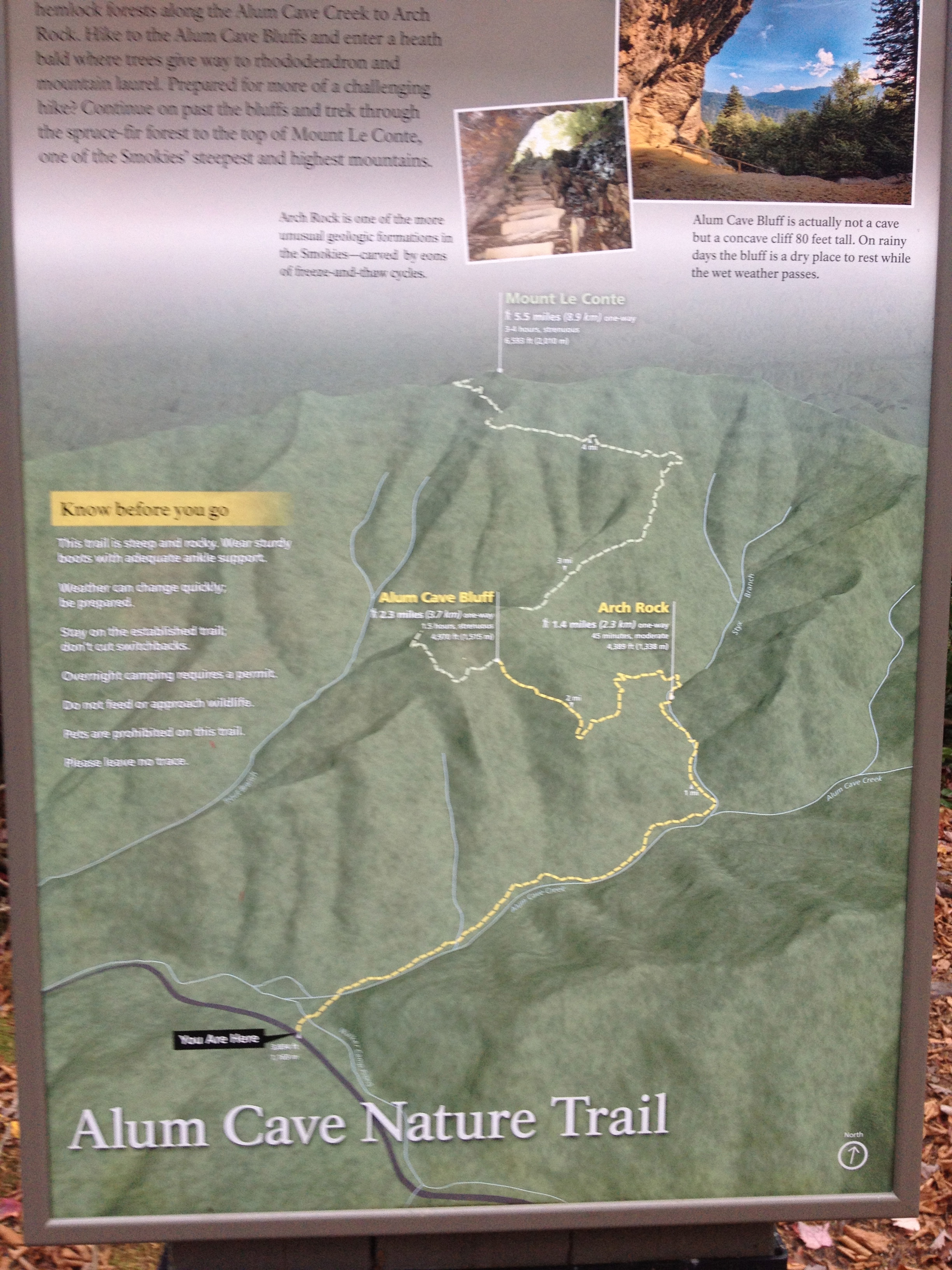
My Thursday hike would take me up the Alum Cave Trail to the top of Mount LeConte.  This trail is right in the middle of the park, and one of the most popular trails here.  It is kind of describes as your “quintessential Smoky Mountain hike”, and since this is my first time here, I figured I might as well start with this one.

IMG_1237

The hike starts off somewhat easy.  The first mile or so treks along the valley of a creek, gradually gaining elevation from a start of something like 3500 feet to just over 4000 feet.  It is in this part of the park, the middle elevations (as it has places lower than 2000, but also peaks above 6000) where the fall foliage was at it’s peak this week.  Knowing this, I would still recommend late October as an ideal time of year to visit the Smoky Mountains.

IMG_1238


Arch Rock is the first defining feature on this trail, 1.4 miles in.  It is at this point that the trail becomes more difficult.  In fact, I think there are a lot of people that end their hike here.

IMG_1240 IMG_1241 IMG_1242


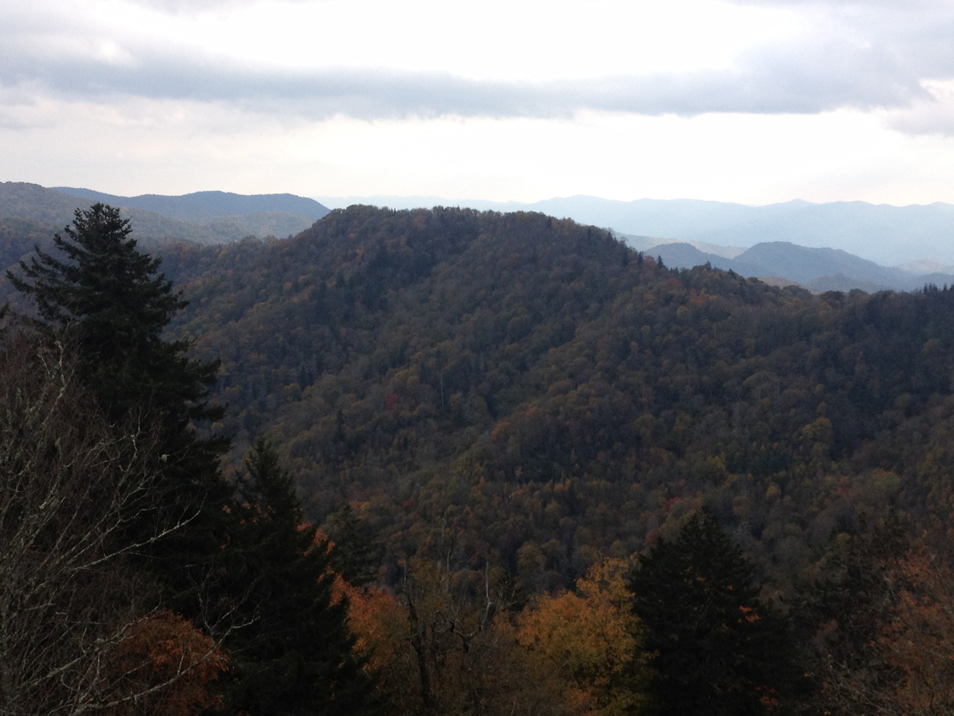
As I continue up the trail, I notice more great views of the mountains and the foliage.  The hike overall is somewhat difficult, but I would say I have done harder hikes in Colorado, especially due to the elevation.  However, I did get a chance to feel really awesome, as I was the fastest person on the trail that day.  I would spend most of the day passing people up, and only get passed up once, at the very end of my descent, right before reaching the car again.  This, of course, is the opposite of the experience that I typically have in Colorado, where I am the one usually getting passed up.  I should really not compare myself to others, especially regarding something like hiking, but it still felt kind of good, almost like I know what it feels like to be one of those guys with their headphones on running up Mt. Bierstadt.

IMG_1244 IMG_1245


The trail’s main defining feature is Alum Cave, which is not a cave, but more of a series of bluffs.  This point is also a common stopping point for hikers.  It was a cold day, especially for Tennessee standards.  Highs would only get into the lower-middle 50s at the base of the mountain, and most of my hike would be in temperatures in the 30s and 40s.  A little nervous about the cold, I thought about stopping here, but decided to keep going anyways, up Mt. LeConte, which would take me over 6500 feet in elevation.

IMG_1247 IMG_1248


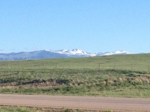
I had perviously noticed a white looking feature to the top part of the mountains.  One could mistake this feature for snow, but one of the hikers informed me that it was a really heavy frost.  This, of course, is something that would never happen in Colorado due to the lack of moisture, and is one of many features that make the Appalachian Mountains different from the Rocky Mountains.  When I finally got to this level, I was relieved to find that this frost was not present on the ground, which would have made the hike slippery.

IMG_1250 IMG_1251


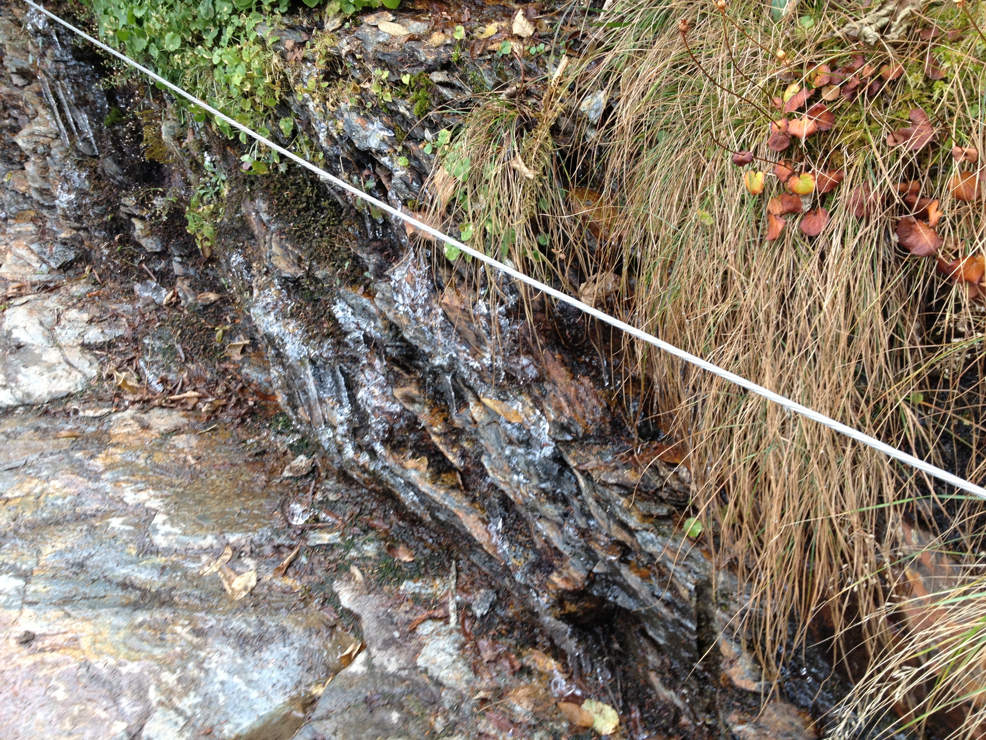
There were some really neat icicle formations near the side of the trail, but there were really only one or two parts I would consider slippery.  The top of the mountain did have some dense pine forests.  With their heavy coating of frost, walking in and out of these areas was somewhat creepy feeling- appropriate for Halloween.  There was some wind at the top of the mountain.  It was no faster than 10 mph, but was enough to blow some of this frost off the trees.  The frost flying through the air felt kind of like it was snowing, but being the scientist I am, I knew that it was not actually snowing.

IMG_1253 IMG_1254


0.2 miles before the top of the mountain, there were a bunch of cabins.  I actually saw some people with full backpacks headed there to stay the night.  The top of the mountain was foggy, which dampened my view.  WIth it being cold and windy, I only stayed up there for about 10 minutes; long enough to take this picture and eat a 6″ sub from Subway, which I brought with me in my backpack.

IMG_1257

The hike took me about 5 hours overall, 3 to get up and 2 to get down.  Other hikers told me that it was an impressive time, but I was kind of in a hurry, as it was cold and I did not want to take long breaks.  The additional time gave me a chance to see some of the park’s other features.

IMG_1259 IMG_1260


The first of such features was the Newfoundland Gap, which was apparently discovered in the early 19th century as an alternate route to the Cumberland Gap.  Looking out at the natural features, I struggle to figure out where this gap is, and what makes it an easy route for settlers to get across the Appalachians.  I am guessing it is the valley between this hills, but it seems as though they would still have to climb to the elevation I am sitting at, 5048 ft.

IMG_1261

I also got to see a small section of the famed “Appalachian Trail”, which follows the high points along the NC/TN state-line through most of the park.

IMG_1263


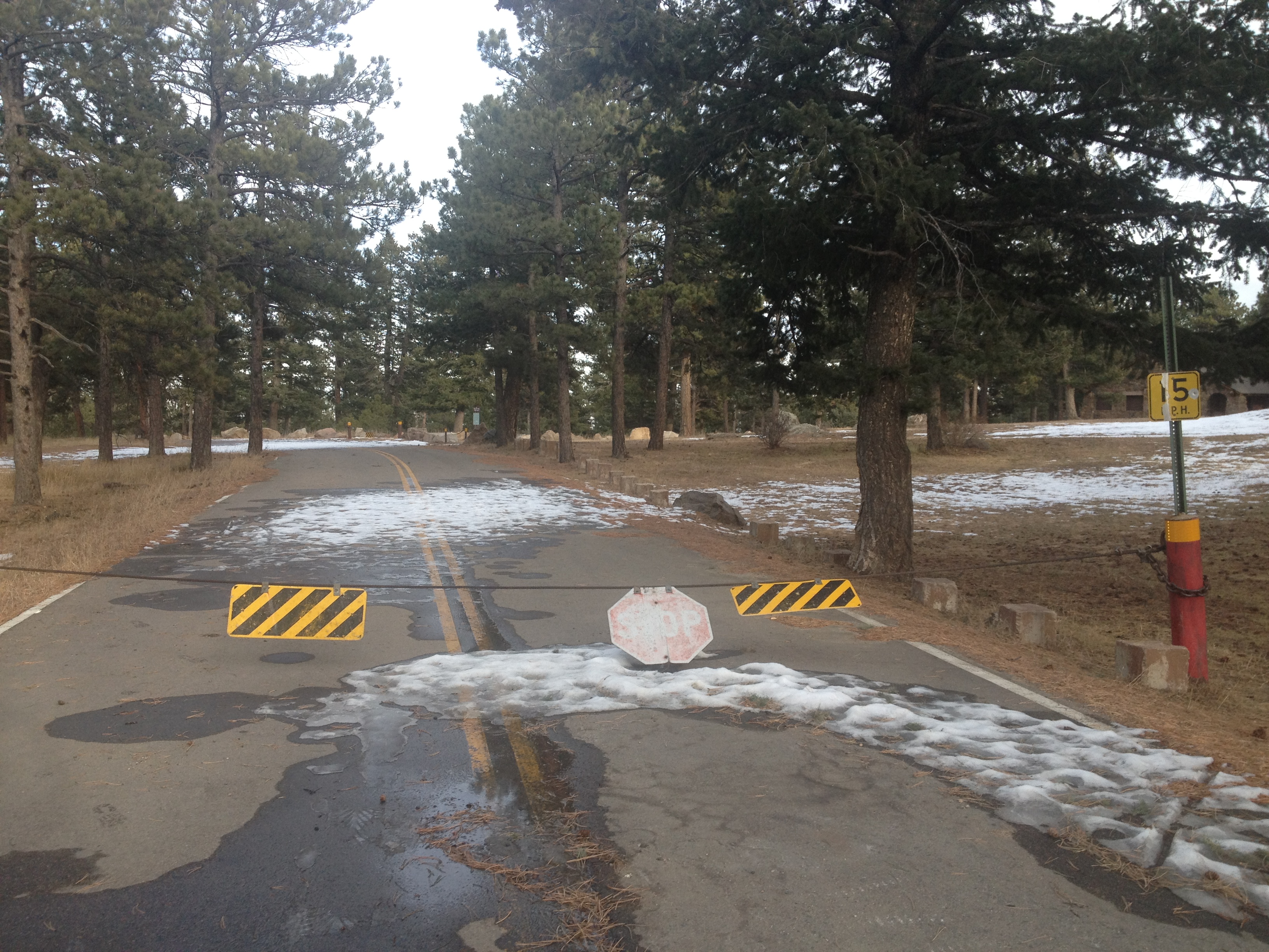
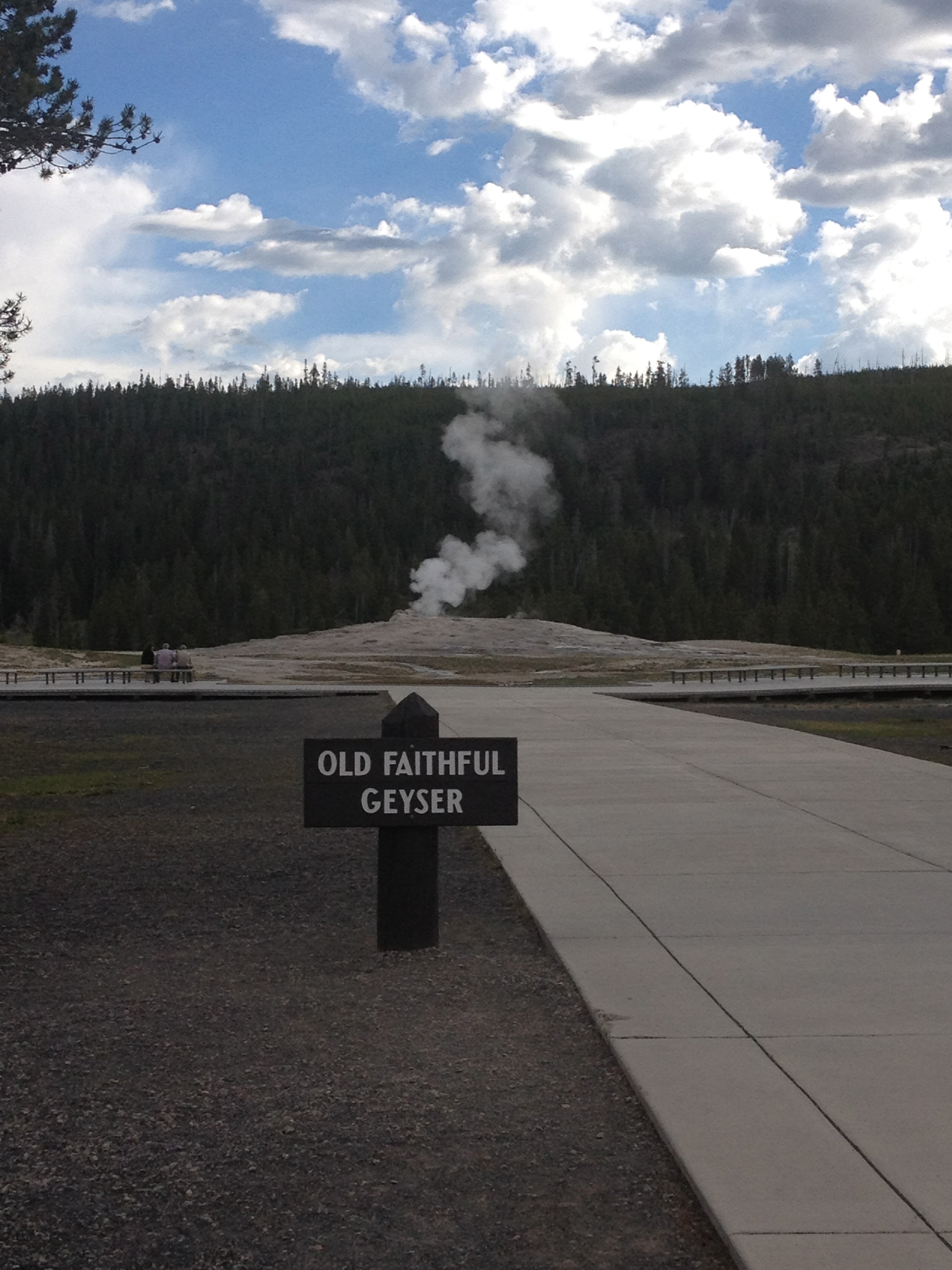
I drove up the road to Clingman’s Dome, the highest point in the park.  But, the cold, windy weather, and fog at the observation deck stopped me from actually going up there.

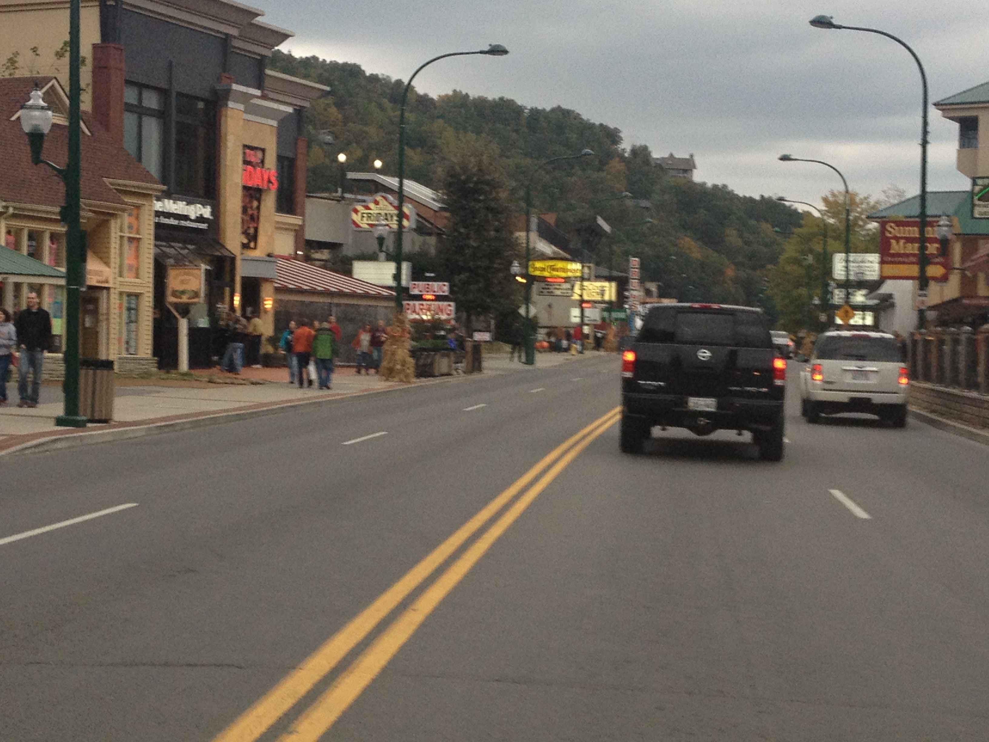
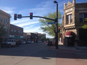
Overall, I enjoyed my experience at the Great Smoky Mountains National Park, and I think the area offers something for everyone.  Just outside the park are the towns of Gatlinberg and Pigeon Forge.

IMG_1264


Both towns are quite touristy, with tons of restaurants, hotels, and other attractions like roller coasters and family fun centers.  However, Gatlinberg was more dense, the kind of place where one would largely walk to most of the places they desire to go to.

IMG_1230


Pigeon Forge, on the other hand, is a driving place.  I saw few people walking around here (as I saw a lot in Gatlinberg), but there were still tons of attractions, probably even more than in Gatlinberg as Pigeon Forge is home to Dollywood.

For those that want a more rustic experience, there is plenty of that too.  In fact, just off the Smoky Mountain Parkway (the highway that connects these two towns to Interstate 40), it gets a lot more rustic quite quickly, with lots of cabin sites, but also areas with tubing and other outdoor activities.  I can imagine nearly everyone getting something out of their Smoky Mountain experience, and I can imagine spending a significant amount of time here.  Between this, my experience in Nashville last year, and what I hear about Memphis, Tennessee seems to me like a state that really knows how to party!

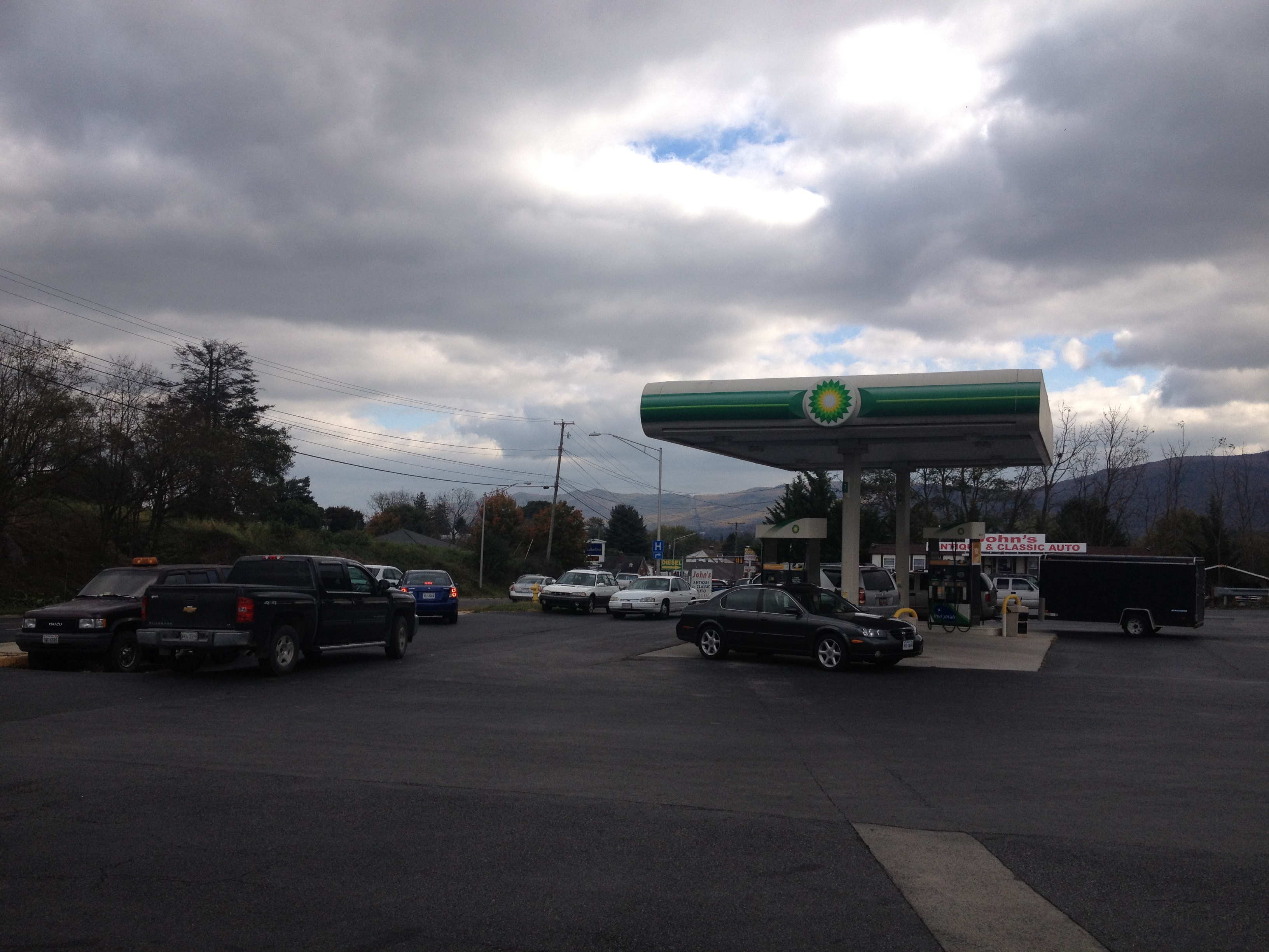
One other thing I noticed while in Tennessee is that there are parts of the country where Krispy Kreme donuts are still popular.  In fact, my hotel offered free Krispy Kreme donuts to their guests, as a manner in which to draw people (as competition is quite stiff in this area).  In this part of the country, Krispy Kreme donuts were popular long before the Krispy Kreme fad up north around a decade ago, and remain a cultural institution.  When I ate my donuts, I realized once again that these are good donuts.

We urban, cosmopolitan, northerners (or however you describe pop-culture influenced mainstream America) seem to do a good job of taking cultural mainstays from other regions and turning them into short-lived fads.  Shortly after the Krispy Kreme fad (which was roughly 2001-2004), we created a fad out of Caribbean reggaton music, culminating with Daddy Yankee’s widely successful BarrioFino album.  For those that don’t know, Daddy Yankee is still producing albums that are widely successful in the Caribbean, and even moderated a gubernatorial debate in Puerto Rico.  We are now doing the same thing with twerking, which has been part of African American culture for two decades.  Actually, that fad may already be over!

After my breakfast, I head back to the park to visit one last destination; Cades Cove.  This part of the park is mainly for wildlife viewing.  I have limited luck, as much of the area is pretty empty.  There are a lot of horses here, but that is kind of what I expect.  I was amazed, though, at how people went right up to the wildlife, even if it was deer, something I see all the time.  At the other National Parks I have visited this year, mainly Yellowstone and Rocky Mountain National Park, anywhere I’d seen wildlife, there were park rangers making sure people don’t get too close.  Here, it appeared as if people were walking up to the animals, just daring them for a fight.

IMG_1266 IMG_1267

I would very much like to come back here.  There is so much more to see and do in Great Smoky Mountains National Park, as well a in Gatlinberg and Pigeon Forge.  However, I am also curious to go somewhere else in this mountain range where it may be less crowded.  Perhaps I could go somewhere like Mount Mitchell, or to an area north or south along the range, just to see if the foliage and hiking experience would be just a good without the traffic and crowds.  However, I do think it is interesting to see these mountain ranges in the east, as they are quite different from the Rocky Mountains, near where I live.  They have much more of a densely forested feel to them than the wide open Rockies.  The colors are different, and the mountains feel somewhat different in orientation.


Louisville Slugger and the Bourbon Trail

IMG_1203


How many people can name one company that manufactures baseball bats?

How about two?

There are probably a lot of people involved with the sport of baseball that can name two or more, but I would reckon to say that most people can name one bat manufacturer; Louisville Slugger.  The truth is, there are over 30 other bat companies, but unlike some other industries, like automobiles and soft drinks, there is a clear leader in this industry.  This is why the Louisville Slugger bat factory is a must see for any baseball fan.  My last time driving through this area, not seeing this bat factory was my one regret, so I have chosen to make this a top priority on this trip to Kentucky.

IMG_1201 IMG_1202


Getting into Louisville was a little bit of a struggle today, as I hit some major traffic and had to take an alternate route.  But, after this minor delay, I was still able to make it in time to get a spot on the 10:00 bat tour.  This is one major advantage of traveling on weekdays.  In fact, time-off considerations aside, I would definitely recommend to anyone to travel in the manner in which I have, designating weekends for parties and such, and leaving the “touristy” activities like this one to weekdays where there will be less tourists.  When being a tourist, you do not want crowds, when partying, you likely want at least some crowds, or are at least less impeded by them- something to definitely consider.

The bat factory tour was well worth the $11 fee, which also included souvenirs, and a museum with exhibits about both the history of Louisville Slugger bats and the history of Major League Baseball.  I am quite astonished by the number of bats this company produces every year, and how quickly they produce customized bats for major league baseball players.  As I watch the World Series tonight, I realize that I will never look at something as simple as a player knowing they have another bat available to them after breaking one the same way again.  A lot of work goes into producing these bats, starting with trees being cut down in the forests of Pennsylvania and New York, followed by the wood being shipped to Louisville to be sorted, cut, and customized to everyone’s individual use.  It is strange to me how easily a ballplayer will throw a bat away due to frustration, slumps, etc. when so much effort was needed to produce that bat.

IMG_1211


Louisville is the largest city in Kentucky, and it seems not too different from other cities of it’s size in the region, like St. Louis and Cincinnati.  For some reason they have this gold replica of the David Statue by Michelangelo.  I don’t know why this is here.  But, otherwise, it is just like any other downtown.  I see people in suits talking business.  I see science museums and performing arts centers.  Those sandwich shops where people go to lunch are there.  I even stopped at one.

IMG_1213 IMG_1214


Kentucky is an interesting place.  It is definitely prettier than Indiana, with more trees and rolling hills.  I am glad they finally raised their state speed limit to 70 (from 65).  However, it is a place that is tough to categorize.  It is not quite part of the Midwest region, as it’s neighbors to the north are.  But, it is not exactly a true southern state either.  During the Civil War, Kentucky largely did not take a stance, as it was a “border state” that allowed slavery but did not secede from the union.  For this reason, and many others related to culture, climate, and geography, I can never figure out how to classify the state of Kentucky when I am describing the different regions in the United States.

IMG_1217 IMG_1219

The state is also unique for several other reasons.  I head east to Frankfort, KY, the state capitol, to join up with the famed “bourbon trail”.  Here, I notice something I should have noticed before about the state; how old the buildings are.  Due to the fact that the easiest pass over the Appalachian Mountains was a place called the “cumberland gap”, near the borders of Virginia, North Carolina, Kentucky, and Tennessee, this state was settled earlier than states to it’s north and south.  Kentucky became a state in 1792.  Tennessee in 1796.  The states to the north and south would not become states until the 1810s.

In fact, given its’ size, the town Frankfort, KY most reminds me of is Annapolis, MD.  Throughout the center of town I see historic buildings, dating back to the later 1700s and earlier 1800s, and the buildings have that more colonial feel that is common on the east coast.  The road layout, and tree density all make me feel like I have reached the east, even though at one point in the early part of this country’s history, this was considered the west.

IMG_1215


My brief stint on the Kentucky Bourbon Trail first takes me to the Buffalo Trace distillery.  Here, I got to learn some strange facts that are second nature to bourbon enthusiasts, but facts I was unaware of, such as the requirement that a “bourbon” contain between 51 and 79 percent corn to be labeled as such.  From all of the spots on the tour out to the parking lot, the area has a distinct smell.  The smell is probably one that any employee of any distillery has become accustomed to, but it definitely smells strong and distinct.  All I can say is, I would not recommend anyone go to a bourbon distillery on a day in which they are nursing a rough hangover.

IMG_1222 IMG_1223


My day ends in Versailles KY (which I am told is pernounced ver-sail-es, and not like the French city), home of the Woodford Reserve Distillery. This distillery produces some more high end whisky.  I drink it “neat” (i.e. no ice), which is what I was told is proper.  I’d say I am drinking it like a “real man”, but I also ordered a water.  So, if I was in an old western of sorts, this would not be acceptable.  Either way, I did drink it the real Kentucky way.  And, to add to the experience, I grabbed a few bottles of Ale 8 (a beverage that is unique to Kentucky), and mixed it with some bourbon for the last drink of the evening.  This gave me to total Kentucky experience.  Earlier this year, rapper Eminem said “Life’s too short to not go all out”.  I have taken a basic equivalent of this message to heart in many of the places I have visited this year, hoping to get the full experience of life in that place.  Heck, I even ate something called “turnip greens” and poured vinegar on them (which I think is the right way to eat them).

There is no real quick way to summarize Kentucky and what Kentucky is all about.  I’d come up with something along the lines of saying that it is like Virginia and Texas had a baby, but that would ignore many of the other unique qualities of this state.  Kentucky produces 95% of the world’s bourbon.  Whisky produced in other states takes on different forms.  Princes and kings from other countries often come to Kentucky for horses.  These qualities are not shared by neighboring states the way one can say Illinois produces corn, like Indiana and Iowa.

Perhaps Kentucky is trying to teach me a lesson.  Maybe it is time for me to stop trying to categorize states, and just visit places and take them for what they are.  Driving across endless seemingly identical corn fields in Indiana it becomes easy to lose sight of the fact that places are worth visiting because every place is unique, with a unique history, a unique geography, and a unique combination of influences that produces an experience different from other places.  The combination of rolling hills, bats, bourbon, and horses makes Kentucky a place like none other.

Back on the Reservation

A few weeks ago, I had the opportunity to visit an Indian Reservation for the first time in my life.  I learned quite a bit from that visit.  I learned that these reservations do not look like many of us imagine them to.  I also concluded that our history is complicated.  I do not have a good understanding regarding why relations between us and the Native Americans progressed the way they did, and it would be disingenuous for me to take a position on these issues.  However, I did see people in need due to their circumstances.

There are some things universal about helping out those in need.  Contrary to some people’s belief, helping out those in need is not dependent on ideology, wealth, or status.  It is only loosely dependent on what someone believes about the person (or people) they are helping.  Caring parents will often bail out their children with financial or housing support even if they believe their child had been lazy, stupid, or malicious in the behavior that led them into trouble.

In my belief, in order to be genuine in helping someone out, there are two necessary conditions.

  1. There must not be coercion.  This one is obvious, being forced to help someone out, or forcing somebody else to help someone out is not genuine charity.
  2. There must be no expectation of a reward.  This includes not only a monetary reward, but also the guy who does charity work and then starts telling girls at the bar about it to help him get lucky.  Or, likewise, anyone that hopes for any praise or increase in status from their charity work.  To be fair, rewards can come.  But they have to not be the reason for it.

For this reason, I was hesitant about writing about this in my blog.  It could come across that I am trying to show off that I did charity work.  I am really just trying to explain the reason I went back to the Pine Ridge Indian Reservation, as it is one of the poorest places in the country.  But, you have no real way of knowing that for sure.  Maybe I could have left this whole part out.

IMG_1135

The Pine Ridge Indian Reservation is in Southwestern South Dakota, with it’s southern border being the Nebraska/South Dakota border.  So, as soon as we entered South Dakota, we were on the reservation.  Last week, this area got an unexpected early season blizzard.   In the Black Hills, to the north, some places got over 40″ of snow.  This is something that rarely ever occurs in mid-winter in this part of the country, let alone in early October.  Pine Ridge, more on the southern flank of this storm, got about 12″, still a lot, and the evidence of this snowstorm could still be seen.

IMG_1140 IMG_1139

The task yesterday was tiling, and we put up tiling like the one pictured above at a couple of houses in this neighborhood in Pine Ridge.  So, just like the day before,  I learned a new activity.  In fact, I continued on the theme of expanding my comfort zone, as over the course of the day I became comfortable using machinery that initially intimidated me.

Spending an entire day on the reservation, I made a couple of observations I hadn’t last time (when I was only there for the morning).  Last time I felt that the reservation may have just as poor as some of the dispirited urban neighborhoods I had previously observed, but not as dangerous.  However, I was only there for the morning, which tends to be the least dangerous time of day.  I noticed this hole in the window of one of the homes I helped work on.

IMG_1143

This hole in the window may just be more evidence that the area is poor and do not have the resources to repair such a thing.  Still, I wonder who it got there.  Stray bullets from gang related activity tends to be one of the biggest fears one has about visiting poor neighborhoods in the United States.  Either way, I am not about to go ask the homeowner how this happened- that would be rude.

IMG_1145 IMG_1144

I was also quite astonished by the number of stray dogs in the neighborhood.  All day long, I encountered stray dogs just wandering up and down the street.  I recall one of my former co-workers in Chicago telling me that stray dogs were common on the south side, but I have no idea what that meant.  Occasionally I would see a stray dog in my neighborhood, but usually there was someone there to call animal control, or try to find them a shelter.  Here they were everywhere, wandering in and out of people’s yards, sometimes getting into people’s trash, and even pooping in the yard (which I was lucky to avoid).  I guess I just wonder why there is a different attitude towards dogs here than what I am used to.

The return trip also gave me an unexpected surprise; the quintessential Nebraska experience.  For me, this means thunderstorms and steak.  On the return trip southbound across the Nebraska Panhandle, we encountered a series of really fun storms, with lots of lightning.

RADAR_20131010 IMG_1146

Thunderstorms are my favorite type of weather, at least from an observers point of view.  There really is nothing like the raw, natural power of these storms.  I also love the differentiation within the storms, and how abruptly things change inside a thunderstorm.  With the heavy rain, frequent lightning, hail, and abrupt wind changes, there is so much to see.  There is so much going on I feel like I can make a diagram like those Xs and Os the football commentators make.  It is the weather phenomenon for people who love to see all things energetic.

It is also the weather phenomenon for people who love efficiency.  Seattle and Kansas City average about the same amount of annual precipitation (37-38″).  However, in Seattle, precipitation occurs 155 days per year, while in Kansas City, precipitation only occurs 104 days per year.  Kansas City achieves the same result with 41 more rain-free days.  In addition, many days with thunderstorms are mostly sunny for large sections of the day, with the exception of the hour or two when the storms are rolling through.  Overall, many more productive hours.  For me, it is the long, humid day, followed by the abrupt thunderstorm that makes the Great Plains what it is.

We stopped at a steakhouse called Cantu’s in the town of Bridgeport, NE right after we finished rolling through the storms.  The place is right on highway 385, the main street through the center of town.  I have many times stopped at random places I encounter on the main streets of towns while driving through.  I really like doing this because it gives me a sense of what makes that town unique to every other town I have ever been to, something I won’t get by eating at a chain restaurant.

Of course, I have had a variety of experiences, ranging from great to horrible at restaurants like this.  However, when on the Great Plains, particularly in areas near a lot of ranches, I’ve have mostly good experiences with steakhouses.  The trend definitely continued today.  I really enjoyed my sirloin steak at Cantu’s.

Mount Evans The Easy Way

The United States of America is not perfect.  There are definitely some aspects of our history that seem a bit shady, and there are definitely some things I would change if I had my way.  But I still love this country, and feel lucky to live here.  One of the things I love about this country is that we attempt to accommodate nearly everybody.  We have lifestyles that range from the crowds of Manhattan to empty parts of Wyoming, and many other things in between.  Despite the fact that I have come across a few Americans who would like to eradicate one or more of our prevalent lifestyles, we remain a county that accommodates.  If anything, we are becoming more accommodating, as more and more places add bike lanes, and some communities allow people to follow their dreams of traveling everywhere by golf cart.

To get to the top of the mountains in Colorado, we also accommodate many different methods.  Most Coloradans prefer to hike up our tallest peaks, and nearly every tall mountain here has multiple hiking trails to the top.  Two of Colorado’s tallest peaks, Mount Evans and Pike’s Peak, have paved roads to the top.  During the summertime, people can drive or ride a bicycle to the top of these peaks.  In fact, the ride from Idaho Springs to the top of Mount Evans was featured as one of Bicycling Magazine’s Top Bike Rides.  Pike’s Peak can even be reached by train.

The easiest way to the top of a mountain is to drive.  Having already hiked three of these peaks this summer, I decide to take a drive (or, more accurately, go along for a ride) up Mount Evans.  The road up to Mount Evans is actually North America’s highest paved road, and a very scenic one.  There are plenty of wonderful places on the way up this highway, including dense pine forests, alpine lakes, and places where you can see the mountains in the distance.  These are the kinds of images you will often find on a calender.

IMG_1074 IMG_1075

One added bonus of taking this trip in late September was the fall colors.  The fall colors here in Colorado come primarily from the Aspen trees, and primarily turn the color yellow.  This makes a fall image here in Colorado quite different than what you would see in the east.  Firstly, with more pine trees here, not all of the trees are changing colors.  And, with the trees mostly changing the same color, yellow, there is less variety.  In that sense, I would say anyone looking to take a vacation for the primary purpose of viewing fall foliage would be better off going to New England or the Smoky Mountains.  But, the colors did add an extra element to the views on this trip.

IMG_1076

Some places in higher terrain just recently received their first snow of the season.  The snowfall was not particularly heavy, but it still could be seen, especially from the shaded areas once we climbed above 9,000 feet.

IMG_1077

As a result of this recent snowfall, as well as a heavier snowfall at the highest peaks (during the floods a couple of weeks ago), the road was not open all the way to the top of Mount Evans.  The farthest up we could go is Summit Lake, which is around 12,800 feet in elevation.  This is not too atypical, as these higher elevations typically start receiving snow in September, and plowing a road at this elevation is not an easy task.

IMG_1078 IMG_1079

I love science!  I love the way some scientific phenomenon can create some unique observations, and I love the process of figuring it all out.  It was a very windy day at Summit Lake, and I could feel it as soon as I got out of the car.  In fact, the wind confirmed for me that it would have been quite unpleasant to try to hike at this elevation.  What I observed on this lake is a phenomenon I had seen years back when I was living in Madison, WI.  On a cold, windy morning, the wind blows water off of the lake onto nearby grass and rocks.  If it is cold enough, those water particles freeze on contact, much as they would in an ice storm.

When I observed this in Madison, WI, it was a similar situation.  In that case it was December, as it gets cold a lot earlier in the year at high elevations, but the progression of events is the same.  Water has a higher heat capacity and therefore both warms up and cools down slower than air.  It takes more than a few cold mornings to freeze over a lake, even a smaller lake like this one.  So, at the time of year when winter-like chill first arrives, this phenomenon can be observed near lakes.  Larger lakes like Lake Michigan and Lake Superior never freeze over in the winter, and sea spray events like this one can be observed pretty much all winter long.  Although I have seen the result of this combination of weather conditions a couple of times, I am now kind of curious to see it actually occurring.

The world is a tough place to understand.  Life often seems to unfold in ways that do not make too much sense.  Often times, after a particular endeavor does not turn out the way I had hoped, I spend a good deal of time scratching my head, wondering why.  When something impacts my life in a negative way, my response is always to try to figure out where it went wrong, as to avoid making the same mistakes.  But, most of the time it does not work that way, particularly when social interactions and group dynamics are involved.

In a way, I feel like I can take comfort in science.  In science, there are universal laws, and certain things that will always behave the same way, even in an unfamiliar place.  The cold windy night on Summit Lake created the same ice patters that it did on Lake Mendota.  No matter where you are light waves of 550nm will appear green to the human eye.  This, and a host of other things, can be counted on, will always make sense, and can provide some comfort in unfamiliar situations.  Yet, unlike some predictable things, like re-watching movies and T.V. reruns, it does not become mundane and uninteresting over time.  There is always something new to be discovered, a new phenomenon to be observed and investigated, and a new possibility to be opened up.

IMG_1073 IMG_1090

On the return trip, we stopped in Idaho Springs, walked around and ate lunch.  I have driven by this town many times, but never really spent much time here.  In a narrow valley, with steep terrain on either side, the town actually has some houses on higher terrain.  From the highway, it’s appearance consistently reminds me of model train sets.  In addition, the town, which champions itself as “Where the Gold Rush Began”, actually named it’s high school team the “Golddiggers”.  I still wonder if the the marching band plays that Kanye West song when the team comes out onto the field.

I was pretty impressed with the downtown.  It is a nice, kind of small, western town.  It is not over touristy, as it is not adjacent to a big attraction the way Estes Park is.  The shops seem well kept, and also seemed to have variety.  We ate at Tommyknockers, a microbrewery downtown with bar food, and also a lot of buffalo burgers.  From walking around town, I see several other places I would like to try, on subsequent trips.  But, I really do not know when I will be coming into town again, as it is not a typical stop-off for me on ski trips and such.

Yellowstone and the Grand Tetons

IMG_0678

Yellowstone National Park was the first National Park in the United States, created in 1872, which seems to be before anyone really cared about preservation or anything like that.  It also appears to be the best known National Park, the first thing people think of when they think of National Parks.  Oddly enough, though, it is one of the toughest to get to.  It is two hours away from the nearest interstate highways, both I-90 and I-15.  And, those highways are not frequently traveled.  Denver is something like ten hours away by car, and with the possible exception of Boise, I do not even want to imagine what it would cost to fly into a closer airport.  So, I would not want to pass up the opportunity to visit this park, even if it is for just one day on my way back from Missoula.

IMG_0682 IMG_0683

Approaching from the West, via West Yellowstone, it is natural to enter the geyser part of the park first.  Old Faithful is the famous geyser that you see in all of the postcards about Yellowstone.  It is the biggest geyser, but not the only one.  In fact there are hundreds of them, maybe thousands, I don’t really know because I did not go everywhere.  All of these geysers, including Old Faithful, steadily emit steam whenever they are not “erupting”.  I am not sure if erupting is the right term for it, but as you know these geysers spew out water.  Apparently, it used to occur on a regular pattern, once every 50 minutes, but then something changed, likely the earthquake in 1959, and now the eruptions of this geyser are irregular.

IMG_0685 IMG_0686

Having time before Old Faithful “erupts”, we checked out the Old Faithful Inn, which is a famous hotel built right next to the geyser about 100 years ago.  I think pretty much every article I have ever read about Yellowstone, as well as every special on the Travel channel or whatever, has mentioned this place.  It would be quite neat to stay at a hotel right next to one of Yellowstone’s defining features.  In fact, there is even a balcony on the second floor on this hotel where you can actually see the geyser from.  If I ever did stay at this hotel (which probably won’t happen as I am assuming it is hella-pricey), I would definitely make a point of watching at least one “eruption” of Old Faithful from the second floor balcony.  With a really good breakfast, and pleasant conditions as they were yesterday, the only thing that could possibly make the experience better would be a 711 slurpee!  For my first ever viewing of the eruption of Old Faithful, which was predicted to be at 9:04 A.M., and occurred roughly three minutes later, I viewed it from the ground along with everybody else who was there.

IMG_0690

If a picture is worth 1,000 words, than seeing this in person would be worth at least a million.  Really, sorry to disappoint you, but it would be futile to even attempt to describe this.  I think all of the billboards in Chicago describe it as “three Buckinghams tall”.  That is a good start for anyone that knows about that place.  I’d say visit the park.

The geyser erupted for a few minutes, and after watching the eruption, we decided to walk towards some of the other features in that area of the park.  Still amazed by the experience of Old Faithful, headed toward this boardwalk with some other geysers, pools, and hot springs, we encountered a woman with her legs straddled across the ground, and a fancy camera shaking her head.  She made several comments to us about how disappointed she was in this Old Faithful eruption.  She eluded to previous viewings of this geyser being much better.  From what she was saying, it sounded like she was referring to something 15-20 years ago, in the 1990s, but I am not 100% sure because as soon as she started talking my mind began to wander out of sheer shock that someone could find something negative to say about this event.

To be honest, I do try to give people the benefit of the doubt.  Maybe the eruptions of Old Faithful in the 1990s were larger- who knows.  But, I can’t help but think of the possibility that she represents a certain type of people that we all have encountered at some point in time in our lives.  These are the people some refer to as “critics”.  No matter what happens, what goes on, they are always focused on the negative aspects of it.  They could be on vacation on a world class boat cruise in perfect weather around their favorite people ever, have a great time dancing by the pool, and get a call from their boss informing them of a raise and a promotion, and they would still focus on the fact that their hot dog came with yellow mustard instead of spicy brown, and embellish on that point.  More significantly, people like this can be a drain to be around sometimes.  Not only because of experiences like this, but anytime making plans with people like this, they are focused on what could go wrong instead of what could go right.  When you tell them about your ideas for what you want to do with your day, you week, your life, what they say to you undoubtedly plants the seeds of doubt and failure in your mind, rather than the seeds of confidence and success.  Maybe all of this is why this woman was alone.  But, once again, I do not want to make a judgement on someone who I met for only two minutes.  There are plenty of good reasons for people to take trips all by themselves, and I have known people to do this and come away with amazing experiences.  So, I am in no way going to make assumptions about this particular person.  I will only use this as a reminder of what kind of people tend to bring others down.  There is a book out this year that seems pretty popular called “Friendfluence” that actually addresses the issue of how the people you chose to associate with effects your personality and success in life.  I am lucky to have a lot of great positive friends that clearly do not fit into the category described above; some of whom I saw last weekend, some of whom I will get to see later in the week, some of whom I will see upon returning to Denver, and some of whom I hope to see again soon.

IMG_0692 IMG_0695

The other interesting features in the vicinity of Old Faithful are hot springs and smaller geysers.  I put my fingers in one of the hot spring’s resultant rivers, and verified- they are hot!  Many of these smaller geysers are constantly erupting in a way.  I hate to gloss over these features, as they are really neat.  But, this is a blog about Yellowstone, and I do not want to make it 10 pages long.  I guess people do write whole books about this place.

Yellowstone is big!  I guess I should have realized that when I saw that it did not fit onto one page of my Wyoming DeLorme Atlas, but I guess I was still not thinking of it as being as big as it is.  I think the park is almost 100 miles long and 100 miles wide.  Either way, it is quite possible, especially with the number of people that stop to take pictures of bison, elk, moose, and such, for it to take over an hour to get from one feature to the other.  So, we had to have a clear plan to get to the most important features in one day, which involved seeing Old Faithful early, and then headed toward Yellowstone Falls via Yellowstone Lake.

IMG_0698 IMG_0699

Yellowstone Lake is quite large, and surrounded by mountain ranges in all directions.  Overall, very picturesque.  It is also a good reference point when looking up weather information for the park.  At roughly 7700 feet in elevation, is is close to the mid-point.  There are plenty of hills that reach higher elevations, especially along the continental divide.  There are also some features, like the gorge of the Grand Canyon of the Yellowstone, and even Old Faithful, that are at lower elevations.

IMG_0704  IMG_0706IMG_0703IMG_0705

Okay, I know a lot of pictures, but Yellowstone Falls and the Grand Canyon of the Yellowstone also blew me away!  I later read (also in my DeLorme Atlas, they are really great) that these falls are actually much higher than Niagara!  Over 300 feet.  When the falls hit, they actually consistently cause rainbows to form, as water particles are projected upward significantly from the impact of the waterfall.  I do not think I even saw the bottom of the waterfall, as there was too much splash for me to actually see the bottom.  I bet Niagara is also like that.

In the same day, we also visit Grand Teton National Park, which is directly south of Yellowstone, with a gap of only a few miles.  I bet most people that visit one park visit the other one.  However, I bet the people that visit both parks do so over the course of several days to a week, not in one day.  This was definitely a hurried trip, but this leaves plenty more to be seen on a subsequent trip, which, now that I live in Denver, is not out of the range of possibilities.

IMG_0709

IMG_0712 IMG_0713

The main feature of the Tetons that stand out are the mountains themselves.  Grand Teton, the highest peak in this mountain range, has a height of 13,770′, making it only 34 feet shorter than the highest peak in Wyoming.  These mountains are actually visible from parts of Yellowstone park, and began to really appear as we approached the Tetons.  There is also a lake here, called Jackson Lake.  Jackson Lake is slightly smaller than Yellowstone Lake, and at a lower elevation.  In fact, it began to feel hot when we arrived here, well into the 80s.  It may have hit 90 somewhere nearby.

This whirlwind of a trip also took us to Jackson, which is quite a happening town.  It is probably best known for Jackson Hole ski resort, one of the premier ski resorts in the country, but is also less than 20 miles from the Tetons.  This provides the town with somewhat year round activity, and was quite lively in activity despite the ski resorts clearly being closed.

IMG_0715 IMG_0716

It was kind of odd visiting an area known to be cold on a hot day.  On a day when Denver hit 99, it is nice to be up in the mountains where highs were in the mid 80s.  However, I did get an experience that is probably significantly different than a typical experience of someone that lives in this area.  The average high at Yellowstone Lake at this time of year is about 65.  It’s a few degrees warmer in Jackson.  Oh well, this warmer weather makes up for the 34 degree morning in Custer on Wednesday.

IMG_0719 IMG_0720 IMG_0723 IMG_0725

The return trip also involves some more interesting features, all near a mountain range called the Wind River Mountains.  This mountain range contains Wyoming’s tallest mountain, Gannett Peak, and is home to the National Outdoor Leadership School.  And, with the town of Dubois (pronounced in a non- French manner, as I was repeatedly told) has a place called the National Bighorn Sheep Interpretive Center.  It would be interesting to see what really goes on there, but as of right now, I imagine a dog whisperer type character trying to figure out what Bighorn Sheep are saying.

Okay, well that was a lot to explore in one day, and I am 100% sure I missed some things, so hopefully I get to come back here.

The Fourth Largest State

Earlier this week, when I was camping in some remote areas (as in, no WiFi), I fell behind on my blog posts. This is the main reason why today, for the second day in a row, three new entries are posted up on this blog. At the end of every day, I had been writing down my thoughts, but had not been able to upload the pictures into this site. Last night, I had a hotel room, and was able to load up my pictures. This weekend, I will be in the hotel world as well. So, with this entry, I will officially be caught up on my entires. On the return trip to Denver, I will most likely re-enter the camping world.

One way I have been amazing myself on this entire trip has been how consistently I have been waking up without provocation. Starting with Saturday morning, every morning I have been waking up at more or less 6 A.M., and not really having any problems. This is a far cry from when I was waking up to a desk job I did not enjoy every morning, and having to force myself out of bed every day, and struggling to be up at 7:00, or even 7:30. I thought this may have been an artifact of being outside camping, but, this morning, at the fabulous Super 8 in Hardin, I awoke at 5:45 with no problems.

Today’s journey was a nearly 400 mile journey across the state of Montana to get to Missoula for my Leadership Training. To be honest, I was somewhat concerned that I would get bored on this drive due to the large spacing between towns, and how traveling on only interstate highways get. But, this was not the case at all. In fact, I ended up finding a lot of Montana to be a pleasant place to drive across, with scenery that gave me serene and pleasant thoughts. It was quite a nice drive.

My first stop was in Billings for gas. Normally this is not really anything worth writing about, except that I was a little taken aback by the 85.5 octane ratings here in Montana. I had always been accustomed to 87 octane being the lowest grade fuel. Then, I moved to Denver where it is 85. I did not even know decimals existed for octane ratings in fuel until today.

20130606-221010.jpg

Another notable thing about Montana’s gas stations is that they have casinos! I took a look inside one of them, and all it was were slot machines and a poker table, but it was still an interesting and unique sight to see. The truck stops here also sold plenty of liquor and such. Montana’s attitude seems kind of like anything goes. It is almost like the people here have found a way to live free of everything uptight about the rest of the country, and avoided the unnecessary behavior restrictions that go along with it. In the grander scheme of things, thinking about this actually makes me feel like Denver may indeed be the place for me. I don’t think I could actually live in Montana, as I am kind of hooked on city life in a way. But, Chicago and New York come out with a bunch of unnecessary silly laws. Denver could be a really good compromise between the two.

Although it was pretty flat (albeit, nowhere near as flat as Nebraska), mountains quickly began to appear. To be honest, I don’t really remember the names of all the Mountain ranges here in Montana. I’ve just gotten to the point where I know most of them in Colorado. But, let’s just say scenes like this one were common throughout the drive. It was common to see mountains, but not have to drive through them like I-70 in Colorado.

20130606-221712.jpg

Bozeman was a nice town. It looked pretty well to do, and had some good Western qualities to it.

20130606-221833.jpg

With a couple of hours to spare, it was time for me to get my Lewis and Clark on. Those that know me know that I love to hear about the journey of Lewis and Clark and actually wish to recreate the adventure on my bicycle someday. In fact, that is the reason I know about the Adventure Cycling Association, as they are the organization that outlined a route in which to follow this historic mission on my bicycle.

So. We took a stop at the Missouri River headwaters, an important point on the Lewis and Clark journey, as well as a very significant place in our nation’s water system. The Missouri River is formed near Three Forks, MT, where the Madison, Jefferson, and Gallatin rivers meet. The Missouri River is actually the longest river in the U.S.A., running from this point all the way to Saint Louis. But, could it be even longer? Who was the one who decided that these three rivers, by three separate names, came together to form the Missouri? Why isn’t it two rivers flowing into the Missouri? This are the questions we pondered while throwing sticks into the river, knowing that sometime next month they would show up in Saint Louis, an amazing feeling.

20130606-222421.jpg

20130606-222432.jpg

20130606-222440.jpg

After this, we passed over the continental divide, which was only at 6300 or so feet. Significantly lower than in Colorado, where the divide is consistently over 10,000 ft. I notice a few cool rock formation, and also a lack of pine beetle damage to the trees. Last year’s drought did not extend this far north, and therefore Montana’s forests, unlike those of Colorado and South Dakota, actually look pretty much in tact.

20130606-222824.jpg

After a little bit of construction, I finally arrived at my destination, Missoula, MT, and the organization I had been reading about on the Internet for a decade.

20130606-222942.jpg

America’s Emptiest Highways

June 5, 2013

Today’s entry is going to really make me seem crazy. You see, I not only had planned to go to the Black Hills with my friends from Chicago, but I also enrolled in a Leadership Training Course with the Adventure Cycling Association in Missoula, MT. This course goes from Thursday through Sunday (June 6-9). After a lot of figuring, my plan for today ended up being to ride with my friend back from the Black Hills to Cheyenne, WY, where I met up with my father-in-law, who ended up deciding to accompany me on the trip to Missoula. We would get as far along on this journey as possible today, and get an early start for Missoula tomorrow. I need to be in Missoula by 4 PM tomorrow.

So, I ended up spending most of today in a car. We started early on, just after 7:00, getting from Custer, SD to Cheyenne, WY by around 11:30. Then, after some lunch, and some additional prep, we took off from Cheyenne at 1:30 P.M. In the end, we made it as far as Hardin, MT, which is the first real town you encounter after the border.

My main activity today really was seeing some new places, that I have never seen before, and experiencing some of the quietest places in the country. I am talking about places where very few people live. You will go over 30 miles between town on some stretches, with the towns you do experience being barely a couple of thousand people. These are places that over 95% of Americans will never experience. And, the solitude of some of these places is something that many of us will also never experience. A good portion of the U.S. population live in or around large cities, and vacation to places where many others also vacation, like Disney World, or the Wisconsin Dells. Really, it is strange got think about how many people really never get away from the crowd.

The highlights of my drive are as follows.

In Eastern Wyoming, most of the area was desolate, as previously mentioned. The main feature the stuck out at me was a rock formation just South of Torrington that literally looked like it was giving me the middle finger! Wow!

20130606-211250.jpg

In the area around Casper it was easy to see the northern parts of the Laramie Mountain Range, however, it is important to note that none of these peaks are above the tree line.

20130606-211327.jpg

After Casper, there was a break in the action with respect to mountain ranges.

20130606-211407.jpg

I got to the end of Interstate 25, and returned to the road that had dominated not of my week already, interstate 90.

20130606-211433.jpg

Sheridan and the Bighorn Mountains. This place is legit. Sheridan has a surprisingly full downtown for its size. It has a fairly long stretch of road that feels like a legitimate downtown, along a Main Street. I have to say I was way more impressed than I expected. And the views of the Bighorn Mountains, both from within town and outside of town were quite breathtaking. Overall, it was a pretty nice experience.

20130606-211510.jpg

20130606-211516.jpg

Hitting the Montana border (New State)! And then, I actually drove through an Indian Reservation. It seemed odd to me that an interstate highway would actually run right through a reservation, but I-90 runs through the Crowe Indian Reservation. The town of Harden is where the road exits the reservation, and probably why the Montana Welcoe center is 50 miles into the state.