Category Archives: Unique Natural Features

Backpacking in the Sangre de Cristo Mountains

IMG_4229

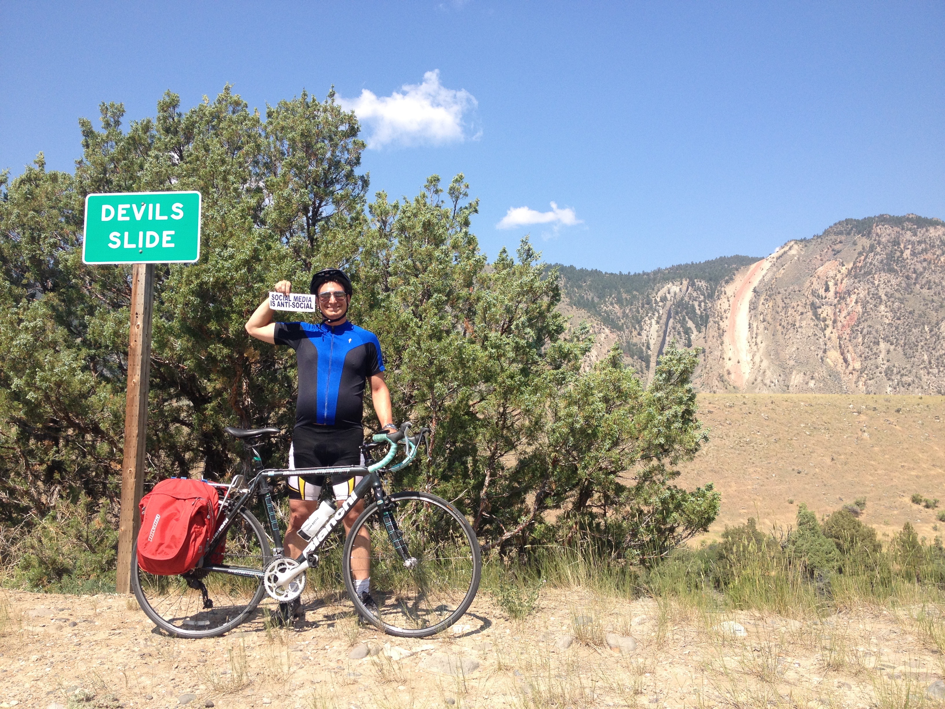
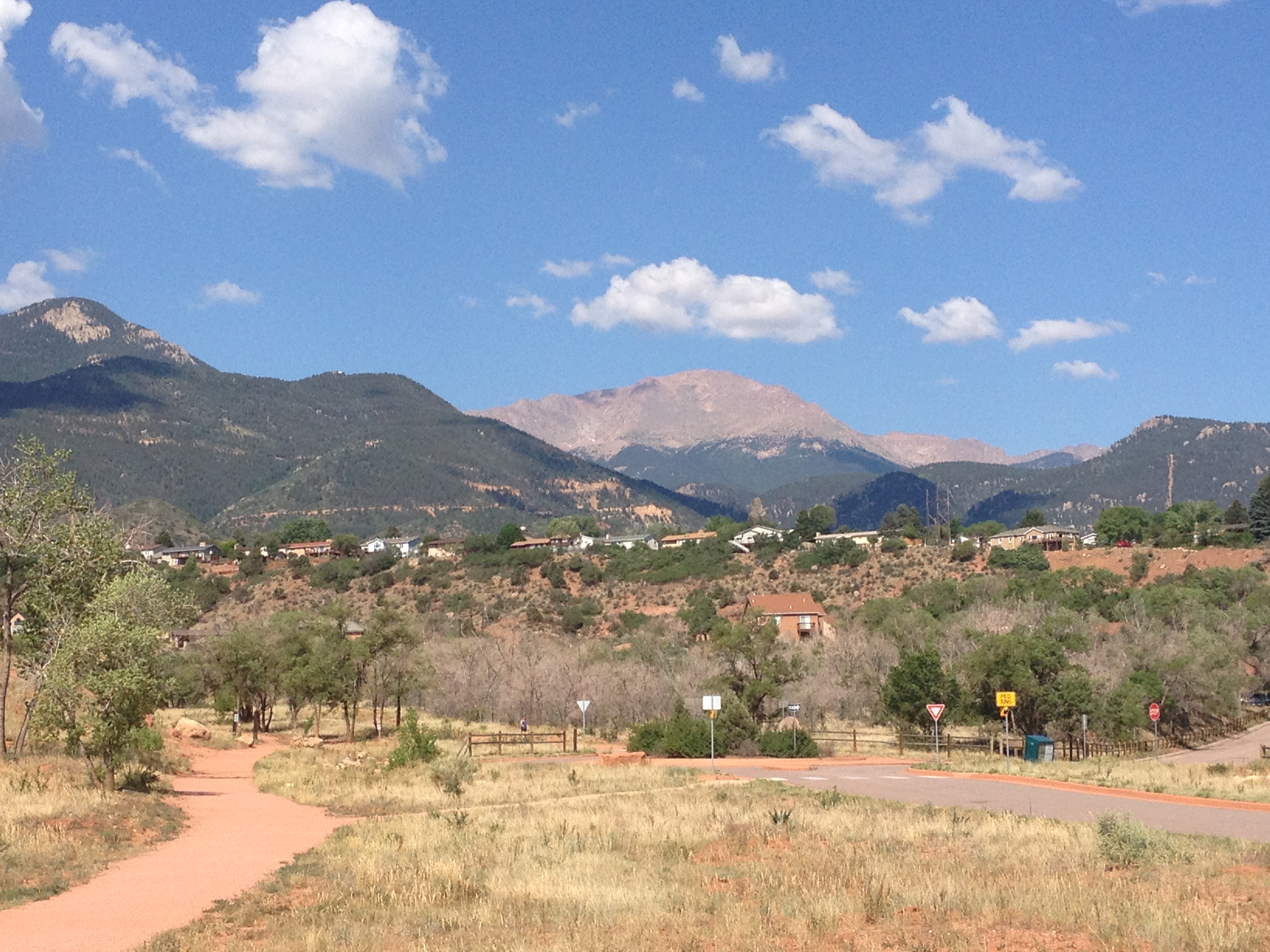
Lately it feels like nearly every article I read about personal growth mentions something about getting out of your comfort zone.  It makes sense, as getting out of our comfort zones forces us to learn new skills, see things in a different light, and keeps us in the habit of expanding our horizons.  One thing I had realized, though, is that many of us often equate leaving our comfort zone with trying something new.  While they often go hand and hand, they are not completely equivalent.  I would argue that, for someone who parties every weekend, trying out a different bar, while a new experience, is not really stepping outside their comfort zone.  Likewise, it takes significant courage, and takes one a significant distance outside their comfort zone, to stand up to a boss or an office bully, despite the fact that they are sitting in the same desk they have sat in every day for multiple years.

IMG_4198 IMG_4205

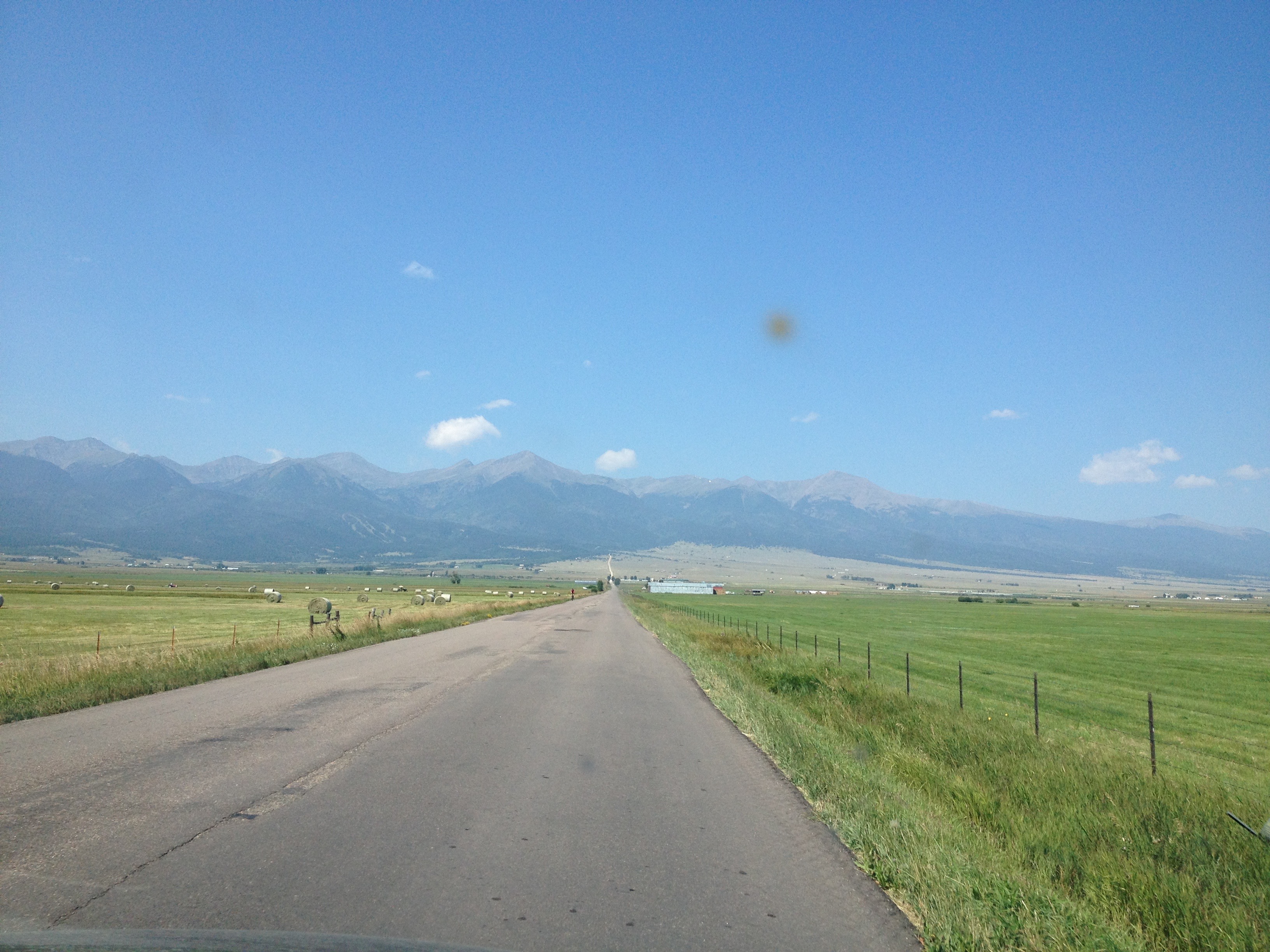
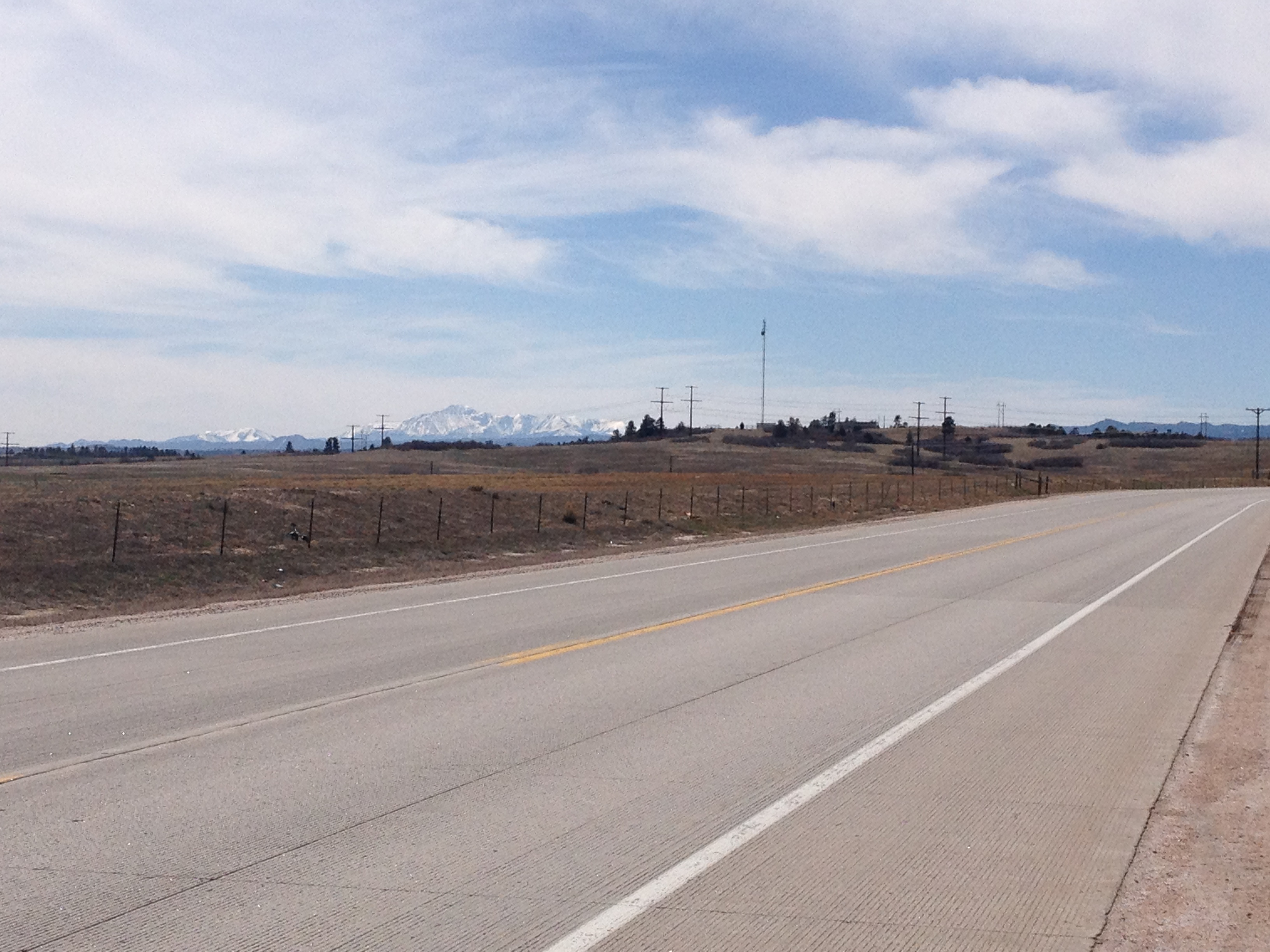
My first backpacking trip would be my first time in the wilderness, completely away from any buildings or vehicles, with no amenities, and no access to supplies other than what has been packed.  Anything forgotten cannot be retrieved.  There is no going back to the car to escape inclement weather, and no town to purchase replacements for any camping gear that may malfunction.  We are completely on our own!

IMG_4207 IMG_4302

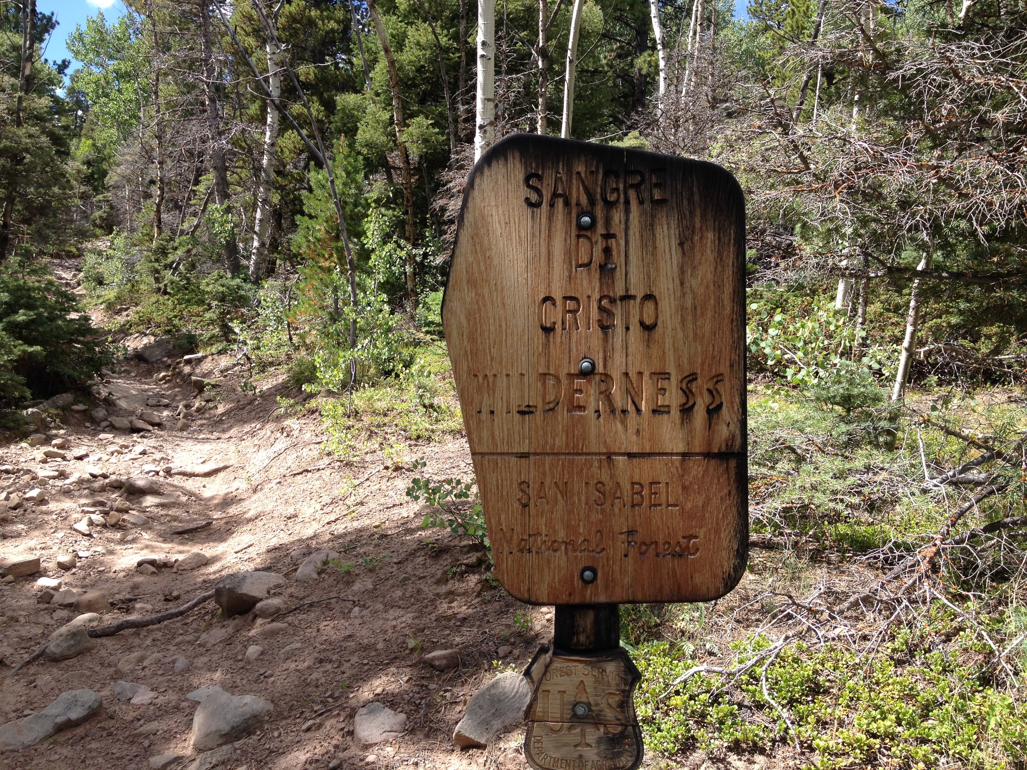
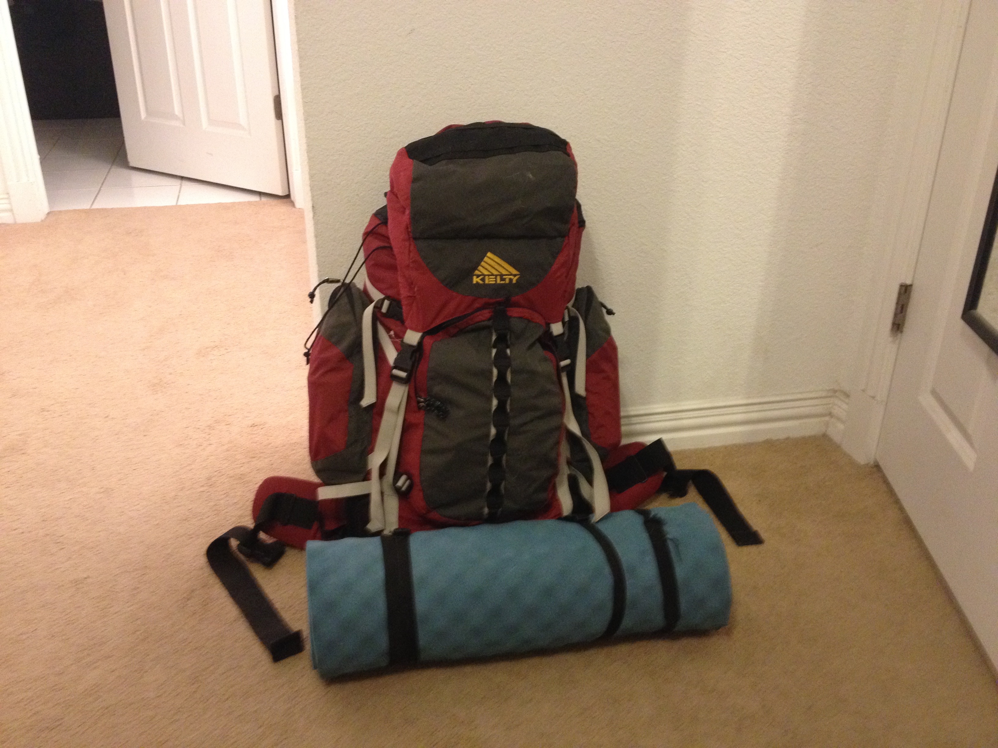
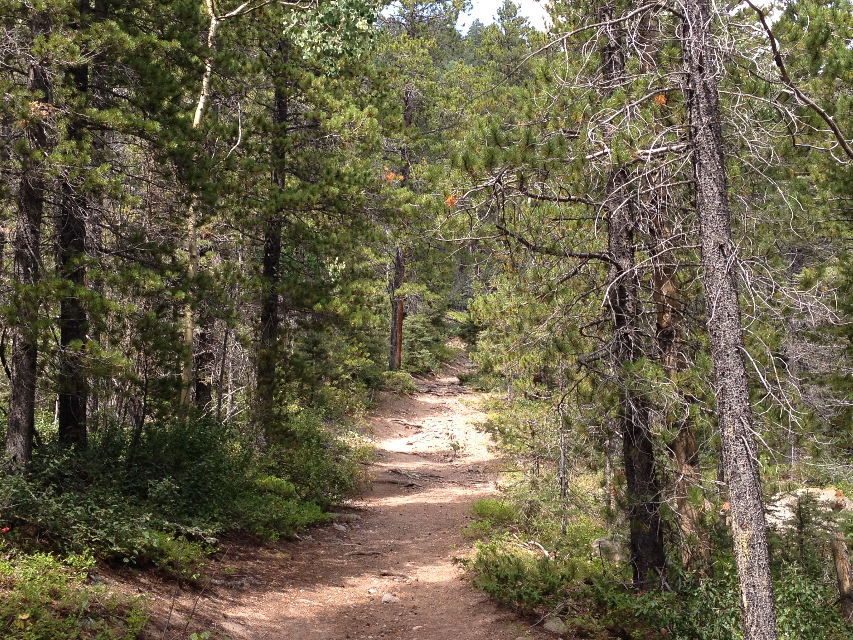
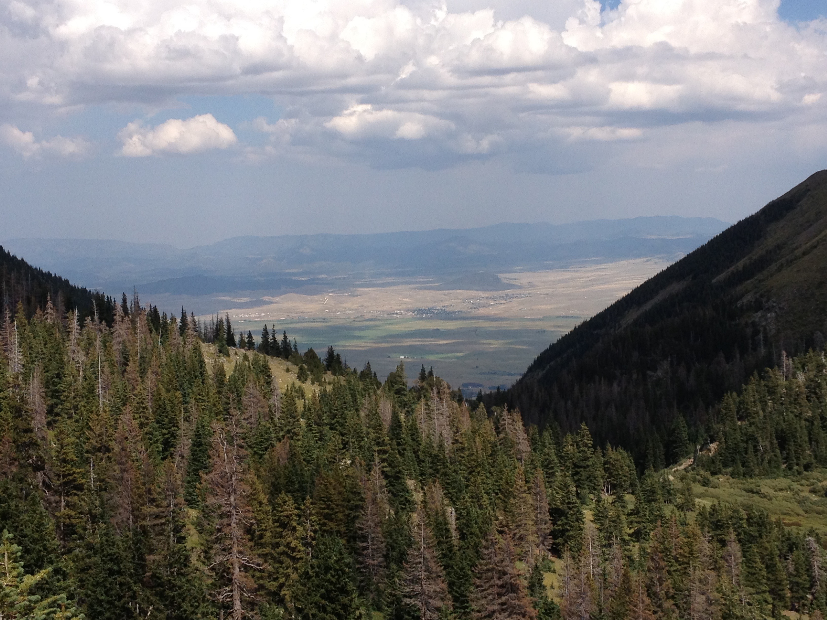
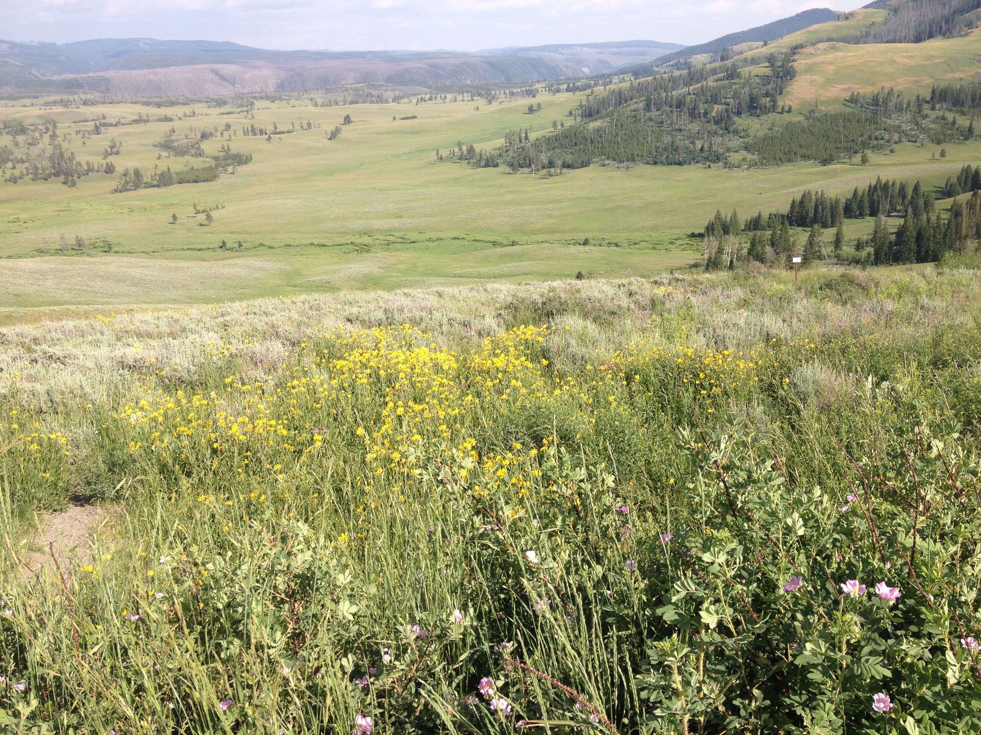
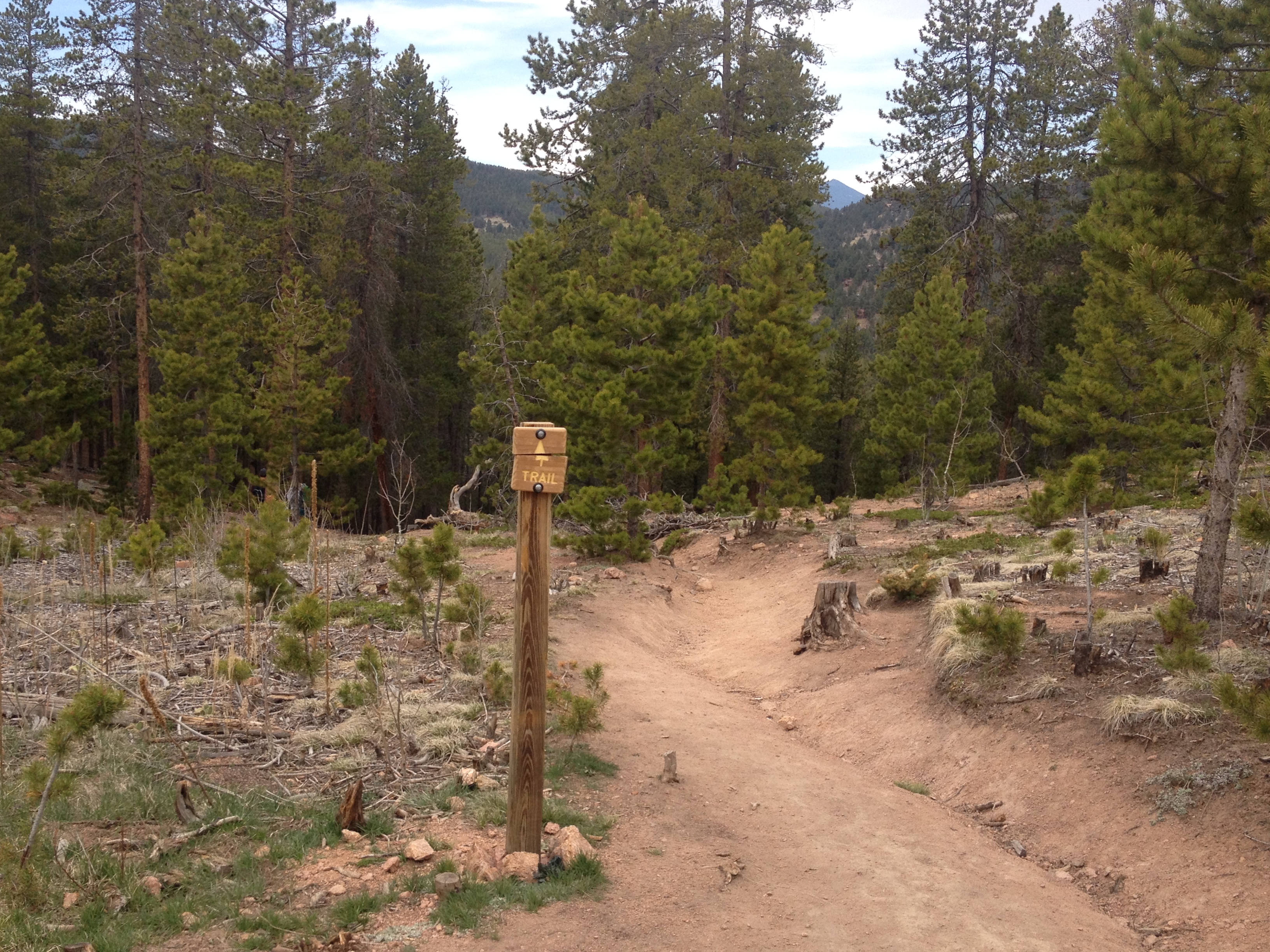
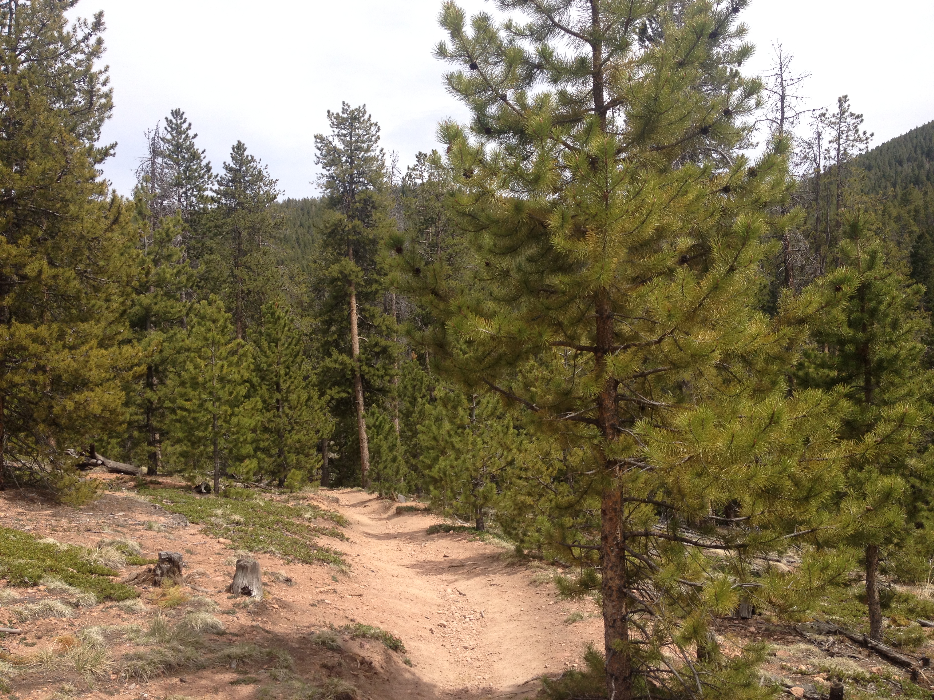
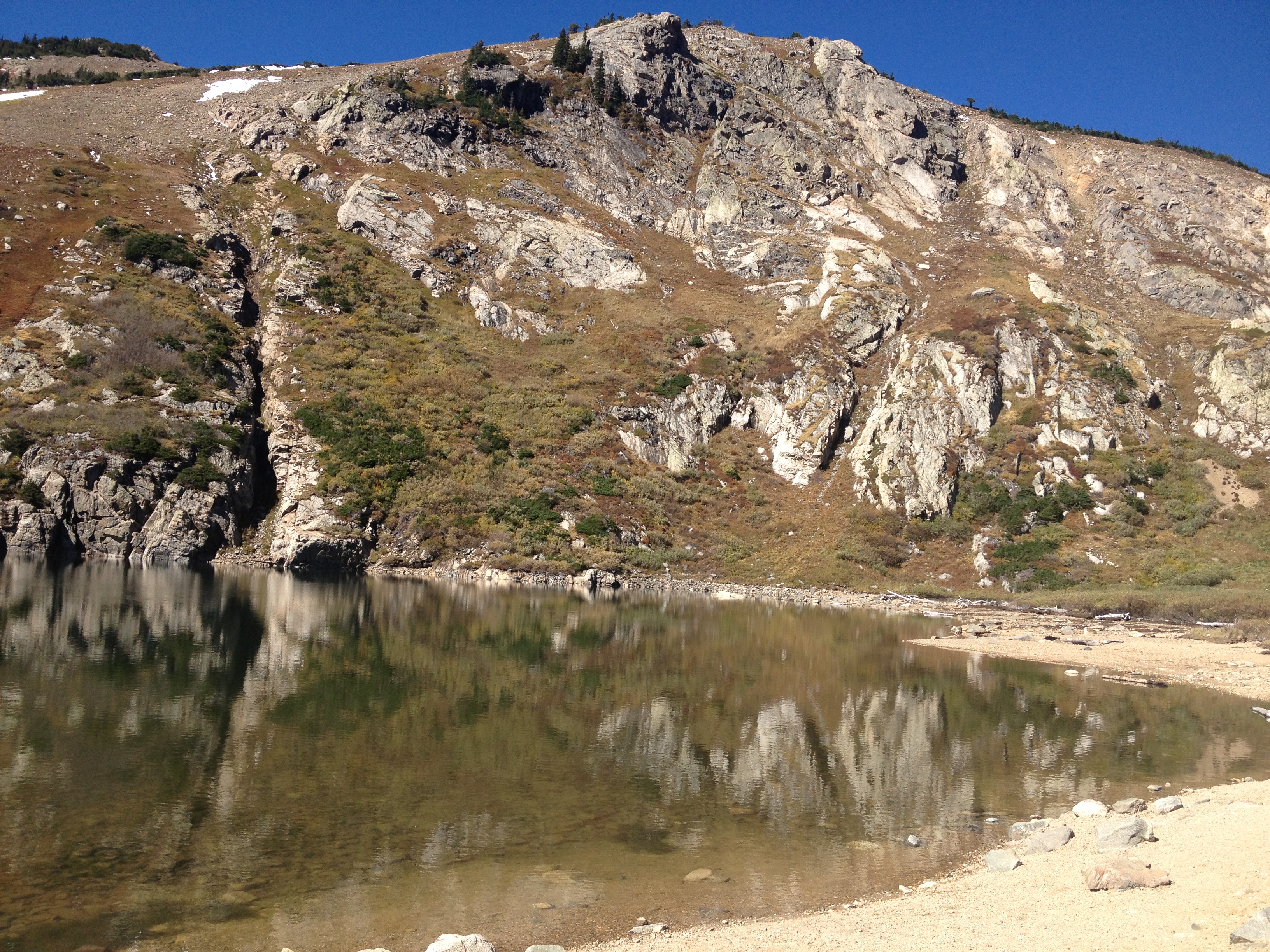
Because this is my first time backpacking, we kept it simple, doing a loop of only 13-14 total miles up the Comanche Trail, over the ridge, and then back down the Venable trail.  I wish to try new things, expand my horizons, and step outside my comfort zone, but I want to do it in a manner that is smart.  I am accustomed to carrying little more than an extra layer or two, water, and some snacks when I hike.  Carrying a backpack, which probably weighed at least 30 pounds, is significantly more intense.  Not leaving some wiggle room in case something goes wrong, could be potentially dangerous.

IMG_4212 IMG_4213 IMG_4219 IMG_4227

And, well, something did go wrong.  After an exhausting 2600 foot climb from the trailhead to Comanche Lake, where we set up camp for the night, the stove malfunctioned halfway through cooking dinner.

IMG_4240 IMG_4231

We watched the sun gradually descend below the mountains, shinning only upon the higher terrain toward the end of the evening wondering what we were to do next.  Could we subsist the next couple of days, along our planned route, without any more cooked food, using only the cold food we had packed?  Would we have to cut any aspect of our trip short?  Was my first backpacking trip turning into a disaster?

IMG_4244 IMG_4245

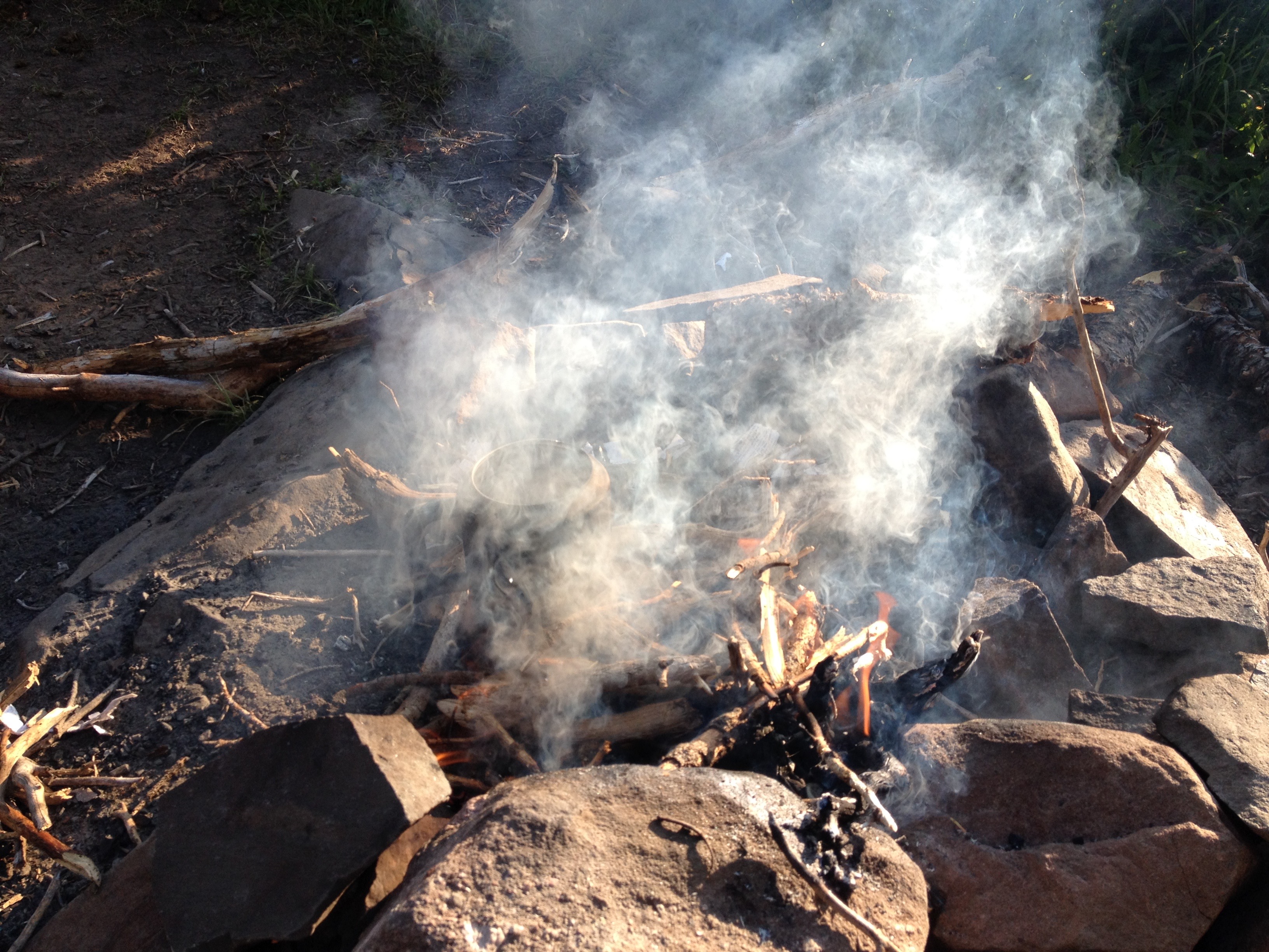
After reasoning out in our heads that we technically could make it on the remaining cold food we had brought, we luckily found this rusty old pot just sitting there by the lake.  This pot saved the day, as we had no qualms putting it directly into a campfire.

Trips like this definitely help us see our lives from a different point of view, and force us to re-evlauate what a “necessity” really is.  Case in point, Saturday morning (second day of the trip), we had Zatarains’ Red Beans and Rice, and very much appreciated it.   This is a dish I will periodically make at home when cooking something “simple”.  When I cook red beans and rice at home, I, by default, add some kind of meat to it, usually sausage.  I behave very much as if it were a necessity to “complete the dish”.  But, in many parts of the world, where people are poorer and life is simpler, rice and beans is a common dish.  Going on trips like this serves to me, as a periodic reminder that many of the things we consider “necessary” for life are not really necessary for life, they are only necessary for the lifestyle we have chosen.

IMG_4248 IMG_4250 IMG_4251 IMG_4253

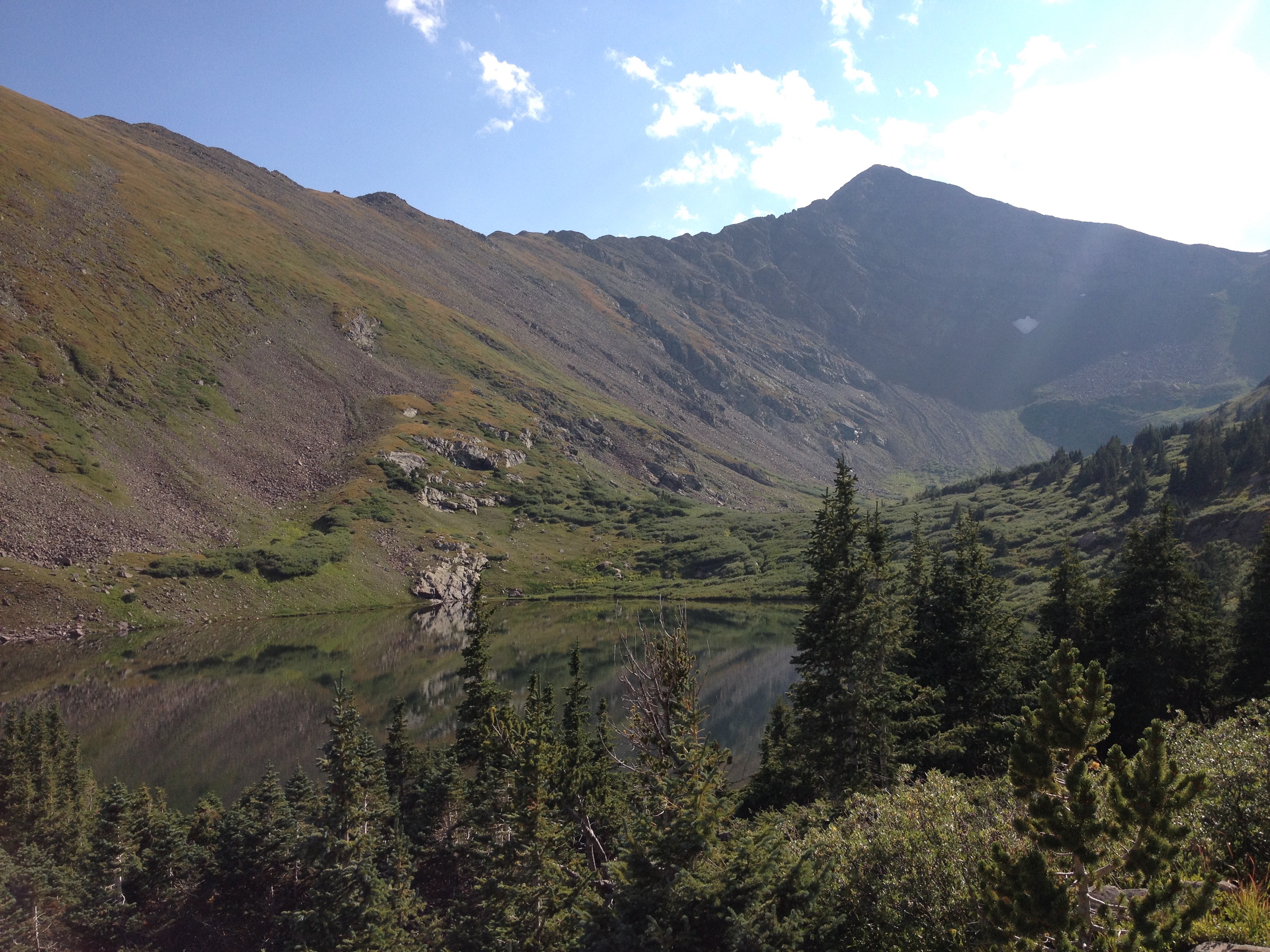
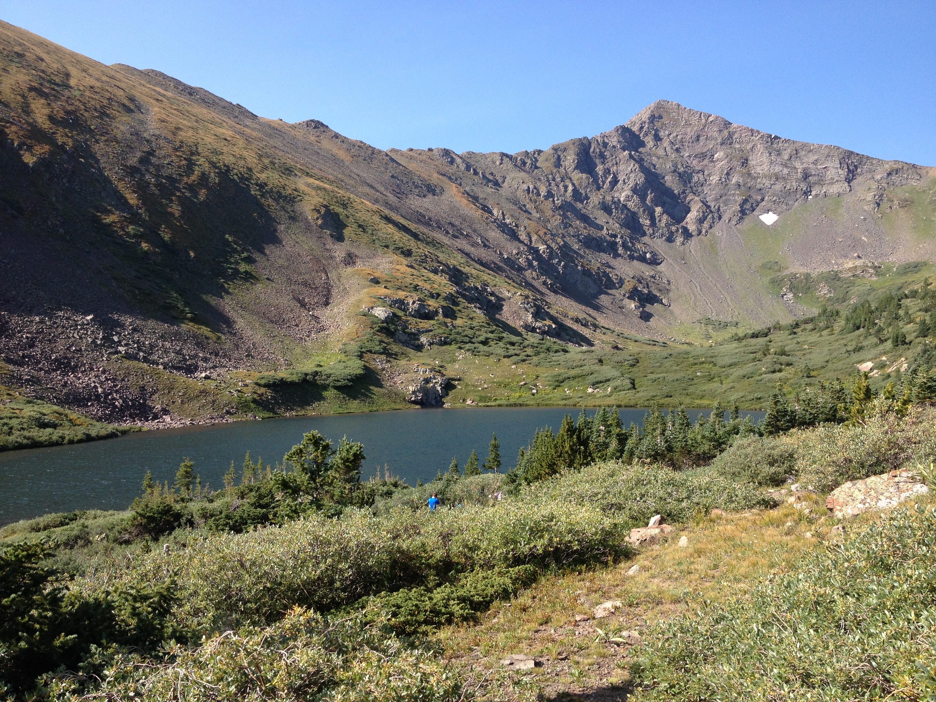
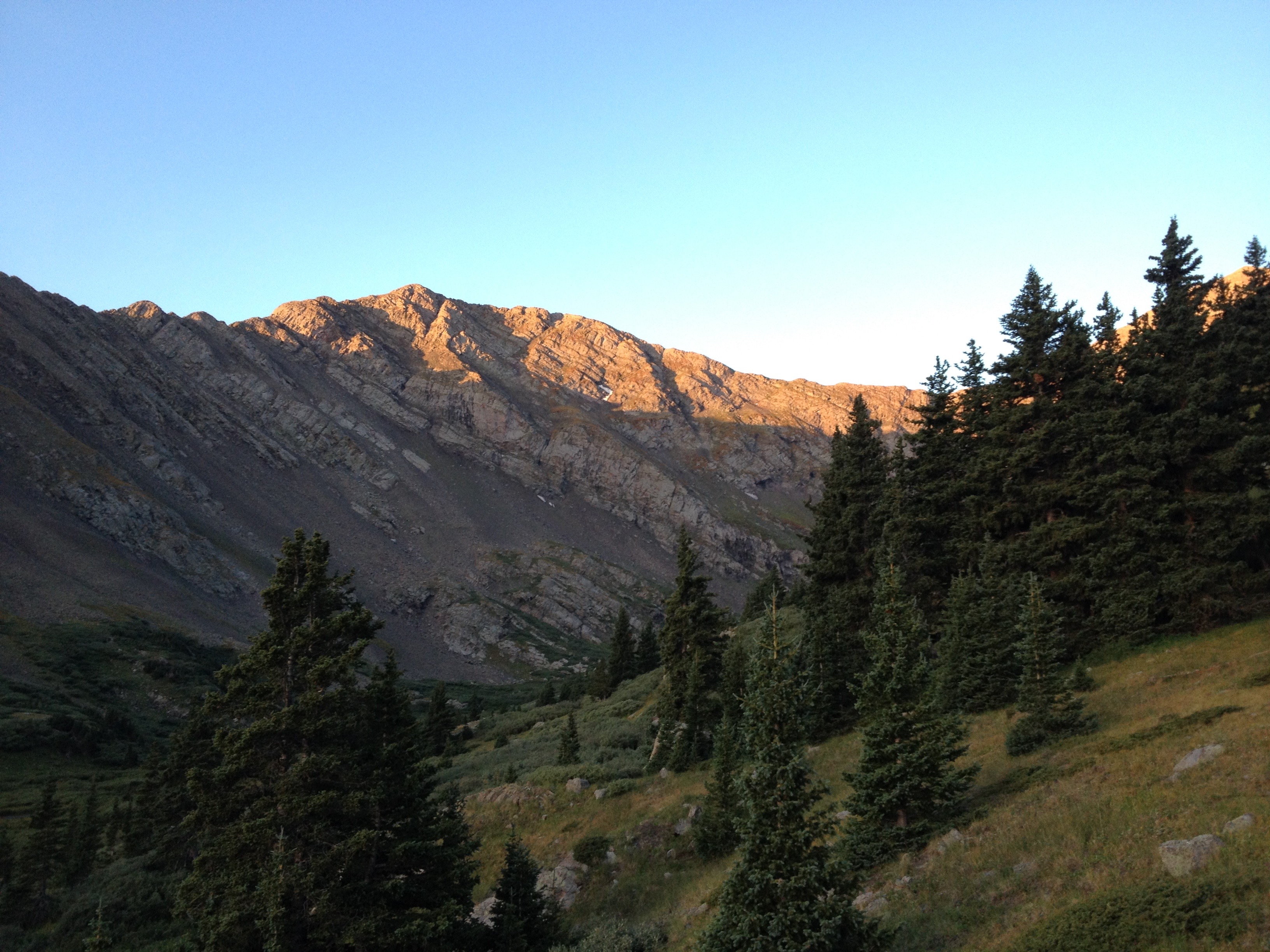
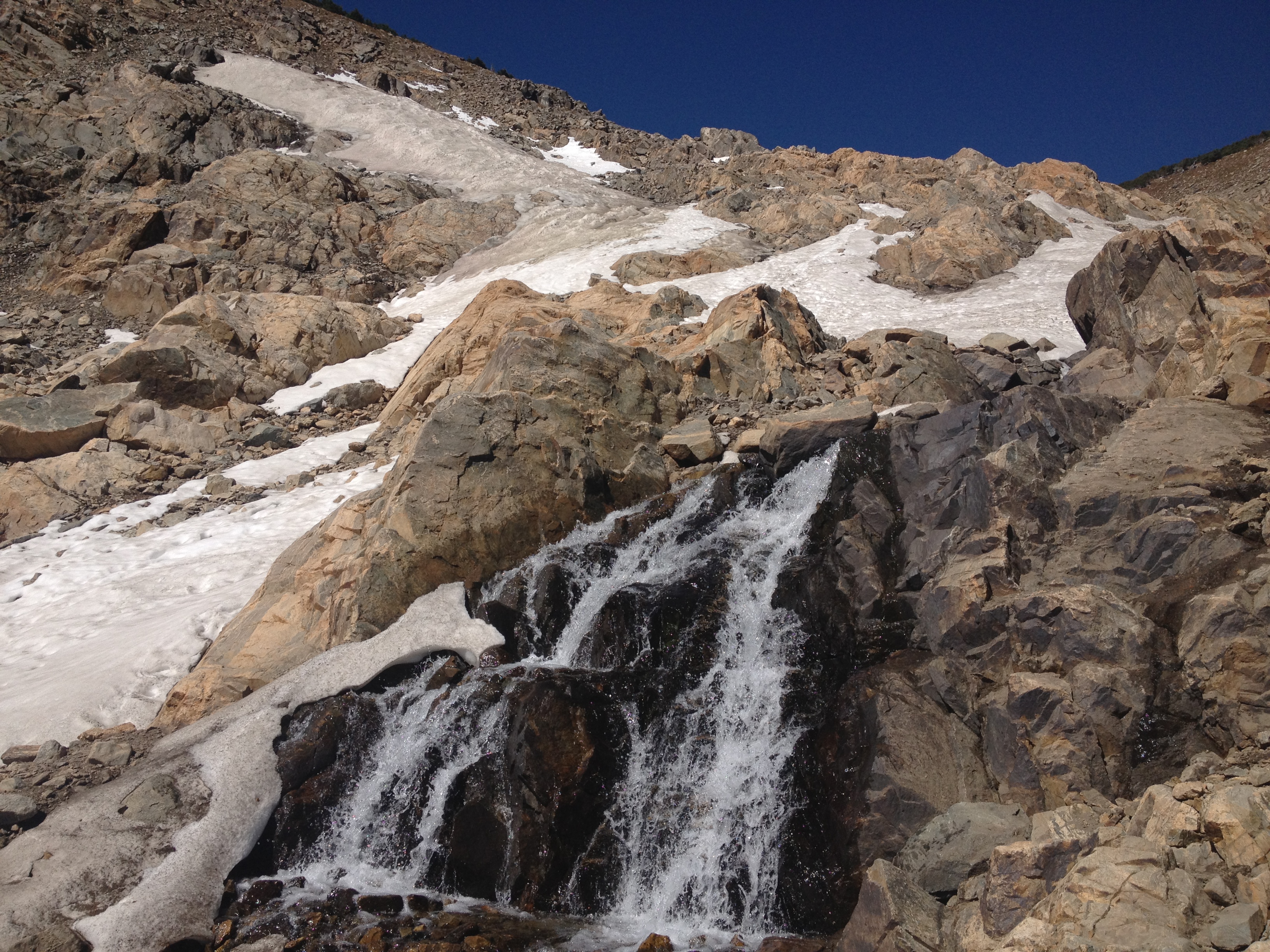
After a late start, we climbed, once again, from our campsite, at an elevation of roughly 11,600′, to the top of Comanche Pass, at roughly 12,800′.  Near the top, I suddenly realized that I was in an altered state of mind.  It felt almost surreal, and almost as if I had indeed taken some sort of mind-altering drug.  But, I hadn’t.  Some kind of combination of exhaustion, high altitude, and being outside my comfort zone had put my mind in a place where everything was both clear and blurry at the same time.  It’s hard to describe, but I am guessing that is why many yoga classes involve both an exhausting workout, and altered air conditions (heat, humidity), alongside its’ spiritual aspects.

IMG_4256 IMG_4257 IMG_4258 IMG_4261

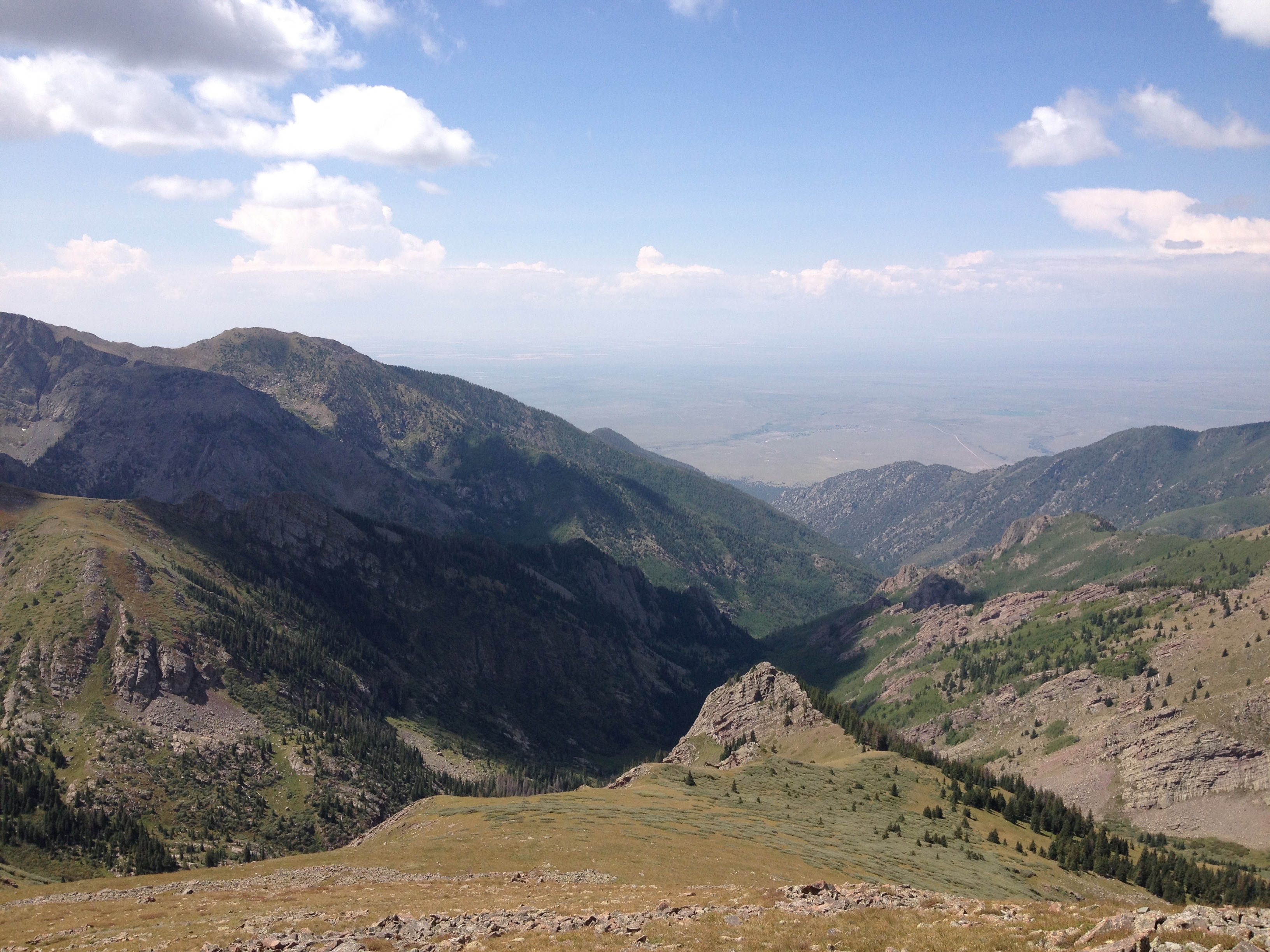
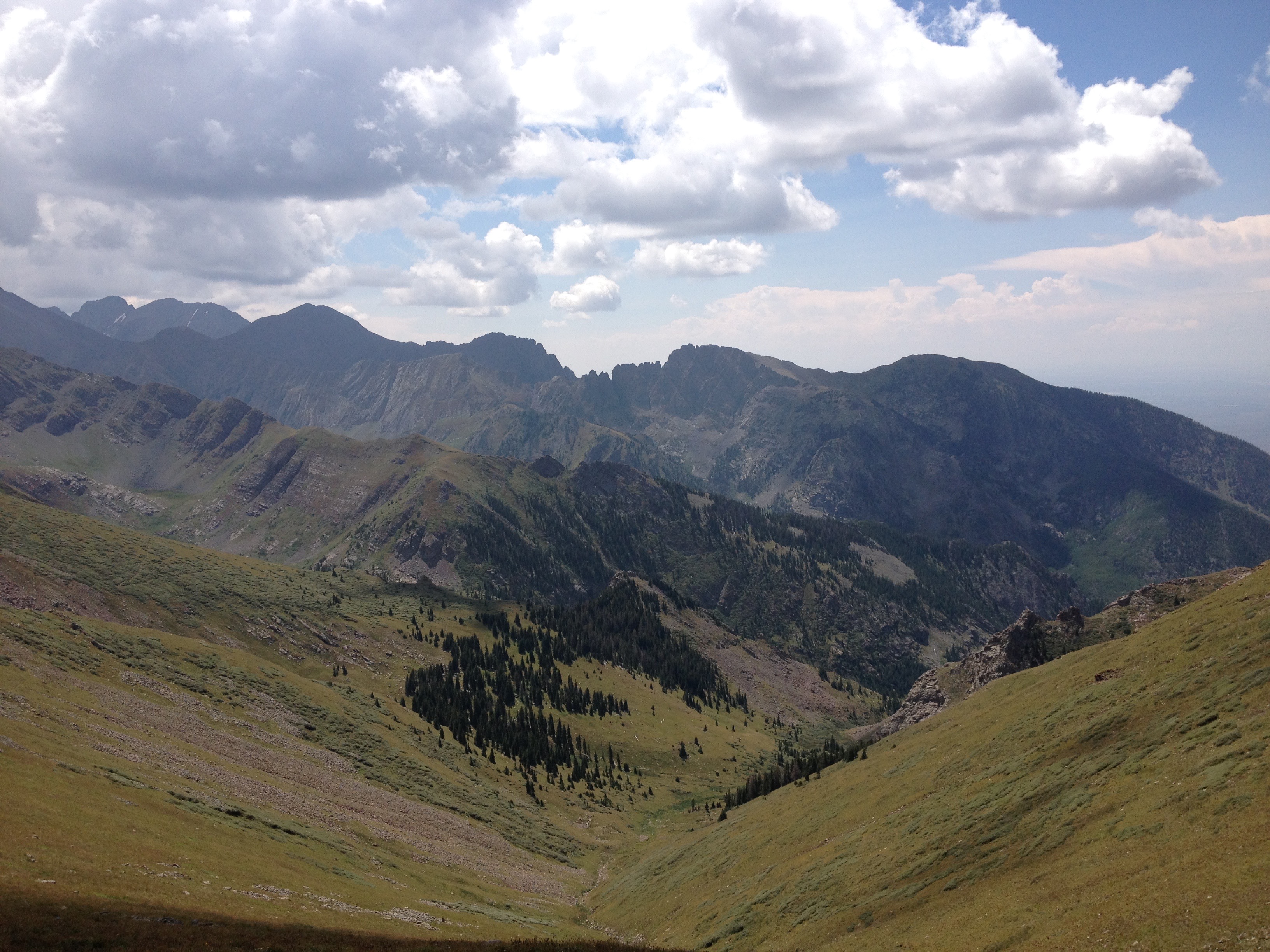
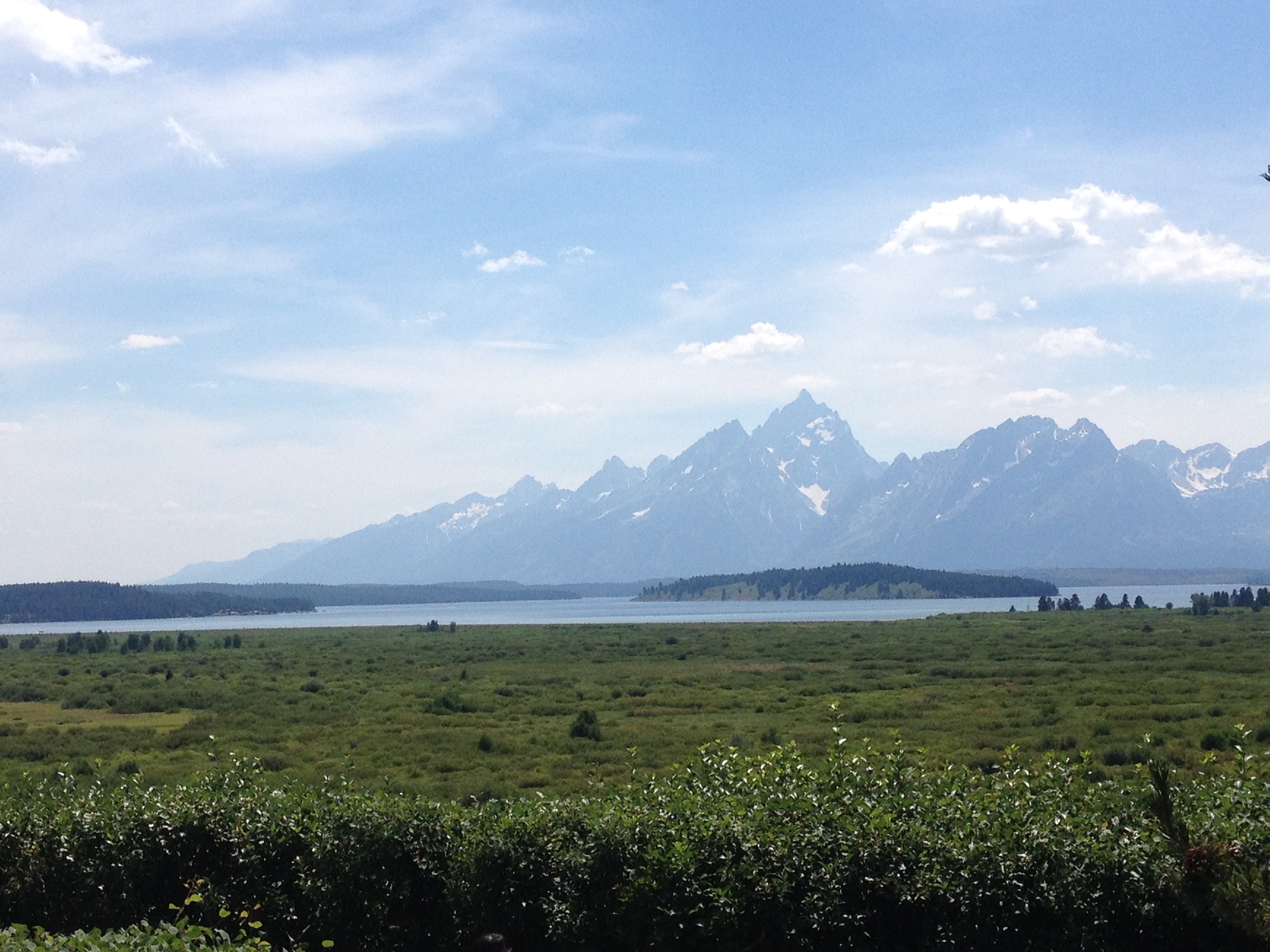
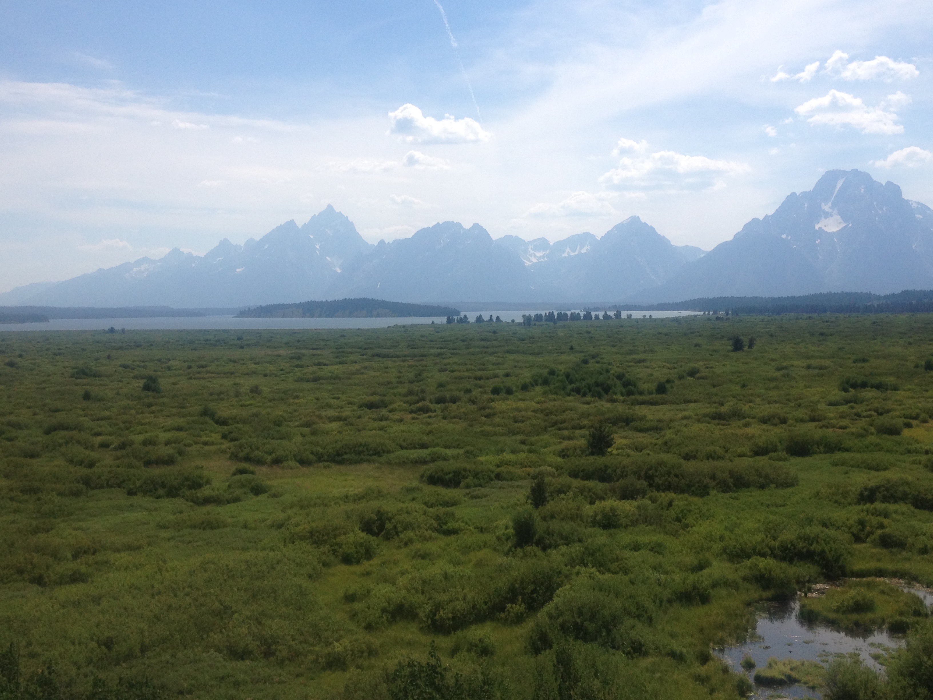
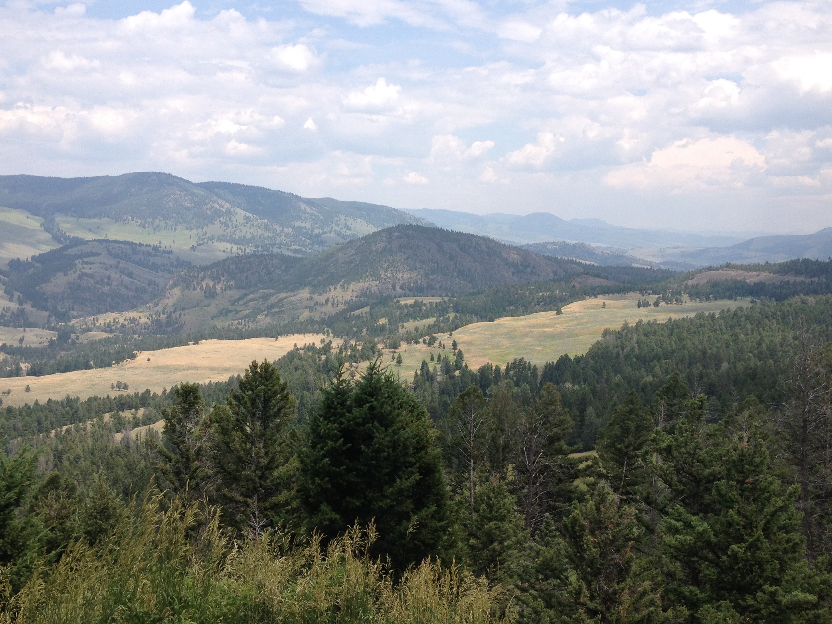
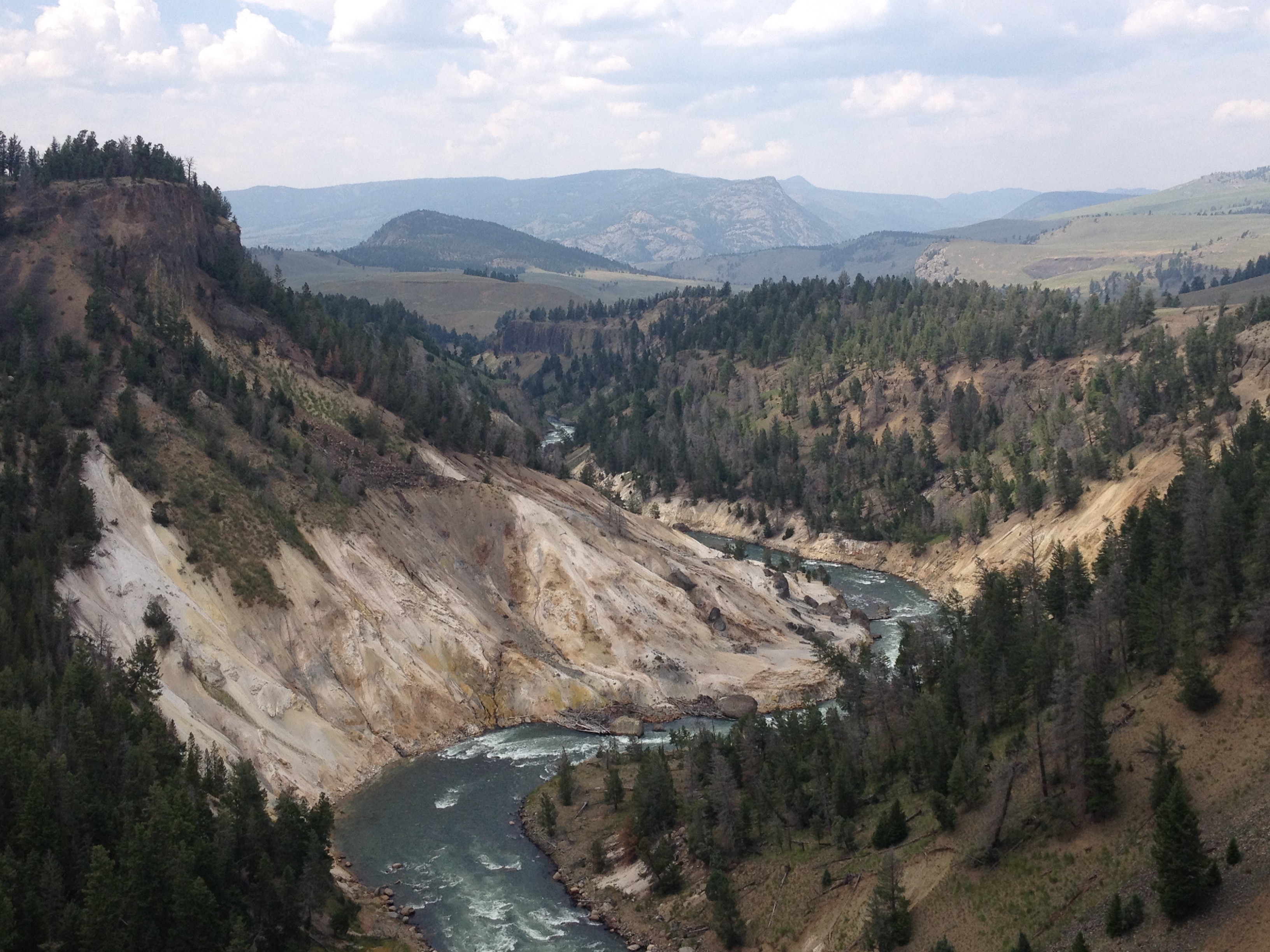
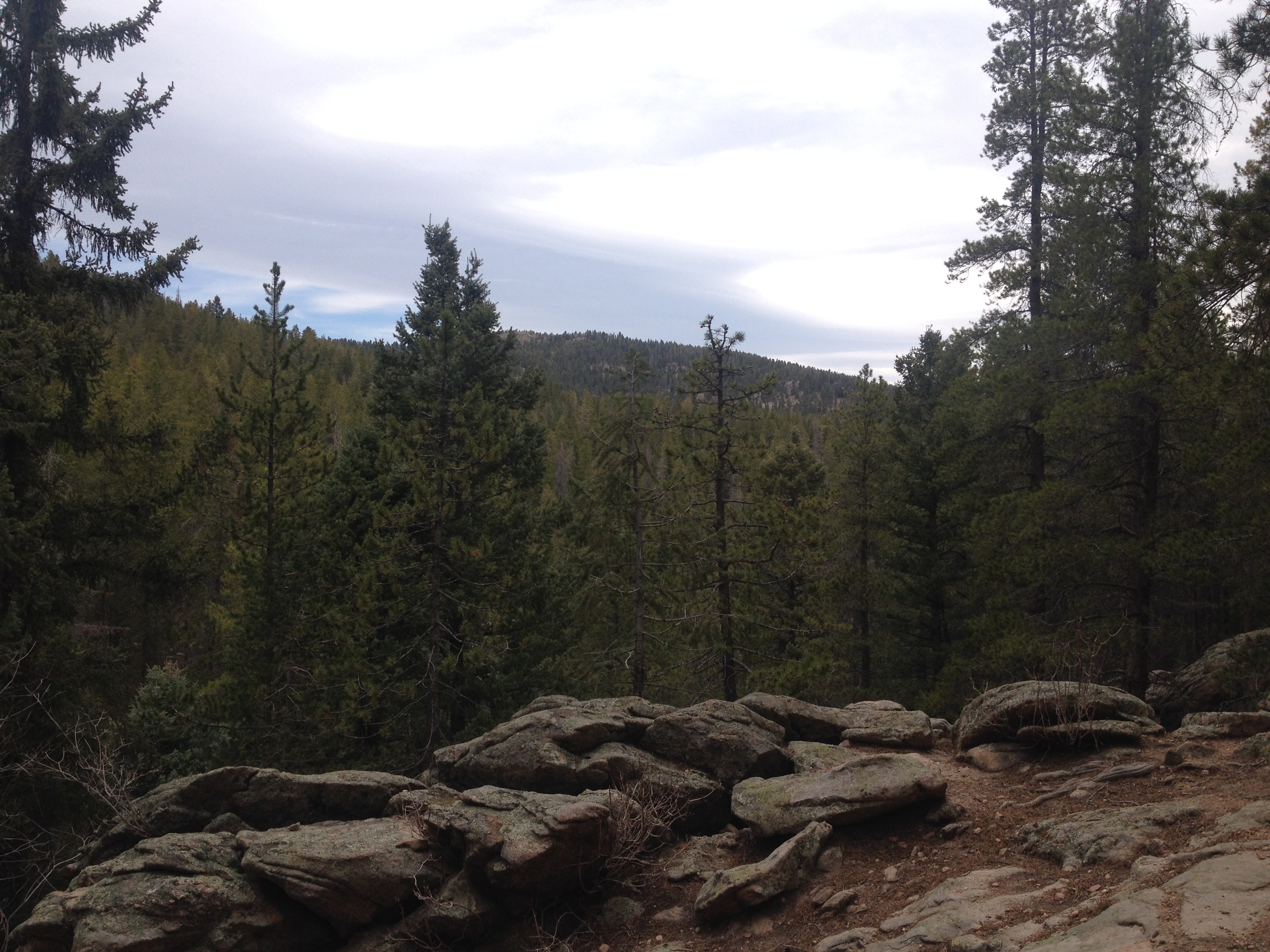
All this made the view at the top, of nearby Comanche Peak, looking Eastward toward the Wet Mountain Valley we hiked in from, and over the mountains toward the Upper San Louis Valley, even more spectacular!

IMG_4260 IMG_4262

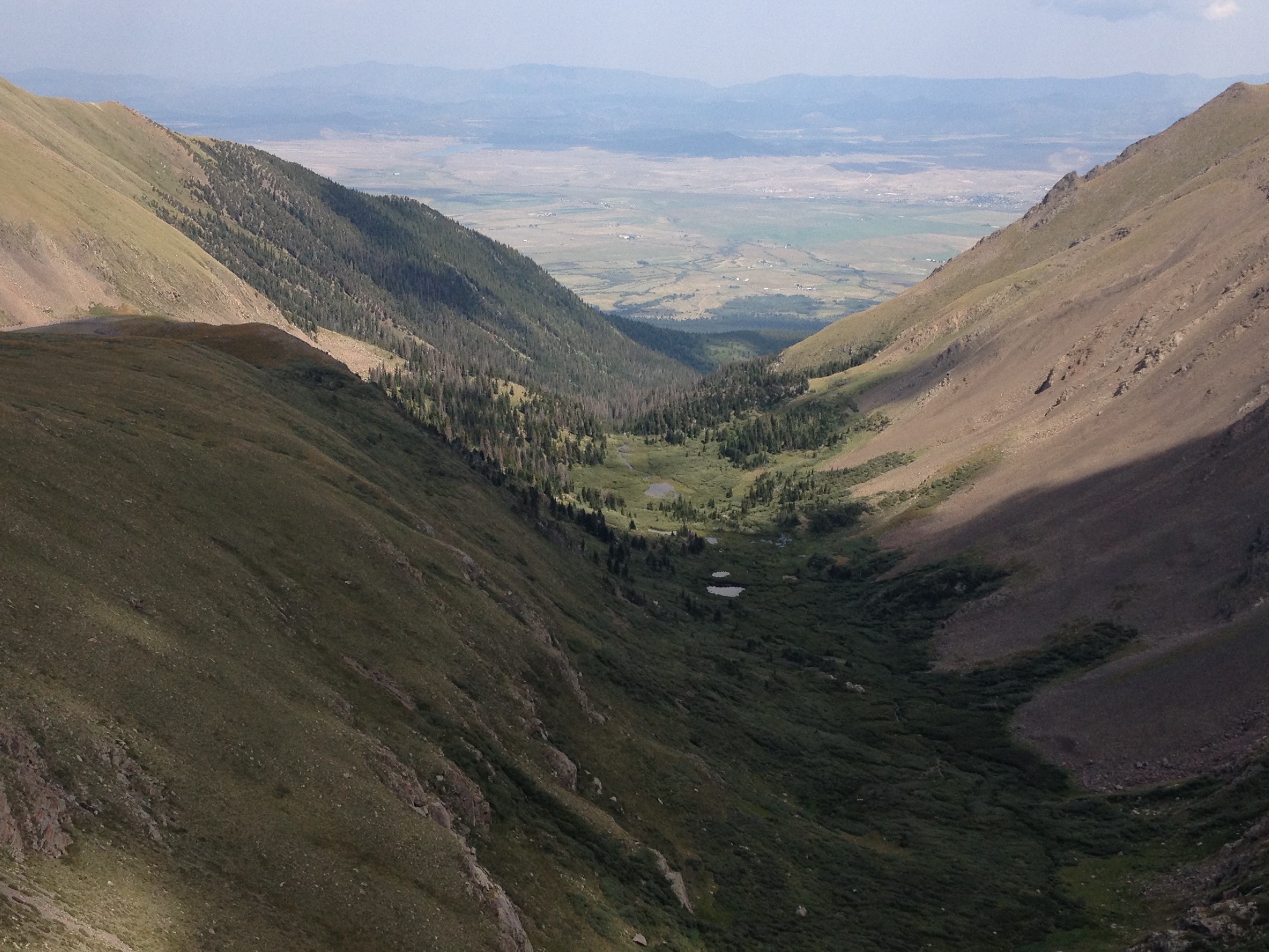
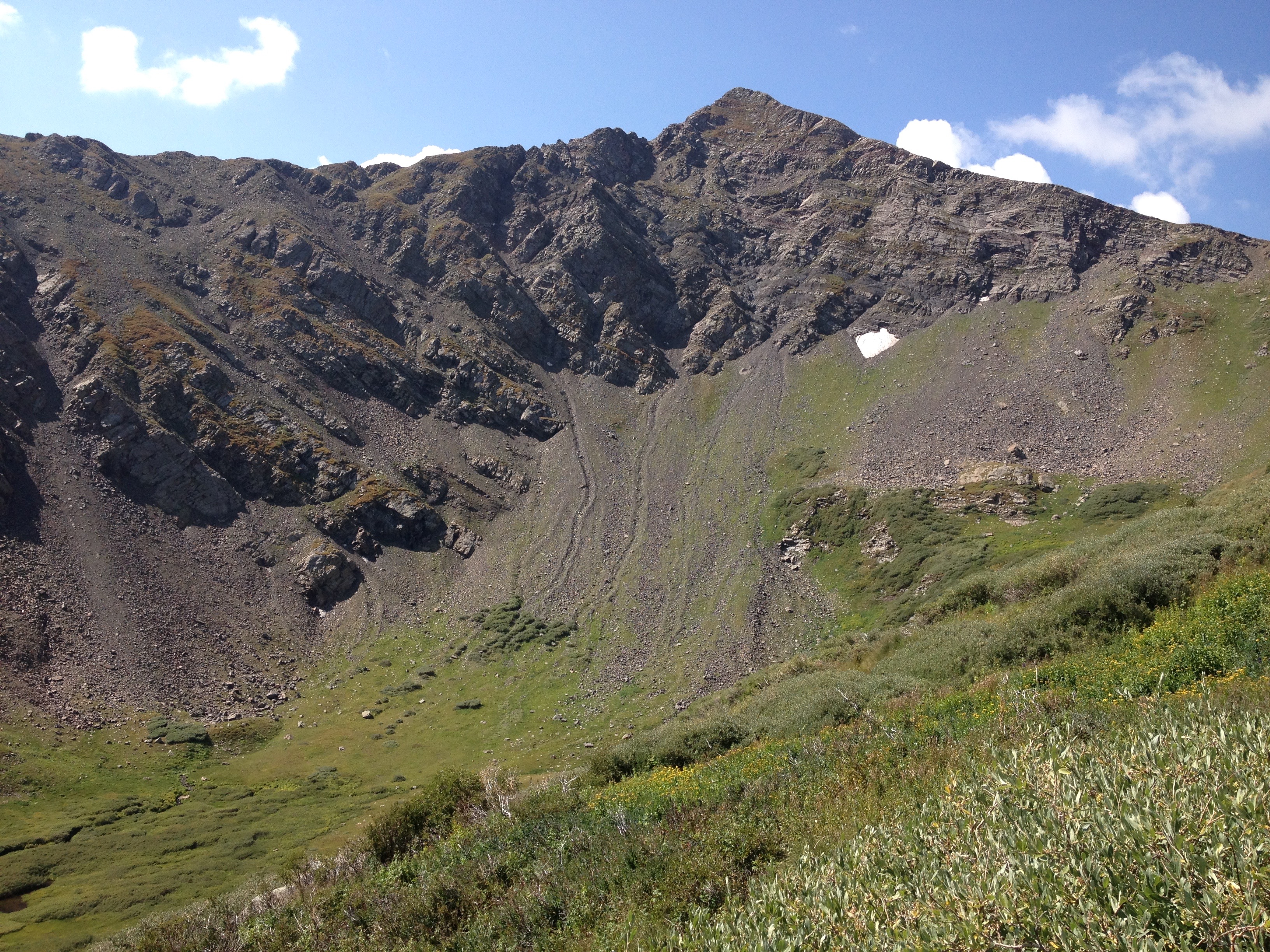
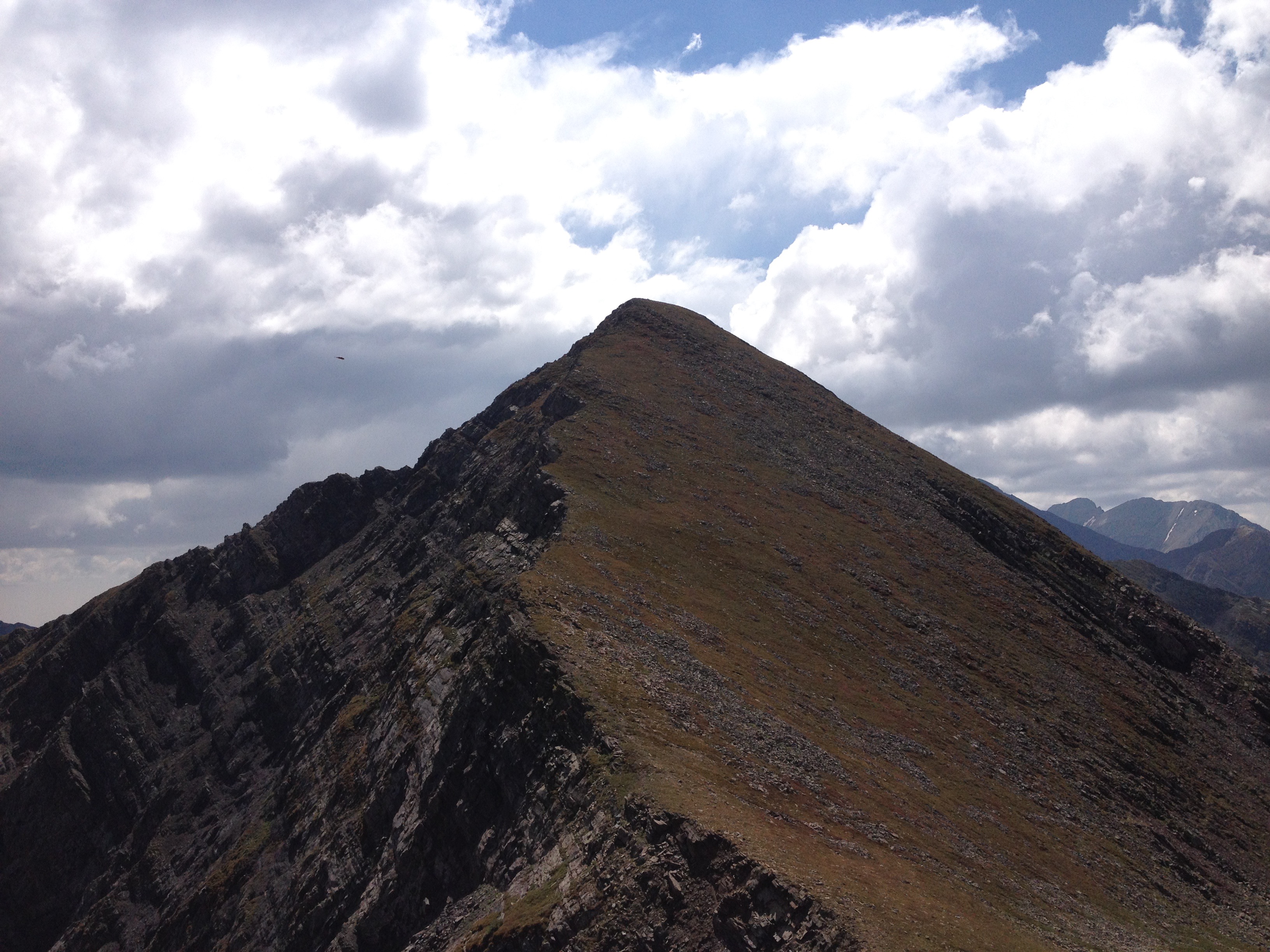
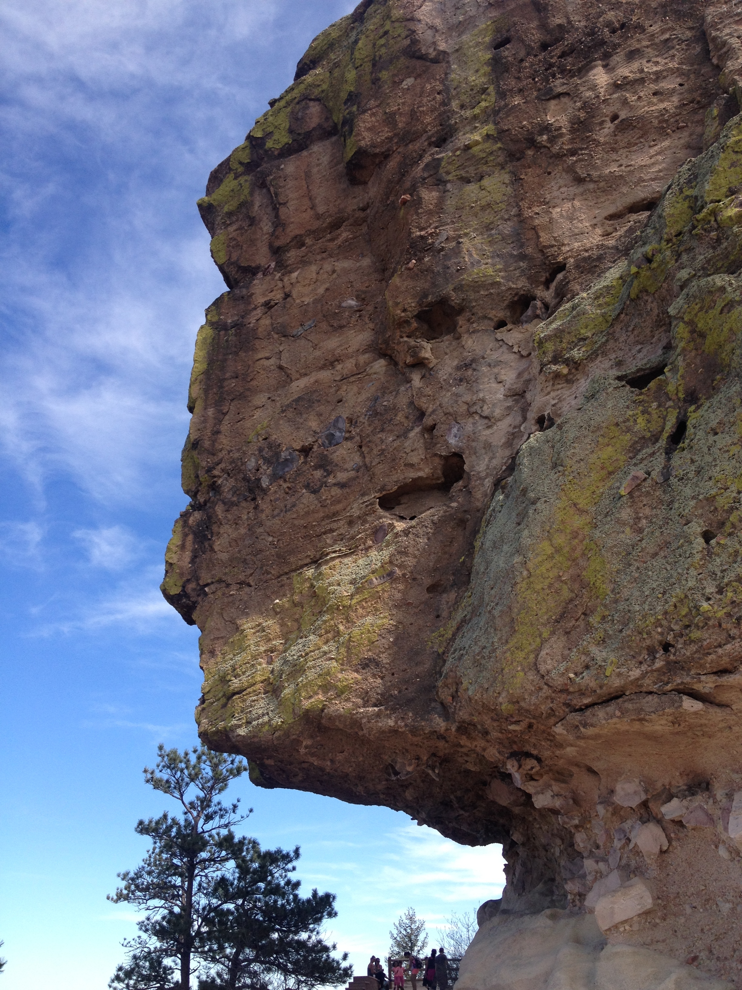
And, after a mile or so with little elevation change, we climbed back up onto the ridge at a place called Venable Pass, where we would complete our loop.  Here, we stopped to eat lunch before beginning our descent through an area known as Phantom Terrace.

IMG_4264 IMG_4267

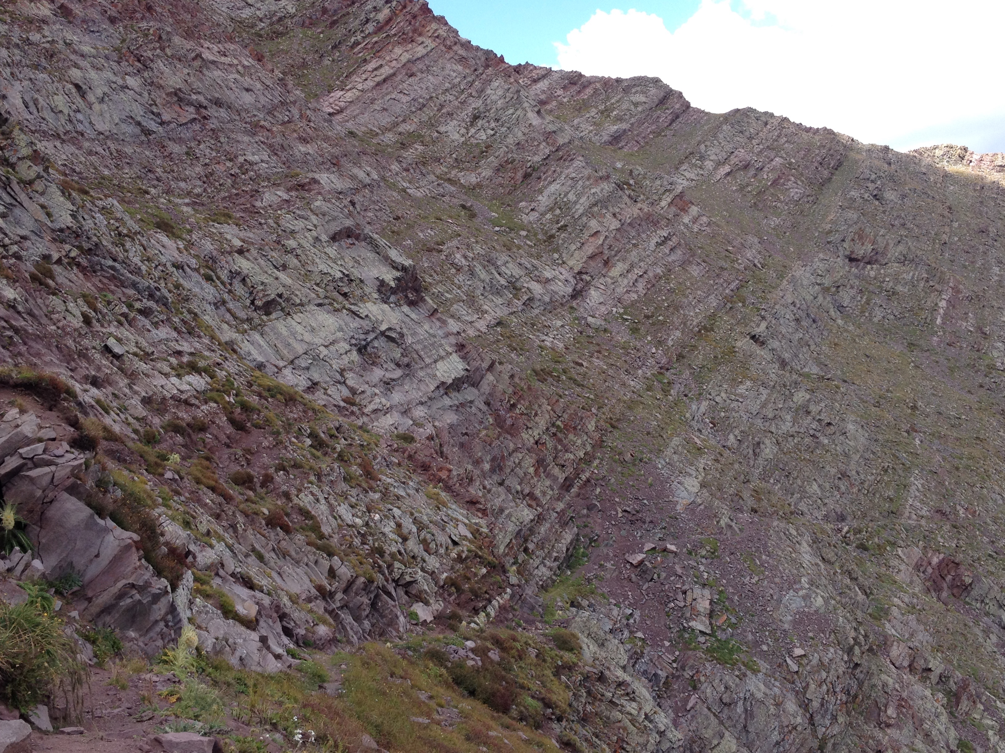
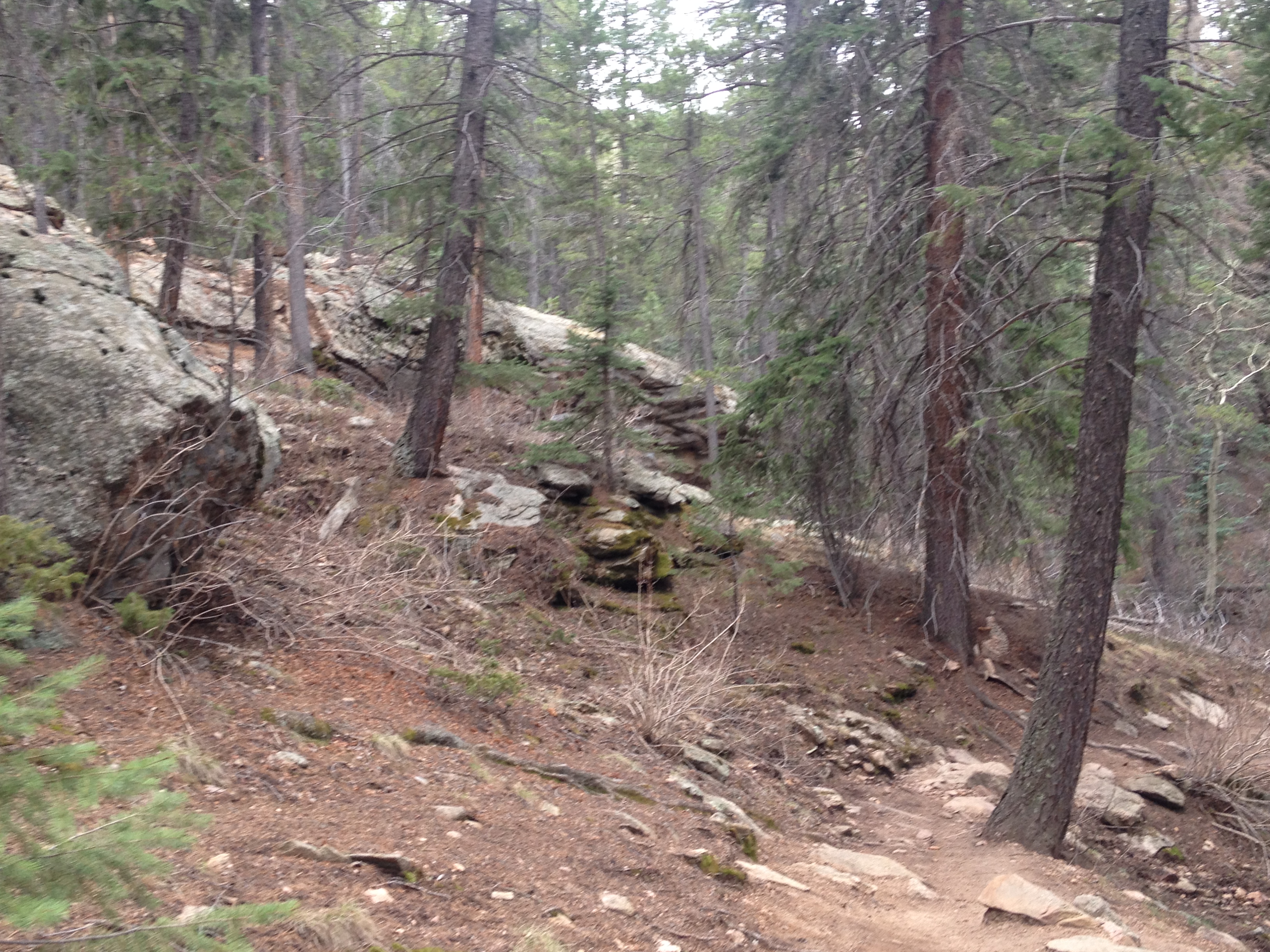
This descent was tricky enough that my exhaustion, and the altered state of mind associated with it, continued.  All sorts of crazy shit was on my mind as we descended towards the Venable Lakes.

IMG_4268 IMG_4269 IMG_4270

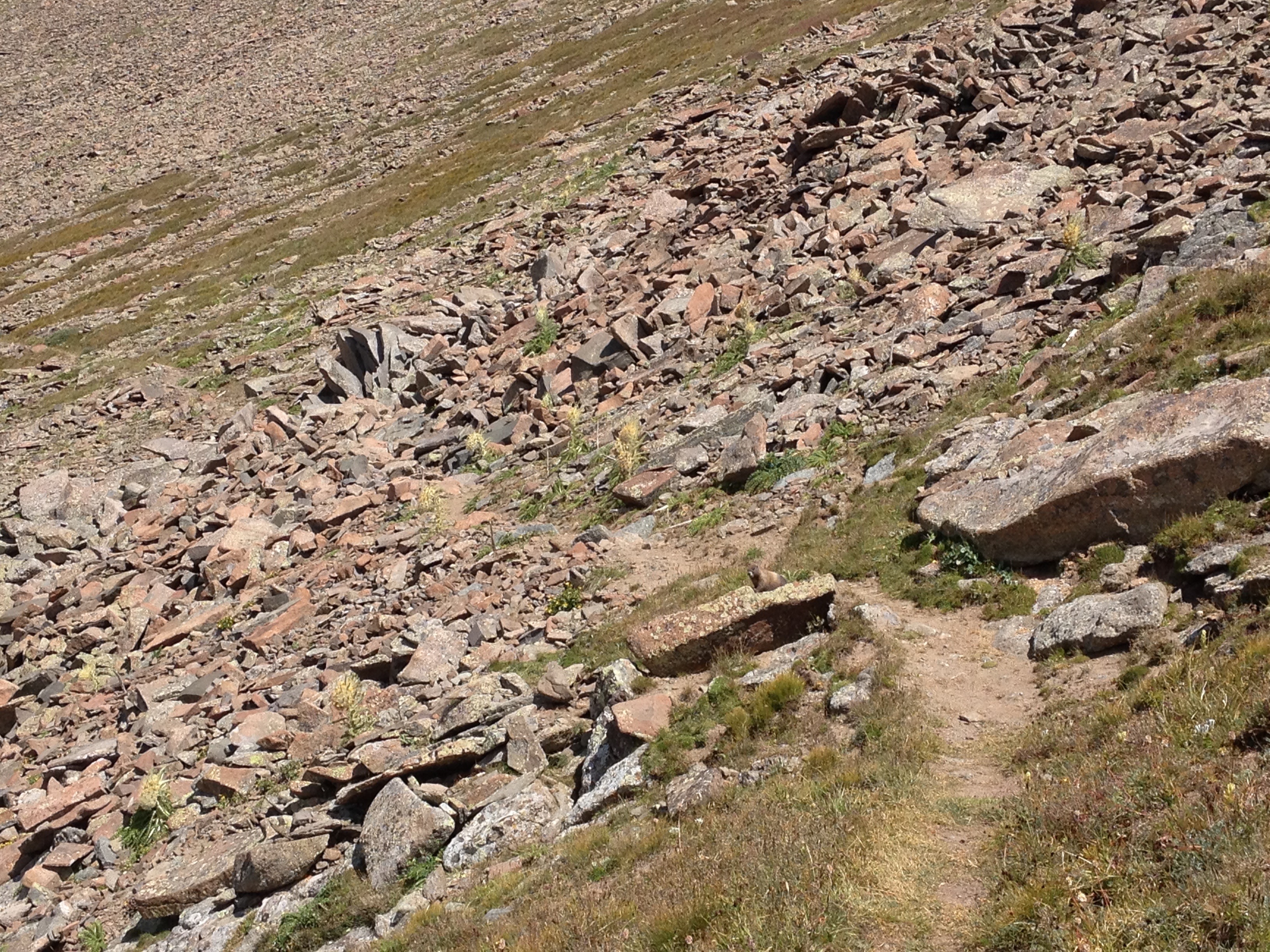
Of course, it was on this descent where I saw the highest concentration of my least favorite plant ever.  I really do not know what they are called, but they look vicious.  They remind me both of the flesh eating plant in the movie Little Shop of Horrors, as well as the plans that try to bite in Mario Brothers.  In fact, in my altered state of mind, I actually felt as if these plants were trying to bite me as I walked by.  It was freaky.  Maybe, despite the Red Beans and Rice, I still did not eat enough, or drink enough, I don’t know.

IMG_4274 IMG_4276

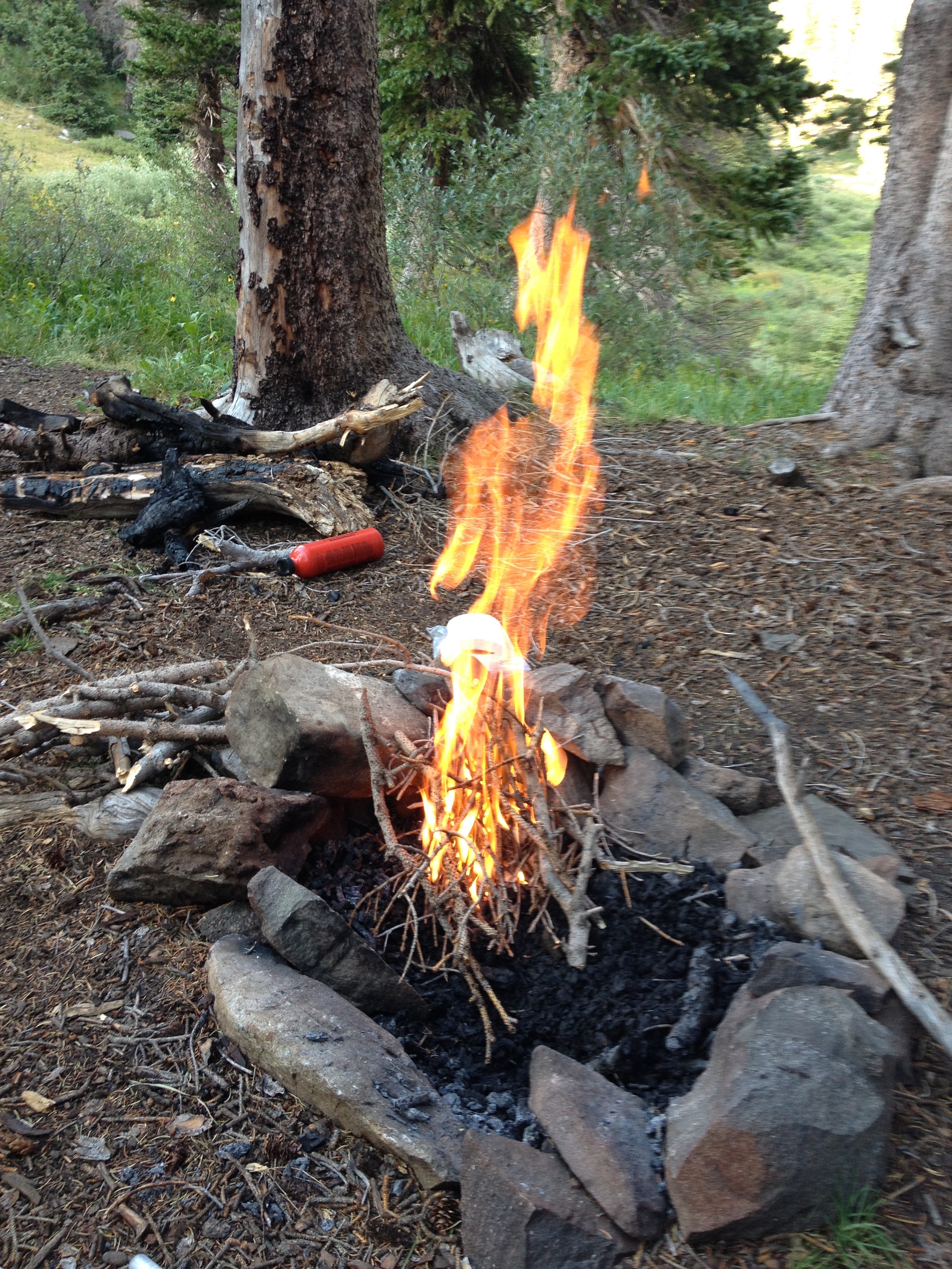
We camped the second night just below Venable Lakes, as we had to get back down to the tree line for access to firewood.  We had become pretty well versed in the process of starting a fire and using it to cook our food using that rusty old pot we found (and kept after the trip).

IMG_4281 IMG_4282 IMG_4285 IMG_4286 IMG_4287

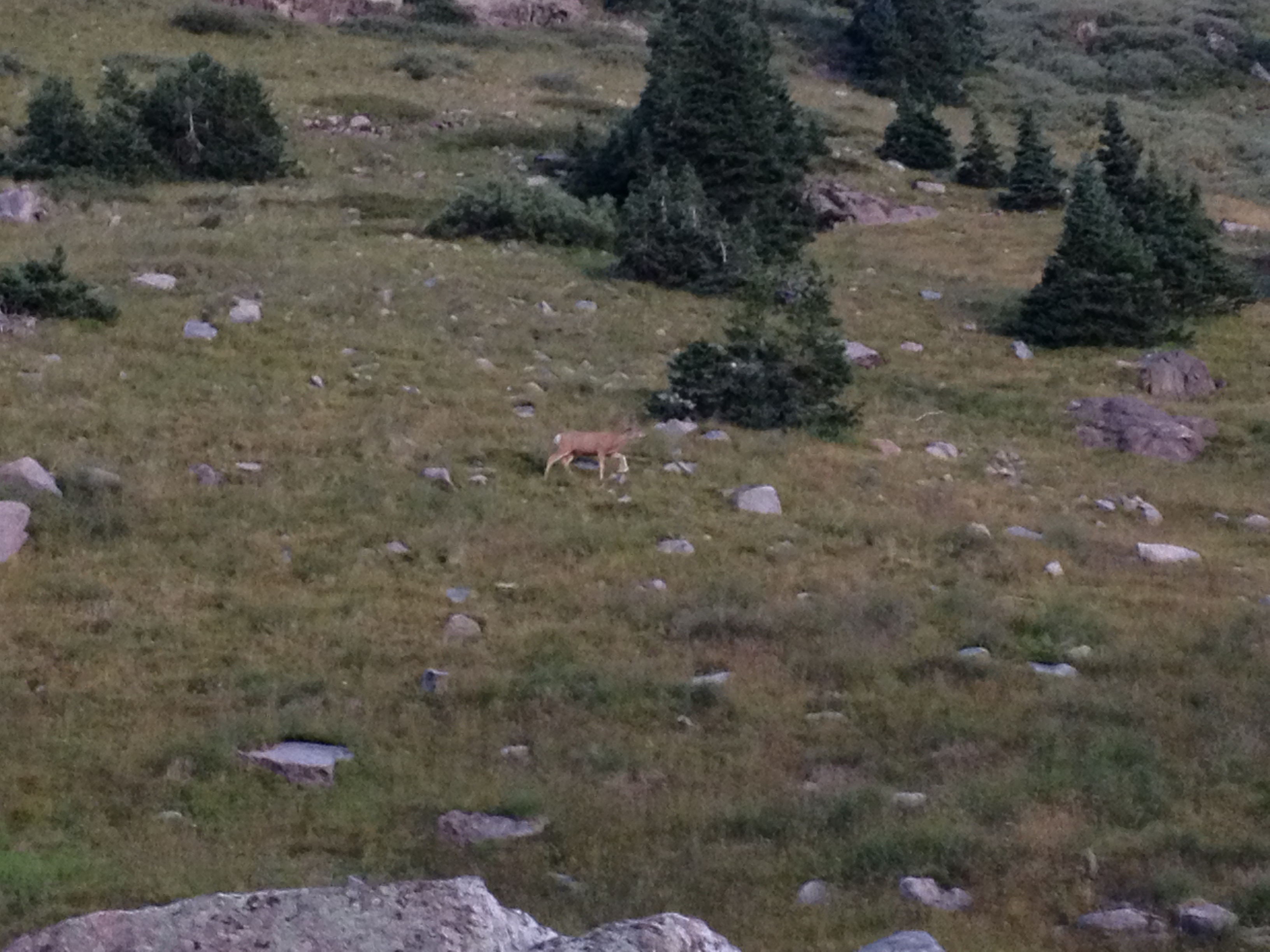
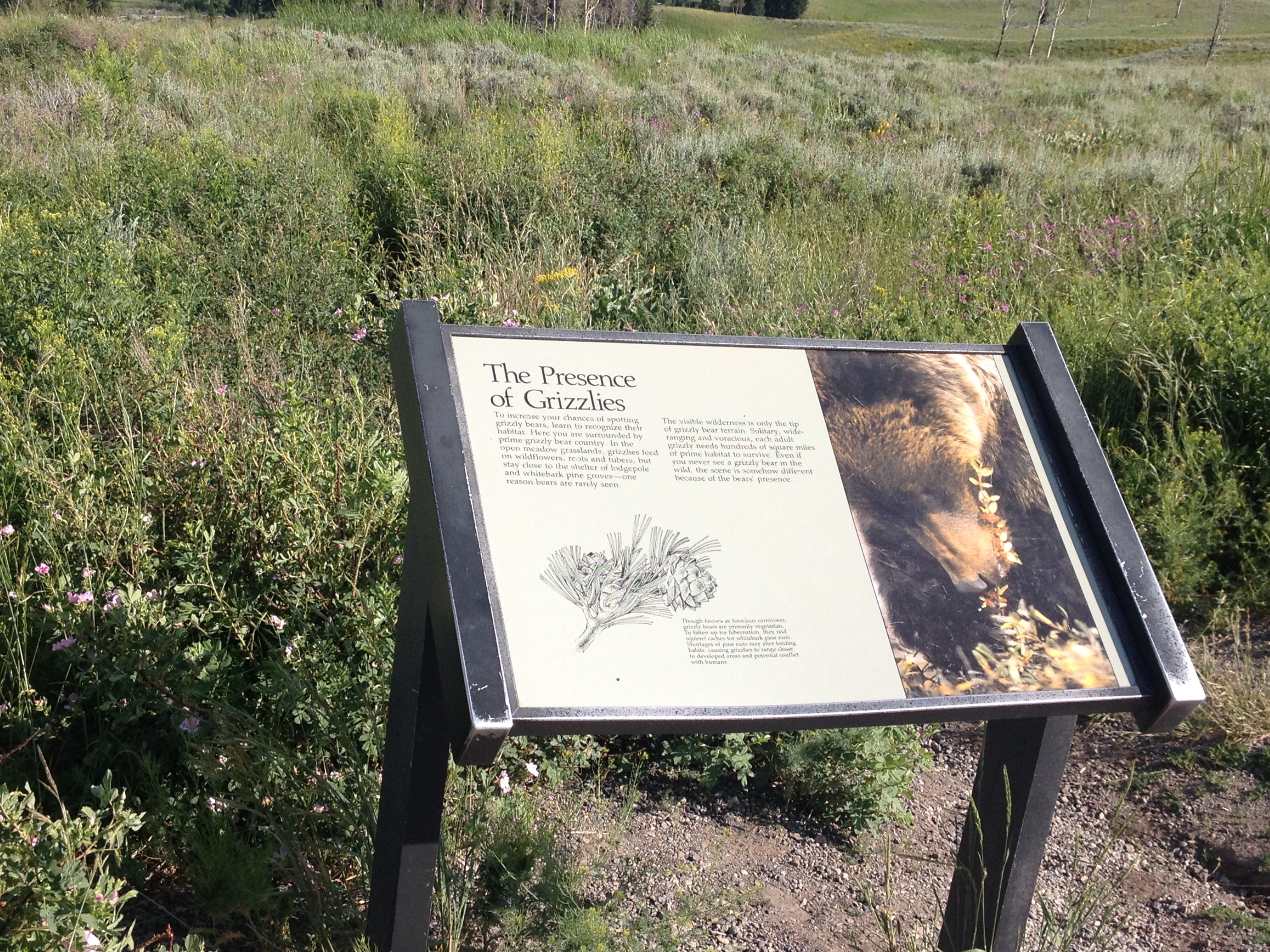
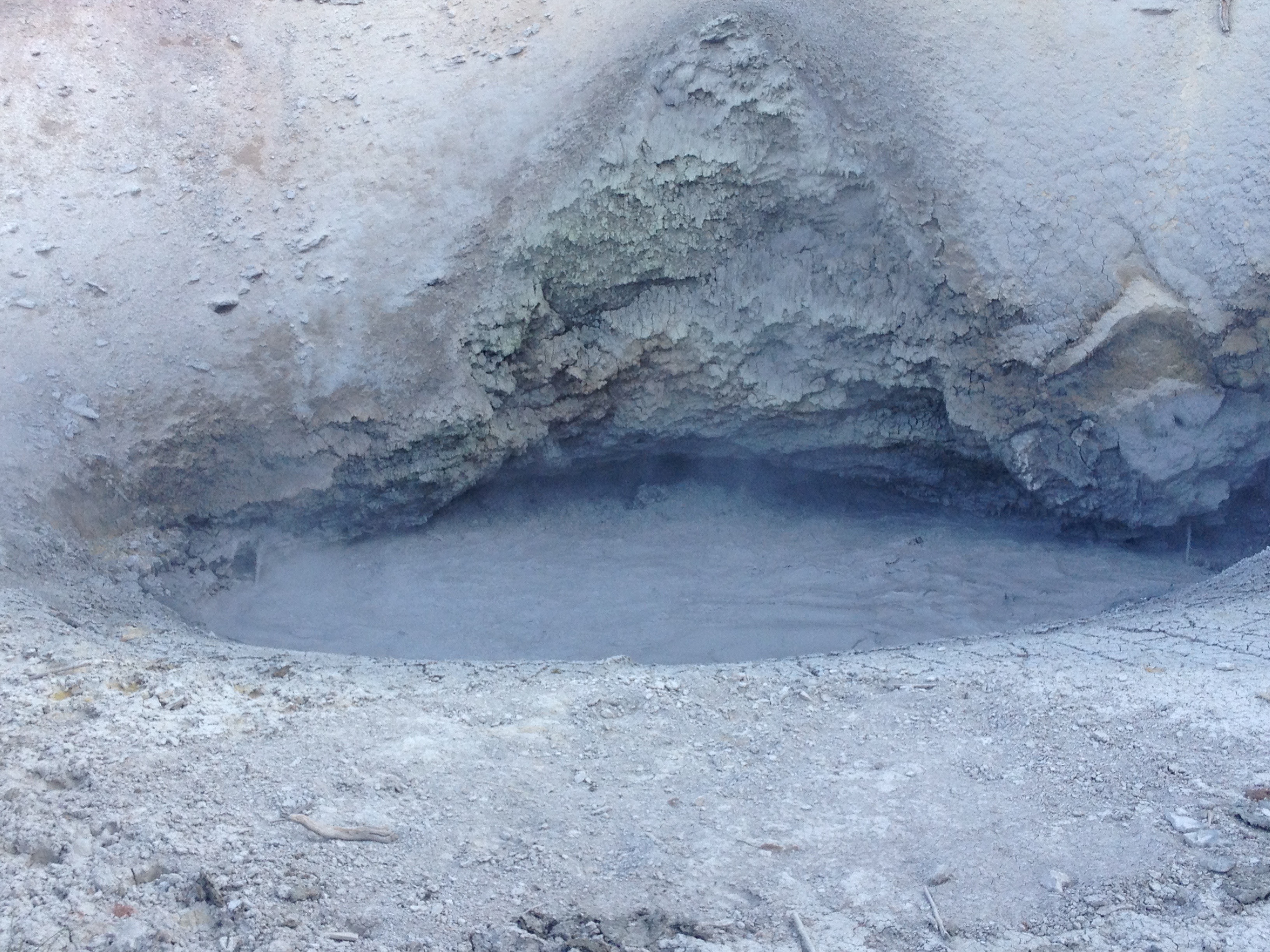
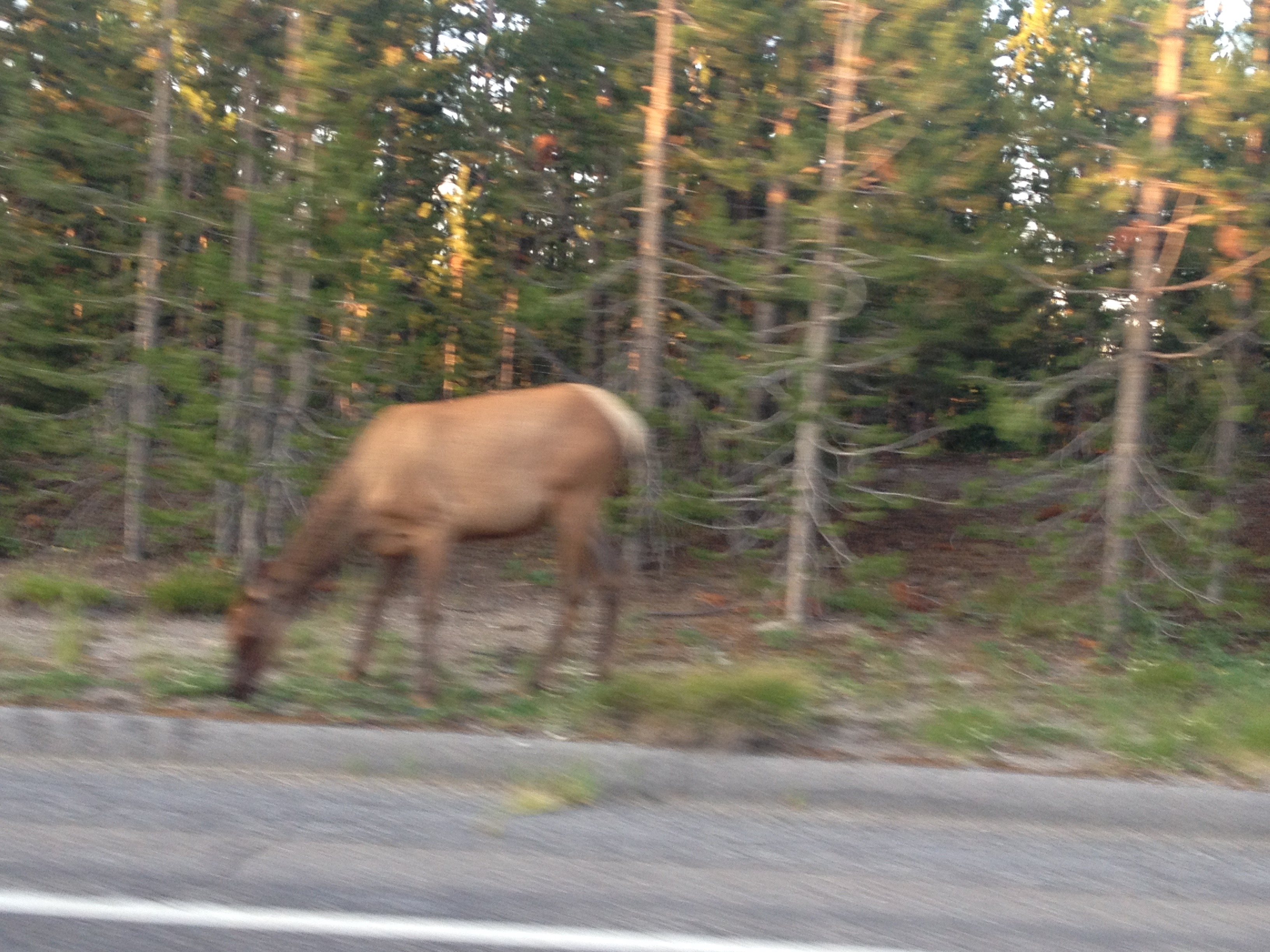
The next morning, we woke up early to view the sun rise.  We also saw some cool wildlife, deer, grouse, and marmots, which we had been viewing on and off for the duration of the trip.  However, particularly with deer, first thing in the morning is often the best time for wildlife viewing.  We also gazed upon the muddy puddle I had stupidly jumped into the prior afternoon, having wanted to cool off as it got quite warm for elevations in excess of 11,500′.

IMG_4289

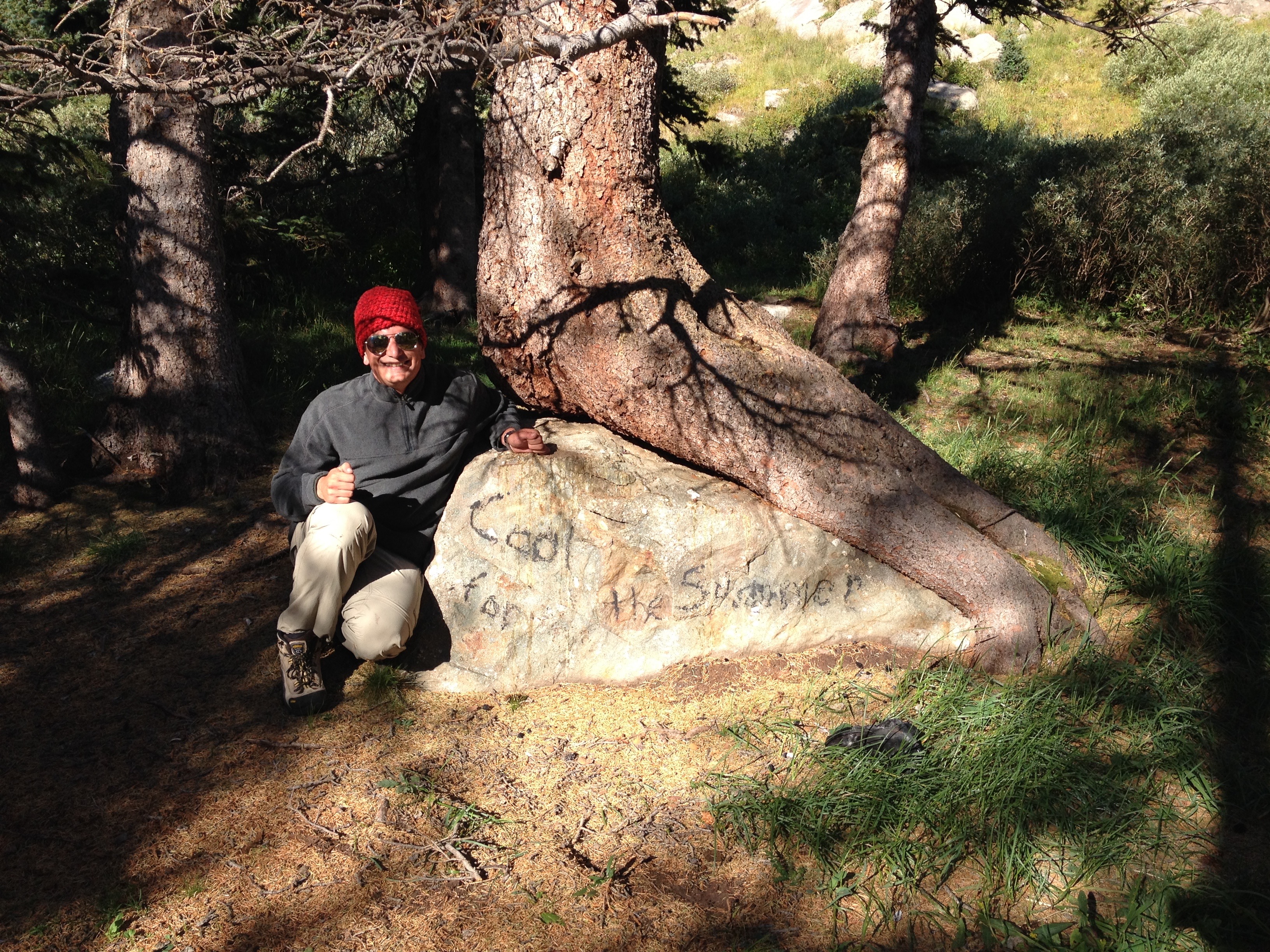
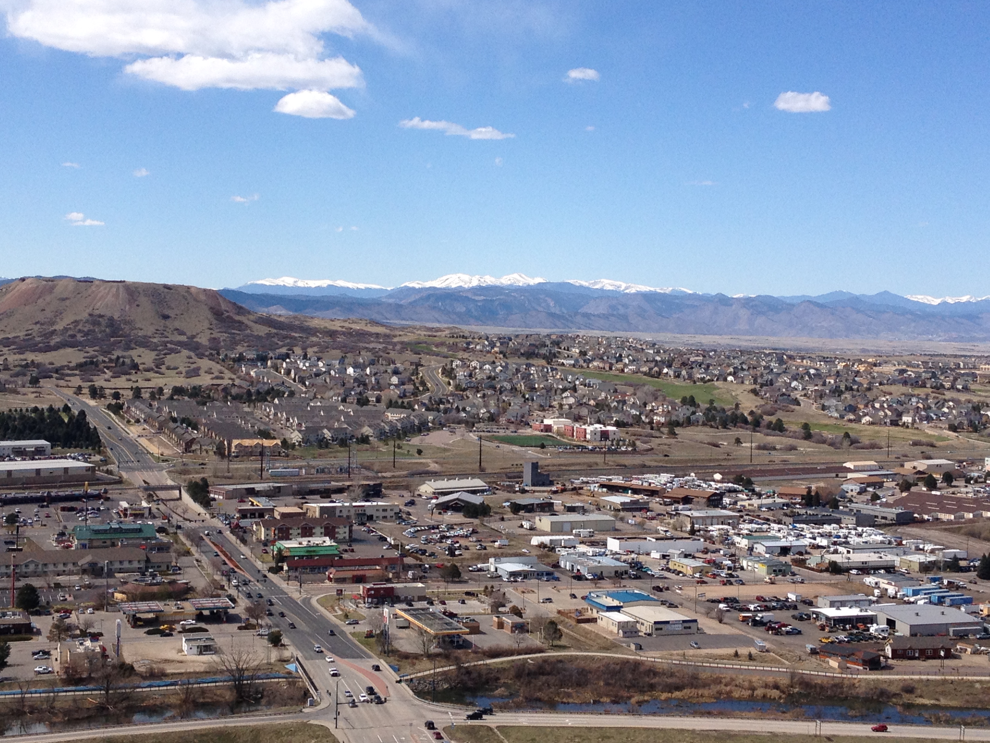
Before leaving the last campsite of my first ever backpacking excursion, I paid homage to one of my favorite songs out right now Cool for the Summer, as, well, this summer has been awesome, and, is now coming to an end.  On the car ride back to Denver, we had a conversation about whether or not songs like this, geared towards high school and college students, apply to people who have graduated, joined the adult world, and no longer have summer break.  However, despite the fact that nothing about my job, or my role in life, automatically shifts for summer (to an internship or summer job), I do feel something magical about this season.  There are so many things one can do in summer that they cannot in other seasons.

IMG_4291 IMG_4296 IMG_4299 IMG_4301

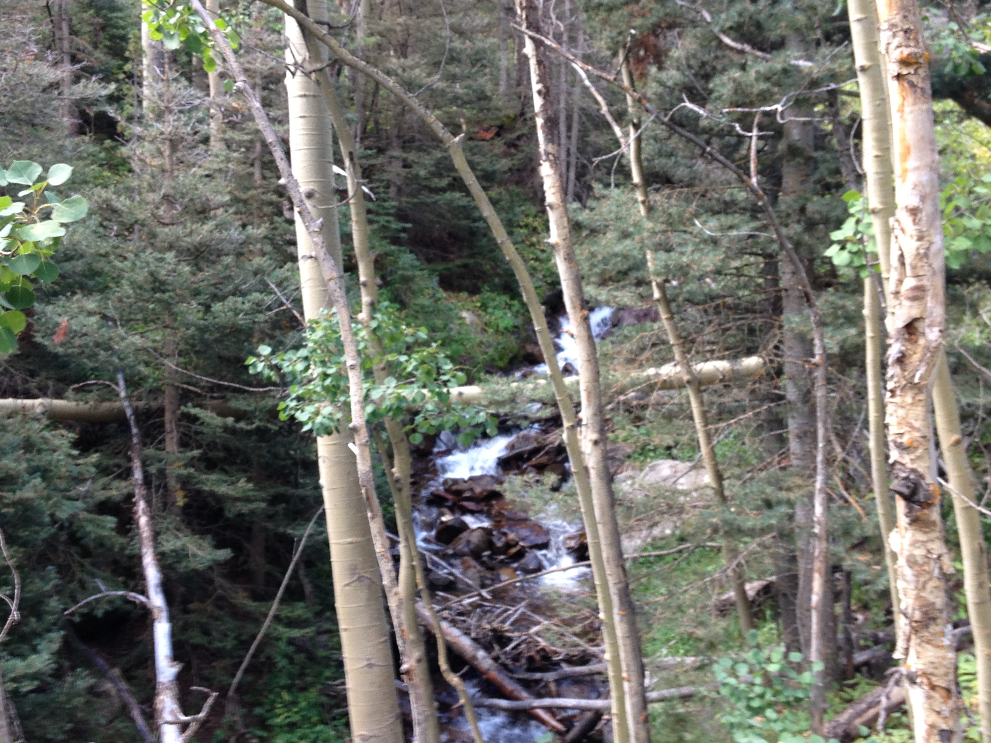
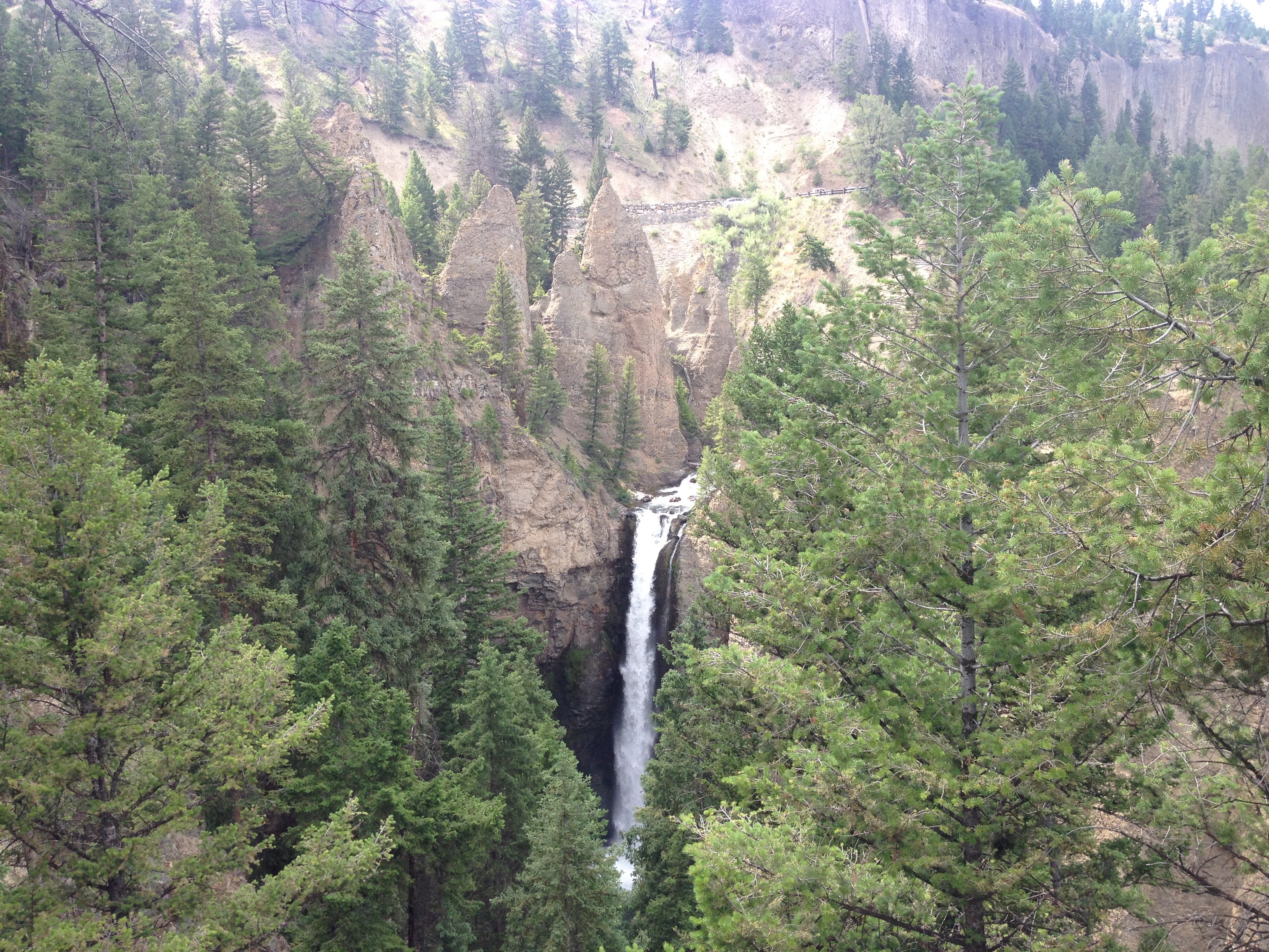
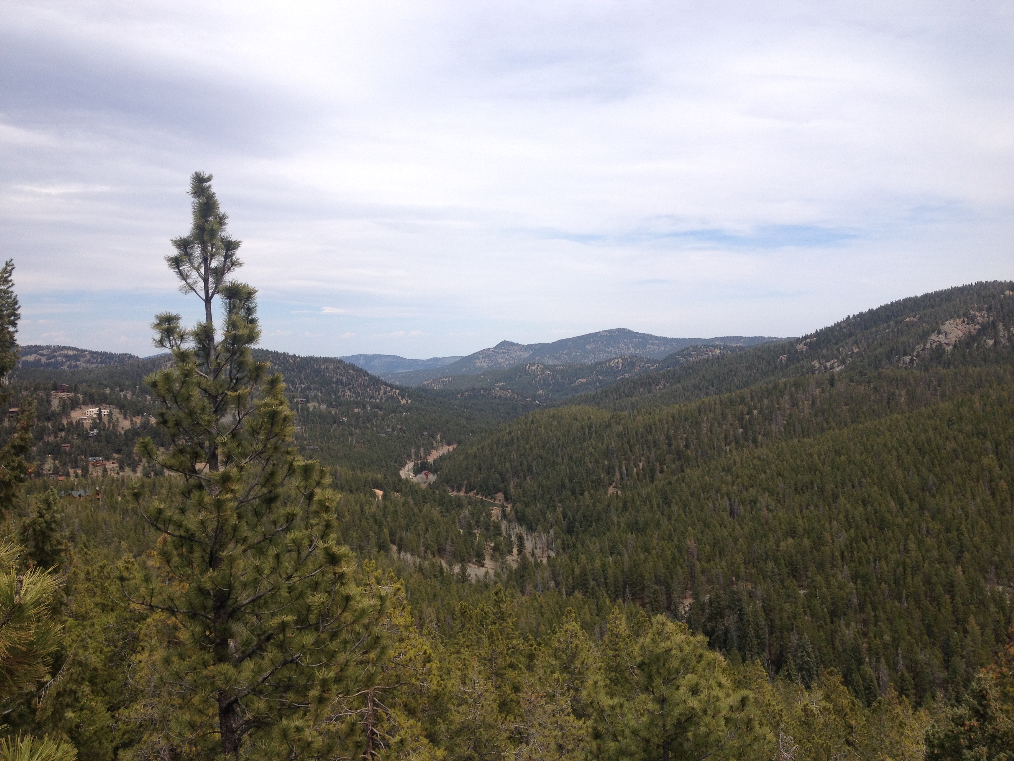
The final descent, back to the trailhead along the Venable Pass Trail, is highlighted by a series of waterfalls, as well as a large number of Aspen trees.  At the biggest water fall, Venable Falls, I actually dunked my head into the water to cool off.  The lower part of this trail would be an amazing day hike sometime around a month from now, when the leaves on the Aspen trees are changing colors.

In the end, my first backpacking experience was quite the trip, and a memory that will last a lifetime!  I came away from this trip confused.  Backpacking is a strange activity.  It is both simple and complex.  It is both exhausting and relaxing.  Never had I been farther away from civilization, having interacted with a total of three people prior to the final day of the trip.  Having experienced additional complications, I am glad to have chosen something modest, in both size and scope, for my first trip.  And, I am glad to have gone with a group large enough to make the experience both efficient and enjoyable, but not too large, as to add additional unnecessary complications.

A Weekend in Texas

IMG_3964

In my last post, I describe my experiences visiting the City of Austin, Texas.  Some people describe Austin as being “not really Texas”.  And, while that may be a simplification, or exaggeration of the experience there, the general point is that the experience of being in Austin is different than the the experience of being in any other part of Texas.  So, while I spent some time in Austin last weekend, I also got the opportunity to experience other places in Texas, and actually get immersed into the culture here.

IMG_3913 IMG_3912

One of the first places I went to, just 20 miles or so outside of Austin, was the Salt Lick, for some high quality Texas barbecue.  I was surprised to see such a large establishment.  I had gone to BBQ in places like Oklahoma City and Tulsa in the past, and those experiences usually involved smaller, more side-of-the road type establishments.  I had come to, in my head, assume that was the standard BBQ experience, but the Salt Lick is pretty gigantic.  And, the first thing I saw when I entered the restaurant was a gigantic barbecue pit.  The last time I had seen so much meat in one place was at the World’s Largest Brat Festival in Wisconsin.

Texas style barbecue, of course, includes brisket.  In order to experience the full range of barbecue experience, I ordered a combination plate that included brisket, ribs, and sausage.  I was pleasantly surprised to find that the restaurant asks their patrons if they want their brisket “lean”, or “moist”.  Not being a fan of fatty meats, I chose “lean”, and really enjoyed the entire meal.

IMG_3952

In fact, I kind of felt like I spent the entire weekend eating brisket!  The other establishments I went to, like the Salt Lick, were sizable establishments.  Coopers, in New Braunfels, was big enough to accommodate a group of 16 people without really having to adjust anything from their normal operating experience.

IMG_3991

Whenever I was not eating barbecue food, I was eating Mexican food, which is plentiful in Texas due to it’s close proximity to, as well as history of being a part of, Mexico.  I visited several Mexican food establishments while in Texas, including a place many of us that live elsewhere should become familiar with: Torchy’s Tacos.  Later this year, they will expand beyond the borders of Texas, opening up a location in Denver, Colorado.  They may very well expand to some other areas as well.

In Bourne and New Braunfels (and places between), I got to experience a bit of the local culture.IMG_3949 IMG_3944

This area is often referred to as “Texas Hill Country”, as, well, unlike most of the Great Plains, it is kind of hilly.  Parts of it sort of remind me of the “Driftless Area” of Southwestern Wisconsin, with rolling hills one to several hundred feet tall.  Although, the geological history these regions is quite different.

IMG_3951 IMG_3950

Here I attended a wedding, and took part in another local custom, floating the river.  At the wedding, the main thing I noticed about the culture here in Texas was the affinity for line dancing.  I had expected the country music line dancing.  But, what shocked me was how often people would just naturally form a line while dancing to other songs.  When YMCA, and Gangnam Style, came on, people here just naturally formed themselves into a line as if it were second nature.

In Texas, if is quite common for people to go on “floating”, or “tubing” trips.  It is basically an outdoorsy activity that is far more relaxing than the ones I usually take part in here in Colorado.  It mostly just involves laying in a tube, and gently floating down a river.  Many people here own their own tubes to float in, and bring floatable coolers, where they pack beer.  I have heard it is quite common for people to get quite intoxicated while taking part in a float trip.

IMG_3973 IMG_3989

Texas hill country also contains a lot of natural features, some of which have become common family-type tourist destinations.  A few miles west of New Braunfels is a place called Natural Bridge Caverns, which, just as the name advertises, is a Natural Bridge above ground with a cavern below ground.

IMG_3975 IMG_3972

Every time I visit a place like this, I always come away with mixed views regarding the commercialization of these natural features.  One one hand, I look at staircases, buildings, and all of these artificial looking features being present, and wonder if we are losing out on some of the experience.  But, I also see that having paved roads to get here, walkways through the area, and other comfort related conveniences opens up the experience of viewing these places to many people who otherwise would not have been able to see them.

IMG_3957 IMG_3963

It was in San Antonio, however, where I learned about the history of Texas.  Downtown San Antonio kind of has an odd combination of historical significance.  On one end of downtown is The Alamo.  Originally a “mission“, the place later became a military post in the war for independence from Mexico, and now a museum, which is also considered a Shrine of Texas Liberty.  This place very much celebrates the people of Texas separating from Mexico, and, of course, later joining the United States.

On the other end of downtown is a place called Historic Market Square, a place that celebrates Mexican cultural heritage.  In the plaza, I saw T-Shirts for sale that exuded Mexican pride.  In fact, with authentic Mexican food and cultural items for sale everywhere, I almost felt like I could have actually been in Mexico.

It just makes me wonder.  Is this a City that is in conflict with itself?  How do those of Mexican decent here in San Antonio feel about Texas history?

The area between the Alamo and Historic Market Square was also kind of confusing.  On the surface, the city looked kind of dreary.  I kind of felt like I was in a bad part of Chicago, or any other big city that has a significant amount of blight.  But, underneath the surface was San Antonio’s Riverwalk, which is quite lively.

IMG_3961 IMG_3958

In fact, San Antonio kind of pioneered the idea of riverwalks.  And, it appears other cities are trying to copy them.

After reading about Texas history, I kind of had a better understanding of the place.  Specifically, at the Alamo, they describe a struggle in Mexican politics.  On one side there was a group of people that strongly supported a Federalist type system of government based on a constitution that was modeled after the United States.  Under this system, some powers were devolved to the states, of which Texas (or Tejas) was one.  On the other side, was a group of centralizers that wanted more control in the hands of the central government in Mexico City.  Texans strongly supported the former over the latter, and when the latter won power, they felt their way of life threatened.  The successful defense of Texas, establishment of the Lone Star Republic, and later admission to a country whose values more closely resembled their own is viewed as a triumph.

IMG_3914

It is without a doubt that many Texans today see a lot of parallels (whether or not they are correct) to today’s political struggles in the United States.  Having this history, one in which many people in the state take pride, definitely explains why succession talk would be much more prevalent here than it would be in other states who strongly oppose some aspects of how our Federal government is operating.

IMG_3943

There was always some concern over whether I would fit in here in Texas.  Anyone that talks to me can clearly hear my Long Island accent.  I do not try to hide it.  Some people who have lived in Texas  told me that it would also be obvious that I am an outsider by the manner in which I conduct myself, and the types of topics I discuss on a regular basis.

But, I took a “leap of faith” of sorts, and just decided to be myself when interacting with people here.  And, I was actually received quite warmly here, by people who probably have a significantly different lifestyle and set of values than my own.  Everyone was friendly to me, and they were even receptive to the kinds of conversation topics I tend to engage people in.

As I thought through the acceptance I experienced here, as well as the history, the current succession talk and anger, I came to an important realization.  Maybe we are not nearly as divided as people make us out to be.  Maybe it is really only the most vocal (and angry) among us that display this division.  After all, if 1.4 Million people can live in a city which celebrates both it’s Mexican heritage and it’s struggle for independence from Mexico, maybe we can find a way to celebrate what makes everyone unique.

July 2015 Bicycle Journey Day 3: Yellowstone’s Grant Village to Jackson, Wyoming

IMG_3840

What a difference a day makes!  After the most exhausting bicycling day of my life, day 3 seemed like a breeze.  Everything seemed different, even in subtle ways.  Whereas on day 2 I felt like I had to struggle, even on the flatter portions of the ride, certain segments of this day seemed to breeze by.  It was almost as if there was some kind of invisible force that had been holding me back on the previous day, but now was helping me along.

IMG_3819

We left the Grant Village campground having done none of the activities that are typically associated with camping (other than putting up and tearing down a tent).  We did not set up a fire.  We did not cook anything.  We did not even spend a significant amount of time at the campsite other than sleeping. The next morning, we got some breakfast, and headed South, towards Grand Teton National Park.

IMG_3820

The day started with a climb, albeit a very small one, and one that event felt easier than a similar sized climb would have felt the previous day.  Only four miles into the ride, we crossed the Continental Divide, and immediately started headed downhill.  The next eight miles flew by as we reached our last major stop in Yellowstone National Park; Lewis Falls.

IMG_3822 IMG_3823

I feel like I got a fairly exhaustive tour of Yellowstone’s waterfalls.  And, while I had seen several waterfalls while in Yellowstone, each one was different in characteristics.  Undine Falls, which I saw yesterday, was skinny and tall.  Lewis Falls is much wider, with a smaller drop.  It is shaped much more like Niagara.  At this point in my journey, 12 miles in, I was energized!  I felt almost as if I could have handled anything on that day.  In fact, I am 100% sure that I had more energy at that point in the day than I would have had I been resting over the last several days.  There is just something about getting through a really rough day of riding, and then riding downhill.

Until this trip, most of my riding had consisted of day trips.  Before moving to Colorado, those trips were pretty much about how many miles I traveled, as Illinois is flat.  Since then, I have begun to tackle some climbs.  In each of these rides, there is a similar theme, I go up, and then I go down.  There is a climb, and it is followed by a “reward”, a chance to go fast.  This almost felt like a way more stretched out version of this.  I spent an entire day pretty much climbing.  The previous day was my climb, and this day of primarily descending was my reward.  Therefore, the feeling of guilt that usually passes over me when I descend without having climbed first did not manifest.  The whole time I knew that I had earned this day of rapid riding through the exhaustion I had endured on the prior day.

IMG_3827 IMG_3829

By the time we left Yellowstone National Park, we had already descended a significant amount.  That descent was interrupted by the days only climb, in the 6 mile space that separates Yellowstone and Grand Teton National Parks.  This is a strange place.  Although you are technically in neither National Park, signs posted along the road remind motorists that National Park speed limits and enforcement are still in effect.  Also, there is no official entrance into Grand Teton National Park from the north, at least not along US-89.  It is pretty much assumed that all motorists (and I guess cyclists too) had already paid to get into Yellowstone and do not need to pay again.

After climbing for a little bit, there is a rapid descent towards Lake Jackson, and the heart of the Grand Tetons.

IMG_3830

This lake is gigantic, and one of the defining features of the National Park.  And, as one travels farther, into the heart of the Park, one can sometimes get some of the most stunning views of the Tetons from the other side of the lake.

IMG_3832 IMG_3833

The Grand Tetons are the most photographed location in Wyoming.  The primary reason they are so photogenic is that this particular mountain range not only has a prominence (how much higher in elevation the peaks are from the area around them) of over 7,000 feet, but there are no foothills to obstruct one’s view of the mountains.

IMG_3838 IMG_3840

There really is nothing like experiencing the Tetons, at a nice comfortable pace of 15-20 miles per hour, from the seat of a bicycle, up and down some gentile rolling hills, as the afternoon progresses. As was the case in Yellowstone, I decided not to push myself and hurry through the park.  Only this time, on a day that had been mostly downhill, it felt way more comfortable.  I wasn’t climbing up a major pass, putting my legs through all of that exhaustion.  I was just gliding kinda.

The final part of the trip into Jackson took me on a bike trail, where I encountered the last wildlife of my journey, a coyote.

IMG_3845 IMG_3847

In the end, I once again rode over 80 mies on the final day of my journey.  However, the last part of the ride felt quite a bit different for me on day 3 as it had on day 2.  At some point, I came to the realization that on my final day’s ride, it wasn’t the energy I had left in my legs that was limiting the number of miles I felt like I could do, it was other intangibles.  It was how my butt felt about getting back on the seat.  It was how many times my right fingers had been used to shift gears, as well as the amount of weight I had placed on my forearms in general over the course of many hours on the seat.  In this case, I wonder if the strategy of biking a bit faster, but taking more frequent stops to get up and off the seat may be a better strategy for handling these long distance rides.

The last five miles of my ride, on the trail, headed into Jackson were counted off by little markers in the trail; white lines labelled 5.0, 4.5, 4.0 and so on, counting off the distance from Jackson at the end of the trail.  These markers countered down, pretty much, the end of my trip.  So while I was excited to make it all the way into Jackson, and really anxious to take a shower and have a coca-cola, it still felt bittersweet to me, knowing that this bicycle trip that I had been anticipating for so long was quickly coming to an end.

IMG_3848 IMG_3851 IMG_3853

Two days earlier, at Chico Hot Springs, I had refrained from eating chicken wings, as I was unsure if the choice would negatively impact my bike ride the next day.  Now, with no more bike riding ahead of me, it was time to finally fulfill that craving.  So, after showering and changing, we went to a place called Local, right in downtown Jackson, and, yes, I had my wings.  Oh, and they were amazing.  One thing I learned the first time I attempted bike travel, ten years ago, was that wings always taste better on a bike journey.

IMG_3856 IMG_3859

That evening, we stayed at the Anvil Motel downtown, and watched the 4th of July firework show.  As I watched the fireworks light up the night sky, I thought to myself about how I had celebrated our Nation’s independence by traveling through some of the most beautiful places in the country.  I cannot think of a better way to honor The United States of America than that.

The only regret I really had was that the haziness of the day had seriously impacted the images I had taken of the Grand Tetons.  This regret was remedied, as we spent another day in Jackson before headed home, and got to see some more sights, including different images of the Tetons, under different weather conditions, both Sunday and Monday, as well as the iconic images that one encounters in the famous Mormon Row settlement to the east of the National Park.

IMG_3864 IMG_3867 IMG_3871 IMG_3894

By completing this journey, I feel like I have entered a whole new league when it comes to bike riding, and bike travel.  Before this trip, I could only speculate as to what rides I would one day love to take on.  I could only respond to people’s own bicycle travel stories with statements such as “wow, that seems incredible”, or “good job”.  I was not truly belonging to the group.  Now, with this trip behind me, I have finally earned the right to consider myself a bike traveler.  I have earned the right to actually chime in with my own anecdotes, about biking long distances, road conditions, places to go, pannier setup, and all sorts of other topics bicycle tourists typically discuss.  I have reached the pros- sort of.

And, because of this experience, Montana and Wyoming now have a special place in my heart, something that someone born on Long Island, New York would never have expected.  I almost feel like Teddy Roosevelt this weekend, New Yorker in attitude and mannerisms through and through, but lover of the West, lover of America’s beauty and lover of the National Parks.

IMG_3906 IMG_3907

As I rode home Monday, July 6th, it suddenly occurred to me how little I missed my regular life.  I think I missed some of the people and some of the socializing.  But I really didn’t miss the kind of stuff that many would assume.  I had yet to watch a single minute of television, and had yet to use the internet for anything other than looking up the weather and writing a blog entry on this site.  I certainly had not looked at the news or anything.  I definitely did not miss either TV or the internet at all.  As of the time of writing this blog, July 9th, my TV total for the month of July still does not exceed one single hour.  And, the odd thing is, I also knew that if I needed to get back on that bike again and ride more distance, I was more than capable of it.  Maybe that is the way I truly know I have reached a whole new level with regards to bicycling.

July 2015 Bicycle Journey Day 2: Chico Hot Springs to Yellowstone’s Grant Villiage

IMG_3776

I was 43 miles into a 100 mile bike ride.  I had already climbed over 1,000 feet from my starting location.  I knew I had over 2,000 more vertical feet to climb before I would reach the high point of my day.  The road mercilessly took a turn downhill.  This was vertical height I had already worked hard to climb.  I knew that somewhere down the road, I would once again have to climb this several hundred vertical feet that I was now descending.  I sped up and continued down the road, already exhausted, knowing that I still had more than half my day left to go, both in terms of milage as well as vertical climb.

IMG_3759

That was when I found myself going over a bridge, over the Gardner River.  The views in all four directions, including downward were spectacular.  Not only was I viewing all of the scenery in all directions, I was smelling it.  I was feeling the air around me.  It was at this moment that I realized that, despite how exhausted I already was, and despite how agonizing the steep hills I had in front of me were going to be, that all of this was worth it.  The effort of pedaling harder than I had ever pedaled before, and enduring hours of pure pain was worth it to experience what I was experiencing on that day.

Miles 44 and 45 would take forever, as I climbed up and out of the river valley and onto the Blacktail Deer Plateau in the Northern part of Yellowstone National Park.  Knowing that I still had so much painful climbing left to go, once again “This Summer’s Gonna Hurt” by Maroon 5, a song that I had heard many times this year, and, like most Maroon 5 songs, catches in one’s head quite easily, popped into my head as I pondered the pain that I was enduring, as well as the pain that would come.

IMG_3715 IMG_3718

That morning, I woke up in Paradise Valley with a strange feeling.  I was half worn out from my first day of cycling, but also felt ready to go.  It is a feeling that people who cycle long distances probably experience quite frequently, but it was a feeling that I had not truly experienced before.  Sure, I had undertaken multi-day tasks before, but never one like this, where in my head I knew I was about to tap into pretty much everything I have, physically, but I also knew that it would make for one of the most exciting days I’ve ever had.

IMG_3724

On the way out of Paradise Valley, we encountered the only other cyclist we would encounter that day, an Austrian gentleman headed for the Grand Canyon.  He was traveling fully self-contained, with all of his camping gear attached to his bike, and therefore taking it slower.

IMG_3726 IMG_3728

After turning back onto US-89 South towards Gardiner, we entered an area known as Yankee Jim Canyon. It is here where we started to see some rafters.  Over the next few miles, we would wonder who was this “Yankee Jim” that this canyon was named after.

IMG_3729 IMG_3731

Unfortunately, even the signage along the highway, the signage that eluded to both history and Yankee Jim, did not tell me anything about who Yankee Jim was.  After the trip, I did a full web search.  Nothing.  I still have no idea who was this man they call Yankee Jim. Maybe if I ever go to a Montana History Museum of some kind I’ll find out, but to this day, it remains a mystery.

IMG_3735 IMG_3733

Luckily, several miles up the road, as we approached Gardiner, there was a distraction.  We encountered a place called Devil’s Slide, a uniquely shaped exposed area of red sedimentary rock that appears to lend itself to stupid, and potentially dangerous adolescent ideas.  I am quite thankful that nobody turned it into a cheesy touristy site.  There are enough overpriced alpine slides elsewhere in the West.

IMG_3738 IMG_3743

We stopped for Ice Cream just before noon in Gardiner, Montana, and stepped out into much hotter air as we entered Yellowstone National Park.

IMG_3746

Back when I lived in Chicago, I never understood why advertisements for Montana tourism would feature images of Yellowstone National Park, which is primarily in Wyoming, with the phrase “Gateway to Yellowstone”.  But, apparently, this was the original entrance to the National Park, and, when the park first opened up, the only way to get in.  This structure right here, that I found myself riding under, was the first entrance ever created to the first National Park established.

IMG_3748 IMG_3749

And I knew the climb was coming, the first climb of the day, which would eventually take me past the 45th Parallel, into the State of Wyoming, and up to Mammoth Hot Springs, where I was now roughly 1000 feet higher than Gardiner.

IMG_3750 IMG_3751 IMG_3754

But, it wasn’t just the climbs that made the ride exhausting.  It was all of the other rolling hills I was not 100% expecting.

IMG_3762

There are very few flat parts of Yellowstone National Park, and even the area between Mammoth Hot Springs and Tower Falls, which starts and ends at a similar elevation had many hills of different sizes.  It was around there that I decided that I was in no hurry to get to the campsite.  After all, I was in Yellowstone National Park, and in a part of the park I did not get to see the last time I visited.  I was gonna see some stuff.

After having to climb back up out of the Gardiner River Valley, I took a look at the Undine Falls.

IMG_3763

Unfortunately, I did not feel I had the energy to add a mile of hiking (round trip) to my day, and see the Wraith Falls.

IMG_3766

But, I stopped several other times to enjoy the scenery along the Blacktail Deer Plateau, and even got a chance to see a blue-billed duck through some bincoulars.

IMG_3770 IMG_3775

In the middle of the afternoon, I reached one of Yellowstone’s more breathtaking, but underrated features, Tower Fall.

IMG_3777

It was here I took a more lengthy break, as I knew ahead of me I had a climb tougher than any climb I had ever undertaken in my life.  After that exhausting 30 mile stretch from Gardiner, up into the park and then over the plateau and all of the rolling hills, I would climb over 2000 feet, to the highest point of any road in Yellowstone; Dunraven Pass.  But, it was here that I also realized that not only was I more than halfway through my trip overall (63 miles into today with 61 miles behind me yesterday), but I was now at a higher elevation than where I would end the trip (Jackson, Wyoming is at 6200 feet).  In every sense of the phrase, I was more than halfway there.

The climb, 12 miles and almost 2600 feet in elevation gain, took me nearly two hours.  It was exhausting, and intense.  I pretty much had to stop every mile.  Somewhere roughly halfway up the pass, I started to see some beautiful alpine flowers; yellow and purple.

IMG_3781

But, signage told me that the presence of these wonderful flowers also signified that I was in Grizzly Bear territory.

IMG_3782

So, it should not have been too much of a surprise to me that when I finally got to the top of the pass,  after two long hours of huffing and puffing, I saw my first Grizzly Bear!

IMG_3786 IMG_3790

Just as I had realized 31 miles (and almost 3000 feet of net climbing) ago, when I was going over that breathtaking bridge over the Gardner River, all of the riding, all of the sweat, and all of the pain did have its reward.  To be honest, it would have been more than worth all of the physical exertion without even seeing the bear.  But, seriously, there was nothing like encountering this animal, so beautiful, so majestic, yet so dangerous and overwhelming, in the manner in which I did; from my bike, out in the open, yet at the top of a pass, knowing that if I needed to outrun it, I could by pedaling as hard as I could on the next downhill stretch.

IMG_3791

By then, after hanging out with the bear for a little while, it was nearly 7 P.M.  I had neither the energy, nor the remaining daylight to take the walk down to Yellowstone’s iconic Lower Falls.  Luckily I saw those last time I was here, so I was glad to have taken the time to see the other waterfalls in the park.

The last real feature I visited that evening was Yellowstone’s Mud Volcano area.

IMG_3798 IMG_3801

There I stood, with the water bottle I had filled up something like 6 times that day, and I came to the realization of just how geothermal Yellowstone Park is.  Like many of the geysers in the park, this “mud volcano” smelled like sulfur.  In fact, it smelled kind of yucky.  And, while I had spent most of the day looking at waterfalls, scenic river valleys, and finally those yellow and purple flowers, it is these types of features that make Yellowstone National Park unique.  We do have waterfalls, canyons, river valleys and the like all over the west, including within an hour or so of home.  All of these geothermal features … I cannot think of where else to see them!  It almost felt like this park was built on sulfur.

IMG_3802 IMG_3803

After seeing an elk on the side of the road, near Yellowstone Lake, I reached the campground at Grant Village.

It had been, without a doubt, the toughest day of riding I had ever undertaken.  Going into this trip, I knew it would be, so I was prepared.  But, I was still pretty much without any residual energy at the end of the day.  In fact, I was kind of acting like I was drunk.  I guess my body had gone through an experience that some would consider “traumatic”, given how far I pushed myself.  But, for me, it is how you grow as an individual, and it is how you gain confidence.  I know that soon I will have to return to “regular life”.  In “regular life”, there is competition, there is conflict, and there are things that are just plain hard.  But, they become easier for those of us that are confident in ourselves.  Accomplishments like these simply serve as a reminder to ourselves that we are awesome.  In fact, I would love to market a bumper sticker that simply says “Smile, you are you, and you are awesome.”  Or, something like that.  There is probably a better, and catchier way to phrase that.  But the point remains that experiences like these do remind us that we are often capable of more than we believe, and are told, that we are.

Testing Our Limits

IMG_3247

A good friend of mine once told me that nearly all people are capable of much more than what they believe they can do.  And that, in fact, when challenged, most would actually be surprised by what they are physically able to do once they have been pushed to their very limit.

When it comes to most activities, people generally tend to stop when tired.  After all, exhaustion is generally an unpleasant experience for most, and has the potential to make an activity no longer enjoyable.  However, from time to time, life issues some kind of challenge that forces us to give everything we have, way beyond what we had been wanting to give.  Most of us have experienced that unexpectedly challenging assignment in college that forced us to “pull an all nighter”, or had to tend to someone they truly care about at a time when completely exhausted.  It is at these moments, when we completely drain ourselves, that we figure out the true boundary of what we are capable of.  And, for physical activities, such as cycling, it is when our bodies actually physically begin to give out on us, that we truly understand what we are capable of doing.

Heading into a new season, I decided it was time to challenge myself.  Monday, I had an entire day available with no prior engagements, so I decided to take on a ride that would potentially test the limits of my endurance at its current state; A bike ride from Denver to Castle Rock, and back, in one day.

IMG_3241 IMG_3259

The first 30 miles of this trek is on the Cherry Creek trail, from Denver to the suburb of Parker.  Most of this trail is relatively flat.  A gradual upslope, combined with a few uphill segments, takes a rider from Denver’s 5280′ in elevation to Parker’s 5900′.  This part of the journey was not too terribly challenging.  In fact, in this segment, my biggest challenge was finding water to refill my water bottle.  I had assumed, for some reason, since it was already the end of March, and that there have already been 12 days with high temperatures of 70 or above, that the water fountains around the suburbs would be turned on for the spring.  I was wrong, and was quite thirsty and relieved to see this sign, indicating that although the water fountain was not operational, that the bathroom had available water.  You would be surprised how many suburban park bathrooms do not have running water.

IMG_3243

To get from Parker to Castle Rock, one must follow a road called Crawfoot Valley Road.  The road is quite luxurious for cyclists, with a shoulder wide enough for roughly two bikes.  In fact, it is labelled a bike lane for some parts of this eight mile stretch of road.  The first three miles, headed southwest from Parker, however, is a bit of a climb, and a deceptive one.  The climb is nowhere near as steep as one in the mountains, and one only climbs 500-600 feet.  But, it is one of those frustrating climbs where the road winds around a bit, and, with each turn, a cyclist will wonder whether or not they are approaching the apex only to see another uphill segment gradually appear as they approach.

IMG_3245 IMG_3246

Once this road levels off, facing southwest, the ride becomes almost surreal.  To the left of the road, one can see Pike’s Peak, standing there all by its lonesome.  To the right, the mountains of the Front Range, due west of Denver appear.  Riding sort of directly at these mountains, with the vantage point of being up at roughly 6500 feet in elevation, I cannot help but take a deep breath and marvel at how wondrous the world can be sometimes.

IMG_3248 IMG_3247

After just over 40 miles of cycling, I arrived at Castle Rock.  When I got to Castle Rock, I decided to add on a mini-hike to my day of activity.  After all, I spent almost three hours getting here, why wouldn’t I head up to this little rock structure- my destination!

IMG_3250 IMG_3253 IMG_3256 IMG_3257

This is a fairly short hike, with stair-step features that indicate that it was designed primarily for tourists, and not hard-core hikers.  So, I did not feel too bad about adding this hike to my already exhausting daily itinerary.

After all, the return trip to Denver would be much easier, after the initial climb out of town on Crawfoot Valley Road, the rest of the trip would be more or less downhill, descending, overall, from an elevation of 6200′ at Castle Rock back to 5280′ at Denver.

That turned out to be wrong.  As I approached Parker, a northerly wind developed, and, although the wind itself was not too terribly strong (10-12 mph range), the gusts began to pick up and become more frequent.  It was here, peddling into the wind, that an already challenging ride became one where I ended up testing the limits of what my body can do.

There are three levels of tired.  First, there is just general tiredness, where we just feel like stopping.  Many people do indeed stop at this point.  However, those who stop at this first level of tiredness generally do not develop any further endurance.  Level two tired is where we begin to ache, or feel some level of pain.  At this point, it is typically recommended that one stop.  This is the level of tiredness I had expected out of Monday’s ride.  However, the gusty winds on the return trip brought my level of tiredness to the third level, the level in which you simply cannot go anymore.

Working to each level of tiredness achieves a different goal.  An activity that stops at level 1 tiredness maximizes our enjoyment of an activity.  An activity that stops at level 2 tiredness is most beneficial to our fitness.  When we push to level 3 tiredness, we achieve personal accomplishments, the kind that make us feel as if we are achieving something with our activities.

The key is, for almost anyone involved in any kind of physical activity, to find a balance between working to each of the three levels, as they feed off of each other.  The original, and ultimate purpose of any activity should be to have fun, but, for most, an activity become even more enjoyable when we improve, take on new challenges, and accomplish new things.  Much like a skier that starts out on the green slopes, moves up to the blues, then blacks, and finally extreme terrain, I am looking to take my bike out longer distances, and to places that were previously unreachable.  However, in order to plan out how to test my own personal limits, I first have to know where those limits are.  So, as much as I can be pissed off that this ride ended up being more difficult than expected due to the wind, the wind allowed me to actually measure my personal limit, so I can start the process of improving.

Places of Questionable Significance

IMG_2460

In 1983, an incredibly drunk Ozzy Osborne made the mistake of deciding to relieve himself on the Alamo, a building of historical significance.  He was arrested (Isn’t public urination usually just a ticket?), and scorned by many, primarily due to the fact that the Alamo is an important symbol of pride amongst Texans.  However, to Ozzy, a British rock star, the building probably did not mean too terribly much.  While a sober Ozzy (if that existed in 1983) would probably have realized the building is significant due to the presence of tourists, he probably would not have felt the same affinity or pride when standing in front of the Alamo.

With the exception of a few wide eyed hippies that believe that every place is significant, and a few hard core cynics, that fail to see the significance in any place (or anything), the significance of most places is dependent on the person and the culture.  There is no better of an example of a place like this than Four Corners, U.S.A.

Four Corners is unique due to the fact that it is the only place in the United States where four states all border one another.  If one wanted to stand in five different states at one time, it would not be possible.  If one wanted to stand in four different states at once, there is only one place where it can be done; Four Corners Monument.

IMG_2455 IMG_2456

The primary reason people visit this particular monument is to take silly pictures like this one.  Assuming the location of the four-state border is correctly marked (some question that is in the right place), in this picture I am in four states at once.

IMG_2462 IMG_2468

However, in the absence of state borders, this particular spot would really actually be quite insignificant.  There is no natural demarcation point, or significant change in scenery.  Even on the Colorado side, the wide open landscape, periodic mesas, and sagebrush screams Arizona much more than Colorado.  This Arizona-like feel persists for over thirty miles into Colorado until the San Juan Mountains start to show up on the horizon somewhere east of Cortez.

IMG_2457

The significance of this place is further muddled by the fact that this point is not the border of four different jurisdictions.  The monument is actually on an Indian Reservation.  Thus, you do not even get the standard differences in policies and sales tax that usually accompany state borders.  An equal number of souvenir stands exists on all four sides of the monument.  I am not sure whether or not marijuana is legal on this particular reservation, but the policy is the same on all sides.  I did not observe all of the pot heads clustered in the Colorado quadrant of this monument.

In the absence of state borders (and people obsessed with exact points of latitude and longitude), the most significant site in this region is a rock formation a dozen or so miles away called Shiprock, which has cultural and religious significance to the Navajo people who have inhabited the region since well before the Spanish arrived.

IMG_2467

From a completely neutral standpoint, the rock formation definitely seems to stand out way more than any other feature in the area, which is mainly small mesas and creeks.  But that does not mean the wide open space where the monument should lack significance to all people.

For most likely a variety of neurological, sociological, and historical reasons, Western Culture associates wide open spaces like this one with freedom.  It’s the wild.  It’s the untamed.  It’s the place where you can yell as loud as you want, shoot any kind of weapon you want, and start a fight without anyone to break it up.  There is nobody to tell you where you can (and can’t) hike, climb, tie a rope to an arch or mesa to swing from it, or even try to catapult small rodents.  It’s the last refuge of people seeking to escape every single one of society’s restrictions and limitations.

But the one set of regulations that one can really never escape is the ones that exist only inside their own heads.  I often refer to these as the “invisible chain”.  And by this, I am referring to all of the anxiety, fear, and self-consciousness that often stop us from doing what we feel we should be doing.  It stops us from telling people what we really think.  It stops us from talking to that interesting and attractive stranger on the train.  It stops us from dancing when fun music comes on.  In some ways, it stops us from living.  And, millions of Americans are in the process of destroying their livers trying to reclaim it.  In these pictures of the free, wild, and untamed west, there are typically very few people, or buildings to indicate the presence of people.  There is nobody to judge you, and nobody to make you feel self-conscious about what you chose to wear, say, and do.  The fact that this is where we go to seek freedom indicates where we, as a people, believe most of our restrictions come from.

Therefore, if one could overcome this “invisible chain”, the restrictions placed upon us would be limited only to those officially legislated by some kind of governing body and effectively enforced by law enforcement personnel.  The few lucky individuals that manage this are able to find this greater level of freedom in places like London, Hong Kong, or New York City; places that provide the interaction with other human being that we all crave.

We often see the desire for community and human interaction as pulling us in one direction, while the desire for freedom and individuality pulling us in the opposite direction.  As an extrovert, I often struggle with the fear that asserting my individuality and refusing to conform, will cost me in the social realm.  Reflecting upon all of this in the wide open spaces of the desert southwest, I re-realized that being an individual and reducing that fear actually helps in the social realm.  Negative responses from those that fear non-conformity are more than outweighed by positive responses by those that appreciate authenticity and variety in nearly all circumstances.  The key is to understand that we all have freedom of choice, and not to allow any of the hate to translate into hatred towards others.  This applies even the people that have ridiculed me and caused me hurt.  They have the freedom say what they want.  The only way to truly overcome that ridicule is not to ridicule them back, or “defeat” them in an argument.  It is to not be affected by that ridicule and continue to be the way you are despite anything they say.

This is one of several lessons, I re-learned on this trip.  These re-realizations make this place significant to me, even if the official reason for the significance of any of these places is questionable.  Everyone has a different experience here, and it is completely understandable for someone to come to Four Corners, find out it is on a reservation, buy nothing at the souvenir stands, and leave seeing the place as pointless.  For me, however, this is where I got my mind off some of life’s frustrations, and got back on the path to becoming a better person.

A Bike Ride to Roxborough State Park

IMG_1933

The primary reason I love cycling as much as I do is that I am able to go places a significant distance away completely under my own power.  For many years I have enjoyed commuting to work (now only 1.5 miles but formerly 6 miles), running errands, visiting specific places, and getting myself to and from specific events by bicycle.  I feel the benefits are two-fold.  There is the obvious money savings on fuel (and/or parking/ transit).  In addition to the monetary savings, I find the exercise and time outdoors to have a been a great value to my health, both mentally and physically, over the years.

Roxborough State Park is about 30 miles South of central Denver.  It is a place I had never really thought about visiting up until a few weeks ago when I was looking for new interesting places to ride my bike to, and wanted a ride that would be roughly two hours each way.  In Denver, it is possible to cover a good amount of distance quite quickly using the metro area’s bike trails, which bypass traffic signals, as well as most terrain features that would normally slow a cyclist down.

IMG_0337IMG_1913

The Platte River trail can be followed from Denver southward to it’s terminus at the C-470 trail, about 16 miles south of downtown.  The Platte River trail is quite flat, as it tracks right along the river.  However, the C-470 trail, which roughly follows the highway (which is the Metro area’s outer loop), contains a lot more rolling hills.  After several miles on the C-470 trail, I arrived at Chattfield State Park, a reservoir, and popular boating destination on the southern fringe of the metro area.

IMG_1916 IMG_1917

A couple of years ago, this was the destination of a couple of rides I had done.  Last year, I did a ride to Waterton Canyon, the starting point of the Colorado Trail, a place I also rode by on my way to Roxborough State Park.  It is somewhat encouraging to actually see my continued progress as a cyclist right in front of me.  However, it also made me realize that there is one disturbing parallel between cycling (or any activity of this nature) and drug addiction; as the more I ride my bicycle, the farther and more intense of a ride I need to do to feel “satisfied”.  This is beginning to feel eerily similar to the gradual increase in tolerance a regular drinker experiences, or the ever increasing doses many drug addicts demand over time.

IMG_1921 IMG_1922

There was a fairly long line of cars at the entrance to this park.  Luckily, I was able to bypass this line, saving me both roughly 20 minutes of time, as well as the $7 entrance fee to the park.

The road from the entrance to the visitor center, basically the last two miles of the ride, was not all that fun.  It was gravel and bumpy for much of the way.  I felt uncomfortable going over 13 miles per hour.  However, the park rangers were quite pleased that I did not try to use my bicycle on any of the trails, as they do not permit bicycles on the trails.

IMG_1927 IMG_1928

At the visitor center, I realized that one of the main attractions of this particular park is the wildlife.  Showing people the fur and bones of dead animals seems like a somewhat sick way of presenting what the park had to offer to it’s visitors, but it was really neat to actually feel the fur of a black bear for the first time in my life!

IMG_1929 IMG_1934

The rock formations at Roxborough State Park were actually quite similar to what I saw at Garden of the Gods.  In fact, it is easy to see how the same geological processes created the rock formations that run up and down the edge of the front range, including the Garden of the Gods, the place, as well as places like Red Rocks.

IMG_1931 IMG_1936

The park is also set up quite similar to Garden of the Gods.  Both places make it easy for the average non-outdoorsy tourist to attain a good view of the park.  Here, the Fountain Valley Overlook, a mere half mile from the parking lot with only a slight grade, provides views like the one at the top of this entry to those with no interest whatsoever of getting any exercise.  The park also offers somewhat more strenuous hiking.  Carpenter Peak is roughly 1000 feet higher in elevation than the visitor center.

IMG_1930

I meandered around the park a bit, but decided not to do the more strenuous hike as to preserve my energy for bicycling.  The only wildlife I encountered were these three deer, which is not particularly out of the ordinary.  However, I did encounter them at a much closer distance than I typically do.

IMG_1940

For much of my time at Roxborough State Park, I was intrigued by these relatively short trees I encountered all over the park.  These tress are quite different than the ones I typically see around Colorado.  I later read, on the way out of the park, that there are some unique species of trees, as well as insects and animals, that live here due to the micro-climates created by the wind patterns that these rock formations create.  In fact, Roxborough State Park is considered a destination not only for it’s rock formations, but also for it’s unique wildlife.

IMG_1935IMG_1938

While marveling at the beauty of the park, and considering how awesome it might be to live in one of those houses that overlooks the place, the weather caught me off guard.  Prior to this ride, I looked at the forecast for Denver, which called for a threat of rain after 3 P.M.  However, 30 miles farther south (and closer to the Palmer Divide), and roughly 1,000 feet higher in elevation, any threat of thunderstorms is naturally going to come earlier in the day.  Right around noon, I noticed a few raindrops, and suddenly noticed the clouds beginning to build overhead.

My bike ride home ended up being a race against mother nature, which I barely won, partially by blatantly ignoring the 15 mile per hour speed limits posted along the trail through South Suburban Littleton.  With a little bit of help from the wind at times, I was able to make the 28 mile ride from Roxborough State Park in 100 minutes, returning home by 1:45 P.M.  As someone who typically pays close attention to the weather, and understands weather patterns quite well, this was a somewhat embarrassing oversight on my part.  However, I do feel a sense of accomplishment in making the return ride so quickly.  And, once again, I was reminded of what I love most about cycling; being able to travel a good amount of distance, and even see my own progress on a map, all under my own power.

Maxwell Falls; The distance between reality and expectation

IMG_1886

Often times in life, the reality of a situation turns out significantly different than the expectation.  In fact, this has been one of the biggest challenges that I have had to deal with.  Like many in my generation, I grew up in a time of prosperity and high hopes for the future, and was told by parents, teachers, etc. about the rewarding life that awaits those that generally do the right thing.  While nearly every person who reaches adulthood has to come to terms with the fact that the world is unfair and that sometimes the wrong people get their way, those in our generation, particularly since the 2008 crash, have had to come to terms with a world where opportunities are fewer and harder to come by than what we had initially prepared for.

I went to Maxwell Falls, near Evergreen, CO, expecting two things that did not materialize.  Most hikes in Colorado are an uphill climb from a trail-head to a specific destination (a summit, lake, natural feature).  I had become so accustomed to this standard formula, that it had never occurred to me that this hike could be any different.

IMG_1887 IMG_1889

The beginning part of the hike was rather uneventful.  The climb was fairly moderate, and the trail would occasionally descend slightly to cross over creeks.  This is kind of typical across Colorado, especially in places like Rocky Mountain National Park.  However, about a mile and a half, maybe two miles into the trail, we reached an unexpected junction.

IMG_1894 IMG_1895

After a short section where the climb was more rigorous, I was surprised not only to find a spot where five separate trails seemed to merge together, but also find out (from talking to people) that none of these “forks” in the trail actually represented a part of the loop I had been expecting to encounter.  The sign pointed to which way to follow the trail, which also, shockingly took us on a fairly rapid descent.  This is not what I had become accustomed to, nor was it what I had expected.

IMG_1897IMG_1898

The descent was fairly lengthy too.  It almost felt like we had descended halfway back to the trailhead’s elevation!  It was there we finally encountered the loop we had anticipated.

Facing unexpected junctions, getting routing advice from strangers on the way, and anticipating landmarks that take longer to reach than anticipated made me think of Lewis and Clark.  On their expedition they would seek advice from many of the Native American tribes they encountered along the way.  They also encountered a few river junctions that made them pause and investigate which way to go.  They came into their journey with little information about features such as Great Falls, and the Rocky Mountains.  All they knew going into the mission was that these features existed, and they had a general idea of where they were.  Both of these featured proved more challenging to pass through than expected.  However, despite these unexpected challenges, they were still successful in their mission, and are still commemorated over 200 years later!

IMG_1900 IMG_1903

The falls themselves also did not quite meet the expectations.  The expectations I had about a waterfall hike largely came from hiking Brandywyn Falls in Cuyahoga Valley National Park, as well as viewing other falls in Rocky Mountain National Park, and Yellowstone National Park.  In all of those situations, the trail would either arrive right at a scenic view of the falls, or a spur coming off the main trail would take hikers right up the falls.  At Maxwell Falls, it was tough to find a really good view of the falls.  We ended up crossing the river and making a somewhat dangerous scramble to a remote rock to see the falls from a somewhat different vantage point.

It was still really neat to see the true power of water falling, even from a short distance, and to actually watch the residual spring ice melting right in front of our eyes.  But, it was still far from what I had been expecting from my previous waterfall hiking experience.

IMG_1908

Despite not getting the picturesque view of the waterfalls, this hike offered some other neat features that I had not necessarily anticipated.  After climbing up the Cliff Loop, we encountered views of the mountains that were much more splendid than I had imagined.  It actually reminded me what I had been missing.  Prior to this hike, I had not gone on a hike for several months.  A couple of months ago, I started a new job in Denver, and had been focusing on making that job, as well as my life in Denver in general, work.  I love to travel, have new experiences, and explore new places.  But, unfortunately, for a while, my life’s demands had taken me elsewhere.

IMG_1907

In addition to the splendid views at the higher points on the trail, which did turn out to be a series of ups and downs, we also encountered one of the most unique rock formations I have ever seen.  This rock, I refer to as “Troll Rock”, as it looks quite like a troll.  It was quite amazing, and was the subject of wonder for quite some time about what unique combination of all of the processes of nature could have lead to this particular rock shape.

IMG_1909 IMG_1910

The end of the day saw the sun come out, and the temperature rise.  This was an unfortunate turn of event for my Husky, who is built for colder conditions.

One of the things that still amazes me quite a bit about life itself is how often the specific experiences we have at a specific time actually mirror what is going on in our lives, or in society, on a much larger scale.  Today I expected a hike where I would climb up to a waterfall, be taken right up to that waterfall, and then make the ascent back to my car.  Instead, I got periodic climbs and descents throughout the duration of the hike, and awkward scramble around strange rocks to largely overlook a waterfall, but also unexpectedly encountered wonderful views at the top and unique rock formations.

In life, I expected to do well at school, generally stay out of trouble, and find a fulfilling job in my field of study.  Instead, I found a world where the seemingly well deserving nice people end up reporting to control freaks that often find sinister ways to get ahead, opportunities do not always present themselves, and many of the specific jobs I had originally hoped for have some expected downsides to them.  So, now, I am trying to make something completely different work, and thus far it is largely working out!  It appears that sometimes the path to fulfillment is not the expected one, and the reasons we end up enjoying the things we enjoy are not things we had previously considered.  Maybe what our generation as a whole needs to do is let go of what we had hoped for out of this world and remain open to finding fulfillment in a completely new way.

An Unexpected Glacier

IMG_1103

It’s the first of October.  The temperature is around 60 degrees, and the sun is shining.  It is the type of weather that would have certainly depleted 6-12 inches of snow back in any East Coast or Midwestern city.  And that is with a wintertime sun angle, and much more atmosphere to obstruct the sun’s impact on the snow.  With this weather being possible on the first of October, it is quite likely that many warmer days occurred on St. Mary’s Glacier during July and August.  Despite all of this, the Glacier still sits here, occupying the little piece of ground in the mountains of Central Colorado that it occupies.

Part of me is actually bothered by it’s existence.  At roughly 11,000 feet in elevation, and at about the same latitude as Denver, it feels like it needs to be either higher or significantly farther north to exist.  Most other glaciers in Colorado are significantly higher in elevation.  So, knowing it is at a latitude an elevation that produces so many 60 degree+ temperatures, how does St. Mary’s glacier exist?

IMG_1094 IMG_1095 IMG_1096 IMG_1097

That is the question I pondered today, after driving past some of the best fall foliage I had seen thus far in Colorado, and climbing a rocky 3/4 mile trail to the base of St. Mary’s Glacier.  Before getting to the glacier, the trail meanders by St. Mary’s lake, a lake pretty much produced by melting glacial waters.  I would not recommend going into this lake, as the water is really cold!  However, it would be really dumb of anyone to not realize this, as the glacier is in clear view, along with the water running off from it.  It is clear for anyone to see that the water in this lake was recently part of that glacier 100 feet or so up the hill.

IMG_1100IMG_1101

The cascades of water along the trail were moving quite fast on this day.  That made sense, given the warmth and sunshine.  But, it still seems to me that 4 months worth of weather like this would eliminate any snow and ice remaining on the surface.  So, what is going on?

Well, the weather in Colorado is actually quite complicated, and highly dependent on local terrain features.  Snowfall rates can vary significantly from location to location in the mountains depending on the wind pattern and terrain.  In fact, this variance caused enough frustration to motivate a local ski enthusiast to create a web page dedicated to finding the best snow and snow conditions in the area.

The terrain features at this particular location must cause snowfall to be significantly higher here than at similar locations I had previously visited.  Earlier this summer, I climbed Gray’s and Torrey’s Peaks.  The trailheads were at about the same elevation as the base of St. Mary’s Glacier, maybe even a little bit higher.  Yet, no glaciers existed.  Another possible part of the explanation is cold air funneling between the two mountain peaks that surround the area.  Unfortunately more detailed observations would be needed to actually conclude that this is why this glacier exists at an altitude where it shouldn’t.

Another conclusion that cannot be made simply from my observations today is the long-term (decades) fate of this glacier.  With the current heated debate about anthropogenic global warming, it is easy for one to view how rapidly the glacier is melting today and consider it evidence that the earth is warming, and that this glacier is melting.  However, the melting of some of the ice and snow on the glacier during the summer months is actually part of a glacier’s annual cycle in which snowfall in the cold season adds to its’ mass and melting in the warm season reduces it’s mass.  If there were no mass reduction of a glacier in the warm season, they would ever expand at the expense of our oceans.

IMG_1104 IMG_1105

In fact, a close up view of the glacier’s ice shelf showcases this annual cycle.  This ice shelf has very white looking snow on top of a darker layer of snow.  The snow on top is newer snow, most likely from the most recent snow season.  On a warm day like today, it had the consistency of wet, snowball making snow.  However, the dark layer of snow underneath had a much icier consistency, indicating that it had survived multiple summers.  This is, in fact, an easy way to verify with no other observations or knowledge that the snow field you are looking at is indeed a glacier (as opposed to just residual snow from last spring).  Some of the ice in this middle part of the glacier has likely been around for decades.

The bottom layer of the ice shelf was dripping pretty rapidly from the melting.  There may be some really fun icicles here on some cooler days.  Given that melting is occurring this rapidly October 1st, it is possible to speculate that this glacier is losing mass over time, but that can only be concluded with more observations.

With it being warmer here than at most glaciers, it makes sense to me that this would be a popular attraction.  What makes less sense to me after today is why people seem to prefer to drink water from glaciers.  At least I see it all over advertisements for bottled water (i.e. the Evian Logo).  Today I saw ice and snow in constant direct contact with dirt and rocks, walked on by humans and dogs, melt and run off into cascading streams where the water is also consistently in contact with dirt, rocks, and possibly more dog pee.  This did not feel to me like the cleanest water I could be drinking.  I guess there are no chemicals.  Still, I think I will trust my city’s water purification system.

Maybe rather than being bothered by this glacier’s existence, I should be inspired.  This glacier has managed to continue to exist despite not so favorable conditions.  It is much like the one remaining factory in a decaying rust-belt town, or that tree in Wyoming the grew out of a rock.  They later built Interstate 80 around this tree, further disrupting it, but it still persists to be alive.  Like that tree, St. Mary’s glacier, and that one person you know who doesn’t seem to have any bull-shit at their job, evidence that bucking the trend is possible is still out there.  It is just a matter of finding out how they did it, and how much of it is luck.

Red Rock Canyon Open Space

Two miles south of Garden of the Gods, a place called Red Rock Canyon Open Space offers some of the same natural features.  Red Rock Canyon Open Space is a city park, belonging  to the city of Colorado Springs, but it is actually kind of halfway between Colorado Springs and Manitou Springs.

IMG_0830

There are two main differences between the Red Rock Canyon Open Space and the Garden of the Gods.  The most important difference is the density of the rock features.  The rock features at Red Rock Canyon do look similar to those at Garden of the Gods, but, these features are much farther apart than the features at Garden of the Gods.  This is most likely the reason that Garden of the Gods is more popular than Red Rock Canyon.

The other main difference is the hiking (and mountain biking).  Although Red Rock Canyon Open Space does not offer hard core hiking, there is more terrain here to climb than there is at Garden of the Gods.  Garden of the Gods can be thought of as more of a scenic walk than a hike, Red Rock Canyon does offer “strenuous” trails, that do have a little bit of grade.

IMG_0827 IMG_0825

Based on a previous understanding that the ratings assigned to hiking trails were relative, we decided to find the most strenuous set of trails possible in the park.  This actually took us on a mix of trails that were open to mountain bikers and trails that were labelled hiking only.  The trails we took wandered through some of the rock formations in the park, which, up close looked a lot like they did from up close at Garden of the Gods.  Oddly enough, one of the trails we ended up on was actually labelled the “Contemplative Trail”, which is odd because my previous post about Garden of the Gods was actually titled “Garden of the Gods, A Place to Collect Thoughts”.

IMG_0826 IMG_0829

We actually hiked far enough to leave the technical boundaries of the park, which took us a bit higher in elevation than those who remained within the park’s boundaries.  This is something I would definitely recommend to anyone else that is planning on hiking at Red Rock Canyon, as it provided us with some of the best views of the day.  From here, we could once again see the effects of last year’s major wildfires, which charred up all of the trees over a large segment of the mountainside.

IMG_0831 IMG_0833

At this location, the trail actually meets up with something called the “Section 16 Trail”, which appears to be a hike through the forest/ foothills with more elevation gain.  I still wonder what it is section 16 of, but my initial research, which primarily involves searching on Google, has not provided me with an answer as of yet.

The second half of this day will eventually feature thunderstorms over the higher terrain, west of both Denver and Colorado Springs.  This is actually a common occurrence, as air is compressed by the mountains.  On days like these, thunderstorms form in the mountainous part of the state, but not in the plains.  Occasionally, the thunderstorms do track eastward, affecting places like Denver and Colorado Springs, but not always, and it always takes quite a bit of time.  Although these storms did not form until afternoon, we could sense these storms were going to form because the wind was blowing up the mountain and already starting to form cumulus clouds.  Pictured below are the cloud formations at 10:30 this morning, and the RADAR image from 3:30 P.M.  Notice how the storms are only present in the mountainous part of the state.

IMG_0832 Screen Shot 2013-07-04 at 3.43.05 PM

Pike’s Peak, the defining feature of the region, was only visible for part of the hike.  In other parts of the hike, it was hidden behind other terrain features near Red Rock Canyon itself.  Of course, almost anywhere within Colorado Springs, Pike’s Peak can be seen towering over the city.  However, Pike’s Peak had a significantly different look this time up than last time.  Last time, in mid-May, Pike’s Peak was snow covered above basically the tree line.  Since then, all that snow has melted and the mountain is pretty much bare, making for a completely different look.

IMG_0377 IMG_0824

My May 16th photograph of Pike’s Peak, compared to the one taken today, July 4th.

Finally, as we finished up our hike, we encountered an unexpected feature.  It was one of those terrain park areas for mountain bikes.  I had never really seen any of those before, and I actually saw a few people riding their bikes around, up and down the railway and sea-saw features.  It seems like a neat thing to do, albeit somewhat scary.  I think I am personally going to stick to long-distance road biking.

IMG_0834

Today’s hike had a surprisingly southwestern feel to it.  And, the whole time it made me wonder, where does the southwest really begin?  The south-westernmost part of Colorado, Durango and the Four Corners region, I can imagine, definitely is part of the southwest the way we know it.  Northeastern Colorado is definitely the plains, but North Central, like Fort Collins and even Denver do not particularly feel southwestern.  They feel basically central Rockies.  Maybe all red-ish features just make me think of all things southwestern, and I am getting it all wrong.  But, still, I wonder if I am entering an entirely new region every time I drive south on I-25 over Monument Pass.