Category Archives: North America

Cycling Day #4: Out of Gas

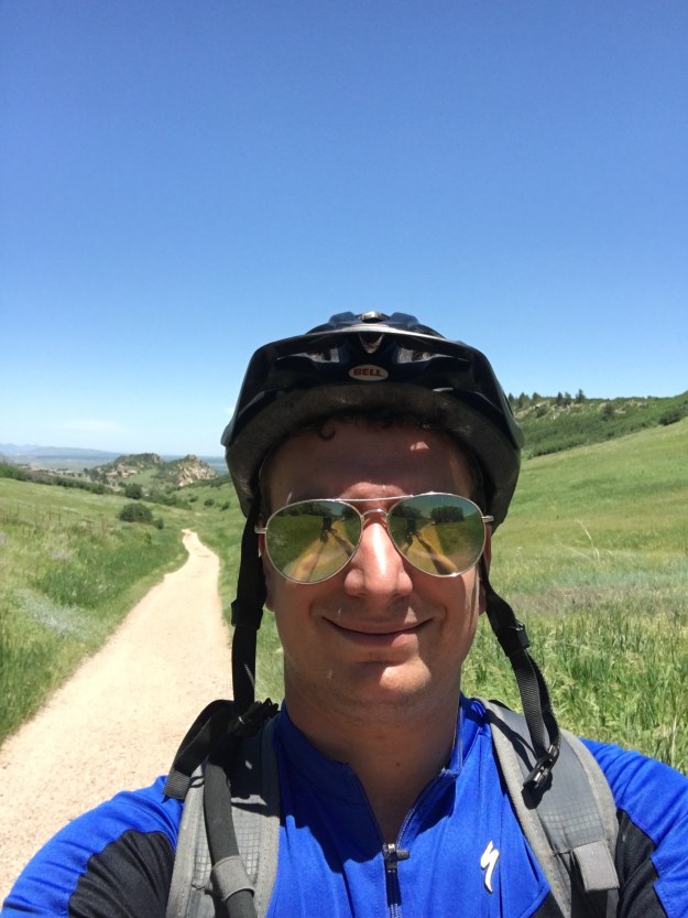
A decade and a half ago, popstar Christina Agulera, recalling a situation that most of us have faced at some point in our lives, sang “My body’s saying let’s go, but my heart is saying no.”  This morning’s situation was the exact opposite!  My heart wanted to continue riding, and soak in every experience that I could out of this trip.  But, my body, soar after three straight days of 100+ miles of riding (including yesterday’s climbs through the Adirondacks), did not feel like going any farther.

Had I decided not to ride today, I would have cheated myself out of an experience, that being day 4.  I have two previous experiences bike touring.  One, in graduate school, was a three day ride across the State of Wisconsin.  The other, last summer’s ride from Bozeman, Montana to Jackson, Wyoming, was also a three-day ride.  This day would be my first day 4, and regardless of what amount of pain I felt, I had to have this experience.

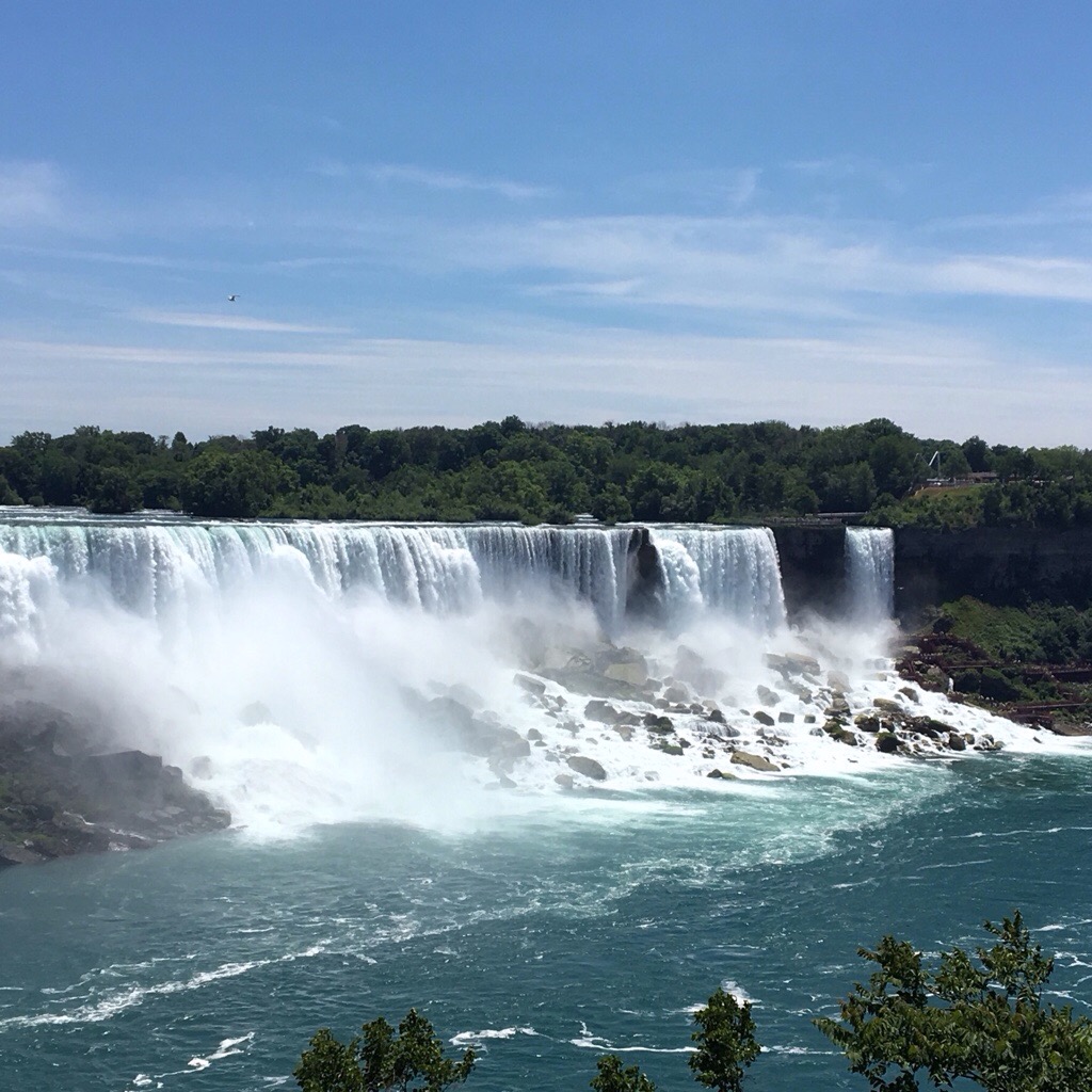
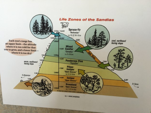
The ride started northeastward out of Lake Placid, with a little bit of a climb.  This was followed by a descent, which follows the Ausible River by Whiteface Mountain Ski Resort, and several waterfalls.

A strange thing happens when the human body is this worn out, but is forced to start going anyways.  The first few miles, or first 15 minutes or so, are kind of rough.  In particular, my legs did not feel as if they had anything left in them.  After 15 minutes, the resistance abated.  It felt like my body finally, and begrudgingly, agreed to tap some kind of alternate energy source.  For my own sake, I hope this energy source is fat reserves rather than muscle tissue.

The pain did not abate.  Sometimes the worst pain one experiences when cycling long distances is not muscle strain in the quadriceps, calves, or hamstrings.  Due to the long periods of time spent in riding position, other ares, particularly the neck and shoulders, often feel the worst.  In these situations, a little bit of Advil can help.  I usually do not advocate turning to pain medication, or any other kind of medication just to avoid a tough situation.  I even lament how many of us are dependent on caffeine to get through the average Thursday.  But, at least for me, eight hours a day hunched over a bicycle counts as that extreme situation where one can partake in pain medication without it becoming a regular occurrence.

IMG_6496.jpg

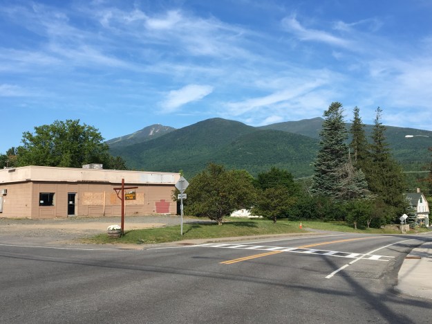
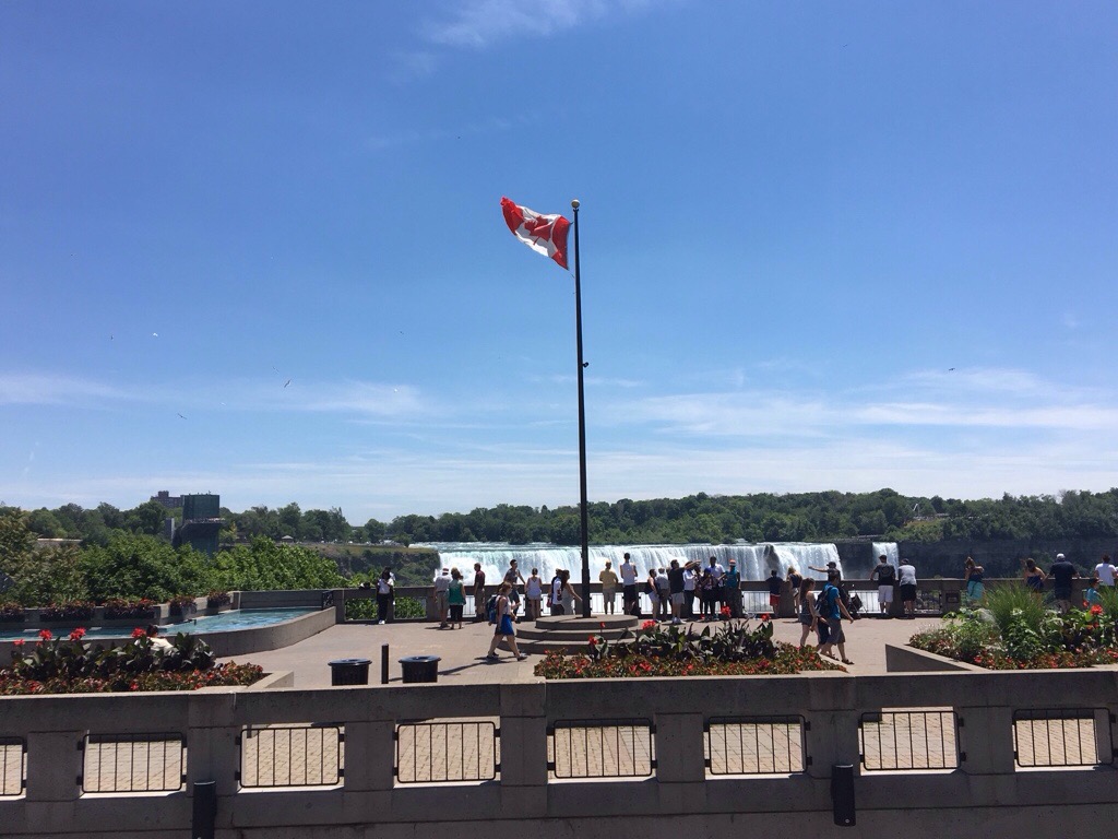
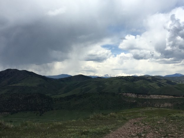
The first stop of the day, early on, was in a town called Wilmington.  This was an important stop for me, as it kind of represents the end of the Adirondacks.  On trips like this, I tend to spend well over 90% of my time looking forward, to the next destination, to the next activity, and to the next challenge.  In Wilmington, though, I found myself gazing backwards, back at the mountain range I had just “conquered”.  I have now already accomplished something.  Despite having significantly more distance in front of me, and some more amazing places to go, I’ve already had an amazing experience, one where I biked far greater distance than I have ever had before, and seen some amazing places I’ve never been to before.

The next segment of the ride followed back roads farther northeastwards towards Plattsburgh, a town along Lake Champlain.  Forests gave way to farmland, and finally town.

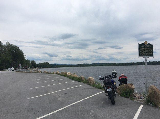
It ended up being a bit harder than I had anticipated to get across Lake Champlain.  First, I hit a wall.  It was as I got into town, just over fifty miles, and only about three hours, into my ride.  I was probably still quite exhausted from the previous three days.

IMG_6503.jpg

Then, the last several miles to get to the ferry ended up being more challenging than expected.  To get to the ferry from town, one must follow a trail along the Cumberland Head Peninsula that starts out heading East, but turns towards the South.  In this case, that was straight into the wind, the only strong headwind I had faced.  Although the trail was flat, the combination of wind and fatigue meant I could barely maintain a speed of ten miles per hour for the very last few miles of my ride in New York State.  I had literally run out of gas.

IMG_6505.jpg

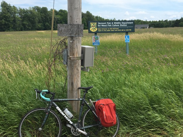
Perhaps my biggest disappointment of the day was that when I arrived on the other side of the lake, from the ferry, there was no sign welcoming me to Vermont.  There was only this Fish and Wildlife Department sign, which I used as a proxy.

IMG_6506.jpg

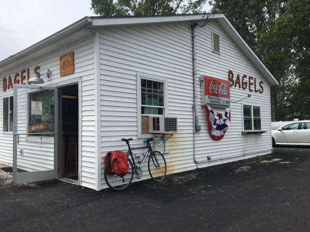
The other side of Lake Champlain, Vermont, is a very different place.  The attitudes of the people could not be any more different.  In Upstate New York, I was told that Texas has a better image than Long Island.  When I first got into Vermont, I stopped at a local bagel shop and grabbed a sandwich.  I overheard a conversation where one of the locals mentioned “extreme political differences” with Texas.

IMG_6507

I doubt that these difference with Texas corespond to any kind of affinity for the New York metropolitan area.

The family that hosted us that night in Greensboro told us that the town, and probably most of the area, was quite homogenous- politically.  They recommended that anyone who had a differing opinion “bite their tongue”.

IMG_6508

To me, though, Vermont felt like the reciprocal of Texas.  Current political considerations put the two places at odds with each other.  However, as soon as I got into Vermont, I saw signs and heard rhetoric that stressed individuality, and Vermont’s “Independence”, both current and historical.  This felt to me, honestly, reminiscent of Texas.

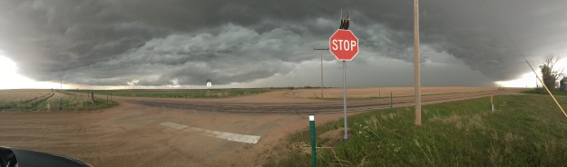
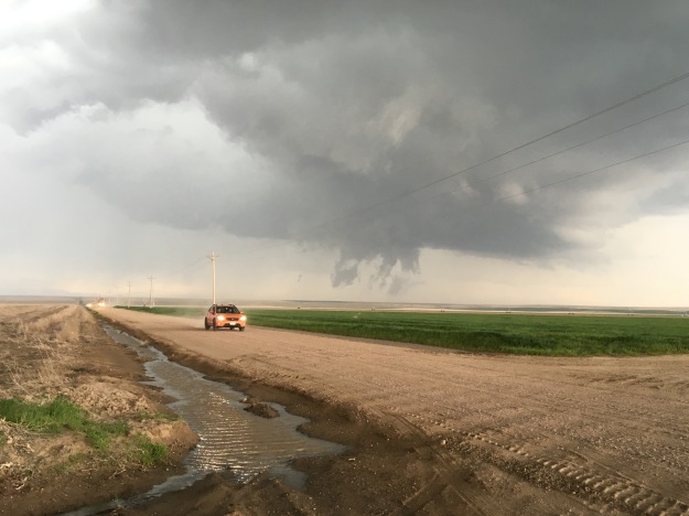
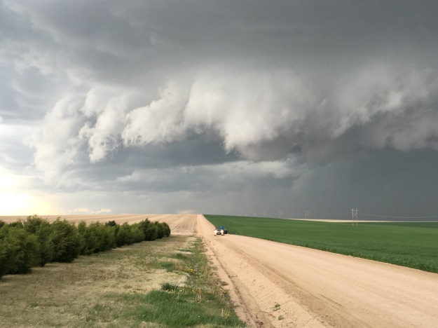
I decided to take the afternoon “off”, which meant returning to my backup plan; riding in the van that was following Clay’s route.  I came into this ride knowing that I would not be able to keep up with Clay’s pace, often well over 100 miles per day, for the entire ride.  Before booking my flights and such to join on this trip, I made sure that I would have a backup plan when this moment of utter fatigue would eventually set in.  I figured this would be the best time to rest, as the weather turned a bit questionable (that afternoon, it became windier, and it would eventually rain in the evening).

Riding in the van also allowed me to see a couple of additional sites, most notably the Ben and Jerry’s Ice Cream factory, which is not along the bike route, but not too far out of the way.

One thing I was told to expect from Northern Vermont, was to see a lot of red barns.  After all, the quintessential Vermont image is of rolling hills, possibly cheese or ice cream, and a red barn.

IMG_6513.jpg

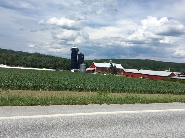
During my time in Vermont, which included both the time in the van today, and the time I would spend on my bicycle the next day (before reaching New Hampshire), I would see a total of 80 barns!  During my entire time in New York State, a much longer distance from Niagara to Plattsburgh, I saw only 54.

IMG_6533.jpg

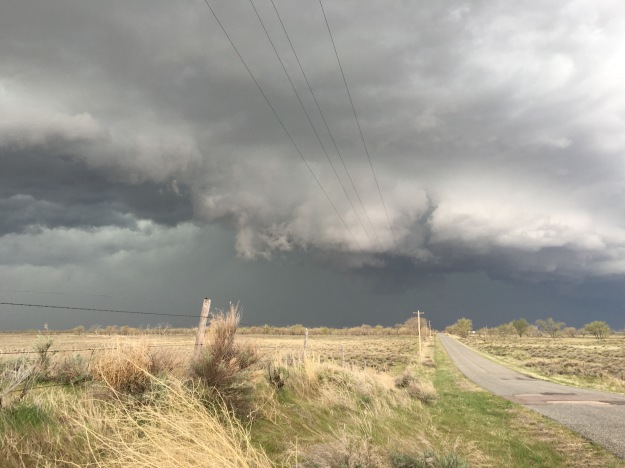
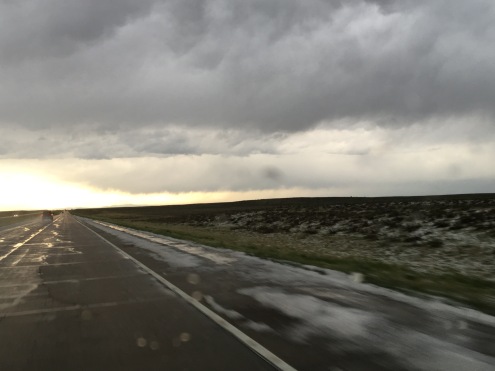
Clay arrived at our destination literally minutes before the sky opened up, and started to pour.  Had I continued cycling that day, not only would I have hit a large amount of rain, I likely would have slowed Clay down, causing him to unnecessarily get wet.  This was the last time I had to invoke my back-up plan, but, based on weather considerations, the opportunity to take the Ben and Jerry’s factory tour, and this dirt road, I think I made the right choice.

Cycling the Adirondacks

IMG_6454.jpg

I woke up in Old Forge not knowing exactly what to expect for the day.  I knew the generalities.  The Adirondacks are mountains.  There will definitely be some terrain, some climbs, and some fantastic scenery.  This would be my first day of riding through a truly mountainous area.  The first day of my bike trip had been flat, mostly following the Erie Canal through Western New York.  There were rolling hills on the second day, through Central New York, but no significant climbs.  A ride through the Adirondack Mountains from Old Forge to Lake Placid would definitely be more of a challenge than the previous two days.

I started the day wondering how challenging the ride would be.  I knew that the mountains here, or anywhere in the East, are not as tall as the mountains in Colorado.  But, I also knew that I had covered quite a bit of distance the past two days, over 100 miles each day, so I could be a bit exhausted.  I had read blogs and such about cycling through the Adirondacks, but it’s hard for anyone to deduce how their body will respond to a bike ride based on a blog entry.  The same more or less holds true for other activities like hiking and skiing.

IMG_6452.jpg

It barely took a mile or so of riding, northeast on highway 28 out of Old Forge before I began to encounter the splendid lakes surrounded by forests and hills that make the Adirondacks so appealing to so many people.

IMG_6462.jpg

It was about 30 miles into the ride, at a place called Blue Mountain Lake, where the terrain started to become more challenging.  The mountains were becoming taller, as I had entered the heart of the Adirondack Mountain Range.

IMG_6464.jpg

Leaving Blue Mountain Lake, heading north on highway 28-N, I encountered the first of a series of challenging climbs.  This one was likely the steepest, but throughout the entire ride, each time I passed through a town, I would have a climb after leaving town.

I was already a little tired from the first exhausting climb when I stopped in Long Lake, at a farmer’s market I randomly encountered.  One of the beautiful things about bike traveling is that, while traveling at slower speeds, it is harder to miss these kinds of random events.  Six years ago, while cycling the I & M Canal trail along the Illinois river, I randomly encountered the Grundy County Corn Festival in the town of Morris, IL.

At this farmer’s market I talked to the people manning the booth while eating an ice cream sandwich.  One thing I notice while bike traveling in general, is that people tend to be interested when they encounter people traveling long distances by bicycle.  One of the vendors even told me she had a friend that had graduated from the same high school, on Long Island, as my father (7 years earlier, so no mutual acquaintances or anything like that).

IMG_6469

The next part of my ride, along state highway 30 from Long Lake to Tupper Lake, was the most challenging for me.  Turning towards the Northwest, for the first time on this bike tour, I was facing a significant head wind.  And, there were a few segments with significant climbing, including the climb to get out of Long Lake.

This was also the part of the ride when negative thoughts started to creep into my head.  Anyone that has taken on a large scale physical challenge understands this phase.  The body starts to get overwhelmed.  It starts to resist.  That resistance creeps into the mind through some kind of combination of messages to oneself such as, “you should quit”, “you’re not gonna make it”, “it was a crazy idea anyways”.

How to respond to this is always a challenge.  From my experience, this occurs anytime anyone truly tries to stretch themselves, and do something that amounts to a serious challenge.  There are some that never overcome this phase, repeatedly giving in to that voice telling them to quit.  Overcoming this internal pressure, born out of fatigue, builds character.  It teaches us all how to endure fatigue and negative pressure in other areas of our lives.

I also learned a valuable lesson about understanding what my body needs.  I was cycling through this challenging segment at roughly 1:30 P.M., and had yet to eat lunch.  The previous day, I had also made a relatively late official lunch stop (around 2 P.M.), but I had eaten a hot dog at 11, something that kept me going.  The ice cream sandwich I had at Long Lake was far less substantial.  It is likely that by 1:30, my body did not have the nutrition it needed.  It’s important to keep in mind that, when traveling by bike your body is your engine, and that engine needs fuel to keep running!

After stopping for a full meal, at a place called the Skyline Drive in, which was recommended to me by the woman at the farmer’s market back in Long Lake, I felt refreshed, and realized I had just over 30 miles to go to my final destination for the day, Lake Placid.  My mindset did a complete 180!  I went from questioning myself at every pedal stroke, to knowing I was going to make it, and finish this beautiful ride.

IMG_6477

I knew I was getting closer to my destination, Lake Placid, where the Olympic Winter Games were held, twice, when my route diverged from the Adirondack Trail and started following the Olympic Trail.

IMG_6481

IMG_6482

After a brief stop in Saranac Lake, and eight miles along state highway 86, which featured a surprisingly high traffic volume (but also a wide enough shoulder to accommodate bicycles), I arrived in Lake Placid, and gazed upon the mountain that had hosted some of the greatest athletes from around the world on two occations.

What a gorgeous town, and what a gorgeous ride, all the way through!  It was an exhausting ride, once again clocking in at 100 miles, but this ride through the Adirondacks is a ride I would recommend to anyone.

IMG_6489.jpg

After a nice meal at Lake Placid Pub and Brewery, across from the Hampton Inn where I would spend the night, I spent the rest of the evening soaking in the sunset over Mirror Lake, gazing at the reflection of the mountains in the water below them.

I thought about life.  I thought about how to live better.  How to be better to people around me.  How to overcome challenges.  I also thought about what I had experienced over the past three days.  The New York portion of this ride was nearly complete.  Through this ride, from Niagara Falls to Lake Placid, I saw a good portion of the state, much of it which I had never seen before.  Having been born on Long Island, and spent much of my childhood going into New York City for various events, museums, shows, etc., I am familiar with the phrase “I love New York”.  Having now seen the roaring falls of Niagara, the majestic lakes of the Adirondacks, and many points in between, I can now say “I love New York”, and know I mean ALL of New York.

100 Miles of Rolling Hills Through Central New York

It’s the quintessential bike tour stop.  A small town diner.  A picture of the bicycle in front of it, the more panniers the better.  Highly decorated walls, with an old fashion sort of flare to it.  And, of course, the existential, thought filled, photo.  It feels like I am having that experience every long distance cyclist needs to have.  Of the many stories of bike travel I have read, particularly in the Adventure Cycling Association’s monthly newsletter, it always seems like there is some sort of experience at a small town diner like this.

I am not even sure, at this point in time, whether or not I am indeed following the Adventure Cycling Association’s Northern Tier route. I know it is somewhere close to here, in Wolcott, NY, a town I would pronounce incorrectly for the entire duration of the trip. But, I am still unsure of just how odd I look at this point in time.

IMG_6408

We rolled out of town on some quiet roads that were significantly hillier than the prior day’s ride.  The entire days’ ride would in some ways resemble this, up and down these types of rolling hills that dominate the landscape of Central New York.  Over the course of the next twenty or so miles (sometimes the brain works slower when the body is consistently physically engaged like this), I processed the interactions I had with the locals, both at the diner this morning and over the course of the day yesterday.   It suddenly occurred to me that my Long Island accent, which I had originally thought would be an asset while interacting with people in this area, is actually a liability.

It’s a familiar story that plays out in so many other states with large metropolitan areas, but also large rural/small town swaths.  People from “downstate”, which mainly means New York City, Long Island, and Westchester County, dominate state politics, and call anything north of Poughkeepsie “upstate” despite its position well south of the center of the state.  This can sometimes lead to resentment from those in other parts of the state that feel neglected or even abused.

IMG_6413

The people at the hot dog stand in Fulton, NY, our next stop, were quite friendly.  They gave us the water we needed to refill our water bottles, and even gave us a couple of hot dogs to help us on our journey.  They also largely confirmed my speculation about my Long Island accent, and how they feel about the region I grew up in.  The discussion focused on state politics.  By far the most common political sign I encountered throughout my time in the state of New York were yard signs advocating the repeal of something called the NY Safe Act.  A rough map of which counties have resolved to oppose this act highlights a clear divide between the New York metropolitan area and the rest of the state!

Green-Star-Map-05-Feb-14

My friend Clay is originally from Texas.  Out of curiosity, I asked the two ladies at the hot dog stand which location, Long Island or Texas, would have a generally more positive reputation in this town.  They quietly giggled at me and told me “Texas wins”.

I’ve always had a strong interest in road networks.  I’ve actually memorized the routes of many interstate and U.S. highways.  People will often open up a map, name two roads, and see if I can guess where those two roads intersect.  I don’t have perfect memory, like that zip code guy that used to hang out in downtown Boulder.  But, knowing my road network, I knew getting to Interstate 81, in Central Square, NY, directly north of Syracuse, felt like a milestone to me. It meant that I was roughly halfway across the state.

IMG_6414

When I was 12 years old, about a year after my family moved from New York to Chicago, I made this mental connection between people talking about “going upstate” back in New York, and people from the Chicago area heading to Wisconsin.  While there are plenty of parallels, the analogy was undoubtedly an oversimplification.  After crossing I-81, I recalled that I was now within a several hour drive of New York City.  Before even hitting the Adirondacks, I saw tons of amazing places in this part of New York.

I was also fortunate to get to ride on some quieter roads. We took Moose River Road northeast out of Booneville to connect to state highway 28, which would lead to our evening’s destination: Old Forge.

IMG_6434

This was one of my favorite parts of today’s ride; 17 quiet miles through dense forests, going over periodic hills and passing by groups of vacation homes tucked away in the woods.  It feels like the kind of place where a lot of happy things happen.  It made me think of people having their weekend away from the crowds.  It made me think of sixth graders at their family vacation home having their first kiss down by the lake.  It made me think of people actually talking to one another as opposed to staring at phones, tablets, and other devices.

IMG_6437

The final ten miles of my ride were along highway 28.  This was kind of the opposite experience.  It was not quiet at all.  But, like many of the roads I had been biking on throughout the state of New York, it had a wide shoulder for biking.  Additionally, it had periodic signs labeling the road as a bike route.  I also saw some wild turkey- not too exotic, but something I do not see on a day-to-day basis.

IMG_6440

I arrived in Old Forge just before sundown.  We stayed at a hotel called Water’s Edge Inn, which, as its name suggests is next to a lake.

We sat by the lake, watching nightfall gradually creep up on us, reflecting on the experiences of the day.  I had now ridden my bike over 100 miles two days in row for the first time ever.  We were covering quite a lot of ground, but I had started wishing I could spend a little more time in some of these places, particularly Old Forge, a town with a lot of activities and natural scenery, and a town I would barely be in for 12 hours, 7 of which would be sleeping.  Still, I was enjoying myself, and finally broadening my view of what this entity known as New York really is; beyond the City and Long Island where I spent my childhood.

My First Long Day of Cycling

IMG_6357

I woke up in the morning with a good feeling.  It wasn’t a premonition regarding something specific, like when people set out to run a triathlon or take a key exam and get this feeling of confidence that they are going to achieve what they set out to do.  After all, this is a bike journey.  Accomplishment does not come at the end of this day.  It comes at the end of the last day, five days later, when I reach the coast of Maine after six days of riding.

The feeling I started the day with was just a general positive vibe, that I knew I was going to have a good day.  It is a Tuesday, a day where many people will simply be grinding out their daily lives.  For tragically many people, this means stressing out at jobs that do not fulfill them.  I get to ride my bicycle, spend the day outside, and see places I have never seen before.  I must be thankful for that.

On bike journeys there are plenty of things that can go wrong.  There’s always the possibility of unpleasant weather, unexpected storms, or an unexpected unfavorable shift in wind direction.  There are also the many possible mechanical issues that can occur to a bicycle, particularly one that was recently shipped across the country.  The feeling I got was that none of those things would happen, and that I would simply have an enjoyable day on my bicycle.

IMG_6356.jpg

Most Canadians will recognize my way of starting my day off right, with a nice breakfast at Tim Hortons.  Food is crucial on a bike trip.  It is so crucial that when I took the Adventure Cycling Association’s Leadership Training Course three years ago, it was the very first thing they talked about, before bike mechanics, camping/lodging, or even the basics of bike touring.  How to pack trailers, roof racks, panniers, etc. would not be covered until the next day!  I know one bad meal can really strain a bike trip, particularly if it’s breakfast, so I made it a good one before crossing the border back into the United States.

IMG_6360.jpg

Before leaving the Niagara area, I took one last view of the falls from a place called Goat Island.  Goat Island is between the two falls, and on the American side.  It offers a pretty good alternate view of Horseshoe Falls, which is directly across from a place called Terrapin Point.  It might be the best view on the American side of the falls, but, as I mentioned in my prior post, the Canadian side still offers better views overall.

I would spend most of my day cycling on one of the Nation’s longest bike paths, the Erie Canal trail.

IMG_6367.jpg

I knew that this was going to be a flat ride.  The Erie Canal is a waterway that was built in 1824 to provide a shipping route between the Great Lakes and the Atlantic Ocean.  In order for the very concept to work, they had to find a route with very minimal elevation change.  When the canal was built, a series of locks were built to regulate the water flow.  The first town we encountered after picking up the trail was Lockport, New York, a small town with one of these locks at the center of town.


East of Lockport, the trail surface becomes crushed limestone.

IMG_6377.jpg

Staying right next to the Erie Canal, the scenery I encountered was quite constant.  Much of my day looked exactly like this.  This trail is flat, and largely straight, which is good for covering a large number of miles in one day.  I spent most of my time on this trail just thinking about the Erie Canal itself, the amount of work it must have taken to build it, and its role in transporting goods across the Union in the Civil War, which some consider to be a major factor in the eventual Union victory.

IMG_6383

On a day like today, covering a lot of miles on a trail with consistent scenery, it is easy to lose track of each individual town.  This is why one of my favorite features of the Erie Canal Trail, at least in Western New York, is these bridges.  Each of them have the name of the town labelled on top of the bridge, so as cyclists approach, they know which town they are, in fact, approaching.

IMG_6375

I generally liked Western New York for bicycling, and bicycle accommodations.  Obviously, there is the trail, but also many of the roads include wide enough shoulders to accommodate bicycling.  Additionally, New York is one of the states that has labelled state-wide bike routes, which add some level of legitimacy to cycling as a form of transportation.

The exception, at least for me and the route we followed, was Rochester.  We split off the Erie Canal trail in order to ride, and eventually camp, along Lake Ontario.  This involved getting off the trail and following State Highway 104 into town.  Like other Western New York roads, this road had a shoulder.  However, this shoulder had frequent obstacles, mainly sewers, that we needed to cut into traffic to avoid.  After that, we cut over to the lake in a suburb called Sea Breeze only to find out that the bridge we were hoping to take, over Irondequoit Bay, was closed for the summer.

IMG_6388.jpg

We were told that the bridge would re-open in November.  I am accustomed to roads being closed in wintertime, but not in summertime.  I never would have thought to even check to see if any bridge that I was hoping to take would be closed.  What was so frustrating about this was that the bridge itself, seen in the distance, and also on this map, is so short.

Screen Shot 2016-07-06 at 6.49.28 AM.png

It couldn’t cover more than fifty feet, and, as a result of that bridge being closed, we had to back track all the way around Irondequoit Bay, adding a significant number of miles to the trip.

I ended up having to invoke my backup plan.  I had already ridden more miles in one day, 112, than I had ever before in my life, smashing my previous record of 104.  Without the detour, I would already be close to my destination for the day.  But, I knew I needed to save some energy for five more days of riding.

So, I got a ride for the remainder of the day’s trip, which ended at Sodus Point, at a campground where I could watch a beautiful sunset along Lake Ontario.

IMG_6397.jpg

The obstacle I faced was not one of the ones I had anticipated.  Usually when I think of what can go wrong on a bike trip, wind, rain, and flat tires are the first things that come to mind.  A bridge closed for the summer is the last thing that would occur to me.  In fact, it took nearly three days for me to eventually realize the likely reason for a summer bridge closure; so boats can pass through from the bay into the lake.  Still, I consider this sunset along one of America’s Great Lakes a great end to a great day on my bicycle.


Niagara Falls: Where My Journey Begins

20160703-224931-82171740.jpg

For most visitors to this iconic location, Niagara Falls is the ultimate destination.  It is the place one travels to, spends some time at, and then subsequently travels home from.  When I think of Niagara’s typical visitors, I think of a family from a place like New York, that made the grueling six hour drive to get there, and will make the grueling six hour drive home.

I guess my sometimes fanatical quest to not be like “normal people”, whatever that means, is working.  I certainly do not feel normal.  My day, which began with an 1:15 A.M. flight out of Denver, involved traveling from airport to airport carrying not luggage or a back pack of sorts, but two panniers, one in each hand.

In a way my journey actually began at a tiny bike shop in Niagara, NY called Beeton’s Cyclery.

20160703-225445-82485961.jpg

I need to give this place a serious shout out.  I shipped my bike here.  It arrived on Friday, June 24th.  I told them I needed it by Monday, and they were able to get the bike assembled (to package a bike for shipping, the pedals, handlebars, seat, and front tire must be removed) and apply new handlebar stripping in time for me to arrive late morning Monday and start my voyage.

I brought my passport, knowing that I wanted to visit the Canadian side of the falls.  Anyone who has been to Niagara told me that the Canadian side was “better”.  I wasn’t sure what that meant.  The contrast between the two sides is quite stark.  Niagara, NY is sort of depressing.  I had trouble finding a place to grab a snack, while I gazed ahead at tall buildings and casinos on the other side.

20160703-230305-82985654.jpg

Still, I wanted to see the falls from the U.S. side first.  The plan was to meet up with my friends on the other side and spend the evening there.

On the American side, the view of the falls is somewhat awkward.

20160703-230550-83150230.jpg

Well, it is from he riverfront. There is this overlook, where theoretically the view is spectacular, but it costs like $18 to go on it, so I didn’t.

20160703-230749-83269193.jpg

Getting to the falls on the Canadian side involved going over the same bridge that cars travel over.  The toll for bikes is only $.50 (I believe cars is $3.50), but I still had to wait in the same traffic cars wait in to cross into Canada.

20160703-230948-83388452.jpg

Once I crossed the border, I realized why most of the tourist attractions, hotels, and buildings and such were on he Canadian side of the border.  By happenstance of geography, the views from this side of the river are better.

20160703-231424-83664213.jpg

20160703-231424-83664658.jpg

20160703-231425-83665101.jpg

This includes both falls that make up what is called “Niagara Falls”, the American Falls, which are on the U.S. side of the river, which splits around an island, and Horseshoe Falls, which are on the Canadian side.  Both falls are magnificent.  Horseshoe Falls is more powerful, but I actually prefer American Falls, particularly the way the water hits he rocks and sort of foams up.  Both falls are best viewed from Canada.

20160703-232006-84006386.jpg

I’ve always loved waterfalls for some reason.  Much like one’s taste in music or art, it is not something that can be explained.  Waterfalls just feel natural to me, they feel peaceful and even sometimes graceful.

In the world of waterfalls though, Niagara Falls is pretty much the opposite of any of the waterfalls I typically view out West.  Waterfalls in the west, such as the Lower Falls of the Yellowstone, tend to be tall and skinny, falling a much greater vertical distance, but carrying much less water.  Niagara is high volume but the vertical drop is actually less than 200 feet.

I also could never imagine waterfalls in the west being as commercialized as these.  In addition to the $18 charge for getting on the overlook in the New York side, the town of Niagara Falls, Ontario is filled with every establishment one would expect to find in a tourist trap packed together at a density I have only seen in one place before; Gatlinburg, Tennessee.

20160703-233302-84782966.jpg

20160703-233303-84783451.jpg

20160703-233304-84784380.jpg

20160703-233303-84783901.jpg

Gatlinburg, like Estes Park, is outside a popular National Park.  The hotels, mini golf, and Ripley’s Believe it or Not, are miles away from the iconic natural beauty that made those places worth preserving through the National Park system.  All of these places in Niagara Falls are within a mile or so of the falls.  In fact, one can get another perspective of the falls by riding a ferris wheel next to the mini golf course across from the laser tag.

20160703-234209-85329566.jpg

Tomorrow a long journey by bicycle begins.  Tonight, I get to continue to savor these falls, as they are lit up at dusk as part of a nightly illumination. This, like the rest of town, adds a man made touch to a natural phenomenon.  Some love it, some hate it, most find a way to enjoy it regardless of the opinion they expose.  As for me, my focus turns to the days ahead, for unlike most of the others watching the illumination, my journey is only beginning.

A Mental Health Day

IMG_6149

I feel like I have over 100 things on my mind, all vying for space, all wearing me out.  All the changes I see around me.  The shocks, the craziness, the idiocy.  The selfishness.  My personal shortcomings, recent mistakes, how my life’s path ended up where it is and what to do about it.  How do we find a balance between order and chaos?  All the ways in which the people around me have let me down.  All the ways I let the people around me down.  How do I keep the benefits of having a smart phone (like being able to take pictures like this, after 28 miles of bicycling, which would have been tough carrying a heavier device) but avoid the pitfalls of mindless scrolling on weekdays when bored?  What is my future,  and how do I find my niche?   What is the future of our society?  The mindless violence followed by the sometimes equally idiotic responses to it.  Globalization.  Trump, Brexit, and the backlash to globalization.  But, most of all, the disappointments when experiences do not match expectations.

Simply put, I needed a mental health day.  I think we all do from time to time.  A day where we get away from jobs, computers, social media, day-to-day responsibilities, pretty much everything that causes us stress, and do something that we enjoy.  This, of course is something different for everybody, and it is not up to me to judge what any one person does for their mental health days.  Well, unless of course it is something morally reprehensible like murder or theft.

I have a firm belief in, and also a unique take on, the connection between mind, body, and spirit.  Over the course of my life, and in observing others, it is almost impossible not to observe the connection between the three.  I remember winters in Chicago, and other times when lack of exercise would in turn weigh on my mind and spirit.  Overall, improvements in one of the three realms often force improvements in the other two.  Likewise, a deterioration in one of the three realms can negatively impact the other two, like the person who develops an eating disorder after a rough breakup.

So, I decided to make my mental health day also a physical health day, with a bike ride to Roxborough State Park.  This is a ride I did two years ago.  The basic gist is that it is 28 miles each way, goes by Chattfield Reservoir, and is a significant climb over the last five or six miles.

Wednesday’s ride was even more exhausting, as temperatures soared into the 90s and a Southerly wind developed making the last several miles of climbing in harder.  Needless to say, I arrived at Roxborough exhausted.  In fact, I had to sit inside for about 15 minutes to cool off when I got there.

IMG_6140

Still, I decided to do some hiking.  Knowing that my legs were exhausted, I decided to stick to moderate trails, but ones where I can still view the essence of the park and what makes it geologically unique.

IMG_6142IMG_6143

It was after roughly 1.5 miles of hiking that the ideas suddenly started popping into my head.  Ideas about things I could be doing with my life just entered my mind.  I could do this, and present it to these people, and achieve fulfillment in this manner.  They just kept pouring in, and, for some reason, felt so simplistic to me.  Like, the only thing I need to do is just go out and do these things.

IMG_6144

These are all things that frustrate the hell out of me day and night.  Maybe it is because all of the physical exertion caused my mind to slow down enough for my brain to stop over-thinking things.  Maybe it is the freedom from all of the distractions of daily life.  It’s strange what I was contemplating.  Whenever I am in front of a computer, at an office, in a cube, or in some kind of work-like setting all of the ideas I have seem almost impossible, like a daunting challenge that would take years to attempt and would likely not result in any meaningful success.  In a way, there, I feel stuck.  Here, not so much.  Here, the same exact ideas seem quite possible.

It is here that the conspiracy theorist in me gets activated, so please bare with me, as I am the kind of person that just likes to entertain theories, even if I am not necessarily going to conclude that they are true.  I wonder if cubicles, offices, sedentary days and the like are the way “the system” maintains itself.  By “the system” I mean what I am observing around me.  A whole generation of highly educated people going to work at jobs that are well beneath the skill level they develop through college, and increasingly, post-granulate, education.  A whole generation of people submitting to rules, such as a strict 9-5 schedules and dress codes, that are no longer relevant for the kind of work that now predominates in a service sector economy.  Is the reason people continue down this path the manner in which a whole day of sitting at a computer connected to the internet and all of its distractions make them feel?

IMG_6147

People visit Roxborough State Park, and the geologically similar and more well-known Garden of the Gods, because they are unique.  If this place looked like every other place on Earth, people would not make a specific point of coming here.  So, maybe the key to being the kind of person people seek after, is to be unique.  After all, the person you meet at the party that is exactly like everyone else, is the person you don’t remember.  Sorry to be harsh.  But, it’s when someone does something unique, or interesting, that you remember that person.  Strangely, though, the world of school, and subsequently work, encourages conformity.  It encourages people to follow the worn out path and do things the way they are always done.  Maybe overcoming that conditioning and doing things our own way is the key to life, both in terms of success and happiness.

Logan Square: A Place That Still Feels Like Home

IMG_6020.jpg

In some ways, it feels as if I never left.  I go about my business from instinct.  I do not need to look up where things are, think too hard about how to get there, and fret about to expect from the people around me.  It is all still very familiar, fresh in my memory.  Things like how the streets are laid out, where the traffic lights are, or where and how to board busses and trains are still like second nature to me.  It is what makes a place feel like “home”.  It is what many people miss after a couple of months moving to a new town, as, for most, it takes time to become truly acquainted with a city, the customs, the energy, mannerisms and the like.

It’s now been nearly four years since I moved away from this neighborhood of Chicago, situated several miles northwest of downtown, near the halfway point between downtown and O’Hare International Airport.  Four years has always been a fascinating length of time for me.  I was a teenager when I first observed the significance of this length of time – four years.  I’ve always been fascinated with observing people, what makes them the way they are and how that changes over time.  I’d think about people, including myself, who they were, what kind of life they are living, what activities they are taking part in, and what their expectations are.  These things were likely to be quite similar one year to the next, but after a four year time frame, significant differences would be observed in most people.

This may be cultural, as we are trained from a young age to break our lives down into four year increments (high school, college, etc.).  But, I noticed something else too.  It felt as if four years was how long certain unintentional transitions took to manifest.  It’s how long a person can passively absorb a new culture (by passively I mean neither actively embracing nor resisting it) before starting to also reflect it.  It is how long one can go without talking to someone before it really does start to become awkward to meet again.

IMG_6018.jpg

It’s not like everything is exactly the way it was four years ago. No place really works like that.  Over the course of time, things change: A store goes out of business, a new one pops up, a few places renovate their buildings, new signage comes in, etc.  We are accustomed to this gradual change.  In the place where we live, we do not even notice it.  It’s kind of a seamless flow.  However, after several years, the cumulative effect of all the new development becomes noticeable.  This Logan Square, the one I returned to in June 2016 is not different enough to feel foreign to me.  It feels more like when a best friend gets a different haircut, or when a house gets one room remodeled.  It’s still the same person.  It’s still the same house.  It’s still the same Logan Square, just with a couple of new features.

Logan Square is also a neighborhood in transition.  It has been for a long time.  At the turn of the century, when the renewed interest in urban living following the crime reductions that took place in many major cities during the 1990s was still a new thing, Logan Square was still run down, and kind of edgy.  It would take a few more years and several thousand more young people searching for the new urban life.  However, Logan Square was destined to become a destination for young urban professionals.  The CTA blue line runs right through the heart of the neighborhood, giving residents easy access to both downtown and O’Hare airport.  Logan Square is somewhat of a hybrid neighborhood in this sense. It is possible to live here car free. But, car ownership is not the burden it is closer to downtown, where monthly parking can get quite pricey.  Most residents pay something like $100 a year (I’m not sure what it is exactly now- not something I keep up with) for a neighborhood city sticker.

IMG_6021.jpg

The Logan Square I came back to was a Logan Square with somewhat more energy than it had several years ago.  There were more people walking around.  There was more nightlife.  There were more buildings, and a lot of new restaurants, bars, shops, just places to go in general.  This should not be surprising.  It is just a continuation of the trend that I had once been a part of.  Logan Square felt more energetic and more alive, but it definitely maintained most of its individual character.  It felt like home- just a slightly livelier home.

IMG_6024.jpg

The weekend was fast-paced, and full of events, taking me from one side of the city to the other.  Due to time constraints, I took far too many Uber rides, as it would have taken longer to take trains and busses everywhere.  I recall going up and down the Kennedy and Dan Ryan expressways, passing from one side of town to another over and over again.  This is the part of a busy weekend, which is mostly about scrambling around to as many events, and seeing as many people as possible, that fades into kind of a blur.  It’s just a blur of nighttime expressway riding, going through Hubbard’s Canyon and riding by the new Whirlyball building a whole bunch of times.

Trips back to Chicago always feel like a whirlwind for me.  Trying to spend time with family friends, etc., see as many people as possible.  But, there is more to it than that.  Everything around me seems to happen faster here.  There is something about dense urban environments that make me, and probably others around me as well, walk faster, move faster, live faster.  Events happen and plans come together much quicker.  It’s like there is something in the air, or something about seeing a lot of buildings, people, and just stuff going on all around us that makes us want to pick up the pace.  If there is one thing I truly miss about Chicago and my life there, it is that.

When You Don’t Appreciate What You Have

IMG_5987.jpg

It’s Memorial Day, and there is a lot on my mind.  Part of me feels like I “should be” doing something way more substantial this weekend, as it is one of three big weekends that define summer here in the United States.  I can’t stop thinking about all of the sales and shopping going on this weekend.  And, then, of course, I end up thinking about the ACTUAL meaning of the holiday; remembering those who have died fighting for my country.  Many people in the military, or closely associated with someone in the military, lament what this holiday has become, all about grilling in the park, going to stores, partying, etc.

I “stayed home” this weekend, which for my standards (as an antsy person) means I stayed within the Denver-Boulder-Castle Rock area.  I needed to take it easy.  My next two months are packed with activities.  Also, most places I would go would have been particularly crowded this weekend.

Confluence Park is a mere three miles from my home, and right in the middle of Downtown Denver.  In fact, when I worked in Lower Downtown (LoDo), I was able to walk here from my office on lunch hours.  I ended up being here at a very unique time of year.  The river that runs through the center of town, the South Platte, has its origins in the higher terrain of the Central Rocky Mountains.  Above 10,000 feet, snow continues to fall, and temperatures remain chilly through much of Spring.  By this time of year, that snow is melting rapidly, swelling rivers like this one with rapidly moving, cold water.  It seems like the water levels reach their highest sometime around Memorial Day.

I sat in Confluence Park with my feet in the water for roughly half an hour.  I moved around from time to time, from rock to rock, feeling the sensation of the rapid stream flow in varying patterns, with different bumps, and eddies at different spots along the river.  I even stood on top of a mini-water fall for a bit.

I thought about all of the people, running around from store to store, looking for something new today.  I even thought of myself, and how I am always looking for new places to travel, new experiences, etc.

I even thought of the other activities I took part in this weekend.

Saturday’s brewery tour by bicycle.

Sunday’s hike up Green Mountain, to a place where one can see multiple 14,000 foot peaks in one direction and Denver’s skyline in the other.

IMG_5984IMG_5985


None of these activities required traveling a long distance, or buying any fancy equipment. A basic bike, a basic pair of sneakers will due.

Sometimes it seems like we spend way too much time looking for something new, and not enough time appreciating what we already have.  After all, whether it be a place to view the skyline from above (something I did not have when I lived in Chicago), or a year old pair of shoes, everything we have was once new, was once exciting, and was once a thing we were happy to obtain.  Are we still happy to have it?  Are we still enjoying it?

Some of us have more than others.  But, no matter how much or how little any one of us has, the one thing each and every one of us has is ourselves.  We have our bodies, and what we are capable of doing.  We have our minds, the things we think of, the way we reason, etc.  And, we have our spirits, our attitudes, what makes us excited for life, what makes us empathize with one another, and what makes us stand up for what we believe in when necessary.  This is definitely something we should all learn to appreciate.  If we all spent more time appreciating ourselves, maybe we would have a more positive outlook, and a more positive impact on the world around us.

Lessons Learned?

IMG_5847

Some events in life are clear.  They can be clearly labeled a success or a failure.  The reason for the success or failure is clear, and there is a clear lesson to be learned from it.  One comes out of an event of this nature much like an idealized application of the scientific method.  A piece of new information is obtained.  It either strengthens a pre-existing theory or calls it into question.

In the real world is not ideal like that.  Many observations, an many of our life experiences do not even produce a clear cut data point, a clear “success” or “failure”, or a clear lesson to be learned.  This was certainly the case on my first storm chase of the 2016 severe storm season, on Saturday, May 7th.

It was a day that did not require me to travel far to chase.  In fact, I returned home to Denver less than eight hours after departure, something that cannot typically be expected.  If I lived in a City right in the heart of “tornado alley”, such as Oklahoma City, Topeka, or Lincoln, I would expect to be able to regularly see great storms without having to allocate an entire day.  However, Denver is a bit West of the region most prone to severe thunderstorms, much the same way Chicago is a bit East of that region.  When I moved to Denver, I did have to make some adjustment with regards to storm chasing, but I did not significantly alter my expectations regarding time spent or distance traveled on a typical one-day storm chase.

Saturday’s severe storm setup provided me with a somewhat familiar dilemma, and one that is even more common chasing storms in Colorado, where many thunderstorms are initiated by orographic features.  Severe storms need a certain environment to thrive, one that is warm an moist, but also with some kind of boundary to create low-level wind sheer, which creates the rotation necessary for supercells, and tornadoes, to form.

Saturday was not that kind of day in the Denver metropolitan area. The Denver area spent the entire day in a thick field of low level cloudiness that prevented the air from warming up.  The high temperature at Denver International Airport was only 53.  Ideal conditions were farther East.  That day the high in Fort Morgan, close to where a lot of the violent storms would hit, was 68.  As is the case with any storm chase, it is important to get into an area where the environment will be favorable for storm development.  So we drove East of the cloud deck.

IMG_5826

But then it happened, forced by the Palmer Divide, thunderstorms formed just to the North and East of Colorado Springs, in an area where conditions were not favorable for severe storms.  Sitting in Byers, roughly 40 miles East of Denver, we had a choice; do we go South and West to catch the storm now, or do we hang back and wait for the storm to reach our current location, in a more favorable environment?

Staying back means potentially missing what the storm does in its early phases.  However, being more aggressive means possibly missing a different storm, that may form in an area with better conditions for severe storms.  On Saturday, after some deliberation, we decided to go after the first storm.  We felt cold air, possibly the coldest I have ever been in while observing a thunderstorm, and saw a strong downdraft.  This is consistent with an atmosphere that is cooler and drier than the ideal one for producing severe weather.

IMG_5831.jpg

The storm raced northward.  We ended up being a little bit limited by the relatively sparse road network in Northeastern Colorado, having to follow the storm along a series of dirt roads that connected Strasburg, CO (along I-70), to Wiggins, CO (which is along I-76).

IMG_5836.jpg

In fact, there was even a time when we were pretty much directly under where the RADAR echoes showed the center of circulation to be.  This situation sort of made me nervous.  At the time I was thinking that if a tornado were to form, it might form quite close to my current location.

IMG_5837.jpg

For roughly an hour, it seemed like the storm was kind of teasing us.  One minute, these clouds would appear to be lowering and rotating, as if a tornado were ready to form, the next minute it would all just simply disappear.

IMG_5839

It was around this time that the storm reached I-76 near Wiggings.  Here, the storm interacted with a previously existing boundary, and, according to sources, went tornadic.  However, we were never able to observe the tornado.

After this, the storm transitioned, as many severe storm clusters often do, into a large bow echo.

This is a clear indicator that the storm is entering a different phase, often associated with decay.  It has become dominated by downdrafts.  The most likely result is severe straight line winds.  At this point in time, the best thing to do is simply observe this gigantic thunderstorm, as despite no longer having the low-level rotation necessary for tornado formation, it is quite breathtaking in its own way.

Storm chasing, and storm observation is about more than just tornadoes, and it is quite unfair to describe all chases that do not result in viewing a tornado as a “failure”.  We really could not have picked a better place.  There was only one other cluster of storms that day that produced numerous severe storm reports.  That one formed farther East, a bit later, and produced tornadoes when it interacted with the same East-West oriented boundary.  We also still observed some interesting severe convective storms.

But still, it is frustrating to know that there was indeed a tornado, verified, within ten miles of where I was sitting, and I somehow did not get to actually see it.

I know being in position to view this storm was quite challenging, and it is likely that few chasers found themselves in such position to view the tornado.  But I wonder, had my group reached the I-76 corridor 15-20 minutes earlier, would we have been in the right position to see it?  We knew this boundary was there, and it was in the area with the most ideal conditions.  Was going after the storm initially an exercise in impatience?

IMG_5851.jpg

The day ended with a return trip, along I-76, back to Denver, through the area that was clearly just recently pelted with hail.  I returned knowing that there are aspects of this chase that can be considered a “success”, but others that can be considered a “failure”.  I also returned still wondering how to strike that proper balance between aggressively chasing after storms that initiate, and patiently waiting for storms to form or reach the location where the conditions appear to be most favorable.

A Visit to Albuquerque

People like to break things up into neat little groups.  It is a technique people use in order to try to simplify a world that, in reality, is quite complicated.  In the United States, we take our cities, and break them out into various groupings.  We place cities in groups based on their region, their size, and sometimes even by culture.  I am as guilty as anyone of doing this.  But, every once in a while, we find ourselves in a place that reminds us that we need to respect two basic tenants of humanity, which apply both to the Cities we visit, as an entity, as well as to each and every one of us individually.

Each City, just like every one of us, has a distinct and unique individual identity.  In this identity, we see reflections of factors such as its geographic location, its history, and some of its specific influences, such as specific personalities and prominent industries.  We also see some specific quirks that cannot be easily explained just by looking at what we observe elsewhere.  It is the same way with each and every one of us.  When we are being true to ourselves, our behavior patterns manifest in a similar unique manner, a manner that can only be described as attributed to our unique person.  I feel it every time any one of my friends responds to anything I do or say by simply saying “That’s so Steve”.

Also embedded in the character of any City I have ever visited are reflections of natural law, or the universal truths that bind us all together.

IMG_5691

Albuquerque reminded me of both of these two basic facts.  Albuquerque has a unique heritage.  It has similar beginnings as Santa Fe, and even has an Old Town Square that reflects these beginnings.

IMG_5737.jpg

However, much of the city was built in a much more sun-belt style car-centric manner.  It is one of the most storied towns along historic U.S. route 66.  Route 66 embodies multiple eras of U.S. history, including the mass migration to California during the Great Depression, and later the first decade after the second World War, when the American road trip first became accessible to a large swath of the American people; the middle class.

IMG_5701.jpg

Route 66 connected Chicago to Los Angeles from the late 1920s through the end of the 1970s.  While the route covers a large distance, traversing many different parts of the country, it is the Southwest, New Mexico and Arizona, that is often most commonly pictured when people imagine that classic road trip on route 66.  While the exact location of the route 66 town in Disney’s Cars is not disclosed, the imagery in the movie clearly points to a southwestern location.

IMG_5728

Albuquerque celebrates its pivotal position along route 66 by both preserving some of the places that were legendary stops for travelers along this highway.

IMG_5729 (1)

As well as creating restorations that recreate the experience of being at a travel stop along the old highway, much the same way old west towns recreate the American West during the 1800s.

IMG_5694 (1).jpg

Route 66 is even the subject of a major controversy in town.  A proposed Bus Rapid Transit project, called Albuquerque Rapid Transit, would more or less follow the path of historic route 66 through town.  Residents of a hip area of town adjacent to the University of New Mexico called Nob Hill appear united in opposition to the project.  Some of the signs I saw opposing the Albuquerque Rapid Transit referenced protecting the heritage of route 66.  However, I wonder if this opposition is motivated by route 66 preservation, or the desire to avoid any changes to the neighborhood.

IMG_5693.jpg

Regardless of whether the people are motivated by the desire to preserve route 66 in its historic format, or preserve their neighborhood the way it currently is, on display here is one aspect of humanity that appears consistent across all cultures.  When people are enjoying their current situation, they generally do not desire change, and, in many cases, will fiercely oppose it.  This has been the case for me, personally, at various stages in my own life, and is also evident in a lot of the behaviors I observe in others when they react to changes in the workplace or their favorite social media outlet.

IMG_5708 (1)

It also appears to be basic human nature to seek out a broader view of the world from time to time.  It is the reason people go to the top of the world’s tallest building, hike Mount Rainier, or sit and gaze down at Los Angeles from the Hollywood sign.  Albuquerque’s answer to this is the Sandia Peak Tramway.

IMG_5718 (1).jpg

This tramway takes passengers on a 15-minute ride from a base elevation of 6559 feet (already significantly higher than the center of town), to a peak of 10,378 feet. Here, visitors to the area can see unique rock formations.


IMG_5707IMG_5723

Learn about the unique biomes that can be found in the mountainous terrain (Breckenridge has a similar exhibit, but uses an actual garden).

IMG_5712

And, can get a view overlooking this city that actually covers a much broader area than just the Albuquerque city limits.  In fact, Sandia Peak is so high that it is quite difficult to make out individual buildings or even neighborhoods in town!

IMG_5716 (1)

The culture is unique as well, seeming to combine so many aspects of the West and Southwest.

IMG_5739IMG_5742

Along the Rio Grande River, which cuts through the center of town, a bike trail, as well as numerous parks provide the urban outdoor space that Westerners seem to value so much.  Whereas, in many other cities I have visited and lived in, living in close proximity to a park is desirable, but kind of a bonus, it feels as if people here in the West view being near a park as a prerequisite, a necessity of life itself!

IMG_5734.jpg

On this particular Sunday afternoon, a parade of classic cars rolled through Old Town Square, showing off their classic appeal, and the hard work each and every car owner put into maintaining their vehicle’s shine.

IMG_5733

That evening, on the West side of downtown, another group of people are gathered, also showing off their vehicles, and, almost downright partying.

When I think of all the cars revving their engines up at night, all I can say is, “That’s so Albuquerque”.  One could speculate what mix of cultural influences, old Spanish, sunbelt, Western, Hispanic, etc. lead to Albuquerque being the way it is today.  But it is more than that.  The same can be said about any other place one would visit.  That is why we travel, not just when we need to go somewhere for business, or when we wish to visit people that live in another place, but also when we desire an experience we simply cannot have in our respective hometowns.