Category Archives: wildlife

A Moderate Hike at Reynolds Park

IMG_6790I became interested in the weather at a young age, in part, because its impact on all of our lives is quite evident, almost every day.  While the weather has an impact on nearly all aspects of our lives, it has the greatest impact on many of the activities we take part in for enjoyment and fulfillment.  Activities such as hiking, playing on a friendly softball team, or having a family picnic in the park take place outdoors, and require a certain type of weather conditions, otherwise they are either not possible or not enjoyable.  For many, including me, activities like these make up an essential part of life, an essential part of feeling “alive”, and an essential part of the human experience.

The weather also behaves in a sort-of predictable but sort-of not predictable manner.  From sheer observation, we can recognize certain patterns in how the weather behaves.  But, there are always some surprises, some deviations, something to keep us on our toes.  If we always knew what exactly what weather conditions to expect, some aspects of life would be easier to plan, but the weather would be far less interesting.

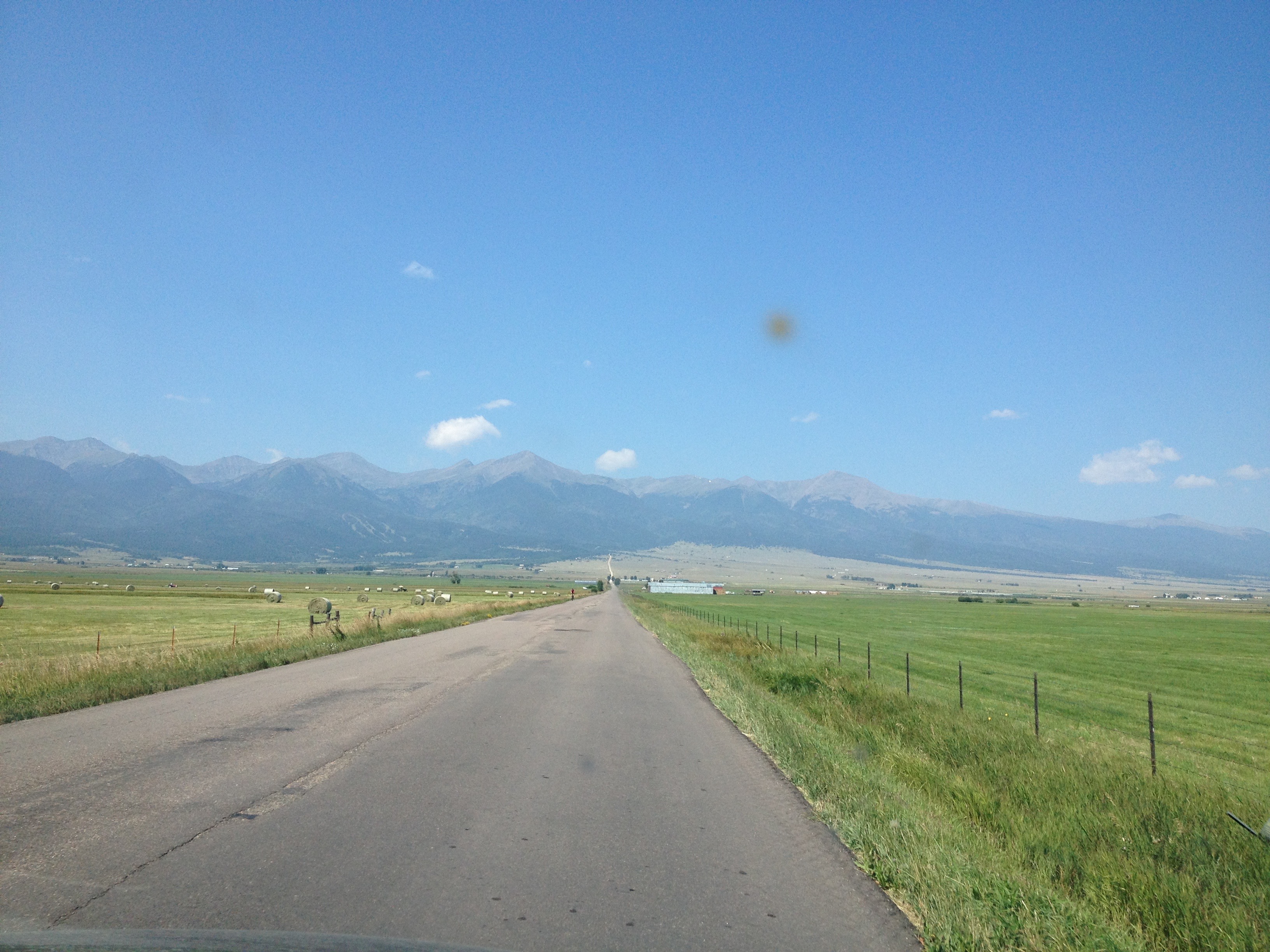
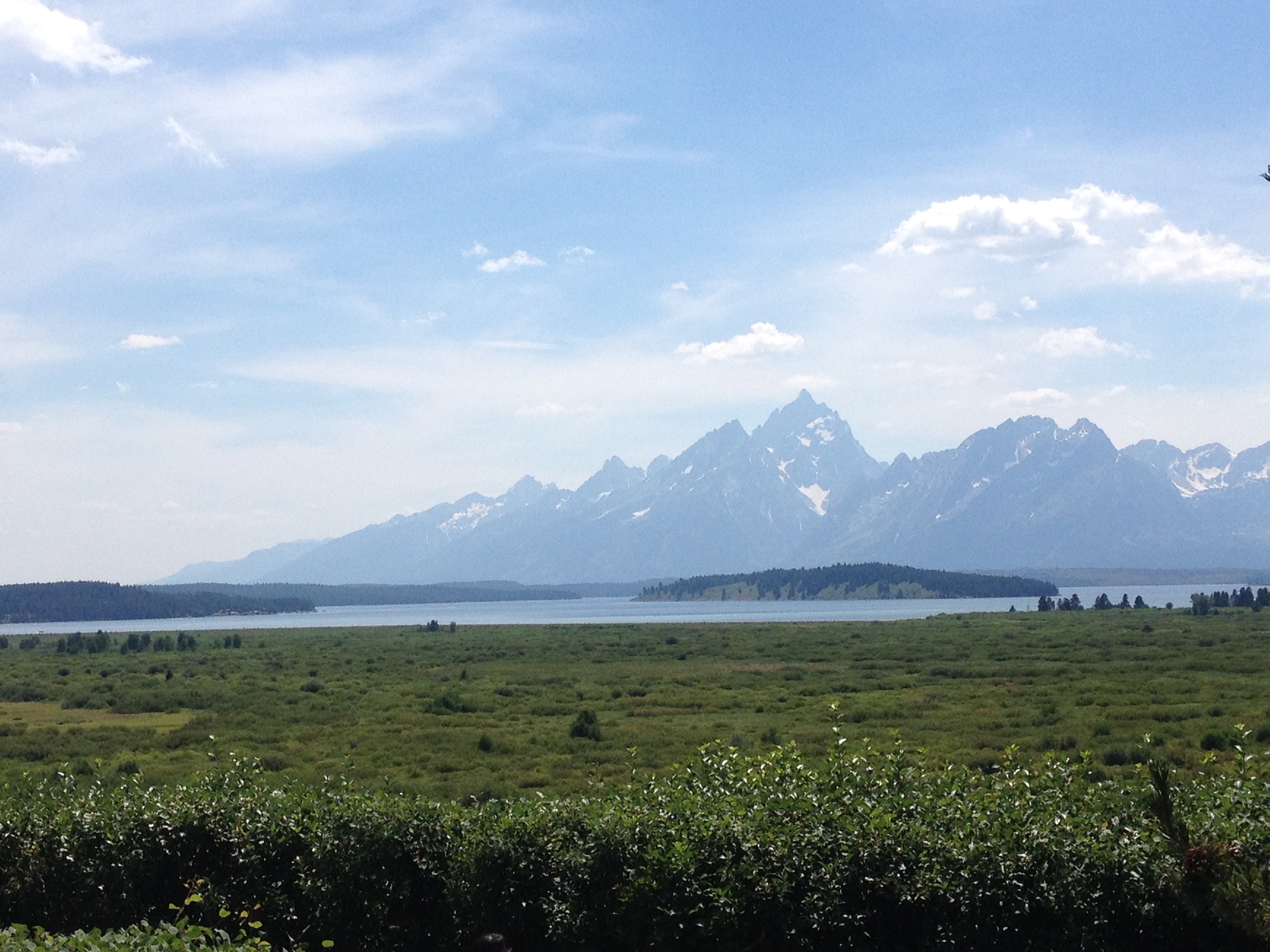
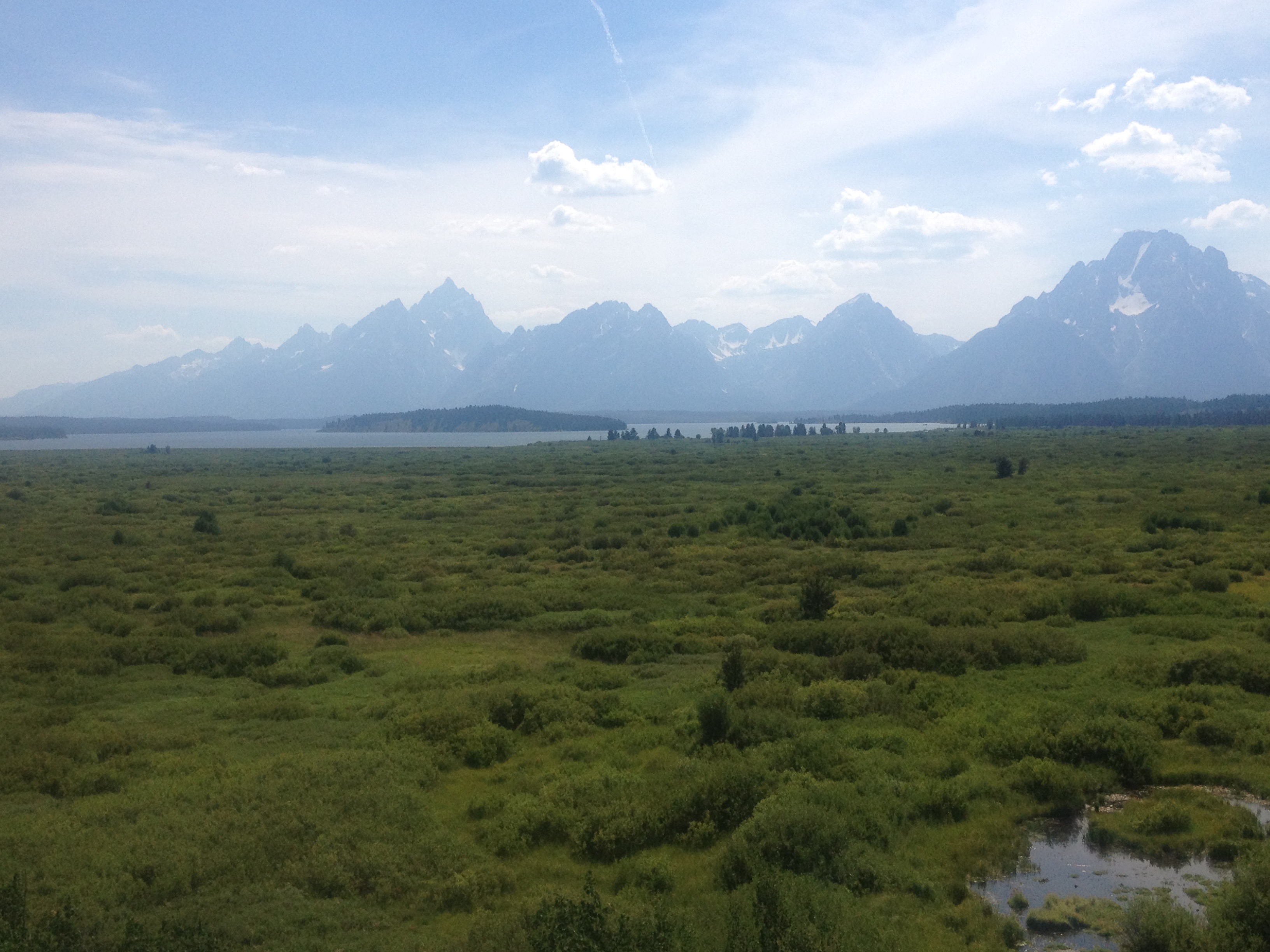
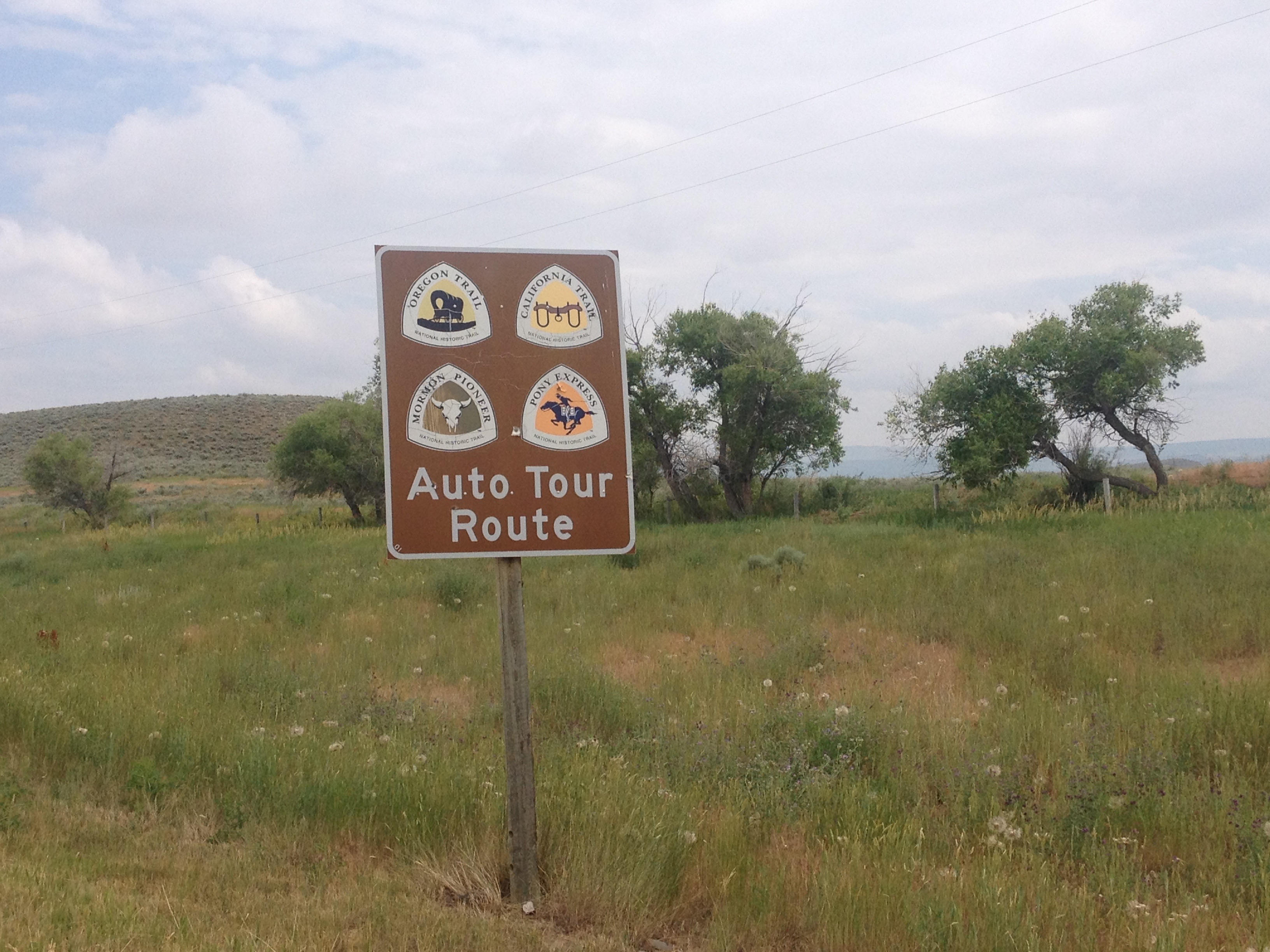
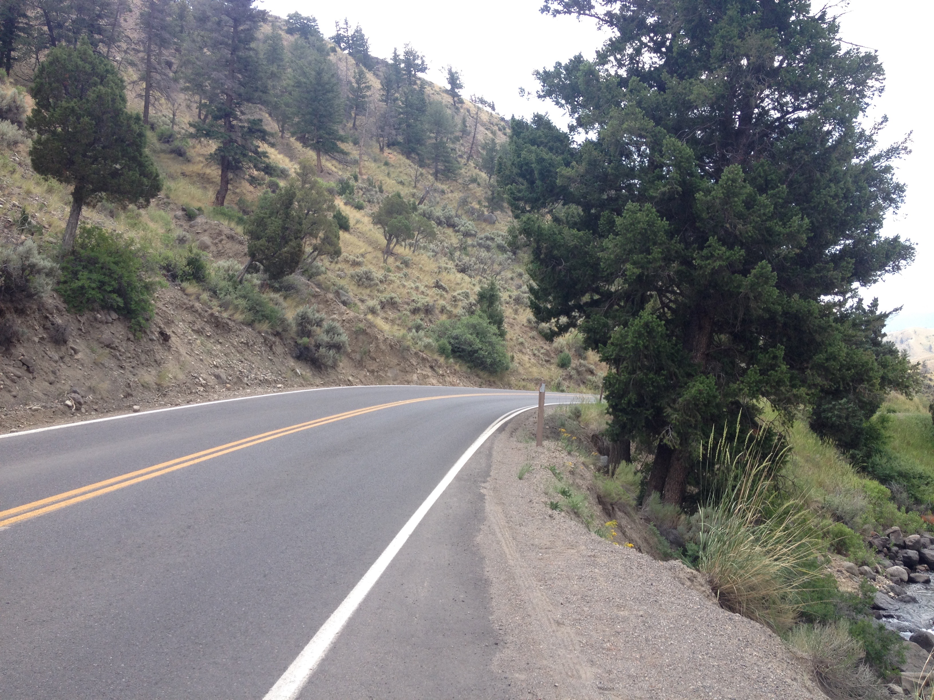
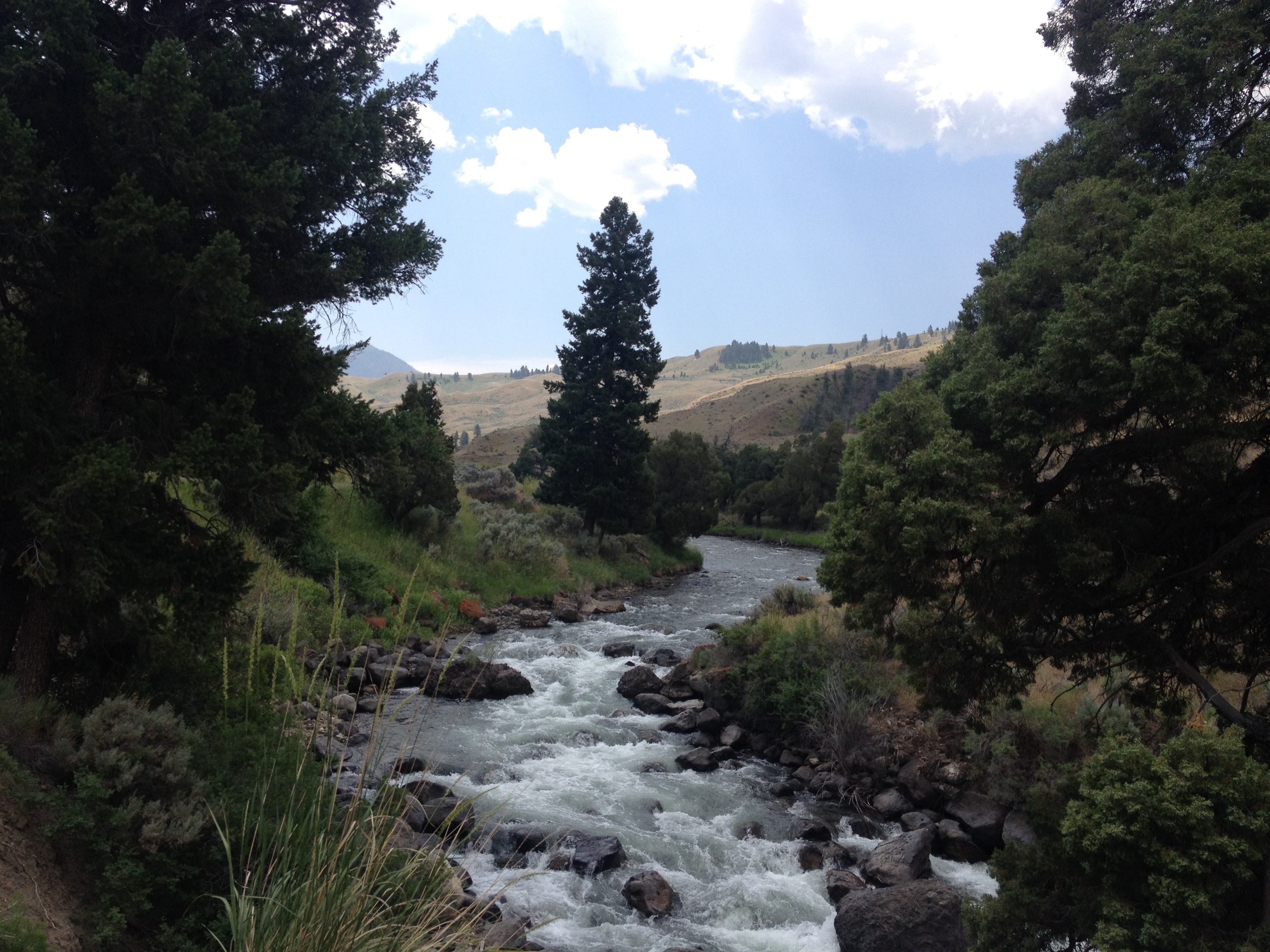
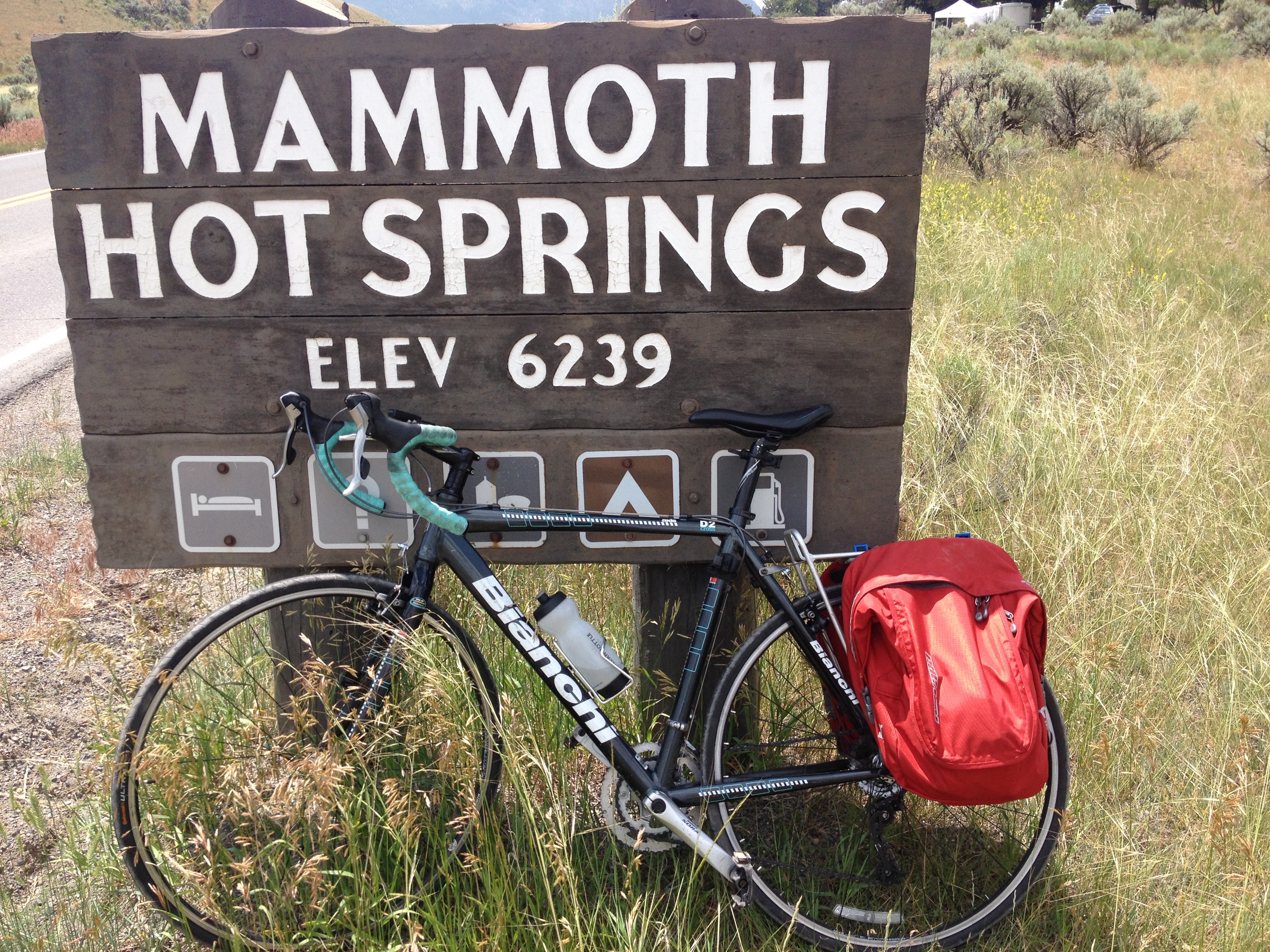
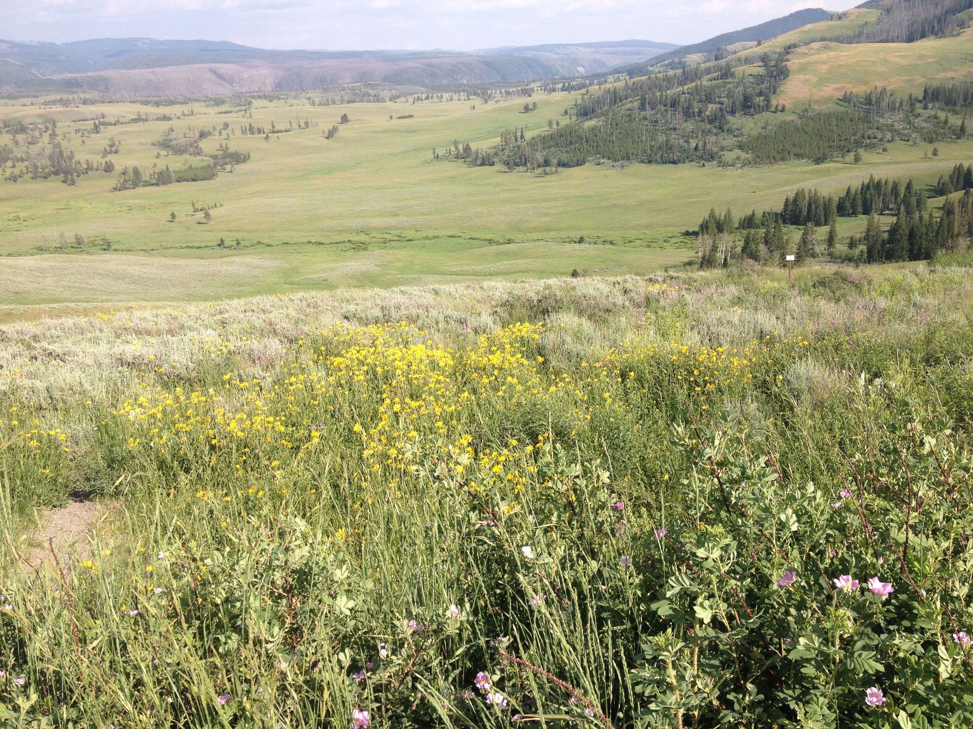
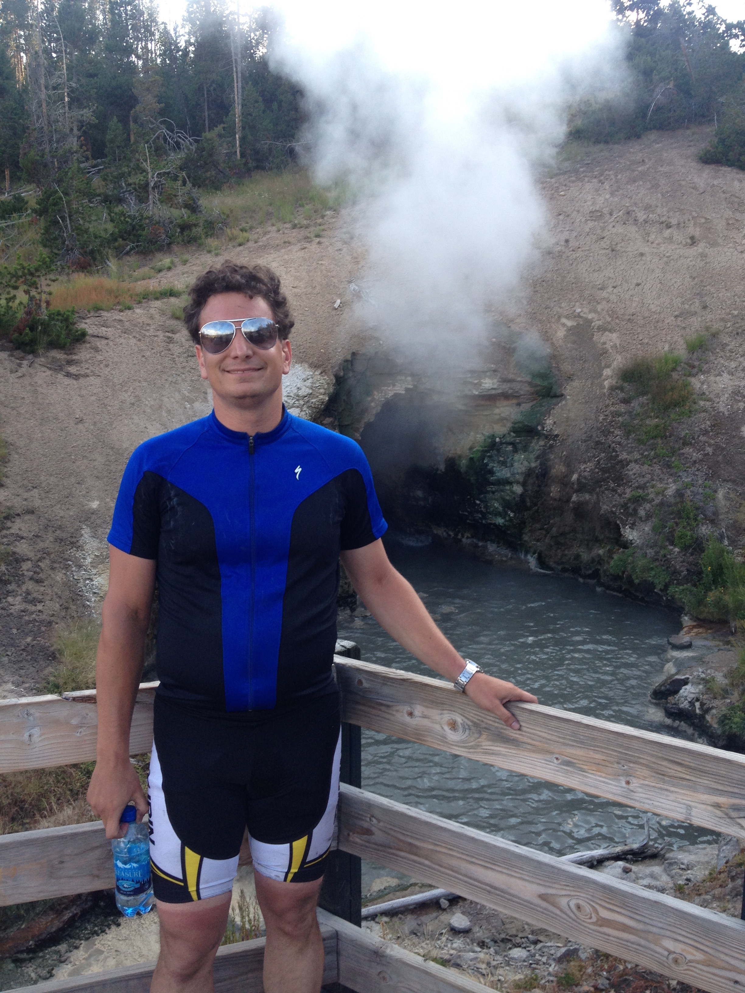
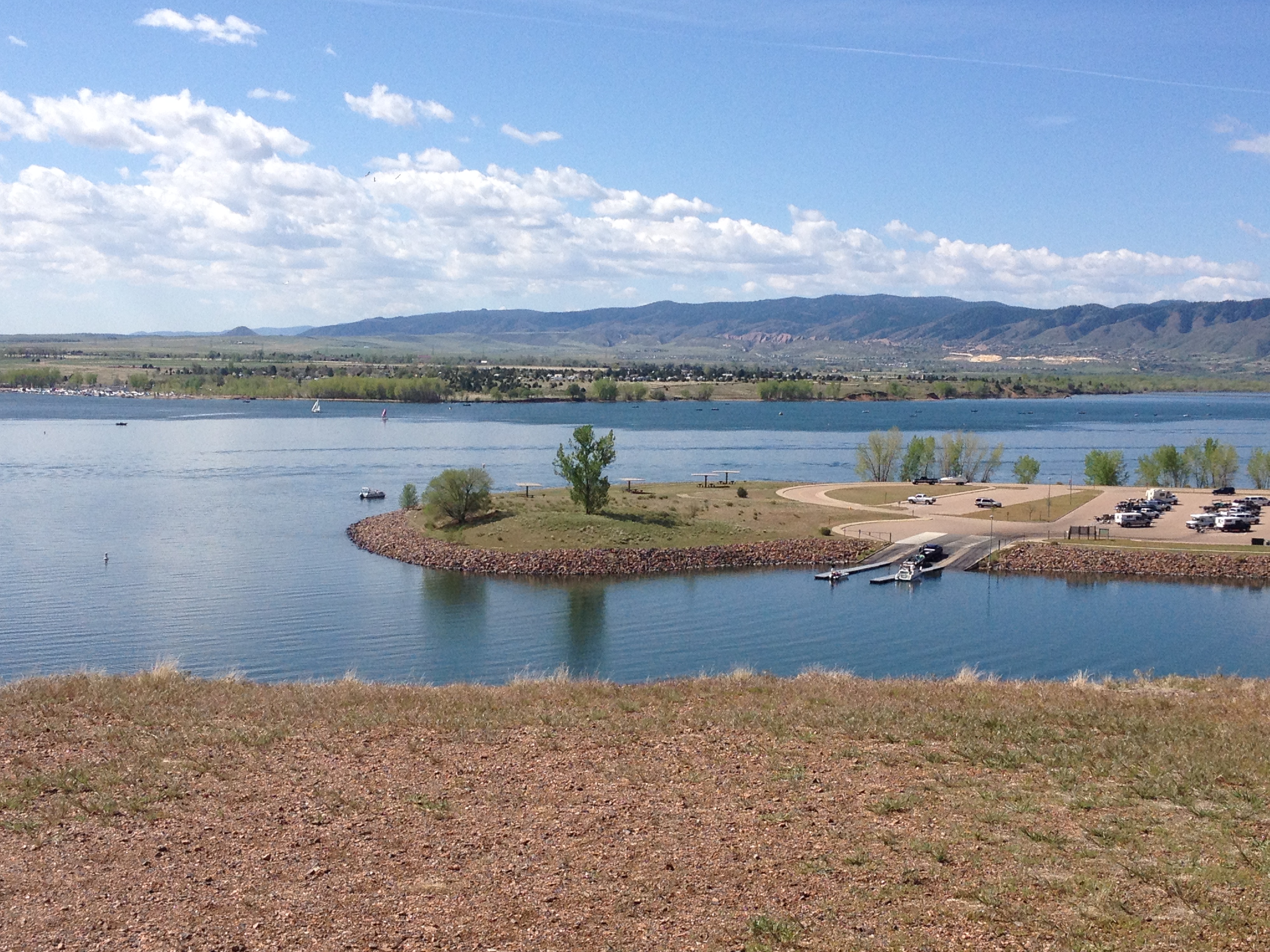
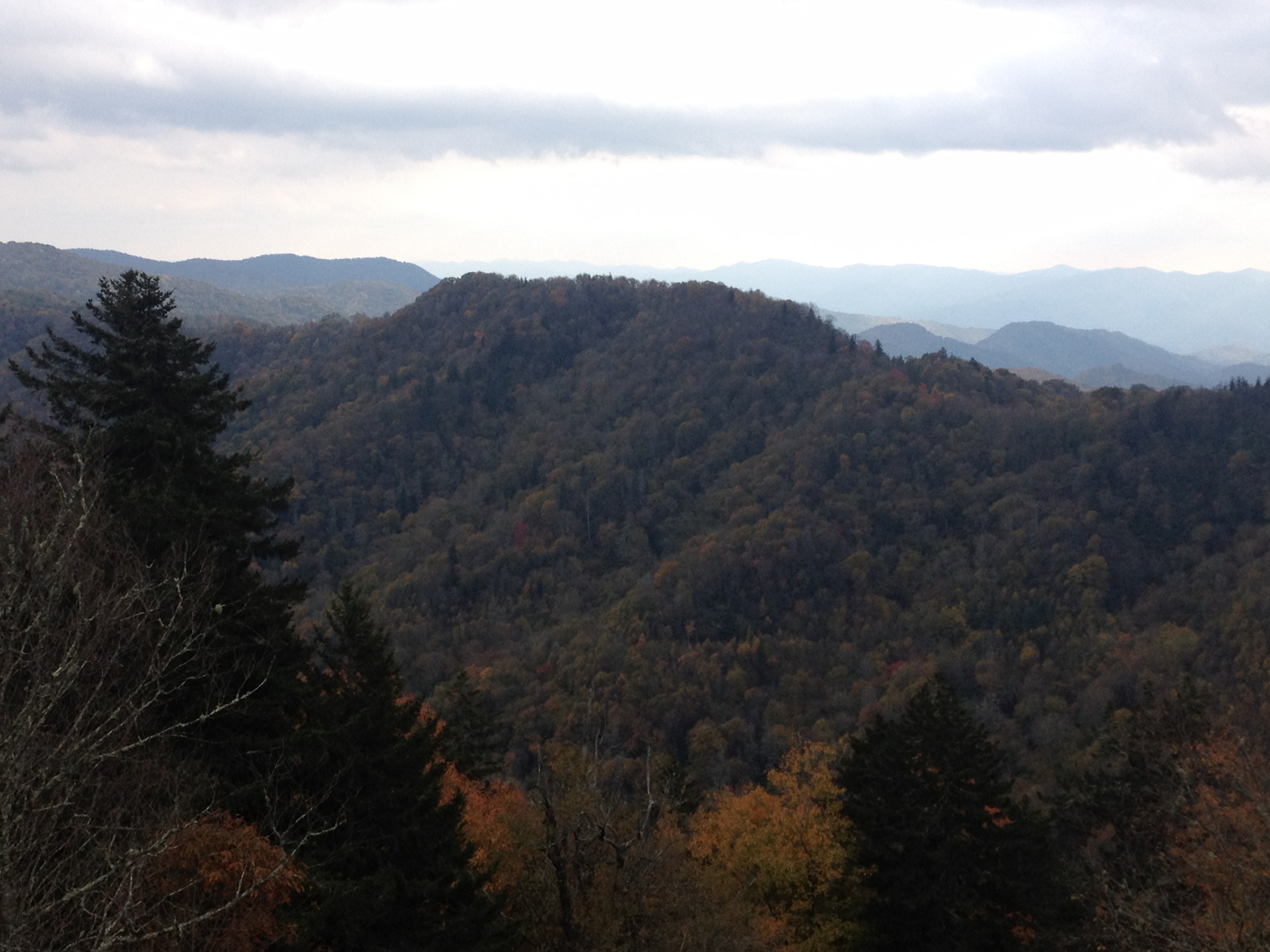
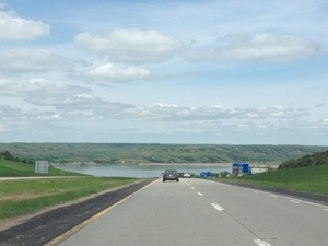
In Colorado, each season presents a different set of considerations.  In winter, we watch the snowpack grow, as well as when and where storms that make travel perilous hit.  In spring, we watch as the snowpack melts and the runoff produces both rapids, and potential floods.   In the summer, an issue for some in places close to Denver, Fort Collins, Pueblo, etc. is the heat.  Mid-summer in particular can get quite hot in these locations, with most days reaching highs in excess of 90 degrees.  Those looking to avoid this heat can do one of two things; wake up early or travel to a higher elevation.

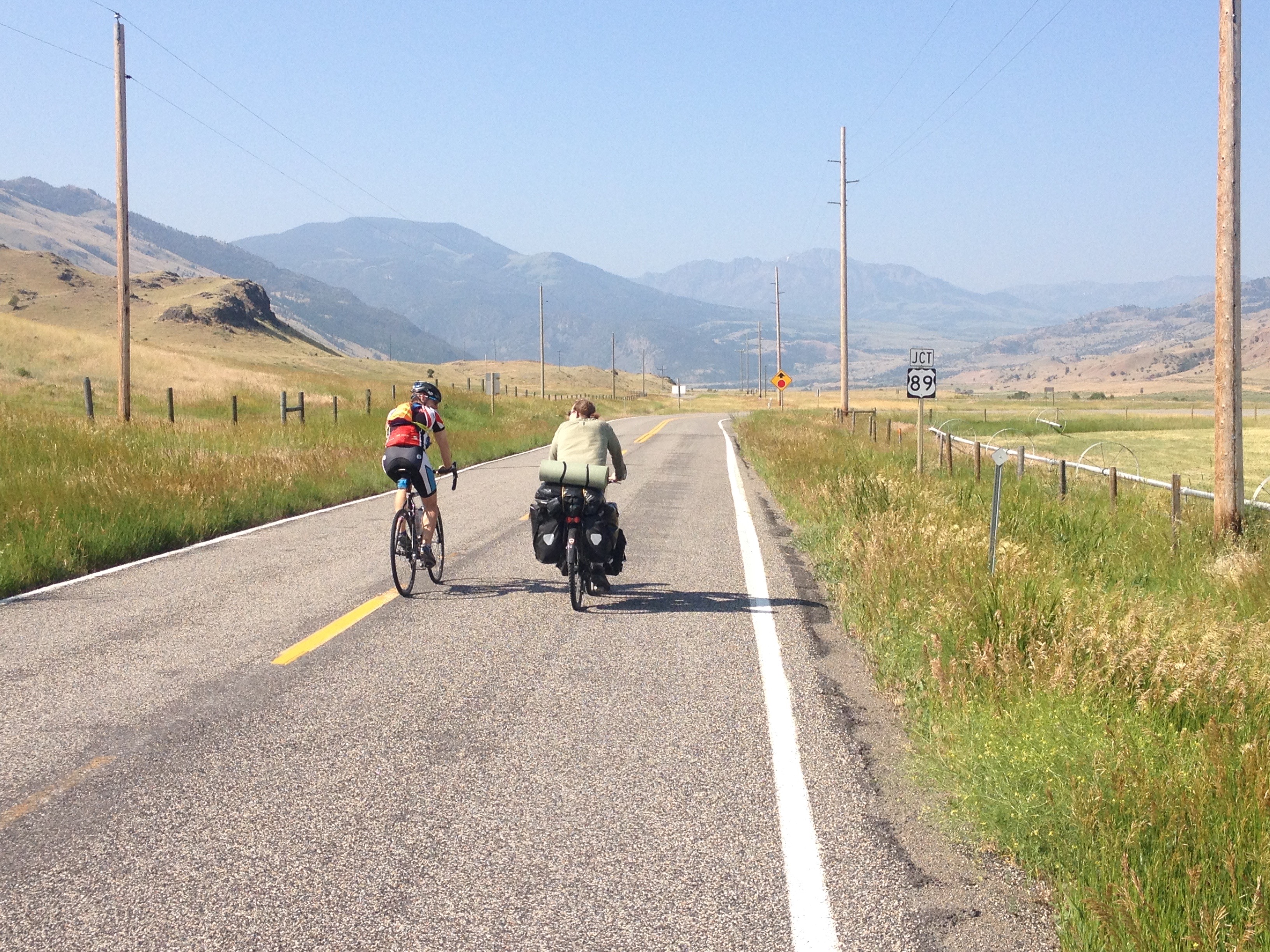
I needed a calmer weekend.  The summer had been active, and I still have to expend some energy in order to make a living.  I am not extremely lucky or extremely wealthy.  But, I am hardly one to sit inside all weekend in the middle of the summer.

IMG_6761

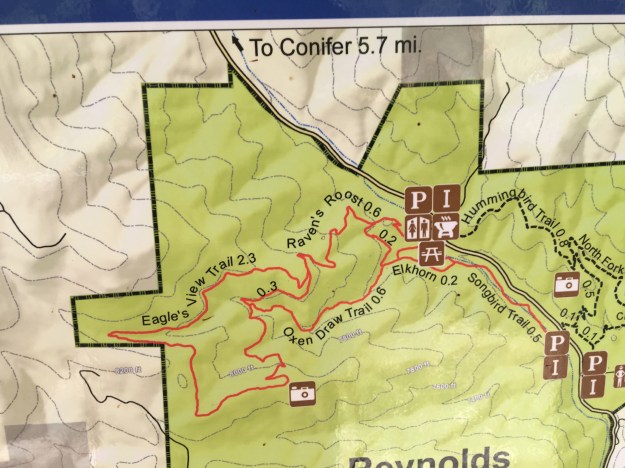
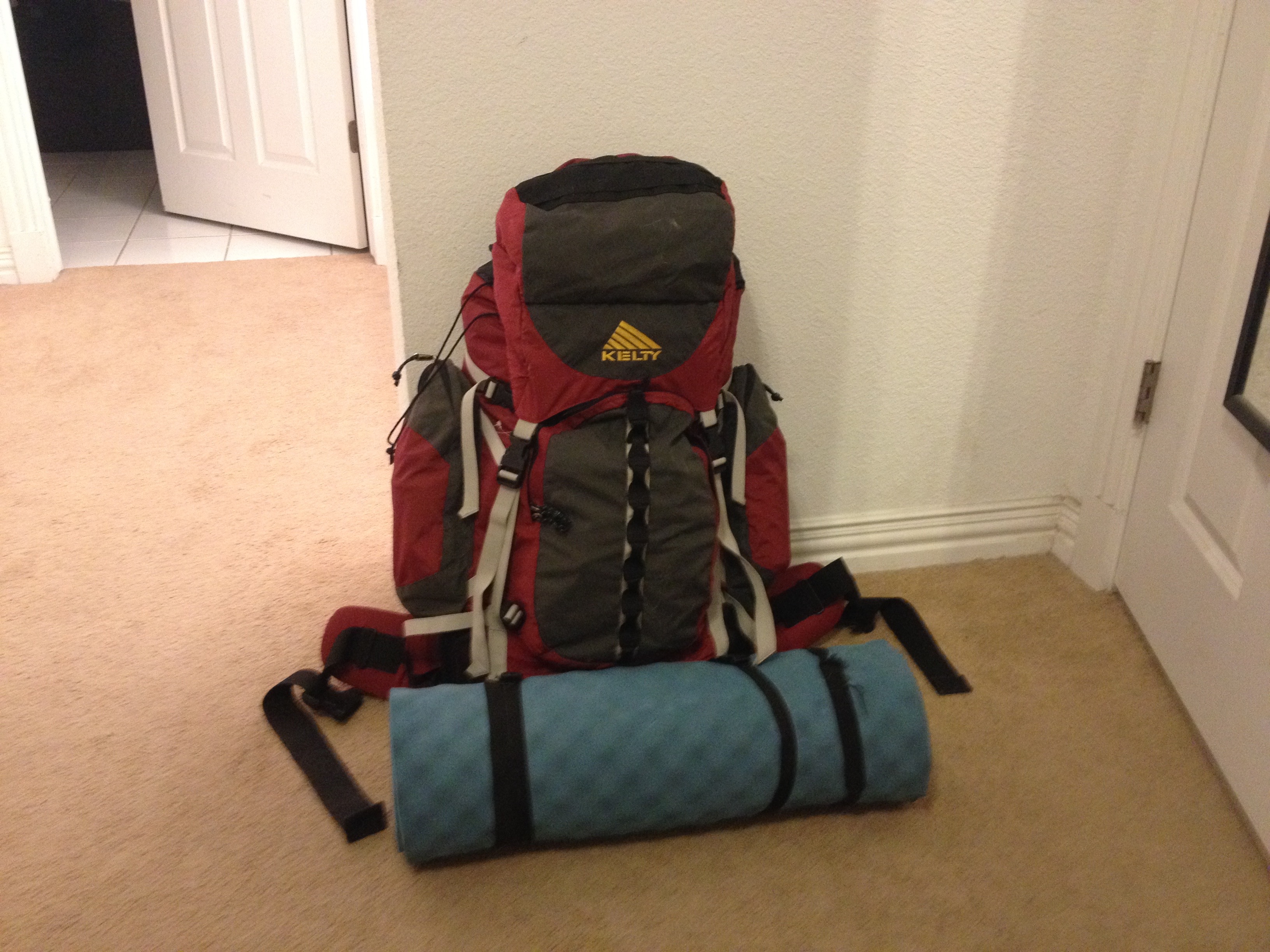
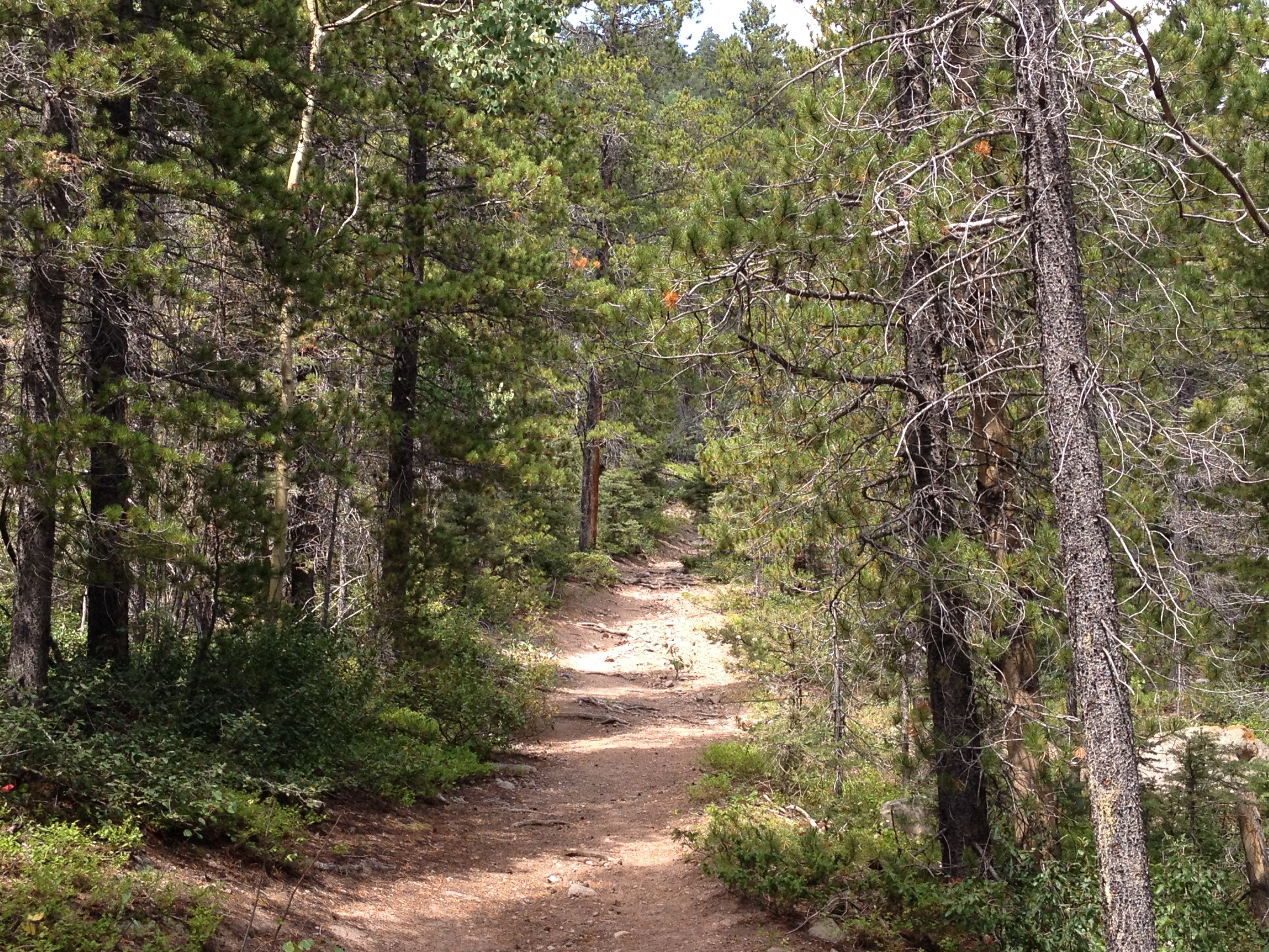
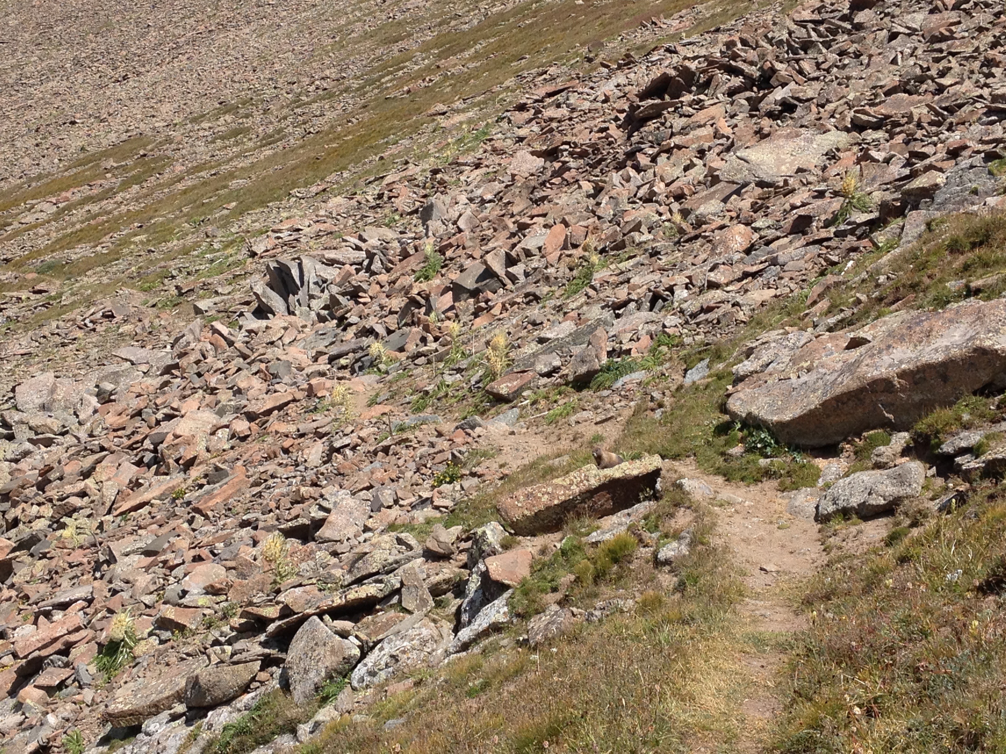
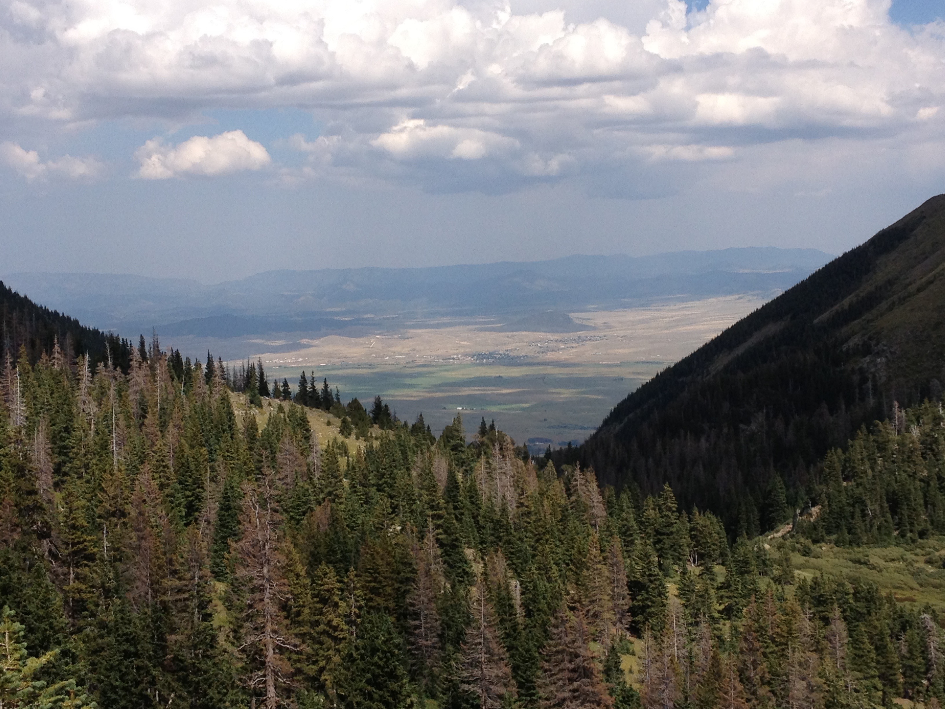
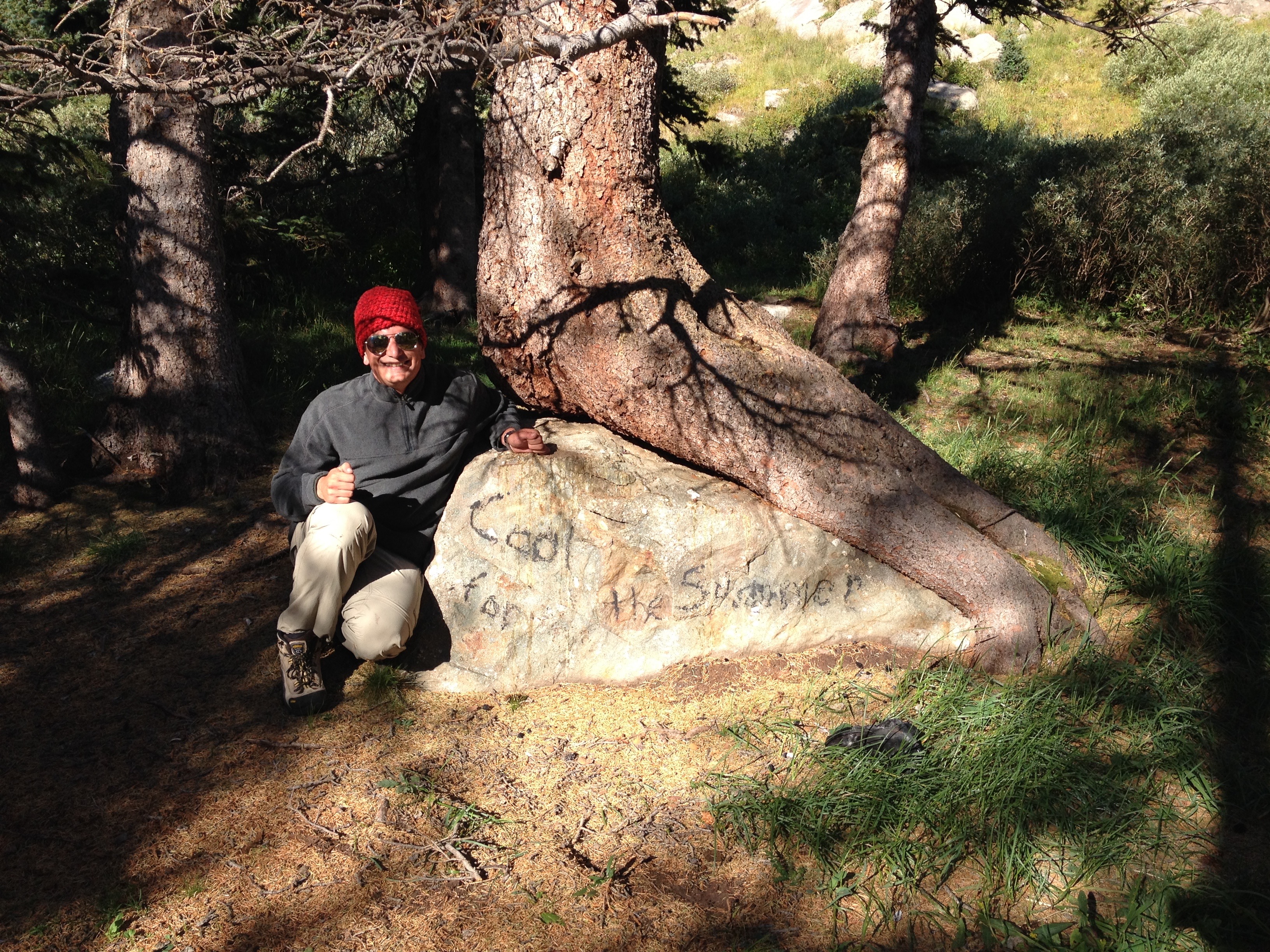
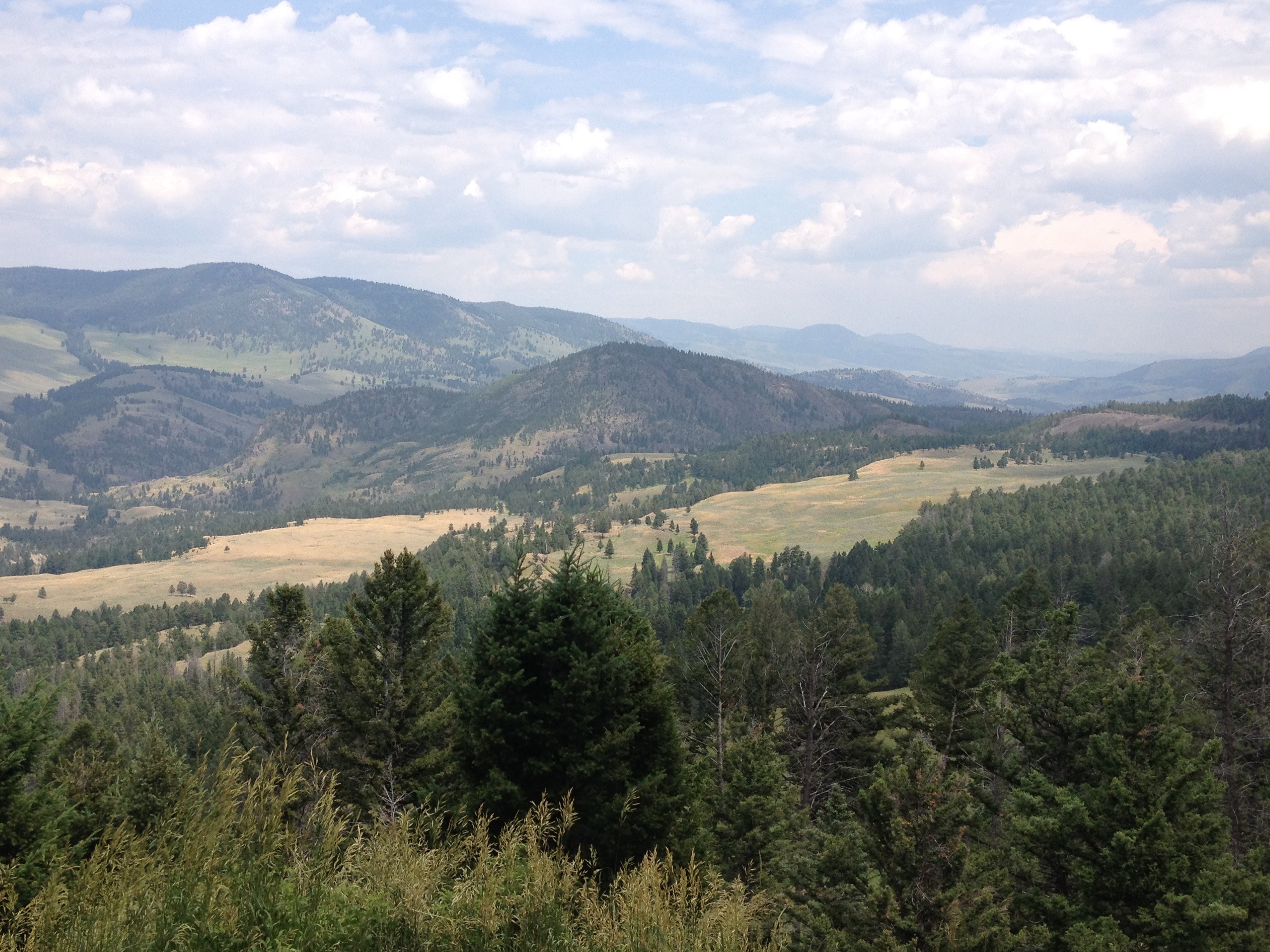
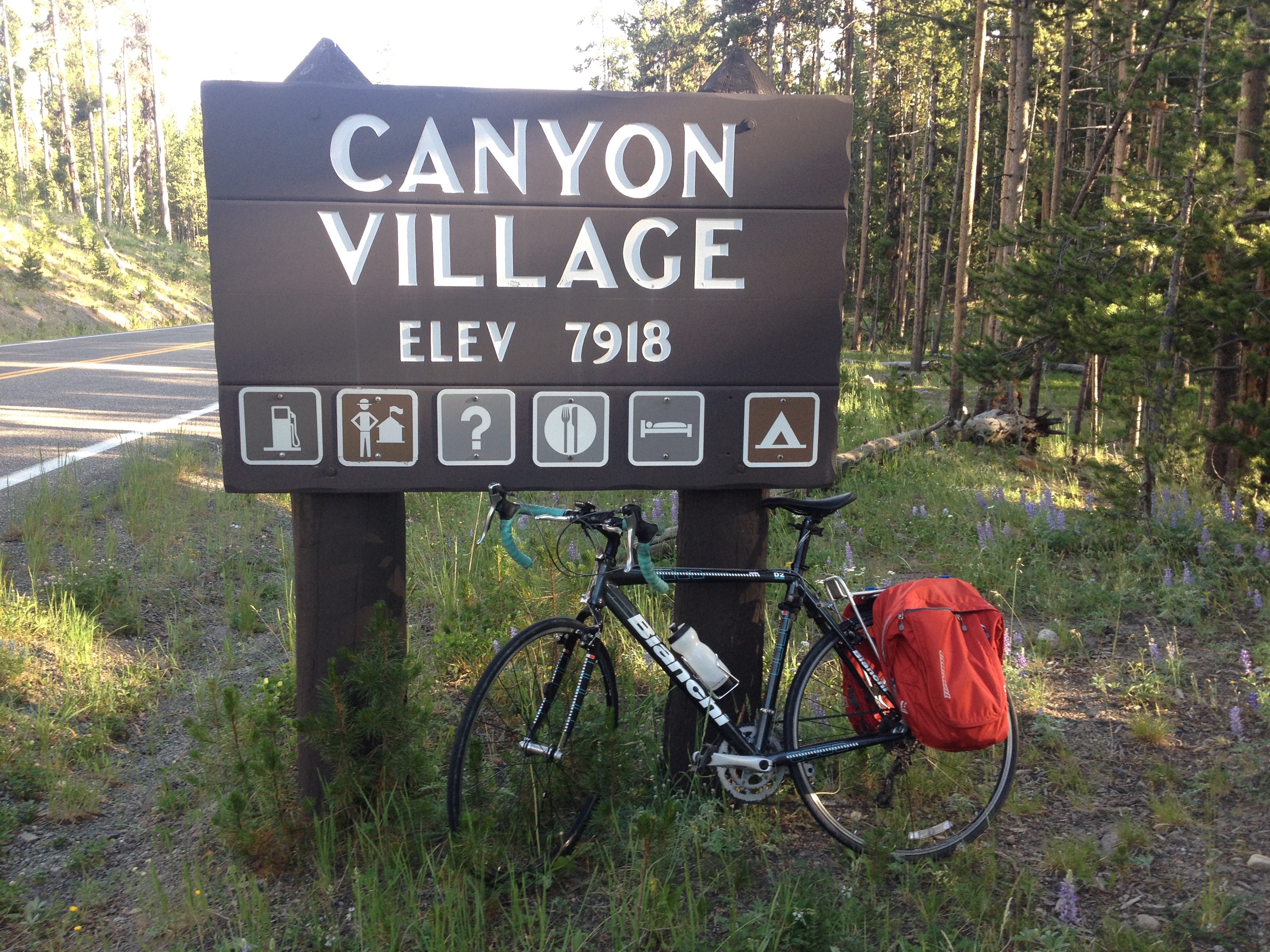
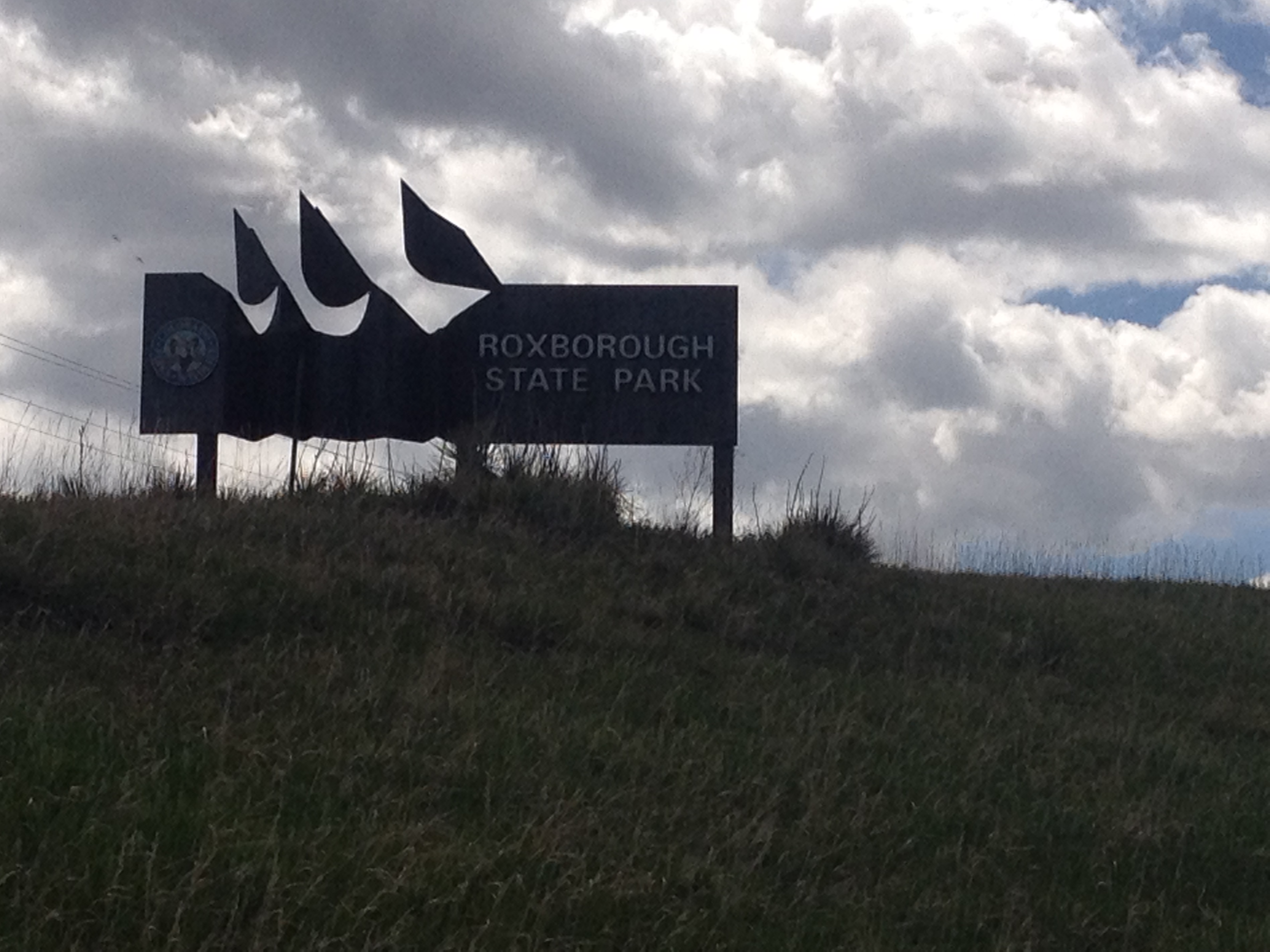
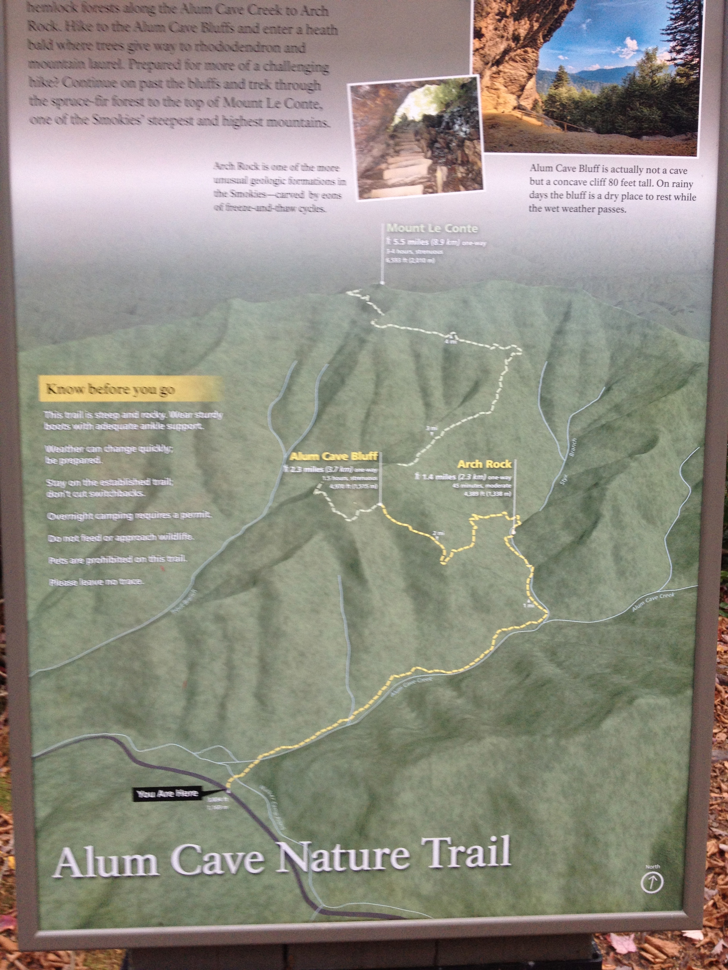
Luckily, there are places one can get to from Denver in roughly an hour, sometimes less, that offer moderate intensity hikes at a high enough elevation to escape some of summer’s heat.  One such place is Reynold’s Park, close to Conifer, where we were able to find a set of trails that offer a six-and-a-half-mile loop, with a vertical climb of just over 1000 feet.  This hike is described as “moderate” in difficulty (as opposed to the hanging lake trail, with a similar vertical climb that is described as “strenuous”), and I would certainly agree with the assessment.

IMG_6763

We took the loop in the counterclockwise direction, using the Raven’s Roost Trail to connect to the Eagle’s Nest Trail.  I am actually glad we decided to take this loop in this direction.

IMG_6765

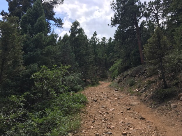
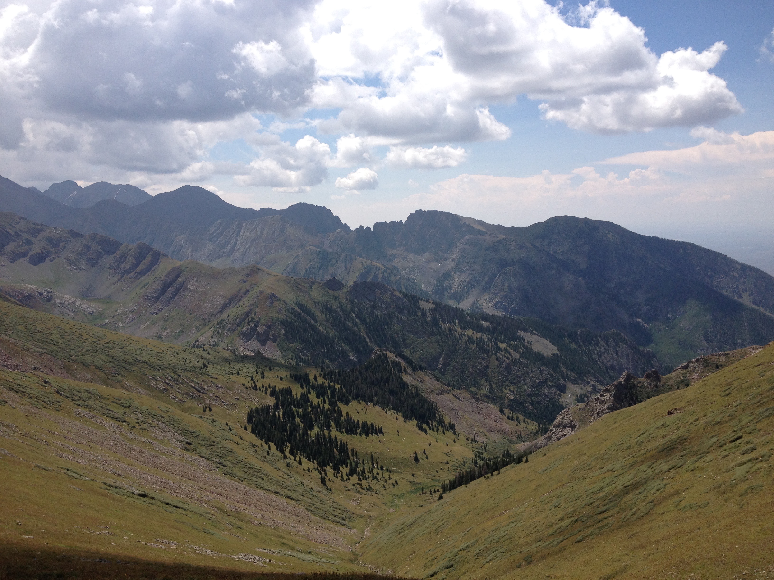
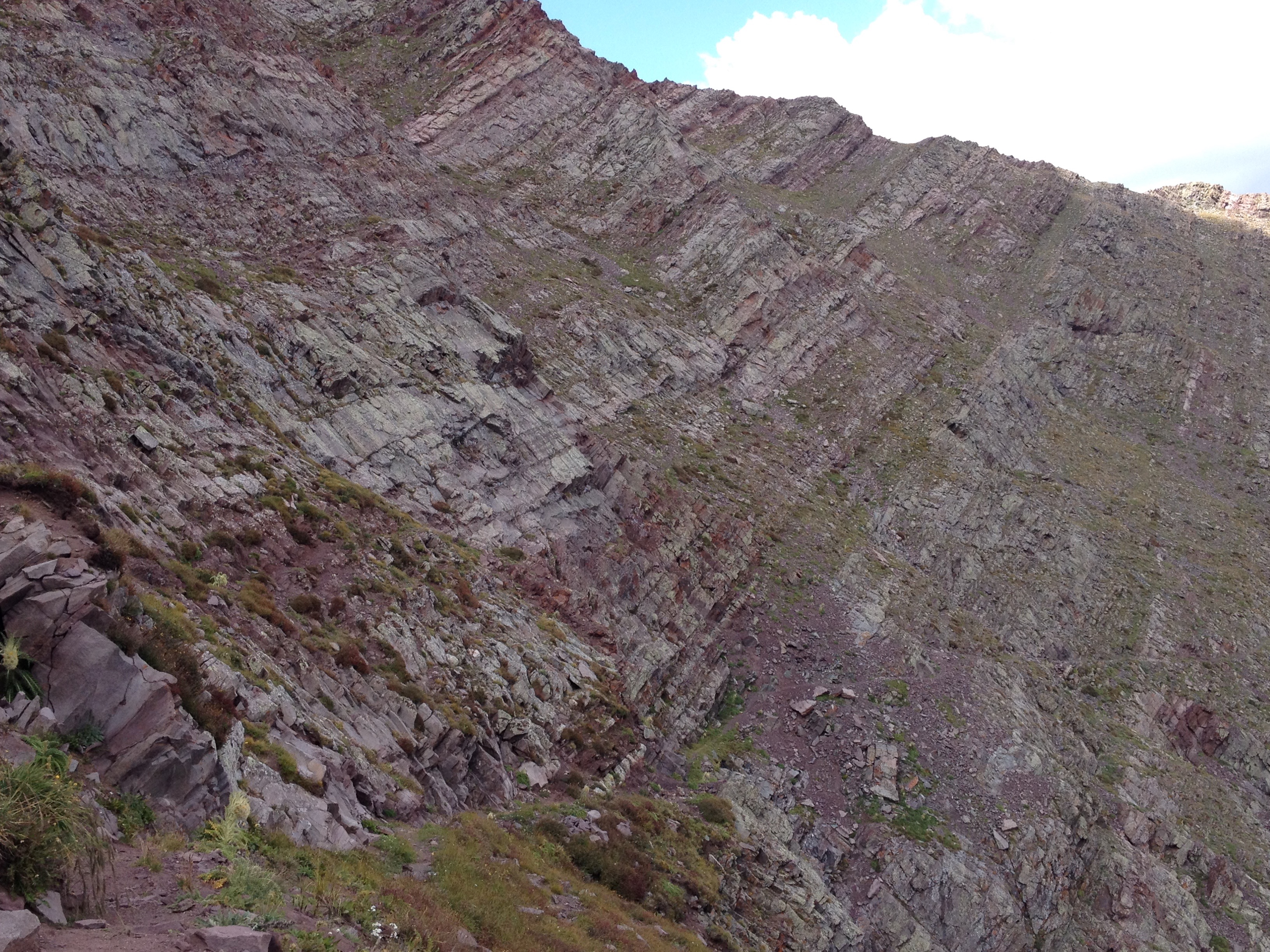
We spent roughly an hour getting to the summit, and were fortunately enough to be shielded from the sun for part of the time, due to both sections of denser forest, and partial cloud cover that afternoon.

IMG_6779

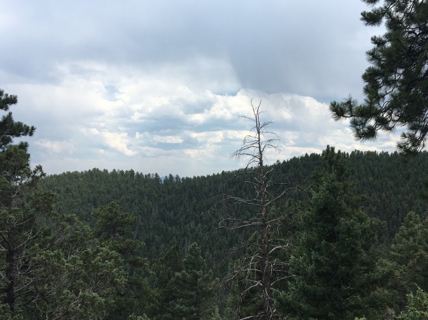
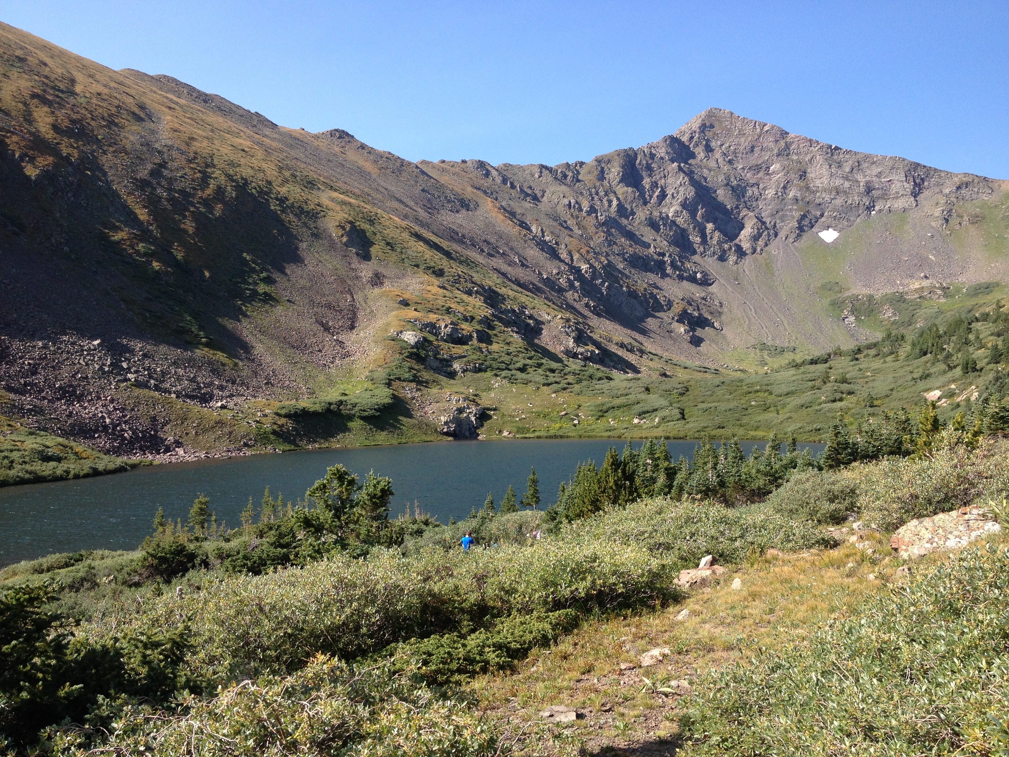
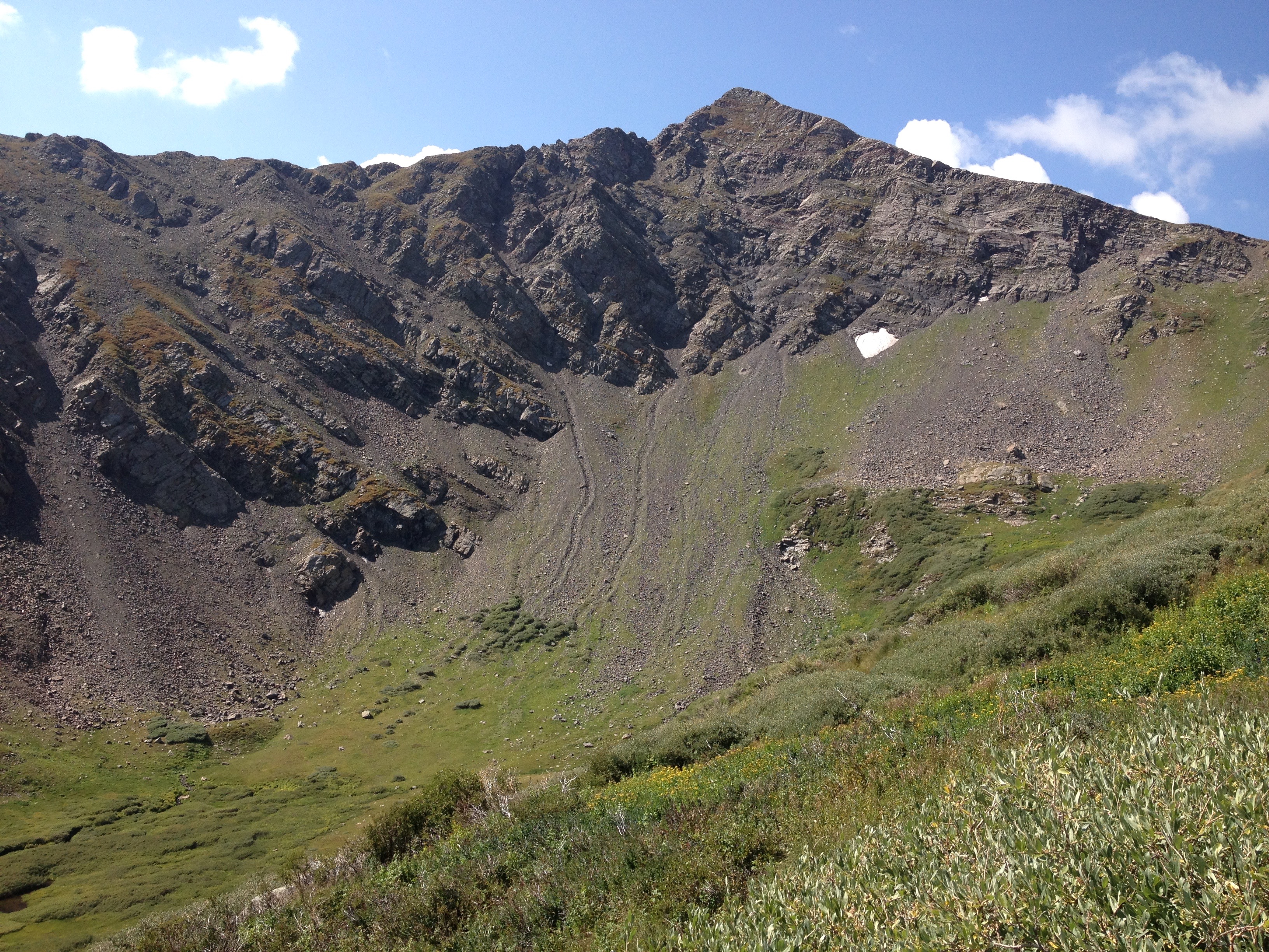
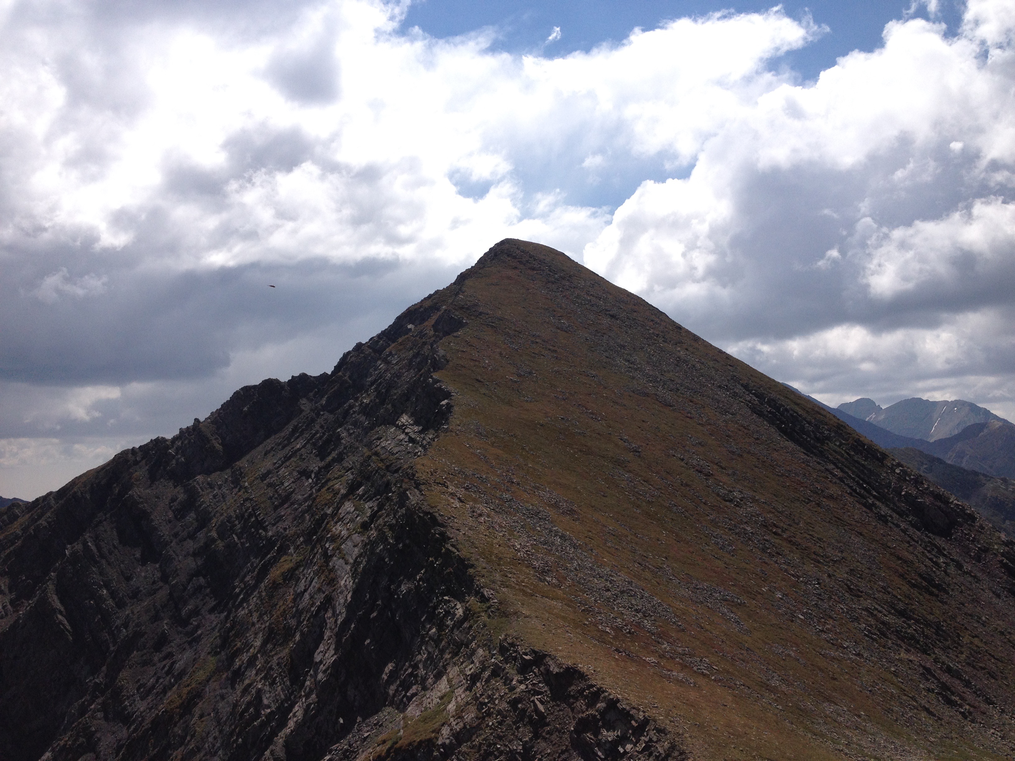
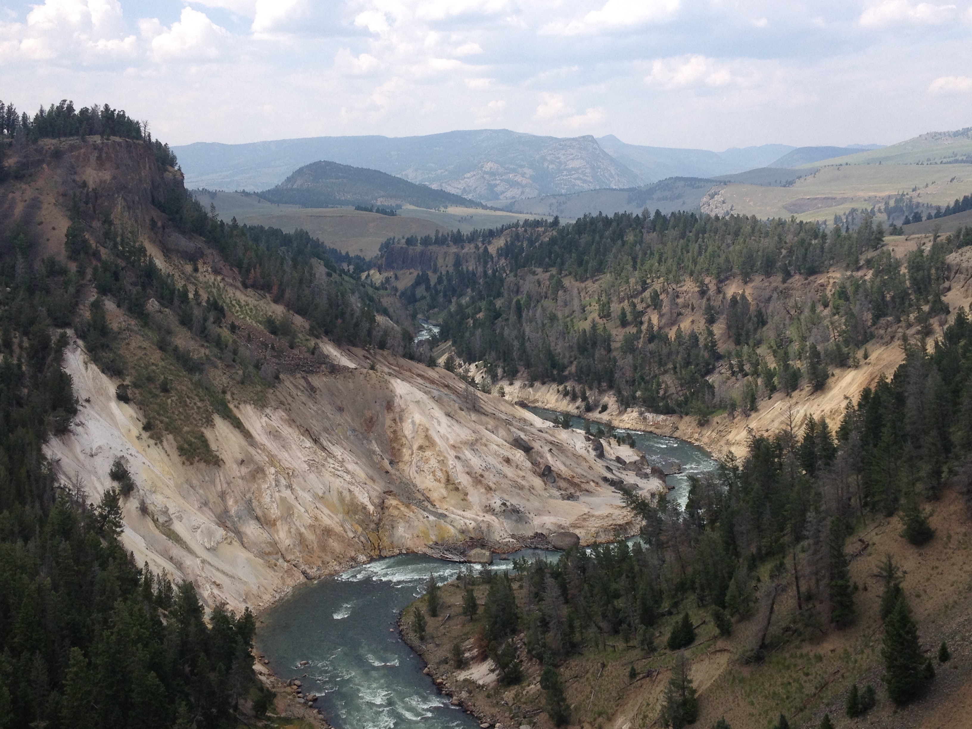
However, hiking the loop in this direction, we actually saved the best for last.  After “summiting”, there was a section of the hike that was generally flat, and also densely packed with pine trees.

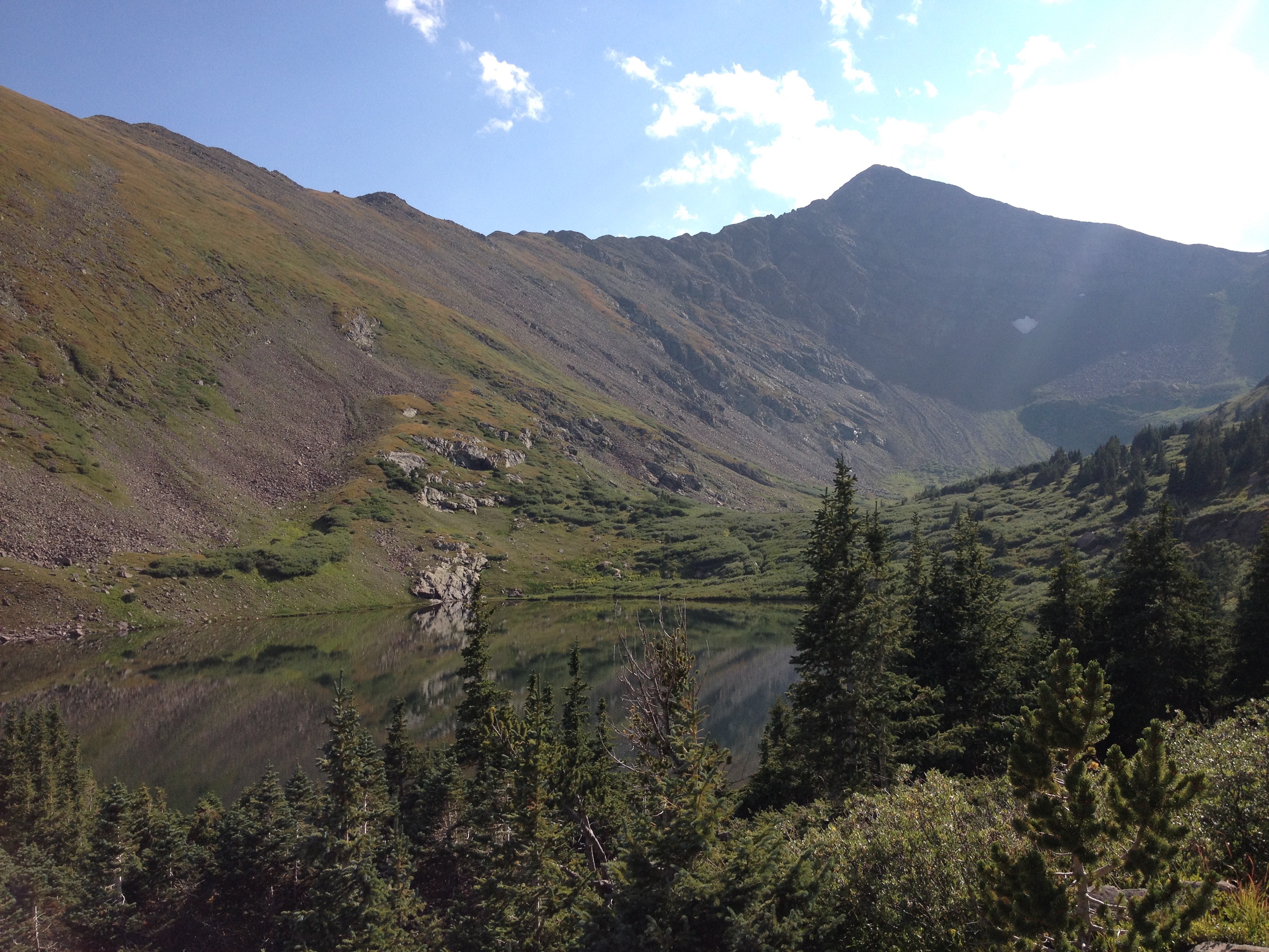
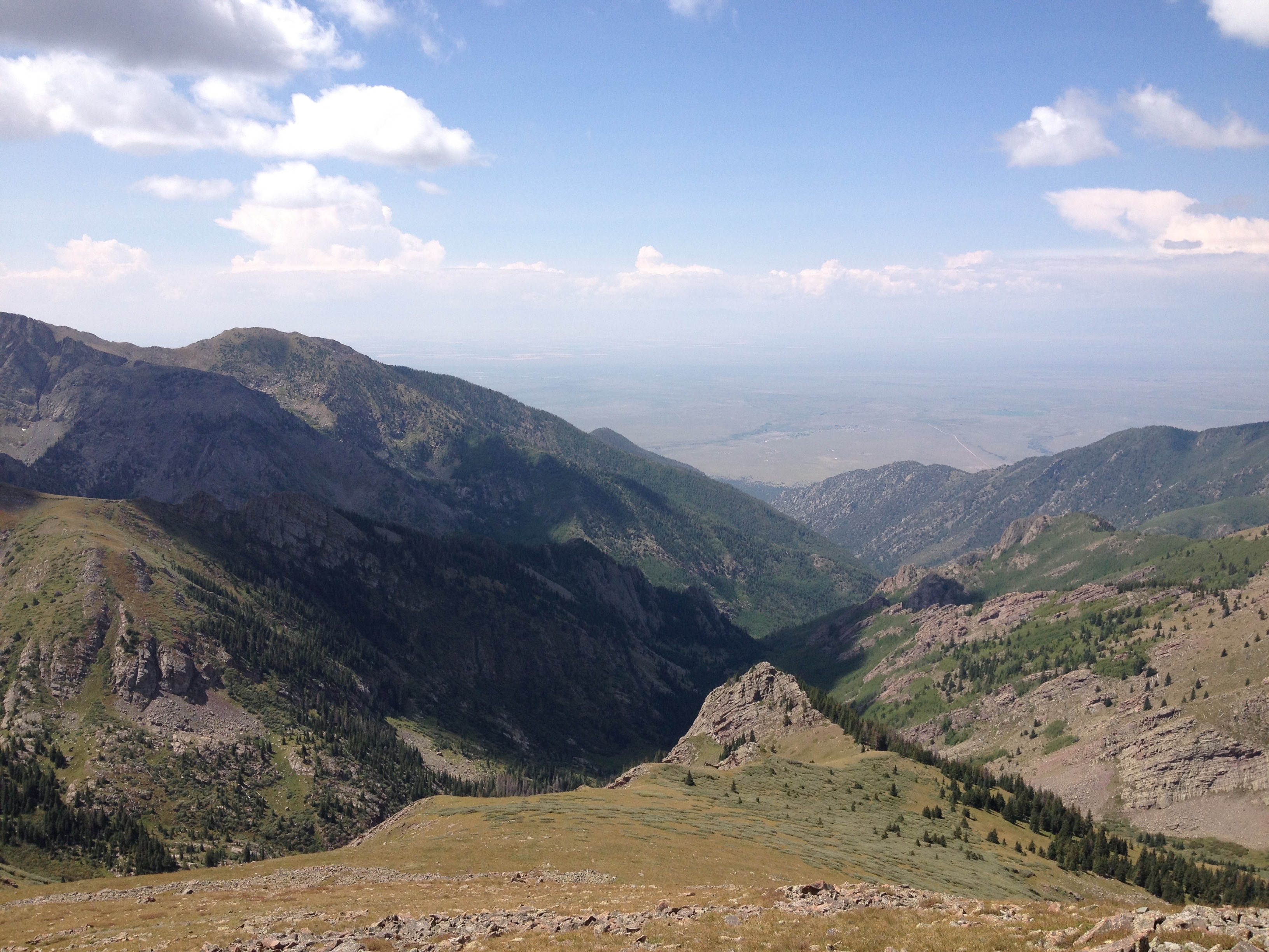
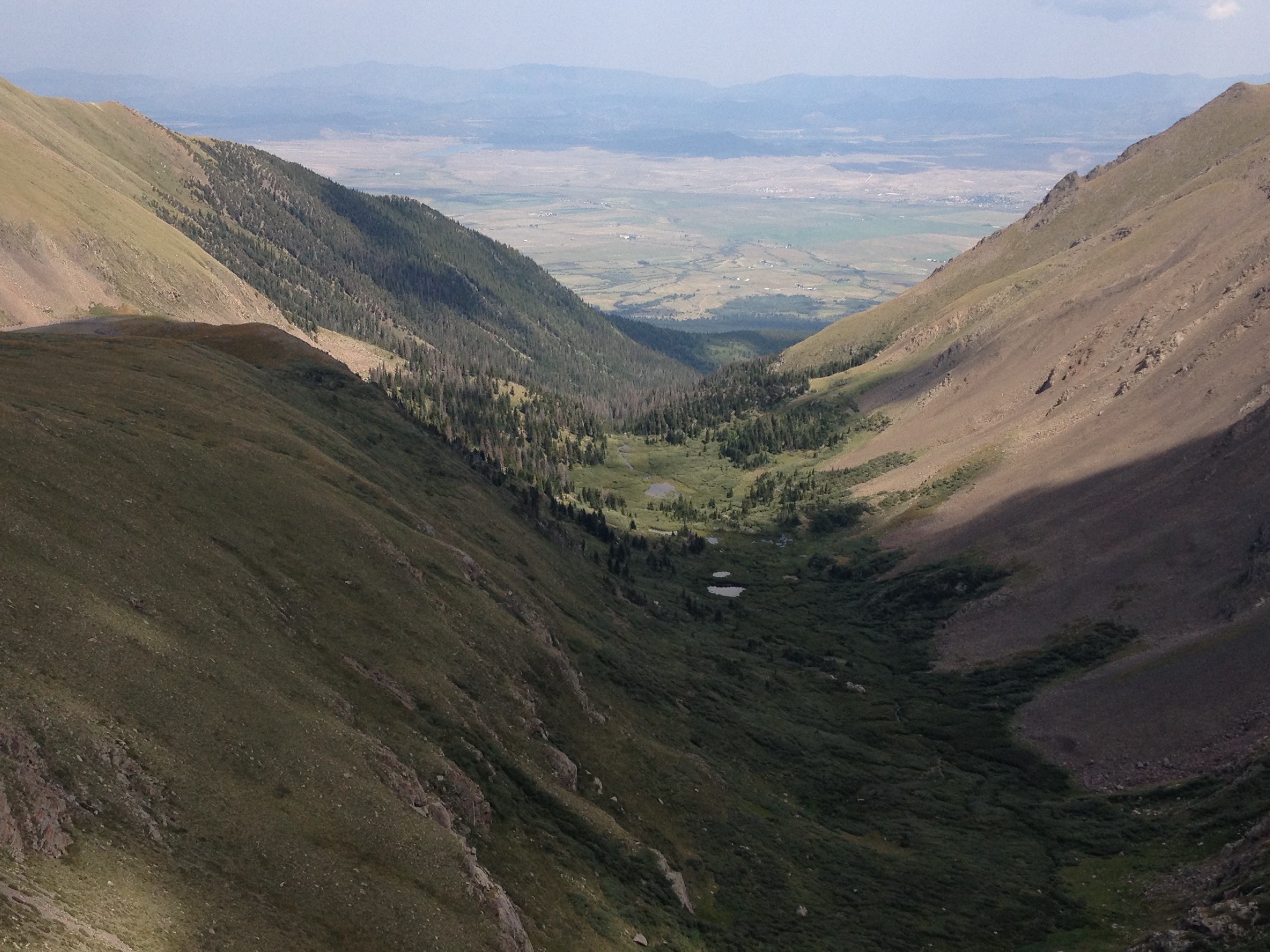
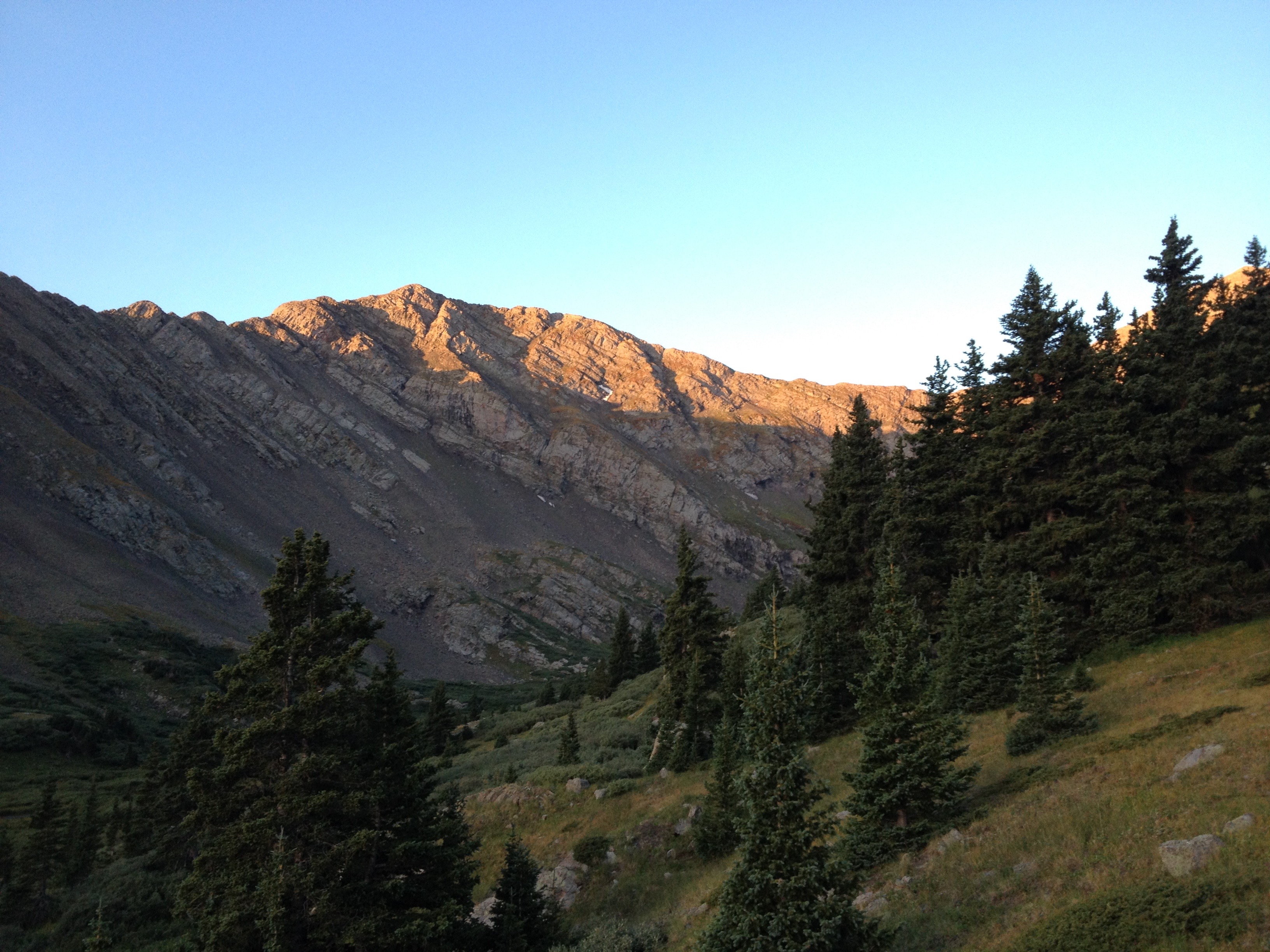
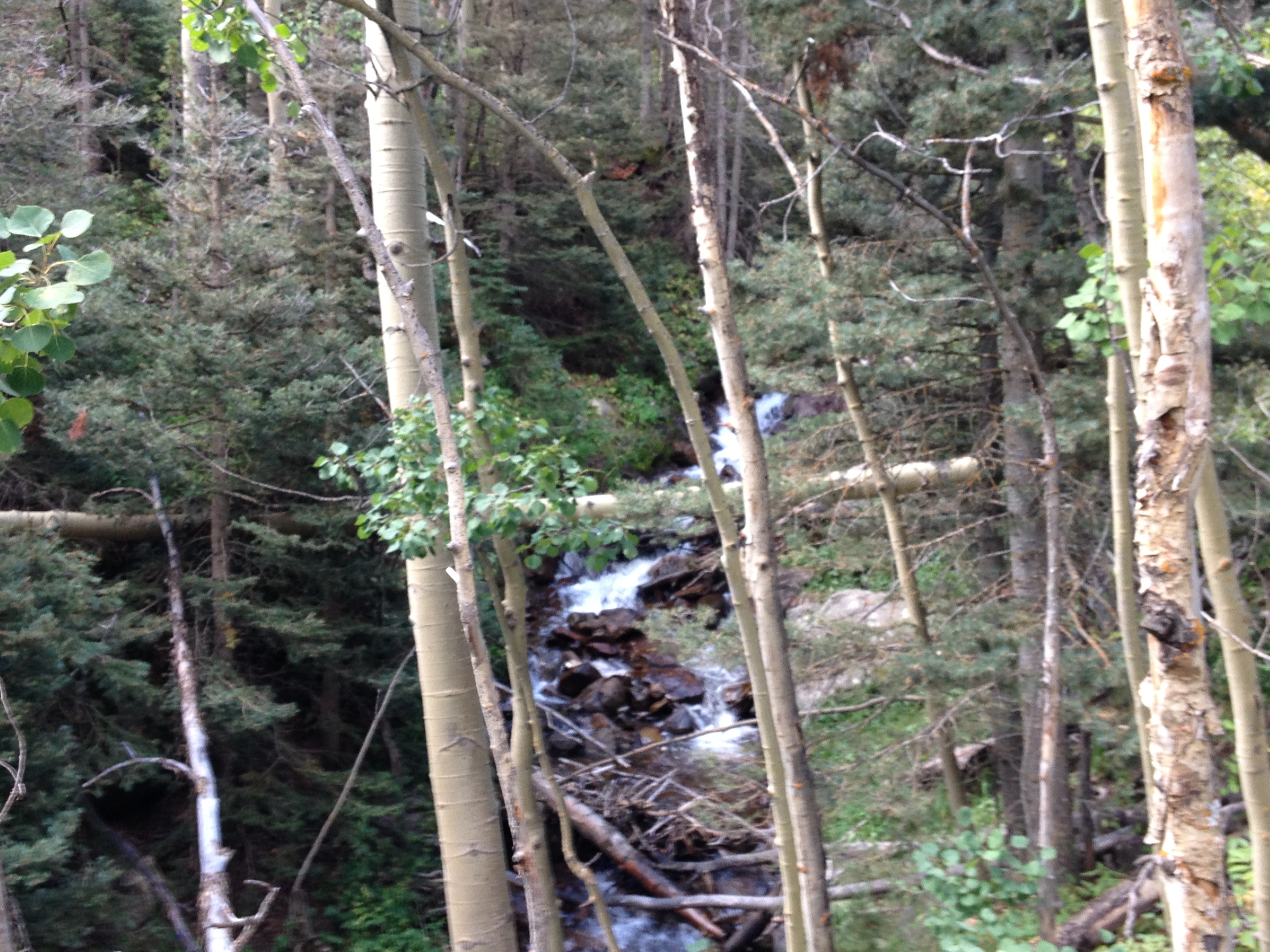
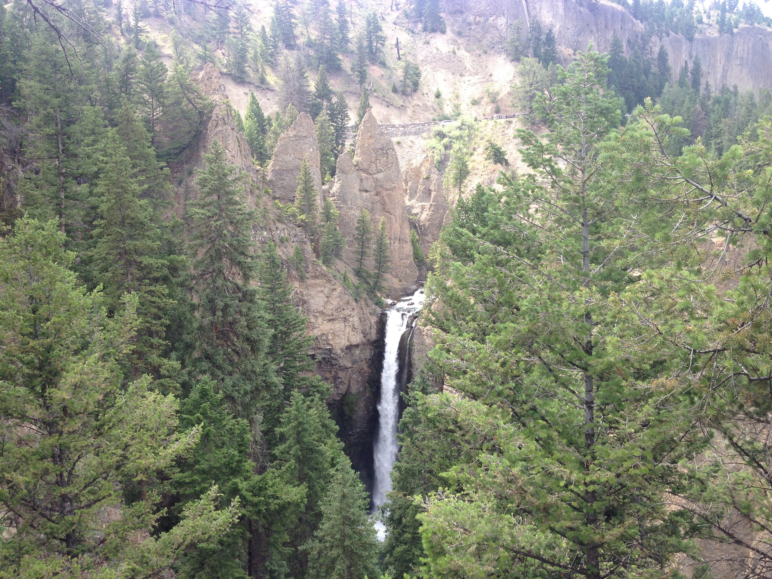
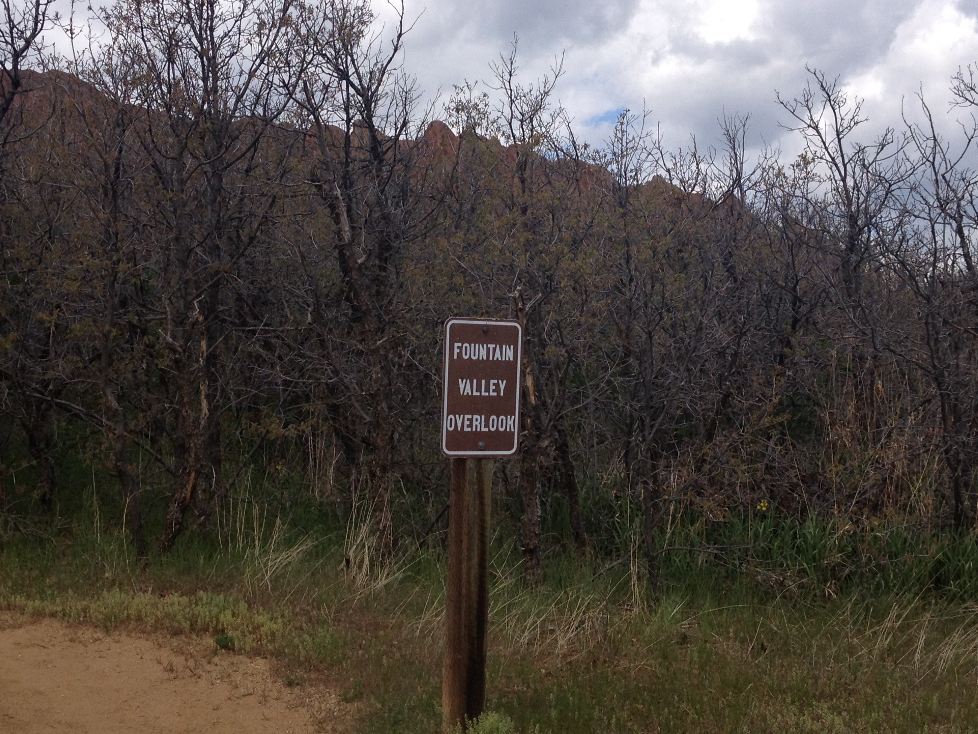
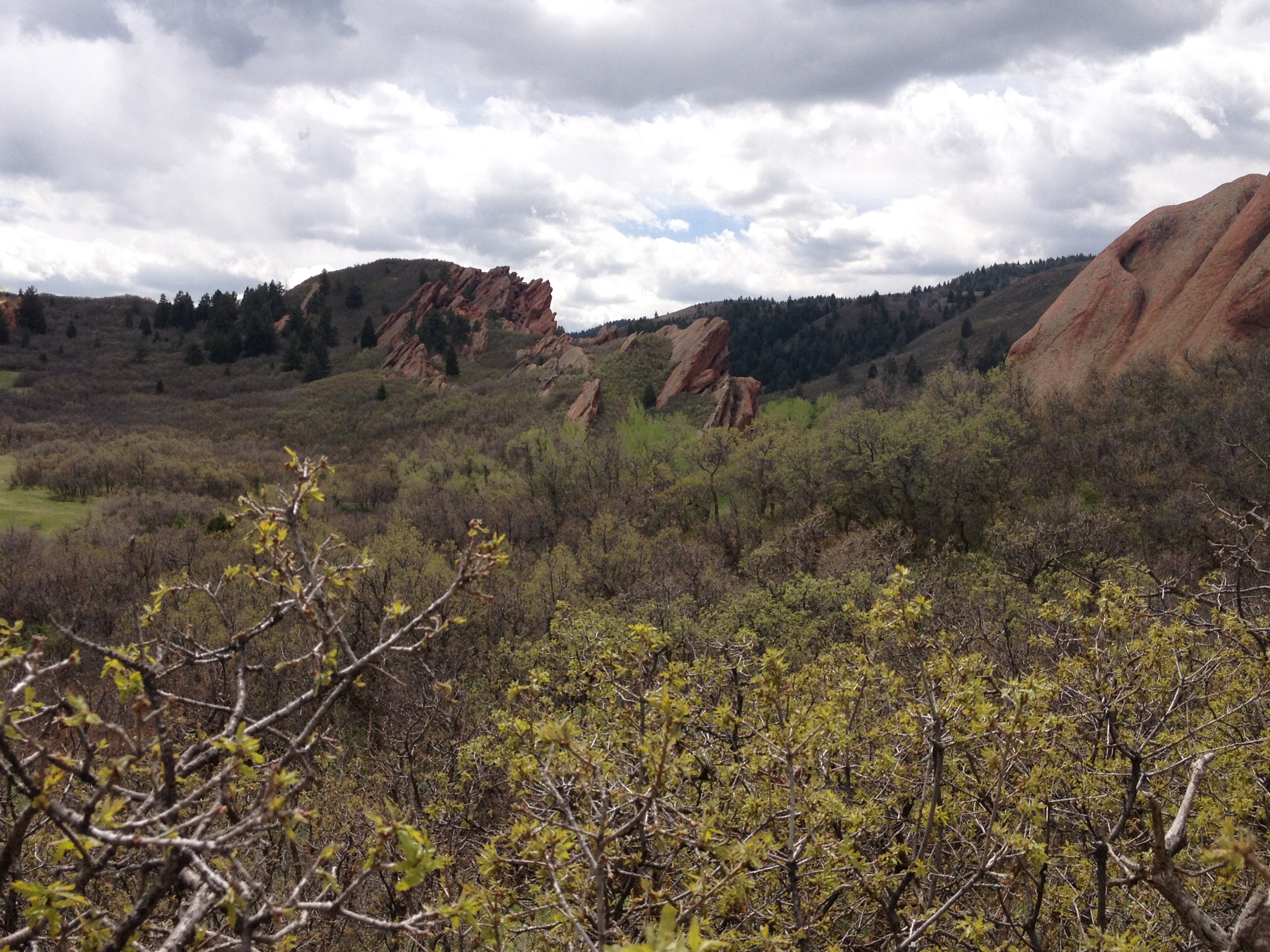
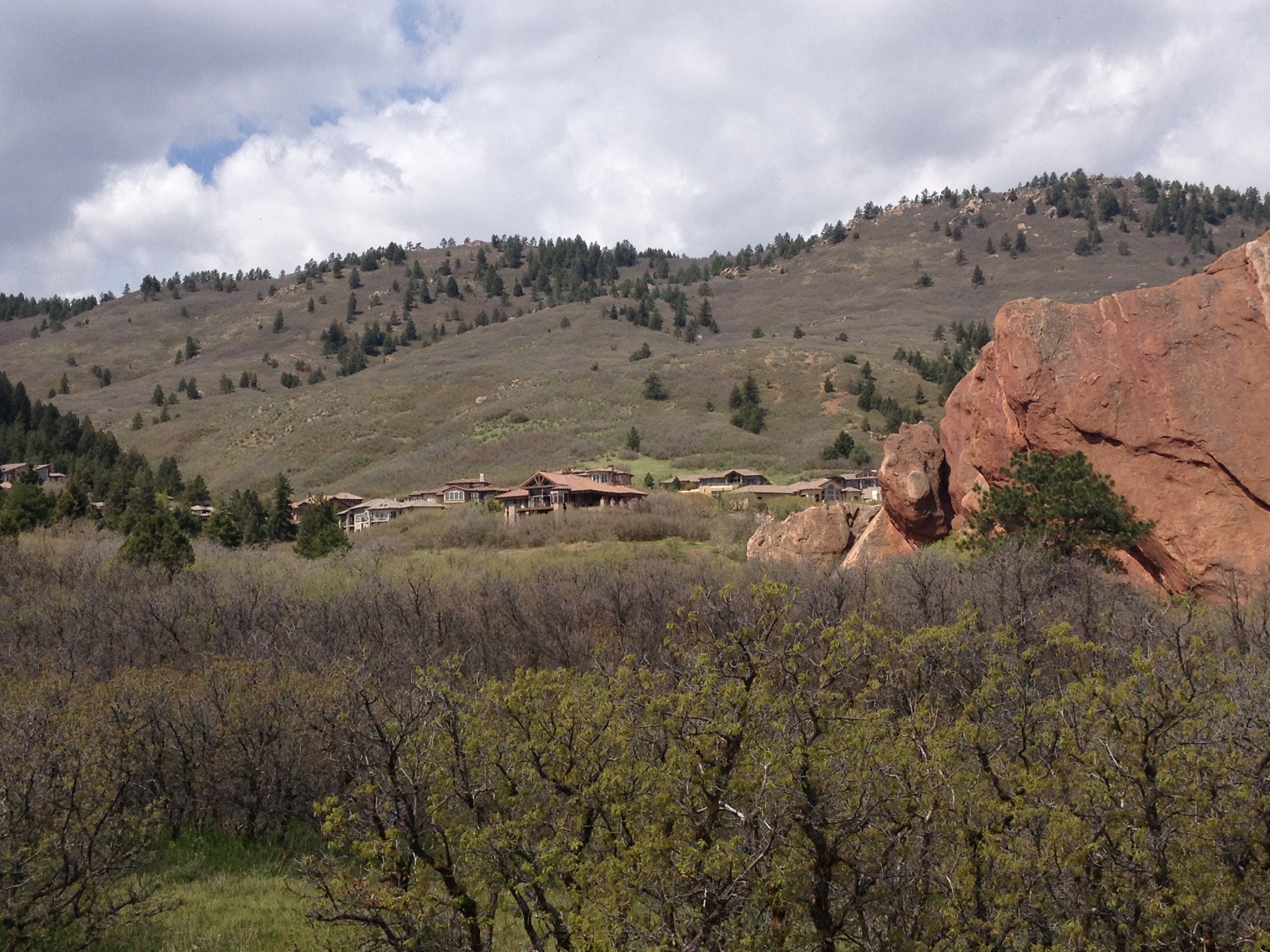
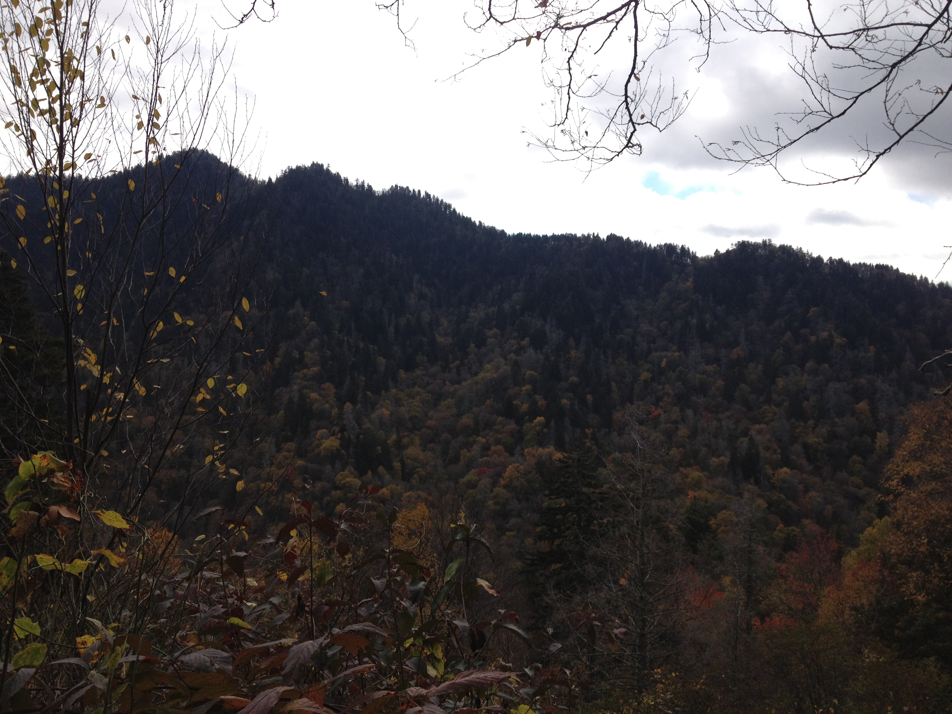
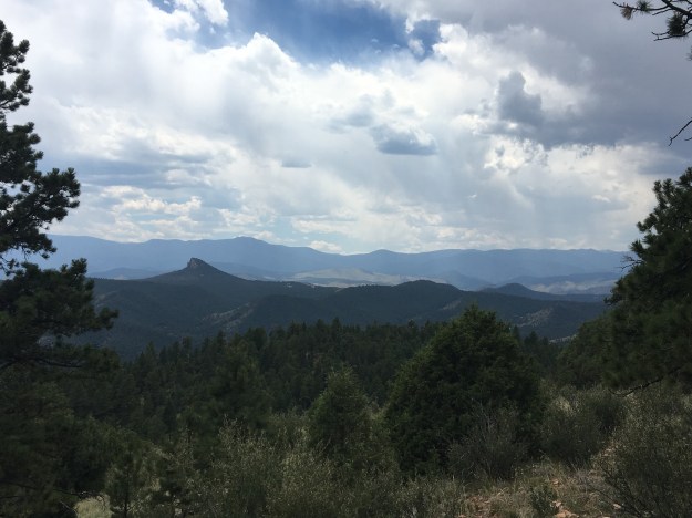
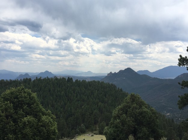
I guess we “descended” a little bit, meaning 150 feet or so into the valley of a small creek.  When we popped out of that valley, we actually encountered the best view of all, as a clearer (from trees) section of the trail gave us clear views of some of the more interesting rock formations in the distance, including “cathedral rock” in the background of this photo.

IMG_6789

As we descended, I thought to myself about how sometimes I do get disappointed when I do not “save the best for last”.  What a letdown it is indeed when the best part of any hike happens within the first 45 minutes!  In fact, every time I eat a meal there is always a battle going on in my head.  I genuinely want to save the best for last, meaning, saving my favorite parts of the meal for the end.  But, I also do not want to get full on the other stuff, and not have enough room for what I enjoy the most.  This is what makes collecting the proper food at Indian Lunch Buffets a particularly daunting task.  Anyone going to one should know their appetite.  In fact, I suggest only going when there is a robust appetite, particularly for those with FOMO (Fear Of Missing Out).

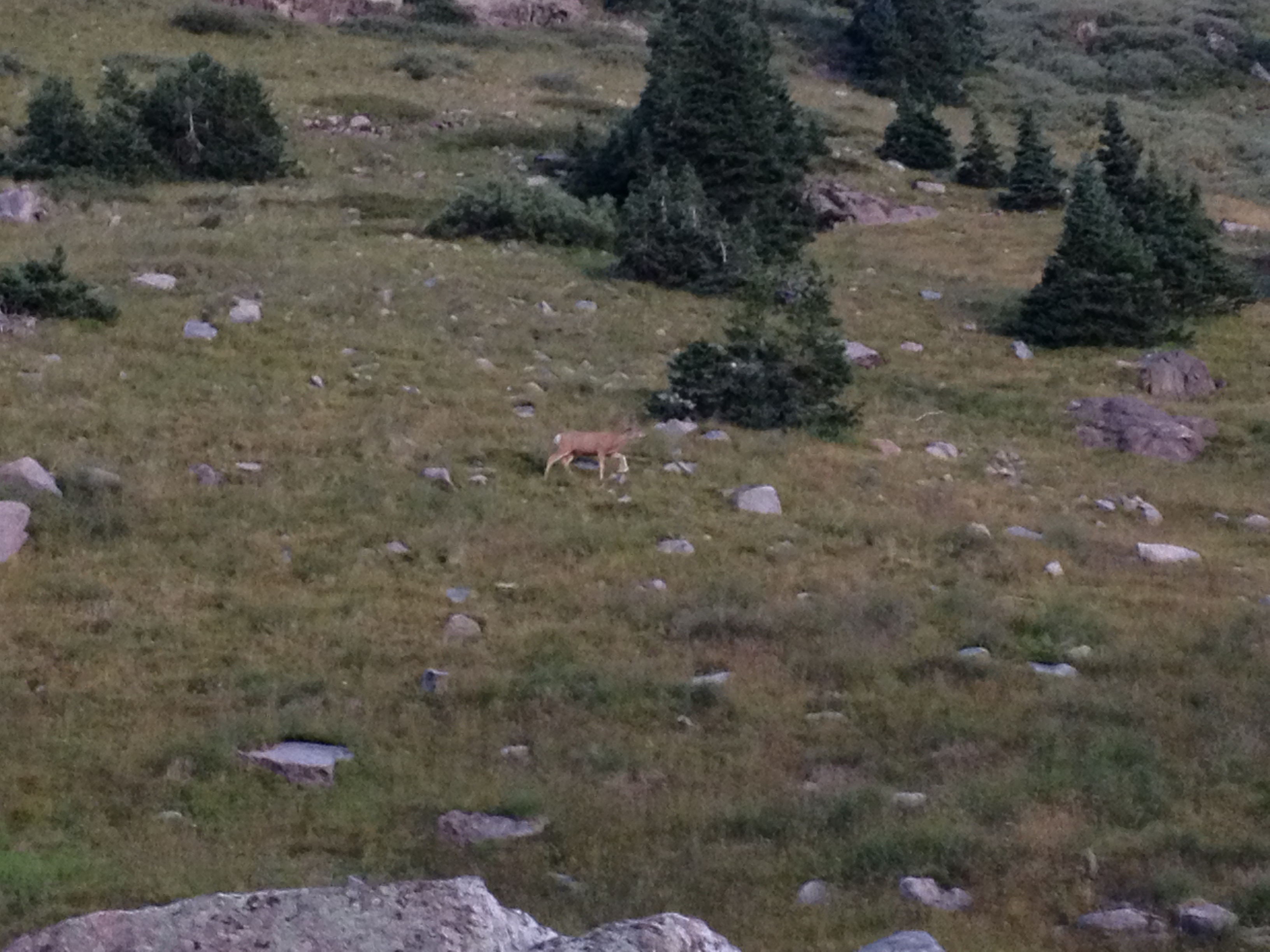
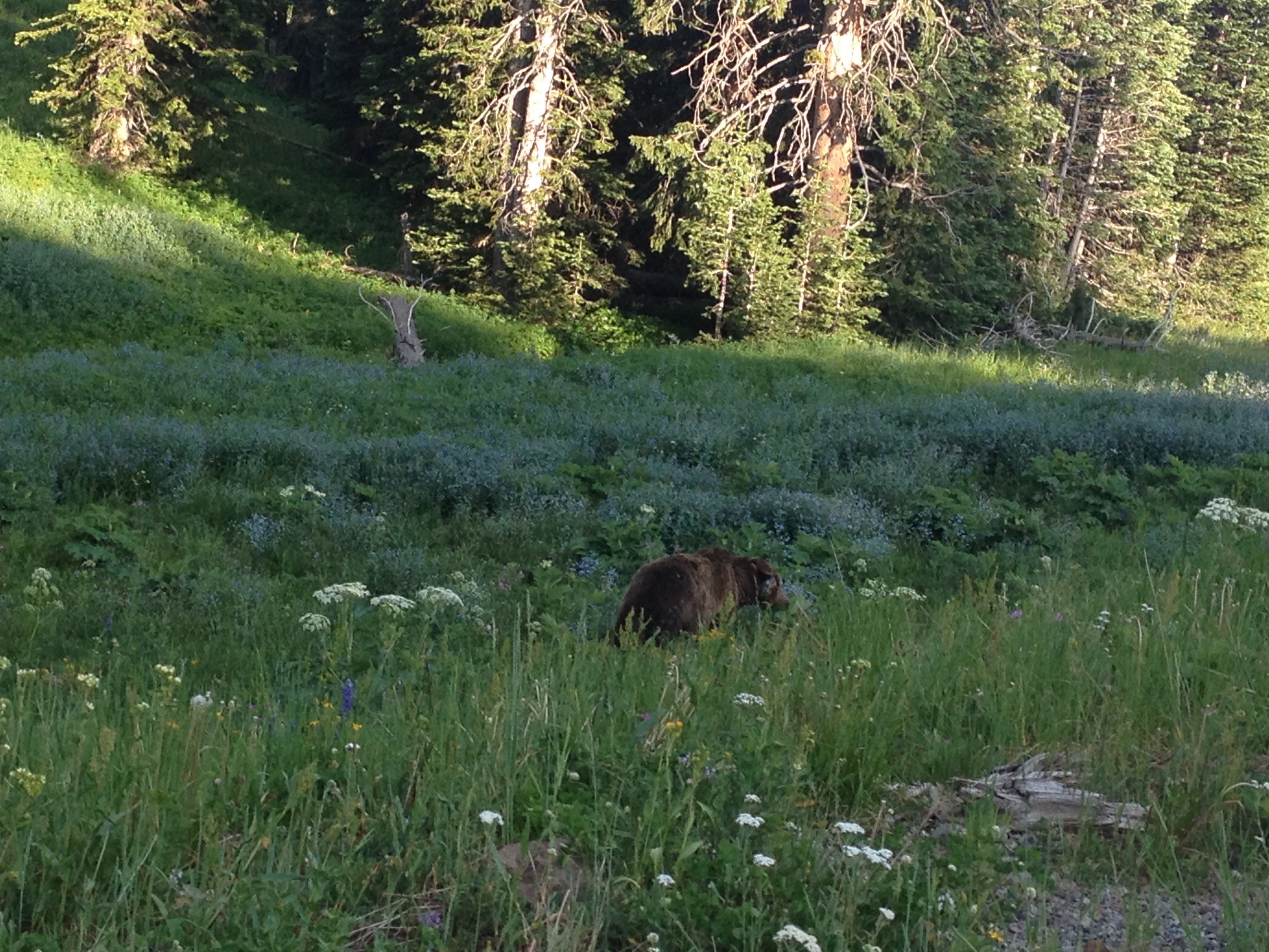
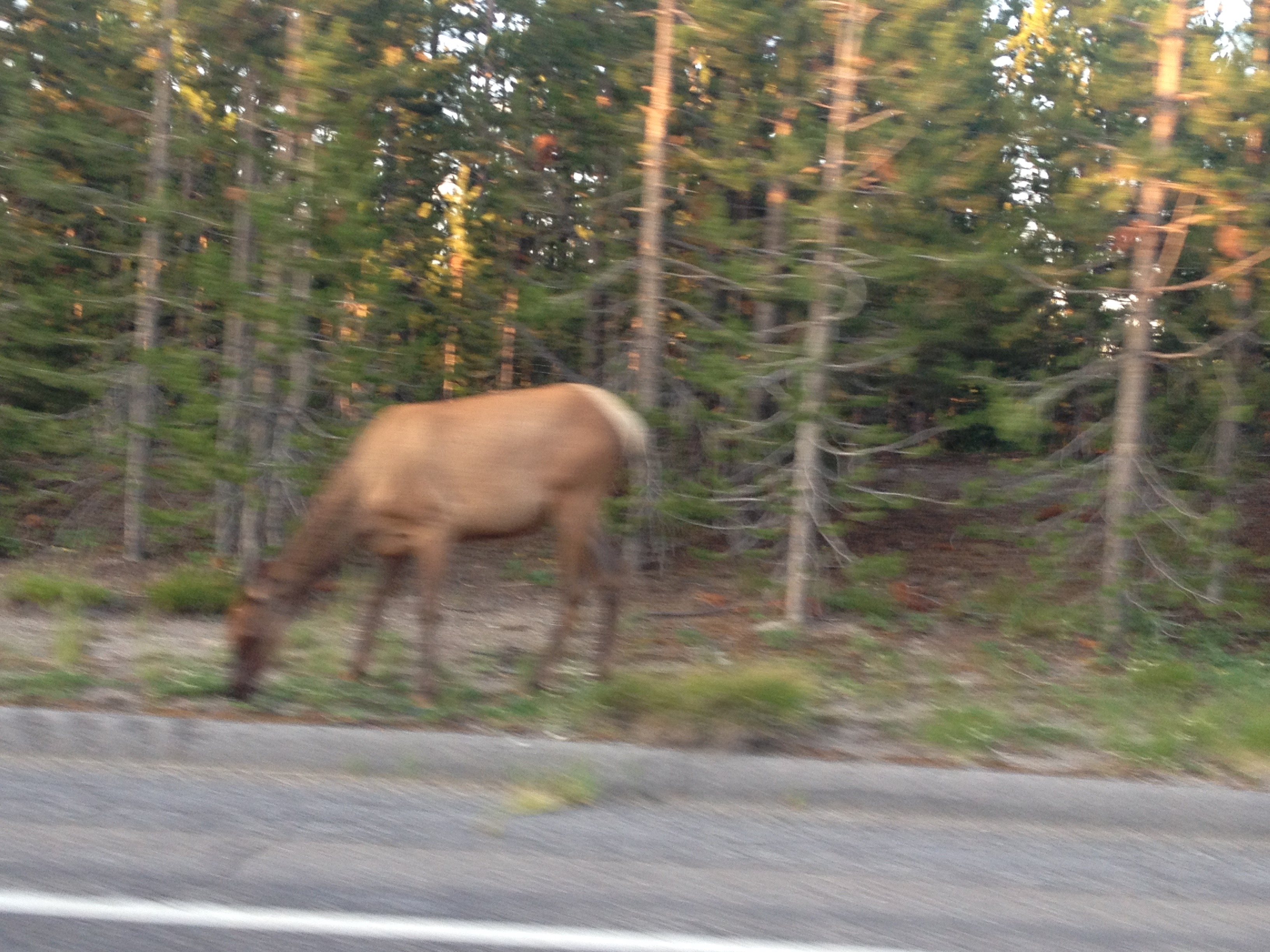
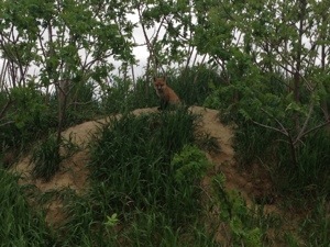
I’ve been trying to, of late, capture some better pictures of wildlife.  While I haven’t necessarily been out in search of it recently, I have been trying to keep my eyes out for it, as opposed to just looking for waterfalls, unique rock formations, summits and the like as I typically do.  The previous week, in Glenwood, I took this photograph of a chipmunk eating a little cracker (also posted in my previous entry).

IMG_6701

At Reynolds Park, I got a chance to take this amazing close up photo of a butterfly in the parking lot after the hike.

IMG_6796

In fact, this particular butterfly chose to land on a yellow colored post and sit there with its wings out, color coding herself in a manner that almost felt like it was purposeful, as if the butterfly somehow thought there was a possibility it would get famous from this photo; possibly ending up as the July photo in a 2017 Butterflies of Colorado calendar that people will see at the mall, or at Barnes and Noble.

IMG_6793

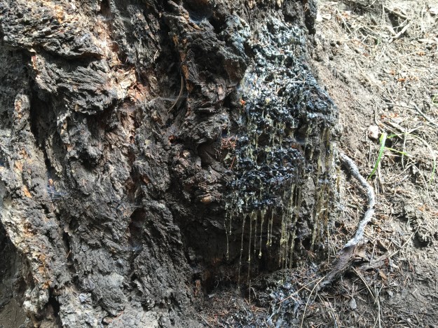
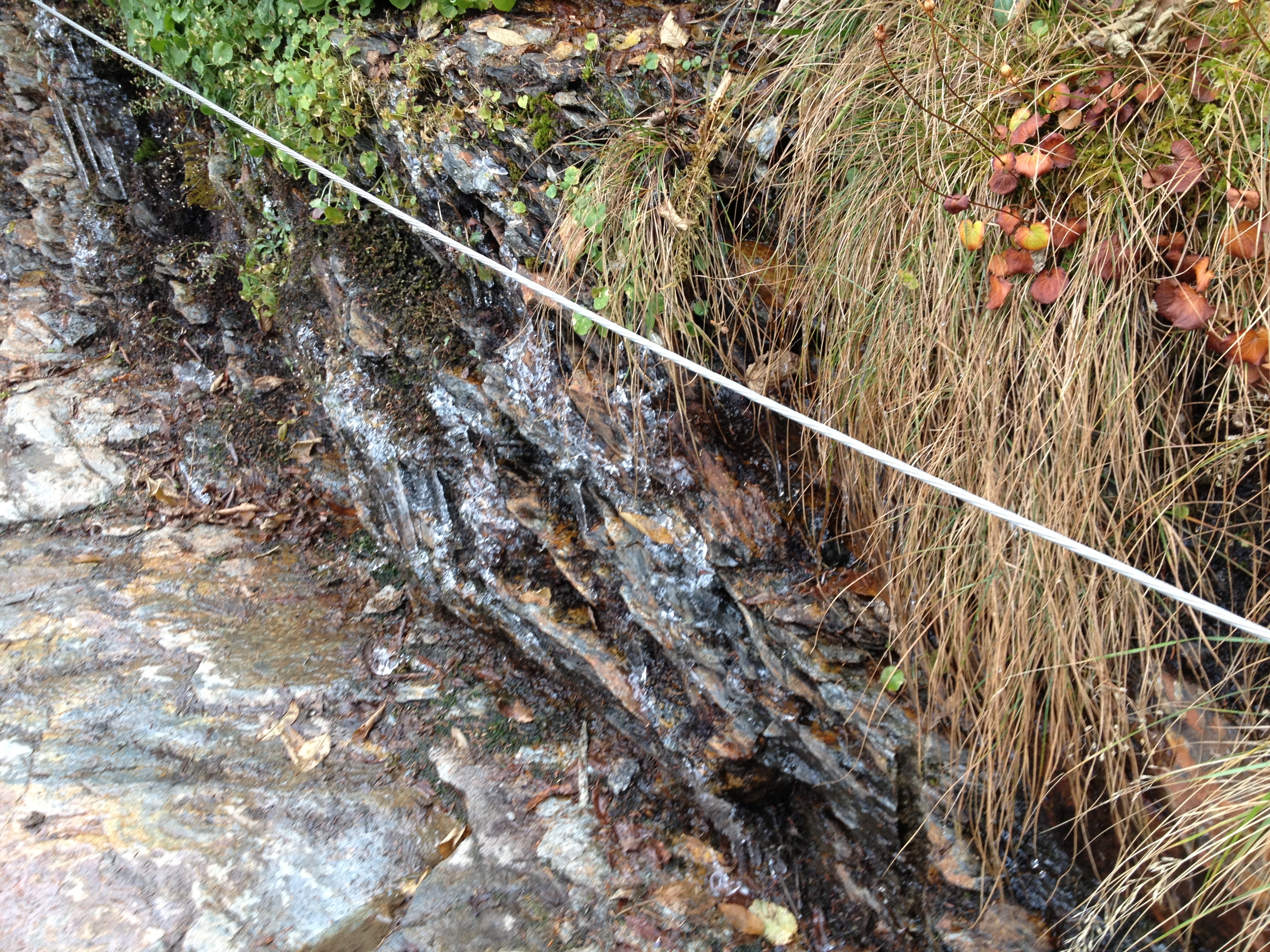
Add to that the craziest sap discharge I have ever seen (okay, trees really aren’t wild but you get the picture), and, well I was pretty successful in trying to expand my photo-taking to new horizons.

In a divine sort of sense, sometimes I wonder if one of the reasons for changes in seasons, changes in weather patterns and such is to ensure that people are forced to go to different places, try different things, and have some kind of a variety in their lives and activities.  It is easy to do the same thing over and over again, but it is also the least satisfying way to live.  But, sometimes we need a push.  Whether that be some sort of tough situation at work, an unwelcome new presence in our community, a terrible breakup or anything else, sometimes the silver lining in all of it is getting involved in something new, something more satisfying than what was before.  While 95 degree temperatures and exhaustion are certainly less extreme than any of these situations, I know it helps push people towards variety and is giving at least some other people a chance to select a more moderate activity while taking time to appreciate nature, have a nice chat with friends, or, in my case, both.

Backpacking in the Sangre de Cristo Mountains

IMG_4229

Lately it feels like nearly every article I read about personal growth mentions something about getting out of your comfort zone.  It makes sense, as getting out of our comfort zones forces us to learn new skills, see things in a different light, and keeps us in the habit of expanding our horizons.  One thing I had realized, though, is that many of us often equate leaving our comfort zone with trying something new.  While they often go hand and hand, they are not completely equivalent.  I would argue that, for someone who parties every weekend, trying out a different bar, while a new experience, is not really stepping outside their comfort zone.  Likewise, it takes significant courage, and takes one a significant distance outside their comfort zone, to stand up to a boss or an office bully, despite the fact that they are sitting in the same desk they have sat in every day for multiple years.

IMG_4198 IMG_4205

My first backpacking trip would be my first time in the wilderness, completely away from any buildings or vehicles, with no amenities, and no access to supplies other than what has been packed.  Anything forgotten cannot be retrieved.  There is no going back to the car to escape inclement weather, and no town to purchase replacements for any camping gear that may malfunction.  We are completely on our own!

IMG_4207 IMG_4302

Because this is my first time backpacking, we kept it simple, doing a loop of only 13-14 total miles up the Comanche Trail, over the ridge, and then back down the Venable trail.  I wish to try new things, expand my horizons, and step outside my comfort zone, but I want to do it in a manner that is smart.  I am accustomed to carrying little more than an extra layer or two, water, and some snacks when I hike.  Carrying a backpack, which probably weighed at least 30 pounds, is significantly more intense.  Not leaving some wiggle room in case something goes wrong, could be potentially dangerous.

IMG_4212 IMG_4213 IMG_4219 IMG_4227

And, well, something did go wrong.  After an exhausting 2600 foot climb from the trailhead to Comanche Lake, where we set up camp for the night, the stove malfunctioned halfway through cooking dinner.

IMG_4240 IMG_4231

We watched the sun gradually descend below the mountains, shinning only upon the higher terrain toward the end of the evening wondering what we were to do next.  Could we subsist the next couple of days, along our planned route, without any more cooked food, using only the cold food we had packed?  Would we have to cut any aspect of our trip short?  Was my first backpacking trip turning into a disaster?

IMG_4244 IMG_4245

After reasoning out in our heads that we technically could make it on the remaining cold food we had brought, we luckily found this rusty old pot just sitting there by the lake.  This pot saved the day, as we had no qualms putting it directly into a campfire.

Trips like this definitely help us see our lives from a different point of view, and force us to re-evlauate what a “necessity” really is.  Case in point, Saturday morning (second day of the trip), we had Zatarains’ Red Beans and Rice, and very much appreciated it.   This is a dish I will periodically make at home when cooking something “simple”.  When I cook red beans and rice at home, I, by default, add some kind of meat to it, usually sausage.  I behave very much as if it were a necessity to “complete the dish”.  But, in many parts of the world, where people are poorer and life is simpler, rice and beans is a common dish.  Going on trips like this serves to me, as a periodic reminder that many of the things we consider “necessary” for life are not really necessary for life, they are only necessary for the lifestyle we have chosen.

IMG_4248 IMG_4250 IMG_4251 IMG_4253

After a late start, we climbed, once again, from our campsite, at an elevation of roughly 11,600′, to the top of Comanche Pass, at roughly 12,800′.  Near the top, I suddenly realized that I was in an altered state of mind.  It felt almost surreal, and almost as if I had indeed taken some sort of mind-altering drug.  But, I hadn’t.  Some kind of combination of exhaustion, high altitude, and being outside my comfort zone had put my mind in a place where everything was both clear and blurry at the same time.  It’s hard to describe, but I am guessing that is why many yoga classes involve both an exhausting workout, and altered air conditions (heat, humidity), alongside its’ spiritual aspects.

IMG_4256 IMG_4257 IMG_4258 IMG_4261

All this made the view at the top, of nearby Comanche Peak, looking Eastward toward the Wet Mountain Valley we hiked in from, and over the mountains toward the Upper San Louis Valley, even more spectacular!

IMG_4260 IMG_4262

And, after a mile or so with little elevation change, we climbed back up onto the ridge at a place called Venable Pass, where we would complete our loop.  Here, we stopped to eat lunch before beginning our descent through an area known as Phantom Terrace.

IMG_4264 IMG_4267

This descent was tricky enough that my exhaustion, and the altered state of mind associated with it, continued.  All sorts of crazy shit was on my mind as we descended towards the Venable Lakes.

IMG_4268 IMG_4269 IMG_4270

Of course, it was on this descent where I saw the highest concentration of my least favorite plant ever.  I really do not know what they are called, but they look vicious.  They remind me both of the flesh eating plant in the movie Little Shop of Horrors, as well as the plans that try to bite in Mario Brothers.  In fact, in my altered state of mind, I actually felt as if these plants were trying to bite me as I walked by.  It was freaky.  Maybe, despite the Red Beans and Rice, I still did not eat enough, or drink enough, I don’t know.

IMG_4274 IMG_4276

We camped the second night just below Venable Lakes, as we had to get back down to the tree line for access to firewood.  We had become pretty well versed in the process of starting a fire and using it to cook our food using that rusty old pot we found (and kept after the trip).

IMG_4281 IMG_4282 IMG_4285 IMG_4286 IMG_4287

The next morning, we woke up early to view the sun rise.  We also saw some cool wildlife, deer, grouse, and marmots, which we had been viewing on and off for the duration of the trip.  However, particularly with deer, first thing in the morning is often the best time for wildlife viewing.  We also gazed upon the muddy puddle I had stupidly jumped into the prior afternoon, having wanted to cool off as it got quite warm for elevations in excess of 11,500′.

IMG_4289

Before leaving the last campsite of my first ever backpacking excursion, I paid homage to one of my favorite songs out right now Cool for the Summer, as, well, this summer has been awesome, and, is now coming to an end.  On the car ride back to Denver, we had a conversation about whether or not songs like this, geared towards high school and college students, apply to people who have graduated, joined the adult world, and no longer have summer break.  However, despite the fact that nothing about my job, or my role in life, automatically shifts for summer (to an internship or summer job), I do feel something magical about this season.  There are so many things one can do in summer that they cannot in other seasons.

IMG_4291 IMG_4296 IMG_4299 IMG_4301

The final descent, back to the trailhead along the Venable Pass Trail, is highlighted by a series of waterfalls, as well as a large number of Aspen trees.  At the biggest water fall, Venable Falls, I actually dunked my head into the water to cool off.  The lower part of this trail would be an amazing day hike sometime around a month from now, when the leaves on the Aspen trees are changing colors.

In the end, my first backpacking experience was quite the trip, and a memory that will last a lifetime!  I came away from this trip confused.  Backpacking is a strange activity.  It is both simple and complex.  It is both exhausting and relaxing.  Never had I been farther away from civilization, having interacted with a total of three people prior to the final day of the trip.  Having experienced additional complications, I am glad to have chosen something modest, in both size and scope, for my first trip.  And, I am glad to have gone with a group large enough to make the experience both efficient and enjoyable, but not too large, as to add additional unnecessary complications.

July 2015 Bicycle Journey Day 3: Yellowstone’s Grant Village to Jackson, Wyoming

IMG_3840

What a difference a day makes!  After the most exhausting bicycling day of my life, day 3 seemed like a breeze.  Everything seemed different, even in subtle ways.  Whereas on day 2 I felt like I had to struggle, even on the flatter portions of the ride, certain segments of this day seemed to breeze by.  It was almost as if there was some kind of invisible force that had been holding me back on the previous day, but now was helping me along.

IMG_3819

We left the Grant Village campground having done none of the activities that are typically associated with camping (other than putting up and tearing down a tent).  We did not set up a fire.  We did not cook anything.  We did not even spend a significant amount of time at the campsite other than sleeping. The next morning, we got some breakfast, and headed South, towards Grand Teton National Park.

IMG_3820

The day started with a climb, albeit a very small one, and one that event felt easier than a similar sized climb would have felt the previous day.  Only four miles into the ride, we crossed the Continental Divide, and immediately started headed downhill.  The next eight miles flew by as we reached our last major stop in Yellowstone National Park; Lewis Falls.

IMG_3822 IMG_3823

I feel like I got a fairly exhaustive tour of Yellowstone’s waterfalls.  And, while I had seen several waterfalls while in Yellowstone, each one was different in characteristics.  Undine Falls, which I saw yesterday, was skinny and tall.  Lewis Falls is much wider, with a smaller drop.  It is shaped much more like Niagara.  At this point in my journey, 12 miles in, I was energized!  I felt almost as if I could have handled anything on that day.  In fact, I am 100% sure that I had more energy at that point in the day than I would have had I been resting over the last several days.  There is just something about getting through a really rough day of riding, and then riding downhill.

Until this trip, most of my riding had consisted of day trips.  Before moving to Colorado, those trips were pretty much about how many miles I traveled, as Illinois is flat.  Since then, I have begun to tackle some climbs.  In each of these rides, there is a similar theme, I go up, and then I go down.  There is a climb, and it is followed by a “reward”, a chance to go fast.  This almost felt like a way more stretched out version of this.  I spent an entire day pretty much climbing.  The previous day was my climb, and this day of primarily descending was my reward.  Therefore, the feeling of guilt that usually passes over me when I descend without having climbed first did not manifest.  The whole time I knew that I had earned this day of rapid riding through the exhaustion I had endured on the prior day.

IMG_3827 IMG_3829

By the time we left Yellowstone National Park, we had already descended a significant amount.  That descent was interrupted by the days only climb, in the 6 mile space that separates Yellowstone and Grand Teton National Parks.  This is a strange place.  Although you are technically in neither National Park, signs posted along the road remind motorists that National Park speed limits and enforcement are still in effect.  Also, there is no official entrance into Grand Teton National Park from the north, at least not along US-89.  It is pretty much assumed that all motorists (and I guess cyclists too) had already paid to get into Yellowstone and do not need to pay again.

After climbing for a little bit, there is a rapid descent towards Lake Jackson, and the heart of the Grand Tetons.

IMG_3830

This lake is gigantic, and one of the defining features of the National Park.  And, as one travels farther, into the heart of the Park, one can sometimes get some of the most stunning views of the Tetons from the other side of the lake.

IMG_3832 IMG_3833

The Grand Tetons are the most photographed location in Wyoming.  The primary reason they are so photogenic is that this particular mountain range not only has a prominence (how much higher in elevation the peaks are from the area around them) of over 7,000 feet, but there are no foothills to obstruct one’s view of the mountains.

IMG_3838 IMG_3840

There really is nothing like experiencing the Tetons, at a nice comfortable pace of 15-20 miles per hour, from the seat of a bicycle, up and down some gentile rolling hills, as the afternoon progresses. As was the case in Yellowstone, I decided not to push myself and hurry through the park.  Only this time, on a day that had been mostly downhill, it felt way more comfortable.  I wasn’t climbing up a major pass, putting my legs through all of that exhaustion.  I was just gliding kinda.

The final part of the trip into Jackson took me on a bike trail, where I encountered the last wildlife of my journey, a coyote.

IMG_3845 IMG_3847

In the end, I once again rode over 80 mies on the final day of my journey.  However, the last part of the ride felt quite a bit different for me on day 3 as it had on day 2.  At some point, I came to the realization that on my final day’s ride, it wasn’t the energy I had left in my legs that was limiting the number of miles I felt like I could do, it was other intangibles.  It was how my butt felt about getting back on the seat.  It was how many times my right fingers had been used to shift gears, as well as the amount of weight I had placed on my forearms in general over the course of many hours on the seat.  In this case, I wonder if the strategy of biking a bit faster, but taking more frequent stops to get up and off the seat may be a better strategy for handling these long distance rides.

The last five miles of my ride, on the trail, headed into Jackson were counted off by little markers in the trail; white lines labelled 5.0, 4.5, 4.0 and so on, counting off the distance from Jackson at the end of the trail.  These markers countered down, pretty much, the end of my trip.  So while I was excited to make it all the way into Jackson, and really anxious to take a shower and have a coca-cola, it still felt bittersweet to me, knowing that this bicycle trip that I had been anticipating for so long was quickly coming to an end.

IMG_3848 IMG_3851 IMG_3853

Two days earlier, at Chico Hot Springs, I had refrained from eating chicken wings, as I was unsure if the choice would negatively impact my bike ride the next day.  Now, with no more bike riding ahead of me, it was time to finally fulfill that craving.  So, after showering and changing, we went to a place called Local, right in downtown Jackson, and, yes, I had my wings.  Oh, and they were amazing.  One thing I learned the first time I attempted bike travel, ten years ago, was that wings always taste better on a bike journey.

IMG_3856 IMG_3859

That evening, we stayed at the Anvil Motel downtown, and watched the 4th of July firework show.  As I watched the fireworks light up the night sky, I thought to myself about how I had celebrated our Nation’s independence by traveling through some of the most beautiful places in the country.  I cannot think of a better way to honor The United States of America than that.

The only regret I really had was that the haziness of the day had seriously impacted the images I had taken of the Grand Tetons.  This regret was remedied, as we spent another day in Jackson before headed home, and got to see some more sights, including different images of the Tetons, under different weather conditions, both Sunday and Monday, as well as the iconic images that one encounters in the famous Mormon Row settlement to the east of the National Park.

IMG_3864 IMG_3867 IMG_3871 IMG_3894

By completing this journey, I feel like I have entered a whole new league when it comes to bike riding, and bike travel.  Before this trip, I could only speculate as to what rides I would one day love to take on.  I could only respond to people’s own bicycle travel stories with statements such as “wow, that seems incredible”, or “good job”.  I was not truly belonging to the group.  Now, with this trip behind me, I have finally earned the right to consider myself a bike traveler.  I have earned the right to actually chime in with my own anecdotes, about biking long distances, road conditions, places to go, pannier setup, and all sorts of other topics bicycle tourists typically discuss.  I have reached the pros- sort of.

And, because of this experience, Montana and Wyoming now have a special place in my heart, something that someone born on Long Island, New York would never have expected.  I almost feel like Teddy Roosevelt this weekend, New Yorker in attitude and mannerisms through and through, but lover of the West, lover of America’s beauty and lover of the National Parks.

IMG_3906 IMG_3907

As I rode home Monday, July 6th, it suddenly occurred to me how little I missed my regular life.  I think I missed some of the people and some of the socializing.  But I really didn’t miss the kind of stuff that many would assume.  I had yet to watch a single minute of television, and had yet to use the internet for anything other than looking up the weather and writing a blog entry on this site.  I certainly had not looked at the news or anything.  I definitely did not miss either TV or the internet at all.  As of the time of writing this blog, July 9th, my TV total for the month of July still does not exceed one single hour.  And, the odd thing is, I also knew that if I needed to get back on that bike again and ride more distance, I was more than capable of it.  Maybe that is the way I truly know I have reached a whole new level with regards to bicycling.

July 2015 Bicycle Journey Day 2: Chico Hot Springs to Yellowstone’s Grant Villiage

IMG_3776

I was 43 miles into a 100 mile bike ride.  I had already climbed over 1,000 feet from my starting location.  I knew I had over 2,000 more vertical feet to climb before I would reach the high point of my day.  The road mercilessly took a turn downhill.  This was vertical height I had already worked hard to climb.  I knew that somewhere down the road, I would once again have to climb this several hundred vertical feet that I was now descending.  I sped up and continued down the road, already exhausted, knowing that I still had more than half my day left to go, both in terms of milage as well as vertical climb.

IMG_3759

That was when I found myself going over a bridge, over the Gardner River.  The views in all four directions, including downward were spectacular.  Not only was I viewing all of the scenery in all directions, I was smelling it.  I was feeling the air around me.  It was at this moment that I realized that, despite how exhausted I already was, and despite how agonizing the steep hills I had in front of me were going to be, that all of this was worth it.  The effort of pedaling harder than I had ever pedaled before, and enduring hours of pure pain was worth it to experience what I was experiencing on that day.

Miles 44 and 45 would take forever, as I climbed up and out of the river valley and onto the Blacktail Deer Plateau in the Northern part of Yellowstone National Park.  Knowing that I still had so much painful climbing left to go, once again “This Summer’s Gonna Hurt” by Maroon 5, a song that I had heard many times this year, and, like most Maroon 5 songs, catches in one’s head quite easily, popped into my head as I pondered the pain that I was enduring, as well as the pain that would come.

IMG_3715 IMG_3718

That morning, I woke up in Paradise Valley with a strange feeling.  I was half worn out from my first day of cycling, but also felt ready to go.  It is a feeling that people who cycle long distances probably experience quite frequently, but it was a feeling that I had not truly experienced before.  Sure, I had undertaken multi-day tasks before, but never one like this, where in my head I knew I was about to tap into pretty much everything I have, physically, but I also knew that it would make for one of the most exciting days I’ve ever had.

IMG_3724

On the way out of Paradise Valley, we encountered the only other cyclist we would encounter that day, an Austrian gentleman headed for the Grand Canyon.  He was traveling fully self-contained, with all of his camping gear attached to his bike, and therefore taking it slower.

IMG_3726 IMG_3728

After turning back onto US-89 South towards Gardiner, we entered an area known as Yankee Jim Canyon. It is here where we started to see some rafters.  Over the next few miles, we would wonder who was this “Yankee Jim” that this canyon was named after.

IMG_3729 IMG_3731

Unfortunately, even the signage along the highway, the signage that eluded to both history and Yankee Jim, did not tell me anything about who Yankee Jim was.  After the trip, I did a full web search.  Nothing.  I still have no idea who was this man they call Yankee Jim. Maybe if I ever go to a Montana History Museum of some kind I’ll find out, but to this day, it remains a mystery.

IMG_3735 IMG_3733

Luckily, several miles up the road, as we approached Gardiner, there was a distraction.  We encountered a place called Devil’s Slide, a uniquely shaped exposed area of red sedimentary rock that appears to lend itself to stupid, and potentially dangerous adolescent ideas.  I am quite thankful that nobody turned it into a cheesy touristy site.  There are enough overpriced alpine slides elsewhere in the West.

IMG_3738 IMG_3743

We stopped for Ice Cream just before noon in Gardiner, Montana, and stepped out into much hotter air as we entered Yellowstone National Park.

IMG_3746

Back when I lived in Chicago, I never understood why advertisements for Montana tourism would feature images of Yellowstone National Park, which is primarily in Wyoming, with the phrase “Gateway to Yellowstone”.  But, apparently, this was the original entrance to the National Park, and, when the park first opened up, the only way to get in.  This structure right here, that I found myself riding under, was the first entrance ever created to the first National Park established.

IMG_3748 IMG_3749

And I knew the climb was coming, the first climb of the day, which would eventually take me past the 45th Parallel, into the State of Wyoming, and up to Mammoth Hot Springs, where I was now roughly 1000 feet higher than Gardiner.

IMG_3750 IMG_3751 IMG_3754

But, it wasn’t just the climbs that made the ride exhausting.  It was all of the other rolling hills I was not 100% expecting.

IMG_3762

There are very few flat parts of Yellowstone National Park, and even the area between Mammoth Hot Springs and Tower Falls, which starts and ends at a similar elevation had many hills of different sizes.  It was around there that I decided that I was in no hurry to get to the campsite.  After all, I was in Yellowstone National Park, and in a part of the park I did not get to see the last time I visited.  I was gonna see some stuff.

After having to climb back up out of the Gardiner River Valley, I took a look at the Undine Falls.

IMG_3763

Unfortunately, I did not feel I had the energy to add a mile of hiking (round trip) to my day, and see the Wraith Falls.

IMG_3766

But, I stopped several other times to enjoy the scenery along the Blacktail Deer Plateau, and even got a chance to see a blue-billed duck through some bincoulars.

IMG_3770 IMG_3775

In the middle of the afternoon, I reached one of Yellowstone’s more breathtaking, but underrated features, Tower Fall.

IMG_3777

It was here I took a more lengthy break, as I knew ahead of me I had a climb tougher than any climb I had ever undertaken in my life.  After that exhausting 30 mile stretch from Gardiner, up into the park and then over the plateau and all of the rolling hills, I would climb over 2000 feet, to the highest point of any road in Yellowstone; Dunraven Pass.  But, it was here that I also realized that not only was I more than halfway through my trip overall (63 miles into today with 61 miles behind me yesterday), but I was now at a higher elevation than where I would end the trip (Jackson, Wyoming is at 6200 feet).  In every sense of the phrase, I was more than halfway there.

The climb, 12 miles and almost 2600 feet in elevation gain, took me nearly two hours.  It was exhausting, and intense.  I pretty much had to stop every mile.  Somewhere roughly halfway up the pass, I started to see some beautiful alpine flowers; yellow and purple.

IMG_3781

But, signage told me that the presence of these wonderful flowers also signified that I was in Grizzly Bear territory.

IMG_3782

So, it should not have been too much of a surprise to me that when I finally got to the top of the pass,  after two long hours of huffing and puffing, I saw my first Grizzly Bear!

IMG_3786 IMG_3790

Just as I had realized 31 miles (and almost 3000 feet of net climbing) ago, when I was going over that breathtaking bridge over the Gardner River, all of the riding, all of the sweat, and all of the pain did have its reward.  To be honest, it would have been more than worth all of the physical exertion without even seeing the bear.  But, seriously, there was nothing like encountering this animal, so beautiful, so majestic, yet so dangerous and overwhelming, in the manner in which I did; from my bike, out in the open, yet at the top of a pass, knowing that if I needed to outrun it, I could by pedaling as hard as I could on the next downhill stretch.

IMG_3791

By then, after hanging out with the bear for a little while, it was nearly 7 P.M.  I had neither the energy, nor the remaining daylight to take the walk down to Yellowstone’s iconic Lower Falls.  Luckily I saw those last time I was here, so I was glad to have taken the time to see the other waterfalls in the park.

The last real feature I visited that evening was Yellowstone’s Mud Volcano area.

IMG_3798 IMG_3801

There I stood, with the water bottle I had filled up something like 6 times that day, and I came to the realization of just how geothermal Yellowstone Park is.  Like many of the geysers in the park, this “mud volcano” smelled like sulfur.  In fact, it smelled kind of yucky.  And, while I had spent most of the day looking at waterfalls, scenic river valleys, and finally those yellow and purple flowers, it is these types of features that make Yellowstone National Park unique.  We do have waterfalls, canyons, river valleys and the like all over the west, including within an hour or so of home.  All of these geothermal features … I cannot think of where else to see them!  It almost felt like this park was built on sulfur.

IMG_3802 IMG_3803

After seeing an elk on the side of the road, near Yellowstone Lake, I reached the campground at Grant Village.

It had been, without a doubt, the toughest day of riding I had ever undertaken.  Going into this trip, I knew it would be, so I was prepared.  But, I was still pretty much without any residual energy at the end of the day.  In fact, I was kind of acting like I was drunk.  I guess my body had gone through an experience that some would consider “traumatic”, given how far I pushed myself.  But, for me, it is how you grow as an individual, and it is how you gain confidence.  I know that soon I will have to return to “regular life”.  In “regular life”, there is competition, there is conflict, and there are things that are just plain hard.  But, they become easier for those of us that are confident in ourselves.  Accomplishments like these simply serve as a reminder to ourselves that we are awesome.  In fact, I would love to market a bumper sticker that simply says “Smile, you are you, and you are awesome.”  Or, something like that.  There is probably a better, and catchier way to phrase that.  But the point remains that experiences like these do remind us that we are often capable of more than we believe, and are told, that we are.

A Bike Ride to Roxborough State Park

IMG_1933

The primary reason I love cycling as much as I do is that I am able to go places a significant distance away completely under my own power.  For many years I have enjoyed commuting to work (now only 1.5 miles but formerly 6 miles), running errands, visiting specific places, and getting myself to and from specific events by bicycle.  I feel the benefits are two-fold.  There is the obvious money savings on fuel (and/or parking/ transit).  In addition to the monetary savings, I find the exercise and time outdoors to have a been a great value to my health, both mentally and physically, over the years.

Roxborough State Park is about 30 miles South of central Denver.  It is a place I had never really thought about visiting up until a few weeks ago when I was looking for new interesting places to ride my bike to, and wanted a ride that would be roughly two hours each way.  In Denver, it is possible to cover a good amount of distance quite quickly using the metro area’s bike trails, which bypass traffic signals, as well as most terrain features that would normally slow a cyclist down.

IMG_0337IMG_1913

The Platte River trail can be followed from Denver southward to it’s terminus at the C-470 trail, about 16 miles south of downtown.  The Platte River trail is quite flat, as it tracks right along the river.  However, the C-470 trail, which roughly follows the highway (which is the Metro area’s outer loop), contains a lot more rolling hills.  After several miles on the C-470 trail, I arrived at Chattfield State Park, a reservoir, and popular boating destination on the southern fringe of the metro area.

IMG_1916 IMG_1917

A couple of years ago, this was the destination of a couple of rides I had done.  Last year, I did a ride to Waterton Canyon, the starting point of the Colorado Trail, a place I also rode by on my way to Roxborough State Park.  It is somewhat encouraging to actually see my continued progress as a cyclist right in front of me.  However, it also made me realize that there is one disturbing parallel between cycling (or any activity of this nature) and drug addiction; as the more I ride my bicycle, the farther and more intense of a ride I need to do to feel “satisfied”.  This is beginning to feel eerily similar to the gradual increase in tolerance a regular drinker experiences, or the ever increasing doses many drug addicts demand over time.

IMG_1921 IMG_1922

There was a fairly long line of cars at the entrance to this park.  Luckily, I was able to bypass this line, saving me both roughly 20 minutes of time, as well as the $7 entrance fee to the park.

The road from the entrance to the visitor center, basically the last two miles of the ride, was not all that fun.  It was gravel and bumpy for much of the way.  I felt uncomfortable going over 13 miles per hour.  However, the park rangers were quite pleased that I did not try to use my bicycle on any of the trails, as they do not permit bicycles on the trails.

IMG_1927 IMG_1928

At the visitor center, I realized that one of the main attractions of this particular park is the wildlife.  Showing people the fur and bones of dead animals seems like a somewhat sick way of presenting what the park had to offer to it’s visitors, but it was really neat to actually feel the fur of a black bear for the first time in my life!

IMG_1929 IMG_1934

The rock formations at Roxborough State Park were actually quite similar to what I saw at Garden of the Gods.  In fact, it is easy to see how the same geological processes created the rock formations that run up and down the edge of the front range, including the Garden of the Gods, the place, as well as places like Red Rocks.

IMG_1931 IMG_1936

The park is also set up quite similar to Garden of the Gods.  Both places make it easy for the average non-outdoorsy tourist to attain a good view of the park.  Here, the Fountain Valley Overlook, a mere half mile from the parking lot with only a slight grade, provides views like the one at the top of this entry to those with no interest whatsoever of getting any exercise.  The park also offers somewhat more strenuous hiking.  Carpenter Peak is roughly 1000 feet higher in elevation than the visitor center.

IMG_1930

I meandered around the park a bit, but decided not to do the more strenuous hike as to preserve my energy for bicycling.  The only wildlife I encountered were these three deer, which is not particularly out of the ordinary.  However, I did encounter them at a much closer distance than I typically do.

IMG_1940

For much of my time at Roxborough State Park, I was intrigued by these relatively short trees I encountered all over the park.  These tress are quite different than the ones I typically see around Colorado.  I later read, on the way out of the park, that there are some unique species of trees, as well as insects and animals, that live here due to the micro-climates created by the wind patterns that these rock formations create.  In fact, Roxborough State Park is considered a destination not only for it’s rock formations, but also for it’s unique wildlife.

IMG_1935IMG_1938

While marveling at the beauty of the park, and considering how awesome it might be to live in one of those houses that overlooks the place, the weather caught me off guard.  Prior to this ride, I looked at the forecast for Denver, which called for a threat of rain after 3 P.M.  However, 30 miles farther south (and closer to the Palmer Divide), and roughly 1,000 feet higher in elevation, any threat of thunderstorms is naturally going to come earlier in the day.  Right around noon, I noticed a few raindrops, and suddenly noticed the clouds beginning to build overhead.

My bike ride home ended up being a race against mother nature, which I barely won, partially by blatantly ignoring the 15 mile per hour speed limits posted along the trail through South Suburban Littleton.  With a little bit of help from the wind at times, I was able to make the 28 mile ride from Roxborough State Park in 100 minutes, returning home by 1:45 P.M.  As someone who typically pays close attention to the weather, and understands weather patterns quite well, this was a somewhat embarrassing oversight on my part.  However, I do feel a sense of accomplishment in making the return ride so quickly.  And, once again, I was reminded of what I love most about cycling; being able to travel a good amount of distance, and even see my own progress on a map, all under my own power.

Great Smoky Mountains National Park

America’s most visited National Park is Great Smoky Mountains National Park.  Situated  in the Southern Appalachian Mountain Range, along the border of North Carolina and Tennessee, it is not the easiest place to get to.  When I think of National Parks, places like Yellowstone and the Grand Canyon first come to mind.  This is why I am somewhat surprised that this National Park takes the prize as most visited, with something like 10 million visitors annually.

IMG_1228 IMG_1229


The drive down to the Smoky Mountains was quite scenic.  It was mostly along Interstate 75, which I joined just north of Richmond, Kentucky.  Mountains began to appear as I approached the border of Tennessee.  And, with it being a cold morning, fog appeared along the sides of the mountains near the border.  I have only driven this road once before, but I actually recall it being prone to fog.  I even remember fog related caution lights the last time I was here, which I did not see this time.

IMG_1232 IMG_1233

As I approached the National Park, I began to think that there may be places besides the National Park itself that are just as scenic.  I knew the park would be crowded, which it was, with slight backups on the way both in and out of the park.  I still wonder if I could have gotten the same experience at a slightly different location.  Most mountain ranges are larger than the parks that are built to celebrate them.

IMG_1234


As I entered the park I notice that the trees in this area have largely not turned yet.  This, of course, is at lower elevations, and as I traveled up the mountains, the scenery would change.  This is one of the things that made this trip quite interesting.

IMG_1235


My Thursday hike would take me up the Alum Cave Trail to the top of Mount LeConte.  This trail is right in the middle of the park, and one of the most popular trails here.  It is kind of describes as your “quintessential Smoky Mountain hike”, and since this is my first time here, I figured I might as well start with this one.

IMG_1237

The hike starts off somewhat easy.  The first mile or so treks along the valley of a creek, gradually gaining elevation from a start of something like 3500 feet to just over 4000 feet.  It is in this part of the park, the middle elevations (as it has places lower than 2000, but also peaks above 6000) where the fall foliage was at it’s peak this week.  Knowing this, I would still recommend late October as an ideal time of year to visit the Smoky Mountains.

IMG_1238


Arch Rock is the first defining feature on this trail, 1.4 miles in.  It is at this point that the trail becomes more difficult.  In fact, I think there are a lot of people that end their hike here.

IMG_1240 IMG_1241 IMG_1242


As I continue up the trail, I notice more great views of the mountains and the foliage.  The hike overall is somewhat difficult, but I would say I have done harder hikes in Colorado, especially due to the elevation.  However, I did get a chance to feel really awesome, as I was the fastest person on the trail that day.  I would spend most of the day passing people up, and only get passed up once, at the very end of my descent, right before reaching the car again.  This, of course, is the opposite of the experience that I typically have in Colorado, where I am the one usually getting passed up.  I should really not compare myself to others, especially regarding something like hiking, but it still felt kind of good, almost like I know what it feels like to be one of those guys with their headphones on running up Mt. Bierstadt.

IMG_1244 IMG_1245


The trail’s main defining feature is Alum Cave, which is not a cave, but more of a series of bluffs.  This point is also a common stopping point for hikers.  It was a cold day, especially for Tennessee standards.  Highs would only get into the lower-middle 50s at the base of the mountain, and most of my hike would be in temperatures in the 30s and 40s.  A little nervous about the cold, I thought about stopping here, but decided to keep going anyways, up Mt. LeConte, which would take me over 6500 feet in elevation.

IMG_1247 IMG_1248


I had perviously noticed a white looking feature to the top part of the mountains.  One could mistake this feature for snow, but one of the hikers informed me that it was a really heavy frost.  This, of course, is something that would never happen in Colorado due to the lack of moisture, and is one of many features that make the Appalachian Mountains different from the Rocky Mountains.  When I finally got to this level, I was relieved to find that this frost was not present on the ground, which would have made the hike slippery.

IMG_1250 IMG_1251


There were some really neat icicle formations near the side of the trail, but there were really only one or two parts I would consider slippery.  The top of the mountain did have some dense pine forests.  With their heavy coating of frost, walking in and out of these areas was somewhat creepy feeling- appropriate for Halloween.  There was some wind at the top of the mountain.  It was no faster than 10 mph, but was enough to blow some of this frost off the trees.  The frost flying through the air felt kind of like it was snowing, but being the scientist I am, I knew that it was not actually snowing.

IMG_1253 IMG_1254


0.2 miles before the top of the mountain, there were a bunch of cabins.  I actually saw some people with full backpacks headed there to stay the night.  The top of the mountain was foggy, which dampened my view.  WIth it being cold and windy, I only stayed up there for about 10 minutes; long enough to take this picture and eat a 6″ sub from Subway, which I brought with me in my backpack.

IMG_1257

The hike took me about 5 hours overall, 3 to get up and 2 to get down.  Other hikers told me that it was an impressive time, but I was kind of in a hurry, as it was cold and I did not want to take long breaks.  The additional time gave me a chance to see some of the park’s other features.

IMG_1259 IMG_1260


The first of such features was the Newfoundland Gap, which was apparently discovered in the early 19th century as an alternate route to the Cumberland Gap.  Looking out at the natural features, I struggle to figure out where this gap is, and what makes it an easy route for settlers to get across the Appalachians.  I am guessing it is the valley between this hills, but it seems as though they would still have to climb to the elevation I am sitting at, 5048 ft.

IMG_1261

I also got to see a small section of the famed “Appalachian Trail”, which follows the high points along the NC/TN state-line through most of the park.

IMG_1263


I drove up the road to Clingman’s Dome, the highest point in the park.  But, the cold, windy weather, and fog at the observation deck stopped me from actually going up there.

Overall, I enjoyed my experience at the Great Smoky Mountains National Park, and I think the area offers something for everyone.  Just outside the park are the towns of Gatlinberg and Pigeon Forge.

IMG_1264


Both towns are quite touristy, with tons of restaurants, hotels, and other attractions like roller coasters and family fun centers.  However, Gatlinberg was more dense, the kind of place where one would largely walk to most of the places they desire to go to.

IMG_1230


Pigeon Forge, on the other hand, is a driving place.  I saw few people walking around here (as I saw a lot in Gatlinberg), but there were still tons of attractions, probably even more than in Gatlinberg as Pigeon Forge is home to Dollywood.

For those that want a more rustic experience, there is plenty of that too.  In fact, just off the Smoky Mountain Parkway (the highway that connects these two towns to Interstate 40), it gets a lot more rustic quite quickly, with lots of cabin sites, but also areas with tubing and other outdoor activities.  I can imagine nearly everyone getting something out of their Smoky Mountain experience, and I can imagine spending a significant amount of time here.  Between this, my experience in Nashville last year, and what I hear about Memphis, Tennessee seems to me like a state that really knows how to party!

One other thing I noticed while in Tennessee is that there are parts of the country where Krispy Kreme donuts are still popular.  In fact, my hotel offered free Krispy Kreme donuts to their guests, as a manner in which to draw people (as competition is quite stiff in this area).  In this part of the country, Krispy Kreme donuts were popular long before the Krispy Kreme fad up north around a decade ago, and remain a cultural institution.  When I ate my donuts, I realized once again that these are good donuts.

We urban, cosmopolitan, northerners (or however you describe pop-culture influenced mainstream America) seem to do a good job of taking cultural mainstays from other regions and turning them into short-lived fads.  Shortly after the Krispy Kreme fad (which was roughly 2001-2004), we created a fad out of Caribbean reggaton music, culminating with Daddy Yankee’s widely successful BarrioFino album.  For those that don’t know, Daddy Yankee is still producing albums that are widely successful in the Caribbean, and even moderated a gubernatorial debate in Puerto Rico.  We are now doing the same thing with twerking, which has been part of African American culture for two decades.  Actually, that fad may already be over!

After my breakfast, I head back to the park to visit one last destination; Cades Cove.  This part of the park is mainly for wildlife viewing.  I have limited luck, as much of the area is pretty empty.  There are a lot of horses here, but that is kind of what I expect.  I was amazed, though, at how people went right up to the wildlife, even if it was deer, something I see all the time.  At the other National Parks I have visited this year, mainly Yellowstone and Rocky Mountain National Park, anywhere I’d seen wildlife, there were park rangers making sure people don’t get too close.  Here, it appeared as if people were walking up to the animals, just daring them for a fight.

IMG_1266 IMG_1267

I would very much like to come back here.  There is so much more to see and do in Great Smoky Mountains National Park, as well a in Gatlinberg and Pigeon Forge.  However, I am also curious to go somewhere else in this mountain range where it may be less crowded.  Perhaps I could go somewhere like Mount Mitchell, or to an area north or south along the range, just to see if the foliage and hiking experience would be just a good without the traffic and crowds.  However, I do think it is interesting to see these mountain ranges in the east, as they are quite different from the Rocky Mountains, near where I live.  They have much more of a densely forested feel to them than the wide open Rockies.  The colors are different, and the mountains feel somewhat different in orientation.


Experiencing Western South Dakota

June 3, 2013

Today’s first activity was a hike at Badlands National Park. Yesterday evening, at the visitors center, I had chosen a hike for our group that was mostly considered “moderate”. Only the initial 1/4 of a mile, which started from the parking lot and took us up the side of the structures towards a plateau was considered “strenuous”. This initial part was pretty strenuous, and, had it gone on for over a mile, would have made a difficult hike. But, after the initial climb, most of the trail system we traversed on this morning, would be pretty flat, with only minor inclines and declines. This, of course, was the part of the trail that was labelled “moderate” in difficulty. I guess, the “moderate” difficulty rating was a let down because, the badlands, while a beautiful natural place, is not a place with a lot of terrain. There simply isn’t 1,000 ft. worth of incline to find.

20130605-211914.jpg

20130605-211920.jpg

Difficulty ratings for hikes have no set standard. How any place labels it’s hikes is completely to the discretion of the park. It reminds me of the differences we observe between ski trails labeled green vs. blue vs. black at different ski resorts. Some of the easiest black diamond ski trails I have skied in Wisconsin may even be considered green if they were to be in Colorado; certainly, they would at least be blue, not black. So, I guess it is important to understand the relative context of activities while planning them. While occasionally you will run into an activity with a standardization of sorts, like whitewater rafting, it seems like when it comes to most activities, descriptions of difficulty levels are subjective as well as relative.

The biggest waste of time today was driving about five miles out of our way to search for Bison at the Badlands. The reason being that our ultimate destination today was Custer. In Custer we saw so many Bison, and so many up close, that the search for Bison anywhere else today, well, the idea of looking for Bison anywhere else today seems utterly silly at this point in time.

20130605-212020.jpg

20130605-212029.jpg

We gave in to the nearly 200 (well, possibly even more) billboards we saw yesterday, and we went to Wall Drug. This place does a really good job of marketing itself, given that the main goal of marketing is to make people aware of your product. The signs, bumper stickers, and such make sure everyone is aware of the existence of Wall Drug. I had heard from others that the place was a gigantic tourist trap and not really worth it, but it is so close that it is worth going and finding out for myself.

20130605-212113.jpg

20130605-212119.jpg

The place was actually alright. It was a little bit cheesy. In the front , there is an actual drug store, true to its name. Behind that is a restaurant and ice cream parlor, which is pretty neat. The rest is mainly souvenir shops. Behind the store, there is this kind of old west town that many tourist traps in the high plains have. The only oddity is that they also have a really poor replica of a dinosaur there too. This was advertised on many billboards, so I am glad the delivered on this. But this does not belong right next to a replica of a village from 1880. Time periods should be consistent.

I made one key mistake there. I ate both ice cream and a donut. That is just simply too much sugar, simple sugar. A little over half an hour down the road, I got that sugar crash, and, for about half an hour could barely keep myself awake. This sucked, because the scenery was starting to become really interesting as we approached Rapid City and then drove Southwest on U.S. 16, and the 16-A.

20130605-212203.jpg

20130605-212213.jpg

The mountains here (I guess they are referred to as hills), are legit. I mean, the way the look, both from a distance, and up close when you drive into them, are actually not too different from the mountains of Colorado. This, I find somewhat surprising. When people make lists of states with really cool mountains, and I mean really big ones, it does not seem like South Dakota is ever really on that list. At least the association is never really made in my mind. I had always kind of known South Dakota to be kind of more interesting than the other plains states, and known that this area existed. But, it was not until now that I fully realized that the terrain in this area is significant when compared to other places in the country. It’s not as mountainous as Colorado, but it is not insignificant.

20130605-212245.jpg

20130605-212250.jpg

20130605-212301.jpg

20130605-212310.jpg

Today the sun rose at 5:30, and set at 8:30, for a total of 15 hours of daylight. I kept thinking about how much is possible with all these hours of daylight. It takes generally an hour or so to set up camp, start a fire, and cook. Today, we were able to take showers because we had extra time after cooking. This was after not arriving until nearly 6:00. In most other months, this would not have been possible. All this week, it seems like we had been less stressed, or had gotten more done than we would have in the fall, or some other time of year with less sunlight.

The problem is, June is the best time of year for a lot of things. Storm chasing is good, rafting is good, and with the most daylight possible, camping, touring, and such are all easier. So, how do we take advantage of our Junes. Should we work our asses off at other times of the year so we could get June off? That might cause too much stress at the other end of the year. How do we decide what activities are most deserving of these days? At the very least, the NBA and NHL can stop extending their playoffs into June so people don’t use up this time watching sports.

Oh, and we also saw Mount Rushmore. It was a bit smaller than I expected.

Camping in the Badlands

Today, June 2nd, started with a bang. Following our friends Jason and Allison, after only about 5 minutes of driving, suddenly a large black structure came flying off their vehicle. At first glance, the structure looked like a tire, and I became concerned that they had lost a tire. But, they continued, seemingly unaffected, so I assumed they had just run over an old tire, or old piece of rubber of some kind that was on the road. Either way, they wanted to stop to check things, which turned out to be unexpectedly beneficial. We stopped, still on some county road nowhere near the interstate, and concluded nothing was wrong with their vehicle.

After returning to the car, I suddenly see Allison running back to us with the kind of look on her face that made me think that something could have been wrong. It turns out that I had confused the sad look with the amazed look. Outside their car, sitting on some county road in South-Central (Minnesota that is), they had spotted a baby fox. This baby fox was quite cute. It actually made me think of dogs. It seemed in no way alarmed by our presence- and just presented itself to us, the same way a pet dog would. Had the fox of 60,000 years ago done the same to our forefathers, could the fox have become the pet of choice for humans rather than the evolved wolf (dog)?

20130605-210640.jpg

The remainder of the drive across Minnesota on I-90 was uneventful. A lot of windmills, that is it. Our first stop off on our journey to the Badlands was in Sioux Falls, SD. I’ve been to this town before. In fact, whenever I see this town, I think to myself that if I were to ever run a city, this is what it would look like, mainly on the count of how many signs that say “CASINO” one encounters here. Of course, they are mainly for places that throw in a slot machine or two, not full-fledged casinos with table games and all, but you still see them. And it makes you think this town is a gambling haven. We encounter a couple of other peculiarities in Sioux Falls. First, the gas station we filled up at had the following “Free Dandelion” sign. I not sure if that was supposed to be a joke or for real. Then, we saw something peculiar from a civil engineering standpoint, an interstate highway, 229, that actually turns into a dirt road (after its’ junction with I-90). From the point of view of someone who did not even know dirt roads still existed until college, but then became all too familiar with them on storm chases. I still think of dirt roads as not belonging in areas near “civilization”.

20130605-210740.jpg

20130605-210758.jpg

To break up the drive, we stop at the Mitchell Corn Palace, in Mitchell, which is just over an hour farther down I-90. For over 100 years, they have been building a succession of buildings that are actually made out of corn. Since corn does not last too long, roughly once a year they reconstruct the building with a different theme. The whole practice is rather ridiculous if you think about it. It becomes even more ridiculous when you see that the town’s city hall is actually attached to this building! Imagine being able to say you get to go to a castle every day because you are the mayor of the seventh largest town in South Dakota. Talk about the life.

20130605-210841.jpg

20130605-210847.jpg

My party thankfully avoids making all of the corn related puns one could make when visiting a ridiculous exhibit like this. I won’t repeat any of them, but I am sure you have thought of at least four by now. I did enjoy getting my picture taken with “Cornelious”, and buying a corn dog at the concession stand.

20130605-210942.jpg

South Dakota is pretty dull to drive across until you reach the Missouri River Valley, at the town of Chamberlin. At that point it becomes sort of interesting, but it does not become exciting all at once, the way it happens in Colorado where you suddenly see the mountains in the distance and one of the dullest most barren areas suddenly becomes a playground of infinite adventure possibilities. This transition starts with the Missouri River Valley, and then with some other river valleys that carve out of the land, as is typical in the high plains. Either way, it feels like we are in the West again.

20130605-211026.jpg

The other gradual transition across the state of South Dakota today was in the weather. Upon entering the state, the weather was similar to the weather we left behind in Iowa/Minnesota. It was chilly for this time of year last night, and we woke up to temperatures near 50 degrees and a thick deck of strato-cumulus clouds. As we transitioned across the state, the strato-cumulus clouds gradually waned, until there were suddenly quite few clouds in the sky. It also significantly warmed across the state, and by the time we arrived at Badlands National Park, it was a comfortable 70-72 degrees with good sun.

Indeed we were in the west. The distance we can see, the dryness, the scenery, everything felt a lot more west than Midwest. I switched I to what I am referring to as “Western mode”, which basically means being more prepared for dehydration and drinking more water. As soon as we arrived at Badlands National Park, we found a couple of really neat scenic overlooks, and then an area with some minor hiking trails. Today’s hike only lasted some thirty minutes and was more of a goofy/exploratory hike. By this, I mean there was no serious burn, no real workout. But we did some goofy things, climb a few rock structures, and went off trail. I even threw a few rocks around to see if I could throw them over some of the gorges. Hikes like this can be fun, even if they don’t build anything.

20130605-211135.jpg

20130605-211142.jpg

After hiking we went to our campsite, which was actually within the grounds of the park. This is my first time camping at a National Park! As a result of this, we have the minor inconvenience of not being allowed to have a campfire. But, the bigger inconvenience on this day is the wind. The high plains is known to be a windy place. Sometime in the afternoon, a Southeast wind of around 15 miles per hour, with major gusts, developed. I think for a while sustained winds may have reached 20. The main issue with this has been that it keeps blowing into my tent, and knocking the rods that hold it up out of place. I wonder if I have a sturdy enough tent. They have to make sturdier ones, but, are they tougher to carry? What is truly the best tent to have for hiking, or bicycle touring? Maybe, having the tent be less effective when camping in the wind is just a fact of life. This, of course is somewhat disturbing to me, as Colorado can get windy at higher elevation.

20130605-211453.jpg

Isn’t it strange how experience often leads us to more questions? I have some camping experience for sure, but to too much. I had never really thought of the odds and ins of these types of situations. I just know that I want the tent to be big enough and comfortable, that is all. Now, I am suddenly in a quandary of thought about a number of factors such as a tent’s weight, it’s reliability, durability, and, of course, how many people it can hold. It’s been said before that for every new question answered, two more are created. I really hope this is not right numerically, as we will never create a closed system of equations if this is the case. But, I do se the reality in answers leading to new questions. So do experiences. In a way, this is the rhythm of life. We meet people, try things, and create experiences. This leads to new inquiry, new ideas, and new methods. Which, leads to new experiences, activities, and people. The cycle goes on and on. The same is true of work, leisure, pretty much any area of life. Getting into this rhythm will create a life that will continue to perform, be motivated, and advance.

20130605-211527.jpg

After a visit to the visitors center where we determine a good hike for tomorrow, and a brief incident that involves me actually breaking our pants, our day ends with an evening presentation at the amphitheater about the black footed ferret, and then some star gazing with some heavy duty telescopes available at the park. This activity was an unexpected possibility at Badlands National Park. I learned about why this area is called the “Badlands”, and a lot about the history of the black footed ferret as well as the prairie dog. Then, we got to look at Saturn in this telescope, which was really quite awesome. Their telescope was so advanced that you could see the ring formations around Saturn, as well as some of its moons.

Overall, it was a very productive day. It is hard to believe that so much of it was spent on a fairly boring road. Tomorrow will involve less driving and more activities, which I look forward to. But, today’s activities were so diverse and the day was so full that I hope I can absorb them all, as well as the frenzy of thought they all put me in, in time to enjoy tomorrow’s to their fullest.